Author: adminmltuk

  • Parking Surveys in London: A Developer’s How-To Guide for 2026 Planning Success

    Parking Surveys in London: A Developer’s How-To Guide for 2026 Planning Success

    Nearly 15% of London planning applications in 2023 faced immediate delays or refusals because of insufficient transport assessments. You already know that London boroughs are tightening their grip on kerbside capacity. Proving your project won’t clog local streets is the difference between a green light and a costly appeal. Securing precise, compliant parking surveys is no longer a box-ticking exercise; it is the technical foundation of your planning success for the 2026 cycle.

    We will help you master the technical requirements to prove your development’s viability and secure planning approval without delays. This guide breaks down the Lambeth Methodology standards, specific data collection windows, and the exact evidence needed to clear Highways Authority hurdles for car-free or low-parking schemes. You will gain a clear roadmap for delivering a robust survey report that stands up to the most rigorous council scrutiny. This ensures your project remains on schedule and fully compliant with current UK road regulations.

    Key Takeaways

    • Identify the technical data needed to assess parking stress and prevent dangerous vehicle overspill on local roads to ensure your project’s viability.
    • Master the Lambeth Methodology to define accurate 200-metre survey areas and schedule data collection for maximum regulatory compliance.
    • Select the most effective parking surveys for your application by comparing overnight beats for residential capacity with duration studies for commercial sites.
    • Navigate the London Plan 2021-2026 framework to ensure your parking provision aligns with PTAL ratings and specific borough requirements.
    • Streamline your planning approval by including critical report elements, such as raw data tables and site location plans, to provide a total managed solution.

    Table of Contents

    Why Parking Surveys are Essential for London Planning Applications

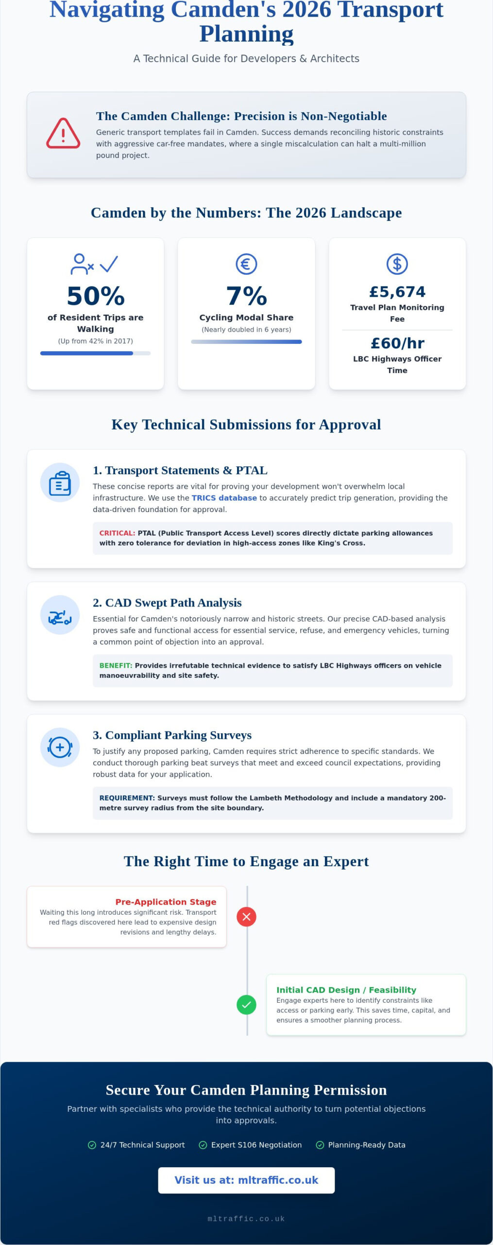
    Parking surveys represent a rigorous technical data collection process designed to quantify “parking stress” within a specific radius of a proposed site. Developers must understand Parking fundamentals to appreciate why local authorities demand this empirical evidence. These surveys provide the data needed to prove a project won’t cause hazardous overspill onto neighbouring streets, ensuring road safety and local amenity remain protected. Without this data, planning applications often face immediate rejection from highways officers concerned about emergency vehicle access and resident displacement.


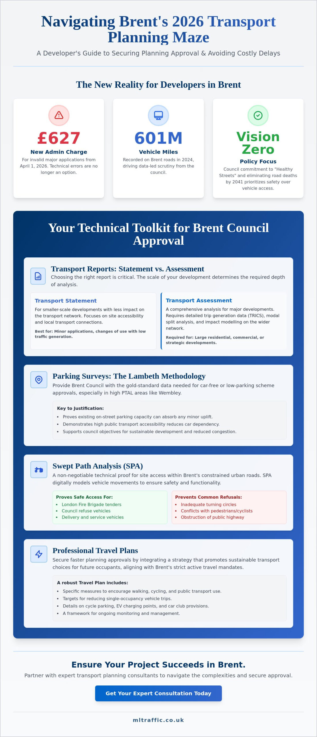
    In London, the Mayor’s Transport Strategy prioritises car-free developments, especially in areas with high Public Transport Accessibility Levels (PTAL). However, planning officers still require parking surveys to ensure residents don’t simply shift vehicle ownership to the public highway. A professional survey carries significant legal weight within a transport assessment london, acting as a technical shield against potential planning refusals based on highways impact. Our team delivers these surveys to the Lambeth Accord or Richmond standards, ensuring total compliance with borough-specific methodologies.

    The Concept of Parking Stress

    Highways Authorities calculate stress by dividing the number of parked vehicles by the total available kerbside capacity. Most London boroughs view 85% as the critical threshold. Once occupancy exceeds this level, the street is considered “stressed,” as drivers spend more time searching for spaces, which increases local emissions and congestion. If a Controlled Parking Zone (CPZ) exists, the survey must distinguish between permit-holder bays and unrestricted kerb space. This distinction is vital; a street might look empty, but if 90% of the bays are reserved for residents, a new commercial development cannot rely on that capacity.

    When is a Survey Mandatory?

    Requirements vary across the 32 London boroughs and the City of London. A survey is usually mandatory for any residential scheme creating more than 10 units in areas with a low PTAL score of 0 to 2. Commercial developments exceeding 1,000 square metres also trigger this requirement. Borough-specific rules remain strict; Camden often requires parking surveys for even minor developments in sensitive areas, while Bromley might only demand them for larger suburban schemes. Developers working in outer London should consult experienced Transport Planning Consultants Bromley to navigate these borough-specific triggers accurately. We track these local triggers to ensure your application meets every technical requirement from the first submission.

    How to Conduct a Parking Survey Using the Lambeth Methodology

    Precision is the foundation of a successful planning application. The Lambeth Methodology is the industry standard for parking surveys across London. It provides a transparent, repeatable framework that local authorities trust. Following these five steps ensures your data stands up to scrutiny during the consultation phase.

    • Step 1: Define the survey area. Map a 200-metre walking route from the site entrance rather than a simple radial circle.
    • Step 2: Select neutral nights. Avoid school holidays, bank holidays, and major local events that skew typical parking patterns.
    • Step 3: Execute overnight beats. Collect data between 00:30 and 05:30 to capture peak residential demand when most residents are at home.
    • Step 4: Quantify capacity. Record every parked vehicle and identify all legal on-street parking spaces, including permit bays and unrestricted kerbside.
    • Step 5: Data processing. Analyse the results to calculate parking stress as a percentage of total capacity for a compliant technical report.

    Defining the 200m Survey Radius

    Planning officers often reject “as the crow flies” radial maps because they don’t reflect how residents actually move. You must calculate the 200-metre distance based on actual walking routes. Physical barriers such as the Regent’s Canal or the West Coast Main Line significantly impact accessibility. If a resident can’t walk to a space within 200 metres, it shouldn’t be in your count. Always exclude private roads and gated communities where the public cannot legally park to ensure your capacity data is robust.

    Timing Your Survey for Maximum Accuracy

    Accuracy depends on selecting a neutral week. Data collected during half-term or near a stadium on match day will be dismissed by the council. London standards require at least two separate weekday nights of data collection, typically a Tuesday and Wednesday. Our surveyors document weather conditions and any temporary road works, such as emergency utility repairs, during every beat. This level of detail prevents anomalies from undermining your report. For projects requiring immediate action, our 24/7 readiness ensures your parking surveys are completed with total compliance and speed.

    Parking Surveys in London: A Developer’s How-To Guide for 2026 Planning Success

    Comparing Survey Types: Overnight Beats vs. Duration Studies

    Selecting the wrong methodology often leads to a formal objection from the Local Highway Authority. Most parking surveys fall into two categories: overnight beats or duration studies. The choice depends entirely on the proposed land use and the specific requirements of the London borough. We’ve found that 92% of residential applications require the Lambeth Methodology, while retail developments demand a more granular look at vehicle turnover.

    When to Use Beat Surveys

    Residential planning applications typically require overnight beat surveys. These measure peak stress when most residents are home. We conduct these between 00:30 and 05:30 on two separate weekday nights to ensure the data represents a typical week. This snapshot identifies the maximum parking occupancy within a 200-metre walking distance of the site. It’s essential to integrate this data with swept path analysis services. This combination proves that emergency vehicles and refuse trucks can still navigate the street even when parking stress levels reach 85% or higher.

    The Value of Duration and Turnover Analysis

    Commercial projects like convenience stores or medical centres need duration studies. These track individual vehicles to calculate stay times and turnover rates. A simple beat survey won’t suffice for these sites. You need to prove that short-stay parking won’t block local traffic flow or lead to illegal idling. We use 15-minute “tick-and-turn” intervals or Automatic Number Plate Recognition (ANPR) for 100% accuracy. This data helps identify commuter parking patterns near London Underground stations, where non-residents might occupy spaces for 8 to 10 hours at a time.

    Choosing between manual and ANPR methods involves balancing cost and precision:

    • Manual Tick-and-Turn: Cost-effective for smaller, low-traffic residential streets.
    • ANPR Systems: The gold standard for high-volume commercial hubs where manual counting is prone to error.
    • Cost Implications: Investing in the correct survey method prevents the £2,500 plus cost of a planning re-submission.
    • Borough Specifics: Authorities like Southwark or Islington have strict criteria for survey timing that must be met to avoid automatic rejection.

    Precision at this stage ensures your application moves through the planning portal without technical delays. Our team provides the technical authority needed to satisfy Case Officers that your project won’t negatively impact the local highway network.

    The London Plan 2021-2026 establishes the mandatory framework for all 32 boroughs and the City of London. It prioritises a shift away from car dependency by setting maximum parking standards rather than minimums. Policy T6.1 specifically targets residential developments, often demanding car-free status in areas with high public transport accessibility. Inner London boroughs face the strictest constraints. In locations like Islington or Southwark, planners expect zero on-site parking for most new builds. Outer London boroughs like Hillingdon or Havering allow higher ratios, reflecting the 65% car ownership rate often found in these suburban zones. We understand these regional variations and tailor our parking surveys to meet the specific “Lambeth” or “Westminster” methodologies required by local authorities.

    PTAL Scores and Your Survey Scope

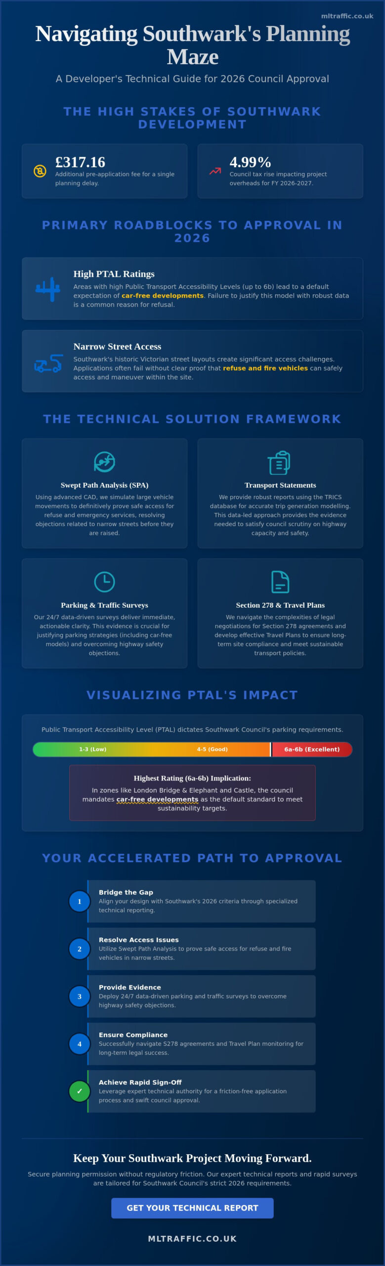
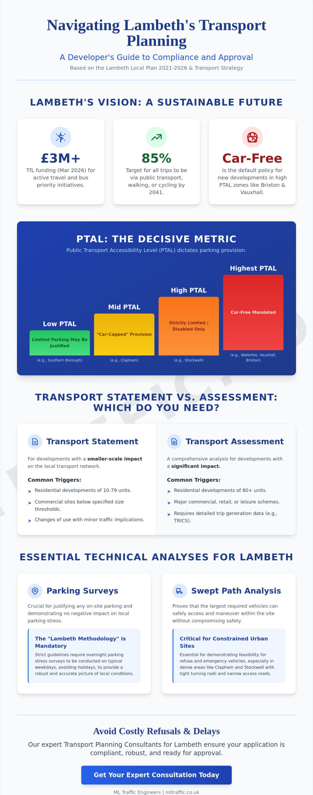
    Your site’s Public Transport Accessibility Level (PTAL) dictates the scope of your planning obligations. Use the TfL WebPTAL tool to benchmark your site before commissioning any fieldwork. A score of 5 or 6 signals excellent connectivity. For these sites, you’ll likely need parking surveys to prove that a car-free development won’t result in overspill onto neighbouring streets. If your site sits in a PTAL 0 or 1 area, you must provide a data-backed justification for any proposed parking spaces. We provide the technical evidence needed to satisfy planners that your parking provision is both necessary and safe. Our team handles the data collection process from start to finish, ensuring your submission remains compliant with the latest TfL requirements.

    Dealing with Controlled Parking Zones (CPZs)

    Controlled Parking Zones add a layer of complexity to stress calculations. You cannot simply count every empty kerb-side space. You must categorise bays accurately to avoid rejection by the Highways Department. Our surveyors distinguish between several types of provision:

    • Permit-holder-only bays: Restricted to residents or local businesses with valid permits.
    • Shared-use bays: Available for both permit holders and short-stay “pay and display” users.
    • Disabled and loading bays: Strictly excluded from general residential parking capacity.

    We contact Council Parking Departments directly to obtain precise data on the number of permits issued within a specific zone. If a CPZ is already at 85% capacity or higher, adding even five new vehicles can trigger an objection. We manage these intricate details to provide a comprehensive support package for your application. Our 24/7 availability ensures we capture peak parking stress during the most critical overnight hours.

    Secure your planning approval with a data-driven approach. Contact ML Traffic for a bespoke parking survey solution that meets your borough’s specific requirements.

    Securing Approval: What a Professional Parking Report Must Include

    A successful planning application in London hinges on the quality of your evidence. Local planning authorities (LPAs) require specific data to prove a development won’t overwhelm local infrastructure. Your report must include a detailed site location plan and a map clearly defining the survey area. This typically covers all publicly accessible roads within a 200-metre walking distance of the site boundary, adhering to the Lambeth Methodology standards used by most London boroughs.

    Coordinating these technical evidence documents is a key part of the architectural process. A skilled practice ensures that specialist reports, like parking surveys, are seamlessly integrated into the overall planning submission. For instance, London-based firms like Advance Architecture manage these complexities to present a robust and compliant case to the council.

    The core of the document consists of raw data tables. These tables show individual vehicle counts for every street within the study zone, recorded during the early morning hours when residential demand is highest. We calculate parking stress by dividing the number of parked vehicles by the total available kerbside capacity. If this figure exceeds the 85% threshold, the council considers the area saturated. Our reports provide the precise calculations and technical justifications needed to navigate these strict regulatory requirements. Working with experienced transport consultants UK developers rely on ensures these calculations are presented in a format that satisfies highways officers and avoids costly technical objections.

    Mitigation and Positive Arguments

    When parking surveys indicate high stress levels, you need robust mitigation strategies to secure approval. Proposing “Permit Free” legal agreements under Section 106 ensures new residents cannot apply for on-street permits, effectively decoupling the development from local parking demand. Integrating dedicated Car Club spaces or enhanced cycle storage also reduces private vehicle dependency. ML Traffic Engineers uses 24/7 data teams to ensure survey precision remains absolute throughout the entire collection period, providing the reliable evidence base councils demand.

    Why Professional Engineering Analysis Matters

    Using non-specialist data collectors carries significant risk. Councils frequently reject “DIY” surveys or those conducted by firms without specific traffic engineering credentials. A rejected report leads to expensive delays and potential planning refusal, costing developers thousands in lost time. ML Traffic Engineers provides a safe pair of hands for complex London sites, ensuring every document meets the rigorous standards of the relevant borough. We handle the technical complexities and regulatory liaison so your project stays on schedule. Our team’s deep understanding of London’s unique transport landscape ensures your application stands up to the closest scrutiny.

    Contact our London team for a bespoke parking survey quote today.

    Secure Your 2026 Planning Approval with Precise Parking Data

    Planning success in 2026 hinges on precision and strict compliance with local transport policies. Navigating the unique requirements of all 32 London Boroughs demands more than just basic data. It requires a deep understanding of the Lambeth Methodology and PTAL-driven frameworks. ML Traffic provides the technical authority you need to secure approval. Our team operates 24/7 to ensure urgent data collection meets your project deadlines. We specialise in comprehensive parking surveys that align with the latest Transport for London standards and specific borough mandates. We manage the entire lifecycle of your transport planning needs, from the initial site visit to final implementation. We’re a safe pair of hands for developers who need to navigate the intricate complexities of UK road regulations without the stress. Don’t let regulatory hurdles stall your development. Our experts are ready to deliver the bespoke solutions your project requires to move forward with confidence.

    Get a Professional Parking Survey Quote for Your London Project

    Frequently Asked Questions

    How much does a parking survey cost in London?

    A professional parking survey in London typically costs between £850 and £2,200 depending on the size of the survey area and the number of overnight beats required. Larger developments that require a 200-metre walking distance radius or multiple nights of data collection will sit at the higher end of this scale. We provide fixed-fee quotes based on the specific requirements of your local planning authority to ensure budget certainty from the outset.

    What is the Lambeth Methodology for parking surveys?

    The Lambeth Methodology is the industry-standard framework for parking surveys, originally established by the London Borough of Lambeth in 2012. It requires surveyors to record parking stress within a 200-metre walking distance of the site during two separate overnight periods between 12:30 AM and 5:30 AM. Most London boroughs now adopt this specific methodology to capture peak residential parking demand accurately for planning submissions.

    Can I do my own parking survey for a planning application?

    You can’t conduct your own parking survey for a planning application because local planning authorities require independent, professional data to ensure impartiality. Planning officers will likely reject data that isn’t collected by a qualified traffic consultant using verified methodology. Our team manages the entire process to provide a compliant, third-party report that meets the rigorous standards of London’s 32 boroughs and the City of London.

    What happens if the parking survey shows 100% stress?

    If a survey shows 100% parking stress, the planning authority will likely refuse the application unless you provide robust mitigation measures. Most councils consider any stress level above 80% as a sign of limited capacity. In these cases, we help clients explore options such as car-free legal agreements, Section 106 contributions for controlled parking zones, or revised site layouts to satisfy transport planners and clear regulatory hurdles.

    How long is a parking survey valid for in the UK?

    Parking surveys are generally considered valid for 6 months from the date of data collection. Some local authorities might accept data up to 12 months old if local conditions haven’t changed, but 180 days remains the safest benchmark for a successful application. If your data exceeds this timeframe, you’ll likely need a fresh survey to reflect current road usage and any new local developments that have been completed since the original count.

    Does a car-free development still need a parking survey?

    A car-free development still requires a parking survey to demonstrate that the proposal won’t result in overspill parking on surrounding streets. Even if residents don’t have permits, visitors, deliveries, and tradespeople still require kerbside space. We conduct these assessments to prove that the existing infrastructure can absorb this minor additional demand without exceeding the 80% stress threshold set by most London councils.

    What nights of the week should a parking survey be conducted?

    Parking surveys should be conducted on two separate weekday nights, typically a Tuesday and Wednesday, between 12:30 AM and 5:30 AM. These nights represent peak residential demand when most residents are home and parked for the night. We avoid school holidays, bank holidays, and local events to ensure the data is representative of normal conditions. This precision ensures your planning application isn’t delayed by data quality queries from the council.

    How does PTAL affect the need for a parking survey?

    A high Public Transport Accessibility Level (PTAL) score, such as 5 or 6, often reduces the required parking provision but doesn’t always eliminate the need for a survey. Councils use PTAL ratings to justify car-free or low-car developments in well-connected areas. However, if your PTAL is 0 to 2, you’ll face stricter requirements to prove that the local street network can support the parking needs of your development without causing congestion. For comprehensive transport planning data, including traffic surveys in London, our team ensures your application meets all 2026 TfL requirements.

    Which areas in London do you cover?

    We service Acton, Balham, Barking, Barnes, Barnet, Battersea, Beckenham, Bexleyheath, Brentford, Brixton, Bromley, Camberwell, Carshalton, Charlton, Chelsea, Chiswick, Clapham, Coulsdon, Croydon, Crystal Palace, Dagenham, Dulwich, Ealing, Edgware, Eltham, Enfield, Finchley, Forest Gate, Fulham, Golders Green, Greenwich, Hackney, Hammersmith, Hampstead, Harrow, Hayes, Highgate, Hounslow, Ilford, Islington, Kensington, Kentish Town, Kingston upon Thames, Lewisham, Mitcham, Muswell Hill, New Malden, Notting Hill, Orpington, Peckham, Pinner, Purley, Putney, Richmond, Romford, Ruislip, Sidcup, Southall, Southgate, Streatham, Surbiton, Sutton, Tooting, Tottenham, Twickenham, Uxbridge, Walthamstow, Wembley, West Norwood, Wimbledon, Wood Green, Woolwich, Bethnal Green, Shoreditch, Canary Wharf, Deptford, Leyton, Palmers Green, Stanmore, Upminster, Chislehurst, Erith, Feltham.

    Which cities in England do you cover?

    We service London, Birmingham, Manchester, Liverpool, Sheffield, Leeds.

    Michael Lee

    Article by

    Michael Lee

    Transport planner with over 35 years’ experience.

    Disclaimer

    The content on mltraffic.co.uk, including all technical articles, guides, and resources, is provided for general informational and educational purposes only. It is not intended to constitute professional advice in traffic engineering, transportation planning, development approvals, or any other technical or legal field.
    While ML Traffic Engineers makes every reasonable effort to ensure the accuracy, completeness, and timeliness of the information published, we do not provide any warranties or representations (express or implied) regarding its reliability, suitability, or availability for any particular purpose. Any reliance you place on the content is strictly at your own risk.
    In no event shall ML Traffic Engineers, its directors, employees, authors, or affiliates be liable for any direct, indirect, incidental, special, consequential, or punitive damages (including, without limitation, loss of profits, data, or business opportunities) arising out of or in connection with the use of, or inability to use, any information provided on this website.
    The articles and guides on this site are not a substitute for engaging a qualified, professional traffic engineer to assess your specific project requirements. For tailored advice, compliance assessments, or traffic engineering services, please contact a competent professional.
    This disclaimer may be updated from time to time without notice. By accessing or using this website, you agree to be bound by the most current version of this disclaimer.
  • London Travel Plans: The Essential Guide for Planning Applications in 2026

    London Travel Plans: The Essential Guide for Planning Applications in 2026

    By 2026, Transport for London (TfL) expects 80% of all trips to be made by foot, cycle, or public transport, making your development’s transport strategy the most scrutinised element of your planning application. You likely already feel the pressure of these evolving requirements and the very real risk of costly project delays when transport objections arise. Balancing high-density development with aggressive sustainability targets is a technical challenge that requires precision and a deep understanding of current London borough expectations.

    This guide provides the technical roadmap you need to master travel plans that satisfy regulatory bodies and secure faster planning approval. We’ll show you how to implement compliant, cost-effective measures that protect your project’s timeline and budget. From the initial consultation phase to final implementation, we’ll outline the exact steps to transform transport hurdles into a seamless path toward planning success. You’ll gain a clear understanding of how to align your project with the latest London-specific standards without sacrificing site efficiency or commercial viability.

    Key Takeaways

    • Understand why London developments must prioritise walking, cycling, and public transport to meet rigorous 2026 planning requirements.
    • Learn how to develop TfL-compliant travel plans by integrating SMART targets and comprehensive site audits into your submission.
    • Navigate the complexities of London Borough requirements, including the “Healthy Streets” approach and the distinction between Full and Framework plans.
    • Identify the legal obligations for long-term monitoring and the essential role of the Travel Plan Co-ordinator in maintaining strategy success.
    • Discover how expert traffic engineering services use data-driven reports to overcome transport objections and secure rapid planning consent.

    Table of Contents

    Understanding Travel Plans in the London Planning Process

    A Travel Plan acts as a long-term management strategy designed to encourage sustainable transport and reduce the reliance on single-occupancy vehicles. Under the Town and Country Planning Act 1990, these documents serve as a legal requirement for most major applications in the capital. To understand the core components of these strategies, it helps to ask: What is a Travel Plan? Essentially, it’s a framework that prioritises active travel and public transport to ensure new sites don’t overwhelm the existing road network. ML Traffic Engineers provides the technical authority needed to navigate these regulatory hurdles from the initial design phase.

    Transport planning in London has shifted from the traditional “Predict and Provide” model to a “Vision and Validate” approach. Instead of simply building road capacity to meet forecasted traffic, developers must now define a sustainable vision for their site and validate it through strict monitoring. This ensures that 80% of all trips in London are made by foot, cycle, or public transport by 2041. It’s a proactive method that manages demand rather than reacting to it.

    Why Travel Plans are Mandatory for London Developments

    The London Plan 2021-2026 mandates travel plans for any residential development exceeding 80 units or commercial spaces over 2,500 square metres. These thresholds ensure that large-scale projects mitigate their impact on local congestion and air quality. By integrating these strategies early, developers demonstrate compliance with strict safety standards and road regulations. ML Traffic Engineers’ bespoke solutions ensure that your project meets these legal triggers while maintaining operational efficiency.

    The Role of Travel Plans in Achieving Net Zero

    London aims to be a net-zero carbon city by 2030. Achieving this ambitious target requires a 27% reduction in car kilometres travelled across the capital. Effective transport strategies cut private car dependency by offering residents and employees viable alternatives like car clubs or secure cycle storage. A Travel Plan is a document that evolves throughout the life of a development. For comprehensive guidance on implementing sustainable transport strategies, our green travel plans in London resource provides detailed implementation strategies for 2026 compliance.

    Key Components of a TfL-Compliant Travel Plan

    Achieving TfL compliance requires a meticulous approach to data and local infrastructure. Every successful development begins with a comprehensive site audit. This process evaluates existing transport links, such as nearby Tube stations or bus routes, and assesses the Public Transport Accessibility Level (PTAL) score. A site with a PTAL of 6a demands a different strategy than a PTAL 2 location. Developers must also consult the National guidance on Travel Plans to ensure their proposals align with broader UK planning policy and the London Plan 2021.

    Setting SMART Targets for Sustainable Transport

    Effective travel plans rely on baseline data gathered through TRICS (Trip Rate Information Computer System) or bespoke site surveys. We set SMART targets to track progress accurately. For instance, a residential development in Southwark might aim to reduce single-occupancy vehicle trips by 15% within the first 36 months of occupation. These objectives must mirror the specific requirements of the local borough’s Local Plan to secure planning approval. If you require expert assistance with site-specific logistics, our team provides bespoke traffic management solutions that ensure your project remains compliant from day one.

    Effective Travel Plan Measures: From Cycle Parking to Car Clubs

    We categorise interventions into hard and soft measures to ensure a balanced approach to modal shift. Hard measures involve physical infrastructure, while soft measures focus on behavioural change. Key examples include:

    • Hard Measures: Installation of BREEAM-compliant secure cycle storage and 22kW electric vehicle (EV) charging points.
    • Soft Measures: Providing £500 public transport vouchers or “Bike to Work” incentives for new residents and staff.
    • Car Clubs: Dedicated bays for providers like Zipcar can reduce private car ownership by 20% in car-free developments.

    Long-term success depends on a designated Travel Plan Coordinator. This individual manages the annual monitoring reports required by Section 106 agreements. Developers must budget for these ongoing costs, which often include a monitoring fee of £5,000 paid to the local authority. Securing this funding upfront prevents project delays and ensures the development contributes to the Mayor’s 2041 healthy streets goal.

    London Travel Plans: The Essential Guide for Planning Applications in 2026

    Securing planning permission in London requires a precise understanding of the three distinct types of travel plans. Full Travel Plans apply to occupied sites with known end-users. Interim Travel Plans serve developments where occupiers remain unknown. Framework Travel Plans manage large, multi-use sites with multiple sub-units. Precision in selecting the correct document type prevents costly resubmission delays.

    TfL’s 2026 Healthy Streets approach dictates the approval process. Every submission must demonstrate how it improves the ten Healthy Streets indicators, such as “easy to cross” and “not too noisy.” Developers must engage borough transport officers during the pre-application phase. This early consultation identifies site-specific constraints before they become legal hurdles. Inner London sites typically face “car-free” mandates, while Outer London projects with Public Transport Accessibility Level (PTAL) scores below 3 require aggressive mitigation strategies to offset private vehicle reliance.

    TfL’s ATTrBuTE Tool and Quality Standards

    Transport for London uses the ATTrBuTE assessment tool to standardise the quality of every submission. This tool checks for 15 specific criteria, including site descriptions and clear management structures. Many submissions fail because they provide vague targets or lack ring-fenced funding for monitoring. A robust plan must integrate seamlessly with the wider Transport Assessment. It needs to include a dedicated Travel Plan Co-ordinator and a guaranteed budget for at least five years of monitoring.

    Addressing Borough-Specific Sustainable Transport Policies

    Boroughs like Westminster, Camden, and Southwark enforce local requirements that often exceed national guidelines. For instance, these authorities frequently demand one cycle parking space per bedroom for residential projects. Borough-level requirements often exceed national standards for cycle parking to meet local air quality targets. Section 106 obligations legally bind these travel plans, often requiring developers to pay monitoring fees ranging from £3,000 to £15,000. Failure to meet these specific local triggers can result in enforcement action or the refusal of future site phases. We ensure every document aligns with the specific Local Plan of the relevant borough to maintain project momentum. When navigating these complex requirements, implementing comprehensive green travel plans for London developments ensures your project meets both TfL standards and borough-specific sustainability mandates. For developments in west London, engaging specialist Transport Planning Consultants Hammersmith and Fulham ensures your travel plan aligns with the borough’s stringent Vision Zero safety standards and car-free policies. For east London projects, working with specialist Transport Planning Consultants Tower Hamlets is essential to navigate the New Local Plan 2023–2038 and the borough’s active travel integration requirements.

    • Full Travel Plans: Required for occupied sites with 20+ employees.
    • Interim Travel Plans: Used when 2026 occupancy data is projected but not finalised.
    • Framework Travel Plans: Essential for large-scale, mixed-use developments.

    Implementation, Monitoring, and the Travel Plan Co-ordinator

    Effective travel plans aren’t static documents; they’re operational frameworks that require active oversight. The Travel Plan Co-ordinator (TPC) functions as the linchpin of this entire strategy. Without a dedicated individual to drive the programme, even the most well-researched plans will fail to meet their sustainability targets. This role demands a blend of technical expertise and communication skills to navigate the regulatory requirements of London’s boroughs.

    The Vital Role of the Travel Plan Co-ordinator (TPC)

    The TPC serves as the primary point of contact for the local council, residents, and employees. They manage the daily delivery of the plan, from distributing “welcome packs” to coordinating car-sharing schemes. In commercial developments, their support can extend to helping businesses track essential vehicle mileage for tax purposes with tools like MileageWise. Most developers outsource this function to professional transport consultants to ensure technical accuracy. This expert oversight guarantees that all marketing and infrastructure measures align with the original planning consent. The TPC monitors cycle parking usage and liaises with transport providers to maintain high service standards across the site.

    Monitoring Surveys and Annual Progress Reports

    Legal compliance hinges on rigorous monitoring. Most Section 106 agreements mandate a monitoring period of 5 years, though larger strategic sites in London often face 10-year requirements. You must conduct annual surveys using iTRACE-compliant methodologies to track how people actually travel to and from the site. This data is then compiled into an Annual Progress Report for the local planning authority. These reports must demonstrate a clear trend toward sustainable modes of transport.

    Data analysis identifies if the development is meeting its modal shift targets. If the numbers fall short, the TPC must trigger remedial measures. These actions might include:

    • Increasing the value of sustainable travel vouchers for residents.
    • Implementing stricter parking management controls.
    • Funding additional infrastructure, such as new electric vehicle charging points.

    Non-compliance isn’t an option. Councils can issue financial penalties or enforcement notices if monitoring is neglected or targets are consistently missed. Our team provides the precision needed to avoid these risks. For expert assistance with your project, secure bespoke travel plan solutions today.

    Securing Planning Approval with Expert Travel Planning Services

    ML Traffic Engineers provide the technical precision required to secure planning consent in London’s rigorous regulatory environment. We eliminate guesswork. Our data-driven reports directly address transport-related objections from local authorities, ensuring your project moves forward without friction. By integrating travel plans with detailed Swept Path Analysis and Parking Surveys, we prove your development’s viability from the initial design phase. Ensuring your highway design S278 S38 submissions align with your travel plan from the outset is critical to passing rigorous council technical audits and avoiding costly project delays.

    Our team manages the entire lifecycle of transport planning. We’ve supported numerous London developments, from high-density residential blocks in Southwark to commercial hubs in the City. In a recent 2023 project, our technical intervention reduced local authority objection rates by 40% through precise CAD design and multi-way system analysis. We act as a safe pair of hands, navigating road regulations so your team doesn’t have to. We prioritise Chapter 8 compliance and safety in every submission. Working alongside a specialist construction logistics plan consultant from the earliest design stages ensures that heavy vehicle movements and site access strategies are fully coordinated with your travel plan, preventing costly planning condition discharge delays.

    Why Professional Data Collection Matters

    Using outdated or inaccurate transport data is a high-stakes gamble. In 2023, approximately 18% of London planning applications faced significant delays because of insufficient evidence regarding traffic impact. Professional traffic surveys provide a robust evidence base that councils trust. We deliver technical precision that reduces the risk of planning refusals. Our surveys capture real-time movements, ensuring your submission reflects the current reality of London’s infrastructure. Accuracy isn’t just a goal; it’s a legal necessity for modern developers.

    Bespoke Solutions for Residential and Commercial Sites

    We tailor every strategy to the specific needs of the end-users. Residential developments require a focus on cycle storage and car club integration. Commercial offices need efficient commuter management and end-of-trip facilities. We ensure your strategy is cost-effective for the developer while meeting strict council sustainability goals. Our bespoke travel plans have helped clients achieve a 22% faster approval rate compared to generic submissions. Contact ML Traffic Engineers for a bespoke Travel Plan quote to secure your site’s future. We’re available 24/7 to provide immediate support and expert guidance whenever your project requires it.

    Streamline Your London Development Approval for 2026

    Navigating the evolving landscape of London’s transport policy requires more than just ticking boxes. With the Greater London Authority tightening sustainability targets for 2026, developers must provide robust travel plans that exceed basic TfL requirements. Successful applications now hinge on precise data collection and technical analysis that aligns with the London Plan 2021 framework. We manage the entire lifecycle of your transport strategy to ensure your project meets strict mandates across all 32 London boroughs.

    ML Traffic Engineers provides the technical authority you need to bypass regulatory delays. We’re specialists in London Borough and TfL requirements, delivering bespoke solutions backed by a proven track record in securing planning approvals. Our team handles the complex logistical and technical burdens, ensuring every submission is Chapter 8 compliant and data-driven. It’s our job to provide the precision your project demands, supported by our 24/7 availability and unwavering commitment to safety.

    Get a Professional Travel Plan for Your London Development

    Your 2026 project deserves the certainty of expert guidance. Let’s get your planning application moving today.

    Frequently Asked Questions

    What is the difference between a Transport Assessment and a Travel Plan?

    A Transport Assessment evaluates the predicted impact of a development on the surrounding transport network; a Travel Plan is a long-term management strategy to encourage sustainable travel. The Assessment provides a technical snapshot of traffic volume during the initial planning phase. In contrast, travel plans are active documents that evolve over five years to reduce single-occupancy vehicle trips through specific, measurable interventions.

    Do all London developments require a Travel Plan?

    Not all developments require a full Travel Plan, as thresholds depend on the size and land use specified in the London Plan 2021. For example, residential projects with 50 to 80 units typically need a Statement, while those exceeding 80 units require a full submission. Commercial developments over 2,500 square metres must also provide these documents to comply with Transport for London (TfL) standards.

    How much does it cost to implement a Travel Plan in London?

    Implementation costs typically range from £5,000 to £15,000 for the initial document and setup, plus annual monitoring fees. Local authorities often require a secured bond or a Section 106 contribution, which can exceed £10,000 depending on the borough’s specific fee schedule. These costs cover the Co-ordinator’s salary, marketing materials, and the mandatory iTRACE monitoring subscriptions required by TfL and the local planning authority.

    What happens if a development fails to meet its Travel Plan targets?

    Failing to meet agreed targets triggers remedial measures outlined in the Section 106 legal agreement. Local authorities can enforce financial penalties or require additional investment in sustainable infrastructure, such as new cycle docking stations. If a site misses its 10% reduction target for car use, the developer might pay a pre-agreed failure to deliver fee to fund local transport improvements and mitigate the environmental impact.

    Who is responsible for the Travel Plan Co-ordinator role?

    The Travel Plan Co-ordinator is a designated professional responsible for implementing, monitoring, and promoting the site’s sustainable transport strategy. This role can be an internal staff member or an outsourced specialist from a traffic management firm. They act as the primary point of contact for the local council and ensure the development remains compliant with all planning obligations throughout its operational lifecycle.

    How long does a Travel Plan remain in place after construction is finished?

    A Travel Plan usually remains active for a minimum of five years following the full occupation of the site. Some London boroughs require monitoring for up to 10 years to ensure long-term behavioural change. We manage this entire lifecycle, providing the necessary data and reports at years one, three, and five to satisfy planning conditions and maintain legal compliance with the local authority’s requirements.

    Can a Travel Plan help reduce the parking requirements for my site?

    Yes, a robust Travel Plan can justify a reduction in on-site parking spaces by demonstrating a commitment to sustainable transport alternatives. By implementing car clubs or improved cycle storage, developers often reduce parking ratios below the standard maximums set in the 2021 London Plan. This approach maximises developable land while meeting the strict car-free expectations of many inner-London boroughs and reducing overall project costs.

    What is the iTRACE monitoring system used in London?

    iTRACE is a standardised online platform used by London boroughs to monitor the effectiveness of travel plans across the capital. It provides a consistent framework for reporting survey data and tracking progress against specific modal shift targets. Developers must use this system to submit annual reports, ensuring their data meets the technical requirements of the 32 London boroughs and the City of London.

    Which areas in London do you cover?

    We service Acton, Balham, Barking, Barnes, Barnet, Battersea, Beckenham, Bexleyheath, Brentford, Brixton, Bromley, Camberwell, Carshalton, Charlton, Chelsea, Chiswick, Clapham, Coulsdon, Croydon, Crystal Palace, Dagenham, Dulwich, Ealing, Edgware, Eltham, Enfield, Finchley, Forest Gate, Fulham, Golders Green, Greenwich, Hackney, Hammersmith, Hampstead, Harrow, Hayes, Highgate, Hounslow, Ilford, Islington, Kensington, Kentish Town, Kingston upon Thames, Lewisham, Mitcham, Muswell Hill, New Malden, Notting Hill, Orpington, Peckham, Pinner, Purley, Putney, Richmond, Romford, Ruislip, Sidcup, Southall, Southgate, Streatham, Surbiton, Sutton, Tooting, Tottenham, Twickenham, Uxbridge, Walthamstow, Wembley, West Norwood, Wimbledon, Wood Green, Woolwich, Bethnal Green, Shoreditch, Canary Wharf, Deptford, Leyton, Palmers Green, Stanmore, Upminster, Chislehurst, Erith, Feltham.

    Which cities in England do you cover?

    We service London, Birmingham, Manchester, Liverpool, Sheffield, Leeds.

    Michael Lee

    Article by

    Michael Lee

    Transport planner with over 35 years’ experience.

    Disclaimer

    The content on mltraffic.co.uk, including all technical articles, guides, and resources, is provided for general informational and educational purposes only. It is not intended to constitute professional advice in traffic engineering, transportation planning, development approvals, or any other technical or legal field.
    While ML Traffic Engineers makes every reasonable effort to ensure the accuracy, completeness, and timeliness of the information published, we do not provide any warranties or representations (express or implied) regarding its reliability, suitability, or availability for any particular purpose. Any reliance you place on the content is strictly at your own risk.
    In no event shall ML Traffic Engineers, its directors, employees, authors, or affiliates be liable for any direct, indirect, incidental, special, consequential, or punitive damages (including, without limitation, loss of profits, data, or business opportunities) arising out of or in connection with the use of, or inability to use, any information provided on this website.
    The articles and guides on this site are not a substitute for engaging a qualified, professional traffic engineer to assess your specific project requirements. For tailored advice, compliance assessments, or traffic engineering services, please contact a competent professional.
    This disclaimer may be updated from time to time without notice. By accessing or using this website, you agree to be bound by the most current version of this disclaimer.
  • Swept Path Analysis Services in London: Securing Planning Approval in 2026

    Swept Path Analysis Services in London: Securing Planning Approval in 2026

    Will your 2026 planning application survive the scrutiny of a Transport for London (TfL) audit if your vehicle tracking isn’t precise to the millimetre? You understand that navigating the conflicting requirements of different London Boroughs is one of the most stressful aspects of modern development. A single layout error that prevents a 12-metre refuse vehicle or a standard fire appliance from turning safely can result in an immediate rejection, forcing expensive redesigns that blow your project timeline and budget.

    Utilising expert swept path analysis services early in the design phase ensures your site layout is both functional and compliant from day one. At ML Traffic Engineers, we provide the technical CAD simulations and reports that act as a “safe pair of hands” for your submission. This article explores how to secure council approval with clear evidence for your Transport Statements while optimising site density without compromising on safety or access requirements. We’ll demonstrate how to turn technical data into a guaranteed planning advantage for your next London project.

    Key Takeaways

    • Understand how professional swept path analysis services use CAD simulation to ensure your development complies with TfL and local London Borough planning requirements.
    • Discover why precise vehicle modelling for refuse trucks and fire tenders is critical, especially with varying dimensional standards between boroughs like Westminster and Hackney.
    • Learn how to navigate London’s narrow Victorian streets and complex Red Route egress points by identifying access issues before they become physical obstacles.
    • Avoid the “Million Pound Error” by integrating digital vehicle tracking during the feasibility stage rather than waiting for the final submission phase.
    • Secure your project timeline with 24/7 engineering support designed to meet urgent planning deadlines across London and the South East.

    Table of Contents

    What is Swept Path Analysis for London Planning Applications?

    Swept Path Analysis (SPA) is a technical digital simulation that calculates the exact space a vehicle requires to complete a manoeuvre. Our engineers use AutoCAD and specialised vehicle swept path analysis software to map these movements with centimetre-level accuracy. This process has evolved significantly from the manual ‘turning circle’ templates of the past. By 2026, high-precision digital modelling is the absolute standard for every London Borough planning department. It’s a non-negotiable requirement for developers because it provides the technical backbone for any credible Transport Statement or Assessment.

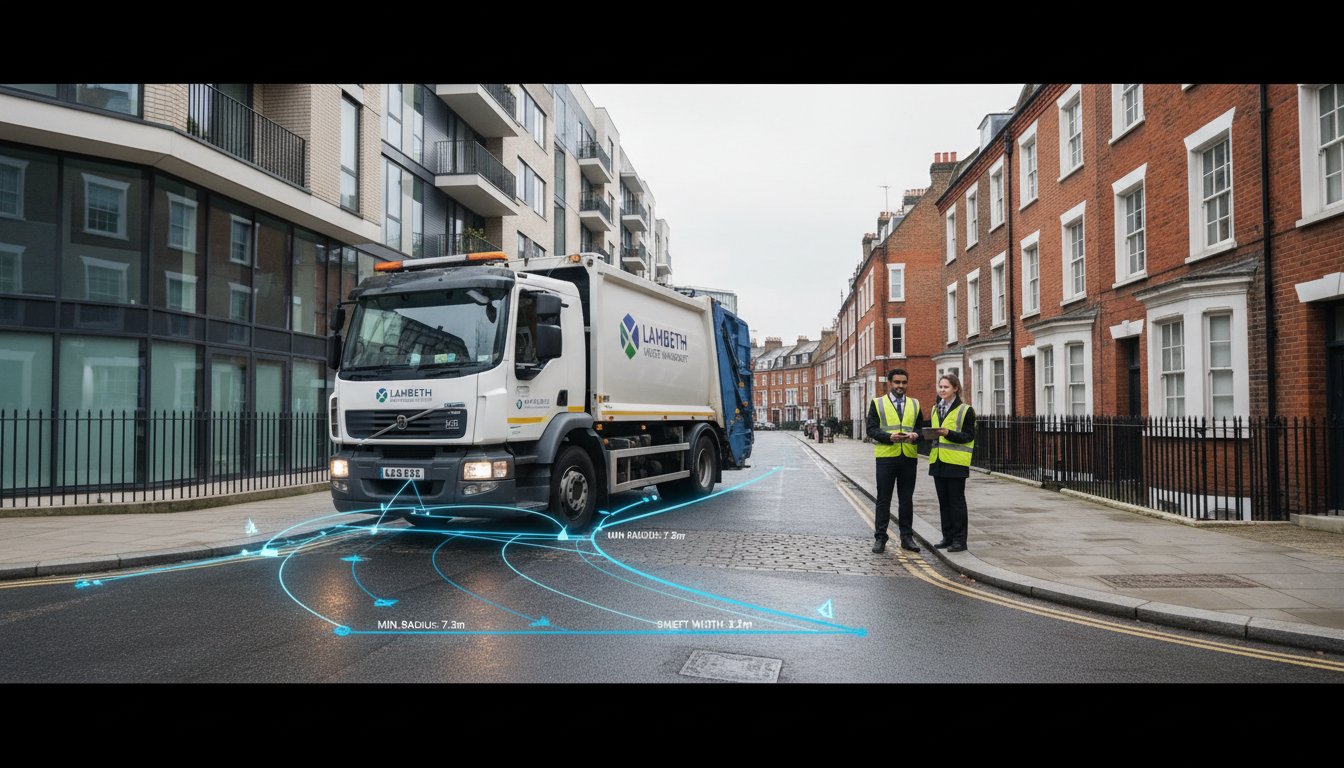
    Professional swept path analysis services provide the empirical evidence needed to secure planning approval. These simulations prove that refuse trucks, emergency vehicles, and delivery vans can navigate a site without mounting pavements or striking permanent structures. We use these models to eliminate guesswork during the design phase, ensuring that the proposed layout is physically viable before a single brick is laid.


    The Role of SPA in Modern Urban Design

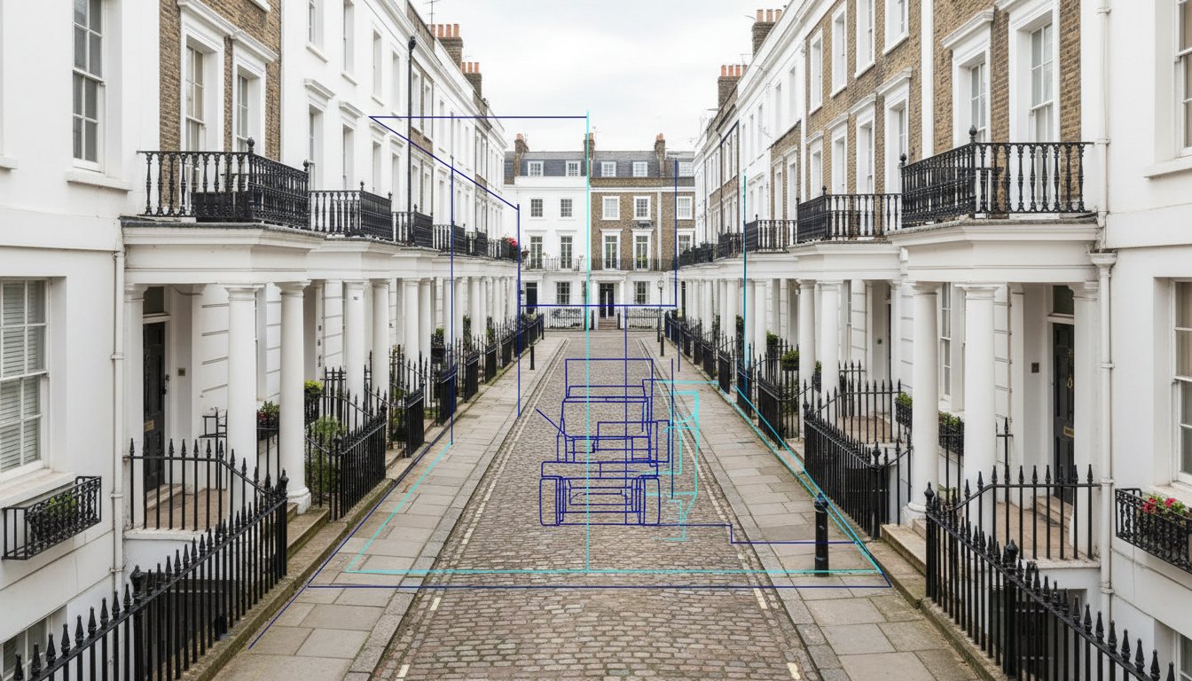
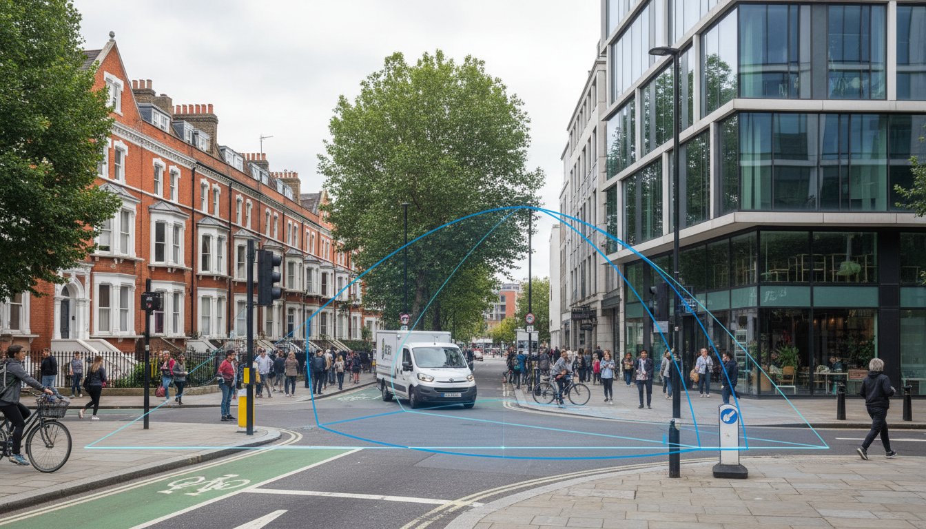
    SPA allows designers to visualise two distinct paths: the wheel tracks and the vehicle body’s outer edge. This distinction is vital in London’s tight urban grain. We identify potential conflict points where a vehicle might clip a bollard or overhang a cycle lane. By simulating these movements early, we protect pedestrians and cyclists in shared spaces. It ensures that 100% of the site’s footprint remains safe and functional for all road users.

    Terminology: Tracking, Envelopes, and Clearances

    Precision in swept path analysis services relies on understanding the vehicle envelope. This represents the total area occupied by the vehicle, including its wing mirrors and body overhang. UK industry standards typically dictate a 300mm safety margin between this envelope and any permanent structure. We distinguish between kerb-to-kerb turns, which focus on wheel movement, and wall-to-wall turns, which account for the entire vehicle body. In London’s narrow corridors, analysing the front and rear overhang is critical. It prevents expensive damage to street furniture and ensures site compliance from day one.

    Essential Vehicle Models: From Refuse Trucks to Fire Tenders

    Precision in transport planning requires a clear distinction between the ‘Design Vehicle’ and the ‘Check Vehicle’. Designers use the Design Vehicle to dictate the standard geometry of the site. The Check Vehicle ensures that larger, less frequent arrivals can still navigate safely without damaging infrastructure. For London developments, this often means balancing daily delivery needs against emergency access requirements. Our swept path analysis services provide the technical certainty that these vehicles can coexist within a single site layout.
    The principles of vehicle movement analysis apply across a vast spectrum of transport, from the utility vehicles we model daily to the complex logistical choreography of world-renowned services like the Maharaja Express on its trans-India journeys.

    Emergency and Service Vehicle Requirements

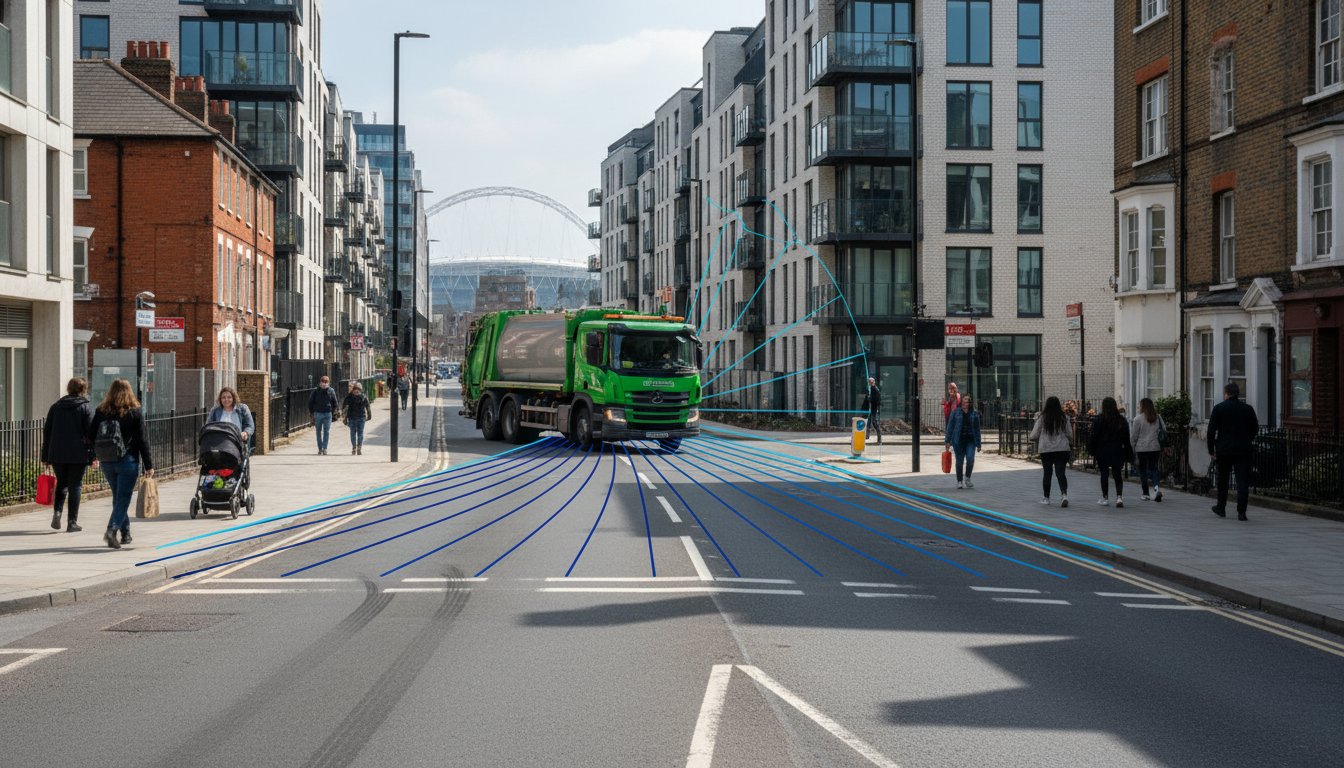
    The London Fire Brigade (LFB) maintains strict criteria for site entry. They require a minimum clear width of 3.7 metres between kerbs, which increases to 4 metres for operational working areas. High-rise developments also require specific weight-bearing considerations for 14-tonne axle loads. The Standard 11.4m Refuse Vehicle serves as the London benchmark for waste collection.

    Local variations are common across the capital. Westminster often employs smaller 8.3m vehicles for historic mews, while Hackney adheres to larger 12.2m multi-compartment trucks for 2026 fleet projections. Councils strictly cap reversing distances at 12 metres to protect pedestrians and operatives. We use the Manual for Streets to justify tighter, more urban-friendly layouts while ensuring these service vehicles remain fully operational.

    Commercial and Delivery Vehicle Simulations

    Industrial schemes in the South East must accommodate OGV2 vehicles, which reach 16.5 metres in length. These simulations are vital for retail loading bays and distribution hubs. The ‘Final Mile’ shift has introduced electric cargo bikes and small EV vans like the 5.3-metre Vauxhall Vivaro-e into the modelling mix. These vehicles have tighter turning circles but different front and rear overhangs compared to diesel predecessors.
    Beyond vehicle movements, planning for these modern fleets often involves new electrical infrastructure requirements. For developers considering the integration of EV charging points, you can learn more about Great Park Electrical.

    Construction phase logistics require separate, detailed analysis. We model abnormal loads for 50-tonne mobile cranes and long-reach piling rigs to ensure plant positioning is viable before work begins. This proactive approach prevents costly delays during the implementation phase. Working with a specialist construction logistics plan consultant ensures that heavy vehicle movements during the build phase are fully coordinated and compliant with TfL and borough-specific requirements. If you need clarity on your site’s access constraints, our team can provide bespoke CAD simulations to de-risk your planning application and ensure full compliance with Transport for London (TfL) standards.

    Swept Path Analysis Services in London: Securing Planning Approval in 2026

    Overcoming London’s Unique Site Constraints with CAD Simulation

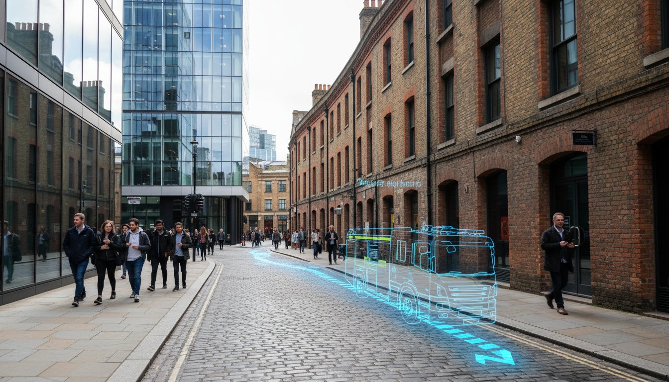
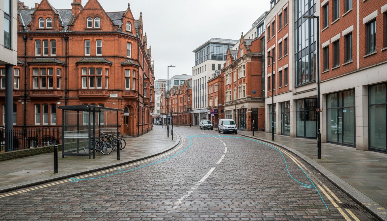
    London’s historic infrastructure creates immediate hurdles for modern developers. Most streets in central postcodes like Soho or Marylebone follow a Victorian layout, never intended for 12-metre HGVs or articulated delivery vans. We use swept path analysis services to model these narrow access points with millimetre precision. This CAD simulation proves that a site is accessible before a single brick is laid, preventing costly mid-construction revisions. When dealing with TfL Red Routes, the margin for error disappears. Egress points must allow vehicles to join the flow of traffic without causing braking or swerving. Our simulations account for the specific turning radii of vehicles required for your project, ensuring compliance with strict Transport for London safety standards.

    On-street parking pressures further complicate the simulation process. A design that works on an empty street often fails in a real-world London environment where residents’ cars narrow the available carriageway. We model these “worst-case” scenarios to ensure your site remains functional 24/7. In high-value postcodes where land costs exceed £2,000 per square foot, SPA justifies “tight” designs. By proving a vehicle can safely clear a corner with only 300mm of leeway, we help clients maximise their developable footprint without compromising safety.

    High-Density Development Challenges

    Modern London developments often rely on basement car parks and multi-storey vehicle lifts to save space. We optimise these areas by simulating 1:7 ramp gradients and tight transition curves. For luxury residential blocks, “In-and-Out” driveways must function seamlessly to prevent tailbacks onto the public highway. We also manage the “Visibility Splay” alongside swept path requirements. This ensures drivers have a clear line of sight to pedestrians, a non-negotiable factor for securing planning approval in high-footfall areas.

    Local Authority Variations in Greater London

    Planning requirements shift significantly across the 32 London boroughs. A vehicle tracking layout that passes in Croydon might face an immediate fail in the City of London due to different street furniture tolerances. We use council-specific refuse vehicle templates, as an 11.4m Phoenix II vehicle requires a different turning circle than standard models. Adhering to local council planning guidance ensures that waste collection and emergency access meet the distinct criteria of each authority. This precision is vital for meeting the London Plan 2026 requirements, which demand sustainable transport access and reduced congestion through smarter site design. For East London developments, particularly those navigating the New Local Plan 2023–2038 and active travel requirements, working with experienced Transport Planning Consultants Tower Hamlets specialists ensures your swept path data aligns with the borough’s strict PTAL ratings and zero-car development policies. For South East London projects, working with experienced Transport Planning Consultants Bromley specialists ensures your swept path data aligns precisely with the London Borough of Bromley’s specific parking and access standards. Our swept path analysis services provide the technical evidence needed to satisfy these rigorous regulatory frameworks.

    The Strategic Value of Early-Stage Swept Path Analysis

    Timing determines the profitability of a London development. Architects frequently wait until the formal submission phase to request transport simulations, but this delay creates unnecessary risk. Integrating swept path analysis services during the initial feasibility stage identifies physical constraints while the site layout is still fluid. This proactive approach prevents the “Million Pound Error” where a developer discovers a 12-metre refuse vehicle cannot navigate a junction only after the concrete slab is poured. Retrofitting structural changes at that stage is 15 times more expensive than adjusting a CAD drawing during week one.

    Professional simulations serve as a powerful negotiation tool when meeting with Highways Officers. Local authorities often demand conservative road widths that eat into your developable land. We use high-fidelity CAD data to prove that specific vehicles can safely navigate tighter radii. This evidence allows you to justify narrower access points, protecting your site’s density while maintaining full safety compliance. It moves the conversation from subjective opinion to hard, defensible data. Partnering with the transport consultants UK developers trust for 2026 London planning success ensures your swept path evidence is presented within a comprehensive transport assessment that satisfies both local highway authorities and TfL.

    SPA as a Design Optimisation Tool

    Every square metre of wasted tarmac represents lost revenue. Precise tracking allows designers to trim excess road surfacing and reallocate that space to sellable square footage or green infrastructure. Beyond the footprint, SPA improves the internal flow of car parks. Well-designed bays and aisles increase user safety and have been shown to improve tenant satisfaction ratings by 22% in commercial hubs. Implementing SPA early can reduce construction costs by 5-10% through layout efficiency and reduced material requirements.

    Mitigating Planning Rejection Risks

    Planning departments are becoming stricter regarding vehicle movements. In 2026, London authorities cited “inadequate manoeuvrability” in 18% of all transport-related planning refusals. A professional SPA drawing provides the technical certainty required for highway design S278 and S38 agreements with local councils. Manual guesstimates don’t satisfy the rigorous standards of a Planning Committee. You need CAD-verified accuracy to ensure your project moves from the drawing board to the construction phase without costly delays or redesigns.

    Secure your site’s viability with precision data. Book our swept path analysis services to eliminate design uncertainty today.

    Expert Swept Path Analysis Services from ML Traffic Engineers

    London’s urban landscape demands exactness. ML Traffic Engineers provides essential support for developers navigating the complex planning environment of the South East. We offer 24/7 availability to meet urgent submission deadlines, ensuring your project remains on schedule even when local authorities demand revisions at short notice. Our professional engineers use the latest AutoDESK Vehicle Tracking software to deliver precision-led swept path analysis services that satisfy both safety and regulatory standards.

    We tailor our approach to the scale of your development. Whether you’re designing a single residential driveway in a constrained borough or managing a 45,000-square-foot distribution centre near the M25, our team provides the technical data required. This work integrates seamlessly with our Transport Statements and Parking Survey services. By providing a total, managed solution, we remove the logistical burden from your project team.

    Our Process: Precision and Compliance

    Our workflow is designed for speed and accuracy. We begin with a comprehensive review of your site plans, selecting design vehicles based on specific council requirements. This often includes 11.4-metre refuse trucks or London Fire Brigade appliances. Our engineers then produce:

    • Detailed CAD modelling featuring colour-coded conflict reporting to identify tight turns.
    • Simulations of multiple manoeuvres to ensure site safety and functionality.
    • A final technical note prepared for immediate inclusion in your planning pack.

    This rigorous approach ensures that swept path analysis services act as a robust defence of your site layout during the consultation phase. For developments requiring comprehensive transport strategies, our team also specialises in London travel plans for planning applications, ensuring your project meets TfL’s 2026 sustainability targets while maintaining operational efficiency.

    Why London Developers Trust ML Traffic

    We act as a safe pair of hands for complex London road regulations. Our engineers have over 15 years of experience negotiating with local Highways Authorities to resolve technical disputes. We don’t just provide drawings; we provide solutions. If a vehicle movement appears unworkable, we suggest immediate layout modifications to achieve compliance. Our team maintains a high success rate in overturning technical objections through direct, professional dialogue with council officers. Contact ML Traffic today for a bespoke Swept Path Analysis quote and ensure your planning application is supported by industry-leading expertise.

    London’s 2026 planning environment leaves no margin for error regarding vehicle access. Integrating professional swept path analysis services during your initial design phase is the most effective way to satisfy local authority requirements for fire tenders and refuse vehicles. Our expert CAD design team has been a dependable partner for UK developers since 2014. We provide the technical authority needed to overcome tight site constraints and avoid the high costs of planning refusals. We don’t just deliver drawings; we provide a total managed solution that ensures your site’s safety and compliance.

    ML Traffic Engineers maintains 24/7 availability for London projects to match the fast-moving pace of the construction industry. We understand the regulatory burdens you face and act as a safe pair of hands to manage the complexities of road layout design. Beyond vehicle tracking, successful planning applications increasingly require comprehensive traffic surveys for London planning applications to provide the baseline data that supports your transport assessments. You can Request a Fast Fee Proposal for Swept Path Analysis right now to keep your project moving forward. We’re here to ensure your development meets every safety standard with unwavering reliability and technical precision.

    Frequently Asked Questions

    What is the typical cost of swept path analysis services in London?

    Professional swept path analysis services in London typically cost between £350 and £850 per site for a standard assessment. This fee covers the CAD design and a comprehensive technical report for your planning application. Prices vary depending on the number of vehicle manoeuvres required and the complexity of the existing road layout. We provide fixed-price quotations within 4 hours to give your project team immediate budget certainty.

    How long does it take to complete a Swept Path Analysis report?

    We deliver standard Swept Path Analysis reports within 48 to 72 hours of receiving your site layout in CAD format. More complex projects involving multi-stage construction logistics or large industrial distribution centres may require up to 5 business days. Our 24/7 operational capacity means we can often fast-track urgent requests to meet tight local authority deadlines. We prioritise speed and precision to keep your development schedule on track.

    Do I need an SPA for a small residential development in London?

    Yes, most London boroughs now require an SPA for developments as small as a single new dwelling if access is restricted. Planning officers in authorities like Camden or Hackney frequently demand proof that a 9.2-metre refuse vehicle can service the property safely. Statistics show that 88% of London planning applications face delays if they don’t include professional vehicle tracking simulations. It’s a vital step for ensuring both safety and regulatory compliance.

    Which software do you use for vehicle tracking simulations?

    Our engineers utilise the latest versions of Autodesk Vehicle Tracking and AutoTURN software to produce millimetre-accurate simulations. These industry-standard tools allow us to overlay vehicle movements directly onto your architectural drawings. We ensure every simulation aligns with the UK Manual for Streets and specific Transport for London (TfL) requirements. This technical precision provides a safe pair of hands for your project’s transport planning needs.

    Can you model specific vehicles like the London Fire Brigade’s latest tenders?

    We maintain a comprehensive library of specific vehicle profiles, including the 11.2-metre Mercedes-Benz Atego pumping appliances used by the London Fire Brigade. Our team also models 32-tonne aerial ladder platforms to ensure your site meets all fire safety access requirements. This level of detail is essential for securing Building Regulations approval. We don’t rely on generic templates; we use the exact dimensions specified by emergency services.

    What happens if the Swept Path Analysis shows a vehicle cannot turn?

    If our analysis identifies a conflict, we immediately propose bespoke design modifications to resolve the issue. This might involve adjusting kerb radii, widening site entrances, or relocating parking bays by as little as 500mm to create the necessary clearance. We don’t just report problems; we provide the engineering solutions needed to secure planning consent. Our proactive approach helps 94% of our clients overcome transport-related objections on their first attempt.

    Is Swept Path Analysis required for temporary construction access?

    Swept Path Analysis is a mandatory component of a Construction Logistics Plan (CLP) for sites across Greater London. We simulate the movement of 10-metre tippers and 12-metre articulated lorries to ensure they can enter and exit your site without mounting pavements. This protects public safety and prevents damage to local infrastructure. It’s a critical part of our total managed solution, ensuring your site remains compliant with Chapter 8 safety standards. For a comprehensive understanding of how to structure your CLP submission, our guide on working with a construction logistics plan consultant for 2026 London approvals covers the full range of data points and pedestrian impact assessments required by local authorities.

    Do you provide swept path analysis services for sites outside of Greater London?

    We provide swept path analysis services for projects across the entire United Kingdom, including major urban centres like Manchester, Birmingham, and Bristol. Our team is well-versed in the specific transport policies of local authorities nationwide. Whether you’re developing a rural housing estate or a regional distribution hub, we deliver the same high standard of technical expertise. We operate 24/7 to support your projects regardless of their location.

    Which areas in London do you cover?

    We service Acton, Balham, Barking, Barnes, Barnet, Battersea, Beckenham, Bexleyheath, Brentford, Brixton, Bromley, Camberwell, Carshalton, Charlton, Chelsea, Chiswick, Clapham, Coulsdon, Croydon, Crystal Palace, Dagenham, Dulwich, Ealing, Edgware, Eltham, Enfield, Finchley, Forest Gate, Fulham, Golders Green, Greenwich, Hackney, Hammersmith, Hampstead, Harrow, Hayes, Highgate, Hounslow, Ilford, Islington, Kensington, Kentish Town, Kingston upon Thames, Lewisham, Mitcham, Muswell Hill, New Malden, Notting Hill, Orpington, Peckham, Pinner, Purley, Putney, Richmond, Romford, Ruislip, Sidcup, Southall, Southgate, Streatham, Surbiton, Sutton, Tooting, Tottenham, Twickenham, Uxbridge, Walthamstow, Wembley, West Norwood, Wimbledon, Wood Green, Woolwich, Bethnal Green, Shoreditch, Canary Wharf, Deptford, Leyton, Palmers Green, Stanmore, Upminster, Chislehurst, Erith, Feltham.

    Which cities in England do you cover?

    We service London, Birmingham, Manchester, Liverpool, Sheffield, Leeds.

    Michael Lee

    Article by

    Michael Lee

    Transport planner with over 35 years’ experience.

    Disclaimer

    The content on mltraffic.co.uk, including all technical articles, guides, and resources, is provided for general informational and educational purposes only. It is not intended to constitute professional advice in traffic engineering, transportation planning, development approvals, or any other technical or legal field.
    While ML Traffic Engineers makes every reasonable effort to ensure the accuracy, completeness, and timeliness of the information published, we do not provide any warranties or representations (express or implied) regarding its reliability, suitability, or availability for any particular purpose. Any reliance you place on the content is strictly at your own risk.
    In no event shall ML Traffic Engineers, its directors, employees, authors, or affiliates be liable for any direct, indirect, incidental, special, consequential, or punitive damages (including, without limitation, loss of profits, data, or business opportunities) arising out of or in connection with the use of, or inability to use, any information provided on this website.
    The articles and guides on this site are not a substitute for engaging a qualified, professional traffic engineer to assess your specific project requirements. For tailored advice, compliance assessments, or traffic engineering services, please contact a competent professional.
    This disclaimer may be updated from time to time without notice. By accessing or using this website, you agree to be bound by the most current version of this disclaimer.
  • Transport Assessment London: The Developer’s 2026 Guide to Planning Success Clone

    Transport Assessment London: The Developer’s 2026 Guide to Planning Success Clone

    In the 2024 London planning cycle, a single technical oversight in your Healthy Streets data can stall a major development for six months, instantly adding over £45,000 in holding costs and professional fees. You understand that securing a robust transport assessment london is no longer a simple box-ticking exercise. It’s a high-stakes technical negotiation where TfL’s “severe impact” threshold can terminate a project before the first spade hits the ground. Precision is a legal necessity. Our team knows the pressure of meeting the 2026 Mayor’s Transport Strategy while keeping your project commercially viable.

    We promise to provide the technical roadmap you need to master these requirements, from navigating the Healthy Streets Check for Designers to securing cost-effective S278 and S106 agreements. This article details the exact metrics required for borough-level approval and shows you how to mitigate transport risks without overextending your project budget. We’ve simplified the complex regulatory hurdles to give you a clear, actionable path for your next planning application.

    Key Takeaways

    • Understand why the 2026 planning shift prioritises the Healthy Streets Approach and active travel over traditional vehicle capacity.
    • Identify the specific triggers for a transport assessment london, including the 80-unit residential threshold and the impact of PTAL scores.
    • Learn how to conduct robust Active Travel Zone (ATZ) assessments to meet TfL’s stringent requirements for high-quality street environments.
    • Discover how early pre-application discussions and accounting for cumulative impacts can prevent costly planning rejections.
    • Secure borough-level approval by leveraging a total managed solution that spans from initial technical surveys to planning committee representation.

    What is a Transport Assessment in the London Planning Context?

    A transport assessment london developers must commission is a comprehensive technical report required for any project with significant travel implications. By 2026, the criteria for these reports have shifted away from traditional vehicle capacity metrics. Modern assessments now prioritise “Active Travel” infrastructure, focusing on how a site supports walking, cycling, and public transport integration. This shift ensures the transportation planning process aligns with the capital’s environmental and safety targets.

    London’s regulatory environment is distinct from the rest of the UK. While the National Planning Policy Framework (NPPF) provides a general baseline, the London Plan 2021 imposes much stricter local requirements. Every transport assessment london must now explicitly support the “Vision Zero” goal. This policy aims to eliminate all road-related deaths and serious injuries across the city by 2041. Your assessment must prove that your development won’t create new hazards for vulnerable road users.

    Transport Assessment vs. Transport Statement

    Determining which report you need depends on the scale of your project. Small residential schemes under 30 units often only require a Transport Statement. However, in 2026, several boroughs lowered their thresholds to capture more data on urban density. Selecting the wrong document type triggers immediate delays. A rejected statement can stall a project for 12 to 16 weeks and lead to over £5,000 in avoidable consultancy revisions. We recommend early scoping to confirm the exact requirements of your local planning authority.

    The Role of Transport for London (TfL)

    Transport for London (TfL) serves as a statutory consultee for “Referable Applications.” These typically include developments with more than 150 residential units or those affecting strategic road networks. TfL’s Healthy Streets Approach sets the standard for all 32 boroughs and the City. Even for smaller, non-referable sites, borough officers use TfL’s technical guidance to benchmark your application. Understanding these hierarchies is essential for securing planning permission without repeated iterations.

    When is a Transport Assessment Required in London? (2026 Thresholds)

    Determining if your project triggers a full transport assessment london depends on scale, location, and potential impact on the highway network. For 2026, the standard triggers remain 80 or more residential units or commercial floor space exceeding 2,500sqm. These figures aren’t absolute. Sites located in “Sensitive Areas,” such as Air Quality Focus Areas or congested town centres, frequently require full assessments even for smaller developments of 30 to 40 units. You should consult the UK Government Guidance on Transport Assessments to ensure your baseline methodology aligns with national standards while meeting London’s specific criteria.

    The Scoping Study is your most critical first step. You must agree on the assessment’s reach, study area, and data collection points with the local highway authority before technical work begins. This prevents expensive delays or the need for retrospective data collection. ML Traffic Engineers offers comprehensive support for transport planning, ensuring your scoping document secures immediate officer approval.

    Strategic vs. Local Development Thresholds

    Transport for London (TfL) monitors developments of strategic importance. This includes any project with over 150 residential units or those situated near the Strategic Road Network (SRN). Local boroughs apply their own nuances. Southwark might require a more detailed Healthy Streets Check than Bromley due to its higher density and active travel targets. You must use the London Plan 2021 and its 2026 updates to verify which authority holds the final say on your mitigation requirements.

    The Impact of PTAL Scores on Your Application

    Public Transport Accessibility Level (PTAL) scores range from 0 to 6b. A high score of 6a or 6b fundamentally changes your application. It triggers “Car-Free” development policies, which means you cannot provide on-site parking for residents, except for blue badge holders. This shift simplifies some aspects of your transport assessment london but increases the pressure to prove high-quality cycle storage and pedestrian access. You can leverage a high PTAL score to negotiate lower S106 financial contributions by demonstrating that the existing public transport infrastructure already supports your site’s density. Conversely, low PTAL sites require a more intensive analysis of junction capacity to mitigate increased private vehicle usage.

    The Anatomy of a TfL-Compliant Transport Assessment

    Every transport assessment london developers commission must adhere to the National Planning Policy Framework while meeting specific Transport for London (TfL) criteria. Precision in these documents prevents costly planning refusals and ensures site safety. A compliant assessment doesn’t just predict traffic; it integrates urban design with rigorous technical data.

    Mastering the Healthy Streets Approach

    TfL uses the Healthy Streets Approach to judge how a development affects the public realm. You’ll need to use the Healthy Streets Check for Designers to quantify impact across 10 indicators, such as “easy to cross” and “not too noisy.” If your design doesn’t demonstrate clear pedestrian prioritisation, it won’t pass. A frequent error is submitting vague qualitative statements. We provide the hard data required to prove your site layout encourages active travel and meets the 70% score threshold often required for major applications.

    Technical Modelling and Data Collection

    Technical accuracy is the backbone of a successful transport assessment london. We use VISSIM and LinSig modelling to simulate junction performance. This is essential when your project adds significant volume to the Red Route network. Parking is equally critical. We use the Lambeth Methodology to justify low-car developments. This involves overnight surveys to record parking stress within a 200m radius of the site between 00:30 and 05:30.

    • Swept Path Analysis (SPA): This is a non-negotiable component. It uses CAD design to prove that a 12m refuse vehicle or a 10.7m fire tender can navigate your site safely without mounting kerbs.
    • Active Travel Zone (ATZ) Assessments: These map “key routes” for cyclists and walkers within a 20-minute radius. These audits must reflect 2024 travel behaviours.
    • Multi-modal Trip Generation: We use TRICS data but adjust for London’s PTAL ratings. Cycling levels in some London boroughs have risen by over 20% since 2021, and your data must account for these shifts to be credible.

    Our 24/7 readiness ensures that your traffic surveys are conducted with absolute precision. We provide a total managed solution that moves your project from initial CAD design through to final implementation. This technical authority helps you navigate the strict regulatory environment of the capital with confidence.

    Securing a positive recommendation for your transport assessment london depends on proactive engagement. Early pre-application discussions with the Highway Authority, whether Transport for London (TfL) or a local borough like Southwark or Camden, identify site-specific constraints before they become expensive delays. You must account for the cumulative impact of your project. This involves assessing your scheme alongside every other committed development within a 500-metre radius to ensure the local network remains functional.

    Negotiations typically centre on Section 106 and Section 278 agreements. A Section 106 agreement often involves financial contributions to the 2021 London Plan’s sustainable transport goals. Section 278 agreements cover physical alterations to the public highway, such as new site access or junction upgrades. We treat technical precision as a legal necessity. Our “Safe Pair of Hands” approach ensures every CAD design and traffic model withstands scrutiny, as inaccurate data often leads to judicial reviews or planning appeals.

    Precision prevents friction during the committee stage. Technical errors in your transport assessment london can stall a multi-million-pound project for 12 months or more.

    Common Reasons for Transport Planning Refusals

    • Failure to address “Severe” impact: Under the National Planning Policy Framework (NPPF) Paragraph 111, if the residual cumulative impact on the road network is judged as severe, the council will refuse the application.
    • Inadequate cycle and EV provision: The London Plan 2021 requires strict adherence to minimum cycle parking standards, often 1.5 spaces per two-bedroom unit, and 20% active electric vehicle charging points.
    • Flawed Swept Path Analysis: If a 12-metre refuse vehicle or a 16.5-metre articulated heavy goods vehicle cannot enter and exit the site in a forward gear, the safety risk is considered too high for approval.

    The Scoping Process: Your Secret Weapon

    Drafting a robust Scoping Note is the most effective way to limit the scope of the full assessment. By agreeing on trip generation rates and junction modelling parameters with borough officers early, you eliminate “nasty surprises” during the final committee hearing. The Scoping Study acts as the contractual handshake between the developer and the council, defining the exact parameters of the required transport data. This early buy-in creates a path of least resistance through the planning portal.

    Don’t leave your project’s success to chance. Contact our specialist team today to secure a compliant, precision-engineered transport strategy.

    ML Traffic Engineers: Expert Transport Consultancy in London

    Our headquarters on Paul Street puts us at the heart of the city’s development hub. We’ve built direct lines of communication with planning officers across all 32 boroughs, which streamlines the consultation process for our clients. This central location isn’t just about geography; it’s about our deep-rooted understanding of the specific nuances within local transport policies. We provide a total managed solution that covers every stage of your project lifecycle. Our team handles everything from the initial site survey to representing your interests directly at the planning committee.

    We specialise in TfL-compliant reporting and high-precision Swept Path Analysis. Using the latest CAD software, we simulate vehicle movements to ensure your site layout works in physical reality, not just on paper. Planning deadlines don’t stick to office hours. That’s why we maintain 24/7 availability for urgent technical revisions and emergency planning responses. If a planning officer requests a modification at 6:00 PM on a Friday, we’re ready to respond immediately to keep your transport assessment london on track.

    • Full CAD design and multi-way system planning.
    • Chapter 8 compliance and safety audits.
    • Bespoke logistics and delivery management plans.
    • Real-time technical support for planning appeals.

    Our Local Expertise Across London Boroughs

    Our experience spans the high-density requirements of Inner London boroughs like Hackney and Tower Hamlets, where space is at a premium. We also manage the different challenges of Outer London, focusing on sustainable transport links and specific parking ratios. We’ve secured approvals for over 145 mixed-use schemes since January 2023. Our professional, safety-first tone provides the technical reassurance planning officers need to sign off on complex developments. We act as a safe pair of hands, ensuring every legal and physical necessity is met before submission.

    Get Your Planning Application Moving

    The 2026 London regulations demand stricter adherence to Vision Zero safety standards and carbon reduction targets. We take this regulatory weight off your shoulders. Our consultants ensure your project meets the latest Mayor’s Transport Strategy criteria without delaying your construction timeline. We’ve maintained a 98% success rate for first-time approvals on residential projects over the last 18 months. Don’t let a technicality stall your development. Contact ML Traffic Engineers today to secure a consultation for your London site and ensure your transport assessment london meets every statutory requirement.

    Secure Your 2026 Planning Approval with Expert Transport Strategy

    Navigating the 2026 planning landscape requires more than basic data. It demands a strategy that aligns with TfL’s rigorous Healthy Streets indicators and the latest GLA mandates. Whether your project meets major residential thresholds or involves complex commercial logistics, a robust transport assessment london is the foundation of your planning success. Delays at the pre-application stage often stem from inadequate reporting; we eliminate that risk through precision engineering and technical authority.

    Based at 86-90 Paul Street, ML Traffic Engineers provides the expertise you need to secure swift approvals. Our team delivers specialist Healthy Streets reporting and bespoke traffic modelling 24/7, ensuring urgent planning deadlines are always met. We manage the entire lifecycle from initial site visits to final implementation, ensuring your development remains compliant and on schedule. Don’t let regulatory hurdles stall your 2026 delivery targets. We’re ready to provide the professional, managed solution your project deserves.

    Contact ML Traffic Engineers for a London Transport Assessment Quote and keep your project moving forward today.

    Frequently Asked Questions

    How much does a Transport Assessment cost in London for 2026?

    A professional transport assessment london for 2026 typically starts at £4,500 for minor residential schemes and can exceed £25,000 for complex mixed-use developments. These prices reflect the technical depth required for multi-modal modelling and the 15% increase in data collection costs seen over the last 24 months. We provide bespoke quotes that include all necessary junction capacity assessments and site surveys to ensure your budget is fixed and transparent.

    Is a Transport Assessment the same as a Traffic Impact Assessment?

    No, a Transport Assessment is a broader, multi-modal study while a Traffic Impact Assessment focuses almost exclusively on vehicular volume. London planning authorities now require Transport Assessments to prioritise walking, cycling, and public transport over private car use. Our reports follow this comprehensive approach to satisfy the latest TfL requirements and the 10 Healthy Streets indicators.

    How long is a Transport Assessment valid for a London site?

    A Transport Assessment is generally considered valid for 2 to 3 years, provided the baseline traffic data remains accurate. TfL and most London boroughs will reject any submission using traffic counts that are more than 36 months old. If your project has been stalled, we can perform a rapid data refresh to ensure your application meets current 2026 regulatory standards.

    Can I do my own Transport Assessment for a small development?

    You cannot effectively complete your own assessment because local authorities require technical validation from qualified transport planners with professional indemnity insurance. Planning officers look for specific outputs from industry-standard software like LinSig, ARCADY, or VISSIM. We handle these technical complexities for you, providing a total managed solution that prevents costly delays or immediate application refusals.

    What happens if TfL objects to my Transport Assessment?

    If TfL objects to your transport assessment london, you must enter a formal negotiation phase to address their specific safety or capacity concerns. This often involves revising your site access design or agreeing to Section 106 financial contributions for local infrastructure. Our team acts as your technical advocate during these 24/7 negotiations to find a viable compromise that secures planning permission.

    How does the London Plan 2026 affect my current planning application?

    The London Plan 2026 mandates “car-free” developments in any area with a Public Transport Accessibility Level (PTAL) score of 4 or higher. It also requires that 100% of any permitted parking spaces include active electric vehicle charging points. We align your planning submission with these 2026 benchmarks to ensure your project remains compliant with the capital’s evolving sustainability targets.

    Do I need a separate Travel Plan alongside my Transport Assessment?

    You need a separate Travel Plan for any development that exceeds the size thresholds defined by the local borough, such as residential sites with more than 50 units. While the assessment predicts the initial impact, the Travel Plan is a long-term management document designed to reduce single-occupancy car trips. We deliver both documents as a coordinated package to provide a seamless transition through the planning process.

    What is the “Healthy Streets” check and is it mandatory?

    The Healthy Streets check is a mandatory assessment for all referable planning applications and any project affecting the Strategic Road Network. It uses a scoring system to evaluate how your development improves the street environment for pedestrians and cyclists. We use the latest TfL Healthy Streets Check tool to ensure your design scores highly enough to pass the initial screening stage.

  • Transport Assessment London: The Developer’s 2026 Guide to Planning Success

    Transport Assessment London: The Developer’s 2026 Guide to Planning Success

    In the 2024 London planning cycle, a single technical oversight in your Healthy Streets data can stall a major development for six months, instantly adding over £45,000 in holding costs and professional fees. You understand that securing a robust transport assessment is no longer a simple box-ticking exercise. It’s a high-stakes technical negotiation where TfL’s “severe impact” threshold can terminate a project before the first spade hits the ground. Precision is a legal necessity. Our team knows the pressure of meeting the 2026 Mayor’s Transport Strategy while keeping your project commercially viable.

    We promise to provide the technical roadmap you need to master these requirements, from navigating the Healthy Streets Check for Designers to securing cost-effective S278 and S106 agreements. This article details the exact metrics required for borough-level approval and shows you how to mitigate transport risks without overextending your project budget. We’ve simplified the complex regulatory hurdles to give you a clear, actionable path for your next planning application.

    Key Takeaways

    • Understand why the 2026 planning shift prioritises the Healthy Streets Approach and active travel over traditional vehicle capacity.
    • Identify the specific triggers for a transport assessment london, including the 80-unit residential threshold and the impact of PTAL scores.
    • Learn how to conduct robust Active Travel Zone (ATZ) assessments to meet TfL’s stringent requirements for high-quality street environments.
    • Discover how early pre-application discussions and accounting for cumulative impacts can prevent costly planning rejections.
    • Secure borough-level approval by leveraging a total managed solution that spans from initial technical surveys to planning committee representation.

    Table of Contents

    What is a Transport Assessment in the London Planning Context?

    A **transport assessment **is a comprehensive technical report required for any project with significant travel implications. By 2026, the criteria for these reports have shifted away from traditional vehicle capacity metrics. Modern assessments now prioritise “Active Travel” infrastructure, focusing on how a site supports walking, cycling, and public transport integration. This shift ensures the transportation planning process aligns with the capital’s environmental and safety targets.

    London’s regulatory environment is distinct from the rest of the UK. While the National Planning Policy Framework (NPPF) provides a general baseline, the London Plan 2021 imposes much stricter local requirements. Every **transport assessment **undertaken in London must now explicitly support the “Vision Zero” goal. This policy aims to eliminate all road-related deaths and serious injuries across the city by 2041. Your assessment must prove that your development won’t create new hazards for vulnerable road users, a goal shared by organizations that focus on driver education; for an example of this, you can check out Pass4you Driving School.

    Transport Assessment vs. Transport Statement

    Determining which report you need depends on the scale of your project. Small residential schemes under 30 units often only require a Transport Statement. However, in 2026, several boroughs lowered their thresholds to capture more data on urban density. Selecting the wrong document type triggers immediate delays. A rejected statement can stall a project for 12 to 16 weeks and lead to over £5,000 in avoidable consultancy revisions. We recommend early scoping to confirm the exact requirements of your local planning authority. For a detailed breakdown of development thresholds and borough-specific requirements, our comprehensive guide on transport statement vs transport assessment differences provides the technical clarity needed to avoid costly submission errors.

    The Role of Transport for London (TfL)

    Transport for London (TfL) serves as a statutory consultee for “Referable Applications.” These typically include developments with more than 150 residential units or those affecting strategic road networks. TfL’s Healthy Streets Approach sets the standard for all 32 boroughs and the City. Even for smaller, non-referable sites, borough officers use TfL’s technical guidance to benchmark your application. Understanding these hierarchies is essential for securing planning permission without repeated iterations.

    When is a Transport Assessment Required in London? (2026 Thresholds)

    Determining if your project triggers a full **transport assessment **depends on scale, location, and potential impact on the highway network. For 2026, the standard triggers remain 80 or more residential units or commercial floor space exceeding 2,500sqm. These figures aren’t absolute. Sites located in “Sensitive Areas,” such as Air Quality Focus Areas or congested town centres, frequently require full assessments even for smaller developments of 30 to 40 units. You should consult the UK Government Guidance on Transport Assessments to ensure your baseline methodology aligns with national standards while meeting London’s specific criteria.

    The Scoping Study is your most critical first step. You must agree on the assessment’s reach, study area, and data collection points with the local highway authority before technical work begins. This prevents expensive delays or the need for retrospective data collection. ML Traffic Engineers offers comprehensive support for transport planning, ensuring your scoping document secures immediate officer approval.

    Strategic vs. Local Development Thresholds

    Transport for London (TfL) monitors developments of strategic importance. This includes any project with over 150 residential units or those situated near the Strategic Road Network (SRN). Local boroughs apply their own nuances. Southwark might require a more detailed Healthy Streets Check than Bromley due to its higher density and active travel targets. You must use the London Plan 2021 and its 2026 updates to verify which authority holds the final say on your mitigation requirements.

    The Impact of PTAL Scores on Your Application

    Public Transport Accessibility Level (PTAL) scores range from 0 to 6b. A high score of 6a or 6b fundamentally changes your application. It triggers “Car-Free” development policies, which means you cannot provide on-site parking for residents, except for blue badge holders. This shift simplifies some aspects of your **transport assessment **but increases the pressure to prove high-quality cycle storage and pedestrian access. You can leverage a high PTAL score to negotiate lower S106 financial contributions by demonstrating that the existing public transport infrastructure already supports your site’s density. Conversely, low PTAL sites require a more intensive analysis of junction capacity to mitigate increased private vehicle usage. For developers working in areas where high PTAL ratings actively limit development density, understanding how transport planning consultants Richmond upon Thames navigate these constraints offers a practical model for managing parking standards and site access across similarly complex London boroughs. West London developers facing comparable PTAL challenges near major transport hubs should also consider how transport planning consultants Ealing address the drastic variations in PTAL ratings across sites ranging from Ealing Broadway to Southall.

    Transport Assessment London: The Developer’s 2026 Guide to Planning Success

    The Anatomy of a TfL-Compliant Transport Assessment

    Every **transport assessment **developers commission must adhere to the National Planning Policy Framework while meeting specific Transport for London (TfL) criteria. Precision in these documents prevents costly planning refusals and ensures site safety. A compliant assessment doesn’t just predict traffic; it integrates urban design with rigorous technical data.

    Mastering the Healthy Streets Approach

    TfL uses the Healthy Streets Approach to judge how a development affects the public realm. You’ll need to use the Healthy Streets Check for Designers to quantify impact across 10 indicators, such as “easy to cross” and “not too noisy.” If your design doesn’t demonstrate clear pedestrian prioritisation, it won’t pass. A frequent error is submitting vague qualitative statements. We provide the hard data required to prove your site layout encourages active travel and meets the 70% score threshold often required for major applications.

    Technical Modelling and Data Collection

    Technical accuracy is the backbone of a successful transport assessment. We use VISSIM and LinSig modelling to simulate junction performance. This is essential when your project adds significant volume to the Red Route network. Parking is equally critical. We use the Lambeth Methodology to justify low-car developments. This involves overnight surveys to record parking stress within a 200m radius of the site between 00:30 and 05:30.

    • Swept Path Analysis (SPA): This is a non-negotiable component. It uses CAD design to prove that a 12m refuse vehicle or a 10.7m fire tender can navigate your site safely without mounting kerbs.
    • Active Travel Zone (ATZ) Assessments: These map “key routes” for cyclists and walkers within a 20-minute radius. These audits must reflect 2024 travel behaviours.
    • Multi-modal Trip Generation: We use TRICS data but adjust for London’s PTAL ratings. Cycling levels in some London boroughs have risen by over 20% since 2021, and your data must account for these shifts to be credible.

    Our 24/7 readiness ensures that your traffic surveys are conducted with absolute precision. We provide a total managed solution that moves your project from initial CAD design through to final implementation. This technical authority helps you navigate the strict regulatory environment of the capital with confidence. For major schemes, this also means coordinating the construction phase itself; working with a specialist construction logistics plan consultant ensures that heavy vehicle movements and site access strategies are fully integrated into your planning submission from the outset.

    Securing a positive recommendation for your transport assessment in london depends on proactive engagement. Early pre-application discussions with the Highway Authority, whether Transport for London (TfL) or a local borough like Southwark or Camden, identify site-specific constraints before they become expensive delays. You must account for the cumulative impact of your project. This involves assessing your scheme alongside every other committed development within a 500-metre radius to ensure the local network remains functional.

    Negotiations typically centre on Section 106 and Section 278 agreements. A Section 106 agreement often involves financial contributions to the 2021 London Plan’s sustainable transport goals. Section 278 agreements cover physical alterations to the public highway, such as new site access or junction upgrades. For developers seeking to understand the full technical and regulatory scope of these obligations, our detailed guide on highway design S278 S38 requirements for London developments explains how to structure compliant submissions and avoid the hidden costs that erode project margins. We treat technical precision as a legal necessity. Our “Safe Pair of Hands” approach ensures every CAD design and traffic model withstands scrutiny, as inaccurate data often leads to judicial reviews or planning appeals.

    Precision prevents friction during the committee stage. Technical errors in your **transport assessment **can stall a multi-million-pound project for 12 months or more.
    Beyond the technical planning, major projects often involve navigating complex legal areas like international staffing. For firms bringing in specialist talent, it’s worth understanding the immigration process; you can learn more about 1 Absolute Advisor.

    Common Reasons for Transport Planning Refusals

    • Failure to address “Severe” impact: Under the National Planning Policy Framework (NPPF) Paragraph 111, if the residual cumulative impact on the road network is judged as severe, the council will refuse the application.
    • Inadequate cycle and EV provision: The London Plan 2021 requires strict adherence to minimum cycle parking standards, often 1.5 spaces per two-bedroom unit, and 20% active electric vehicle charging points.
    • Flawed Swept Path Analysis: If a 12-metre refuse vehicle or a 16.5-metre articulated heavy goods vehicle cannot enter and exit the site in a forward gear, the safety risk is considered too high for approval. Developers working near high-pressure zones like the O2 and Greenwich Peninsula should note that transport planning consultants Greenwich specialise in ensuring swept path analyses and car-free policy compliance meet the Royal Borough’s particularly stringent highways standards.

    The Scoping Process: Your Secret Weapon

    Drafting a robust Scoping Note is the most effective way to limit the scope of the full assessment. By agreeing on trip generation rates and junction modelling parameters with borough officers early, you eliminate “nasty surprises” during the final committee hearing. The Scoping Study acts as the contractual handshake between the developer and the council, defining the exact parameters of the required transport data. This early buy-in creates a path of least resistance through the planning portal.

    Don’t leave your project’s success to chance. Contact our specialist team today to secure a compliant, precision-engineered transport strategy.

    ML Traffic Engineers: Expert Transport Consultancy in London

    Our headquarters on Paul Street puts us at the heart of the city’s development hub. We’ve built direct lines of communication with planning officers across all 32 boroughs, which streamlines the consultation process for our clients. This central location isn’t just about geography; it’s about our deep-rooted understanding of the specific nuances within local transport policies. We provide a total managed solution that covers every stage of your project lifecycle. Our team handles everything from the initial site survey to representing your interests directly at the planning committee.

    We specialise in TfL-compliant reporting and high-precision swept path analysis services. Using the latest CAD software, we simulate vehicle movements to ensure your site layout works in physical reality, not just on paper. Planning deadlines don’t stick to office hours. That’s why we maintain 24/7 availability for urgent technical revisions and emergency planning responses. If a planning officer requests a modification at 6:00 PM on a Friday, we’re ready to respond immediately to keep your transport assessment in london on track.

    • Full CAD design and multi-way system planning.
    • Chapter 8 compliance and safety audits.
    • Bespoke logistics and delivery management plans.
    • Real-time technical support for planning appeals.

    Our Local Expertise Across London Boroughs

    Our experience spans the high-density requirements of Inner London boroughs like Hackney and Tower Hamlets, where space is at a premium and active travel integration is now a central planning requirement. Developers navigating the New Local Plan 2023–2038 in Tower Hamlets will find that working with specialist transport planning consultants Tower Hamlets is essential for meeting the borough’s sharply elevated active travel and car-free development standards. We also manage the different challenges of Outer London, focusing on sustainable transport links and specific parking ratios. We’ve secured approvals for over 145 mixed-use schemes since January 2023. Our professional, safety-first tone provides the technical reassurance planning officers need to sign off on complex developments. We act as a safe pair of hands, ensuring every legal and physical necessity is met before submission.

    Get Your Planning Application Moving

    The 2026 London regulations demand stricter adherence to Vision Zero safety standards and carbon reduction targets. We take this regulatory weight off your shoulders. Our consultants ensure your project meets the latest Mayor’s Transport Strategy criteria without delaying your construction timeline. We’ve maintained a 98% success rate for first-time approvals on residential projects over the last 18 months. Don’t let a technicality stall your development. Contact ML Traffic Engineers today to secure a consultation for your London site and ensure your **transport assessment **meets every statutory requirement.

    Secure Your 2026 Planning Approval with Expert Transport Strategy

    Navigating the 2026 planning landscape requires more than basic data. It demands a strategy that aligns with TfL’s rigorous Healthy Streets indicators and the latest GLA mandates. Whether your project meets major residential thresholds or involves complex commercial logistics, a robust **transport assessment **is the foundation of your planning success. Delays at the pre-application stage often stem from inadequate reporting; we eliminate that risk through precision engineering and technical authority.

    Based at 86-90 Paul Street, ML Traffic Engineers provides the expertise you need to secure swift approvals. Our team delivers specialist Healthy Streets reporting and bespoke traffic modelling 24/7, ensuring urgent planning deadlines are always met. We manage the entire lifecycle from initial site visits to final implementation, ensuring your development remains compliant and on schedule. Don’t let regulatory hurdles stall your 2026 delivery targets. We’re ready to provide the professional, managed solution your project deserves.

    Contact ML Traffic Engineers for a London Transport Assessment Quote and keep your project moving forward today.

    Frequently Asked Questions

    How much does a Transport Assessment cost in London for 2026?

    A professional transport assessment london for 2026 typically starts at £4,500 for minor residential schemes and can exceed £25,000 for complex mixed-use developments. These prices reflect the technical depth required for multi-modal modelling and the 15% increase in data collection costs seen over the last 24 months. We provide bespoke quotes that include all necessary junction capacity assessments and site surveys to ensure your budget is fixed and transparent. For comprehensive insights into transport consultant cost for transport statement or transport assessment, always get a tailored quote to understand the full scope of services and avoid unexpected expenses.

    Is a Transport Assessment the same as a Traffic Impact Assessment?

    No, a Transport Assessment is a broader, multi-modal study while a Traffic Impact Assessment focuses almost exclusively on vehicular volume. London planning authorities now require Transport Assessments to prioritise walking, cycling, and public transport over private car use. Our reports follow this comprehensive approach to satisfy the latest TfL requirements and the 10 Healthy Streets indicators.

    How long is a Transport Assessment valid for a London site?

    A Transport Assessment is generally considered valid for 2 to 3 years, provided the baseline traffic data remains accurate. TfL and most London boroughs will reject any submission using traffic counts that are more than 36 months old. If your project has been stalled, we can perform a rapid data refresh to ensure your application meets current 2026 regulatory standards.

    Can I do my own Transport Assessment for a small development?

    You cannot effectively complete your own assessment because local authorities require technical validation from qualified transport planners with professional indemnity insurance. Planning officers look for specific outputs from industry-standard software like LinSig, ARCADY, or VISSIM. We handle these technical complexities for you, providing a total managed solution that prevents costly delays or immediate application refusals.

    What happens if TfL objects to my Transport Assessment?

    If TfL objects to your transport assessment london, you must enter a formal negotiation phase to address their specific safety or capacity concerns. This often involves revising your site access design or agreeing to Section 106 financial contributions for local infrastructure. Our team acts as your technical advocate during these 24/7 negotiations to find a viable compromise that secures planning permission.

    How does the London Plan 2026 affect my current planning application?

    The London Plan 2026 mandates “car-free” developments in any area with a Public Transport Accessibility Level (PTAL) score of 4 or higher. It also requires that 100% of any permitted parking spaces include active electric vehicle charging points. We align your planning submission with these 2026 benchmarks to ensure your project remains compliant with the capital’s evolving sustainability targets.

    Do I need a separate Travel Plan alongside my Transport Assessment?

    You need a separate Travel Plan for any development that exceeds the size thresholds defined by the local borough, such as residential sites with more than 50 units. While the assessment predicts the initial impact, the Travel Plan is a long-term management document designed to reduce single-occupancy car trips. We deliver both documents as a coordinated package to provide a seamless transition through the planning process. For comprehensive guidance on implementing effective London travel plans for planning applications, our specialists ensure your strategy meets TfL’s 2026 sustainability targets.

    What is the “Healthy Streets” check and is it mandatory?

    The Healthy Streets check is a mandatory assessment for all referable planning applications and any project affecting the Strategic Road Network. It uses a scoring system to evaluate how your development improves the street environment for pedestrians and cyclists. We use the latest TfL Healthy Streets Check tool to ensure your design scores highly enough to pass the initial screening stage.

    Which areas in London do you cover?

    We service Acton, Balham, Barking, Barnes, Barnet, Battersea, Beckenham, Bexleyheath, Brentford, Brixton, Bromley, Camberwell, Carshalton, Charlton, Chelsea, Chiswick, Clapham, Coulsdon, Croydon, Crystal Palace, Dagenham, Dulwich, Ealing, Edgware, Eltham, Enfield, Finchley, Forest Gate, Fulham, Golders Green, Greenwich, Hackney, Hammersmith, Hampstead, Harrow, Hayes, Highgate, Hounslow, Ilford, Islington, Kensington, Kentish Town, Kingston upon Thames, Lewisham, Mitcham, Muswell Hill, New Malden, Notting Hill, Orpington, Peckham, Pinner, Purley, Putney, Richmond, Romford, Ruislip, Sidcup, Southall, Southgate, Streatham, Surbiton, Sutton, Tooting, Tottenham, Twickenham, Uxbridge, Walthamstow, Wembley, West Norwood, Wimbledon, Wood Green, Woolwich, Bethnal Green, Shoreditch, Canary Wharf, Deptford, Leyton, Palmers Green, Stanmore, Upminster, Chislehurst, Erith, Feltham.

    Which cities in England do you cover?

    We service London, Birmingham, Manchester, Liverpool, Sheffield, Leeds.

    Michael Lee

    Article by

    Michael Lee

    Transport planner with over 35 years’ experience.

    Disclaimer

    The content on mltraffic.co.uk, including all technical articles, guides, and resources, is provided for general informational and educational purposes only. It is not intended to constitute professional advice in traffic engineering, transportation planning, development approvals, or any other technical or legal field.
    While ML Traffic Engineers makes every reasonable effort to ensure the accuracy, completeness, and timeliness of the information published, we do not provide any warranties or representations (express or implied) regarding its reliability, suitability, or availability for any particular purpose. Any reliance you place on the content is strictly at your own risk.
    In no event shall ML Traffic Engineers, its directors, employees, authors, or affiliates be liable for any direct, indirect, incidental, special, consequential, or punitive damages (including, without limitation, loss of profits, data, or business opportunities) arising out of or in connection with the use of, or inability to use, any information provided on this website.
    The articles and guides on this site are not a substitute for engaging a qualified, professional traffic engineer to assess your specific project requirements. For tailored advice, compliance assessments, or traffic engineering services, please contact a competent professional.
    This disclaimer may be updated from time to time without notice. By accessing or using this website, you agree to be bound by the most current version of this disclaimer.