Over 60% of UK planning appeals involving highway objections are lost because of layout geometry disputes or a lack of verified servicing evidence. It’s a common frustration for developers when a project stalls because a local authority isn’t satisfied that an 11.2-metre refuse vehicle can safely navigate the site. Utilizing professional swept path analysis for site access eliminates this uncertainty, ensuring you don’t have to guess which vehicle templates to use or risk costly redesigns once the project is already underway.
This 2026 guide explains how professional modelling provides the technical certainty required to satisfy Paragraph 115(b) of the NPPF. We’ll cover the transition to AutoTURN 2026, mandatory safety buffers, and how to integrate precise tracking into your Transport Statement. By the end, you’ll know exactly how to secure a council-approved design that protects both your budget and public safety. Our approach focuses on empirical evidence to mitigate safety risks and prevent the “unacceptable impact” thresholds that lead to planning refusals.
Key Takeaways
- Learn how professional swept path analysis for site access provides the empirical evidence needed to satisfy NPPF requirements and prevent costly planning refusals.
- Understand why Local Planning Authorities mandate forward-gear entry and exit for all servicing vehicles to maintain highway safety on classified roads.
- Identify the exact technical dimensions for fire tenders and 11.2-metre refuse vehicles required to validate your site’s emergency and waste management access.
- Explore how advanced AutoTURN 2026 modelling resolves complex design challenges and visibility splay requirements in constrained urban environments.
- Discover the process for integrating technical SPA reports into comprehensive Transport Statements to ensure a streamlined council approval process.
Understanding Swept Path Analysis (SPA) for UK Site Access
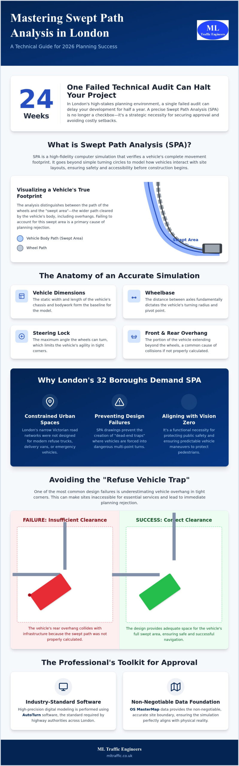
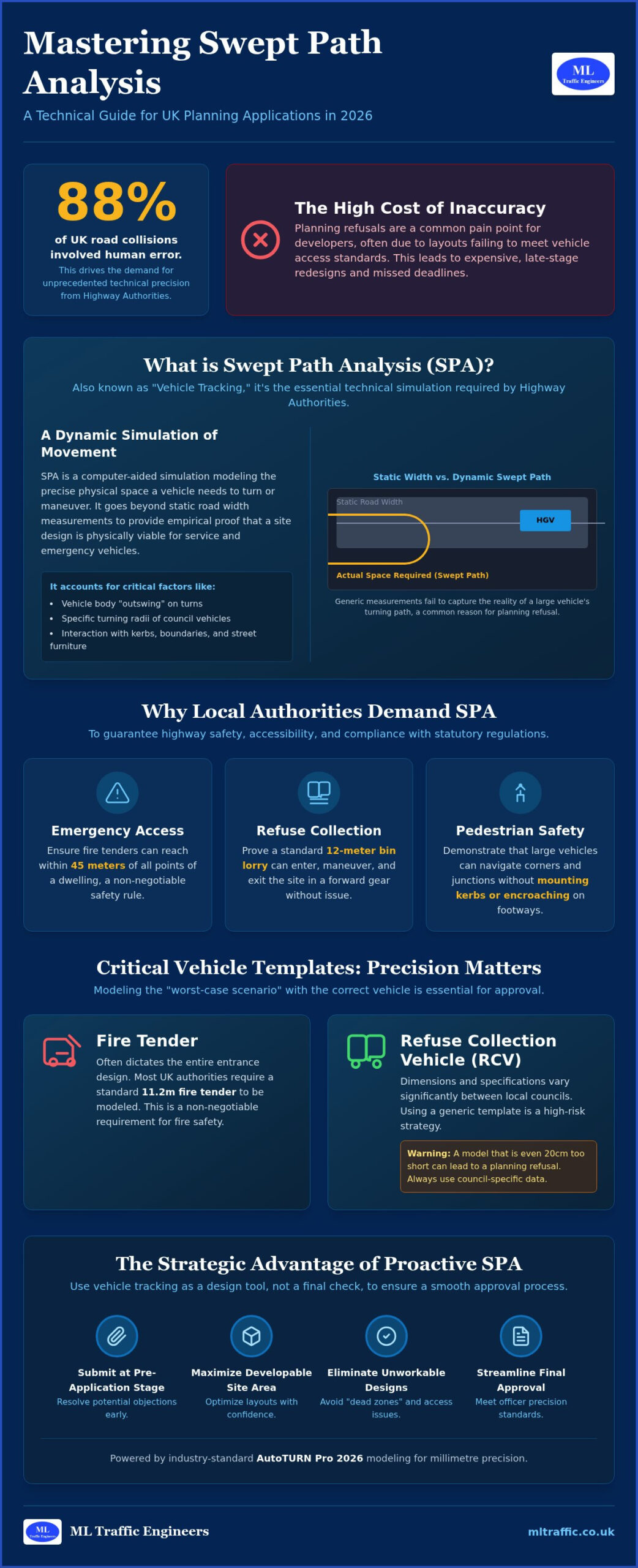
Swept path analysis for site access is the digital simulation of vehicle movements within a proposed development layout. In 2026, the industry has moved beyond manual tracking templates toward the precision of AutoTURN 2026 software. This technology calculates the exact vehicle turning radius and off-tracking dynamics to ensure that a site design functions in the real world. For developers, this analysis serves as a critical feasibility check that prevents fundamental design flaws from reaching the planning committee. It’s not just a technical drawing; it’s a functional necessity for modern infrastructure planning.
To better understand how these simulations are conducted, watch this helpful overview of the technical process:
What is Swept Path Analysis in Planning?
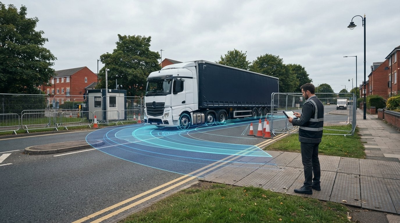
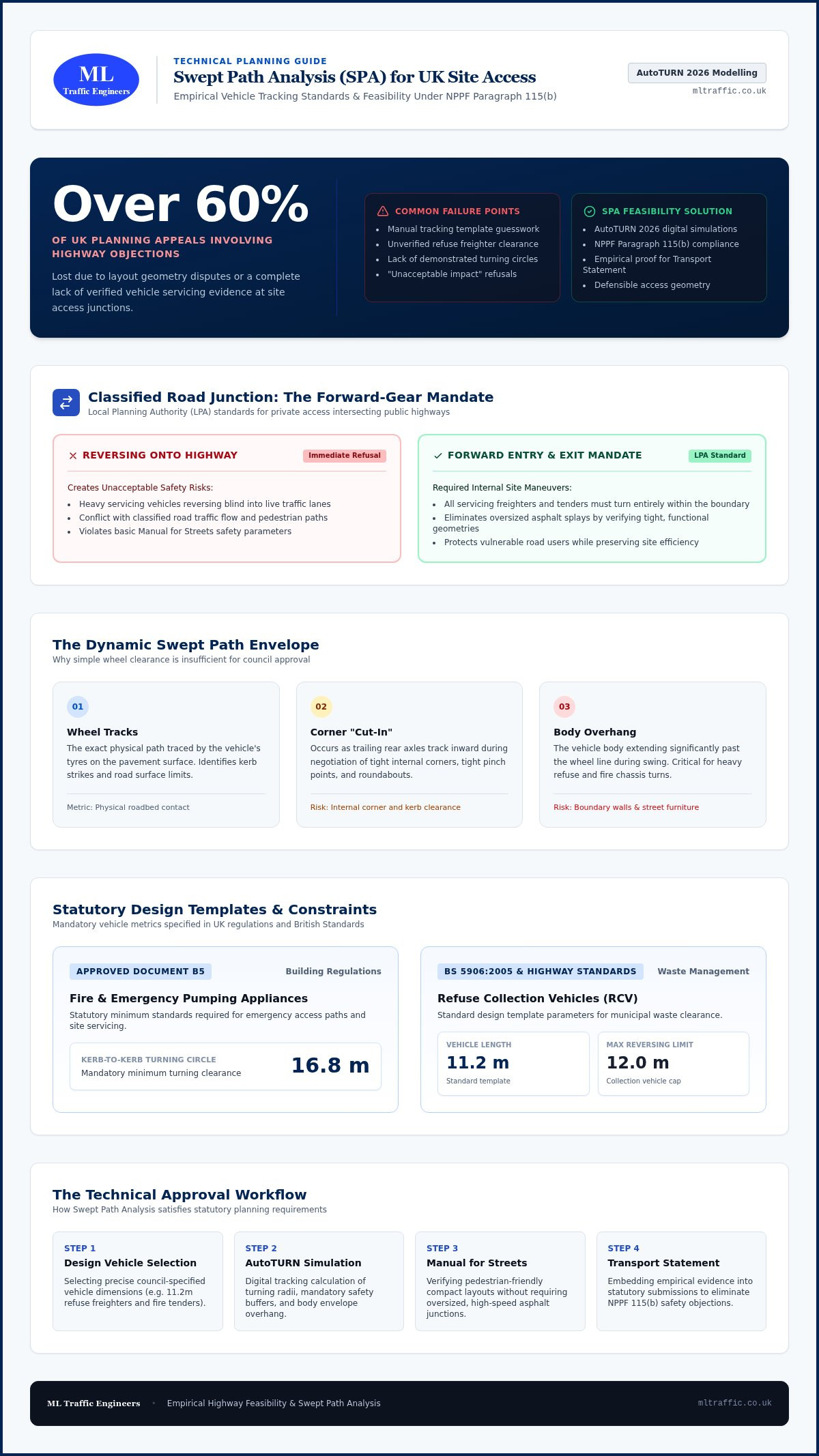
Professional path modelling identifies the “envelope” of a vehicle, which includes both the wheel tracks and the body path. Understanding the difference is vital because the body of a refuse vehicle or fire tender often extends far beyond its wheels during a turn. This “overhang” can strike boundary walls or street furniture if not properly accounted for, while “cut-in” affects how a vehicle clears internal corners. Swept path analysis for site access is a mandatory requirement for proving site feasibility to local authorities across England. By simulating these movements digitally, we provide clear evidence that a site can safely accommodate the specific design vehicles required by the council.
Why Site Access is the Primary Focus
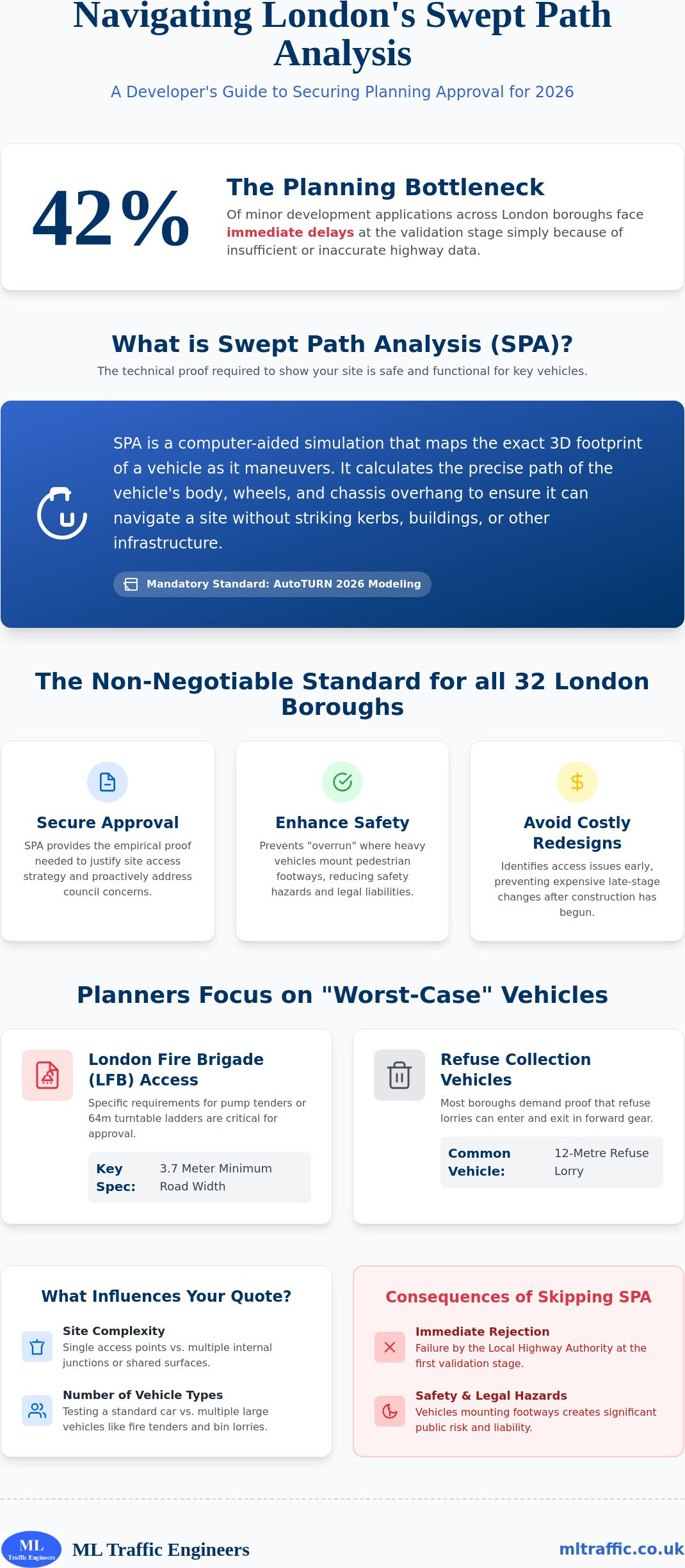
The junction between a private development and the public highway is the most scrutinized element of any planning application. National policy and local highway standards generally dictate that all servicing vehicles, such as refuse freighters and emergency tenders, must enter and leave a site in a forward gear when connecting to a classified road. Reversing onto a busy highway creates unacceptable safety risks that lead to immediate application refusal. Using technical modelling allows us to justify access designs that might otherwise appear too constrained. It provides the empirical data needed to support your Transport Statement. If you’re managing a project in a high-pressure environment, our Swept Path Analysis Services in London ensure your site access design meets the rigorous standards set by local borough officers.
Why Local Planning Authorities Demand SPA for Site Access
Local Planning Authorities (LPAs) prioritize highway safety and the efficient movement of traffic above all else. They rely heavily on the Manual for Streets guidance to evaluate if a development layout is fit for purpose. Professional swept path analysis for site access has become the standard method for proving that a design works without relying on outdated, over-engineered road widths. This approach supports the creation of tighter, pedestrian-friendly environments that prioritize vulnerable road users while still accommodating essential service vehicles.
The requirement for forward gear entry and exit is non-negotiable on classified roads. LPAs won’t accept designs where heavy goods vehicles or refuse trucks must reverse onto the public highway. SPA provides the technical proof that these maneuvers can occur safely within the site boundary. By simulating these turns, developers can avoid oversized junctions that encourage higher vehicle speeds, creating a safer environment for everyone. It’s about precision rather than just adding more asphalt.
Statutory Requirements for Emergency and Service Vehicles
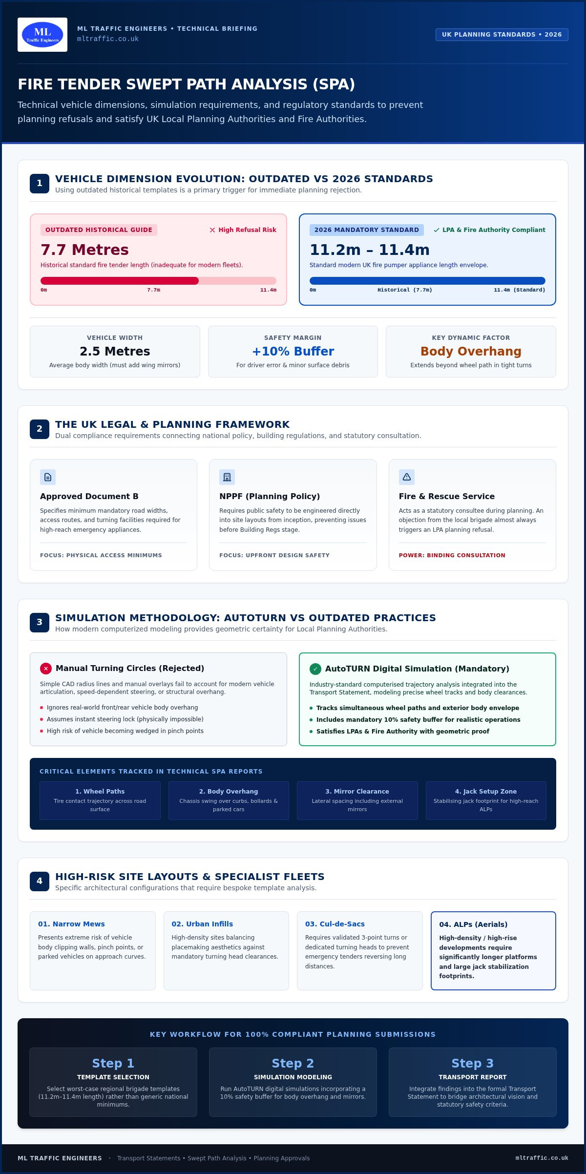
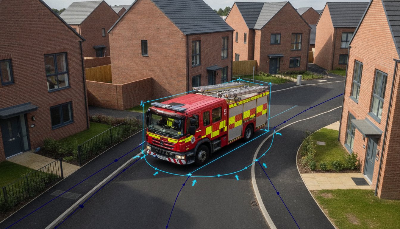
Compliance with Building Regulations Approved Document B5 is a legal necessity for fire service access. This mandates specific turning circles and road widths, such as a minimum 16.8-metre kerb-to-kerb turning circle for pumping appliances. Additionally, British Standard BS 5906:2005 and most local highway standards state that refuse collection vehicles shouldn’t be required to reverse more than 12 metres. Failing to provide SPA evidence during the pre-application stage often results in immediate registration delays or outright refusal. If you need to verify your layout, our team can provide a technical swept path assessment to ensure compliance from day one.
Meeting National and Local Design Standards
While national guidance provides a framework, individual English boroughs often have specific requirements for vehicle templates. For instance, many London authorities demand tracking for an 11.2-metre or 11.35-metre refuse collection vehicle rather than a standard HGV. Professional modelling ensures your design reflects these local nuances. This data is essential for a robust Transport Statement London Guide, where clear evidence of site accessibility is a primary validation requirement. By integrating swept path analysis for site access early, you simplify the path to council approval and avoid costly design changes late in the project lifecycle.
Key Vehicle Templates Used in Site Access Analysis
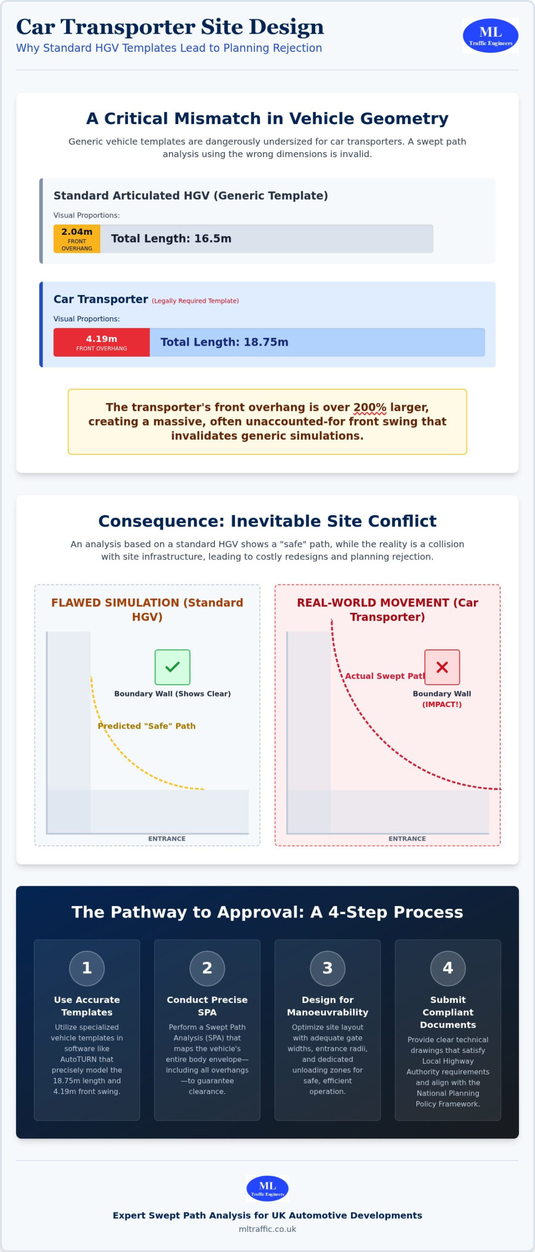
Selecting the correct design vehicle is a high-stakes decision that dictates the viability of your entire site layout. Local Planning Authorities (LPAs) don’t just look for generic vehicle movements; they require simulations based on specific, high-load templates that reflect the actual machinery used by local councils and emergency services. Using the wrong template during swept path analysis for site access is a primary driver of planning delays and expensive late-stage design revisions. Our technical team utilizes the latest AutoTURN libraries to ensure every simulation aligns with the planning practice guidance on transport assessments provided by the government.
Modelling Emergency Access
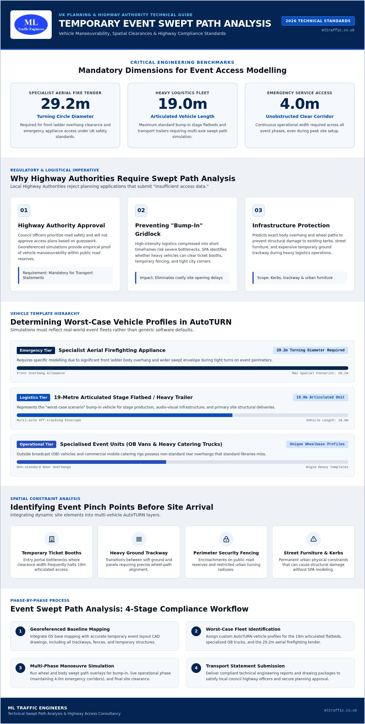
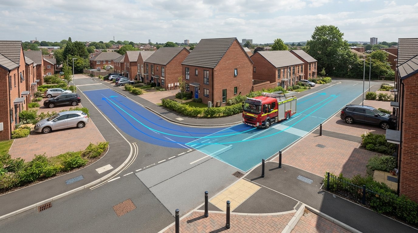
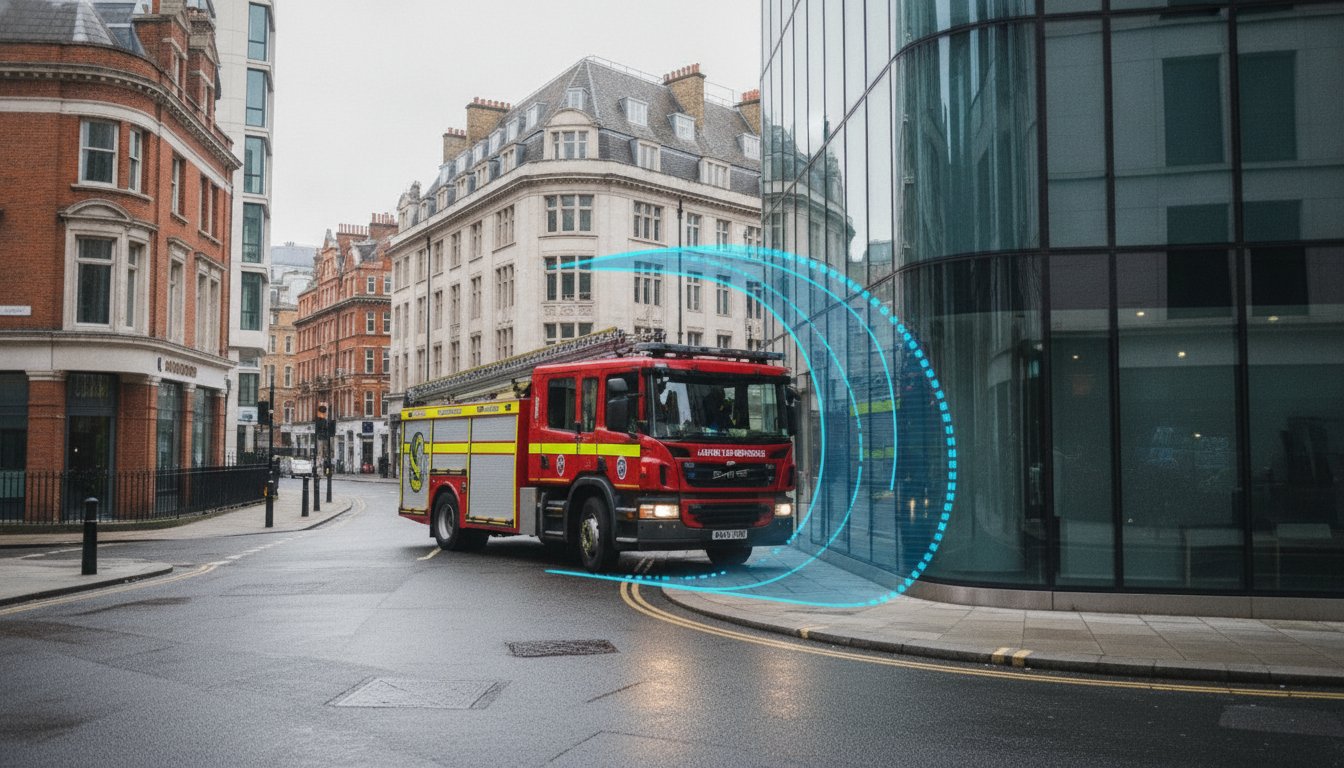
The fire tender is the non-negotiable template for every residential development in England. To comply with Building Regulations, you must prove that a fire appliance can reach within 45 metres of every point within a dwelling, measured along the route of the hose. Failure to demonstrate this maneuverability often results in a statutory objection from the Fire Authority. The standard UK fire tender template is 8.0m long by 2.5m wide, requiring a minimum kerb-to-kerb turning circle of 16.8 metres. We model these paths with a 500mm safety buffer to vertical obstructions, ensuring the vehicle’s body envelope doesn’t strike walls or overhanging structures during an emergency response.
Service and Delivery Vehicles
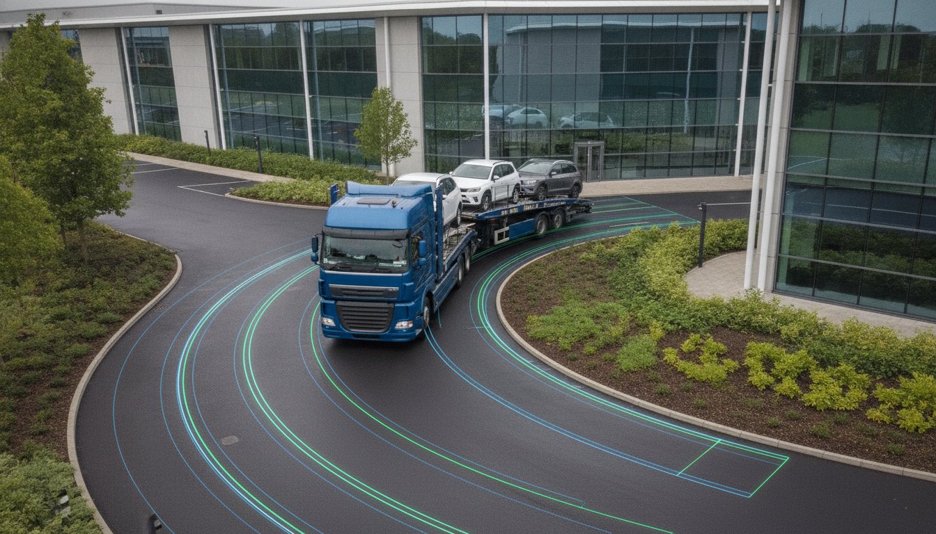
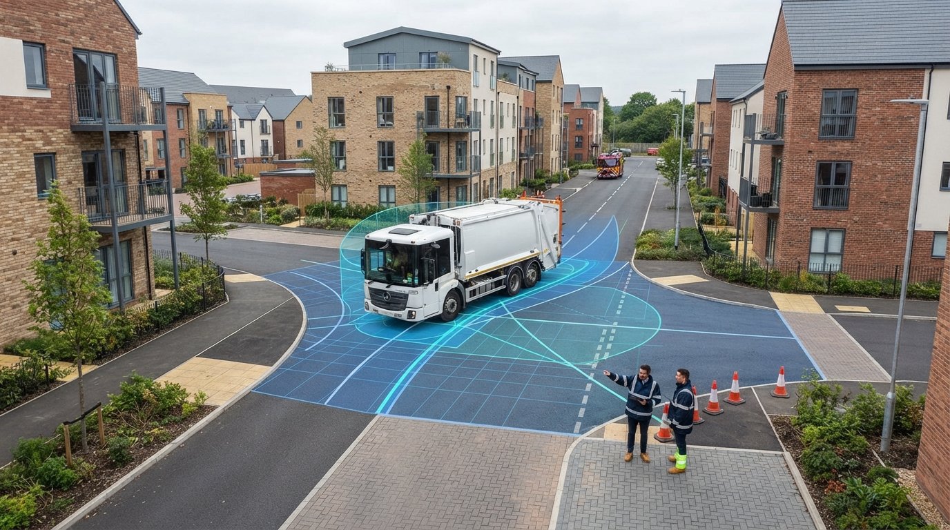
Refuse Collection Vehicles (RCVs) present the most significant geometric challenge due to their size and weight. While many developers assume a standard HGV template is sufficient, most UK councils demand tracking for a 26-tonne, 3-axle RCV, typically modeled as an 11.2-metre or 12.0-metre vehicle. We also differentiate between “Fixed Axle” and “Steered Axle” configurations. A steered rear axle allows for a tighter turning radius, which can be critical for securing approval on constrained urban sites. Beyond refuse, commercial developments require modelling for:
- Large Goods Vehicles (LGVs): Essential for retail delivery bay simulations.
- Pantechnicons: Used for residential removal tracking.
- Custom Vans: Modelling 7.4-metre Mercedes-Benz Sprinters for high-density parcel delivery zones.
Accurate modelling ensures that delivery bays remain accessible without forcing vehicles to block the public highway or pedestrian footways. By proving these vehicles can enter and exit in forward gear, we provide the empirical evidence needed to satisfy highway officers and secure your planning consent.
Overcoming Common Site Access Challenges with Technical Modelling
Designing for tight urban environments requires more than just standard templates. It requires an engineering interpretation of how vehicles interact with physical constraints. Urban constraints in London often present sites that look inaccessible on a standard OS map, but professional swept path analysis for site access turns these logistical puzzles into viable developments. By simulating exact vehicle envelopes, we prove that even the tightest entrances can function safely without compromising heritage assets or neighboring land. This level of precision is essential for satisfying the rigorous validation checklists of local highway authorities.
Mountable kerbs and overrun areas serve as strategic tools in these constrained settings. They allow larger vehicles, like a 26-tonne refuse freighter, to periodically utilize extra space while maintaining a narrower, pedestrian-friendly carriageway for daily use. We also conduct multi-vehicle simulations to verify that a resident’s car can safely pass while a delivery truck enters the site. This prevents the bottlenecks and safety concerns that frequently lead to planning refusals. It’s about demonstrating that the site works under real-world stress, not just in an empty simulation.
Navigating Tight Urban Constraints
In sensitive areas, balancing heritage preservation with modern highway safety is a constant struggle. We use SPA to justify narrow access roads that traditional, over-engineered highway standards might otherwise reject. For a recent mews development, we demonstrated that a fire tender could navigate a restricted entry arch by utilizing precise AutoTURN simulations. This evidence-based approach removes the guesswork and provides a reassuring level of detail for council engineers who are often risk-averse when dealing with non-standard road widths. It shows that safety and character can coexist through smart design.
Visibility Splays and Safety Margins
Visibility splays are the sightlines required for drivers to see and be seen when exiting a site. We integrate these ‘X’ and ‘Y’ distances directly with the swept path drawing to ensure the vehicle’s path doesn’t dangerously encroach on the opposite lane or third-party land. Safety buffers are non-negotiable here. We maintain a 300mm margin to horizontal kerb lines and a 500mm clearance to vertical obstructions like lamp posts, boundary walls, or trees. This precision ensures that your design doesn’t just work on paper but survives the scrutiny of a Section 278 technical audit. If you’re facing a difficult access issue, you can get a technical swept path assessment for your site to clear the way for approval.
Securing Planning Approval with Professional SPA Reports
A standalone CAD drawing is often insufficient for a successful planning submission because it lacks the necessary context for highway officers. While a simulation visually demonstrates vehicle movement, planning officers require a narrative that explains the underlying methodology and design assumptions. A professional report interprets the swept path analysis for site access, justifying the choice of vehicle templates and confirming that all safety buffers meet local authority expectations. This technical note acts as a bridge, translating complex AutoTURN data into a format that a non-technical case officer can confidently approve without requesting further technical clarification.
Providing this level of detail upfront significantly reduces the risk of ‘Regulation 25’ requests or other formal requests for further information. These delays occur when the Highway Authority feels the evidence is incomplete or ambiguous. By presenting a comprehensive package that includes annotated tracking, visibility splay integration, and clear clearance envelopes, you demonstrate a commitment to safety and regulatory compliance. This transparency speeds up the consultation period and ensures your project moves through the planning system without the friction of late-stage design objections or costly redesigns during the technical audit phase.
Integrating SPA into Transport Documentation
Site feasibility is best proven through the integration of SPA into your Transport Statement or Assessment. This documentation provides the empirical evidence that your site can be serviced safely and efficiently, even in high-pressure urban environments. Professional modelling allows highway officers to quickly validate your design against national standards like the NPPF. When you include these simulations as part of a wider strategy, you provide a robust defense against potential highway-based refusals. Our integrated reporting approach ensures that your technical evidence is aligned with your planning goals. For more on navigating these requirements, refer to our Transport Assessment Success Guide.
Why Choose ML Traffic Engineers UK for Your Site Access Analysis?
ML Traffic Engineers UK has provided specialist support to developers across England since 2014. We understand the intricate regional regulations of various local authorities, allowing us to act as your dependable expert partner throughout the planning lifecycle. Our team prioritizes precision and adherence to standards, ensuring every report is council-ready from the first submission. We balance technical authority with a client-focused approach, aiming to maximize your developable plot area while maintaining strict safety compliance. We take immense pride in our role as guardians of public and worker safety through precise engineering.
We offer an all-encompassing, fully-managed service that covers everything from initial parking surveys to final transport assessments. Our rapid response capabilities and expert use of AutoTURN modelling ensure that your project stays on track, even in a fast-moving regulatory environment. By choosing a partner that understands both the engineering and the planning policy, you secure a site access design that is safe, compliant, and ready for execution. We manage the full project technical requirements so you can focus on the development itself.
Accelerate Your Planning Approval with Expert Technical Modelling
Professional swept path analysis for site access is the empirical backbone of a successful planning application. It transforms theoretical site designs into verified, functional layouts that satisfy both highway officers and emergency services. By moving beyond static geometry to dynamic AutoTURN simulations, you eliminate the regulatory pressure that causes project delays and ensure your development is safe for all road users from the very first submission.
ML Traffic Engineers UK has served as a specialist partner for developers across England since 2014. We provide the council-ready technical reporting necessary to navigate intricate regional standards with absolute precision. Our commitment to accuracy and rapid response ensures your infrastructure maintenance or development works proceed without the logistical friction of inadequate access evidence. We don’t just provide drawings; we deliver the technical authority required for immediate planning success.
Request a Swept Path Analysis Quote for Your Site to secure a fully-managed technical solution for your project. We’re ready to provide the professional integrity and engineering expertise your development requires to move forward with confidence and clarity.
Frequently Asked Questions
What is the difference between swept path analysis and a tracking diagram?
Swept path analysis is the digital simulation process used to calculate how a vehicle moves through a space, accounting for steering geometry and off-tracking. A tracking diagram is the visual CAD output of that analysis. While the terms are often used interchangeably in planning applications, the analysis involves the technical calculation of the vehicle’s body and wheel “envelopes,” while the diagram serves as the evidence submitted for council approval.
Is swept path analysis a legal requirement for UK planning applications?
Swept path analysis for site access is a mandatory validation requirement for most developments under the National Planning Policy Framework (NPPF). Paragraph 115(b) requires developers to demonstrate safe and suitable access for all users. Local Planning Authorities (LPAs) will rarely register or approve an application involving new junctions or internal roads without empirical evidence that refuse and emergency vehicles can maneuver safely within the site boundary.
Which vehicle templates should be used for a standard residential development?
Every residential scheme must model a standard UK fire tender, typically 8.0 metres in length, to comply with Building Regulations. You must also include the local authority’s specific Refuse Collection Vehicle (RCV), which is usually an 11.2-metre or 12-metre 3-axle freighter. Commercial elements might require a 16.5-metre articulated HGV or a 7.4-metre delivery van template to ensure the internal layout remains functional for all expected servicing and delivery needs.
Can swept path analysis help reduce the required width of a new access road?
Yes, professional modelling allows for a “vision-led” design approach rather than relying on rigid, over-engineered highway standards. By proving a vehicle can safely navigate a narrower carriageway using precise digital simulations, you can reduce the amount of asphalt and increase developable land. This approach aligns with Manual for Streets guidance, which encourages tighter, pedestrian-friendly environments that still accommodate essential service vehicle movements without encouraging excessive vehicle speeds.
How much does a professional swept path analysis cost for a small site?
The cost of a swept path analysis for site access depends on the complexity of the junction and the number of vehicle templates required by the local highway officer. Fees are typically based on the technical time needed to conduct the AutoTURN simulations and produce a supporting technical report. For a project-specific estimate, developers should request a bespoke quote from a specialist traffic engineering consultancy to ensure all statutory requirements are met.
What software do traffic engineers use for swept path analysis in 2026?
In 2026, the industry standard is AutoTURN 2026, which provides the most comprehensive library of UK-specific manufacturer and standard design vehicles. Many engineers also utilize Autodesk Vehicle Tracking within the Civil 3D environment for integrated site design. These tools provide the high-precision simulations required to satisfy highway authorities and ensure that vertical clearance and ground clearance issues, such as ramp gradients, are identified before the construction phase begins.
What happens if my site access fails the swept path analysis?
If a simulation shows a vehicle striking a boundary or failing to make a turn, the site layout must be adjusted. Solutions often include increasing junction radii, implementing mountable kerbs, or redesigning internal turning heads to accommodate the vehicle’s “cut-in.” We work with developers to find the most efficient design balance, ensuring the site remains safe and compliant without losing valuable plot space to oversized turning circles or excessively wide roads.
Do I need SPA for a simple dropped kerb application?
A standard residential dropped kerb for a single driveway usually doesn’t require a full swept path analysis unless there are specific safety concerns or visibility constraints. However, if the dropped kerb serves a commercial site or a multi-unit development, the Highway Authority will likely demand SPA evidence. They must be certain that larger vehicles won’t be forced to reverse onto the public highway when entering or exiting the property due to inadequate turning space.

Disclaimer
The content on mltraffic.co.uk, including all technical articles, guides, and resources, is provided for general informational and educational purposes only. It is not intended to constitute professional advice in traffic engineering, transportation planning, development approvals, or any other technical or legal field.
While ML Traffic Engineers makes every reasonable effort to ensure the accuracy, completeness, and timeliness of the information published, we do not provide any warranties or representations (express or implied) regarding its reliability, suitability, or availability for any particular purpose. Any reliance you place on the content is strictly at your own risk.
In no event shall ML Traffic Engineers, its directors, employees, authors, or affiliates be liable for any direct, indirect, incidental, special, consequential, or punitive damages (including, without limitation, loss of profits, data, or business opportunities) arising out of or in connection with the use of, or inability to use, any information provided on this website.
The articles and guides on this site are not a substitute for engaging a qualified, professional traffic engineer to assess your specific project requirements. For tailored advice, compliance assessments, or traffic engineering services, please contact a competent professional.
This disclaimer may be updated from time to time without notice. By accessing or using this website, you agree to be bound by the most current version of this disclaimer.