Tag: Construction Planning

  • Swept Path Analysis Quote London: A 2026 Developer’s Guide to Costs and Requirements

    Swept Path Analysis Quote London: A 2026 Developer’s Guide to Costs and Requirements

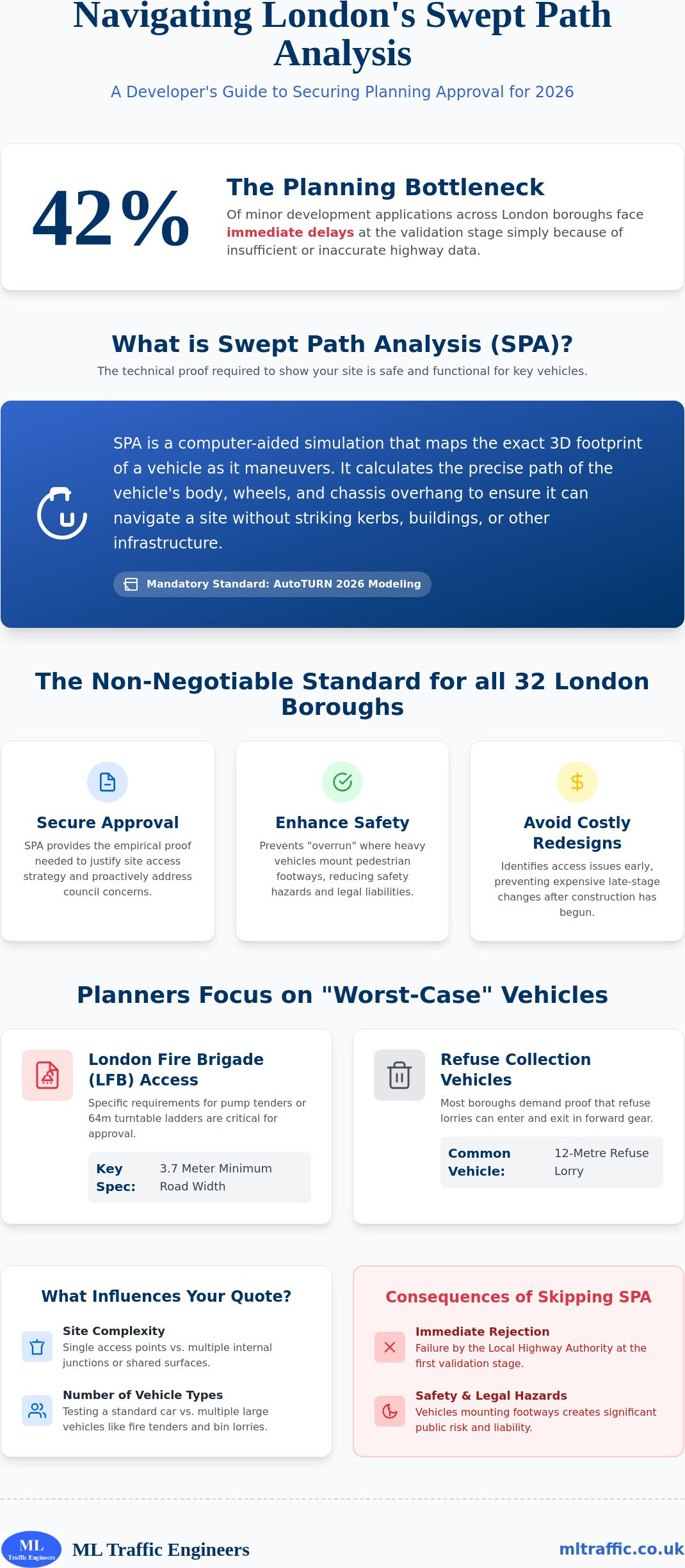
    Did you know that 42% of minor development applications across London boroughs face immediate delays at the validation stage simply because of insufficient highway data? It’s a frustrating bottleneck that stalls projects before they even begin. If you’re navigating the complexities of site access, securing a precise swept path analysis quote London councils will actually accept is your first line of defense against these setbacks. We understand that the pressure to provide technical drawings that meet the latest 2026 standards, such as AutoTURN 2026 modeling, can feel overwhelming when you’re managing tight project timelines.

    You’ve likely dealt with the confusion of whether a specific borough requires a standard pump fire tender or a 64m turntable ladder template for your site. This guide simplifies that process. You’ll learn how to obtain a fast, fixed-fee quote while ensuring your technical drawings pass scrutiny the first time. We’ll examine the specific requirements for the London Fire Brigade, including the 3.7 meter minimum road width, and explain why digital modeling has replaced manual templates as the non-negotiable standard for planning approval in 2026.

    Key Takeaways

    • Identify why high-precision digital simulations are now the mandatory standard for proving vehicle maneuverability to all 32 London boroughs.
    • Learn how site complexity and specific vehicle templates, like 12-metre refuse lorries, directly impact your swept path analysis quote London for a 2026 application.
    • Understand the technical role of AutoTurn software in modeling “vehicle envelopes” to account for body overhang and wheel paths with absolute precision.
    • Discover the critical differences between London Fire Brigade standards and individual borough requirements for refuse collection to prevent validation failures.
    • Access professional guidance on securing a fast, fixed-fee quote and expert-led technical drawings that prioritize both safety and planning approval.

    What is Swept Path Analysis and Why is it Mandatory in London?

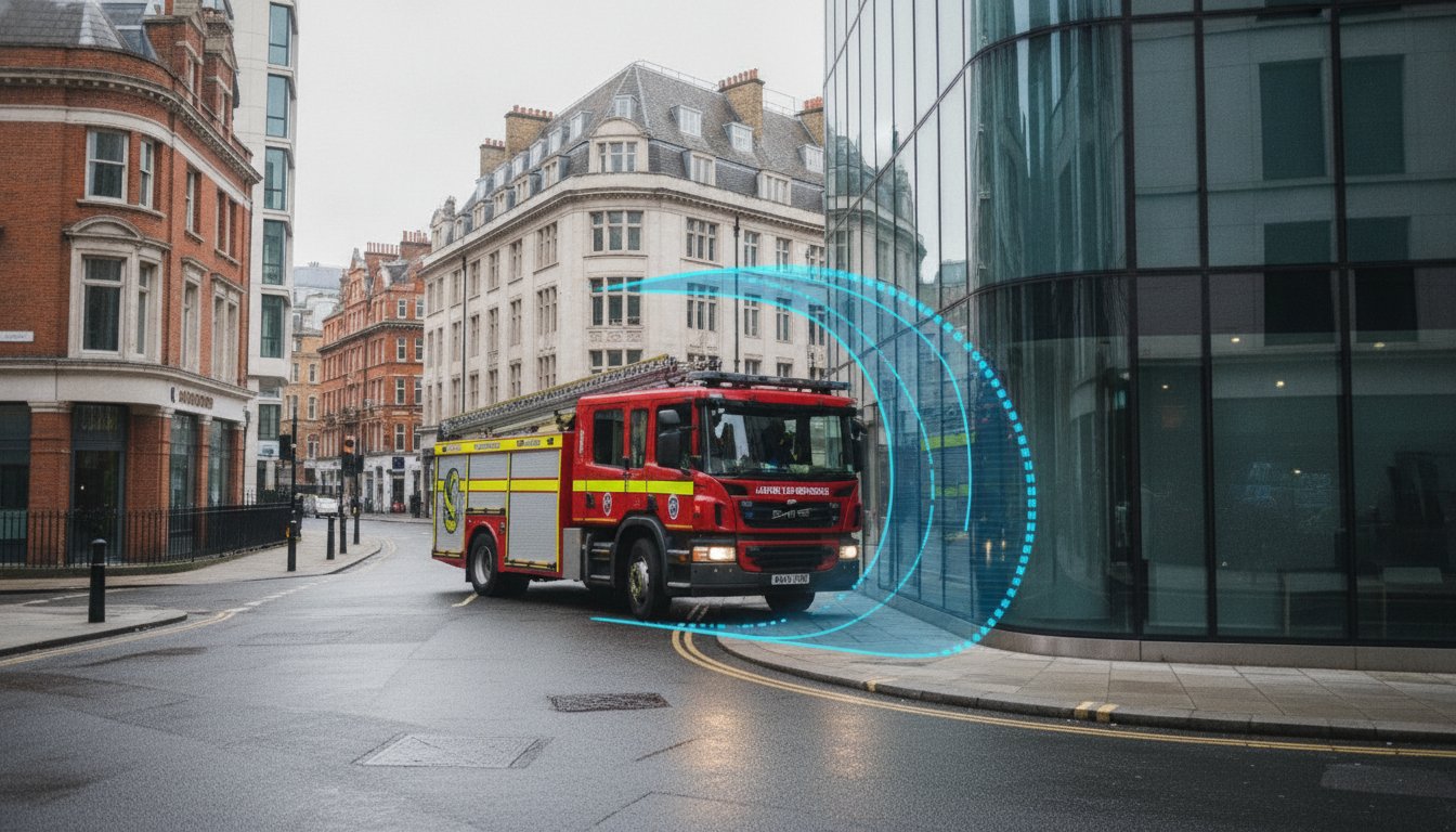
    Swept Path Analysis (SPA) is a technical computer-aided simulation that maps the exact footprint of a vehicle as it maneuvers through a specific layout. By utilizing advanced AutoTurn Software, we calculate the precise path of the vehicle’s body, wheels, and outer chassis overhang. This digital modeling ensures that your proposed site can accommodate the physical realities of vehicle movement without striking kerbs, buildings, or other infrastructure. Securing a reliable swept path analysis quote London developers can trust is now a standard requirement for almost every planning application across the capital.

    To better understand the mechanics of how these simulations work in a real-world engineering context, watch this helpful video:

    In high-density boroughs like Westminster, Tower Hamlets, or Camden, space is a finite resource. Planning officers don’t just look at whether a car can park; they prioritize the “worst-case” vehicle scenarios. A common misconception among developers is that standard passenger vehicle access is sufficient for approval. In reality, London councils focus almost exclusively on fire tenders and refuse lorries. If your site plan doesn’t demonstrate that a 12-metre bin lorry can enter and exit in forward gear, your application will likely fail at the first hurdle. High-precision digital modeling is now the non-negotiable benchmark for all 32 London boroughs in 2026.

    The Consequences of Skipping Professional Vehicle Tracking

    Failing to include professional vehicle tracking often leads to an immediate rejection by the Local Highway Authority. This isn’t just a paperwork issue; it’s a safety and functional necessity. Without SPA, you risk costly late-stage redesigns. Imagine completing a courtyard only to discover a London Fire Brigade pump cannot reach the building because the turning circle is too tight. Furthermore, improper planning leads to “overrun” where heavy vehicles mount pedestrian footways, creating significant safety hazards and potential legal liabilities for the developer.

    The Role of SPA in London Transport Statements

    SPA serves as the technical backbone of a Transport Statement London councils require for minor and major developments. By integrating vehicle tracking into your site access strategy, ML Traffic Engineers UK provides the empirical proof needed to justify tighter turning circles or reduced parking allocations. We use these simulations to show that even restricted urban sites can function safely. When you request a swept path analysis quote London experts provide, you’re investing in a planning solution that proactively addresses council concerns before they become formal objections.

    Calculating Your Swept Path Analysis Quote: Factors That Influence Cost

    Calculating a swept path analysis quote London developers can rely on requires a clear understanding of your site’s physical constraints. No two projects are identical. A simple residential driveway check differs significantly from a large-scale commercial distribution hub. Several technical variables consistently drive the consultancy fee. Site complexity is the primary factor. If we’re assessing a single access point from a public highway, the simulation is straightforward. However, projects involving multiple internal junctions or shared surfaces require more engineering time to ensure every corner meets the safety standards that are now mandatory in London planning applications.

    Timeline and urgency play a final role in the quote. We maintain a constant sense of readiness to meet tight deadlines, but “24-hour turnaround” requests usually carry a premium. This accounts for the immediate reallocation of technical resources to ensure your drawings are ready for submission. If you need to understand the technical nuances before requesting a price, you can learn more about our technical approach here.

    What Information You Need to Provide for a Fast Quote

    To receive an accurate swept path analysis quote London consultancies can provide quickly, you should follow three steps. First, provide your site layout in a scaled DWG format. This allows for immediate integration into our modeling software. Second, identify the “critical” vehicles required by your specific borough. If you aren’t sure, we can advise on whether you need a standard bin lorry or a specialist emergency vehicle. Third, specify the necessary maneuvers. Most councils want to see entry, exit, and any three-point turns or hammerhead maneuvers required within the site boundary. Providing this data upfront ensures a fast, precise response.

    Fixed-Fee vs. Hourly Rates in London Consultancies

    We recommend choosing fixed-fee quotes for better budget certainty. Hourly rates often lead to “scope creep,” where minor adjustments result in unexpected costs that can stall your project. A standard fixed-fee quote from a professional firm usually includes the technical report, the CAD drawings, and at least one round of revisions. This transparent approach helps you manage your transport planning budget without hidden charges. For a tailored assessment of your project, you can reach out to our team at mltraffic.co.uk to discuss your specific site requirements and secure a dependable quote.

    Technical Precision: Using AutoTurn Software for Planning Approval

    When you request a swept path analysis quote London planning departments will respect, the technical tools behind the drawings are just as critical as the engineer’s experience. ML Traffic Engineers UK utilizes AutoTurn 2026, the global industry standard for simulating vehicle maneuvers. This software is not merely a drawing aid; it’s a high-precision validation engine that accounts for complex steering geometry and vehicle dynamics. London councils expect this level of digital modeling because it eliminates the guesswork associated with tight urban sites. It provides a level of certainty that manual templates simply cannot match, especially when every millimetre of pavement counts.

    A primary advantage of digital simulation is the ability to model “vehicle envelopes” with absolute accuracy. We don’t just track the wheels; we account for the body overhang at the front and rear of the vehicle. This is vital in London, where street furniture, historic building corners, and narrow kerb alignments create constant obstacles. Our simulations also incorporate real-world variables like kerb heights and gradients. By testing these conditions digitally, we reduce the need for expensive and logistically difficult physical trial runs on-site. This proactive approach ensures your site layout is functional before a single brick is laid.

    Visualising the Swept Path Envelope

    Your SPA report will clearly distinguish between the “chassis” lines, which show where the wheels travel, and the “body” lines, which indicate where the outer edges of the vehicle swing. London Highway Officers look for specific clearance margins between these lines and the site boundaries to ensure safety. The swept envelope is the total area a vehicle occupies during a turn. We include these margins to prove that even the largest permitted vehicles can navigate your site without risking structural damage or pedestrian safety.

    Integrating SPA into Your Highway Design

    Precision modeling is essential for successful Highway Design S278 & S38 submissions. ML Traffic Engineers UK integrates vehicle tracking directly into your AutoCAD drawings to validate the placement of loading bays, car park entrances, and refuse collection points. This spatial accuracy confirms that your infrastructure can handle the intended traffic volume and vehicle types. If you’re preparing a submission, you can explore our practical guide to AutoTurn modeling to see how we refine these technical details for council approval.
    Swept Path Analysis Quote London: A 2026 Developer’s Guide to Costs and Requirements

    Securing a swept path analysis quote London developers can move forward with requires more than just technical software; it demands an intimate knowledge of borough-specific fleet dimensions. While generic UK templates exist, London’s 32 boroughs often utilize bespoke vehicle configurations that catch unprepared developers off guard. For example, the refuse collection vehicle (RCV) dimensions required for a planning application in Hackney may differ from those in Bromley due to varying local fleet contracts. We maintain an updated database of these local requirements to ensure your drawings reflect the exact vehicle your local council operates.

    Developments located on or near the Strategic Road Network (SRN) face additional scrutiny from Transport for London (TfL). In these cases, your simulation must prove that servicing vehicles, such as a 10.7m rigid lorry, can enter and exit the site without disrupting the flow of red routes or high-traffic corridors. We provide the technical proof required for Servicing and Delivery Plans, ensuring that your commercial units remain functional and compliant with TfL’s stringent safety standards. If you need to verify your site’s viability against these complex regulations, you can explore our full range of swept path analysis services to see how we manage these regional intricacies.

    Standard London Vehicle Templates

    The most common hurdle in London planning is the 11.2m or 12m refuse collection vehicle. Councils prioritize these “worst-case” scenarios to prevent waste collection teams from blocking narrow residential streets. For residential basement parking, we typically model an 8.0m “large car” or van template to ensure ramp gradients and tight corners are navigable. During the construction phase, central London boroughs often require simulations for abnormal loads, proving that heavy machinery can reach the site without damaging historic infrastructure or street furniture.

    Addressing the “Fire Tender Access” Objection

    London Fire Brigade (LFB) standards are non-negotiable. You must prove that a fire appliance can reach within 45m of all points within a building. The LFB requires a minimum road width of 3.7m between kerbs and a gateway width of at least 3.2m. For dead-end roads longer than 20m, you must provide a turning facility, such as a hammerhead or turning circle. We use high-precision modeling to justify reversing distances that might exceed the standard 20m guidance, provided the safety case is robust. Integrating these findings into a Construction Logistics Plan is essential for projects with restricted access. When you request a swept path analysis quote London experts provide, you ensure that these safety critical dimensions are baked into your design from day one.

    Secure Your Planning Approval with ML Traffic Engineers UK

    Timing is critical in the high-stakes environment of London property development. Our team maintains a constant state of readiness to provide a swept path analysis quote London professionals can rely on to keep their projects moving forward. We commit to a 24 to 48 hour turnaround for all initial quotes, reflecting the urgency that modern infrastructure projects demand. This rapid response capability is a hallmark of our service, ensuring that technical requirements never become a bottleneck for your planning submission. We prioritize clarity and precision to reduce the regulatory pressures on your team.

    Our expertise extends across all 32 London boroughs and the City of London. This comprehensive geographic coverage means ML Traffic Engineers UK already understands the specific preferences of local highway officers, whether they require bespoke refuse vehicle dimensions or strict adherence to fire tender access routes. We don’t just provide drawings; we deliver planning solutions. By integrating our vehicle tracking simulations seamlessly with your Transport Assessment or Transport Statement, we create a unified technical case that supports your site’s feasibility from the outset. This holistic approach ensures that all transport-related elements of your application are technically sound and ready for scrutiny.

    Why Developers Choose ML Traffic Engineers UK

    Developers frequently partner with us because of our proven track record in overcoming difficult access objections. We take immense pride in our precision and adherence to industry standards, positioning ourselves as a vital guardian of site safety and public welfare. Unlike larger consultancies, we provide direct communication with our engineers. This ensures that technical progress is never blocked by administrative layers or account managers who lack specialized knowledge. We also offer competitive, transparent pricing for projects of all sizes, from small residential infills to complex industrial units. Our goal is to provide a tailored service that reflects the unique constraints of your specific site.

    Get Your Fixed-Fee Quote Today

    Securing your planning-ready drawings starts with a simple assessment of your site layout. Upload your plans via our contact form for a same-day response from our technical team. When you submit your inquiry, please mention your specific borough so we can provide a tailored vehicle template assessment immediately. This allows us to align our modeling with local requirements right from the start. You can also Request a Swept Path Analysis Quote through our dedicated resource page. We are ready to help you manage the intricate regional regulations and secure the approval your project needs to succeed.

    Secure Your Site Access and Planning Certainty

    Achieving planning approval in 2026 requires technical precision and a deep understanding of borough-specific vehicle requirements. You’ve seen how digital simulations using AutoTurn software eliminate the guesswork that often leads to validation delays. By prioritizing accurate modeling for fire tenders and refuse vehicles, you proactively address the safety and accessibility concerns of local highway officers. Securing a professional swept path analysis quote London developers can trust ensures your site layout is validated against statutory requirements before submission.

    Since 2014, ML Traffic Engineers has provided over a decade of specialized London planning expertise. We are specialists in AutoTurn vehicle tracking and maintain an intricate understanding of LFB and TfL statutory requirements. Get a Fixed-Fee Swept Path Analysis Quote for Your London Project to secure expert-led drawings that pass scrutiny the first time. Our team is ready to provide the technical certainty your project deserves, helping you navigate complex regional regulations with confidence and efficiency. We look forward to supporting your next successful development.

    Frequently Asked Questions

    How much does a Swept Path Analysis quote in London typically cost?

    The price for a swept path analysis quote London developers receive depends on the technical complexity of the site and the total number of vehicle maneuvers required. Factors such as the availability of scaled CAD drawings and the urgency of your planning deadline also influence the final fee. We provide fixed-fee quotes to ensure budget certainty, covering the full technical report and the necessary revisions to meet borough standards.

    What vehicles do I need to include in my Swept Path Analysis?

    How long does it take to receive the completed SPA drawings?

    You can expect to receive completed technical drawings within 2 to 5 working days for standard projects. We understand the urgency of planning deadlines and offer accelerated turnarounds of 24 to 48 hours for time-sensitive applications. Providing your site layout in a scaled DWG format significantly speeds up the modeling process, allowing our engineers to integrate the data into AutoTurn software immediately for rapid delivery.

    Will the council accept a Swept Path Analysis if I do it myself?

    Planning departments generally reject self-produced drawings because they lack the precision of industry-standard software like AutoTurn. Research indicates that 92% of self-written transport reports face delays or rejection due to technical omissions. Councils require professional engineering validation to ensure public safety and highway functionality. Investing in a professional swept path analysis quote London experts provide ensures your submission meets the rigorous digital modeling standards expected in 2026.

    What is the difference between a Swept Path Analysis and a Transport Statement?

    A Swept Path Analysis is a specific technical simulation showing vehicle movement, while a Transport Statement is a broader planning document. The SPA provides the empirical proof of accessibility that supports the arguments made within the Transport Statement. While the statement explains the overall impact of the development, the vehicle tracking drawings offer the visual and mathematical evidence that the site layout is physically viable for heavy vehicles.

    Do I need a Swept Path Analysis for a dropped kerb application in London?

    Many London boroughs now require a technical simulation for dropped kerb applications, especially in areas with restricted space or high pedestrian activity. You must demonstrate that a vehicle can safely enter and exit the driveway in a single maneuver without mounting the footway or endangering other road users. This technical proof is essential for the Local Highway Authority to approve any modification of the public footway and kerb alignment.

    Can Swept Path Analysis be done in 3D?

    3D modeling is essential for projects involving basement access, multi-story car parks, or sites with significant gradients. This analysis checks for vertical clearance to ensure vehicle roofs or chassis don’t strike low ceilings or steep ramps. While 2D analysis covers the horizontal footprint, 3D simulations provide a comprehensive safety check for the entire vehicle volume. This is a common requirement for complex urban infill developments across Central London.

    What happens if the Swept Path Analysis shows a vehicle cannot make the turn?

    If the simulation identifies a conflict, it serves as an early warning to redesign the site layout before submitting your application. We don’t just provide drawings; we offer expert advice on mitigation measures, such as widening access points or adjusting kerb alignments. This proactive approach prevents costly late-stage redesigns and ensures your final submission demonstrates a functional, safe, and policy-compliant development that is ready for council approval.

    Michael Lee

    Article by

    Michael Lee

    Transport planner with over 35 years' experience.

    Disclaimer

    The content on mltraffic.co.uk, including all technical articles, guides, and resources, is provided for general informational and educational purposes only. It is not intended to constitute professional advice in traffic engineering, transportation planning, development approvals, or any other technical or legal field.
    While ML Traffic Engineers makes every reasonable effort to ensure the accuracy, completeness, and timeliness of the information published, we do not provide any warranties or representations (express or implied) regarding its reliability, suitability, or availability for any particular purpose. Any reliance you place on the content is strictly at your own risk.
    In no event shall ML Traffic Engineers, its directors, employees, authors, or affiliates be liable for any direct, indirect, incidental, special, consequential, or punitive damages (including, without limitation, loss of profits, data, or business opportunities) arising out of or in connection with the use of, or inability to use, any information provided on this website.
    The articles and guides on this site are not a substitute for engaging a qualified, professional traffic engineer to assess your specific project requirements. For tailored advice, compliance assessments, or traffic engineering services, please contact a competent professional.
    This disclaimer may be updated from time to time without notice. By accessing or using this website, you agree to be bound by the most current version of this disclaimer.
  • What is a Vehicle Tracking Diagram?  A Guide for Developers

    What is a Vehicle Tracking Diagram? A Guide for Developers

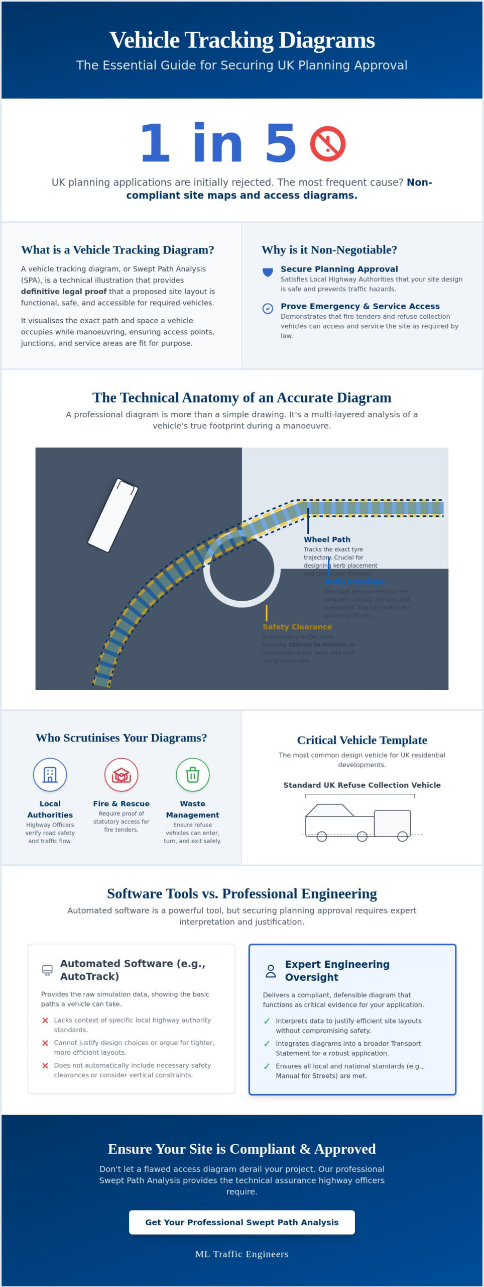
    Approximately one in five planning applications in the UK are initially rejected as invalid, with non-compliant site maps cited as the most frequent cause for failure. For any developer, a vehicle tracking diagram is far more than a simple technical drawing; it serves as the definitive legal proof that your proposed site layout is functional and safe. You likely recognize the stress of selecting the correct vehicle templates, such as fire tenders or refuse trucks, knowing that a single unworkable access point can lead to a costly planning refusal from the Local Highway Authority.

    We understand the pressure of meeting stringent highway standards while trying to maximize every square meter of your site. This guide provides a clear understanding of Swept Path Analysis (SPA) and explains how a professional vehicle tracking diagram functions as critical evidence for your application. You’ll learn how to ensure your layout meets the latest 2026 regulatory benchmarks, including updates to the Manual for Streets. We will preview how to bridge the gap between software features and engineering requirements to deliver a site that is both compliant and highly efficient.

    Key Takeaways

    • Understand why a vehicle tracking diagram is a mandatory requirement for proving site accessibility to Local Highway Authorities and emergency services.
    • Distinguish between wheel paths and body envelopes to ensure your layout accommodates the full physical footprint of a manoeuvring vehicle.
    • Identify the specific design templates required for your project, including the standard 11.4m refuse collection vehicle used by most UK councils.
    • Learn how professional interpretation of swept path data can justify tighter site layouts without compromising on safety or regulatory compliance.
    • Recognise the limitations of automated software and why expert engineering oversight is essential for securing planning approval.

    What is a Vehicle Tracking Diagram in UK Planning?

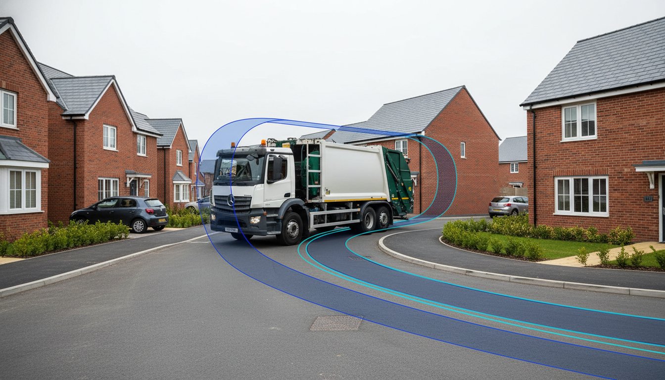
    A vehicle tracking diagram is a technical illustration that visualises the physical space required for a vehicle to manoeuvre through a site layout. It serves as a vital piece of evidence in the UK planning system, proving that a proposed design can safely accommodate the vehicles expected to use it. These diagrams aren’t just for show; they’re essential for securing approval from Local Highway Authorities who must ensure that emergency and service vehicles don’t get stuck or cause hazards on the public highway. By mapping the ‘swept path’ of a vehicle, developers can demonstrate that their site is functional before a single brick is laid.

    The role of these diagrams extends throughout the entire planning lifecycle. During the pre-application stage, they help identify potential access issues before they become expensive design flaws. Later, they’re frequently submitted as part of a formal application or used to discharge planning conditions once permission is granted. By integrating professional Swept Path Analysis services, developers provide the technical assurance that highway officers require to recommend an application for approval.

    A common oversight in many planning submissions is failing to integrate these diagrams into the broader Transport Statement. A vehicle tracking diagram shouldn’t stand alone. It provides the empirical data that supports the access and safety arguments within your Transport Statement. Without this visual proof, claims about site accessibility are merely anecdotal and often face immediate rejection from the council. Precision here is a functional necessity, not an optional extra.

    Terminology: Vehicle Tracking vs. Swept Path Analysis

    While often used interchangeably, ‘vehicle tracking’ refers to the simulation process itself, whereas the ‘diagram’ is the physical or digital output. This technical field has evolved significantly since the development of AutoTrack, the world’s first swept path analysis software. In professional engineering reports, ‘swept path’ specifically describes the area covered by the vehicle’s body plus a necessary safety margin. This margin is critical because it accounts for driver error and minor variations in vehicle dimensions, ensuring the layout works in the real world.

    Who Requires These Diagrams?

    Several statutory consultees will scrutinise your site’s accessibility. Local Planning Authorities (LPAs) and Highway Officers are the primary gatekeepers. They use these diagrams to verify road safety and traffic flow. Additionally, Fire and Rescue services require proof of statutory access for fire tenders to meet building regulations. Finally, waste management departments won’t approve a development unless a vehicle tracking diagram proves that a standard refuse collection vehicle can enter, turn, and exit the site safely in forward gear.

    The Technical Anatomy of an Accurate Tracking Diagram

    A professional vehicle tracking diagram is a composite of several critical data layers. It isn’t merely a drawing of a vehicle moving through a space; it’s a calculated projection of physical limits. The most fundamental layer is the ‘Wheel Path’, which tracks the exact trajectory of the tyres. This data is vital for engineers to determine curb heights and pavement structural requirements. However, the ‘Body Envelope’ is often the primary focus for planning officers. This represents the outer limits of the vehicle’s chassis, including mirrors and overhangs. In a tight turn, the body of a refuse truck or fire tender will often swing wider than the wheels. Ignoring this distinction is a common reason for planning failure.

    Precision is mandatory. Real-world driving isn’t perfect, so a safety clearance is essential. Most UK authorities expect a buffer of 300mm to 500mm between the vehicle’s body envelope and any physical obstruction like a wall or a parked car. For developments involving underground car parks or low bridges, vertical clearance must also be factored into the vehicle tracking diagram. A layout that works on a 2D plane might still fail if it doesn’t account for the height of a standard delivery van or emergency vehicle. If you’re concerned about these technical margins, our experts can provide a detailed Swept Path Analysis to ensure your site remains functional and compliant.

    Visual Standards for Planning Submission

    Clarity is just as important as accuracy. Planning officers often review dozens of applications a week, so your diagram must be legible and professional. High-resolution PDF outputs are the industry standard; raw CAD files are rarely accepted because they require specialised software to view. We recommend colour-coding different vehicle types to make the diagram intuitive. For example, using red for fire tenders and blue for passenger cars allows a reviewer to quickly verify access for different services. Adhering to these UK government requirements for vehicle tracking plans ensures your base map, typically an OS MasterMap, is up-to-date and provides an accurate context for the manoeuvres.

    Interpreting ‘Lock-to-Lock’ Time

    One technical detail that frequently trips up developers is ‘lock-to-lock’ time. This is the time it takes a driver to turn the steering wheel from one extreme to the other. If a diagram assumes a steering speed that’s too fast for a heavy refuse vehicle, the resulting arc will be unrealistically tight. Most residential manoeuvres occur at slow speeds, often under 5mph. Your vehicle tracking diagram must reflect these slow-speed realities. Applications are often rejected when highway officers spot steering assumptions that don’t align with the physical capabilities of the chosen design vehicle.

    Software Tools vs. Professional Engineering Services

    Autodesk Vehicle Tracking has become the dominant force in digital site modeling, providing developers with powerful tools to simulate vehicle movement. While this software is the industry standard for precision, it’s vital to remember that it is a tool, not a solution. A vehicle tracking diagram generated by a computer is only as reliable as the parameters defined by the operator. Simply owning the software doesn’t mean a developer can produce a document that will withstand the scrutiny of a Local Highway Authority. Expert interpretation remains the bridge between a technical drawing and a successful planning approval.

    One of the most significant risks in using automated software is the reliance on ‘default settings’. Standard vehicle libraries often include templates that don’t align with specific UK council requirements. For instance, using a generic ‘Garbage Truck’ template might result in a manoeuvre that is either too optimistic or unnecessarily restrictive. Most English councils require a specific 11.4m Refuse Collection Vehicle (RCV) template. If your diagram uses a 10.5m default model, your application will likely be rejected for being ‘unworkable’. Hiring a transport consultant ensures that the correct, council-specific design vehicles are used from the start, avoiding costly redesigns.

    The Limitations of Automated Software

    Software lacks the ability to understand local policy or the nuances of the ‘human element’ in driving. While a computer might flag a turn as ‘failing’ because of a 50mm overlap, an experienced engineer can often optimise the layout or provide a technical justification for the manoeuvre. We focus on finding functional solutions that maximise your site’s developable area. A professional report includes the commentary necessary to explain why a specific path is safe, even in ‘tight’ site layouts that automated software might struggle to validate.

    Why Professional Certification Matters

    Highway Officers give significantly more weight to a vehicle tracking diagram submitted by a recognised traffic engineering firm. This isn’t just about the drawing; it’s about the accountability that comes with it. Professional firms carry Professional Indemnity (PI) insurance, which protects the developer against design errors that could lead to structural or operational failures. Furthermore, we ensure these diagrams are seamlessly integrated into a comprehensive Transport Statement London. This holistic approach provides the statutory consultees with all the evidence they need in a single, authoritative package, significantly reducing the likelihood of a planning refusal.

    What is a Vehicle Tracking Diagram? A Guide for Developers

    Critical Vehicle Templates for UK Planning Approval

    Selecting the correct ‘Design Vehicle’ is the most consequential decision in the creation of a vehicle tracking diagram. A design vehicle is the largest or most frequent vehicle expected to use the site, and its dimensions dictate the layout’s feasibility. Using a generic or undersized template is a common error that leads to immediate planning rejection. For most residential developments in England, the 11.4m Refuse Collection Vehicle (RCV) is the non-negotiable standard. Highway officers require proof that this specific vehicle can navigate the site without mounting kerbs or endangering pedestrians.

    Statutory access for emergency services is equally critical. Fire tenders must meet the 12.5m outer turning circle rule, as specified in Building Regulations. If your site layout cannot accommodate this manoeuvre, it won’t pass safety inspections regardless of how well the rest of the design performs. For commercial and retail schemes, the focus shifts to delivery logistics. This often requires tracking for 16.5m Articulated HGVs or smaller Rigid HGVs for urban environments. If you are unsure which templates your local council requires, our team can provide expert Swept Path Analysis to ensure your submission is accurate from the start.

    Residential Development Requirements

    In residential schemes, the vehicle tracking diagram must demonstrate that refuse trucks can enter and exit in forward gear. This often involves designing ‘turning heads’ at the end of cul-de-sacs. If a dead-end road is longer than 20 metres, a turning facility is a mandatory requirement for fire access. Larger residential developments may also need to show tracking for a Pantechnicon, or standard removal van, to ensure residents can move in and out without blocking the entire street. For premium developments, ensuring that high-end private hire services like Hyper Executive Travel can easily access drop-off points is equally important for the end-user experience. Precision here prevents the ‘unworkable’ label that highway officers often apply to poorly planned access points.

    Commercial and Industrial Standards

    Industrial developments face different challenges, particularly regarding warehouse loading bays. These sites require tracking for 16.5m Articulated HGVs to prove that vehicles can reverse into bays without multiple shunts that disrupt traffic flow. Urban retail units often rely on Rigid HGV templates, which are more manoeuvrable but still require significant clearance. Some specialist developments, such as petrol stations or industrial plants, may even require tracking for fuel tankers or abnormal loads. For developers managing the logistics of industrial site setup, silver-knight.co.uk offers a detailed guide on heavy equipment transport costs. We ensure every vehicle tracking diagram uses the specific manufacturer data required for these high-stakes manoeuvres, maintaining the safety-conscious standards your project demands.

    Securing Planning Approval with Accurate Vehicle Tracking

    A professional vehicle tracking diagram serves as a persuasive tool during negotiations with the Local Highway Authority. It transforms subjective concerns about site access into objective, data-driven discussions. When a highway officer or a local resident raises an objection based on perceived congestion or “unworkable” turns, your diagram provides the empirical proof needed to mitigate those concerns. By demonstrating that every manoeuvre is within safe physical limits, you can often justify “tight” site layouts that maximise your developable land without compromising on safety standards.

    Engaging in pre-application tracking is one of the most effective ways to avoid expensive redesigns. Identifying a conflict between a refuse truck’s body envelope and a proposed building corner is far easier to fix during the initial design phase than after a formal submission. At ML Traffic Engineers UK, we provide compliant, planning-ready documentation that integrates seamlessly into your wider application. We ensure that every vehicle tracking diagram we produce adheres to the latest 2026 standards, providing the technical authority required to satisfy statutory consultees and streamline the approval process.

    Integrating Tracking into Your Design Process

    Tracking should never be an afterthought. We recommend conducting a Swept Path Analysis before your final site plan is frozen. This proactive approach allows you to determine the absolute minimum road widths required for safe passage. It also helps you find the critical balance between maximizing parking provision and ensuring necessary vehicle manoeuvrability. When you design with tracking data from the start, you create a layout that is both functional for users and acceptable to highway officers.

    Next Steps for Your Planning Application

    Securing a professional assessment is a straightforward process that provides immediate clarity for your project. You can request a quote for a professional Swept Path Analysis by contacting our team with your current site plans. We understand the urgency of planning deadlines; we prioritise efficient turnaround times to keep your application moving forward. For more developer guides and technical insights, visit our resources page. Our goal is to act as your dependable partner, managing the intricate regional regulations so you can focus on the broader vision of your development.

    Advancing Your Development with Technical Certainty

    A compliant site layout depends on more than just a drawing; it requires the precise application of highway standards and physical limits. You’ve seen how the body envelope and safety clearances dictate the success of your application. Choosing the correct design vehicles, from refuse trucks to fire tenders, ensures your layout remains functional under real-world conditions. A professional vehicle tracking diagram acts as your definitive evidence against planning objections and helps you avoid the high costs of post-submission redesigns.

    Expertise matters when navigating the specific requirements of London and England planning authorities. We provide technical analysis that is accepted by all UK Highway Authorities, ensuring your project meets every regulatory benchmark. We understand that planning deadlines move quickly, so we offer a rapid turnaround to keep your development on track. Request a Professional Swept Path Analysis for Your Project today to secure your site access. Our team is ready to provide the precision your application needs for a smooth path to approval.

    Frequently Asked Questions

    Is a vehicle tracking diagram required for every planning application?

    Not all applications require a vehicle tracking diagram, but they’re mandatory for any development creating new access points or involving significant changes to vehicle movement. Local Highway Authorities typically demand them for residential schemes of three or more dwellings and all commercial developments. If your project requires service or emergency vehicle access, you’ll need to provide this technical proof to avoid an invalid application status.

    What is the standard size of a fire tender for UK swept path analysis?

    The standard fire tender used for UK swept path analysis typically measures 8 metres in length and 2.55 metres in width. However, the most critical metric is the 12.5 metre outer turning circle requirement specified in Building Regulations. We ensure your diagram accounts for these dimensions plus the necessary safety buffers to ensure statutory access is guaranteed for emergency services without any risk of collision.

    Can I use a standard car for my tracking diagram?

    You can use a standard car template for tracking individual parking spaces, but it won’t satisfy access requirements for a planning application. Highway officers focus on the largest vehicles expected on site, such as refuse trucks or fire tenders. A vehicle tracking diagram that only shows a passenger car doesn’t prove that the site is functional for essential services or emergency responders.

    What happens if my site layout fails the vehicle tracking test?

    If your site layout fails the test, you’ll need to redesign the access or turning areas before submitting your application. This often involves widening internal junctions, increasing the radius of a turning head, or slightly relocating buildings to provide the necessary clearance. Identifying these failures during the pre-application stage prevents a formal refusal and the associated costs of starting the process over again.

    Do I need a separate diagram for every entrance and exit?

    You must provide tracking for every entrance and exit that serves different vehicle types or has unique geometric constraints. While you don’t necessarily need separate drawings, the diagrams must clearly show that all access points are functional for their intended use. This includes demonstrating that a refuse truck can safely enter and exit the site in forward gear at every designated point.

    How much does a professional swept path analysis cost in 2026?

    The cost of a professional swept path analysis varies depending on the complexity of the site and the number of vehicle manoeuvres required. While industry rates in London for standard CAD assessments can range significantly, every project has unique requirements. We recommend requesting a tailored quote to ensure you receive a comprehensive report that meets your specific local authority’s stringent standards.

    What software do transport engineers use for vehicle tracking?

    Transport engineers primarily use specialised software such as Autodesk Vehicle Tracking, AutoTURN 2026, and RapidPath. These tools allow us to simulate precise manoeuvres using up-to-date libraries of UK-specific vehicle templates. By using industry-standard software, we produce a verifiable vehicle tracking diagram that highway officers can trust, ensuring your technical evidence aligns with the digital systems used by local planning departments.

    Does the diagram need to show the vehicle reversing?

    Your diagram must show reversing manoeuvres if they’re a necessary part of the site’s operation, such as in turning heads or loading bays. However, councils generally prefer designs that allow refuse and emergency vehicles to enter and exit in forward gear. If reversing is required, the diagram must prove the manoeuvre is safe and doesn’t conflict with pedestrian paths or structural boundaries.

    Michael Lee

    Article by

    Michael Lee

    Transport planner with over 35 years' experience.

    Disclaimer

    The content on mltraffic.co.uk, including all technical articles, guides, and resources, is provided for general informational and educational purposes only. It is not intended to constitute professional advice in traffic engineering, transportation planning, development approvals, or any other technical or legal field.
    While ML Traffic Engineers makes every reasonable effort to ensure the accuracy, completeness, and timeliness of the information published, we do not provide any warranties or representations (express or implied) regarding its reliability, suitability, or availability for any particular purpose. Any reliance you place on the content is strictly at your own risk.
    In no event shall ML Traffic Engineers, its directors, employees, authors, or affiliates be liable for any direct, indirect, incidental, special, consequential, or punitive damages (including, without limitation, loss of profits, data, or business opportunities) arising out of or in connection with the use of, or inability to use, any information provided on this website.
    The articles and guides on this site are not a substitute for engaging a qualified, professional traffic engineer to assess your specific project requirements. For tailored advice, compliance assessments, or traffic engineering services, please contact a competent professional.
    This disclaimer may be updated from time to time without notice. By accessing or using this website, you agree to be bound by the most current version of this disclaimer.
