
Tag: Ealing Council

  • Ealing Parking Survey Requirements: A Developer’s Guide to the Lambeth Methodology (2026)

    Ealing Parking Survey Requirements: A Developer’s Guide to the Lambeth Methodology (2026)

    A single percentage point in your parking stress calculation can be the difference between a successful planning approval and a costly refusal in 2026. Developers across West London know that Ealing Council’s shift toward car-free schemes makes local validation more rigorous than ever. It’s frustrating to face project delays simply because your data fails to meet the precise 200 metre walking distance or overnight timing standards required by transport officers.

    This technical guide explains how to navigate the ealing parking survey requirements using the Lambeth Methodology. We’ll help you master the nuances of the 80% stress threshold and the specific 00:30 to 05:30 survey windows to ensure your Transport Statement is audit-ready from the start. You’ll learn how to justify low-parking developments while remaining fully compliant with Ealing’s Climate and Ecological Emergency Strategy. We will cover everything from calculating kerb capacity at five metre intervals to establishing a robust baseline within the first six months of occupation.

    Key Takeaways

    • Understand why Ealing Council mandates the Lambeth Methodology as the framework for assessing on-street parking capacity in 2026.
    • Master the specific ealing parking survey requirements regarding the 200-metre walking distance rule and the critical overnight observation windows.
    • Learn how to calculate parking stress accurately using the standard five-metre vehicle length to ensure data stays below the 80% critical threshold.
    • Identify the essential colour-coding and plotting standards required for an audit-ready mapping submission to council transport officers.
    • Discover how to integrate survey data with a Transport Statement and Swept Path Analysis to justify successful car-free or low-parking schemes.

    What are the Ealing Parking Survey Requirements?

    Ealing Council mandates a clear evidence base for every planning application that changes local demand. Meeting ealing parking survey requirements isn’t just about counting cars; it’s about proving that your project won’t push local infrastructure past its breaking point. The council uses these surveys to determine if the existing kerbside can absorb new residents or visitors without causing safety issues or congestion. This evidence is a non-negotiable part of the planning process for developments ranging from small flat conversions to large-scale commercial hubs. It helps manage the complex relationship between urban planning and parking in London’s dense residential areas. Every survey must measure “parking stress” within a specific catchment area, typically a 200-metre walking distance from the site entrance, to provide a granular view of local capacity during peak demand periods.

    To better understand how these data points are calculated in practice, watch this helpful video:

    The Role of the Lambeth Methodology in Ealing

    Ealing adopts the Lambeth Methodology as its mandatory framework for assessing on-street parking. This approach ensures every survey follows the same rules for calculating capacity. We focus on identifying “legal” parking spaces, which means excluding areas near junctions, over dropped kerbs, or within restricted zones like red routes. Precision is a functional necessity here. If a survey incorrectly identifies restricted kerb space as available, the resulting “parking stress” figure becomes invalid, leading to immediate planning refusal.

    Ealing’s 2026 Planning Climate: Sustainability and Parking

    The 2026 planning climate in Ealing is defined by the borough’s 2030 carbon neutral goal. This strategy impacts how transport officers interpret ealing parking survey requirements for new units. There’s a decisive shift toward car-free developments in high PTAL zones like Ealing Broadway or Acton. Professional data provides the factual rebuttal needed for local objections regarding overspill. By proving stress levels remain below 80%, you can justify “parking-light” schemes in your Transport Statement.

    Securing approval for a development in Ealing requires more than just meeting the minimum standards. It demands a proactive approach to data collection that aligns with the council’s long-term infrastructure goals. Our parking surveys provide the technical authority required to navigate these high-stakes planning environments. We manage the full project lifecycle, from initial site assessment to the final reporting phase, ensuring every detail is compliant with local benchmarks. By providing an all-encompassing service, we reduce the regulatory burden on your team and increase the likelihood of a successful application.

    Technical Standards: The 200m Walkway Rule and Timing

    Precision is a functional necessity when preparing your planning submission. Validation starts at the site entrance, which serves as the central point for all data collection. To meet ealing parking survey requirements, you must define the survey area based on how a person actually walks, not how a crow flies. This is a critical distinction that often determines whether a council transport officer accepts your data or returns it for revision. We manage this process by mapping a 200-metre walkway along the public highway, ensuring every legal parking space is accounted for within a realistic walking distance of the development.

    Walkway vs. Radial Distance: Accuracy in Ealing

    A simple 200-metre radius on a map is insufficient for an audit-ready application. Ealing’s urban landscape is segmented by physical barriers like the Central Line, the Great Western Main Line, and various gated estates. If your 200-metre circle crosses a railway track but the nearest bridge is a ten-minute walk away, that data is technically flawed. The Lambeth Methodology requires a 200-metre walkway that follows the actual pavement route. We use 1:1250 scale OS mapping to verify these distances, which allows us to exclude areas that are physically inaccessible to future residents. This level of detail is vital for justifying car-free schemes in dense areas like West Ealing or Hanwell.

    Survey Timing: Avoiding Anomalous Data

    Timing is everything for residential data. We conduct counts between 00:30 and 05:30 to capture peak residential demand when the highest number of cars are parked overnight. Surveys must occur on two separate weekday nights, typically a Tuesday and Wednesday or a Wednesday and Thursday. Consistency across these two nights is vital to prove that the results aren’t a fluke. We strictly exclude school holidays, bank holidays, and local events such as the Ealing Summer Festivals from our schedules. These periods produce anomalous data that transport officers will quickly identify as non-representative of typical parking stress.

    Recording all parking restrictions is the final technical layer of a compliant survey. This includes identifying Controlled Parking Zone (CPZ) operational hours, permit requirements, and double yellow lines. If you aren’t sure how these restrictions impact your site’s capacity, our team can provide a detailed Parking Survey to clarify your position. By capturing this data accurately, we help you avoid the high costs of repeating surveys during non-representative periods. Our approach ensures your submission is grounded in empirical evidence that stands up to council scrutiny.

    Calculating Parking Stress and Thresholds for Approval

    Parking stress is the core metric that determines the viability of your planning application. It’s expressed as a percentage, calculated by dividing the number of parked vehicles by the total available legal capacity. To meet ealing parking survey requirements, we apply a standard assumption of five metres per vehicle for parallel parking sections. This ensures the capacity calculation is realistic and accounts for the space needed for safe manoeuvring on the public highway. When the data shows stress levels below 80%, council transport officers generally consider the local infrastructure capable of absorbing additional demand.

    Defining “Legal” Kerbside Capacity

    A common pitfall in DIY surveys is overestimating available space. We strictly exclude any sections that aren’t “legal” for overnight parking. This includes junction clearances, where a minimum of 10 metres from any corner is removed from the capacity total to ensure visibility and safety. All dropped kerbs, driveways, and pedestrian crossing points are also excluded. We discount red routes and areas with double yellow lines unless specific overnight exemptions apply.

    In Ealing’s various Controlled Parking Zones (CPZs), we differentiate between Permit Holder bays and Pay & Display spaces. We also account for dedicated disabled bays and car club spaces, as these aren’t available for general residential use. Precision in these exclusions is what makes a report audit-ready. If you include illegal or restricted spaces in your capacity totals, the council will likely reject the entire Transport Statement.

    Mitigation Strategies for High-Stress Results

    If your survey reveals stress levels exceeding 80%, the application enters a “high stress” category. When saturation reaches 90% or more, Ealing Council typically requires significant mitigation to prevent further congestion. One effective strategy is a Section 106 agreement that legally restricts future residents from applying for local CPZ permits. This effectively de-couples the development from local on-street parking demand.

    Integrating a comprehensive Travel Plan is another essential step. This document outlines how the development will encourage sustainable travel through cycle parking, car club memberships, or enhanced EV charging infrastructure. By using empirical data from the survey, we can justify why a car-free scheme is not only viable but necessary for the local area’s sustainability goals. Our technical expertise allows us to frame high-stress results as a catalyst for active travel solutions rather than a reason for refusal. We manage this entire process to ensure your project stays on track for approval.

    Mapping and Presentation: Ealing’s Validation Checklist

    Ealing’s validation process is rigorous, and a simple spreadsheet of numbers is no longer sufficient for a successful planning application. To meet ealing parking survey requirements, your submission must include a high-quality technical map that serves as a visual audit trail for transport officers. We plot each vehicle’s exact position on a 1:1250 scale OS map to show the real-time distribution of occupancy across the survey area. This level of detail allows the council to see exactly where parking stress is concentrated, rather than relying on a vague average across multiple streets. Every report we produce includes a comprehensive street-by-street breakdown of capacity and stress, ensuring total transparency in the data presentation.

    A critical requirement that many developers overlook is the mandatory inclusion of photographic evidence. A compliant report must feature clear photos of every parking restriction sign and time plate within the 200-metre catchment area. This verification proves the surveyor correctly identified the operational hours of the Controlled Parking Zone (CPZ) and the legality of the spaces recorded. Without this evidence, the council may question the accuracy of your capacity totals, leading to unnecessary delays or requests for a re-survey.

    Visualising CPZ Restrictions

    Technical drawings must use distinct colour-coding to separate different types of kerbside use. We clearly distinguish between permit holder bays, shared-use bays, and Pay & Display sections. Single and double yellow lines are mapped with precise start and end points to ensure the “legal” capacity calculation is indisputable. Professionally drafted drawings reduce the logistical pressure on council officers, as they can verify your findings against their own records without ambiguity. If you need an audit-ready report that meets these technical standards, you can book a professional Parking Survey with our team to secure your evidence base.

    Data Integrity and Audit Trails

    Data integrity is the foundation of a defensible planning application. We provide summary tables in both Excel and PDF formats to facilitate easy review by the local highway authority. This structured approach ensures the data remains robust if your project faces scrutiny during the public consultation phase or from local interest groups. Raw data should never be submitted without context; it must be interpreted by a professional traffic engineer who can explain the nuances of the findings. We manage this entire reporting lifecycle to ensure your data is presented as a strategic asset for your application, rather than a liability. Our focus on precision ensures your Transport Statement is grounded in empirical, verifiable facts.

    Securing Permission: Integrating the Survey into Your Application

    A parking survey is not a standalone document; it is a core component of your broader Transport Statement. In 2026, Ealing transport officers look for a cohesive narrative where survey data supports the physical design and operational constraints of the site. For instance, the occupancy levels recorded on the street must align perfectly with your Swept Path Analysis. If your survey identifies heavy overnight parking on a narrow access road, your analysis must prove that refuse and emergency vehicles can still manoeuvre safely past those parked cars. This technical integration is vital for project validation and prevents “parking stress” from becoming a reason for refusal.

    Survey results also provide the empirical weight needed to justify Public Transport Accessibility Level (PTAL) ratings. In areas with high PTAL scores, your data can demonstrate that existing stress levels are manageable, supporting a car-free or low-parking scheme. Conversely, in high-stress areas, the data helps justify permit-free legal agreements that decouple the development from the local kerbside. ML Traffic Engineers UK provides an all-encompassing service that bridges these technical gaps. We ensure your data flows logically from the initial kerbside count to the final planning report, providing a single point of accountability for your transport evidence.

    From Data Collection to Planning Committee

    The transition from raw data to a successful committee vote requires a professional executive summary. Non-technical councillors must understand how your project meets ealing parking survey requirements without wading through hundreds of individual data points. We provide objective evidence to address common resident objections regarding overspill parking, replacing subjective anxiety with factual capacity figures. Engaging in pre-application discussions with this data in hand allows you to agree on the survey scope early. This proactive approach reduces the risk of late-stage revisions and ensures the council is satisfied with the methodology before the final submission.

    Why Professional Consultancy is Non-Negotiable

    Attempting a DIY survey or using non-specialist staff often leads to the “amateur survey” trap. Small errors in timing, walkway mapping, or restriction identification can cause significant planning delays and lead to the refusal of a wider Transport Assessment. Professional consultants understand Ealing’s specific benchmarks and the nuances of the 2026 planning framework. We ensure your application is audit-ready and technically sound from day one. Ready for a quote? Contact ML Traffic Engineers UK today to secure expert support for your next Ealing development.

    Secure Your Planning Approval with Audit-Ready Data

    Successfully meeting ealing parking survey requirements in 2026 demands absolute technical precision. You’ve seen how the 200-metre walkway rule and the 80% parking stress threshold act as the primary benchmarks for council transport officers. By integrating this data with a robust Transport Statement and Swept Path Analysis, you transform a simple survey into a strategic asset that supports your development’s viability. Precision is a functional necessity in these high-stakes environments, and professional data is your best defence against project delays.

    We’ve been specialists in London transport planning since 2014, providing the technical authority needed to navigate complex regional regulations. Our reports guarantee full Lambeth Methodology compliance, ensuring your data is defensible during public consultation and planning committee reviews. We provide an all-encompassing service that manages the logistical pressures of data collection so you don’t have to. Our team is ready to act as the guardian of your application’s transport evidence.

    Ready to move forward? Request a Professional Parking Survey Quote for Your Ealing Project today to ensure your submission is compliant from the start. With the right data and expert support, your project is well-positioned for a successful outcome.

    Frequently Asked Questions

    Why does Ealing Council require the Lambeth Methodology?

    Ealing Council mandates the Lambeth Methodology because it provides a standardized framework for calculating kerbside capacity and occupancy. This London-wide standard ensures consistency across all planning applications, allowing transport officers to compare data accurately. By using a uniform formula, the council can objectively assess whether a new development will push local parking stress beyond acceptable limits.

    What is the 200m walkway rule in an Ealing parking survey?

    The 200-metre walkway rule requires surveyors to measure the distance along actual pedestrian paths from the site entrance rather than using a simple radius. This is a critical part of ealing parking survey requirements because it accounts for physical barriers like the Central Line or the A406. It ensures the survey area only includes parking spaces that are realistically accessible to future residents.

    Can I do my own parking survey for a planning application?

    The council typically rejects self-conducted surveys due to potential bias and the lack of professional technical oversight. Transport officers require independent, empirical data collected by qualified traffic engineers to validate a Transport Statement. Using a professional consultant ensures the report is audit-ready and follows the strict Lambeth standards required for a successful planning committee review.

    What happens if the survey shows 100% parking stress?

    If a survey shows 100% parking stress, the local kerbside is considered fully saturated. In these scenarios, Ealing Council usually requires the development to be car-free through a Section 106 legal agreement. This prevents future residents from obtaining local parking permits. Developers must then use the survey data to justify how active travel and cycle infrastructure will mitigate any additional transport impact.

    How many nights of surveying are required in Ealing?

    Ealing Council requires surveys to be conducted over two separate weekday nights to establish a reliable baseline of residential demand. These counts typically take place between 00:30 and 05:30 on a Tuesday and Wednesday or a Wednesday and Thursday. Surveying across multiple nights ensures the results aren’t skewed by one-off local events or unusual parking activity on a single evening.

    Can I conduct a parking survey during the school holidays?

    No, surveys conducted during school holidays, bank holidays, or major local events are considered non-representative and will likely be rejected. These periods don’t reflect typical residential parking patterns in the borough. To meet ealing parking survey requirements, you must schedule data collection during neutral weeks when local schools and businesses are operating at their normal capacity.

    How long is a Lambeth parking survey valid for in London?

    A parking survey is generally considered valid for six to twelve months from the date of the original count. If your planning application is delayed beyond this period, the local highway authority may request a fresh survey to reflect current demand. It’s essential to coordinate your data collection with your overall project timeline to avoid the high costs of repeating the process.

    Do I need a survey for a car-free development in Ealing?

    Yes, even car-free schemes often require a survey to prove they won’t cause overspill parking on surrounding residential streets. The data demonstrates that the existing kerbside can absorb incidental demand from visitors, deliveries, or residents who may still own vehicles despite permit restrictions. This objective evidence is vital for addressing community objections and securing approval from the planning committee.

    Michael Lee

    Article by

    Michael Lee

    Transport planner with over 35 years' experience.

    Disclaimer

    The content on mltraffic.co.uk, including all technical articles, guides, and resources, is provided for general informational and educational purposes only. It is not intended to constitute professional advice in traffic engineering, transportation planning, development approvals, or any other technical or legal field.
    While ML Traffic Engineers makes every reasonable effort to ensure the accuracy, completeness, and timeliness of the information published, we do not provide any warranties or representations (express or implied) regarding its reliability, suitability, or availability for any particular purpose. Any reliance you place on the content is strictly at your own risk.
    In no event shall ML Traffic Engineers, its directors, employees, authors, or affiliates be liable for any direct, indirect, incidental, special, consequential, or punitive damages (including, without limitation, loss of profits, data, or business opportunities) arising out of or in connection with the use of, or inability to use, any information provided on this website.
    The articles and guides on this site are not a substitute for engaging a qualified, professional traffic engineer to assess your specific project requirements. For tailored advice, compliance assessments, or traffic engineering services, please contact a competent professional.
    This disclaimer may be updated from time to time without notice. By accessing or using this website, you agree to be bound by the most current version of this disclaimer.
  • Transport Planning Consultants Ealing: Navigating 2026 Planning Approvals

    Transport Planning Consultants Ealing: Navigating 2026 Planning Approvals

    Could a single technical error in your transport assessment be the reason Perceval House rejects your 2026 development plans? Securing planning permission in West London is a high-stakes process where precision is a legal necessity. You already know that meeting Ealing Council’s stringent 2030 carbon-neutral requirements is a significant challenge for any developer. This is why many firms now rely on Transport Planning Consultants Ealing to ensure every CAD design and multi-way system analysis meets strict Chapter 8 compliance. Whether you’re managing a high-density build near Ealing Broadway or a complex site in Southall, the drastic variations in PTAL ratings require a specialist touch.

    We promise to help you master the complexities of transport statements and technical surveys. Our guidance helps you avoid the common pitfalls that lead to costly refusals. This article provides a sequential look at delivering cost-effective reports that satisfy every safety standard and legislative mandate. We’ll explore the specific data and strategic planning required to move your project from consultation to implementation. Our focus is on providing a total, managed solution. We ensure your project stays on track, remains compliant, and moves toward a successful approval without unnecessary delays.

    Key Takeaways

    • Understand how Ealing’s 2030 Carbon Neutral commitment and the borough’s complex street network directly impact the success of your 2026 planning applications.
    • Identify whether your development triggers a full Transport Assessment or a Statement by working with Transport Planning Consultants Ealing to navigate specific London thresholds.
    • Learn why Swept Path Analysis (SPA) is critical for Ealing’s narrow Victorian roads to guarantee refuse vehicle access and avoid immediate planning refusals.
    • Discover how to implement the Lambeth Methodology for parking stress surveys to meet Ealing Council’s gold standard for technical data collection.
    • Gain expert insights into managing S278 and S38 highway works to ensure your project aligns with the latest Ealing Local Implementation Plan (LIP) requirements.

    Why Transport Planning in Ealing is Unique in 2026

    Ealing’s 500km street network is one of the most pressured in West London. This vast infrastructure must balance the high-frequency requirements of Transport for London (TfL) and Network Rail, particularly as the Elizabeth Line continues to drive vertical density. As we move into 2026, the regulatory environment is no longer forgiving of generic submissions. Developers need transport planning strategies that reflect the borough’s unique constraints. Generic UK models often fail because they don’t account for the specific congestion patterns of the A406 or the A40 corridors.

    The role of Transport Planning Consultants Ealing is to bridge the gap between ambitious development and strict council mandates. Every project must now align with the 2030 Carbon Neutral commitment. This shift means that safety and compliance aren’t just checkboxes; they’re the foundation of the planning process. Our team provides 24/7 support to ensure that traffic management plans meet Chapter 8 standards while facilitating seamless site access. We utilize CAD design to map out multi-way systems that prevent local gridlock during the construction phase.

    Ealing’s Climate and Ecological Strategy

    The borough’s 2030 target has transformed car-free development from a suggestion into a requirement for areas like Ealing Broadway. New applications must prioritize active travel by integrating cycling and walking routes directly into the site’s initial footprint. Ealing’s Local Implementation Plan (LIP) serves as the primary statutory document that aligns local transport objectives with the Mayor of London’s Transport Strategy. This hierarchy dictates that every new curb-cut or access point must demonstrate a net benefit to the borough’s ecological goals and pedestrian safety.

    The Perceval House Factor: Dealing with Ealing Council

    Securing approval involves direct negotiation with transport officers based at Perceval House on Uxbridge Road. These officials expect high-quality technical data and early engagement. Seeking pre-application advice is no longer optional for major schemes; it’s a strategic necessity to avoid costly delays. Working with ML Traffic ensures your project meets these rigorous local expectations through comprehensive support and bespoke traffic management solutions. We handle the intricate road regulations and technical CAD requirements so you can focus on delivery. Our 24/7 availability ensures that even the most urgent planning revisions are handled with precision and speed.

    Transport Statement vs. Transport Assessment: Ealing Thresholds

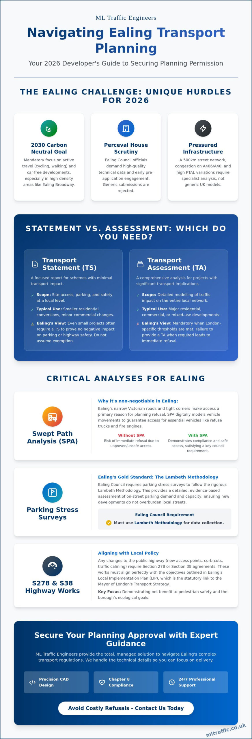
    Choosing the correct technical document is the first step in securing planning permission. Developers often confuse a Transport Statement (TS) with a Transport Assessment (TA), but the distinction is vital for 2026 compliance. The UK government guidance establishes that the scale and potential impact of a project dictate which report is necessary. While a TS focuses on smaller schemes with limited traffic impact, a full TA provides a rigorous analysis of the local network’s capacity to handle significant demand. Transport Planning Consultants Ealing evaluate these requirements during the pre-application stage to prevent costly delays or requests for further information from the council.

    Many developers fall for the “no-impact” myth. They assume that small-scale Ealing developments, such as a four-unit residential conversion, don’t require technical documentation. This is rarely the case. Ealing council requires evidence that even minor projects won’t compromise highway safety or parking availability. Public Transport Accessibility Level (PTAL) scores heavily influence these requirements. A site in Ealing Broadway with a PTAL of 6b faces different reporting pressures than a site in Northolt with a PTAL of 2. Higher PTAL areas often mandate car-free or car-capped developments, requiring a specific type of justification within the transport report. Developers working across multiple London boroughs should also be aware that similar car-free policies apply elsewhere; for instance, Transport Planning Consultants Greenwich face equally stringent requirements near high-pressure zones like the O2 and Greenwich Peninsula.

    Ealing-Specific Reporting Thresholds

    Thresholds in London are stricter than national averages. In Ealing, residential developments exceeding 80 units typically trigger a full Transport Assessment and require direct involvement from Transport for London (TfL). For commercial projects, a floor space exceeding 2,500 square meters usually necessitates a TA. Smaller projects, such as those between 30 and 80 units or commercial spaces under 1,000 square meters, generally only require a Transport Statement. You can find more detail on these differences in our Transport Statement vs. Transport Assessment Guide. Our team ensures your submission matches the exact scale of your project to streamline the approval process.

    The Role of the TRICS Database

    We use the TRICS (Trip Rate Information Computer System) database to predict how much traffic a new development will generate. This system allows us to compare your project against thousands of similar sites across the UK. For Ealing-specific land uses, we prioritize London-based data over national averages. This is because London’s unique travel patterns, influenced by the ULEZ and high bus density, don’t align with rural or regional statistics. Accurate trip generation data directly influences the financial contributions required for local infrastructure improvements through Section 106 negotiations. By using precise, localized data, we protect developers from over-inflated mitigation costs. If you need assistance with data-driven planning, our experts provide comprehensive support for all project phases.

    Transport Planning Consultants Ealing: Navigating 2026 Planning Approvals

    Swept Path Analysis: Preventing Access Refusals in Ealing

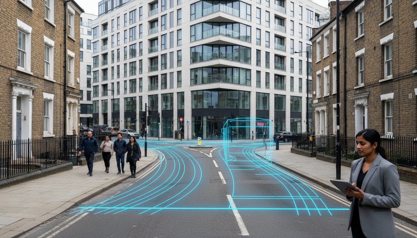
    Ealing’s Victorian infrastructure presents a physical barrier to modern development. Narrow streets in residential pockets make vehicle maneuverability a primary concern for local planning officers. As expert Transport Planning Consultants Ealing, we’ve seen applications fail simply because a refuse truck couldn’t clear a corner without mounting the kerb. Swept Path Analysis (SPA) provides the technical proof required to satisfy these safety concerns. By simulating the movement of specific vehicles, developers can identify pinch points before they become legal roadblocks. This process aligns with Ealing’s new Transport Strategy, which prioritizes safe, efficient logistics within the borough’s evolving streetscape. Failure to provide this data often results in an immediate refusal, as the Council won’t risk approving designs that compromise public safety or block emergency routes.

    Modeling refuse vehicle access is a non-negotiable requirement. Ealing Council operates specific vehicle dimensions, often requiring a 10.2m or 11.2m refuse collection vehicle (RCV) template depending on the ward. In high-density areas like Acton and Southall, fire tender requirements are even more stringent. We model these 12m emergency vehicles to ensure they can navigate tight turns within new residential blocks. SPA prevents the need for costly post-planning design revisions. Redesigning a site layout after a refusal can cost a developer over £15,000 in additional architectural fees and delay a project by six months or more.

    Vehicle Templates for London Boroughs

    Standard London refuse vehicles don’t always fit the reality of Ealing’s tight-access fleets. We use bespoke templates that reflect the actual machinery used by local waste contractors. In West Ealing, commercial units must demonstrate that delivery and servicing maneuvers won’t cause tailbacks on the A4020. Utilizing professional Swept Path Analysis Services in London ensures your site layout accommodates these local variations. This technical foresight protects the project from being stalled by Transport for London (TfL) or local highway officers during the consultation phase.

    CAD Design and Technical Accuracy

    The transition from 2D drawings to dynamic vehicle movement simulations has changed the approval landscape. Ealing transport officers no longer accept “manual” checks or simple overlays. They require dynamic CAD simulations that account for steering lock, body overhang, and wheel paths. Accurate SPA justifies reduced road widths in car-free schemes, allowing developers to allocate more space to green infrastructure or housing units. This precision ensures that even the most compact urban sites remain fully compliant with UK building regulations and local safety standards.

    Parking Surveys and the Lambeth Methodology in Ealing

    Ealing Council requires a formal parking stress survey whenever a proposed development might significantly impact local kerbside capacity. Transport Planning Consultants Ealing rely on these surveys to provide the empirical evidence necessary for planning committee approval in 2026. The core objective is to demonstrate that the existing highway can accommodate the residual parking demand from a new project without creating safety hazards or blocking emergency access. We provide these assessments as part of a total, managed solution to ensure your project remains compliant with the latest London Plan requirements.

    The Lambeth Methodology remains the gold standard for these assessments across London. It offers a consistent, data-driven approach that planning officers trust. By following this framework, developers avoid the delays associated with insufficient or anecdotal evidence. Our team utilizes this methodology to provide technical authority, addressing every regulatory hurdle before it becomes a bottleneck for your planning application.

    Conducting Surveys in Ealing CPZs

    When working within Ealing’s Controlled Parking Zones (CPZs), timing and frequency are non-negotiable. Surveys must occur between 1am and 5am on two separate weekday nights to capture the maximum residential parking load. Ealing planning policy mandates a 200-metre radius for the survey area, measured by walking distance from the site entrance. This specific distance identifies all available legal parking spaces that a future resident might reasonably use. Precision here is a legal necessity; any deviation from the 200-metre rule can lead to a summary rejection of the Transport Assessment. You can find more detail on these regulatory requirements in our Transport Assessment London Guide.

    PTAL Ratings and Parking Reductions

    Ealing’s PTAL map is the primary lever for arguing for reduced parking provision. The arrival of the Elizabeth Line has transformed accessibility in Hanwell and Ealing Broadway, pushing many sites into PTAL Zones 5 and 6. In these high-accessibility areas, Ealing Council often supports “zero-parking” developments, provided that the developer enters into a Section 106 agreement to prevent residents from obtaining on-street permits. A higher PTAL rating directly correlates with a lower statistical probability of car ownership and a corresponding reduction in local parking stress. This data is vital for developers looking to maximize floor space in high-density urban areas.

    Our 24/7 readiness ensures that your parking data is collected accurately and submitted promptly. We manage the intricate complexities of UK road regulations so you don’t have to. Our experts take pride in delivering Chapter 8 compliance and bespoke traffic solutions that stand up to council scrutiny.

    Partnering with a Transport Planning Consultant for Ealing Success

    Success in West London development requires more than just standard technical drawings. It demands a deep understanding of the Ealing Local Implementation Plan (LIP), which outlines the borough’s transport objectives through to 2041. Working with experienced Transport Planning Consultants Ealing ensures your project aligns with specific local targets for active travel and traffic reduction. The Ealing LIP 3 specifically targets a 40% reduction in carbon emissions from transport by 2030, making your 2026 application a critical milestone in meeting these environmental benchmarks.

    We manage the complex S278 and S38 legal agreements required for highway works. These are essential for any development requiring permanent alterations to the public highway in Ealing. Our team handles the technical submissions and direct liaison with the local highway authority to prevent delays. In London boroughs, S278 approvals can often take 6 to 12 months to finalize; early engagement with a technical partner helps mitigate this risk and keeps your construction schedule on track.

    Urgency defines the 2026 planning cycle. With tightening regulations and increased scrutiny on sustainable transport, 24/7 availability isn’t a luxury; it’s a necessity. We provide constant support to address planning queries or technical revisions immediately. ML Traffic Engineers acts as your technical partner, ensuring every CAD design and traffic survey meets current safety standards and legislative requirements. We take the logistical burden off your shoulders so you can focus on the broader aspects of your development.

    From Consultation to Implementation

    We don’t just provide raw data; we deliver a total managed solution. Our team oversees the entire lifecycle of your Ealing transport application, from initial feasibility studies to final site implementation. This comprehensive approach removes the burden of coordinating multiple vendors. You can learn more about how we integrate these services on our What We Do page. We prioritize Chapter 8 compliance and precision in every temporary traffic signal or multi-way system we deploy, ensuring your site remains safe and compliant from day one.

    Securing Your Quote for Ealing

    Every project has unique requirements. We provide tailored technical reporting for residential developments, commercial hubs, and mixed-use schemes across Ealing. Whether you need a Transport Assessment or a detailed Travel Plan, our quotes reflect the specific technical demands of your site. To better understand the financial side of your application, read our guide on Understanding Transport Consultant Costs. This transparency helps you budget accurately for your 2026 planning milestones.

    Ready to move forward? Contact ML Traffic Engineers for an Ealing project review today to secure your 2026 planning approval and ensure your project meets all regulatory hurdles with precision.

    Secure Your Ealing Planning Approval for 2026

    Navigating Ealing Council’s evolving transport requirements requires technical precision and immediate action. Success in 2026 hinges on meeting specific TfL compliance standards and mastering the Lambeth Methodology for parking surveys. Our team provides the TRICS data and Swept Path Analysis needed to eliminate access refusals before they happen. We focus on total managed solutions that move your project from the initial CAD design to final implementation without regulatory delays. We’re a safe pair of hands for developers who must satisfy strict UK road regulations.

    As leading Transport Planning Consultants Ealing, we understand that planning deadlines don’t wait for business hours. That’s why we offer 24/7 technical support to address urgent queries and ensure your submission meets every legal requirement. We take the logistical burden off your shoulders so you can focus on the build. Our expertise in SPA and parking data ensures your development stands up to the strictest scrutiny from local authorities. We pride ourselves on professional integrity and a commitment to safety that protects both your project and the public.

    Get a professional transport planning quote for your Ealing project. We look forward to helping you achieve a seamless approval process.

    Frequently Asked Questions

    Do I need a transport planning consultant for a small development in Ealing?

    You need a consultant if your project alters highway access or impacts local parking capacity. Ealing Council’s 2024 Local Plan mandates that even minor residential conversions provide a Transport Statement to prove safety. Transport Planning Consultants Ealing ensure your submission meets the 2026 London Plan requirements. We provide the technical evidence to prevent delays during the validation stage.

    What is a PTAL rating and how does it affect my Ealing planning application?

    PTAL stands for Public Transport Accessibility Level, a score from 0 to 6b that measures proximity to public transport. Ealing Council uses this score to determine your maximum allowable parking provision. A high PTAL score of 5 or 6 often mandates car-free or low-car developments under the 2021 London Plan. We calculate these ratings to justify your project’s density and parking strategy.

    How much does a Transport Statement cost for an Ealing project?

    Industry data from 2024 suggests that a standard Transport Statement for a medium-scale UK development costs between £1,500 and £3,500. Fees vary based on the complexity of the highway impact and the required data collection. We provide bespoke quotes that reflect the specific technical requirements of Ealing’s 2026 planning framework. This ensures you only pay for the necessary compliance work.

    Does Ealing Council allow car-free developments?

    Ealing Council actively encourages car-free developments in areas with high public transport accessibility. Policy T6 of the London Plan 2021 states that new homes in well-connected locations should be car-free, excluding disabled persons’ parking. Our team designs robust Travel Plans to support these applications. We demonstrate how your project aligns with the borough’s sustainable transport targets.

    What is the Lambeth Methodology for parking surveys?

    The Lambeth Methodology is the gold standard for conducting on-street parking surveys in London. It requires surveyors to record parking stress within a 200-metre walking distance of the site over two consecutive weekday nights. Ealing Council requires this data to assess if a development will cause overspill parking. We use precise data logging to ensure these surveys meet strict 2026 audit standards.

    How long does it take to get a Transport Assessment approved by Ealing Council?

    Ealing Council typically aims to determine minor applications within 8 weeks and major projects within 13 weeks. However, complex Transport Assessments often involve 3 to 6 months of consultation with highway officers. We mitigate these timelines by engaging in pre-application discussions. This proactive approach identifies potential hurdles before the formal submission date.

    Can a transport consultant help with Section 278 agreements in Ealing?

    We manage the entire Section 278 process for works on Ealing’s public highways. This legal agreement under the Highways Act 1980 allows developers to fund and implement permanent alterations like new junctions or traffic signals. Our Transport Planning Consultants Ealing handle the technical approvals and Chapter 8 compliance. We ensure all highway modifications meet the safety standards required by the local authority.

    What happens if my Swept Path Analysis shows a vehicle cannot turn?

    If a Swept Path Analysis shows a vehicle cannot safely manoeuvre, you must redesign the site layout or access point immediately. Ealing Council won’t approve plans where refuse vehicles or emergency services strike kerbs or encroaching on third-party land. We use specialized CAD software to simulate vehicle movements and provide immediate design solutions. This ensures your site plan is functional and safe before you submit it for approval.

    Michael Lee

    Article by

    Michael Lee

    Transport planner with over 35 years’ experience.

    Disclaimer

    The content on mltraffic.co.uk, including all technical articles, guides, and resources, is provided for general informational and educational purposes only. It is not intended to constitute professional advice in traffic engineering, transportation planning, development approvals, or any other technical or legal field.
    While ML Traffic Engineers makes every reasonable effort to ensure the accuracy, completeness, and timeliness of the information published, we do not provide any warranties or representations (express or implied) regarding its reliability, suitability, or availability for any particular purpose. Any reliance you place on the content is strictly at your own risk.
    In no event shall ML Traffic Engineers, its directors, employees, authors, or affiliates be liable for any direct, indirect, incidental, special, consequential, or punitive damages (including, without limitation, loss of profits, data, or business opportunities) arising out of or in connection with the use of, or inability to use, any information provided on this website.
    The articles and guides on this site are not a substitute for engaging a qualified, professional traffic engineer to assess your specific project requirements. For tailored advice, compliance assessments, or traffic engineering services, please contact a competent professional.
    This disclaimer may be updated from time to time without notice. By accessing or using this website, you agree to be bound by the most current version of this disclaimer.