Road transport generates one-third of all carbon emissions across the borough, placing commercial distribution sites under intense scrutiny from local highway teams. If you are developing industrial or distribution floor space across the M4 corridor or western approaches, preparing a rigorous transport assessment for logistics warehouse in Hounslow is the essential first step toward securing planning permission without protracted negotiations.
Developers know that planning delays caused by Transport for London highway objections or disputed HGV trip generation thresholds can stall a viable project for months. You shouldn’t have to compromise your yard layout or commit to unnecessary infrastructure costs just to satisfy planning conditions. In this guide, you will learn the exact technical standards needed to obtain rapid planning approval from the London Borough of Hounslow while protecting your operational site capacity. We examine local junction modelling, strict London Plan active travel benchmarks, and the precise vehicle tracking required to deliver a rock-solid submission.
Key Takeaways
- Understand the precise highway capacity and trip generation thresholds that trigger statutory scrutiny from the council and Transport for London.
- Discover the critical evidence needed in a transport assessment for logistics warehouse in Hounslow, including calibrated TRICS forecasting and multi-modal transport audits.
- Learn how advanced swept path analysis prevents on-street HGV stacking while protecting maximum usable yard area.
- Implement a structured approval roadmap using early pre-application scoping to resolve potential highway objections before formal submission.
- Balance demanding operational distribution requirements with the London Plan’s strict parking and sustainable transport standards to secure rapid planning consent.
Why Hounslow Logistics Developments Face Rigorous Transport Assessment Thresholds
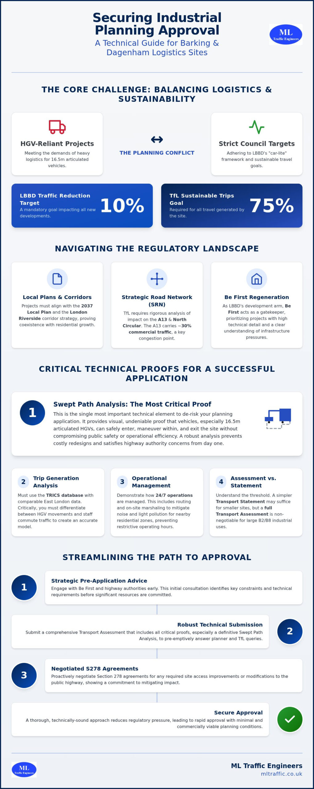
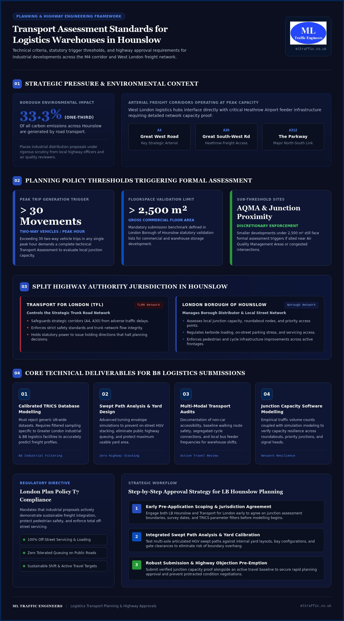
A Transport Assessment provides highway authorities with technical proof that a proposed scheme functions safely, preserves highway capacity, and encourages sustainable travel modes. In West London, logistics hubs must operate alongside complex arterial freight corridors serving Heathrow Airport. Major routes like the Great West Road (A4), Great South-West Road (A30), and The Parkway (A312) operate near peak capacity throughout the working week. Because road transport produces one-third of all local carbon emissions, delivering a comprehensive transport assessment for logistics warehouse in Hounslow is vital whenever an industrial development triggers over 30 two-way vehicle movements in a peak hour.
To see how commercial vehicle turning circles directly influence warehouse layout efficiency and site access design, watch this informative analysis:
Unlike generic edge-of-town distribution parks elsewhere in the UK, Hounslow developments must satisfy dual layers of urban freight policy within established transportation planning frameworks. A robust submission addresses acute local congestion while aligning directly with regional zero-emission goals.
Planning Policy Triggers: NPPF and The London Plan
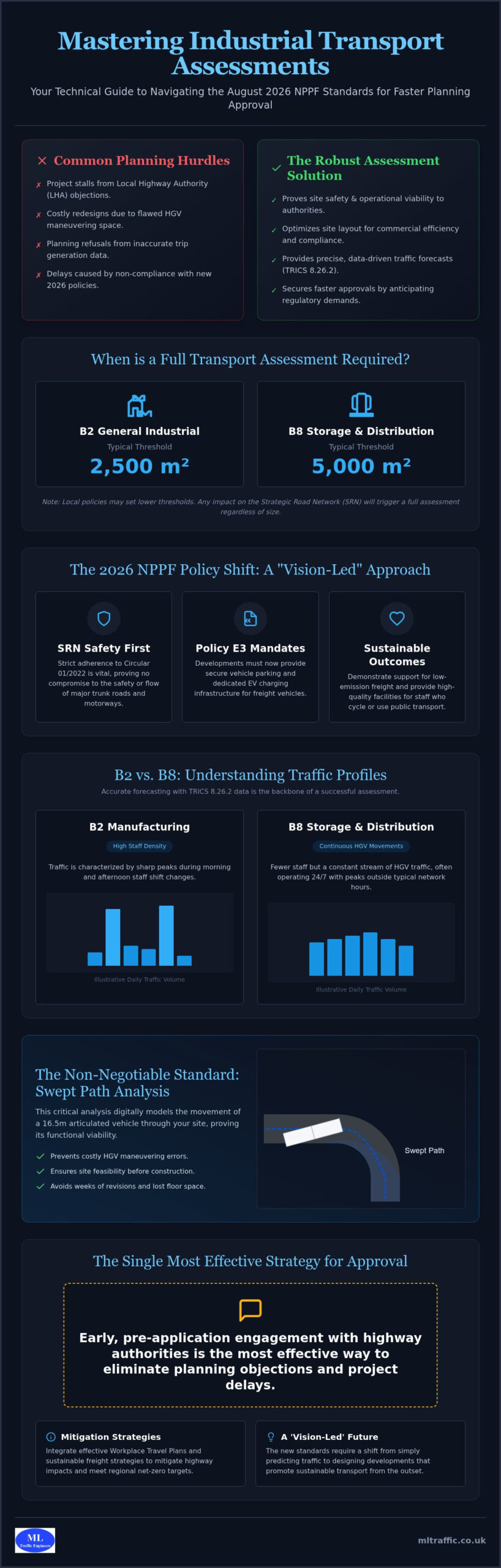
National planning policies require full technical appraisals whenever a scheme creates noticeable highway impacts. Under London Plan Policy T7, industrial proposals must actively demonstrate sustainable freight integration, off-street servicing, and site designs that eliminate queuing on public roads. In the London Borough of Hounslow, statutory validation lists enforce these principles strictly. Commercial floor space exceeding 2,500 square metres automatically triggers a mandatory assessment. However, council transport officers also require formal assessments for smaller sites positioned near Air Quality Management Areas or congested junctions to safeguard network performance.
The Strategic Road Network in Hounslow: TfL vs Council Roads
Industrial logistics sites in this borough inevitably encounter split highway management responsibilities:
- Transport for London (TfL): Controls the Transport for London Road Network (TLRN), protecting strategic corridors such as the A4 and A30 from adverse delay and safety hazards.
- London Borough of Hounslow: Manages borough distributor roads, monitoring local junction capacity, kerbside loading, and pedestrian infrastructure.
Navigating this split jurisdiction requires an integrated technical methodology. Preparing a defensible transport assessment for logistics warehouse in Hounslow means addressing council road access and strategic trunk corridors simultaneously, preventing TfL holding directions that stall statutory determination.
Core Components of a Compliant Warehouse Transport Assessment in Hounslow
Securing highway approval requires technical precision across every chapter of your submission. Following official government guidance, a transport assessment for logistics warehouse in Hounslow must prove that daily distribution operations will not degrade local network resilience or pedestrian safety. Baseline multi-modal transport audits document walking routes, cycling networks, and local bus feeder services. From there, highway engineers evaluate local junction capacity using empirical traffic counts and software modeling to verify roundabout and priority junction performance.
Trip Generation and TRICS Database Modelling for B8 Use
Trip forecasting for logistics operations cannot rely on generic nationwide samples. For outer London sites near major corridors, engineers must filter TRICS database records to select comparable Greater London industrial facilities. We separate light commercial vans from multi-axle articulated heavy goods vehicles across distinct operational profiles. Because warehouse distribution often runs continuously, the assessment must evaluate shift-change vehicle arrivals against the morning and evening highway network peaks, demonstrating that freight peaks won’t compound background congestion.
Parking Provision and Electric Vehicle Fleet Infrastructure
Workplace Travel Plans for Logistics Staff
Logistics personnel frequently work early morning or overnight shifts when public transport runs on reduced timetables, making standard travel plans ineffective. Low Public Transport Accessibility Level scores in industrial pockets demand creative active travel measures, such as secure cycling storage, shower facilities, and carpool incentives. Review our guide on Travel Plan Consultants to strengthen your workplace travel strategy. For developers seeking complete submission clarity, partnering with ML Traffic Engineers provides the technical assurance required to align operational freight demands with borough sustainability policies.
HGV Access and Swept Path Analysis for Industrial Yards
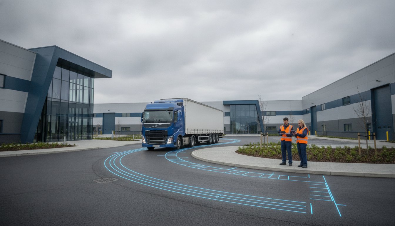
Rigorous vehicle tracking analysis forms the operational core of any warehouse planning submission. When you prepare a transport assessment for logistics warehouse in Hounslow, council transport teams and TfL scrutinise site ingress and internal yard geometry before evaluating wider traffic impacts. Inadequate turning space creates tailbacks onto active carriage lanes, creating immediate safety risks. By integrating advanced AutoTURN computer simulations into the design phase, developers prove that heavy goods vehicles can enter, manoeuvre, and leave a parcel safely without conflicting with pedestrians or structural columns.
Precision simulation protects commercial floor space. Reviewing our technical guide on AutoTURN Swept Path Analysis demonstrates how dynamic turning envelopes verify functional yard depths before planning submission, safeguarding site viability.
Design Vehicle Selection for Modern Logistics
Selecting appropriate design templates prevents costly planning refusals. Logistics operations around Heathrow rely on diverse fleet profiles that standard refuse vehicle tracking cannot replicate:
- 16.5-metre articulated HGVs: Represents the primary benchmark for UK distribution centres and regional fulfillment hubs.
- 18.75-metre drawbar combinations: Essential for high-cube air freight forwarding applications near Heathrow cargo terminals.
- London Fire Brigade appliances: Emergency access requires distinct width, turning radius, and load-bearing parameters under local design codes.
Tracking software models real-world steering angles, body swing, and rear-axle cut-through. Testing these paths against site boundaries, structural supports, and security barriers confirms that large vehicles navigate circulation loops without encroaching onto footways or cycle lanes.
Loading Bay Turnaround and On-Street Stacking Mitigation
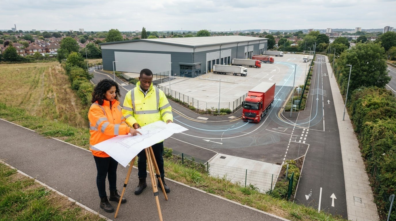
Hounslow planning policy strictly prohibits HGVs reversing directly from or onto public roads. Vehicles must enter and exit in a forward gear at all times. In dense industrial zones where land values remain high, internal yard space faces severe pressure. The technical assessment must demonstrate that loading bays accommodate continuous turnarounds, even when adjacent berths are occupied.
Planning officers will reject schemes that risk on-street vehicle stacking. Incorporating dedicated internal waiting bays or holding lanes within your transport assessment for logistics warehouse in Hounslow proves that arriving delivery vehicles will not obstruct local distributor routes. This proactive engineering validation ensures smooth approvals while securing maximum operational yard efficiency for your asset. If you are managing ongoing haulage or require dependable freight transport services for warehouse distribution, check out NS Logistics Solutions Limited.
Step-by-Step Approval Strategy for London Borough of Hounslow Planning
Securing planning consent for distribution facilities requires a proactive technical strategy rather than passive form-filling. The difference between an on-time committee approval and months of costly holding objections lies in procedural timing. By systematically addressing baseline traffic data, highway capacity thresholds, and internal circulation before formal submission, developers keep their applications moving forward smoothly.
A structured approach ensures that your technical documentation withstands statutory examination:
- Formal Scoping: Engage both borough engineers and Transport for London early to freeze study junction selections.
- Traffic & Parking Surveys: Commission automated traffic counts and queue length surveys across defined neutral periods.
- Capacity & Tracking Refinement: Run junction capacity simulations and swept path checks concurrently to optimise site access points.
- Unified Technical Reporting: Compile the final evidence base alongside workplace travel measures into a coherent submission package.
Pre-Application Scoping with Hounslow and TfL Highways
Never commission extensive junction surveys until the relevant highway officers formally sign off your scoping note. Reaching an early consensus on study boundaries, TRICS database land-use subcategories, and baseline survey dates avoids disputed methodologies later. Surveys must occur during neutral working weeks, strictly avoiding school holidays, public bank holidays, and major local network disruptions. Review the technical frameworks detailed in our Transport Assessment London Guide to align your scoping submissions with regional standards.
Resolving Statutory Highway Authority Consultations
After submission, TfL and council officers review documentation against London-wide Vision Zero and Healthy Streets criteria. Technical holding objections frequently arise over minor issues like missing junction flare details, incomplete night-shift vehicle trip rates, or swept path clearances along access radii. An experienced engineering team resolves these queries swiftly with precise supplementary modeling iterations, avoiding determination deferrals. If you need robust technical support to de-risk your upcoming commercial planning submission, consult with ML Traffic Engineers to secure timely, fully defended highway approvals.
Delivering an airtight transport assessment for logistics warehouse in Hounslow protects development timelines and demonstrates safety compliance, positioning your application for rapid planning officer sign-off.
Partnering with ML Traffic Engineers for Hounslow Industrial Approvals
Industrial distribution schemes operate within tight commercial margins and demanding construction timetables. Securing planning consent hinges on presenting technical reports that satisfy statutory highway teams while preserving every square metre of viable warehouse space. When commissioning a transport assessment for logistics warehouse in Hounslow, developers need an engineering partner who understands both local network sensitivities and logistics yard realities. Established in 2014, ML Traffic Engineers UK delivers defensible highway documentation that bridges the gap between complex municipal regulations and real-world operational needs. We craft balanced technical submissions that prevent unnecessary off-site infrastructure burdens and disproportionate Section 278 financial liabilities.
Our engineering methodology focuses on de-risking applications from day one. Through direct, active communication, we keep planning milestones on track, resolving technical highway matters before they turn into formal planning objections.
Technical Precision and Defensible Planning Data
Local highway authorities and TfL examine traffic models down to individual queue metrics. Our engineers eliminate technical vulnerability by building evidence bases on validated TRICS trip data, empirical traffic surveys, and transparent junction capacity modelling. We integrate advanced AutoTURN swept path simulations straight into architectural CAD layouts, ensuring loading docks, yard circulation, and structural clearances function seamlessly without sacrificing usable warehouse floor space. Explore our comprehensive Transport Planning Services to discover how our technical analysis supports commercial schemes across London.
Request Your Transport Assessment Proposal
Planning deadlines demand rapid responses and dependable technical execution. We remove regulatory guesswork by establishing an agreed assessment scope aligned with the London Borough of Hounslow validation requirements from day one. You can send us your site boundary drawings and proposed operational parameters for an immediate technical appraisal.
Our team identifies potential access constraints, determines required survey parameters, and delivers a clear, fully scoped engineering roadmap. Contact ML Traffic Engineers UK to secure a compliant transport assessment for logistics warehouse in Hounslow that protects your development programme and delivers planning success.
Accelerate Your Logistics Planning Approval in Hounslow
Securing planning consent for industrial space in West London requires absolute technical clarity. Between heavy freight movements along Heathrow corridors and strict regional active travel mandates, submitting an unverified proposal risks months of costly deferrals. A defensible transport assessment for logistics warehouse in Hounslow validates your trip generation, safeguards internal yard circulation through precision vehicle tracking, and satisfies statutory highway officers early in the planning process.
Founded in 2014, ML Traffic Engineers UK brings extensive UK transport planning expertise and a proven track record of securing highway authority clearances across London boroughs. Our advanced in-house swept path analysis and traffic modelling capabilities give your development team the exact data needed to resolve complex highway issues without compromising commercial operational space. Take control of your submission schedule today. Instruct ML Traffic Engineers UK for Your Transport Assessment and move your industrial scheme toward a swift, confident planning approval.
Frequently Asked Questions
Do I need a Transport Assessment or a Transport Statement for a Hounslow warehouse?
The required document depends on floor space and anticipated traffic impact. For B8 storage and distribution schemes, floor space exceeding 2,500 square metres or proposals generating over 30 two-way peak-hour vehicle trips require a full transport assessment for logistics warehouse in Hounslow. Schemes below these thresholds typically require a simpler Transport Statement, though council officers may still request a comprehensive assessment if the site borders congested corridors or air quality zones.
How does London Plan Policy T7 affect warehouse planning applications in Hounslow?
London Plan Policy T7 regulates freight and servicing to protect road safety and promote sustainable logistics. For warehouse proposals, it mandates that all servicing and turning occur off-street within site boundaries. The policy requires developers to demonstrate low-emission fleet accommodation, rapid electric vehicle charging, and consolidation practices. Planning teams will refuse applications that fail to prove that delivery vehicles can access and leave the facility without disrupting surrounding network operations.
What design vehicles must be included in swept path analysis for industrial developments?
Industrial developments must simulate maximum-sized fleet vehicles alongside statutory emergency services. Standard assessments test 16.5-metre articulated heavy goods vehicles and, where relevant for air cargo hubs near Heathrow, 18.75-metre drawbar lorries. Layouts must also verify access for London Fire Brigade pumping appliances, refuse collection vehicles, and standard 7.5-tonne box vans. Each simulation accounts for vehicle cut-through, mirror clearances, and body overhangs across internal junctions and loading bays.
Can commercial vehicles reverse out onto the public highway in London?
No, commercial vehicles cannot reverse out onto the public highway in London. Highway authorities and borough development management policies strictly require all heavy goods vehicles and servicing vans to enter and leave sites in a forward gear. Reversing onto live carriageways presents serious safety hazards to pedestrians, cyclists, and traffic flow. Site plans must incorporate dedicated internal turning heads or sufficient yard depth to allow complete on-site turnarounds.
How long does it take to complete a Transport Assessment for a logistics facility?
Preparing a robust assessment typically takes between four and eight weeks, depending on survey scope and consultation requirements. Commissioning baseline traffic counts requires neutral term-time survey weeks without holiday anomalies. Once traffic data and site plans are finalised, engineers complete junction capacity modelling, swept path simulations, and trip forecasting. Engaging engineers early during pre-application discussions helps align survey windows with council milestones, avoiding critical planning programme delays.
What happens if Transport for London objects to my warehouse planning proposal?
A TfL holding objection pauses the planning process until identified highway issues are resolved. Objections usually focus on junction capacity deficits, unsafe access onto the Strategic Road Network, or inadequate active travel integration. To overturn an objection, your engineering team must submit technical rebuttals, such as revised junction modelling or updated swept paths. Resolving these points collaboratively ensures TfL withdraws its holding direction so the borough can grant approval.
How are HGV trips calculated for a new storage and distribution warehouse?
Engineers calculate freight movements using the national TRICS database, filtering comparable sites across Greater London with similar operational characteristics. For a transport assessment for logistics warehouse in Hounslow, we calibrate trip generation rates per 100 square metres of gross floor area across specific vehicle classes. The calculation splits light vans from multi-axle HGVs and profiles arrival and departure patterns across 24-hour cycles, ensuring night shifts and morning peaks are accurately captured.

Disclaimer
The content on mltraffic.co.uk, including all technical articles, guides, and resources, is provided for general informational and educational purposes only. It is not intended to constitute professional advice in traffic engineering, transportation planning, development approvals, or any other technical or legal field.
While ML Traffic Engineers makes every reasonable effort to ensure the accuracy, completeness, and timeliness of the information published, we do not provide any warranties or representations (express or implied) regarding its reliability, suitability, or availability for any particular purpose. Any reliance you place on the content is strictly at your own risk.
In no event shall ML Traffic Engineers, its directors, employees, authors, or affiliates be liable for any direct, indirect, incidental, special, consequential, or punitive damages (including, without limitation, loss of profits, data, or business opportunities) arising out of or in connection with the use of, or inability to use, any information provided on this website.
The articles and guides on this site are not a substitute for engaging a qualified, professional traffic engineer to assess your specific project requirements. For tailored advice, compliance assessments, or traffic engineering services, please contact a competent professional.
This disclaimer may be updated from time to time without notice. By accessing or using this website, you agree to be bound by the most current version of this disclaimer.