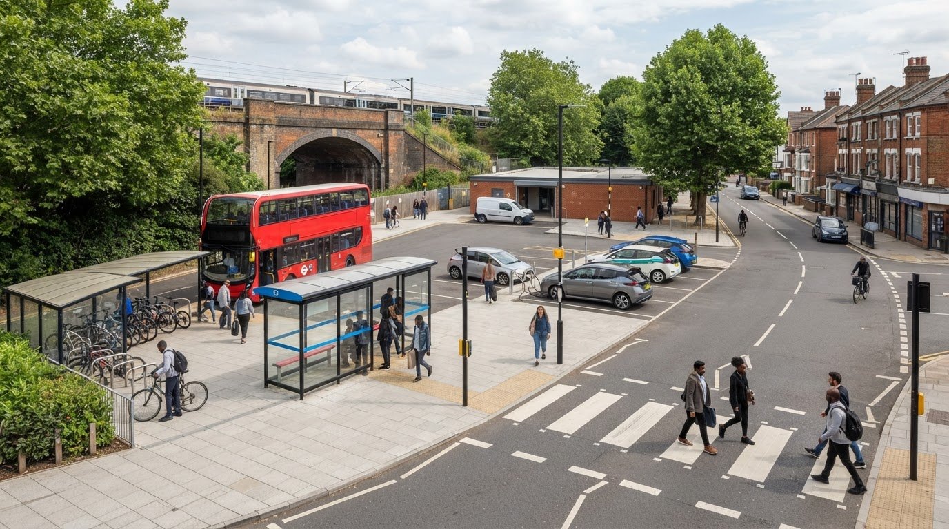
Tag: Mobility Hubs

  • Transport Assessments for Mobility Hubs: A UK Planning Guide

    Transport Assessments for Mobility Hubs: A UK Planning Guide

    A mobility hub’s transport impact can’t be understood by counting car trips alone. A transport assessment for mobility hub proposals needs to consider how people reach, use and move between its different services, and how those journeys affect the surrounding network.

    Scoping a mixed-use destination, forecasting demand across travel modes and understanding local planning and highway authority expectations all take careful thought. The right level of assessment depends on the proposal and its likely impacts, so a clear, evidence-led approach matters from the outset.

    This guide explains what a proportionate assessment should examine, including access for people walking, wheeling, cycling and using public transport, vehicle movements, servicing, parking and network effects. It also outlines the project information and survey evidence that can support a credible planning submission. ML Traffic Engineers UK prepares Transport Assessments and can provide traffic and parking surveys and technical analysis to help present a mobility hub’s likely impacts and proposed mitigation clearly to decision-makers.

    Key Takeaways

    • Scope a transport assessment for mobility hub around the proposal’s uses, location, scale and expected travel demand.
    • Build a clear evidence base by combining project details, relevant surveys and justified assumptions to explain likely transport impacts.
    • Understand how a Transport Assessment differs from a Transport Statement, and why the local planning authority’s expectations matter.
    • Coordinate access, interchange, servicing, cycle provision and parking decisions so the site layout supports connected journeys.
    • See how Transport Assessments, traffic and parking surveys, and Swept Path Analysis can support a clear planning submission.

    What does a transport assessment for a mobility hub need to establish?

    A Transport Assessment explains how a development is likely to affect transport and how its effects will be addressed. For a mobility hub, that means looking beyond the site entrance. The assessment should show how the hub’s services connect with surrounding routes and how people are expected to arrive, transfer and continue their journeys.

    Scope the work around the hub’s scale, mix of uses, location and expected travel demand. A hub beside a railway station with shared vehicles and cycle facilities raises different questions from a neighbourhood site combining a bus stop, cycle parking and local services. A general overview of mobility hubs can help explain the concept, but it can’t replace a project-specific assessment.

    For a visual introduction to the concept, watch this short video:

    Which mobility hub elements can affect travel demand?

    Start by defining the scheme. Identify its transport connections, on-site uses and facilities, such as public transport interchange, cycle parking, shared mobility, waiting areas or retail. Consider who will use each element, including people transferring between modes, visitors to on-site businesses, staff and people accessing the hub on foot, by cycle or by vehicle.

    Separate existing journeys from new trips generated by the development. Some users may already travel through the area and simply change mode at the hub. Others may make a new journey or visit an on-site use. Opening hours and the hub’s interchange role can affect when people arrive and depart, so assumptions should reflect how the facilities are intended to operate.

    Why assess the hub and its surrounding network together?

    Map connections between the site and nearby public transport stops, walking and cycling routes, and local streets. Review how people reach the hub, move between its facilities and continue their journey. Consider access and movement beyond the red line where the proposal could affect wider routes, rather than treating the boundary as the limit of its transport influence.

    A mobility hub assessment evaluates how the development’s connected services shape journeys to, through and beyond the site, and what those journeys mean for the surrounding transport network. Tailor the report to the proposal and planning context. There’s no single template that can replace proportionate consideration of local conditions and the expectations of the relevant planning and highway authorities.

    How should the assessment examine mobility hub travel demand and impacts?

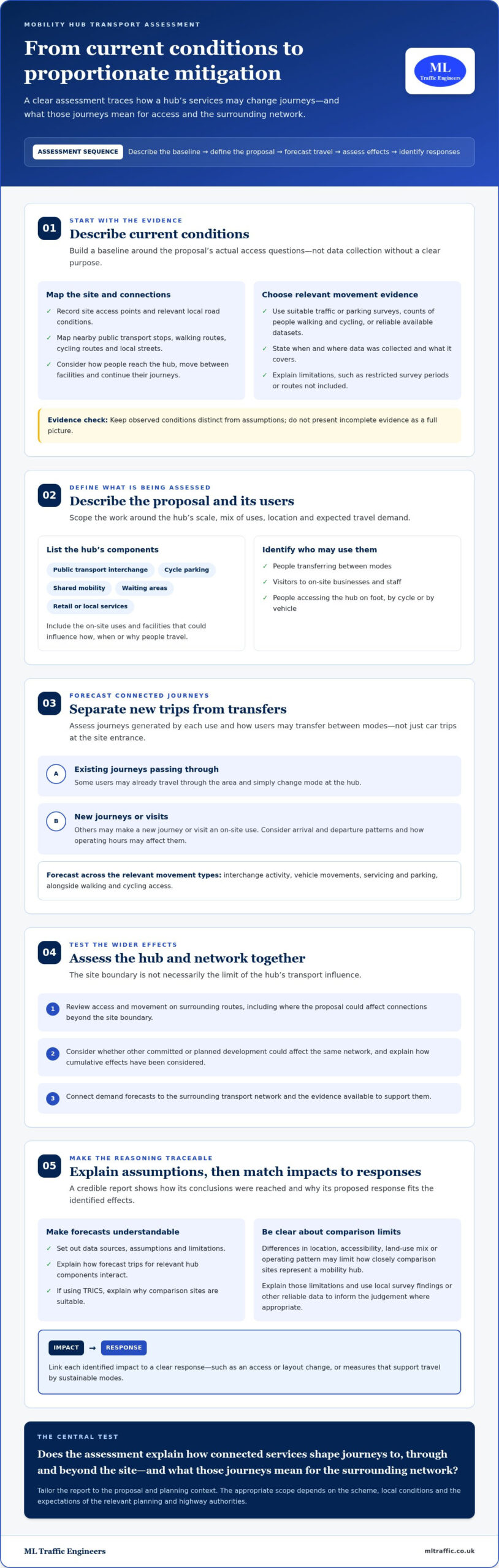
    A robust assessment follows a clear sequence: describe current conditions, define the proposal, estimate how it may change travel, assess effects on access and the surrounding network, then identify proportionate mitigation. This makes the reasoning traceable for decision-makers. A transport assessment for mobility hub should consider the journeys generated by each use as well as transfers between modes, rather than treating the hub as a single source of vehicle trips.

    The UK Government guidance on Transport Assessments provides a national reference point for assessment scope. The report should also respond to the scheme and its planning context, setting out data sources, assumptions and limitations so readers can follow how conclusions were reached.

    What baseline information helps describe the site?

    Record site access points and relevant local road conditions, alongside walking and cycling connections and nearby public transport services. Establish existing movement patterns using suitable traffic or parking surveys, counts of people walking and cycling, or reliable available datasets. Choose evidence to answer specific questions raised by the proposal rather than collecting data without a clear purpose.

    State when and where data was collected, what it covers and any factors that could affect its representativeness. For example, explain if a count covers only particular periods or excludes a route that may influence access. Documenting limitations helps distinguish observed conditions from assumptions and avoids presenting incomplete evidence as a full picture.

    How can the report assess forecast trips and network effects?

    Estimate demand for each relevant hub component, then explain how those trips interact. A traveller transferring from a bus to a shared bicycle is different from a new visitor arriving by car to use an on-site facility. Consider arrival and departure patterns, interchange activity, vehicle movements, servicing and parking, as well as walking and cycling access. Where other committed or planned development could affect the same network, explain how cumulative effects have been considered.

    Forecasts depend on a proposal’s uses, location and the evidence available to support the assumptions. If TRICS is used, select comparison sites with relevant characteristics and explain why they are suitable. Differences in location, accessibility, land-use mix or operating pattern may limit how closely those sites represent a mobility hub. Set out those limitations and use local survey findings or other reliable data to inform the judgement where appropriate.

    Finally, connect each identified impact to a clear response, such as an access or layout change, or measures that support travel by sustainable modes. For project-specific assessment and supporting transport evidence, see ML Traffic Engineers.

    When does a mobility hub need a Transport Assessment rather than a shorter report?

    There’s no universal trip threshold that determines the right report for every mobility hub. The local planning authority considers the proposal, its likely transport effects and relevant planning guidance. A transport assessment for mobility hub proposals may need to be more detailed where several uses and travel modes interact, but the appropriate scope depends on the site and the evidence needed to explain its effects.

    A Transport Assessment generally provides a more comprehensive examination of transport impacts, forecast demand and mitigation. A Transport Statement is a shorter, proportionate report for proposals where a more limited level of analysis is appropriate. For a hub, the distinction isn’t simply the number of facilities. A compact scheme could still raise complex access or interchange questions, while a larger proposal in a well-connected location may present a different evidence task. The report type and scope should reflect the planning context, not a generic template.

    Which project characteristics may widen the assessment scope?

    Consider the scale and mix of uses, anticipated demand, access arrangements and sensitivity of the surrounding network. A hub bringing together public transport, cycle facilities, shared vehicles and commercial uses can generate linked journeys that need to be explained as one movement pattern. Accessibility belongs in that picture too. Examine how people can reach the site and transfer between facilities, including the continuity of walking routes and the practical relationship between entrances and transport stops.

    Authority feedback and local site conditions may also affect what evidence is proportionate. Constrained access, nearby junctions or a proposal connecting with several routes could prompt more detailed analysis than a straightforward site with limited effects.

    How do local planning and highway authority expectations fit?

    The local planning authority determines the planning information it expects to assess the application. The relevant highway authority may provide technical advice on effects involving roads or transport infrastructure within its remit. Understanding both roles can help shape a clear scope. Current national guidance and local validation requirements should inform the approach for the specific application.

    Requirements can differ between Greater London, Manchester, Birmingham, the West Midlands, Liverpool, Surrey, East Sussex, West Sussex, Hampshire, Berkshire and Buckinghamshire because local planning policy, transport networks and authority guidance vary. Don’t assume that an approach accepted in one location will suit another. For wider London planning context, see this Transport Assessment London guide.

    For a mobility hub, the practical choice is the report that gives decision-makers enough reliable evidence to understand the scheme’s connected travel effects, without adding analysis that doesn’t help answer a planning question. Shape the scope around the relevant authority guidance and feedback before finalising the assessment approach.
    Transport Assessments for Mobility Hubs: A UK Planning Guide

    What evidence and design decisions make a mobility hub assessment more useful?

    A useful assessment starts with coordinated project information, then tests how the proposed layout works for people and vehicles. Transport questions should inform design from the outset: access, interchange, cycle provision, parking and servicing all compete for space and can affect one another. Reviewing them together helps identify conflicts before the report is finalised.

    Which project information should the assessment team review?

    Prepare a clear evidence trail from the scheme brief to the assessment conclusions. A practical sequence is:

    • 1. Define the proposal. Set out the location, intended uses, facilities, operating arrangements and phasing.
    • 2. Share the plans. Provide location plans, site layouts and access drawings that show entrances, cycle facilities, parking, servicing areas and connections to nearby routes.
    • 3. Explain travel assumptions. Record available estimates of users, journey types and arrival patterns, noting their source and any limitations.
    • 4. Review the evidence. Compare the project information with relevant surveys and available transport data to identify gaps that could affect the analysis.
    • 5. Resolve uncertainties. Flag missing inputs early. If assumptions are needed, state them clearly and explain how they influence the assessment’s findings.

    This sequence keeps the report grounded in the actual design rather than a generic description of a mobility hub. For related preparation considerations in London, see the Transport Assessment London guide.

    How can inclusive access and interchange be assessed?

    Trace a complete journey from the surrounding network to the site and between its facilities. Check how people reach entrances from public transport stops, walking and cycling routes, and onward destinations. Consider whether routes are continuous and legible, where crossing points sit, and whether the layout makes transfers straightforward. Include different users’ access needs in this review, rather than treating accessibility as a separate item after the site plan is settled.

    Inclusive access is measured by the quality of the complete journey, not just the facilities provided at the hub. A cycle parking area, for example, is less useful if its approach conflicts with servicing movements or leaves a gap in the onward route.

    Mitigation should respond directly to the impacts identified in the assessment. It might involve refining access arrangements, improving route connections or adjusting the position of facilities. Explain how each measure addresses a specific issue and ensure it is practical within the proposed design and phasing. To develop a clear, project-specific evidence base, discuss your mobility hub Transport Assessment.

    How can ML Traffic Engineers support a mobility hub planning submission?

    A clear planning submission needs more than a description of the proposed facilities. It should connect the scheme’s plans and intended uses with relevant transport evidence, explain likely impacts, and show how those impacts have informed the design or mitigation. ML Traffic Engineers prepares Transport Assessments and supporting technical evidence for planning applications, tailored to the proposal and its context.

    What can a tailored Transport Assessment bring together?

    The work follows a practical sequence: understand the proposal, define the evidence needed, analyse the transport effects, then present findings and responses in a structured report. For a mobility hub, that means assessing the relationship between its facilities and expected journeys, not treating each component in isolation.

    Traffic surveys can help describe movement on relevant routes, while parking surveys can provide evidence about existing parking conditions. Where vehicle access or manoeuvrability is a project question, Swept Path Analysis can test vehicle movements against the proposed layout. The appropriate evidence depends on the site and the issues the assessment needs to address.

    Bringing these inputs together helps decision-makers follow how the project information and evidence support the assessment’s conclusions. For wider London planning context, see the Transport Assessment London guide.

    What are the next steps for a mobility hub proposal?

    Organise the current project information before preparing the assessment brief. Useful starting materials include:

    • Location and layout plans, including access points and proposed transport facilities.
    • A summary of proposed uses, operating arrangements and expected project stages.
    • Available information about travel demand, parking, servicing and vehicle access.
    • Any existing survey data or relevant discussions with the planning or highway authority.

    These inputs help define the assessment scope and identify evidence gaps early. If plans are still developing, share the current version and clearly identify what remains subject to change. The assessment can then reflect the proposal accurately and explain any assumptions used.

    ML Traffic Engineers prepares project-specific Transport Assessments for mobility hubs, supported by traffic or parking survey evidence and Swept Path Analysis where relevant. Discuss your mobility hub transport assessment and take the next step towards a clear, evidence-led planning submission.

    Prepare a Clear Case for Your Mobility Hub

    A credible mobility hub submission explains how the proposal’s uses and transport connections shape journeys, not just what facilities sit on the site. A proportionate transport assessment for mobility hub should draw on suitable evidence, make its assumptions clear and connect forecast impacts to practical mitigation.

    Start with the project plans, access arrangements and available travel information, then shape the assessment around the site and relevant authority expectations. Consider how public transport, walking, cycling, servicing and parking work together, including the complete journey for different users. Clear, project-specific analysis gives decision-makers a stronger basis for understanding the proposal.

    ML Traffic Engineers prepares Transport Assessments and Transport Statements for planning applications, supported where relevant by traffic surveys, parking surveys and Swept Path Analysis. These inputs help bring the proposal, evidence and transport conclusions together in a focused report.

    Ready to progress your planning submission? Discuss your mobility hub transport assessment with ML Traffic Engineers and take the next step with confidence.

    Frequently Asked Questions

    What is a transport assessment for a mobility hub?

    A transport assessment for a mobility hub is a project-specific report explaining how the proposal may affect travel and how those effects can be addressed. It considers the hub’s uses, transport connections, access arrangements and expected journeys, alongside relevant conditions on nearby routes. The report brings evidence and analysis together so planning decision-makers can understand the proposal’s likely impacts and the reasoning behind proposed mitigation.

    When does a mobility hub need a Transport Assessment?

    The local planning authority determines the transport information expected for an application, based on the proposal, its likely impacts and relevant guidance. There is no single threshold that applies to every mobility hub. Local context matters across Greater London, Manchester, Birmingham, the West Midlands, Liverpool, Surrey, East Sussex, West Sussex, Hampshire, Berkshire and Buckinghamshire. Establish the proportionate scope for the specific site using applicable authority guidance.

    What should a mobility hub transport assessment include?

    It should set out the proposal and relevant baseline conditions, then assess expected travel demand, access and effects on the surrounding network. Depending on the scheme, evidence may cover walking, cycling, public transport, vehicle movements, interchange, servicing and parking. The report should explain its data sources, assumptions and limitations, then connect identified impacts to practical mitigation. Its scope should reflect the hub’s uses, location and likely transport effects.

    How are trips to and from a mobility hub assessed?

    Assessment starts by identifying the journeys associated with each proposed use and facility. It distinguishes new trips from existing journeys that transfer between modes, then considers arrival and departure patterns, vehicle movements and effects on nearby routes. Surveys and suitable available datasets can inform forecasts. Where TRICS is used, the report should explain why comparison sites are relevant and note limitations that affect how well they represent the proposed hub.

    Does a mobility hub assessment need to consider accessibility?

    Yes. Accessibility should inform the assessment of the complete journey, from surrounding streets and public transport stops to site entrances, facilities and onward routes. Consider route continuity, crossing points, wayfinding and how people with different access needs can move between modes. This helps identify barriers that a review of facilities inside the site alone could miss, and supports a more complete understanding of how the hub is likely to function.

    Who reviews a transport assessment for a mobility hub?

    The local planning authority considers the application’s transport evidence as part of its planning decision. The relevant highway authority may provide technical input on transport effects and roads within its remit. The precise review arrangements depend on the site and application context. A clear report that explains its evidence, assumptions and proposed responses can help decision-makers and technical consultees understand how the assessment reaches its conclusions.

    How early should transport assessment work start for a mobility hub?

    Start during early project planning, while the site layout and access arrangements can still respond to transport findings. Share current plans, proposed uses, access details and known project stages so the assessment scope and evidence needs can be identified. Early work can also highlight data gaps and help align the design with likely user journeys. If plans change, update the assessment inputs so its conclusions remain relevant to the proposal.

    Michael Lee

    Article by

    Michael Lee

    Transport planner with over 35 years' experience.

    Disclaimer

    The content on mltraffic.co.uk, including all technical articles, guides, and resources, is provided for general informational and educational purposes only. It is not intended to constitute professional advice in traffic engineering, transportation planning, development approvals, or any other technical or legal field.
    While ML Traffic Engineers makes every reasonable effort to ensure the accuracy, completeness, and timeliness of the information published, we do not provide any warranties or representations (express or implied) regarding its reliability, suitability, or availability for any particular purpose. Any reliance you place on the content is strictly at your own risk.
    In no event shall ML Traffic Engineers, its directors, employees, authors, or affiliates be liable for any direct, indirect, incidental, special, consequential, or punitive damages (including, without limitation, loss of profits, data, or business opportunities) arising out of or in connection with the use of, or inability to use, any information provided on this website.
    The articles and guides on this site are not a substitute for engaging a qualified, professional traffic engineer to assess your specific project requirements. For tailored advice, compliance assessments, or traffic engineering services, please contact a competent professional.
    This disclaimer may be updated from time to time without notice. By accessing or using this website, you agree to be bound by the most current version of this disclaimer.

  • Mobility Hubs: 2026 Technical Guide for UK Developers

    Mobility Hubs: 2026 Technical Guide for UK Developers

    What if the difference between a stalled project and a successful planning approval rests not on vehicle capacity, but on the technical precision of a single multi-modal interchange? With the 2026 NPPF shifting transport planning from a “predict and provide” model to a “vision-led” approach, developers face unprecedented pressure to deliver infrastructure that performs. Integrating a robust transport assessment for sustainable development is no longer an optional extra; it’s the technical foundation of modern site yield.

    We know the frustration of navigating ambiguous local authority requirements while trying to balance rising infrastructure costs. This guide eliminates that uncertainty. You’ll master the technical standards needed to specify high-quality mobility hubs that satisfy even the most stringent planning officers. We’ll provide a clear framework for hub components, show you how to integrate them into your Transport Assessments, and demonstrate how robust data can accelerate your approval timeline in a landscape where 33% of local authorities are currently failing their housing delivery targets.

    Key Takeaways

    • Identify the specific technical requirements for mobility halts, local hubs, and regional interchanges under the 2026 UK planning framework.
    • Specify micro-mobility and EV charging infrastructure that complies with the latest standards for shared transport and active travel.
    • Use a robust transport assessment for sustainable development to quantify mode shift and justify reduced on-site parking requirements.
    • Apply Swept Path Analysis to ensure safe, efficient interactions between pedestrians, cyclists, and vehicles within the hub layout.
    • Streamline the planning process by following a data-driven specification sequence from initial feasibility to final technical documentation.

    Defining the Mobility Hub Specification Framework

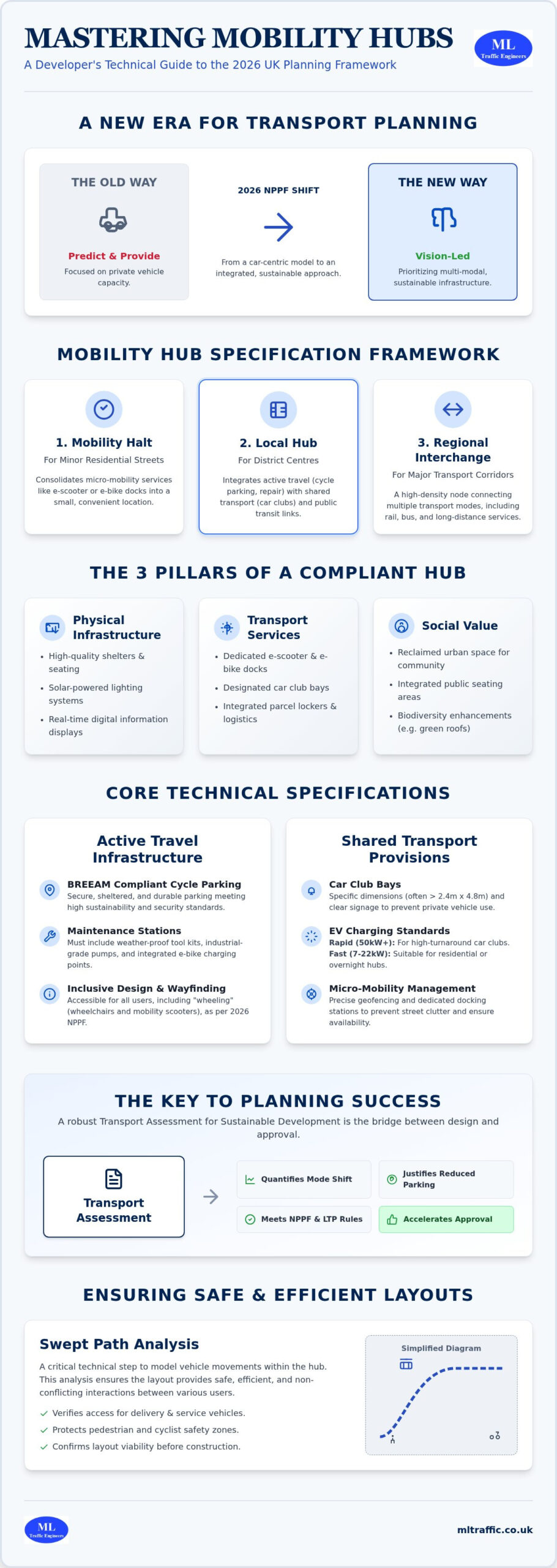
    A mobility hub is a high-density, multi-modal interchange that consolidates shared transport services and active travel infrastructure. In the 2026 UK planning context, it isn’t just a collection of bike racks; it’s a strategic engineering framework. Understanding What is a Mobility Hub? requires looking past the physical shelter to the data-driven integration of services. We categorize these into three distinct specifications: Mobility Halts for minor residential streets, Local Hubs for district centres, and Regional Interchanges for major transport corridors.

    Securing planning approval requires a formal specification that stands up to scrutiny during Section 106 and Community Infrastructure Levy (CIL) negotiations. Local authorities now demand evidence that these facilities will actively reduce private car dominance. Integrating this technical data into your transport assessment for sustainable development provides the necessary justification to local planners. Without a precise technical definition in your planning submission, you risk costly delays or over-specification that erodes site yield.

    The Three Pillars of Hub Specification

    A compliant hub must address three critical areas to satisfy modern planning standards. First, physical infrastructure provides the foundation, including high-quality shelters, solar lighting, and real-time digital interfaces. Second, transport services must integrate seamlessly. This includes dedicated bays for e-scooters, e-bike docks, and shared car club spaces. Finally, social value components reclaim urban space for community use through integrated seating and biodiversity enhancements. This holistic approach ensures the hub functions as a destination, not just a transit point.

    Regulatory Alignment in England

    Your hub must align with the revised National Planning Policy Framework (NPPF) published on August 17, 2026. Specifically, policies TR3 through TR8 require developments to prioritize active travel and decarbonisation. A robust transport assessment for sustainable development acts as the bridge between these national mandates and your site-specific design. It ensures your proposal meets Homes England sustainable placemaking guidance and contributes directly to the objectives set out in the Local Transport Plan (LTP) guidance published on April 2, 2026. By meeting these benchmarks, you demonstrate a commitment to inclusive mobility and public safety.

    Core Technical Components and Standards

    Precision in technical specification separates a viable mobility hub from a planning liability. Developers must move beyond aesthetic concepts to hard engineering standards that satisfy local highways authorities. According to the UK Government Guidance on Mobility Hubs, the success of these sites depends on functional reliability and safety. For a transport assessment for sustainable development to be robust, it must detail the power load for EV chargers and the specific dimensions of shared transport bays to ensure they accommodate diverse vehicle types.

    Active Travel Infrastructure Specifications

    Secure, sheltered cycle parking must meet BREEAM compliance, ensuring long-term durability and user security. Maintenance stations are now a standard requirement; these must include weather-proof tool kits, industrial-grade pumps, and integrated e-bike charging points. Inclusive design is non-negotiable. Wayfinding must be accessible for all users, including those “wheeling”-a term the 2026 NPPF uses to explicitly include wheelchairs and mobility scooters. These elements ensure the hub remains a safe, accessible environment for every demographic.

    Shared Transport Provisions

    Shared car club bays require specific signage and dimensions to prevent private vehicle encroachment. While standard UK parking spaces are 2.4m by 4.8m, hub bays often require additional clearance for ease of access and charging cable management. For shared car clubs, Rapid charging (50kW+) is preferred to ensure vehicle turnaround, though Fast charging (7kW to 22kW) may suffice for overnight residential hubs. E-scooter integration relies on precise geofencing and docking station technicalities to prevent street clutter. Integrating parcel lockers and last-mile logistics within the footprint further reduces local delivery traffic. If you’re unsure about the spatial requirements for these components, a professional Swept Path Analysis will confirm the layout’s viability before you submit.

    Digital integration, such as Real-Time Passenger Information (RTPI) and smart ticketing kiosks, bridges the gap between different transport modes. Finally, the hub’s footprint must incorporate Sustainable Drainage Systems (SuDS) and greening. This isn’t just for aesthetics; it’s a regulatory requirement that supports biodiversity and manages surface water runoff. These technical layers ensure the hub remains a functional asset throughout the lifecycle of the development, providing the data-driven evidence needed for a successful transport assessment for sustainable development.

    Strategic Layout and Swept Path Analysis

    Strategic placement is the foundation of a successful mobility hub. For a hub to function effectively, it must sit within the 800-metre “reasonable walking distance” defined by the 2026 NPPF. Visibility and accessibility are non-negotiable. A hub tucked away in a low-traffic corner will fail to achieve the mode shift required for a successful transport assessment for sustainable development. We prioritize locations that intersect with existing desire lines, ensuring the facility is a natural choice for residents and commuters alike.

    Designing for safe interaction between pedestrians, “wheelers,” and vehicles requires technical precision. Conflict points must be engineered out through clear segregation and intuitive wayfinding. Validating these designs with Swept Path Analysis provides the technical assurance that the layout works in the real world. This data-driven approach proves to planning authorities that your site can accommodate multi-modal movements without compromising safety or public realm quality.

    Vehicle Manoeuvrability Standards

    Ensuring smooth ingress and egress for shared transport is a technical requirement that often determines site yield. We use AutoTurn simulations to analyze car club vehicle movements, ensuring that bays are accessible even when the hub is at peak capacity. Logistics integration, such as parcel lockers, introduces the need for delivery van access. Your transport assessment for sustainable development must demonstrate that these larger vehicles can maneuver safely without overrunning pedestrian footways. We also prioritize fire tender access, ensuring that even the most constrained urban layouts meet statutory emergency requirements without sacrificing valuable development space.

    Safety and Lighting Specifications

    Operational safety is a primary hallmark of a reliable mobility hub. Because these facilities operate 24/7, lighting lux levels must be specified to ensure user confidence during hours of darkness. We adhere to “Safe Space” design principles, integrating CCTV and open sightlines to reduce the risk of anti-social behavior. Surface materials are equally critical. We specify high-durability, slip-resistant finishes that perform in all UK weather conditions. These choices reduce long-term maintenance pressures and ensure the hub remains a vital, safe guardian of public mobility throughout its lifecycle. High-quality specifications at the design stage prevent costly retrofits and strengthen your position during planning negotiations.

    Integrating Mobility Hubs into Transport Assessments

    The 2026 NPPF has fundamentally altered the requirements for planning submissions by mandating a “vision-led” approach to transport planning. A mobility hub is the primary mechanism for delivering this vision. By providing a technical framework for shared transport, developers can move beyond qualitative descriptions and provide the quantitative data required for a successful transport assessment for sustainable development. This document must prove exactly how the hub will facilitate mode shift and reduce the impact of the development on the local highway network.

    Quantifying this impact requires a rigorous analysis of trip generation. We use TRICS data to benchmark the potential reduction in private vehicle movements when a high-quality mobility hub is present. This evidence allows developers to justify reduced parking ratios, which is essential for maximizing site yield in high-density urban environments. A robust Transport Assessment that incorporates these metrics demonstrates a commitment to decarbonisation that resonates with statutory consultees. It transforms the hub from a site amenity into a non-negotiable piece of strategic infrastructure.

    Data-Driven Justification

    Success begins with accurate baseline data. We conduct comprehensive Parking Surveys to identify existing demand and potential overspill risks within the local area. This analysis determines the optimal sizing and service mix for your hub. If traffic survey data indicates a high volume of short-distance commuting, the specification should prioritize e-bikes and e-scooters. Conversely, in suburban settings, the focus might shift to shared car club provision to address the “first and last mile” challenge. Calculating CO2 reductions based on these specific modal shifts provides the necessary technical weight for sustainability statements and planning credits.

    Planning Policy Compliance

    Highways authorities now expect a “Vision and Validate” strategy rather than the outdated “Predict and Provide” model. Your transport assessment for sustainable development must show how the hub will be managed over the long term. Integrating hub operations into a comprehensive Travel Plan ensures that the facility remains functional and well-utilized post-completion. This proactive management strategy reduces the logistical pressure on local authorities and secures their support by providing a clear roadmap for traffic mitigation. Robust technical data is the only way to overcome the ambiguity often found in local authority requirements.

    Our team specializes in translating complex mobility concepts into the precise technical reports required for planning success. If you need to justify reduced parking or prove the sustainability of your site, book a technical consultation to discuss your transport assessment requirements.

    Mobility Hubs: 2026 Technical Guide for UK Developers

    The Specification Process with ML Traffic Engineers

    Securing planning approval in 2026 requires more than a conceptual sketch; it demands a data-led engineering strategy. As ML Traffic Engineers UK, we manage the full project lifecycle, translating complex site constraints into a robust transport assessment for sustainable development. Our process ensures every mobility hub component is justified by technical data, reducing regulatory pressure on your development team and providing a clear path to approval.

    Step 1: Data Collection and Analysis

    We begin with a granular analysis of the existing transport network. We utilize comprehensive traffic surveys to map movement patterns and identify latent demand for shared transport. By assessing Public Transport Accessibility Level (PTAL) scores, we determine the necessary service density for the site. This is particularly critical for developments in London, where the 2026 London Plan mandates car-free schemes in areas with a PTAL score of 4 or higher. We pinpoint specific gaps in the local micro-mobility network, ensuring your hub provides the e-bike or cargo bike services the community actually needs. This data-driven foundation ensures your transport assessment for sustainable development is based on reality, not just projections.

    Step 2: Technical Design and Validation

    Our technical team creates layout plans that maximize space efficiency while ensuring smooth user flow between different transport modes. We run AutoTurn simulations for all expected vehicle types, from shared car club EVs to fire tenders and delivery vans. This validation process proves the physical viability of the hub to highways officers and prevents costly design revisions later in the process. To ensure the hub remains a functional asset post-completion, we draft a bespoke Travel Plan. This document outlines the long-term management and monitoring strategies required by local authorities to maintain mode shift targets.

    The final stage involves consolidating this technical data into a professional Transport Statement or Assessment. We ensure every drawing and calculation aligns with the 2026 NPPF policies TR3 through TR8. This comprehensive approach provides the technical authority needed to secure faster planning approvals and navigate Section 106 negotiations with confidence. We act as your dependable partner, ensuring your development meets modern sustainability benchmarks while protecting your site yield and public safety.

    Securing Future-Ready Planning Approvals

    The shift toward vision-led transport planning in 2026 requires developers to move beyond conceptual amenities to precise engineering frameworks. Successful mobility hubs rely on three critical factors: technical alignment with 2026 NPPF standards, robust multi-modal integration, and data-driven validation through Swept Path Analysis. By quantifying mode shift potential and optimizing site layouts, you protect your development yield while satisfying the stringent requirements of local highways authorities.

    A robust transport assessment for sustainable development serves as the bridge between ambitious design and regulatory compliance. We provide the technical authority needed to translate these complex infrastructure requirements into planning-ready documentation. Since 2014, we’ve specialized in navigating England-specific statutory requirements and delivering comprehensive analysis for complex urban sites. Our proven track record with UK planning authorities ensures your project moves from initial assessment to execution with unwavering reliability.

    Ready to validate your site’s potential? Contact ML Traffic Engineers for a Mobility Hub Feasibility Review to ensure your next development meets the highest technical standards. We’re here to help you navigate these intricate regulations with precision and confidence.

    Frequently Asked Questions

    What is the minimum space required for a mobility hub?

    The minimum space for a mobility hub varies by its specific classification. A basic “Mobility Halt” can be integrated into the footprint of two standard parking bays, which is approximately 24 square metres. This allows for essential cycle parking and a micro-mobility dock. Larger local hubs require 50 to 100 square metres to accommodate EV car club bays and parcel lockers. We use Swept Path Analysis to ensure these footprints remain functional without compromising vehicle movement.

    Do mobility hubs require specific planning permission?

    Most mobility hubs are included as integral components of a wider planning application. If you’re adding a hub to an existing site, it may require a separate application depending on the scale and visual impact. Certain elements, like bike racks or small shelters, might fall under Permitted Development rights. We recommend including the hub early in your transport assessment for sustainable development to ensure all technical specifications are approved simultaneously.

    How do mobility hubs impact residential parking requirements?

    Mobility hubs directly support reduced residential parking ratios. By providing on-site shared transport alternatives, developers can justify a lower number of private spaces to planning authorities. This is particularly effective in high-density urban areas. We use TRICS data and localized parking surveys to prove that hub provision mitigates the need for traditional parking, which often increases the overall residential yield of the site.

    Can a mobility hub be integrated into an existing development?

    Integration into existing developments is possible through strategic retrofitting. We often identify underutilized parking areas or redundant public realm spaces that can be converted into mobility hubs. This process requires a detailed feasibility study to ensure power supplies for EV charging and micro-mobility docks are accessible. We use vehicle tracking simulations to ensure the new hub layout doesn’t interfere with existing service or emergency vehicle access.

    What are the typical maintenance requirements for a mobility hub?

    Maintenance requirements depend on the hub’s specific component list. Standard tasks include cleaning shelters, inspecting lighting, and servicing digital real-time information displays. EV chargers and e-bike docks require specialist technical inspections. These obligations are typically outlined in a Travel Plan. Developers often partner with shared transport operators who manage the day-to-day upkeep of the vehicles and docking infrastructure, ensuring the hub remains a safe guardian of public mobility.

    How does a mobility hub affect a site’s PTAL rating?

    A mobility hub doesn’t technically alter a site’s Public Transport Accessibility Level (PTAL) score, as that metric is fixed by distance to rail and bus stops. However, it significantly improves the practical accessibility profile of a development. By bridging the “first and last mile” gap, a hub can mitigate the impact of a lower PTAL score. This improvement is a vital component of a transport assessment for sustainable development when seeking higher-density approvals.

    Are there grants available for delivering mobility hubs in the UK?

    Funding opportunities for mobility hubs are available through several channels. Local authorities often secure funding via the Department for Transport’s decarbonisation schemes or the Transforming Cities Fund. Homes England also provides funding for infrastructure that supports sustainable placemaking. We help developers identify these opportunities during the initial site feasibility stage. Securing these grants can offset initial capital costs while ensuring the development meets national net-zero targets.

    What is the role of a mobility hub in a Section 278 agreement?

    If a mobility hub is situated on or impacts the public highway, it must be incorporated into the Section 278 agreement. This legal mechanism ensures the infrastructure meets the local highway authority’s safety and design standards. Our technical drawings and Swept Path Analysis provide the precise data required for these negotiations. This ensures the hub is properly integrated into the surrounding road network and meets all statutory requirements for adoption or maintenance.

    Michael Lee

    Article by

    Michael Lee

    Transport planner with over 35 years' experience.

    Disclaimer

    The content on mltraffic.co.uk, including all technical articles, guides, and resources, is provided for general informational and educational purposes only. It is not intended to constitute professional advice in traffic engineering, transportation planning, development approvals, or any other technical or legal field.
    While ML Traffic Engineers makes every reasonable effort to ensure the accuracy, completeness, and timeliness of the information published, we do not provide any warranties or representations (express or implied) regarding its reliability, suitability, or availability for any particular purpose. Any reliance you place on the content is strictly at your own risk.
    In no event shall ML Traffic Engineers, its directors, employees, authors, or affiliates be liable for any direct, indirect, incidental, special, consequential, or punitive damages (including, without limitation, loss of profits, data, or business opportunities) arising out of or in connection with the use of, or inability to use, any information provided on this website.
    The articles and guides on this site are not a substitute for engaging a qualified, professional traffic engineer to assess your specific project requirements. For tailored advice, compliance assessments, or traffic engineering services, please contact a competent professional.
    This disclaimer may be updated from time to time without notice. By accessing or using this website, you agree to be bound by the most current version of this disclaimer.