A 2% discrepancy in parking stress calculations is often the thin line between a successful submission and a costly planning refusal. You’ve likely felt the pressure when a local council objects to your parking impact, potentially forcing a redesign of your entire site layout. It’s a common frustration to see a project stall because the data was collected during a school holiday or used an outdated radius. Securing a parking survey for planning application shouldn’t feel like a gamble with your project timeline.
This 2026 guide provides the technical clarity you need to satisfy the Highway Authority on your first attempt. You’ll learn how to master the Lambeth Methodology, navigate specific London borough requirements, and avoid the high costs of repeating surveys. We provide a breakdown of the essential survey windows for residential and commercial developments while showing you how to use precision data as a strategic tool for design justification. By the end of this article, you’ll have a clear roadmap to move your UK development to the next stage without regulatory friction.
Key Takeaways
- Understand how a parking survey acts as a technical audit to demonstrate that your development maintains safe and acceptable parking levels on local streets.
- Master the Lambeth Methodology, the essential industry standard for a parking survey for planning application, to ensure your data meets strict Highway Authority requirements.
- Identify why the 85% parking stress threshold is a critical tipping point for council approval and how to accurately calculate site capacity.
- Learn to schedule data collection during “neutral periods” to avoid the common timing errors that result in costly survey repetitions.
- Discover how to combine parking data with Swept Path Analysis to provide a comprehensive evidence base for your Transport Statement.
Why Parking Surveys are Crucial for Planning Approval
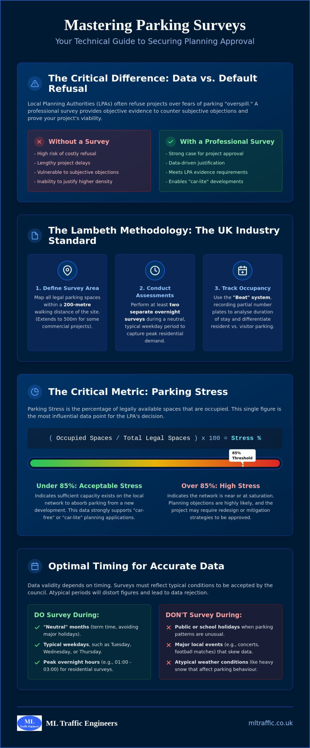
A parking survey for planning application is a technical audit designed to quantify existing parking demand and residual capacity within a specific radius of your site. It serves as the primary evidence base to prove that your development won’t create “unacceptable” parking stress on local streets. For developers, this data is vital because local councils often implement parking mandates that require specific levels of provision or empirical proof that overspill won’t occur. Without this data, the Local Highway Authority (LHA) cannot verify your claims, often leading to a recommendation for refusal.
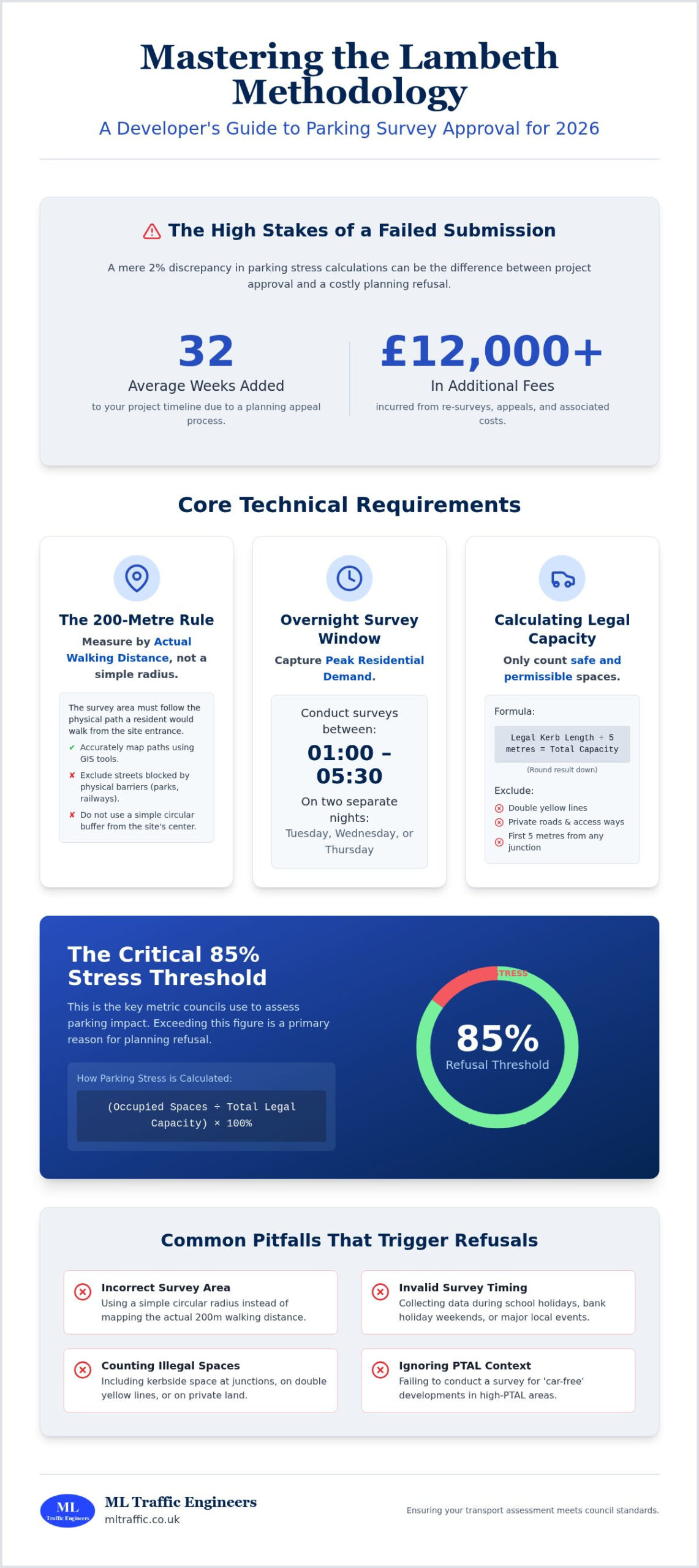
Councils determine the survey area based on the “Zone of Influence.” For residential projects, this is typically a 200-metre walking distance from the site entrance. For commercial sites, the radius may extend to 500 metres. The survey captures every available kerb space, accounting for driveways, yellow lines, and dropped kerbs. Precision is a functional necessity here. If your survey area is incorrectly defined, the resulting stress figures will be skewed, rendering the report invalid for planning purposes.
When is a Parking Survey Legally Required?
Local planning authorities usually trigger the requirement for a survey in three specific scenarios:
- Zero-parking developments: When you propose no on-site parking in areas with high Public Transport Accessibility Levels (PTAL), you must prove the surrounding streets can absorb any potential visitor or resident overspill.
- Intensification of use: Substantial increases in residential units or commercial floor space often require a fresh look at local capacity to ensure public safety.
- High-demand locations: If your site sits on a narrow street or in an area with known parking shortages, the council will demand a robust Transport Assessment supported by fresh survey data.
The Consequences of Inadequate Parking Data
Inaccurate or poorly timed data creates immediate risks for your project lifecycle. A formal objection from the LHA based on flawed data is difficult to overturn. If you conduct a survey during a school holiday or use the wrong methodology, you’ll likely face a request to repeat the work at your own expense. This causes significant delays to the planning committee date. Local resident groups also scrutinise parking data during the consultation phase. If your report lacks technical integrity, it provides an easy target for legal challenges that can stall your progression to the next stage.
Understanding Survey Methodologies: The Lambeth Standard
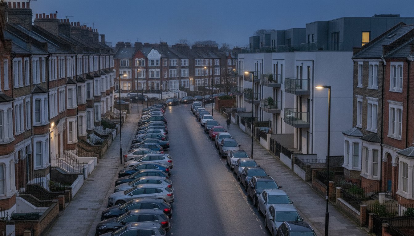
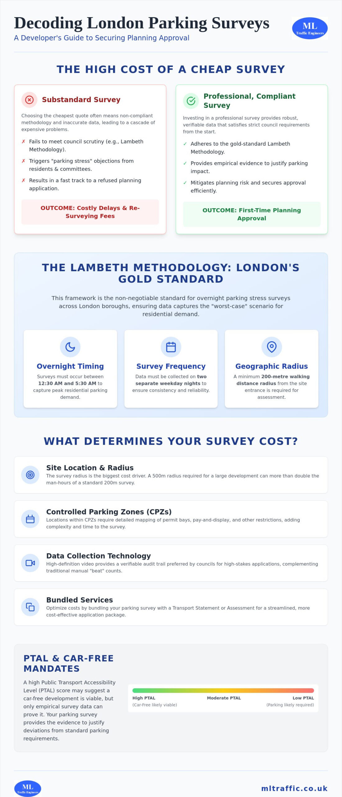
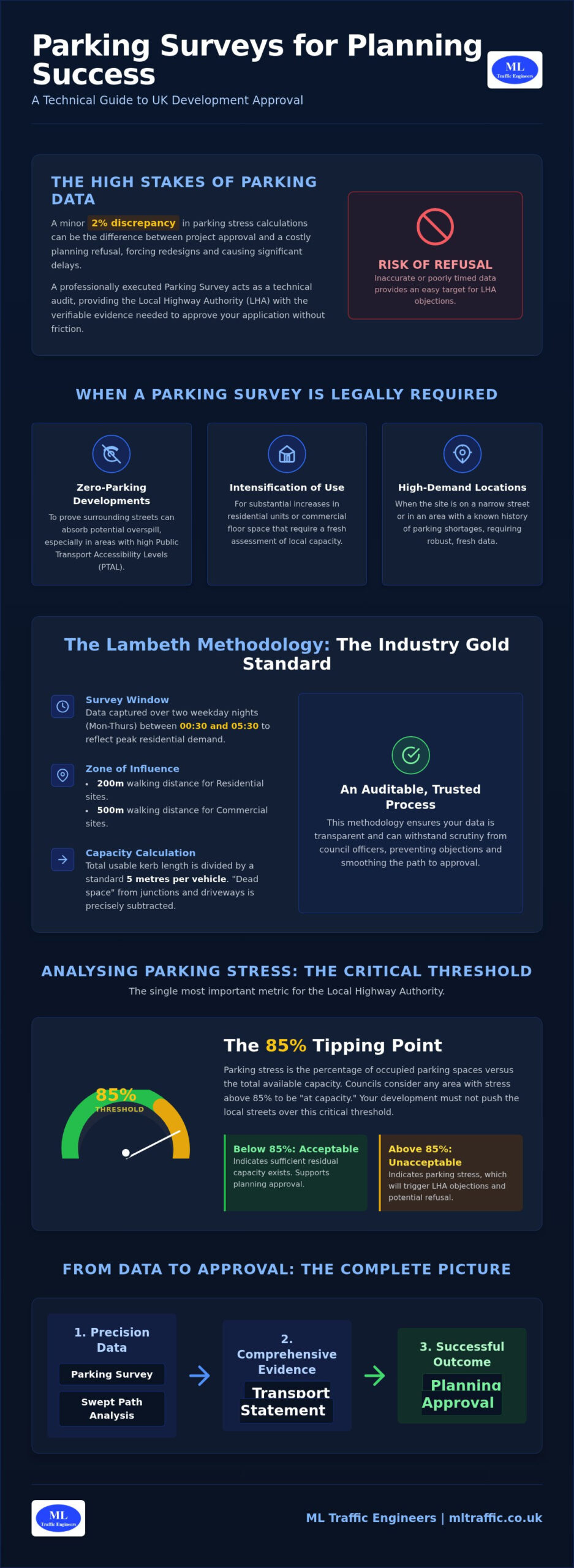
The Lambeth Methodology is the definitive framework for conducting a parking survey for planning application within London and increasingly across the UK. It provides a transparent, auditable process that Highway Authorities trust. The core requirement involves capturing data over two separate weekday nights, typically between Monday and Thursday. This ensures the results represent “neutral” peak residential demand, free from the anomalies of weekend travel patterns or local events. The results must be auditable. Our technical teams ensure every data point stands up to independent verification by council officers.
Precision in calculating capacity is what separates a compliant report from a rejected one. Under the Lambeth standard, we don’t just count cars; we map every metre of available kerb space. We define capacity by dividing usable kerb length by 5 metres per vehicle. It’s vital to subtract “dead” space, such as 10-metre clearance zones at junctions, dropped kerbs, and driveways. If you’re unsure which variation applies to your borough, our experts can help you define the correct parking survey scope.
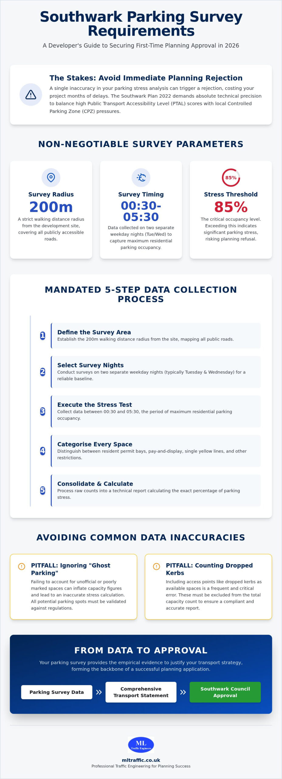
While Lambeth is the baseline, many authorities introduce unique requirements. For instance, Southwark or Wandsworth may demand specific data on permit holder occupancy versus visitor pay-and-display usage. Some boroughs also require a higher level of granularity in how “legal” spaces are categorised near Controlled Parking Zones (CPZs). Ignoring these borough-specific tweaks is a frequent cause of planning delays.
The Mechanics of the Lambeth Methodology
The survey window is strictly defined between 00:30 and 05:30. This timeframe captures the period when most residents are home, providing the most accurate reflection of maximum parking stress. The survey extent follows a 200-metre walking distance from the site entrance. This is considered the maximum distance a resident will realistically walk from their vehicle to their front door. Every vehicle is categorised by bay type to ensure the Highway Authority understands exactly who is using the street and when.
Custom Scopes for Specific Development Types
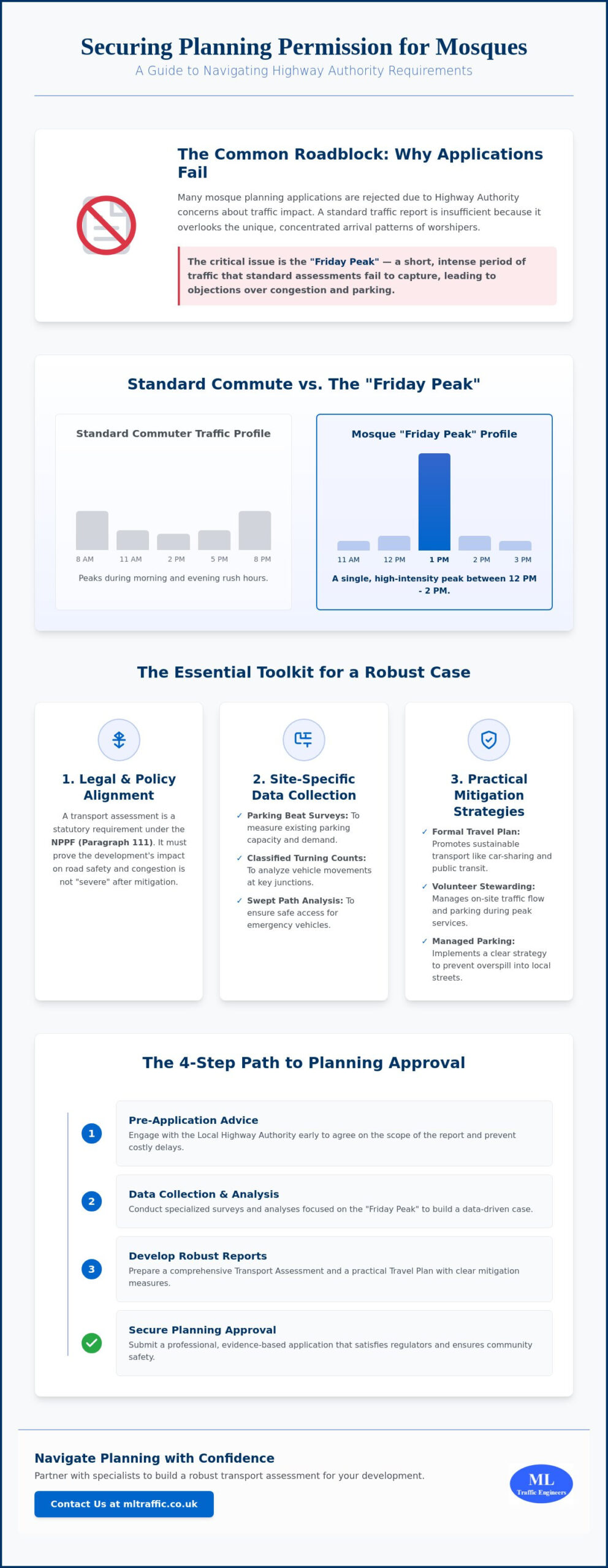
Not every project fits the residential overnight model. Retail or office developments require daytime audits to capture peak operational hours, often conducted on an hourly basis. Places of worship or leisure centres might require event-based surveys to account for specific peak gatherings. Educational institutions often face “school-run” surveys. These assess the immediate impact of drop-off and pick-up activities on local traffic flow and safety. We integrate these findings directly into a Transport Statement to provide a complete picture of site feasibility.
Analysing Parking Stress and Site Capacity
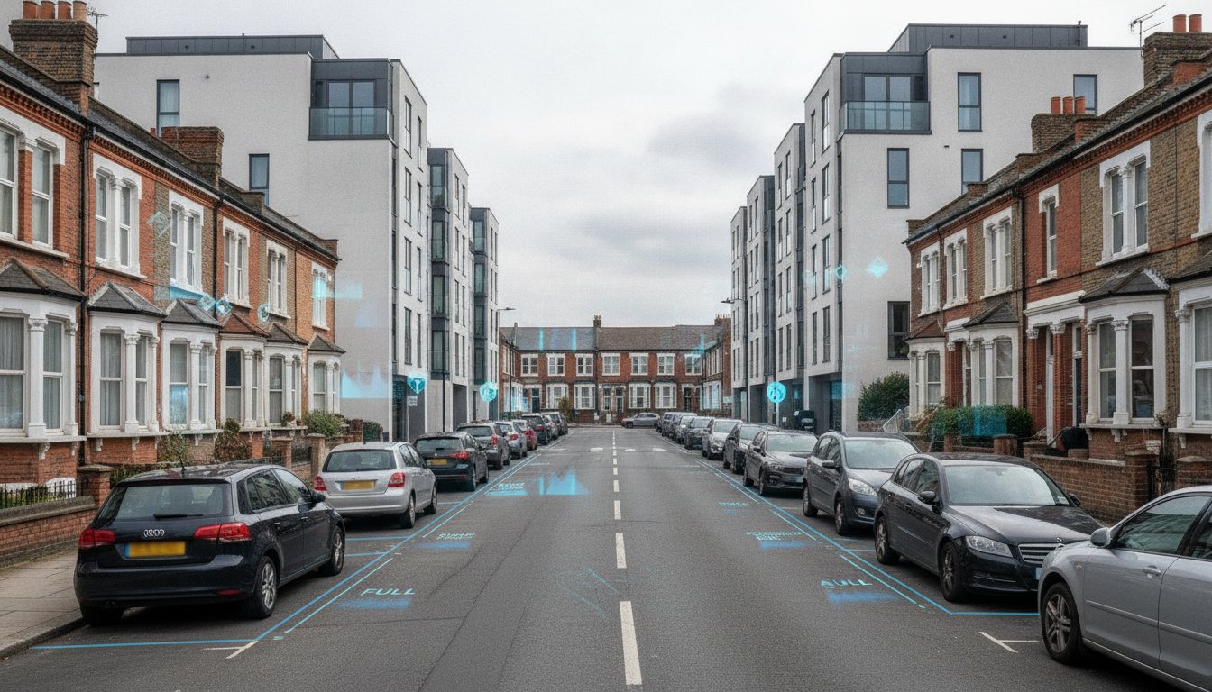
Once the raw data from a parking survey for planning application is collected, the focus shifts to technical analysis. This stage determines whether your development is perceived as a benefit or a burden to the local infrastructure. We translate the physical vehicle counts into a parking stress percentage, which serves as the primary metric for the Highway Authority’s decision. High stress levels indicate that the local network is nearing saturation, while lower figures suggest the area can safely absorb the additional demand your project might generate.
The “Critical Threshold” is a vital benchmark in this analysis. Most UK councils, particularly within London, view 85% to 90% parking stress as the tipping point. When occupancy exceeds 85%, drivers often spend significant time searching for spaces, leading to increased emissions and unsafe double-parking. If your survey results show existing stress levels above this threshold, you must provide a robust justification or mitigation strategy to avoid a recommendation for refusal. Conversely, demonstrating low stress is a powerful tool for justifying car-free developments in high-density urban areas.
Calculating Parking Stress Percentages
Precision in calculation is non-negotiable for regulatory compliance. We use a standard formula to derive these figures: (Number of vehicles parked / Total legal capacity) x 100. Parking stress is the ratio of vehicle count to legal kerbside capacity. A result of 100% or higher usually indicates that vehicles are parked in non-designated areas, such as across dropped kerbs or too close to junctions. For a planning officer, “spare capacity” is only truly available if the post-development stress remains below the 85% limit. Our reports provide a clear, auditable trail of these calculations to ensure your data withstands scrutiny during the consultation phase.
Assessing On-Street Impact
Predicting “overspill” is the next logical step in your Transport Statement. We calculate the likely number of additional vehicles your development will introduce to the street based on census data and the site’s specific use class. If the predicted overspill pushes local stress beyond the critical 85% threshold, you’ll need effective mitigation. Proposing “Permit Free” agreements via Section 106 is a common solution; this legally prevents future occupiers from obtaining on-street parking permits.
The site’s PTAL rating also plays a significant role here. In areas with high public transport accessibility, councils are more likely to accept lower on-site parking provision if the survey proves the surrounding streets aren’t already at capacity. Combining these survey insights with expert Travel Plans can significantly strengthen your position, showing a proactive approach to reducing car dependency and maintaining local highway safety.
Planning and Executing Your Parking Survey
Success begins long before our enumerators arrive on-site. The first stage of a robust parking survey for planning application involves a direct consultation with the Local Highway Authority. We recommend agreeing on the survey scope, radius, and timing before any data collection occurs. This proactive step eliminates the risk of the council rejecting your findings later. Once the scope is locked, we move to identifying a “neutral” window that reflects typical street conditions, ensuring your data is beyond reproach during the planning committee review.
Our execution process follows a logical, four-step sequence designed for maximum precision. After consultation, we schedule the survey during neutral periods. Step three involves the actual site visit where experienced traffic enumerators record vehicle locations and bay types. Finally, our transport engineers process this raw data to draft a technical report. This report bridges the gap between raw numbers and the planning-compliant evidence required for your submission. If you’re ready to secure your project timeline, you can book a parking survey to start the consultation process today.
Selecting the Optimal Survey Window
Timing is the most frequent point of failure for developer-led surveys. Councils generally prefer “neutral months” such as May, June, September, and October. These periods avoid the seasonal anomalies of summer holidays, Christmas, and Easter, which can artificially lower parking stress figures. Submitting data collected during a school holiday is a near-guarantee for a planning refusal. We also cross-reference your site location with a local “Events Calendar.” A nearby football match or a street festival can create “anomalous data” that doesn’t represent day-to-day reality. We ensure roadworks aren’t scheduled for your survey nights, as temporary closures can shift parking demand to adjacent streets and skew your results.
Data Collection Technologies
Choosing the right technology is essential for data integrity. While manual beat surveys, where enumerators walk the route, remain highly effective for detailed bay categorisation, we often utilise Video or ANPR technology for larger-scale assessments. Video data provides an auditable record that allows for secondary verification if a council officer challenges the results. Modern planning submissions now frequently require photographic evidence to prove the “legal” status of the spaces counted. At ML Traffic Engineers, we verify every data point against current site conditions, ensuring that your traffic surveys meet the highest standards of regulatory compliance.
Integrating Surveys into Your Transport Statement
A parking survey for planning application provides the empirical foundation for a Transport Statement. Data collection is only half the battle; the true value lies in how that data is synthesised to justify your development’s footprint. We don’t just present raw numbers to the Highway Authority. We build a technical narrative that proves your site is sustainable and safe. By integrating survey results with Swept Path Analysis, we demonstrate that even with existing on-street parking, emergency and service vehicles can safely manœuvre around the site.
This integrated approach is essential for negotiating planning obligations. If your survey shows high parking stress, we use that data to propose targeted Section 106 contributions or parking permit restrictions. This proactive stance shows the council that you’ve considered the impact on the wider community. It often makes the difference between a flat refusal and a conditional approval. A professional engineering narrative “sells” the data by contextualising it within local and national policy frameworks.
From Raw Data to Planning Justification
We translate raw data into a “Parking Technical Note” that speaks directly to the Planning Officer’s requirements. Visualisation plays a major role here. We use heat maps and charts to show capacity at a glance, making it easier for stakeholders to digest complex occupancy patterns. When local resident groups raise objections regarding parking loss, we counter these concerns with empirical, third-party data. Facts are the most effective way to manage the consultation phase and protect your project from delays caused by anecdotal evidence.
Why Expert Engineering Analysis Matters
There is a significant difference between a simple “data collector” and a transport planning consultant. A collector provides a spreadsheet; a consultant provides a solution. At ML Traffic Engineers, we interpret complex datasets to identify the most viable path to approval. We understand the nuances of borough-specific requirements and how to leverage PTAL ratings to your advantage. Our teams manage the full project lifecycle, from initial data collection to the final report submission. If you’re ready to advance your development, secure a quote for your parking survey today to ensure your submission is robust and compliant.
Securing Approval for Your 2026 Development
Securing planning permission in a high-stakes regulatory environment requires a strategic approach to data collection. By mastering the Lambeth Methodology and identifying neutral survey windows, you eliminate the common pitfalls that lead to council objections. A robust parking survey for planning application acts as the technical foundation for your site’s feasibility. It provides the empirical proof needed to justify car-free designs or negotiate Section 106 permit restrictions effectively. Precision data is not just a requirement; it is your strongest tool for design justification.
Since 2014, we’ve acted as dependable partners for developers, providing precision data collection for Transport Statements across England. Our team specialises in navigating the intricate planning requirements of individual London Boroughs to ensure your project moves to the next stage without delay. We understand the urgency of your timeline and the necessity of adherence to industry standards. Let us manage the complexities of regulatory compliance so you can focus on the progression of your site layout. Your development deserves a compliant evidence base that stands up to every level of scrutiny.
Take the first step toward a successful submission today. Request a Professional Parking Survey Quote and let our experts secure the data you need for approval.
Frequently Asked Questions
How long is a parking survey valid for a planning application?
A parking survey for planning application is typically valid for six to twelve months. Most local authorities in England prefer data collected within the last six months. This ensures it reflects current street conditions accurately. If your submission is delayed, you may need to provide a technical note justifying the older data. Alternatively, you can conduct a fresh survey to avoid a formal objection from the council.
What is the Lambeth Methodology for parking surveys?
The Lambeth Methodology is the industry standard for London parking surveys. It requires counting parked vehicles on two separate weekday nights between 00:30 and 05:30. The survey covers a 200-metre walking distance from the site entrance. This methodology ensures a consistent, auditable framework that councils use to assess parking stress accurately. We deliver these technical reports to meet strict statutory planning requirements across the UK.
Can I do my own parking survey for my planning application?
Councils generally require an independent, professional parking survey for planning application to ensure data integrity. Self-conducted surveys are often viewed as biased. They lack the technical rigour required for a compliant Transport Statement. Using an experienced traffic engineer ensures your data is collected during neutral periods and follows recognised methodologies. This professional oversight reduces the risk of your application being refused due to inadequate evidence during the consultation.
What happens if my parking survey shows 100% stress?
If your survey shows 100% parking stress, the council will likely conclude that local streets cannot absorb additional demand. You must propose robust mitigation to secure approval. This often includes legal agreements to make the development “permit-free.” Our engineers help interpret this complex data to find a viable path toward planning success. We ensure your submission remains compliant with local transport policies while minimising the impact on your site layout.
How much does a professional parking survey cost in the UK?
The cost of a professional survey varies based on site location and the required radius. Council methodology requests also impact the price. Factors like the number of nights surveyed and parking restriction complexity influence the final cost. We recommend requesting a tailored quote to match your local authority’s validation requirements exactly. This prevents the high costs of repeating surveys due to incorrect timing or methodology errors during the initial assessment.
Are parking surveys required for car-free developments?
Yes, car-free developments frequently require surveys to prove they won’t negatively impact the local highway. Even without on-site parking, the council needs empirical proof. They must ensure visitors or residents who own cars won’t cause “overspill” stress on adjacent streets. A robust survey demonstrates current capacity. It helps justify why a car-free approach is sustainable for that specific location, especially in areas with high public transport accessibility levels.
What are “neutral periods” in traffic and parking surveys?
Neutral periods represent typical, day-to-day demand. These periods exclude school holidays, bank holiday weeks, and significant local events that could skew results. Councils in England prefer surveys conducted in May, June, September, or October. Collecting data outside these windows often leads to “anomalous data.” Highway Authorities frequently reject this, causing significant project delays and additional costs for the developer. We ensure all surveys are scheduled during these optimal windows.
How many nights do you need for a residential parking survey?
A standard residential survey requires data collection over two separate weekday nights. This usually occurs between Monday and Thursday. It captures peak residential demand when most occupants are at home. Some local authorities may request additional nights if the site is near a major transport hub or a high-demand venue. We always check specific borough requirements to ensure your survey scope is fully compliant before our team starts the data collection process.

Disclaimer
The content on mltraffic.co.uk, including all technical articles, guides, and resources, is provided for general informational and educational purposes only. It is not intended to constitute professional advice in traffic engineering, transportation planning, development approvals, or any other technical or legal field.
While ML Traffic Engineers makes every reasonable effort to ensure the accuracy, completeness, and timeliness of the information published, we do not provide any warranties or representations (express or implied) regarding its reliability, suitability, or availability for any particular purpose. Any reliance you place on the content is strictly at your own risk.
In no event shall ML Traffic Engineers, its directors, employees, authors, or affiliates be liable for any direct, indirect, incidental, special, consequential, or punitive damages (including, without limitation, loss of profits, data, or business opportunities) arising out of or in connection with the use of, or inability to use, any information provided on this website.
The articles and guides on this site are not a substitute for engaging a qualified, professional traffic engineer to assess your specific project requirements. For tailored advice, compliance assessments, or traffic engineering services, please contact a competent professional.
This disclaimer may be updated from time to time without notice. By accessing or using this website, you agree to be bound by the most current version of this disclaimer.