Tag: residential planning

  • Swept Path Analysis for Residential Cul-de-Sacs

    Swept Path Analysis for Residential Cul-de-Sacs

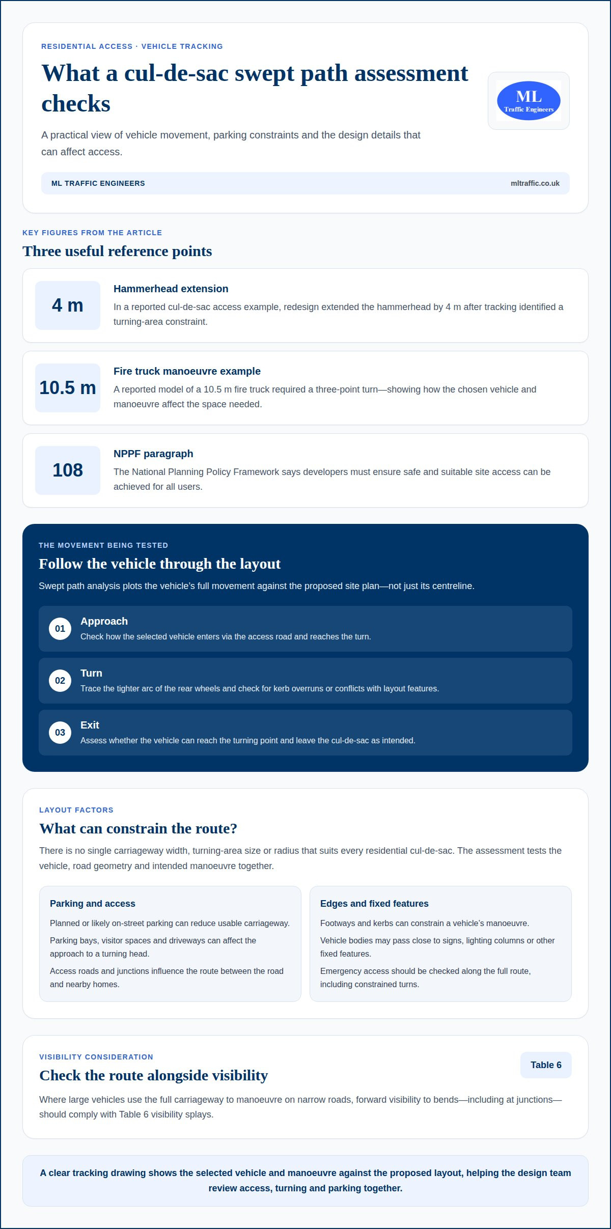
    A cul-de-sac’s turning space is only adequate if the vehicles expected to use it can manoeuvre within the layout. Swept path analysis for a residential cul-de-sac tests how vehicles enter, turn and leave, accounting for the tighter path followed by rear wheels. It can show whether access roads, turning areas and parking layouts create conflicts or require adjustment.

    It’s easy to focus on a road’s overall shape, but vehicle dimensions and turning movements also determine whether a design works in practice. Refuse and recycling vehicles are among the larger vehicles that regularly access residential areas, so their movements can influence a cul-de-sac’s layout.

    This guide explains what swept path analysis checks, which vehicles may need to be assessed, and how the results can support planning approval and construction requirements. It also considers how CAD-based and browser-based software can represent vehicle movements, and what affects the quality of an assessment.

    The analysis helps assess access, turning and parking before a layout is built. Understanding these checks makes it easier to identify the design questions an assessment should answer and the information a professional needs to assess them.

    Key Takeaways

    • Understand how turning radius and vehicle movement shape the space needed for a cul-de-sac manoeuvre.
    • See why parking positions, access geometry and likely on-street parking all matter when assessing vehicle routes.
    • Learn how CAD-based and browser-based software can model vehicle movements against a proposed layout.
    • Identify which vehicles to include by considering who is expected to use the development, from refuse vehicles to emergency services.
    • Discover how a professional swept path assessment can support planning and construction decisions, and where ML Traffic Engineers UK’s service fits.

    What is Swept Path Analysis?

    Swept path analysis models a vehicle moving through a proposed layout. It traces the approach, turn and exit to show whether the manoeuvre fits the available space.

    Vehicle Turning Geometry

    During a turn, a vehicle’s rear wheels follow a tighter arc than its front wheels. Vehicle dimensions, steering and turning radius all affect the space needed, so the model traces the vehicle’s full movement, not just its centreline.

    To commission an assessment, provide a CAD layout showing the proposed road geometry and relevant site features. Include the vehicle type and intended route through the cul-de-sac. With these inputs, the professional can plot the vehicle path against the design and assess whether the manoeuvre fits.

    Turning Space and Safe Movement

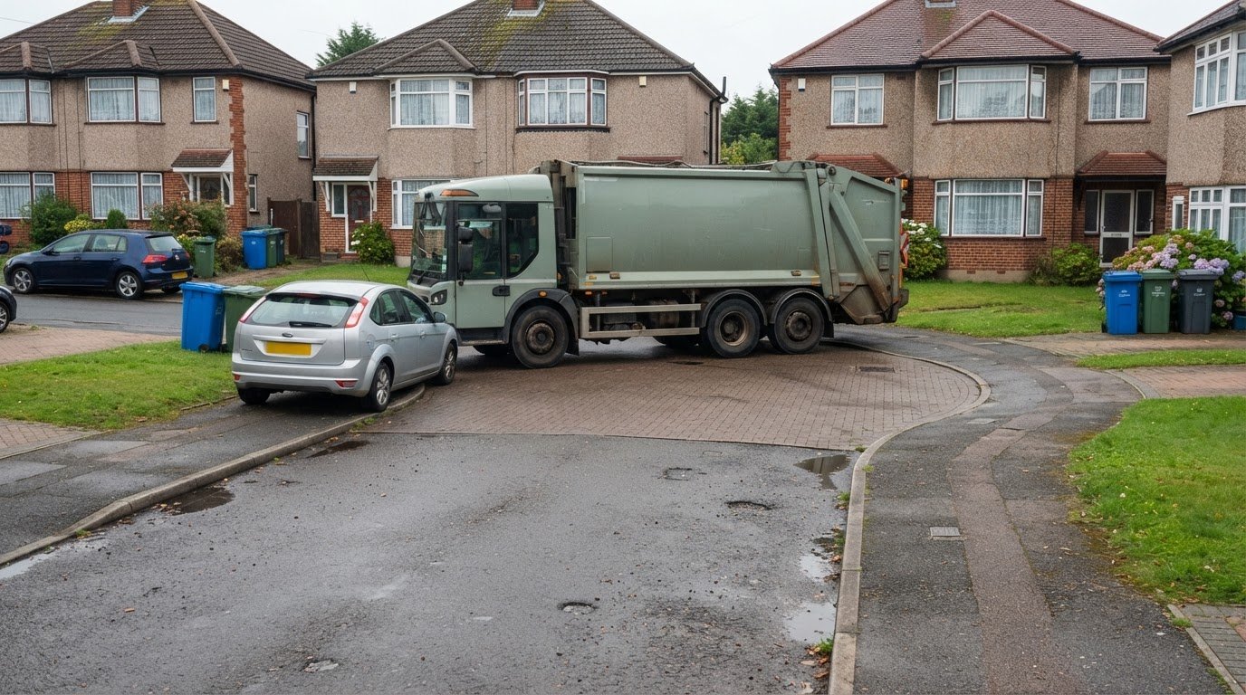
    The model shows whether a vehicle can negotiate bends, enter parking facilities and reach a turning point without conflicts. For example, a refuse vehicle may need to use a turning head before leaving a cul-de-sac forwards.

    The assessment can identify where the wheels or body could overrun kerbs or conflict with layout features. Designers can then review the turning area, kerb positions and route. In one reported example, a 10.5 m fire truck model required a three-point turn, illustrating how the selected manoeuvre affects the space needed.

    Vehicles and Turning Templates

    The vehicles and templates required depend on the site’s expected use and the relevant highway authority’s requirements. Refuse vehicles and fire tenders may need to be assessed for residential access. Removal vehicles may also be relevant, while buses matter where public transport will serve the development.

    No single vehicle template represents every UK residential scheme. A professional selects models relevant to the access requirements and tests their routes against the proposed layout. A clear drawing identifies each selected vehicle and manoeuvre for the project team to review.

    Carriageway Widths and Turning Areas

    No single carriageway width, turning-area size or radius suits every residential cul-de-sac. Required dimensions depend on the selected vehicle, its turning radius, the road geometry and the intended manoeuvre. The assessment tests these elements together, rather than treating carriageway width alone as proof that access works.

    The National Planning Policy Framework states in paragraph 108 that developers must ensure safe and suitable site access can be achieved for all users. A professional assesses the proposed design against the relevant local guidance and vehicles expected to use it, then plots the movement on the site plan. CAD-based swept path analysis can map the selected vehicle’s route onto that drawing.

    Parking layouts and access roads

    Paragraph 108 of the National Planning Policy Framework states that developers must ensure safe and suitable site access can be achieved for all users. For a residential scheme, this means considering how parking spaces, access roads and junctions work together as vehicles enter, move through and leave the site.

    A swept path assessment should account for planned or likely on-street parking. A parked car can reduce the usable carriageway and change the space available for a refuse or emergency vehicle to turn. Parking bays, visitor spaces and driveways can also affect a vehicle’s approach to a turning head or its route between a junction and nearby homes.

    There is no single minimum carriageway width, turning-area size or radius for every UK residential cul-de-sac. The suitable layout depends on the design vehicle, road geometry and relevant local guidance. The assessment tests these elements together, rather than treating carriageway width alone as evidence that access works.

    Footways, kerbs and street furniture can constrain manoeuvres. A wheel may overrun a kerb, or a vehicle body may pass close to a sign, lighting column or other fixed feature. Plotting the vehicle against these elements helps identify where the parking arrangement, footway or access layout may need adjustment.

    Emergency access needs to be assessed along the full route. Vehicle tracking can test whether an emergency service vehicle can use the proposed access road and negotiate its turns. The results help the design team assess whether the route accommodates the selected vehicle, including at constrained points near junctions or turning areas.

    Visibility also matters where large vehicles use the full carriageway to manoeuvre on narrow roads. Forward visibility to bends, including at junctions, should comply with Table 6 visibility splays. Considering the vehicle’s path alongside visibility helps show how a manoeuvre relates to approaching road users.

    Tracking results can inform practical layout changes. In a reported cul-de-sac access example, redesign extended the hammerhead by 4 m. The change illustrates how an assessment can identify a specific constraint and help the design team consider a revised turning area.

    Where parking demand affects the proposed arrangement, a parking survey service can provide relevant information about parking patterns. Combining that evidence with vehicle tracking helps assess whether access and parking proposals work together.

    Swept path analysis can help assess whether residential parking layouts, turning areas and access roads accommodate vehicles expected to use them safely. Projects requiring vehicle access will usually need swept path analysis. It also helps designers assess whether vehicles can exit a site onto a street without reversing. For a residential scheme in Leicestershire, a vehicle-tracking exercise assessed whether the proposed access road could accommodate emergency service vehicles. Leicestershire Highway Design Guide requires swept path details for refuse vehicles 11.2 m long and at turning heads, unless the local borough or district already uses a larger vehicle.

    A townhouse site with 90-degree bin storage in a rear lane illustrates how site constraints can affect servicing: waste trucks could not reverse in because of the narrow width and power poles. Testing vehicle movements against the proposed layout can help identify such conflicts before the arrangement is finalised. It can also inform decisions about storage locations and access geometry, while checking that vehicles can manoeuvre safely through the site and reach the street without reversing.

    How professionals use CAD-based and browser-based swept path software

    Software models vehicle movements on a proposed layout. Engineers use the model to examine entry, turning and exit routes against the plan. AutoTURN, Pathplanner and SimWalk are examples of software used for swept path analysis. The platform matters less than whether the assessment represents the actual layout and vehicle movement.

    A CAD layout is a key input. Swept path specialists need drawings that show the road geometry and relevant site features. The software can then plot the vehicle path against the drawing, showing where its wheels and body travel relative to the design. If the layout changes, the model can be updated to assess the revision.

    The professional sets the vehicle parameters and route before interpreting the output. Software can account for vehicle dimensions, turning radius, layout and movement characteristics. These inputs shape the result: a refuse vehicle model does not represent every other vehicle using the development. Vehicle selections therefore need to match the site’s intended use.

    CAD-based and browser-based tools offer different ways to carry out and review a digital assessment. The key question is whether the chosen workflow can use the project drawing and clearly represent the required vehicle manoeuvre. A platform label alone cannot show whether a cul-de-sac works. The vehicle path must be assessed against the kerbs, turning areas, access route and other fixed features on the plan.

    Software also helps professionals compare design options. Multiple vehicle types can be tested quickly, helping a team identify where a layout needs closer attention. For example, a proposed turning head can be assessed against a refuse vehicle’s path, then tested again if its geometry changes. Each model remains specific to its selected vehicle and route.

    Interpreting the result takes more than producing a graphic. The professional checks the vehicle’s tracked route against the drawing for conflicts and areas where the manoeuvre may not fit. A path that crosses a kerb or overlaps a fixed obstacle can indicate a design issue. The team can then discuss a layout adjustment and model its effect.

    For a residential cul-de-sac, the useful output is a clear drawing showing the selected vehicle’s movement on the proposed site plan. It helps planners and designers understand the access case and any constraints identified by the model. Its value depends on accurate drawings, suitable vehicle inputs and a route that reflects how the site will operate.
    Swept Path Analysis for Residential Cul-de-Sacs

    Vehicles for UK Residential Cul-de-Sac Swept Path Analysis

    Select vehicles according to the movements expected at the development. A residential assessment may include cars and refuse trucks, with fire tenders, removal vehicles or buses added where they will use the site. Each model represents a particular vehicle, so a successful car manoeuvre alone does not show that a larger service vehicle can turn.

    Refuse and recycling vehicles often influence residential road and turning-head design because they regularly access homes. The right vehicle depends on the scheme’s collection arrangements and access requirements. A professional should establish which waste vehicle needs access, then assess its route through the site, including entry, turning and exit.

    Emergency service vehicles may also need to be assessed. Their inclusion depends on the access function and the vehicles expected to use the proposed road. A fire tender model can be tested against the site plan to assess its manoeuvre through constrained areas. The aim is to evaluate the actual route, not assume a layout suitable for residents’ cars will also suit emergency access.

    Delivery vehicle selection should reflect the development’s likely use. An 8.8 m Medium Rigid Vehicle is listed as a typical design vehicle for small commercial deliveries. A 12.5 m Heavy Rigid Vehicle is listed for Council waste trucks and medium freight. These examples describe vehicle classes; they do not automatically establish which model a residential scheme requires.

    Public transport brings another design consideration. Where a development will have bus services, include a bus in the tracking assessment. If no bus movement is planned, a bus model may not help answer the access question. Removal vehicles are relevant where residents need to move goods through the proposed road and turning areas.

    Large articulated vehicles should be selected only where the site’s expected movements make them relevant. A 19.0 m articulated vehicle is listed as a typical design vehicle for a standard semi-trailer. That does not mean every residential cul-de-sac needs to accommodate one. The vehicle choice should follow the development’s access requirements and expected users.

    A professional assessment can make the vehicle selection clear by linking each model to a specific site movement. For example, the drawing can show a refuse vehicle’s route to a turning head or a bus’s path through planned public-transport access. This helps the project team and planners understand what each test assesses and how it relates to the proposed development.

    What UK design standards and guidance apply to vehicle tracking in residential streets and cul-de-sacs?

    UK vehicle tracking is assessed against national planning policy and highway design guidance relevant to the site. These have different purposes: policy addresses suitable access, while highway guidance can set more detailed expectations for layout and vehicle movements. Local authority guidance also matters because a cul-de-sac may need to accommodate vehicles used by local services.

    Leicestershire Highway Design Guide provides a specific example of local requirements. It requires swept path analysis for 18.55 m long heavy goods vehicles where they need to be accommodated. This does not mean every residential street must accept that vehicle. The key consideration is whether the proposed development needs to provide for it.

    For a residential scheme, the professional first identifies the relevant guidance and the vehicles expected to use the access. The assessment then models those vehicles against the proposed drawings. This connects the design criteria to the actual layout, rather than applying a vehicle template without considering how the site will be used.

    Local requirements can also specify how the model represents vehicle movement. The Leicestershire Highway Design Guide sets modelling-speed requirements for forward and reversing manoeuvres. These inputs affect the simulated route, so the assessment must follow the approach specified by the relevant guidance. The resulting drawing should clearly identify the selected vehicle and movement.

    Visibility and manoeuvring need to be considered together on narrow streets. Where large vehicles use the full carriageway, forward visibility to bends, including junctions, should comply with Table 6 visibility splays. This connects the vehicle’s turning movement with what approaching road users can see, rather than treating tracking and visibility as unrelated checks.

    The National Planning Policy Framework also provides a national planning context for site access. Its paragraph 108 states that developers must ensure safe and suitable site access can be achieved for all users. A vehicle-tracking drawing can help explain how the proposed access works for its selected vehicles, alongside the wider planning information for the development.

    For a robust submission, the professional should identify the relevant guidance, explain the selected design vehicles and show their routes on a legible site drawing. If the local authority raises access concerns during pre-application discussions or assessment, the tracking can address the specific manoeuvre or layout issue. Discuss your proposed access layout when you need a professional assessment of vehicle movements.

    ML Traffic Engineers UK: Swept Path Analysis

    ML Traffic Engineers UK provides swept path analysis to assess vehicle movements against proposed residential layouts. Use the service when a planning review raises access questions, a turning area needs assessment or design drawings need clear vehicle-tracking evidence. The analysis can show how selected vehicles move through the site and where the design may need attention.

    Where a development also needs wider transport documentation, Transport Statements and Transport Assessments can support planning applications. Parking Surveys can provide information about parking conditions around a proposed scheme. The appropriate scope depends on the planning and access questions the project needs to address.

    Share your proposed layout and the vehicle movements requiring assessment to discuss the project. Contact ML Traffic Engineers UK to discuss swept path analysis for your residential cul-de-sac.

    Move your residential access design forward

    The next step is to match the proposed layout with the vehicles expected to use it. A swept path analysis for a residential cul-de-sac can inform decisions as the design develops, rather than leaving access questions until later project stages. Start by identifying the movement or planning issue the assessment needs to address.

    With that focus, the resulting drawing can support a more informed discussion about the scheme’s access arrangements. It gives the project team a practical basis for considering whether the proposed layout accommodates the expected vehicle movements. Contact ML Traffic Engineers UK to discuss swept path analysis for your development and its planning requirements.

    Contact ML Traffic Engineers UK to discuss your residential access project and its vehicle-tracking requirements. A clear next step can help you progress the design with greater confidence.

    Frequently Asked Questions

    What is swept path analysis for a residential cul-de-sac?

    Swept path analysis assesses whether vehicles can manoeuvre through a proposed residential layout. For example, a planning submission may need to show that a refuse vehicle can reach a turning point and leave without conflicting with the design. The assessment considers a specified vehicle and route, helping the project team explain how the proposed access functions and identify layout issues that need attention.

    How is swept path analysis carried out professionally using vehicle-tracking software?

    A professional uses a site drawing and a suitable digital vehicle model to plot the proposed manoeuvre. Software such as AutoTURN, Pathplanner or SimWalk can show the vehicle’s movement against the drawing. The professional reviews the resulting track for conflicts and can model a revised layout if needed. The final tracking drawing presents the assessed route and helps communicate the access arrangement to the project team or planning authority.

    What common swept path analysis failures cause planning or highway approval to be refused?

    A swept path assessment can reveal issues such as insufficient turning space, vehicle paths over kerbs, or conflicts with parking, street furniture and other fixed features. These findings do not, by themselves, establish that planning or highway approval will be refused.

    Michael Lee

    Article by

    Michael Lee

    Transport planner with over 35 years' experience.

    Disclaimer

    The content on mltraffic.co.uk, including all technical articles, guides, and resources, is provided for general informational and educational purposes only. It is not intended to constitute professional advice in traffic engineering, transportation planning, development approvals, or any other technical or legal field.
    While ML Traffic Engineers makes every reasonable effort to ensure the accuracy, completeness, and timeliness of the information published, we do not provide any warranties or representations (express or implied) regarding its reliability, suitability, or availability for any particular purpose. Any reliance you place on the content is strictly at your own risk.
    In no event shall ML Traffic Engineers, its directors, employees, authors, or affiliates be liable for any direct, indirect, incidental, special, consequential, or punitive damages (including, without limitation, loss of profits, data, or business opportunities) arising out of or in connection with the use of, or inability to use, any information provided on this website.
    The articles and guides on this site are not a substitute for engaging a qualified, professional traffic engineer to assess your specific project requirements. For tailored advice, compliance assessments, or traffic engineering services, please contact a competent professional.
    This disclaimer may be updated from time to time without notice. By accessing or using this website, you agree to be bound by the most current version of this disclaimer.
  • Swept Path Analysis for Residential Driveway Access in the UK

    Swept Path Analysis for Residential Driveway Access in the UK

    A driveway’s usable width is only part of the picture. Swept path analysis for residential driveways models how a vehicle enters, turns and exits, showing its wheel paths and the space its body occupies. This can reveal whether walls, gates, kerbs or other features restrict the manoeuvre.

    It is easy to focus on whether a car fits when parked, but access also depends on whether it can pass through the entrance and turn within the available space. Larger service vehicles may also need to be considered, depending on the development and the movements being assessed.

    This guide explains what a swept path drawing shows, how analysis supports driveway and development access, and what planning authorities may request in the UK. It also covers the information needed to model movements, the role of specialist software and how findings can inform layout changes before plans are finalised.

    Key Takeaways

    • A swept path drawing shows more than whether a vehicle fits: it maps wheel paths, body position and the space needed through a manoeuvre.
    • Choose the design vehicle and manoeuvre to match the access being assessed, including service or emergency vehicle movements where relevant.
    • Accurate site layouts help reveal potential conflicts with gates, walls, kerbs, parking and other fixed features before plans are finalised.
    • Planning authority requests can depend on the development and local requirements, so assess access needs early in the application process.
    • Specialist tracking software models vehicle movements, while swept path analysis can support driveway design and planning documentation.

    What is a Swept Path Analysis?

    A swept path analysis models a vehicle’s movement through a site using its dimensions and turning characteristics. For residential access, it can show whether selected vehicles can enter, manoeuvre and leave without conflicting with the layout.

    Emergency Vehicle Access

    For emergency access, the analysis tests a selected emergency vehicle’s route through the site. It can show whether the vehicle can reach the required area, negotiate bends and clear fixed features such as walls, gates and parked vehicles.

    Review the entire manoeuvre, not just the entrance. A drawing can illustrate forward and reverse movements, including whether the vehicle can leave in forward gear or must reverse. This helps identify tight turns and obstructions that may affect access.

    For example, a proposed driveway might admit a car but constrain a larger emergency vehicle at a boundary wall. Modelling both movements makes the difference clear on the plan, so the access layout can be reviewed before it is finalised.

    Delivery and Refuse Vehicle Access

    Delivery and servicing movements can be tested against the driveway, parking area and route through the site. The vehicle’s turning path shows whether it can reach a drop-off point, turn around or leave without crossing into a wall, gate or neighbouring space.

    Refuse vehicles need particular consideration because they are among the largest vehicles that regularly access residential areas. The appropriate design vehicle depends on the development and movement being assessed. A refuse collection route may require a different manoeuvre from a delivery van reaching a private entrance.

    Check the approach, turning area and exit together. A vehicle may enter successfully but need an impractical reversing movement to leave. The drawing can highlight this constraint and show where the layout restricts vehicle movement.

    Vehicle Selection and Dimensions

    Choose vehicle types to match the access task. Depending on project requirements and available information, residential assessments may model passenger cars, vans, rigid delivery vehicles, refuse vehicles or construction vehicles. The selected design vehicle should represent the movement the layout needs to accommodate.

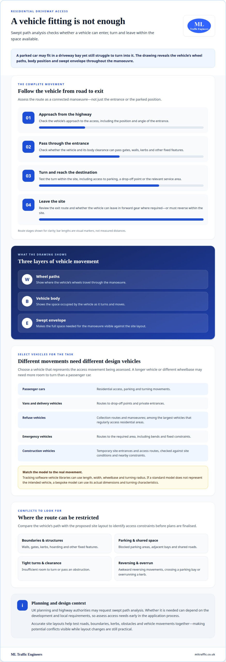
    Vehicle libraries in tracking software provide models with dimensions such as length, width, wheelbase and turning radius. These inputs affect the path: a longer vehicle or a different wheelbase may need more room to turn than a passenger car. The drawing typically shows wheel paths, the vehicle body and its swept envelope.

    If a standard library model does not represent the intended vehicle, a bespoke model can use its actual dimensions and turning characteristics. This makes the simulation specific to the vehicle being assessed. For swept path analysis for residential driveways, matching the vehicle and manoeuvre to the real access task is essential for a useful result.

    Residential driveway and development access

    Access assessment follows each vehicle from the public highway into the site, through its manoeuvre and back out. Common problems include tight turns, insufficient clearance from boundaries, blocked parking areas and layouts that leave vehicles needing awkward reversing movements.

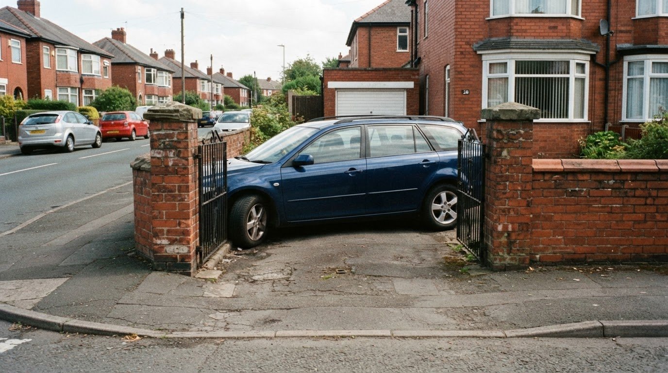
    These issues can be difficult to spot on a plan that shows only fixed parking spaces. A swept path drawing shows the vehicle’s route and occupied space, helping identify where a gate, wall, parked car or kerb interferes with turning. For example, a car may fit in a driveway bay but struggle to turn into it.

    Assess the whole movement, not just the entrance. Test the approach from the highway, the access position and angle, movement within the site and the exit route. Check whether the selected vehicle can enter and leave in forward gear where required, and whether any reversing takes place within the site.

    For a residential layout, examine how driveways interact with shared roads, parking spaces and turning areas. In custom home architecture and neighborhood planning, firms like TanneyDesign coordinate these elements early so that site layouts balance aesthetics with functional vehicular movement. A vehicle tracking path can reveal whether a car needs to cross an adjacent parking bay or overrun a kerb to complete a turn. The drawing can also show whether an obstruction narrows the usable route.

    Development access may need to serve more than residents’ cars. Test delivery vans reaching drop-off points, servicing vehicles approaching their working area and refuse vehicles following the intended collection route. Each movement may have a different destination and turning requirement, so assess them against the actual site layout.

    Construction-phase access raises a separate design question. Temporary access roads and site entrances may need to accommodate construction vehicles as site conditions change. Model the intended route against gates, hoarding, kerbs and nearby highway constraints. If a vehicle cannot complete the planned turn, the access alignment or working layout may need to change.

    Emergency access also depends on the route beyond the entrance. Assess whether the selected vehicle can reach the relevant part of the development, negotiate bends and pass fixed constraints. A clear route on the site plan is not enough if the vehicle’s turning path conflicts with a wall or parked vehicle.

    Start with an accurate site or layout drawing showing roads, boundaries, kerbs and obstacles. Then define the vehicle and manoeuvre to test, including entry, turning, stopping or exit. Comparing these movements with the proposed layout makes specific access conflicts visible while design changes are still practical.

    For a closer look at how vehicle movements are illustrated for planning, the AutoTURN swept path analysis guide explains the role of tracking drawings in assessing access arrangements.

    Planning authority requirements in the UK

    UK planning and highway authorities may request swept path analysis when a proposal changes vehicle access or movement. A highway authority can ask for it while determining a planning application, making vehicle tracking relevant to the evidence submitted with the application.

    To commission an analysis, provide an accurate site or layout drawing showing the access, roads, kerbs, obstacles and other relevant features. Include the vehicle type and manoeuvre to be tested, such as entering, turning, reversing or exiting. Plans can be supplied in PDF or CAD format.

    Requirements depend on the development, expected vehicle movements and the local authority’s assessment of access. A drawing may need to demonstrate that vehicles can reach parking, turn within the site or leave safely. Showing the proposed entrance alone may not establish whether the full route works.

    For example, a house proposal with a narrow entrance and a turning area near a boundary may need to show how a vehicle moves between them. Planned or likely on-street parking can also affect the space available on an approach. Include these conditions in the assessment when they are relevant to the proposed movement.

    The evidence should make each tested manoeuvre clear. A swept path drawing can show the vehicle body, wheel paths and swept envelope against the proposed layout. Review the entrance, internal turn and exit as separate stages, then assess clearance from fixed features and interaction with parked vehicles.

    Local highway guidance may also address how larger vehicles manoeuvre on narrow roads and the visibility needed near bends or junctions. Where relevant, the submitted layout should show how the access arrangement relates to the surrounding highway. The authority’s requirements shape the evidence expected for the site.

    Before submitting an application, allow the relevant highway authority to assess the proposed layout where its input is needed. Considering access early can bring questions into the design process before the application is determined, when layout changes may be easier to incorporate.

    Use the analysis to address conflicts shown on the plan. A constrained entrance, obstructed turning area or limited clearance may call for a revised access position, parking arrangement or layout. Accurate drawings and clearly defined vehicle movements help the authority assess how the proposal works in practice.

    Software used for swept path analysis

    Swept path software models a selected vehicle moving through a site layout. It uses vehicle dimensions, turning characteristics and the intended manoeuvre to create a visual path. For residential access, this can show how a car or service vehicle interacts with parking, gates, kerbs and walls.

    Specialised software can be used to model vehicle movements for swept path analysis. These tools can simulate forward and reverse movements. The analyst selects the vehicle, loads the site layout and defines the route to test. The resulting path can then be reviewed against the proposed access geometry.

    Software matters, but the input drawing matters just as much. A CAD layout can provide geometry for roads, parking spaces, kerbs and fixed obstacles. The analyst uses this information to position the vehicle path accurately. If the drawing omits a wall or shows an incorrect access width, the output may not represent the actual layout.

    Browser-based tools offer one way to access a modelling workflow, while CAD-based processes work directly with design drawings. The practical choice depends on the source layout, required output and how the vehicle movements need to be presented. Whichever approach is used, the model must reflect the intended vehicle and manoeuvre.

    For example, testing a car entering a driveway differs from testing a refuse vehicle turning within a shared access. Each movement needs its own route and vehicle model. The analysis should also account for whether the vehicle travels forwards, reverses or changes direction near a parking space. A clearly defined test setup makes the result easier to interpret.

    A useful report turns the simulation into evidence that can be reviewed alongside the design. Visuals can show the vehicle path against the layout, making tight corners and potential conflicts easier to identify. The drawing typically presents the wheel paths, vehicle body position and swept envelope, rather than relying on a written description alone.

    Before interpreting a software output, check that the site drawing shows the relevant access features and that the selected vehicle suits the movement. Then review the path for clearance from boundaries and other fixed features. For a planning submission, the drawing should make the tested route and any constrained manoeuvre clear to the person reviewing the proposal.

    Software alone cannot determine whether a layout works. It provides a model for assessing vehicle movement. Its value depends on pairing accurate geometry with an appropriate vehicle, clearly defined movements and a report that relates the simulation to the proposed design.

    Swept Path Analysis for Residential Driveway Access in the UK

    Swept path analysis in civil engineering

    In civil engineering, vehicle tracking connects transport needs with the geometry of a proposed site. It tests whether a design vehicle’s movement fits the physical layout, helping engineers assess how access roads, junctions and parking areas work together.

    The analysis can inform geometric design decisions, not simply confirm whether a vehicle can turn. For example, a tracked path may show that a kerb alignment or junction corner restricts movement. Designers can then assess layout changes before fixing road markings, parking bays or access positions.

    Horizontal tracking examines a vehicle’s path across the plan, but a driveway also has a vertical profile and cross-sections. Gradients, changes in level and surface shape can affect vehicle clearance, so a two-dimensional turning plan may not show every potential conflict.

    Three-dimensional CAD swept path simulations can test vehicle movement against driveway surfaces and terrain. They can identify vehicle-terrain conflicts that two-dimensional driveway profile analysis does not reveal. This matters where a vehicle crosses a steep transition or uneven surface rather than turning across a flat paved area.

    For engineering projects, the design vehicle and geometry must be considered together. The vehicle’s dimensions and turning characteristics shape its path; the site’s alignment, profile and cross-sections shape the available space. Testing these elements in a coordinated model gives a more complete view of how the design performs.

    A practical review can follow a clear sequence. First, establish the design layout and relevant ground levels. Then model the vehicle’s intended route across that geometry. Finally, inspect the path for conflicts with kerbs, boundaries, surface changes and other fixed features. This helps distinguish a plan-view constraint from a terrain-related issue.

    These findings can guide discussions across civil engineering and transport planning. A tight turning path might require a revised access alignment; a ground-clearance conflict may call for changes to the driveway profile. The appropriate response depends on where the model shows the vehicle contacting or overrunning the proposed geometry.

    The key is to match vehicle tracking to the engineering question. A two-dimensional model can assess horizontal movement, while three-dimensional analysis can examine how vehicle paths interact with surface geometry. Where driveway levels or terrain matter, consider the full three-dimensional relationship before finalising the design.

    Explore the vehicle tracking workflow for planning projects to see how movement analysis can support design decisions.

    ML Traffic Engineers UK: Transport Statements

    ML Traffic Engineers UK provides Swept Path Analysis to assess vehicle access and manoeuvring for residential layouts. Use the service when a proposed driveway, parking arrangement or access route needs a clear vehicle-tracking assessment for design or planning evidence.

    Where a wider planning submission needs transport documentation, Transport Statements and Transport Assessments can address the development’s transport considerations. Parking Surveys can provide evidence about parking conditions relevant to a proposal. The appropriate work depends on the planning question and the information needed to assess the site.

    To discuss your project or find out more, visit ML Traffic Engineers UK.

    Move your access design forward

    A driveway layout is easier to refine while the design is still taking shape. Use swept path analysis for residential driveways to guide discussions with your design team, especially when vehicle movement affects the entrance, parking arrangement or available turning space. Clear access evidence keeps transport considerations connected to the site layout as plans progress.

    ML Traffic Engineers UK provides Swept Path Analysis, alongside Transport Statements and Parking Surveys to support related planning work. The next step depends on the evidence your proposal needs and the access question you need to resolve.

    Bring your access requirements into focus and discuss the appropriate transport planning support. Contact ML Traffic Engineers UK to explore the next step for your project.

    With a clear assessment, you can move your driveway plans forward with greater confidence.

    Frequently Asked Questions

    What Vehicles Can Be Assessed?

    A swept path assessment can model passenger cars, vans, rigid delivery vehicles, refuse vehicles and construction vehicles. Emergency vehicles can also be assessed when their access forms part of the design question. For example, a proposal with a shared access might test a resident’s car alongside the vehicle expected to serve the site. Select vehicles according to the project’s actual use and the movements the layout needs to accommodate.

    What is swept path analysis for a residential driveway?

    It is a computer-based assessment of how a chosen vehicle moves through a driveway or site. The analysis maps the vehicle’s movement so a designer can see whether the proposed arrangement accommodates the intended journey. For a house, that might mean testing a car entering from the street, reaching a parking space and turning to leave. It assesses movement, not simply the dimensions of a parked vehicle.

    When is swept path analysis required for a UK house or driveway planning application?

    It may be requested when a proposal changes access, parking or vehicle movements and the planning or highway authority needs evidence that the layout is workable. A new house access, altered driveway or development with shared vehicle routes can prompt an assessment. The need depends on the proposal and the authority’s concerns. If an application includes a constrained entrance or turning area, showing vehicle movements in the submitted design can help clarify access.

    Which vehicle types and design vehicles should be used for residential driveway swept path analysis?

    Choose design vehicles that reflect who will use the site and which movements need testing. A single-home access may focus on a passenger car, while shared residential layouts can also involve delivery or refuse collection movements. Consider emergency access when it forms part of the assessment. The vehicle model should represent the relevant vehicle’s dimensions and turning characteristics, rather than simply selecting the largest available model.

    What UK standards and guidance cover driveway access widths, turning areas and vehicle tracking?

    Driveway access is assessed against the planning and highway considerations relevant to the project and location. Requirements can depend on the road context, proposed layout, vehicle movements and local authority guidance. A tracking drawing tests how the selected vehicle moves through the design, but does not establish every applicable design requirement by itself. Consider the authority’s expectations alongside the layout, particularly where access meets a public highway.

    How is a driveway swept path analysis carried out using CAD or vehicle tracking software?

    The analyst works from a site or design plan and sets up the vehicle and manoeuvre in tracking software. CAD drawings can provide geometry for the driveway and surrounding features; PDF plans can also form part of the supplied layout information. The model then represents the movement for review. Before relying on the drawing, ensure the plan reflects the design being assessed, including relevant boundaries and obstructions.

    What driveway dimensions and turning space are needed for cars, vans and refuse vehicles?

    There is no single driveway dimension that suits every car, van or refuse vehicle movement. The space required depends on vehicle dimensions, turning characteristics, access alignment and manoeuvre. A vehicle entering straight into a space needs a different layout from one turning around or reversing to exit. Assess the chosen vehicle against the actual plan rather than applying a dimension without considering how the vehicle must move.

    Do driveway access and turning requirements vary by UK council or local planning authority?

    Yes. Local requirements and highway authority expectations can differ, and the assessment also depends on the site and proposed movements. A layout considered in one council area may raise different questions elsewhere, especially where road widths, parking or access arrangements differ. Review the relevant authority’s published expectations for the application area and ensure vehicle tracking reflects the design and movements being submitted.

    Michael Lee

    Article by

    Michael Lee

    Transport planner with over 35 years' experience.

    Disclaimer

    The content on mltraffic.co.uk, including all technical articles, guides, and resources, is provided for general informational and educational purposes only. It is not intended to constitute professional advice in traffic engineering, transportation planning, development approvals, or any other technical or legal field.
    While ML Traffic Engineers makes every reasonable effort to ensure the accuracy, completeness, and timeliness of the information published, we do not provide any warranties or representations (express or implied) regarding its reliability, suitability, or availability for any particular purpose. Any reliance you place on the content is strictly at your own risk.
    In no event shall ML Traffic Engineers, its directors, employees, authors, or affiliates be liable for any direct, indirect, incidental, special, consequential, or punitive damages (including, without limitation, loss of profits, data, or business opportunities) arising out of or in connection with the use of, or inability to use, any information provided on this website.
    The articles and guides on this site are not a substitute for engaging a qualified, professional traffic engineer to assess your specific project requirements. For tailored advice, compliance assessments, or traffic engineering services, please contact a competent professional.
    This disclaimer may be updated from time to time without notice. By accessing or using this website, you agree to be bound by the most current version of this disclaimer.