
Did you know that a failed technical audit for a highway submission in London can delay your development by as much as 24 weeks? For many UK developers, the technical complexity of a junction capacity assessment feels like a barrier designed to trigger objections rather than facilitate growth. It’s common to feel overwhelmed by the threat of planning refusal or the high costs of unnecessary road mitigation schemes demanded by local authorities. You want to move forward, but conservative council estimates often stand in the way of your project’s viability.
This guide will help you master the technical requirements of modern modelling to overcome highway objections and secure planning approval for your UK development. We’ll show you how to use the latest software, such as Junctions 11.2.0 and LinSig 3.3.2.0, to challenge assumptions and present a robust case to planning committees. We’ll provide a clear breakdown of RFC and degree of saturation results, ensuring you understand exactly how to navigate 2026 regulatory standards. From interpreting traffic survey data to implementing cost-effective mitigation strategies, you’ll gain the technical authority needed to manage your project’s lifecycle with confidence and precision.
Key Takeaways
- Understand how a professional junction capacity assessment satisfies NPPF requirements and prevents planning refusal by proving your development doesn’t cause ‘severe’ cumulative impact.
- Identify the correct modelling software for your specific project, from ARCADY for roundabouts to PICADY for priority junctions, to ensure technical data accuracy.
- Learn to interpret critical metrics like the 0.85 RFC threshold and MMQ to understand how Highway Authorities evaluate your project’s operational stability.
- Discover how precise modelling streamlines the transition from planning approval to S278 and S38 legal agreements for highway design works.
- Gain strategies for identifying cost-effective mitigation options that satisfy council requirements without over-engineering your road infrastructure.
What is a Junction Capacity Assessment and Why is it Critical in 2026?
A junction capacity assessment is a rigorous technical evaluation that measures how vehicle flow interacts with the physical constraints of a road intersection. It’s the primary tool used to determine whether existing infrastructure can handle the additional traffic generated by a new development. In 2026, this isn’t just about counting cars. It’s about precision. We focus on “residual capacity,” which is the remaining space on the network after existing traffic is accounted for, to ensure your project doesn’t push the local roads past their breaking point.
This technical study is your strongest defence against planning refusal. Under Paragraph 115 of the National Planning Policy Framework (NPPF), development should only be prevented or refused on highways grounds if there’s an unacceptable impact on highway safety, or the cumulative impacts on the road network would be “severe.” Without a robust junction capacity assessment, “severe” is a subjective term that local authorities might use to block your application. Our job is to provide the data that turns that subjective opinion into a technical negotiation.
Modern planning standards require more granular data than ever before. The rapid uptake of Electric Vehicles (EVs) and changing urban mobility patterns mean older traffic models are often inaccurate. Modern assessments must account for different acceleration profiles and the increased presence of active travel lanes. By using Industry-Standard Modelling Software, we ensure your data reflects the reality of 2026 road usage, not the outdated metrics of a decade ago.
To better understand how vehicle flow is managed at intersections, watch this helpful video:
When Does a Developer Need a Formal Capacity Study?
The requirement for a study usually depends on the scale of the project. Larger developments typically require a full Transport Assessment, while smaller sites might only need a Transport Statement. However, even small projects can trigger a mandatory assessment if the Local Highway Authority identifies “sensitive” junctions nearby that are already approaching their physical limits. Your site access design often dictates whether you need to model the wider network or just the immediate entrance.
The Commercial Risk of Ignoring Junction Modelling
Ignoring the need for early modelling creates significant commercial risk. Poorly executed data often leads to “Grampian” conditions. These are planning conditions that prevent development from starting until specific off-site highway works are completed. Such delays can stall your project for months and inflate your preliminary costs. Furthermore, conservative council estimates often result in over-designed junctions. Accurate modelling allows you to present a data-driven case that protects your profit margins by avoiding excessive Section 106 contributions for unnecessary road improvements.
Industry-Standard Modelling Software: ARCADY, PICADY, and LinSig
Selecting the right tools ensures your junction capacity assessment withstands scrutiny. Local Highway Authorities expect models built on industry-standard platforms that reflect the latest 2026 updates. We utilize several specialized tools depending on the junction type and the complexity of the surrounding network:
- ARCADY: This module within the Junctions 11.2.0 suite is the essential tool for circular junctions. It calculates capacity and delay by analysing geometry like entry width and flare length.
- PICADY: Designed for T-junctions or staggered crossroads, PICADY is the technical benchmark for priority-controlled intersections.
- LinSig 3.3.2.0: We use this for signal-controlled junctions to model traffic lights and urban networks, accounting for signal timings, lane saturation, and pedestrian phases.
- VISSIM: When static models aren’t enough for high-density city centres, micro-simulation provides a dynamic, vehicle-by-vehicle analysis of the network.
This level of technical detail is often necessary for UK Planning Success in complex urban corridors where multi-modal traffic is the norm. By choosing the correct software, we demonstrate a precise understanding of how your development interacts with existing infrastructure.
Data Inputs: Garbage In, Garbage Out
A model is only as reliable as the data driving it. We build every junction capacity assessment on a foundation of accurate Traffic Surveys. We use Automatic Traffic Counters (ATC) for long-term flow data and Manual Classified Counts (MCC) to capture specific vehicle types at peak times. In 2026, capturing the correct vehicle mix is vital due to the shift toward electric delivery fleets and cycle lane integration. We then apply growth factors from TEMPro and the National Road Traffic Forecasts (NRTF) to predict future demand. We also integrate Swept Path Analysis into the process. This ensures the model’s physical dimensions match the actual turning capabilities of HGVs and emergency vehicles, preventing technical objections later.
Modelling Scenarios: Base Year vs. Future Year
Highway Authorities require multiple scenarios to test resilience. First, we develop a ‘Base Year’ model. This must accurately reflect current on-street reality to gain technical approval. Once validated, we create ‘Opening Year’ and ‘Horizon Year’ scenarios, usually looking five or ten years ahead. We test both AM and PM peak hours to identify the ‘worst-case’ impact scenario for your development. This comprehensive approach ensures your planning application is robust against challenges. If you need assistance with these complex requirements, our team can provide a tailored Transport Assessment to support your project and reduce regulatory pressure.
Interpreting Results: Understanding RFC, MMQ, and Delay
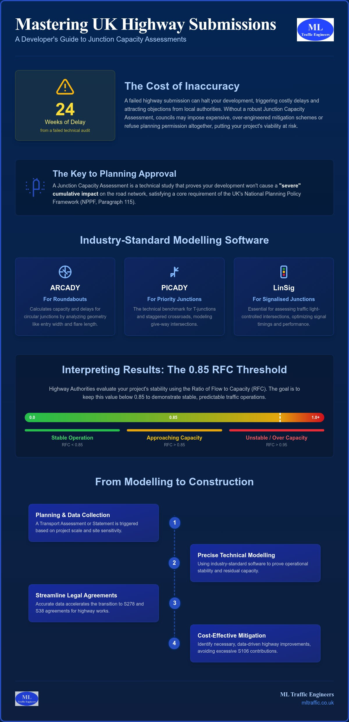
Interpreting the output of a junction capacity assessment requires moving beyond raw numbers to understand operational stability. Once the modelling software processes the survey data, it generates several key metrics that Highway Authorities use to judge your application. The primary metric we focus on is the Ratio of Flow to Capacity (RFC). While a junction technically has capacity up to a value of 1.0, anything above 0.85 suggests the junction is starting to struggle with peak fluctuations. This is the point where queues become non-linear and unpredictable.
Beyond RFC, we analyze the Mean Maximum Queue (MMQ). This metric visualizes the physical length of the queue in “passenger car units” (PCUs) during peak periods. It’s vital for ensuring that traffic from your site doesn’t “tail back” and block adjacent intersections or pedestrian crossings. We also measure delay per vehicle, which quantifies the average waiting time in seconds. For signalized junctions, we switch to the Degree of Saturation (DoS), where we aim for a result below 90%. This framework is a core component of the wider What is a Junction Capacity Assessment process that local authorities use to evaluate development impact.
What Happens When the Model ‘Fails’?
A “failed” model doesn’t always lead to planning refusal. We distinguish between a junction that’s simply “at capacity” and one that’s “over capacity.” If the existing road network is already performing poorly, we often utilize the “Nil Detriment” principle. This involves proving that the development’s additional traffic doesn’t make the existing situation significantly worse. Since a 2026 survey found that 71% of councils still categorize roads based on traffic flow rather than modern “Movement and Place” concepts, they often strictly enforce these thresholds. The Ratio of Flow to Capacity (RFC) is an industry-standard metric where a value of 0.85 or lower indicates that a junction is operating within its practical capacity and remains stable during peak fluctuations.
Mitigation Strategies for Failing Junctions
When a junction capacity assessment identifies a genuine capacity issue, we look for cost-effective mitigation rather than expensive road reconstruction. Physical improvements like flare extensions, signal optimization, or lane re-allocation can often provide the necessary residual capacity. We also prioritize demand management. Implementing a robust Travel Plan reduces peak vehicle trips by encouraging sustainable transport modes. If physical or demand-side changes aren’t enough, we might propose strategic site access changes to redistribute the traffic load across multiple junctions, preventing any single point from becoming a bottleneck that stalls your planning success.
From Modelling to Construction: S278 and S38 Integration
The transition from a successful planning application to actual construction depends on the technical integrity of your junction capacity assessment. While the model secures the initial “resolution to grant,” it also serves as the technical blueprint for Highway Design S278 works. Highway Authorities scrutinise these models during the Technical Approval (TA) phase with extreme rigour. They must ensure that the physical design, such as lane widths or signal timings, matches the performance predicted in the capacity study before they sign off on legal agreements.
There’s a direct link between your capacity results and the cost of the S278 bond. If a model suggests a junction is nearing capacity, authorities may demand wider lanes or longer flares. This increases the scale of works and, consequently, the financial bond you must provide. For instance, Cornwall Council’s Highways Agreement fee was updated in April 2026 to 8.75% of the works cost. Precise modelling ensures you aren’t paying for over-engineered infrastructure based on conservative assumptions. We design for 2026 standards while accounting for future autonomous vehicle patterns to ensure your investment remains viable for decades. For those looking to ensure on-site precision during these works, you can explore Construction Layout options that align civil engineering data with real-world construction.
Negotiating with Local Highway Authorities
Negotiations with bodies like Transport for London (TfL) or County Councils often centre on model “validation.” Authorities frequently challenge trip rates or junction geometry to ensure the model reflects real-world congestion. Professional representation is vital during these pre-application meetings to defend your data. We use sensitivity testing to challenge overly conservative “background growth” assumptions that often stall projects. By proving that the local network can handle the load without excessive widening, we protect your project’s bottom line from unnecessary infrastructure costs.
While technical data is used to protect a project’s viability, strategic brand communication is equally important for firms in the engineering and technology sectors; BCM Public Relations provides the specialist B2B media relations support required to effectively manage industry reputation and professional profile.
The Role of the Transport Assessment
We synthesise all junction results into a comprehensive Transport Assessment that speaks to both technical auditors and Planning Committee members. It’s not enough to have a stable RFC; you must present the data in a way that non-technical stakeholders can understand. This means clearly explaining how the development aligns with local “Vision Zero” safety goals and active travel policies. If you need a partner who can manage the full project lifecycle from initial survey to technical sign-off, our team provides the specialist traffic engineering support required to secure your Section 278 agreement.
Why Choose ML Traffic Engineers UK for Your Capacity Assessment?
ML Traffic Engineers UK understands that a junction capacity assessment is more than just a data set; it’s a vital component of your project’s commercial viability. Since our founding in 2014, we’ve focused on delivering precision-led documentation that withstands the most rigorous scrutiny from Local Highway Authorities. We take immense pride in our role as a dependable partner, ensuring your development meets all statutory requirements while minimizing logistical pressures. Our team maintains a constant sense of readiness to respond to the fast-moving and often unpredictable nature of UK infrastructure planning.
We adopt a developer-focused mentality that prioritizes your bottom line. Many consultants propose mitigation schemes that are easiest for the Council to approve, often resulting in unnecessary and expensive road construction. We do the opposite. We use the latest industry software to identify the most cost-effective mitigation strategies, ensuring you don’t pay for over-engineered road works. Our track record across London Boroughs and UK County Councils proves that accurate modelling is the best way to protect your profit margins against conservative background growth assumptions.
Our Technical Toolkit
Our technical toolkit includes mastery of the Junctions 11.2.0 suite (ARCADY and PICADY), LinSig 3.3.2.0, and AutoTurn. We provide an integrated service where Swept Path Analysis and capacity work happen simultaneously. Because we conduct our own Traffic Surveys, we guarantee the integrity of the foundation data and eliminate the risk of third-party errors. ML Traffic Engineers UK manages full project lifecycles from initial inception through to the final sign-off of S278 technical agreements. This all-encompassing service ensures your junction capacity assessment remains robust under the technical audits required by authorities like Transport for London or various County Councils.
Get Started on Your Assessment
Early engagement prevents costly delays and identifies highway “showstoppers” before you commit significant capital. We understand the intricate regional regulations that vary between authorities, so you don’t have to. When you contact us for a quote, please provide your site location, proposed land use, and existing access details. This allows our team to provide a tailored, sequential plan for your Transport Assessment or statement. Our rhythmic efficiency and commitment to standards ensure your project moves from planning to execution without unnecessary friction. Contact ML Traffic Engineers UK for a professional junction capacity review today.
Secure Your Planning Approval with Technical Precision
A robust junction capacity assessment is the cornerstone of any successful planning application in 2026. By mastering technical metrics like RFC and utilizing industry-standard software, you transform highway objections into manageable technical negotiations. Accurate modelling doesn’t just satisfy Local Highway Authorities; it protects your project from the high costs of over-engineered infrastructure and unnecessary Section 278 bond increases. Precision in the early stages ensures a clear path through the complex regulatory landscape of modern UK infrastructure. Furthermore, as designs become more complex, specialized training from White Plains Driving Center ensures that drivers have the highway practice needed to navigate these environments safely.
Our team brings specialized expertise in ARCADY, PICADY, and LinSig to every project. We maintain a proven track record of success across UK Planning Authorities, supported by our integrated Swept Path Analysis and Traffic Survey capabilities. We manage the entire technical lifecycle so you don’t have to worry about regulatory pressure. Secure your planning approval with expert junction modelling from ML Traffic Engineers UK. Your project deserves the certainty that only professional engineering precision can provide. Let’s ensure your next development moves forward with confidence.
Frequently Asked Questions
What is a ‘severe’ impact in a junction capacity assessment?
A ‘severe’ impact refers to the threshold set by Paragraph 115 of the National Planning Policy Framework (NPPF) where development can be refused on highways grounds. It is not defined by a single metric but is typically triggered when a junction capacity assessment shows that a development pushes an intersection significantly over its practical capacity, leading to unpredictable queuing or safety risks. We use technical data to prove your project remains below this threshold.
How much does a junction capacity assessment cost in the UK?
The cost varies significantly depending on the number of junctions involved and the complexity of the modelling required. Factors such as whether you need fresh traffic surveys or if the site requires complex signal modelling using LinSig will influence the final fee. Developers should provide specific site details, including location and proposed land use, to receive a tailored technical quote that reflects the scope of their project.
Can I use old traffic survey data for a new 2026 assessment?
Most Local Highway Authorities require traffic survey data to be no more than three years old to ensure it reflects current baseline conditions. In 2026, authorities are particularly cautious about older data due to significant shifts in vehicle modes and the increased uptake of electric vehicles. Using outdated counts often leads to technical objections, so fresh data collection is usually a non-negotiable requirement for a robust submission.
What is the difference between RFC and Degree of Saturation?
RFC (Ratio of Flow to Capacity) is the primary metric used for priority junctions and roundabouts, with 0.85 representing the threshold for practical stability. Degree of Saturation (DoS) is the equivalent metric for signal-controlled junctions, where the target is typically below 90%. Both indicators measure how close a junction is to its physical limit, but they apply to different types of traffic control software.
How long does it take to complete a full junction model?
A standard model typically takes between one and two weeks to complete once the underlying traffic survey data is available. This timeframe allows for geometric validation, data input, and the testing of various AM and PM peak scenarios. More complex urban networks or those requiring micro-simulation may require additional time to ensure the model accurately reflects the intricate regional regulations of the local area.
What happens if the Highway Authority disagrees with my modelling results?
Disagreements are typically resolved through a technical validation process where both parties review the input parameters, such as trip rates and saturation flows. Professional representation is vital during these negotiations to defend the integrity of the junction capacity assessment. We use sensitivity testing to challenge conservative assumptions and find a data-driven middle ground that satisfies the authority without compromising your project’s viability.
Do I need a capacity assessment for a small residential development?
Small developments might only require a Transport Statement, but a formal capacity study is often triggered if the site access joins a sensitive or congested part of the network. Local Highway Authorities have the discretion to request modelling if they believe the cumulative impact of several small sites will affect road safety. Engaging with consultants early helps identify if these requirements apply to your specific site before you submit an application; once your planning is secured, you can check out Wolverhampton Driveways Ltd for high-quality driveway and access paving services in the West Midlands.
What software is required for modelling a mini-roundabout?
ARCADY, which is now a module within the Junctions 11 software suite, is the industry standard for modelling mini-roundabouts. The software utilizes specific geometric data, such as entry widths and curb radii, to predict how the junction will perform under various traffic loads. This ensures the design meets the safety and capacity standards required for formal adoption by the Highway Authority under a Section 38 agreement.

Disclaimer
The content on mltraffic.co.uk, including all technical articles, guides, and resources, is provided for general informational and educational purposes only. It is not intended to constitute professional advice in traffic engineering, transportation planning, development approvals, or any other technical or legal field.
While ML Traffic Engineers makes every reasonable effort to ensure the accuracy, completeness, and timeliness of the information published, we do not provide any warranties or representations (express or implied) regarding its reliability, suitability, or availability for any particular purpose. Any reliance you place on the content is strictly at your own risk.
In no event shall ML Traffic Engineers, its directors, employees, authors, or affiliates be liable for any direct, indirect, incidental, special, consequential, or punitive damages (including, without limitation, loss of profits, data, or business opportunities) arising out of or in connection with the use of, or inability to use, any information provided on this website.
The articles and guides on this site are not a substitute for engaging a qualified, professional traffic engineer to assess your specific project requirements. For tailored advice, compliance assessments, or traffic engineering services, please contact a competent professional.
This disclaimer may be updated from time to time without notice. By accessing or using this website, you agree to be bound by the most current version of this disclaimer.