Tag: Transport Statements

  • Healthy Streets Approach to Highways Engineering and Placemaking

    Healthy Streets Approach to Highways Engineering and Placemaking

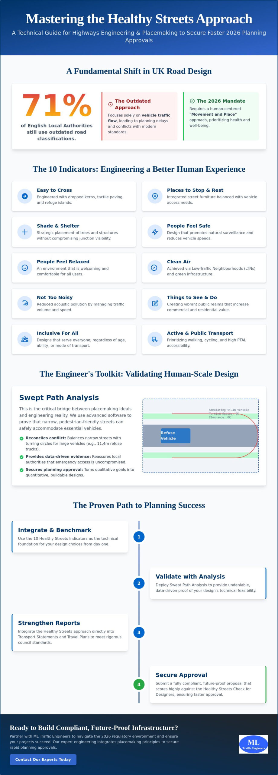
    A recent survey of English Local Highway Authorities revealed that 71% still categorize roads based on traffic flow rather than the “Movement and Place” approach championed by modern guidance. This reliance on outdated metrics often leads to costly planning delays and direct conflict with current active travel standards. We understand the pressure of balancing technical vehicle requirements with the increasing demand for high-quality public spaces. It’s often difficult to quantify placemaking in a way that satisfies both a highways engineer and a planning officer during a rigorous technical review.

    This article shows you how to master the healthy streets approach highways engineering and placemaking to secure rapid approvals for your projects. You’ll learn how to integrate the 10 Healthy Streets indicators into your technical reports without compromising on safety or essential vehicle access. We provide a clear, sequential path to aligning your infrastructure designs with the 2026 regulatory environment, ensuring your Transport Statements and Travel Plans stand up to scrutiny. We will examine how to bridge the gap between engineering precision and human-centered design to deliver compliant, future-proof infrastructure.

    Key Takeaways

    • Understand the 10 Healthy Streets Indicators and how they serve as the technical foundation for human-centered urban design in 2026.
    • Learn to use Swept Path Analysis to reconcile narrow, high-quality placemaking with the essential access requirements of emergency and service vehicles.
    • Discover how to integrate the healthy streets approach highways engineering and placemaking into your Transport Statements to satisfy rigorous local authority standards.
    • Master strategies for balancing parking requirements in car-lite developments by utilizing robust Travel Plans and high PTAL accessibility.
    • Follow a proven, sequential audit process to score your proposals against the Healthy Streets Check for Designers and secure faster planning approvals.

    What is the Healthy Streets Approach in 2026 Highways Engineering?

    The Healthy Streets Approach is an evidence-based framework created by Lucy Saunders to prioritize the human experience in urban design. It moves away from the traditional focus on vehicle throughput and instead evaluates the success of a street based on ten specific indicators of health and well-being. By adopting this method, developers and local authorities ensure that public spaces are inclusive, safe, and sustainable. This approach aligns closely with the principles of Complete Streets, which advocate for infrastructure that serves all users regardless of their mode of transport.

    To better understand this concept, watch this helpful video:

    2026 represents a critical tipping point for highways engineering in England. The mandate from Active Travel England has shifted from optional guidance to a hard requirement for planning approvals. Historically, engineers focused on “Level of Service” for vehicles, often at the expense of pedestrians. Today, the role of a highways engineer involves translating qualitative indicators into quantitative, buildable designs that satisfy both safety regulations and placemaking goals. This evolution ensures that the healthy streets approach highways engineering and placemaking is integrated into every stage of the project lifecycle.

    The 10 Indicators as Engineering Benchmarks

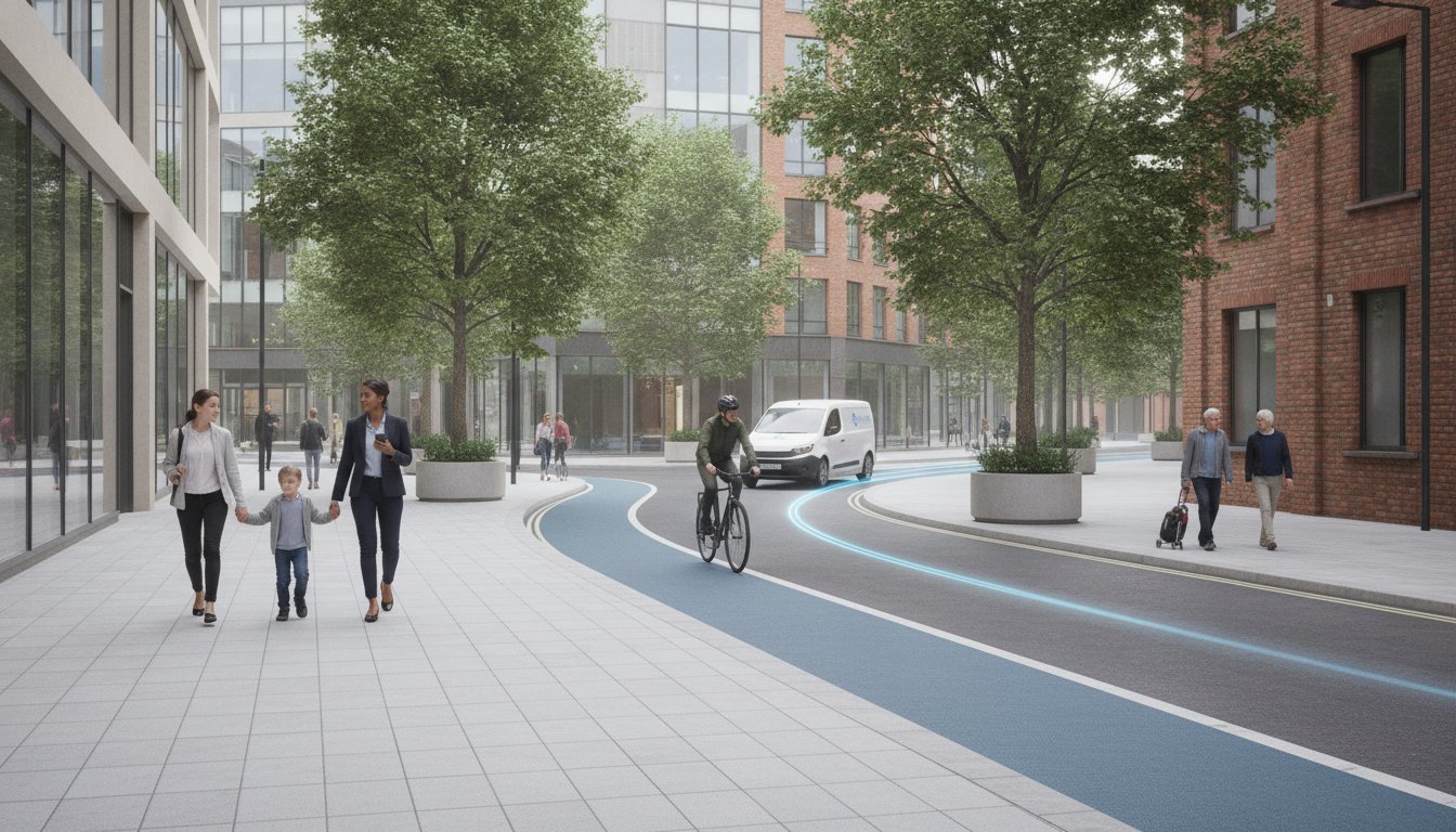
    We use the 10 Healthy Streets indicators as technical benchmarks to validate design choices. For example, “Easy to Cross” isn’t just a feeling; it’s the implementation of dropped kerbs, tactile paving, and refuge islands positioned along pedestrian desire lines. “Shade and Shelter” requires the integration of trees and street furniture, but these must be carefully engineered to maintain visibility splays at junctions. Finally, “Clean Air” and “Not too noisy” are achieved through the strategic design of low-traffic neighbourhoods (LTNs) that reduce nitrogen dioxide levels and acoustic pollution, encouraging people to spend more time outdoors.

    Placemaking vs. Traditional Traffic Management

    Traditional management prioritizes the movement of cars above all else. In contrast, placemaking focuses on the “Level of Service” for people. High-quality public realms increase the commercial and residential value of a development by creating places where people actually want to live and work. This transition is essential for securing a successful Transport Assessment in modern planning environments. The Healthy Streets Approach is the functional union of public health objectives and civil engineering precision.

    Technical Integration: Swept Path Analysis and Healthy Streets

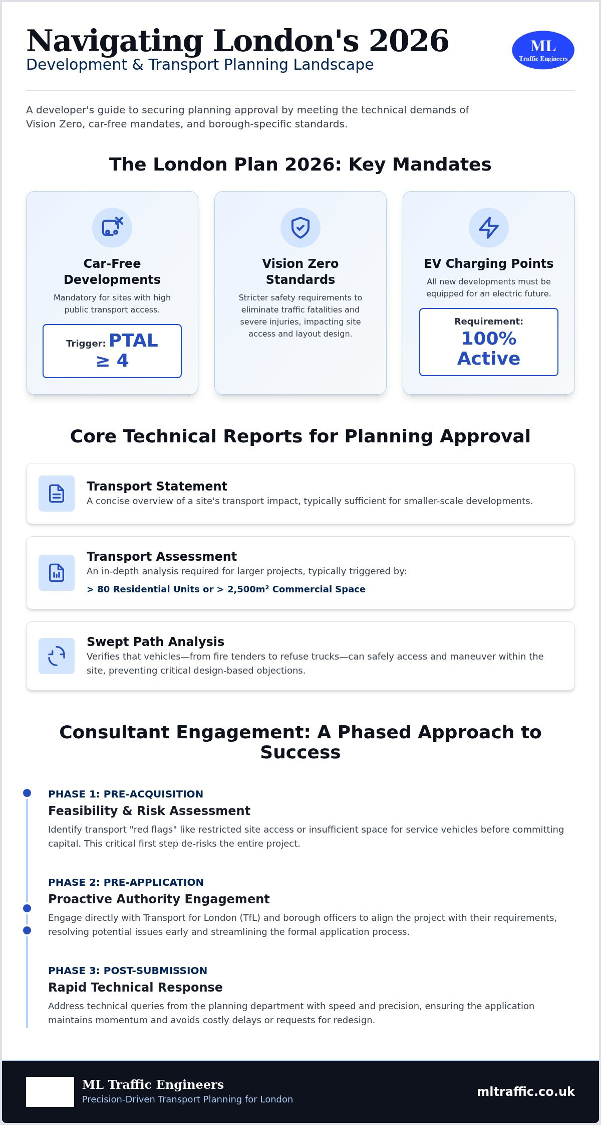
    Designing narrow, human-scale streets is a primary objective of the Healthy Streets framework. It fosters a sense of community and safety by reducing the dominance of motor vehicles. However, this design preference presents a significant hurdle for highways engineers who must ensure that life-safety vehicles and essential services can still navigate the site. Balancing “Places to Stop and Rest” with the required turning circles for an 11.4m refuse vehicle requires more than just a creative eye. It demands rigorous technical validation to ensure the layout is functional.

    At ML Traffic Engineers UK, our team uses advanced Swept Path Analysis to bridge this gap. This software allows us to simulate vehicle movements within tight, human-centric layouts before any construction begins. We can demonstrate that even with reduced carriageway widths, emergency access remains uncompromised. This data-driven evidence is crucial for securing planning approvals. It reassures local authorities that the healthy streets approach highways engineering and placemaking is feasible in practice, not just in theory. Providing this level of technical certainty reduces the risk of costly design revisions during the planning process.

    Optimising Kerb Radii for Pedestrians and HGVs

    Tight kerb radii are a staple of the Healthy Streets philosophy. They force drivers to slow down and significantly reduce the distance pedestrians must travel to cross the road. But large vehicles struggle with these sharp turns. To solve this, we implement technical workarounds like overrun areas or mountable kerbs. These features allow the rear wheels of larger vehicles to safely traverse a designated area without endangering pedestrians or damaging the footway. This approach ensures full compliance with the Manual for Streets while maintaining the high-quality public realm outlined in the Healthy High Streets guidance.

    Visibility Splays in a Greener Streetscape

    Integrating street trees and Sustainable Drainage Systems (SuDS) is vital for the “People Feel Safe” indicator. Trees provide natural cooling and psychological comfort. However, they can easily obstruct visibility splays at junctions. We address this by engineering “Vertical Deflection” into the road surface. By using speed tables and raised junctions, we can legally and safely reduce the required visibility splay lengths because vehicle speeds are physically constrained to 20mph or less. If you are struggling to fit green infrastructure into a constrained site, our team can provide a technical Swept Path Analysis to find the optimal balance between greenery and safety.

    Planning success in 2026 hinges on your ability to validate design choices against public health outcomes. A standard Transport Statement is no longer just about vehicle capacity and parking numbers. It must now feature a comprehensive Healthy Streets assessment. This is especially critical for projects within Greater London, where Transport for London’s Healthy Streets Approach serves as the mandatory framework for evaluating new infrastructure. We manage this entire process, ensuring your technical documentation aligns with the latest statutory requirements.

    We use detailed Traffic Surveys to provide the empirical data required for these assessments. By quantifying existing pedestrian movements and vehicle speeds, we create a robust baseline for the “People Choose to Walk and Cycle” metric. This evidence-based strategy ensures that your proposal meets the expectations of both TfL and Active Travel England during the pre-application stage. Integrating the healthy streets approach highways engineering and placemaking early in your project lifecycle prevents the costly delays often associated with non-compliance and redesign requests.

    The Healthy Streets Check for Designers

    The Healthy Streets Check for Designers is a spreadsheet-based tool that scores a development from 0 to 100 based on the 10 indicators. Our engineers conduct a thorough audit of your site to identify “Quick Wins” that can boost a failing score. These often include simple adjustments to street lighting, the addition of seating, or improving the legibility of signage. A higher score provides the evidence-based justification needed to secure highway authority approval. We provide the technical narrative to explain how your design choices directly improve the score, making the case for your development undeniable.

    Securing S278 and S38 Agreements

    One of the biggest challenges is ensuring that Healthy Streets principles survive the transition from a planning concept to a detailed design. During the S278 and S38 negotiation phases, Local Highway Authorities may prioritize maintenance ease over placemaking features like street trees or non-standard paving. We act as your technical advocate during this adoption process. We bridge the gap between high-level vision and adoptable standards, ensuring the healthy streets approach highways engineering and placemaking remains intact. For more details on this transition, see our Highway Design S278 & S38 Guide.

    Balancing Parking Requirements with the Healthy Streets Approach

    The most common concern we hear from developers is the perceived conflict between parking provision and the Healthy Streets indicators. If you prioritize street-level placemaking, where do the vehicles go? In urban centers with high Public Transport Accessibility Levels (PTAL), the healthy streets approach highways engineering and placemaking often dictates a shift toward car-lite or car-free developments. This transition isn’t about ignoring vehicle needs but about managing them with technical precision. We help you design layouts that prioritize people while still providing essential access for Blue Badge holders and emergency services.

    Justifying Reduced Parking to Planning Committees

    Our team conducts comprehensive Parking Surveys to provide empirical evidence of parking over-provision in the surrounding area. This data is vital for convincing planning committees that a reduced parking ratio won’t negatively impact local street capacity. We pair this data with bespoke Travel Plans that outline clear incentives for walking, cycling, and public transport use. A robust Travel Plan acts as a technical commitment to sustainable transport that directly justifies a reduction in on-site parking density. This dual approach of data and strategy is the most effective way to overcome local authority resistance to low-parking developments.

    Loading and Servicing in Healthy Streets

    Loading and servicing require careful engineering to avoid disrupting the pedestrian experience. We design multi-functional loading bays that can transition into public seating or additional footway width during off-peak hours. Integrating e-cargo bike hubs into the placemaking strategy also helps meet “Clean Air” targets by reducing the number of heavy goods vehicles in the immediate vicinity. To ensure the “Not Too Noisy” indicator is met, we often recommend timed delivery restrictions within the final Transport Assessment. If you need to reconcile your parking strategy with local authority expectations, contact us for a professional Parking Survey today.

    Healthy Streets Approach to Highways Engineering and Placemaking

    The ML Traffic Engineers UK Approach: Expert Engineering for Healthy Streets

    Professional highways engineering is the essential bridge between a creative placemaking vision and a legal planning permit. Without technical validation, even the most inspired designs will fail the scrutiny of a local highway authority. ML Traffic Engineers UK provides the technical rigor required to ensure the healthy streets approach highways engineering and placemaking is successfully implemented and approved. Our role is to reduce the logistical and regulatory pressures on your team by managing the full project lifecycle from inception to completion.

    Our process is logical and sequential, starting with an initial Healthy Streets audit to establish a clear baseline score. We then move into technical design, using advanced Swept Path Analysis to verify that the proposed layout functions for all vehicle types. This empirical data forms the core of our final Transport Assessment submission. We handle complex negotiations with TfL and local boroughs, acting as a technical shield for our clients during the pre-application phase. This ensures that the design principles agreed upon early in the process are not diluted during later stages of the planning journey.

    Future-proofing your development is a necessity in the 2026 regulatory environment. We ensure your project adheres to the latest standards, including the January 2026 London Congestion Charge updates and the stricter Direct Vision Standard (DVS) for HGVs. ML Traffic Engineers UK understands these intricate regional regulations so you don’t have to. We take pride in our precision and adherence to standards, positioning ourselves as a reliable partner that values your time and project deadlines. This proactive approach ensures your infrastructure is ready for the transition to zero-emission zones and increased active travel mandates.

    Why Choose ML Traffic Engineers UK?

    We offer a unique combination of technical SPA expertise and qualitative placemaking insight. Our track record includes securing approvals for high-stakes projects across London and the South East. We provide comprehensive support from the earliest pre-app meetings through to the completion of Section 278 and Section 38 agreements. Our engineers are highly organized experts who prioritize safety and precision in every report. By choosing ML Traffic Engineers UK, you gain a partner that views its role as a vital guardian of public safety and professional integrity.

    Get Started on Your Healthy Streets Project

    Ready to secure your planning approval with a compliant design? You can book a preliminary design review with our London-based team to identify potential issues before they become costly delays. We provide competitive quotes for Healthy Streets compliant Transport Statements and full assessments. Our team is available to provide expert advice on how to integrate the healthy streets approach highways engineering and placemaking into your next scheme. Contact ML Traffic Engineers UK today to discuss your project requirements and receive a tailored service proposal.

    Future-Proof Your Infrastructure Proposals

    Mastering the healthy streets approach highways engineering and placemaking is now a functional necessity for securing planning approvals in England. Success relies on your ability to reconcile human-centered design with the rigorous technical requirements discussed throughout this guide. By utilizing advanced Swept Path Analysis and data-driven Transport Statements, you can provide the evidence-based justification that local authorities demand. These strategies ensure your project remains compliant with the evolving 2026 standards set by TfL and Active Travel England.

    ML Traffic Engineers UK provides the technical authority required to mitigate logistical and regulatory pressures. With over 10 years of experience navigating UK planning regulations, our team delivers the precision needed for complex London transport planning. We utilize expert Swept Path Analysis and tailored Transport Assessments to ensure your project meets every benchmark. Secure your planning approval with a Healthy Streets compliant Transport Statement from ML Traffic Engineers UK today. We are ready to assist you in creating safer, more inclusive environments.

    Frequently Asked Questions

    What are the 10 indicators of the Healthy Streets Approach?

    The ten indicators are a set of evidence-based criteria used to measure the human experience of a street environment. They include: Everyone feels welcome, People choose to walk and cycle, People feel safe, Easy to cross, and Things to see and do. The remaining five are Places to stop and rest, Shade and shelter, Clean air, Not too noisy, and People feel relaxed. These indicators provide a holistic framework for evaluating how well a street design supports public health and well-being.

    Is a Healthy Streets Check mandatory for planning in London?

    A Healthy Streets Check is mandatory for all referable planning applications in London according to the Mayor’s Transport Strategy. Smaller developments may also require a check depending on the specific requirements of the local borough. This assessment ensures that new infrastructure aligns with the healthy streets approach highways engineering and placemaking goals. We recommend checking with the specific local authority early in the pre-application stage to confirm the level of detail required for your submission.

    How does the Healthy Streets Approach affect parking standards?

    This approach typically leads to a reduction in on-site parking provision to prioritize active travel and high-quality public space. In areas with high public transport accessibility, developers are often required to implement car-lite or car-free schemes. While this reduces car dominance, it necessitates a robust strategy for Blue Badge holders and essential deliveries. We use detailed Parking Surveys to justify these reductions by proving that the local street capacity can accommodate the shift without negative impacts.

    Can I use Swept Path Analysis to justify narrower street designs?

    Swept Path Analysis is a vital tool for validating that narrower, human-scale streets remain functional for larger vehicles. By simulating the movements of fire tenders and refuse trucks, we provide the technical evidence that local highway authorities need to approve reduced carriageway widths. This ensures that the design maintains safety standards while achieving the desired placemaking aesthetic. It’s the most effective way to prove that a constrained layout won’t compromise essential services or emergency response times.

    What is the difference between placemaking and highways engineering?

    How much does a Healthy Streets Check for Designers cost?

    The cost of a Healthy Streets Check depends on the scale and complexity of the proposed development. Factors such as the number of junctions to be assessed and the level of baseline data required will influence the final fee. We provide tailored quotes for these assessments as part of our comprehensive Transport Statement and Assessment services. Contact our London-based team for a specific project proposal that meets your regulatory requirements and project deadlines.

    How do I improve my Healthy Streets score if it is currently low?

    Improving a low score often involves implementing “quick wins” like adding street furniture, improving lighting, or increasing the number of trees. You can also boost scores by reducing vehicle speeds through vertical deflection or tightening kerb radii to make streets easier to cross. Our engineers conduct detailed audits to identify exactly where a design is failing and provide technical solutions to raise the score. Small adjustments to the healthy streets approach highways engineering and placemaking can lead to significant improvements in the final assessment.

    Does the Healthy Streets Approach apply to private developments or just public roads?

    The approach applies to any development that impacts the public realm or creates new street environments. While it’s a core requirement for public highway projects, private developers must also adhere to these principles to secure planning approval in most urban areas. This ensures that new residential and commercial schemes integrate seamlessly with the surrounding urban fabric. Whether you’re designing a private courtyard or a new public link, the indicators remain the benchmark for a successful, healthy design.

    Michael Lee

    Article by

    Michael Lee

    Transport planner with over 35 years' experience.

    Disclaimer

    The content on mltraffic.co.uk, including all technical articles, guides, and resources, is provided for general informational and educational purposes only. It is not intended to constitute professional advice in traffic engineering, transportation planning, development approvals, or any other technical or legal field.
    While ML Traffic Engineers makes every reasonable effort to ensure the accuracy, completeness, and timeliness of the information published, we do not provide any warranties or representations (express or implied) regarding its reliability, suitability, or availability for any particular purpose. Any reliance you place on the content is strictly at your own risk.
    In no event shall ML Traffic Engineers, its directors, employees, authors, or affiliates be liable for any direct, indirect, incidental, special, consequential, or punitive damages (including, without limitation, loss of profits, data, or business opportunities) arising out of or in connection with the use of, or inability to use, any information provided on this website.
    The articles and guides on this site are not a substitute for engaging a qualified, professional traffic engineer to assess your specific project requirements. For tailored advice, compliance assessments, or traffic engineering services, please contact a competent professional.
    This disclaimer may be updated from time to time without notice. By accessing or using this website, you agree to be bound by the most current version of this disclaimer.
  • Streets for a Healthy Life: Transport Planning Guide

    Streets for a Healthy Life: Transport Planning Guide

    Designing a street that prioritizes people while maintaining vehicle functionality is no longer just a matter of creative vision; it is a rigorous technical requirement that can make or break your planning application. Since Active Travel England became a statutory consultee, mastering the streets for a healthy life technical companion guide transport planning framework has become essential for developers facing intense regulatory pressure. You’re likely feeling the strain of meeting strict active travel quotas while trying to ensure your site remains accessible for emergency and service vehicles. It’s a difficult balance that often leads to the fear of a costly planning refusal due to non-compliance with the latest standards.

    This guide provides the data-led strategies you need to evidence compliance and secure approval with confidence. We’ll examine the specific technical metrics required for healthy streets, how to document them within your Transport Statement, and the methods for passing a Swept Path Analysis without sacrificing pedestrian-friendly layouts. By aligning your project with the 2026 updates to national design guidance, you can transform regulatory hurdles into a clear, technical pathway for development success.

    Key Takeaways

    • Understand how to implement the streets for a healthy life technical companion guide transport planning framework to meet Active Travel England’s 2026 statutory requirements.
    • Learn the specific technical metrics required to evidence compliance within Transport Statements and Assessments for people-centric developments.
    • Discover how to use Swept Path Analysis to prove that narrow, pedestrian-friendly layouts maintain essential access for emergency and refuse vehicles.
    • Identify strategies for using TRICS data and parking surveys to validate low-car site designs and reduce the risk of planning refusal.
    • Master a structured approach to the 12 Building for a Healthy Life principles to streamline your project lifecycle from inception to planning approval.

    Defining ‘Streets for a Healthy Life’ in the 2026 Planning Context

    In the current UK planning system, the “Streets for a Healthy Life” framework represents the definitive standard for residential and mixed-use development. Formerly recognized as Building for a Healthy Life (BfHL), this guidance serves as the technical companion for creating neighborhoods that prioritize human health over vehicle throughput. It signals a decisive shift from outdated, car-centric transport planning to a model that values active travel and community connectivity. For developers, mastering the streets for a healthy life technical companion guide transport planning requirements isn’t optional; it’s a functional necessity for securing planning consent.

    To better understand how these design principles translate into real-world benefits, watch this video on how streets can be optimized for healthy living:

    The Evolution of Building for a Healthy Life (BfHL)

    The transition from the original BfL12 standards to today’s healthy street criteria reflects a fundamental change in transport engineering. The modern 12-point criteria have become a mandatory baseline for many Local Authorities across England. This framework aligns with the global Complete Streets policy and design approach, which advocates for streets that are safe for everyone, regardless of their age or mode of travel. By integrating these principles into the transport planning lifecycle, we move away from isolated cul-de-sacs and toward permeable, walkable networks. This evolution ensures that new developments are not just places to live, but environments that actively promote physical activity and social interaction.

    Regulatory Requirements for Developers in 2026

    The National Planning Policy Framework (NPPF) now places significant weight on design quality and health outcomes. Local Highway Authorities use these metrics to judge whether a site is fit for purpose. If your initial site design ignores active travel quotas or prioritizes car parking at the expense of pedestrian safety, you’ll likely face immediate pushback. Since Active Travel England became a statutory consultee for major applications, the scrutiny on transport strategies has intensified.

    The 2026 edition of Building for a Healthy Life, updated on June 10, 2026, places an even sharper focus on nature-based solutions and climate resilience. This means your transport planning must now account for green infrastructure alongside cycle lanes. Local Authorities are no longer accepting surface-level promises. They require technical evidence that your layout reduces car dependency while maintaining essential service access. For those working to build support among local stakeholders, you can discover Throughmotion Ltd., who help councils and healthcare organisations engage and grow their audiences effectively. Using the streets for a healthy life technical companion guide transport planning framework allows you to demonstrate that your project meets these high standards, significantly increasing the probability of securing planning approval on the first attempt.

    The 12 Principles: Translating Design Goals into Technical Metrics

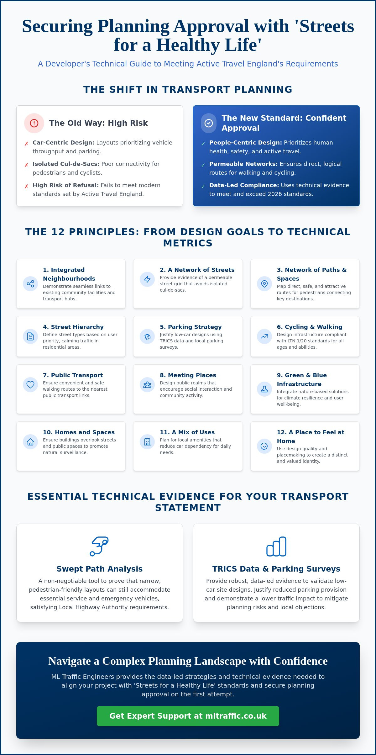
    To secure planning approval, you must translate the 12 Building for a Healthy Life (BfHL) points into verifiable engineering metrics. This process moves beyond subjective design goals. It requires using the streets for a healthy life technical companion guide transport planning framework to prove that your site functions efficiently for all users. Local authorities now demand data that demonstrates permeability, connectivity, and safety. This is where the 12 principles transition from a brochure concept into the backbone of your technical reporting.

    Creating walkable neighborhoods starts with reducing cul-de-sac dependency. A successful layout prioritizes “Connections,” ensuring that pedestrians and cyclists have direct, logical routes that bypass circuitous vehicle paths. This alignment mirrors Transport for London’s Healthy Streets Approach, which emphasizes the human experience of the street environment. For residential sites, you must evidence that essential facilities and services are within a comfortable 10-minute walk, typically defined as an 800-meter radius. Additionally, maximizing Public Transport Accessibility Level (PTAL) ratings ensures that your development isn’t an isolated car-dependent island but a well-integrated part of the wider transit network.

    Active Travel and Modal Shift Requirements

    Meeting the inclusive design mandate requires strict adherence to technical clearances. Under LTN 1/20 standards, cycle lanes must maintain a minimum width of 1.5 to 2.0 meters to accommodate different types of cycles, including cargo bikes and adapted cycles for disabled users. Pedestrian footways should provide at least 2.0 meters of clear space to ensure two wheelchair users can pass comfortably. In your Transport Assessment, you must calculate the potential modal shift by comparing your proposed infrastructure against existing local travel patterns. This data provides the justification for low-car development strategies.

    Street Character and Traffic Calming

    Modern transport planning favors place-based design over the “standard road” template. This involves using shared surfaces and “home zones” where the street character naturally dictates lower vehicle speeds, often 20mph or less. While these layouts improve aesthetics and social interaction, they must still meet functional highway safety requirements. You’ll need to demonstrate that visibility splays and junction geometries don’t compromise safety for vulnerable road users. By applying the streets for a healthy life technical companion guide transport planning principles, you can create a layout that feels like a community space while still satisfying the rigorous safety standards of the Local Highway Authority.

    Evidencing Compliance in Transport Statements and Assessments

    To move from a conceptual layout to a validated development, you must integrate technical evidence directly into your planning documents. Local authorities expect your Transport Statement to provide a rigorous analysis of how the site adheres to the UK Government’s Streets for a Healthy Life Guidance. This isn’t a box-ticking exercise; it requires a structured narrative that links your design choices to measurable transport outcomes. By utilizing the streets for a healthy life technical companion guide transport planning framework, you can transform design theory into a robust evidence base that withstands planning scrutiny.

    When arguing for low-car development, the TRICS database is your most powerful tool. By selecting comparable sites that already utilize healthy street principles, you can evidence lower trip generation rates. This data-led approach often proves that a development will not have a severe impact on the local highway network. In many cases, high-quality pedestrian and cycle infrastructure reduces the need for expensive off-site highway mitigation. If the predicted vehicle load is significantly lower than a traditional, car-centric layout, you can redirect those resources toward higher-quality on-site place-making.

    The Role of the Travel Plan

    A robust Travel Plan serves as a long-term commitment to these healthy street outcomes. It addresses the first and last mile problem by ensuring that the transition between the site and public transport hubs is seamless. You must set realistic, monitorable targets for walking and cycling uptake. These targets shouldn’t be arbitrary; they must reflect the specific improvements made to the site’s permeability and the quality of its active travel links. Monitoring modal shift post-occupation ensures that the healthy street principles continue to deliver benefits throughout the project lifecycle.

    Negotiating with Local Highway Authorities

    Highways Officers often prioritize vehicle flow and road widths over place-making. To successfully negotiate departures from standard road geometries, you must present your streets for a healthy life technical companion guide transport planning strategies during pre-application meetings. Use concrete data to pre-empt common objections regarding emergency access or parking overspill. By showing that your people-first goals don’t compromise safety or functional requirements, you can secure support for innovative designs. This proactive approach reduces the risk of costly delays or planning refusal during the formal application stage.

    Technical Validation: Swept Path Analysis and Parking Surveys

    Designing for human health does not remove the necessity for vehicle functionality. While the 12 principles prioritize active travel, your site must still accommodate emergency services and refuse collection. Applying the streets for a healthy life technical companion guide transport planning framework requires rigorous technical validation to prove that narrow, people-centric streets don’t become logistical bottlenecks. This phase of the planning process moves from vision to verification, ensuring your layout is as practical as it is progressive.

    Swept Path Analysis for Tight Urban Environs

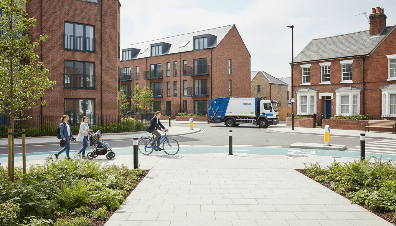
    Innovative shared-space designs often feature tighter corner radii and narrower carriageways to naturally calm traffic. However, these features can create conflict with larger vehicles. We use Swept Path Analysis to model the exact movements of fire tenders and refuse vehicles within your proposed layout. This digital simulation prevents critical design errors that lead to kerb-striking or blocked access. By demonstrating that a 12-meter refuse truck can navigate your “healthy” street without mounting the footway, you provide the safety assurance Highways Officers require. Precision in these models is non-negotiable; it proves that a people-first design remains fully accessible for essential services.

    Evidence-Based Parking Strategies

    Securing approval for car-lite or car-free developments depends entirely on the strength of your data. Detailed Parking Surveys allow you to justify lower parking ratios by evidencing existing capacity in the surrounding area. In London and other urban centers, your Public Transport Accessibility Level (PTAL) rating acts as a primary baseline for these requirements. A high PTAL rating, combined with a robust survey, allows you to reallocate space from car parking to green infrastructure or active travel routes. This approach ensures that parking provision is efficient and doesn’t dominate the streetscape, maintaining the aesthetic and functional integrity of the neighborhood.

    Balancing car park design with active travel priorities involves more than just reducing vehicle numbers. It requires a strategic placement of parking that doesn’t intersect with primary walking and cycling corridors. Using the streets for a healthy life technical companion guide transport planning standards, we help you design layouts where car storage is integrated discreetly, often through mews-style parking or shared hubs. This keeps the street frontage active and safe for pedestrians. When these layouts are backed by empirical survey data, they become much harder for planning committees to refuse. If you need technical validation for your site layout, book a professional Swept Path Analysis or Parking Survey today to secure your planning consent.

    Streets for a Healthy Life: Transport Planning Guide

    How ML Traffic Engineers UK Supports Your Healthy Street Application

    Securing planning approval for a people-centric development requires more than high-quality design; it demands a rigorous evidence base. We translate the design goals of the 12 Building for a Healthy Life principles into the technical documentation required by Local Highway Authorities. Our team prepares bespoke Transport Statements and Transport Assessments that explicitly align with the streets for a healthy life technical companion guide transport planning framework. By providing the data-led justification for your site layout, we help you overcome regulatory hurdles and reduce the risk of planning refusal.

    Our approach centers on precision and technical authority. We don’t just describe the benefits of walkable neighborhoods; we use empirical data to prove their viability. This includes conducting comprehensive Traffic Surveys and Parking Surveys to establish a clear baseline for your application. Whether you’re proposing a car-lite scheme in a high PTAL area or a shared-surface residential development, our data provides the technical backbone your planning report needs to succeed.

    One of the most significant challenges in modern development is navigating the complexities of Highway Design (S278/S38) within healthy street frameworks. We ensure that your pedestrian-first layouts aren’t just attractive, but also meet the strict technical standards for adoption by the Local Highway Authority. This prevents costly redesigns late in the project lifecycle and ensures that your vision for a healthy community is actually buildable and functional.

    Our Full-Managed Transport Planning Service

    ML Traffic Engineers UK manages the full transport planning lifecycle, from initial site feasibility through to final planning submission. Our engineers specialize in technical Swept Path Analysis (SPA) modelling to validate innovative, pedestrian-friendly site layouts. We prove that tight urban environs can remain safe for fire tenders and refuse vehicles without compromising the “place” quality of the street. By liaising directly with Local Authorities during the pre-application stage, we secure early design acceptance and resolve potential objections before they become obstacles to your progress.

    Ready to Secure Planning Approval?

    Precision in transport data is the non-negotiable foundation of a successful healthy street application. Without technical validation, even the most visionary designs can fail at the planning committee. ML Traffic Engineers UK provides the technical authority and regulatory expertise you need to ensure your development meets all legislative requirements while delivering a high-quality environment for future residents. It’s time to move your project forward with confidence.

    Contact ML Traffic Engineers UK today for a tailored project review and see how our expertise can streamline your planning process. Get a quote for your Transport Statement or SPA today and secure the data-led strategies your development deserves.

    Achieving a successful planning outcome in 2026 requires more than an aesthetic vision; it demands a rigorous technical foundation. By mastering the streets for a healthy life technical companion guide transport planning framework, you transform visionary design into a robust, evidence-led application that satisfies the most demanding regulators. As explored, technical validation through specialized Swept Path Analysis and data-driven assessments bridges the gap between people-first layouts and functional highway requirements. Precision in these metrics is the key to reducing project risk and avoiding costly refusals.

    At ML Traffic Engineers UK, our team brings extensive expertise in NPPF and London Plan compliance to every project. We provide the specialized modelling and survey data required for tight urban sites and maintain a proven track record with Local Highway Authorities across England. We understand the intricacies of modern transport planning so that you don’t have to navigate them alone. Let us provide the technical authority your development needs to succeed in a competitive landscape.

    A holistic approach to healthy living also encompasses the internal environment of the home. For developers concerned with comprehensive site safety, Methamphetamine Testing Services NZ Limited provides expert contamination testing, ensuring that residential spaces are as healthy on the inside as the streets are on the outside.

    Request a Technical Transport Review for Your Project today to ensure your site meets the highest standards of safety and accessibility. We’re ready to help you deliver sustainable, healthy communities that stand the test of time.

    Frequently Asked Questions

    Is “Streets for a Healthy Life” a mandatory requirement for UK planning?

    While not a single standalone law, it is effectively mandatory through the National Planning Policy Framework (NPPF) and local design codes. The Levelling Up and Regeneration Act 2023 now requires local authorities to produce authority-wide design codes, making these standards a legal baseline. Failing to follow the streets for a healthy life technical companion guide transport planning framework often leads to planning refusal because Active Travel England acts as a statutory consultee for major developments.

    How does healthy street design affect the number of parking spaces I can provide?

    Healthy street design typically shifts the focus from private car storage to active travel infrastructure. This often results in lower parking ratios, particularly in urban areas with high Public Transport Accessibility Levels (PTAL). By demonstrating high-quality walking and cycling links, you can justify “car-lite” or car-free schemes. This reallocation of space allows for more green infrastructure and social spaces within the development footprint.

    Can a fire engine still access a street designed under healthy street principles?

    Emergency access is a non-negotiable requirement in any healthy street layout. We use specialized Swept Path Analysis to model the exact movements of fire tenders and refuse vehicles within tighter, pedestrian-friendly designs. This technical validation proves that a street can be both people-centric and fully accessible. Proper planning ensures that narrower carriageways or shared surfaces don’t impede life-saving emergency services or essential refuse collection.

    What is the difference between Building for a Healthy Life and the Healthy Streets Approach?

    Building for a Healthy Life (BfHL) is a toolkit specifically for designing new residential neighborhoods based on 12 points. The Healthy Streets Approach, pioneered by Transport for London, is a broader framework used to evaluate the quality of any street using 10 specific health indicators. Both systems share the goal of reducing car dependency, but BfHL is more focused on the site-planning stage for residential developers.

    Do I need a Transport Assessment or just a Transport Statement for a healthy street project?

    The requirement depends on the size and impact of your development rather than the design philosophy itself. Generally, smaller developments require a Transport Statement, while larger, more complex sites need a full Transport Assessment. Regardless of the document type, you must integrate the streets for a healthy life technical companion guide transport planning metrics to prove compliance with modern active travel mandates and local highway standards.

    How do I prove that my development will actually encourage walking and cycling?

    Evidence is provided through a combination of site permeability mapping and a robust Travel Plan. You can use the TRICS database to show lower trip generation rates in comparable developments that prioritize active travel. Additionally, modeling walking distances to local amenities and transit hubs proves the site’s practical walkability. Clear, monitorable targets for modal shift in your reporting further validate these claims to planning officers.

    What technical software is used to validate healthy street designs?

    We primarily use Autodesk Vehicle Tracking to perform Swept Path Analysis, ensuring vehicle maneuvers are safe and functional. For trip generation and modal shift data, the TRICS database remains the industry standard. These tools allow us to provide the empirical evidence required by Local Highway Authorities to support innovative, low-car site layouts that prioritize pedestrian safety over vehicle throughput.

    How much does a healthy street transport planning review cost?

    Costs for a transport planning review depend on the specific requirements of your site, such as the need for detailed Swept Path Analysis or extensive parking surveys. Each project is unique; fees reflect the technical complexity and the level of negotiation required with Local Highway Authorities. We recommend a tailored project review to determine the exact scope of work needed to secure your specific planning approval.

    Michael Lee

    Article by

    Michael Lee

    Transport planner with over 35 years' experience.

    Disclaimer

    The content on mltraffic.co.uk, including all technical articles, guides, and resources, is provided for general informational and educational purposes only. It is not intended to constitute professional advice in traffic engineering, transportation planning, development approvals, or any other technical or legal field.
    While ML Traffic Engineers makes every reasonable effort to ensure the accuracy, completeness, and timeliness of the information published, we do not provide any warranties or representations (express or implied) regarding its reliability, suitability, or availability for any particular purpose. Any reliance you place on the content is strictly at your own risk.
    In no event shall ML Traffic Engineers, its directors, employees, authors, or affiliates be liable for any direct, indirect, incidental, special, consequential, or punitive damages (including, without limitation, loss of profits, data, or business opportunities) arising out of or in connection with the use of, or inability to use, any information provided on this website.
    The articles and guides on this site are not a substitute for engaging a qualified, professional traffic engineer to assess your specific project requirements. For tailored advice, compliance assessments, or traffic engineering services, please contact a competent professional.
    This disclaimer may be updated from time to time without notice. By accessing or using this website, you agree to be bound by the most current version of this disclaimer.
  • Transport Planning Consultants Bromley: A Developer’s Guide to Planning Success in 2026

    Transport Planning Consultants Bromley: A Developer’s Guide to Planning Success in 2026

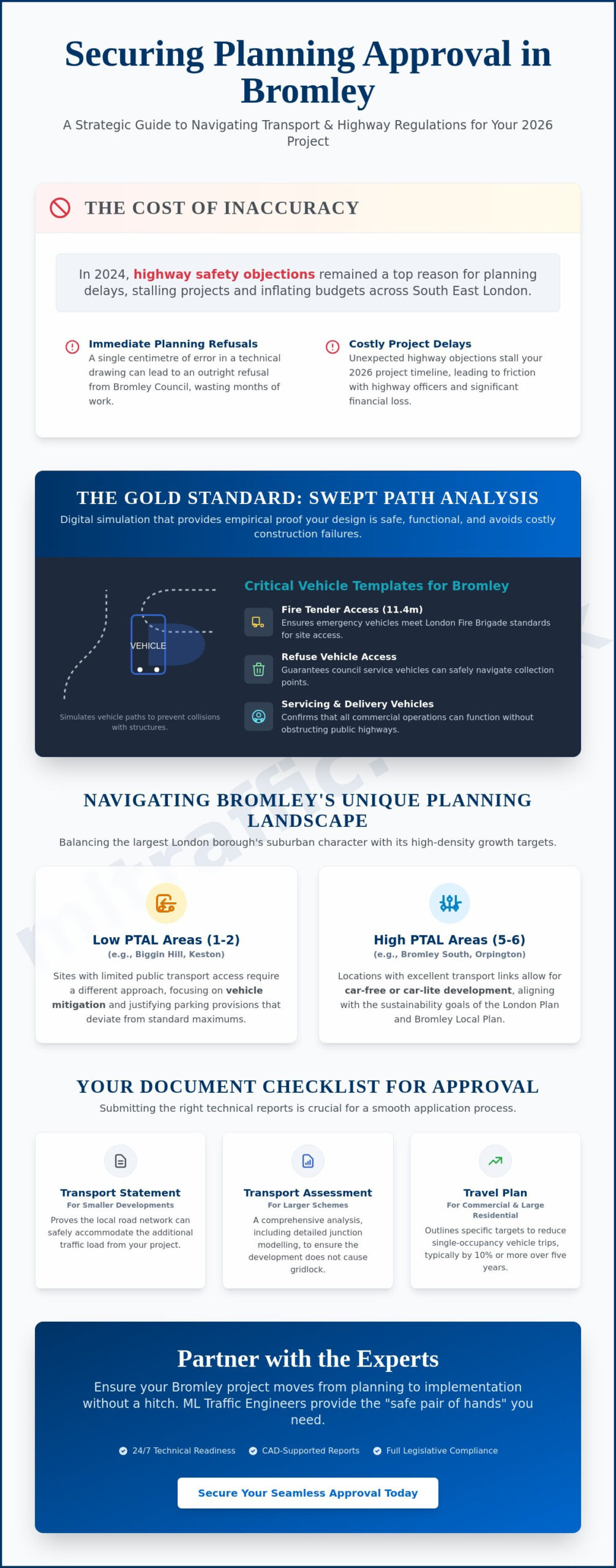
    A single centimetre of error in a swept path analysis can result in an immediate planning refusal from Bromley Council. You’ve likely spent months refining your site layout, only to face unexpected highway safety objections that stall your 2026 project timeline. Working with experienced Transport Planning Consultants Bromley ensures these technical details are handled with precision from day one. We understand that mastering the London Borough of Bromley’s specific parking and access standards often feels like hitting a moving target. It’s frustrating when technical inaccuracies lead to costly delays and friction with highway officers. In 2024, highway safety objections remained one of the top reasons for planning delays in South East London. You need more than just a drawing; you need a strategic partner who understands the intricate complexities of UK road regulations.

    This guide shows you how to secure a seamless approval by navigating the council’s requirements with confidence. You’ll learn how to leverage precise CAD designs and cost-effective technical reports to satisfy every regulatory standard. We’ll walk through the essential components of a successful planning submission, from robust transport statements to expert representation. We ensure your project moves from the initial planning phase through to final implementation without a hitch.

    Key Takeaways

    • Understand the critical intersection between the London Plan and the Bromley Local Plan 2026 to ensure your development meets all evolving council requirements.
    • Discover why digital Swept Path Analysis is the essential gold standard for proving vehicle access feasibility and preventing costly design failures before construction begins.
    • Learn how expert Transport Planning Consultants Bromley provide the technical justification needed to navigate maximum parking standards and specific local policy deviations.
    • Identify common transport “red flags” and access pitfalls that trigger planning refusals, allowing you to mitigate risks before submitting your application.
    • Leverage 24/7 technical readiness and a “safe pair of hands” approach to secure professional, CAD-supported reports that guarantee full legislative compliance.

    The Role of Transport Planning Consultants in Bromley

    Securing planning permission in the London Borough of Bromley requires more than a basic site layout. Transport planning is the technical discipline of managing how people move to and from a new development. As we move toward the targets set for 2026, the Bromley Local Plan places heavy emphasis on sustainable growth and reduced car dependency. Transport Planning Consultants Bromley act as technical experts who translate these rigid policy requirements into actionable site designs. They move beyond simple access design to create complex strategies that prioritise walking, cycling, and public transport over private vehicle use.

    A consultant serves as your direct link to Bromley highway officers. They handle the technical negotiations regarding road safety, junction capacity, and the overall impact on the local network. This relationship is vital for avoiding costly delays during the planning process. Instead of reacting to objections, a consultant proactively addresses potential traffic issues before the application is submitted. They ensure your project meets the London Plan 2021 standards and local Bromley requirements, providing a safe pair of hands for complex urban or suburban developments. For a broader perspective on selecting the right expertise for your scheme, the developer’s guide to choosing transport consultants UK professionals trust outlines the essential criteria for a successful London planning submission.

    Why Bromley’s Geography Requires Specialized Planning

    Bromley is the largest London borough by area, covering 150 square kilometres. This creates a unique challenge for any developer. You must balance the protected “leafy” suburban character of areas like Chislehurst and Keston with the high-density requirements of Bromley South and Orpington. Transport Planning Consultants Bromley use Public Transport Accessibility Level (PTAL) ratings to determine your project’s parking and density viability. A site near Bromley South station might have a PTAL of 5 or 6, which allows for car-free or car-lite development. Conversely, a site in Biggin Hill might have a PTAL of 1 or 2, requiring a completely different approach to vehicle mitigation and infrastructure design.

    Key Documents for Your Planning Application

    The scale of your project dictates the documentation you must submit to the council. Smaller developments typically require a Transport Statement to prove the local road network can handle the additional load. Larger schemes demand a full Transport Assessment. This document includes detailed junction modelling and capacity analysis to ensure the development doesn’t cause gridlock. By 2026, Travel Plans have become essential for almost all commercial and large residential applications. These plans outline specific targets to reduce single-occupancy vehicle trips, often by 10% or more over a five-year period. You can see our project types for specific examples of these documents in practice. Precision in these reports prevents the London Borough of Bromley from issuing a refusal based on transport grounds.

    Swept Path Analysis: The Core of Modern Access Design

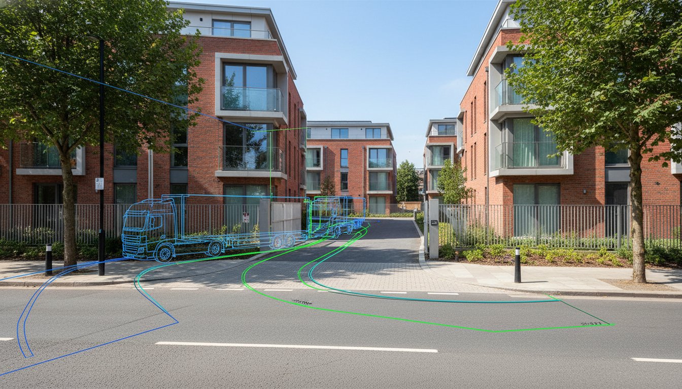
    Swept Path Analysis (SPA) serves as the technical foundation for every successful planning application in the London Borough of Bromley. It’s a digital simulation that maps the path of a vehicle as it maneuvers through a proposed site layout. Planners view this as the gold standard because it provides empirical proof that a design is safe and functional. Transport Planning Consultants Bromley use these simulations to identify potential collisions between vehicles and permanent structures like kerbs, walls, or parked cars before any ground is broken.

    In 2026, the margin for error has disappeared. Bromley Council updated its local plan requirements to reflect the increased size of modern service vehicles and stricter safety protocols. Digital simulation prevents physical access failures, saving developers from the catastrophic expense of retrofitting access roads after construction. For tight urban infill sites, which are common in areas like Beckenham or Orpington, SPA is often the deciding factor in securing planning permission from a skeptical committee.

    Critical Vehicle Templates for Bromley Developments

    Local authorities require specific vehicle templates to ensure public safety and service continuity. Our simulations focus on three primary areas:

    • Fire Tender Access: Our engineers simulate the movement of 11.4m fire tenders to meet London Fire Brigade standards. This ensures emergency vehicles reach every corner of the development without obstruction.
    • Refuse Vehicle Tracking: Bromley Council employs specific waste collection criteria. We use 11.2m refuse vehicle templates to confirm that bins are collected without the truck mounting pavements or blocking essential traffic flow.
    • Deliveries and Servicing: For commercial projects, we map the swept paths of Heavy Goods Vehicles (HGVs) and Light Goods Vehicles (LGVs) to ensure loading bays remain accessible and functional under heavy use.

    The Technology Behind the Analysis

    Our team utilizes industry-leading software like AutoTrack to produce millimetre-perfect simulations. This CAD-based technology allows us to overlay 2D and 3D swept paths directly onto your architectural site plans. These visualizations highlight “pinch points” in car park designs where visibility might be compromised or turning circles are too tight for standard vehicles.

    By identifying these issues during the initial design phase, Transport Planning Consultants Bromley provide a clear, data-driven path to approval. You can learn more about swept path analysis services in London to see how these techniques apply across the capital. If you need to verify your site’s viability, we offer comprehensive traffic planning support to guide your project through the regulatory process. Our constant availability ensures your project moves forward without delay.

    Transport Planning Consultants Bromley: A Developer's Guide to Planning Success in 2026

    Bromley Council operates within a complex regulatory framework. It must adhere to the London Plan 2021 while maintaining the borough’s unique character. By 2026, the council has intensified its scrutiny of “Vision Zero” targets. Every new development must demonstrate a proactive contribution to eliminating road deaths and serious injuries. This requires more than just a standard Transport Assessment. Expert Transport Planning Consultants Bromley provide the technical rigor needed to satisfy these safety-first requirements. We ensure your project aligns with the latest pedestrian safety audits and cycle infrastructure standards.

    Sustainable Drainage Systems (SuDS) are now a non-negotiable part of highway design in the borough. Bromley requires developers to manage surface water runoff within the site boundary to prevent local flooding. This often involves permeable paving or rain gardens integrated directly into the transport layout. Our designs prioritize these green solutions without compromising vehicle tracking or site access. We focus on seamless integration to satisfy both highway and environmental officers simultaneously.

    Bromley’s Approach to Parking and PTAL Ratings

    Bromley contains some of the most varied PTAL (Public Transport Accessibility Level) ratings in London. While central Bromley often reaches scores of 5 or 6, rural areas like Biggin Hill can drop to 0 or 1. You can’t apply a one-size-fits-all approach here. For car-lite developments in the town center, you’ll need robust justification to deviate from the London Plan’s maximum allowances. If you’re proposing lower parking ratios, you must prove that on-street capacity exists. Our team utilizes parking surveys to provide the empirical data Bromley’s planning officers demand. These surveys follow the Lambeth Methodology to ensure accuracy within a 200-metre radius of your site.

    S278 and S38 Agreements in the Borough

    Securing planning permission is only half the battle for a developer. If your project requires changes to the public highway, you’ll need a Section 278 agreement. This is a legal contract between the developer and Bromley Council. It ensures that off-site highway improvements, like new site accesses or junction upgrades, meet strict safety and construction standards. For internal roads intended for adoption by the council, a Section 38 agreement is necessary. Our engineers provide comprehensive highway design services to manage these technical approvals. We handle the CAD drawings and technical audits to prevent costly delays during the construction phase. We act as your technical liaison, ensuring all works meet the borough’s specific adoption criteria.

    Preventing Planning Refusal: Common Access Pitfalls

    Planning refusal in the London Borough of Bromley often stems from overlooked transport details that appear minor but impact public safety. Professional Transport Planning Consultants Bromley identify these “red flag” issues during the initial site appraisal. If you wait for the Highways Officer to point out a deficiency, you’ve already lost time and momentum.

    One of the most expensive mistakes is delaying swept path analysis until the objection stage. This CAD-based simulation proves that large vehicles, such as 11.4-metre refuse trucks or emergency fire tenders, can enter and exit your site in forward gear. If your site layout doesn’t account for these turning circles, you may face a total redesign of your ground floor or parking area. This often happens after the architectural plans are supposedly “final,” leading to thousands of pounds in wasted design fees.

    When highway officers raise concerns, don’t guess. Respond with technical data. We use 2026-compliant modelling to show exactly how a development impacts the local network. In a 2024 case study involving a narrow residential mews near Bromley South, access objections nearly stalled a six-unit development. By using high-precision 3D swept path analysis and revised visibility splay calculations, we proved that the existing entrance met safety standards without requiring land from neighbouring properties. The application was approved in the next committee cycle.

    Top 5 Reasons Bromley Transport Applications Fail

    • Inadequate visibility splays: Failing to prove that drivers can see 43 metres in both directions at a 30mph junction.
    • Emergency vehicle access: Failing to demonstrate safe turning circles for a standard 12-tonne fire appliance.
    • Inaccurate traffic surveys: Using outdated data that underestimates the number of peak-hour trips.
    • Cycle storage non-compliance: Not meeting the London Plan’s strict requirements for secure, accessible bike parking.
    • Over-reliance on on-street parking: Assuming the local streets can handle “overspill” without a formal parking stress survey.

    Proactive Mitigation Strategies

    Success requires a proactive stance. We often redesign car park layouts to maximise every square metre while maintaining Chapter 8 compliance and safety. Implementing a robust Travel Plan can also reduce your development’s perceived impact on peak-hour congestion by promoting sustainable transport alternatives. Engaging in pre-application discussions with the Bromley highways team is vital. It allows us to resolve technical disputes before they’re made public in the planning portal.

    Partnering with ML Traffic Engineers for Your Bromley Project

    Securing planning permission in 2026 requires more than just standard documentation. It demands a partner who anticipates regulatory shifts and responds with urgency. As leading Transport Planning Consultants Bromley, ML Traffic Engineers provides a 24/7 response model to ensure your project never stalls. Speed of technical response is critical. A single day’s delay in submitting a revised drawing can result in missing a planning committee deadline, potentially pushing your project back by three months or more.

    We adopt a “Safe Pair of Hands” approach to every technical transport report. This means we take full responsibility for the accuracy and compliance of your submission. We don’t just identify potential highway issues; we engineer the solutions required to overcome them. Our team provides total managed solutions that cover the entire project lifecycle. We handle everything from the initial site survey and data collection to the final negotiations with highway officers. Our deep understanding of London-specific regulations and Bromley’s local transport policies makes us the most reliable partner for developers in the borough. Understanding what separates effective transport consultants UK developers rely on for London planning success can help you make the most informed choice for your project.

    Data-Driven Precision for Developers

    Accuracy is the only way to avoid costly appeals. We use our own in-house data collection teams to ensure every Transport Statement is based on current, verifiable facts rather than outdated estimates. This precision allows us to combine technical Swept Path Analysis (SPA) with practical highway engineering to prove your site’s viability. We demonstrate exactly how delivery vehicles or emergency services will navigate your development. We maintain an unwavering commitment to Chapter 8 safety standards to ensure all site-based assessments are conducted with total legal and physical integrity.

    Start Your Bromley Planning Journey Today

    The first step toward a successful build is a comprehensive site feasibility review. Our process for requesting a quote is designed for speed, providing you with the clarity you need to make informed investment decisions. We collaborate closely with architects during the early design stages to refine site layouts. This partnership ensures that access points and parking configurations are optimized for both local authority approval and maximum development efficiency. Getting these details right at the start prevents expensive redesigns later in the process.

    Don’t leave your project’s success to chance. You can Contact ML Traffic Engineers for your Bromley project today to secure the technical expertise your development deserves.

    Future-Proof Your Bromley Development for 2026

    Success in the Bromley planning landscape requires more than just a standard application; it demands technical precision and a deep understanding of local access requirements. By utilizing advanced AutoTrack swept path analysis and TRICS modelling, you can address potential access pitfalls before they lead to a refusal. These tools are essential for proving that your site can handle modern traffic demands while maintaining strict safety standards.

    Since 2014, ML Traffic Engineers has acted as a dependable partner for developers across the capital. With over a decade of London planning experience, we provide the 24/7 emergency response and rapid technical report turnaround necessary to meet tight deadlines. As expert Transport Planning Consultants Bromley, we take pride in managing the logistical burdens of your project from initial CAD design through to final execution. Our team ensures full legislative compliance so you don’t have to worry about regulatory stress.

    Secure your Bromley planning approval with expert transport consultancy

    Your project’s viability is our priority, and we’re ready to provide the professional integrity your development needs to succeed.

    Frequently Asked Questions

    When is a Transport Statement required for a planning application in Bromley?

    Bromley Council requires a Transport Statement for developments that generate moderate traffic levels but don’t warrant a full assessment. This usually applies to residential schemes between 50 and 80 units or commercial developments with a floor area exceeding 1,500 square metres. It’s a vital document that proves your project won’t negatively impact the local highway network’s safety or capacity.

    How long does a swept path analysis report take to produce?

    A standard swept path analysis report typically takes 3 to 5 working days from the moment we receive your final CAD site layout. For more complex projects involving multi-way systems or emergency vehicle access through narrow junctions, the process might take up to 7 days. We prioritize speed and precision to ensure your planning submission remains on schedule.

    Does Bromley Council have specific parking standards for new residential developments?

    Bromley follows the parking standards set out in the London Plan 2021, which links parking provision to Public Transport Accessibility Level (PTAL) scores. In areas with a PTAL score of 4 to 6, the council expects car-free developments. Conversely, in PTAL 0 to 1 areas, developers can provide up to 1.5 spaces per unit to meet local demand.

    What is the difference between a Transport Assessment and a Transport Statement?

    The primary difference lies in the scale of the development and the depth of the required data. A Transport Statement is a concise report for smaller projects with limited traffic impact. Transport Planning Consultants Bromley produce full Transport Assessments for larger schemes, incorporating detailed traffic modelling and junction capacity analysis to satisfy the National Planning Policy Framework requirements.

    Can swept path analysis help if my site has a very narrow entrance?

    Swept path analysis is essential for sites with constrained access points because it provides digital proof of vehicle maneuverability. By using CAD design software, we simulate the exact turning circles of refuse trucks and fire tenders. This technical evidence often resolves Highway Authority concerns about site safety and prevents costly delays during the planning committee stage.

    How much do transport planning consultants in Bromley typically cost?

    Fees depend heavily on project complexity, but a basic Transport Statement for a small-scale Bromley development often starts around £1,500. For major residential or commercial schemes requiring extensive traffic data and Transport Planning Consultants Bromley expertise, costs can exceed £5,000. These figures reflect the technical expertise required to ensure full regulatory compliance and safety.

    What happens if the Highway Authority objects to my planning application?

    An objection from the Highway Authority triggers a formal review of your site’s access and safety design. We act immediately to review the specific grounds for objection, such as inadequate visibility splays or pedestrian safety concerns. Our team then prepares a robust technical rebuttal or suggests design modifications to align the project with current safety standards.

    Do I need a parking survey for a small-scale development in Bromley?

    You’ll need a parking survey if your proposal offers less parking than the London Plan’s maximum standards. Bromley Council typically insists on a survey following the Lambeth Methodology, which requires data collection between 00:30 and 05:30 on two separate weekday nights. This data proves that the surrounding streets have the capacity to absorb any potential overspill.

    Michael Lee

    Article by

    Michael Lee

    Transport planner with over 35 years’ experience.

    Disclaimer

    The content on mltraffic.co.uk, including all technical articles, guides, and resources, is provided for general informational and educational purposes only. It is not intended to constitute professional advice in traffic engineering, transportation planning, development approvals, or any other technical or legal field.
    While ML Traffic Engineers makes every reasonable effort to ensure the accuracy, completeness, and timeliness of the information published, we do not provide any warranties or representations (express or implied) regarding its reliability, suitability, or availability for any particular purpose. Any reliance you place on the content is strictly at your own risk.
    In no event shall ML Traffic Engineers, its directors, employees, authors, or affiliates be liable for any direct, indirect, incidental, special, consequential, or punitive damages (including, without limitation, loss of profits, data, or business opportunities) arising out of or in connection with the use of, or inability to use, any information provided on this website.
    The articles and guides on this site are not a substitute for engaging a qualified, professional traffic engineer to assess your specific project requirements. For tailored advice, compliance assessments, or traffic engineering services, please contact a competent professional.
    This disclaimer may be updated from time to time without notice. By accessing or using this website, you agree to be bound by the most current version of this disclaimer.