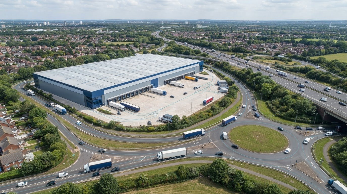
A transport assessment for a distribution centre near the M25 may be needed when the proposal is likely to have significant transport implications. The case depends on expected vehicle movements, site access and effects on the surrounding road network; there isn’t one M25-wide threshold that decides every application. UK Government says freight and logistics developments should have good access to transport networks suited to their type, including sustainable modes where possible.
For a warehouse or distribution centre, the key issue is not simply how many vehicles the site will generate. Trip timing and type, route choice and the capacity of nearby junctions all influence the assessment. A Transport Statement may suit a proposal with limited transport effects, while more substantial impacts can require a fuller Transport Assessment.
This article explains why a Transport Assessment may be needed, how vehicle movements and junction capacity are examined, and how to establish a proportionate scope with highway officers. It also covers how Transport Assessments, Transport Statements and supporting surveys can provide clear evidence for a planning application.
Key Takeaways
- Assess how warehouse traffic affects nearby junctions, not just the site entrance; trip timing, vehicle type and route choice all help shape the network analysis.
- Use expected vehicle movements, access arrangements and existing highway conditions to explain whether the proposal could have significant transport impacts.
- Thresholds can vary by local authority. For example, Guildford’s guidance uses different document requirements for B8 developments at 3,000 to 5,000 sq m and over 5,000 sq m.
- Identify the local planning authority and relevant highway authority early, then agree the assessment scope with the highways team before preparing the planning submission.
- Transport Assessments, Transport Statements, surveys and vehicle tracking can provide evidence suited to the proposal’s scale and transport issues.
Junction and network capacity
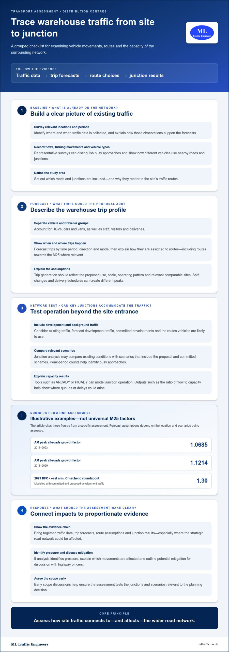
For a transport assessment for a distribution centre near the M25, junction capacity is considered alongside the traffic the development would add. The analysis looks beyond the site access to nearby roads and junctions that could carry those trips. It considers existing traffic, forecast development traffic, committed developments and the routes vehicles are likely to use.
National Highways requirements depend on whether a proposal could affect the strategic road network, including the M25 and its junctions. The National Planning Policy Framework says freight and logistics developments should have good access to transport networks appropriate to their type, including sustainable transport modes where possible, according to UK Government. Assessment scope should explain the connection between the site, its traffic routes and the network.
A site near an M25 junction may send HGVs towards that junction, but its wider effects depend on access arrangements, trip patterns and route distribution. Department for Transport Circular 02/2013 is listed as further reading on the strategic road network and sustainable development. The assessment should make clear which roads and junctions form part of its study area and why those locations matter.
Junction analysis tests whether forecast traffic can pass through key approaches without unacceptable queuing or delay. It may compare existing conditions with scenarios that include the proposed development and committed schemes. The traffic evidence should identify survey locations and collection periods, then explain how those observations inform the forecasts. Peak-period counts help distinguish busy approaches from movements less likely to affect junction operation.
Forecasts also account for background traffic growth. One assessment applied AM peak all-roads growth factors of 1.0685 for 2018-2023 and 1.1214 for 2018-2029. These are examples from that assessment, not universal factors for M25 proposals. The correct forecast period and assumptions depend on the assessment’s location and scenarios.
Capacity modelling may use tools such as ARCADY or PICADY to examine junction operation. Outputs, including the ratio of flow to capacity, help show where queues or delays could arise. One assessment modelled a 2029 RFC of 1.30 on the east arm of Churchend roundabout with committed and proposed development traffic. That result is a location-specific example, not a prediction for a junction near the M25.
For a development affecting the strategic road network, the assessment should present a clear evidence chain: traffic data, trip forecasts, route assumptions and junction results. If the analysis identifies pressure, it can explain which movements are affected and outline potential mitigation for discussion with highway officers. Agreeing the scope early helps ensure the analysis tests the junctions and scenarios relevant to the planning decision.
Vehicle movement and significant transport impacts
Traffic surveys and trip-generation evidence help show how a distribution centre could affect surrounding roads. Surveys can record existing flows, turning movements and vehicle types. Forecasts then estimate development trips by time period, direction and mode. For a warehouse, distinguish HGVs from cars and vans, and account for staff, visitors and deliveries.
Trip generation should reflect the proposed use, scale, operating pattern and relevant comparable sites. A distribution centre with shift changes may concentrate staff arrivals, while delivery schedules can create different HGV peaks. The assessment should explain its assumptions and show how trips are assigned to routes, including access towards the M25 where relevant.
Sustainable transport measures can include walking, cycling, public transport and car sharing, supported by a Framework Travel Plan. The plan can set out initiatives, responsibilities and monitoring arrangements; it normally accompanies an initial planning application and may become a planning condition or Section 106 obligation.
For staff travel, consider whether site access, facilities and public transport make alternatives practical. Measures for a distribution centre should reflect its workforce, operating hours and location rather than rely on a generic travel offer. A Green Travel Plan should link proposed initiatives to how staff travel to and from the site.
Planning risks arise if evidence does not adequately address highway effects, access, parking or sustainable travel. Mitigation may involve changes to access or travel measures, while highway contributions can support agreed improvements. Full transport mitigation is likely before first occupation or opening unless a phased strategy matches development build-out. The relevant authority’s requirements and the development’s impacts shape the appropriate approach. Alongside transport planning, commercial schemes must also address broader statutory obligations prior to occupation, where multi-disciplinary property compliance specialists such as oxford-ec.co.uk assist developers across the UK.
For a distribution centre, connect each identified impact to a proportionate response. Vehicle tracking can test whether the internal layout accommodates delivery and refuse vehicles. Parking evidence can help establish how staff and visitors will be accommodated without adding pressure to nearby streets.
Useful evidence may include:
- Traffic surveys covering representative locations, periods, turning movements and vehicle classifications.
- Trip-generation calculations explaining comparable land uses, operating assumptions and peak periods.
- Route assignment showing how cars, vans and HGVs may reach the site and strategic roads.
- Parking analysis and site-layout tracking for delivery and refuse strategies.
- A Travel Plan setting out practical walking, cycling, public transport and car-sharing measures.
Connecting survey results with forecast trips helps highways officers understand the development’s likely effects. A Framework Travel Plan can document proposed travel measures alongside the transport evidence.
When transport assessments or transport statements are required
A transport assessment for a distribution centre near the M25 may be required when a proposal is likely to have significant transport implications. The deciding factors include the site’s scale, expected vehicle movements, access arrangements and effects on surrounding roads. There isn’t one threshold that applies to every authority or development. Local planning policy and the highway authority’s requirements shape the evidence needed.
A Transport Statement is a concise assessment for proposals with limited transport issues where a full assessment is not required. A Transport Assessment examines more substantial effects, including existing highway conditions, accessibility and forecast traffic. The distinction depends on the scale and complexity of transport impacts, not simply whether the proposal is a warehouse or distribution centre.
Local thresholds illustrate why applicants need to consider the relevant authority’s policy. For B8 storage or distribution developments in Guildford, a Transport Statement applies at sizes from 3,000 to 5,000 sq m. A Transport Assessment applies when the development is over 5,000 sq m. Those Guildford size bands are local criteria, not a blanket rule for every M25-area site.
Movement and parking thresholds also appear in requirements for specified buildings. These state that a Transport Assessment and Travel Plan are required where a site will experience over 30 two-way vehicle movements per hour, over 100 two-way vehicle movements per day, or contains over 100 parking spaces. Apply these figures only within the scope of the relevant requirements; they do not establish a universal M25 trigger.
The likely transport effects can matter more than a single site measurement. A smaller proposal may still need assessment if its access or traffic affects a sensitive junction. A proposal with limited effects may need neither a Transport Assessment nor a Transport Statement, depending on the relevant authorities’ requirements. The evidence should explain trip generation, routes, access and sustainable travel measures.
Guildford Borough Council directs applicants to National Planning Policy Framework paragraphs 109 to 111 for further information on Transport Assessments and Travel Plans. In London, a Transport Assessment should accompany an application where a development is likely to have significant transport implications. These examples show why an M25 location alone doesn’t settle the requirement.
For a distribution proposal, consider these factors together:
- Use and scale: the B8 floorspace and the authority’s local thresholds.
- Vehicle movements: expected HGV, van and staff trips, including peak periods.
- Network effects: access, route choice and impacts on nearby junctions.
- Travel and parking: site accessibility, parking demand and practical alternatives to car travel.
A proportionate document should reflect the proposal’s likely effects and the authority’s stated requirements, rather than rely on a threshold from another council area.
Agreeing assessment scope with the highways team
Agree the assessment scope before fixing survey work or modelling assumptions. For a distribution centre near the M25, identify the local planning authority and highway authority first. Then establish whether the site’s access or forecast routes could affect the strategic road network. The scope should reflect those connections, not simply the site boundary.
Discuss the proposed development with the relevant highway officers before submitting the planning application, and agree the scope and contents of the required transport documents. Early discussion can establish what evidence the authority expects. Tailor the approach to the site and its likely effects instead of copying another council’s checklist.
Prepare a concise scope proposal that describes the development, access points, operating assumptions and likely vehicle types. Identify the roads and junctions to assess, explaining how distribution traffic may reach the M25. Include proposed survey locations and periods, existing traffic evidence, the trip-generation method, forecast scenarios and any junction modelling. These details give officers a clear basis for agreeing what the assessment must cover.
For an M25-area site, explain how the proposal relates to the National Planning Policy Framework and the strategic road network. The Framework says freight and logistics developments should have good access to transport networks appropriate to their type, including sustainable transport modes where possible, according to UK Government. Set out how the scope will address access, likely routes and practical sustainable travel options.
Define the collision review area in relation to the proposed access and the roads included in the assessment. Explain which available Personal Injury Collision data will be reviewed and why the selected area relates to the development’s traffic effects. If forecast routes extend beyond roads adjoining the site, include those links in the proposed study area for discussion with highway officers.
Use the discussion to settle the evidence needed for each transport issue. A written scope can record:
- Which access points, local roads and M25 connections the assessment will examine.
- Where traffic surveys will take place and which periods they will cover.
- How trip generation, route assignment and committed development will be treated.
- Which junctions need modelling and what forecast scenarios will be tested.
- Whether collision review, parking evidence, sustainable travel measures or mitigation require further detail.
Agree which junctions and assumptions need detailed modelling before the analysis begins. Record the agreed scope, evidence requirements and any changes raised during the discussion. If the access, site boundary or distribution routes change, revisit the scope with the relevant authority so the final assessment addresses the proposal’s actual transport effects.
Which local planning authority and highway authority cover the proposed site?
Start by locating the site boundary, proposed access and roads used by distribution traffic. The local planning authority (LPA) determines the planning application, while the relevant highway authority provides transport advice on roads within its responsibility. A site near the M25 may involve more than one authority, especially where access roads and forecast routes cross administrative boundaries.
Identify the LPA from the site’s exact location, rather than relying on a nearby town or postal address. Then identify the highway authority for the site access and each road included in the assessment. If forecast HGV routes reach the strategic road network, establish which authority needs to consider those connections. The M25 is not itself a local boundary marker for deciding every transport responsibility.
Use the proposed development plan to define the area that needs checking. Mark the red-line boundary, access points, nearby junctions and likely routes towards the M25. Then compare that area with the relevant council boundaries and highway responsibilities. Where a route crosses into another authority’s area, include the affected roads in the scope discussion rather than assuming the site authority covers the whole network.
The planning authority and highway authority may have different roles, even when one council performs both functions. The local planning authority handles the application; highway officers assess transport evidence and advise on effects, access and mitigation. For a major proposal in London, transport assessments should show accessibility by all modes, likely modal split and measures to improve access by public transport, walking and cycling. This illustrates why the local planning context matters.
Before agreeing the assessment scope, create an authority and network schedule containing:
- The site address, boundary plan and proposed vehicle access.
- The LPA responsible for the application and the relevant highway contact.
- Each road and junction included in the traffic-impact study.
- Any route connection to the M25 or another strategic road.
- Questions about survey locations, modelling and sustainable travel evidence.
Stockport Council, for example, advises developers to contact its Highways team within Development Management before submitting an application. That is a local example, not a procedure that automatically applies to every M25-area site. The responsible authority’s own policies and scope expectations should guide the submission. Early identification also helps avoid preparing evidence for the wrong network or omitting a council affected by forecast traffic.
Record the agreed authority contacts and assessment area in the project file. If the site boundary, access or distribution routes change, revisit the authority map and scope before finalising the transport evidence. Discuss the transport requirements for your proposed site as you prepare the planning submission.
ML Traffic Engineers UK: Transport Statements
ML Traffic Engineers UK prepares Transport Assessments and Transport Statements for development planning applications. This support is relevant when a distribution centre proposal needs clear transport evidence about its scale, access and likely effects on surrounding roads.
Where vehicle movements, parking demand or site access need further examination, Parking Surveys and Swept Path Analysis can provide relevant project evidence. The appropriate work depends on the planning questions and the scope for the proposed site.
A coordinated assessment can bring the transport evidence together for submission and help address the issues raised by the development. To discuss your proposed site and planning requirements, contact ML Traffic Engineers UK.
Prepare your next planning step with confidence
A transport assessment for a distribution centre near the M25 is most useful when it supports clear planning decisions from the outset. Before moving forward, bring together the proposal’s access arrangements, operational assumptions and key transport questions. This gives the assessment a practical focus and helps keep the planning submission aligned with the evidence highways officers need.
ML Traffic Engineers UK provides Transport Statements, Swept Path Analysis and Parking Surveys to support development planning applications. The right evidence depends on the site and the questions the planning process needs to resolve. Discuss your proposed distribution centre with the team to identify the services that fit the project.
Take the next step by contacting ML Traffic Engineers UK about your proposed site. With the transport issues clearly scoped, you can progress your planning work with a more organised evidence base.
Frequently Asked Questions
Why do you need Transport Assessments?
Transport Assessments help planning authorities understand how a development could affect travel and the highway network. They provide evidence about access, expected trips and transport effects, helping decision-makers consider whether a proposal is acceptable and what changes may be needed. For a distribution centre, the assessment can distinguish operational traffic from background flows and show how the site supports sustainable travel where those options suit its location and workforce.
What is a transport assessment for a distribution centre and when is one required in England?
A transport assessment for a distribution centre near the M25 is a planning document examining access, existing highway conditions and traffic associated with the proposal. It is generally needed when significant transport impacts are anticipated; a Transport Statement is a shorter alternative where transport issues are limited. For example, a proposal with a straightforward access and limited network effects may need a different level of evidence from one generating complex HGV movements. The relevant authority’s requirements inform the scope.
What transport assessment requirements apply to a distribution centre near the M25?
Requirements depend on the development’s effects and the authorities responsible for the site and affected roads. The National Planning Policy Framework says freight and logistics developments should have good access to transport networks appropriate to their type, including sustainable modes where possible, according to UK Government. A proposal should explain how its access and routes relate to the network. The M25 location alone does not establish one universal assessment threshold or document requirement.
How are HGV and van trip numbers, routes, and peak-hour impacts assessed?
Assessors combine traffic survey evidence with trip-generation estimates for the proposed use. They distinguish HGVs, vans, staff and other traffic, then consider when trips occur and which routes they are likely to use. Shift patterns and delivery schedules can influence peak periods, so assumptions should reflect the proposed operation. Route assignment shows where trips join local roads or approach the M25, helping identify which links and junctions need closer analysis.
What transport modelling and junction capacity assessments are required for an M25 distribution centre?
The modelling should match the junctions and scenarios identified through the assessment scope, rather than applying the same tests to every site. It may compare existing traffic with forecasts including the development and committed schemes, then report queues, delays or flow-to-capacity results. ARCADY and PICADY are examples of software used for junction assessment. The modelled network should reflect forecast routes, including relevant connections towards the M25, and use assumptions agreed with highways officers.

Disclaimer
The content on mltraffic.co.uk, including all technical articles, guides, and resources, is provided for general informational and educational purposes only. It is not intended to constitute professional advice in traffic engineering, transportation planning, development approvals, or any other technical or legal field.
While ML Traffic Engineers makes every reasonable effort to ensure the accuracy, completeness, and timeliness of the information published, we do not provide any warranties or representations (express or implied) regarding its reliability, suitability, or availability for any particular purpose. Any reliance you place on the content is strictly at your own risk.
In no event shall ML Traffic Engineers, its directors, employees, authors, or affiliates be liable for any direct, indirect, incidental, special, consequential, or punitive damages (including, without limitation, loss of profits, data, or business opportunities) arising out of or in connection with the use of, or inability to use, any information provided on this website.
The articles and guides on this site are not a substitute for engaging a qualified, professional traffic engineer to assess your specific project requirements. For tailored advice, compliance assessments, or traffic engineering services, please contact a competent professional.
This disclaimer may be updated from time to time without notice. By accessing or using this website, you agree to be bound by the most current version of this disclaimer.