Highway transportation underpins nearly every planning decision you’ll make this year. Whether you’re submitting a residential scheme, a commercial unit, or a logistics hub, the highway network’s capacity to accommodate your proposal will determine whether it wins approval or faces refusal. For architects, planners, and developers working in 2026, understanding how local authorities assess highway impact, and what design standards they expect, is no longer optional. It’s the difference between a smooth consent and months of costly revision. This guide walks you through the essentials: what highway transportation really means, how it shapes development planning, and the practical steps you need to take to satisfy highways officers and planning committees alike.
Key Takeaways
- Highway transportation assessment is a critical factor in planning decisions, determining whether development proposals gain approval or face refusal based on the network’s capacity to accommodate additional trips.
- Local authorities evaluate highway impact using traffic impact assessments (TIAs) and design standards such as Manual for Streets, requiring early engagement with highways officers before formal submission.
- Highway capacity thresholds vary significantly by council and location, making it essential to check your local authority’s specific validation requirements rather than assuming a standard approach.
- Common highway challenges including peak-hour congestion, freight capacity limitations, and environmental emissions require robust mitigation strategies such as sustainable transport plans and off-site improvements.
- Compliance with national and local highway design standards for junction geometry, visibility splays, and pedestrian safety is non-negotiable, as non-compliance will require costly rectification before adoption.
- Early dialogue with highways consultants and local authorities about baseline network performance, pinch points, and credible mitigation can transform a contentious highway transportation proposal into a straightforward approval.
What Is Highway Transportation and Why Does It Matter?
Highway transportation is the movement of people and goods by road, using vehicles on a prepared road network. It covers everything from daily commuter journeys and school runs to freight deliveries and emergency-service access. In the UK, this network includes motorways, A-roads, B-roads, and local streets, all maintained to various standards by Highways England (now National Highways) or local highway authorities.
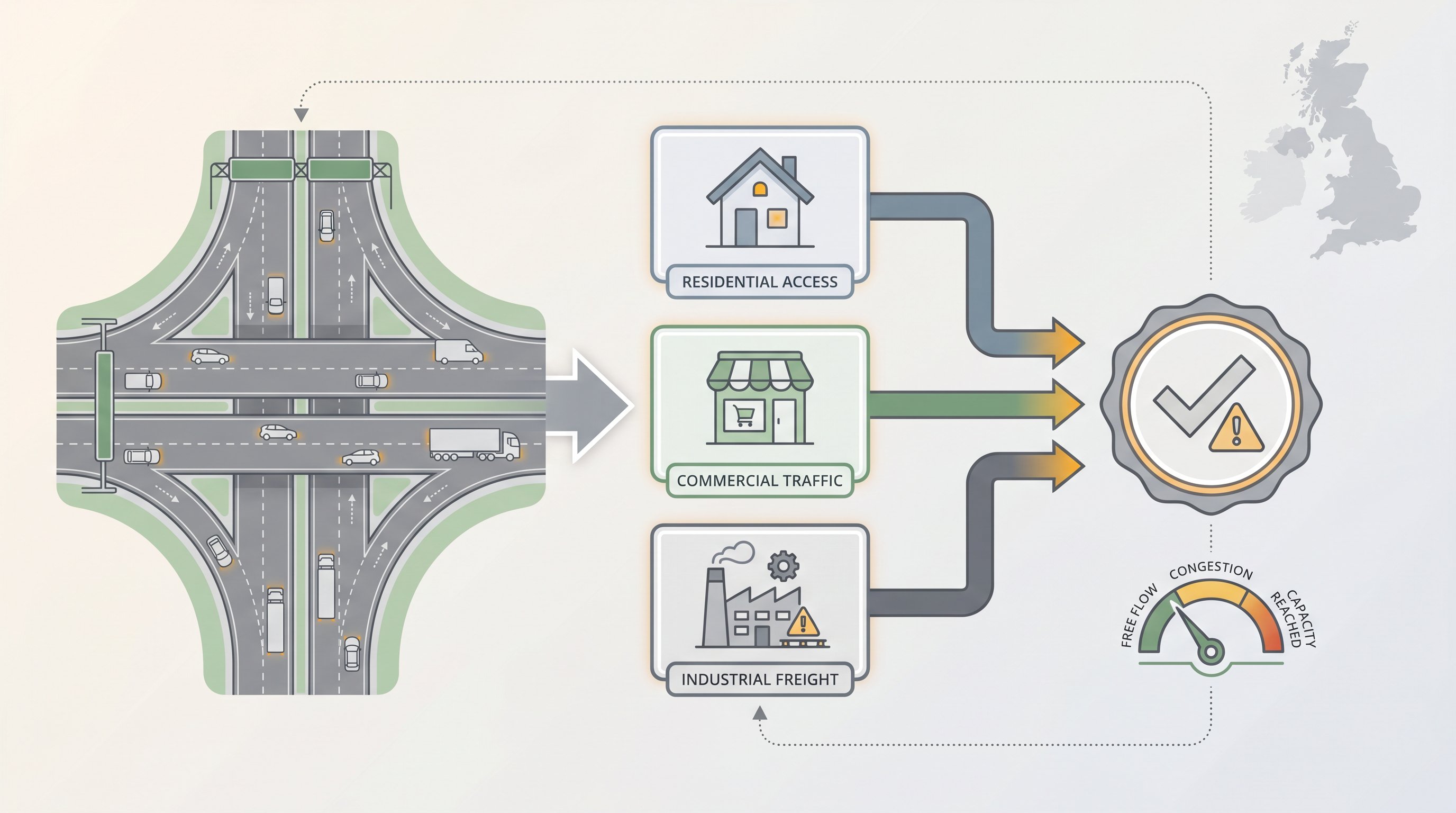
Why does it matter for your planning application? Because every new development generates trips. Homes need access for residents, deliveries, and visitors. Commercial premises rely on customer and staff movements. Industrial sites generate heavy-goods traffic. If the existing highway network can’t safely absorb those additional trips, your proposal will be refused or subjected to expensive mitigation measures, new junctions, widening schemes, or financial contributions toward off-site improvements.
Highway transport is especially critical where rail, tram, or waterway alternatives don’t exist. In many rural and semi-rural locations, the road is the only viable link between communities, employment centres, and services. That makes highway capacity and safety a non-negotiable consideration for planning officers and highways consultees. Miss it, and you’ll find yourself stuck in pre-application limbo or facing a formal objection at committee stage.
The Role of Highway Networks in Development Planning
Highway networks are the connective tissue of economic activity. They link homes to workplaces, schools to town centres, distribution hubs to retail outlets. For local authorities, maintaining and improving this network is a statutory duty, and a political priority. That’s why highways officers scrutinise every planning application that could affect traffic flow, junction performance, or pedestrian safety.
In England, the National Planning Policy Framework (NPPF) requires that development should only be refused on highways grounds if the residual cumulative impacts are severe. But that doesn’t mean highway considerations are soft or negotiable. In practice, councils use detailed transport assessments, junction-capacity models, and accident data to judge whether a scheme is acceptable. They also look at connectivity: does your site encourage walking and cycling, or does it force car dependency?
For developers, this means early engagement with the local highway authority is essential. You need to understand the baseline network performance, identify pinch points, and propose credible mitigation before you submit. A well-prepared transport statement or feasibility study highway engineering can turn a potentially contentious application into a straightforward approval. Ignore the highway implications, and you risk months of delay, or outright refusal.
Highway Capacity and Traffic Impact Assessments
Highway capacity is the maximum number of vehicles a road or junction can handle in a given period without unacceptable delay or safety risk. When your development pushes a junction beyond its capacity, typically measured by queue length, delay, or degree of saturation, you’ll need to propose improvements or demonstrate that the impact is not severe.
Traffic impact assessments (TIAs) are the tool highways officers use to evaluate this. A TIA models baseline traffic flows, adds your development’s trip generation (using industry-standard rates from TRICS or similar databases), and forecasts future-year scenarios with and without the scheme. The output shows whether junctions will operate within acceptable limits, and whether visibility splays, pedestrian crossings, or cycle infrastructure need upgrading.
Congestion is the enemy of highway efficiency. Even modest increases in peak-hour traffic can tip a junction from free-flowing to gridlocked, especially on constrained urban routes or rural single-carriageways. Some authorities are exploring demand-management measures, such as workplace travel plans, car-club spaces, or off-peak delivery windows, to reduce trip generation without building new tarmac. But the baseline expectation remains: if your scheme causes material harm to network performance, you must mitigate it.
Understanding Local Authority Thresholds
Local authorities use threshold-based screening to decide whether your proposal needs a full transport assessment or just a simple transport statement. These thresholds vary by council and by location. A scheme generating 30 two-way vehicle trips in the peak hour might trigger a TIA in one borough but sail through in another, depending on local network sensitivity and planning-policy context.
Typical thresholds consider the number of dwellings (for residential), floor area (for commercial or industrial), or vehicle movements (for logistics or healthcare). Some councils publish their requirements in a local validation checklist or supplementary planning document: others expect you to agree the scope in pre-application discussions. Either way, you must check the relevant authority’s guidance before you start work. Assuming a one-size-fits-all approach is a recipe for abortive costs and resubmission.
In sensitive locations, conservation areas, Air Quality Management Areas, or roads with poor accident records, thresholds may be lower, and the assessment more detailed. Early dialogue with highways officers, ideally supported by an experienced transport consultant, will clarify what’s needed and help you budget time and fee accordingly.
Key Design Standards for Highway Infrastructure
Highway infrastructure in the UK is governed by a suite of national and local design standards. The Design Manual for Roads and Bridges (DMRB) sets out technical requirements for trunk roads and motorways managed by National Highways. For local roads, the ones that serve most development sites, councils typically adopt Manual for Streets (MfS) and Manual for Streets 2, supplemented by their own design guides.
These standards cover geometry (junction radii, visibility splays, carriageway widths), construction (pavement thickness, drainage, kerb details), and safety (pedestrian crossing points, speed-reduction measures, street lighting). They also address access design highway engineering, the rules for new junctions, bellmouths, and site accesses that ensure safe entry and egress without compromising through-traffic flow.
Compliance isn’t optional. If your drawings show a junction radius that’s too tight for a refuse vehicle, or a visibility splay obstructed by boundary planting, highways officers will object. Worse, if the highway authority adopts the new infrastructure (as it usually does for residential streets), any non-compliance will need rectifying at your expense before adoption can complete.
For larger schemes, you may also need to demonstrate compliance with the local authority’s highway infrastructure design UK policies, which can include requirements for sustainable drainage (SuDS), electric-vehicle charging points, and future-proofing for emerging technologies such as connected and autonomous vehicles. Getting the design right at outline or reserved-matters stage saves time, cost, and professional embarrassment later.
Common Challenges in Highway Transportation Projects
Even well-prepared schemes hit roadblocks, literally and figuratively. Congestion is the most visible challenge: peak-hour queues that stretch back from saturated junctions, causing delay and frustration. For developers, mitigating congestion often means funding new lanes, signal upgrades, or off-site improvements that can run into six or seven figures.
Delivery delays are another pain point. Construction traffic, especially HGVs bringing concrete, steel, or modular units, can conflict with school drop-offs, commuter peaks, or local events. A construction logistics plan that specifies delivery windows, routes, and banksman arrangements is now standard in most urban authorities, but enforcement is patchy.
Freight capacity is limited compared with rail or waterborne transport. Lorries are flexible and offer door-to-door service, but they’re also space-hungry and contribute to road wear, noise, and local air quality issues. If your development relies on high volumes of freight, such as a distribution centre or manufacturing plant, you’ll need to justify why road is the best (or only) mode, and how you’ll minimise nuisance.
Environmental impacts loom large in 2026. Emissions from road transport remain a significant contributor to NOx and particulate pollution, especially in Air Quality Management Areas. Electric and hybrid vehicles are growing in number, but the majority of the fleet still runs on petrol or diesel. Your transport assessment will need to address air quality, noise, and carbon, often requiring detailed modelling and mitigation (such as travel plans, car-club spaces, or financial contributions toward public-transport improvements).
Finally, there’s the challenge of balancing competing demands: pedestrian safety versus vehicle flow, on-street parking versus cycle lanes, bus priority versus general traffic. Highways officers must juggle these trade-offs within constrained budgets and political pressures. As an applicant, showing that you understand those constraints, and that your design respects them, will earn goodwill and speed your application through the system.
Conclusion
Highway transportation isn’t glamorous, but it’s foundational. Every successful planning application rests on a credible highway strategy: one that demonstrates safe access, acceptable capacity, and compliance with design standards. In 2026, with rising scrutiny of sustainability and network resilience, early engagement, robust assessment, and professional design are more important than ever. Get them right, and your project moves forward: get them wrong, and you’ll be back to the drawing board.
Frequently Asked Questions About Highway Transportation
What is highway transportation and why does it matter for planning applications?
Highway transportation is the movement of people and goods by road on a prepared network including motorways, A-roads, and local streets. It matters for planning because every development generates trips; if the existing highway network cannot safely absorb those additional movements, your proposal risks refusal or costly mitigation measures such as new junctions or financial contributions toward improvements.
How do local authorities decide if my development needs a traffic impact assessment?
Local authorities use threshold-based screening that varies by council and location. Thresholds typically consider dwelling numbers, floor area, or vehicle movements. You must check your local authority’s validation checklist or supplementary planning document before starting work, as a one-size-fits-all approach can lead to costly resubmission and delays.
What design standards must highway infrastructure comply with in the UK?
Highway infrastructure is governed by the Design Manual for Roads and Bridges (DMRB) for trunk roads and Manual for Streets (MfS) for local roads, supplemented by local council design guides. Standards cover geometry, construction, and safety. Compliance is essential; non-compliant designs will require costly rectification before the highway authority can adopt the infrastructure.
What are the main challenges in managing highway transportation for new developments?
Key challenges include congestion at peak hours, construction delivery delays (especially HGVs), limited freight capacity compared with rail or waterborne transport, and environmental impacts including emissions in Air Quality Management Areas. Balancing pedestrian safety, parking, cycle lanes, and bus priority within constrained budgets adds further complexity.
How can developers reduce the highway impact of their schemes?
Mitigation strategies include workplace travel plans, car-club spaces, off-peak delivery windows, and demand-management measures that reduce trip generation. Early engagement with the local highway authority, supported by a transport consultant, helps identify pinch points and propose credible solutions before submission, turning contentious applications into straightforward approvals.
Why is early pre-application dialogue with highways officers so important?
Early engagement clarifies baseline network performance, identifies capacity constraints, and allows you to propose mitigation before formal submission. A well-prepared transport statement or feasibility study highway engineering can transform a potentially contentious application into swift approval, avoiding months of delay and expensive revision cycles.