Traffic control signs are the silent language of the road network, regulating movement, warning of hazards, and guiding drivers, cyclists, and pedestrians through every junction, roundabout, and construction zone. For architects, planners, and developers, they’re more than street furniture: they’re legal instruments that shape access strategies, visibility splays, and transport assessments. Whether you’re designing a new housing estate, submitting a planning application, or coordinating temporary works, understanding how traffic control signs function, and how they must comply with UK law, can mean the difference between a smooth approval and costly re-designs. This guide explains what traffic control signs are, how they’re categorised, and why they matter in the planning and development process in 2026.
Key Takeaways
- Traffic control signs are legally mandated instruments governed by the Traffic Signs Regulations and General Directions 2016 (TSRGD 2016), and compliance is essential for any development affecting highway access or safety.
- The three main categories of traffic control signs—regulatory (circular), warning (triangular), and informational (rectangular)—each serve distinct purposes and must be correctly specified in transport assessments and planning applications.
- Developers must demonstrate that traffic control signs are positioned at appropriate sight distances, comply with design standards, and function safely for the road hierarchy and speed limit in which they’re located.
- Temporary traffic control signs during construction are governed by Chapter 8 of the Traffic Signs Manual and the Safety at Street Works and Road Works Code of Practice, with non-compliance risking enforcement action and project delays.
- Responsibility for traffic control signs is shared between National Highways, local highway authorities, and developers, requiring close coordination and professional advice to secure planning approval and ensure legal compliance.
What Are Traffic Control Signs and Why Do They Matter?
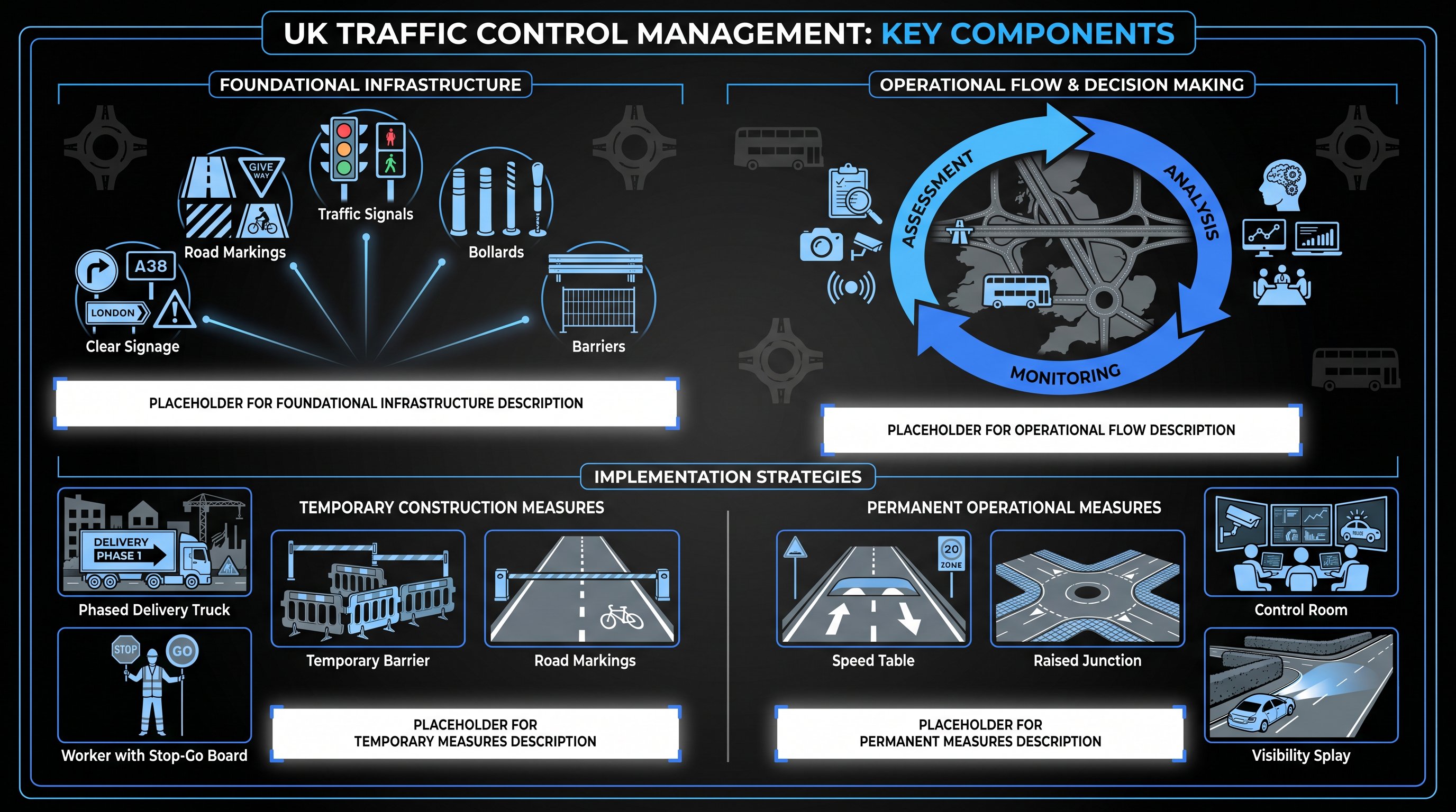
Traffic control signs are official road signs installed to regulate, warn, and inform all road users, drivers, cyclists, and pedestrians alike. They communicate instructions, alert users to upcoming hazards, and provide directional or general information that supports safe and efficient movement across the highway network.
In the UK, every traffic sign you see on public roads must conform to the Traffic Signs Regulations and General Directions 2016 (TSRGD 2016) in Great Britain, with equivalent regulations in Scotland, Wales, and Northern Ireland managed by devolved administrations. This legal framework ensures uniformity: signs are instantly recognisable, their meanings are enforceable by law, and road users can rely on consistent messaging whether they’re driving through London, Manchester, or rural Devon.
Why does this matter? Because traffic signs do more than prevent collisions, they reduce confusion at complex junctions, manage traffic flow during peak hours, and safeguard pedestrians and cyclists at crossings and shared spaces. For developers and transport consultants, signs are integral to site access design, visibility assessments, and the safe delivery of construction phases. Fail to account for appropriate signage in your transport assessment, and you risk delays, enforcement action, or conditions that add unexpected cost and complexity to your project.
In short, traffic control signs are the legally mandated connective tissue of the road network, and getting them right is non-negotiable for anyone involved in planning and development.
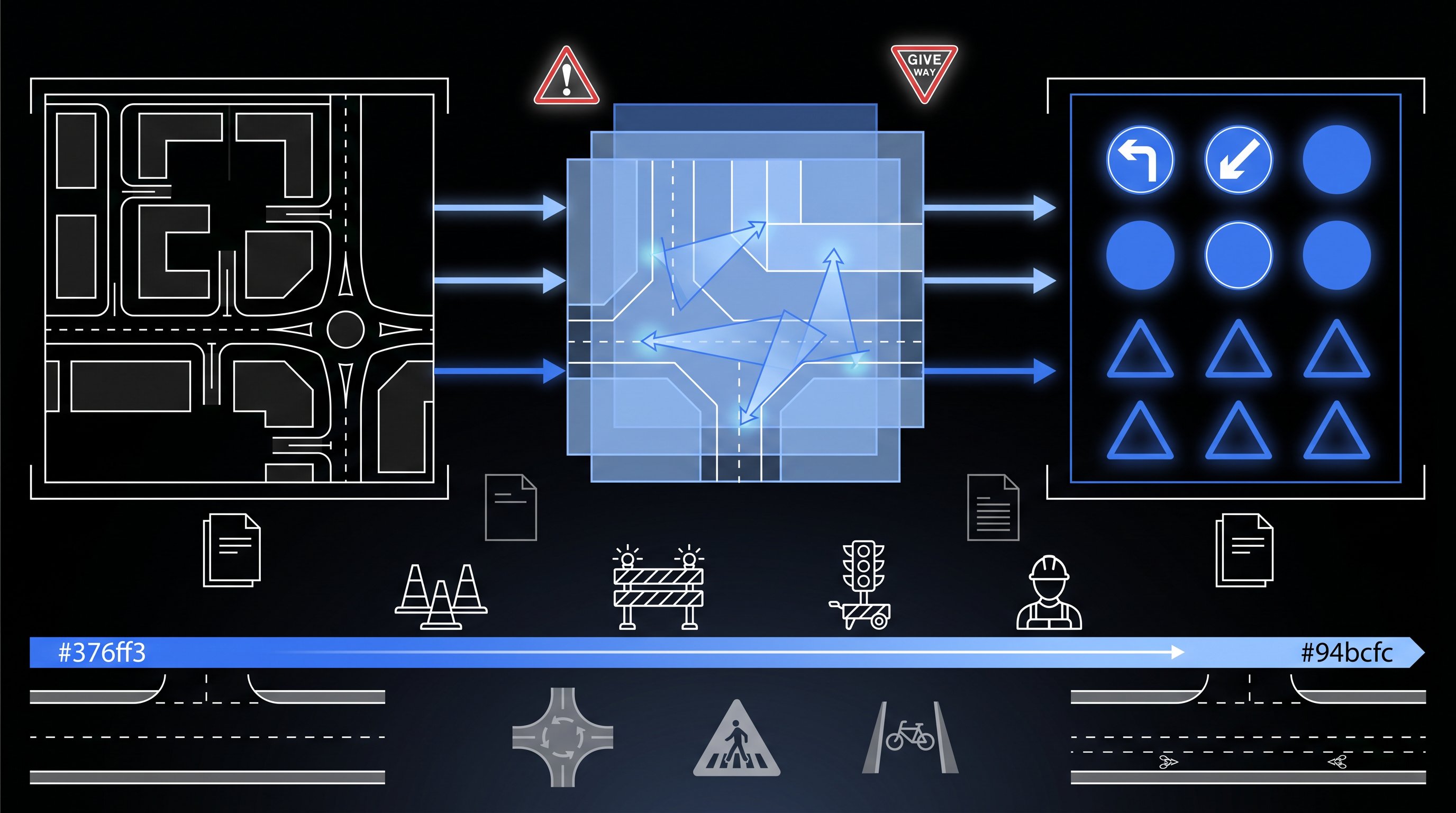
The Main Categories of Traffic Control Signs
Traffic control signs in the UK fall into three broad categories, each with a distinct purpose and visual identity. Understanding these categories helps you anticipate which signs will be required in your development proposals and transport assessments.
Regulatory Signs
Regulatory signs give orders, they tell road users what they must or must not do. These are the signs with legal teeth: ignore them, and you’re committing an offence.
Circular signs are the hallmark of regulation. Red circles with a white background indicate prohibitions: no entry, no right turn, no vehicles over a certain weight. Blue circles with white pictograms indicate mandatory instructions: turn left, keep left, or proceed in a particular direction. You’ll also see rectangular signs for speed limits and parking restrictions, though the circular format remains the most common regulatory marker.
For developers, regulatory signs are crucial when designing site access. A new junction might require “Give Way” or “Stop” signs, or prohibition signs to manage HGV routing during construction. Your transport consultant will model these requirements as part of junction capacity and safety audits.
Warning Signs
Warning signs alert road users to hazards ahead, bends, junctions, pedestrian crossings, roadworks, or changes in road surface. These are almost always triangular, with a red border and white background, making them immediately distinct from regulatory circles.
Common examples include “Bend Ahead,” “Junction on Bend,” “Road Works,” and “Pedestrians in Road Ahead.” Warning signs don’t give orders, but they prompt drivers to slow down, increase attention, or prepare to stop.
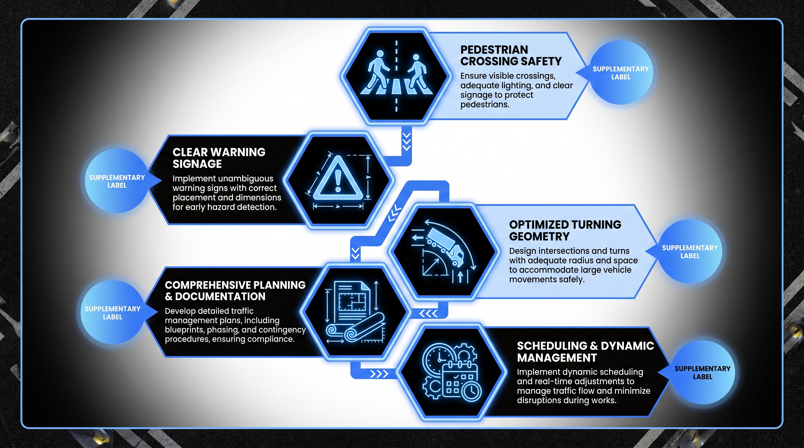
In planning terms, warning signs often feature in transport assessments where new accesses intersect busy roads, or where construction traffic will temporarily alter normal road conditions. Your highway authority will expect you to specify appropriate warning signage, correctly sited and illuminated, as part of any Section 278 agreement or temporary traffic management plan.
Informational and Guide Signs
Informational and guide signs provide route directions, distances, facility locations (parking, services, tourist attractions), and general information. These signs are typically rectangular, and their colour coding conveys different types of information:
- Blue: motorway signs
- Green: primary route signs
- White: local route signs
- Brown: tourist and leisure facilities
These signs don’t regulate or warn, they guide. For larger developments, especially those with public-facing elements (retail parks, business estates, leisure facilities), informational signage becomes part of the wayfinding strategy. You’ll need to coordinate with local highway authorities to ensure any new directional signs align with the existing hierarchy and don’t clutter the streetscape.
Understanding these three categories isn’t academic, it’s practical. Each type of sign has design rules, siting requirements, and approval processes, all governed by TSRGD 2016 and the Traffic Signs Manual.
Traffic Control Signs in Planning Applications and Transport Assessments
Traffic control signs aren’t usually the headline item in a transport assessment, but overlook them, and your planning application can stall.
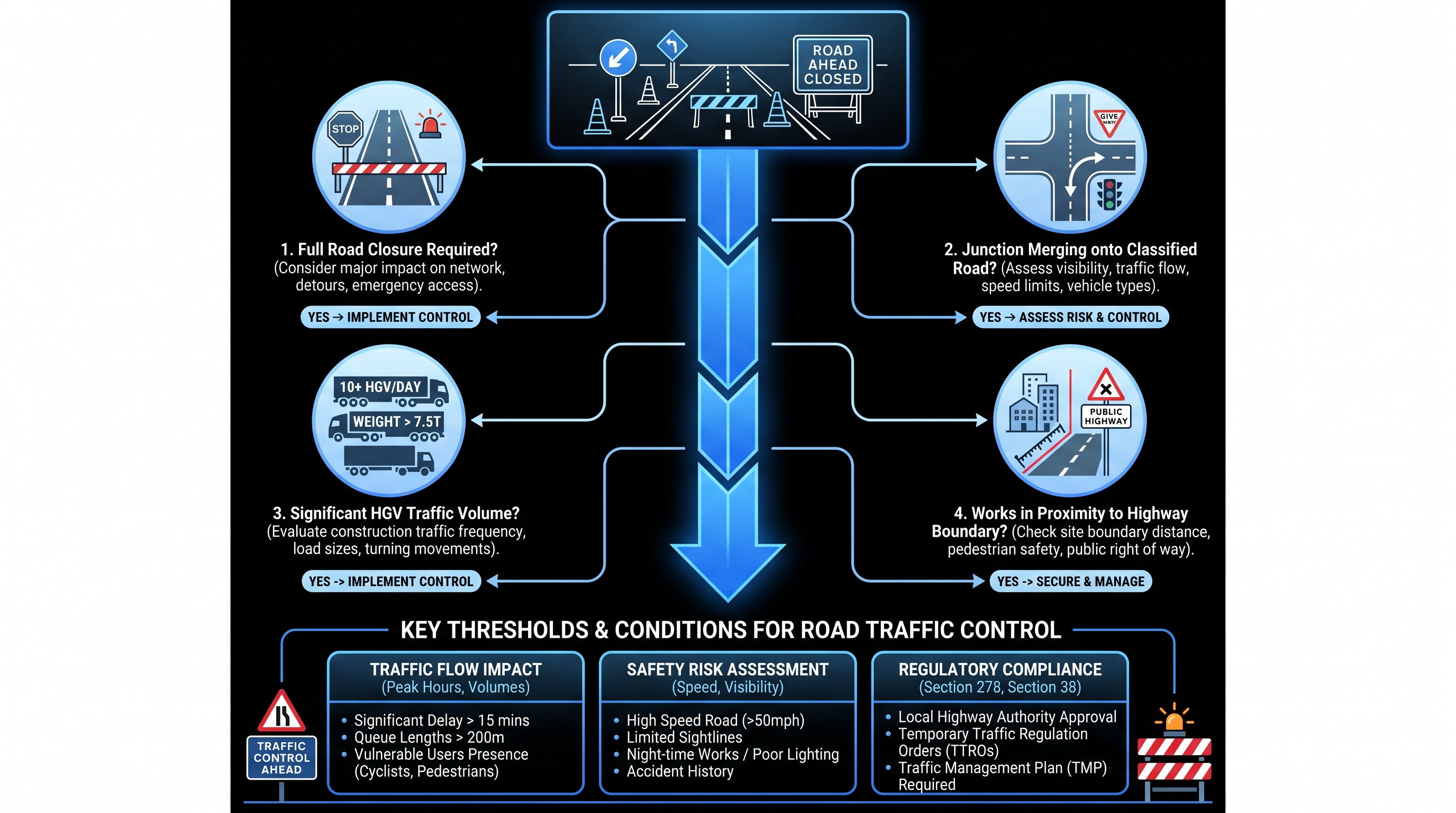
When a development affects highway access, safety, or traffic flow, the local planning authority (and highway authority) will scrutinise how you’ve addressed signing and road markings. This includes permanent signs for new junctions, accesses, and pedestrian crossings, as well as temporary signs for construction traffic management.
Permanent signing is assessed alongside junction design, visibility splays, and pedestrian facilities. If you’re proposing a new priority junction on a 40mph road, you’ll need to demonstrate that appropriate warning signs (e.g., “Junction Ahead”) and regulatory signs (e.g., “Give Way”) are positioned correctly, with adequate sight lines and illumination where required. Your transport consultant, such as mltraffic.co.uk, with over 30 years’ experience in transport engineering, will model these details to meet local authority thresholds and ensure compliance with design standards.
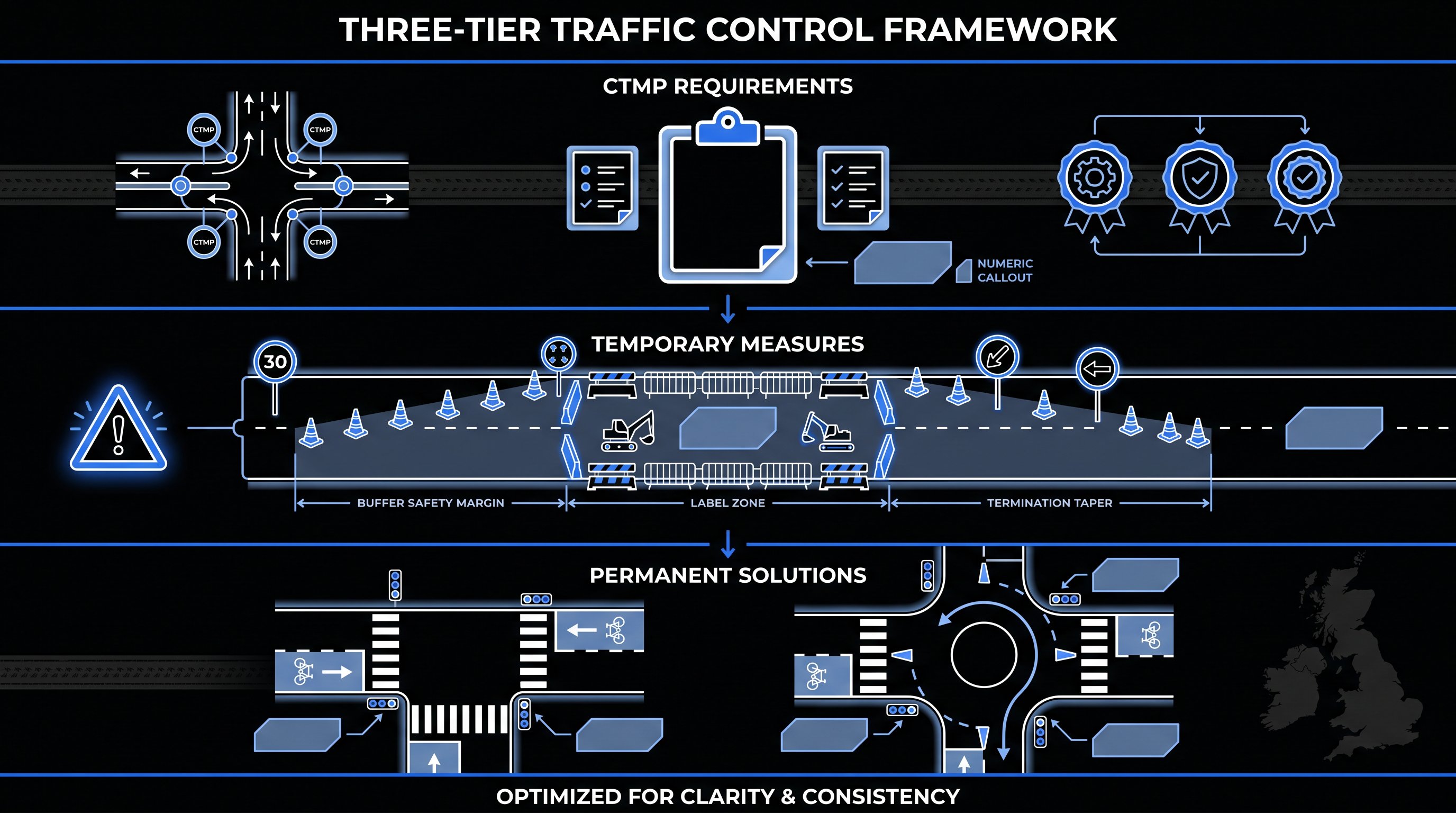
Temporary signing becomes critical during construction. Roadworks, site access points, and HGV routes all require carefully planned traffic management, governed by Chapter 8 of the Traffic Signs Manual and the TSRGD framework. Your Construction Traffic Management Plan (CTMP) must specify which signs will be used, where they’ll be sited, and how they’ll be maintained. Failure to comply can result in enforcement action, project delays, or accidents that expose you to liability.
In practice, sign provision is interwoven with broader movement strategy. It’s not enough to draw a sign on a plan, you need to show it’s legally compliant, correctly sited, visible at the required stopping sight distance, and appropriate for the road hierarchy and speed limit. This level of detail is what separates a robust transport assessment from one that invites objections and conditions.
UK Standards and Compliance Requirements for Traffic Control Signs
Traffic control signs in the UK are governed by a strict regulatory and guidance framework, and compliance isn’t optional, it’s a legal requirement.
The cornerstone is the Traffic Signs Regulations and General Directions 2016 (TSRGD 2016), which prescribes the size, colour, design, and permitted use of every sign on public roads in Great Britain. Scotland, Wales, and Northern Ireland operate under equivalent regulations managed by their devolved governments. Any sign that doesn’t conform to TSRGD can’t be legally enforced and may be challenged or removed.
Supporting TSRGD is the Traffic Signs Manual, a multi-chapter guidance document published by the Department for Transport. It covers everything from sign design and siting to illumination, maintenance, and temporary works. Chapter 8, in particular, is essential reading for anyone involved in roadworks or construction-phase traffic management.
Responsibility for traffic signs is shared. National Highways manages signs on the strategic road network (motorways and trunk roads), while local and regional highway authorities are responsible for signs on local roads. Developers working on Section 38 or Section 278 agreements will need to coordinate closely with the relevant authority to agree sign specifications, locations, and adoption arrangements.
For temporary or works-related signing, compliance with Chapter 8 and the Safety at Street Works and Road Works Code of Practice is mandatory. This includes ensuring signs are retro-reflective, correctly positioned, and maintained throughout the works period. Non-compliance can result in enforcement notices, financial penalties, or prosecution if an accident.
In 2026, digital and dynamic signage is becoming more common, but even these must comply with TSRGD and receive authorisation from the highway authority. If you’re proposing variable message signs (VMS) or smart signage as part of a development, expect additional scrutiny and potentially longer approval timelines.
The bottom line: traffic control signs are legal instruments. Treat them as such, and budget time and resource for compliance checks, authority liaison, and professional advice from experienced transport engineers who understand both the regulations and the practical realities of getting schemes approved and delivered.
Frequently Asked Questions About Traffic Control Signs
What are traffic control signs and why do they matter in the UK?
Traffic control signs are official road signs that regulate, warn, and inform road users to support safe and efficient movement. In the UK, they must conform to the Traffic Signs Regulations and General Directions 2016 (TSRGD 2016), ensuring uniformity, legal enforceability, and consistent messaging across all road networks.
What are the three main categories of traffic control signs?
The three categories are regulatory signs (circular, giving orders with red circles for prohibitions and blue for mandatory instructions), warning signs (triangular with red borders, alerting to hazards), and informational/guide signs (rectangular, providing directions and facility locations).
How do traffic control signs impact planning applications and transport assessments?
Traffic control signs are integral to transport assessments when developments affect highway access, safety, or traffic flow. Developers must demonstrate compliance with design standards, correct siting, visibility, and illumination for both permanent junctions and temporary construction-phase signage.
What regulatory standards govern traffic control signs in the UK?
Traffic control signs must comply with the Traffic Signs Regulations and General Directions 2016 (TSRGD 2016) in Great Britain, with equivalent regulations in Scotland, Wales, and Northern Ireland. The Traffic Signs Manual provides detailed guidance on design, siting, illumination, and maintenance.
Who is responsible for installing and maintaining traffic control signs?
Responsibility is shared: National Highways manages signs on motorways and trunk roads, whilst local and regional highway authorities oversee local roads. Developers coordinate through Section 38 or Section 278 agreements to ensure compliance and proper adoption arrangements.
What are the requirements for temporary traffic control signs during construction?
Temporary signage must comply with Chapter 8 of the Traffic Signs Manual and the Safety at Street Works and Road Works Code of Practice. Signs must be retro-reflective, correctly positioned, maintained throughout works, and specified in the Construction Traffic Management Plan (CTMP).