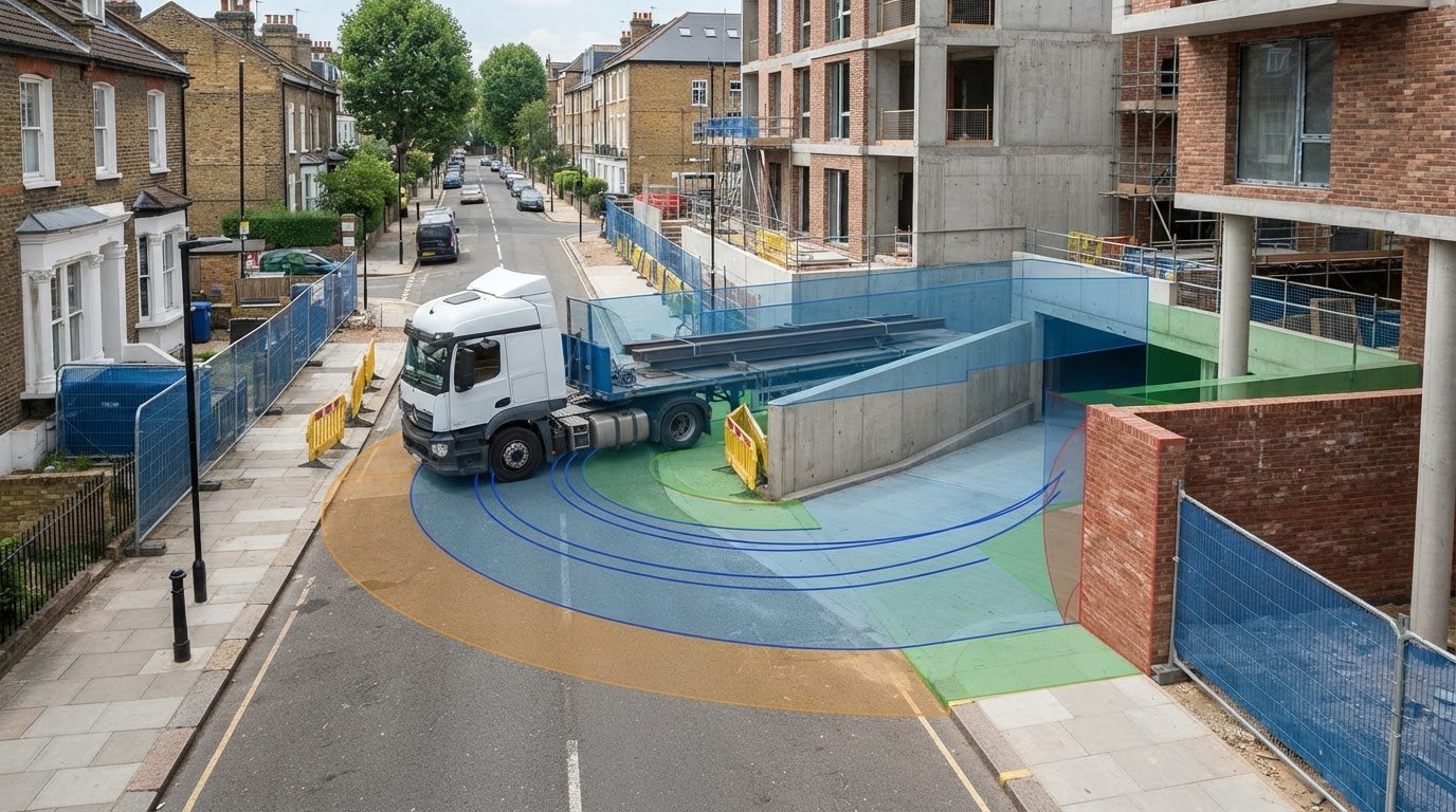
Tag: site access

  • Swept Path Analysis London: The 2026 Developer’s Guide to Planning Success

    Swept Path Analysis London: The 2026 Developer’s Guide to Planning Success

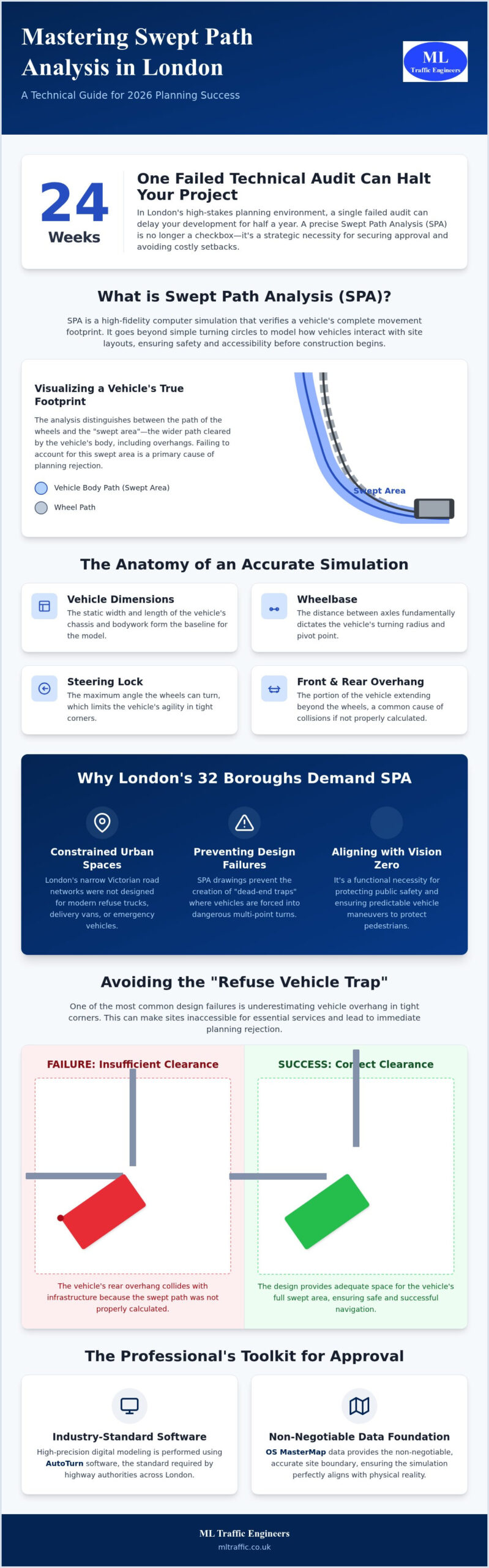
    A single failed technical audit in a London borough can delay your development project by 24 weeks. In the high-stakes environment of 2026 planning, a precise swept path analysis london is no longer just a technical checkbox; it’s a strategic necessity for securing approval. You’re likely facing the pressure of maximizing site density while trying to satisfy conflicting requirements for refuse collection and fire safety. It’s a difficult balance to strike when every square meter counts and London’s footprints remain notoriously tight.

    We understand that navigating the intricate regional regulations of 32 different boroughs feels like a moving target. This guide provides the technical clarity you need to master current standards and TfL expectations for a successful submission. You’ll learn how to leverage high-precision digital modeling to optimize your site layout for both safety and density. We examine the specific vehicle dimensions required across the capital, from Westminster’s compact trucks to Hackney’s larger fleet, ensuring your submission is robust enough to withstand the most rigorous highway authority scrutiny.

    Key Takeaways

    • Understand how computer-aided simulations model precise vehicle movements to ensure site designs accommodate critical technical parameters like steering lock and wheelbase.
    • Learn why industry-standard AutoTurn software and OS MasterMap data are the required foundations for high-precision digital modeling in the capital.
    • Identify the specific project triggers that make a swept path analysis london mandatory for residential, commercial, or mixed-use planning submissions.
    • Discover how to avoid common design failures like the “refuse vehicle trap” by managing over-hang and over-run in constrained urban environments.
    • Position your development for success by aligning with borough-specific vehicle dimensions to reduce regulatory risk and prevent costly planning delays.

    Understanding Swept Path Analysis for London Developments

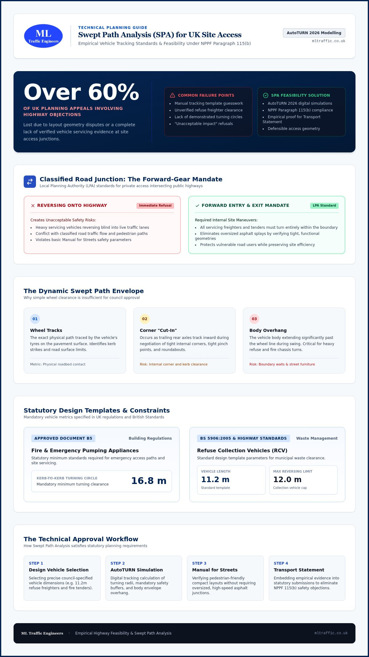
    Following the August 2026 NPPF update, precision isn’t optional in the capital’s planning process. London planning departments demand technical proof that vehicles can navigate proposed site layouts without compromising safety or existing infrastructure. A swept path analysis london provides this proof through high-fidelity computer simulations that visualize the movement of vehicles through a specific space. It’s a critical tool for demonstrating that your site is both feasible and safe before any ground is broken.

    To better understand how these simulations function in a planning context, watch this technical overview:

    What is a Swept Path Analysis (SPA)?

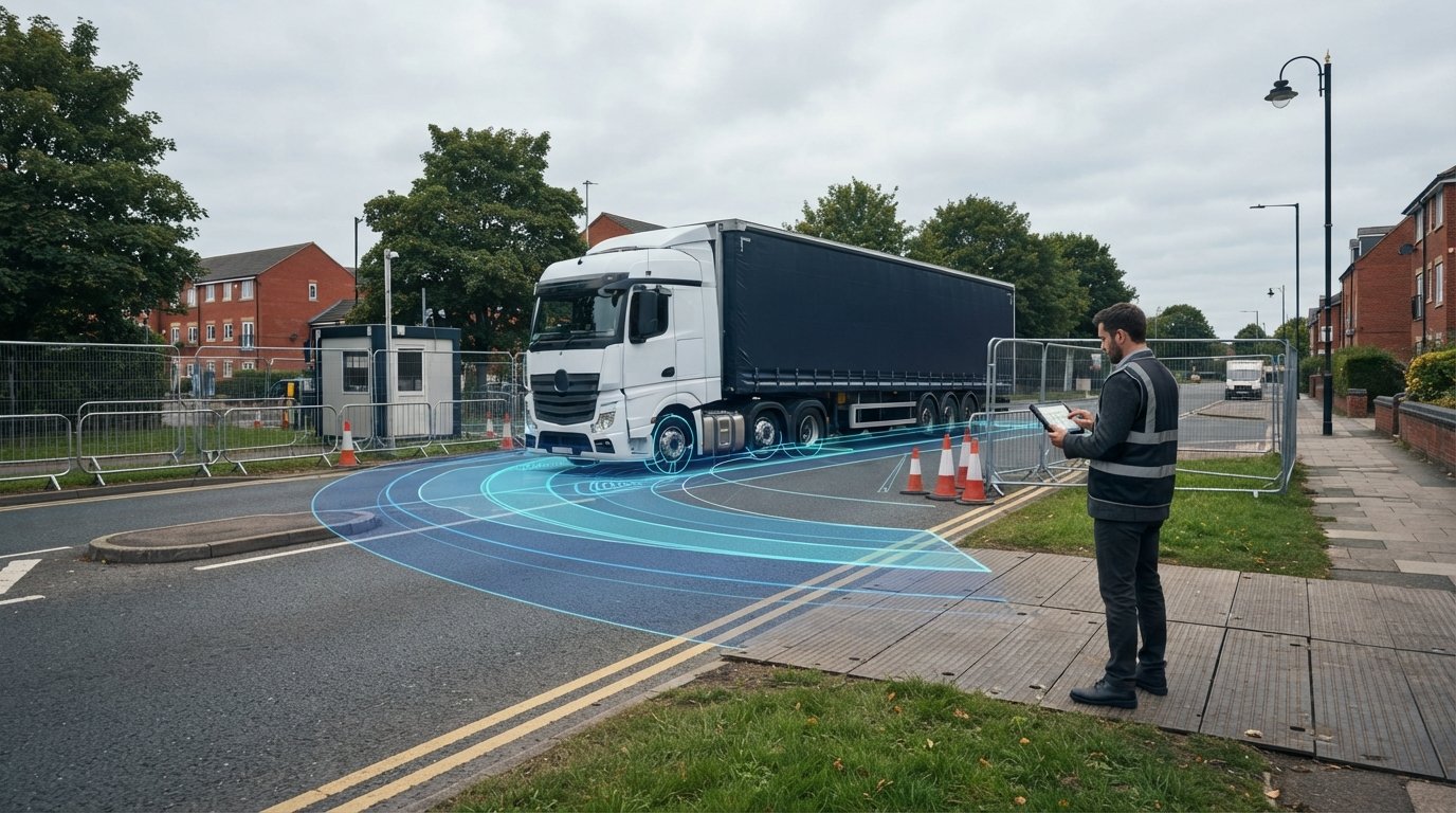
    SPA is the digital verification of a vehicle’s physical footprint during movement. It uses advanced vehicle swept path analysis software to model how specific vehicles, such as refuse trucks, delivery vans, or fire engines, interact with the built environment. These simulations are far more than simple turning circles; they’re dynamic models that account for speed, steering rates, and physical constraints.

    The simulation integrates four critical technical components to ensure accuracy:

    • Vehicle Width and Length: The static dimensions of the vehicle’s chassis and bodywork.
    • Wheelbase: The distance between axles, which fundamentally dictates the turning radius and pivot point.
    • Steering Lock: The maximum angle the wheels can turn, which limits the vehicle’s agility in tight corners.
    • Front and Rear Overhang: The portion of the vehicle that extends beyond the wheels, which is often the cause of collisions with curbs or walls.

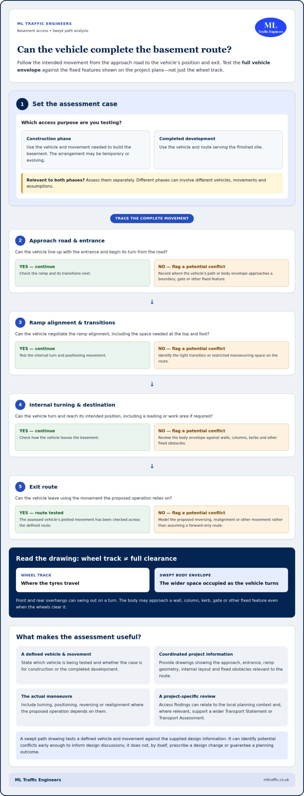
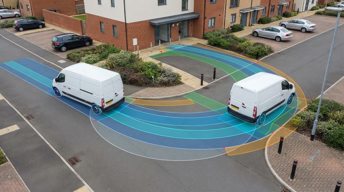
    Engineers distinguish between the “vehicle body” path and the “swept area.” While the wheels follow a specific track, the body of the vehicle often “sweeps” over a wider area during a turn. Failing to account for this overhang is a primary cause of planning rejection in 2026. Professional autoturn swept path analysis ensures these margins of error are eliminated during the design phase.

    Why London Boroughs Require SPA Drawings

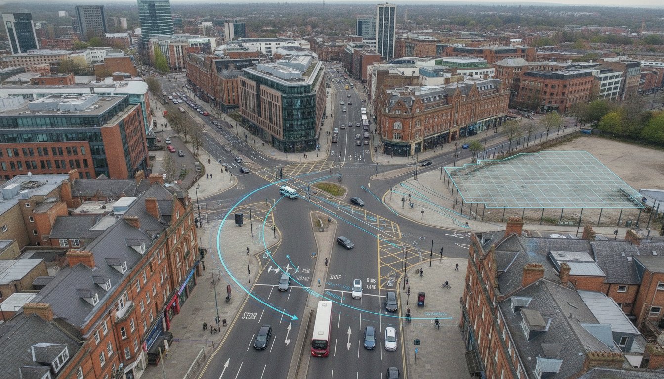
    London’s narrow Victorian road networks weren’t built for modern logistics or large emergency vehicles. Tight corners and restricted access points mean that what looks feasible on a standard 2D drawing often fails in a real-world scenario. Planning officers now view 2D static drawings as insufficient because they don’t account for the dynamic movement of heavy goods vehicles (HGVs) or the specific requirements of borough-specific refuse fleets.

    By requiring a comprehensive swept path analysis london, boroughs ensure that new developments don’t create “dead-end” traps where drivers are forced into dangerous multi-point turns. This alignment with London’s “Vision Zero” strategy prioritizes pedestrian and cyclist safety by ensuring all vehicle maneuvers are predictable and contained within designated zones. It’s a functional necessity for protecting public safety and ensuring that essential services, like waste collection and fire response, can operate without obstruction.

    Technical Standards: Vehicle Templates and Software Requirements

    Precision in a swept path analysis london depends entirely on the quality of the underlying data. We utilize OS MasterMap as the non-negotiable foundation for every analysis. This ensures the digital site boundary aligns perfectly with the physical reality of the London streetscape. Without this baseline, even the most advanced simulation fails to provide the reliable results required by highway authorities. Accuracy isn’t just a goal; it’s a functional necessity for project approval.

    Transport engineers distinguish between design vehicles and checking vehicles. Design vehicles are used to shape the minimum physical geometry of the site during the early planning stages. Checking vehicles, such as specialized refuse trucks or emergency tenders, verify that the final layout functions safely under real-world conditions. Modern 2026 technology now allows us to provide live animations of these vehicle movements. These visualizations give planning committees a clear, dynamic view of how access points will operate in practice.

    Common Vehicle Templates for London Projects

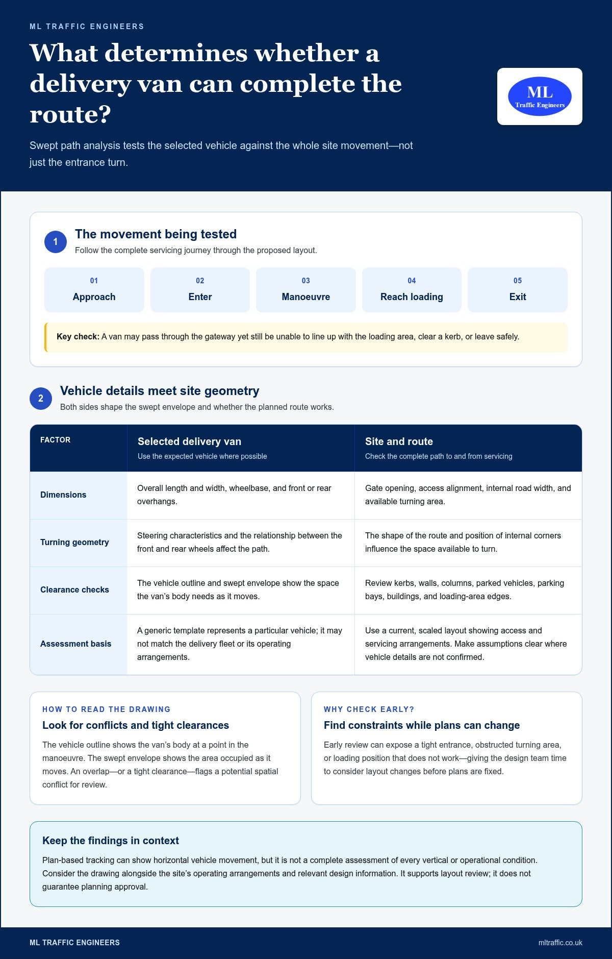
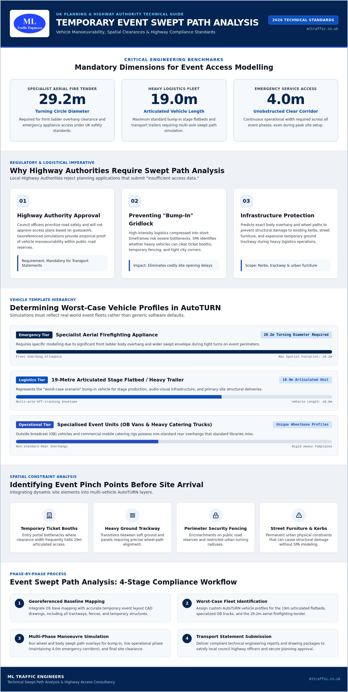
    Selecting the correct vehicle template is vital because London boroughs maintain diverse fleet specifications. While the 11.4m Refuse Collection Vehicle (RCV) is the standard benchmark, specific requirements vary. For example, Westminster often utilizes smaller 8.3m vehicles, while Hackney may require testing against 12.2m trucks. Residential developments must also satisfy fire tender access requirements under Building Regulations Part B. We ensure your layout accommodates the 11.2m fire appliance used by the London Fire Brigade. For commercial sites, we model pantechnicons and delivery vans to ensure loading areas don’t obstruct the public highway.

    The Role of AutoTurn and CAD Accuracy

    Manual turning circle templates are obsolete in modern traffic engineering. They cannot account for the complex steering rates and multi-point maneuvers required in tight urban spaces. We use AutoTurn to provide millimetre-perfect site layout adjustments within a CAD environment. This integration allows for immediate identification of over-hang or over-run issues. If a vehicle body sweeps over a proposed boundary, we can fix the design before it reaches the planning stage. Professional-grade software is essential to withstand local authority scrutiny and reduce project risk. If you are preparing a submission, a professional swept path analysis provides the technical evidence needed to secure your approval. You can also review our practical guide for planning applications to see how these standards are applied in detail.

    When is Swept Path Analysis Mandatory in London?

    Planning officers use technical data to prevent congestion and safety hazards before they occur. A swept path analysis london is mandatory whenever a development alters how vehicles interact with the public highway or internal site infrastructure. While large scale schemes always require this data, smaller developments often trigger the requirement based on site constraints or specific borough standards. Local highway authorities use these drawings to verify that your proposal won’t lead to blocked roads or dangerous reversing maneuvers.

    We’ve identified a 5-step trigger checklist to help you determine if your project requires a formal simulation:

    • New Access Points: Any creation or modification of a junction onto the public highway.
    • Tight Footprints: Internal layouts with limited turning space, cul-de-sacs, or courtyard access.
    • Service Requirements: Developments requiring regular refuse collection or HGV deliveries.
    • Strategic Road Impact: Sites bordering the Transport for London (TfL) Road Network (TLRN).
    • Change of Use: Projects that increase the size or frequency of vehicles visiting the site.

    Triggers for SPA in Planning Applications

    In dense urban areas like Tower Hamlets, planning departments focus heavily on high-density refuse collection maneuvers. In contrast, Westminster prioritizes heritage street preservation and often requires testing against smaller, specialized vehicle templates. If your site includes a cul-de-sac or a restricted loading bay, you must prove that the largest anticipated vehicle can enter and exit in a forward gear. Failing to provide this evidence often results in an immediate holding objection from the highway officer. Integrating these drawings into your Transport Statement London ensures that your technical narrative is backed by visual proof.

    Integrating SPA into Transport Assessments

    SPA drawings serve as the technical backbone for comprehensive Transport Assessments. For developments in high PTAL zones (Public Transport Accessibility Level), you can use a swept path analysis london to justify car-free or low-car designs. By proving that the site only needs to accommodate essential service vehicles, you can maximize residential or commercial density. This precision allows you to optimize every square meter of the site while maintaining compliance with TfL’s Healthy Streets indicators. We ensure that the written technical report and the CAD simulations are perfectly synchronized to withstand the most rigorous local authority scrutiny.

    Swept Path Analysis London: The 2026 Developer’s Guide to Planning Success

    Avoiding Common Design Failures in Tight Urban Spaces

    London’s constrained streetscapes leave zero margin for error during the planning phase. A swept path analysis london often reveals that what looks functional on a traditional site plan is physically impossible for a heavy vehicle. The “Refuse Vehicle Trap” occurs when a designer assumes a standard turning circle is sufficient, only to find the vehicle’s body strikes a boundary wall or overhangs a pedestrian footway. These kerb-strike failures and over-hang issues are the leading causes of technical objections from highway officers.

    Managing over-run (the path of the wheels) and over-hang (the path of the body) is a functional necessity in the capital. In narrow Victorian corridors, a vehicle might successfully clear a corner with its wheels but strike a street lamp or building with its rear swing. We use high-fidelity modeling to identify these conflicts while the design is still fluid. This allows for minor layout adjustments that prevent major planning setbacks and ensure your site remains safe for all road users.

    Managing Refuse and Emergency Access

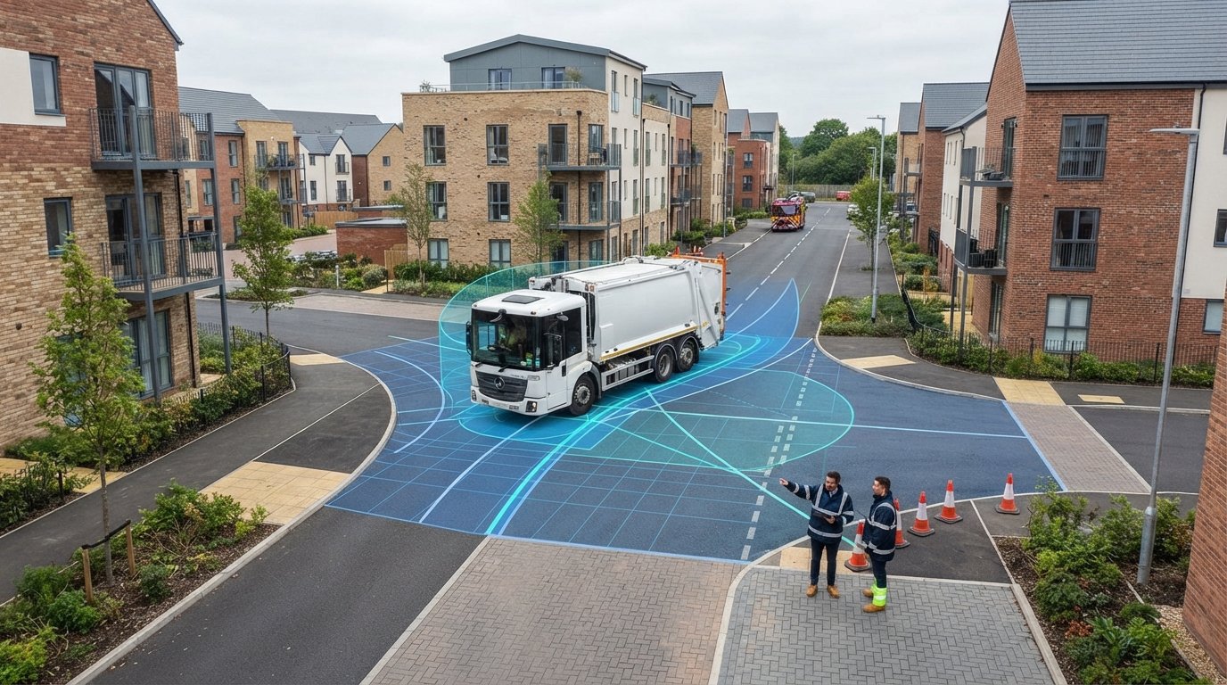
    Waste collection is the primary hurdle for most London planning submissions. While the 11.4m refuse collection vehicle (RCV) is the benchmark, many boroughs maintain strict reversing limits to protect pedestrians. Most London councils cap reversing distances at 12 meters for safety reasons. If your site layout requires a vehicle to reverse out onto the public highway, it’ll likely face an immediate refusal. We ensure your design accommodates a full 3-point turn within the site boundary or provides a through-route that meets borough-specific standards.

    Emergency access is equally non-negotiable for project success. Building Regulations Part B require fire tenders to reach within 45 meters of all points within a residential building. Balancing these rigid access paths with landscaping and “Healthy Streets” requirements is a complex task. Our simulations prove that your green infrastructure doesn’t obstruct the 11.2m fire appliance path, satisfying both the planning officer and the fire authority simultaneously.

    The Cost of Design Errors in London

    A failed technical audit can delay your project by 24 weeks. If a Highway Officer issues an objection based on insufficient access proof, you’re often forced to re-submit your entire planning application. The financial implications are most severe when errors affect structural elements, such as basement car park ramps or supporting columns. Re-designing a basement after a planning refusal is a costly and time-consuming process that can derail project financing. Industry data suggests that early-stage swept path analysis london saves up to 15% in total project design costs by preventing these late-stage structural revisions. If you’re refining a site layout, our swept path analysis services provide the technical certainty needed to avoid these common pitfalls.

    Professional SPA Services: Securing Your Planning Approval

    Securing planning approval in London’s 2026 regulatory environment requires more than just a software-generated drawing. It requires a technical defense of the proposed site geometry. Choosing a specialist London transport consultancy reduces project risk by ensuring that every simulation is rooted in local highway authority expectations. We don’t just provide static images; we deliver a comprehensive service that bridges the gap between architectural vision and functional highway safety. Our team takes pride in precision, recognizing that a single oversight can derail an entire development timeline.

    Our “cradle-to-grave” approach ensures that your project is supported from inception to completion. We move from initial data collection and site plan review to the production of a final technical report. Interpreting a swept path analysis london drawing involves understanding the dynamic interaction between vehicle body swing and physical constraints. We provide the expert analysis needed to spot potential conflicts before they become grounds for a highway officer’s objection, allowing for immediate design refinements.

    Why Work with ML Traffic Engineers?

    We understand that precision is a functional necessity in high-stakes urban planning. Our team has deep expertise in navigating the statutory requirements of all 32 London boroughs and TfL. We eliminate the logistical pressure on developers by providing integrated services. This includes parking surveys and traffic data collection that feed directly into our digital models. Our commitment to accuracy prevents the 24-week delays often caused by insufficient access proof. We position ourselves as a vital partner in your design team, ensuring compliance with the August 2026 NPPF update and Healthy Streets standards.

    Getting Your SPA Quote for 2026 Projects

    To provide a precise fee proposal for your 2026 project, we require specific information to assess the complexity of the maneuvers. We need your current site plans in CAD format, the specific vehicle types you need to model, and the overall project scope. We understand the fast-moving nature of infrastructure development and the urgency of planning deadlines. Our team maintains rapid response capabilities to help you meet critical submission dates without compromising technical quality. We’re ready to provide the technical evidence required to satisfy even the most rigorous highway authority scrutiny. Contact ML Traffic Engineers today for a bespoke Swept Path Analysis quote to secure your project’s future.

    Securing Your Development’s Future with Technical Precision

    Success in 2026 planning requires more than just meeting minimum standards; it demands technical excellence. Navigating borough-specific vehicle templates and avoiding common design pitfalls are essential steps for any London developer. By prioritizing a precise swept path analysis london, you eliminate the risk of technical objections that often lead to costly 24-week delays. Precision isn’t just a goal; it’s a functional necessity for protecting your project’s timeline and budget.

    ML Traffic Engineers has provided fully-managed transport planning services since 2014. As specialists in AutoTurn and CAD accuracy, we ensure your site layout is robust enough to withstand the most rigorous local authority scrutiny. We take the regulatory pressure off your team by delivering millimetre-perfect simulations that guarantee safe and efficient access. Don’t leave your planning submission to chance when technical certainty is within reach.

    Request a Swept Path Analysis Quote for Your London Project to secure your approval. We’re ready to help you optimize your site for maximum density and safety today.

    Frequently Asked Questions

    When is a Swept Path Analysis required for a London project?

    A swept path analysis london is required whenever a development alters access to the public highway or introduces internal layouts where maneuvering space is restricted. Common triggers include the creation of new junctions, the inclusion of cul-de-sacs, or the need to accommodate large service vehicles. Planning officers use these simulations to verify that refuse trucks and fire tenders can navigate the site safely without causing congestion or safety hazards for other road users.

    Can I use a standard car template for my planning application?

    Using a standard car template is rarely sufficient for London planning applications. While car parking maneuvers are important, most boroughs prioritize the movement of larger vehicles like the 11.4m refuse collection vehicle or fire appliances. Your application must prove that the largest anticipated vehicle can enter and exit the site in a forward gear. Relying solely on car templates often leads to a holding objection from the local highway authority.

    How much does a Swept Path Analysis cost in London?

    The cost of technical modeling depends on the specific complexity of your development and the number of vehicle maneuvers required. Factors such as the number of access points, the variety of vehicle templates, and the scale of the site layout will influence the final fee. We recommend requesting a bespoke quote to ensure the analysis covers all borough-specific requirements. This approach prevents the financial risk associated with redesigns after a planning refusal.

    What vehicle templates do London Boroughs usually require?

    London boroughs maintain diverse fleet specifications, but the 11.4m Refuse Collection Vehicle (RCV) remains the most common benchmark. Fire tenders, typically modeled at 11.2m, are also a mandatory requirement for residential schemes. Some areas, like Westminster, utilize smaller 8.3m vehicles, while others may require testing against 12.2m trucks. We always verify the current fleet dimensions for the specific borough to ensure your swept path analysis london is technically accurate.

    Do I need a Swept Path Analysis for a private driveway?

    A swept path analysis london isn’t always required for a single private driveway. However, it becomes a necessity if the driveway serves multiple dwellings or connects to a strategic road network managed by TfL. If there is any doubt about a vehicle’s ability to turn within the site or exit in a forward gear, the Highway Officer will likely request technical proof. Providing this data early prevents delays during the consultation period.

    How long does it take to produce a Swept Path Analysis report?

    Production timelines vary based on the quality of the provided CAD site plans and the complexity of the maneuvers. Once we receive accurate digital drawings, a standard technical report can often be produced within a few business days. We understand the urgency of planning deadlines and maintain a responsive service to help you meet critical submission dates. Having all technical data ready prevents the 24-week delays caused by insufficient access evidence.

    What software is used for Swept Path Analysis in 2026?

    AutoTurn remains the industry standard software for swept path analysis in 2026. This software allows engineers to perform high-precision digital modeling within a CAD environment. By integrating OS MasterMap data, we ensure that vehicle simulations are grounded in the physical reality of the London streetscape. These advanced tools provide the live animations and technical appendices that planning committees now expect for all significant residential and commercial development proposals.

    Can an architect produce a Swept Path Analysis, or do I need an engineer?

    While some architects utilize basic tracking tools, a specialist traffic engineer is recommended for formal planning submissions. Traffic engineers possess a deeper understanding of the intricate regional regulations and the specific technical parameters required by highway authorities. A professional engineer ensures that the simulation accounts for steering rates and wheelbase pivot points accurately. This specialized expertise reduces project risk and provides the technical authority needed to overcome potential objections from council officers.

    Michael Lee

    Article by

    Michael Lee

    Transport planner with over 35 years' experience.

    Disclaimer

    The content on mltraffic.co.uk, including all technical articles, guides, and resources, is provided for general informational and educational purposes only. It is not intended to constitute professional advice in traffic engineering, transportation planning, development approvals, or any other technical or legal field.
    While ML Traffic Engineers makes every reasonable effort to ensure the accuracy, completeness, and timeliness of the information published, we do not provide any warranties or representations (express or implied) regarding its reliability, suitability, or availability for any particular purpose. Any reliance you place on the content is strictly at your own risk.
    In no event shall ML Traffic Engineers, its directors, employees, authors, or affiliates be liable for any direct, indirect, incidental, special, consequential, or punitive damages (including, without limitation, loss of profits, data, or business opportunities) arising out of or in connection with the use of, or inability to use, any information provided on this website.
    The articles and guides on this site are not a substitute for engaging a qualified, professional traffic engineer to assess your specific project requirements. For tailored advice, compliance assessments, or traffic engineering services, please contact a competent professional.
    This disclaimer may be updated from time to time without notice. By accessing or using this website, you agree to be bound by the most current version of this disclaimer.
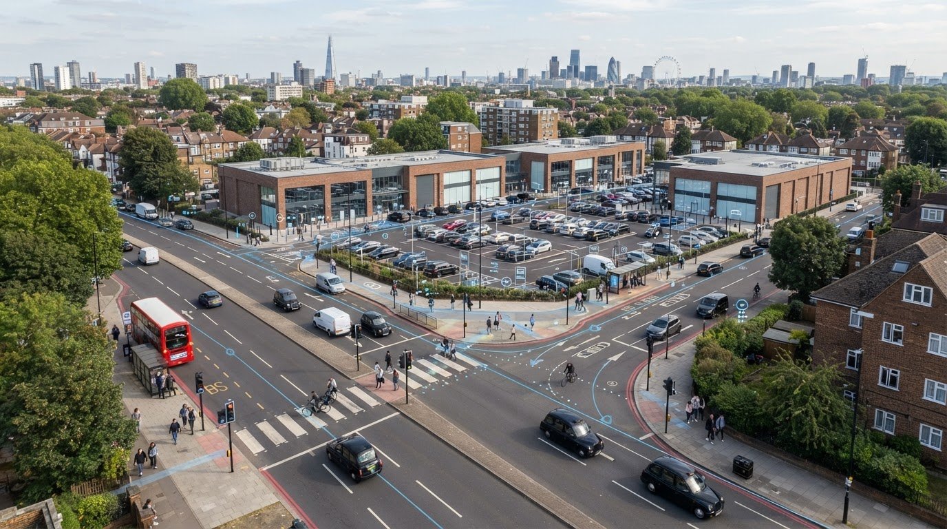
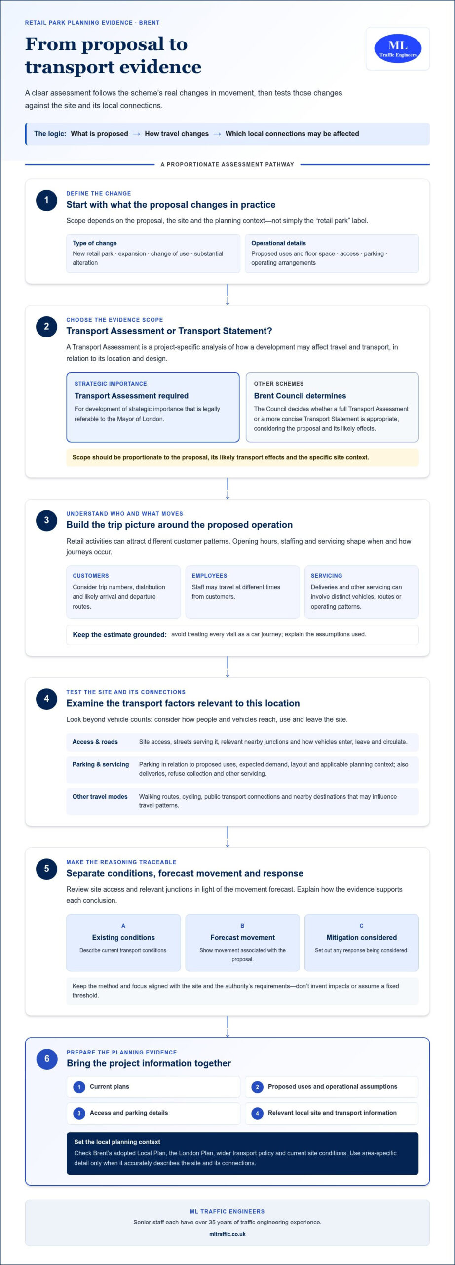
  • When Is a Transport Planner Needed? A Developer’s Guide to UK Planning

    When Is a Transport Planner Needed? A Developer’s Guide to UK Planning

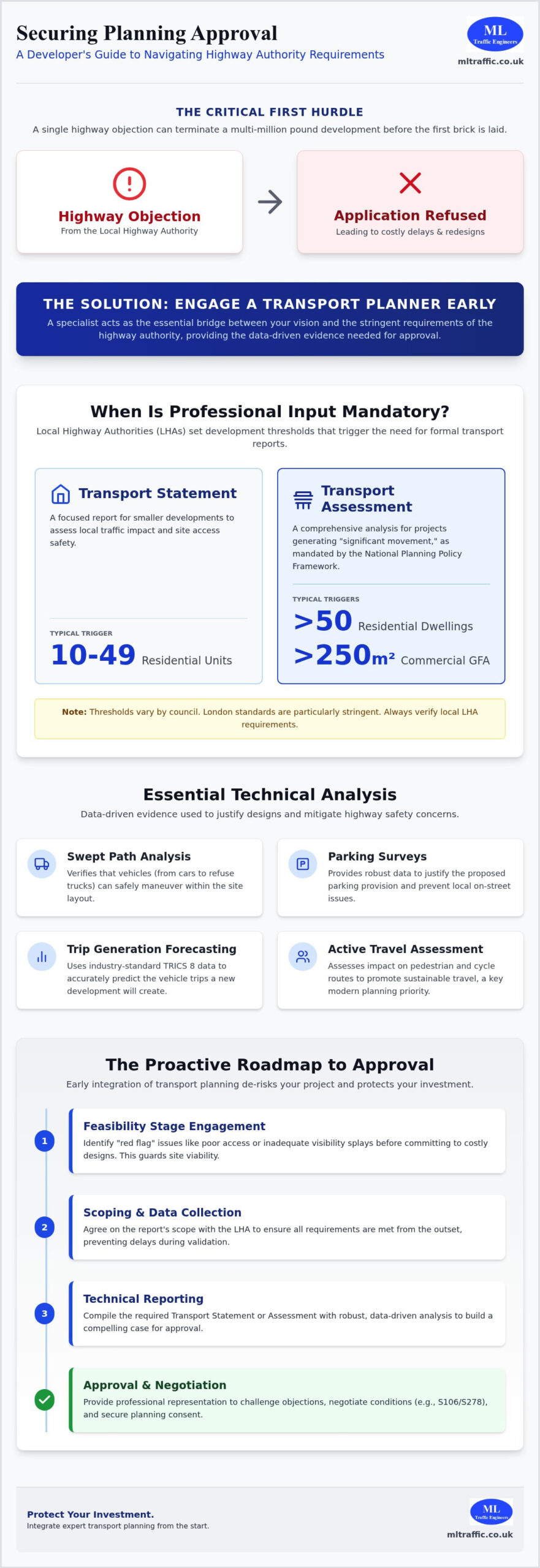
    A single highway objection can terminate a multi-million pound development before the first brick is laid. Many developers mistakenly treat highways as a late-stage technicality, only to face immediate refusal from the Local Highway Authority. Understanding exactly when is a transport planner needed within the current planning framework is the difference between a stalled application and a successful site commencement. With the National Planning Policy Framework updated in February 2025 and new TRICS 8 data standards now active, the technical requirements for site access and traffic impact are more stringent than ever.

    You probably recognize the confusion that arises when trying to distinguish between a Transport Statement and a full Assessment. It’s a high-stakes environment where uncertainty about local thresholds can lead to expensive redesigns or missed deadlines. This guide provides the clarity you need to navigate these regulatory pressures. We’ll outline the statutory triggers for professional input, identify which specific reports your project requires for 2026, and provide a clear roadmap to securing planning approval without highway objections.

    Key Takeaways

    • Identify the specific thresholds set by Local Highway Authorities that mandate professional reporting to avoid application refusal.
    • Learn exactly when is a transport planner needed to navigate the National Planning Policy Framework and provide technical evidence for site access.
    • Distinguish between a Transport Statement for smaller developments and a comprehensive Transport Assessment for complex projects.
    • Understand how specialized data like Swept Path Analysis and Parking Surveys justify your design and mitigate highway safety concerns.
    • Discover how to streamline the path to planning approval by integrating transport planning at the earliest feasibility stages.

    The Role of a Transport Planner in the Planning Process

    A transport planner functions as the essential link between a developer’s architectural vision and the stringent safety requirements of the public highway. While architects focus on the building’s aesthetics and structural engineers on its stability, neither is trained to analyze the complex dynamics of transportation planning. Professional transport planners provide the technical evidence required to prove that a new development won’t compromise the safety or efficiency of the surrounding road network. Determining exactly when is a transport planner needed depends on the scale and location of your project, but their input is often the only thing standing between an approval and a refusal.

    Local Highway Authorities rely on data-driven justifications rather than subjective design choices. Transport planners use specialized tools like TRICS data and comprehensive support strategies to forecast trip generation and mitigate traffic impacts. Without this specific expertise, a developer lacks the professional representation needed to challenge council objections or negotiate complex highway requirements. Relying on non-specialists for transport evidence is a high-risk strategy that frequently leads to costly delays during the validation process.

    To better understand the professional path and expertise involved in this field, watch this helpful video:

    Consultancy vs. Public Sector Planners

    There’s a fundamental difference between planners who set policy within a local authority and consultants who support private applications. Public sector planners act as gatekeepers, ensuring new developments align with regional transport goals. Private developers need a specialist consultant to “speak the language” of the council and translate technical requirements into actionable site designs. This expertise is vital when negotiating Section 106 contributions or Section 278 agreements, where the consultant ensures that the developer isn’t saddled with disproportionate infrastructure costs.

    Reducing Risk and Cost Through Early Engagement

    Engaging a specialist at the feasibility stage prevents fundamental design errors that can’t be easily fixed once an application is submitted. If a site layout doesn’t allow for safe vehicle turning or adequate visibility splays, the project may be fundamentally unviable. In 2026, the transport planner’s role is defined as a guardian of site viability. By identifying these “red flag” issues early, you avoid the financial burden of planning appeals and the need for expensive, late-stage redesigns. Proactive transport planning ensures that your site layout is technically sound before it ever reaches the council’s desk.

    Statutory Triggers: When Is Professional Input Mandatory?

    The National Planning Policy Framework (NPPF), updated in February 2025, mandates that developments generating significant movement must provide technical evidence to support a planning application. This is exactly when is a transport planner needed to interpret official government guidance against specific local requirements. While national rules provide a baseline, individual Local Highway Authorities (LHAs) set their own thresholds. London standards often differ significantly from national ones due to the capital’s unique congestion levels and strict sustainability targets. Modern planning triggers now prioritize “Active Travel,” meaning any project affecting pedestrian or cycle routes faces immediate scrutiny.

    Development Size and Trip Generation

    Project scale is the most common trigger for mandatory transport reporting. For residential projects, a development exceeding 50 dwellings typically requires a full Transport Assessment. However, many councils now request a Transport Statement for as few as 10 to 49 units to manage cumulative impact. Commercial sites face similar scrutiny based on Gross Floor Area (GFA). For instance, retail developments over 250 square meters in cities like Manchester often trigger the need for a Travel Plan. Transport planners use the TRICS 8 database, which received a major update in June 2025, to predict trip generation accurately. This data allows us to forecast the volume of vehicles and cyclists your site will attract, ensuring your infrastructure meets current benchmarks.

    Sensitive Locations and Safety Concerns

    Small developments can trigger the need for specialist input if they occupy sensitive locations. If your site is near a school, a busy junction, or within an Air Quality Management Area (AQMA), the council will likely demand a Transport Statement regardless of the unit count. Safety remains the non-negotiable foundation of the work. A minor change to a site access point might seem simple, but if it impacts visibility splays or pedestrian safety, it requires a formal technical review. Proving your site supports sustainable travel is no longer optional; it’s a core requirement for securing approval in 2026. If you’re unsure if your site meets these criteria, reviewing our project types can help identify the specific triggers for your development.

    Choosing the Right Report: Statements, Assessments, and Travel Plans

    Selecting the correct technical documentation is a critical step in the development lifecycle. Local planning authorities utilize these reports to determine if a project’s impact on the highway is manageable or if it requires significant mitigation. This is exactly when is a transport planner needed to evaluate the specific demands of your site against the professional standards set by the Chartered Institution of Highways & Transportation. Misclassifying your report type often leads to immediate validation failure, which can stall a project before the technical review even begins.

    The choice between a Transport Statement, a Transport Assessment, or a Travel Plan depends on the scale of the development and the specific policies of the borough. While national guidelines provide a framework, local authorities have the autonomy to request higher levels of detail based on local congestion or safety concerns. We manage the full project lifecycle by identifying these requirements early, ensuring that the evidence provided is proportionate to the development’s impact.

    Transport Statement vs. Assessment

    The primary difference between these two reports lies in their scope and the depth of analysis required. A Transport Statement is typically used for smaller developments where the impact on the wider highway network is limited. It focuses on site access, local pedestrian links, and parking provision. In contrast, a Transport Assessment is a comprehensive study required for larger or more complex projects. It often involves sophisticated junction modeling and an analysis of the development’s effect on the wider road network. For developers working in the capital, understanding the Transport Statement vs. Assessment: London Differences is vital, as many boroughs demand full assessments for relatively modest unit counts to address cumulative traffic pressures.

    The Necessity of Travel Plans

    Councils increasingly demand Travel Plans as a condition of planning, especially for “car-free” or low-parking developments in urban centers. A Travel Plan is not a one-off report; it is a long-term management strategy designed to encourage sustainable travel modes like cycling and public transport. These documents outline specific targets for reducing single-occupancy vehicle trips and include monitoring commitments that can last for several years post-occupation. Our expert London Travel Plans: The Essential Guide helps developers navigate these requirements, ensuring that sustainability targets are both ambitious and achievable. By integrating a Travel Plan early, you demonstrate a commitment to reducing environmental impact, which is a key priority for planning committees in 2026.

    When Is a Transport Planner Needed? A Developer’s Guide to UK Planning

    Technical Analysis That Requires a Specialist

    Precision in technical data is a functional necessity for modern planning applications. Generalist architectural software often lacks the sophisticated algorithms required for regulatory compliance; creating a gap that can lead to immediate highway objections. Determining exactly when is a transport planner needed often comes down to the requirement for forensic technical data that generalist designers cannot provide. We manage full project lifecycles by providing the specialized analysis that proves a site is safe, accessible, and compliant with local standards.

    Swept Path Analysis for Fire Tenders and Refuse Trucks

    Planning officers prioritize site functionality above all else. If you can’t prove a vehicle can physically enter, turn, and exit your site in a forward gear, your application faces refusal. This is where Swept Path Analysis Services in London become indispensable. We use industry-standard software like AutoTurn to simulate the movement of specific vehicle templates, including:

    • Emergency Vehicles: Proving fire tenders can reach all areas of a residential development.
    • Refuse Trucks: Ensuring 12m refuse vehicles can maneuver without mounting curbs.
    • HGVs: Validating loading bay access for commercial and industrial sites.

    This analysis acts as the primary tool for proving site functionality. It eliminates guesswork and provides planning officers with the visual and mathematical evidence they need to approve your layout.

    Parking Surveys and the Lambeth Methodology

    Justifying parking provision is one of the most contentious aspects of urban planning. In high-density areas, councils often push for “car-free” developments, but they require technical proof that this won’t result in overspill onto local streets. We conduct professional Parking Surveys using the Lambeth Methodology to provide a snapshot of on-street capacity. These surveys are typically conducted over two consecutive weekday nights between 00:30 and 05:30 to capture peak residential parking demand.

    Our analysis also incorporates PTAL (Public Transport Accessibility Level) ratings. A high PTAL score allows for lower parking ratios, but this must be justified with data rather than anecdotal evidence. Proving that there is sufficient on-street capacity within a 200-meter walk of the site can mitigate concerns about local congestion. Secure your site’s functionality and justify your parking strategy by commissioning a professional technical assessment today.

    Junction Modeling and Visibility Splay Analysis

    Safety is the non-negotiable foundation of our work. When a new development increases traffic at a local intersection, we use junction modeling to assess capacity and delay. This ensures the local road network can absorb the additional trips without failing. Similarly, visibility splay analysis is vital for any new or modified access point. We calculate the required sightlines based on recorded road speeds, ensuring that drivers can see and be seen when entering the highway. This level of technical detail is a statutory requirement for securing planning permission in 2026.

    Securing Approval with ML Traffic Engineers

    Navigating the complexities of UK planning requires more than just submitting documents; it demands a strategic partnership with experts who understand the nuances of highway safety and regulatory compliance. Determining exactly when is a transport planner needed depends on the complexity of your site access and the scale of the proposed works. ML Traffic Engineers UK provides an all-encompassing, fully-managed service that bridges the gap between your development goals and statutory requirements. Our approach prioritizes precision and rapid response, ensuring that your project maintains momentum through every stage of the planning lifecycle.

    Beyond the initial application, we provide expert guidance on Section 278 and Section 38 agreements. These legal frameworks govern the design and construction of new or improved highway infrastructure. Our technical reports, including Transport Assessments and Swept Path Analysis, form the non-negotiable foundation for these negotiations. By delivering accurate, data-backed evidence early, we significantly reduce the risk of costly planning delays and highway objections that could jeopardize your site’s viability. ML Traffic Engineers UK acts as a vital guardian of public safety, ensuring that all proposed highway works meet the strict standards required for local authority adoption.

    Our Expertise in London and England Planning

    Since our founding in 2014, we’ve developed a deep understanding of the specific requirements across different London Boroughs and regional authorities in England. Each jurisdiction has its own benchmarks for trip generation, parking provision, and sustainable travel. We specialize in navigating these intricate regional regulations so that you don’t have to. The unwavering reliability of ML Traffic Engineers UK in high-stakes planning environments makes us a dependable partner for developers facing strict regulatory scrutiny. Our expertise in TRICS 8 data and London-specific policy ensures every report meets the necessary statutory benchmarks for 2026 applications.

    Next Steps for Your Development

    Securing professional input is a straightforward, sequential process. We recommend providing your site plan for an initial review as early as the feasibility stage. This allows us to identify any immediate red flags regarding visibility splays or vehicle tracking before they become entrenched in your architectural design. The typical timeline for preparing a Transport Statement or Assessment varies based on project complexity, but our efficient workflow ensures rapid delivery to meet your project deadlines. Contact our team to discuss your requirements and receive a bespoke fee proposal. You can get a quote for your Transport Statement today to secure professional input for your 2026 planning application.

    Take Control of Your Planning Timeline

    Success in the 2026 planning landscape requires more than just a viable site; it requires technical evidence that withstands rigorous scrutiny from Local Highway Authorities. By identifying exactly when is a transport planner needed, you avoid the common pitfalls of application refusal and expensive late-stage redesigns. The right combination of Transport Statements, Travel Plans, and specialized data like Swept Path Analysis ensures your project meets the non-negotiable foundation of highway safety.

    ML Traffic Engineers UK has provided comprehensive London planning expertise since 2014. We are specialists in Swept Path Analysis and TRICS data, offering the precision required to navigate intricate regional regulations. Our team understands that precision is a functional necessity in high-stakes environments. We manage the full project lifecycle from initial assessment to execution, providing the unwavering reliability your development deserves.

    Don’t let highway objections stall your progress. Request a Transport Planning Quote from ML Traffic Engineers UK today to secure professional, data-backed representation for your application. We’re ready to help you achieve a seamless approval.

    Frequently Asked Questions

    Do I need a transport planner for a small residential conversion?

    Fees for technical reporting vary significantly based on the project’s complexity and the specific data analysis required by the local authority. Every development demands a tailored approach to ensure compliance with Local Highway Authority standards. We recommend requesting a bespoke fee proposal to ensure the scope of work aligns with your site’s unique constraints. This ensures you only pay for the necessary analysis while meeting all statutory benchmarks.

    What is the difference between a transport planner and a traffic engineer?

    Transport planners focus on the strategic movement of people and policy compliance, while traffic engineers handle the technical design and physical operation of the road network. Planners manage the application process and prepare reports like Transport Assessments. Engineers deal with junction geometry and signal timings. Knowing exactly when is a transport planner needed is vital for navigating the initial planning stages and securing the necessary statutory approvals.

    Can an architect complete a Swept Path Analysis?

    Architects generally lack the specialized software and verified vehicle templates required for a planning-grade Swept Path Analysis. While some design programs include basic tracking, they rarely meet the rigorous standards set by Local Highway Authorities. Professional planners use dedicated tools like AutoTurn with precise templates for fire tenders and refuse vehicles. This precision is a functional necessity to prove that large vehicles can maneuver safely within your specific site layout.

    What happens if I submit a planning application without a required Travel Plan?

    Submitting an application without a mandatory Travel Plan usually results in a non-validation or an immediate highway objection. Councils view these documents as essential management strategies for reducing environmental impact and promoting sustainable transport. Failure to provide this evidence can lead to significant delays or an outright refusal. Including a professional Travel Plan from the outset demonstrates your commitment to sustainability and helps streamline the path to planning approval.

    How long does it take to produce a Transport Assessment?

    A comprehensive Transport Assessment typically takes three to six weeks to produce, depending on the scale of the development and data availability. This timeline accounts for site visits, data collection from the TRICS database, and complex junction modeling. Early engagement is essential to ensure these technical reports are ready for your submission deadline. Our efficient workflow prioritizes the rapid delivery of information to maintain your project’s momentum throughout the process.

    Is a transport planner needed for a change of use application?

    Determining when is a transport planner needed for a change of use depends on whether the new use generates more trips or different parking requirements. Converting an office into a residential block or a retail unit into a restaurant significantly changes the traffic profile of the site. We analyze these trip generation shifts to justify the change to the council and ensure the local network can accommodate the new demand safely.

    Can a transport planner help with a refused planning application appeal?

    Transport planners provide vital expert evidence to challenge highway-related reasons for refusal during the appeal process. We review the council’s objections and prepare technical rebuttals, often utilizing more detailed data like Parking Surveys or forensic junction modeling. This professional representation provides the technical authority needed to address safety concerns and demonstrate that your development is fully compliant with national and local planning policies.

    Michael Lee

    Article by

    Michael Lee

    Transport planner with over 35 years' experience.

    Disclaimer

    The content on mltraffic.co.uk, including all technical articles, guides, and resources, is provided for general informational and educational purposes only. It is not intended to constitute professional advice in traffic engineering, transportation planning, development approvals, or any other technical or legal field.
    While ML Traffic Engineers makes every reasonable effort to ensure the accuracy, completeness, and timeliness of the information published, we do not provide any warranties or representations (express or implied) regarding its reliability, suitability, or availability for any particular purpose. Any reliance you place on the content is strictly at your own risk.
    In no event shall ML Traffic Engineers, its directors, employees, authors, or affiliates be liable for any direct, indirect, incidental, special, consequential, or punitive damages (including, without limitation, loss of profits, data, or business opportunities) arising out of or in connection with the use of, or inability to use, any information provided on this website.
    The articles and guides on this site are not a substitute for engaging a qualified, professional traffic engineer to assess your specific project requirements. For tailored advice, compliance assessments, or traffic engineering services, please contact a competent professional.
    This disclaimer may be updated from time to time without notice. By accessing or using this website, you agree to be bound by the most current version of this disclaimer.

  • Vehicle Access Visibility Splays: The Developer’s 2026 Guide to Planning Success

    Vehicle Access Visibility Splays: The Developer’s 2026 Guide to Planning Success

    A single miscalculation in your vehicle access visibility splays can render a high-value development site undevelopable before the first brick is even laid. You likely recognize that securing Highway Authority approval remains one of the most significant risks to your project timeline. The constant tension between maximizing developable area and meeting uncompromising safety standards often leads to costly design errors and planning delays.

    This guide empowers you to master the technical requirements of X and Y distances, ensuring your site access meets the latest UK safety standards and secures planning approval without friction. We provide the professional precision necessary to navigate the complex transition between Manual for Streets and DMRB requirements. By integrating rigorous data collection early in the design phase, you can mitigate the risk of ‘unsafe access’ objections that frequently stall major applications.

    We examine the 2026 regulatory updates, the vital role of 85th percentile speed surveys in determining splay dimensions, and strategic solutions for boundary issues where sightlines cross third-party land. This technical overview ensures your project remains compliant, safe, and ready for execution.

    Key Takeaways

    • Understand how vehicle access visibility splays function as the primary safety mechanism for site access, protecting both emerging and passing motorists.
    • Master the technical application of X and Y distances to ensure your junction geometry meets precise Highway Authority stopping sight distance requirements.
    • Determine the correct regulatory framework for your site by distinguishing between Manual for Streets (MfS) and DMRB standards based on local road speeds.
    • Learn to identify and mitigate common sightline obstructions, such as boundary walls and vegetation, while adhering to strict vertical visibility limits.
    • Streamline your planning application by integrating visibility analysis with Swept Path Analysis for a comprehensive, submission-ready Transport Statement.

    What Are Vehicle Access Visibility Splays and Why Are They Critical?

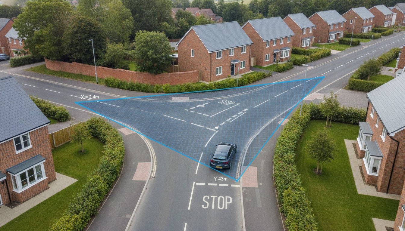
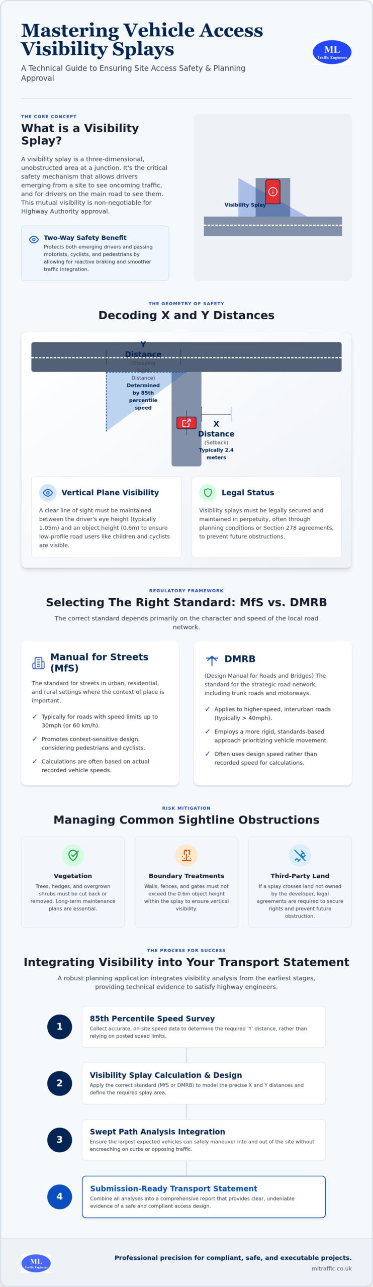
    Vehicle access visibility splays represent the physical area at a junction where sightlines must remain entirely unobstructed to ensure safe movement between a side road and a major road. Unlike a simple 2D drawing, a splay is a three-dimensional envelope of visibility. It ensures that any driver positioned at the junction has a clear, unhindered view of approaching traffic. Precision in these calculations is mandatory. Highway Authorities treat these splays as the primary gatekeepers of site viability, often prioritizing them over architectural aesthetics or unit density. A site with a ‘blind’ access point is often fundamentally undevelopable, as safety remains a non-negotiable requirement for planning approval.

    The safety benefit is strictly two-way. While it is vital for the emerging driver to see oncoming traffic, it’s equally important for drivers on the major road to see vehicles preparing to join the flow. This mutual visibility allows for reactive braking and smoother traffic integration. Adhering to standard road junction design principles ensures that all road users, including cyclists and motorcyclists, are protected from high-speed collisions. In 2026, failing to demonstrate compliant vehicle access visibility splays in your initial application is a leading cause of immediate refusal. Visibility analysis is the cornerstone of a robust Transport Statement, providing the technical evidence needed to satisfy highway engineers.

    The Geometry of Safety: Side Road vs. Major Road

    Visualizing the splay as a triangle is the most effective way to understand your site entrance. The ‘X’ distance is your setback from the major road, while the ‘Y’ distance extends along the main carriageway. The speed of the major road dictates the entire design. Higher recorded speeds require longer ‘Y’ distances to account for vehicle stopping sight distances. In urban development projects, this geometry must also account for pedestrian visibility. Drivers must be able to see pedestrians on the footway before the vehicle crosses their path. We use actual speed data, rather than just posted limits, to ensure the triangle is both safe and realistic.

    Legal and Planning Status of the Splay

    Visibility splays must be maintained in perpetuity. The Highway Authority requires long-term control over this land to prevent future obstructions like overgrown hedges or new fences. If the required splay crosses land you don’t own, you must secure that land through legal agreements or demonstrate that it’s part of the public highway. We often manage these requirements through Section 278 agreements for off-site improvements. These visibility requirements typically appear as strict planning conditions. You’ll often find that you cannot begin work on-site until the access and its associated visibility splays are physically constructed and verified.

    Decoding the Dimensions: Understanding X and Y Distances

    Precision is the difference between a validated planning application and a costly refusal. When designing vehicle access visibility splays, we define the safety area using two primary coordinates: the X and Y distances. The X distance represents the setback from the edge of the major road to the driver’s eye. While 2.4 meters is the standard requirement for most junctions, this measurement is not arbitrary. It allows a driver to see the main road clearly without their vehicle protruding into the flow of traffic. The Y distance, or Stopping Sight Distance (SSD), is the length visible along the major road. This distance must be sufficient for a driver on the main road to see a hazard and come to a safe stop.

    Technical accuracy extends into the vertical plane. We must maintain a clear line of sight between a driver’s eye height, typically 1.05 meters, and an object height of 0.6 meters. This ensures that low-profile road users, such as children or cyclists, are not obscured by boundary treatments. Environmental factors also influence these calculations. Steep gradients or road surfaces prone to moisture can increase braking distances, requiring an extension of the Y distance to maintain safety margins. Following the Manual for Streets (MfS) guidance, we calculate these dimensions based on actual vehicle deceleration rates rather than theoretical ideals.

    When Can the X Distance Be Reduced?

    Reducing the X distance to 2.0 meters is sometimes permissible for lightly trafficked residential drives or in constrained urban environments. However, Highway Authorities often resist this ‘nose-out’ visibility because it forces the front of the vehicle to enter the major road before the driver has a full view. At ML Traffic, we justify these reductions by providing empirical evidence of low traffic volumes or by using Swept Path Analysis to prove that the maneuver remains safe. If you are struggling with a tight site boundary, commissioning professional Traffic Surveys can provide the specific data needed to defend a non-standard design.

    Calculating the Y Distance: The Speed Factor

    The Y distance is directly tethered to the 85th percentile speed of the major road. A 20mph zone typically requires an SSD of 25 meters, whereas a 30mph zone requires 43 meters. It is a common error to rely solely on the posted speed limit. Actual recorded speeds often exceed the limit, and Highway Authorities will demand visibility splays that reflect how the road is used in reality. We use 85th percentile speed data to ensure your design is robust enough to pass a formal safety review.

    MfS vs. DMRB: Selecting the Right Regulatory Standard

    Selecting the correct regulatory framework is a strategic decision that dictates the viability of your site layout. In the UK, we primarily work with two sets of guidance: Manual for Streets (MfS) and the Design Manual for Roads and Bridges (DMRB). MfS is the standard for most urban and residential environments where speeds are 37mph or lower. It prioritizes place-making and utilizes stopping sight distances based on actual vehicle deceleration. Conversely, the DMRB is a more rigid standard designed for trunk roads and high-speed rural routes.

    The ‘grey area’ typically occurs on the urban fringe where a 30mph limit transitions into a 60mph zone. Applying DMRB standards to an urban-edge site often results in excessively large vehicle access visibility splays. These over-engineered designs can consume valuable frontage, reduce your unit count, and ultimately kill site density. We specialize in navigating these transitions, using technical authority to argue for the more appropriate MfS standard when the character of the road supports it. Identifying the most appropriate standard early prevents logistical pressures and ensures your project meets safety benchmarks without sacrificing land.

    The Critical Role of Speed Surveys

    Relying on posted speed limits is a common mistake that leads to conservative, space-wasting designs. We recommend conducting 85th percentile speed surveys to determine the actual speed at which motorists travel past your site. If the 85th percentile speed is lower than the limit, we can often justify shorter Y distances, preserving more of your developable area. For example, on a recent project with restricted frontage, a speed survey proved that actual speeds were significantly lower than the 30mph limit. This allowed for a reduction in the required splay, saving multiple residential units that would have otherwise been lost to visibility requirements. Professional Traffic Surveys provide the empirical data required to challenge assumptions and maximize site potential.

    National vs. Local Highway Authority Variances

    While MfS and DMRB provide national frameworks, local Highway Officers often have their own specific interpretations. Some authorities are more flexible regarding ‘nose-out’ visibility, while others strictly adhere to their own internal design guides. Early pre-application engagement is essential to understand these local nuances before you finalize your site plan. This proactive approach is particularly vital when navigating London’s transport planning system, where high-density constraints require a more tailored technical justification for every meter of visibility. We manage these negotiations on your behalf, ensuring your design aligns with both national standards and local expectations.

    Managing Obstructions and Maintenance within the Splay

    The 0.6m rule is the fundamental benchmark for any object positioned within the visibility envelope. To maintain a clear line of sight between the driver’s eye height (1.05m) and the object height (0.6m), everything within the splay must remain below this 600mm threshold. Common pitfalls include boundary walls, decorative hedges, and seasonal vegetation that grows rapidly. Parked cars represent another significant concern. Highway Authorities will often require new parking restrictions if existing or proposed on-street parking blocks the vehicle access visibility splays.

    Not every object is a prohibited obstruction. Slim signposts, lighting columns, and clear-stemmed trees where the canopy starts above 2.0m are often permitted because they don’t significantly mask a vehicle. However, the cumulative effect of multiple ‘slim’ objects can still lead to a refusal if they create a visual screen. If your site layout is constrained, we can perform a detailed assessment to identify which existing features can be retained and which must be removed to satisfy safety requirements.

    Land Ownership and Control

    For a planning application to succeed, you must demonstrate that the required visibility splays are either within your site’s red-line boundary or on land that is already part of the public highway. If a splay crosses third-party land, you face a significant legal hurdle. You must either purchase that land or secure a legal agreement with the neighbor. In some cases, we utilize Grampian conditions. These are negatively worded planning conditions that prevent development from starting until the off-site visibility is secured. We often facilitate these arrangements through Section 106 or Section 278 agreements to ensure the Highway Authority has the legal right to maintain the sightlines in perpetuity.

    Designing for Longevity

    Maintaining vehicle access visibility splays isn’t just a requirement for the planning phase; it’s a permanent safety obligation. When designing your landscaping scheme, select low-growth species that naturally stay below 0.6m. This prevents future safety breaches caused by overgrown vegetation. As the developer, you remain liable for maintaining these sightlines until the road is formally adopted by the council. For complex projects involving new road infrastructure, our Highway Design S278 & S38 Guide provides deeper insight into the adoption process and long-term maintenance requirements.

    If you’re facing boundary disputes or need a technical justification for a potential obstruction, contact us today to discuss how our Transport Statements can resolve your planning bottlenecks and secure your site’s access.

    Vehicle Access Visibility Splays: The Developer’s 2026 Guide to Planning Success

    Integrating Visibility into Your Transport Statement

    A robust Transport Statement relies on the technical validation of vehicle access visibility splays. It isn’t enough to state that an access point is safe; we must prove it through rigorous data. Our workflow begins with precise site surveys to capture 85th percentile speeds, which then inform our CAD modeling. This transition from raw data to engineered drawings ensures the Highway Officer receives a submission that is technically sound and ready for approval on the first attempt. We present our findings in a logical, sequential format that mirrors the Highway Authority’s own review process, reducing the friction often found in planning negotiations.

    There is a critical synergy between visibility analysis and Swept Path Analysis. While visibility splays ensure drivers can see, Swept Path Analysis proves that vehicles can physically maneuver through the junction without overrunning footways or striking street furniture. We integrate these two disciplines to ensure your site entrance is both visible and navigable. Presenting these reports as a unified technical package demonstrates a comprehensive understanding of junction safety. This combined approach reduces the likelihood of supplementary information requests that can stall your project for weeks.

    Beyond the Drawing: The Technical Report

    The technical report goes beyond simple geometry. We use evidence-based engineering to justify deviations from standard guidance when site constraints make literal compliance impossible. This approach is especially critical when following our Transport Assessment London Guide, where high-density environments require creative but safe solutions. Our safety-critical designs are backed by professional indemnity insurance, providing developers with the assurance that their project’s technical foundation is legally and professionally robust. We don’t just provide drawings; we provide the engineering justification needed to win planning appeals.

    Next Steps for Your 2026 Planning Application

    Early-stage feasibility is the most effective way to protect your site’s value. We recommend checking vehicle access visibility splays before you finalize your site layout. Identifying a visibility constraint during the initial design phase allows for minor adjustments to building positions or frontage treatments. Waiting until the full application stage to discover an unsafe access point often results in expensive redesigns and lost units.

    To streamline your 2026 planning application, you should request a site-specific access review as early as possible. We provide a clear roadmap from initial assessment to final Highway Authority sign-off, managing the logistical and regulatory pressures so you don’t have to. By choosing a partner that understands the intricate relationship between safety standards and commercial site viability, you ensure your project moves forward with unwavering reliability and precision.

    Securing Site Viability Through Technical Precision

    Securing planning approval in 2026 requires more than a compliant drawing; it demands an evidence-based approach to highway safety. By mastering the geometric requirements of X and Y distances and selecting the appropriate regulatory standard, you protect your development from the risk of ‘unsafe access’ refusals. Integrating these vehicle access visibility splays with detailed data collection ensures your site maximizes its developable area while meeting the Highway Authority’s stringent benchmarks. We’ve explored how speed surveys and proactive obstruction management turn regulatory hurdles into manageable design elements.

    Our team acts as your dependable technical partner, offering specialized expertise in MfS and DMRB compliance alongside comprehensive Transport Planning support. We’re highly experienced in Section 278 negotiations, ensuring that off-site improvements are handled with professional integrity. Secure your site access approval with a professional visibility analysis from ML Traffic Engineers. We provide the rapid response and precision necessary to reduce logistical pressures and keep your project on schedule. Let’s ensure your site access is safe, compliant, and ready for construction.

    Frequently Asked Questions

    What is the standard X distance for a visibility splay in the UK?

    2.4 meters is the standard X distance for the vast majority of UK road junctions. This setback represents the distance from the edge of the major road to the driver’s eye, allowing for a clear view of approaching traffic without the vehicle protruding into the carriageway. In certain constrained urban settings with low traffic speeds, some Highway Authorities may permit a reduction to 2.0 meters, though this often requires a robust technical justification.

    Can a visibility splay go over a neighbour’s land?

    A visibility splay can cross third-party land, but you must demonstrate legal control over that area to ensure it remains unobstructed. The Highway Authority requires sightlines to be maintained in perpetuity, so you’ll typically need a formal easement, a land purchase, or a Grampian planning condition. If you cannot prove the land will be kept clear, the vehicle access visibility splays will be considered ‘unprotected’ and likely lead to a planning refusal.

    What height can objects be within a visibility splay?

    Objects within the splay must generally remain below a height of 0.6 meters above the ground. This threshold ensures a clear line of sight between a driver’s eye height, which is typically 1.05 meters, and lower-profile hazards or road users. While some slim items like lighting columns or signposts are often permitted, they must not cumulatively block the driver’s field of vision.

    Do I need a visibility splay for a private driveway?

    You do need a visibility splay for a private driveway if it creates a new access or intensifies an existing one onto the public highway. Safety standards apply to all access points to prevent collisions between emerging vehicles and passing traffic. Planning officers will scrutinize the access as part of your application to ensure it doesn’t compromise the safety of the road network.

    How do I calculate the Y distance for a 30mph road?

    The Y distance for a 30mph road is typically 43 meters when following Manual for Streets (MfS) guidance. However, this distance is based on the stopping sight distance required for a vehicle traveling at the 85th percentile speed of the road. If actual recorded speeds are higher than 30mph, the required Y distance will increase to ensure drivers have enough time to react and stop safely.

    What is the difference between MfS and DMRB visibility standards?

    Manual for Streets (MfS) is designed for urban and residential environments with speeds of 37mph or less, focusing on place-making and actual driver behavior. The Design Manual for Roads and Bridges (DMRB) is a more conservative standard used for high-speed rural routes and trunk roads. Applying the stricter DMRB standards to an urban site can result in unnecessarily large splays that significantly reduce your developable land.

    Can trees be planted within a visibility splay?

    Trees can be planted within a visibility splay provided they are clear-stemmed and don’t create a visual screen. The trunk must be narrow, and the canopy should start at a minimum of 2.0 meters above ground level to keep the 0.6m to 2.0m visibility envelope clear. You must also select species that won’t grow to obstruct the splay as they mature, as you are responsible for their ongoing maintenance.

    How much does a visibility splay survey cost for a planning application?

    The cost of a visibility splay assessment varies based on the size of the site and the level of data collection required. A survey that includes 85th percentile speed data or topographical mapping will involve different requirements than a desk-based assessment. Developers should seek a tailored proposal from a specialist engineer to ensure all Highway Authority requirements are met without overspending on unnecessary surveys.

    Michael Lee

    Article by

    Michael Lee

    Transport planner with over 35 years' experience.

    Disclaimer

    The content on mltraffic.co.uk, including all technical articles, guides, and resources, is provided for general informational and educational purposes only. It is not intended to constitute professional advice in traffic engineering, transportation planning, development approvals, or any other technical or legal field.
    While ML Traffic Engineers makes every reasonable effort to ensure the accuracy, completeness, and timeliness of the information published, we do not provide any warranties or representations (express or implied) regarding its reliability, suitability, or availability for any particular purpose. Any reliance you place on the content is strictly at your own risk.
    In no event shall ML Traffic Engineers, its directors, employees, authors, or affiliates be liable for any direct, indirect, incidental, special, consequential, or punitive damages (including, without limitation, loss of profits, data, or business opportunities) arising out of or in connection with the use of, or inability to use, any information provided on this website.
    The articles and guides on this site are not a substitute for engaging a qualified, professional traffic engineer to assess your specific project requirements. For tailored advice, compliance assessments, or traffic engineering services, please contact a competent professional.
    This disclaimer may be updated from time to time without notice. By accessing or using this website, you agree to be bound by the most current version of this disclaimer.
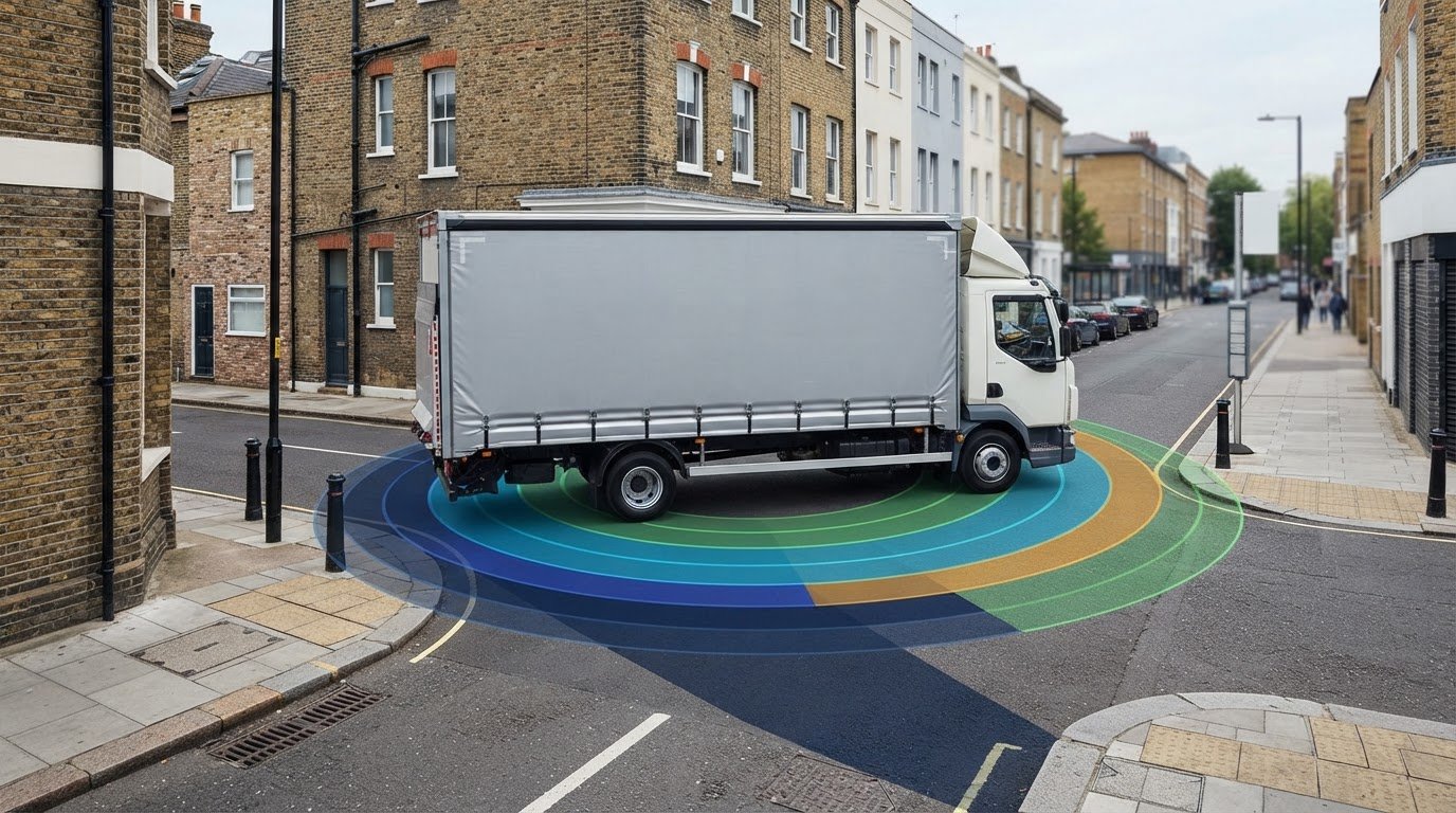
  • Swept Path Analysis Quote London: A 2026 Developer’s Guide to Costs and Requirements

    Swept Path Analysis Quote London: A 2026 Developer’s Guide to Costs and Requirements

    Did you know that 42% of minor development applications across London boroughs face immediate delays at the validation stage simply because of insufficient highway data? It’s a frustrating bottleneck that stalls projects before they even begin. If you’re navigating the complexities of site access, securing a precise swept path analysis quote London councils will actually accept is your first line of defense against these setbacks. We understand that the pressure to provide technical drawings that meet the latest 2026 standards, such as AutoTURN 2026 modeling, can feel overwhelming when you’re managing tight project timelines.

    You’ve likely dealt with the confusion of whether a specific borough requires a standard pump fire tender or a 64m turntable ladder template for your site. This guide simplifies that process. You’ll learn how to obtain a fast, fixed-fee quote while ensuring your technical drawings pass scrutiny the first time. We’ll examine the specific requirements for the London Fire Brigade, including the 3.7 meter minimum road width, and explain why digital modeling has replaced manual templates as the non-negotiable standard for planning approval in 2026.

    Key Takeaways

    • Identify why high-precision digital simulations are now the mandatory standard for proving vehicle maneuverability to all 32 London boroughs.
    • Learn how site complexity and specific vehicle templates, like 12-metre refuse lorries, directly impact your swept path analysis quote London for a 2026 application.
    • Understand the technical role of AutoTurn software in modeling “vehicle envelopes” to account for body overhang and wheel paths with absolute precision.
    • Discover the critical differences between London Fire Brigade standards and individual borough requirements for refuse collection to prevent validation failures.
    • Access professional guidance on securing a fast, fixed-fee quote and expert-led technical drawings that prioritize both safety and planning approval.

    What is Swept Path Analysis and Why is it Mandatory in London?

    Swept Path Analysis (SPA) is a technical computer-aided simulation that maps the exact footprint of a vehicle as it maneuvers through a specific layout. By utilizing advanced AutoTurn Software, we calculate the precise path of the vehicle’s body, wheels, and outer chassis overhang. This digital modeling ensures that your proposed site can accommodate the physical realities of vehicle movement without striking kerbs, buildings, or other infrastructure. Securing a reliable swept path analysis quote London developers can trust is now a standard requirement for almost every planning application across the capital.

    To better understand the mechanics of how these simulations work in a real-world engineering context, watch this helpful video:

    In high-density boroughs like Westminster, Tower Hamlets, or Camden, space is a finite resource. Planning officers don’t just look at whether a car can park; they prioritize the “worst-case” vehicle scenarios. A common misconception among developers is that standard passenger vehicle access is sufficient for approval. In reality, London councils focus almost exclusively on fire tenders and refuse lorries. If your site plan doesn’t demonstrate that a 12-metre bin lorry can enter and exit in forward gear, your application will likely fail at the first hurdle. High-precision digital modeling is now the non-negotiable benchmark for all 32 London boroughs in 2026.

    The Consequences of Skipping Professional Vehicle Tracking

    Failing to include professional vehicle tracking often leads to an immediate rejection by the Local Highway Authority. This isn’t just a paperwork issue; it’s a safety and functional necessity. Without SPA, you risk costly late-stage redesigns. Imagine completing a courtyard only to discover a London Fire Brigade pump cannot reach the building because the turning circle is too tight. Furthermore, improper planning leads to “overrun” where heavy vehicles mount pedestrian footways, creating significant safety hazards and potential legal liabilities for the developer.

    The Role of SPA in London Transport Statements

    SPA serves as the technical backbone of a Transport Statement London councils require for minor and major developments. By integrating vehicle tracking into your site access strategy, ML Traffic Engineers UK provides the empirical proof needed to justify tighter turning circles or reduced parking allocations. We use these simulations to show that even restricted urban sites can function safely. When you request a swept path analysis quote London experts provide, you’re investing in a planning solution that proactively addresses council concerns before they become formal objections.

    Calculating Your Swept Path Analysis Quote: Factors That Influence Cost

    Calculating a swept path analysis quote London developers can rely on requires a clear understanding of your site’s physical constraints. No two projects are identical. A simple residential driveway check differs significantly from a large-scale commercial distribution hub. Several technical variables consistently drive the consultancy fee. Site complexity is the primary factor. If we’re assessing a single access point from a public highway, the simulation is straightforward. However, projects involving multiple internal junctions or shared surfaces require more engineering time to ensure every corner meets the safety standards that are now mandatory in London planning applications.

    Timeline and urgency play a final role in the quote. We maintain a constant sense of readiness to meet tight deadlines, but “24-hour turnaround” requests usually carry a premium. This accounts for the immediate reallocation of technical resources to ensure your drawings are ready for submission. If you need to understand the technical nuances before requesting a price, you can learn more about our technical approach here.

    What Information You Need to Provide for a Fast Quote

    To receive an accurate swept path analysis quote London consultancies can provide quickly, you should follow three steps. First, provide your site layout in a scaled DWG format. This allows for immediate integration into our modeling software. Second, identify the “critical” vehicles required by your specific borough. If you aren’t sure, we can advise on whether you need a standard bin lorry or a specialist emergency vehicle. Third, specify the necessary maneuvers. Most councils want to see entry, exit, and any three-point turns or hammerhead maneuvers required within the site boundary. Providing this data upfront ensures a fast, precise response.

    Fixed-Fee vs. Hourly Rates in London Consultancies

    We recommend choosing fixed-fee quotes for better budget certainty. Hourly rates often lead to “scope creep,” where minor adjustments result in unexpected costs that can stall your project. A standard fixed-fee quote from a professional firm usually includes the technical report, the CAD drawings, and at least one round of revisions. This transparent approach helps you manage your transport planning budget without hidden charges. For a tailored assessment of your project, you can reach out to our team at mltraffic.co.uk to discuss your specific site requirements and secure a dependable quote.

    Technical Precision: Using AutoTurn Software for Planning Approval

    When you request a swept path analysis quote London planning departments will respect, the technical tools behind the drawings are just as critical as the engineer’s experience. ML Traffic Engineers UK utilizes AutoTurn 2026, the global industry standard for simulating vehicle maneuvers. This software is not merely a drawing aid; it’s a high-precision validation engine that accounts for complex steering geometry and vehicle dynamics. London councils expect this level of digital modeling because it eliminates the guesswork associated with tight urban sites. It provides a level of certainty that manual templates simply cannot match, especially when every millimetre of pavement counts.

    A primary advantage of digital simulation is the ability to model “vehicle envelopes” with absolute accuracy. We don’t just track the wheels; we account for the body overhang at the front and rear of the vehicle. This is vital in London, where street furniture, historic building corners, and narrow kerb alignments create constant obstacles. Our simulations also incorporate real-world variables like kerb heights and gradients. By testing these conditions digitally, we reduce the need for expensive and logistically difficult physical trial runs on-site. This proactive approach ensures your site layout is functional before a single brick is laid.

    Visualising the Swept Path Envelope

    Your SPA report will clearly distinguish between the “chassis” lines, which show where the wheels travel, and the “body” lines, which indicate where the outer edges of the vehicle swing. London Highway Officers look for specific clearance margins between these lines and the site boundaries to ensure safety. The swept envelope is the total area a vehicle occupies during a turn. We include these margins to prove that even the largest permitted vehicles can navigate your site without risking structural damage or pedestrian safety.

    Integrating SPA into Your Highway Design

    Precision modeling is essential for successful Highway Design S278 & S38 submissions. ML Traffic Engineers UK integrates vehicle tracking directly into your AutoCAD drawings to validate the placement of loading bays, car park entrances, and refuse collection points. This spatial accuracy confirms that your infrastructure can handle the intended traffic volume and vehicle types. If you’re preparing a submission, you can explore our practical guide to AutoTurn modeling to see how we refine these technical details for council approval.

    Swept Path Analysis Quote London: A 2026 Developer’s Guide to Costs and Requirements

    Securing a swept path analysis quote London developers can move forward with requires more than just technical software; it demands an intimate knowledge of borough-specific fleet dimensions. While generic UK templates exist, London’s 32 boroughs often utilize bespoke vehicle configurations that catch unprepared developers off guard. For example, the refuse collection vehicle (RCV) dimensions required for a planning application in Hackney may differ from those in Bromley due to varying local fleet contracts. We maintain an updated database of these local requirements to ensure your drawings reflect the exact vehicle your local council operates.

    Developments located on or near the Strategic Road Network (SRN) face additional scrutiny from Transport for London (TfL). In these cases, your simulation must prove that servicing vehicles, such as a 10.7m rigid lorry, can enter and exit the site without disrupting the flow of red routes or high-traffic corridors. We provide the technical proof required for Servicing and Delivery Plans, ensuring that your commercial units remain functional and compliant with TfL’s stringent safety standards. If you need to verify your site’s viability against these complex regulations, you can explore our full range of swept path analysis services to see how we manage these regional intricacies.

    Standard London Vehicle Templates

    The most common hurdle in London planning is the 11.2m or 12m refuse collection vehicle. Councils prioritize these “worst-case” scenarios to prevent waste collection teams from blocking narrow residential streets. For residential basement parking, we typically model an 8.0m “large car” or van template to ensure ramp gradients and tight corners are navigable. During the construction phase, central London boroughs often require simulations for abnormal loads, proving that heavy machinery can reach the site without damaging historic infrastructure or street furniture.

    Addressing the “Fire Tender Access” Objection

    London Fire Brigade (LFB) standards are non-negotiable. You must prove that a fire appliance can reach within 45m of all points within a building. The LFB requires a minimum road width of 3.7m between kerbs and a gateway width of at least 3.2m. For dead-end roads longer than 20m, you must provide a turning facility, such as a hammerhead or turning circle. We use high-precision modeling to justify reversing distances that might exceed the standard 20m guidance, provided the safety case is robust. Integrating these findings into a Construction Logistics Plan is essential for projects with restricted access. When you request a swept path analysis quote London experts provide, you ensure that these safety critical dimensions are baked into your design from day one.

    Secure Your Planning Approval with ML Traffic Engineers UK

    Timing is critical in the high-stakes environment of London property development. Our team maintains a constant state of readiness to provide a swept path analysis quote London professionals can rely on to keep their projects moving forward. We commit to a 24 to 48 hour turnaround for all initial quotes, reflecting the urgency that modern infrastructure projects demand. This rapid response capability is a hallmark of our service, ensuring that technical requirements never become a bottleneck for your planning submission. We prioritize clarity and precision to reduce the regulatory pressures on your team.

    Our expertise extends across all 32 London boroughs and the City of London. This comprehensive geographic coverage means ML Traffic Engineers UK already understands the specific preferences of local highway officers, whether they require bespoke refuse vehicle dimensions or strict adherence to fire tender access routes. We don’t just provide drawings; we deliver planning solutions. By integrating our vehicle tracking simulations seamlessly with your Transport Assessment or Transport Statement, we create a unified technical case that supports your site’s feasibility from the outset. This holistic approach ensures that all transport-related elements of your application are technically sound and ready for scrutiny.

    Why Developers Choose ML Traffic Engineers UK

    Developers frequently partner with us because of our proven track record in overcoming difficult access objections. We take immense pride in our precision and adherence to industry standards, positioning ourselves as a vital guardian of site safety and public welfare. Unlike larger consultancies, we provide direct communication with our engineers. This ensures that technical progress is never blocked by administrative layers or account managers who lack specialized knowledge. We also offer competitive, transparent pricing for projects of all sizes, from small residential infills to complex industrial units. Our goal is to provide a tailored service that reflects the unique constraints of your specific site.

    Get Your Fixed-Fee Quote Today

    Securing your planning-ready drawings starts with a simple assessment of your site layout. Upload your plans via our contact form for a same-day response from our technical team. When you submit your inquiry, please mention your specific borough so we can provide a tailored vehicle template assessment immediately. This allows us to align our modeling with local requirements right from the start. You can also Request a Swept Path Analysis Quote through our dedicated resource page. We are ready to help you manage the intricate regional regulations and secure the approval your project needs to succeed.

    Secure Your Site Access and Planning Certainty

    Achieving planning approval in 2026 requires technical precision and a deep understanding of borough-specific vehicle requirements. You’ve seen how digital simulations using AutoTurn software eliminate the guesswork that often leads to validation delays. By prioritizing accurate modeling for fire tenders and refuse vehicles, you proactively address the safety and accessibility concerns of local highway officers. Securing a professional swept path analysis quote London developers can trust ensures your site layout is validated against statutory requirements before submission.

    Since 2014, ML Traffic Engineers has provided over a decade of specialized London planning expertise. We are specialists in AutoTurn vehicle tracking and maintain an intricate understanding of LFB and TfL statutory requirements. Get a Fixed-Fee Swept Path Analysis Quote for Your London Project to secure expert-led drawings that pass scrutiny the first time. Our team is ready to provide the technical certainty your project deserves, helping you navigate complex regional regulations with confidence and efficiency. We look forward to supporting your next successful development.

    Frequently Asked Questions

    How much does a Swept Path Analysis quote in London typically cost?

    The price for a swept path analysis quote London developers receive depends on the technical complexity of the site and the total number of vehicle maneuvers required. Factors such as the availability of scaled CAD drawings and the urgency of your planning deadline also influence the final fee. We provide fixed-fee quotes to ensure budget certainty, covering the full technical report and the necessary revisions to meet borough standards.

    What vehicles do I need to include in my Swept Path Analysis?

    How long does it take to receive the completed SPA drawings?

    You can expect to receive completed technical drawings within 2 to 5 working days for standard projects. We understand the urgency of planning deadlines and offer accelerated turnarounds of 24 to 48 hours for time-sensitive applications. Providing your site layout in a scaled DWG format significantly speeds up the modeling process, allowing our engineers to integrate the data into AutoTurn software immediately for rapid delivery.

    Will the council accept a Swept Path Analysis if I do it myself?

    Planning departments generally reject self-produced drawings because they lack the precision of industry-standard software like AutoTurn. Research indicates that 92% of self-written transport reports face delays or rejection due to technical omissions. Councils require professional engineering validation to ensure public safety and highway functionality. Investing in a professional swept path analysis quote London experts provide ensures your submission meets the rigorous digital modeling standards expected in 2026.

    What is the difference between a Swept Path Analysis and a Transport Statement?

    A Swept Path Analysis is a specific technical simulation showing vehicle movement, while a Transport Statement is a broader planning document. The SPA provides the empirical proof of accessibility that supports the arguments made within the Transport Statement. While the statement explains the overall impact of the development, the vehicle tracking drawings offer the visual and mathematical evidence that the site layout is physically viable for heavy vehicles.

    Do I need a Swept Path Analysis for a dropped kerb application in London?

    Many London boroughs now require a technical simulation for dropped kerb applications, especially in areas with restricted space or high pedestrian activity. You must demonstrate that a vehicle can safely enter and exit the driveway in a single maneuver without mounting the footway or endangering other road users. This technical proof is essential for the Local Highway Authority to approve any modification of the public footway and kerb alignment.

    Can Swept Path Analysis be done in 3D?

    3D modeling is essential for projects involving basement access, multi-story car parks, or sites with significant gradients. This analysis checks for vertical clearance to ensure vehicle roofs or chassis don’t strike low ceilings or steep ramps. While 2D analysis covers the horizontal footprint, 3D simulations provide a comprehensive safety check for the entire vehicle volume. This is a common requirement for complex urban infill developments across Central London.

    What happens if the Swept Path Analysis shows a vehicle cannot make the turn?

    If the simulation identifies a conflict, it serves as an early warning to redesign the site layout before submitting your application. We don’t just provide drawings; we offer expert advice on mitigation measures, such as widening access points or adjusting kerb alignments. This proactive approach prevents costly late-stage redesigns and ensures your final submission demonstrates a functional, safe, and policy-compliant development that is ready for council approval.

    Michael Lee

    Article by

    Michael Lee

    Transport planner with over 35 years' experience.

    Disclaimer

    The content on mltraffic.co.uk, including all technical articles, guides, and resources, is provided for general informational and educational purposes only. It is not intended to constitute professional advice in traffic engineering, transportation planning, development approvals, or any other technical or legal field.
    While ML Traffic Engineers makes every reasonable effort to ensure the accuracy, completeness, and timeliness of the information published, we do not provide any warranties or representations (express or implied) regarding its reliability, suitability, or availability for any particular purpose. Any reliance you place on the content is strictly at your own risk.
    In no event shall ML Traffic Engineers, its directors, employees, authors, or affiliates be liable for any direct, indirect, incidental, special, consequential, or punitive damages (including, without limitation, loss of profits, data, or business opportunities) arising out of or in connection with the use of, or inability to use, any information provided on this website.
    The articles and guides on this site are not a substitute for engaging a qualified, professional traffic engineer to assess your specific project requirements. For tailored advice, compliance assessments, or traffic engineering services, please contact a competent professional.
    This disclaimer may be updated from time to time without notice. By accessing or using this website, you agree to be bound by the most current version of this disclaimer.
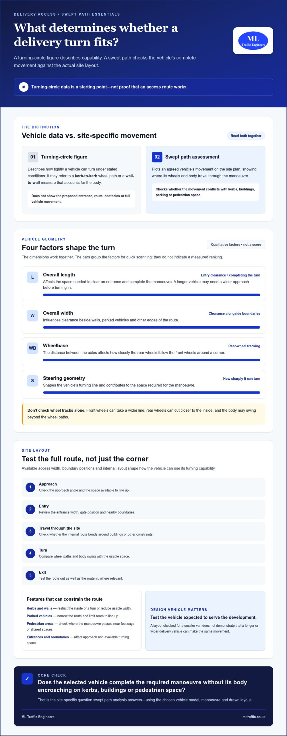
  • What is a Traffic Engineer? A Guide for Developers

    What is a Traffic Engineer? A Guide for Developers

    With van traffic rising 10% above pre-pandemic levels and London drivers losing 109 hours a year to congestion, your development’s access strategy isn’t a simple box-ticking exercise. It’s a high-stakes regulatory hurdle. You’ve likely felt the frustration when a highway authority objection stalls your project; these delays create unnecessary costs and uncertainty for your timeline. A specialist traffic engineer acts as your technical advocate, transforming these logistical barriers into a clear path toward planning approval.

    This guide explains how expert transport data secures your site’s future. You’ll learn how to determine whether you need a Transport Statement or a full Transport Assessment to satisfy local authorities. We’ll also explore how technical tools like Swept Path Analysis and Parking Surveys provide the evidence needed to counter local objections. By the end of this article, you’ll understand how to design a safe, efficient layout that meets 2026 standards and maximises your land value.

    Key Takeaways

    • Understand the vital role of a traffic engineer in navigating complex UK transport policies and securing planning approval for your site.
    • Identify the specific technical documents, such as Transport Assessments and Travel Plans, required to satisfy highway authority requirements.
    • Learn to distinguish between traffic engineers and transport planners to ensure you engage the correct specialist for your project’s technical needs.
    • Discover how utilizing technical data like Swept Path Analysis and Parking Surveys can proactively mitigate risks and counter local objections.
    • Explore how early intervention and professional accuracy from ML Traffic Engineers streamline the planning process and maximize land value.

    Table of Contents

    The Role of a Traffic Engineer in Modern UK Development

    A traffic engineer serves as the technical bridge between your architectural vision and the strict requirements of the local highway authority. While the broad discipline of traffic engineering (transportation) encompasses highway capacity and signal timing, the modern UK developer needs a specialist focused on the planning cycle. These professionals translate complex vehicle movements into data-driven reports that satisfy statutory bodies and reduce regulatory friction. In a high-stakes environment where precision is a necessity, their role is to ensure your project moves from inception to completion without highway-related delays.

    To better understand this concept, watch this helpful video:

    Beyond Cones and Signs: Defining the Consultancy Role

    Many developers initially associate "traffic" with physical roadworks or temporary closures. However, in a consultancy context, the role is purely analytical and advisory. A traffic engineer focuses on data-driven reporting for statutory approvals rather than physical construction. They analyze how your proposed site will interact with the existing network through detailed Traffic Surveys. This work requires close collaboration with architects and planning officers to ensure that site layouts aren’t just aesthetic but functional. They provide the technical certainty that a refuse vehicle can turn safely or that a delivery van won’t block a primary arterial road. Accuracy is a functional necessity here.

    Why Traffic Engineering is Essential for Planning Approval

    Securing "safe and suitable access" remains a non-negotiable pillar of the National Planning Policy Framework (NPPF). Without expert technical evidence, your application is vulnerable to immediate highway authority objections. In 2026, the planning environment has become even more rigorous. New regulations, including the Traffic Management Permit Scheme (England) (Amendment) Regulations 2026, now mandate a focus on Electric Vehicle infrastructure and sustainable transport integration. A traffic engineer provides the evidence to mitigate local community objections. Whether it’s through a detailed Transport Assessment or a robust Travel Plan, they prove your development won’t compromise public safety or highway efficiency. This proactive approach saves time and protects your land value by removing the logistical barriers to approval.

    Core Technical Services: How Engineers Solve Site Constraints

    A traffic engineer provides the technical evidence required to prove a development is viable and safe. In 2026, this process relies heavily on digital modelling and simulation to test site layouts before any physical work begins. Recent updates to the Design Manual for Roads and Bridges (DMRB) on March 30, 2026, have refined the technical standards for these assessments. Additionally, the Traffic Management Permit Scheme (England) (Amendment) Regulations 2026, which came into force on April 10, 2026, now integrate Electric Vehicle (EV) charge point operators into the permit system. A specialist engineer ensures these new regulatory requirements are met without compromising site efficiency or parking capacity. Precision in these early stages is a functional necessity for project success.

    Swept Path Analysis: Ensuring Vehicle Access Feasibility

    Proving that emergency and service vehicles can navigate your site is a non-negotiable requirement for planning approval. A traffic engineer uses Swept Path Analysis Services to simulate the movement of specific vehicles, such as a 12-metre refuse truck or a fire tender. Modern councils demand this data for even small residential projects to prevent future access issues. This technical simulation identifies pinch points in your layout early. It allows for adjustments that protect your land value while ensuring public safety. If you’re developing on a tight urban site, accurate simulation is your best defense against highway authority objections.

    Transport Statements and Assessments: The Statutory Requirement

    The scale of your development determines whether you need a Transport Statement or a full Transport Assessment. While a Statement is typical for smaller projects with limited impact, an Assessment is a comprehensive study for larger developments. These reports evaluate how your project affects the local road network and public transport capacity. Understanding these requirements is vital, as this resource from Michigan State University explains the difference between broader transportation disciplines and specific technical applications. For projects in the capital, following a Transport Assessment London Guide ensures your submission aligns with the specific policies of the London Plan, such as car-free mandates in high-accessibility areas. Providing this technical evidence early reduces the risk of costly delays during the planning cycle. You can explore our technical planning services to see which reports your specific project requires.

    Traffic Engineer vs. Transport Planner: Navigating the Terminology

    Developers often use the terms "transport planner" and "traffic engineer" interchangeably, but this confusion can lead to critical gaps in a planning submission. A transport planner typically focuses on the "why" of a project. They handle high-level policy alignment, sustainable travel strategies, and long-term social impacts. In contrast, a traffic engineer is a technical specialist focused on the "how." They analyze the physical geometry of a site, calculate junction capacity, and ensure vehicle movements are safe and compliant with the latest standards. It’s also vital to distinguish these roles from traffic management contractors; an engineer provides the analytical design required long before any physical cones or signs appear on the road.

    This distinction is essential for meeting the technical requirements of modern UK infrastructure. The professional profile for Transportation Engineers highlights a reliance on mathematical modelling and complex problem-solving. While a planner might argue for a reduction in car parking based on local public transport accessibility, the engineer proves the remaining parking layout functions without causing vehicle conflict or safety risks. Precision is a functional necessity here. A successful planning application requires these two disciplines to work in tandem, ensuring policy goals are supported by technical reality.

    Strategic Planning vs. Technical Design

    Strategic planners are your primary navigators for the London Plan or national sustainability targets. They excel at arguing for a project’s place within a wider urban context. However, they rarely possess the tools to simulate the physical dynamics of a 12-metre vehicle entering a narrow mews. This is where the engineering role becomes indispensable. When you hire a traffic engineer, you’re securing the technical feasibility of your site. They focus on design elements such as visibility splays, gradient changes, and Swept Path Analysis. They provide the hard data that highway authorities demand before they’ll sign off on a project. Without this engineering input, a planner’s strategy remains a theoretical exercise rather than a buildable reality.

    When Do You Need a Specialist Traffic Engineer?

    Specific "trigger points" in a development cycle mandate the involvement of an engineering specialist. If your site has a complex junction, a steep access ramp, or a particularly tight entrance, a planner’s report won’t suffice. You need an engineer when your project involves works within the existing highway, specifically for Section 278 or Section 38 agreements. These legal requirements demand a level of technical precision that only an engineering consultant can provide. Early intervention is key to avoiding highway authority objections. You can find more technical guidance in our Highway Design S278 & S38 Guide. Using an engineer early ensures your site layout is optimized for both safety and land value, preventing expensive redesigns late in the planning process.

    Maximising Success in Your Planning Application

    Planning success is rarely accidental. It requires a proactive strategy where technical evidence addresses regulatory concerns before they escalate into formal refusals. A specialist traffic engineer identifies potential highway authority objections early in the cycle, allowing for design adjustments that protect your project’s timeline and budget. With Great Britain’s road traffic reaching 342.6 billion vehicle miles in 2025, local authorities are more critical than ever. The 2026 regulatory environment, including recent updates to the Design Manual for Roads and Bridges (DMRB) published on March 30, 2026, demands a higher standard of technical precision. Early technical intervention is a functional necessity to mitigate risk and avoid the heavy financial burden of a failed application.

    Early Engagement with Local Highway Authorities

    Pre-application engagement provides a clear path to approval. This process allows your consultant to discuss site constraints with council highway officers before you submit a formal application. Because engineers understand the technical lexicon of regulatory compliance, they can resolve "deal-breakers" like substandard visibility splays or restricted access points. This collaborative approach prevents the friction often caused by late-stage redesigns. It ensures that your site layout adheres to industry benchmarks from the outset, providing the reassurance that planning officers require. By speaking the same technical language as the authority, a traffic engineer builds the professional trust necessary to navigate complex urban sites.

    Using Data to Overcome Objections

    The primary obstacle for many developers is the public perception that a new site will cause "traffic chaos." You can dismantle these objections with high-quality data. Robust Traffic Surveys provide the evidence needed to prove that additional vehicle movements won’t compromise local junction capacity, even with van traffic now 10% higher than pre-pandemic levels. Similarly, Parking Surveys are vital when proposing car-free or low-parking developments. In London contexts, adhering to the Lambeth Methodology is essential for data to be accepted by local authorities. This methodology provides a standardised way to demonstrate that existing on-street capacity can accommodate any residual parking demand. This technical approach removes the subjectivity from local planning committee debates. It replaces anecdotal concerns with verifiable facts, securing your planning certainty and protecting the project’s overall land value.

    Precision in your technical submission is non-negotiable. Contact ML Traffic Engineers to secure the professional surveys needed for your planning application.

    What is a Traffic Engineer? A Guide for Developers

    Partnering with ML Traffic Engineers for Planning Certainty

    Success in the 2026 planning environment requires more than just technical data; it demands a partner who understands the high-stakes nature of property development. ML Traffic Engineers operates as a specialist UK consultancy dedicated to removing the regulatory and logistical pressures from your project. We recognize that precision is a functional necessity in every report we produce. Our team maintains a constant state of readiness to address the evolving requirements of highway authorities across England. By positioning ourselves as a vital guardian of public safety and professional integrity, we ensure your development meets every industry benchmark and legislative requirement from the outset.

    Our service model prioritizes rapid response and unwavering reliability. We manage full project lifecycles, moving your application from initial feasibility through to final statutory approval. This all-encompassing approach allows you to focus on the broader aspects of your development while we handle the intricate technical details. We take immense pride in our adherence to standards, ensuring that every submission is bulletproof and safety-conscious. When you work with a traffic engineer from our team, you gain a dependable partner who understands regional regulations so you don’t have to.

    Expert Technical Reporting for England’s Developers

    Our track record demonstrates a consistent ability to secure planning certainty for diverse project types. We specialize in delivering robust Transport Statements and Travel Plans tailored to the specific needs of your site. Navigating complex urban environments with restricted access is a core strength of our consultancy. We use advanced modelling tools to prove that even the tightest sites can function safely and efficiently. You can explore our full range of technical services by visiting What We Do. Each report we generate serves as a definitive piece of evidence to support your application’s success.

    Comprehensive Support from Inception to Approval

    The path to planning approval often involves technical challenges and unexpected comments from council highway officers. We provide comprehensive support that extends well beyond the initial data collection phase. Our proactive approach includes managing the dialogue with highway authorities and resolving technical objections with precision and speed. We don’t just provide reports; we provide solutions that protect your land value and project timeline. This commitment to excellence ensures that your development remains compliant with the latest 2026 standards, including recent updates to the Design Manual for Roads and Bridges. Contact ML Traffic Engineers for a project review to secure the technical authority your development requires.

    Secure Your Planning Approval with Technical Precision

    Navigating the 2026 planning landscape requires more than just a viable site; it demands technical evidence that satisfies the most rigorous highway authority standards. You’ve learned how a specialist traffic engineer transforms complex vehicle dynamics into the clear data required for statutory approval. By utilizing professional Parking Surveys and junction modelling, you replace local uncertainty with verifiable facts. From detailed Swept Path Analysis to comprehensive Transport Statements, these technical documents are the foundation of a successful application. Early intervention doesn’t just resolve objections; it actively protects your project’s timeline and land value.

    ML Traffic Engineers has provided this essential technical authority since 2014. With over a decade of planning success, we specialize in delivering the precise evidence developers need to navigate UK regional highway regulations. We ensure your site layout is safe, compliant, and ready for approval. Get Expert Traffic Engineering Support for Your Planning Application. Your project’s success is within reach when you have a dependable partner managing your technical submission.

    Frequently Asked Questions

    What is the difference between a traffic engineer and a transport planner?

    A traffic engineer focuses on the technical and operational aspects of a transport system, including road design, vehicle dynamics, and safety management. In contrast, a transport planner deals with strategic development and long-term policy implementation. While planners handle the high-level "why" of a project, engineers manage the "how" by calculating junction capacity and ensuring site geometry meets strict safety standards.

    When is a Transport Statement required for a planning application in the UK?

    A Transport Statement is typically required for developments that have relatively small transport implications but still need to demonstrate safe access. Local authorities set specific thresholds based on the number of residential units or commercial floor space proposed. This concise report proves that the development’s impact on the local network is acceptable and that the internal site layout functions correctly.

    How much does a traffic engineer cost for a small residential development?

    Consultancy fees depend on the complexity of the site and the specific reports required by the local highway authority. Developers should check with a consultant for a tailored quote based on their specific project scope. Factors such as the need for Parking Surveys or complex access designs will influence the final cost. It’s best to check directly to ensure all statutory requirements are covered.

    What is Swept Path Analysis and why does my architect need it?

    Swept Path Analysis is a digital simulation used to calculate the space required for specific vehicles, such as refuse trucks and fire tenders, to turn and manoeuvre. Architects use this data to ensure the site layout is functional and safe. Providing this technical evidence early prevents highway authority objections regarding vehicle access and protects the overall land value of the development by avoiding late-stage redesigns.

    Can a traffic engineer help if the council has already objected to my project?

    Yes, an engineer can provide technical evidence to counter specific highway authority objections. By conducting Traffic Surveys or using Swept Path Analysis to redesign access points, they can prove that the council’s concerns are mitigated. This technical advocacy often resolves disputes through data-driven reporting, frequently avoiding the need for a costly and time-consuming planning appeal.

    How long does it take to prepare a Transport Assessment for planning?

    The preparation time for a Transport Assessment varies based on the scale of the development and the depth of data collection required. A standard assessment usually takes several weeks to complete because it involves site visits, junction modelling, and coordination with planning officers. Starting this process early ensures the final report is robust and satisfies all regulatory requirements before the submission deadline.

    Do I need a traffic survey for a change of use application?

    A survey is often necessary if the change of use results in a significant increase in vehicle trips or a change in delivery patterns. Planning officers need to understand how the new use affects the local highway network compared to the previous permission. Providing accurate data demonstrates that the proposal won’t compromise local road safety or capacity, reducing the risk of a highway objection.

    What is a Section 278 agreement and why do I need an engineer for it?

    A Section 278 agreement is a legal contract between a developer and the Highway Authority for permanent works on a public road. You need a traffic engineer to provide the technical design and capacity analysis required for these works. Their expertise ensures that the proposed changes meet strict safety benchmarks and legislative requirements, which is a non-negotiable foundation for securing final approval.

    Which areas in London do you cover?

    We service Acton, Balham, Barking, Barnes, Barnet, Battersea, Beckenham, Bexleyheath, Brentford, Brixton, Bromley, Camberwell, Carshalton, Charlton, Chelsea, Chiswick, Clapham, Coulsdon, Croydon, Crystal Palace, Dagenham, Dulwich, Ealing, Edgware, Eltham, Enfield, Finchley, Forest Gate, Fulham, Golders Green, Greenwich, Hackney, Hammersmith, Hampstead, Harrow, Hayes, Highgate, Hounslow, Ilford, Islington, Kensington, Kentish Town, Kingston upon Thames, Lewisham, Mitcham, Muswell Hill, New Malden, Notting Hill, Orpington, Peckham, Pinner, Purley, Putney, Richmond, Romford, Ruislip, Sidcup, Southall, Southgate, Streatham, Surbiton, Sutton, Tooting, Tottenham, Twickenham, Uxbridge, Walthamstow, Wembley, West Norwood, Wimbledon, Wood Green, Woolwich, Bethnal Green, Shoreditch, Canary Wharf, Deptford, Leyton, Palmers Green, Stanmore, Upminster, Chislehurst, Erith, Feltham.

    Which cities in England do you cover?

    We service London, Birmingham, Manchester, Liverpool, Sheffield, Leeds.

    Michael Lee

    Article by

    Michael Lee

    Transport planner with over 35 years' experience.

    Disclaimer

    The content on mltraffic.co.uk, including all technical articles, guides, and resources, is provided for general informational and educational purposes only. It is not intended to constitute professional advice in traffic engineering, transportation planning, development approvals, or any other technical or legal field.
    While ML Traffic Engineers makes every reasonable effort to ensure the accuracy, completeness, and timeliness of the information published, we do not provide any warranties or representations (express or implied) regarding its reliability, suitability, or availability for any particular purpose. Any reliance you place on the content is strictly at your own risk.
    In no event shall ML Traffic Engineers, its directors, employees, authors, or affiliates be liable for any direct, indirect, incidental, special, consequential, or punitive damages (including, without limitation, loss of profits, data, or business opportunities) arising out of or in connection with the use of, or inability to use, any information provided on this website.
    The articles and guides on this site are not a substitute for engaging a qualified, professional traffic engineer to assess your specific project requirements. For tailored advice, compliance assessments, or traffic engineering services, please contact a competent professional.
    This disclaimer may be updated from time to time without notice. By accessing or using this website, you agree to be bound by the most current version of this disclaimer.
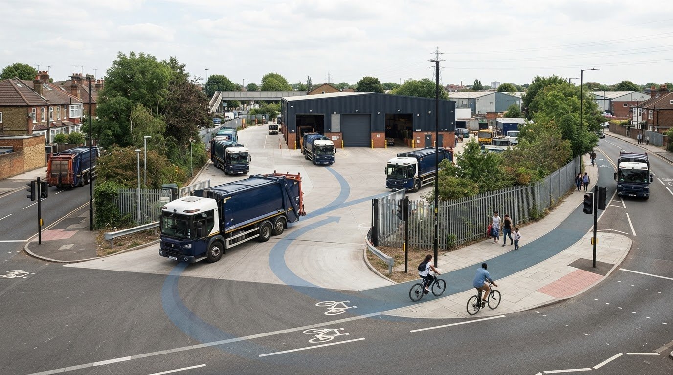
  • What is a Transport Planner? A Guide for Developers

    What is a Transport Planner? A Guide for Developers

    What if the difference between your project breaking ground and getting stuck in a multi-month regulatory deadlock was a single technical report? You already know that securing planning permission is becoming more expensive and complex, particularly following the 3.8% increase in planning application fees across England on April 1, 2026. It’s common to feel the pressure when local councils suddenly demand intricate data or when you’re forced to navigate the confusion between consumer journey apps and a professional transport planner who understands the law.

    You deserve a clear path to approval without the friction of unexpected technical hurdles. This guide shows you how a transport planner acts as a strategic risk-mitigator to secure your approvals and protect your bottom line. We will examine how specialized services like Swept Path Analysis and Transport Statements ensure your site access is safe and compliant with the latest 2026 standards. By the end of this guide, you’ll understand how to leverage technical expertise to avoid costly design revisions and keep your project moving forward at pace.

    Key Takeaways

    • Identify the specific role of a professional transport planner in translating complex regulatory requirements into technical reports that secure planning approval.
    • Differentiate between Transport Statements and comprehensive Transport Assessments to ensure your application meets the exact evidentiary standards of the local authority.
    • Utilize digital tools like Swept Path Analysis to provide definitive proof of safe site access and avoid expensive design revisions late in the project lifecycle.
    • Navigate the technical complexities of Section 278 and Section 106 agreements with precision to mitigate development risks and manage infrastructure impacts.
    • Leverage data-driven Parking Surveys and Traffic Surveys to address council objections regarding local network capacity and site viability.

    Table of Contents

    What is a Transport Planner? (And Why Developers Need One)

    A transport planner acts as a technical bridge between your architectural vision and the regulatory requirements of the local highway authority. This role isn’t about deciding where a new train line should go. Instead, it focuses on providing the robust technical evidence needed to prove that your specific development won’t negatively impact road safety or local congestion. They assess how a project integrates with the existing network, ensuring that site access is safe and the infrastructure can handle the increased demand.

    To better understand this concept, watch this helpful video:

    Professional transportation planning involves a rigorous cycle of data collection, traffic modelling, and the preparation of statutory reports. This work is entirely distinct from consumer-facing tools like TfL’s journey planners. While a journey app helps a commuter find the quickest route, a professional consultant uses specialized CAD software and TRICS data to prove that a refuse vehicle can safely maneuver within your site boundaries. They translate raw data into the technical language that council planning officers require for approval.

    The Role in the Planning Application Process

    In the context of a planning application, your transport planner serves as an expert witness. They handle technical scrutiny from council officers and provide the data required by the National Planning Policy Framework (NPPF). This involves liaising directly with Highway Authorities to agree on mitigation measures, ensuring that transport-related queries don’t stall your project. By providing this technical evidence early, you reduce the risk of late-stage objections that could derail your construction timeline or lead to expensive design changes.

    Consultancy vs. Public Sector Planning

    It’s vital to distinguish between public sector planners and private consultants. Public sector planners work for the local authority to set regional transport policy and manage the wider network. Private consultants, however, focus exclusively on the developer’s needs. They help you navigate specific council standards and use independent data to challenge unreasonable or outdated demands from local authorities. A transport planning consultant is a strategic partner who ensures your development remains viable, safe, and fully compliant with current legislation.

    Key Deliverables: Transport Statements and Assessments

    A transport planner produces the specific technical documentation required for every stage of a planning application. The scale of your development determines the depth of reporting needed. Smaller projects with limited traffic implications typically require a Transport Statement. Larger developments that could significantly impact the local network necessitate a full Transport Assessment. Both types of documents rely on the TRICS database. This national system allows consultants to predict trip generation by comparing your project to similar land uses across the UK. By using this data, your consultant provides a realistic forecast of the volume of vehicles, cyclists, and pedestrians your site will attract.

    Choosing the Right Report for Your Project

    Selecting the correct report depends on specific thresholds set by individual local authorities. While official government guidance provides a general framework, councils often apply stricter requirements in dense urban environments. For residential developments, a Transport Statement is often the standard for 10 to 49 units, but these figures can change based on local policy. Engaging a professional early for a scoping study can prevent you from over-investing in a full assessment when a simpler statement would suffice. You can review our resources to understand how these technical requirements apply to your specific project type.

    Sustainable Travel and Travel Plans

    Modern planning success in 2026 relies heavily on sustainable transport strategies. A Travel Plan is no longer an optional extra; it is a vital tool to encourage active travel and reduce reliance on private cars. Since the electric vehicle exemption for the London Congestion Charge ended in late 2025, the focus has shifted toward infrastructure readiness. Your reports must now detail active EV charging points and high-quality cycle parking to meet the 100% provision mandate for new residential spaces. A robust plan can effectively offset concerns about traffic volume by demonstrating a clear commitment to reduced vehicle usage.

    Securing your planning approval requires precision in these technical reports. If you’re unsure which document your project needs, reviewing our technical services can help clarify the requirements for your next submission. A transport planner ensures your data is accurate and compliant from the first draft.

    What is a Transport Planner? A Guide for Developers

    Technical Analysis: Proving Site Viability

    Technical analysis transforms a conceptual design into a viable, functional site. While previous sections focused on the strategic reports required for submission, this stage involves the raw data that proves those reports are accurate. A transport planner utilizes advanced modelling software and on-site observations to ensure every vehicle, from a standard car to a 12-meter refuse truck, can navigate the proposed layout. This precision reduces the risk of the council rejecting a scheme based on perceived safety or access issues. It moves the conversation from abstract policy to physical reality.

    The Power of Swept Path Analysis

    Swept Path Analysis (SPA) is the cornerstone of modern site design. By simulating the movement of specific vehicles on your digital site plans, we identify potential pinch points before they become physical obstacles. This is particularly critical for emergency services access. If a fire tender cannot reach the furthest point of your development, the scheme will fail its safety assessment. Utilizing professional Swept Path Analysis services provides the definitive evidence needed to satisfy these safety requirements. This proactive approach prevents the need for expensive structural changes or road widening once construction has already begun.

    Parking Surveys and the Lambeth Methodology

    High-density urban developments often face intense scrutiny regarding parking capacity. To justify a specific parking ratio, we conduct comprehensive Parking Surveys. Following the Lambeth Methodology, these overnight surveys establish the exact level of parking stress on surrounding streets. This data is essential when proposing car-free developments in areas with high Public Transport Accessibility Levels (PTAL). It demonstrates that the development won’t cause overspill parking that inconveniences existing residents or compromises road safety. Accurate surveys are the only way to challenge council assumptions about local parking availability.

    Establishing the baseline environment also requires real-world Traffic Surveys. We measure vehicle speeds and volumes to determine the precise dimensions of visibility splays at new junctions. A visibility splay is the unobstructed view a driver needs to see oncoming traffic before pulling out. These sightlines must adhere to strict safety standards to prevent collisions. This level of technical rigor is a core responsibility within the Transport planner job profile, ensuring that every project contributes to a safer and more efficient highway network.

    Securing planning approval is only half the battle. Once technical viability is proven through analysis and surveys, a transport planner must navigate the legal frameworks that govern physical changes to the road network. Most developers encounter Section 278 (S278) agreements when their project requires modifications to the existing public highway. These agreements ensure that any changes, such as a new junction or pavement widening, meet the strict safety and construction standards of the local authority. Without this technical oversight, projects risk significant delays or refusal during the later stages of the planning process.

    Section 106 contributions also play a major role in the financial feasibility of a development. These are legally binding obligations used to mitigate the impact of a project on the wider transport infrastructure. A planner acts as your advocate, ensuring that requested contributions are proportionate and directly related to the development’s actual impact. They facilitate direct liaison with National Highways and local authorities to reach a technical consensus that protects your project’s timeline and budget.

    Understanding Highway Design Agreements

    It’s essential to distinguish between S278 and Section 38 (S38) agreements. While S278 covers works on the existing public highway, S38 relates to the adoption of entirely new roads built within the development site. A planner ensures that the technical design of these roads meets the council’s specific adoption standards from the outset. For a detailed breakdown of these requirements, read our Highway Design S278 & S38 Guide. This early alignment prevents the council from refusing to adopt the roads later, which would leave the developer with long-term maintenance liabilities.

    Pre-application Advice and Negotiation

    Risk mitigation starts long before the formal submission. Engaging a transport planner for pre-application discussions allows for early negotiation with council officers to find a technical middle ground on complex issues like site access or parking ratios. These early meetings provide an opportunity to address potential concerns in a collaborative environment rather than a confrontational one. Early engagement prevents “objection” letters from statutory consultees that can otherwise stall an application for months. This proactive liaison ensures that the final submission is already aligned with the highway authority’s expectations.

    If you’re preparing a new submission and need to navigate these regulatory requirements, view our project types to see how ML Traffic Engineers UK manages these legal agreements for developers.

    Why Choose ML Traffic Engineers UK for Your Transport Planning?

    Choosing the right transport planner is a critical decision for any developer. At ML Traffic Engineers UK, we provide specialized expertise in the English planning system, with a deep understanding of the evolving London-specific requirements. As of May 2026, motor vehicle traffic volumes have reached 105% of pre-COVID levels. This increase makes accurate data more essential than ever for securing approvals. We utilize a data-driven approach, leveraging the latest TRICS data and CAD-based Swept Path Analysis to deliver reports that withstand the highest levels of scrutiny. Our proven track record spans residential, commercial, and mixed-use developments, ensuring that your project benefits from our extensive industry knowledge.

    You gain direct access to senior consultants who prioritize rapid response and professional reassurance. In a high-stakes regulatory environment, precision is a functional necessity. We don’t just provide reports; we act as a reliable partner throughout the entire project lifecycle. Our team understands intricate regional regulations, such as the 2026 mandates for 100% EV charging access in residential developments. We handle these complexities so you don’t have to navigate them alone.

    Comprehensive Project Lifecycle Support

    Our support begins at the initial site feasibility stage and continues through to final planning sign-off. We produce tailored reporting that speaks the technical language of local authority planning officers, reducing the risk of friction during the application process. Whether we are conducting complex Parking Surveys or detailed Traffic Surveys, our focus remains on precision. This commitment ensures public safety and full regulatory compliance, protecting your project from costly delays. We manage the technical lexicon and industry benchmarks so you can focus on the broader architectural vision.

    Get Started with Your Transport Statement

    Initiating your technical assessment is a straightforward process. To provide an accurate quote for your specific development type, we typically require a site location plan and a clear description of the project scale. This information allows us to determine whether a Transport Statement or a more comprehensive Transport Assessment is the most appropriate deliverable. We value your time and understand the fast-moving nature of the infrastructure industry. By providing an all-encompassing, fully-managed service, we ensure your submission is robust from day one.

    Contact ML Traffic Engineers UK for your Transport Planning needs to discuss your next project and secure professional technical support today.

    Secure Your Development’s Future with Technical Precision

    Securing planning approval requires more than just a vision; it demands technical accuracy and a deep understanding of highway regulations. By integrating robust data from the outset, you protect your project from the high-stakes risks of regulatory delays and late-stage design changes. A professional transport planner acts as your primary advocate, translating complex traffic modelling and site constraints into the technical reporting that local authorities demand.

    Since our foundation in 2014, ML Traffic Engineers UK has delivered over a decade of planning success for developers navigating London Borough and National Highway requirements. Our comprehensive toolkit, including advanced Swept Path Analysis and TRICS trip generation data, ensures your submission is compliant and safe. We provide the technical authority needed to satisfy strict 2026 standards, from EV charging mandates to active travel targets.

    Don’t let technical transport data requests stall your project’s progress. Secure your planning approval with expert Transport Planning from ML Traffic Engineers UK. Our team is ready to provide the precision and reliability your development needs to move forward with confidence.

    Frequently Asked Questions

    What is the difference between a transport planner and a traffic engineer?

    A transport planner focuses on the strategic assessment, modeling, and reporting required to secure planning permission. They analyze how a development impacts the wider network and ensure compliance with transport policy. A traffic engineer typically handles the detailed design and technical engineering of physical infrastructure, such as junction geometry or traffic signal timings. While their roles overlap, the planner’s work is centered on the impact analysis phase of the project lifecycle.

    When is a Transport Statement required for a planning application in England?

    A Transport Statement is typically required for residential developments consisting of 10 to 49 units. However, local highway authorities in dense urban areas often set lower thresholds based on local network capacity. You should check the specific validation requirements of your local council, as they may demand a statement for smaller projects if the site is in a sensitive location or has complex access requirements.

    How much does a professional transport planner cost?

    Fees for a professional transport planner are determined by the complexity of the project and the specific deliverables required, such as Traffic Surveys or Swept Path Analysis. A comprehensive Transport Assessment involves more extensive modeling and data analysis than a Transport Statement, which impacts the overall project budget. We recommend requesting a tailored quote based on your site’s specific constraints and the local authority’s requirements.

    Can a transport planner help with a refused planning application?

    Yes, a planner is vital when a project is refused on highway or transport grounds. They analyze the council’s reasons for refusal and provide the technical evidence, such as revised Parking Surveys or improved access designs, to address those specific concerns. This evidence is essential for a successful resubmission or to support a formal planning appeal by proving the development is safe and viable.

    What is the TRICS database and why do planners use it?

    TRICS stands for the Trip Rate Information Computer System. It is the national standard database used to predict the number of trips a new development will generate. Planners use this data to provide a realistic forecast of vehicle, pedestrian, and cyclist movements by comparing your project to similar land uses across the UK. This ensures the local network can accommodate the additional demand without compromising safety.

    Do I need a transport planner for a small residential conversion?

    Small residential conversions don’t always require a full assessment, but they often trigger requests for a Parking Survey or a short Transport Statement. If your conversion is located in a high-density area with existing parking stress, the council will likely need technical proof that the new residents won’t negatively impact local street capacity. Providing this data early prevents the council from stalling your application with last-minute requests.

    What is Swept Path Analysis and is it mandatory?

    Swept Path Analysis is a digital simulation that proves specific vehicles can safely enter, maneuver within, and exit a site. While not mandatory for every single application, it’s almost always required when a development involves new access points or internal roads. Councils use it to verify that refuse trucks and fire tenders can operate without hitting curbs or buildings, ensuring the site meets essential safety standards.

    How long does it take to produce a Transport Assessment?

    Producing a full Transport Assessment typically takes several weeks, though this timeline depends on the scale of the project and the availability of data. If new Traffic Surveys or complex modeling are required, the process may take longer to ensure all information is accurate and compliant. Early engagement ensures that these technical reports are ready well before your submission deadline, reducing the risk of project delays.

    Which areas in London do you cover?

    We service Acton, Balham, Barking, Barnes, Barnet, Battersea, Beckenham, Bexleyheath, Brentford, Brixton, Bromley, Camberwell, Carshalton, Charlton, Chelsea, Chiswick, Clapham, Coulsdon, Croydon, Crystal Palace, Dagenham, Dulwich, Ealing, Edgware, Eltham, Enfield, Finchley, Forest Gate, Fulham, Golders Green, Greenwich, Hackney, Hammersmith, Hampstead, Harrow, Hayes, Highgate, Hounslow, Ilford, Islington, Kensington, Kentish Town, Kingston upon Thames, Lewisham, Mitcham, Muswell Hill, New Malden, Notting Hill, Orpington, Peckham, Pinner, Purley, Putney, Richmond, Romford, Ruislip, Sidcup, Southall, Southgate, Streatham, Surbiton, Sutton, Tooting, Tottenham, Twickenham, Uxbridge, Walthamstow, Wembley, West Norwood, Wimbledon, Wood Green, Woolwich, Bethnal Green, Shoreditch, Canary Wharf, Deptford, Leyton, Palmers Green, Stanmore, Upminster, Chislehurst, Erith, Feltham.

    Which cities in England do you cover?

    We service London, Birmingham, Manchester, Liverpool, Sheffield, Leeds.

    Michael Lee

    Article by

    Michael Lee

    Transport planner with over 35 years’ experience.

    Disclaimer

    The content on mltraffic.co.uk, including all technical articles, guides, and resources, is provided for general informational and educational purposes only. It is not intended to constitute professional advice in traffic engineering, transportation planning, development approvals, or any other technical or legal field.
    While ML Traffic Engineers makes every reasonable effort to ensure the accuracy, completeness, and timeliness of the information published, we do not provide any warranties or representations (express or implied) regarding its reliability, suitability, or availability for any particular purpose. Any reliance you place on the content is strictly at your own risk.
    In no event shall ML Traffic Engineers, its directors, employees, authors, or affiliates be liable for any direct, indirect, incidental, special, consequential, or punitive damages (including, without limitation, loss of profits, data, or business opportunities) arising out of or in connection with the use of, or inability to use, any information provided on this website.
    The articles and guides on this site are not a substitute for engaging a qualified, professional traffic engineer to assess your specific project requirements. For tailored advice, compliance assessments, or traffic engineering services, please contact a competent professional.
    This disclaimer may be updated from time to time without notice. By accessing or using this website, you agree to be bound by the most current version of this disclaimer.
  • Swept Path Analysis Services in London: Securing Planning Approval in 2026

    Swept Path Analysis Services in London: Securing Planning Approval in 2026

    Will your 2026 planning application survive the scrutiny of a Transport for London (TfL) audit if your vehicle tracking isn’t precise to the millimetre? You understand that navigating the conflicting requirements of different London Boroughs is one of the most stressful aspects of modern development. A single layout error that prevents a 12-metre refuse vehicle or a standard fire appliance from turning safely can result in an immediate rejection, forcing expensive redesigns that blow your project timeline and budget.

    Utilising expert swept path analysis services early in the design phase ensures your site layout is both functional and compliant from day one. At ML Traffic Engineers, we provide the technical CAD simulations and reports that act as a “safe pair of hands” for your submission. This article explores how to secure council approval with clear evidence for your Transport Statements while optimising site density without compromising on safety or access requirements. We’ll demonstrate how to turn technical data into a guaranteed planning advantage for your next London project.

    Key Takeaways

    • Understand how professional swept path analysis services use CAD simulation to ensure your development complies with TfL and local London Borough planning requirements.
    • Discover why precise vehicle modelling for refuse trucks and fire tenders is critical, especially with varying dimensional standards between boroughs like Westminster and Hackney.
    • Learn how to navigate London’s narrow Victorian streets and complex Red Route egress points by identifying access issues before they become physical obstacles.
    • Avoid the “Million Pound Error” by integrating digital vehicle tracking during the feasibility stage rather than waiting for the final submission phase.
    • Secure your project timeline with 24/7 engineering support designed to meet urgent planning deadlines across London and the South East.

    Table of Contents

    What is Swept Path Analysis for London Planning Applications?

    Swept Path Analysis (SPA) is a technical digital simulation that calculates the exact space a vehicle requires to complete a manoeuvre. Our engineers use AutoCAD and specialised vehicle swept path analysis software to map these movements with centimetre-level accuracy. This process has evolved significantly from the manual ‘turning circle’ templates of the past. By 2026, high-precision digital modelling is the absolute standard for every London Borough planning department. It’s a non-negotiable requirement for developers because it provides the technical backbone for any credible Transport Statement or Assessment.

    Professional swept path analysis services provide the empirical evidence needed to secure planning approval. These simulations prove that refuse trucks, emergency vehicles, and delivery vans can navigate a site without mounting pavements or striking permanent structures. We use these models to eliminate guesswork during the design phase, ensuring that the proposed layout is physically viable before a single brick is laid.


    The Role of SPA in Modern Urban Design

    SPA allows designers to visualise two distinct paths: the wheel tracks and the vehicle body’s outer edge. This distinction is vital in London’s tight urban grain. We identify potential conflict points where a vehicle might clip a bollard or overhang a cycle lane. By simulating these movements early, we protect pedestrians and cyclists in shared spaces. It ensures that 100% of the site’s footprint remains safe and functional for all road users.

    Terminology: Tracking, Envelopes, and Clearances

    Precision in swept path analysis services relies on understanding the vehicle envelope. This represents the total area occupied by the vehicle, including its wing mirrors and body overhang. UK industry standards typically dictate a 300mm safety margin between this envelope and any permanent structure. We distinguish between kerb-to-kerb turns, which focus on wheel movement, and wall-to-wall turns, which account for the entire vehicle body. In London’s narrow corridors, analysing the front and rear overhang is critical. It prevents expensive damage to street furniture and ensures site compliance from day one.

    Essential Vehicle Models: From Refuse Trucks to Fire Tenders

    Precision in transport planning requires a clear distinction between the ‘Design Vehicle’ and the ‘Check Vehicle’. Designers use the Design Vehicle to dictate the standard geometry of the site. The Check Vehicle ensures that larger, less frequent arrivals can still navigate safely without damaging infrastructure. For London developments, this often means balancing daily delivery needs against emergency access requirements. Our swept path analysis services provide the technical certainty that these vehicles can coexist within a single site layout.
    The principles of vehicle movement analysis apply across a vast spectrum of transport, from the utility vehicles we model daily to the complex logistical choreography of world-renowned services like the Maharaja Express on its trans-India journeys.

    Emergency and Service Vehicle Requirements

    The London Fire Brigade (LFB) maintains strict criteria for site entry. They require a minimum clear width of 3.7 metres between kerbs, which increases to 4 metres for operational working areas. High-rise developments also require specific weight-bearing considerations for 14-tonne axle loads. The Standard 11.4m Refuse Vehicle serves as the London benchmark for waste collection.

    Local variations are common across the capital. Westminster often employs smaller 8.3m vehicles for historic mews, while Hackney adheres to larger 12.2m multi-compartment trucks for 2026 fleet projections. Councils strictly cap reversing distances at 12 metres to protect pedestrians and operatives. We use the Manual for Streets to justify tighter, more urban-friendly layouts while ensuring these service vehicles remain fully operational.

    Commercial and Delivery Vehicle Simulations

    Industrial schemes in the South East must accommodate OGV2 vehicles, which reach 16.5 metres in length. These simulations are vital for retail loading bays and distribution hubs. The ‘Final Mile’ shift has introduced electric cargo bikes and small EV vans like the 5.3-metre Vauxhall Vivaro-e into the modelling mix. These vehicles have tighter turning circles but different front and rear overhangs compared to diesel predecessors.
    Beyond vehicle movements, planning for these modern fleets often involves new electrical infrastructure requirements. For developers considering the integration of EV charging points, you can learn more about Great Park Electrical.

    Construction phase logistics require separate, detailed analysis. We model abnormal loads for 50-tonne mobile cranes and long-reach piling rigs to ensure plant positioning is viable before work begins. This proactive approach prevents costly delays during the implementation phase. Working with a specialist construction logistics plan consultant ensures that heavy vehicle movements during the build phase are fully coordinated and compliant with TfL and borough-specific requirements. If you need clarity on your site’s access constraints, our team can provide bespoke CAD simulations to de-risk your planning application and ensure full compliance with Transport for London (TfL) standards.

    Swept Path Analysis Services in London: Securing Planning Approval in 2026

    Overcoming London’s Unique Site Constraints with CAD Simulation

    London’s historic infrastructure creates immediate hurdles for modern developers. Most streets in central postcodes like Soho or Marylebone follow a Victorian layout, never intended for 12-metre HGVs or articulated delivery vans. We use swept path analysis services to model these narrow access points with millimetre precision. This CAD simulation proves that a site is accessible before a single brick is laid, preventing costly mid-construction revisions. When dealing with TfL Red Routes, the margin for error disappears. Egress points must allow vehicles to join the flow of traffic without causing braking or swerving. Our simulations account for the specific turning radii of vehicles required for your project, ensuring compliance with strict Transport for London safety standards.

    On-street parking pressures further complicate the simulation process. A design that works on an empty street often fails in a real-world London environment where residents’ cars narrow the available carriageway. We model these “worst-case” scenarios to ensure your site remains functional 24/7. In high-value postcodes where land costs exceed £2,000 per square foot, SPA justifies “tight” designs. By proving a vehicle can safely clear a corner with only 300mm of leeway, we help clients maximise their developable footprint without compromising safety.

    High-Density Development Challenges

    Modern London developments often rely on basement car parks and multi-storey vehicle lifts to save space. We optimise these areas by simulating 1:7 ramp gradients and tight transition curves. For luxury residential blocks, “In-and-Out” driveways must function seamlessly to prevent tailbacks onto the public highway. We also manage the “Visibility Splay” alongside swept path requirements. This ensures drivers have a clear line of sight to pedestrians, a non-negotiable factor for securing planning approval in high-footfall areas.

    Local Authority Variations in Greater London

    Planning requirements shift significantly across the 32 London boroughs. A vehicle tracking layout that passes in Croydon might face an immediate fail in the City of London due to different street furniture tolerances. We use council-specific refuse vehicle templates, as an 11.4m Phoenix II vehicle requires a different turning circle than standard models. Adhering to local council planning guidance ensures that waste collection and emergency access meet the distinct criteria of each authority. This precision is vital for meeting the London Plan 2026 requirements, which demand sustainable transport access and reduced congestion through smarter site design. For East London developments, particularly those navigating the New Local Plan 2023–2038 and active travel requirements, working with experienced Transport Planning Consultants Tower Hamlets specialists ensures your swept path data aligns with the borough’s strict PTAL ratings and zero-car development policies. For South East London projects, working with experienced Transport Planning Consultants Bromley specialists ensures your swept path data aligns precisely with the London Borough of Bromley’s specific parking and access standards. Our swept path analysis services provide the technical evidence needed to satisfy these rigorous regulatory frameworks.

    The Strategic Value of Early-Stage Swept Path Analysis

    Timing determines the profitability of a London development. Architects frequently wait until the formal submission phase to request transport simulations, but this delay creates unnecessary risk. Integrating swept path analysis services during the initial feasibility stage identifies physical constraints while the site layout is still fluid. This proactive approach prevents the “Million Pound Error” where a developer discovers a 12-metre refuse vehicle cannot navigate a junction only after the concrete slab is poured. Retrofitting structural changes at that stage is 15 times more expensive than adjusting a CAD drawing during week one.

    Professional simulations serve as a powerful negotiation tool when meeting with Highways Officers. Local authorities often demand conservative road widths that eat into your developable land. We use high-fidelity CAD data to prove that specific vehicles can safely navigate tighter radii. This evidence allows you to justify narrower access points, protecting your site’s density while maintaining full safety compliance. It moves the conversation from subjective opinion to hard, defensible data. Partnering with the transport consultants UK developers trust for 2026 London planning success ensures your swept path evidence is presented within a comprehensive transport assessment that satisfies both local highway authorities and TfL.

    SPA as a Design Optimisation Tool

    Every square metre of wasted tarmac represents lost revenue. Precise tracking allows designers to trim excess road surfacing and reallocate that space to sellable square footage or green infrastructure. Beyond the footprint, SPA improves the internal flow of car parks. Well-designed bays and aisles increase user safety and have been shown to improve tenant satisfaction ratings by 22% in commercial hubs. Implementing SPA early can reduce construction costs by 5-10% through layout efficiency and reduced material requirements.

    Mitigating Planning Rejection Risks

    Planning departments are becoming stricter regarding vehicle movements. In 2026, London authorities cited “inadequate manoeuvrability” in 18% of all transport-related planning refusals. A professional SPA drawing provides the technical certainty required for highway design S278 and S38 agreements with local councils. Manual guesstimates don’t satisfy the rigorous standards of a Planning Committee. You need CAD-verified accuracy to ensure your project moves from the drawing board to the construction phase without costly delays or redesigns.

    Secure your site’s viability with precision data. Book our swept path analysis services to eliminate design uncertainty today.

    Expert Swept Path Analysis Services from ML Traffic Engineers

    London’s urban landscape demands exactness. ML Traffic Engineers provides essential support for developers navigating the complex planning environment of the South East. We offer 24/7 availability to meet urgent submission deadlines, ensuring your project remains on schedule even when local authorities demand revisions at short notice. Our professional engineers use the latest AutoDESK Vehicle Tracking software to deliver precision-led swept path analysis services that satisfy both safety and regulatory standards.

    We tailor our approach to the scale of your development. Whether you’re designing a single residential driveway in a constrained borough or managing a 45,000-square-foot distribution centre near the M25, our team provides the technical data required. This work integrates seamlessly with our Transport Statements and Parking Survey services. By providing a total, managed solution, we remove the logistical burden from your project team.

    Our Process: Precision and Compliance

    Our workflow is designed for speed and accuracy. We begin with a comprehensive review of your site plans, selecting design vehicles based on specific council requirements. This often includes 11.4-metre refuse trucks or London Fire Brigade appliances. Our engineers then produce:

    • Detailed CAD modelling featuring colour-coded conflict reporting to identify tight turns.
    • Simulations of multiple manoeuvres to ensure site safety and functionality.
    • A final technical note prepared for immediate inclusion in your planning pack.

    This rigorous approach ensures that swept path analysis services act as a robust defence of your site layout during the consultation phase. For developments requiring comprehensive transport strategies, our team also specialises in London travel plans for planning applications, ensuring your project meets TfL’s 2026 sustainability targets while maintaining operational efficiency.

    Why London Developers Trust ML Traffic

    We act as a safe pair of hands for complex London road regulations. Our engineers have over 15 years of experience negotiating with local Highways Authorities to resolve technical disputes. We don’t just provide drawings; we provide solutions. If a vehicle movement appears unworkable, we suggest immediate layout modifications to achieve compliance. Our team maintains a high success rate in overturning technical objections through direct, professional dialogue with council officers. Contact ML Traffic today for a bespoke Swept Path Analysis quote and ensure your planning application is supported by industry-leading expertise.

    London’s 2026 planning environment leaves no margin for error regarding vehicle access. Integrating professional swept path analysis services during your initial design phase is the most effective way to satisfy local authority requirements for fire tenders and refuse vehicles. Our expert CAD design team has been a dependable partner for UK developers since 2014. We provide the technical authority needed to overcome tight site constraints and avoid the high costs of planning refusals. We don’t just deliver drawings; we provide a total managed solution that ensures your site’s safety and compliance.

    ML Traffic Engineers maintains 24/7 availability for London projects to match the fast-moving pace of the construction industry. We understand the regulatory burdens you face and act as a safe pair of hands to manage the complexities of road layout design. Beyond vehicle tracking, successful planning applications increasingly require comprehensive traffic surveys for London planning applications to provide the baseline data that supports your transport assessments. You can Request a Fast Fee Proposal for Swept Path Analysis right now to keep your project moving forward. We’re here to ensure your development meets every safety standard with unwavering reliability and technical precision.

    Frequently Asked Questions

    What is the typical cost of swept path analysis services in London?

    Professional swept path analysis services in London typically cost between £350 and £850 per site for a standard assessment. This fee covers the CAD design and a comprehensive technical report for your planning application. Prices vary depending on the number of vehicle manoeuvres required and the complexity of the existing road layout. We provide fixed-price quotations within 4 hours to give your project team immediate budget certainty.

    How long does it take to complete a Swept Path Analysis report?

    We deliver standard Swept Path Analysis reports within 48 to 72 hours of receiving your site layout in CAD format. More complex projects involving multi-stage construction logistics or large industrial distribution centres may require up to 5 business days. Our 24/7 operational capacity means we can often fast-track urgent requests to meet tight local authority deadlines. We prioritise speed and precision to keep your development schedule on track.

    Do I need an SPA for a small residential development in London?

    Yes, most London boroughs now require an SPA for developments as small as a single new dwelling if access is restricted. Planning officers in authorities like Camden or Hackney frequently demand proof that a 9.2-metre refuse vehicle can service the property safely. Statistics show that 88% of London planning applications face delays if they don’t include professional vehicle tracking simulations. It’s a vital step for ensuring both safety and regulatory compliance.

    Which software do you use for vehicle tracking simulations?

    Our engineers utilise the latest versions of Autodesk Vehicle Tracking and AutoTURN software to produce millimetre-accurate simulations. These industry-standard tools allow us to overlay vehicle movements directly onto your architectural drawings. We ensure every simulation aligns with the UK Manual for Streets and specific Transport for London (TfL) requirements. This technical precision provides a safe pair of hands for your project’s transport planning needs.

    Can you model specific vehicles like the London Fire Brigade’s latest tenders?

    We maintain a comprehensive library of specific vehicle profiles, including the 11.2-metre Mercedes-Benz Atego pumping appliances used by the London Fire Brigade. Our team also models 32-tonne aerial ladder platforms to ensure your site meets all fire safety access requirements. This level of detail is essential for securing Building Regulations approval. We don’t rely on generic templates; we use the exact dimensions specified by emergency services.

    What happens if the Swept Path Analysis shows a vehicle cannot turn?

    If our analysis identifies a conflict, we immediately propose bespoke design modifications to resolve the issue. This might involve adjusting kerb radii, widening site entrances, or relocating parking bays by as little as 500mm to create the necessary clearance. We don’t just report problems; we provide the engineering solutions needed to secure planning consent. Our proactive approach helps 94% of our clients overcome transport-related objections on their first attempt.

    Is Swept Path Analysis required for temporary construction access?

    Swept Path Analysis is a mandatory component of a Construction Logistics Plan (CLP) for sites across Greater London. We simulate the movement of 10-metre tippers and 12-metre articulated lorries to ensure they can enter and exit your site without mounting pavements. This protects public safety and prevents damage to local infrastructure. It’s a critical part of our total managed solution, ensuring your site remains compliant with Chapter 8 safety standards. For a comprehensive understanding of how to structure your CLP submission, our guide on working with a construction logistics plan consultant for 2026 London approvals covers the full range of data points and pedestrian impact assessments required by local authorities.

    Do you provide swept path analysis services for sites outside of Greater London?

    We provide swept path analysis services for projects across the entire United Kingdom, including major urban centres like Manchester, Birmingham, and Bristol. Our team is well-versed in the specific transport policies of local authorities nationwide. Whether you’re developing a rural housing estate or a regional distribution hub, we deliver the same high standard of technical expertise. We operate 24/7 to support your projects regardless of their location.

    Which areas in London do you cover?

    We service Acton, Balham, Barking, Barnes, Barnet, Battersea, Beckenham, Bexleyheath, Brentford, Brixton, Bromley, Camberwell, Carshalton, Charlton, Chelsea, Chiswick, Clapham, Coulsdon, Croydon, Crystal Palace, Dagenham, Dulwich, Ealing, Edgware, Eltham, Enfield, Finchley, Forest Gate, Fulham, Golders Green, Greenwich, Hackney, Hammersmith, Hampstead, Harrow, Hayes, Highgate, Hounslow, Ilford, Islington, Kensington, Kentish Town, Kingston upon Thames, Lewisham, Mitcham, Muswell Hill, New Malden, Notting Hill, Orpington, Peckham, Pinner, Purley, Putney, Richmond, Romford, Ruislip, Sidcup, Southall, Southgate, Streatham, Surbiton, Sutton, Tooting, Tottenham, Twickenham, Uxbridge, Walthamstow, Wembley, West Norwood, Wimbledon, Wood Green, Woolwich, Bethnal Green, Shoreditch, Canary Wharf, Deptford, Leyton, Palmers Green, Stanmore, Upminster, Chislehurst, Erith, Feltham.

    Which cities in England do you cover?

    We service London, Birmingham, Manchester, Liverpool, Sheffield, Leeds.

    Michael Lee

    Article by

    Michael Lee

    Transport planner with over 35 years’ experience.

    Disclaimer

    The content on mltraffic.co.uk, including all technical articles, guides, and resources, is provided for general informational and educational purposes only. It is not intended to constitute professional advice in traffic engineering, transportation planning, development approvals, or any other technical or legal field.
    While ML Traffic Engineers makes every reasonable effort to ensure the accuracy, completeness, and timeliness of the information published, we do not provide any warranties or representations (express or implied) regarding its reliability, suitability, or availability for any particular purpose. Any reliance you place on the content is strictly at your own risk.
    In no event shall ML Traffic Engineers, its directors, employees, authors, or affiliates be liable for any direct, indirect, incidental, special, consequential, or punitive damages (including, without limitation, loss of profits, data, or business opportunities) arising out of or in connection with the use of, or inability to use, any information provided on this website.
    The articles and guides on this site are not a substitute for engaging a qualified, professional traffic engineer to assess your specific project requirements. For tailored advice, compliance assessments, or traffic engineering services, please contact a competent professional.
    This disclaimer may be updated from time to time without notice. By accessing or using this website, you agree to be bound by the most current version of this disclaimer.