Tag: Traffic Management

  • School Travel Plans for Planning Applications: The 2026 Developer’s Guide

    School Travel Plans for Planning Applications: The 2026 Developer’s Guide

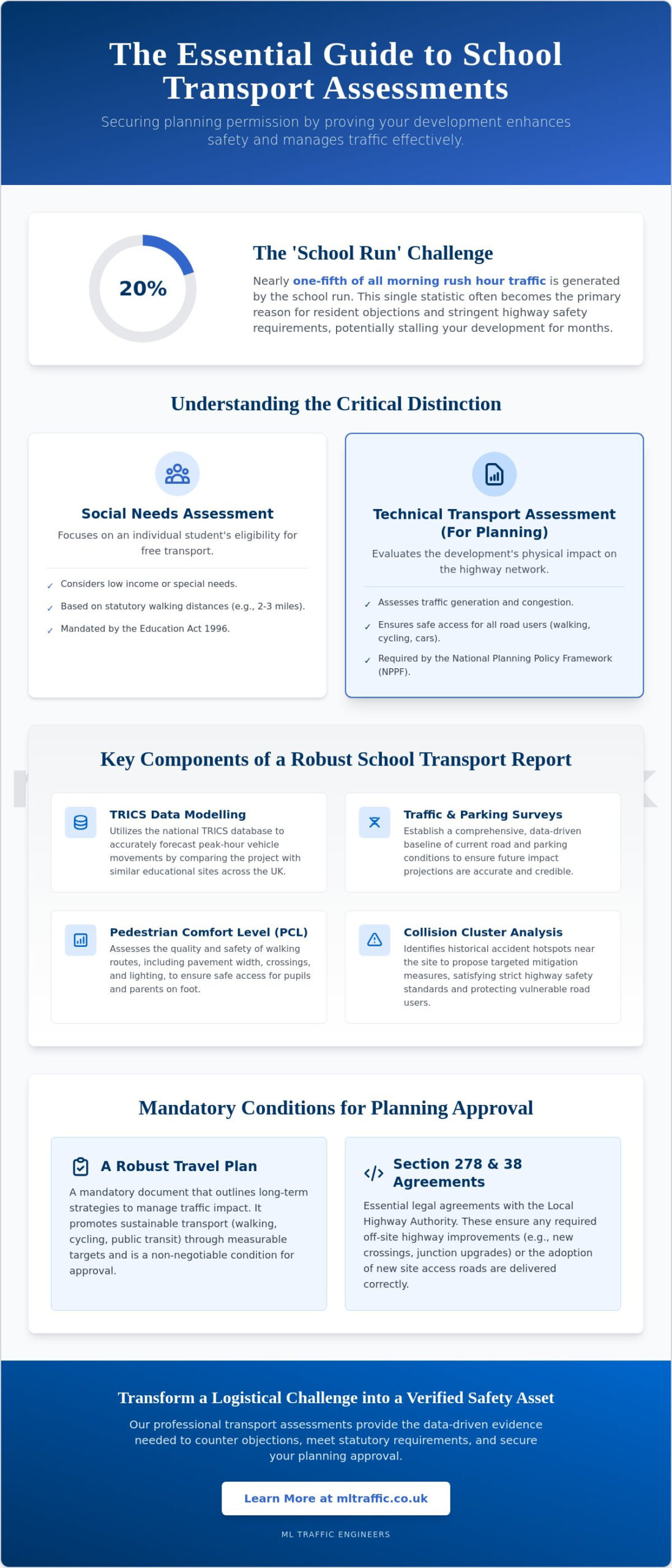
    A school travel plan is no longer just a courtesy document; it’s a high-stakes technical requirement that can make or break your 2026 planning application. Local authorities now demand more than just a list of walking initiatives. They require a data-driven strategy that proves your development won’t paralyze the local road network. For many developers, the gap between a simple management plan and a technical planning document is where applications often fail.

    We understand the pressure of navigating complex council requirements while trying to avoid costly delays due to traffic congestion concerns. It’s a high-stakes environment where precision is a functional necessity. This guide provides a definitive roadmap to securing planning permission by developing a technically robust school travel plan that aligns with both TfL’s Healthy Streets indicators and national transport policies. You’ll learn how to satisfy local authorities, meet the latest 2026 Modeshift STARS accreditation deadlines, and implement measurable traffic mitigation strategies. We’ll cover everything from the London Plan thresholds to the specific data collection methods required for a successful submission.

    Key Takeaways

    • Understand the legal framework under the National Planning Policy Framework that mandates a school travel plan for any development generating significant travel.
    • Learn how to conduct a comprehensive site audit and accessibility assessment to evaluate existing pedestrian and public transport infrastructure.
    • Discover how a robust strategy mitigates severe transport impacts and addresses local resident concerns regarding school-run congestion.
    • Follow a clear step-by-step process for engaging with Local Highway Authorities to secure essential pre-application transport advice.
    • Recognize the value of technical precision in navigating complex Section 106 negotiations and reducing regulatory pressure on your project.

    What Is a School Travel Plan and Why Is It Legally Required?

    A school travel plan is a technical document designed to manage and reduce the transport impact of an educational development. It isn’t merely a set of aspirations; it’s a long-term management strategy that delivers measurable sustainable transport objectives. By identifying specific measures to encourage walking, cycling, and public transport use, an STP acts as a critical mitigation tool for traffic congestion and localized air quality issues. For developers, understanding What is a Travel Plan? is the first step in ensuring a project meets the high standards expected by local planning authorities in 2026. These documents provide the evidence needed to prove that a new school or expansion won’t overwhelm existing infrastructure.

    The Role of the National Planning Policy Framework (NPPF)

    The legal weight of an STP stems from the National Planning Policy Framework (NPPF). Specifically, Paragraph 113 mandates that all developments generating significant amounts of movement must provide a travel plan. Local authorities use these documents to hit aggressive carbon reduction targets. For example, Transport for London (TfL) has set a target for 80% of all trips to be made via sustainable modes by 2026. Achieving this requires a rigorous approach to transport planning and environmental sustainability. An STP shouldn’t exist in a vacuum; it works alongside a Transport Assessment to provide a holistic view of a site’s impact. This integration ensures that the proposed mitigation measures are both realistic and technically sound.

    Statutory vs. Voluntary Travel Plans

    Developers must distinguish between voluntary school initiatives and statutory planning requirements. While many existing schools create plans to improve pupil health or reduce local parking friction, a statutory school travel plan is a legal requirement for new builds or major expansions. These planning-led documents carry much stricter monitoring and enforcement protocols than their voluntary counterparts. They require baseline data, clear targets, and a commitment to ongoing review. Local authorities often secure these requirements through Section 106 agreements, which provide a legally binding framework for the implementation and ongoing funding of the plan’s initiatives. A Section 106 agreement functions as a legally binding contract that ensures the developer remains accountable for the travel plan’s targets throughout the life of the development. Without this technical precision, applications face a high risk of refusal based on transport grounds.

    Core Components of a Robust School Travel Plan in 2026

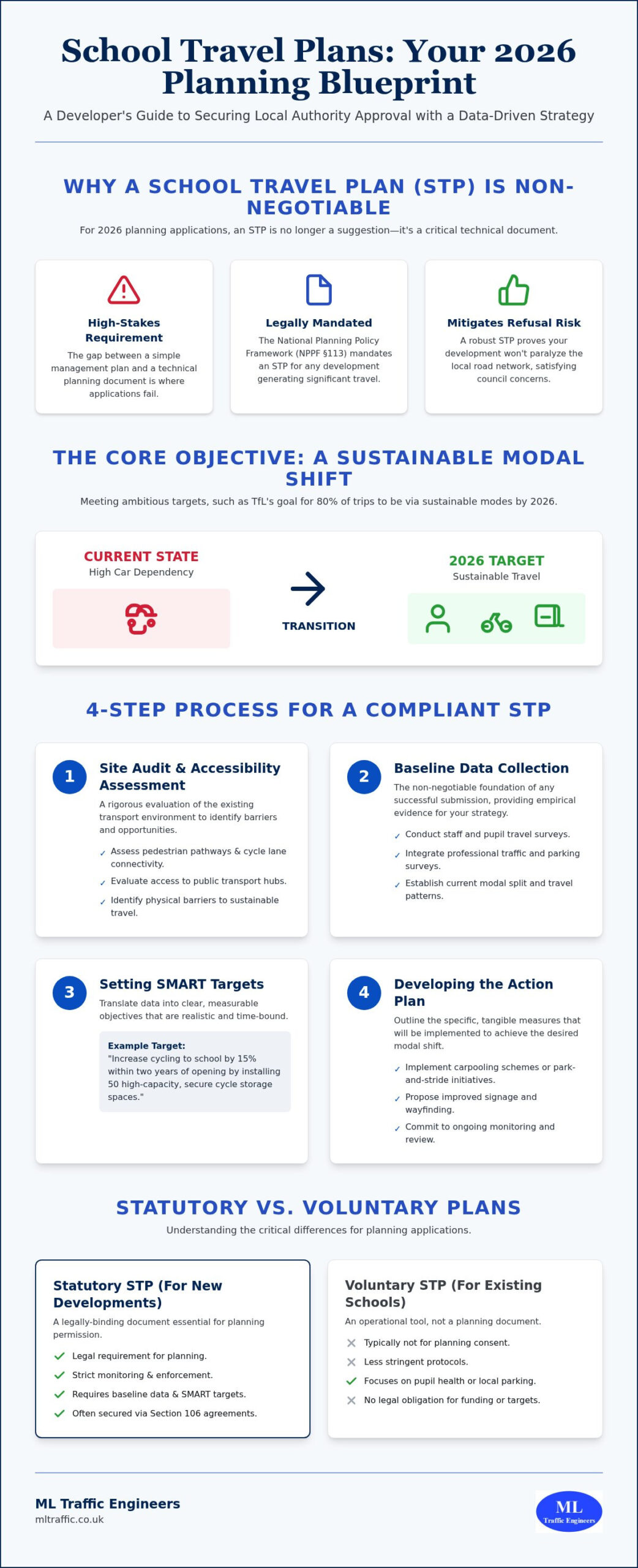
    A technically sound school travel plan requires more than high-level aspirations; it must be built on a foundation of empirical evidence. The document serves as a strategic roadmap that local authorities scrutinize to ensure a development won’t compromise road safety or air quality. A comprehensive plan begins with a detailed site audit. This process involves a rigorous assessment of existing pedestrian pathways, cycle lane connectivity, and the accessibility of public transport hubs. By identifying physical barriers to sustainable travel early, developers can propose targeted infrastructure improvements that satisfy council requirements.

    Once the physical environment is mapped, the focus shifts to establishing baseline travel data through staff and pupil surveys. These surveys provide the necessary metrics to set SMART targets. For a goal to be Specific, Measurable, Achievable, Realistic, and Time-bound, it must relate directly to the site’s unique constraints. For instance, if a survey reveals high car dependency due to lack of facilities, a SMART target might aim to increase cycling by 15% within two years by installing high-capacity, secure cycle storage. These targets lead directly into the action plan, which outlines the specific measures, such as carpooling schemes or improved signage, required to achieve the desired modal shift.

    Data Collection: Traffic and Parking Surveys

    Accurate baseline data is the non-negotiable foundation of any successful submission. Planners look for precision in how current and future movements are calculated. Integrating professional parking surveys is essential to demonstrate current street capacity and mitigate potential overspill risks into residential areas. For 2026 applications, local authorities increasingly demand multi-modal count data. This technical approach tracks not just cars, but the volume of pedestrians, cyclists, and bus users at peak times. Providing this level of detail proves that your mitigation strategies are based on reality rather than estimates. If you require technical precision for your application, expert travel plan consultants can ensure your data meets all statutory requirements.

    The Modeshift STARS Framework

    The Modeshift STARS system has become the national standard for managing and monitoring travel plans in England. This framework provides an online platform where schools can track progress and work toward accreditation levels ranging from Bronze to Platinum. In the 2025/2026 academic year, 1,101 schools achieved Modeshift STARS Education Accreditation, highlighting its widespread adoption. Many UK councils now mandate that new developments achieve a specific STARS level as a condition of planning approval. This accreditation offers planners a reliable benchmark for evaluating the long-term commitment of a school to sustainable transport. Aligning your school travel plan with this framework ensures it is recognized by local authorities as a professional and compliant document.

    The Role of School Travel Plans in Securing Planning Permission

    Securing planning permission for an educational facility requires overcoming significant regulatory hurdles. A robust school travel plan acts as a technical shield against refusal by demonstrating that the development will not result in ‘severe’ residual transport impacts. Under the National Planning Policy Framework (NPPF) guidelines, applications are often rejected if they cannot prove that the local road network will remain functional. While a Transport Statement or Assessment identifies physical capacity and infrastructure needs, the travel plan provides the behavioral strategy to manage that capacity effectively. It serves as the primary tool for mitigating the most common objection to school developments: local congestion and dangerous parking during peak drop-off and pick-up hours.

    To ensure these strategies are more than just words on paper, local authorities mandate the appointment of a Travel Plan Coordinator. This role is essential for monitoring progress and reporting back to the council, often as a requirement of a Section 106 agreement. The coordinator manages the day-to-day implementation of the plan, from organizing walking buses to conducting annual travel surveys. Without a designated professional to drive these initiatives, the plan lacks the accountability needed for planning approval. This role proves to the council that the developer is committed to the long-term transport sustainability of the site, rather than just seeking a quick approval.

    Satisfying the Highways Authority

    Highways officers prioritize the safety and efficiency of the existing road network above all else. They look for evidence that the site can accommodate all necessary movements without causing gridlock. By utilizing Swept Path Analysis, developers can prove that buses and emergency vehicles can enter and exit the site safely. A well-prepared school travel plan often reduces the need for expensive physical off-site highway works. By proving that demand management can keep traffic volumes within acceptable limits, developers can often negotiate lower financial contributions toward road widening or junction improvements. Technical precision in the planning stage directly translates to significant cost savings during construction.

    Overcoming Public Objections

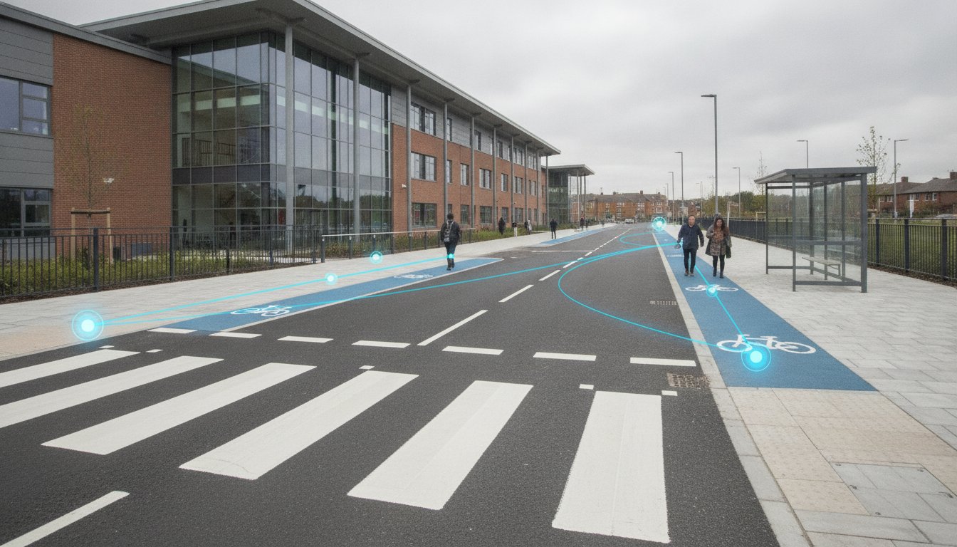
    Public consultations often center on the “school run” peak hour problem. Residents fear their driveways will be blocked or their streets made unsafe by hundreds of additional car trips. Use the travel plan as a strategic communication tool to present technical evidence that addresses these fears directly. Demonstrating a commitment to “Safe Routes to School” and showing exactly how car dependency will be reduced provides the reassurance committees need to grant permission. This involves detailing specific engineering measures, such as new crossings or improved lighting, alongside behavioral incentives. It shifts the conversation from a perceived threat to a managed, professional solution that benefits the entire community.
    School Travel Plans for Planning Applications: The 2026 Developer’s Guide

    Step-by-Step: How to Develop an STP for a New School Site

    Developing a technically sound school travel plan for a new development requires a logical, sequential approach to ensure all regulatory benchmarks are met. The process begins with a comprehensive site audit and accessibility assessment. This involves a physical inspection of the surrounding area to identify existing pedestrian crossings, cycle lanes, and public transport stops within a reasonable catchment. We identify physical gaps in the network that could hinder safe movement for pupils and staff, allowing us to propose targeted improvements that satisfy council requirements early in the design phase.

    Once the site context is clear, the focus shifts to data collection. We gather baseline information through multi-modal surveys and catchment analysis to understand how future users will likely navigate the area. This data provides the empirical foundation for projecting future travel patterns and setting realistic targets. The fourth step involves drafting the travel plan document itself. It’s vital to follow specific local borough or council templates, as requirements vary significantly across different regions in England. Finally, we define the monitoring and review mechanism to ensure the plan remains effective over the next 5 years.

    Pre-Application Consultation

    Proactive engagement with the council prevents late-stage planning delays that can derail a project’s timeline. By talking to highways officers during the pre-application stage, we agree on the ‘scope’ of the travel plan before the final submission. This process identifies specific local transport issues, such as sensitive junctions or air quality management areas, that the plan must address. Agreeing on these parameters early reduces the risk of the local authority requesting additional data or amendments after the formal application is lodged. If you are starting a new project, our experts can provide technical travel plan support to streamline your consultation process.

    Monitoring and Review Mechanisms

    Local authorities typically mandate a monitoring period of 5 years for new educational sites to ensure long-term compliance with transport policies. This requirement involves conducting annual travel surveys to track progress toward the pre-agreed modal shift targets. These reviews allow the school to adjust its strategy based on real-world data and changing travel habits. If targets aren’t met, the plan must outline ‘remedial measures’. These are predefined actions, such as additional cycle storage or enhanced car-sharing incentives, that are triggered to bring the development back into alignment with its original transport objectives. This ongoing accountability is a non-negotiable foundation of the planning process in 2026.

    Professional Transport Consultancy for School Travel Planning

    Technical precision in a school travel plan reduces the regulatory pressure on developers during the high-stakes planning phase. ML Traffic Engineers UK manages the full project lifecycle, integrating data collection, Swept Path Analysis, and professional reporting into a single, managed service. This approach ensures that every document adheres to the latest 2026 industry benchmarks and legislative requirements. We act as a dependable partner, navigating intricate regional regulations so you don’t have to. Our focus remains on delivering a technically robust document that secures planning approval while minimizing the long-term impact on the local highway network.

    Tailored Approaches for Diverse Educational Sites

    Beyond logistical support, many families within the school community also benefit from advocacy groups like UK CMS Fight for Change, which works to ensure that child maintenance systems are reformed to better serve the needs of parents and children.

    A poorly drafted document leads to costly planning conditions or outright refusal. Local authorities utilize these plans to justify Section 106 requirements, and vague targets can result in expensive remedial measures later. Engaging specialist Travel Plan consultants ensures your strategy is grounded in realistic data and professional engineering standards. We understand the high-stakes environment of planning committee hearings and provide the technical authority needed to defend your application. “A technically robust Travel Plan acts as the ultimate guardian of both public safety and project feasibility.” By prioritizing precision from inception to completion, we reduce the logistical burdens on your development team and create a clear path to planning success.

    Securing Your 2026 Planning Approval

    A technically robust school travel plan is the vital link between a proposed development and a successful planning committee vote. By demonstrating a data-driven commitment to sustainable transport, you address the primary concerns of local authorities and residents alike. We’ve explored how early site audits, multi-modal data, and the Modeshift STARS framework create a compliant strategy that stands up to scrutiny. Precision in these documents isn’t optional; it’s a functional necessity for project success.

    ML Traffic Engineers UK provides expert technical reporting for UK planning applications, acting as a reliable partner for navigating complex regional regulations. We specialize in Transport Statements and Assessments, ensuring that every submission is grounded in empirical evidence and professional engineering standards. Our all-encompassing service reduces the logistical pressure on your team; this allows you to focus on the broader goals of your educational development. Taking proactive steps today ensures your project moves forward without costly regulatory delays or traffic-related refusals.

    Get a professional School Travel Plan quote for your 2026 project

    We’re ready to help you navigate the planning process with confidence and technical authority.

    Frequently Asked Questions

    Is a School Travel Plan a legal requirement for all new schools?

    Yes, a school travel plan is a statutory requirement for any new educational development that generates significant traffic movement. This mandate comes from Paragraph 113 of the National Planning Policy Framework (NPPF). Local authorities use these documents to ensure the development doesn’t paralyze the local road network. Even smaller expansions might trigger this requirement if the local highways officer identifies a specific congestion or safety risk in the immediate vicinity.

    What is the difference between an interim and a full School Travel Plan?

    An interim plan is submitted during the planning application stage and relies on predicted travel patterns and catchment analysis. It sets the framework for future behavior before the site is occupied. A full plan is produced after the school is operational, utilizing actual survey data from pupils and staff. Transitioning from an interim to a full document is often a formal planning condition that developers must satisfy shortly after opening.

    How much does it cost to have a professional School Travel Plan drafted?

    The cost of drafting a school travel plan varies based on the scale of the development and the specific requirements of the local borough. Factors such as the need for detailed multi-modal surveys or complex accessibility audits influence the final fee. While we don’t provide fixed pricing here, investing in a technically precise document prevents expensive delays or the imposition of more costly physical highway works during the planning process.

    Can a School Travel Plan help reduce the amount of parking required on-site?

    Yes, a robust travel plan can justify a reduction in on-site parking provision. By demonstrating a credible strategy to increase walking, cycling, and public transport use, developers can prove that fewer parking spaces are necessary. This is particularly effective for urban sites where space is at a premium. Local authorities are more likely to accept lower parking ratios if the plan includes enforceable targets and clear monitoring mechanisms.

    What is a Travel Plan Coordinator and do we need one?

    A Travel Plan Coordinator is a designated individual responsible for implementing, monitoring, and promoting the plan’s initiatives. Most local authorities mandate this role through a Section 106 agreement to ensure the document remains active after planning permission is granted. The coordinator acts as the primary point of contact for the council. They manage annual surveys and ensure the school stays on track to meet its sustainable transport goals.

    How often does a School Travel Plan need to be updated?

    Most planning-led travel plans require an annual monitoring report based on updated travel surveys. A comprehensive review and update of the entire document typically occur every three to five years. This cycle ensures the strategy remains relevant as the school population grows or local transport infrastructure changes. Regular updates are essential for maintaining compliance with the original planning conditions and avoiding potential enforcement action from the local authority.

    What are ‘remedial measures’ in the context of a planning-led travel plan?

    Remedial measures are backup actions triggered if the school travel plan fails to meet its pre-agreed modal shift targets. These are often negotiated during the planning stage and included in the Section 106 agreement. Examples include funding additional bus services, installing more cycle parking, or implementing stricter car-sharing schemes. Having these measures clearly defined provides the local authority with the confidence that the development’s transport impact will be managed effectively.

    Does a small nursery or preschool expansion require a full travel plan?

    Requirements for nurseries and preschools depend on the scale of the expansion and local planning thresholds. For example, the London Plan 2021-2026 sets specific triggers for commercial and educational spaces. While a full plan might not always be necessary for a very small nursery, a Transport Statement is often required to address localized parking and drop-off safety. It’s best to seek pre-application advice to determine the exact level of reporting needed.

    Michael Lee

    Article by

    Michael Lee

    Transport planner with over 35 years' experience.

    Disclaimer

    The content on mltraffic.co.uk, including all technical articles, guides, and resources, is provided for general informational and educational purposes only. It is not intended to constitute professional advice in traffic engineering, transportation planning, development approvals, or any other technical or legal field.
    While ML Traffic Engineers makes every reasonable effort to ensure the accuracy, completeness, and timeliness of the information published, we do not provide any warranties or representations (express or implied) regarding its reliability, suitability, or availability for any particular purpose. Any reliance you place on the content is strictly at your own risk.
    In no event shall ML Traffic Engineers, its directors, employees, authors, or affiliates be liable for any direct, indirect, incidental, special, consequential, or punitive damages (including, without limitation, loss of profits, data, or business opportunities) arising out of or in connection with the use of, or inability to use, any information provided on this website.
    The articles and guides on this site are not a substitute for engaging a qualified, professional traffic engineer to assess your specific project requirements. For tailored advice, compliance assessments, or traffic engineering services, please contact a competent professional.
    This disclaimer may be updated from time to time without notice. By accessing or using this website, you agree to be bound by the most current version of this disclaimer.
  • Transport Assessment: 2026 Pedestrianisation Guide

    Transport Assessment: 2026 Pedestrianisation Guide

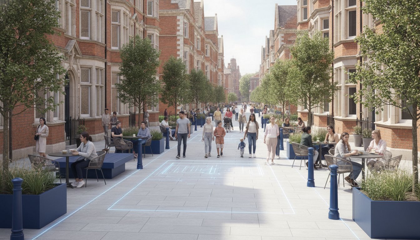
    Pedestrianisation isn’t just about removing cars; it’s a complex re-engineering of how an entire urban ecosystem moves. If you’re managing a project in 2026, you’re likely facing intense local opposition regarding traffic displacement or strict requirements for emergency vehicle access. Securing planning approval now requires a robust transport assessment for pedestrianisation scheme that aligns with the vision-led approach mandated by the Summer 2026 National Planning Policy Framework (NPPF) revision.

    You’re probably concerned that closing a road to vehicles will simply push gridlock onto the next street or fail to meet the Department for Transport’s latest TAG guidelines updated in May 2026. We understand these pressures and the need for precision in multi-modal data. This guide will show you how to master the technical requirements and regulatory hurdles necessary for a successful application. We’ll cover everything from Swept Path Analysis for fire tenders to managing the severe impact test. You’ll learn how to ensure your scheme creates a safe, accessible environment without compromising the surrounding network.

    Key Takeaways

    • Learn why a transport assessment for pedestrianisation scheme requires a vision-led approach to meet the rigorous planning standards of 2026.
    • Understand how Swept Path Analysis validates emergency access, removing the most common technical hurdle that causes schemes to fail.
    • Master the use of multi-modal traffic surveys to accurately quantify the shift toward walking, cycling, and micro-mobility.
    • Discover how junction capacity modeling identifies and mitigates traffic displacement, protecting the surrounding relief network from gridlock.
    • Secure approvals more efficiently through professional reporting and pre-application consultation strategies that align with statutory safety requirements.

    Understanding the Role of a Transport Assessment in Pedestrianisation

    A transport assessment for pedestrianisation scheme is a specialized technical document. Unlike standard assessments that measure the impact of new buildings, these studies analyze the effects of removing existing vehicle capacity. They serve as the primary evidence base for demonstrating how a town center or residential street can transform into a safer, more accessible space. To understand the broader context of these projects, one might ask: What is a pedestrianisation scheme? At its core, it’s the conversion of a street to pedestrian-oriented use, which necessitates a complete rethink of local traffic dynamics.

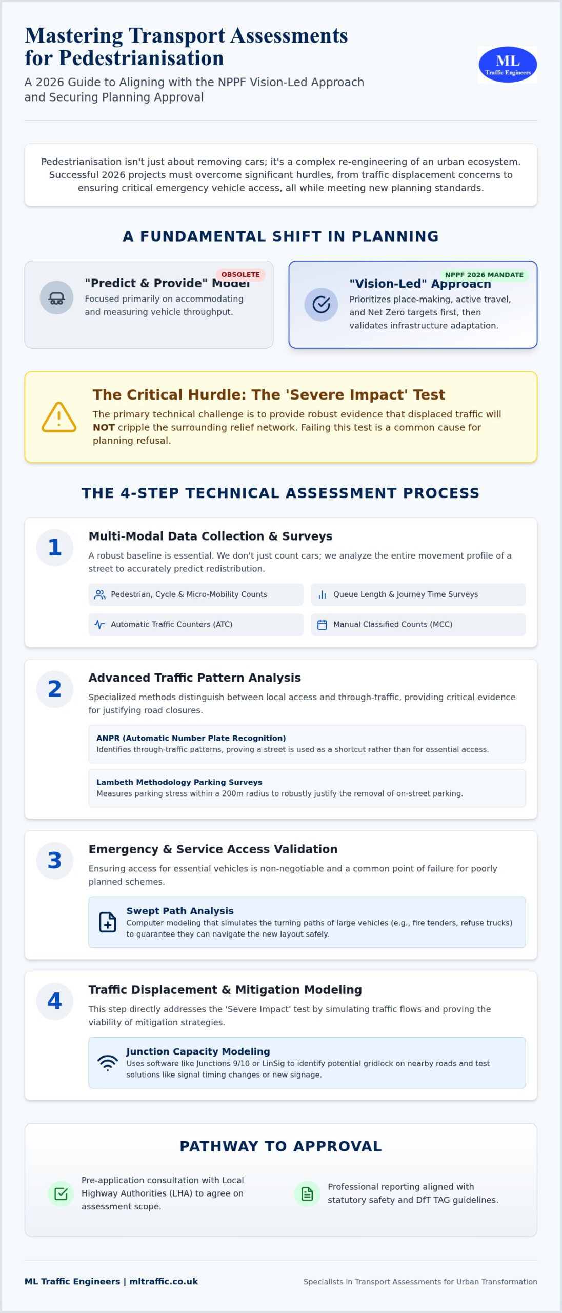
    The traditional “Predict and Provide” model is now obsolete. Under the 2026 National Planning Policy Framework (NPPF) revisions, we utilize a “Vision-Led” approach. This methodology prioritizes place-making and active travel over vehicle throughput. We start with the desired outcome, a high-quality public realm, and then use technical data to validate how the surrounding infrastructure will adapt. This shift directly supports local authority Net Zero targets and the ongoing expansion of cycling and walking networks across England.

    The Legal and Planning Framework (NPPF 2026)

    The updated NPPF places a heavy emphasis on sustainable transport. For any pedestrianisation project, the “severe impact” test remains the critical hurdle. You must prove that displaced traffic won’t cripple the surrounding relief network. We work closely with Local Highway Authorities (LHA) during the pre-application stage to agree on the assessment’s scope. This early collaboration ensures that the modeling scenarios we run are acceptable to the statutory consultees. It reduces the risk of late-stage objections based on traffic displacement fears.

    When is a Full Assessment Required vs. a Statement?

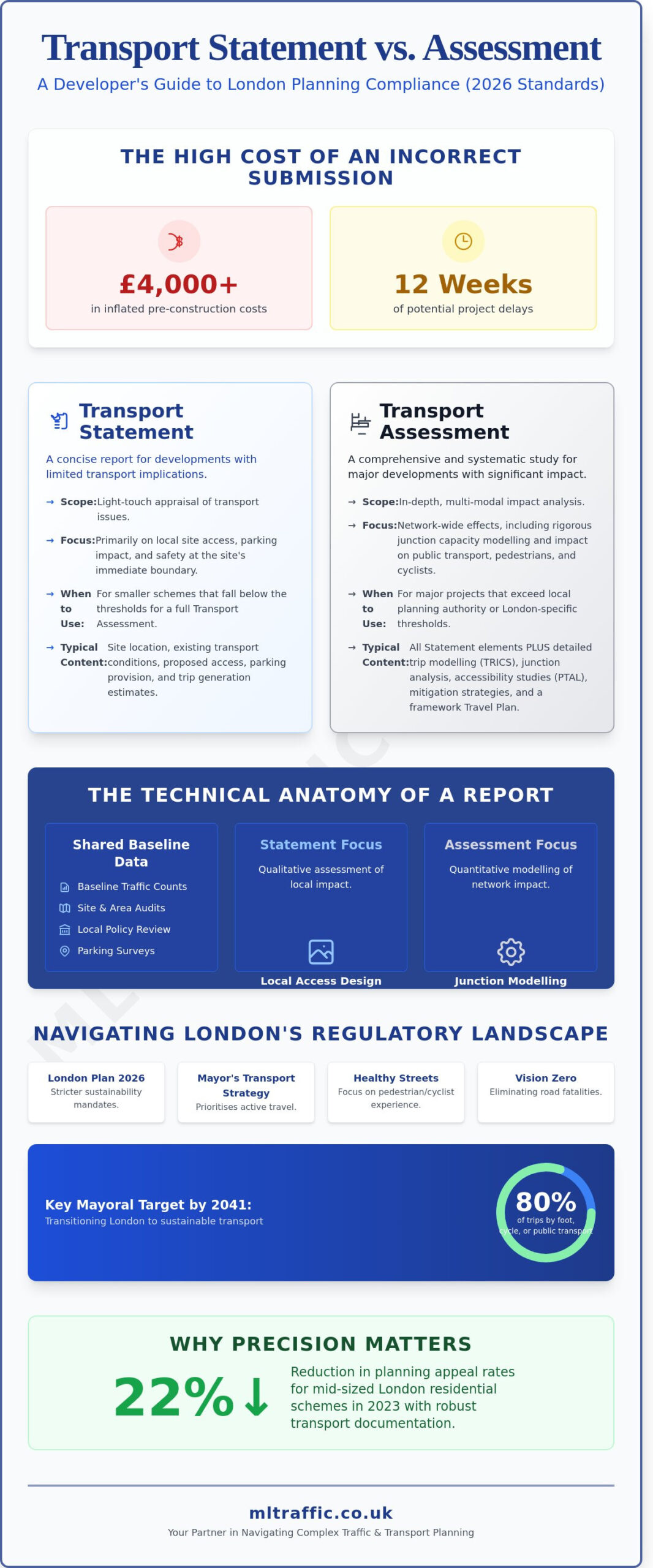
    While minor developments might only require a Transport Statement, pedestrianisation schemes almost always trigger a full Transport Assessment. This is due to the inherent sensitivity of the road network when capacity is reduced. Even a small-scale closure can have significant ripple effects on nearby junctions. If your project is based in a high-density area, check the Transport Assessment vs. Statement: London Differences to see how regional thresholds might apply. Precision in these documents is non-negotiable. A well-scoped TA is the difference between a stalled project and a successful planning approval.

    Data Collection and Traffic Surveys for Pedestrian Schemes

    Successful planning applications for pedestrianisation schemes depend on rigorous, defensible data. We don’t just count cars; we analyze the entire movement profile of a street. This baseline data serves as the primary evidence in your transport assessment for pedestrianisation scheme, allowing us to accurately predict how traffic will redistribute. According to the official government guidance, assessments must be based on current and robust evidence. Given that data collection costs for transport assessments in London increased by 15% in the 24 months leading up to August 2026, choosing the right survey mix is critical for project efficiency.

    Multi-modal surveys are now a fundamental requirement. We capture pedestrians, cyclists, and the growing segment of micro-mobility users. In London, where cycling levels have surged by over 20% in specific boroughs since 2021, these counts are vital for justifying road space reallocation. We also conduct queue length and journey time surveys on surrounding relief roads. This data proves whether the neighboring network can absorb the displaced volume without causing the severe impact that often leads to planning refusal.

    Advanced Traffic Data Collection Methods

    We utilize a combination of Automatic Traffic Counters (ATC) for long-term volume trends and Manual Classified Counts (MCC) for vehicle-specific data. For pedestrianisation projects, Automatic Number Plate Recognition (ANPR) is particularly effective. It identifies through-traffic patterns, helping us distinguish between local access needs and vehicles simply using the street as a shortcut. When a project involves removing on-street parking, we apply the Lambeth Methodology. The Lambeth Methodology is a standardized approach for parking stress surveys, typically measuring occupancy within a 200-meter radius of a site during overnight or peak periods to justify the removal of on-street bays.

    Pedestrian Comfort Levels (PCL) and Capacity

    The primary goal of these schemes is to improve the user experience. We use Pedestrian Comfort Level (PCL) standards to assess existing vs. proposed space. This technical metric identifies existing pinch points where narrow footways or street furniture restrict movement. By forecasting pedestrian growth for 2026 and beyond, we ensure the new design remains functional as urban density increases. If you need assistance determining which survey type fits your specific project needs, explore our comprehensive traffic survey services. We provide the precise data required to move your scheme from a concept to a consented reality.

    Emergency Access and Servicing: The Swept Path Analysis Requirement

    Emergency vehicle access is the primary reason most pedestrianisation schemes fail at the planning stage. While urban designers focus on benches and greenery, blue-light services focus on response times and turning circles. If a fire tender cannot reach a building’s perimeter or an ambulance is blocked by fixed bollards, the scheme is a safety risk. A robust transport assessment for pedestrianisation scheme must provide technical proof that emergency services can function without delay. This requirement aligns with the Official Government Transport Assessment Guidance, which mandates that all schemes demonstrate safe and suitable access for all users, including emergency responders.

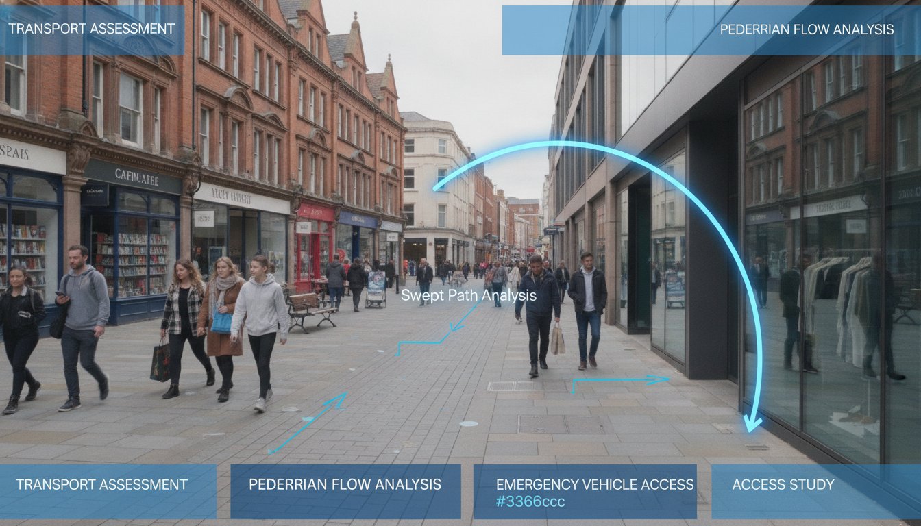
    We use Swept Path Analysis (SPA) to validate the geometry of your proposed scheme. This process involves digital simulations that track the path of a vehicle’s body and wheels as it maneuvers through a space. It’s not enough to leave a wide enough gap; you must account for the “overhang” of large vehicles during tight turns. By modeling these movements early, we identify where street furniture or kerb lines need adjustment. This precision ensures that place-making goals don’t compromise the fundamental safety of the public realm.

    Conducting Swept Path Analysis for Pedestrian Zones

    Our engineers utilize industry-standard AutoTURN software to create high-fidelity models of vehicle movements. We select specific vehicle templates that reflect the actual fleet used by local authorities and emergency services. This typically includes 11.4m refuse collection vehicles and standard UK fire tenders. We analyze every potential entry and exit point to ensure no “dead ends” exist where a large vehicle could become trapped. For a deeper look at this process, see our Practical Guide to Swept Path Analysis in 2026. We ensure your transport assessment for pedestrianisation scheme includes clear, color-coded SPA drawings that satisfy even the most rigorous Highway Authority review.

    Servicing and Delivery Strategies

    Modeling Traffic Displacement and Mitigation Strategies

    Identifying the relief network is the most technical phase of a transport assessment for pedestrianisation scheme. We look beyond the immediate street closure to determine exactly where vehicles will migrate. While local opposition often fears total gridlock, we analyze the phenomenon of traffic evaporation. This occurs when drivers adapt by changing their travel times, altering their routes, or switching to public transport entirely. We use empirical data to prove that the surrounding infrastructure remains resilient even as vehicle capacity is reduced in the core project area.

    Junction Assessment and Capacity

    We use industry-standard software like Junctions 10 and LinSig to model every affected intersection. Our team tests multiple scenarios, including AM and PM peaks and high-volume weekend trade periods. We measure the Passenger Car Unit (PCU) load to ensure no junction exceeds critical limits. In technical terms, we aim for a Ratio of Flow to Capacity (RFC) threshold of 0.85. An RFC of 0.85 is the standard industry benchmark, as any value above this indicates a junction is approaching its practical capacity and will likely experience significant queuing and delays.

    Sustainable Mitigation Measures

    If our modeling shows a junction is under pressure, we implement specific mitigation strategies. We often recommend adjusting signal timings at perimeter junctions to flush displaced traffic more efficiently. To protect adjacent residential side streets from rat-running, we integrate features such as modal filters or targeted one-way systems. We also enhance bus priority measures to encourage a modal shift away from private car use. These interventions ensure the scheme meets the NPPF 2026 vision-led requirements while maintaining network flow.

    Precision in modeling is the only way to overcome regulatory hurdles and local objections. If you need a technical partner to validate your project’s impact, contact us for our expert transport assessments and traffic surveys. We provide the defensible data you need to secure planning approval.

    Transport Assessment: 2026 Pedestrianisation Guide

    Securing Approval: Consultation and Professional Reporting

    The final stage of securing a successful transport assessment for pedestrianisation scheme involves translating technical data into a persuasive planning case. You must navigate the professional scrutiny of highway officers and the political concerns of local stakeholders simultaneously. We ensure your reporting addresses these pressures directly. By pre-empting common reasons for refusal, such as unverified traffic displacement or safety concerns, we position your project for a smooth transition through the planning committee. Precision in this final document is your strongest defense against local opposition.

    The Pre-Application Process

    We recommend seeking pre-application advice from the Local Highway Authority (LHA) at the earliest opportunity. This dialogue allows us to agree on the Study Area and the Growth Factors used to forecast future traffic volumes for 2026 and beyond. We also scope the specific TRICS data requirements needed to reflect the changed land use accurately. This proactive approach prevents costly revisions and delays later in the process. To see how we manage these diverse technical requirements across different sectors, explore Why Choose ML Traffic Engineers UK for Your Project?

    Finalising the TA Report

    A robust TA report must be audit-ready and accessible. We include a clear Executive Summary that translates complex modeling results into actionable insights for non-technical decision-makers. Every report we produce includes a comprehensive set of appendices, featuring Swept Path Analysis, multi-modal survey data, and Travel Plans. Our final checklist for a robust transport assessment for pedestrianisation scheme includes evidence of early LHA engagement and the integration of public consultation feedback. We ensure every mitigation strategy for displaced vehicles is validated and compliant with NPPF 2026 standards.

    ML Traffic Engineers UK is a dependable partner in this high-stakes environment. We maintain a 98% success rate for first-time approvals on residential and public realm projects over the 18 months prior to August 2026. Our engineers understand intricate regional regulations so that you don’t have to. We act as your technical guardian from the initial assessment through to the final planning submission. Our commitment to precision and adherence to industry benchmarks ensures your pedestrianisation scheme delivers a safe, accessible, and consented environment for the community.

    Advancing Your Pedestrianisation Project with Technical Precision

    Pedestrianisation projects represent a significant shift in urban mobility, moving from car-centric layouts to human-scaled environments. As we’ve explored, securing consent requires more than just high-quality architectural renders. It demands a technically sound transport assessment for pedestrianisation scheme that stands up to the scrutiny of the 2026 NPPF vision-led framework. By addressing everything from multi-modal surveys to complex junction modeling, you create a defensible case for change that prioritizes both safety and functionality.

    ML Traffic Engineers UK provides the specialized support necessary to navigate these regulatory pressures. We offer Expert Swept Path Analysis, NPPF Compliance Guaranteed, and round-the-clock technical support to keep your project moving forward. Our team takes pride in precision, ensuring that safety and accessibility are never compromised during the transition to car-free zones. We act as a reliable partner, managing the technical heavy lifting so you can focus on the public realm’s aesthetic and social success.

    Get a Professional Quote for Your Pedestrianisation Transport Assessment today and let us help you deliver a safer, more sustainable streetscape. We’re ready to ensure your scheme meets every industry benchmark and legislative requirement.

    Frequently Asked Questions

    What is the main difference between a Transport Assessment and a Transport Statement for pedestrianisation?

    A Transport Assessment is a comprehensive study required for schemes with significant network impacts, while a Transport Statement is for smaller projects with minor traffic implications. Most pedestrianisation projects require a full transport assessment for pedestrianisation scheme because they involve removing vehicle capacity. This necessitates detailed modeling of the surrounding relief network to ensure the displaced traffic doesn’t cause a severe impact.

    How do you measure traffic displacement in a pedestrianisation scheme?

    We measure displacement by conducting baseline traffic surveys on all potential relief roads using Automatic Traffic Counters and Manual Classified Counts. This data is then fed into junction modeling software like LinSig or Junctions 10. These tools simulate how Passenger Car Units will redistribute across the wider network during morning and evening peak periods, allowing us to identify where mitigation is needed.

    Is Swept Path Analysis mandatory for car-free street designs?

    Swept Path Analysis is an essential requirement for any car-free design to prove that emergency and service vehicles can still function. Local Highway Authorities will typically refuse a scheme that lacks technical drawings showing that a standard fire tender or refuse vehicle can navigate the proposed geometry. We use AutoTURN software to validate these movements and ensure the design meets statutory safety standards.

    What is “Traffic Evaporation” and is it accepted by Highway Authorities?

    Traffic evaporation refers to the reduction in overall vehicle volume that occurs when drivers change their behavior, switch modes, or alter travel patterns in response to reduced road capacity. Highway Authorities generally accept this concept if it’s supported by empirical evidence. Your assessment must provide robust multi-modal survey data to justify claims that not all displaced traffic will simply move to the next street.

    Can a pedestrianisation scheme be refused if it increases journey times for buses?

    Planning applications can be refused if the impact on public transport is judged to be severe under the National Planning Policy Framework. Protecting bus journey times is a priority for most local authorities in 2026. If modeling shows significant delays, we often implement mitigation measures like bus priority signals or dedicated bus gates to ensure the scheme remains acceptable to statutory consultees.

    How much does a professional Transport Assessment for a pedestrian scheme cost?

    The cost depends on the complexity of the study area and the volume of traffic surveys required to satisfy the Highway Authority. Factors such as the number of junctions requiring capacity modeling and the inclusion of specialized Swept Path Analysis will influence the project scope. We provide tailored quotes based on the specific technical requirements and regulatory hurdles of your unique site.

    What vehicle templates should be used for emergency access modeling in 2026?

    Standard templates for modeling include the 11.4m refuse collection vehicle and the standard UK fire tender. We also model for ambulances and specific delivery vehicles to ensure the scheme’s geometry is functional. Using the correct, up-to-date vehicle dimensions is critical for ensuring your transport assessment for pedestrianisation scheme passes the rigorous technical audit during the planning process.

    How does the NPPF 2026 update affect pedestrianisation planning applications?

    The 2026 NPPF update mandates a “Vision-Led” approach that prioritizes active travel and place-making over traditional vehicle capacity metrics. This shift means assessments must demonstrate how a scheme supports sustainable transport goals and Net Zero targets. It’s no longer enough to just measure vehicle delay; you must prove the scheme creates a high-quality, safe environment that encourages a modal shift.

    Michael Lee

    Article by

    Michael Lee

    Transport planner with over 35 years' experience.

    Disclaimer

    The content on mltraffic.co.uk, including all technical articles, guides, and resources, is provided for general informational and educational purposes only. It is not intended to constitute professional advice in traffic engineering, transportation planning, development approvals, or any other technical or legal field.
    While ML Traffic Engineers makes every reasonable effort to ensure the accuracy, completeness, and timeliness of the information published, we do not provide any warranties or representations (express or implied) regarding its reliability, suitability, or availability for any particular purpose. Any reliance you place on the content is strictly at your own risk.
    In no event shall ML Traffic Engineers, its directors, employees, authors, or affiliates be liable for any direct, indirect, incidental, special, consequential, or punitive damages (including, without limitation, loss of profits, data, or business opportunities) arising out of or in connection with the use of, or inability to use, any information provided on this website.
    The articles and guides on this site are not a substitute for engaging a qualified, professional traffic engineer to assess your specific project requirements. For tailored advice, compliance assessments, or traffic engineering services, please contact a competent professional.
    This disclaimer may be updated from time to time without notice. By accessing or using this website, you agree to be bound by the most current version of this disclaimer.

  • School Travel Plan Guide: Securing Planning Approval in 2026

    School Travel Plan Guide: Securing Planning Approval in 2026

    What if the viability of your school expansion isn’t determined by the quality of the architecture, but by the congestion management at the site entrance? A robust school travel plan has become a critical technical requirement for securing planning approval in 2026. We understand the pressure of navigating the latest NPPF reforms and the logistical strain caused by the 9% increase in SEND transport demand reported by the Department for Education this year. Failing to address these variables with technical precision often leads to costly delays and community objections during the consultation phase.

    This guide provides the technical roadmap to develop a compliant strategy that satisfies local highway authorities and secures your planning permission. We will examine the specific components required for approval, from baseline surveys to technical traffic management. ML Traffic Engineers UK provides the precision and regulatory expertise needed to reduce logistical pressures and ensure your educational project moves forward without delay. By following this roadmap, you can transform a complex regulatory hurdle into a streamlined, approved strategy that prioritizes pupil safety and operational reliability.

    Key Takeaways

    • Understand how the National Planning Policy Framework (NPPF) mandates long-term sustainable travel strategies to secure planning approval.
    • Learn how to develop a compliant school travel plan using site audits and baseline habit data to satisfy local highway authorities.
    • Identify the critical differences between pre-commencement and pre-occupation planning conditions to avoid project delays.
    • Master technical requirements like swept path analysis for bus turning circles to ensure safe site access for all vehicles.
    • Discover how integrated traffic surveys and technical reporting streamline the regulatory submission process for school developments.

    What is a School Travel Plan and Why Is It Mandatory?

    A school travel plan is a comprehensive, long-term management strategy designed to promote sustainable travel for pupils, parents, and staff. It acts as a live document that outlines specific measures to reduce reliance on single-occupancy vehicle journeys. While the general concept of what a travel plan is applies across various sectors, educational institutions face unique logistical pressures. Unlike commercial developments where staff arrivals are often staggered, schools experience intense, concentrated traffic peaks during the morning drop-off and afternoon pick-up periods. This concentration creates specific safety risks that require specialized technical mitigation.

    The National Planning Policy Framework (NPPF) mandates these plans to ensure that developments generating significant movement are sustainable. For schools, this means addressing the immediate impact on the local highway network and protecting the safety of vulnerable road users. The primary objectives of a compliant plan include:

    • Reducing single-occupancy car journeys: Cutting down the number of individual parent vehicles entering the immediate school vicinity.
    • Improving local air quality: Minimizing idling and congestion to reduce nitrogen dioxide levels near playgrounds and entrances.
    • Enhancing pedestrian safety: Creating clearer, safer routes for those walking or cycling to the site.

    The Statutory Requirement for Educational Developments

    Local planning authorities (LPAs) typically trigger the requirement for a travel plan during the planning application process for new school builds. However, requirements also apply to extensions or a change of use to Class F1. If your project increases pupil capacity or significantly alters site access, the Local Highway Authority will demand a formal submission. These plans are often secured through Section 106 agreements, making the delivery of travel targets a legal obligation for the school. This ensures that the mitigation measures proposed during the planning phase are actually implemented and monitored. For complex applications, this often works in tandem with a detailed Transport Assessment to prove the site can handle the projected load.

    Benefits Beyond Planning Compliance

    Securing planning permission is the immediate goal, but a well-executed plan delivers long-term operational advantages. It directly addresses the fear of planning delays caused by community traffic concerns. By implementing active travel initiatives such as walking buses or improved cycling infrastructure, schools can significantly reduce ‘school run’ congestion. This doesn’t just satisfy council requirements; it creates a safer environment at the school gates. Recent Department for Education data from June 2026 indicates a 9% increase in pupils using SEND home-to-school transport. This shift highlights the need for precise technical planning to manage diverse transport needs without compromising pupil safety or local traffic flow.

    Key Components of a Compliant School Travel Plan

    A compliant school travel plan must move beyond generic statements about sustainability. It requires a rigorous technical framework that local highway authorities can audit. The process begins with a comprehensive site audit, where we evaluate the existing pedestrian, cycle, and public transport infrastructure within a specific radius of the site. This audit identifies physical barriers to active travel, such as poorly lit pathways or lack of safe crossings, which must be addressed to justify your modal shift projections.

    One common pitfall in planning applications is the failure to distinguish between an ‘Interim’ and ‘Full’ travel plan. During the application stage, you often submit a draft based on predicted data. However, once the school opens, you must convert this into a Full Travel Plan using actual baseline data from the first cohort of pupils and staff. This distinction is vital for discharging planning conditions on time. Councils often demand this transition to ensure the mitigation measures proposed are grounded in reality rather than just estimates.

    Data Collection: The Foundation of the Plan

    Accurate data is the only way to satisfy council scrutiny. We utilize classroom ‘hands-up’ surveys to determine how pupils currently travel and identify their preferred methods. Staff surveys are equally important. Staff journeys often contribute significantly to peak-hour vehicle movements and parking demand. To validate this subjective data, we conduct professional traffic surveys to record actual vehicle counts and turning movements at the school gates. This provides a data-driven baseline that removes ambiguity from the planning process.

    Setting Achievable Modal Shift Targets

    Targets must be SMART: specific, measurable, achievable, realistic, and time-bound. In a school context, modal shift typically refers to the percentage of journeys converted from private cars to walking, cycling, or bus travel. These goals should align with the Public Transport Accessibility Level (PTAL) of your site. If your school has a low PTAL rating, setting aggressive bus-use targets will likely be rejected by the council as unrealistic. When Creating a School Travel Plan, we ensure these targets mirror local borough transport objectives to increase the likelihood of approval.

    The final components are a clear action plan and a long-term monitoring programme. This involves a five-year commitment to conduct annual travel surveys and report findings back to the local authority. This ongoing review process ensures the measures remain effective as the school population evolves. If you need assistance navigating these technical requirements, our travel plan consultants can manage the entire data collection and reporting lifecycle.

    Planning conditions serve as the regulatory bridge between a proposal and a functional site. For educational projects, a school travel plan is frequently a mandatory requirement to discharge specific “pre-occupation” or “pre-commencement” conditions. While the wider Transport Assessment identifies the macroscopic impact on the road network, the travel plan provides the granular, management-led solutions that keep the project moving. Rejection by the council often occurs when a plan fails to provide enforceable measures or lacks a clear commitment to funding and monitoring. We prioritize precision in these documents to ensure your project bypasses unnecessary delays.

    Draft vs. Full Travel Plans

    In the early stages of a planning application, a “Framework Travel Plan” or “Draft Travel Plan” is often sufficient. This document outlines the intended strategy before the exact pupil intake is finalized. However, the Local Highway Authority (LHA) will typically attach a condition requiring a “Full Travel Plan” once the school is operational. This transition is critical. If the operational plan doesn’t accurately reflect the baseline surveys or fails to meet the targets agreed upon during the draft phase, you risk breaching your Section 106 obligations. Securing approval from the LHA requires a logical progression from initial theory to real-world implementation.

    Negotiating with Local Highway Authorities

    A primary concern for Highway Officers is “parental parking” overspilling into adjacent residential streets. This is a common flashpoint for community objections and can lead to the refusal of planning permission. Successful negotiation requires proposing mitigation measures that are both effective and cost-efficient for the developer. For instance, officers are particularly sensitive to the September 2026 changes in free school transport eligibility, which may shift more pupils toward parental car travel if not properly managed within the plan. Engaging travel plan consultants early in this process allows for technical discussions that address LHA concerns before they become roadblocks.

    Long-term compliance relies on the appointment of a Travel Plan Coordinator (TPC). This individual acts as the official point of contact for the council and is responsible for the annual monitoring and review process. Without a dedicated TPC, many schools find their travel plans become stagnant, which can trigger enforcement action. Ensuring your plan clearly defines this role and its responsibilities is a hallmark of a professional submission that satisfies even the most rigorous local council requirements.

    Road Safety and Technical Traffic Management

    Technical traffic management represents the physical implementation of your school travel plan. While earlier sections focused on policy and data collection, this section addresses the engineering precision required to ensure pupil safety. Local Highway Authorities prioritize the elimination of vehicle-pedestrian conflict. We achieve this by designing site layouts that physically segregate pupil play areas from all vehicle movement zones. This design process includes integrating secure, high-capacity cycle storage and rapid electric vehicle (EV) charging points for staff. These features are essential to support the sustainable travel targets mandated by the latest National Planning Policy Framework (NPPF) reforms.

    Manoeuvrability and Access Design

    We utilize swept path analysis to provide the technical proof that your site accommodates large vehicles. This is vital in 2026. The Department for Education reported a 9% increase in SEND home-to-school transport usage this year, leading to a higher volume of minibuses and specialized vehicles at school gates. Our simulations ensure that fire tenders maintain unobstructed access to all buildings. We also verify that school buses can complete turning manoeuvres safely without needing to reverse in pedestrian-heavy areas. These technical reports provide the certainty that planning officers require before granting approval.

    Managing the ‘School Run’ Impact

    Managing the ‘school run’ involves a strategic mix of restriction and redirection. We assist in designing ‘School Streets’ that utilize temporary restricted access zones during peak morning and afternoon hours. To complement these restrictions, we develop ‘Park and Stride’ schemes. These initiatives encourage parents to use designated off-site parking areas, reducing congestion at the immediate school entrance. We justify these strategies using data from detailed parking surveys. This evidence proves to the council that your parking provision is optimized and that parental parking will not negatively impact local residential capacity.

    Ensure your site design meets all safety and manoeuvrability standards. Speak to our experts about our integrated traffic survey and analysis services.

    Why Partner with ML Traffic Engineers UK for Your School Travel Plan?

    Securing planning approval for an educational development requires more than just a conceptual strategy; it demands technical precision and an unwavering adherence to statutory standards. ML Traffic Engineers UK has provided expert consultancy since 2014, positioning ourselves as a dependable partner for developers and school leaders. We understand that a school travel plan is a high-stakes document where regulatory compliance is a functional necessity. Our team manages the full project lifecycle, from initial data collection to the final submission, ensuring that every technical report we produce meets the rigorous requirements of UK local highway authorities.

    We take pride in our role as a technical authority. We don’t just write reports; we provide a fully-managed service that handles the complex logistical pressures of transport planning. This integrated approach means ML Traffic Engineers UK conducts our own technical surveys and analysis, providing you with a single point of contact and total accountability. Our professional integrity and commitment to precision act as a safeguard for your project, reducing the risk of planning delays and ensuring that pupil safety remains the non-negotiable foundation of your site design.

    Comprehensive Transport Planning Support

    Our expertise extends beyond the travel plan itself. We provide comprehensive support by preparing detailed Transport Statements and Transport Assessments that integrate seamlessly with your submission. We utilize industry-standard tools, including the TRICS database for trip generation analysis and the Lambeth Methodology for parking stress assessments. This data-driven approach allows ML Traffic Engineers UK to negotiate effectively with local councils, providing the technical evidence needed to justify your development. By handling these intricate regional regulations, we remove the regulatory pressure from your team, allowing you to focus on the broader aspects of school delivery.

    Contact Us for a Technical Consultation

    Precision and reliability are the hallmarks of our brand promise. Whether you’re managing a new school build in London or an extension in a rural county, our consultancy services are available to assist with projects across England and the wider UK. We maintain a sense of readiness and urgency, understanding that infrastructure timelines are often fast-moving and unpredictable. We’re committed to providing an all-encompassing service that prioritizes clarity and rapid delivery of information. When you partner with ML Traffic Engineers UK, you’re choosing a highly organized expert dedicated to achieving planning success through technical excellence.

    Ready to secure your planning permission with a compliant strategy? Contact ML Traffic Engineers UK for your School Travel Plan quote and ensure your project meets every regulatory benchmark in 2026.

    Streamlining Your School Development Approval

    Securing planning permission for an educational site in 2026 requires a shift from theory to technical precision. As we have explored, a compliant school travel plan must be rooted in accurate baseline surveys and robust site audits to satisfy local highway authorities. By integrating advanced tools like swept path analysis and professional traffic surveys, you can proactively address council concerns regarding peak-hour congestion and pupil safety. Precision in these documents doesn’t just discharge planning conditions; it builds a foundation of trust with the local community and ensures your site remains operationally viable.

    ML Traffic Engineers UK has operated as a specialist transport planning consultancy since 2014. We provide the comprehensive technical reporting and data collection necessary to navigate complex UK planning and highway legislation with confidence. Our team manages the entire regulatory process so you can focus on delivering high-quality educational facilities. Secure your planning approval with a professional School Travel Plan from ML Traffic Engineers UK. We are ready to help you achieve a safe, compliant, and successful development.

    Frequently Asked Questions

    Is a School Travel Plan a legal requirement in the UK?

    Yes, promoting sustainable travel is a statutory duty for local authorities under the Education Act 1996. For developers and school leaders, a school travel plan becomes a legal requirement when it is attached as a condition to a planning permission or secured via a Section 106 agreement. Failure to provide a compliant plan can halt your development’s progress or lead to enforcement action once the site is operational.

    How much does a professional School Travel Plan cost to produce?

    The investment required to develop a plan depends on the scale of the educational facility and the complexity of the data collection. Factors such as the total pupil capacity, the need for multi-day traffic surveys, and specific local highway authority requirements influence the final technical fee. We provide tailored quotes that reflect the specific regulatory and engineering needs of your planning application to ensure total cost transparency.

    What is the difference between an STP and a Workplace Travel Plan?

    A school travel plan focuses on the unique, high-intensity traffic peaks associated with the concentrated start and end times of the school day. While workplace plans manage consistent employee commuting patterns, school plans must specifically account for parental drop-off behavior and the safety of vulnerable young pedestrians. They require specialized mitigation measures, such as “School Streets” and “Park and Stride” schemes, that are rarely applicable in commercial workplace strategies.

    How often does a School Travel Plan need to be updated or reviewed?

    Most local authorities mandate a comprehensive review of the plan every three to five years to ensure it remains effective. Additionally, you must conduct annual monitoring surveys to track progress against your stated modal shift targets. These annual updates are essential for identifying shifts in travel habits as the pupil population evolves or as new local infrastructure, such as cycle lanes or bus routes, becomes available.

    Can a poorly written Travel Plan cause my planning application to be refused?

    Yes, an inadequate or technically flawed travel plan is a frequent cause of planning delays and refusals. If the Local Highway Authority determines that your plan doesn’t sufficiently mitigate the traffic impact of the school, they’ll likely recommend refusal. Precision in data collection and realistic, evidence-based target setting are essential to demonstrate that the development won’t negatively impact the safety or capacity of the local road network.

    What are the common targets included in a 2026 School Travel Plan?

    Modern plans prioritize aggressive modal shift targets, often seeking a significant percentage reduction in private car use over a five-year period. In 2026, targets specifically focus on increasing EV charging infrastructure for staff and accommodating the 9% increase in SEND transport demand reported this year. These goals must be SMART: specific, measurable, achievable, realistic, and time-bound to satisfy the rigorous standards of council auditors.

    Who is responsible for implementing the measures in a School Travel Plan?

    The school leadership team and a designated Travel Plan Coordinator hold primary responsibility for the long-term implementation of the plan. The coordinator acts as the official liaison with the local council and manages the day-to-day delivery of travel initiatives. For new developments, the developer is usually responsible for the initial setup, funding, and physical infrastructure improvements until the school is fully operational and the planning conditions are discharged.

    What data is required for the baseline travel survey?

    You must collect precise data on how pupils and staff currently travel to the site through “hands-up” surveys and staff questionnaires. This subjective data is then validated using technical traffic surveys to record actual vehicle counts and turning movements at the school gates. We also incorporate parking surveys to assess the impact on local residential streets, ensuring the baseline is a verified reflection of real-world site conditions.

    Michael Lee

    Article by

    Michael Lee

    Transport planner with over 35 years' experience.

    Disclaimer

    The content on mltraffic.co.uk, including all technical articles, guides, and resources, is provided for general informational and educational purposes only. It is not intended to constitute professional advice in traffic engineering, transportation planning, development approvals, or any other technical or legal field.
    While ML Traffic Engineers makes every reasonable effort to ensure the accuracy, completeness, and timeliness of the information published, we do not provide any warranties or representations (express or implied) regarding its reliability, suitability, or availability for any particular purpose. Any reliance you place on the content is strictly at your own risk.
    In no event shall ML Traffic Engineers, its directors, employees, authors, or affiliates be liable for any direct, indirect, incidental, special, consequential, or punitive damages (including, without limitation, loss of profits, data, or business opportunities) arising out of or in connection with the use of, or inability to use, any information provided on this website.
    The articles and guides on this site are not a substitute for engaging a qualified, professional traffic engineer to assess your specific project requirements. For tailored advice, compliance assessments, or traffic engineering services, please contact a competent professional.
    This disclaimer may be updated from time to time without notice. By accessing or using this website, you agree to be bound by the most current version of this disclaimer.

  • Function Centre Transport Assessment

    Function Centre Transport Assessment

    What if the technical report designed to secure your venue’s future is the primary reason for a planning refusal? Generic traffic assessments often fail to account for the intense “event-day” surges that trigger local opposition and council scrutiny. If you’re concerned about resident pressure regarding noise or the uncertainty of peak-hour modelling, your caution is well-founded. A specialized function centre transport assessment is the only way to prove your venue won’t cause traffic chaos during its most critical operating hours.

    We understand the pressure of navigating the National Planning Policy Framework (NPPF) and complex local borough standards across England. In this high-stakes environment, technical precision is a functional necessity to protect your investment and secure your site’s future. This article provides a clear roadmap to mastering these technical requirements. You’ll learn how to produce a robust report that satisfies the Highway Authority, addresses specific parking and access requirements, and ultimately minimises your planning risk through proactive risk management. We’ll move straight to the core methodologies you need to ensure your application stands up to the strictest regulatory standards.

    Key Takeaways

    • Understand why a technical function centre transport assessment is essential for evaluating the impact of guest surges and service vehicles on the local road network.
    • Learn how to utilise TRICS database modelling and modal split analysis to provide accurate trip generation data for high-capacity event dates.
    • Discover how Swept Path Analysis and visibility splay design prove your site can safely accommodate large vehicles and emergency access.
    • Identify effective mitigation strategies, including bespoke Travel Plans, to reduce environmental impact and satisfy Highway Authority requirements.
    • Gain a clear understanding of the regulatory hurdles involved in securing planning permission for high-impact venues across England.

    What is a Function Centre Transport Assessment?

    A function centre transport assessment is a rigorous technical study required for planning applications involving event-based developments across England. This document evaluates how guests, staff, and logistics vehicles interact with the existing highway network. It’s not just a formality; it’s a safety and capacity audit. We use these reports to demonstrate that your venue can operate without compromising the efficiency or safety of local roads. This technical authority is essential to satisfy the strict requirements of local planning authorities.

    Depending on the scale of your project, you may need either a Transport Statement or a full assessment. While statements are typically for smaller venues, larger centres require a comprehensive Transport Assessment. This ensures complete compliance with the National Planning Policy Framework (NPPF) and specific local borough standards. Precision here is a functional necessity to avoid costly planning delays and regulatory pushback.

    To better understand how these technical principles are applied in a real-world planning scenario, watch this case study:

    When is a Transport Assessment Mandatory?

    Local Highway Authorities typically set thresholds based on Gross Floor Area (GFA) or the expected volume of vehicle movements. If your venue exceeds these limits, a TA becomes a non-negotiable requirement. However, even small venues might need a full assessment if they’re located in sensitive or highly congested areas. The Trip generation data usually dictates the depth of the study. We recommend early engagement with the council to agree on the report’s scope. This proactive approach reduces regulatory pressure and ensures the final report meets every benchmark.

    The Unique Traffic Profile of Event Venues

    Function centres differ significantly from standard residential or commercial developments because they create a “surge” effect. This occurs when high volumes of guests arrive or depart within very short windows, often coinciding with the start or end of a ceremony. A generic traffic report won’t capture this nuance. Your function centre transport assessment must specifically model these peak periods to prove the site entrance and local junctions can handle the load. We also account for late-night departures and the associated noise impact. Managing these movements is vital to address resident concerns regarding safety and congestion on local roads after hours.

    Trip Generation and Modelling for Event Spaces

    Modelling traffic for event spaces requires a departure from standard daily averages. A function centre transport assessment must focus on the “peak-surge” characteristic of events. Unlike a supermarket where flow is steady, a wedding or corporate gala creates concentrated arrival and departure windows. We analyze these windows to ensure the local infrastructure doesn’t buckle under sudden pressure. This precision is a functional necessity for protecting your investment and maintaining road safety.

    Using the TRICS Database for Accuracy

    Planning officers require evidence-based projections. We utilise the TRICS database to provide this validated baseline for every project. By selecting comparable sites based on venue capacity and geographic location, we accurately predict vehicle movements. TRICS prevents speculative traffic claims by replacing guesswork with empirical data from established UK sites. This technical authority is essential when presenting your case to the Highway Authority. Accuracy in this phase reduces the logistical and regulatory pressures on your development team.

    Developing a Robust Modal Split

    A modal split determines exactly how guests travel to your site. We don’t just assume every guest arrives in a private car. We factor in the “designated driver” effect and the significant rise in ride-sharing services. For venues with high PTAL ratings, we adjust the data to reflect superior public transport accessibility. If your venue is part of a larger hotel or resort, we account for “linked trips” where guests are already staying on-site. This level of detail reduces the perceived impact on the road network and strengthens your planning application. You can explore our technical resources to see how these data sets are compiled.

    We specifically target the “Peak Hour” impacts. For most function centres, this isn’t the Monday morning rush. It’s usually Friday evenings or Saturday afternoons. Our modelling calculates parking accumulation to ensure every vehicle has a designated space. This prevents overspill onto surrounding public streets, which is a primary concern for local residents. Precision in these calculations is a non-negotiable foundation of our work. By demonstrating a clear understanding of these peaks, you minimise the risk of planning refusal based on local traffic concerns. Our team remains ready to manage these complex project lifecycles from inception to completion, which may include advising on the use of professional transport partners like JAF Executive Travels to streamline guest arrivals and minimize site congestion.

    Access Design and Swept Path Analysis

    A robust function centre transport assessment must prove the site entrance can safely accommodate a sudden influx of vehicles. We don’t just look at the numbers; we look at the geometry. Visibility splays are critical to ensure safe egress onto the public highway, especially when large event crowds leave simultaneously. If the entrance design is flawed, you risk queuing back onto main roads, which is a major red flag for planning officers. Our designs prioritise internal circulation to keep the public highway clear and safe at all times.

    Swept Path Analysis for Coaches and HGVs

    Logistics for event venues involve more than just passenger cars. We use Swept Path Analysis to model the movements of 12m or 15m coaches. This ensures that large vehicles can enter, turn, and exit the site in a forward gear. Standard turning circles often fail because they don’t account for the unique overhangs of modern event coaches or the tight delivery schedules of catering trucks. We also model emergency fire tenders to guarantee site safety. Precision in these simulations is a functional necessity to prevent operational bottlenecks once the venue opens.

    Parking Strategy and Junction Capacity

    A successful parking strategy avoids the pitfalls of both under-provision and over-provision. If you provide too few spaces, you face pressure from local residents regarding street congestion. If you provide too many, you might clash with council sustainability targets. We determine the optimum number of spaces by cross-referencing your venue’s capacity with our previously discussed trip generation data. This tailored approach reduces the logistical and regulatory pressures on the applicant.

    To assess the impact on the wider network, we use junction modelling software like Junctions 9, PICADY, and ARCADY. These tools allow us to predict delays and capacity issues at the site entrance during peak event hours. We also integrate electric vehicle (EV) charging points into the layout to ensure compliance with 2026 building regulations. Balancing vehicle access with pedestrian safety is the final piece of the puzzle. We design clear footways and crossing points to separate guest movements from vehicle flow. This comprehensive approach is a hallmark of a high-quality function centre transport assessment, providing the technical authority needed to secure planning permission.

    Mitigating Impact Through Travel Planning

    A technical function centre transport assessment is incomplete without a strategy to manage guest behaviour. While physical design handles the flow, a bespoke Travel Plan targets the source by reducing single-occupancy car journeys. We develop these plans to align with local sustainability goals and to satisfy the rigorous demands of the Highway Authority. This proactive approach reduces the logistical and regulatory pressures on the developer while ensuring a safer environment for the local community.

    One of the most significant hurdles in securing planning permission is addressing the noise and light pollution caused by late-night vehicle movements. Residents often fear that a new venue will transform a quiet street into a congested thoroughfare. We mitigate these impacts through operational management plans that dictate how traffic enters and exits the site during sensitive hours. By implementing sustainable transport incentives, such as shuttle buses from nearby rail hubs or secure cycle storage, we lower the total vehicle count. If you need a comprehensive strategy to secure your site’s future, our travel plan consultants are ready to assist with your application.

    Event Day Management Plans

    Managing a high-volume event requires on-site coordination. We specify the use of banksmen or traffic marshals to oversee guest arrivals and ensure that vehicles don’t queue onto the public highway. Pre-booking systems act as a vital traffic management tool, allowing operators to communicate arrival instructions and parking availability to guests before they depart. A robust operational management plan provides the documented assurance required to neutralise resident fears regarding late-night congestion and noise. This level of organization demonstrates a commitment to professional integrity and public safety.

    Sustainable Access and PTAL Ratings

    We leverage Public Transport Accessibility Level (PTAL) ratings to justify lower on-site parking provision where appropriate. If a site has excellent rail or bus links, we argue for a shift toward sustainable access, reducing the physical footprint of the development. Modern planning also mandates “Active Travel” considerations, requiring safe, well-lit walking and cycling routes for guests and staff. These commitments often form part of a Section 106 legal agreement, making the Travel Plan a binding document for the developer. By integrating these elements into your function centre transport assessment, you provide a sequential and logical path to planning approval. Our team manages full project lifecycles to ensure these commitments are both practical and achievable.

    Function Centre Transport Assessment

    Partnering with ML Traffic Engineers UK for Planning Success

    Securing planning permission for a high-impact venue requires a partner who understands the intricate regional regulations and the specific operational pressures of the event industry. ML Traffic Engineers UK specialises in navigating complex Transport Assessments for venues where precision is a functional necessity. Our team brings technical authority to every project, ensuring that your function centre transport assessment stands up to the most rigorous Highway Authority scrutiny across England.

    We maintain a proven track record of negotiating with local authorities to overcome common planning hurdles. This experience allows us to anticipate potential objections before they become roadblocks. Our comprehensive approach covers the full project lifecycle, moving from initial feasibility studies to post-planning monitoring. We focus on precision data collection, including tailored Parking Surveys and Traffic Counts that reflect the actual peak-hour conditions of your specific site. This dedication to accuracy reduces the logistical and regulatory pressure on our clients and provides a clear path to approval.

    Our Technical Precision

    We use industry-leading software to deliver high-quality Swept Path Analysis and junction modelling. Our reports are clear, professional, and designed to minimise “Request for Further Information” (RFI) delays. By providing a robust technical foundation from the start, we help you avoid the cycle of costly revisions. We handle the full project lifecycle for various project types, ensuring that every assessment meets the benchmarks required by modern building regulations. Our role isn’t just as a service provider; we act as a vital guardian of public safety and professional integrity.

    Get Your Transport Assessment Quote

    Early engagement is the most effective way to prevent design revisions later in the planning process. We recommend an initial site review and scoping session with our senior engineers to identify potential challenges early. This proactive strategy ensures that your site layout is optimised for both vehicle access and pedestrian safety from day one. Contact ML Traffic Engineers UK today to discuss your project requirements. We remain ready to provide a professional, safety-conscious function centre transport assessment that secures your venue’s future. Our commitment to constant availability and unwavering reliability makes us the dependable partner you need for planning success.

    Secure Your Venue’s Future with Technical Precision

    Securing planning permission for a high-impact event space requires a shift from generic traffic modelling to specialized event-day analysis. By prioritising precise trip generation and robust swept path analysis, you address the primary concerns of local authorities and residents alike. A comprehensive function centre transport assessment ensures your venue operates safely while meeting all legislative benchmarks. It’s the most effective way to minimise planning risk and prove your site’s viability.

    We bring technical authority to every project as members of the Chartered Institute of Highways & Transportation. Our team specialises in London and England planning regulations, utilising industry-standard tools like TRICS and AutoTurn to deliver reports that withstand the strictest scrutiny. We manage the full project lifecycle so you can focus on your venue’s success. Request a Quote for Your Function Centre Transport Assessment today to move your project forward with confidence. Your vision for a premier event space is within reach when it’s backed by expert engineering.

    Frequently Asked Questions

    Do I need a Transport Statement or a Transport Assessment for my function centre?

    The requirement depends on the scale of your development and local planning thresholds. Smaller venues with lower trip generation typically require a Transport Statement. Larger developments or those in sensitive areas need a full function centre transport assessment. We review your venue’s capacity and gross floor area against local borough standards to determine the correct technical path for your application.

    How much does a function centre transport assessment cost?

    Fees are determined by the complexity of the site and the specific requirements set by the Highway Authority. Costs depend on whether your project needs junction modelling, multi-day traffic surveys, or complex swept path simulations. We provide tailored quotes after an initial site review. This ensures the scope of work matches the regulatory demands of your project without including unnecessary technical studies.

    Will the council refuse my wedding venue application if local roads are narrow?

    Narrow roads aren’t an automatic trigger for refusal if we can demonstrate safe operation. We use technical data to prove that passing places and managed arrival windows maintain highway safety. A robust operational management plan often overcomes physical constraints. By staggering guest arrivals and using trained banksmen, we show the council that your venue won’t cause local gridlock or safety hazards.

    How is “peak traffic” calculated for an event venue?

    We calculate peak traffic by identifying the specific “surge” periods unique to your venue’s schedule. Unlike office blocks, function centres see peaks on Friday evenings or Saturday afternoons. We use the TRICS database to compare your site with similar UK venues. This allows us to predict guest, staff, and service vehicle movements with high precision during your most intense operating windows.

    Can a Travel Plan really help me get planning permission?

    A bespoke Travel Plan is a vital tool for mitigating transport impacts and meeting sustainability targets. It proves to planning officers that you’re actively reducing single-occupancy car journeys. By proposing shuttle buses, car-sharing incentives, or cycle storage, you address concerns about parking overspill. This proactive strategy often neutralises resident objections and demonstrates a commitment to professional integrity and public safety.

    What is Swept Path Analysis and why does my event venue need it?

    Swept Path Analysis is a technical simulation that tracks the movement of vehicles through your site layout. Your venue needs this to prove that 15m coaches, catering trucks, and emergency fire tenders can navigate safely. It ensures that large vehicles can enter and exit in a forward gear without striking kerbs or buildings. Precision in these simulations is a functional necessity for site safety.

    How do I handle parking requirements for a function centre in a town centre?

    Town centre venues can often justify reduced on-site parking by leveraging high PTAL ratings and nearby public infrastructure. We conduct a parking survey to identify available capacity in local car parks within an acceptable walking distance. This approach aligns with modern “Active Travel” requirements. It allows you to maximise your development’s floor area while still satisfying the council’s parking standards.

    What happens if the Highway Authority objects to my transport assessment?

    An objection triggers a technical negotiation phase where we address the Authority’s specific concerns. We might provide additional junction modelling or suggest minor highway improvements to mitigate the perceived impact. Our team remains ready to defend your function centre transport assessment through evidence-based analysis. We maintain a professional dialogue with authorities to find practical solutions that secure your planning permission.

    Michael Lee

    Article by

    Michael Lee

    Transport planner with over 35 years' experience.

    Disclaimer

    The content on mltraffic.co.uk, including all technical articles, guides, and resources, is provided for general informational and educational purposes only. It is not intended to constitute professional advice in traffic engineering, transportation planning, development approvals, or any other technical or legal field.
    While ML Traffic Engineers makes every reasonable effort to ensure the accuracy, completeness, and timeliness of the information published, we do not provide any warranties or representations (express or implied) regarding its reliability, suitability, or availability for any particular purpose. Any reliance you place on the content is strictly at your own risk.
    In no event shall ML Traffic Engineers, its directors, employees, authors, or affiliates be liable for any direct, indirect, incidental, special, consequential, or punitive damages (including, without limitation, loss of profits, data, or business opportunities) arising out of or in connection with the use of, or inability to use, any information provided on this website.
    The articles and guides on this site are not a substitute for engaging a qualified, professional traffic engineer to assess your specific project requirements. For tailored advice, compliance assessments, or traffic engineering services, please contact a competent professional.
    This disclaimer may be updated from time to time without notice. By accessing or using this website, you agree to be bound by the most current version of this disclaimer.

  • Mosque Transport Assessment

    Mosque Transport Assessment

    Why do so many mosque planning applications fail even when the architectural design is perfect? The answer usually lies in the Highway Authority’s concerns regarding the “Friday peak” and its impact on the local road network. It’s a common frustration for community leaders who face rejection because of perceived traffic congestion or parking overspill. Securing approval requires more than just a standard traffic report; you need a specialized mosque transport assessment that addresses the unique, concentrated arrival patterns of worshipers.

    We understand that navigating the National Planning Policy Framework and specific local validation guidance is a high-stakes challenge. You’re likely concerned about how to justify parking requirements in high-density areas or how to prove that Jumu’ah prayers won’t cause gridlock. This guide provides a clear roadmap to help you secure planning permission with minimal delays. We’ll explain how to use site-specific parking beat surveys and classified turning counts to build a robust case for your development. You’ll learn how to implement practical mitigation measures, such as volunteer stewarding and formal Travel Plans, that satisfy regulators and ensure the safety of the surrounding community.

    Key Takeaways

    • Understand the statutory requirements under the NPPF that make a professional mosque transport assessment essential for securing planning permission.
    • Identify why the “Friday Peak” between 12 PM and 2 PM is the critical window for traffic analysis rather than standard commuter hours.
    • Learn how to use Parking Surveys and Swept Path Analysis to provide the technical evidence required by Local Highway Authorities.
    • Discover how a robust Travel Plan can mitigate community concerns through managed car-sharing and sustainable transport initiatives.
    • Gain strategies for navigating complex negotiations with planning officials to avoid costly delays and project rejections.

    What is a Mosque Transport Assessment in the UK Planning Process?

    A mosque transport assessment is a specialized technical report that evaluates how a proposed place of worship will affect the local highway network. It’s a statutory requirement under the National Planning Policy Framework (NPPF) for any new build or significant extension that generates substantial movement. This document provides the Highway Authority with the data they need to judge if the local roads can handle the influx of worshipers safely. Without this evidence, planning applications for religious buildings often face immediate rejection due to concerns over traffic congestion and pedestrian safety.

    A transport planning consultant bridges the gap between the community’s needs and the council’s strict regulatory expectations. They don’t just calculate vehicle numbers; they translate religious practice into technical data. This process follows the UK’s approach to transport appraisal, which focuses on safety, environmental impact, and accessibility. Depending on the size of the project, you might need a full assessment or a simplified Transport Statement. Smaller sites with lower footfall typically qualify for a statement, while larger regional hubs require the exhaustive detail of a full Transport Assessment.

    To better understand how transit planning affects local accessibility, watch this helpful video:

    When is a Mosque-Specific Assessment Required?

    In England, thresholds for these reports are usually set by local planning authorities. Generally, any development exceeding 500 to 1,000 square meters will trigger a formal report. However, even small projects often require technical scrutiny during change-of-use applications. Converting an existing office or retail unit into a place of worship (Class F1) fundamentally shifts the traffic profile of a residential street. It’s vital to seek pre-application advice from the Local Highway Authority to agree on the scope of the report early. This proactive step prevents expensive delays and ensures the data collected meets specific council standards.

    The Legal Framework: NPPF and Local Transport Policies

    Paragraph 111 of the NPPF serves as the primary legal benchmark for planning decisions. It dictates that development should only be refused on highways grounds if there’s an unacceptable impact on safety, or if the residual cumulative impacts on the road network would be severe. In 2026 planning terms, residual cumulative impact is the total remaining pressure on local infrastructure after all physical and operational mitigation strategies have been fully implemented. A professional mosque transport assessment must align with regional parking standards, such as those found in the London Plan, which often prioritize public transport over private car use to reduce urban congestion.

    Identifying Specialized Peak Hours for Religious Developments

    Standard traffic models often fail to capture the operational reality of religious buildings. While a typical office or retail unit sees peaks during the morning and evening commute, a mosque operates on a unique temporal cycle. A robust mosque transport assessment must account for these specific surges to satisfy local highway authorities. If an assessment only analyzes the standard 8-9 AM and 5-6 PM windows, it ignores the moments of highest impact, leading to inevitable planning objections.

    The “Friday Peak” occurring between 12 PM and 2 PM represents the most significant stress test for the local highway network. This short, high-intensity window involves concentrated arrivals and departures that don’t align with standard network peaks. Beyond the weekly Jumu’ah prayers, we must also analyze seasonal peaks. Ramadan evening prayers (Taraweeh) and the biannual Eid festivals create massive, short-term surges. Additionally, weekday Madrasa sessions, usually between 4:30 PM and 6:30 PM, often coincide with the evening rush hour, requiring careful management of drop-off and pick-up activity in residential areas.

    TRICS Database and Faith-Based Trip Generation

    To forecast traffic volume, we utilize the TRICS database to select comparable sites based on size, location, and PTAL (Public Transport Accessibility Level) ratings. You can find more technical detail on what is the TRICS Database in our resource center. We align our data collection with the UK government’s official guidance to ensure the methodology withstands technical scrutiny from council officers. It’s not enough to use generic data; we must adjust these figures to reflect the specific demographic and travel habits of your congregation.

    Modal Split Analysis

    Understanding how worshipers travel is as important as knowing how many arrive. We conduct modal split analysis to determine the percentage of visitors who will arrive by car, bus, foot, or cycle. This isn’t just guesswork. We use empirical evidence from existing local mosques or site-specific surveys to provide a realistic picture of the “catchment area.” If your site has a high PTAL rating, we can often justify lower parking provision by proving that the majority of the congregation lives within walking distance or has access to reliable public transport. If you need help identifying these unique peaks for your project, our team can conduct detailed traffic surveys to provide the necessary evidence.

    Critical Data Collection: Parking Surveys and Swept Path Analysis

    Establishing a baseline for the local road network requires precise Traffic Surveys. These surveys record current traffic volumes, queue lengths, and junction delays before the mosque project begins. This data is the foundation of any professional mosque transport assessment. It allows us to compare the “with development” scenario against the existing conditions, ensuring that the Highway Authority has a clear picture of the potential impact on local residents.

    We follow the official government guidance to ensure all data collection meets rigorous technical standards. This includes conducting parking accumulation surveys to prove whether there’s sufficient on-site or on-street capacity to handle the peak worship times discussed in previous sections. Hard data is the only way to satisfy council officers who are often under pressure from local residents concerned about congestion.

    Parking Stress and Accumulation

    Measuring parking “stress” involves surveying all available on-street parking spaces within a 200-meter walking distance of the site. We typically apply the Lambeth Methodology, which requires surveys during the day and overnight to determine the “baseline” occupancy. For a mosque, we must also perform these surveys during the Friday Jumu’ah peak. This evidence is vital when justifying “zero-parking” developments in high PTAL areas like Central London, where the council’s policy often discourages private car ownership. By proving that the existing street capacity can absorb the surge without creating safety hazards, we can overcome one of the biggest hurdles to planning permission. This empirical approach replaces speculation with hard data, which is essential for projects in sensitive residential areas.

    Vehicle Manoeuvrability (Swept Path)

    It’s not enough to show that cars can park; you must also prove that larger vehicles can move. Our Swept Path Analysis Services in London use AutoCAD and AutoTurn software to simulate the movements of refuse trucks and fire tenders. This simulation ensures that these essential services can enter, turn, and exit the site safely without being obstructed by parked cars or narrow access points. Proving that delivery vehicles won’t block the public highway is a non-negotiable requirement for modern planning. Swept Path Analysis provides the technical certainty needed to prove that even the tightest urban mosque sites can accommodate emergency and service vehicle access without compromising local road safety. These detailed technical simulations are a cornerstone of a successful mosque transport assessment, turning potential planning objections into manageable design solutions.

    Mosque Transport Assessment

    Mitigating Traffic Impact with Effective Travel Plans

    While the technical data in your mosque transport assessment establishes the potential impact of the development, a Travel Plan dictates how the site will actually operate. This document serves as a live management tool for promoting sustainable transport and reducing reliance on private cars. For many councils, a robust Travel Plan is the deciding factor that overcomes Highway Authority objections. It demonstrates that the mosque is a proactive neighbor committed to active management rather than passive observation.

    Effective mitigation strategies often include car-sharing schemes and “walking bus” initiatives specifically designed for Madrasa students. By organizing groups of children to walk together under supervision, the mosque significantly reduces the volume of individual car trips during the sensitive evening peak. Managing dedicated drop-off and pick-up zones is equally critical. These zones prevent local congestion by ensuring that vehicles don’t idle in the public highway or block residential driveways. Our travel plan consultants specialize in designing these operational frameworks to ensure they’re both practical for the congregation and acceptable to the council.

    Soft Measures and Community Engagement

    Monitoring and Enforcement

    Councils frequently use Section 106 agreements to ensure that travel plans remain effective over the long term. These legal agreements make the implementation of the plan a non-negotiable condition of the planning permission. Regular monitoring through annual travel surveys allows the mosque to track progress against its initial targets and adjust strategies if needed. Modern technology provides efficient ways to manage demand. We often suggest using SMS alerts or dedicated apps to coordinate parking bookings during high-attendance events. This proactive approach proves to the Highway Authority that the mosque has the tools to manage its impact on the local community effectively. If you’re ready to develop a strategy that secures your project’s future, contact us to start your Travel Plan today.

    Securing Planning Approval with ML Traffic Engineers UK

    Planning permission for religious buildings involves complex regulatory hurdles that can stall even the most well-funded projects. At ML Traffic Engineers UK, we provide the technical authority needed to overcome these obstacles. A professional mosque transport assessment isn’t just a checkbox; it’s a strategic document designed to protect your project’s future. We manage every stage of the process, ensuring that your application meets the stringent requirements of local councils and the Highway Authority. Our engineers don’t just submit reports; we advocate for your project. We understand the specific benchmarks that planning officers use to evaluate applications, allowing us to anticipate and address objections before they become formal roadblocks.

    We manage the entire lifecycle of your transport planning needs. This end-to-end approach reduces project risk and ensures that all data is robust enough to withstand public inquiry or planning committee scrutiny. Our comprehensive service includes:

    • Site-specific data collection and Traffic Surveys to establish baseline conditions.
    • Technical reporting that aligns with current NPPF and regional policy requirements.
    • Direct liaison and negotiation with Local Highway Authority officers across England.
    • Operational mitigation strategies that satisfy safety and capacity concerns.

    Tailored Solutions for Faith-Based Projects

    Community and religious hubs have unique logistical needs that standard traffic reports often ignore. ML Traffic Engineers UK has built a track record of securing approvals for complex urban sites by providing bespoke solutions that address specific local concerns. Whether you’re dealing with high-density residential areas or restrictive parking zones, we provide the evidence needed to move forward. Our expertise ensures that your mosque’s operational reality is accurately reflected in the planning data. For developers working within the capital, our Transport Assessment London: 2026 Guide offers essential insights into navigating regional planning success and meeting Transport for London’s rigorous standards.

    Get Started with Your Mosque Transport Assessment

    Early engagement is the most effective way to avoid costly design changes and planning delays. By consulting with ML Traffic Engineers UK during the initial stages of your project, you ensure that transport considerations are integrated into your site layout from the beginning. This proactive strategy demonstrates professional integrity and a commitment to public safety, which builds trust with local planning officers. We handle the technical negotiations so you can focus on building your community. Contact us today to request a bespoke quote for your mosque transport assessment and take the first step toward a successful planning outcome.

    Move Forward with Technical Certainty

    Securing planning permission for a place of worship requires a shift from standard traffic modeling to a specialized approach that respects the operational reality of your congregation. By focusing on the Friday peak and utilizing precise data, you provide the technical certainty that local highway authorities demand. A comprehensive mosque transport assessment ensures that every potential objection, from parking stress to emergency vehicle access, is addressed with empirical evidence and practical mitigation strategies.

    ML Traffic Engineers UK brings specialized expertise in religious building transport planning to every project we manage. We understand the high stakes involved in community developments and offer the precision and rapid response needed to meet tight planning deadlines. Our team handles the complex regulatory negotiations so you don’t have to worry about technical pushback. Contact ML Traffic Engineers UK for a Professional Mosque Transport Assessment to secure your project’s approval. You’re one step closer to establishing a vital community hub with a partner that values precision, safety, and professional integrity.

    Frequently Asked Questions

    Do I need a transport assessment for a small mosque extension?

    You will likely need an assessment if the extension increases the capacity for worshipers or triggers local planning thresholds. Even small additions can fundamentally change the traffic profile of a residential street. Councils require this data to ensure the increased footfall doesn’t compromise local safety or exceed parking capacity. In many cases, a simplified Transport Statement is sufficient for smaller extensions.

    What is the “Friday Peak” and why does the council care about it?

    The Friday Peak is the high-intensity window between 12 PM and 2 PM during Jumu’ah prayers. Councils prioritize this window because the concentrated arrival of worshipers creates a unique stress test for the local highway network. A professional mosque transport assessment must prove that this specific surge won’t lead to severe congestion or safety hazards for other road users in the immediate area.

    Can we get planning permission for a mosque with no on-site parking?

    Yes, securing approval for a car-free mosque is possible if the site has excellent public transport links or high PTAL ratings. You must provide technical evidence through a parking survey to show that local streets can absorb any potential overflow. In high-density urban areas, many councils actually prefer developments that discourage private car use in favor of sustainable travel methods.

    How long does it take to complete a mosque transport assessment?

    A standard mosque transport assessment typically takes four to six weeks to finalize. This timeline accounts for the specialized data collection required, such as parking beat surveys conducted during Friday prayers or evening Madrasa sessions. We prioritize precision during this phase to ensure the final technical report withstands the scrutiny of the Highway Authority and avoids unnecessary planning delays.

    What is the TRICS database and how is it used for religious buildings?

    TRICS is the national standard system for trip generation analysis in the UK. We use it to identify comparable religious sites and forecast the number of vehicle and pedestrian movements your specific mosque will generate. This allows us to build a credible traffic model based on established industry benchmarks rather than using generic assumptions that councils might reject.

    How does Swept Path Analysis help our mosque application?

    Swept Path Analysis uses computer simulations to prove that large vehicles, such as fire tenders and refuse trucks, can safely navigate your site. This is a critical safety requirement for tight urban developments where maneuverability is limited. By showing that emergency services can access the building without obstruction, you remove a major technical hurdle that often leads to planning objections.

    Will a Travel Plan really make a difference to the council’s decision?

    A Travel Plan is often the deciding factor in a successful application because it demonstrates proactive management of transport impacts. It provides a formal framework for car-sharing, walking buses, and other sustainable initiatives. Councils view a robust plan as a securable commitment to community safety, which helps mitigate concerns about the long-term impact of the development on local infrastructure.

    What happens if the parking survey shows high local stress?

    If surveys indicate high parking stress, we focus on operational mitigation strategies to manage demand effectively. This might involve implementing staggered prayer times or a managed parking booking system for peak events. We work with you to design practical solutions that satisfy the Highway Authority’s requirements while ensuring the mosque remains accessible and functional for your congregation.

    Michael Lee

    Article by

    Michael Lee

    Transport planner with over 35 years' experience.

    Disclaimer

    The content on mltraffic.co.uk, including all technical articles, guides, and resources, is provided for general informational and educational purposes only. It is not intended to constitute professional advice in traffic engineering, transportation planning, development approvals, or any other technical or legal field.
    While ML Traffic Engineers makes every reasonable effort to ensure the accuracy, completeness, and timeliness of the information published, we do not provide any warranties or representations (express or implied) regarding its reliability, suitability, or availability for any particular purpose. Any reliance you place on the content is strictly at your own risk.
    In no event shall ML Traffic Engineers, its directors, employees, authors, or affiliates be liable for any direct, indirect, incidental, special, consequential, or punitive damages (including, without limitation, loss of profits, data, or business opportunities) arising out of or in connection with the use of, or inability to use, any information provided on this website.
    The articles and guides on this site are not a substitute for engaging a qualified, professional traffic engineer to assess your specific project requirements. For tailored advice, compliance assessments, or traffic engineering services, please contact a competent professional.
    This disclaimer may be updated from time to time without notice. By accessing or using this website, you agree to be bound by the most current version of this disclaimer.
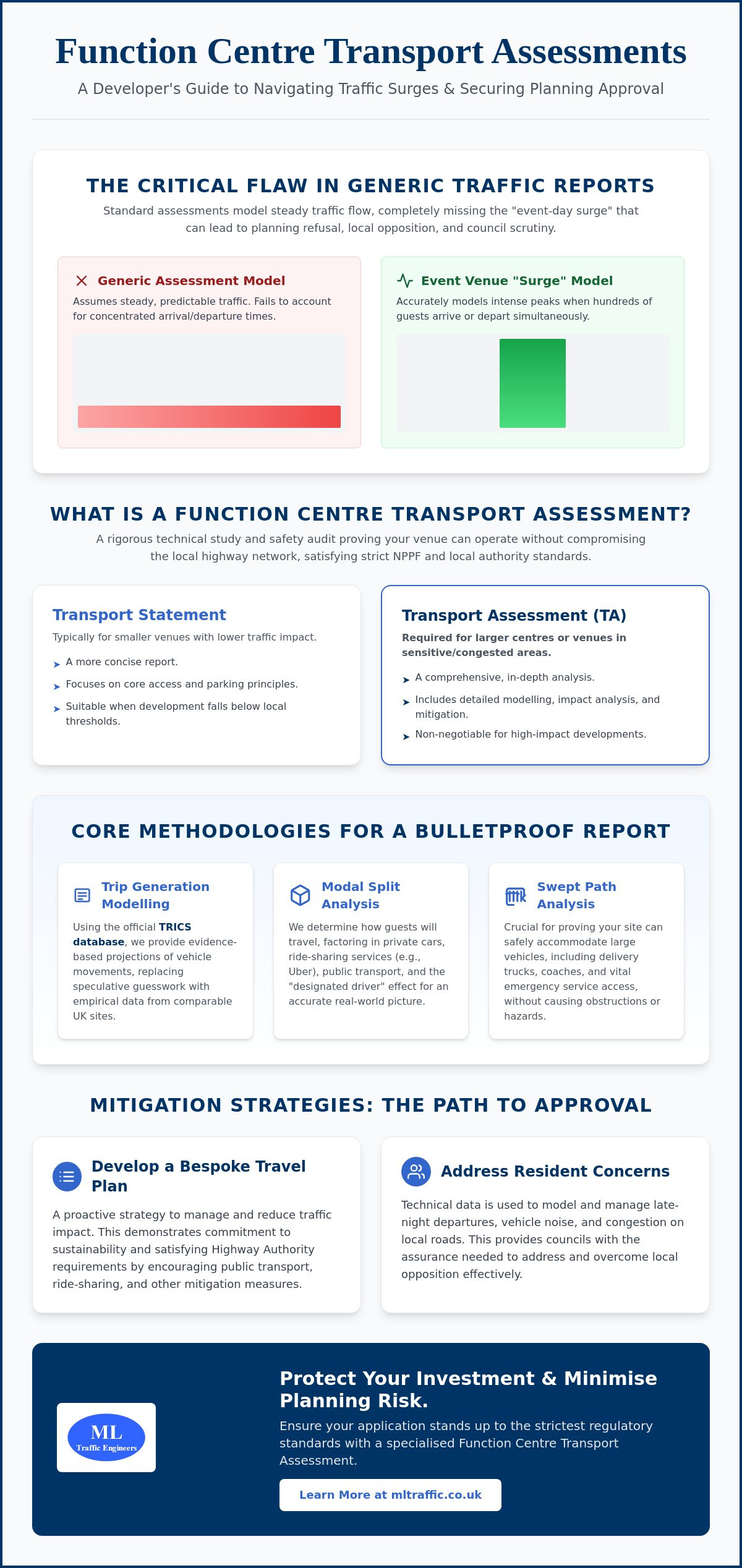
  • Hindu Temple Transport Assessment

    Hindu Temple Transport Assessment

    Standard transport models often fail for places of worship because they treat a spiritual community hub like a generic office block. If you’re managing a planning application, you’ve likely encountered the friction between rigid local authority parking standards and the reality of high-intensity traffic peaks during festivals like Diwali or Holi. It’s frustrating when a project that serves the public good is met with resident objections regarding parking overspill and road safety.

    We understand that securing a successful Hindu temple transport assessment requires more than just filling out forms; it demands a technical, data-led strategy that reflects the unique peaking patterns of your congregation. This guide provides a comprehensive roadmap to mastering the complexities of planning permission. You’ll learn how to leverage the latest TRICS data and bespoke parking surveys to satisfy the Highway Authority and mitigate local concerns.

    We’ll preview the essential steps for building a robust Travel Plan and optimizing your site layout for safe vehicle access. With the National Planning Policy Framework in transition throughout 2026, now is the time to adopt a “vision and validate” approach that ensures your development is both compliant and community-focused.

    Key Takeaways

    • Differentiate between a Transport Statement and a full assessment to align your application with the latest National Planning Policy Framework standards.
    • Utilize the TRICS database and bespoke parking surveys to generate credible trip rates that reflect your temple’s specific attendance patterns.
    • Implement tiered mitigation strategies to successfully manage traffic surges during major religious festivals and resolve local resident objections.
    • Secure a robust Hindu temple transport assessment by mastering pre-application engagement with Highway Authorities and National Highways.
    • Learn how professional traffic modeling optimizes site layouts for safe vehicle access and long-term regulatory compliance.

    What is a Transport Assessment for a Hindu Temple?

    A Hindu temple transport assessment is a specialized technical document required to evaluate the impact of a religious development on the local highway network. It differs significantly from a Transport Statement, which is typically reserved for smaller projects with minimal traffic generation. For Class F1 developments, the planning process in 2026 demands a high level of precision. This is because temples don’t follow the predictable 9-to-5 traffic patterns of an office or retail site. Instead, they produce concentrated peaks of activity that require careful modeling to avoid local gridlock.

    The National Planning Policy Framework (NPPF) serves as the primary regulatory anchor for these assessments. Currently, the industry is operating in a transition phase following the major policy review that concluded in March 2026. This means your report must reflect the latest “vision and validate” principles. Rather than just predicting traffic growth, you must demonstrate a commitment to sustainable transport and active travel from the outset. This ensures the site remains functional without placing an undue burden on existing infrastructure.

    To better understand the technical depth required for these reports, watch this helpful video:

    When is a Full Transport Assessment Required?

    Local planning authorities decide the level of reporting based on the scale of the development and its potential impact. While there’s no fixed national law, a full assessment is generally expected if the site generates more than 30 two-way vehicle movements in a single hour or over 100 movements per day. For a temple, these thresholds are often triggered by the size of the main prayer hall or the expected congregation during weekend services.

    Location significantly influences the scope of the work. Urban sites often face rigid parking caps and must prioritize public transport links. Conversely, rural developments may need to address vehicle speeds and visibility splays at site entrances. Because requirements vary between counties, we prioritize early engagement with highway officers to agree on the assessment parameters before work begins.

    The Core Components of a Temple Transport Report

    Every successful report starts with a rigorous analysis of baseline conditions. We collect real-time traffic data to understand how the local road network currently performs. This includes reviewing safety records and junction capacity to ensure the new development won’t compromise public safety. It’s about establishing a factual foundation that can withstand scrutiny from local residents and planning committees.

    Accessibility audits are equally vital. We examine the quality of pedestrian footways, the safety of cycling routes, and the frequency of nearby bus or rail services. By proving the site is accessible through multiple modes of transport, we strengthen the case for approval. This alignment with Local Transport Plans is essential for satisfying statutory consultees like National Highways or Transport for London.

    Technical Data: Trip Generation and Parking Standards

    Accurate data is the foundation of any Hindu temple transport assessment. We utilize the TRICS database to predict vehicle movements, but “Place of Worship” data can be broad and occasionally misleading. Following official government guidance, we ensure the selected data set matches the specific operational characteristics of your site. This involves filtering results to find comparable locations that mirror your temple’s size and geographic setting.

    Finding truly comparable sites is often the most significant hurdle in the planning process. A temple in a dense urban center operates differently than a suburban facility. We refine these models by analyzing congregation size and specific catchment areas. This level of precision prevents the Highway Authority from overestimating traffic impact based on generic or outdated data. Our team specializes in identifying these nuances to build a credible case for your development.

    Parking accumulation studies are equally vital for a successful application. We don’t just count cars; we analyze how long they stay and when they arrive. If you need to justify a lower number of on-site spaces, professional Parking Surveys provide the evidence required. These surveys prove whether local on-street capacity can safely handle overflow during peak times without causing a nuisance to neighbors. You can view our full range of technical traffic engineering services to see how we support complex applications with site-specific data.

    Calculating Trip Generation for Religious Festivals

    Standard Sunday peaks don’t represent the full operational reality of a temple. For major festivals like Diwali or Holi, we use survey data from existing temples to demonstrate how car-sharing reduces the total number of vehicles. High vehicle occupancy is a common cultural trait within the Hindu community. By documenting an average of three to four people per car, we can significantly lower trip rate estimates in the Hindu temple transport assessment, making the project more acceptable to planners.

    This strong sense of community often extends to shared travel experiences; for those interested in organizing group visits to spiritual landmarks in India or Southeast Asia, you can learn more about Tailormade Journeys Limited.

    Meeting (and Challenging) Local Parking Standards

    UK planning policy continues to shift toward maximum parking standards to discourage private car use. In high PTAL areas, particularly across London, we frequently justify “Zero-Parking” schemes for new religious developments. However, we must still strictly adhere to 2026 requirements for disabled bays and electric vehicle (EV) charging points. We balance these rigid standards with practical site layouts that prioritize safety and accessibility for all visitors, regardless of how they choose to travel.

    Overcoming Objections: Managing Festival Peaks and Congestion

    The most frequent objection to new religious developments is the perceived impact on the local road network during major events. While a site might function perfectly on a weekday afternoon, resident concerns focus on the high-intensity peaks of Diwali, Holi, or Janmashtami. A successful Hindu temple transport assessment must address these fears with technical precision rather than vague promises. We utilize site-specific Traffic Surveys to establish exactly how much spare capacity exists at nearby junctions. This data allows us to prove that the network can absorb temporary increases in volume when the right management is in place.

    We implement tiered mitigation strategies to separate daily operations from peak festival management. According to official government guidance, mitigation must be proportionate to the impact of the development. For standard days, the focus remains on onsite parking and pedestrian safety. For festivals, we deploy advanced measures such as temporary traffic marshals, off-site parking agreements, and pre-booked arrival slots. This proactive approach reassures the Highway Authority that the community has a clear, actionable plan for every scenario.

    The Role of a Robust Travel Plan

    A Travel Plan is a dynamic document that sets measurable targets for reducing single-occupancy car journeys. We often propose shuttle bus services from local rail stations during major festivals to intercept visitors before they reach the site. Appointing a Travel Plan Coordinator is a critical step in this process. This individual monitors community compliance and ensures that sustainable travel initiatives remain effective long after the planning permission is granted. It turns a technical report into a living commitment to local road safety and civic responsibility.

    Swept Path Analysis for Temple Sites

    Temple forecourts are often architecturally complex and space-constrained. We use Swept Path Analysis to simulate the movement of refuse vehicles, fire tenders, and coaches within these tight spaces. It’s vital to demonstrate that emergency vehicles can access the site and exit in a forward gear without requiring dangerous multiple-point turns. We also ensure that delivery vehicles and visitor coaches can complete “In and Out” manoeuvres safely without obstructing the public highway. Our engineers utilize AutoTURN software to verify vehicle swept paths, which prevents costly layout revisions during the late stages of the planning phase.

    Hindu Temple Transport Assessment

    Successful planning outcomes depend on early collaboration with the Local Highway Authority. Before submitting your Hindu temple transport assessment, you should engage in pre-application discussions to agree on the study area and the scope of junction modeling. This proactive step prevents the rejection of your technical data later in the process. It also provides a platform to address resident concerns before they escalate into formal objections during the public consultation phase. We manage these early-stage meetings to ensure the assessment parameters are both fair and achievable.

    When your site sits near a major A-road or motorway, National Highways will act as a statutory consultee. Their review follows DfT Circular 01/2022, which prioritizes sustainable development over road capacity expansion. If your project is in the capital, Transport for London (TfL) will assess your application against the London Plan healthy streets indicators. We coordinate these high-stakes negotiations on your behalf. Our engineers provide the technical responses needed to satisfy every regulatory body, keeping your project moving through the planning portal without unnecessary friction.

    Understanding Section 278 (S278) Requirements

    A Section 278 Agreement is necessary when your development requires changes to the existing public highway. This often happens when a new temple needs a safe vehicle entrance or a pedestrian crossing to connect to a nearby bus stop. These agreements are legally binding and involve specific financial obligations for the developer. Common S278 works include:

    • New or improved site access points for better visibility.
    • Junction widening to accommodate coach turning circles.
    • Installation of traffic signals or zebra crossings to protect visitors.
    • Footway improvements to enhance pedestrian safety and site accessibility.

    Costs for these works include the construction itself, alongside the highway authority’s fees for design checks, legal reviews, and site supervision. You’ll likely need to provide a highway bond to guarantee the works are completed to the required standard. Because these fees are not standardized and are specific to each project, early cost estimation is vital for your project budget.

    Securing Approval via Transport Statements

    For smaller religious developments, a full assessment might be unnecessary. A well-drafted Transport Statement can often satisfy the planning officer if the expected vehicle movements fall below the 30-per-hour threshold. This shorter report still requires a high level of technical accuracy to be planning-ready. We include a summary of expected visitor numbers, an analysis of local public transport, and a clear description of the proposed temple use. Precision in your data serves as the primary defence against planning appeals and costly delays. If you need professional support for your application, contact our traffic engineers for a detailed project review.

    Why Choose ML Traffic Engineers UK for Temple Developments?

    Securing planning approval for a place of worship requires a partner who understands the intersection of religious practice and highway regulations. ML Traffic Engineers UK provides a specialized service that bridges the gap between technical engineering and community focused planning. We’ve built a reputation for securing approvals for F1 Class developments by delivering precision led reports that satisfy even the most stringent local authorities. Our team manages every stage of the process in house. From the initial Traffic Surveys to the final submission of your Hindu temple transport assessment, we maintain total control over data quality and technical accuracy.

    We prioritize a safety-first approach. This protects the interests of your congregation while addressing the safety concerns raised by planning committees. For many religious organizations, this dedication to safety also involves ensuring that volunteers and staff are prepared for medical emergencies through First Medical Training Ltd. Our experts don’t just provide data; we provide solutions that reduce regulatory pressure on your team. By handling the technical lexicon and highway negotiations, we allow you to focus on the spiritual and community aspects of your development. Our readiness to act and constant availability make us a reliable partner for high-stakes infrastructure projects.

    Our Tailored Approach to Religious Sites

    Generic engineering firms often miss the nuances of religious peaking patterns. We model these specific surges with accuracy, ensuring that your application reflects the actual behavior of your community. Our extensive experience negotiating with London Boroughs and County Councils across England gives us a distinct advantage. We understand the local variations in parking standards and accessibility requirements that can make or break an application. You can contact ML Traffic Engineers UK today for a bespoke project review to discuss your site’s specific challenges.

    Case Studies: Turning Objections into Approvals

    Our track record includes numerous urban temple projects where initial resident objections threatened to derail the planning process. Through detailed Swept Path Analysis, we’ve demonstrated that even the most constrained sites can accommodate emergency vehicles and coaches safely. Our robust Travel Plans have successfully shifted the focus from car dependency to sustainable access, often convincing highway officers to support the development.

    These technical interventions do more than just secure approval. They often result in significant cost savings for our clients. By proving that certain off-site improvements are unnecessary or by negotiating fairer terms for Section 106 or Section 278 agreements, we reduce the financial burden on the developer. Every client receives direct access to our senior consultants. This ensures that high-level expertise is applied to every Hindu temple transport assessment, providing the unwavering reliability your project demands.

    Secure Your Planning Approval with Technical Precision

    Securing planning permission for a place of worship requires a strategy that balances technical compliance with community needs. We’ve explored how data-driven trip generation models and tiered festival management plans turn local objections into a clear path for approval. A professional Hindu temple transport assessment provides the technical evidence necessary to satisfy the Highway Authority and protect your development’s future.

    Founded in 2014, ML Traffic Engineers UK brings over a decade of UK planning expertise to your project. Our team delivers professional, safety-conscious reporting that meets all statutory requirements, from Swept Path Analysis to detailed Parking Surveys. We manage the full project lifecycle, ensuring your site layout is optimized for safe vehicle access and long-term regulatory compliance. Don’t let complex highway regulations or resident concerns delay your spiritual mission.

    Request a Transport Assessment Quote for Your Temple Project to receive a bespoke review from our senior consultants. We’re ready to help you build a lasting, accessible foundation for your congregation.

    Frequently Asked Questions

    Do I need a Transport Assessment for a small community temple?

    Whether you need a full Hindu temple transport assessment depends on the scale of your congregation and the expected vehicle movements. Smaller developments that generate fewer than 30 two-way vehicle movements in any hour typically only require a Transport Statement. However, if your site is in a sensitive area or has limited access, the council might still request a more detailed report to ensure local road safety isn’t compromised.

    How does a Travel Plan help in getting planning permission for a place of worship?

    A Travel Plan acts as a formal commitment to reducing car dependency and promoting sustainable transport like cycling or public transport. It helps secure planning permission by proving to the Highway Authority that you have a proactive strategy to manage visitor numbers. By setting measurable targets and appointing a coordinator, you demonstrate that the temple won’t cause long-term congestion or parking stress in the neighborhood.

    What is the Lambeth Methodology for parking surveys, and does it apply to temples?

    The Lambeth Methodology is a standard industry practice used to measure “parking stress” on local streets. While councils originally designed it for residential developments, we often adapt it for temples to prove that enough on-street capacity exists during peak service times. These surveys involve counting parked cars late at night and during your busiest weekend hours to show that visitors won’t block access for residents.

    Can the council refuse my temple application based on traffic alone?

    The council can refuse an application if the transport impact is considered “severe” under the National Planning Policy Framework. This usually happens when a development causes dangerous levels of congestion or lacks safe access for pedestrians and emergency vehicles. Our role is to provide technical data and mitigation strategies that prove the impact is manageable, preventing a refusal based on anecdotal traffic concerns from local objectors.

    How much does a Hindu temple transport assessment typically cost?

    The cost of a Hindu temple transport assessment varies significantly based on the project’s scale and the number of junctions we need to model. Factors like the requirement for manual traffic counts, the complexity of the site layout, and the need for multi-day parking surveys will influence the final fee. We provide bespoke quotes that reflect the specific technical requirements of your local highway authority and the size of your development.

    What is Swept Path Analysis and why is it required for my site?

    Swept Path Analysis uses specialized software like AutoTURN to simulate the movement of large vehicles within your site layout. It’s a mandatory requirement for most planning applications to prove that fire tenders, refuse trucks, and visitor coaches can enter and exit the site safely in a forward gear. This analysis ensures your design functions correctly before construction begins, preventing costly revisions to the site’s physical boundaries or access points.

    How do we handle traffic management for Diwali and other major festivals?

    We manage high-intensity festival peaks through a tiered Traffic Management Plan that triggers additional measures during major events. This often includes hiring professional marshals to direct cars, using off-site “park and ride” locations, and implementing a pre-booked arrival system for visitors. These measures are detailed in your transport report to reassure planners that your community can handle surges like Diwali without disrupting the wider local road network.

    What is the difference between a Transport Statement and a Transport Assessment?

    The primary difference lies in the scale of the development and the depth of the technical analysis. A Transport Statement is a concise report for smaller projects with limited traffic impact. In contrast, a full assessment is a comprehensive document that includes detailed junction modeling and a much wider study area. We determine which report you need by reviewing your floor area and expected visitor numbers against local highway authority thresholds.

    Michael Lee

    Article by

    Michael Lee

    Transport planner with over 35 years' experience.

    Disclaimer

    The content on mltraffic.co.uk, including all technical articles, guides, and resources, is provided for general informational and educational purposes only. It is not intended to constitute professional advice in traffic engineering, transportation planning, development approvals, or any other technical or legal field.
    While ML Traffic Engineers makes every reasonable effort to ensure the accuracy, completeness, and timeliness of the information published, we do not provide any warranties or representations (express or implied) regarding its reliability, suitability, or availability for any particular purpose. Any reliance you place on the content is strictly at your own risk.
    In no event shall ML Traffic Engineers, its directors, employees, authors, or affiliates be liable for any direct, indirect, incidental, special, consequential, or punitive damages (including, without limitation, loss of profits, data, or business opportunities) arising out of or in connection with the use of, or inability to use, any information provided on this website.
    The articles and guides on this site are not a substitute for engaging a qualified, professional traffic engineer to assess your specific project requirements. For tailored advice, compliance assessments, or traffic engineering services, please contact a competent professional.
    This disclaimer may be updated from time to time without notice. By accessing or using this website, you agree to be bound by the most current version of this disclaimer.
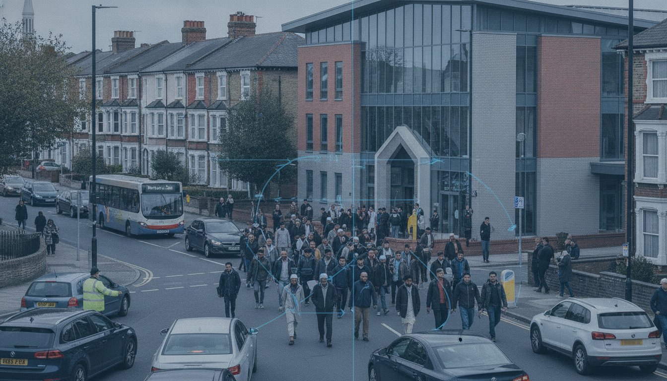
  • Pedestrianising High Streets: Design & Regeneration

    Pedestrianising High Streets: Design & Regeneration

    With nearly 13,000 UK shops closing in 2024 at a rate of 37 per day, the survival of town centres depends on more than just aesthetic upgrades. Effective pedestrianisation high street public realm design and regeneration requires a precise balance between creating inviting spaces and maintaining the logistical integrity of the surrounding urban network. It’s not enough to simply remove cars; you must ensure the scheme remains accessible, compliant, and economically viable for all stakeholders.

    You’ve likely faced resistance from local businesses worried about car-free schemes or concerns that traffic will simply displace into residential zones. These logistical pressures are significant, but they shouldn’t stall progress. This article explains how to transform declining high streets into thriving, pedestrian-first spaces while navigating technical complexities like Section 278 negotiations and traffic displacement. We’ll explore how data-driven tools, including Swept Path Analysis and professional Transport Assessments, provide the evidence needed to secure planning permission and increase property value. You’ll gain a clear roadmap for creating a safe, accessible urban environment that meets the latest government standards and supports long-term growth.

    Key Takeaways

    • Understand why successful high street regeneration in 2026 relies on transitioning from traditional retail centres to diverse, experience-led urban hubs.
    • Master the technical complexities of pedestrianisation high street public realm design and regeneration to ensure your scheme balances increased footfall with efficient traffic management.
    • Resolve logistical conflicts by using timed delivery windows and Swept Path Analysis to maintain essential service access without compromising pedestrian safety.
    • Streamline the planning process by leveraging professional Transport Statements and Travel Plans to meet strict regulatory standards and secure S278 agreements.
    • Use precise Traffic Surveys to provide the data-backed evidence needed to overcome political resistance and demonstrate the long-term economic value of your project.

    High Street Regeneration: Why Pedestrianisation is Essential in 2026

    Urban regeneration in 2026 isn’t about simple cosmetic fixes; it focuses on the strategic repurposing of the public realm to combat the decline of traditional retail. Pedestrianisation serves as the primary mechanism for this shift. By transforming vehicle-dominated corridors into pedestrian zones, local authorities and developers create “experience hubs” that prioritize social interaction over mere transactions. This approach directly supports the “15-minute city” concept, where residents access essential services within a short walk or cycle. Successful planning applications now frequently rely on this model to demonstrate community benefit and long-term sustainable growth.

    To better understand the global standards for these projects, watch this helpful video:

    The Economic Case: Beyond the Pedestrian Pound

    The link between footfall and retail spend is well-documented. On a traffic-free day in September 2025, 67% of Oxford Street stores reported higher sales. When people feel safe and comfortable, they stay longer. Increased dwell time directly correlates with higher transaction values in hospitality and retail. For developers, high-quality public realm design attracts premium commercial tenants who value long-term stability and access to high-quality maintenance; for reliable heating and gas services, check out Plumbing & Boilers London. Data from the Voices of Retail 2026 report shows that 71% of independent retailers are now stable or growing. These businesses thrive in environments where pedestrianisation high street public realm design and regeneration are prioritized, as it creates a destination rather than just a thoroughfare. This shift also bolsters the evening economy, turning quiet retail streets into vibrant hospitality zones after 6:00 PM.

    Environmental and Social Governance (ESG) in Urban Design

    Modern regeneration must address Net Zero targets. Removing cars reduces local emissions and allows for the installation of green infrastructure. This helps mitigate the “Urban Heat Island” effect through strategic planting and permeable paving, which also manages surface water runoff. Social inclusion is equally vital. A compliant public realm must be accessible to all ages and abilities. This level of technical precision is essential when preparing a Transport Statement for a new development. It proves that the scheme isn’t just aesthetic; it’s a functional, inclusive, and environmentally responsible piece of infrastructure that meets modern ESG benchmarks.

    Core Principles of Successful Public Realm Design

    Successful pedestrianisation high street public realm design and regeneration starts with the Movement and Place framework. This principle ensures that we don’t treat streets solely as conduits for through-traffic. Instead, we must recognize their function as vital social and commercial destinations. Designers face a choice between tactical urbanism and permanent infrastructure. Temporary trials, such as those used in London’s West End, allow for real-time data collection and community feedback before you commit to significant capital expenditure. Integrating multi-modal transport hubs is equally essential. High streets must accommodate bus priority, cycle storage, and pedestrian flow without creating visual clutter. Street furniture should be legible, meaning its placement and design intuitively guide users through the space without the need for excessive signage.

    Adhering to the Manual for Streets (MfS)

    Planning authorities expect designs to align with the latest Manual for Streets guidance. The 2026 update reinforces a strict hierarchy of road users that prioritizes pedestrians and cyclists over private motor vehicles. Technical durability is just as important as aesthetics. Paving materials must withstand heavy cleaning equipment and occasional emergency vehicle access while maintaining a premium finish. Designing for Self-Explaining Roads is a key safety strategy. Physical cues, such as narrowed carriageways and raised tables, naturally lower vehicle speeds. This creates a safer environment through engineering rather than relying solely on enforcement or speed limit signs.

    Healthy Streets Indicators and Public Realm

    The Healthy Streets indicators provide a quantifiable way to measure project success. While developed by TfL, these metrics apply to any UK high street regeneration project. Providing adequate shade, shelter, and places to rest increases stay time and accessibility for elderly or disabled visitors. Noise pollution remains a major barrier to dwell time. Traffic evaporation strategies, where reducing road capacity leads to a reduction in total traffic volume, help encourage modal shifts to walking or cycling. To ensure your design meets these rigorous standards, professional Swept Path Analysis can verify vehicle accessibility within tight urban layouts while protecting pedestrian zones.

    Balancing the ‘Pedestrian Pound’ with Essential Servicing Access

    The primary objection to pedestrianisation high street public realm design and regeneration usually comes from local retailers asking how deliveries will reach their stores. If a business cannot receive stock, its commercial viability disappears. However, modern urban logistics prove that you don’t need constant vehicle access to maintain a thriving economy. The Build Back Better High Streets strategy highlights that successful schemes must integrate servicing plans that respect both the pedestrian experience and the needs of businesses. By implementing timed access and specific delivery windows, you can ensure that heavy goods vehicles only enter the space during low-footfall hours, typically before 10:00 AM or after 4:00 PM.

    Logistics and Servicing Strategies

    Innovative logistics are essential for high-density urban environments. Micro-consolidation centres allow large hauliers to drop off goods at a peripheral hub, with the final-mile delivery handled by cargo bikes or small electric vehicles. This reduces the number of large trucks entering the high street while maintaining rapid stock replenishment. We also advocate for multi-functional public spaces. Loading bays can be designed to serve as essential delivery points in the early morning but transition into outdoor seating, parklets, or market stalls during peak trading hours. This dual-use approach ensures that every square metre of the public realm provides maximum value throughout the day.

    Technical Validation via Swept Path Analysis

    Technical precision is the only way to overcome political and commercial skepticism. We use Swept Path Analysis to simulate the exact movements of refuse trucks and fire tenders within the proposed layout. It’s vital to prove that tight urban radii and new street furniture don’t block emergency vehicle access. Using AutoTurn software, we can model various vehicle classes to ensure the design is safe and compliant with highway standards. SPA prevents costly kerb-side redesigns post-construction by identifying physical constraints during the initial design phase. This data-backed approach provides the reassurance planning authorities need to approve car-free zones. It demonstrates that the scheme is not just a visual improvement, but a functionally sound piece of infrastructure that accommodates essential services without compromise.

    Securing planning permission for pedestrianisation high street public realm design and regeneration requires more than a vision; it demands a robust technical evidence base. Local highway authorities prioritize safety and network capacity above all else. You must prove that your scheme won’t cause gridlock on adjacent roads or compromise emergency response times. This starts with conducting comprehensive Traffic Surveys to establish accurate baseline data. Without this foundation, your proposals risk being dismissed during the initial consultation phases by skeptical council officers or local residents.

    A professionally prepared Transport Statement is the most critical document in your application. It details how the scheme manages vehicle movements, deliveries, and pedestrian safety. Effective stakeholder management also plays a vital role. You need to align the interests of Business Improvement Districts (BIDs), local residents, and council members who may fear the loss of parking or increased congestion. Providing data-backed reassurance early in the process reduces friction and builds the political will necessary for approval. We bridge the gap between design aspiration and highway reality by providing the precision these authorities demand.

    Transport Assessments for Large Scale Regeneration

    Smaller schemes usually only require a Statement, but large-scale transformations often trigger the need for a full Transport Assessment. This is necessary when the project significantly impacts the wider road network or involves major changes to traffic flow. You’ll need to use junction modelling to predict traffic displacement and ensure that surrounding intersections can handle the diverted load. For a deeper look at the technical requirements, consult our 2026 Guide to Transport Assessments. This methodology ensures your project stands up to rigorous scrutiny from statutory consultees during the planning journey.

    Securing S278 and S38 Agreements

    Once you secure planning permission, you must enter into legal agreements with the highway authority. A Section 278 (S278) agreement is required for any works on the existing public highway, such as widening pavements or installing new crossings. Section 38 (S38) agreements cover the adoption of new roads. To minimize delays, your technical audit submissions must be precise and fully compliant with local standards. Errors in these documents can stall construction for months. We manage this entire process, from initial submission to final sign-off, ensuring your designs meet every regulatory benchmark. If you need expert support to navigate these complexities, view our full range of technical services to see how we can assist your project.

    Pedestrianising High Streets: Design & Regeneration

    Expert Traffic Engineering: Securing Approval for Regeneration

    The journey from initial concept to final planning submission requires a sequential approach. It begins with feasibility studies and robust Traffic Surveys to understand existing conditions. From there, we move into technical modelling and the production of formal reports. These documents provide the objective evidence that planning officers require to recommend a scheme for approval. We understand the intricate regional regulations and industry benchmarks, allowing you to focus on the broader goals of your regeneration project while we handle the logistical and regulatory pressures.

    Developing a Comprehensive Travel Plan

    A data-backed Travel Plan is essential for any modern high street project. It’s not enough to simply remove cars; you must actively encourage sustainable transport modes for both employees and visitors. Effective Travel Plans set measurable targets for modal shift, outlining specific strategies to increase walking, cycling, and public transport use. This reduces the overall pressure on the surrounding road network and supports the long-term viability of pedestrian-first spaces. For a detailed look at how these documents strengthen your application, read our Travel Plan Consultants Guide. This methodology ensures your scheme aligns with the latest sustainable planning requirements for 2026.

    Partnering with ML Traffic Engineers UK

    We specialize in navigating the complex English planning landscape for pedestrianisation high street public realm design and regeneration. Our team provides tailored technical reporting, from initial Transport Assessments to detailed Swept Path Analysis. We take pride in our precision and adherence to standards, ensuring every project meets the strict criteria set by local highway authorities. Whether you are managing a small-scale town centre improvement or a major city-wide transformation, ML Traffic Engineers UK offers the technical authority and readiness your project demands. We provide an all-encompassing, fully-managed service that guides you through every stage of the planning journey. Contact ML Traffic Engineers UK for a project consultation to discuss how our expertise can secure the future of your development.

    Securing the Future of the High Street

    Town centre survival now depends on shifting toward experience-led, pedestrian-first environments. This transformation requires a balance between bold urban vision and the technical realities of the highway network. Successful pedestrianisation high street public realm design and regeneration projects use data-backed strategies to overcome stakeholder resistance and ensure long-term commercial viability. By addressing logistical concerns through timed access and micro-consolidation, you can create a space that serves both local businesses and the wider community.

    Navigating these technical complexities demands a partner with a deep understanding of regional regulations and safety standards. Our specialist consultants provide the precision needed for S278 and S38 agreements, alongside expert Swept Path Analysis using the latest AutoTurn software. We maintain a proven track record with UK local highway authorities, ensuring your planning application stands up to the most rigorous scrutiny. We reduce the regulatory pressure on your team by managing the full technical lifecycle of your project.

    Ready to move from vision to execution? Get Expert Transport Planning Support for Your Regeneration Project. We provide the professional, reliable expertise needed to deliver a safe and compliant urban environment.

    Frequently Asked Questions

    What is the “Pedestrian Pound” and why does it matter for regeneration?

    The “Pedestrian Pound” refers to the total economic expenditure of people who walk, cycle, or use public transport to reach a high street. Data shows that shoppers on foot often visit more frequently and spend more over time than those arriving by car. This matters for regeneration because it provides a commercial justification for removing parking spaces in favour of wider pavements and social areas. High-quality environments encourage visitors to stay longer, which directly increases transaction values for local hospitality and retail businesses.

    How does pedestrianisation affect traffic in surrounding residential streets?

    Traffic in surrounding areas is managed through either displacement or evaporation. While some vehicles may move to adjacent roads, well-designed schemes often lead to “traffic evaporation,” where the total number of car trips reduces as people switch to active travel. We use junction modelling and Traffic Surveys to predict these shifts accurately. This data allows us to implement mitigation measures that protect residential streets from increased congestion while maintaining the integrity of the urban network.

    Is a Transport Statement required for small-scale public realm improvements?

    Yes, local highway authorities usually require a Transport Statement for any change that alters the use of a public highway. Even minor improvements, such as installing new seating or narrowing a carriageway, must be assessed for safety and compliance. This document proves to the council that the changes won’t negatively impact road safety or emergency vehicle access. It provides the technical evidence needed to secure planning permission and ensures the scheme meets all statutory requirements.

    Can emergency vehicles still access fully pedestrianised high streets?

    Emergency vehicles maintain full access through the use of specific design features like removable bollards or reinforced paving. We ensure that the public realm remains permeable for fire tenders and ambulances while remaining car-free for the general public. Swept Path Analysis is used during the design phase to verify that these large vehicles can navigate the proposed layout without being obstructed by street furniture or planting. This ensures that public safety is never compromised by regeneration efforts.

    How do businesses receive deliveries in a car-free zone?

    Deliveries are managed through timed access windows and designated loading bays. Most schemes allow heavy goods vehicles to enter the pedestrian zone during early morning or late evening hours when footfall is at its lowest. Some modern developments also utilize micro-consolidation centres and cargo bikes for final-mile delivery. This allows shops to stay fully stocked without having large trucks idling in the street during peak trading hours. These logistics strategies are a core part of successful pedestrianisation high street public realm design and regeneration.

    What is a Section 278 agreement in the context of high street works?

    A Section 278 (S278) agreement is a legal contract between a developer and the local highway authority. It is required whenever a private project involves making permanent alterations to an existing public road or pavement. In high street regeneration, this agreement covers works like installing new paving, changing kerb lines, or adding pedestrian crossings. We manage the technical audit process for these agreements to ensure your designs meet the authority’s strict engineering standards and avoid construction delays.

    Does pedestrianisation always lead to an increase in retail sales?

    Pedestrianisation leads to sales growth when it is paired with high-quality design and easy accessibility. Simply closing a road to cars isn’t enough; the space must be inviting, safe, and well-connected to public transport. When these conditions are met, the results are significant. For example, during traffic-free trials on Oxford Street in 2025, 67% of retailers reported an increase in sales. The goal is to create a destination that people want to visit for the experience, not just for a specific transaction.

    How is Swept Path Analysis used in public realm design?

    Swept Path Analysis is a technical simulation used to model the movement of vehicles through a proposed street layout. We use it to verify that refuse trucks, delivery vans, and emergency vehicles can clear new corners and navigate around street furniture. This is a critical step in the design process because it identifies physical constraints before any construction begins. By proving that essential vehicles can still operate, we help developers secure approval from skeptical highway officers and prevent costly redesigns later in the project.

    Michael Lee

    Article by

    Michael Lee

    Transport planner with over 35 years' experience.

    Disclaimer

    The content on mltraffic.co.uk, including all technical articles, guides, and resources, is provided for general informational and educational purposes only. It is not intended to constitute professional advice in traffic engineering, transportation planning, development approvals, or any other technical or legal field.
    While ML Traffic Engineers makes every reasonable effort to ensure the accuracy, completeness, and timeliness of the information published, we do not provide any warranties or representations (express or implied) regarding its reliability, suitability, or availability for any particular purpose. Any reliance you place on the content is strictly at your own risk.
    In no event shall ML Traffic Engineers, its directors, employees, authors, or affiliates be liable for any direct, indirect, incidental, special, consequential, or punitive damages (including, without limitation, loss of profits, data, or business opportunities) arising out of or in connection with the use of, or inability to use, any information provided on this website.
    The articles and guides on this site are not a substitute for engaging a qualified, professional traffic engineer to assess your specific project requirements. For tailored advice, compliance assessments, or traffic engineering services, please contact a competent professional.
    This disclaimer may be updated from time to time without notice. By accessing or using this website, you agree to be bound by the most current version of this disclaimer.
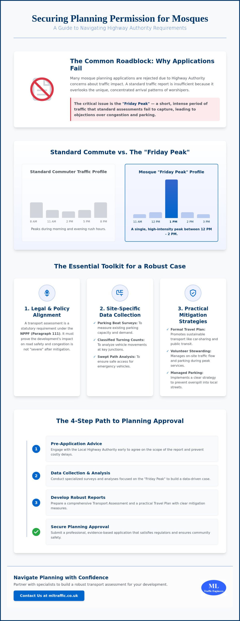
  • Sporting Facilities Transport Assessment: A Guide for Developers

    Sporting Facilities Transport Assessment: A Guide for Developers

    Can your sports development survive the logistical “match-day crunch” without alienating the entire local community? You’re likely facing the dual pressure of minimizing traffic mitigation costs while satisfying local authorities who are wary of parking overspill and congestion. It’s a high-stakes balancing act where a single technical oversight can lead to expensive delays or a flat refusal at the planning committee. Under the National Planning Policy Framework updated in February 2025, the margin for error in your submission has never been smaller.

    This guide will help you master the complexities of a sporting facilities transport assessment so you can secure planning permission and manage peak event traffic with precision. You’ll learn how to navigate the latest vision-led Local Transport Plan guidance and determine exactly when a full Assessment is required over a simpler Transport Statement. We will preview the essential steps for designing cost-effective car parks and robust match-day management plans that meet every regulatory benchmark while protecting public safety. From utilizing the TRICS database to performing a detailed Swept Path Analysis, we provide the technical clarity you need to move your project from inception to completion.

    Key Takeaways

    • Identify whether your development requires a comprehensive sporting facilities transport assessment or a streamlined Transport Statement based on specific vehicle movement thresholds.
    • Learn to manage the “peak-of-peaks” traffic phenomenon by aligning match-day demand with robust management strategies and local infrastructure capacity.
    • Utilize parking surveys and PTAL scores to justify parking provision that meets regulatory standards without incurring unnecessary construction costs.
    • Secure planning permission by integrating essential Travel Plans that set measurable targets for sustainable access and modal shift.
    • Apply technical data from Traffic Surveys and Swept Path Analysis to guarantee safe, reliable access for emergency services and large vehicles like team coaches.

    Understanding Transport Planning Requirements for Sports Developments

    A sporting facilities transport assessment is a technical, site-specific study designed to evaluate how a new or expanded development impacts the local highway network. Unlike residential or commercial projects, sports venues produce a “peak-of-peaks” traffic phenomenon. This occurs when large volumes of spectators arrive and depart simultaneously within a narrow window, putting extreme pressure on local junctions and public transport links. Failing to account for this surge can lead to gridlock and immediate planning refusal.

    The transportation planning process for these sites must account for these surges to prevent local infrastructure failure. Regulatory compliance is anchored in the National Planning Policy Framework (NPPF), which was updated in February 2025. This version places a heavier burden on developers to demonstrate how their site aligns with Net Zero targets and enhanced road safety standards. Successful applications require early consultation with key stakeholders. Local Highway Authorities focus on capacity and safety, while Sport England ensures the facility meets strategic community needs. Local residents often provide the strongest opposition, usually centered on parking overspill and residential amenity.

    To better understand this concept, watch this helpful video:

    The Strategic Importance of Transport in Planning

    Transport accessibility is a fundamental driver of a venue’s commercial viability. If fans can’t reach the site efficiently, attendance suffers and operational costs rise. Modern planning policy has shifted heavily toward sustainable transport. This requires developers to balance daily community access with the massive regional draw of major events. We help clients bridge this gap by providing data-driven insights that satisfy both commercial goals and local authority mandates. You can find more detail on our comprehensive approach in our technical service overview.

    When is a Formal Assessment Triggered?

    The scale of your project dictates the depth of the study required. A small local gym or a minor pitch expansion might only need a simplified Transport Statement. However, larger developments like regional leisure centres or multi-use stadiums typically trigger a full assessment. Pre-application discussions with highway officers are vital for defining the study area. These meetings set the scope of the work and identify whether existing local congestion will complicate your application. If a site generates 30 or more two-way vehicle movements in any peak hour, or 100 movements per day, a comprehensive sporting facilities transport assessment is almost always mandatory. We ensure these technical thresholds are managed accurately from the start.

    Transport Statement vs. Transport Assessment: Which Do You Need?

    Determining whether your project requires a Transport Statement or a full Assessment is a critical first step in the planning process. Local authorities typically set these requirements based on the scale of the development and its potential impact on the highway. While residential sites often follow predictable trip patterns, sports venues are judged more strictly due to their concentrated arrival and departure windows. A sporting facilities transport assessment is generally mandatory for developments generating 30 or more two-way vehicle movements in any peak hour, or 100 or more movements per day.

    The criteria for selection involve several factors, including Gross Floor Area (GFA), spectator capacity, and projected trip generation. Planning officers look at these metrics to gauge if the local network can absorb the sudden influx of users. Because sports venues create high-intensity traffic “pulses,” even a relatively small facility might trigger a full Assessment if it sits near a congested junction. We recommend consulting with highways officers early to define the scope of work and avoid unnecessary technical delays. If you are unsure of your project’s specific requirements, our team provides clarity through our comprehensive transport planning services.

    The Transport Statement: For Smaller Sporting Sites

    A Transport Statement serves as a streamlined report for lower-impact developments. This includes small community gyms, local football pitches, or minor extensions to existing leisure centres. The document focuses on local access points, parking provision, and cycle storage to prove the daily traffic increase is negligible. You must demonstrate that the site aligns with the latest guidance on Sustainable Access and Travel Plans to satisfy local planning policies. Robust Statements rely on accurate site observations and basic trip data to reassure planners that local residents will not face parking overspill.

    The Transport Assessment: For High-Impact Venues

    Large leisure centres, professional stadiums, and multi-use hubs require a far more rigorous technical approach. A full Assessment involves complex junction modelling using industry-standard software to simulate peak-hour performance. We utilize the TRICS database to establish accurate trip generation figures, comparing your site against similar facilities nationwide. This analysis must also account for the cumulative impact of other nearby developments to ensure the highway remains safe and functional. For these high-stakes venues, the Assessment acts as the foundation for your match-day traffic management strategy and long-term mitigation plans.

    Managing Peak Event Demand and Parking Requirements

    High-intensity sports events create a unique strain on local infrastructure that standard commercial developments do not face. Standard local authority parking ratios often fail to account for the intense arrival and departure windows of a stadium or leisure centre. This creates a direct conflict between providing enough spaces for spectators and adhering to council policies that aim to reduce car dependency. A robust sporting facilities transport assessment must bridge this gap by demonstrating how peak demand will be handled without causing local gridlock or safety hazards.

    In urban environments, we use technical Parking Surveys to justify lower-than-standard provision, particularly in areas with high accessibility. For instance, the London Plan 2026 mandates car-free developments in areas with a Public Transport Accessibility Level (PTAL) score of 4 or higher. By collecting accurate baseline data, we prove that multi-modal arrival strategies are viable alternatives to massive on-site car parks. These strategies include dedicated coach bays, shuttle services, and “park and walk” schemes. This data-driven approach is the most effective way to dismantle the primary resident objection that fans will inevitably park on residential streets.

    Car Park Design and Access Efficiency

    Efficiency in car park design is focused on the speed of egress. A sports facility car park must be engineered to empty rapidly after an event without backing up onto the main highway network. We prioritize layouts that include natural surveillance and clear sightlines to protect public safety. Modern standards also require significant future-proofing for sustainable travel. Under current 2026 regulations, all permitted parking spaces must include 100% active electric vehicle charging points. We manage these intricate technical requirements throughout the project lifecycle as part of our comprehensive transport planning services.

    Match-Day Traffic Management Plans (TMPs)

    Securing planning permission often hinges on a robust Match-Day Traffic Management Plan. This document proves to the council that you can manage peak flows safely and predictably through operational control. It outlines the implementation of temporary traffic orders, specialized signage, and the deployment of transport marshals at key junctions. Coordination with local police is essential for high-capacity venues to ensure public safety remains the non-negotiable foundation of the event. By providing a clear, logical sequence for event-day operations, we reduce the regulatory pressure on developers and provide the technical authority needed for a successful submission. Our technical resources offer further insight into these specific operational requirements.

    Sporting Facilities Transport Assessment: A Guide for Developers

    Sustainable Access and Travel Plans for Sports Sites

    While a sporting facilities transport assessment identifies the potential impact of a development on the highway, a Travel Plan provides the operational framework to mitigate those effects. Local planning authorities now view these documents as a non-negotiable requirement for securing permission. This shift aligns with the April 2026 statutory guidance for Local Transport Plans, which prioritizes a “vision-led” approach over traditional traffic modeling. By moving away from “predict and provide” methodologies, developers can focus on active demand management and long-term sustainability.

    Setting realistic targets for modal shift is the cornerstone of a successful submission. These targets must outline how the development will reduce car use over time, often aiming for ambitious benchmarks like the 80% sustainable trip target set for London by 2041. Achieving these figures requires more than just policy statements. It demands practical incentives like integrated ticketing, where event passes include local bus or rail travel. High-quality cycle parking and well-lit pedestrian links are equally essential to make non-car travel a viable, safe choice for the community. If you need to develop a robust strategy for your site, we provide expert assistance in creating Travel Plans that satisfy both regulatory requirements and fan expectations.

    The Role of the Travel Plan Coordinator

    The Travel Plan Coordinator acts as the technical guardian of the site’s transport strategy after the doors open. This role involves monitoring fan travel habits through annual surveys and reporting the findings back to the local authority. This data-driven approach allows for immediate adjustments if modal shift targets aren’t being met. The Coordinator also serves as a vital liaison with local transport operators. By coordinating with bus and rail providers, they ensure that match-day services are synchronized with event timings, reducing the risk of platform overcrowding and local congestion.

    Active Travel Infrastructure

    Safety is the primary driver when designing active travel infrastructure for high-capacity venues. Developers must create dedicated pedestrian “fan zones” and walking routes that are physically separated from vehicle traffic to prevent accidents during the post-event egress. Accessibility is a critical component of this design. With 16.8 million disabled people in the UK as of 2026, representing nearly a quarter of the population, your site must provide inclusive, step-free access for all fans. Connecting the facility to existing cycle networks and public footpaths ensures the venue remains a permeable, accessible part of the local urban fabric rather than an isolated destination.

    Technical Analysis: Swept Path and Data Collection

    Precision in technical modeling is the final pillar of a successful sporting facilities transport assessment. Without empirical evidence, planning applications rely on assumptions that highway officers will quickly dismantle. We utilize advanced simulation tools to prove that your site remains safe and operational under the most extreme event-day conditions. This rigorous approach ensures that your development meets every industry benchmark and legislative requirement from the outset.

    Predicting attendance patterns requires a sophisticated application of the TRICS database. By comparing your proposal against similar UK venues, we establish a credible baseline for vehicle, pedestrian, and cycle movements. This data allows us to engineer solutions that manage the specific traffic surges identified in earlier chapters. Our team at ML Traffic Engineers UK provides the data-driven evidence needed to secure planning success, reducing regulatory pressure through our comprehensive transport services.

    Swept Path Analysis for Stadium Logistics

    Stadiums possess unique geometric challenges that standard commercial sites don’t encounter. We use Swept Path Analysis to simulate the precise movements of specialized vehicles, including high-capacity team coaches, broadcast units, and refuse vehicles. This simulation identifies potential pinch points in the site layout before construction begins, allowing for cost-effective design adjustments. Ensuring compliance with fire safety access requirements is a non-negotiable foundation of our work. We verify that emergency tenders can navigate the site without obstruction, protecting public safety and satisfying the most stringent building regulations.

    Traffic and Parking Surveys: The Foundation of Evidence

    A robust application requires a clear understanding of existing local capacity. We conduct both manual and automated traffic surveys to establish accurate baseline data for the surrounding highway network. This evidence is vital for proving that your development won’t push local junctions beyond their operational limits. Additionally, we perform parking stress surveys in nearby residential streets to address the concerns of local residents directly. By providing the raw data that highway officers trust, we build a persuasive case for your project. Our commitment to technical authority ensures that every survey we conduct adheres to the highest professional standards, providing a reliable foundation for your planning submission.

    Securing Planning Approval for Your Sports Development

    Navigating the technical requirements of a sporting facilities transport assessment requires a meticulous approach to both daily operations and event-day surges. By integrating the technical modeling and sustainable travel strategies discussed in this guide, you ensure your development remains safe and accessible for all users. A well-structured submission doesn’t just present data; it builds trust with the highway authority and the local community. These steps transform a complex logistical challenge into a clear path for development.

    Since our founding in 2014, ML Traffic Engineers UK has provided extensive UK planning experience to help developers move from initial data collection to final technical reporting. We manage the full project lifecycle so you can focus on building world-class facilities. Our expertise in regulatory compliance and technical modeling removes the logistical pressure from your team. Get a Professional Quote for Your Sporting Facility Transport Assessment to ensure your project stays on track. We’re ready to help you achieve a successful planning submission and a safely managed venue.

    Frequently Asked Questions

    Do I need a Transport Assessment for a small local sports club expansion?

    A small expansion typically requires a Transport Statement rather than a full assessment. If your project generates fewer than 30 two-way vehicle movements in a peak hour, local authorities generally accept this lighter-touch report. We analyze your specific trip generation to ensure you don’t over-invest in unnecessary technical reporting while still meeting all local validation requirements.

    How does Sport England’s Facilities Planning Model relate to my transport report?

    Sport England’s model identifies the strategic demand for sports provision in a specific area. While the model proves why your facility is needed, your sporting facilities transport assessment proves that the local road network can handle the resulting traffic. These documents work together to provide a complete picture of project viability and community benefit during the planning process.

    What is the most common reason for a sports facility planning application to be refused on transport grounds?

    Applications are most frequently refused due to a lack of evidence regarding match-day parking overspill. If you cannot prove that spectators will avoid residential streets, local residents and highway officers will object. We use detailed parking surveys and robust management plans to provide the technical reassurance councils require to approve high-capacity venues.

    Can I use a Travel Plan to reduce the number of parking spaces the council requires?

    You can use a Travel Plan to justify lower parking provision by committing to measurable modal shift targets. By incentivizing public transport and cycling, you demonstrate that fewer car spaces are necessary. This approach aligns with the latest National Planning Policy Framework standards and can significantly reduce your construction and land acquisition costs.

    How far back from the site should my traffic surveys extend?

    The extent of your surveys is defined during pre-application scoping with the Local Highway Authority. Planners usually focus on key junctions where your development increases traffic by more than 5%. For large stadiums, this study area can extend several miles to include major arterial routes and public transport hubs used by spectators.

    What is the role of Swept Path Analysis in sports venue design?

    Swept Path Analysis simulates the physical movement of large vehicles to ensure they can navigate your site safely. This is critical for accommodating team coaches, broadcast units, and emergency fire tenders. Identifying these requirements early prevents expensive layout changes during construction and ensures your site complies with mandatory safety access benchmarks.

    How does the PTAL rating of my site affect my transport assessment?

    A high Public Transport Accessibility Level (PTAL) score directly reduces the amount of on-site parking you are permitted to provide. In areas with a score of 4 or higher, planners often expect car-free developments. Your assessment must then focus heavily on pedestrian flow modeling and public transport capacity to ensure the site remains accessible.

    How long does it typically take to produce a full Transport Assessment for a stadium?

    Producing a comprehensive sporting facilities transport assessment for a stadium usually takes between six to twelve weeks. This timeline accounts for specialized data collection, complex junction modeling, and stakeholder consultations. Early engagement is essential to manage this process effectively and avoid delays in your planning submission schedule.

    Michael Lee

    Article by

    Michael Lee

    Transport planner with over 35 years' experience.

    Disclaimer

    The content on mltraffic.co.uk, including all technical articles, guides, and resources, is provided for general informational and educational purposes only. It is not intended to constitute professional advice in traffic engineering, transportation planning, development approvals, or any other technical or legal field.
    While ML Traffic Engineers makes every reasonable effort to ensure the accuracy, completeness, and timeliness of the information published, we do not provide any warranties or representations (express or implied) regarding its reliability, suitability, or availability for any particular purpose. Any reliance you place on the content is strictly at your own risk.
    In no event shall ML Traffic Engineers, its directors, employees, authors, or affiliates be liable for any direct, indirect, incidental, special, consequential, or punitive damages (including, without limitation, loss of profits, data, or business opportunities) arising out of or in connection with the use of, or inability to use, any information provided on this website.
    The articles and guides on this site are not a substitute for engaging a qualified, professional traffic engineer to assess your specific project requirements. For tailored advice, compliance assessments, or traffic engineering services, please contact a competent professional.
    This disclaimer may be updated from time to time without notice. By accessing or using this website, you agree to be bound by the most current version of this disclaimer.

  • School Transport Assessment Guide

    School Transport Assessment Guide

    Nearly 20% of all traffic during the morning rush hour is attributed to the “school run” according to recent traffic data. This single statistic often fuels the fierce resident objections and strict highway safety requirements that can stall your development for months. Securing a comprehensive school transport assessment is no longer just a regulatory hurdle. It is a strategic necessity to prove your project will not gridlock the local community or compromise the safety of vulnerable road users.

    We recognize the pressure of balancing ambitious educational goals with the intricate demands of local authorities and the Children’s Wellbeing and Schools Act 2026. This guide demonstrates how a professional school transport assessment secures planning permission while ensuring pupil safety and local traffic efficiency. We will examine how validated traffic data and precise site design strategies counter local objections and provide a clear, reliable path to planning approval. By aligning your project with the latest 2025 Road Safety GB guidelines, you can transform a logistical challenge into a verified safety asset.

    Key Takeaways

    • Understand the critical distinction between social needs and a technical school transport assessment to ensure your planning application meets all statutory highway requirements.
    • Learn how to use TRICS data modelling and precise traffic surveys to provide the validated evidence needed to counter resident objections regarding local congestion.
    • Identify how assessing Pedestrian Comfort Levels (PCL) and collision clusters secures pupil safety while satisfying strict local authority highway safety standards.
    • Discover why a robust Travel Plan is a mandatory condition for planning approval and how it helps manage long-term traffic impact through measurable targets.
    • Gain insights into navigating Section 278 and Section 38 agreements to ensure seamless site access and infrastructure delivery for new educational facilities.

    What is a School Transport Assessment in the Planning Context?

    A school transport assessment in the planning context isn’t an evaluation of a student’s eligibility for a free bus pass. While social “needs assessments” focus on individual criteria like low income or statutory walking distances (2 miles for children under 8 and 3 miles for those older), a technical assessment for planning focuses on the physical impact of a school development on the highway network. It serves as a vital document for local authorities to determine if a site can safely accommodate the surge of activity known as the “school run.”

    This technical report bridges the gap between the Education Act 1996 and the National Planning Policy Framework (NPPF). While the Education Act mandates that local authorities provide transport for eligible children, the NPPF requires that developments maximize sustainable transport and ensure safe, suitable access for all users. For a comprehensive student transport overview, one must look at both the legal duties of the school and the physical infrastructure required to support them.

    The Purpose of Technical Transport Reporting

    The primary goal is to provide Local Highway Authorities (LHA) with data-driven evidence. We use these reports to demonstrate that a school is accessible by all modes, including walking, cycling, and public transport. It isn’t just about cars. We evaluate how the sudden influx of trips during peak hours affects local junctions. By identifying potential bottlenecks, the report allows us to propose mitigation measures. These might include “School Streets” where motor traffic is restricted during drop-off times or physical improvements like new zebra crossings and widened pavements to enhance pedestrian safety. You can learn more about how we manage these technical requirements in our technical service overview.

    When is a Full Transport Assessment Required?

    Not every project needs the same level of detail. A Transport Statement is often sufficient for small expansions with limited impact. However, a full school transport assessment becomes mandatory for new school builds or significant capacity increases that meet specific local borough thresholds. These thresholds vary across England but generally trigger when a development is expected to generate a substantial number of new trips. Our team analyzes these local standards to ensure the scope of the report satisfies the specific requirements of the LHA. This precision prevents costly delays in the planning process and ensures the site design remains compliant with the latest 2025 Road Safety GB guidelines.

    Technical Components of a Robust School Transport Report

    A robust school transport assessment relies on empirical data rather than assumptions. Local Highway Authorities require granular evidence to prove that a proposed development won’t create safety hazards or community gridlock. We begin this process with comprehensive traffic and parking surveys to establish an accurate baseline of current road conditions. Without this foundational data, any projections regarding future impact will likely face rejection during the planning phase.

    To predict future movement, we utilize trip generation modelling through the TRICS database. This system allows us to compare your project with similar educational facilities across the UK to forecast peak-hour vehicle movements accurately. We don’t just look at cars; our analysis evaluates the existing transport infrastructure, including the proximity of bus stops, the condition of cycle paths, and the continuity of footways. Ensuring safe access and egress for pedestrians and cyclists is just as critical as managing vehicle flow. If you need assistance with data collection, our team provides comprehensive traffic survey solutions tailored to educational sites.

    Swept Path Analysis for School Sites

    One of the most frequent gaps in planning applications is the lack of technical detail regarding heavy vehicle manoeuvrability. We use Swept Path Analysis Services to prove that school buses and emergency fire tenders can navigate the site layout without conflict. By overlaying digital vehicle templates onto your site plans, we identify potential “pinch points” in car parks or drop-off loops. This proactive approach prevents costly design errors and ensures that emergency services have unhindered access at all times, a non-negotiable requirement for modern school safety standards.

    Parking Surveys and Accumulation

    Balancing parking provision is a delicate task. Planners often push for lower parking numbers to encourage sustainable travel, yet schools must manage significant staff requirements and parent drop-off demand. We apply the “Lambeth Methodology” in urban settings to assess overnight and daytime parking stress on surrounding streets. Our reports detail the expected parking accumulation, distinguishing between long-stay staff parking and short-stay pick-up windows. This data allows us to design parking solutions that satisfy council planners while remaining functional for the school’s daily operations. We focus on providing a site design that ensures pupil safety through clear segregation of vehicles and pedestrians.

    School Transport Assessment Guide

    Addressing Highway Safety and the ‘School Run’ Challenge

    The “school run” represents one of the most intense periods of activity on the UK highway network. This concentrated surge of traffic creates unique safety risks that require rigorous technical analysis. A professional school transport assessment identifies “collision clusters” within the immediate vicinity of a proposed site. We analyze historic accident data, typically covering the most recent five-year period, to ensure that new school traffic won’t exacerbate existing safety issues. By pinpointing high-risk junctions or poorly sighted crossings, we can develop targeted interventions that satisfy both local residents and highway officers.

    Pedestrian Comfort Levels (PCL) are a vital metric in this analysis. Many school routes rely on narrow pavements that weren’t designed for large groups of pupils and parents. We measure the available footway width against expected pedestrian volumes to determine if the environment remains safe and comfortable. If a route fails these standards, it can lead to “pedestrian overflow” into the live carriage-way. Designing for active travel is a central requirement of the National Planning Policy Framework. We focus on reducing private car journeys by making walking and cycling the most attractive and safest options for the local community.

    Safe Routes to School (SRTS) Analysis

    Our team conducts detailed audits of local footpaths and crossings to identify physical barriers to safe travel. We look for “severance” issues, where busy arterial roads effectively cut off residential areas from the school site. To resolve these, we propose specific infrastructure improvements such as:

    • Installation of new Zebra or Puffin crossings at key desire lines.
    • Widening of footways to accommodate peak-period pedestrian surges.
    • Improved street lighting and “tactile paving” for inclusive accessibility.
    • Clearer signage and road markings to alert drivers to the presence of children.

    Mitigation Strategies for Planning Approval

    Securing planning permission often hinges on the quality of your mitigation strategy. We frequently recommend “School Streets” schemes, which involve timed road closures during drop-off and pick-up windows. These schemes significantly improve air quality and safety at the school gate. Additionally, we work with architects to design internal “loop” systems for essential vehicle drop-offs. These systems keep waiting vehicles off the main highway, preventing the tailbacks that often trigger resident objections. Professional reporting provides the validated data needed to counter claims of unmanageable congestion. You can see how we apply these strategies across different educational projects in our sector-specific project portfolio.

    The Role of Travel Plans in Securing Permission

    Local Highway Authorities (LHA) almost always attach a Travel Plan as a mandatory condition of planning approval for educational facilities. This requirement ensures that the traffic impacts identified in your school transport assessment aren’t just acknowledged but actively managed over time. A Travel Plan serves as a formal commitment to reducing the number of private vehicle trips generated by staff and pupils. It provides a strategic framework for shifting travel behaviour toward more sustainable modes. For projects within the capital, our London Travel Plans Guide offers specific insights into meeting the rigorous standards set by Transport for London (TfL).

    Success in this area requires setting measurable, realistic targets. These targets aren’t arbitrary. They’re based on the data collected during the initial assessment phase. Many UK schools now aim for “Modeshift STARS” accreditation. This national scheme provides a clear pathway for schools to demonstrate their excellence in supporting walking, cycling, and other forms of sustainable travel. Achieving this accreditation often reassures planners that the school will remain a responsible neighbour long after the development is complete.

    Steps to Creating an Effective School Travel Plan

    The process begins with conducting baseline “hands-up” surveys. We ask pupils and staff how they currently travel to the site and how they would prefer to travel if conditions were different. This data allows us to identify specific barriers to active travel. For example, a lack of secure, covered bike storage or the absence of showers for staff can significantly hinder cycling uptake. Once these barriers are identified, we appoint a Travel Plan Coordinator. This individual manages the ongoing monitoring and reporting required by the council to ensure the school meets its agreed reduction targets.

    Incentivising Sustainable Transport

    Proposing physical infrastructure isn’t enough; you must also incentivise its use. We recommend implementing “walking buses” where groups of children are escorted to school by adult volunteers along a set route. For staff, car-sharing schemes can drastically reduce the demand for on-site parking spaces. These initiatives demonstrate a long-term commitment to the Local Highway Authority, proving that the development won’t lead to unmanageable peak-hour congestion. A robust plan acts as a safeguard against future traffic enforcement issues. If you’re ready to move your project forward, you can request a bespoke Travel Plan from our expert consultancy team today.

    Professional Transport Consultancy with ML Traffic Engineers UK

    Securing planning approval for educational infrastructure is a high-stakes undertaking where precision is a functional necessity. Our technical team at ML Traffic Engineers UK produces every school transport assessment with an unwavering focus on adherence to industry benchmarks and legislative requirements. We manage the full project lifecycle; we move from initial site feasibility and data collection to the final planning submission and post-decision support. This comprehensive approach ensures that your development remains compliant with the latest highway safety standards while minimizing the risk of costly planning delays.

    We provide expert guidance on navigating complex legal frameworks, including Section 278 and Section 38 agreements. These are critical for any school project that requires modifications to the existing highway or the creation of new adoptable roads for site access. Our data-driven methodology reduces planning risk by providing Local Highway Authorities (LHA) with the validated evidence they require. We don’t just identify potential issues; we deliver engineered solutions that resolve technical objections before they stall your project timeline.

    Why Technical Expertise Matters for Schools

    The high stakes of pupil safety require engineering standards that go beyond basic compliance. We recognize that schools are unique environments where the vulnerability of road users is at its peak. Our consultants at ML Traffic Engineers UK possess extensive experience in negotiating with LHAs across England to secure favourable outcomes for our clients. We understand the intricate regional regulations that govern school access and parking, allowing us to act as a reliable partner throughout the process. You can view our extensive track record in this sector by reviewing the ML Traffic project types for educational developments.

    Our experience allows us to anticipate the specific concerns of council officers and local residents. By utilizing advanced modelling and real-world traffic data, we build a robust case for your development. We prioritize clarity and the rapid delivery of information, ensuring that all stakeholders understand the safety and efficiency measures integrated into your site design. This technical authority is essential for overcoming the common hurdles associated with “school run” congestion and pedestrian safety.

    Get Started with Your School Transport Assessment

    Ready to move forward with your project? Requesting a fee proposal is a straightforward process. We require basic site information, including the proposed pupil capacity and a draft site layout, to provide a tailored quote. We maintain a sense of readiness and urgency because we understand that educational developments often operate within strict academic calendars and urgent planning deadlines. Our rapid response capability ensures that your school transport assessment is delivered on time and to the highest professional standard.

    We maintain a standard of formal excellence that aligns with the strict regulatory environments of modern infrastructure. Visit the ML Traffic Engineers UK homepage to find our contact details and speak directly with a consultant. We are prepared to act as your vital guardian of public safety, ensuring your school development is both safe for pupils and efficient for the local community.

    Secure Your Planning Approval with Precision Engineering

    A successful educational development depends on more than just architectural design. It requires a robust school transport assessment that addresses the technical realities of the highway. By utilizing the validated data and design strategies discussed in this guide, you can effectively counter resident objections and satisfy the strict safety requirements of Local Highway Authorities. A comprehensive Travel Plan further secures your project’s future by demonstrating a long-term commitment to sustainable transport and pupil safety.

    ML Traffic Engineers UK has been a trusted partner in the UK planning sector since 2014. We specialize in providing the technical documentation needed to navigate complex regulatory environments. Our professional reports are tailored to meet specific local standards, ensuring your application moves through the system without unnecessary delays. We take pride in our role as guardians of public safety, delivering precision engineering for every educational project.

    Don’t let logistical pressures stall your development goals. Request a technical School Transport Assessment quote from ML Traffic Engineers UK to secure expert support for your planning submission. We’re ready to help you build a safer, more efficient future for your school community.

    Frequently Asked Questions

    Is a school transport assessment the same as a bus pass application?

    No, these are entirely different processes. A bus pass application is a social needs assessment focused on individual pupil eligibility for travel assistance based on income or distance. In contrast, a technical school transport assessment evaluates the physical impact of the school development on the local road network to support a planning application.

    What is the difference between a Transport Statement and a Transport Assessment for a school?

    The primary difference lies in the scale of the development and its predicted traffic impact. A Transport Statement is a concise report for smaller projects with limited highway implications. A full Transport Assessment is a comprehensive document required for larger schools or significant expansions where the traffic and safety impacts are more substantial and require detailed modelling.

    How long does it take to complete a technical school transport assessment?

    Completion times typically range from four to six weeks depending on the complexity of the site. This timeline must account for the necessity of conducting traffic surveys during school term time to ensure the data accurately reflects peak “school run” conditions. Planning ahead for these survey windows is essential to avoid significant project delays.

    Do I need a new assessment if I am only adding one classroom?

    You may not require a full assessment, but you will likely need a Transport Statement or a technical update. Local Highway Authorities set specific thresholds for pupil numbers and trip generation. Even adding a single classroom can trigger a review if the local network is already operating at capacity or has known safety issues that require mitigation.

    Can a transport assessment help overcome local resident objections?

    Yes, a professional school transport assessment provides the empirical data needed to counter subjective concerns about congestion and safety. By using validated TRICS modelling and parking surveys, we prove that the development is manageable. This objective evidence often neutralizes resident objections by demonstrating that safety and traffic flow have been engineered into the site design.

    What happens if the Local Highway Authority objects to our school access design?

    If an objection occurs, we work to redesign the access points using Swept Path Analysis to satisfy the authority’s safety standards. We engage in technical negotiations with the council to find a viable solution that balances site functionality with highway requirements. This often involves adjusting junction geometry or proposing specific off-site mitigation measures like crossing improvements.

    Are Travel Plans mandatory for all school planning applications in England?

    Travel Plans are almost always a mandatory condition for new school developments or significant expansions in England. They are required under the National Planning Policy Framework to encourage sustainable travel and manage long-term traffic impact. These documents ensure the school actively works to reduce car dependency among staff and pupils through measurable targets.

    How much does a professional school transport assessment cost?

    The cost varies based on the project’s scale, the number of required surveys, and the specific requirements of the local council. Factors such as the need for junction modelling or detailed parking stress surveys will influence the final fee. We recommend requesting a bespoke proposal to get an accurate estimate for your specific site requirements and planning goals.

    Michael Lee

    Article by

    Michael Lee

    Transport planner with over 35 years’ experience.

    Disclaimer

    The content on mltraffic.co.uk, including all technical articles, guides, and resources, is provided for general informational and educational purposes only. It is not intended to constitute professional advice in traffic engineering, transportation planning, development approvals, or any other technical or legal field.
    While ML Traffic Engineers makes every reasonable effort to ensure the accuracy, completeness, and timeliness of the information published, we do not provide any warranties or representations (express or implied) regarding its reliability, suitability, or availability for any particular purpose. Any reliance you place on the content is strictly at your own risk.
    In no event shall ML Traffic Engineers, its directors, employees, authors, or affiliates be liable for any direct, indirect, incidental, special, consequential, or punitive damages (including, without limitation, loss of profits, data, or business opportunities) arising out of or in connection with the use of, or inability to use, any information provided on this website.
    The articles and guides on this site are not a substitute for engaging a qualified, professional traffic engineer to assess your specific project requirements. For tailored advice, compliance assessments, or traffic engineering services, please contact a competent professional.
    This disclaimer may be updated from time to time without notice. By accessing or using this website, you agree to be bound by the most current version of this disclaimer.
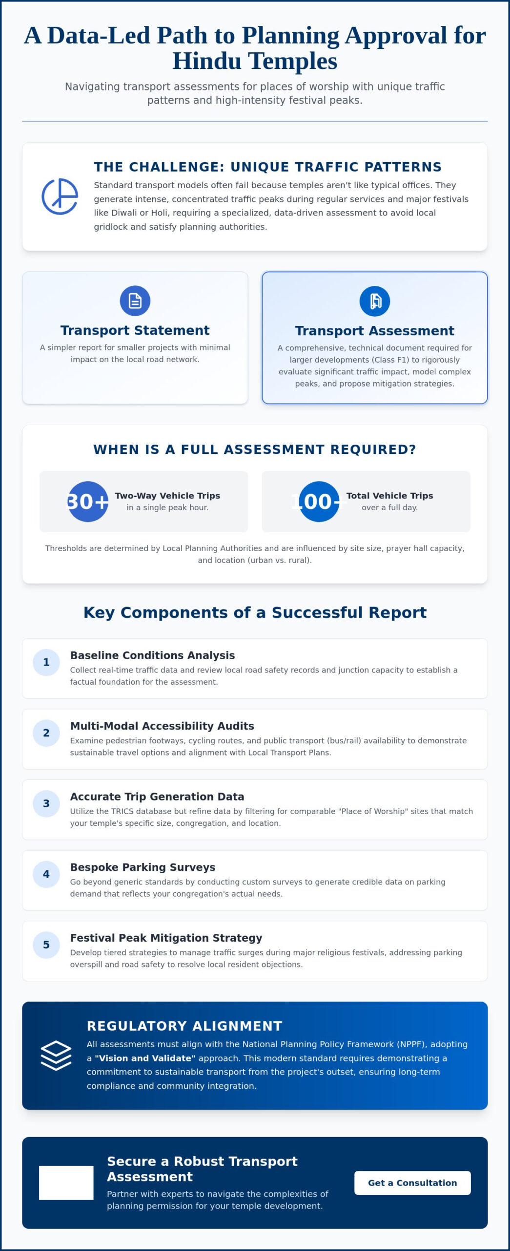
  • Transport Statement vs. Transport Assessment: A London Developer’s 2026 Comparison Guide

    Transport Statement vs. Transport Assessment: A London Developer’s 2026 Comparison Guide

    Submitting a full transport assessment when a simpler transport statement would suffice can inflate your pre-construction costs by more than £4,000 and delay your start date by up to 12 weeks. With 32 London boroughs and the City of London each enforcing distinct planning thresholds, a single technical omission often leads to immediate application refusal. We know the pressure of meeting tight deadlines while maintaining total legislative compliance. It’s a high-stakes environment where precision is a legal necessity and there’s no room for guesswork.

    You’ve likely felt the frustration of shifting regulatory goalposts and the high costs of unnecessary technical data. This comparison guide ensures you master the critical differences between these documents to meet 2026 regulatory standards without costly setbacks. We’ll provide a clear breakdown of development thresholds and borough-specific requirements so you can budget accurately for technical reports. You’ll gain a sequential roadmap for securing faster planning approval through professional, safety-conscious traffic planning that keeps your project moving forward.

    Key Takeaways

    • Identify whether your project requires a transport statement or a more detailed transport assessment based on 2026 London-specific thresholds and “significant impact” rules.
    • Navigate the technical requirements of the Mayor’s Transport Strategy, ensuring your submission integrates Healthy Streets and Vision Zero safety protocols.
    • Avoid planning delays by mastering baseline data collection, from site-specific traffic counts to comprehensive parking surveys in Central London.
    • Discover how professional modelling and expert policy reviews can mitigate the logistical and regulatory burdens of a major planning application.
    • Gain access to 24/7 technical guidance to meet urgent deadlines and maintain strict compliance with Greater London’s evolving traffic regulations.

    Table of Contents

    What are Transport Statements and Assessments in the London Planning Context?

    In the high-stakes environment of London property development, securing planning permission hinges on technical precision and safety compliance. A transport statement serves as a light-touch appraisal for smaller schemes, while a transport assessment is a comprehensive study required for major developments with significant impact. These documents form the backbone of the transportation planning process, ensuring that new projects don’t compromise the safety or efficiency of the capital’s road network.

    The National Planning Policy Framework (NPPF) sets the baseline for these requirements, but the London Plan 2026 introduces stricter mandates for sustainable travel and Vision Zero safety standards. For developers, these reports are non-negotiable. Without them, local authorities can’t grant a positive planning recommendation. Our team at ML Traffic understands that precision in these early stages prevents costly delays during the implementation phase of a project.

    The Purpose of Transport Documentation

    These reports identify potential traffic and safety issues before they become permanent design flaws. By using CAD design and site data, developers demonstrate compliance with London Borough Local Plans. This data-driven approach is critical for negotiating Section 106 agreements or Community Infrastructure Levy (CIL) contributions. In 2023, industry data indicated that robust documentation reduced planning appeal rates by 22% for mid-sized London residential schemes. Key objectives include:

    • Evaluating the existing transport infrastructure and its capacity.
    • Proposing mitigation measures for any identified negative impacts.
    • Ensuring safe access for all road users, including pedestrians and cyclists.
    • Aligning the project with the Mayor’s Transport Strategy.

    Key Differences in Scope and Scale

    The depth of analysis varies based on the project’s scale. A transport assessment requires rigorous junction modelling and multi-modal impact studies. Conversely, a transport statement focuses on local access and parking. Early engagement with Highway Authorities, specifically Transport for London (TfL), is vital to agree on the scope before submission. In 2024, TfL updated their pre-application guidance to emphasize “Healthy Streets” indicators in all major assessments. A transport statement is a concise report for developments with limited transport implications. Whether you’re managing a small conversion or a major commercial hub, accuracy is a legal and physical necessity. We provide the technical authority needed to manage these complexities from initial planning through to final execution.

    The Technical Anatomy: What Goes Into Each Report?

    Every transport statement and transport assessment begins with rigorous data collection to satisfy the London Plan 2021 requirements. Developers must provide a baseline that reflects current Central London conditions. This process includes parking surveys following the Lambeth Methodology and automated traffic counts at key junctions. We align every project with the Mayor’s Transport Strategy, specifically the Healthy Streets Approach which aims for 80% of trips to be made by foot, cycle, or public transport by 2041. This data ensures your submission adheres to the official government guidance for planning applications.

    A site audit evaluates the local Public Transport Accessibility Level (PTAL) score. This metric determines the intensity of development allowed on the plot. We use the TRICS database, currently on version 7.11, to predict future vehicle movements based on comparable London sites. Precise data collection is the foundation of a successful application. It prevents delays during the local authority review process.

    Core Components of a Transport Statement

    A Transport Statement is typically required for smaller developments where the traffic impact is limited. It focuses on the transition from existing site use to the proposed use. We provide a detailed analysis of basic access arrangements for all road users. This includes Swept Path Analysis to prove that refuse and delivery vehicles can manoeuvre safely within the site constraints. The report also summarises parking provision against the strict maximum standards set by the London Boroughs to discourage private car ownership.

    Advanced Components of a Transport Assessment

    Major developments require a comprehensive Transport Assessment. This involves sophisticated junction capacity modelling using industry software like LinSig or Junctions 9. These tools simulate how the project affects the wider London road network during peak hours, specifically between 08:00 and 09:00. We conduct multi-modal impact analysis to track how pedestrians, cyclists, and bus users interact with the site. Every assessment integrates a full Travel Plan and a Construction Logistics Plan (CLP) to manage the build phase. If you need assistance with these technical requirements, you can explore what we do to ensure your project remains compliant with Transport for London (TfL) standards.

    Transport Statement vs. Transport Assessment: A London Developer’s 2026 Comparison Guide

    Transport Statement vs. Transport Assessment: Which Do You Need?

    The decision between a transport statement and a transport assessment depends on the scale of your development and its potential impact on the London road network. While national thresholds exist, London boroughs often apply stricter criteria due to high urban density and air quality targets. According to the official government guidance, developers must provide a proportionate level of detail based on the project’s size. Smaller projects with limited traffic impact usually require a Statement, whereas larger schemes necessitate a full Assessment.

    Threshold Guidelines for London Developers

    Residential thresholds in London generally follow a 50 to 80 rule. Projects with fewer than 50 units usually require a Statement. Once a scheme exceeds 80 units, a full Assessment is mandatory. Commercial requirements are stricter. Office developments (B1) often trigger an Assessment at 2,500m² GFA, but retail sites (A1) face this requirement at just 1,000m² due to higher trip generation rates. Sensitive locations near primary schools or major interchanges like Stratford or Victoria often trigger full reporting regardless of these numbers. A 40-unit residential build near a major bus depot in Southwark might be pushed into a full Assessment to ensure public safety and network fluidity.

    PTAL Ratings and the Significant Impact Rule

    Public Transport Accessibility Level (PTAL) ratings influence the depth of your report. Sites with a PTAL score of 6a or 6b indicate excellent connectivity, which can sometimes justify a reduced scope because car dependency is lower. However, the “Significant Impact” rule remains the ultimate decider. If a development is expected to generate more than 30 two-way vehicle movements in peak hours, an Assessment is almost always required. In 2024, a developer in Ealing successfully used a transport statement for a 60-unit project by proving the site’s high PTAL rating would result in negligible vehicle growth, saving weeks in the planning cycle.

    The Role of Pre-Application Advice

    You shouldn’t guess which report is needed. Engaging with borough planning officers through pre-app services is the most reliable way to confirm the required scope. A professional transport planning consultant uses these meetings to negotiate a “scoped-down” Assessment where possible. This prevents the over-assessment trap, which often adds 6 weeks to project lead times and increases costs through unnecessary data collection. We focus on technical precision and Chapter 8 compliance to ensure your application is robust from the first submission. This proactive approach manages regulatory burdens and keeps your project on schedule.

    London’s planning landscape in 2026 demands a shift from traditional traffic modelling to a holistic “Healthy Streets” approach. This framework prioritises 10 indicators, such as shade, shelter, and air quality, over simple vehicle throughput. Whether you’re submitting a transport statement for a minor scheme or a full transport assessment for a major project, your report must demonstrate how the development encourages active travel. The 2026 London Plan updates require developers to prove their site contributes to the Vision Zero goal: eliminating all deaths and serious injuries from London’s transport network by 2041.

    Active Travel Zone (ATZ) assessments are now a non-negotiable standard for most London developments. You’ll need to evaluate the quality of walking and cycling routes within a 20-minute radius of your site. If your project sits near a London Bus route or a designated Cycleway, your report must address potential delays to public transport and safety risks to cyclists. Failing to account for these variables often leads to immediate objections from local authorities or TfL. Precision in these reports isn’t just about compliance; it’s about ensuring the long-term viability of the urban fabric. High-pressure development zones such as the O2 and Greenwich Peninsula, where Transport Planning Consultants Greenwich must navigate some of London’s strictest car-free policies, demonstrate exactly how demanding these active travel requirements can become.

    PTAL and Parking Minimums/Maximums

    Public Transport Accessibility Level (PTAL) scores dictate your parking strategy. In 2026, sites with a PTAL of 4 or higher are typically mandated as car-free, excluding essential disabled parking. For outer London Boroughs where PTAL scores are lower, you can justify parking provision using data-backed parking surveys to prove local capacity exists. Current Building Regulations Part S now require 100% of new residential parking spaces to have access to EV charging infrastructure, a significant jump from previous 20% requirements that developers must factor into their initial site power assessments. Boroughs with strict heritage and parking controls, such as those served by transport planning consultants Richmond upon Thames, illustrate how high PTAL ratings of 5 or 6 can actively limit development density and shape the entire parking strategy.

    Liaising with Transport for London (TfL)

    Projects affecting the Strategic Road Network (SRN) or the Transport for London Road Network (TLRN) face higher scrutiny. You’ll need a detailed Transport Assessment London if your site is near a Tube station to manage pedestrian flow and potential structural impacts. TfL oversight is mandatory for any development within 100 metres of a red route. Early engagement with TfL helps you avoid costly design revisions later in the planning process. Our team manages these high-stakes consultations to ensure your project moves from the planning phase to execution without regulatory delays.

    Ensure your project meets every London safety and compliance standard by booking a consultation for a comprehensive transport assessment today.

    How ML Traffic Engineers Secures Your Planning Approval

    ML Traffic Engineers delivers a rigorous, data-first methodology to ensure your application meets the exacting standards of London local authorities. We combine site-specific traffic surveys, including Automatic Traffic Counts (ATCs) and Manual Classified Counts (MCCs), with industry-standard modelling software like Junctions 10 and VISSIM. This evidence-based approach is essential when you submit a transport statement or a full transport assessment in 2026. Our team remains available 24/7 because we know planning deadlines are often unforgiving and require immediate technical responses. We manage site visits across all 32 Greater London boroughs, providing a local presence from the congested streets of Westminster to the suburban corridors of Bromley.

    We understand that a successful application requires more than just a summary of vehicle movements. Our engineers provide a total, managed solution. We integrate the following elements directly into your core report:

    • Swept Path Analysis (SPA): We use CAD-based tracking to prove that refuse vehicles, fire tenders, and delivery vans can navigate your site safely.
    • Multi-modal Travel Plans: We develop robust strategies to encourage sustainable transport, a non-negotiable requirement for modern London developments.
    • Borough-Specific Validation: We tailor every document to meet the unique Local Validation Lists of the specific council overseeing your project, including the carbon-neutral targets that transport planning consultants Ealing must address for developments near Ealing Broadway and Southall.

    Why a Bespoke Solution Trumps a Template

    Generic templates don’t account for the intricate highway constraints of a London site. We customise every report to address the unique concerns of local planning officers. Our professional technical reports significantly reduce the risk of Section 106 delays. Industry data from 2024 suggests that approximately 15% of London planning applications face deferral due to insufficient transport evidence. We eliminate this risk by providing technical data that is robust and defensible at committee. You can visit our resources page for technical templates and guidance on the latest regulatory standards.

    Next Steps for Your Project

    Securing a “Safe Pair of Hands” for your traffic engineering needs is a strategic necessity. We position ourselves as a dependable partner that understands the high-stakes nature of UK road regulations. We’ll handle the logistical and regulatory burdens so you can focus on the construction phase. Obtaining a rapid fee proposal is straightforward. We provide clear, fixed-price quotes that reflect the specific scale of your development. To understand the transport consultant cost for transport statement or transport assessment, always get a tailored quote that accounts for your project’s unique requirements. Contact ML Traffic Engineers now for a comprehensive London site review. We’re ready to provide the technical authority and unwavering reliability your project demands.

    Secure Your London Planning Approval for 2026

    Securing planning permission in London for 2026 hinges on choosing the right technical report for your development. While a transport statement, transport assessment, or a full travel plan might seem similar, selecting the wrong one often leads to immediate rejection and lost revenue. Accuracy is vital because every report must align with the latest Transport for London (TfL) standards and specific borough requirements. These regulations change frequently, making up-to-date technical knowledge a non-negotiable asset for any project manager.

    ML Traffic Engineers has been a trusted partner for developers since 2014. We bring over 10 years of expertise to every project, ensuring your submission is compliant and professional. Our team remains available 24/7 to handle urgent CAD designs and technical submissions when your deadlines are tight. We’ll manage the intricate safety standards and legislative requirements so you don’t have to. You can rely on our proven track record of securing approvals across all 32 London boroughs.

    Get a Professional Quote for Your London Transport Statement

    We’re ready to help you navigate these complexities with confidence and precision.

    Frequently Asked Questions

    Is a Transport Statement a legal requirement for all London developments?

    A Transport Statement isn’t a legal requirement for every London project; it’s triggered by specific development thresholds defined in the London Plan 2021. For example, residential schemes with fewer than 50 units usually avoid this requirement unless the local planning authority identifies specific local traffic concerns. You should check your specific borough’s Local Plan to confirm if your site area or unit count triggers a formal submission.

    How long does it take to produce a Transport Assessment in London?

    Producing a comprehensive transport assessment typically takes between 4 and 8 weeks from the initial site visit to the final report. This timeline accounts for traffic count data collection, which requires 7 consecutive days of neutral-period monitoring to ensure accuracy. If your project involves complex modelling or requires consultation with Transport for London, you should allow for 12 weeks to ensure all regulatory standards are met.

    Can I upgrade a Transport Statement to an Assessment if the council requests it?

    You can upgrade a transport statement to a full assessment if the council’s planning officer determines the development’s impact is larger than initially projected. This process involves expanding the scope to include detailed junction capacity modelling and wider network analysis. Because the baseline data remains valid, we can often transition the documentation quickly, though you’ll need to account for the additional technical hours required for deeper analysis.

    What is the typical cost difference between a Statement and an Assessment?

    A Transport Assessment costs significantly more than a Statement because it requires advanced computer modelling and extensive data collection. While a Statement focuses on qualitative descriptions, an Assessment uses quantitative data to predict traffic flow changes across multiple junctions. Costs vary based on the specific project scale, but developers should expect the technical fee for an Assessment to be double or triple that of a standard Statement. For precise budgeting, understanding transport consultant costs in London and getting a tailored quote ensures you have accurate financial planning for your specific development requirements.

    Do I need a Transport Assessment for a change of use application?

    You’ll need a Transport Assessment for a change of use application if the proposed activity generates more trips than the existing site. For instance, converting a 500-square-metre warehouse into a gym often triggers a requirement because visitor frequency increases. The local council examines the net change in traffic; if the new use exceeds the thresholds set in the 2021 London Plan, a full technical report is mandatory.

    What happens if my Transport Statement shows a negative impact on local parking?

    If your report identifies a negative impact on local parking, you must propose formal mitigation measures to the planning authority. This often includes a Permit Free agreement where residents of the new development can’t apply for local Controlled Parking Zone permits. Alternatively, you might need to fund a parking survey within a 200-metre radius of the site to prove that 85% occupancy levels aren’t exceeded during peak hours.

    How long is a Transport Statement valid for once submitted?

    A submitted Transport Statement remains valid for the duration of the planning application and for 3 years after permission is granted. However, the underlying traffic data shouldn’t be older than 12 to 18 months at the point of submission. If your project faces delays and the local traffic network changes, such as a new cycle superhighway installation, the council may require updated counts to reflect current conditions.

    Does a Transport Statement include a Travel Plan?

    A Transport Statement doesn’t include a full Travel Plan, although it often contains a Travel Plan Statement for smaller sites. While the Statement assesses the physical impact of the development, the Travel Plan focuses on long-term strategy to reduce car usage. For London developments exceeding 80 units, you’ll likely need to submit both documents as part of a coordinated planning strategy to ensure regulatory compliance.approval.

    Which areas in London do you cover?

    We service Acton, Balham, Barking, Barnes, Barnet, Battersea, Beckenham, Bexleyheath, Brentford, Brixton, Bromley, Camberwell, Carshalton, Charlton, Chelsea, Chiswick, Clapham, Coulsdon, Croydon, Crystal Palace, Dagenham, Dulwich, Ealing, Edgware, Eltham, Enfield, Finchley, Forest Gate, Fulham, Golders Green, Greenwich, Hackney, Hammersmith, Hampstead, Harrow, Hayes, Highgate, Hounslow, Ilford, Islington, Kensington, Kentish Town, Kingston upon Thames, Lewisham, Mitcham, Muswell Hill, New Malden, Notting Hill, Orpington, Peckham, Pinner, Purley, Putney, Richmond, Romford, Ruislip, Sidcup, Southall, Southgate, Streatham, Surbiton, Sutton, Tooting, Tottenham, Twickenham, Uxbridge, Walthamstow, Wembley, West Norwood, Wimbledon, Wood Green, Woolwich, Bethnal Green, Shoreditch, Canary Wharf, Deptford, Leyton, Palmers Green, Stanmore, Upminster, Chislehurst, Erith, Feltham.

    Which cities in England do you cover?

    We service London, Birmingham, Manchester, Liverpool, Sheffield, Leeds.

    Michael Lee

    Article by

    Michael Lee

    Transport planner with over 35 years’ experience.

    Disclaimer

    The content on mltraffic.co.uk, including all technical articles, guides, and resources, is provided for general informational and educational purposes only. It is not intended to constitute professional advice in traffic engineering, transportation planning, development approvals, or any other technical or legal field.
    While ML Traffic Engineers makes every reasonable effort to ensure the accuracy, completeness, and timeliness of the information published, we do not provide any warranties or representations (express or implied) regarding its reliability, suitability, or availability for any particular purpose. Any reliance you place on the content is strictly at your own risk.
    In no event shall ML Traffic Engineers, its directors, employees, authors, or affiliates be liable for any direct, indirect, incidental, special, consequential, or punitive damages (including, without limitation, loss of profits, data, or business opportunities) arising out of or in connection with the use of, or inability to use, any information provided on this website.
    The articles and guides on this site are not a substitute for engaging a qualified, professional traffic engineer to assess your specific project requirements. For tailored advice, compliance assessments, or traffic engineering services, please contact a competent professional.
    This disclaimer may be updated from time to time without notice. By accessing or using this website, you agree to be bound by the most current version of this disclaimer.