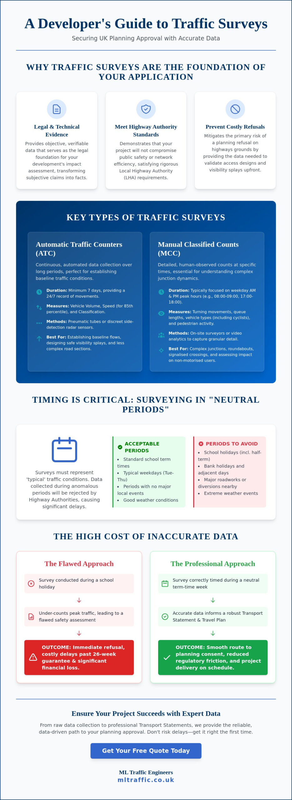
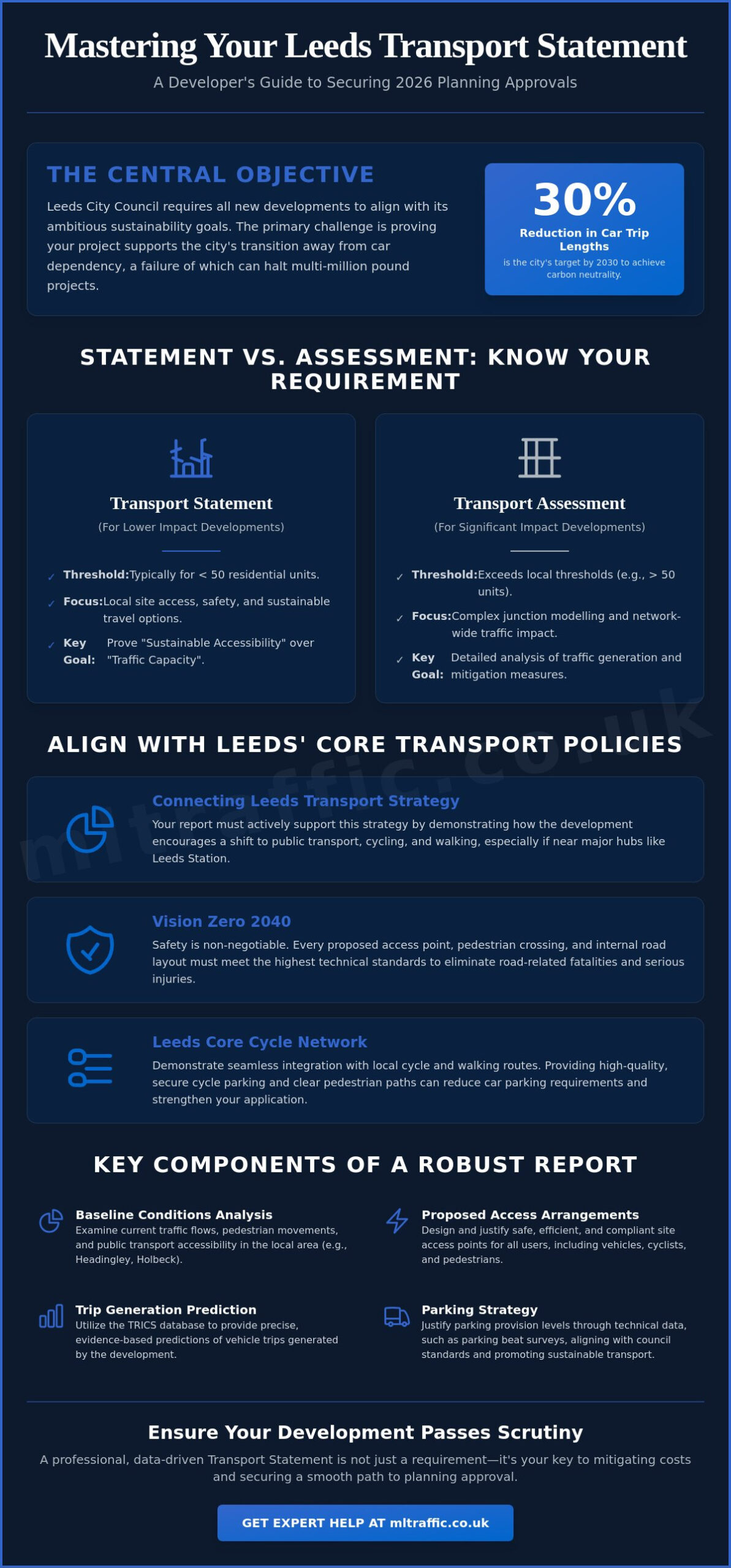
Can a single oversight in your technical data derail a multi-million pound development before the first stone is laid? For developers operating in West Yorkshire, securing a successful transport statement leeds is no longer just about traffic counts. It requires aligning with a city aiming for a 30% reduction in car trip lengths to meet its 2030 carbon-neutral targets. We recognize that opaque requirements from Leeds City Council Highways often create a climate of uncertainty, where the fear of planning refusal or unexpected mitigation costs looms over every application.
This guide provides the clear roadmap you need to master specific transport planning requirements and secure 2026 approvals. You’ll gain the technical insights necessary to produce professional data that stands up to the most rigorous scrutiny while maintaining cost-effective highway solutions. We will examine the latest Connecting Leeds Transport Strategy, the impact of Vision Zero 2040 on road design, and the essential steps to ensure your project supports the city’s transition to a sustainable, liveable urban centre.
Key Takeaways
- Understand the specific criteria Leeds City Council uses to evaluate developments with lower traffic impacts to ensure your project qualifies for a streamlined report.
- Learn how to analyze baseline transport conditions in high-demand areas like Headingley to design safe and compliant access arrangements for all road users.
- Discover how to align your site strategy with the “Vision Zero” safety approach and the Leeds Core Cycle Network to meet strict sustainability standards.
- Master the step-by-step submission process to secure a robust transport statement leeds that proactively addresses potential highway mitigation costs.
- Identify the essential data collection methods, including parking beat surveys and traffic counts, required to provide technical data that withstands council scrutiny.
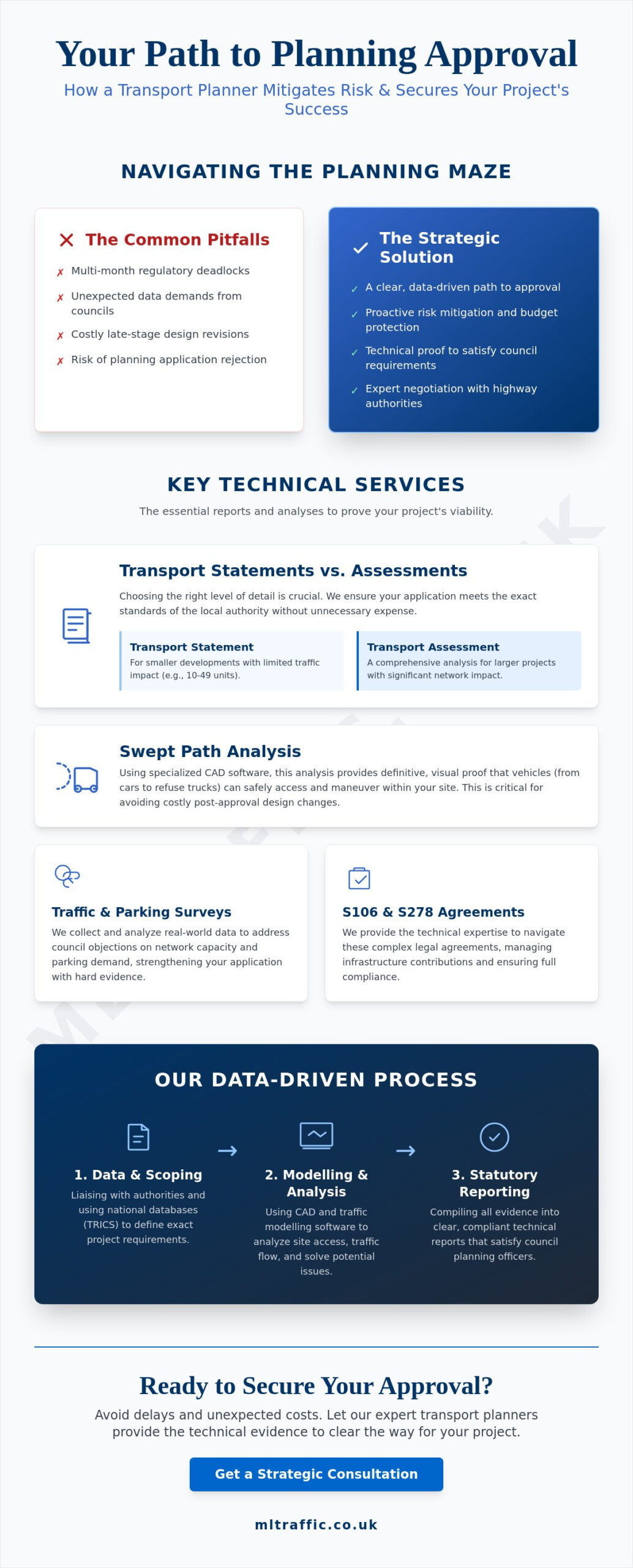
What is a Transport Statement for Leeds Planning Applications?
A transport statement leeds is a technical document required for developments that don’t generate significant volumes of traffic but still impact the local highway network. It serves as a concise, evidence-based report that outlines how a project will manage access and safety. Leeds City Council (LCC), acting as the Local Highway Authority, uses this data to decide if a proposal aligns with regional safety standards. Without a professionally prepared statement, your planning application in West Yorkshire won’t pass the initial validation stage. It’s a mandatory requirement that proves your site is accessible and safe for all users.
Beyond being a legal necessity, the report functions as a critical negotiation tool. It provides the technical basis for discussions between your design team and LCC Highways officers. By presenting clear data early, you can often mitigate the need for expensive off-site highway works. Our team ensures these reports reflect the high standards of modern transportation planning, providing a firm foundation for project approval. To understand how these documents fit into the city’s wider infrastructure goals, watch this overview of the Leeds transport system:
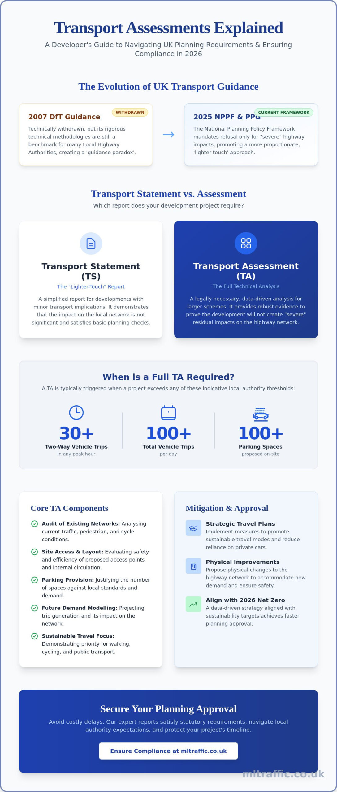
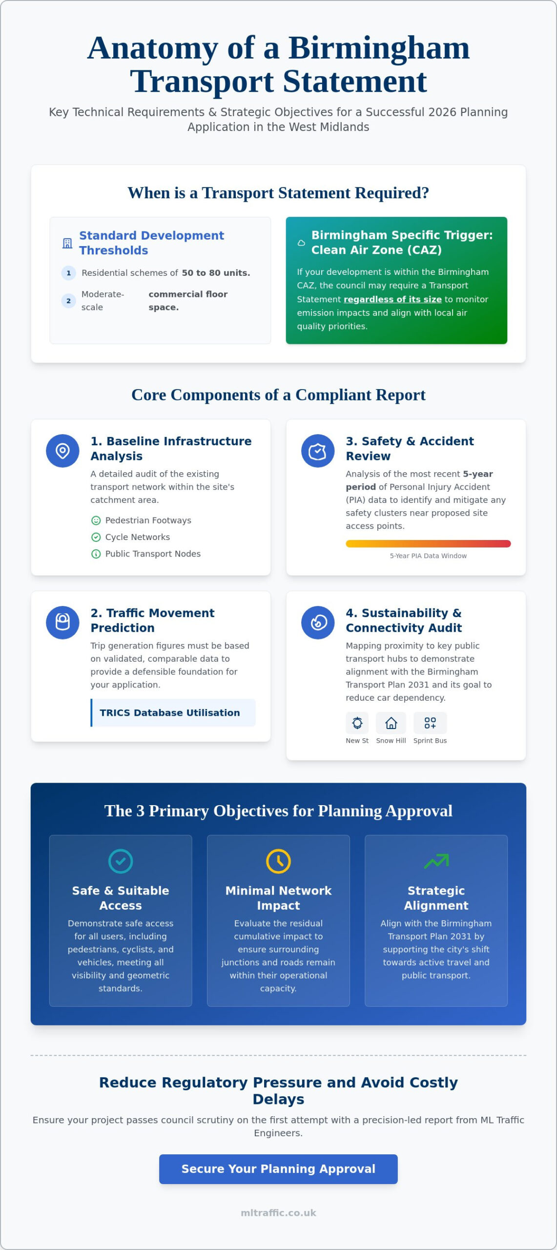
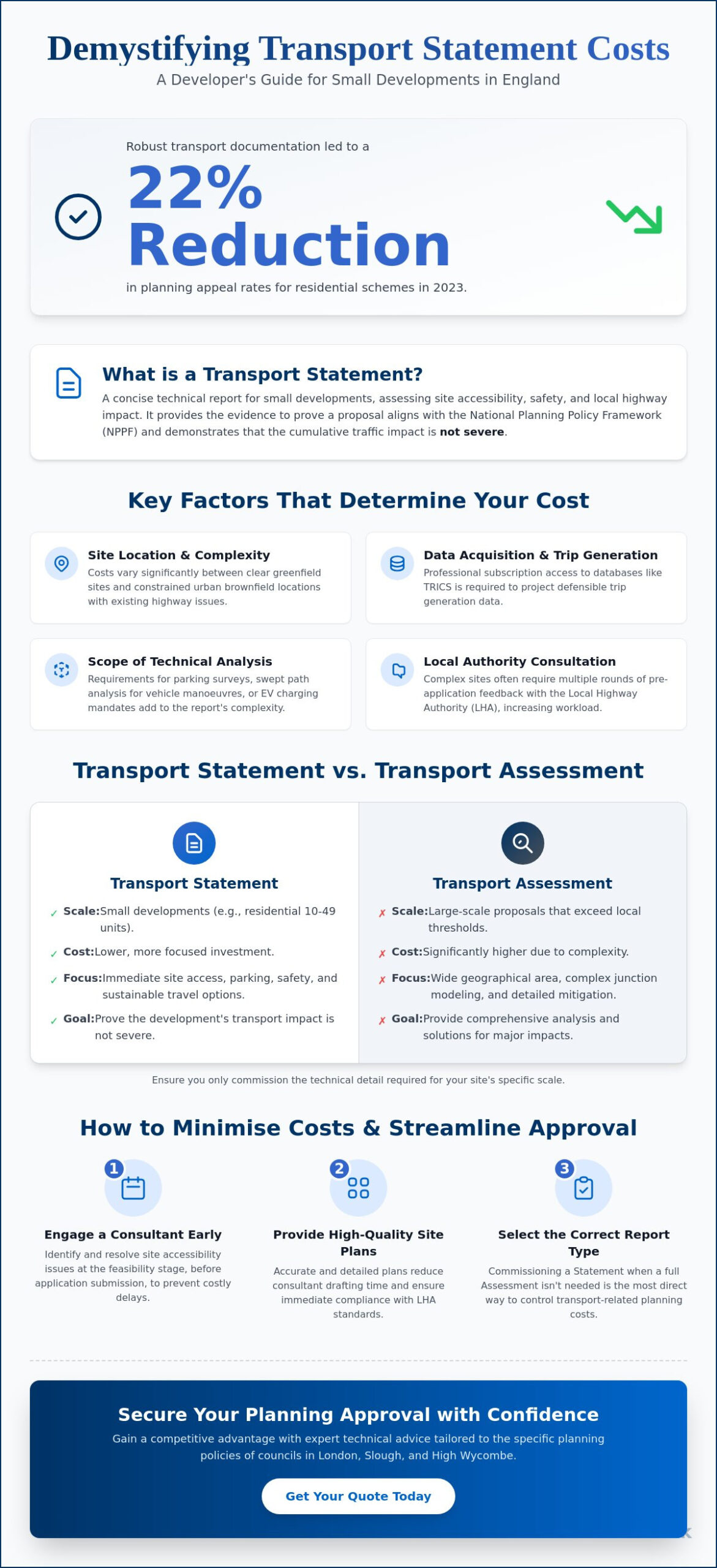
Transport Statement vs. Transport Assessment in Leeds
LCC applies specific thresholds to determine which type of report you need. Generally, residential developments with fewer than 50 units only require a Statement. If your project exceeds this, or involves large-scale commercial space, a full Transport Assessment is usually necessary. The Statement is less exhaustive than an Assessment, focusing on local access rather than complex junction modelling. However, the focus in 2026 has shifted significantly. Officers no longer prioritize “traffic capacity” alone. Instead, they look for “sustainable accessibility,” meaning your report must prove that residents or visitors don’t have to rely on private cars to reach your site. You can view the different technical reports we provide to see which fits your specific project scale.
The Strategic Importance of the Connecting Leeds Initiative
Your transport statement leeds must actively support the Connecting Leeds Transport Strategy. This policy aims for a 30% reduction in the length of car trips across the city to help Leeds become carbon neutral by 2030. Because Leeds Station is the busiest transport hub in the north of England, your development’s proximity to rail and bus corridors is a major factor in LCC’s decision. If your site is near the Leeds Inner Ring Road, your strategy needs to address how you’ll manage vehicle movements without increasing congestion. The council’s commitment to “Vision Zero” means that safety isn’t negotiable. Every access point and pedestrian crossing you propose must meet the highest technical benchmarks to avoid planning refusal.
Key Components of a Technical Transport Report in Leeds
A technical transport statement leeds provides a granular analysis of the existing highway network. We examine baseline conditions in high-pressure areas such as Headingley or Holbeck to understand current traffic flows and pedestrian movements. This data allows us to design proposed access arrangements that guarantee safe entry and exit for all road users. We don’t just guess traffic volumes. Instead, we use the TRICS database to predict trip generation based on comparable sites. This precision ensures your application stands up to the scrutiny of Leeds City Council officers.
Aligning with the Connecting Leeds Transport Strategy is essential for 2026 approvals. Your report needs to evaluate the site’s proximity to Leeds station and key bus corridors to prove that sustainable travel is a viable option. Demonstrating a clear path for walking and cycling can often reduce the need for extensive car parking. This saves you significant development costs while meeting city-wide environmental goals.
Swept Path Analysis: Proving Site Manoeuvrability
Leeds is famous for its narrow Victorian streets and tight urban infill sites. This makes Swept Path Analysis services a critical component of any successful application. We use specialized software to simulate the movement of large vehicles. This proves that fire tenders and refuse trucks can navigate your site safely. LCC Environmental Services will often reject a plan if refuse vehicle access isn’t clearly demonstrated. Common pitfalls in SPA often occur in Leeds City Centre where space is at a premium. We identify these issues early. This prevents delays during the consultation phase.
Parking Surveys and Policy Compliance
Navigating the council’s parking standards requires an understanding of different zones across the city. Central zones encourage lower car ownership. Suburban projects may face stricter requirements. We conduct detailed parking surveys to justify lower-than-standard provision when the local network has sufficient capacity. Your report must also integrate EV charging infrastructure as per the latest 2026 building regulations. These technical requirements are non-negotiable for modern approvals. If you’re unsure about your specific obligations, our team can help you prepare a robust transport statement leeds that addresses every council concern.
Aligning with Leeds Sustainable Transport Policy
Leeds City Council has adopted a “Vision Zero” strategy with the goal of eliminating all traffic fatalities and serious injuries by 2040. When you submit a transport statement leeds, you must demonstrate that your development prioritizes the safety of pedestrians and cyclists over vehicle speed. This isn’t just a local preference; it aligns with the broader National Planning Policy Framework which emphasizes promoting sustainable transport. Your site’s layout must integrate seamlessly with the Leeds Core Cycle Network. This ensures that residents can access major employment hubs without relying on the highway network.
The West Yorkshire Connectivity Infrastructure Plan provides a framework for these regional improvements. For larger projects, you may face consultation from Active Travel England. They evaluate whether your design truly supports walking and cycling. We manage these interactions by providing technical data that proves your site contributes to a more connected city. Our approach focuses on meeting these high-level policy goals while protecting the commercial viability of your project.
The Role of Travel Plans in Leeds Planning
A Travel Plan is often a mandatory supplement to your transport statement leeds for commercial or larger residential sites. These plans focus on behavior change. You might offer discounted bus passes or implement car-sharing schemes to reduce the number of single-occupancy vehicle trips. Leeds City Council expects ongoing monitoring after the site is occupied. This ensures that the sustainable travel targets you set during the planning phase are actually met in practice.
Maximising PTAL and Accessibility Scores
Leeds utilizes an accessibility mapping system that functions similarly to London’s PTAL scores. If your site sits along the A61 or A64 corridors, you benefit from high-frequency bus services. This makes it easier to justify reduced parking provision. However, if your development is in an area with lower public transport frequency, your transport strategy must be more robust. We help you justify these locations by highlighting planned infrastructure improvements or by proposing site-specific enhancements that bridge the connectivity gap. This technical precision reduces the risk of council officers requesting expensive off-site mitigation works.
Navigating the Leeds Planning Process: From Submission to Approval
Securing planning permission in Leeds requires a logical, sequential approach to the highway planning process. We begin with a pre-application consultation with LCC Highways to agree on the specific scope of work. This early engagement prevents the wasted cost of collecting irrelevant data or conducting unnecessary surveys. Once the scope is defined, we execute a structured five-step process to move your project toward approval:
- Step 1: Pre-application consultation to define the technical parameters with LCC Highways officers.
- Step 2: Data collection, including site-specific traffic counts and parking beat surveys to establish a baseline.
- Step 3: Technical drafting and SPA modelling to ensure the design is physically feasible for refuse and emergency vehicles.
- Step 4: Submission and response, where we manage communications with statutory consultees to resolve technical queries.
- Step 5: Legal negotiation of Section 106 or Section 278 agreements for any required off-site highway works.
Our team manages the entire lifecycle of your transport statement leeds, from initial data collection to final legal negotiations, ensuring your project remains on schedule.
Common Highway Objections in Leeds and How to Overcome Them
LCC Highways often raise objections based on an “unacceptable impact on highway safety” or concerns about “overspill parking.” These issues are particularly common in high-density residential areas like Chapel Allerton. We overcome these objections through precise design mitigation and data-driven evidence. If a council officer makes exaggerated traffic impact claims, we use more comprehensive Transport Assessments to provide the necessary counter-evidence. This technical authority protects your project from subjective decisions and ensures the council’s requests remain proportionate to your development’s actual impact.
Section 278 Agreements in West Yorkshire
If your development requires physical changes to the public highway, such as a new junction or a widened footway, you’ll need a Section 278 agreement. Securing technical approval for Highway Design S278 involves a detailed review by LCC engineers to ensure the works meet West Yorkshire standards. You must budget for commuted sums, which are payments made to the council for the future maintenance of the new infrastructure. We provide the technical drawings and specifications required to pass LCC inspection fees and secure technical approval without unnecessary revisions. This proactive management minimizes the logistical and financial pressures on your project team.
Why Choose ML Traffic Engineers UK for Your Leeds Development?
Partnering with ML Traffic Engineers UK ensures your project is backed by a consultancy that understands the specific nuances of the West Yorkshire Combined Authority and LCC. We offer a data-driven methodology that removes the uncertainty often associated with highway planning. Preparing a transport statement leeds requires more than just technical reporting; it demands a deep understanding of local policy shifts and the specific expectations of LCC Highways officers. Our track record includes securing approvals for complex urban sites where space is at a premium and regulatory scrutiny is at its highest. Precision is non-negotiable.
We take immense pride in our role as a dependable, highly organized expert. Our team manages the entire project lifecycle from inception to completion. We handle everything from the initial site assessment and Swept Path Analysis to the final monitoring of a Travel Plan. This comprehensive, fully-managed service serves as a unique hallmark of our brand promise. By maintaining a focus on precision and adherence to standards, we minimize the risk of planning delays and help you avoid the unexpected costs of excessive highway mitigation. We view our role not just as a service provider, but as a vital partner in ensuring public safety through rigorous technical analysis.
Our Technical Expertise
We utilize the latest CAD and SPA software to conduct precise manoeuvrability testing. This level of technical accuracy is essential for proving that your site can accommodate refuse vehicles and fire tenders, especially on constrained urban sites in the city centre. Our engineers have direct experience negotiating with LCC Highways officers on a regular basis. We understand the specific lexicon and data points they require to grant approval. This specialized knowledge allows us to advocate effectively for your project, ensuring that mitigation requests remain proportionate and fair. You can visit our What We Do page to see the full range of technical reports we provide to support your application.
Get a Quote for Your Leeds Project
We recognize that the infrastructure maintenance and development environment is fast-moving and often unpredictable. ML Traffic Engineers UK offers a fast turnaround for every transport statement leeds to ensure you meet your critical submission deadlines. We provide transparent pricing with no hidden technical fees, allowing you to budget with confidence from the start. Reliability is the foundation of our service. We maintain a standard of formal excellence that aligns with the strict regulatory environments in which we operate. You can contact us via our homepage for an initial site review. We’ll help you identify potential highway risks early and provide the technical authority needed to secure your 2026 planning approval.
Securing Your 2026 Planning Approval
Successful development in West Yorkshire requires a proactive approach to highway planning. Aligning with the Connecting Leeds strategy and meeting Vision Zero safety standards is now essential for a smooth application process. A robust transport statement leeds acts as your primary defense against planning delays. It provides the technical evidence needed to justify your site design and access arrangements. By prioritizing sustainable accessibility and precise data, you can navigate council requirements with confidence and avoid disproportionate mitigation costs.
We bring over 10 years of UK transport planning expertise to every project. Our team specializes in Leeds City Council highway standards and provides specialist Swept Path Analysis capabilities to solve the tightest urban site constraints. We understand the regulatory pressures you face and offer the technical authority required to secure a positive outcome. Request a Transport Statement Quote for Your Leeds Project today to ensure your development remains on track. We’re ready to help you move your project from the drawing board to the construction phase.
Frequently Asked Questions
Do I need a Transport Statement for a small residential conversion in Leeds?
Leeds City Council typically requires a transport statement leeds for conversions that increase the intensity of use or alter existing access. Even small residential projects must prove they don’t compromise highway safety or local parking capacity. We assess your specific site to determine if LCC will mandate a formal report for validation.
How much does a Transport Statement cost for a Leeds planning application?
The cost depends on the specific technical requirements and the amount of data collection needed for your site. We don’t offer flat-rate pricing because every development has unique highway constraints. Instead, we provide a transparent, bespoke quote once we’ve reviewed your project’s scope and LCC’s expectations.
What is the difference between a Transport Statement and a Transport Assessment in West Yorkshire?
A Transport Statement is a concise report for developments with lower traffic impacts, while a Transport Assessment is a comprehensive study for larger projects. In West Yorkshire, the threshold for a full Assessment is usually 50 residential units or significant commercial floor space. Assessments require complex junction modeling that isn’t necessary for a standard Statement.
Will Leeds City Council accept a Transport Statement without Swept Path Analysis?
LCC rarely accepts reports for constrained sites without technical proof of vehicle manoeuvrability. Refuse vehicle and fire tender access are non-negotiable for Environmental Services. We include Swept Path Analysis as a standard component to ensure your design is physically feasible and avoids immediate rejection.
How long does it take to produce a Transport Statement for a Leeds project?
Most reports are completed within a 2 to 4 week timeframe. This duration allows for the mobilization of traffic counts and the technical drafting of the report. We understand the urgency of planning deadlines and work to deliver high-quality data as rapidly as possible to keep your project moving.
What happens if LCC Highways objects to my Transport Statement?
We immediately analyze the technical basis of the objection to find a viable solution. This often involves negotiating with highways officers or proposing design mitigations that address their safety concerns. Our goal is to provide the technical authority needed to overturn objections and secure your planning permission.
Do I need a parking survey for a car-free development in Leeds City Centre?
A parking survey is often mandatory for car-free sites to prove that residents won’t park in the surrounding area. LCC wants to see evidence that your project won’t cause “parking overspill” on local streets. We conduct these surveys during peak hours to provide a realistic picture of current street capacity.
Can a Transport Statement help reduce Section 106 contributions?
Professional technical evidence can ensure your Section 106 contributions are based on actual impact rather than generic formulas. By proving your development generates fewer trips than standard models predict, we can help keep your highway mitigation costs proportionate. This data-driven approach protects the commercial viability of your Leeds project.

Disclaimer
The content on mltraffic.co.uk, including all technical articles, guides, and resources, is provided for general informational and educational purposes only. It is not intended to constitute professional advice in traffic engineering, transportation planning, development approvals, or any other technical or legal field.
While ML Traffic Engineers makes every reasonable effort to ensure the accuracy, completeness, and timeliness of the information published, we do not provide any warranties or representations (express or implied) regarding its reliability, suitability, or availability for any particular purpose. Any reliance you place on the content is strictly at your own risk.
In no event shall ML Traffic Engineers, its directors, employees, authors, or affiliates be liable for any direct, indirect, incidental, special, consequential, or punitive damages (including, without limitation, loss of profits, data, or business opportunities) arising out of or in connection with the use of, or inability to use, any information provided on this website.
The articles and guides on this site are not a substitute for engaging a qualified, professional traffic engineer to assess your specific project requirements. For tailored advice, compliance assessments, or traffic engineering services, please contact a competent professional.
This disclaimer may be updated from time to time without notice. By accessing or using this website, you agree to be bound by the most current version of this disclaimer.