Planning permission in Carlisle rarely turns on transport alone, but transport issues can absolutely derail an otherwise well-designed scheme. We see it all the time: a site looks strong on land use, design and viability, yet progress slows because access visibility is tight, a nearby junction is already under strain, or the application lacks the right level of transport evidence.
That matters even more in Carlisle. The city’s historic street pattern, strategic links to the M6, A7 and A69, flood-sensitive areas, and a broad rural catchment all shape how the local authority and highway authority look at development. A modest residential site can raise questions about walkability, school traffic or parking pressure. A commercial scheme near a key corridor can quickly trigger requests for trip analysis, junction modelling or a Travel Plan.
In this guide, we set out the practical side of Transport Planning in Carlisle for architects, planners, surveyors, developers, legal teams and local authorities. We explain when a Transport Statement, Transport Assessment or Travel Plan is likely to be needed, what a typical study includes, where planning risks usually arise, and how to build a stronger application from the outset.
The principles below reflect standard UK practice, tailored to Carlisle’s planning and highway context in 2026. As ever, scheme-specific advice matters, and it’s wise to check the latest Cumberland Council and highway guidance at pre-application stage.
Why Transport Planning Matters For Development In Carlisle
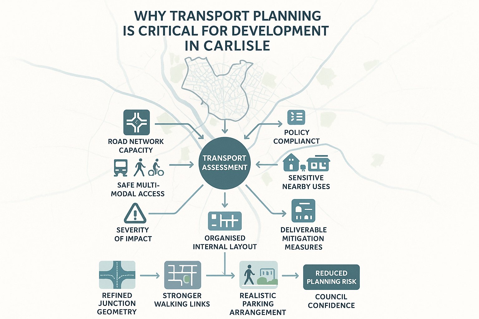
Transport planning is not just a planning application add-on. In Carlisle, it often becomes one of the main pieces of evidence used to judge whether a proposal is acceptable in practical, policy and safety terms.
At the heart of it is a simple question: can the development function without creating unacceptable impacts on the transport network, and can people reach it safely and reasonably by more than just the private car? That question sits squarely within the National Planning Policy Framework, local plan policy and the wider Cumbria transport planning approach.
For Carlisle, this is especially important because growth has to fit into a network that mixes historic streets, strategic roads, residential neighbourhoods and rural approaches. Some corridors have limited spare capacity. Some sites look straightforward on a plan but have awkward access constraints or sensitive nearby uses. Schools, local centres, healthcare sites and edge-of-city employment areas all bring their own transport pressures.
Good transport planning helps decision-makers understand whether impacts might be severe, which is the key NPPF test. It also helps design teams shape better schemes early: better access geometry, better internal layouts, stronger pedestrian links, more realistic parking, and mitigation that can actually be delivered.
In practice, strong transport input reduces planning risk. It gives councils confidence, helps applicants answer technical objections, and can save a great deal of time compared with trying to repair avoidable issues after submission.
How Carlisle’s Local Transport Context Shapes Planning Decisions
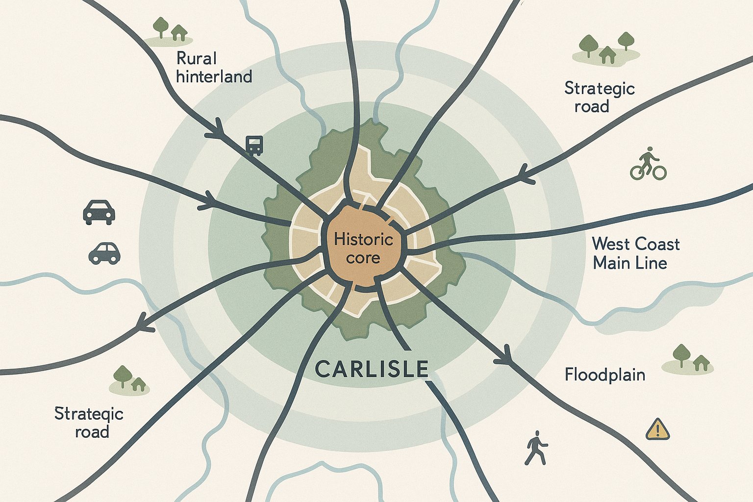
Carlisle is not a blank canvas. Planning decisions are shaped by the city’s physical form, strategic role and travel patterns.
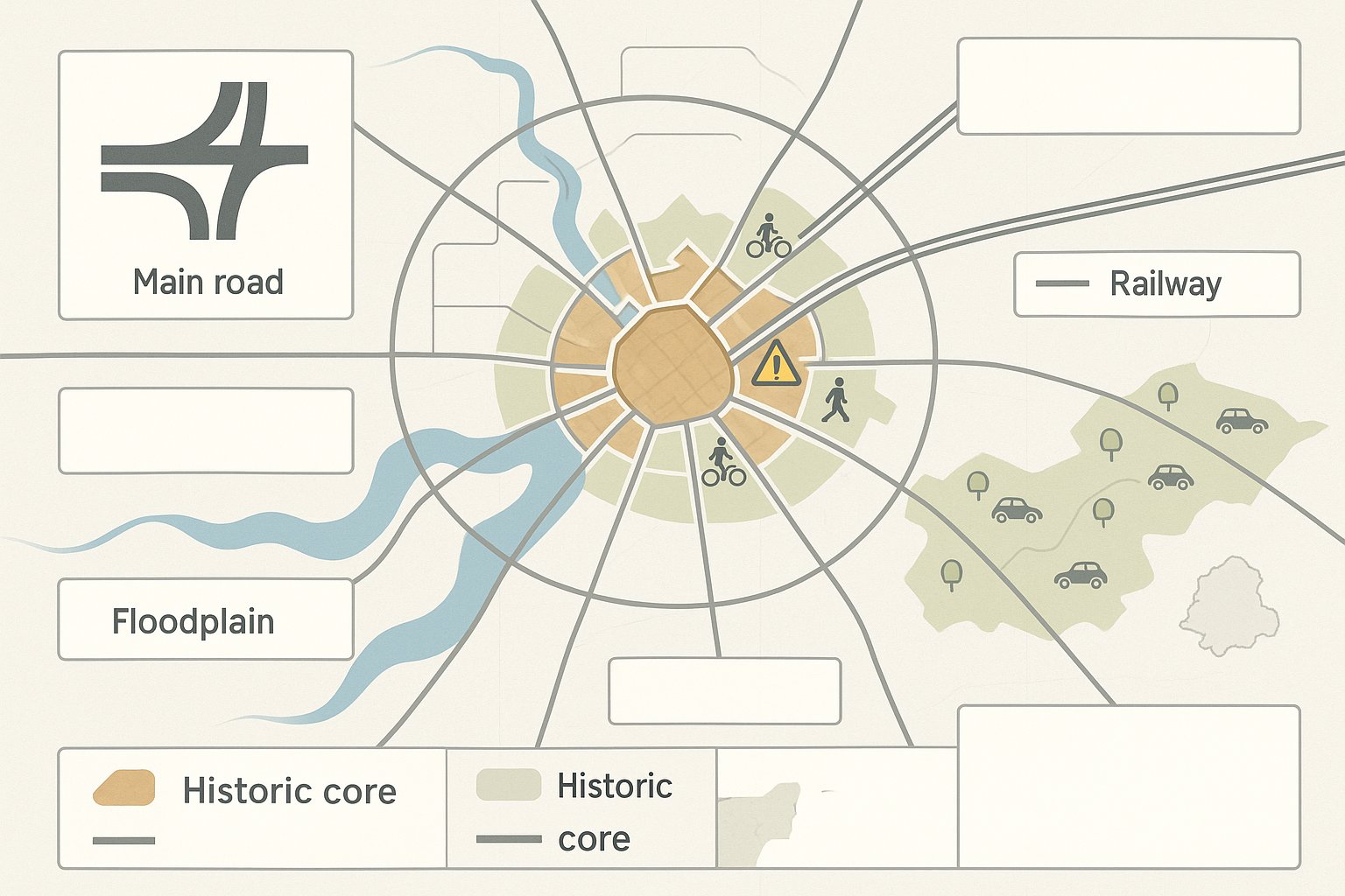
The historic core creates obvious constraints. Street widths, junction arrangements, pedestrian activity and heritage sensitivity can limit what is possible in access design or highway alteration. Then there are the radial routes feeding movement into and around the city, plus the influence of the M6, A7 and A69. Development that loads traffic onto already sensitive corridors will usually attract closer scrutiny.
The West Coast Main Line also matters. Rail connectivity is a strength, particularly for some town centre, employment and mixed-use schemes, but it does not remove the need to address local road and active travel impacts properly. And Carlisle’s floodplain context can affect route resilience, emergency access considerations and the attractiveness of certain walking and cycling connections.
Another local factor is the rural hinterland. Many trips into Carlisle originate from villages and smaller settlements where car ownership and car reliance are relatively high. That means authorities may be cautious about optimistic assumptions around mode shift. If a site is urban and well connected, they will often expect meaningful sustainable travel measures. If it is more peripheral, they may expect applicants to be realistic about travel behaviour rather than dressing up a car-dependent site as something it is not.
So, transport planning in Carlisle works best when it responds to local conditions honestly. Generic assessments tend to unravel quickly. Place-specific evidence usually stands up much better.
Key Development Types That Commonly Require Transport Input
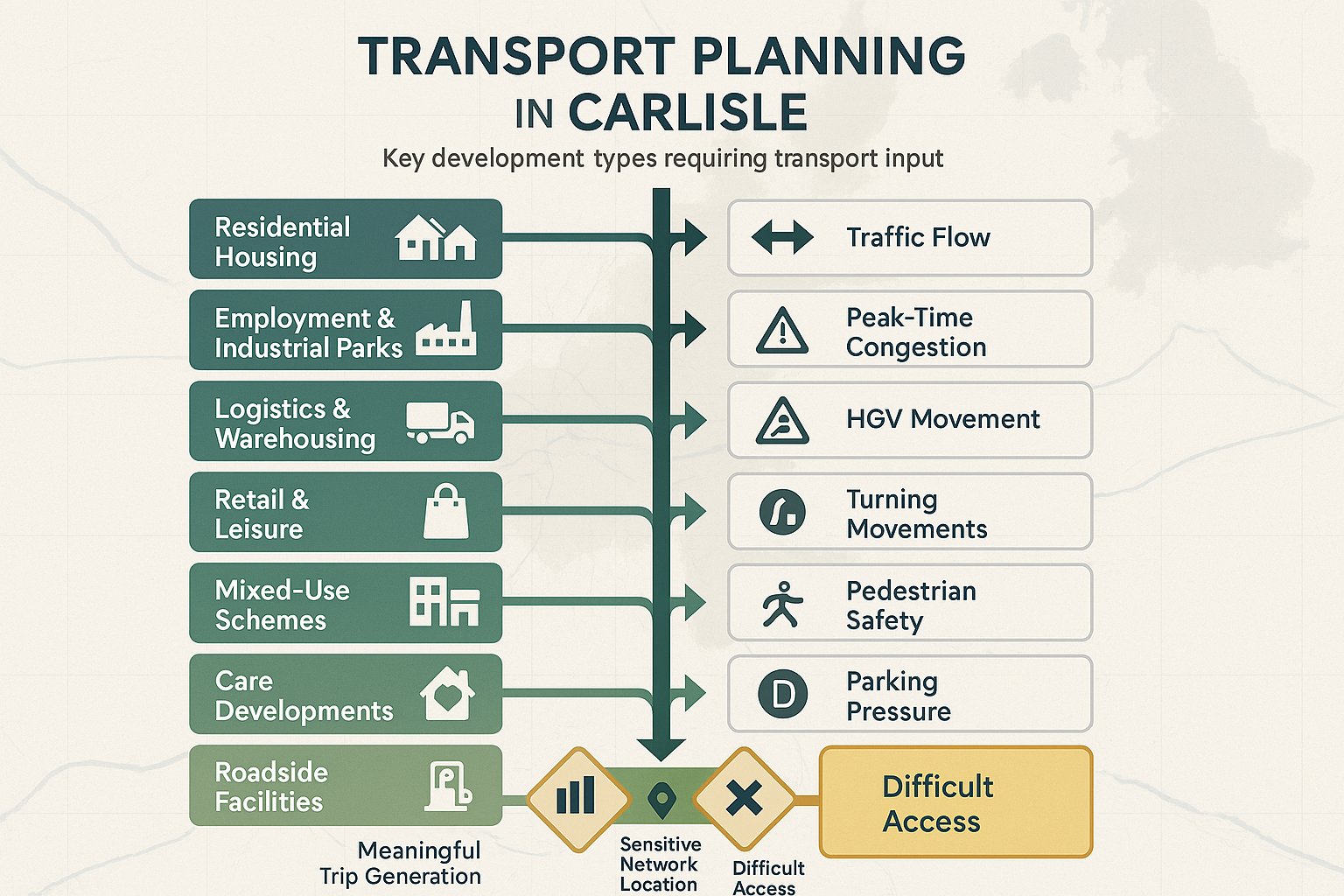
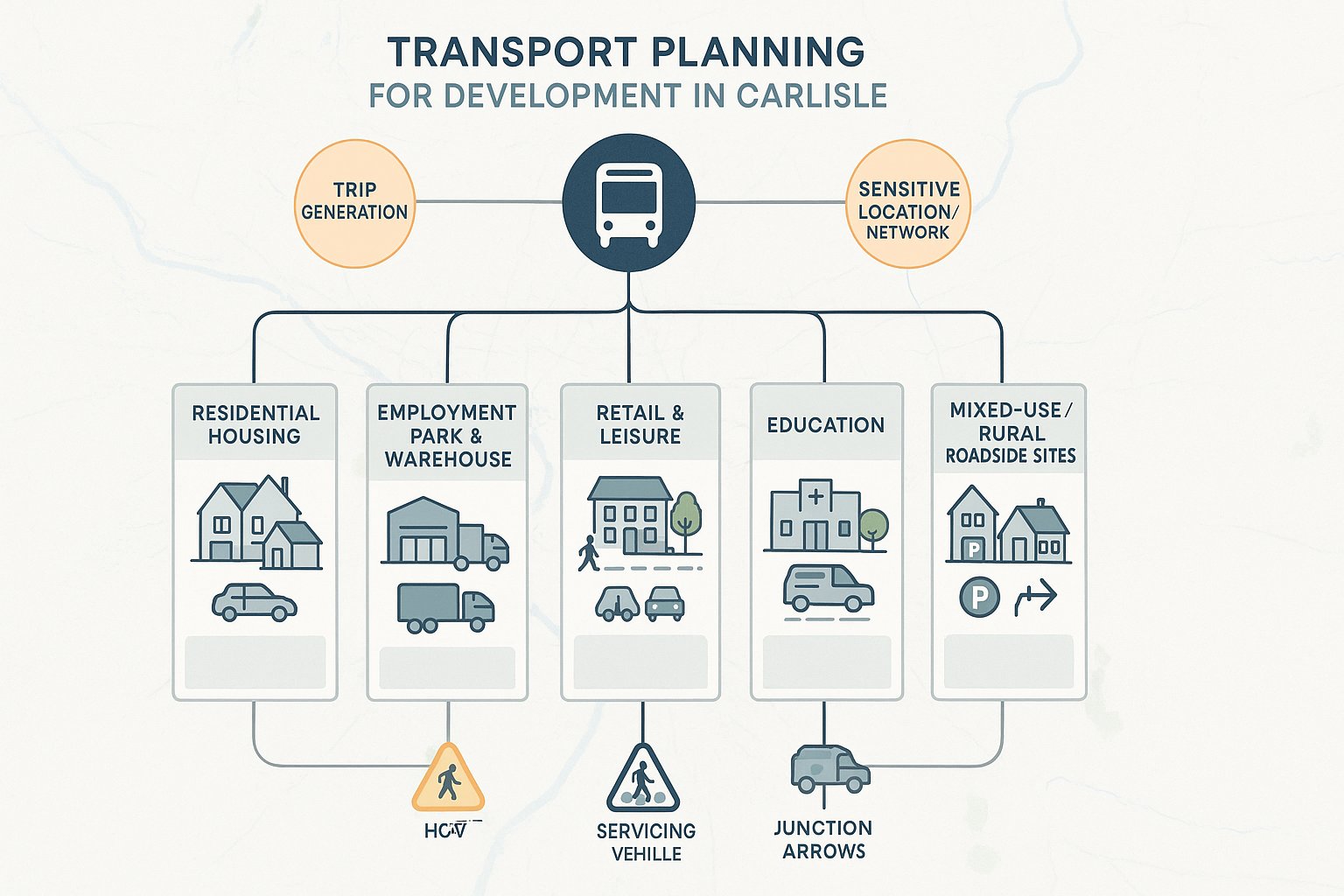
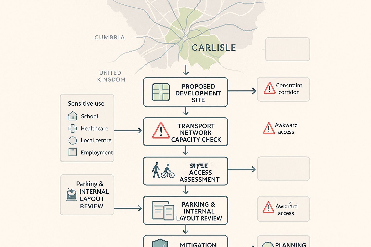
Not every planning application in Carlisle needs a full transport package, but many do need at least some transport input. The trigger is usually not just size. It is also about trip generation, network sensitivity and access circumstances.
Residential development is one of the most common examples. Even fairly modest housing schemes can raise questions about peak-hour traffic, pedestrian links, school travel, refuse vehicle access and parking. Larger sites almost always need formal assessment.
Employment parks, industrial uses, logistics and warehousing often require detailed work because they can generate staff trips, HGV movements and operational activity at specific peak times. For roadside or edge-of-network sites, that can mean closer examination of junction capacity and turning movements.
Retail and leisure development can be just as sensitive. Trip patterns may be concentrated at weekends, evenings or seasonal peaks, and linked trips are not always as generous as applicants hope. Town centre context, servicing strategy and pedestrian safety often become central issues.
Education and healthcare uses also attract attention because of concentrated arrivals and departures, vulnerable users, and the potential for localised congestion. A school expansion near constrained roads, for instance, can need more transport evidence than a larger but less sensitive site.
We also see transport input required for mixed-use schemes, care developments, roadside facilities and rural sites with direct access onto faster roads. In short: if a scheme creates meaningful trips, has a constrained access, or sits near a sensitive location, transport planning should be considered early.
When A Transport Statement, Transport Assessment, Or Travel Plan Is Needed
The level of transport documentation should match the scale and likely impact of the development. That sounds obvious, but it is where many applications go wrong. Some submit too little and face objections. Others submit a bulky assessment when a focused statement would have done.
In broad terms, a Transport Statement is typically suited to smaller or medium-sized schemes with relatively modest effects. It still needs to be robust, but it is usually a concise evidence document covering access, baseline conditions, parking, traffic impact and safety considerations.
A Transport Assessment is generally required for larger schemes, more intensive land uses, or developments affecting important junctions, busy corridors or the strategic road network. Here, the authority will usually expect more detailed forecasting, trip assignment, capacity assessment and mitigation testing.
A Travel Plan is different again. It is not primarily about measuring impact but about managing travel behaviour. It is commonly requested for housing, schools, workplaces, healthcare and other major trip-generating uses, often by condition or planning obligation.
Thresholds are not universal, and Carlisle-specific expectations can vary by site and sensitivity. That is why pre-application scoping matters. We usually advise agreeing the study area, assessment years, survey requirements and expected outputs before the application is finalised.
Transport Statements Vs Transport Assessments Vs Travel Plans
A useful way to think about these documents is this:
- Transport Statement: a proportionate snapshot of transport effects and access suitability.
- Transport Assessment: a fuller technical case, often with modelling and tested mitigation.
- Travel Plan: a delivery tool for reducing reliance on the private car over time.
A Transport Statement may include traffic counts, collision analysis, site accessibility review, parking provision and a short discussion of local junctions. A Transport Assessment goes further, typically using TRICS trip rates, distribution and assignment assumptions, and recognised models such as PICADY, ARCADY or LINSIG where junctions need testing.
The Travel Plan then complements either document by setting out measures, targets, responsibilities and monitoring. For example, welcome packs, cycle parking, bus information, car-sharing measures, EV support or school/workplace travel coordination.
These documents are related, but they are not interchangeable. Using the wrong one can create delay for no good reason.
What A Carlisle Transport Planning Study Typically Includes
A well-prepared Carlisle transport study is usually structured around evidence, policy and design logic. It should tell a clear story: what the site is, how people will reach it, what impact it will have, and what measures make the proposal acceptable.
Most studies begin with a policy review, covering the NPPF, relevant local plan policies, the Local Transport Plan and any local guidance on parking or transport assessments. That policy context matters because it frames what the authority will expect in terms of accessibility, safety and mitigation.
Then comes the site and context description. This is where a good report moves beyond the red line boundary. Nearby junctions, bus stops, footways, cycle routes, schools, local centres and constraints all need to be understood.
Baseline evidence often includes:
- traffic counts and turning counts
- personal injury collision data
- speed survey data where access visibility is an issue
- parking accumulation or beat surveys where pressure is relevant
- public transport accessibility information
From there, the study usually addresses the proposed access strategy, trip generation, trip distribution, junction impact, sustainable travel opportunities, parking and servicing. If mitigation is needed, it should be shown clearly and linked back to the identified issue.
The strongest reports are proportionate and readable. They do not bury key points in technical appendices. They explain assumptions, acknowledge limitations and make it easy for officers, consultees and committee members to follow the reasoning. That clarity often matters just as much as the technical work itself.
Site Access, Highway Safety, And Visibility Requirements
Access is one of the first things highway officers examine, and with good reason. If a site cannot be accessed safely and conveniently, the rest of the transport case becomes much harder to defend.
In Carlisle, access design needs to respond to actual local conditions rather than relying on standard drawings alone. Manual for Streets and, where relevant, DMRB principles are commonly used to assess geometry, visibility, gradients, radii and user safety. The right standard depends on road function, traffic speed and context.
Visibility splays are a regular pressure point. Applicants sometimes assume an access is workable because vehicles already enter the land informally. Planning assessment is stricter than that. The authority will normally want evidence that the achieved visibility is appropriate for observed vehicle speeds and that the splay can be maintained within land under the applicant’s control.
Highway safety is broader than vehicle access. Footway continuity, crossing points, cycling provision, bin collection arrangements, emergency access and inclusive movement all matter. A technically adequate bellmouth is not enough if pedestrians are forced into conflict or disabled users face awkward gradients and dropped kerb arrangements.
Collision analysis also plays a role. If there is a local pattern of shunts, turning collisions or vulnerable user incidents, the authority may look more critically at a proposal, even if the scheme itself is not the sole cause.
We find it is far easier to deal with access and visibility early, while layouts are still flexible. Once architecture, levels and red line boundaries harden, simple fixes stop being simple.
Junction Capacity, Trip Generation, And Network Impact
This is often the section that decides whether a scheme feels manageable or risky.
Trip generation normally starts with TRICS, unless there is strong local survey data or another justified source. But taking rates from TRICS is only the beginning. The real work lies in selecting comparable sites properly, applying sensible assumptions on mode share and temporal spread, and explaining those choices transparently.
Once trips are estimated, they need to be assigned onto the network. In Carlisle, that means understanding how drivers are likely to use the radial routes, strategic links and local junctions in reality, not in an idealised spreadsheet world. Peak periods should reflect the development type. Residential schemes may focus on weekday commuter peaks: retail and leisure schemes may need weekend testing too.
Junction capacity is then tested using recognised tools such as PICADY for priority junctions, ARCADY for roundabouts and LINSIG for signals. The purpose is not just to generate ratio figures. It is to understand whether queues, delays and reserve capacity remain acceptable, and whether the cumulative effect with committed development changes the picture.
Where impact is material, mitigation might include ghost islands, lane widening, signal staging changes, revised access design, relocation of crossings or targeted sustainable travel measures. Sometimes the answer is operational rather than geometric.
The important point is this: authorities are rarely persuaded by vague statements that extra trips will be “minimal”. They want to see the mechanics. And if the numbers are tight, they will usually want mitigation that is specific and deliverable.
Sustainable Travel, Walkability, And Public Transport Considerations
Sustainable travel is no longer a soft appendix to a highways report. In Carlisle, as elsewhere, it is a central planning issue.
The authority will usually want to know whether future residents, staff, visitors or students can realistically walk, wheel, cycle or use public transport for at least a proportion of trips. That means looking at actual routes and desire lines rather than simply drawing circles on a location plan.
A good assessment will consider:
- footway quality and continuity
- crossing opportunities on busy roads
- gradients and route directness
- cycling connections and road environment
- bus stop proximity, service frequency and destination coverage
- access to Carlisle railway station where relevant
For urban sites, expectations may be relatively high. If a school, local shop, employment area or bus stop is close by, the report should show how people will get there comfortably and safely. For more peripheral or semi-rural sites, we need to be realistic: public transport may be limited, and travel by car may remain dominant. Even then, the application can still be strengthened through practical measures such as new footway links, upgraded crossings, cycle parking, improved waiting facilities, travel information packs or support for bus infrastructure.
Travel Plans often sit here as the delivery mechanism. But the physical environment comes first. A glossy Travel Plan cannot compensate for a site where walking routes are poor and the nearest bus stop feels like an afterthought. Built-in accessibility usually performs better than promised behaviour change.
Parking, Servicing, And Operational Vehicle Movements
Parking and servicing are frequently underestimated, especially on constrained sites where the design team is trying to make every square metre work twice.
In Carlisle, parking provision should align with local standards and the site context. Too little parking can push overspill onto surrounding streets and trigger local objection very quickly. Too much can undermine sustainability goals, weaken placemaking and waste developable space. The right answer is rarely at either extreme.
Cycle parking deserves the same seriousness. It should be secure, convenient and usable, not hidden behind bins or squeezed into left-over corners. EV charging is also increasingly expected, and future-proofing matters because standards keep moving.
Servicing is where many schemes become operationally awkward. Deliveries, refuse collection, maintenance access and emergency movements all need to work without blocking internal circulation or spilling onto the public highway. Swept-path analysis is usually essential for anything more than the smallest proposal.
For employment, retail, food, healthcare and education schemes, timing matters too. A layout that technically accommodates a service vehicle may still be poor if deliveries coincide with school drop-off, customer peaks or shift changeovers. Management measures can help, but only if they are realistic and enforceable.
The most robust transport planning in Carlisle tends to address parking and servicing as part of the site design conversation, not as a compliance exercise at the end. If it is left too late, compromises start to stack up.
Common Planning Risks And How To Address Them Early
Most transport objections do not appear out of nowhere. They usually grow from a handful of predictable mistakes.
One common risk is underestimating trip generation or selecting overly favourable assumptions. That can undermine confidence in the whole submission once officers or consultees start testing the numbers. Another is failing to assess the right junctions. If local concern focuses on a pinch-point and the report barely addresses it, expect questions.
Access problems are another regular issue: inadequate visibility, uncertain land control, steep gradients, weak pedestrian provision or a layout that works on paper but not for larger vehicles. Parking shortfalls, ignored cycle safety concerns and superficial public transport analysis are also familiar pressure points.
Then there is timing. Bringing transport consultants in after the site layout is fixed often means the report becomes defensive rather than helpful. At that stage, even sensible officer comments can be hard to resolve without redesign.
The best way to reduce risk is to scope early and honestly. We usually recommend:
- early review of access feasibility
- agreement on likely TS/TA/TP requirements
- up-to-date surveys and collision data
- realistic trip and distribution assumptions
- testing of mitigation while design is still flexible
- pre-application discussion with the authority where the site is sensitive
It sounds basic, but it works. Strong evidence gathered early nearly always costs less than repeated redesign, holding objections at bay, or an appeal built around avoidable technical weaknesses.
Working With Local Planning And Highway Authorities In Carlisle
Good technical work helps, but good engagement helps just as much.
In Carlisle, early dialogue with the local planning authority and highway authority can save weeks or months later on. Pre-application discussions are especially useful for agreeing scope: which junctions should be assessed, which survey periods are appropriate, whether a Transport Statement is enough, whether a Travel Plan will be needed, and what local concerns already exist.
That matters because transport planning is often as much about proportionality as raw analysis. If the authority is expecting a focused statement and receives a sprawling, generic assessment, it may still be dissatisfied. Equally, if it expects junction modelling and receives only broad narrative, the application can stall.
Once comments are received, transparency is crucial. Assumptions should be explained, not hidden. Limitations should be acknowledged rather than glossed over. If there is uncertainty around committed development, survey conditions or land control, it is usually better to state it clearly and show how it has been dealt with.
We also find that officers respond better when mitigation is specific. A drawing, a swept path, a visibility plan, a trigger point for a crossing upgrade, or a clearly worded Travel Plan measure goes much further than “details to be agreed later”.
For applicants working across disciplines, this collaborative approach matters internally too. Architects, planning consultants, drainage engineers and highways specialists need to coordinate. In reality, many transport issues are solved through integrated design, not transport text alone.
Choosing The Right Evidence To Support A Planning Application
The quality of the evidence base often determines how quickly a transport submission is accepted. Decision-makers do not just want conclusions: they want confidence in the route taken to get there.
At minimum, that usually means current traffic counts, relevant collision data, clear site and access drawings, and justified trip generation evidence. Where junctions are sensitive, recognised modelling tools should be used and the input assumptions should be traceable. If parking stress is part of the discussion, survey methodology needs to be clear. If walkability is central, route audits should reflect the actual experience on the ground.
Policy alignment matters as well. The strongest reports tie conclusions back to the NPPF, the local plan, the Local Transport Plan and any local parking or transport assessment guidance. That policy thread helps show not just that the scheme works technically, but that it fits the decision-making framework.
Presentation counts more than many people think. Plans should be legible. Appendices should support the report, not bury it. Key findings should be easy to locate. A planning officer or committee member should be able to understand the practical story without needing to reverse-engineer the evidence.
This is one reason specialist support can make a tangible difference. At ML Traffic, for example, the value is not only in producing transport reports quickly but in tailoring them to local authority thresholds, likely consultee questions and the planning reality of the site. That kind of focus tends to give applications a cleaner run.
Transport planning in Carlisle is rarely about producing the biggest report. It is about producing the right evidence, at the right level, in the right way.
Transport Planning in Carlisle – Frequently Asked Questions
Why is transport planning critical for development projects in Carlisle?
Transport planning ensures new developments in Carlisle do not cause unacceptable traffic impacts, supports safe access by various modes beyond private cars, and aligns with local and national policies like the NPPF, helping decision-makers assess scheme acceptability.
When is a Transport Statement, Transport Assessment, or Travel Plan required for a planning application in Carlisle?
A Transport Statement is needed for smaller schemes with modest effects; a Transport Assessment suits larger or more impactful developments requiring detailed analysis; a Travel Plan manages travel behaviour for major trip generators, often by planning condition.
How does Carlisle’s unique local transport context affect transport planning requirements?
Carlisle’s historic streets, strategic road links (M6, A7, A69), floodplains, and rural hinterland influence planning by limiting access options, increasing scrutiny on sensitive junctions, and prompting realistic sustainable travel measures particularly for urban versus rural locations.
What factors are assessed in a typical transport planning study for Carlisle developments?
Studies review policy context, baseline traffic and collision data, site access, trip generation and distribution, junction capacity, sustainable travel opportunities, parking and servicing strategies, and mitigation measures ensuring developments are safe and sustainable.
How can developers minimise transport-related planning risks in Carlisle?
Early, honest scoping with local authorities, robust data collection, realistic trip assumptions, addressing access visibility and junction impacts upfront, integrating mitigation into design, and early engagement with highways reduce delays and objections.
What roles do parking and servicing considerations play in Carlisle transport planning?
Appropriate car and cycle parking aligned with local standards, inclusion of EV charging, and carefully designed servicing and refuse access are essential to prevent operational issues and parking overspill, supporting both sustainability goals and functional site layouts.