Streets are no longer judged only by how many vehicles they can push through a junction in the peak hour. Across the UK, the better question is simpler: does the street work for people? That shift sits at the heart of pedestrian priority design.
In practical terms, pedestrian priority design gives walking greater importance than general traffic in the layout, operation, and day-to-day feel of a street. Sometimes that means a fully pedestrianised space. More often, it means something less absolute but more useful in planning terms: slower vehicle speeds, continuous footways, clearer crossing points, filtered access, and public realm choices that make walking the easiest and most intuitive option.
For architects, planners, developers, highways consultants, and local authorities, this matters because pedestrian priority is no longer a niche urban design idea. It affects transport assessments, access strategies, servicing arrangements, street adoption discussions, placemaking ambitions, and the overall planning narrative. A scheme that looks attractive on a masterplan can still struggle if it hasn’t properly addressed vehicle access, bus movements, inclusive design, or displaced traffic impacts.
We see this regularly in planning work. The strongest applications tend to be the ones that treat walking as a core transport function from the outset, not as decorative paving added at the end. In this guide, we’ll look at what pedestrian priority design means in 2026, where it works best, the features most commonly used, and the planning implications that applicants need to get right.
What Pedestrian Priority Design Means In Modern Street Planning
Pedestrian priority design is a street-planning approach that puts walking ahead of general traffic. That sounds straightforward, but in practice it changes a lot more than kerb lines. It affects how space is allocated, how junctions are designed, how people read a route, where vehicles can go, and what a street is actually for.
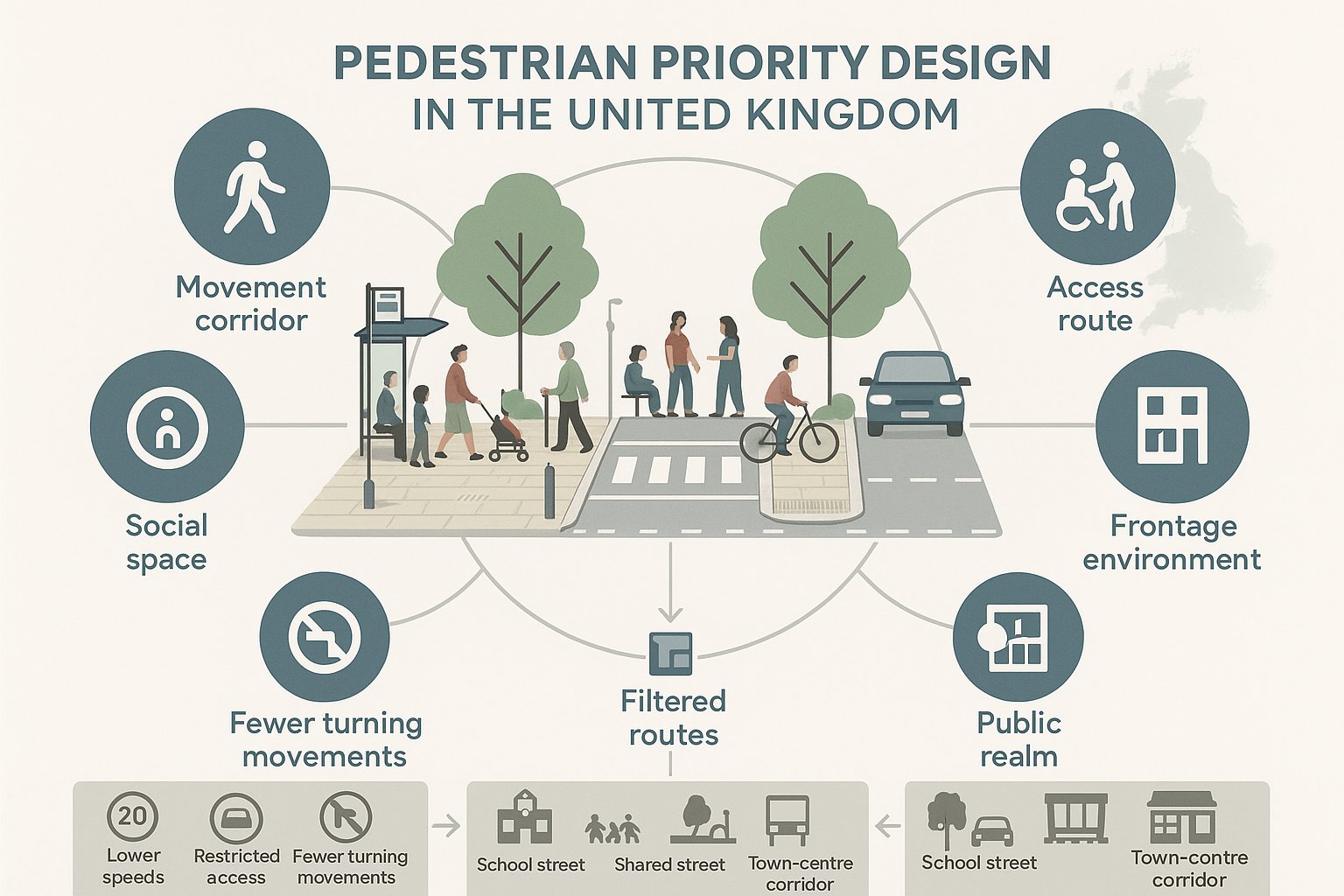
Modern street planning has moved away from the old assumption that movement efficiency for cars is the main objective. Streets are now expected to perform several roles at once: movement corridor, social space, access route, frontage environment, and public realm. In that context, pedestrian priority design treats walking as the baseline mode because almost every trip begins or ends on foot.
This doesn’t always mean banning vehicles. In many successful schemes, vehicles still operate, but under tighter conditions: lower speeds, restricted access, fewer turning movements, shorter crossing distances, and clearer visual cues that drivers are entering a people-first environment. Shared streets, school streets, filtered neighbourhood routes, and town-centre corridors can all sit under the same broad umbrella.
For planning professionals, the key point is that pedestrian priority design is both a transport and placemaking strategy. It influences road safety, accessibility, development value, and policy compliance at the same time. That is why local planning authorities increasingly expect applicants to explain not only vehicle access, but also how a site supports direct, legible, attractive and inclusive pedestrian movement within and beyond the red line boundary.
Why It Matters For Safety, Accessibility, And Place Quality
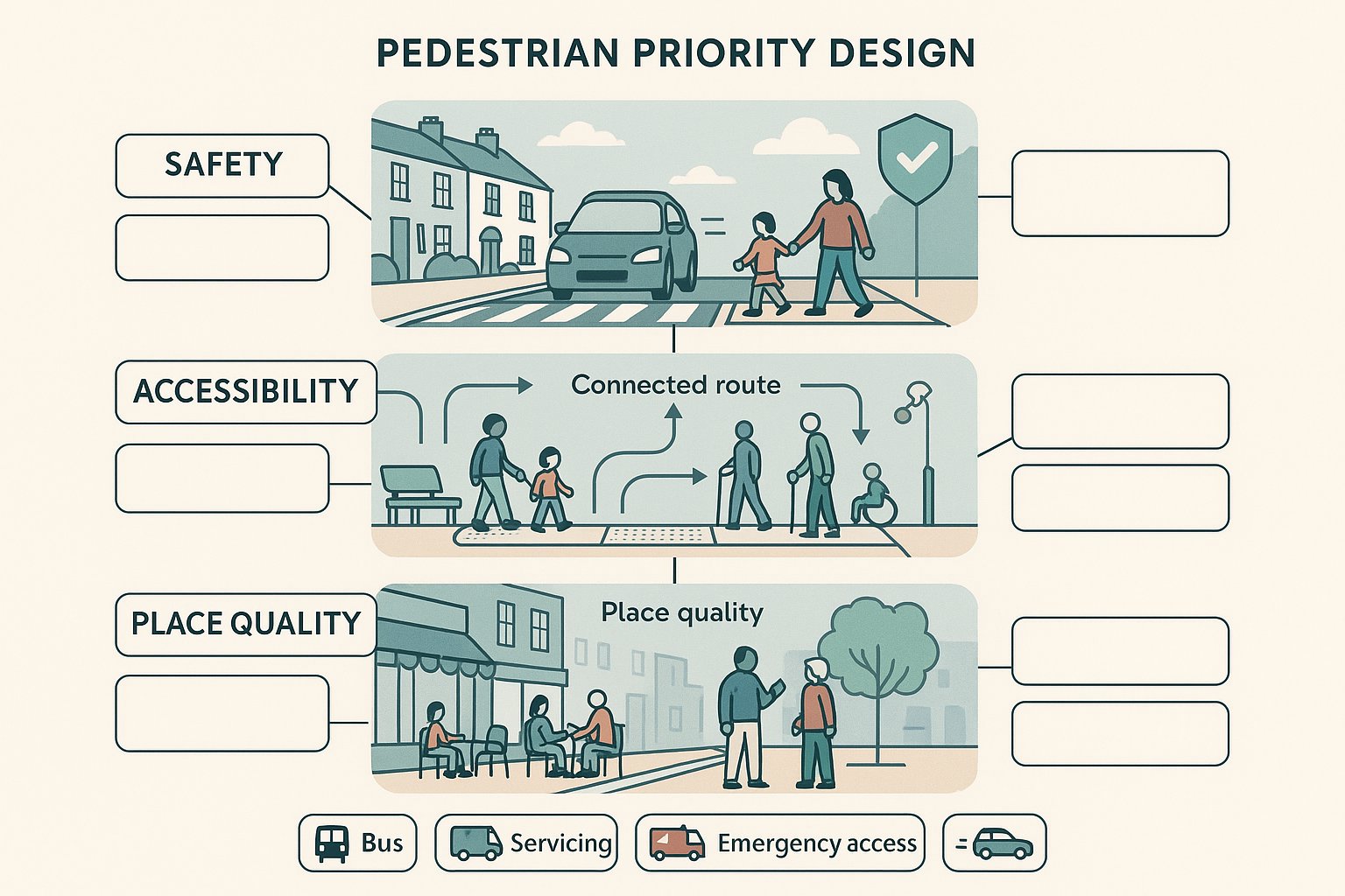
The case for pedestrian priority design is strong because it aligns three objectives that are often treated separately: safer streets, better accessibility, and higher-quality places.
On safety, lower vehicle speeds are the starting point. A street where drivers move slowly, encounter simpler junction geometry, and expect pedestrian activity is fundamentally less hostile than one designed around speed and capacity. That matters not just for collision severity, but for perceived safety too. Many people avoid walking routes that feel exposed, confusing, or dominated by traffic even if the formal collision record looks acceptable.
Accessibility goes further than compliance with minimum dimensions. A genuinely walkable environment needs continuous routes, dropped kerbs where appropriate, crossing opportunities in the right places, good surface quality, lighting, rest points, and layouts that work for wheelchair users, older people, children, and visually impaired pedestrians. If a route is technically passable but awkward, indirect, or stressful, it is not truly inclusive.
Then there is place quality. Streets with stronger pedestrian priority often support longer dwell time, better frontage activity, stronger local trade, and more social interaction. People notice shopfronts, stop for coffee, meet neighbours, and use the space as part of daily life rather than just passing through. That can support town-centre recovery and residential value alike.
From a planning perspective, these outcomes are closely linked. A safer, more accessible street is usually a better place: and a better place often performs better as part of a sustainable transport network. The challenge, of course, is delivering those benefits without creating unresolved impacts for buses, servicing, emergency access, or displaced traffic on surrounding streets.
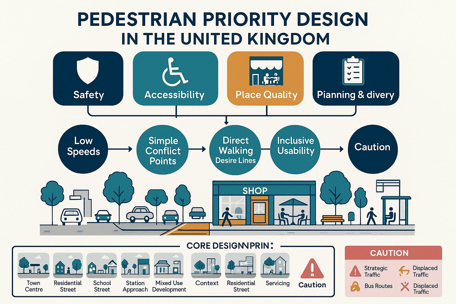
Core Design Principles That Put People First
At the scheme level, pedestrian priority design works best when it is guided by a few clear principles rather than a checklist of fashionable materials. The surface treatment matters, yes, but it cannot compensate for a layout that still gives vehicles the upper hand.
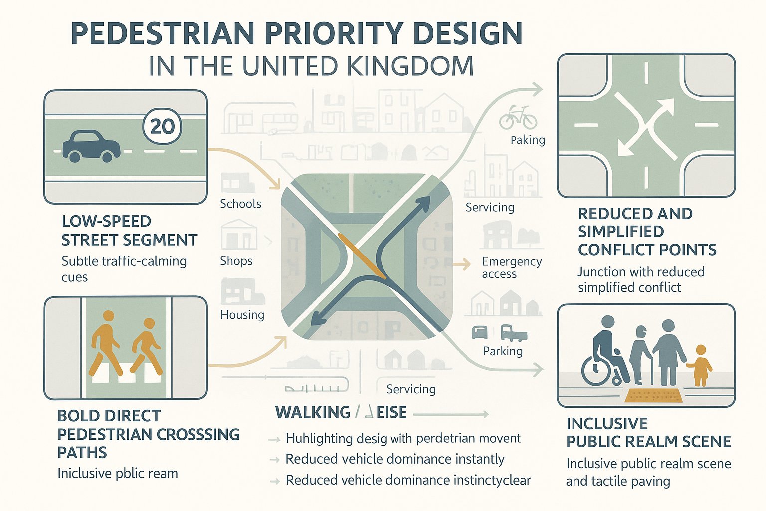
We generally come back to four fundamentals: low speeds, simple conflict points, direct pedestrian desire lines, and inclusive usability. If those are present, the street has a good chance of functioning well. If they are absent, even an expensive public realm scheme can disappoint.
Design should start with pedestrian movement patterns, not be retrofitted after carriageway geometry has been fixed. Where do people naturally want to walk? Where do they need to cross? What frontages, bus stops, schools, stations, or amenities generate footfall? How will a child, an older resident, or a wheelchair user experience the space at a wet November peak, not just in a summer visualisation?
It is also worth saying that people-first design is not anti-vehicle design. Most developments still need access for residents, deliveries, refuse, maintenance, and emergency services. The aim is to manage that access in a way that reduces dominance rather than pretending it does not exist.
Done properly, pedestrian priority is a network decision as much as a street decision. It should fit with surrounding walking routes, cycle links, bus operations, parking strategy, servicing arrangements, and the likely travel behaviour generated by the development.
Typical Features Used In Pedestrian Priority Schemes
Pedestrian priority schemes usually combine several physical and operational measures rather than relying on a single intervention. The exact mix depends on context, highway status, land use, traffic demand, and the authority’s design preferences.
Some features are geometric: wider footways, tighter corner radii, shorter crossings, raised tables, and reduced carriageway widths. Others are regulatory or management-led: timed vehicle restrictions, loading controls, modal filters, permit-based access, or changes to servicing windows. Then there are public realm elements such as seating, planting, lighting, drainage detailing, and wayfinding, which shape how the street feels and how intuitively people use it.
The strongest schemes tend to match the design tools to the street type. A town-centre high street with active frontages and bus activity needs a different balance from a residential mews or a school access street. That sounds obvious, but plenty of weak proposals still copy details from precedent images without asking whether the operational context is comparable.
For planning applications, we need to show not just what features are proposed, but why they are appropriate and how they will function together. Authorities increasingly want evidence that applicants have considered swept paths, servicing practicality, accessibility impacts, drainage, maintenance, and user behaviour. Pedestrian priority is rarely secured by one attractive drawing. It is secured by a coherent package that can be explained, tested, and defended.
Where Pedestrian Priority Design Is Most Effective
Pedestrian priority design is not equally suitable everywhere. It tends to work best where pedestrian demand is already high, where place function matters as much as traffic movement, or where vehicle access can be managed without undermining essential connectivity.
That includes residential streets, town centres, local centres, station approaches, school environments, campus settings, and mixed-use developments with short internal trip patterns. In these contexts, walking is either already significant or has strong latent demand. Small changes in layout and traffic management can hence produce meaningful benefits.
By contrast, locations with heavy strategic traffic, limited network resilience, or essential bus and servicing functions may need a more nuanced approach. That does not rule out pedestrian priority, but it usually means targeted interventions rather than blanket pedestrianisation. Continuous crossings at side roads, filtered permeability, reduced speed environments, or selective public realm upgrades may be more effective than a full traffic exclusion model.
For developers and design teams, this is where context really matters. A solution that is entirely logical in a historic market town may be weak in an edge-of-centre retail park or on a distributor route serving industrial activity. Planning authorities will usually be more persuaded by a context-led rationale than by broad claims about walkability.
The best results come when we identify the street’s primary role, likely user mix, access needs, and policy objectives early, then design pedestrian priority to support those realities rather than ignore them.
How Pedestrian Priority Design Affects Transport Assessments And Planning Applications
This is where pedestrian priority design becomes more than an urban design concept. In planning terms, it directly affects the scope, assumptions, and conclusions of transport work.
A pedestrian-priority proposal can influence trip distribution, internal site layout, access strategy, visibility expectations, parking demand, servicing arrangements, refuse collection, emergency access, and off-site mitigation. It may also change how a development is presented in policy terms, especially where local plans emphasise healthy streets, sustainable travel, town-centre vitality, or net-zero objectives.
For transport assessments, the key is to move beyond a narrow traffic-capacity lens. We still need robust analysis of vehicle effects, of course. But authorities increasingly expect a broader assessment covering pedestrian routes, crossing opportunities, public transport interfaces, cycle connections, delivery activity, and the interaction between all of those elements. A scheme cannot claim walking benefits while quietly creating poor bus stop access or an unworkable servicing pattern.
This is also where evidence quality matters. Good planning submissions compare options, explain design trade-offs, and show that the proposed arrangement has been tested in a realistic way. Temporary trials, before-and-after evidence from similar schemes, stakeholder engagement, and clear auditing can all strengthen the case. At ML Traffic, that sort of concise, planning-focused analysis is often what helps a proposal move from a broad aspiration to an application document a case officer and highway authority can actually rely on.
In short, pedestrian priority design should be embedded in the transport narrative from the start. If it appears only as a final visual layer, it is much harder to justify under scrutiny.
Common Design Risks, Evidence Requirements, And Conclusion
Pedestrian priority design is not automatically successful just because it reallocates road space. Some of the most common problems arise when a scheme improves one frontage or movement corridor while exporting inconvenience, delay, or safety risk elsewhere.
A classic example is displaced traffic. Remove capacity or access in one location without a realistic network response and neighbouring streets may absorb the impact. That can be especially sensitive where residential roads, bus corridors, or servicing routes sit nearby. Another risk is over-reliance on shared surface concepts without enough thought for visually impaired users, kerb definition, or behavioural clarity. What looks elegant on plan can feel ambiguous on site.
There are also practical planning risks: loading arrangements that work only in theory, refuse collection paths that conflict with pedestrian peaks, emergency access assumptions that have not been agreed, or public realm layouts that create maintenance burdens the adopting authority will resist.
That is why evidence matters. Strong schemes usually test alternatives, gather baseline pedestrian and traffic data, consult affected stakeholders, and where appropriate use temporary or staged interventions to understand real-world effects. Performance measures should include more than traffic flow alone: footfall, dwell time, accessibility, bus reliability, collision history, and user experience all matter.
The wider conclusion is simple. Pedestrian priority design is now a mainstream planning and transport issue, not an optional extra. When it is evidence-led, context-specific, and properly integrated with access and servicing needs, it can produce safer, more attractive and more policy-aligned places. When it is handled superficially, problems show up quickly, and usually during the planning process.
Frequently Asked Questions about Pedestrian Priority Design
What is pedestrian priority design in modern street planning?
Pedestrian priority design places walking ahead of general traffic by allocating street space, reducing vehicle dominance, and improving safety, accessibility, and legibility for pedestrians. It balances streets as movement corridors and public spaces, often including slower vehicle speeds and clearer crossings.
Why is pedestrian priority design important for safety and accessibility?
It reduces vehicle speeds and simplifies junctions, creating safer streets and improving perceived safety. It ensures continuous, inclusive walking routes suitable for all users, including wheelchair users and visually impaired pedestrians, thus enhancing street accessibility and quality of place.
Which street locations benefit most from pedestrian priority design?
Locations with high or latent pedestrian demand such as residential streets, town and local centres, retail areas, transit hubs, school surroundings, and mixed-use developments benefit most. These environments support walking as a core transport mode and public space function.
How does pedestrian priority design affect planning applications and transport assessments?
It influences trip patterns, access strategies, servicing, parking, and sustainable travel policy compliance. Transport assessments must consider pedestrian routes, bus and cycle interfaces, and deliver a coherent, tested design package addressing all modes, not just vehicle capacity.
What are common features used in pedestrian priority schemes?
Typical features include widened footways, continuous crossings, raised tables, traffic calming measures, filtered vehicle access, shared surfaces, street trees, seating, lighting, wayfinding, and loading controls, all designed to prioritize walking while managing necessary vehicle movements.
How can pedestrian priority design avoid problems like displaced traffic or service conflicts?
Through context-led, evidence-based design that assesses network effects, tests alternatives, engages stakeholders, and uses temporary trials. Managing vehicle access carefully avoids displacing traffic problems, while coordinating servicing and emergency access ensures operational practicality.