Planning in Salisbury rarely fails because of a single drawing or one awkward consultee comment. More often, schemes get slowed down because transport has been treated as something to tidy up later rather than shape properly from the start. In a city with a historic centre, sensitive streets, pressure on radial routes and the strategic influence of the A36, that approach can become expensive very quickly.
For developers, architects, planners and consultants, transport planning Salisbury work is really about proving three things early and clearly: the proposal can be accessed safely, it won’t create unacceptable pressure on the network, and it supports the kind of sustainable movement pattern national and local policy now expects. That sounds straightforward on paper. In practice, it means understanding Wiltshire Council’s transport expectations, knowing when National Highways may need to be involved, and producing evidence that is proportionate but credible.
We see the same pattern again and again: when transport advice is scoped early, layouts improve, planning risks become visible sooner, and applications tend to move through the system with fewer surprises. When it is left too late, teams often end up redesigning access, re-running modelling or defending weak assumptions on trip rates, parking or sustainable travel.
This guide sets out what developers need to know in 2026, from when a Transport Assessment is likely to be required to what a Salisbury-focused submission should actually cover if it is going to stand up to scrutiny.
Why Transport Planning Matters For Salisbury Developments
Salisbury is not a place where transport can be treated as a standard technical appendix. The city’s historic form, constrained street pattern and sensitive highway network mean movement issues often sit at the heart of planning decisions. A scheme can be architecturally strong and still run into trouble if access is awkward, parking is undercooked, or the traffic case is weak.
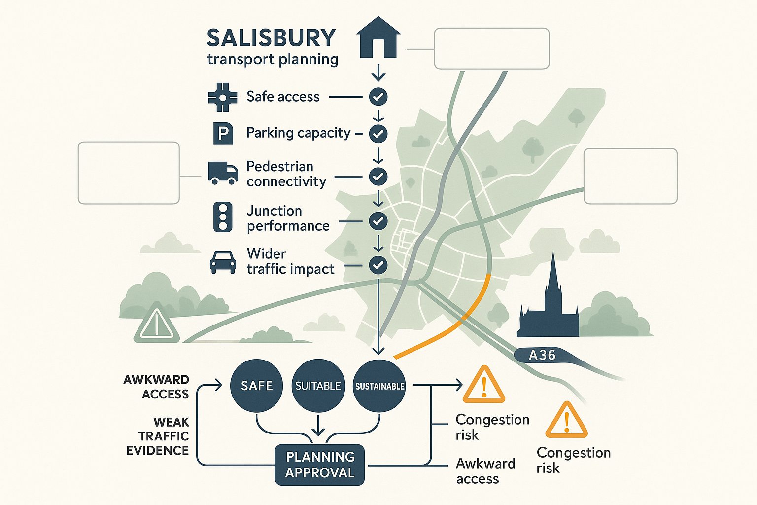
At planning stage, transport evidence helps decision-makers test whether a development is safe, suitable and sustainable. Those are not abstract policy words. They affect whether a junction can accommodate extra turning traffic, whether pedestrians can reach nearby services comfortably, whether refuse vehicles can manoeuvre without conflict, and whether the residual traffic impact could be considered severe under the National Planning Policy Framework (NPPF).
In Salisbury, that matters even more because local constraints stack up. The city centre is historic and environmentally sensitive. Several routes already experience peak-time pressure. And sites influenced by the A36 may trigger wider strategic concerns beyond the immediate frontage. Even modest proposals can attract detailed questions if they sit in the wrong location or intensify movements at a known hotspot.
Good transport planning is hence part risk management, part design support. It gives the project team evidence to justify the scheme, but it also improves the scheme itself. At ML Traffic, we find that concise, locally tailored reporting usually works better than generic volume. Planners and highway officers are looking for robust judgement, not paperwork for its own sake.
How Salisbury’s Local Highway And Planning Context Shapes Applications
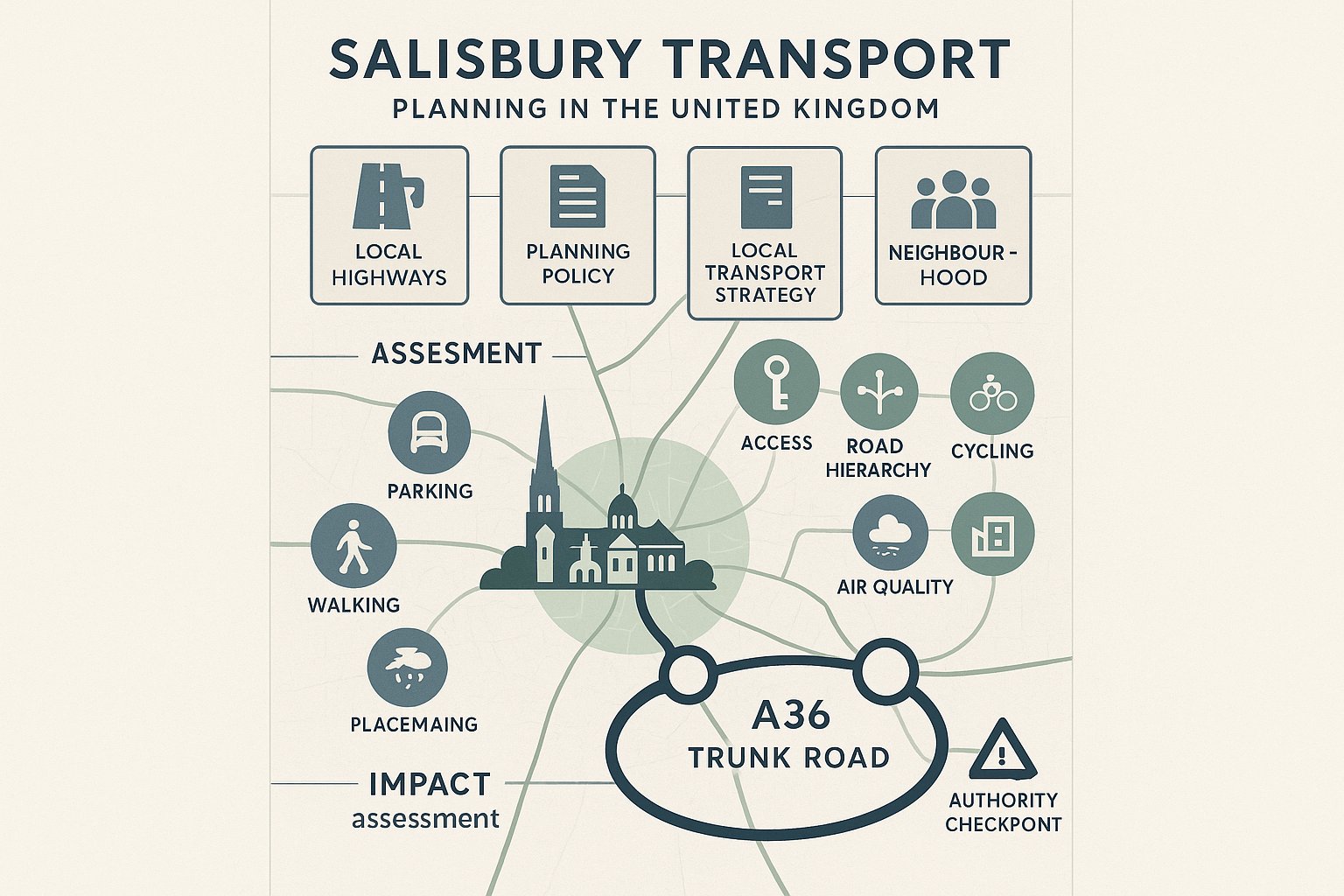
Any serious transport submission in Salisbury needs to reflect the local planning and highway context, not just national best practice. The key local highway authority is Wiltshire Council Highways, and its expectations sit alongside the NPPF, the emerging and adopted local plan framework, neighbourhood plan considerations where relevant, and the wider Local Transport Plan. Together, those documents shape what is likely to be acceptable on access, parking, road hierarchy and sustainable travel.
That local context is unusually important here. Salisbury has a compact historic core, streets with limited capacity for change, heritage sensitivities, and a network where relatively small increases in traffic can become contentious if they affect the wrong junction or route. There is also the presence of the A36 trunk road, where National Highways may need to comment on development impacts. If a site loads traffic onto the A36 or interacts with a junction linked to it, the scope of work often expands.
Air quality and placemaking considerations can also influence transport discussions. A proposal that depends almost entirely on private car access may face tougher scrutiny, especially where walking, cycling or bus opportunities should realistically form part of the travel pattern. In other words, the question is not only ‘can vehicles get in and out?‘ It is also whether the scheme aligns with the direction of travel in policy terms.
That is why transport planning Salisbury projects need a genuinely local lens. Thresholds and assumptions that might feel acceptable elsewhere do not always land well in Salisbury’s planning environment.
When A Planning Application Is Likely To Need Transport Evidence
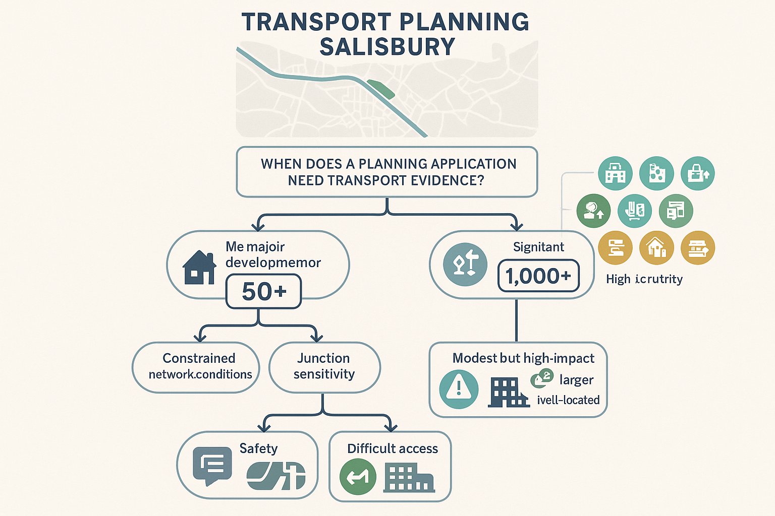
Not every planning application needs a full transport package, but a surprising number need more than a basic access note. As a rule, transport evidence becomes more likely where the proposal is major development, generates notable trips, affects a constrained part of the network, or raises site-specific safety concerns.
In Salisbury, a Transport Assessment is commonly expected for larger schemes such as 10 or more dwellings or 1,000 square metres or more of non-residential floorspace, especially where impacts extend beyond the site frontage. Even below those broad markers, a proposal can still require formal transport evidence if it is likely to affect a sensitive junction, increase traffic on the A36 corridor, or intensify movement at a location already known for congestion or collision history.
Some land uses attract closer scrutiny because they are naturally trip-heavy or create sharp peaks. Retail, foodstores, drive-thrus, schools, healthcare, leisure, logistics and employment uses often fall into that category. A smaller site with difficult access, poor visibility, heavy servicing demand or local parking pressure can also trigger the need for a technical report.
We usually advise clients not to think in terms of pure size thresholds alone. Highway authorities look at effect, not just scale. A modest town-centre redevelopment can need detailed transport input, while a larger but well-located scheme may be more straightforward if impacts are demonstrably limited. Pre-application engagement is often what clarifies the right level of evidence before the programme slips.
Transport Assessments Vs Transport Statements Vs Travel Plans
These three documents are related, but they do different jobs, and mixing them up is a common source of delay.
A Transport Assessment (TA) is the most detailed option. It is normally prepared for larger or higher-impact development and provides a full appraisal of baseline conditions, trip generation, network impact, access design, parking, servicing, safety and mitigation. In Salisbury, a TA is often the right tool where there is a realistic prospect of off-site traffic effects, junction stress or strategic highway interest.
A Transport Statement (TS) is lighter-touch and proportionate. It is generally suitable for smaller or lower-impact schemes where the transport implications are limited but still need evidence. A TS may review the site context, set out access proposals, summarise expected trips and explain why severe impacts are unlikely. It still needs to be robust. “Short” does not mean vague.
A Travel Plan (TP) is different again. It is a strategy document aimed at influencing travel behaviour and reducing reliance on the private car. It is often required for workplaces, schools, larger residential schemes and developments where policy support depends partly on delivering sustainable travel outcomes. A good TP includes practical measures, targets, monitoring and someone responsible for implementation.
In practice, these documents often sit together. A planning application might include a TA plus a Framework Travel Plan, or a TS with a simpler package of sustainable travel measures. The trick is proportionality: enough evidence to answer the real issues, without producing a report that looks comprehensive but dodges the important questions.
What A Salisbury Transport Assessment Typically Needs To Cover
A Salisbury Transport Assessment should be detailed enough to reflect local conditions and proportionate enough to stay focused on likely impacts. The strongest reports usually combine policy analysis, baseline evidence, transparent forecasting and clear mitigation. They show not just what the development adds, but how the site will function for all users.
Most TAs begin with a review of the planning and transport policy framework, including the NPPF, Wiltshire policy, local transport objectives and any site-specific context such as neighbourhood plans. From there, the report should establish baseline conditions: the surrounding highway network, existing traffic patterns, collision history, public transport provision, walking and cycling connectivity, and any operational issues already affecting the area.
The technical core then tests how the development will perform. That normally means trip generation, distribution and assignment, capacity modelling at relevant junctions, access design checks, parking and servicing review, and an assessment of road safety implications. Depending on the proposal, the report may also need to account for committed development, phased delivery, construction effects or strategic network interactions.
A Salisbury-focused TA should also keep a close eye on practical planning questions. Can emergency and refuse vehicles turn safely? Are pedestrian routes direct and legible? Do parking levels align with Wiltshire expectations? Is the sustainable travel package believable? Those details matter because they are often where officer comments become planning conditions, redesign requests or, occasionally, objections.
Trip Generation, Traffic Impact And Junction Capacity Analysis
Trip generation is where many transport cases are won or lost. In most schemes, we use TRICS to forecast likely person and vehicle trips by land use, mode and time period. The quality of that exercise depends on sensible site selection, transparent filtering and realistic professional judgement. If the comparator sites are weak, the whole submission can start to wobble.
For Salisbury applications, weekday AM and PM peak periods are usually central, though retail and leisure uses may also need Saturday or interpeak analysis. The next step is to distribute and assign those trips across the network, taking account of likely approach routes, travel patterns and nearby destinations. Larger schemes should also consider committed developments so that the assessment reflects the real network that decision-makers are planning for, not a frozen snapshot from two years ago.
Junction capacity testing may then be undertaken using tools such as PICADY, ARCADY or LINSIG, depending on the junction type. The key question is not whether every arm runs perfectly in every scenario, but whether the development causes material worsening and whether any residual impact could be considered severe in NPPF terms. Queueing, delay and practical operation all matter.
Poorly evidenced trip rates are a frequent reason for challenge. Wiltshire Highways will usually look closely at whether assumptions are proportionate, current and locally credible.
Access, Parking, Servicing And Road Safety Considerations
Even where off-site traffic impact is modest, many Salisbury schemes hinge on whether the site can actually function safely day to day. That starts with access design. Visibility splays, junction geometry, gradients, pedestrian crossing points and interaction with nearby accesses all need to be checked carefully. A beautiful layout can fall apart quickly if the access point is in the wrong place or cannot achieve safe visibility without third-party land.
Parking is another live issue. Car and cycle parking should be assessed against Wiltshire standards and local expectations, while also reflecting the nature of the site and realistic travel behaviour. Over-provision can undermine placemaking and sustainable transport objectives: under-provision can trigger overspill parking and neighbour objections. EV charging, accessible bays and visitor provision are now expected parts of the conversation, not add-ons.
Servicing is often underestimated. Delivery vehicles, refuse collection, emergency access and occasional larger vehicles may all need to be demonstrated through swept-path analysis. If the strategy relies on awkward reversing or informal kerbside activity, officers are unlikely to be reassured.
Road safety should also be grounded in evidence. A review of STATS19 collision data can reveal existing trends or risk patterns, and for new junctions or significant changes, a Road Safety Audit may be appropriate. The best submissions treat safety as a design principle rather than a final checklist item.
Walking, Cycling, Public Transport And Sustainable Travel Measures
A Salisbury TA should never stop at cars. Current policy expects development to support sustainable movement, and in a city like Salisbury that matters for both planning and place quality. So the report needs to examine whether people can walk, cycle or use public transport in a way that is realistic, not merely theoretical.
For walking, we would normally assess directness, crossing opportunities, footway quality, surveillance and links to nearby services. Manual for Streets principles remain highly relevant here, especially for residential and mixed-use schemes. If the only route to the nearest bus stop feels unsafe or indirect, that weakens the overall case.
Cycling considerations include route connections, storage quality, security, gradient and integration with local networks or rights of way. Public transport review should consider proximity to bus stops, service frequency, destinations served and whether any infrastructure upgrades are needed. It is no use pointing to a stop within walking distance if the service pattern is thin and impractical for the proposed use.
Where a Travel Plan is required, the measures need to be tangible: welcome packs, personalised travel information, cycle incentives, car-share promotion, monitoring, targets and perhaps car-club support where suitable. Weak, generic promises are easy to spot. Strong sustainable travel measures, by contrast, can materially improve the planning balance.
Key Site Types That Often Require Transport Planning Input In Salisbury
Some Salisbury site types attract transport scrutiny almost by default because of the way they interact with the network. Edge-of-settlement housing and urban extension proposals are a clear example. Even where individual accesses look manageable, cumulative effects on radial routes, schools, local centres and strategic junctions can be significant. These schemes often need a broad view of movement patterns, not just a frontage assessment.
Retail parks, supermarkets and drive-thrus also tend to require detailed input. They generate concentrated vehicle movements, can affect weekend peaks, and often depend heavily on turning traffic, servicing and parking efficiency. Small mistakes in trip assumptions or junction modelling are noticed quickly.
Employment parks, logistics units and warehousing bring a different transport profile: staff arrivals, van traffic, HGV movements, servicing hours and routeing concerns. In the wrong location, those issues can become politically and technically sensitive.
For schools, colleges, hospitals and care homes, the challenge is often less about all-day traffic totals and more about sharp peak concentrations, pick-up and drop-off behaviour, pedestrian safety and operational management. Town-centre redevelopments and mixed-use schemes can be especially nuanced. They may benefit from sustainable location credentials, but access, parking, servicing and construction logistics are usually tighter.
In short, transport planning Salisbury work is frequently most valuable on schemes where movement patterns are complex, constrained or publicly visible. Those are exactly the projects where proportionate but early analysis tends to save the most time later.
Common Reasons Transport Planning Submissions Face Delays Or Objections
Most transport objections do not appear from nowhere. They usually follow a pattern, and once you have seen that pattern a few times, it becomes fairly predictable.
One of the biggest causes of delay is poor scoping. If the applicant has not agreed the likely extent of assessment with Wiltshire Highways, and with National Highways where the A36 is relevant, there is a good chance the authority will ask for more work after submission. That can mean extra surveys, additional modelling and weeks lost.
Data quality is another recurring problem. We still see out-of-date traffic counts, missing peak periods, thin sustainable transport evidence or assessments that ignore committed development nearby. None of that inspires confidence. Nor does underestimating trip generation through selective TRICS use or optimistic assumptions that are not backed by transparent reasoning.
Then there is local awareness, or the lack of it. If a report overlooks known congestion points, parking stress, school peak conditions or a poor collision record, objectors and officers will notice. The submission starts to look generic rather than place-specific.
Design non-compliance also causes friction: inadequate visibility, awkward access geometry, substandard parking provision, weak cycle facilities, unclear servicing strategy. And finally, many Travel Plans fail because they read like template text. Unrealistic targets and vague commitments rarely persuade anyone.
Put simply, delays happen when the report feels detached from the site, the network and the decision-maker’s likely concerns. Strong submissions anticipate objections before they are written.
How Early Transport Advice Can Reduce Planning Risk And Design Changes
Early transport input is not just about getting a report ready sooner. It changes decisions upstream, when those decisions are still cheap to change. That is the real value.
At concept stage, transport advice can test whether a site has a realistic point of access, whether visibility can be achieved, how internal movement should work, and whether parking and servicing can be accommodated without compromising layout quality. If there is a potential show-stopper, such as an access constrained by frontage conditions or sensitivity around the A36, it is much better to discover that before the architectural design hardens.
Early scoping also reduces technical drift. Agreeing survey requirements, peak periods, study junctions and modelling approach with the relevant authority can prevent the familiar cycle of submit-comment-rework-resubmit. That is often where programmes quietly unravel.
There is a commercial benefit too. Redesigning a site layout after planning submission usually costs more than commissioning sound transport advice at the start. The same goes for late requests for extra surveys or revised mitigation. A sensible early strategy helps the whole consultant team work from the same assumptions.
We have found that concise, front-loaded advice often gives clients the clearest route through planning risk. Not every site needs a full TA on day one. But almost every site benefits from someone asking the awkward transport questions early, while there is still room to answer them properly.
What To Prepare Before Commissioning A Transport Planning Report
The better the information at the start, the better and faster the transport advice is likely to be. Before commissioning a TA, TS or Travel Plan, it helps to assemble a practical project pack rather than sending over a red line and hoping for the best.
Start with the basics: the red-line boundary, site address, proposed use, unit numbers or floorspace schedule, and any draft layout or access drawings. If the scheme is phased, that should be clear from the outset because phasing can affect survey strategy, trip forecasting and mitigation.
Next, gather the planning background. Previous applications, appeal decisions, pre-app feedback, local allocation status and any earlier transport work can save a lot of duplicated effort. If there have been known concerns about access, parking, rat-running, congestion or collisions, flag them early. They are unlikely to disappear just because the report does not mention them.
Policy context is useful too, especially if there are neighbourhood plan references, town-centre considerations or site-specific local plan policies in play. Programme matters should not be overlooked. Survey windows, committee dates, land deals and design freeze points all affect what can realistically be delivered.
A short brief covering constraints, timescales and decision-making priorities can make a real difference. It allows the transport consultant to recommend the right level of work, identify risks quickly and avoid over- or under-scoping. That is usually where efficient projects begin.
Conclusion
In Salisbury, transport evidence is rarely a box-ticking exercise. It sits close to the core planning questions: safety, access, network impact, heritage sensitivity and whether a scheme genuinely supports sustainable travel. That is why early, properly scoped work tends to outperform reactive reporting every time.
For developers and project teams, the practical lesson is simple. Build transport planning into site appraisal and design development, not just the planning submission stage. Understand Wiltshire Council’s expectations, recognise when the A36 or sensitive local junctions may widen the assessment, and make sure your evidence is proportionate, current and site-specific.
Done well, transport planning Salisbury applications become easier to defend because the scheme itself is stronger. Access works better. Parking and servicing are thought through. Travel planning is more credible. And the risk of late redesign, additional surveys or avoidable objection drops sharply.
In 2026, that kind of early clarity is not a luxury. It is one of the most reliable ways to secure smoother planning approval.
Transport Planning Salisbury – Frequently Asked Questions
What is transport planning in Salisbury and why is it important?
Transport planning in Salisbury ensures developments are safe, accessible, and compliant with Wiltshire Council and NPPF policies. Given Salisbury’s historic layout and sensitive network, it manages traffic impact, supports sustainable travel, and protects key routes like the A36.
When is a Transport Assessment required for a Salisbury planning application?
A Transport Assessment is typically needed for major developments with 10 or more dwellings or over 1,000m² non-residential floorspace, or when proposals impact key junctions, the A36 corridor, or constrained local networks in Salisbury.
How do Transport Assessments differ from Transport Statements or Travel Plans in Salisbury?
Transport Assessments provide detailed traffic impact and safety analysis for larger developments. Transport Statements are lighter evidence for smaller schemes. Travel Plans focus on reducing car use through sustainable travel measures, often required for workplaces and large residential projects.
What local policies and conditions affect transport planning in Salisbury?
Transports submissions must consider Wiltshire Council’s local plans, the NPPF, neighbourhood plans, and the Local Transport Plan. Salisbury’s historic centre, constrained streets, peak congestion, and the A36’s strategic role require locally tailored assessments.
How can early transport advice reduce planning risk for Salisbury developments?
Early transport input identifies access or network constraints before design finalisation, helps scope appropriate evidence with Wiltshire and National Highways, and prevents costly redesigns or delays, leading to smoother planning approval in Salisbury.
What are common reasons for delays or objections to transport planning submissions in Salisbury?
Delays often arise from insufficient scoping, outdated or incomplete data, underestimating trip generation, ignoring local congestion or safety hotspots, non-compliance with Wiltshire standards on access or parking, and weak sustainable travel proposals.