Planning applications rarely fail because of one dramatic flaw. More often, they stall because a seemingly ordinary access arrangement hasn’t been thought through well enough. A junction is too close to another junction. Visibility is tight. Refuse vehicles can’t turn. Walking routes are awkward. Or the access strategy described in the planning documents simply doesn’t match what’s shown on the drawings.
That is why development access design matters so much. It sits at the point where planning policy, highway engineering, site constraints and real-world movement all meet. For architects, planners, developers, lawyers and local authorities, getting access right is not just a technical exercise: it is often the difference between a smooth consent process and months of avoidable delay.
In 2026, expectations are only getting sharper. Highway authorities want clear evidence. Local planning authorities expect policy alignment, inclusive design and credible transport reporting. And applicants need access proposals that are safe, buildable and proportionate to the development they support.
In this guide, we set out what development access design means in practice, the standards and policy framework to review first, how site context affects the right solution, and the design mistakes that most often trigger objections. We also explain how transport statements, transport assessments and travel plans need to align with the proposed access strategy, because in planning, consistency wins trust.
What Development Access Design Means In The Planning Process
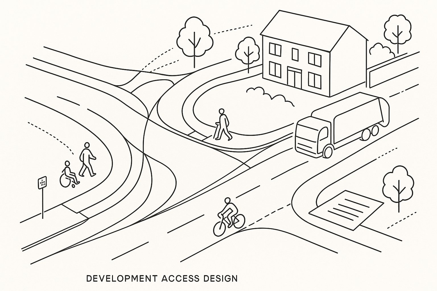
Development access design is the planning and engineering of how people, vehicles and service movements enter, leave and move within a site. In planning terms, that sounds simple. In practice, it is one of the most scrutinised parts of a proposal because it connects the development to the public highway, to neighbouring land uses and to the wider transport network.
Usually, access design is presented across several documents rather than one. We see it in the site layout, highway drawings, the Design and Access Statement, and the supporting Transport Statement or Transport Assessment. For larger or more sensitive schemes, it may also appear in swept-path drawings, visibility plans, stage 1 road safety audits, travel plans and construction logistics material.
The purpose is broader than proving that cars can get in and out. A sound access strategy shows that the proposal responds to site context, respects the road hierarchy, accommodates emergency and servicing needs, and provides safe routes for walking, wheeling and cycling. It should also demonstrate inclusive access, which is not an optional extra tucked on at the end.
From a planning perspective, access design helps answer a basic but decisive question: can this development function safely and appropriately in this location? If the answer is unclear, consent is vulnerable. If the answer is robust, well-evidenced and policy-aligned, the rest of the application tends to stand on firmer ground.
Why Access Design Matters For Safety, Capacity And Planning Consent
Access design matters because it goes straight to the issues highway authorities care about most: safety, operational performance and impact on other road users. A poorly designed access can increase turning conflicts, reduce inter-visibility, obstruct traffic flow and create avoidable risk for pedestrians and cyclists. Even a modest scheme can attract objection if those basics are not convincingly addressed.
Safety is usually the first test. Authorities will want confidence that vehicles can enter and exit without dangerous manoeuvres, that sightlines are adequate for the speed environment, and that vulnerable users are protected. They will also look at whether the design creates hidden problems, such as reversing refuse vehicles onto the highway or crossing points placed in the wrong location.
Capacity comes next. Not every application needs complex modelling, but every application does need a believable explanation of how the access will operate. If forecast traffic, turning movements or nearby junction interactions have been ignored, the access strategy can quickly unravel.
And then there is consent. In many cases, the practical route to planning permission runs through a highway authority “no objection”. Access design is rarely the only issue in a planning application, but it is often the issue that carries disproportionate weight. Get it right and the scheme looks thought through. Get it wrong and confidence in the entire proposal drops.
The Core Standards, Guidance And Policy Framework To Check First
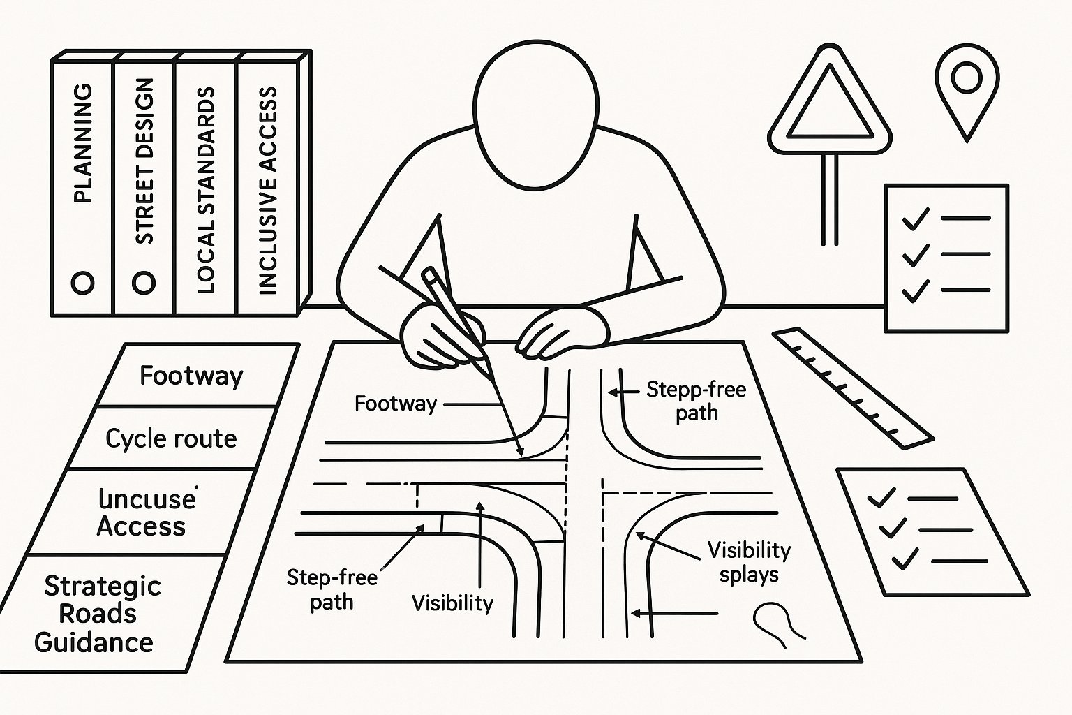
Before any geometry is fixed, we need to know which standards and policy documents govern the site. In England, the starting point is usually the National Planning Policy Framework and the relevant National Planning Practice Guidance. These establish the broad planning tests around sustainable transport, safe access and severe cumulative impacts.
From there, the technical framework depends on the road context. For many local streets and urban environments, Manual for Streets and Manual for Streets 2 remain central reference points, particularly on speed, place function and visibility. Where the development affects the strategic road network or trunk roads, the DMRB becomes more relevant. Local highway design guides can be just as important, especially where councils have their own adopted visibility, parking, cycling or junction standards.
We also need to review Local Plan transport and design policies, supplementary planning documents, parking standards and cycling guidance. Those local documents often decide what is acceptable in practice.
Inclusive access requirements should be checked at the outset as well, including duties under the Equality Act and the principles reflected in Building Regulations Part M. If step-free routes, dropped kerbs, gradients or crossing details are left until late design stages, redesign is almost inevitable.
This is one reason specialist input matters. At ML Traffic, for example, the value is not just in producing transport reports quickly: it is in tailoring the access evidence to local authority thresholds, policy wording and likely review points.
How Site Context Shapes The Right Access Strategy
There is no universally correct access arrangement. The right strategy depends on where the site sits, what surrounds it, how the adjoining highway operates and what the development is trying to achieve. A suburban infill scheme on a low-speed residential street is a different proposition from a roadside employment site on a fast A-road, even if the red line area looks similar on paper.
Context starts with the basics: settlement type, frontage conditions, topography, existing accesses, nearby junctions, boundary vegetation, public rights of way and whether there are heritage or environmental constraints. A conservation area, listed wall, steep embankment or mature tree belt can all materially affect access location and geometry.
Public transport and active travel links matter too. If a site has strong bus connections and direct walking and cycling routes, that may support a different access emphasis than a site where car dependency is higher. Equally, if a proposal relies on sustainable travel in principle, the access design has to make those journeys practical in reality.
A strong planning submission shows that the access strategy emerged from the site, rather than being dropped onto it. Highway officers can usually tell the difference within a few minutes.
Existing Highway Conditions And Road Hierarchy
The first practical question is what kind of road the site connects to. Road hierarchy influences almost everything: expected speeds, traffic composition, acceptable junction form, visibility requirements and the degree of priority the site access can reasonably demand.
A new access onto a quiet local street may work as a simple priority arrangement with modest radii and pedestrian-friendly geometry. The same layout on a busier distributor road may be entirely unsuitable. On higher-speed routes, design must respond to stopping sight distance, turning demand, lane discipline and the consequences of right-turn movements across traffic.
We also need to look beyond classification labels. An unclassified road outside a settlement can function like a fast rural link: a B-road in a town centre may operate more like a place-led street. Traffic flows, observed speeds, collision history, on-street parking, frontage activity and nearby schools or shops all help describe the real operating environment.
This is where weak applications often slip. They cite the speed limit but ignore actual conditions. Or they note traffic levels without considering how queueing at adjacent junctions affects the proposed access. A credible design takes the road’s function seriously and aligns the access with that function, rather than forcing a preferred layout onto the wrong network context.
Land Use, Scale Of Development And Expected Vehicle Types
Access design also has to reflect what the development will generate. Residential, retail, industrial, logistics, mixed-use and care uses all produce different travel patterns, peaks and vehicle types. That affects not just the size of the access, but the form it should take and the evidence needed to support it.
For housing, the key questions may centre on peak-hour car trips, visitor parking pressure, refuse collection and whether pedestrians can move safely between the site and local facilities. For employment or warehousing, the proportion of vans and HGVs becomes critical. For roadside retail or drive-through uses, turning volumes and short-stay circulation can dominate the design challenge.
Scale changes things again. A small scheme may be acceptable with a straightforward priority junction if geometry and visibility are sound. Larger developments often require more robust arrangements, internal stacking capacity, dedicated turning lanes or phased mitigation.
Vehicle type is where many layouts reveal whether they have been genuinely tested. Can a fire tender enter and leave in forward gear? Can a refuse vehicle turn without overrunning footways? Can a 16.5 metre articulated HGV, if relevant, reach loading areas without conflict? If the likely design vehicles have not informed the layout from the start, amendments are usually unavoidable.
Key Design Elements Of A Safe And Effective Site Access
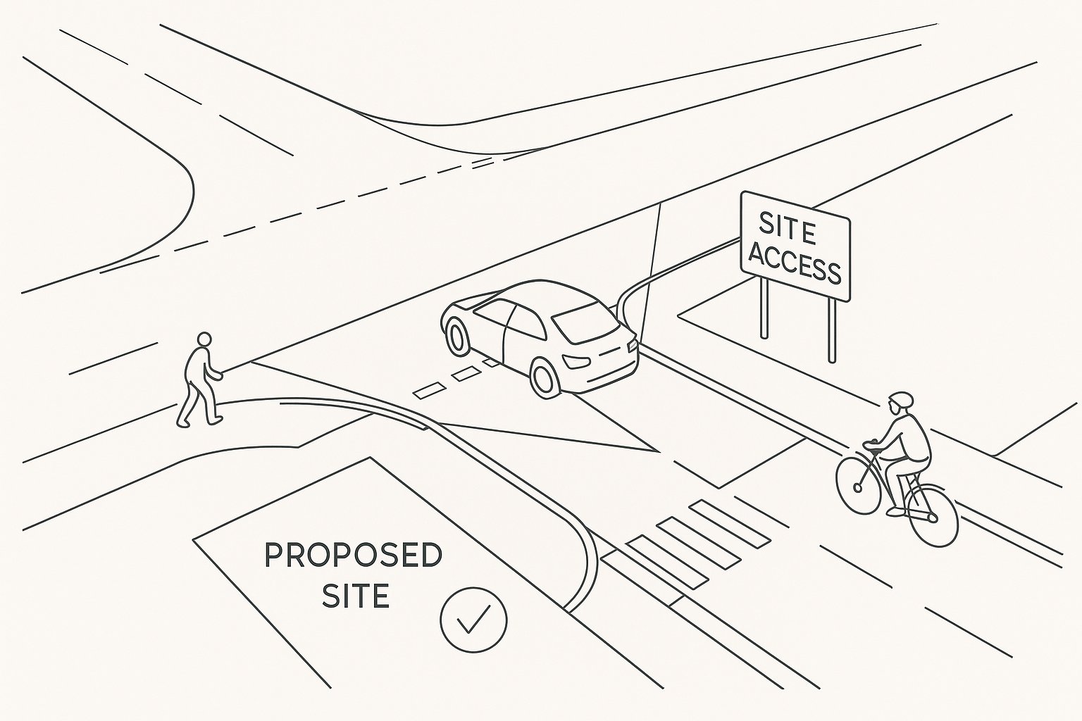
A safe and effective site access is made up of a handful of design components that must work together, not as isolated checks on a list. Location, visibility, junction geometry, pedestrian provision, drainage, surfacing, lighting and operational clarity all matter. If one element is materially weak, the whole arrangement can become difficult to defend.
The chosen access point should minimise conflict with existing junctions, crossings, bus stops, parking activity and frontage uses. It should be legible to drivers and comfortable for those walking or cycling past the site. Gradients need to be controlled so vehicles can stop and emerge safely, while surface water must not drain onto the highway.
Width is another balancing act. Too narrow, and larger vehicles mount kerbs or block movement. Too wide, and crossing distances for pedestrians increase while driver speeds at the access can creep up. Kerb radii need the same judgement: enough to accommodate the intended vehicle, but not so generous that the junction behaves like a slip road.
Design quality here is rarely about one dramatic flourish. It is about coordination. The most successful access layouts are usually the ones where every small decision supports the same outcome: safe movement, policy compliance and a proposal that feels proportionate to its context.
Visibility Splays, Geometry, Junction Spacing And Tracking
Visibility splays are often treated as a box-ticking exercise. They are not. They are a direct expression of whether drivers and riders can see, react and manoeuvre safely in the actual speed environment. The required splay will depend on the applicable guidance and the road context, often drawing on Manual for Streets principles in lower-speed places and more stringent standards where speeds or road functions demand it.
But visibility is only one part of the picture. Junction geometry needs to support the intended turning movements without causing excessive entry speeds or encroachment into opposing lanes. Carriageway width, kerb radii, approach angles and gradients all affect how safely the access operates.
Junction spacing matters too. If a proposed access sits too close to another junction, roundabout arm, private drive or crossing point, manoeuvres can overlap in ways that create instability and capacity problems. Authorities are understandably cautious where cumulative conflict is obvious from the plan.
And then there is tracking. Swept-path analysis should test realistic worst-case design vehicles, not just a convenient one. Depending on the scheme, that may include refuse vehicles, fire appliances, delivery vans or articulated HGVs. Tracking should prove not only that a vehicle can technically make the turn, but that it can do so without unreasonable overrun, repeated shunting or conflict with pedestrian routes.
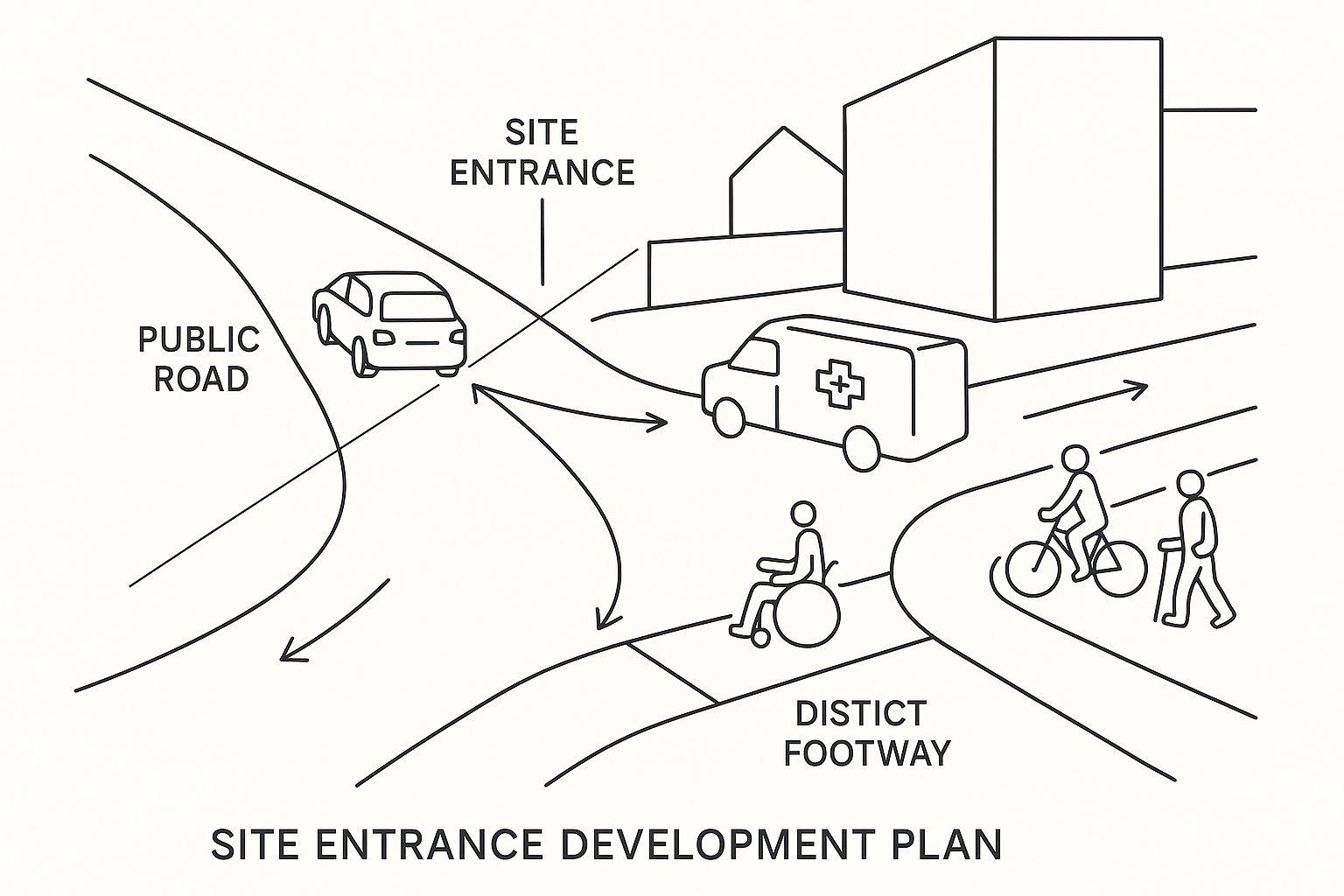
Walking, Cycling, Servicing And Refuse Access Requirements
A modern access strategy cannot be vehicle-only. Local planning authorities and highway authorities increasingly expect a coherent explanation of how people will walk, wheel, cycle, receive deliveries and store waste safely and conveniently.
For pedestrians, that means direct and step-free routes, suitable footway widths, dropped kerbs where needed, logical crossing points and gradients that work for all users rather than just the able-bodied. Inclusive design should be embedded early. If wheelchair users, people with pushchairs or those with impaired vision are forced into awkward detours or shared conflict points, the scheme will attract justified criticism.
Cycle access needs similar attention. Connections should be continuous, obvious and safe, with parking located where people will actually use it. A cycle store hidden behind service yards may tick a policy box but still fail in practice.
Servicing and refuse are the classic afterthoughts that delay applications. Loading bays, turning heads, headroom, route widths and bin collection points all need operational logic. In some schemes, especially flatted development or commercial sites, waste collection strategy can shape the access almost as much as general traffic does. If refuse vehicles need to reverse long distances, stop on the public highway or block pedestrian movement, officers will usually push back, and rightly so.
When A Priority Junction, Ghost Island Or Other Access Form Is Appropriate
The correct access form depends on demand, speed, hierarchy and safety performance. A simple priority junction is often suitable where flows are low to moderate, the site road is clearly subordinate, and the adjoining highway environment is relatively forgiving. For many residential and small mixed-use schemes, this remains the most proportionate solution.
A ghost island right-turn lane may be more appropriate where right-turn demand into the site is material, through traffic speeds are higher, or there is a need to reduce the risk of rear-end shunt collisions caused by waiting right-turners. It can improve operation, but it also introduces land, visibility and road-width implications, so it should never be specified casually.
Other forms have their place. Roundabouts can help where turning volumes are significant and speed reduction is beneficial. Signal control may be justified where capacity, pedestrian crossing demand or network management requires it. Left-in/left-out arrangements can work on busy corridors, though they often shift turning patterns elsewhere and need careful network consideration.
What matters is evidence. The chosen form should reflect forecast traffic, likely turning proportions, safety audit findings and the broader function of the road. If the proposed junction type feels either underpowered or over-engineered for the site, reviewers will spot that quickly.
How Access Design Links To Transport Statements, Transport Assessments And Travel Plans
Access design should never sit in a separate silo from the transport documents. The Transport Statement or Transport Assessment establishes how many trips the development is likely to generate, when those trips occur, where they are likely to travel and whether nearby junctions can cope. The access arrangement must then be consistent with that evidence.
If a Transport Assessment predicts significant right-turn demand but the access has no protected provision, there is a mismatch. If the site layout assumes refuse vehicles can turn internally but the swept-path evidence says otherwise, there is a mismatch. And if a Travel Plan seeks to reduce car dependence while the site entrance neglects walking and cycling connections, the strategy lacks credibility.
Done well, these documents reinforce each other. The transport assessment justifies the junction form and any off-site mitigation. The access drawings show that the physical layout can accommodate those assumptions. The travel plan supports mode shift by making active and shared travel practical from day one.
For applicants, consistency is more valuable than volume. A concise, accurate suite of documents usually performs better than a large submission with internal contradictions. That is one reason specialist reporting can make such a difference: experienced transport engineers know how to tie access drawings, trip evidence and planning narratives into one coherent case.
Common Design Mistakes That Delay Planning Applications
Most access-related delays are not caused by obscure technical debates. They come from avoidable mistakes that suggest the proposal has not been fully interrogated.
One common problem is underestimating trip generation or choosing assumptions that are hard to defend locally. Another is ignoring the operational needs of larger vehicles, especially refuse, delivery and emergency access. A layout can look tidy on a concept plan and still fail the moment tracking is applied.
Substandard visibility is another frequent issue, particularly where boundary treatments, vegetation or level changes are not properly accounted for. We also see access points positioned too close to nearby junctions, crossings or bus stops, creating conflict that should have been identified at feasibility stage.
Pedestrians and cyclists are often the weak link. An application may show a compliant vehicular bellmouth but provide poor footway continuity, awkward crossing movements or no clear step-free route. That can trigger objections not only on highway grounds but also on inclusive design and placemaking grounds.
Finally, document mismatch causes endless frustration. The Design and Access Statement says one thing, the planning drawings show another, and the transport note uses different assumptions again. Reviewers do not need perfection, but they do expect internal consistency. When evidence, policy and drawings line up, applications move more smoothly.
What Local Planning Authorities And Highway Authorities Typically Expect
In most cases, authorities are looking for the same underlying thing: confidence. They want confidence that the proposed access is safe, proportionate, policy-compliant and based on evidence rather than optimism.
That usually means a clear Design and Access Statement, coherent transport reporting and drawings that actually correspond with the written justification. They will expect the proposal to reference the relevant national and local standards, explain any departures sensibly and show how the development responds to the specific site context. A generic standard detail with a generic paragraph rarely goes very far.
Where appropriate, authorities may also expect road safety audits, speed survey evidence, visibility plans, swept-path analysis and junction modelling. For larger or more sensitive schemes, they will want to see how the access works not just on opening day but over time, with realistic traffic growth and operational patterns.
Inclusive design is now central, not peripheral. So is future resilience. Authorities increasingly ask whether the access supports sustainable travel, changing servicing patterns and a safer public realm overall.
Our experience is that early, well-targeted evidence saves time. When access strategy, planning policy and transport analysis are aligned from the outset, consultation is more focused, objections are fewer and the route to consent becomes much clearer.
A good access design does not merely get a red line site onto the highway. It helps prove that the development belongs there.
Frequently Asked Questions about Development Access Design
What does development access design involve in the planning process?
Development access design involves planning and engineering how people and vehicles enter, leave, and move within a site. It is explained through a Design and Access Statement and transport reports, showing how a proposal responds to site context, policy, and inclusive access requirements.
Why is development access design critical for safety and planning consent?
It ensures that site access is safe for vehicles and vulnerable users, respects highway capacity, and complies with planning policy. A robust access design supports highway authority approval, which is often essential for gaining planning permission.
Which standards and policies should be checked first for development access design?
In England, key references include the National Planning Policy Framework (NPPF), National Planning Practice Guidance, Manual for Streets and MfS2, Design Manual for Roads and Bridges (DMRB) for trunk roads, local highway design guides, and inclusive design rules from the Equality Act and Building Regulations Part M.
How does site context influence the right access strategy?
Site context such as settlement type, road speed, frontage conditions, environmental constraints, and availability of public transport and active travel routes shapes the appropriate access design. Each location requires an approach tailored to its specific surroundings and transport networks.
What are the main design elements of a safe and effective site access?
Key elements include appropriate location away from conflicting junctions, adequate visibility splays, suitable junction geometry with correct radii and widths, safe pedestrian and cycling routes, proper drainage, lighting, surfacing, and clear operational signage.
How should development access design link with transport assessments and travel plans?
Access design must align with trip generation and distribution forecasts from Transport Statements or Assessments. It should support the transport mitigation measures and make active travel feasible, ensuring consistency between physical layout, traffic modelling, and travel plan objectives.