Tag: Active Travel

  • Section 278 Sustainable Transport in Urban Regeneration

    Section 278 Sustainable Transport in Urban Regeneration

    Your urban regeneration project’s vision for a greener, walkable future will likely fail if the technical Section 278 engineering isn’t aligned with active travel policy from the very first day. It’s a common frustration for developers. While the government’s April 2026 Better Connected strategy pushes for integrated, user-focused networks, the reality often involves high mitigation costs and friction with Local Highway Authorities over rigid design standards. You’re likely feeling the pressure to deliver urban regeneration sustainable transport solutions Section 278 agreements that are future-proofed while managing the technical hurdles of retrofitting sustainable tech into aging urban environments.

    This article provides the clarity you need to master the technical and legal requirements of these complex agreements. We’ll explore how to align your design with the latest Local Transport Plan guidance to secure faster planning approval. You’ll learn how to deliver cost-effective highway works that meet safety benchmarks without compromising on your project’s environmental goals. From managing financial bonds to understanding the latest fee structures in regions like Worcestershire or West Sussex, we’ll ensure your transport infrastructure is ready for the 2041 shift toward active travel.

    Key Takeaways

    • Understand how Section 278 agreements serve as the critical legal framework under the Highways Act 1980 for funding and executing essential highway improvements.
    • Master the technical alignment of urban regeneration sustainable transport solutions Section 278 requirements with the April 2026 “Better Connected” national strategy.
    • Learn to navigate the technical trade-offs between vehicle capacity and active travel safety when retrofitting infrastructure into historic or narrow urban footprints.
    • Explore how integrating Mobility as a Service (MaaS) and shared transport hubs can transform traditional developments into modern, people-centric urban environments.
    • Discover how utilizing professional Transport Assessments and Swept Path Analysis mitigates regulatory friction and accelerates approval from Local Highway Authorities.

    The 2026 Landscape of Urban Regeneration and Transport Planning

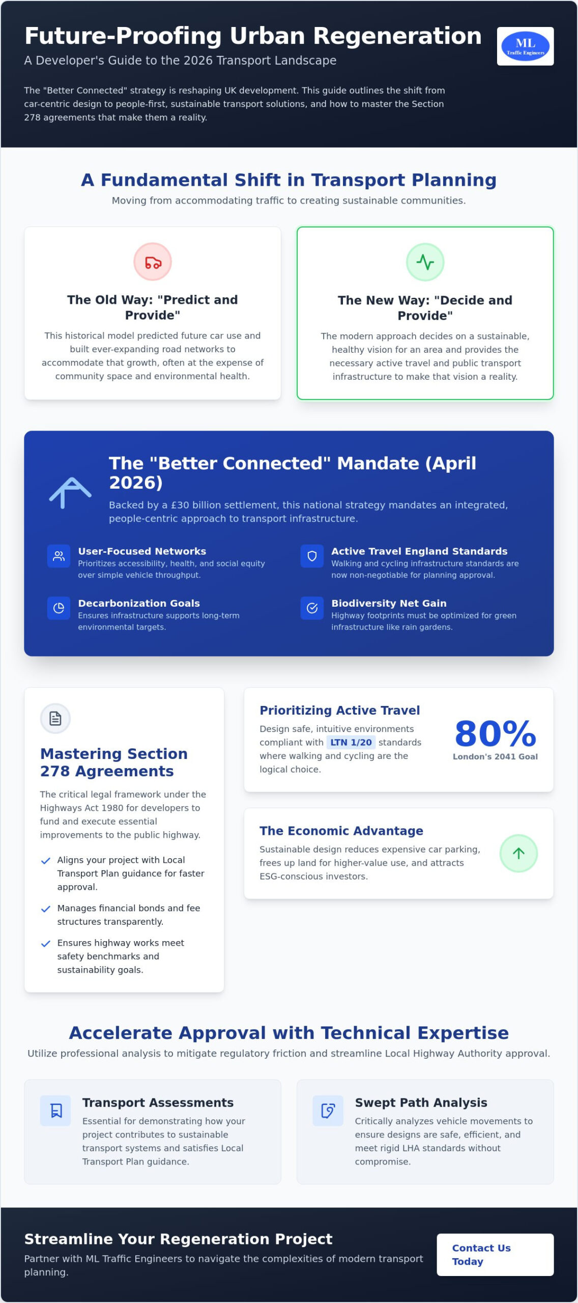
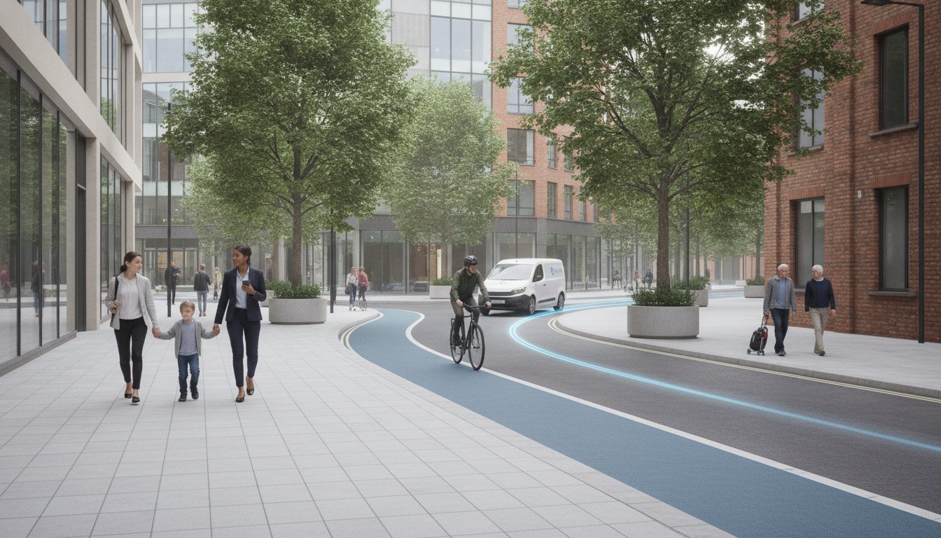
    Transport acts as the structural backbone for any successful urban redevelopment. In 2026, the focus has moved away from simply managing vehicle throughput. Instead, we’re seeing a fundamental shift toward people-centric urban design. Modern projects prioritize accessibility, health, and social equity over traditional traffic flow models. This evolution is driven by the government’s “Better Connected” strategy, published in April 2026, which mandates an integrated approach to how we move within our cities. Backed by a £30 billion settlement, this policy ensures that infrastructure supports economic growth without sacrificing environmental integrity.

    One of the most significant shifts in planning is the move from “Predict and Provide” to “Decide and Provide” strategies. Historically, engineers predicted future car use and built roads to match that growth. Today, we decide on a sustainable vision for the area and provide the infrastructure to achieve it. This proactive stance ensures that urban regeneration sustainable transport solutions Section 278 agreements support long-term decarbonization goals. It’s about creating a destination where residents don’t need to rely on private cars for every journey.

    To better understand the practical skills required for modern urban redevelopment, watch this helpful video:

    Regulatory Drivers in 2026 UK Planning

    Active Travel England now holds significant weight in local planning decisions. Their standards for walking and cycling are non-negotiable for developers seeking approval. Additionally, mandatory biodiversity net gain requirements mean highway footprints must be optimized to allow for green infrastructure like rain gardens and urban trees. These 2026 sustainability targets directly influence the requirements for a Transport Statement. Every submission must now demonstrate how the project contributes to sustainable transport systems to satisfy both local authorities and the updated Local Transport Plan guidance issued in April 2026.

    The Economic Case for Sustainable Transport

    Investing in active travel isn’t just a regulatory hurdle; it’s a sound financial strategy. Reducing the reliance on private vehicles allows developers to minimize or eliminate expensive multi-storey car parking. This reclaimed space can be repurposed for higher-value residential or commercial use. Improved public realms and better connectivity naturally increase land value across the entire site. ESG-conscious investors are also prioritizing schemes that demonstrate a commitment to low-carbon mobility. By integrating robust urban regeneration sustainable transport solutions Section 278 frameworks, you position your project as a low-risk, high-reward asset in a competitive market.

    Sustainable Transport Solutions for Modern Regeneration

    Success in modern development depends on high-quality active travel infrastructure. London aims for 80% of trips to be made by foot, cycle, or public transport by 2041. To hit these targets, urban regeneration sustainable transport solutions Section 278 must prioritize the user experience. This means moving beyond basic road widening to create environments where active travel is the most logical choice. We design these spaces to be safe, intuitive, and resilient, ensuring they stand up to the demands of a growing urban population while meeting the strict standards of the April 2026 “Better Connected” strategy.

    Active Travel Design Standards

    LTN 1/20 is the benchmark for modern cycle infrastructure. It’s no longer a suggestion; it’s a requirement for securing highway authority approval. We focus on creating segregated lanes that provide physical protection for cyclists. To ensure these designs work in practice, we use Swept Path Analysis to verify that larger vehicles, such as refuse trucks or emergency services, don’t encroach on active travel zones. This technical precision is vital for pedestrian priority zones and the “15-minute city” concept. It allows us to maximize the utility of constrained urban footprints without compromising safety or regulatory compliance.

    Public Transport Connectivity and Hubs

    Multi-modal hubs are the new standard for connected communities. The UITP highlights the role of sustainable transport in urban regeneration as a primary tool for social inclusion and economic growth. Shared mobility is expanding rapidly in the UK, with revenue projected to grow at an annual rate of 10.63% through 2026. Integrating e-scooter and e-bike docking stations directly into your site layout encourages this modal shift. We optimize site layouts to ensure bus priority and rapid transit access are seamless, making public transport the most efficient way to travel.

    Electric Vehicle (EV) infrastructure must go beyond the basic minimum requirements. Modern regeneration projects require scalable charging solutions that anticipate future demand. We also address last-mile logistics by designing dedicated hubs for cargo bikes and electric delivery vans. These solutions reduce the volume of heavy goods vehicles in residential areas, improving air quality and safety. If you’re struggling with site layout constraints or regulatory friction, our team can help you develop a comprehensive Travel Plan to support your planning application and ensure long-term project viability.

    By focusing on these technical details early, you reduce the risk of costly retrofits later. Every urban regeneration sustainable transport solutions Section 278 agreement we support is built on a foundation of precision and adherence to national standards. This approach ensures your project is not only compliant but also future-proofed against the evolving expectations of both local authorities and ESG-conscious investors.

    Understanding Section 278 Agreements in Regeneration Projects

    Under Section 278 of the Highways Act 1980, a developer enters into a legal agreement with the Local Highway Authority (LHA) to fund and execute works on the existing public highway. While Section 38 agreements focus on the adoption of new roads within a development, Section 278 covers the off-site improvements necessary to mitigate the project’s impact. In the context of urban redevelopment, this is often the “make or break” stage. It is where your private vision for a site meets the public infrastructure. If this transition isn’t managed with technical precision, it can lead to significant delays and cost overruns.

    The success of these agreements relies on coordination between three key stakeholders: the developer, the LHA, and the contractor. The developer provides the capital and the vision, while the LHA acts as the guardian of safety and design standards. The contractor must then deliver the physical works within a live urban environment. Balancing these competing interests requires a clear understanding of both legal obligations and engineering requirements. Getting it right ensures that urban regeneration sustainable transport solutions Section 278 frameworks are both viable and safe for the public.

    This technical oversight often extends to material validation, where independent accredited bodies like The Testing Lab PLC provide the necessary testing to ensure all highway components meet the safety and durability standards required for adoption.

    The S278 Process: From Scoping to Adoption

    Technical approval is the first major hurdle in the S278 process. The LHA must sign off on every detail of your sustainable design before work can begin. You’ll also need to account for financial security. For example, Worcestershire County Council requires a financial bond of 110% of the highway works’ cost, while West Sussex County Council demands an upfront fee of 5% of the estimated cost just to process the submission. Beyond the initial build, you’ll likely face “commuted sums” for the ongoing maintenance of non-standard features. Managing the construction phase is equally demanding, as you must maintain safety and access for the existing community while retrofitting new infrastructure.

    Negotiating Sustainable S278 Deliverables

    Negotiation is a critical skill when integrating green infrastructure. LHAs are often risk-averse and may prefer standard materials that are easier to maintain. However, modern regeneration requires a different approach. We work to justify the use of non-standard materials for sustainable drainage systems (SuDS) or rain gardens by demonstrating their long-term functionality. We also advocate for reduced lane widths. By narrowing vehicle lanes, we reclaim vital space for high-quality pedestrian zones and cycle tracks. This approach prioritizes active travel without compromising the network’s overall safety. For a detailed breakdown of these technical nuances, you can view our Highway Design S278 & S38 Guide.

    By addressing these legal and technical complexities early, you reduce the logistical pressure on your team. Our approach focuses on delivering an all-encompassing service that manages the full project lifecycle from inception to adoption. This ensures that your project meets all industry benchmarks and legislative requirements while delivering the high-quality, sustainable outcomes that modern urban environments demand.

    Section 278 Sustainable Transport in Urban Regeneration

    Technical Challenges: Balancing Capacity with Sustainability

    Integrating urban regeneration sustainable transport solutions Section 278 often creates a technical friction point between traditional traffic engineering and modern policy goals. Local Highway Authorities frequently worry that reducing lane widths or installing cycle tracks will lead to congestion. We address these concerns by using data to prove that “green” infrastructure doesn’t cause gridlock. A robust Transport Assessment is your primary tool for this. It provides the evidence needed to show that a shift in modal split actually improves network efficiency by moving more people within the same physical footprint.

    Retrofitting these solutions into historic or narrow urban footprints requires a high level of precision. We don’t just look at vehicle numbers; we analyze the entire movement of the street. This involves simulating how pedestrians and cyclists interact with vehicle flow to ensure safety isn’t sacrificed for speed. By proving that sustainable designs can handle peak demand, we help developers overcome the “predict and provide” mindset that often stalls innovative regeneration projects.

    Junction Design for All Users

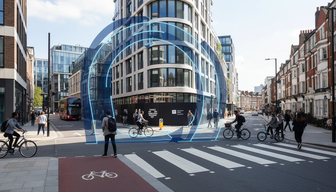
    Modern regeneration demands a move beyond simple signalization toward protected junction designs. These layouts physically separate vulnerable road users from turning vehicles, significantly reducing the risk of collisions. We simulate these complex movements alongside standard vehicle flow to ensure the junction remains functional for everyone. Technical accuracy is non-negotiable here. Swept Path Analysis ensures that even with narrowed carriageways or protected cycle curbs, fire tenders and other emergency vehicles maintain unhindered access through narrow regenerated streets.

    Mitigating the Impact of Reduced Car Parking

    Reducing on-site parking is often essential for maximizing land value and meeting sustainability targets. We use detailed Parking Surveys to justify low-car or car-free developments by demonstrating existing capacity and alternative transport availability. To manage the residual demand, we implement robust Travel Plans that encourage residents and visitors to use active travel or public transport. This isn’t just about policy; it’s about providing technical solutions like car club integration and dedicated EV priority zones that make car-free living a viable reality.

    If you’re facing technical resistance from local authorities regarding your site’s capacity, our team provides the engineering evidence needed to secure approval. Explore our traffic engineering services to see how we streamline the S278 process and protect your project’s timeline.

    Streamlining Your Regeneration Project with ML Traffic Engineers

    Specialized traffic engineering is the most effective way to reduce planning risk and eliminate costly delays. We’ve seen many projects stall because of technical disagreements with Local Highway Authorities over design standards or mitigation costs. Our role is to remove that friction. We manage the entire project lifecycle, from the initial assessment to the final adoption of the highway works. By aligning your project with the April 2026 “Better Connected” strategy from the start, we ensure your urban regeneration sustainable transport solutions Section 278 submission is both robust and defensible.

    Our approach integrates transport planning with detailed engineering design. We bridge the gap between developer ambition and the rigid requirements of highway authorities. Early engagement is vital for success. We represent your interests professionally, ensuring that technical discussions stay focused on viable solutions. We understand the specific financial and technical requirements across different regions. Whether it’s navigating Birmingham’s £15,348 minimum technical fee or managing Worcestershire’s 110% bond requirement, we provide the expert representation you need to protect your project’s timeline and budget.

    Our Comprehensive Technical Support

    Our team delivers every technical component required for a successful application. We produce detailed Transport Statements and Transport Assessments that satisfy the latest 2026 Local Transport Plan guidance. Our Swept Path Analysis and junction modelling services ensure your sustainable designs are technically sound. We don’t just provide data; we provide a clear path to approval. We negotiate directly with LHAs to secure favourable terms, often reducing the long-term burden of commuted sums and additional inspection fees through precise engineering.

    Ready to Transform Your Urban Site?

    Choosing a consultant with deep UK expertise is critical for managing the intricate regulations that govern modern regeneration. We pride ourselves on precision and a strict adherence to industry standards. This commitment ensures your infrastructure is future-proofed, compliant, and safe for the public. We take the logistical and regulatory pressure off your team so you can focus on the broader vision of your development. It’s about delivering a high-quality, sustainable outcome that meets the expectations of both the community and ESG-conscious investors. If you’re ready to move your project forward, contact ML Traffic Engineers for expert S278 support. We’ll provide a tailored quote and a technical strategy that reflects the specific needs of your regeneration scheme.

    Future-Proofing Your Urban Regeneration Projects

    Successful urban redevelopment now requires a proactive approach to highway engineering. The transition to “Decide and Provide” strategies ensures that your project remains viable under the 2026 “Better Connected” framework. Mastering the technical nuances of urban regeneration sustainable transport solutions Section 278 agreements is the difference between a project that stalls and one that sets a new standard for modern living. By prioritizing active travel and high-quality public realms, you create high-value environments that appeal to both residents and ESG-focused investors.

    Precision is a functional necessity in this high-stakes environment. Founded in 2014, ML Traffic Engineers brings extensive UK planning experience to your project. We specialize in Transport Statements and S278 technical reports, providing the professional, safety-conscious approach required to satisfy strict highway authority standards. Secure your planning approval with ML Traffic Engineers’ expert transport planning and ensure your infrastructure is adopted without unnecessary delays. We’re ready to help you navigate these complex regulations with unwavering reliability. Your vision for a sustainable urban future is within reach.

    Frequently Asked Questions

    What is the main difference between a Section 278 and a Section 38 agreement?

    A Section 278 agreement covers modifications to the existing public highway, whereas a Section 38 agreement facilitates the adoption of entirely new roads by the Local Highway Authority. In urban regeneration, S278 is the primary mechanism for integrating new site access points or improving local pedestrian crossings. It ensures that developer-funded works meet the same safety and durability standards as the rest of the public network.

    Do urban regeneration projects always require a full Transport Assessment?

    Not every project requires a full Transport Assessment. The necessity depends on the scale of the development and its projected impact on the local network. Smaller regeneration schemes often only require a Transport Statement to justify their impact. Consulting with a traffic engineer early helps determine which document is necessary to satisfy local planning requirements and avoid unnecessary delays during the application process.

    How does Active Travel England influence Section 278 design in 2026?

    Active Travel England (ATE) enforces strict design standards for any highway works involving walking or cycling. In 2026, ATE acts as a statutory consultee, ensuring that urban regeneration sustainable transport solutions Section 278 agreements comply with LTN 1/20. Failure to meet these high-quality infrastructure standards can lead to a formal objection, effectively blocking planning approval until the technical designs are corrected to meet national benchmarks.

    Can I include sustainable drainage (SuDS) within a Section 278 highway work?

    You can integrate sustainable drainage systems (SuDS) like rain gardens or swales into Section 278 works. These features help manage surface water runoff while contributing to mandatory biodiversity net gain targets. While some authorities were previously hesitant, the 2026 planning landscape prioritizes green infrastructure. To read more about professional drainage maintenance and surveys that ensure these systems remain functional, visit T.M. Drainage. You’ll likely need to provide a commuted sum to cover the long-term maintenance of these non-standard highway features once they’re adopted.

    What are commuted sums in the context of Section 278 agreements?

    Commuted sums are financial contributions paid to the Local Highway Authority to cover the future maintenance of new infrastructure. If your project uses non-standard materials, such as high-quality paving or extensive street planting, the authority requires these funds to ensure they don’t face unexpected costs. These sums are calculated based on the expected lifespan and maintenance frequency of the specific assets provided within the highway.

    How can Swept Path Analysis help secure approval for narrow urban streets?

    Swept Path Analysis provides the technical evidence that large vehicles, like fire tenders or refuse trucks, can safely navigate narrow streets. By simulating these movements, we prove that reduced carriageway widths are safe and functional. This allows developers to reclaim vital road space for wider pavements or cycle lanes, supporting the delivery of urban regeneration sustainable transport solutions Section 278 that prioritize people over cars.

    What happens if a developer fails to complete S278 works as agreed?

    If a developer fails to complete the works to the agreed standard or within the specified timeframe, the Local Highway Authority can intervene. They’ll use the financial bond, which is typically set at 110% of the works’ value, to pay for the completion or rectification of the highway. This protects the public from being left with unfinished or dangerous infrastructure on the existing road network during the regeneration process.

    How long does the Section 278 technical approval process typically take?

    The technical approval process typically takes between three and six months, though complex schemes can take longer. This period includes the initial submission, technical review by the LHA, and any necessary design revisions. Early engagement with highway officers and providing high-quality engineering drawings from the outset are the most effective ways to accelerate this timeline and avoid planning bottlenecks in your project schedule.

    Michael Lee

    Article by

    Michael Lee

    Transport planner with over 35 years' experience.

    Disclaimer

    The content on mltraffic.co.uk, including all technical articles, guides, and resources, is provided for general informational and educational purposes only. It is not intended to constitute professional advice in traffic engineering, transportation planning, development approvals, or any other technical or legal field.
    While ML Traffic Engineers makes every reasonable effort to ensure the accuracy, completeness, and timeliness of the information published, we do not provide any warranties or representations (express or implied) regarding its reliability, suitability, or availability for any particular purpose. Any reliance you place on the content is strictly at your own risk.
    In no event shall ML Traffic Engineers, its directors, employees, authors, or affiliates be liable for any direct, indirect, incidental, special, consequential, or punitive damages (including, without limitation, loss of profits, data, or business opportunities) arising out of or in connection with the use of, or inability to use, any information provided on this website.
    The articles and guides on this site are not a substitute for engaging a qualified, professional traffic engineer to assess your specific project requirements. For tailored advice, compliance assessments, or traffic engineering services, please contact a competent professional.
    This disclaimer may be updated from time to time without notice. By accessing or using this website, you agree to be bound by the most current version of this disclaimer.
  • Healthy Streets Approach to Highways Engineering and Placemaking

    Healthy Streets Approach to Highways Engineering and Placemaking

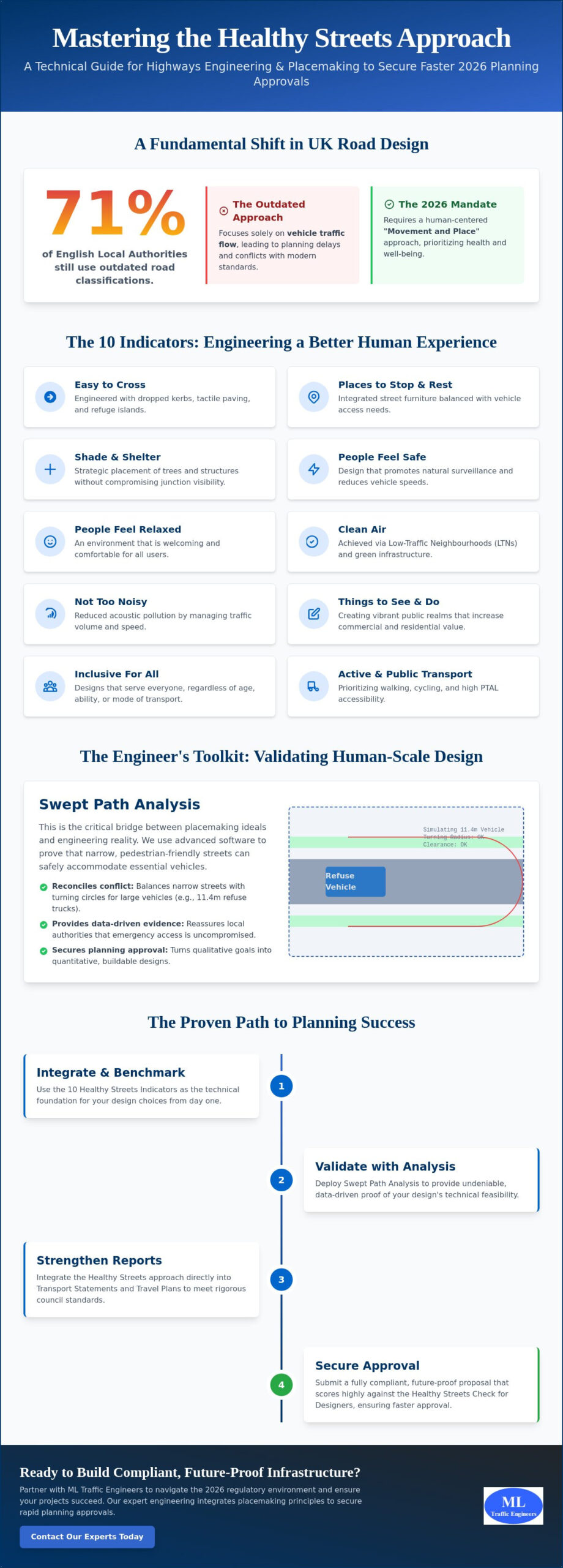
    A recent survey of English Local Highway Authorities revealed that 71% still categorize roads based on traffic flow rather than the “Movement and Place” approach championed by modern guidance. This reliance on outdated metrics often leads to costly planning delays and direct conflict with current active travel standards. We understand the pressure of balancing technical vehicle requirements with the increasing demand for high-quality public spaces. It’s often difficult to quantify placemaking in a way that satisfies both a highways engineer and a planning officer during a rigorous technical review.

    This article shows you how to master the healthy streets approach highways engineering and placemaking to secure rapid approvals for your projects. You’ll learn how to integrate the 10 Healthy Streets indicators into your technical reports without compromising on safety or essential vehicle access. We provide a clear, sequential path to aligning your infrastructure designs with the 2026 regulatory environment, ensuring your Transport Statements and Travel Plans stand up to scrutiny. We will examine how to bridge the gap between engineering precision and human-centered design to deliver compliant, future-proof infrastructure.

    Key Takeaways

    • Understand the 10 Healthy Streets Indicators and how they serve as the technical foundation for human-centered urban design in 2026.
    • Learn to use Swept Path Analysis to reconcile narrow, high-quality placemaking with the essential access requirements of emergency and service vehicles.
    • Discover how to integrate the healthy streets approach highways engineering and placemaking into your Transport Statements to satisfy rigorous local authority standards.
    • Master strategies for balancing parking requirements in car-lite developments by utilizing robust Travel Plans and high PTAL accessibility.
    • Follow a proven, sequential audit process to score your proposals against the Healthy Streets Check for Designers and secure faster planning approvals.

    What is the Healthy Streets Approach in 2026 Highways Engineering?

    The Healthy Streets Approach is an evidence-based framework created by Lucy Saunders to prioritize the human experience in urban design. It moves away from the traditional focus on vehicle throughput and instead evaluates the success of a street based on ten specific indicators of health and well-being. By adopting this method, developers and local authorities ensure that public spaces are inclusive, safe, and sustainable. This approach aligns closely with the principles of Complete Streets, which advocate for infrastructure that serves all users regardless of their mode of transport.

    To better understand this concept, watch this helpful video:

    2026 represents a critical tipping point for highways engineering in England. The mandate from Active Travel England has shifted from optional guidance to a hard requirement for planning approvals. Historically, engineers focused on “Level of Service” for vehicles, often at the expense of pedestrians. Today, the role of a highways engineer involves translating qualitative indicators into quantitative, buildable designs that satisfy both safety regulations and placemaking goals. This evolution ensures that the healthy streets approach highways engineering and placemaking is integrated into every stage of the project lifecycle.

    The 10 Indicators as Engineering Benchmarks

    We use the 10 Healthy Streets indicators as technical benchmarks to validate design choices. For example, “Easy to Cross” isn’t just a feeling; it’s the implementation of dropped kerbs, tactile paving, and refuge islands positioned along pedestrian desire lines. “Shade and Shelter” requires the integration of trees and street furniture, but these must be carefully engineered to maintain visibility splays at junctions. Finally, “Clean Air” and “Not too noisy” are achieved through the strategic design of low-traffic neighbourhoods (LTNs) that reduce nitrogen dioxide levels and acoustic pollution, encouraging people to spend more time outdoors.

    Placemaking vs. Traditional Traffic Management

    Traditional management prioritizes the movement of cars above all else. In contrast, placemaking focuses on the “Level of Service” for people. High-quality public realms increase the commercial and residential value of a development by creating places where people actually want to live and work. This transition is essential for securing a successful Transport Assessment in modern planning environments. The Healthy Streets Approach is the functional union of public health objectives and civil engineering precision.

    Technical Integration: Swept Path Analysis and Healthy Streets

    Designing narrow, human-scale streets is a primary objective of the Healthy Streets framework. It fosters a sense of community and safety by reducing the dominance of motor vehicles. However, this design preference presents a significant hurdle for highways engineers who must ensure that life-safety vehicles and essential services can still navigate the site. Balancing “Places to Stop and Rest” with the required turning circles for an 11.4m refuse vehicle requires more than just a creative eye. It demands rigorous technical validation to ensure the layout is functional.

    At ML Traffic Engineers UK, our team uses advanced Swept Path Analysis to bridge this gap. This software allows us to simulate vehicle movements within tight, human-centric layouts before any construction begins. We can demonstrate that even with reduced carriageway widths, emergency access remains uncompromised. This data-driven evidence is crucial for securing planning approvals. It reassures local authorities that the healthy streets approach highways engineering and placemaking is feasible in practice, not just in theory. Providing this level of technical certainty reduces the risk of costly design revisions during the planning process.

    Optimising Kerb Radii for Pedestrians and HGVs

    Tight kerb radii are a staple of the Healthy Streets philosophy. They force drivers to slow down and significantly reduce the distance pedestrians must travel to cross the road. But large vehicles struggle with these sharp turns. To solve this, we implement technical workarounds like overrun areas or mountable kerbs. These features allow the rear wheels of larger vehicles to safely traverse a designated area without endangering pedestrians or damaging the footway. This approach ensures full compliance with the Manual for Streets while maintaining the high-quality public realm outlined in the Healthy High Streets guidance.

    Visibility Splays in a Greener Streetscape

    Integrating street trees and Sustainable Drainage Systems (SuDS) is vital for the “People Feel Safe” indicator. Trees provide natural cooling and psychological comfort. However, they can easily obstruct visibility splays at junctions. We address this by engineering “Vertical Deflection” into the road surface. By using speed tables and raised junctions, we can legally and safely reduce the required visibility splay lengths because vehicle speeds are physically constrained to 20mph or less. If you are struggling to fit green infrastructure into a constrained site, our team can provide a technical Swept Path Analysis to find the optimal balance between greenery and safety.

    Planning success in 2026 hinges on your ability to validate design choices against public health outcomes. A standard Transport Statement is no longer just about vehicle capacity and parking numbers. It must now feature a comprehensive Healthy Streets assessment. This is especially critical for projects within Greater London, where Transport for London’s Healthy Streets Approach serves as the mandatory framework for evaluating new infrastructure. We manage this entire process, ensuring your technical documentation aligns with the latest statutory requirements.

    We use detailed Traffic Surveys to provide the empirical data required for these assessments. By quantifying existing pedestrian movements and vehicle speeds, we create a robust baseline for the “People Choose to Walk and Cycle” metric. This evidence-based strategy ensures that your proposal meets the expectations of both TfL and Active Travel England during the pre-application stage. Integrating the healthy streets approach highways engineering and placemaking early in your project lifecycle prevents the costly delays often associated with non-compliance and redesign requests.

    The Healthy Streets Check for Designers

    The Healthy Streets Check for Designers is a spreadsheet-based tool that scores a development from 0 to 100 based on the 10 indicators. Our engineers conduct a thorough audit of your site to identify “Quick Wins” that can boost a failing score. These often include simple adjustments to street lighting, the addition of seating, or improving the legibility of signage. A higher score provides the evidence-based justification needed to secure highway authority approval. We provide the technical narrative to explain how your design choices directly improve the score, making the case for your development undeniable.

    Securing S278 and S38 Agreements

    One of the biggest challenges is ensuring that Healthy Streets principles survive the transition from a planning concept to a detailed design. During the S278 and S38 negotiation phases, Local Highway Authorities may prioritize maintenance ease over placemaking features like street trees or non-standard paving. We act as your technical advocate during this adoption process. We bridge the gap between high-level vision and adoptable standards, ensuring the healthy streets approach highways engineering and placemaking remains intact. For more details on this transition, see our Highway Design S278 & S38 Guide.

    Balancing Parking Requirements with the Healthy Streets Approach

    The most common concern we hear from developers is the perceived conflict between parking provision and the Healthy Streets indicators. If you prioritize street-level placemaking, where do the vehicles go? In urban centers with high Public Transport Accessibility Levels (PTAL), the healthy streets approach highways engineering and placemaking often dictates a shift toward car-lite or car-free developments. This transition isn’t about ignoring vehicle needs but about managing them with technical precision. We help you design layouts that prioritize people while still providing essential access for Blue Badge holders and emergency services.

    Justifying Reduced Parking to Planning Committees

    Our team conducts comprehensive Parking Surveys to provide empirical evidence of parking over-provision in the surrounding area. This data is vital for convincing planning committees that a reduced parking ratio won’t negatively impact local street capacity. We pair this data with bespoke Travel Plans that outline clear incentives for walking, cycling, and public transport use. A robust Travel Plan acts as a technical commitment to sustainable transport that directly justifies a reduction in on-site parking density. This dual approach of data and strategy is the most effective way to overcome local authority resistance to low-parking developments.

    Loading and Servicing in Healthy Streets

    Loading and servicing require careful engineering to avoid disrupting the pedestrian experience. We design multi-functional loading bays that can transition into public seating or additional footway width during off-peak hours. Integrating e-cargo bike hubs into the placemaking strategy also helps meet “Clean Air” targets by reducing the number of heavy goods vehicles in the immediate vicinity. To ensure the “Not Too Noisy” indicator is met, we often recommend timed delivery restrictions within the final Transport Assessment. If you need to reconcile your parking strategy with local authority expectations, contact us for a professional Parking Survey today.

    Healthy Streets Approach to Highways Engineering and Placemaking

    The ML Traffic Engineers UK Approach: Expert Engineering for Healthy Streets

    Professional highways engineering is the essential bridge between a creative placemaking vision and a legal planning permit. Without technical validation, even the most inspired designs will fail the scrutiny of a local highway authority. ML Traffic Engineers UK provides the technical rigor required to ensure the healthy streets approach highways engineering and placemaking is successfully implemented and approved. Our role is to reduce the logistical and regulatory pressures on your team by managing the full project lifecycle from inception to completion.

    Our process is logical and sequential, starting with an initial Healthy Streets audit to establish a clear baseline score. We then move into technical design, using advanced Swept Path Analysis to verify that the proposed layout functions for all vehicle types. This empirical data forms the core of our final Transport Assessment submission. We handle complex negotiations with TfL and local boroughs, acting as a technical shield for our clients during the pre-application phase. This ensures that the design principles agreed upon early in the process are not diluted during later stages of the planning journey.

    Future-proofing your development is a necessity in the 2026 regulatory environment. We ensure your project adheres to the latest standards, including the January 2026 London Congestion Charge updates and the stricter Direct Vision Standard (DVS) for HGVs. ML Traffic Engineers UK understands these intricate regional regulations so you don’t have to. We take pride in our precision and adherence to standards, positioning ourselves as a reliable partner that values your time and project deadlines. This proactive approach ensures your infrastructure is ready for the transition to zero-emission zones and increased active travel mandates.

    Why Choose ML Traffic Engineers UK?

    We offer a unique combination of technical SPA expertise and qualitative placemaking insight. Our track record includes securing approvals for high-stakes projects across London and the South East. We provide comprehensive support from the earliest pre-app meetings through to the completion of Section 278 and Section 38 agreements. Our engineers are highly organized experts who prioritize safety and precision in every report. By choosing ML Traffic Engineers UK, you gain a partner that views its role as a vital guardian of public safety and professional integrity.

    Get Started on Your Healthy Streets Project

    Ready to secure your planning approval with a compliant design? You can book a preliminary design review with our London-based team to identify potential issues before they become costly delays. We provide competitive quotes for Healthy Streets compliant Transport Statements and full assessments. Our team is available to provide expert advice on how to integrate the healthy streets approach highways engineering and placemaking into your next scheme. Contact ML Traffic Engineers UK today to discuss your project requirements and receive a tailored service proposal.

    Future-Proof Your Infrastructure Proposals

    Mastering the healthy streets approach highways engineering and placemaking is now a functional necessity for securing planning approvals in England. Success relies on your ability to reconcile human-centered design with the rigorous technical requirements discussed throughout this guide. By utilizing advanced Swept Path Analysis and data-driven Transport Statements, you can provide the evidence-based justification that local authorities demand. These strategies ensure your project remains compliant with the evolving 2026 standards set by TfL and Active Travel England.

    ML Traffic Engineers UK provides the technical authority required to mitigate logistical and regulatory pressures. With over 10 years of experience navigating UK planning regulations, our team delivers the precision needed for complex London transport planning. We utilize expert Swept Path Analysis and tailored Transport Assessments to ensure your project meets every benchmark. Secure your planning approval with a Healthy Streets compliant Transport Statement from ML Traffic Engineers UK today. We are ready to assist you in creating safer, more inclusive environments.

    Frequently Asked Questions

    What are the 10 indicators of the Healthy Streets Approach?

    The ten indicators are a set of evidence-based criteria used to measure the human experience of a street environment. They include: Everyone feels welcome, People choose to walk and cycle, People feel safe, Easy to cross, and Things to see and do. The remaining five are Places to stop and rest, Shade and shelter, Clean air, Not too noisy, and People feel relaxed. These indicators provide a holistic framework for evaluating how well a street design supports public health and well-being.

    Is a Healthy Streets Check mandatory for planning in London?

    A Healthy Streets Check is mandatory for all referable planning applications in London according to the Mayor’s Transport Strategy. Smaller developments may also require a check depending on the specific requirements of the local borough. This assessment ensures that new infrastructure aligns with the healthy streets approach highways engineering and placemaking goals. We recommend checking with the specific local authority early in the pre-application stage to confirm the level of detail required for your submission.

    How does the Healthy Streets Approach affect parking standards?

    This approach typically leads to a reduction in on-site parking provision to prioritize active travel and high-quality public space. In areas with high public transport accessibility, developers are often required to implement car-lite or car-free schemes. While this reduces car dominance, it necessitates a robust strategy for Blue Badge holders and essential deliveries. We use detailed Parking Surveys to justify these reductions by proving that the local street capacity can accommodate the shift without negative impacts.

    Can I use Swept Path Analysis to justify narrower street designs?

    Swept Path Analysis is a vital tool for validating that narrower, human-scale streets remain functional for larger vehicles. By simulating the movements of fire tenders and refuse trucks, we provide the technical evidence that local highway authorities need to approve reduced carriageway widths. This ensures that the design maintains safety standards while achieving the desired placemaking aesthetic. It’s the most effective way to prove that a constrained layout won’t compromise essential services or emergency response times.

    What is the difference between placemaking and highways engineering?

    How much does a Healthy Streets Check for Designers cost?

    The cost of a Healthy Streets Check depends on the scale and complexity of the proposed development. Factors such as the number of junctions to be assessed and the level of baseline data required will influence the final fee. We provide tailored quotes for these assessments as part of our comprehensive Transport Statement and Assessment services. Contact our London-based team for a specific project proposal that meets your regulatory requirements and project deadlines.

    How do I improve my Healthy Streets score if it is currently low?

    Improving a low score often involves implementing “quick wins” like adding street furniture, improving lighting, or increasing the number of trees. You can also boost scores by reducing vehicle speeds through vertical deflection or tightening kerb radii to make streets easier to cross. Our engineers conduct detailed audits to identify exactly where a design is failing and provide technical solutions to raise the score. Small adjustments to the healthy streets approach highways engineering and placemaking can lead to significant improvements in the final assessment.

    Does the Healthy Streets Approach apply to private developments or just public roads?

    The approach applies to any development that impacts the public realm or creates new street environments. While it’s a core requirement for public highway projects, private developers must also adhere to these principles to secure planning approval in most urban areas. This ensures that new residential and commercial schemes integrate seamlessly with the surrounding urban fabric. Whether you’re designing a private courtyard or a new public link, the indicators remain the benchmark for a successful, healthy design.

    Michael Lee

    Article by

    Michael Lee

    Transport planner with over 35 years' experience.

    Disclaimer

    The content on mltraffic.co.uk, including all technical articles, guides, and resources, is provided for general informational and educational purposes only. It is not intended to constitute professional advice in traffic engineering, transportation planning, development approvals, or any other technical or legal field.
    While ML Traffic Engineers makes every reasonable effort to ensure the accuracy, completeness, and timeliness of the information published, we do not provide any warranties or representations (express or implied) regarding its reliability, suitability, or availability for any particular purpose. Any reliance you place on the content is strictly at your own risk.
    In no event shall ML Traffic Engineers, its directors, employees, authors, or affiliates be liable for any direct, indirect, incidental, special, consequential, or punitive damages (including, without limitation, loss of profits, data, or business opportunities) arising out of or in connection with the use of, or inability to use, any information provided on this website.
    The articles and guides on this site are not a substitute for engaging a qualified, professional traffic engineer to assess your specific project requirements. For tailored advice, compliance assessments, or traffic engineering services, please contact a competent professional.
    This disclaimer may be updated from time to time without notice. By accessing or using this website, you agree to be bound by the most current version of this disclaimer.
  • Active Travel for Housing Developments

    Active Travel for Housing Developments

    Active Travel England is no longer a secondary advisor; since June 1, 2023, their statutory consultee status means a poor assessment can effectively halt your project before it begins. Integrating high-quality active travel infrastructure for new housing developments UK is now a non-negotiable technical requirement rather than a design choice. With the Third Cycling and Walking Investment Strategy (CWIS3) projecting £4.5 billion in investment through 2030, the regulatory bar for LTN 1/20 compliance has never been higher.

    We understand the pressure of balancing housing density with the need for wide cycle lanes and filtered permeability. It’s frustrating when opaque requirements lead to costly planning delays or inflated s106 and s278 agreements. This guide provides the technical clarity you need to master current planning strategies and secure permission efficiently. We will examine how to leverage tools like the Cycle Level of Service (CLOS) and Swept Path Analysis to create compliant, marketable communities that meet the 2035 national travel targets.

    Key Takeaways

    • Understand the 2026 role of Active Travel England as a statutory consultee and how to align your project with national investment strategies.
    • Learn to implement the LTN 1/20 “Hierarchy of Users” to ensure your active travel infrastructure for new housing developments UK meets core design standards for cycle and pedestrian safety.
    • Discover how robust active travel provision can justify lower parking ratios and reduce vehicular trip generation within Transport Assessments.
    • See how Swept Path Analysis ensures that dedicated cycling routes do not compromise emergency vehicle access or delivery logistics.
    • Master the use of Travel Plans to set monitorable targets that turn physical infrastructure into a functional, sustainable transport network.

    Defining Active Travel Infrastructure in the 2026 Regulatory Landscape

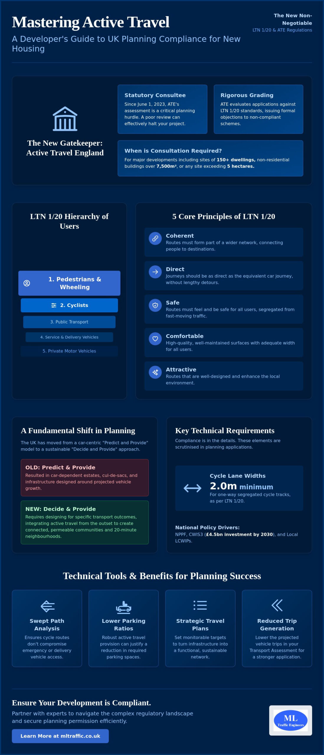
    Active travel is no longer a fringe consideration for developers; it’s the cornerstone of modern site design. By Defining Active Travel as a combination of walking, wheeling, and cycling, the UK government has shifted the focus toward sustainable mobility. This transition marks the end of the “predict and provide” model, which often resulted in car-dependent estates. Instead, the 2026 regulatory landscape operates on a “decide and provide” basis. This approach requires developers to design for specific transport outcomes from the outset, ensuring that active travel infrastructure for new housing developments UK is integrated into the site’s DNA rather than added as an afterthought.

    To better understand how these networks benefit growing communities, watch this helpful overview:

    The Statutory Role of Active Travel England

    Active Travel England (ATE) now holds significant authority over the planning process. Since June 1, 2023, ATE has acted as a statutory consultee for major developments. Local authorities must consult them on residential sites of 150 dwellings or more, non-residential buildings over 7,500 square metres, or any site exceeding 5 hectares. ATE uses a rigorous grading system to evaluate planning applications against LTN 1/20 standards. A low grade can lead to a formal objection, which creates significant barriers to approval. Engaging with these requirements during the pre-application stage prevents the need for expensive, late-stage redesigns. It’s a functional necessity to align your Transport Assessment with ATE’s expectations to ensure a smooth path to permission.

    Key Policy Drivers: NPPF and Local Transport Plans

    The National Planning Policy Framework (NPPF), last amended in February 2025, places a heavy emphasis on high-quality design and sustainable transport. Site layouts must now reflect the National Design Guide’s principles, which prioritise the safety and comfort of vulnerable road users. Many local authorities have adopted the “20-minute neighbourhood” concept, where residents can meet most daily needs within a short walk or cycle from home. This shift forces a move away from traditional cul-de-sac layouts toward permeable, connected networks. Active travel infrastructure within the context of the 2026 UK planning system refers to the physical network of safe, high-quality, and connected routes designed to prioritise pedestrians, cyclists, and those using mobility aids over private motor vehicles. Successfully integrating active travel infrastructure for new housing developments UK requires a precise understanding of how these national policies interact with Local Cycling and Walking Infrastructure Plans (LCWIPs).

    Core Design Standards: LTN 1/20 and Beyond

    The design of estate roads must follow a strict hierarchy of users that prioritises pedestrians and cyclists over private motor vehicles. This shift ensures that active travel infrastructure for new housing developments UK provides a viable alternative to driving for short local trips. Modern standards require designers to look beyond simple pavements. We must now incorporate “wheeling” considerations, ensuring that surfaces and gradients are fully inclusive for wheelchair users and those with pushchairs. Compliance with these standards is a functional necessity to secure planning approval in the current regulatory environment.

    Cycle Infrastructure Design (LTN 1/20)

    The Department for Transport’s Local Transport Note (LTN) 1/20 serves as the technical foundation for all new schemes. Compliance requires adherence to five core principles: routes must be coherent, direct, safe, comfortable, and attractive. Failure to meet these criteria often leads to formal objections from Active Travel England. For instance, segregated cycle tracks should maintain a minimum width of 2.0 metres for one-way travel, while shared paths must provide at least 3.0 metres to avoid conflict between users. High-quality surface materials and consistent lighting are also essential. These features ensure the network remains functional during winter months and late-evening commutes.

    Permeability and Filtered Permeability

    Permeability determines how easily people can move through a development. Traditional cul-de-sac designs often create “islands” that force pedestrians into long, circuitous detours. To counter this, we implement filtered permeability. This technique uses bollards or planters to block through-traffic for cars while allowing cyclists and pedestrians to take direct “short-cuts.” These routes must feel safe and overlooked by housing to maintain site security. Balancing public access with resident privacy is a delicate task, but it’s vital for creating a walkable community. Effective active travel infrastructure for new housing developments UK relies on these connections to link residents to local services and public transport hubs.

    Integrating these standards into your site layout requires precision from the earliest stages of the project lifecycle. Secure cycle storage must also meet M4(2) and M4(3) building regulations to ensure accessibility for all residents, including those using non-standard cycles or mobility aids. To ensure your proposed routes don’t conflict with essential services, conducting a detailed Swept Path Analysis can verify that emergency and delivery vehicles can still navigate the site safely without compromising pedestrian priority.

    Integrating Active Travel into Transport Statements and Assessments

    Active travel provision isn’t just a design feature; it’s a technical lever that directly influences the viability of your planning application. In a modern Transport Assessment London: The Developer’s 2026 Guide, we must demonstrate how your site connects to existing local cycle networks and public transport hubs. These connections are vital for proving that residents have genuine alternatives to private car use. By documenting these links with precision, we provide the evidence required to satisfy local planning authorities and Active Travel England (ATE).

    Trip Generation and Mode Share Analysis

    High-quality active travel infrastructure for new housing developments UK allows for more favourable trip generation modelling. When a site offers direct, safe, and coherent routes, we can justify adjusting predicted vehicular trip rates within the TRICS database. This process often includes demonstrating the “internalisation” of trips, where residents meet their needs within the development or its immediate vicinity. To validate these claims, we utilise the Active Travel England route check tool. This tool provides an objective score for your proposed network, ensuring it meets the required quality thresholds before the application is submitted. This data-driven approach reduces the risk of planning delays caused by unsubstantiated transport claims.

    Justifying Parking Deviations

    Reducing car parking ratios is a common requirement for high-density developments, but it often meets resistance from planning officers concerned about overspill. A robust active travel infrastructure for new housing developments UK strategy serves as a powerful mitigation tool. By providing superior cycling facilities and pedestrian permeability, we can argue for lower parking standards without compromising local highway safety. This argument must be supported by comprehensive Parking Surveys that document current local capacity and demand. Presenting this evidence clearly in your Transport Statement London: A Developer’s Buying Guide helps secure approval for reduced parking layouts. This not only increases developable land but also lowers overall project costs by reducing the need for expensive underground or multi-storey parking structures.

    Precision in these technical documents ensures that the “hard” infrastructure you build is supported by the “soft” data that planners require. We ensure every assessment reflects the latest 2026 regulatory expectations, providing a clear path to planning success.

    Technical Verification: Swept Path Analysis and Safety

    Designing active travel infrastructure for new housing developments UK requires more than just policy alignment; it demands rigorous engineering verification. We must ensure that dedicated cycle lanes and widened footways don’t create operational bottlenecks for essential services. Precision in the design phase is a functional necessity to avoid costly redesigns during construction. We use technical modelling to prove that a site can prioritise vulnerable users without compromising the requirements of heavy vehicles.

    Swept Path Analysis (SPA) serves as the primary tool for this verification. It allows us to simulate the movement of specific vehicles, such as fire engines and refuse trucks, through tight estate geometries. We use SPA to manage the inherent conflict between frequent delivery vehicles and active travel routes. Ensuring that these larger vehicles can navigate the site safely is vital for maintaining the long-term viability of the development. For a deeper look at the technical process, read our AutoTurn Swept Path Analysis Guide.

    While we focus on the technical assessment and layout verification, the role of a Road Safety Audit (RSA) remains critical. An RSA provides an independent assessment of the safety implications of the proposed active travel infrastructure for new housing developments UK. This process identifies potential risks to pedestrians and cyclists, ensuring the final design adheres to the highest safety standards before adoption by the local authority.

    Swept Path Analysis for Complex Junctions

    Complex junctions, including “Dutch-style” roundabouts and protected intersections, require precise modelling to function correctly. We must verify that refuse vehicles can navigate narrowed estate roads without mounting kerbs or encroaching on cycle tracks. Swept Path Analysis prevents 11th-hour design changes for cycle-friendly junctions by identifying insufficient turning radii for refuse vehicles and emergency services during the initial layout phase. This early intervention ensures the design remains compliant with LTN 1/20 while satisfying the operational needs of local service providers.

    Section 278 and Section 38 Agreements

    Active travel infrastructure must meet adoptable standards to be taken over by the Highway Authority. Section 38 agreements cover the adoption of new roads within the site, while Section 278 agreements manage alterations to the existing public highway. We ensure a seamless transition between private site paths and the public highway network. This coordination is essential for maintaining a coherent network that residents can use safely. Our Highway Design S278 & S38 Guide provides further detail on these critical legal agreements.

    If you need to verify your site’s accessibility for all vehicle types, we can provide professional Swept Path Analysis to support your planning application immediately.

    Active Travel for Housing Developments

    Strategic Travel Planning for Planning Compliance

    Physical assets alone do not guarantee a shift in resident behaviour. A Travel Plan serves as the strategic framework that transforms individual paths and lanes into a functional transport network. It acts as the “soft” infrastructure that ensures the “hard” active travel infrastructure for new housing developments UK achieves its intended purpose. For developers, a robust Travel Plan is a vital tool for securing planning consent, particularly when proposing reduced parking ratios that might otherwise face local opposition. By committing to specific modal share outcomes, you provide the reassurance that planners need to approve high-density, sustainable schemes.

    Our role as Travel Plan Consultants: Strengthening Planning Applications involves setting realistic, monitorable targets that align with national objectives. For example, the government aims for 55% of all short journeys in towns and cities to be walked or cycled by 2035. Your Travel Plan must outline how your development will contribute to these benchmarks. Appointing a Travel Plan Coordinator is a functional necessity for larger sites; this individual manages the day-to-day implementation of the plan and acts as the primary point of contact for the local authority.

    Incentivising Active Travel

    Behavioural change requires a combination of high-quality design and targeted incentives. We recommend implementing measures that reduce the friction of choosing sustainable modes. Effective strategies include:

    • Providing bike vouchers or subsidies for cycle-to-work schemes.
    • Establishing car clubs to reduce the perceived need for private car ownership.
    • Installing real-time travel information displays in residential lobbies or community hubs.
    • Designing for the “first/last mile” connection to ensure residents can easily reach rail stations or bus interchanges.

    These measures ensure that the active travel infrastructure for new housing developments UK is not just present, but actively utilised from the first day of occupation.

    Monitoring and Enforcement

    Planning permissions are increasingly tied to s106 obligations that mandate long-term Travel Plan monitoring. Local authorities require evidence that the development is meeting its promised modal share targets. This process typically involves conducting regular resident travel surveys to document how people are actually moving. If targets are not met, the developer may be required to implement further remedial measures. Precision in the initial plan prevents these unforeseen costs later in the project lifecycle. For those operating in the capital, our London Travel Plans Guide provides specific insights into the unique requirements of the various London boroughs and Transport for London.

    By integrating technical design with strategic planning, we help you create communities that are both compliant and highly marketable. To ensure a smooth transition from construction to occupancy, developers can explore Residential Sales and property registration processes through expert legal support. Our comprehensive approach ensures that every transport document supports a swift, successful planning outcome.

    A high-quality Transport Assessment or Statement provides the evidence needed to justify reduced parking and demonstrate network connectivity. We bring technical authority to every project, ensuring your infrastructure is safe, adoptable, and fully compliant with the latest regulatory benchmarks. We’re specialists in Swept Path Analysis for complex sustainable layouts and maintain a proven track record with Active Travel England consultations. Ensure your development is ATE-compliant—Contact ML Traffic Engineers UK for a Transport Assessment quote. We look forward to helping you deliver a project that meets every technical and safety standard with confidence.

    Frequently Asked Questions

    Is Active Travel England a statutory consultee for all housing developments?

    Active Travel England acts as a statutory consultee only for major planning applications in England as of June 1, 2023. This requirement applies to developments of 150 dwellings or more, sites exceeding 5 hectares, or non-residential buildings with a floor space of 7,500 square metres or more. For developments below these thresholds, local authorities still assess applications against national design standards, though formal consultation with ATE is not mandatory.

    What is the minimum width for a segregated cycle track in a new development?

    The LTN 1/20 standard specifies a minimum width of 2.0 metres for a one-way segregated cycle track. If the design features a two-way track, the minimum width requirement increases to 3.0 metres. Providing these dimensions for active travel infrastructure for new housing developments UK ensures the network can safely accommodate non-standard cycles, such as cargo bikes and adapted cycles, which are essential for inclusive mobility.

    Can active travel infrastructure really help me reduce the number of parking spaces?

    High-quality active travel provision serves as a technical justification for lower parking ratios, particularly in high-density or urban developments. By proving that residents have direct, safe access to local services and public transport hubs, we can demonstrate a reduced dependency on private vehicle ownership. This argument must be supported by a robust Transport Assessment and Parking Surveys to satisfy planning officers and prevent local parking overspill.

    Do I need a Road Safety Audit for a simple cycle path?

    A Road Safety Audit is almost always required if the cycle path involves changes to the existing public highway or is intended for adoption by the Highway Authority. Even simple paths create new conflict points at junctions and property accesses. While we focus on the technical design and Transport Statement, an independent audit is a functional necessity to ensure the safety of all users and to meet the requirements of Section 38 and Section 278 agreements.

    What happens if my development fails to meet its active travel targets?

    Failure to meet the targets set out in your Travel Plan typically triggers remedial actions specified within the s106 agreement. This might involve additional financial contributions to local sustainable transport funds or the implementation of further travel incentives for residents. Local authorities monitor these targets through annual surveys, and consistent non-compliance can lead to formal enforcement action or difficulties with future planning applications.

    How does LTN 1/20 affect the cost of estate road construction?

    Adhering to LTN 1/20 can increase the land take required for segregated infrastructure and the cost of high-quality surfacing. However, these costs are often mitigated by reducing the width of vehicular carriageways and simplifying junction designs. Integrating these standards early in the project lifecycle prevents expensive late-stage redesigns and ensures the development remains marketable to a more sustainable-conscious demographic.

    Can I use Swept Path Analysis to justify narrower roads for active travel?

    Swept Path Analysis is the primary tool used to justify narrowing vehicular carriageways to make room for cycle lanes and wider footways. By simulating the movement of refuse trucks and fire engines, we can prove that essential services can still operate safely on narrower roads. This technical verification is vital for creating active travel infrastructure for new housing developments UK that prioritises pedestrians without compromising emergency access.

    What is the difference between a Transport Statement and a Travel Plan regarding active travel?

    A Transport Statement is a technical document that assesses the physical impact of a development on the transport network and outlines the required infrastructure. A Travel Plan is a long-term management strategy focused on encouraging residents to use that infrastructure through “soft” measures like bike vouchers or car clubs. Both are required to prove that the development will meet its modal shift targets and operate sustainably over time.

    Michael Lee

    Article by

    Michael Lee

    Transport planner with over 35 years' experience.

    Disclaimer

    The content on mltraffic.co.uk, including all technical articles, guides, and resources, is provided for general informational and educational purposes only. It is not intended to constitute professional advice in traffic engineering, transportation planning, development approvals, or any other technical or legal field.
    While ML Traffic Engineers makes every reasonable effort to ensure the accuracy, completeness, and timeliness of the information published, we do not provide any warranties or representations (express or implied) regarding its reliability, suitability, or availability for any particular purpose. Any reliance you place on the content is strictly at your own risk.
    In no event shall ML Traffic Engineers, its directors, employees, authors, or affiliates be liable for any direct, indirect, incidental, special, consequential, or punitive damages (including, without limitation, loss of profits, data, or business opportunities) arising out of or in connection with the use of, or inability to use, any information provided on this website.
    The articles and guides on this site are not a substitute for engaging a qualified, professional traffic engineer to assess your specific project requirements. For tailored advice, compliance assessments, or traffic engineering services, please contact a competent professional.
    This disclaimer may be updated from time to time without notice. By accessing or using this website, you agree to be bound by the most current version of this disclaimer.
  • Transport Planning Consultants Merton: A Developer’s 2026 Guide to Planning Approvals

    Transport Planning Consultants Merton: A Developer’s 2026 Guide to Planning Approvals

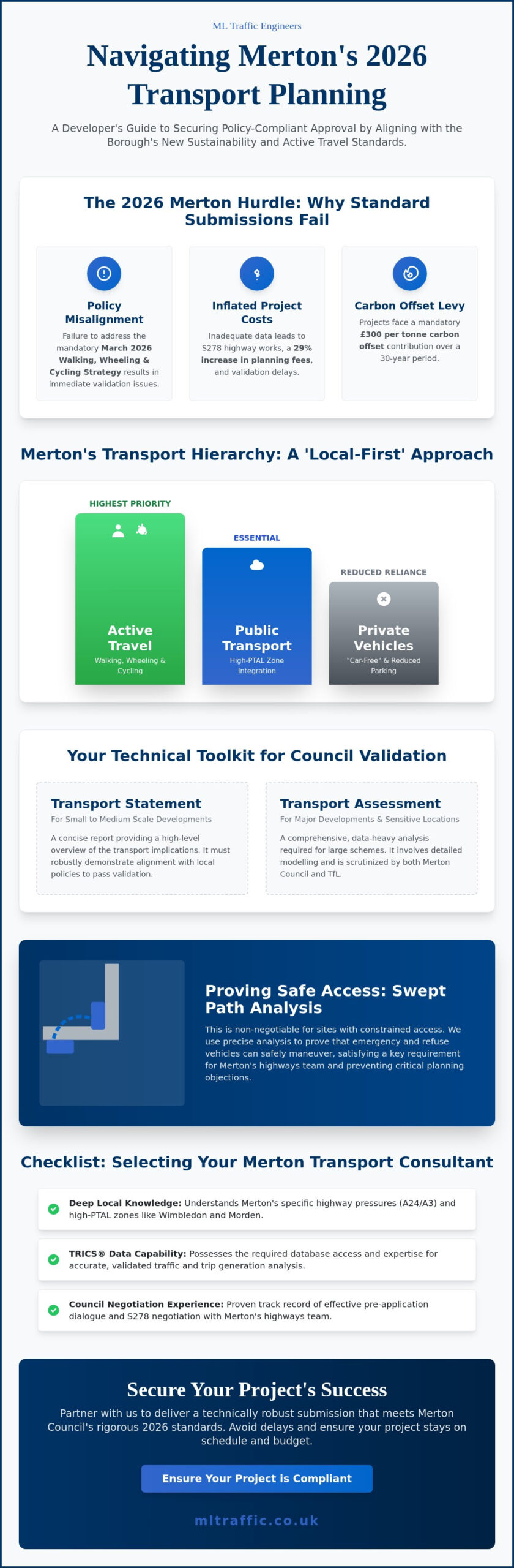
    What if the primary obstacle to your Merton development isn’t the architecture, but a failure to account for the borough’s March 2026 Walking, Wheeling and Cycling Strategy? Securing planning permission in 2026 requires more than just standard documentation; it demands a technical strategy that aligns with Merton’s rigorous sustainability and parking standards. As specialized Transport Planning Consultants Merton, we understand that inadequate transport data leads to validation delays and inflated S278 highway costs. You need a partner who treats precision as a functional necessity, ensuring every Transport Statement and Swept Path Analysis meets the council’s specific requirements from day one.

    We recognize the pressure of managing high-stakes projects while navigating a 29% increase in planning fees and a £300 per tonne carbon offset contribution. This guide provides a clear roadmap to achieving a policy-compliant submission. You’ll learn how to optimize site access, conduct effective Parking Surveys, and leverage tailored Travel Plans to satisfy Merton Council’s latest highway objectives. We’ve structured this overview to move you from initial assessment to final approval with technical authority and professional integrity, ensuring your project remains on schedule and within budget.

    Key Takeaways

    • Understand Merton’s 2026 focus on active travel and how the London Plan influences highway approval for high-PTAL developments.
    • Identify whether your project requires a concise Transport Statement or a comprehensive Transport Assessment based on site scale and location.
    • Learn how Transport Planning Consultants Merton utilize Swept Path Analysis to prove safe access for emergency and refuse vehicles in constrained residential zones.
    • Discover the technical requirements for Parking Surveys and Travel Plans that align with Merton’s latest sustainability and car-reduction policies.
    • Gain a criteria checklist for selecting consultants who possess the specific local knowledge and TRICS data capabilities required for Merton Council validation.

    Developers in Merton face a shifting regulatory environment as we move through 2026. Merton Council has intensified its focus on reducing car dependency, particularly within high-PTAL (Public Transport Accessibility Level) zones like Wimbledon town centre and Morden. This shift is codified in the borough’s Climate Delivery Plan for Year 6 and the newly adopted Walking, Wheeling and Cycling Strategy (March 2026). For any major or minor development, the expectation is clear: transport submissions must demonstrate a “local-first” approach that prioritizes active travel over private vehicle use. Relying on generic templates often leads to immediate validation failure because these reports fail to address Merton’s specific highway requirements. Engaging experienced Transport Planning Consultants Merton ensures your project aligns with the London Plan and Merton’s Local Plan from the outset.

    Effective transportation planning in this borough requires a deep understanding of the unique pressures on the A24 and A3 corridors. Whether your site is in Mitcham or Raynes Park, the council scrutinizes how your development impacts existing congestion and air quality. We provide the technical precision required to navigate these hurdles, ensuring your Transport Statements reflect the reality of Merton’s infrastructure.

    Merton’s Sustainable Transport Priorities

    Merton’s 2026 policies demand the seamless integration of walking and cycling infrastructure. If your site is located in a high-PTAL area, the council will likely push for “car-free” or significantly restricted parking layouts. This isn’t just a suggestion; it’s a requirement to meet the borough’s goal of net-zero by 2050. We use detailed Parking Surveys and Traffic Surveys to justify parking ratios that satisfy both the developer’s needs and the council’s strict sustainability benchmarks. Addressing the carbon offset contribution, currently £300 per tonne for a 30-year period as of March 2026, is also a critical component of your transport strategy.

    Pre-application Advice with Merton Highways

    Early dialogue with Merton’s highways team is a functional necessity to avoid costly redesigns later. During pre-application stages, planners often raise concerns regarding visibility splays and site access safety. Our role involves managing this technical dialogue, using data-driven reports to resolve potential conflicts before the formal submission. We provide the technical authority needed to negotiate highway works and S278 agreements effectively. By securing early buy-in from the council, you reduce the risk of delays during the high-stakes validation process. Our Transport Planning Consultants Merton focus on delivering robust data that stands up to the most rigorous council scrutiny.

    Essential Technical Reports for Merton Planning Applications

    Validation of a planning application in Merton hinges on the quality of your technical transport documentation. Without precise data, your project risks immediate rejection or costly delays. Most developers in the borough will require either a Transport Statement or a full Transport Assessment, depending on the scale and location of the proposal. As Transport Planning Consultants Merton, we ensure these documents address the specific nuances of the local highway network, from the busy intersections of Wimbledon to the residential streets of Morden. While smaller projects often proceed with a Statement, larger schemes require a comprehensive Transport Assessment London developers use to navigate complex TfL and borough-level requirements.

    Transport Statements vs. Assessments in Merton

    The choice between a Statement and an Assessment usually follows established thresholds for residential units and commercial floor space. In Merton, developments exceeding 80 residential units or significant commercial footprints typically trigger a full Assessment. However, site-specific constraints near major hubs like Wimbledon station can elevate the requirements even for smaller schemes due to high pedestrian density and existing traffic pressures. A Transport Statement for a Merton residential conversion is a concise technical report that evaluates the potential transport impacts of the change in use and demonstrates compliance with local highway safety and parking standards. For projects with broader regional implications, we align our reports with Merton Council’s Transport Planning Requirements to ensure every policy benchmark is met.

    Parking Surveys and the Lambeth Methodology

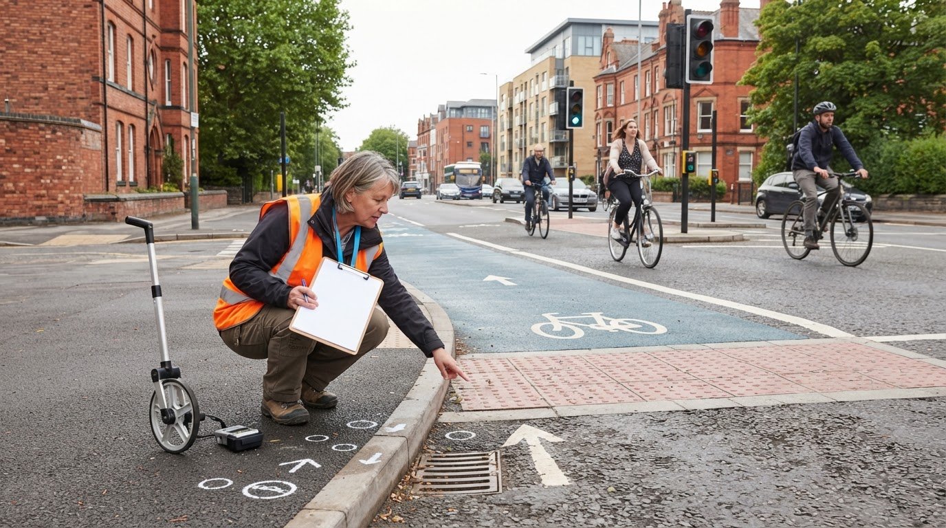
    Parking remains one of the most contentious issues for Merton planners. In high-density zones or areas with existing permit restrictions, the council frequently demands overnight Parking Surveys conducted between 00:30 and 05:30. We execute these using the Lambeth Methodology, a recognized industry standard that provides a clear snapshot of on-street parking capacity within a 200-metre radius of the site. This data is vital when justifying “car-free” or “car-lite” developments in Merton’s town centres, where the council prioritizes active travel over private vehicle storage. If your project is in a sensitive residential area, proving that your scheme won’t exacerbate local parking stress is a functional necessity for approval. You can explore our full range of technical services on our what we do page to see how we support these submissions.

    For commercial schemes, a policy-compliant Travel Plan is often a non-negotiable condition of planning. These plans outline long-term strategies to encourage staff and visitors to use sustainable transport modes, directly supporting the borough’s 2026 climate goals. By providing robust Traffic Surveys and data-driven analysis, we help you secure approvals while minimizing the need for expensive highway mitigations.

    Transport Planning Consultants Merton: A Developer’s 2026 Guide to Planning Approvals

    Swept Path Analysis: Solving Merton’s Access Challenges

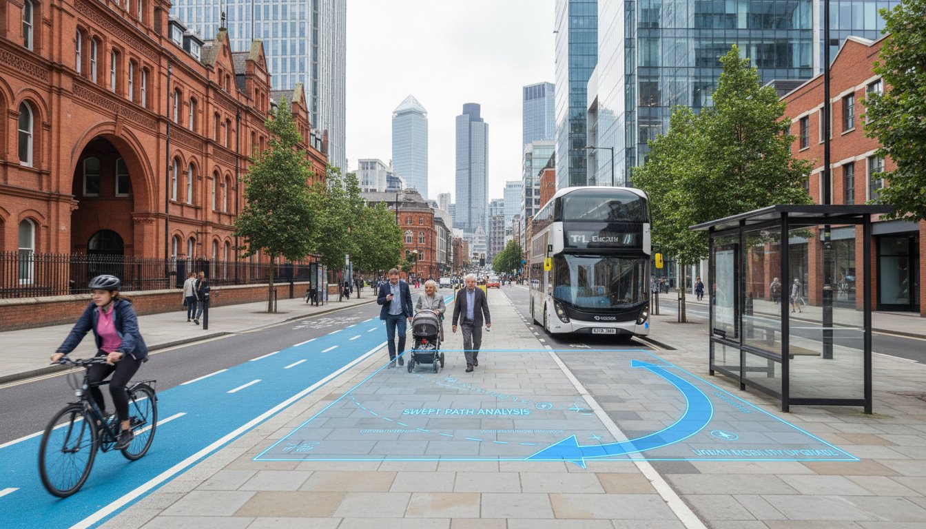
    Merton’s urban fabric presents a unique challenge for modern development. From the narrow Victorian terraces of South Wimbledon to the high-density blocks in Colliers Wood, ensuring safe vehicle access is a functional necessity that planners scrutinize heavily. Transport Planning Consultants Merton use Swept Path Analysis (SPA) to provide the technical proof that refuse vehicles and emergency services can navigate your site without obstruction. This digital simulation maps the exact path of a vehicle’s body and wheels during manoeuvres, allowing us to identify potential pinch points long before construction begins. Our Swept Path Analysis Services solve these access hurdles by providing the data-driven evidence Merton planners demand for validation.

    Digital simulations act as a safeguard against expensive physical design errors. If a refuse truck cannot clear a corner in a digital model, it certainly won’t clear it in reality. Identifying these issues during the planning stage allows for immediate adjustments to curb alignments or gate widths. This proactive approach prevents the need for retrospective planning amendments, which can stall a project for months. When you Select the Right Transport Consultant, you ensure that these technical simulations are grounded in current borough-specific vehicle dimensions rather than generic templates.

    Vehicle Templates for Merton Refuse Collection

    Merton Council operates a specific fleet of refuse collection vehicles, each with distinct wheelbase and width requirements. We use advanced SPA software to simulate 2026 vehicle turn radii, ensuring that even the tightest site entrances accommodate these essential services without overhanging curbs or impacting pedestrian safety. In areas like Colliers Wood, proving fire tender access is a non-negotiable safety benchmark for high-occupancy residential schemes. Our Transport Planning Consultants Merton ensure that every template used in your report reflects the actual vehicles operating within the borough today.

    Optimising Site Access and Internal Layouts

    Optimising site layouts requires a delicate balance between maximizing parking provision and maintaining safe manoeuvrability. We address critical visibility splays on high-speed routes like the A217 and A298, ensuring that emerging vehicles have a clear line of sight to oncoming traffic. As we move through 2026, we also account for the evolving logistics landscape, such as accommodating larger electric delivery vans in commercial layouts. These vehicles often have different turning characteristics than traditional combustion models, and failing to account for them can lead to operational failures. We focus on:

    • Achieving maximum parking efficiency without compromising safety.
    • Securing approval for complex visibility splays on busy arterial roads.
    • Future-proofing layouts for the next generation of electric service vehicles.

    By integrating these technical details early, we reduce the regulatory pressure on your project and ensure a smoother path to planning approval.

    How to Select the Right Transport Consultant in Merton

    Selecting a partner for your highway documentation is a pivotal decision that directly impacts your project’s timeline and budget. Specialized Transport Planning Consultants Merton must offer more than just technical data; they need a proven track record within the Merton planning portal. A consultant who understands the specific preferences of Merton Council’s highways team can anticipate objections before they are raised, saving weeks of back-and-forth negotiations. This local insight is particularly valuable when managing the borough’s high-PTAL town centres where car-free requirements are strictly enforced. We prioritize constant accessibility to ensure your deadlines are met, reflecting the high-stakes nature of modern infrastructure projects where precision is a functional necessity.

    Evaluating Local Authority Expertise

    Choosing a London-based consultant over a national firm provides a distinct advantage for Merton developments. Local experts possess granular knowledge of the borough’s transport links and specific Sustainable Drainage Systems (SuDS) requirements that national providers often overlook. Before appointing a firm, check their history of successful applications in Wimbledon, Mitcham, and Morden. A consultant who has already navigated the nuances of Merton’s Local Plan will be better equipped to manage the technical dialogue between you and the local authority. This expertise ensures that your Transport Statements and Parking Surveys are robust enough to withstand rigorous council scrutiny from the first submission.

    Cost vs. Value in Transport Planning

    While it’s tempting to select the lowest quote, the cheapest option often leads to expensive planning refusals or excessive S106 demands. High-quality transport planning is a functional necessity that protects your investment from regulatory friction. A reliable consultant uses the TRICS database to provide defensible trip generation data, which is essential for justifying your site’s impact on the local network. We offer fixed-fee quotes for Transport Statements to provide developers with financial certainty. Investing in precision from the start reduces the risk of costly redesigns or validation delays. Our team provides:

    • In-house Swept Path Analysis to ensure site viability.
    • Accurate Traffic Surveys that reflect 2026 road conditions.
    • Comprehensive Travel Plans that align with Merton’s net-zero goals.

    If you’re ready to secure your project’s approval with data-driven reports, contact our expert transport planning team today to discuss your Merton development. We provide the technical authority and rapid response capabilities required to keep your project moving forward without unnecessary regulatory delays.

    Secure Your Merton Project Success with ML Traffic Engineers

    Successful development in Merton requires a partner who treats technical precision as a functional necessity. ML Traffic Engineers operates as a comprehensive partner for developers navigating the complexities of the 2026 Merton planning landscape. Our approach is rooted in providing data-driven reports that prioritize council approval and minimize regulatory friction. We manage the entire technical lifecycle of your application, from the initial execution of Parking Surveys to the final submission of policy-compliant Travel Plans. By focusing on the specific highway requirements of the borough, we ensure your project remains on schedule and avoids the pitfalls of inadequate transport data. Our team is ready to support a wide range of project types, ensuring each one meets the borough’s strict validation standards.

    Why Merton Developers Trust Us

    Our reputation as leading Transport Planning Consultants Merton is built on a foundation of professional integrity and successful outcomes. We recently resolved a complex access issue for a high-density residential scheme in Wimbledon where narrow Victorian street geometry threatened to stall the project. By utilizing advanced Swept Path Analysis, we proved that fire tenders and refuse vehicles could navigate the site safely, preventing a costly redesign. This level of technical authority is a hallmark of our service. We maintain a deep understanding of Merton’s 2026 transport policy environment, including the March 2026 Walking, Wheeling and Cycling Strategy and the implications of the £300 per tonne carbon offset contribution. Every instruction receives direct oversight from senior consultants, ensuring that your Transport Assessments and Traffic Surveys are robust, defensible, and accurate.

    Get Your Merton Transport Quote Today

    Time is a critical factor in infrastructure maintenance and development. We maintain a sense of readiness and urgency to help you meet strict planning deadlines. Our process for delivering a policy-compliant Merton Transport Statement is streamlined for efficiency. To begin, simply send us your site plan for a rapid initial review. We will assess the specific highway constraints of your location, whether it is near the congested A24 corridor or a sensitive residential zone in Raynes Park. Following this assessment, we provide a clear, fixed-fee quote for the required technical reports.

    Our commitment to constant accessibility means we are available to discuss your project requirements immediately. We provide the comprehensive support needed to reduce the logistical pressures on your team. If you require precision-engineered Transport Statements or Swept Path Analysis that align with the latest 2026 standards, contact ML Traffic Engineers today. We act as a vital guardian of your project’s regulatory compliance, moving your development from initial planning to successful execution with unwavering reliability.

    Secure Your Merton Planning Approval in 2026

    Navigating Merton’s evolving highway requirements is a functional necessity for every 2026 development. You’ve learned how integrating active travel policies and precise Swept Path Analysis prevents validation delays and high-stakes redesigns. Success in this borough depends on reports that align with the latest Walking, Wheeling and Cycling Strategy while justifying parking layouts through rigorous Lambeth methodology surveys. As experienced Transport Planning Consultants Merton, we provide the technical authority needed to move your project from initial assessment to final approval without regulatory friction.

    Founded in 2014, ML Traffic Engineers brings over a decade of London planning experience to your site. We specialize in TRICS database analysis and Merton Council highways validation requirements, ensuring every report is robust and defensible. Our team maintains a sense of readiness and urgency to help you meet critical deadlines. Don’t let inadequate transport data stall your progress. Request a policy-compliant Transport Planning Quote for your Merton project today. We look forward to securing your project’s success with unwavering reliability and professional integrity.

    Frequently Asked Questions

    Do I need a Transport Statement for a small development in Merton?

    Merton Council typically requires a Transport Statement for any development that alters site access or increases local traffic, even for small-scale residential conversions. These reports prove that your project won’t negatively impact highway safety or local parking capacity. It’s a functional necessity for validation, ensuring that even minor schemes align with the borough’s strict 2026 sustainability and transport standards.

    How long does Merton Council take to validate transport reports?

    Validation usually occurs within five to ten working days of your initial submission, provided all technical data meets the council’s local requirements. If the transport data is incomplete or uses incorrect vehicle templates, the process stops immediately. Once validated, the full assessment of your transport documentation typically takes eight to thirteen weeks as part of the wider planning application review.

    What is the cost of a Swept Path Analysis for a Merton project?

    The cost for a Swept Path Analysis is determined by the complexity of the site layout and the specific vehicle templates required by the local authority. Developers should request a tailored quote to ensure all necessary fire tender and refuse vehicle manoeuvres are included in the simulation. Using accurate borough-specific data prevents expensive redesigns during the later stages of the planning process.

    Does Merton Council require a Travel Plan for residential conversions?

    A Travel Plan is often a condition of approval for residential conversions in Merton, particularly for car-free developments located in high-PTAL areas. These plans outline long-term strategies to promote walking and cycling among future residents. Professional Transport Planning Consultants Merton can determine if your specific conversion triggers this requirement by evaluating the scale and location of your project against local policy thresholds.

    How does a high PTAL rating in Wimbledon affect my parking requirements?

    A high PTAL rating, common in central Wimbledon, allows Merton Council to enforce lower parking ratios or entirely car-free developments. Planners expect schemes in these zones to rely on existing public transport links rather than private vehicle ownership. We use detailed data to justify these reduced parking provisions, ensuring your site layout remains efficient while satisfying the council’s 2026 car-reduction targets.

    Can you help with Section 278 agreements in Merton?

    We provide the technical Transport Assessments and access data required to negotiate Section 278 agreements with Merton Council. These reports are essential for securing approval for any works within the existing public highway, such as new site entrances or junction improvements. Our data-driven approach ensures that the proposed highway modifications meet all safety standards and regulatory requirements for the borough.

    What parking survey methodology does Merton Council accept?

    Merton Council primarily accepts the Lambeth Methodology for overnight parking surveys. This industry-standard approach requires data collection between 00:30 and 05:30 on two separate weekday nights to provide an accurate snapshot of on-street parking capacity. We execute these surveys within a 200-metre radius of your site to produce the defensible evidence needed to support your parking strategy.

    Why was my previous transport report refused by Merton planners?

    Previous refusals frequently occur when a report lacks site-specific Traffic Surveys or fails to account for Merton’s 2026 Walking and Cycling Strategy. If your data doesn’t reflect the narrow street constraints of the borough or uses generic vehicle templates, planners will likely reject the submission. Engaging specialized Transport Planning Consultants Merton helps resolve these technical gaps by providing reports tailored to the council’s specific validation criteria.

    Michael Lee

    Article by

    Michael Lee

    Transport planner with over 35 years’ experience.

    Disclaimer

    The content on mltraffic.co.uk, including all technical articles, guides, and resources, is provided for general informational and educational purposes only. It is not intended to constitute professional advice in traffic engineering, transportation planning, development approvals, or any other technical or legal field.
    While ML Traffic Engineers makes every reasonable effort to ensure the accuracy, completeness, and timeliness of the information published, we do not provide any warranties or representations (express or implied) regarding its reliability, suitability, or availability for any particular purpose. Any reliance you place on the content is strictly at your own risk.
    In no event shall ML Traffic Engineers, its directors, employees, authors, or affiliates be liable for any direct, indirect, incidental, special, consequential, or punitive damages (including, without limitation, loss of profits, data, or business opportunities) arising out of or in connection with the use of, or inability to use, any information provided on this website.
    The articles and guides on this site are not a substitute for engaging a qualified, professional traffic engineer to assess your specific project requirements. For tailored advice, compliance assessments, or traffic engineering services, please contact a competent professional.
    This disclaimer may be updated from time to time without notice. By accessing or using this website, you agree to be bound by the most current version of this disclaimer.
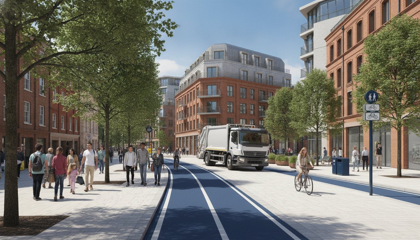
  • Transport Planning Consultants Tower Hamlets: A Developer’s Guide to 2026 Approvals

    Transport Planning Consultants Tower Hamlets: A Developer’s Guide to 2026 Approvals

    In Tower Hamlets, your development’s success no longer hinges on how many cars you can fit; it depends on how many you can keep away. With the New Local Plan 2023–2038 submitted for examination on February 16, 2026, the borough has pivoted sharply toward active travel integration. As specialist Transport Planning Consultants Tower Hamlets, we recognize that the old traffic mitigation mindset is now a fast track to a planning refusal.

    You probably feel the weight of these shifting requirements, especially with the Court of Appeal’s January 22, 2026, ruling reinforcing the Mayor’s control over Low Traffic Neighbourhoods. Whether you’re struggling with PTAL ratings on the Isle of Dogs or the new 2026 CIL indexation rates, the regulatory burden is significant. This guide simplifies the process by providing the technical insights necessary to navigate Tower Hamlets’ safety standards and sustainability targets. You’ll learn exactly which transport reports are mandatory for 2026 and how to align your project with the borough’s 27% cycling growth to ensure a seamless approval.

    Key Takeaways

    • Identify the specific criteria for Transport Statements and Assessments to ensure your LBTH planning application is validated without technical delays.
    • Navigate high PTAL ratings in areas like Bethnal Green by implementing car-free development strategies that align with 2026 sustainability targets.
    • Use technical Swept Path Analysis and the Lambeth Methodology for parking surveys to mitigate highway safety objections and fire access concerns.
    • Partner with specialist Transport Planning Consultants Tower Hamlets to bridge the gap between your development goals and the borough’s complex highways regulations.
    • Leverage 24/7 availability for urgent traffic survey requirements and a managed solution that covers your project from initial CAD design to final implementation.

    Why You Need Specialist Transport Planning Consultants in Tower Hamlets

    In the London Borough of Tower Hamlets (LBTH), transport planning validation is the gatekeeper of your project timeline. It involves more than just drafting a site map; it’s a technical discipline that aligns your development goals with the borough’s strict safety and environmental standards. Professional transportation planning ensures your proposal meets the legal requirements for highway safety and public access from day one. Without this precision, developers face the immediate financial risk of planning refusal. These setbacks often stem from inadequate data or a failure to address the borough’s specific movement strategies.

    Expert Transport Planning Consultants Tower Hamlets act as a vital bridge between your design team and the local highways officers. We translate complex architectural visions into the technical language that LBTH officials require for validation. This technical authority is essential because 2026 regulations now demand comprehensive active travel integration rather than simple traffic volume counts. We manage the logistical and regulatory burdens so you don’t have to.

    Navigating the Tower Hamlets Local Plan 2031

    The “Vision for Tower Hamlets” focuses on high-density growth and reduced car dependency. With the New Local Plan 2023–2038 submitted for independent examination on February 16, 2026, the requirements for site access have become more stringent. Our consultants interpret how programs like “Liveable Streets” affect your specific site layout and access points. We prioritize obtaining pre-application advice from highways officers. This early engagement identifies potential objections before they become costly roadblocks during the formal application phase. It’s about securing a safe pair of hands for your project’s future.

    The 2026 Regulatory Landscape for London Developers

    The London Plan 2021/2026 has introduced rigorous parking maximums that effectively mandate car-free developments in high PTAL areas. These updates, combined with the expanded ULEZ and the Mayor’s Vision Zero policy, have transformed transport reporting. Modern reports must prove a 15% overall casualty reduction on roads, mirroring borough-wide successes seen between 2017 and 2023. At ML Traffic Engineers, we stay ahead of these statutory changes by integrating bespoke technical solutions into every report. We ensure your project addresses the 20% reduction in child casualties required by current safety standards, providing the unwavering reliability needed for 2026 approvals.

    Essential Deliverables: Transport Statements and Assessments in LBTH

    Securing planning approval in Tower Hamlets requires a robust technical submission that addresses the borough’s unique highway constraints. The primary deliverables include Transport Statements and Transport Assessments. These documents provide the evidence base for your development’s impact on the local network. We use the TRICS database to predict trip generation with high precision, comparing your site against similar developments across London. This data-driven approach is essential for 2026 approvals, as it allows us to model junction capacity and multi-modal traffic flow accurately.

    A failed submission often ignores the cumulative impact of neighboring projects. Our team ensures that your reports account for the 20.4% projected population growth in the borough between 2022 and 2032. We provide a managed solution that covers everything from initial CAD design to final implementation, acting as a safe pair of hands for your application. If you’re facing tight deadlines, our technical team is available 24/7 to finalize your sustainable transport strategy.

    Transport Statements vs. Assessments: Which Do You Need?

    The requirement depends on the scale of your project. Generally, developments exceeding 80 residential units or 1,000 square meters of floor space require a full Transport Assessment. For smaller schemes, a Transport Statement is typically sufficient. However, Tower Hamlets officers frequently demand Statements for even minor ‘car-free’ developments in areas with high PTAL ratings. Understanding the Transport Statement vs. Assessment: London Differences is vital for setting your project’s budget and timeline. As experienced Transport Planning Consultants Tower Hamlets, we determine the exact level of detail required to satisfy LBTH Highways and avoid unnecessary technical delays.

    Travel Plans: More Than Just a Document

    Travel Plans are now a mandatory component for most Tower Hamlets applications. These are living documents designed to reduce single-occupancy vehicle trips and promote the borough’s 27% cycling participation rate. A successful Travel Plan includes site-specific measures such as subsidized transit passes or expanded cycle storage. For major residential schemes, you’ll likely need a dedicated Travel Plan Coordinator to oversee these initiatives for at least five years. This proactive management helps mitigate ‘unacceptable’ transport impacts that could otherwise lead to a refusal.

    Transport Planning Consultants Tower Hamlets: A Developer’s Guide to 2026 Approvals

    Tower Hamlets Specifics: PTAL Ratings and Active Travel

    PTAL (Public Transport Accessibility Level) is the primary metric Tower Hamlets uses to dictate parking density and development scale. In 2026, high PTAL scores of 5 or 6 in areas like Bethnal Green and Spitalfields make car-free development a mandatory requirement. We utilize Transport for London’s 100m x 100m grid resolution data from 2023 to verify these ratings with total precision. For developers, this means shifting focus from traditional parking bays to Active Travel Zone (ATZ) assessments. These assessments are now a non-negotiable 2026 standard; they require a detailed audit of walking and cycling routes within a 20 minute radius of your site to ensure safety and connectivity.

    Our role as Transport Planning Consultants Tower Hamlets is to prove your site can handle increased density without adding to road congestion. We analyze existing infrastructure to ensure your project aligns with the borough’s 15% overall casualty reduction targets. This technical authority helps you avoid highway safety objections that often stall major schemes in the borough’s densest wards. We provide the technical evidence needed to satisfy officers that your development supports the borough’s goal of a cleaner, greener environment.

    Understanding PTAL in the Isle of Dogs and Canary Wharf

    The Elizabeth Line has significantly recalibrated PTAL ratings across the borough, turning previously isolated spots into transport hubs. While Canary Wharf enjoys elite connectivity, pockets of the Isle of Dogs and Blackwall still present accessibility challenges. We specialize in justifying development in these lower PTAL areas by proposing targeted infrastructure improvements. This might include new pedestrian links or improved bus stop facilities to bridge the accessibility gap. For smaller projects, our expertise in Flat Conversions in London ensures that even complex subdivisions meet PTAL-based parking constraints without triggering a refusal.

    Integrating Active Travel and Cycling Infrastructure

    With 27% of residents now cycling, LBTH demands infrastructure that exceeds basic racks in a basement. We design secure, accessible storage that strictly adheres to the London Cycle Design Standards (LCDS). Your site entrance must also account for the heavy flow of Cycle Superhighways CS2 and CS3. Our CAD design team ensures these interfaces are safe and functional, preventing conflicts between residents and high-speed cycle traffic. We provide a total, managed solution that integrates these active travel requirements into your initial planning phase, ensuring your site is ready for the 2026 regulatory environment.

    Technical Precision: Swept Path Analysis and Parking Surveys

    Technical precision is the foundation of a successful planning application in East London. As Transport Planning Consultants Tower Hamlets, we provide the rigorous data collection needed to satisfy the borough’s highways department. Our team conducts detailed traffic counts and pedestrian flow surveys to establish a baseline for your site. We don’t just guess; we use CAD design to simulate real-world movements. This level of detail is particularly critical for sites near the Limehouse Cut or Regent’s Canal, where we must coordinate with the Canal & River Trust to ensure development doesn’t impede waterway maintenance or emergency towpath access.

    Our technical authority extends to managing the logistical burdens of night-time economy areas. In districts like Shoreditch and Brick Lane, we perform ‘Stress Surveys’ to measure peak parking and traffic demand during evening hours. This data ensures your development won’t exacerbate existing congestion, aligning with the borough’s safety standards. If you need immediate technical support for your site layout, book a consultation with our CAD engineers today.

    Swept Path Analysis for Narrow Tower Hamlets Streets

    Tower Hamlets features some of London’s most challenging historic street layouts. We use Swept Path Analysis Services in London to model the movement of 12m refuse vehicles and emergency fire tenders. For high-rise developments in Poplar, proving fire tender access is a non-negotiable safety requirement. We simulate various approach angles to ensure these critical vehicles can navigate tight corners without overrunning curbs or striking street furniture. This precision supports the borough’s goal of a 20% reduction in child casualties by ensuring service vehicles operate safely in residential zones.

    Overcoming Parking Objections with Robust Data

    Parking objections are a common cause of planning delays. To mitigate this, we conduct parking surveys using the ‘Lambeth Methodology,’ which is the gold standard in LBTH. We analyze on-street capacity within a 200m radius of your site during the early morning hours when residents are most likely to be at home. This data allows us to justify ‘car-free’ schemes even when local parking appears at capacity. We also address the impact of Controlled Parking Zones (CPZs) on new residents, ensuring your proposal complies with the New Local Plan 2023–2038 policies regarding on-street stress levels.

    Partnering with ML Traffic Engineers for Planning Success in Tower Hamlets

    Securing a planning approval in the current regulatory climate requires a partner who treats precision as a legal necessity. We position ourselves as a safe pair of hands, ensuring your development meets the strict 2026 safety standards set by the London Borough of Tower Hamlets. As experienced Transport Planning Consultants Tower Hamlets, we manage the intricate complexities of UK road regulations so you don’t have to. Our team provides a total, managed solution that moves your project seamlessly from the initial consultation through to final implementation.

    The high-stakes nature of traffic management in East London demands a sense of readiness and urgency. We offer 24/7 availability for urgent survey requirements, which is a primary hallmark of our brand promise. Whether you need a rapid response for a parking survey or a late-night traffic count in a busy night-time economy zone, we’re ready to act. This constant availability ensures that busy project managers can maintain their timelines without navigating through unnecessary delays or logistical hurdles.

    Our approach balances technical authority with a customer-centric focus. We develop bespoke transport solutions that protect your return on investment while ensuring full compliance with the New Local Plan 2023–2038. By prioritizing clarity and speed of information, we help you clear the final hurdles of the planning process with confidence. Contact our technical team today to discuss your project requirements and receive a professional, safety-conscious quote.

    Why Experience in East London Matters

    Success in LBTH depends on a deep understanding of local constraints and a history of successful negotiations with highways officers. We know how the borough’s team interprets the London Plan 2021/2026, especially regarding sites near the Limehouse Link or the A12 corridor. Our expertise allows us to anticipate potential objections before they lead to a refusal. You can view What We Do – Our Full Range of Transport Services to see how we’ve helped other developers navigate these specific East London challenges. We use the active voice to demonstrate capability and immediate action on every project we undertake.

    Start Your Tower Hamlets Project with a Site Appraisal

    The most effective way to save on design fees is to identify transport risks before you commit to a site. A pre-acquisition transport appraisal identifies PTAL limitations or access constraints that could impact your development’s density. We provide these technical insights early in the lifecycle to ensure your project remains viable and compliant. You can access our technical library and Resources to learn more about the safety standards and legislative compliance that form the foundation of our work. Our rhythmic efficiency and professional integrity make us the vital guardian of your project’s planning success.

    Accelerate Your Highway Approval in Tower Hamlets

    The 2026 planning landscape in East London requires a shift from simple traffic counts to comprehensive active travel integration. Navigating the New Local Plan 2023–2038 demands technical precision, especially when dealing with the borough’s historic street layouts and high PTAL zones. As specialist Transport Planning Consultants Tower Hamlets, we provide the technical authority needed to clear these hurdles. We specialize in Swept Path Analysis for narrow London streets, ensuring fire tenders and refuse vehicles maintain safe access in Poplar and beyond.

    Our team offers 24/7 availability for emergency survey data, providing a safe pair of hands when deadlines are tight. We leverage expert knowledge of the LBTH Local Plan 2031 to justify your development’s impact and secure highway validation. By partnering with a firm that prioritizes safety and legislative compliance, you alleviate the regulatory burden on your design team. It’s about moving from uncertainty to a guaranteed technical solution.

    Secure your Tower Hamlets planning approval with ML Traffic Engineers today. We’re ready to transform your site’s transport constraints into a validated, compliant success.

    Frequently Asked Questions

    Is a Transport Statement mandatory for all developments in Tower Hamlets?

    A Transport Statement isn’t mandatory for every minor internal refurbishment, but it’s required for any development creating a net increase in residential units or commercial floor space. Tower Hamlets officers often request these reports for even single-unit conversions in high PTAL areas to confirm car-free compliance. Professional Transport Planning Consultants Tower Hamlets ensure these documents meet the borough’s specific validation requirements to avoid immediate technical rejection or costly delays.

    What is the ‘car-free’ policy in Tower Hamlets and how does it affect my project?

    The ‘car-free’ policy, rooted in the Tower Hamlets Local Plan and the London Plan 2021/2026, prohibits residents in new developments from obtaining on-street parking permits. This policy applies to almost all new residential projects in areas with high public transport accessibility. You must provide a legal agreement under Section 106 to enforce this restriction. It ensures that the 20.4% projected population growth doesn’t lead to gridlock on local roads.

    How long does it take to complete a Transport Assessment for a LBTH application?

    A standard Transport Assessment for a London Borough of Tower Hamlets (LBTH) application typically takes four to six weeks to complete. This timeline includes seven days for automated traffic counts and the technical modeling required for junction capacity analysis. Complex major schemes may require longer if extensive pre-application discussions with highways officers are necessary. Our 24/7 availability for data collection helps compress these timelines for urgent planning deadlines.

    Does Tower Hamlets require a specific parking survey methodology?

    Yes, Tower Hamlets strictly requires the ‘Lambeth Methodology’ for all on-street parking surveys. You must survey a 200m radius around the site on two separate weekday mornings between 00:30 and 05:30. This data proves whether there’s sufficient capacity for visitor parking or if local ‘stress’ levels exceed the 85% threshold. Using this specific methodology is a non-negotiable requirement for a successful planning validation in 2026 and beyond.

    What happens if TfL objects to my planning application in Tower Hamlets?

    If Transport for London (TfL) objects, you must address their concerns through technical mitigation or design revisions before the Planning Committee meets. Objections often relate to site access near the Strategic Road Network or impacts on bus journey times. As Transport Planning Consultants Tower Hamlets, we negotiate directly with TfL officers to resolve these issues. We use CAD design to prove that your site entrance doesn’t compromise the safety of the red route network.

    Can Swept Path Analysis help reduce the land required for my site access?

    Yes, Swept Path Analysis optimizes the site layout by proving exactly how much space a 12m refuse vehicle or fire tender needs to turn. By simulating these movements with CAD software, we often reduce the land dedicated to oversized access roads. This technical precision allows you to maximize the developable area while maintaining full safety compliance. It’s a vital tool for high-density projects in narrow East London streets where space is at a premium.

    How much does a transport planning consultant cost for a London project?

    Fees for transport consulting in London vary significantly based on the project’s scale and the complexity of the required reports. A basic Transport Statement for a minor conversion costs less than a full multi-modal Assessment for a major Poplar high-rise. While we don’t provide fixed prices here, industry data suggests that technical reporting typically accounts for a small percentage of the total planning budget. Contact our team for a bespoke, safety-conscious quote.

    What is an Active Travel Zone (ATZ) assessment?

    An Active Travel Zone (ATZ) assessment is a mandatory audit of the walking and cycling environment within a 20 minute radius of your development. It follows the Mayor of London’s ‘Healthy Streets’ approach to identify improvements needed for pedestrian safety and cycle connectivity. These assessments are now a standard requirement for 2026 approvals. They ensure your project contributes to the borough’s target of a 15% overall casualty reduction on local roads.

    Michael Lee

    Article by

    Michael Lee

    Transport planner with over 35 years’ experience.

    Disclaimer

    The content on mltraffic.co.uk, including all technical articles, guides, and resources, is provided for general informational and educational purposes only. It is not intended to constitute professional advice in traffic engineering, transportation planning, development approvals, or any other technical or legal field.
    While ML Traffic Engineers makes every reasonable effort to ensure the accuracy, completeness, and timeliness of the information published, we do not provide any warranties or representations (express or implied) regarding its reliability, suitability, or availability for any particular purpose. Any reliance you place on the content is strictly at your own risk.
    In no event shall ML Traffic Engineers, its directors, employees, authors, or affiliates be liable for any direct, indirect, incidental, special, consequential, or punitive damages (including, without limitation, loss of profits, data, or business opportunities) arising out of or in connection with the use of, or inability to use, any information provided on this website.
    The articles and guides on this site are not a substitute for engaging a qualified, professional traffic engineer to assess your specific project requirements. For tailored advice, compliance assessments, or traffic engineering services, please contact a competent professional.
    This disclaimer may be updated from time to time without notice. By accessing or using this website, you agree to be bound by the most current version of this disclaimer.