Tag: UK planning

  • Overcoming Transport Objections in Planning Applications: A 2026 Developer Guide

    Overcoming Transport Objections in Planning Applications: A 2026 Developer Guide

    A highway authority objection isn’t a project death sentence; it’s a technical challenge that requires a precise, engineering-led solution. You’ve likely felt the frustration of receiving formal pushback based on perceived highway safety risks or complex technical jargon that seems designed to stall your progress. These delays threaten your development timelines and your capital. This guide focuses on overcoming transport objections planning application processes by replacing subjective concerns with objective, data-driven engineering evidence.

    We agree that the planning process should be predictable and based on hard facts rather than consultee caution. You’ll learn how to systematically dismantle objections using technical reports like Swept Path Analysis and robust Transport Statements aligned with 2026 planning policies. We’ll provide a clear framework for managing statutory requirements and implementing cost-effective mitigation strategies. This article previews the technical path to satisfying the Highway Authority and securing your planning consent with unwavering reliability.

    Key Takeaways

    • Identify whether objections stem from highway safety, traffic capacity, or sustainable accessibility to deploy the correct technical response.
    • Replace subjective consultee fears with objective engineering data through professional Transport Statements and Swept Path Analysis.
    • Master the NPPF “Severe” impact threshold to demonstrate why minor traffic increases do not justify a planning refusal in 2026.
    • Leverage strategic negotiation and pre-application engagement to resolve technical disputes before they escalate into formal project delays.
    • Streamline the path to overcoming transport objections planning application hurdles by using precision-led reports that meet strict regulatory benchmarks.

    Common Transport Objections in Planning Applications Explained

    Transport objections are formal concerns submitted during the planning process that challenge the viability of a development based on its impact on the road network. These objections typically originate from statutory consultees, most notably the Local Highway Authority (LHA), or from members of the public during the consultation phase. While public comments often focus on personal inconvenience, the LHA provides a technical assessment based on established safety and capacity benchmarks. Under the Town and Country Planning Act 1990, these objections carry significant weight and can lead to project refusal if left unaddressed.

    Effective strategies for overcoming transport objections planning application hurdles start with categorizing the pushback into three main areas: Highway Safety, Traffic Capacity, and Sustainable Accessibility. Developers must distinguish between subjective resident concerns, such as “the road feels busy,” and technical LHA objections that cite specific breaches of design standards. The LHA acts as a technical gatekeeper for public safety. Their feedback requires a precision-led response backed by engineering data rather than anecdotal claims.

    To better understand this concept, watch this helpful video:

    Highway Safety and Visibility Concerns

    Highway safety objections often center on inadequate junction visibility splays or risks to pedestrian movement. In many cases, a “perception of danger” from local residents triggers a deeper investigation by the LHA. However, perception does not equal a technical failure. In 2026, compliance with Manual for Streets (MfS) remains the primary benchmark for urban developments. We resolve these objections by demonstrating that proposed access points meet or exceed sightline requirements through detailed technical drawings. If a safety concern is raised, we provide the data to prove that the design maintains public safety while facilitating efficient vehicle flow.

    Parking Provision and Overspill Issues

    Parking is a frequent flashpoint in the planning process. Objections arise if a development provides too little parking, leading to fears of overspill onto local streets, or too much parking, which may conflict with sustainable transport goals. Local parking standards provide a baseline, but site-specific demand often varies. We use Parking Surveys as a primary tool to resolve these disputes. By gathering empirical data on existing street capacity and predicted demand, we replace guesswork with facts. This evidence-based approach is essential for overcoming transport objections planning application teams face when parking capacity is questioned by the local community.

    Technical Evidence: Using Data to Refute Objections

    Securing planning permission often feels like a battle of opinions. Residents and local groups may claim a new development will clog the streets, but these assertions lack technical weight when challenged with engineering facts. The process of overcoming transport objections planning application teams encounter relies on shifting the narrative from subjective fear—an emotion expertly explored in the psychological fiction of Graham Mulvein’s World of Horrors—to objective engineering. High-quality data serves as your shield against arbitrary pushback. As highlighted in the Transport Planning Society evidence, a robust evidence base is the non-negotiable foundation for any successful planning outcome.

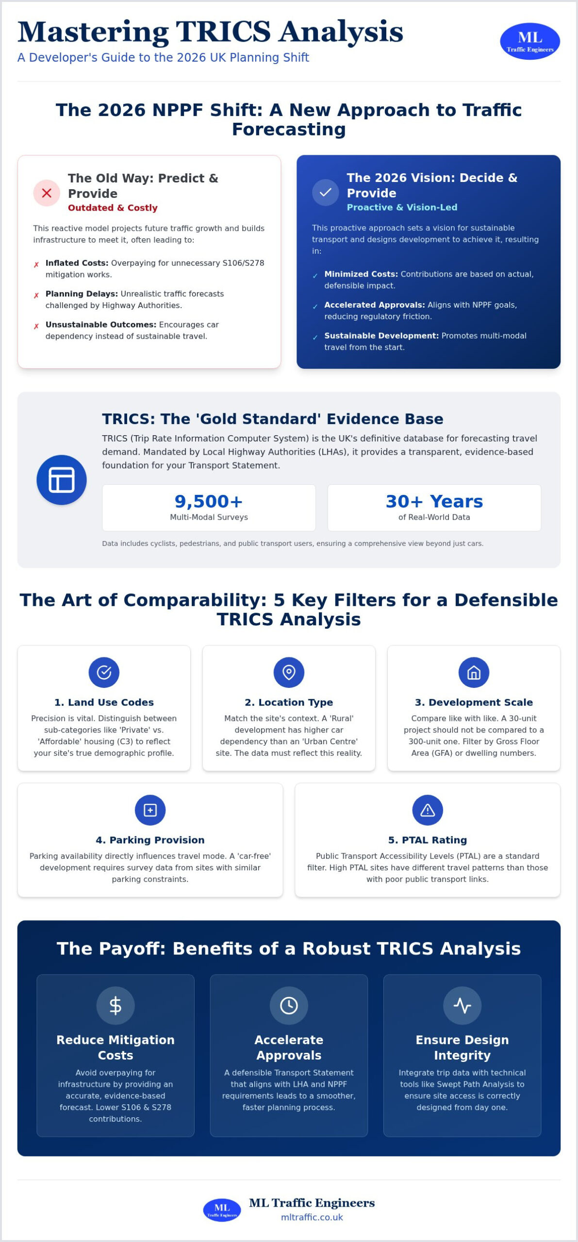
    A professional Transport Statement provides this baseline defense. It outlines predicted trip generation and demonstrates how the local network can accommodate the change. While historical TRICS data remains a standard, updated traffic surveys are significantly more persuasive in 2026. Local authorities increasingly scrutinize generic data sets that don’t reflect post-pandemic travel patterns. Providing real-time, site-specific counts reduces regulatory pressure by leaving no room for doubt. If your project faces specific capacity challenges, commissioning bespoke Traffic Surveys ensures your defense is built on current reality rather than outdated models.

    Swept Path Analysis for Access Feasibility

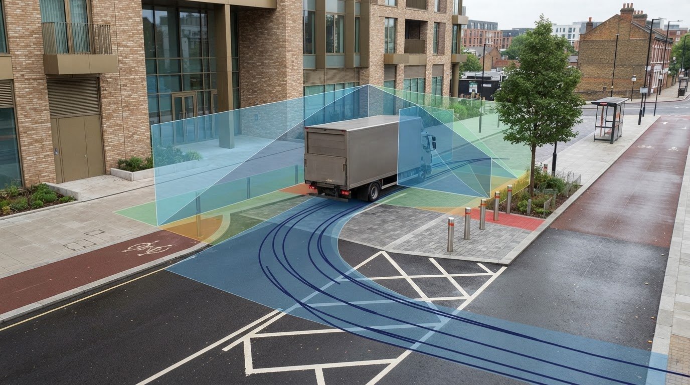
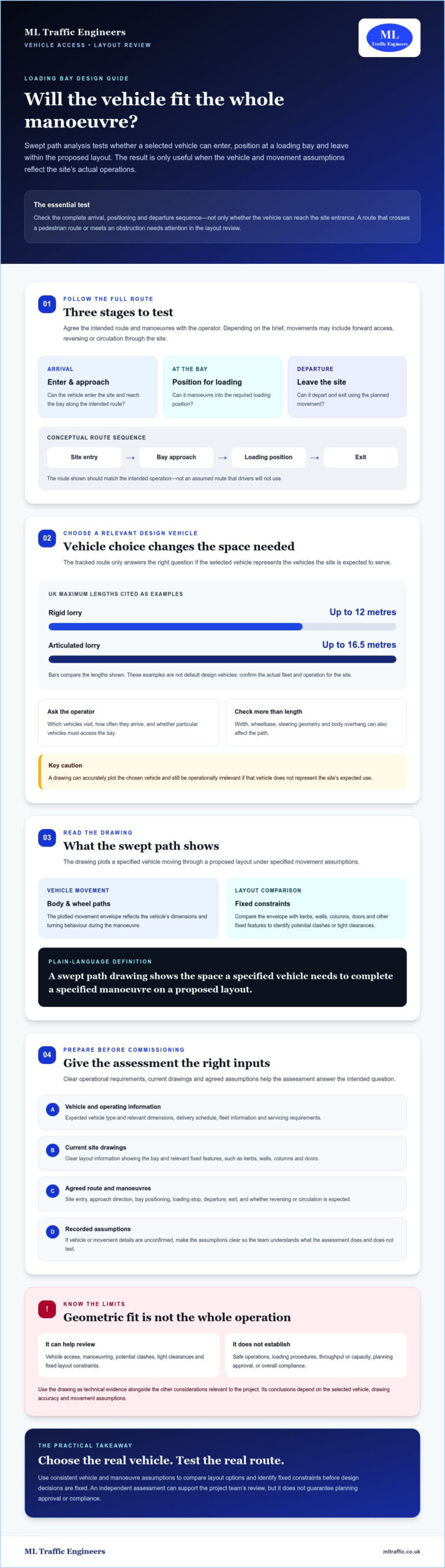
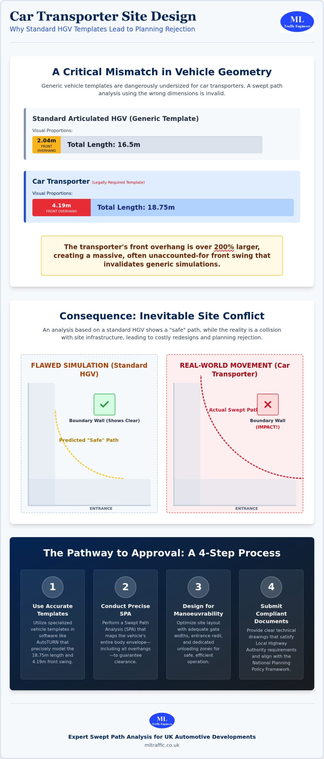
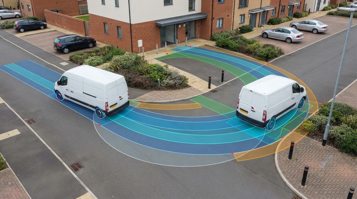
    Objections frequently target the physical ability of large vehicles to navigate a site safely. Planning officers often worry about refuse trucks or fire tenders becoming stuck or mounting curbs in tight residential layouts. Swept Path Analysis (SPA) provides the visual proof needed to silence these concerns. By overlaying vehicle turning circles onto site plans, we demonstrate precisely how specialized vehicles enter and exit. This technical precision bypasses subjective officer concerns and proves feasibility before a single brick is laid, ensuring safety remains a functional reality.

    Parking Surveys and the Lambeth Methodology

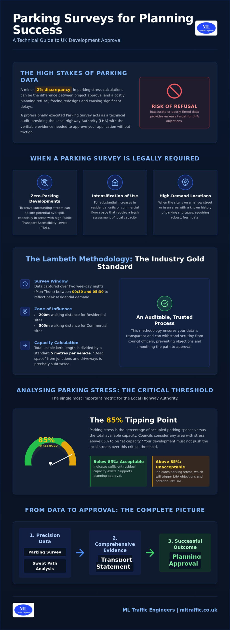
    Local opposition often centers on unacceptable parking stress. To refute this, we utilize overnight parking surveys following the Lambeth Methodology. This industry-standard approach provides a defensible data set by measuring parking occupancy within a 200-meter radius of the site during peak residential demand hours. This typically occurs between 12:30 AM and 5:30 AM. It proves exactly how many spaces are available on the public highway. Hard numbers dismantle the claim that a development will cause parking chaos, providing the local authority with the evidence required to support your application despite neighbor pushback.

    The National Planning Policy Framework (NPPF), specifically Paragraph 115, remains the definitive authority for transport planning decisions in 2026. One of the most critical tools for overcoming transport objections planning application teams have is the “Severe” impact test. The NPPF dictates that development should only be refused on highways grounds if the residual cumulative impacts on the road network are severe or if there is an unacceptable impact on highway safety. This establishes a high legal threshold. It means that simply adding traffic to a busy road isn’t enough to justify a refusal. The official government guidance on transport project approvals provides a framework for how these impacts are adjudicated through formal processes. We use this policy-led approach to ensure your project isn’t unfairly penalized for pre-existing congestion issues.

    Distinguishing between perceived “harm” and the legal definition of an “unacceptable impact” is vital for project success. A professional Transport Assessment quantifies these impacts using sophisticated junction modeling software and capacity analysis. By presenting a technical breakdown of “Ratio of Flow to Capacity” (RFC) values, we provide the evidence required to show that while a development might increase delay by a few seconds, it doesn’t cross the threshold into severity. This data-driven clarity often resolves technical disputes before they reach the committee stage.

    The Role of Sustainable Travel Plans

    We mitigate traffic objections by reducing the number of single-occupancy vehicle trips through robust Travel Plans. These documents promote a modal shift toward walking, cycling, and public transport. By lowering the “residual” traffic impact, we often bring a project’s impact well below the severe threshold. A Travel Plan isn’t just a suggestion; it’s a legal commitment to sustainability that planning officers value during the decision-making process. It demonstrates a proactive approach to managing the development’s long-term environmental footprint and community impact.

    Challenging Unreasonable LHA Demands

    Local Highway Authorities (LHA) sometimes request “gold-plated” junction improvements that aren’t proportional to the development’s actual impact. We push back on these unreasonable demands by citing the principle of proportionality. Mitigation must be necessary, directly related to the development, and fairly related in scale. In overcoming transport objections planning application strategies, we use technical evidence to ensure developers aren’t funding existing network deficits. If an LHA demand exceeds the specific impact of your site, we provide the technical data and policy arguments to challenge that request effectively and protect your project viability.

    Overcoming Transport Objections in Planning Applications: A 2026 Developer Guide

    Strategic Mitigation and Negotiation Techniques

    An objection from the Highway Authority isn’t a final verdict. It’s the beginning of a technical dialogue. Successful developers view these comments as a list of requirements to be met through engineering evidence or strategic negotiation. Engaging with the council during the pre-application stage is the most effective way to prevent formal objections. It allows for early adjustments to site layouts or access points before they’re set in stone. If pushback happens after submission, you must respond with a formal Rebuttal Statement. This document should be logical and data-heavy, addressing each concern with a specific engineering solution rather than general reassurances.

    Overcoming transport objections planning application requirements often comes down to the clever use of Section 106 and Section 278 agreements. These legal frameworks allow you to resolve disputes by committing to specific works or financial contributions. They provide the local authority with the certainty that any identified impacts will be managed or mitigated effectively. If you need a reliable partner to lead these negotiations, our team provides professional transport planning support to move your project forward.

    Physical vs. Management Mitigation

    Mitigation strategies generally fall into two categories: physical and management-based. Physical mitigation involves structural changes to the highway network. This might include:

    • Junction upgrades or signalization
    • Road widening to accommodate larger vehicles
    • Visibility splay improvements through land acquisition or clearing

    Management mitigation focuses on operational changes that reduce traffic impact. Examples include car club schemes, specific delivery scheduling, or restricting parking permits for new residents. Choosing management-led solutions—which can include ensuring high standards of driver proficiency through I Jones Training—is often the most cost-effective path to compliance. It reduces the residual traffic impact without the need for significant capital expenditure on roadworks.

    The Psychology of LHA Negotiation

    Negotiating with a Local Highway Authority (LHA) requires a focus on shared goals, specifically public safety. Start by seeking common ground on baseline safety data. Once safety is established, use technical meetings to walk the officer through your Swept Path Analysis results. Seeing a vehicle navigate the site in a simulation is far more persuasive than a static drawing. It’s harder to maintain a subjective objection when presented with a functional, data-driven demonstration of vehicle movement. If an officer remains unreasonable despite clear technical evidence, it might be necessary to involve a planning solicitor. They can assess whether the LHA is acting within its legal powers or if the objection is based on non-material considerations.

    Securing Approval with ML Traffic Engineers

    ML Traffic Engineers provides a comprehensive approach to overcoming transport objections planning application processes often present. Since our founding in 2014, we’ve positioned ourselves as a dependable partner for developers who require technical precision and regulatory certainty. We manage the entire lifecycle of your project’s transport requirements. Our team starts with the initial feasibility assessment and continues through to post-submission negotiations with the Highway Authority. We understand that planning timelines are tight. Delays cost money. Our workflow prioritizes rapid delivery without compromising on the technical depth needed to satisfy statutory consultees. We ensure every Transport Statement and Swept Path Analysis meets the exact regulatory benchmarks required for 2026.

    We take pride in our role as a vital guardian of project viability. By handling complex technical jargon and regulatory pushback, we reduce the logistical pressure on your development team. Our reports are designed to be defensible in front of any planning committee. We don’t just provide raw data; we provide engineering solutions that align with both UK-wide policy and specific local highway standards. This commitment to precision ensures that safety remains a functional necessity rather than a vague concept. Our active approach to problem-solving means we identify potential objections before they’re raised, allowing for a smoother path to approval.

    Tailored Reporting for Complex Sites

    Every urban development faces unique constraints. A one-size-fits-all report won’t satisfy a rigorous review by the Local Highway Authority. We produce customized Transport Statements that address the specific nuances of your site, whether it’s a tight residential infill or a large-scale commercial project. Our engineers possess deep expertise in regional LHA requirements across the UK. We know what specific data points local officers look for and we provide them upfront to minimize the need for clarification requests. We maintain 24/7 availability for infrastructure-critical projects to ensure that urgent regulatory queries never stall your progress. This level of readiness is a hallmark of our commitment to project success.

    Start Your Path to Approval Today

    Success in the planning process requires a partner who understands the high stakes involved in modern development. We invite you to review our Project Types to see how we’ve helped other developers succeed through data-driven engineering. Our team is ready to provide a no-obligation technical review of your current transport challenges. We’ll identify the most cost-effective path to compliance and help you navigate the complexities of highway safety and traffic capacity. By focusing on overcoming transport objections planning application teams can move from submission to approval with technical certainty. ML Traffic Engineers stands as a vital guardian of your project’s safety and regulatory success, ensuring your vision becomes a reality through professional integrity and precision.

    Securing planning consent requires a shift from anecdotal defense to engineering-led evidence. By leveraging the NPPF “Severe” impact threshold and deploying a full technical report suite, you replace council uncertainty with regulatory compliance. Success in overcoming transport objections planning application processes depends on presenting a defensible, data-rich case that leaves no room for subjective interpretation. It’s about proving safety and capacity through professional rigor.

    ML Traffic Engineers has acted as a vital guardian of project viability since 2014. We are specialists in LHA negotiation and provide the precision-led reporting required to protect your investment. Our team remains ready to manage your full technical lifecycle with urgency and professional integrity. We understand the high stakes of infrastructure planning and offer the constant availability your project demands.

    Contact ML Traffic Engineers to Resolve Your Transport Objections and ensure your development moves forward with total technical certainty. Let’s turn your planning challenges into a clear path for approval.

    Frequently Asked Questions

    What is the most common transport objection in planning applications?

    Highway safety concerns and traffic generation are the most frequent objections raised by Local Highway Authorities. These often involve inadequate visibility splays at site entrances or the perceived risk to pedestrian movement. We address these by providing empirical data that demonstrates compliance with Manual for Streets design standards. Replacing anecdotal fears with technical evidence is the first step in overcoming transport objections planning application processes.

    Can a planning application be refused solely on transport grounds?

    A planning application can be refused on transport grounds, but only under specific criteria defined by the NPPF. The local authority must prove that the development creates an unacceptable impact on highway safety or that the residual cumulative impacts on the road network are severe. Most applications survive transport challenges by offering technical mitigation or demonstrating that the impact falls below this high legal threshold.

    How do I prove that my development won’t cause traffic congestion?

    You prove a lack of congestion by submitting a professional Transport Assessment that includes junction capacity modeling. This technical report uses software to calculate the Ratio of Flow to Capacity (RFC) for affected junctions. By showing that the development’s added trips don’t push these junctions beyond their operational limits, you provide the engineering proof required to silence capacity-based objections.

    What is the “severe” impact threshold in UK planning policy?

    The “severe” impact threshold is the legal test set out in Paragraph 115 of the National Planning Policy Framework. It dictates that traffic increases alone aren’t grounds for refusal unless they cause a significant breakdown in the operation of the local road network. This high bar protects developers from being penalized for minor increases in delay or pre-existing congestion issues in the surrounding area.

    How much does it cost to overcome a transport objection?

    The cost to resolve a transport objection depends on the complexity of the technical reports required. A simple Swept Path Analysis or an updated Transport Statement may be sufficient for minor developments. Larger projects might require extensive junction modeling or a full Transport Assessment. Developers should consult with an engineer to determine the specific technical suite needed to address the council’s concerns effectively.

    Is a Swept Path Analysis always required for residential developments?

    A Swept Path Analysis is almost always required for new residential developments to prove that refuse vehicles and fire tenders can navigate the site. Local authorities need visual certainty that service vehicles won’t become stuck or mount curbs. Providing SPA drawings early in the application process prevents safety-based objections from stalling your project during the consultation phase.

    How long does it take to conduct a parking survey for a planning appeal?

    Conducting a parking survey typically takes one to two weeks, including the data collection and final report preparation. Surveys following the Lambeth Methodology require overnight observations during specific peak demand hours. This timeline allows for a robust data set that accurately reflects local parking stress. We prioritize rapid delivery to ensure these reports are ready for planning appeals or urgent committee deadlines.

    What happens if the Highway Authority objects to my access design?

    If the Highway Authority objects to your access design, you must enter a technical dialogue to identify the specific safety or design breach. This often involves refining the visibility splays or adjusting the junction geometry based on Swept Path Analysis results. We act as a vital partner in these negotiations, providing the engineering evidence needed for overcoming transport objections planning application hurdles and securing a safe, compliant access solution.

    Michael Lee

    Article by

    Michael Lee

    Transport planner with over 35 years' experience.

    Disclaimer

    The content on mltraffic.co.uk, including all technical articles, guides, and resources, is provided for general informational and educational purposes only. It is not intended to constitute professional advice in traffic engineering, transportation planning, development approvals, or any other technical or legal field.
    While ML Traffic Engineers makes every reasonable effort to ensure the accuracy, completeness, and timeliness of the information published, we do not provide any warranties or representations (express or implied) regarding its reliability, suitability, or availability for any particular purpose. Any reliance you place on the content is strictly at your own risk.
    In no event shall ML Traffic Engineers, its directors, employees, authors, or affiliates be liable for any direct, indirect, incidental, special, consequential, or punitive damages (including, without limitation, loss of profits, data, or business opportunities) arising out of or in connection with the use of, or inability to use, any information provided on this website.
    The articles and guides on this site are not a substitute for engaging a qualified, professional traffic engineer to assess your specific project requirements. For tailored advice, compliance assessments, or traffic engineering services, please contact a competent professional.
    This disclaimer may be updated from time to time without notice. By accessing or using this website, you agree to be bound by the most current version of this disclaimer.
  • Transport Statement for Planning Application: The Developer’s 2026 Guide

    Transport Statement for Planning Application: The Developer’s 2026 Guide

    A single highway objection can derail a multi-million pound development before the first brick is laid. For many developers, preparing a transport statement for planning application feels like a bureaucratic hurdle designed to trigger an immediate refusal. You’re likely already dealing with the pressure of the 2026 NPPF updates and the recent April fee increases. The last thing you need is a technical report that fails to satisfy the local highway authority or falls short of statutory requirements.

    It’s frustrating when confusion over local parking standards or access requirements delays your project timeline. You deserve a clear path to a validated application without the stress of regulatory uncertainty. This guide provides the technical clarity you need to master current requirements, allowing you to mitigate objections and secure planning approval with confidence. We’ll examine the critical differences between Statements and Assessments, the shift toward a more rules-based planning system, and the specific data points required to prove your site is safe, sustainable, and ready for construction.

    Key Takeaways

    • Identify the specific thresholds that distinguish a “lighter touch” Transport Statement from a full Assessment to avoid unnecessary technical costs and junction modelling.
    • Ensure your transport statement for planning application includes high-quality traffic and parking survey data to satisfy the latest 2026 statutory requirements.
    • Utilize Swept Path Analysis (SPA) as a technical safeguard to prove that emergency and refuse vehicles can safely access your site, neutralizing common highway objections.
    • Navigate the 2026 National Planning Policy Framework (NPPF) updates with a rules-based approach that aligns with evolving local parking and sustainable travel standards.
    • Streamline the validation process by integrating expert-led data collection and reporting from project inception to final planning submission.

    Understanding the Transport Statement for Planning Applications in 2026

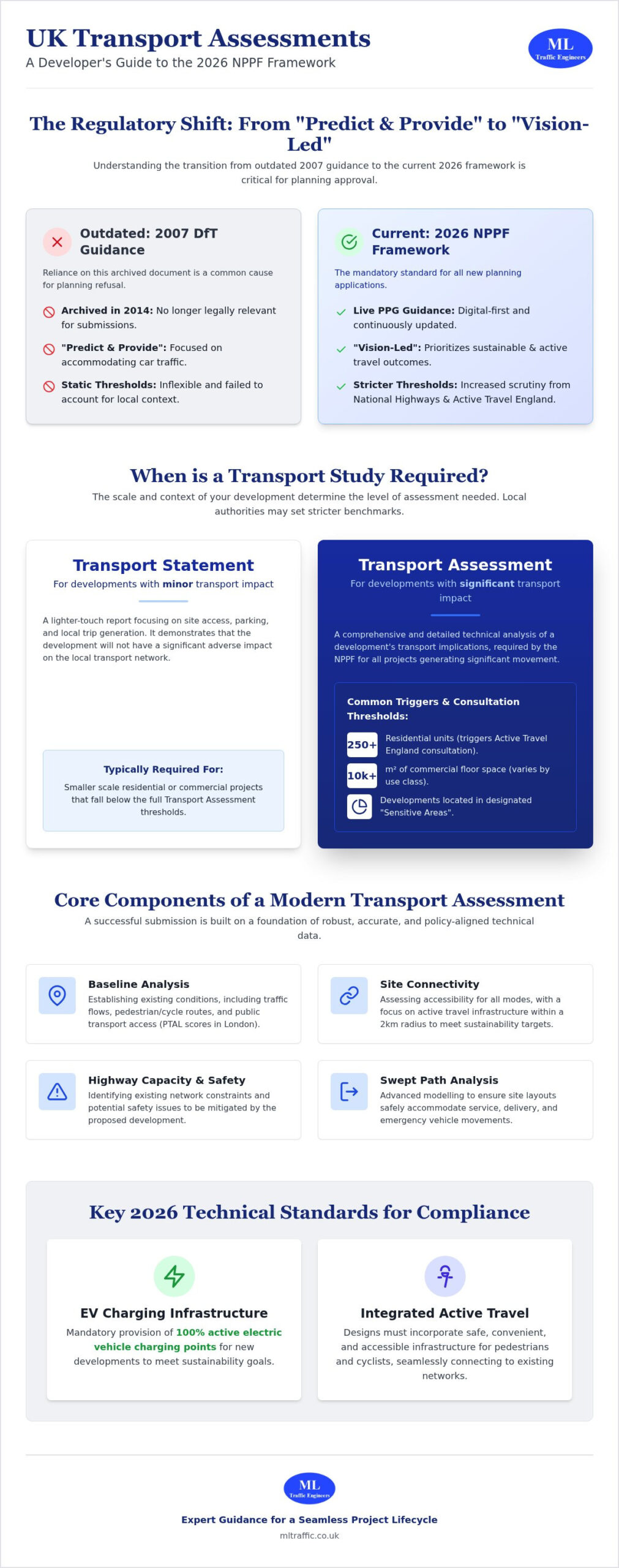
    A transport statement for planning application serves as a concise technical report designed for developments with limited transport implications. It acts as a “lighter touch” version of a full Transport Assessment, focusing on proving your project will not cause an unacceptable impact on highway safety or local traffic flow. In 2026, the primary goal has shifted. It is no longer just about proving car capacity; it is about demonstrating how your site integrates into the wider network through sustainable and active travel modes. This report is your primary tool for neutralizing potential highway objections before they reach the planning committee.

    To better understand the nuances of these technical reports, watch this helpful video:

    The Statutory Framework: NPPF and Local Requirements

    The requirement for these documents is dictated by the National Planning Policy Framework (NPPF) and Planning Practice Guidance (PPG). While a major consultation on a revised, more “rules-based” NPPF concluded in early 2026, the core principle remains consistent. Developments should only be refused on transport grounds if the residual cumulative impacts on the road network would be severe or the impact on highway safety would be unacceptable. Modern Transportation planning emphasizes a hierarchy of road users. This means your statement must prioritize pedestrians, cyclists, and public transport access over private vehicle movements. You must check your Local Validation List (LVL) at the start of the project. These lists vary by authority and define exactly what technical data is needed for a validated application.

    Who Specifically Needs a Transport Statement?

    Determining whether your project requires a statement or a full assessment often depends on the scale of the proposal. Typically, residential developments consisting of 50 to 80 dwellings fall into the “Statement” category. Commercial thresholds vary significantly based on use class and floor area. However, scale isn’t the only factor. Local Highway Authorities (LHA) often request a transport statement for planning application on much smaller sites if they are located in sensitive or congested areas. If you are developing in a high-density urban setting, you should review specific regional guidance, such as our buying guide for London developments. The LHA maintains discretion on these requirements, making early engagement and professional data collection essential to avoid project delays.

    Key Components of a Robust Transport Statement

    A high-quality transport statement for planning application requires a logical structure and precise technical data. It translates complex highway engineering into a persuasive document for planning officers. Every report follows a sequential flow. It begins with the existing conditions, moves to the development proposal, and concludes with the predicted transport impact. This structure must align with official UK government guidance to ensure the report is technically sound. In 2026, this impact assessment must go beyond vehicle numbers. It must integrate modern requirements like Electric Vehicle (EV) charging infrastructure and active travel provisions as outlined in the government’s “Gear Change” policy.

    For developers implementing these sustainable features, partnering with a reliable contractor like Excel Electrical for qualified electrical installation and maintenance ensures that the site’s infrastructure meets all necessary safety and operational standards.

    Assessing Existing Site Conditions and Baseline Data

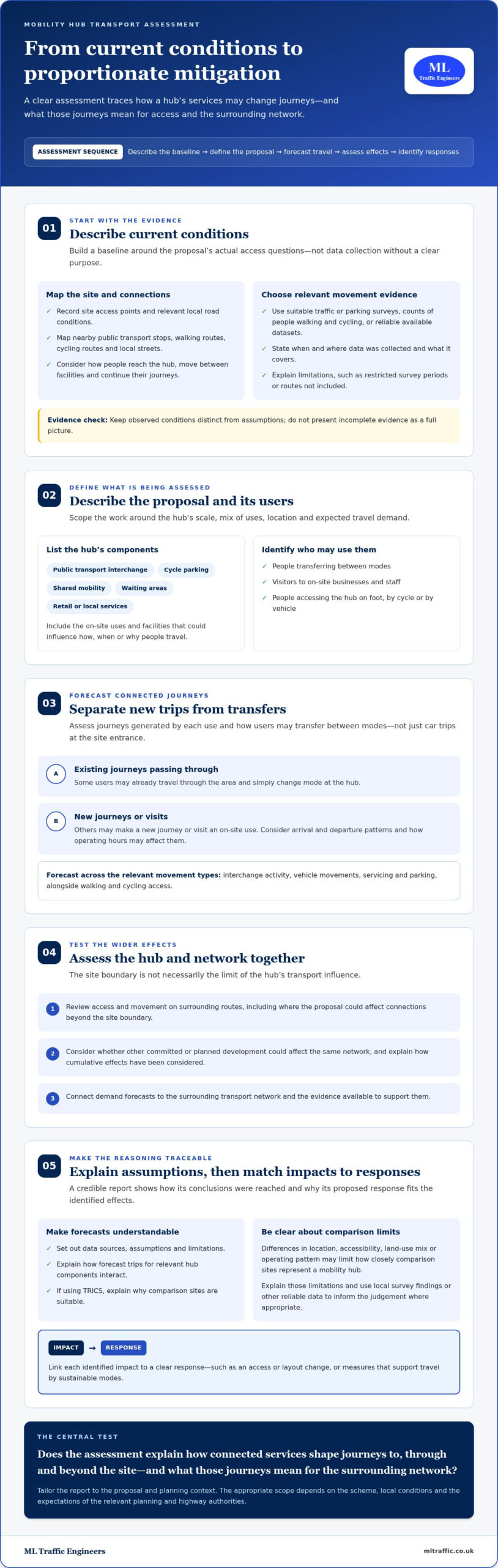
    We begin by auditing the local highway network. This includes measuring junction visibility and footway widths to ensure the infrastructure can support new users. Safety is a non-negotiable priority. We review Personal Injury Collision (PIC) data from the last five years to identify existing safety patterns. For urban sites, we evaluate Public Transport Accessibility Levels (PTAL). This scoring system determines how well your site is connected to the bus and rail network. High PTAL scores often allow for reduced parking provision, making your site more viable and cost-effective.

    Trip Generation and TRICS Analysis

    Predicting how many people will travel to and from your site is critical. We use the TRICS database to achieve this. TRICS is the industry-standard database for predicting development traffic based on comparable sites. By selecting surveyed sites with similar characteristics, we calculate the “trip rate” for your specific proposal. We then compare the existing traffic generated by the current site use against the proposed use. This “net impact” calculation shows the Local Highway Authority exactly how much additional pressure the development will place on the road network.

    If your site is in a constrained area, you may need a specialized parking survey to justify your parking ratios and prevent overspill issues. A robust transport statement for planning application also includes mitigation strategies. These aren’t just technical fixes; they are safety-conscious design choices. We might suggest improved cycle storage or clearer signage to encourage sustainable travel. By addressing these components early, you reduce the risk of late-stage highway objections and ensure a smoother path to planning approval.

    Transport Statement vs. Transport Assessment: Which Do You Need?

    Choosing between these two reports depends on the scale of your project and the anticipated volume of traffic. A transport statement for planning application is generally sufficient for smaller developments where the impact on the local highway network is limited. In contrast, a Transport Assessment is a comprehensive document required for larger schemes that could significantly alter traffic patterns. Understanding this distinction early prevents you from over-spending on unnecessary technical modelling or facing a “request for further information” that stalls your application mid-process.

    The technical depth is the primary differentiator. While a Statement focuses on site-specific access and immediate local impact, an Assessment requires detailed junction modelling using software like Junctions 10 or LinSig. These tools simulate peak-hour capacity across multiple intersections. We provide the technical authority to determine which path is necessary, ensuring you don’t commission more work than the Local Highway Authority (LHA) requires.

    When a Lighter Touch Approach Suffices

    Small residential schemes, minor change-of-use applications, and local retail units typically qualify for the Statement approach. This “lighter touch” document focuses on proving that the site can be accessed safely without requiring a complete overhaul of the surrounding infrastructure. The benefits are clear: faster production timelines and lower consultancy costs. However, you must ensure the LHA agrees to the “Statement” scope during your pre-application discussions. Securing this agreement early protects your project from unexpected technical demands later in the cycle. We often manage these negotiations to define a scope that is both cost-effective and compliant.

    Transitioning to a Full Transport Assessment

    Major housing developments or high-traffic commercial hubs act as triggers for a full Transport Assessment. If your proposal involves significant vehicle movements, the LHA will require a more rigorous analysis of the wider network. An Assessment also demands a detailed Travel Plan to manage long-term site sustainability and encourage active travel. Professional scoping is vital to avoid being asked for an Assessment after you’ve already submitted a Statement. If your development is situated in a high-density area, you should review our guide on Transport Assessment London: The Developer’s 2026 Guide to Planning Success. We specialize in navigating these intricate regional regulations so that your transport statement for planning application or full assessment meets all statutory benchmarks from the outset.

    Leveraging Technical Data to Support Your Application

    Technical data is the backbone of a successful transport statement for planning application. It replaces speculation with verifiable evidence. By using specialized tools, we demonstrate that a site layout functions safely in the real world. This approach is essential for sites with physical constraints or those where local residents fear increased traffic pressure. Data-driven reports provide the technical authority needed to win an appeal or justify a tight site layout that might otherwise face rejection.

    The Role of Swept Path Analysis in Access Feasibility

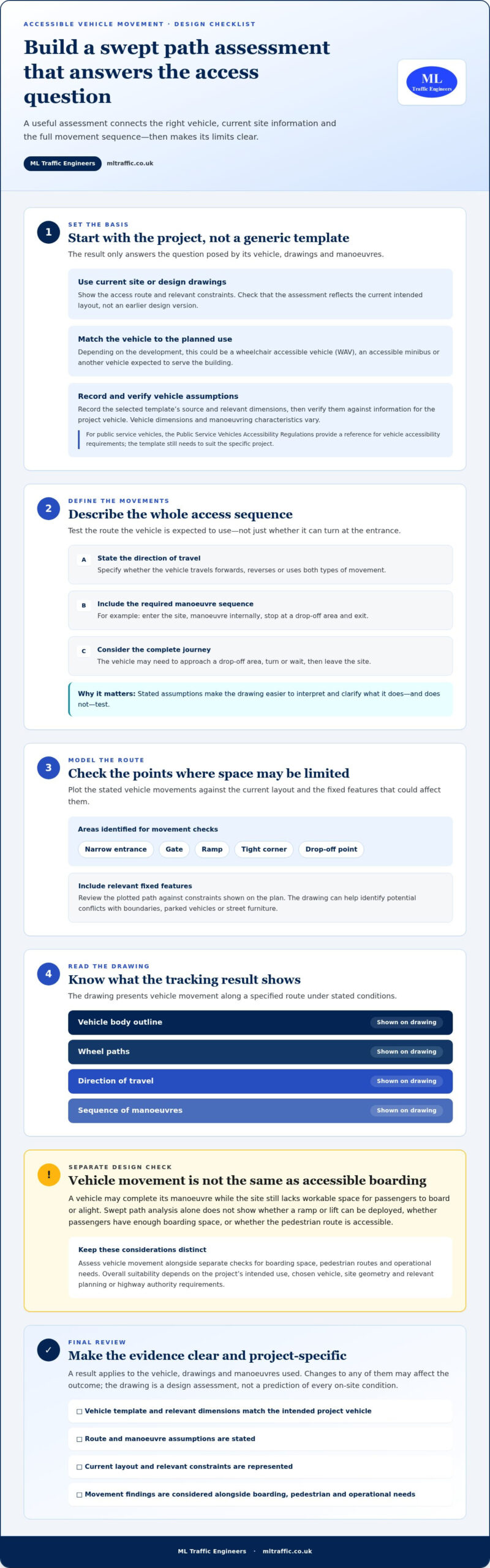
    Swept Path Analysis (SPA) prevents costly design errors by testing vehicle manoeuvres digitally before construction begins. We use software to simulate the exact movements of fire tenders and refuse vehicles. These are common points of failure in planning applications. If a refuse truck cannot turn within your site or a fire tender cannot reach a designated point, the application will likely face a highway objection. Local Highway Authorities (LHAs) increasingly demand SPA as a mandatory part of a validated transport statement for planning application. For a deeper technical breakdown, see our guide on Autoturn Swept Path Analysis: A Practical Guide for Planning Applications in 2026.

    Justifying Parking Provision with Empirical Surveys

    Parking objections often stem from a fear of “overspill” onto residential streets. We use the Lambeth Methodology for overnight parking surveys to provide a snapshot of local street capacity. This data allows us to prove there is spare capacity on-street, which can overcome objections to lower-than-standard parking provision. Empirical parking surveys provide the evidence needed to challenge rigid local parking standards. By documenting actual car ownership levels and street occupancy, we present a realistic picture of parking demand that often differs from conservative local policy.

    Integrating technical findings with a robust Travel Plan demonstrates a clear commitment to reducing car dependency. This comprehensive strategy proves your development aligns with the 2026 focus on sustainable urban growth and active travel. We manage the entire data collection process, from initial surveys to final report generation, to ensure your application remains on track. Ensure your site layout meets all safety benchmarks by commissioning a professional swept path analysis to support your application.

    Transport Statement for Planning Application: The Developer’s 2026 Guide

    Securing Planning Approval with ML Traffic Engineers

    Navigating the complexities of highway regulations requires more than just technical data; it demands a partner who understands the high stakes of the planning process. ML Traffic Engineers provides a professional, safety-conscious approach that reduces logistical pressure on developers. We manage the full project lifecycle from inception to completion, ensuring every transport statement for planning application we produce adheres to the strictest industry benchmarks. By positioning ourselves as a vital guardian of public safety and regulatory compliance, we provide the technical authority needed to satisfy even the most demanding Local Highway Authority (LHA). Our team acts with a sense of readiness and urgency, reflecting the fast-moving nature of the infrastructure sector.

    Our Integrated Approach to Transport Planning

    We offer an all-encompassing service that combines technical reporting with professional data collection. This means we don’t just write the report; we manage the traffic surveys, parking audits, and swept path analyses required to populate it. This integrated model ensures data integrity and eliminates the need for you to coordinate multiple contractors. Our expertise spans diverse project types, ranging from small-scale residential developments to large industrial hubs and commercial units. Every document we prepare reflects the 2026 shift toward a rules-based planning system, incorporating necessary provisions for sustainable travel and active travel infrastructure. If you are operating within the capital, our Transport Statement London: A Developer’s Buying Guide for 2026 offers specific insights into regional requirements and complex urban constraints.

    Managing LHA liaison on your behalf is a core part of our service. We speak the technical lexicon of planning officers and understand how to present mitigation strategies that align with their specific safety and capacity concerns. This proactive communication reduces the risk of protracted negotiations or “requests for further information” that can stall your project for months. We take immense pride in our precision and adherence to standards, acting as a comprehensive partner rather than a simple service provider. Our goal is to provide a cost-effective report that meets all statutory requirements while protecting your project from the fear of planning refusal.

    Requesting a Professional Fee Proposal

    We prioritize rapid response and unwavering reliability because we understand that time is a critical factor in your development timeline. To provide a precise fee proposal for your transport statement for planning application, we require a few key details to assess the scope of work accurately. Please provide a clear site plan, a brief description of the proposed development, and any existing correspondence from the LHA. This information allows us to identify potential highway hurdles early and tailor our technical approach to your site’s unique requirements. We remain available to discuss your project needs and provide the expert-led support necessary to secure your planning approval. Contact ML Traffic Engineers for your Transport Statement quote to secure the expertise your project requires.

    Beyond the technical demands of highway planning, professionals in the infrastructure sector often value other forms of precise navigation, such as the structured microlight flight training and experience flights offered by Fun Flying Aviation Ltd.

    Securing Your Development’s Future in 2026

    A successful planning outcome hinges on your ability to prove site safety and network sustainability from the outset. By distinguishing between a statement and an assessment early, you avoid unnecessary technical delays and protect your project budget. Leveraging empirical data through Swept Path Analysis and parking surveys ensures your transport statement for planning application withstands the scrutiny of the Local Highway Authority. These technical tools aren’t just optional extras; they’re the non-negotiable foundation of a validated application in today’s rules-based planning environment.

    ML Traffic Engineers acts as a dependable partner for developers across England. We provide specialist consultancy in Transport Statements and Assessments, utilizing our deep expertise in TRICS trip generation and technical surveys to manage your full project lifecycle. We take the regulatory pressure off your team by handling all highway liaison and adhering to the latest 2026 industry benchmarks. Precision is our functional necessity, and your project’s approval is our priority. Get a professional quote for your Transport Statement from ML Traffic Engineers today. We’re ready to help you move your development from inception to completion with unwavering reliability.

    Frequently Asked Questions

    How much does a transport statement for a planning application cost in 2026?

    The cost varies based on the scale of your project, site location, and the complexity of the local highway requirements. Factors such as the need for specialized Swept Path Analysis or multi-day traffic surveys will influence the final fee proposal. Developers should request a tailored quote to ensure the report covers all statutory requirements without including unnecessary technical overhead that inflates costs.

    When is a transport statement required for a small development?

    A transport statement for planning application is required for small developments if the local highway authority believes the proposal will impact road safety or local parking capacity. This often includes minor change-of-use applications or residential schemes below 50 units in congested urban areas. You should always consult the Local Validation List to identify specific triggers for your site’s location.

    Can I prepare a transport statement myself?

    You can technically draft your own report, but it’s not recommended due to the specialized technical data and regulatory lexicon required by planning officers. Authorities expect professional TRICS trip generation data and digital Swept Path Analysis that meets current industry benchmarks. An amateur report often leads to validation delays or immediate highway objections that can derail your project timeline and increase overall costs.

    What is the difference between a transport statement and a transport assessment?

    The primary difference lies in the development scale and the depth of technical modelling required for the application. A Transport Statement is a lighter report for smaller sites with limited traffic impact. A Transport Assessment is a comprehensive analysis for major developments that requires complex junction modelling and a detailed Travel Plan to satisfy the National Planning Policy Framework requirements.

    How long does it take to produce a professional transport statement?

    A professional report typically takes between two to four weeks to produce from the initial date of instruction. This timeline allows for site visits, data collection from the TRICS database, and the drafting of the technical analysis. If your project requires bespoke traffic or parking surveys, the duration may extend slightly to ensure the data gathered is accurate and reflects current conditions.

    Will a transport statement guarantee my planning permission?

    No technical report can guarantee permission, but a robust transport statement for planning application significantly reduces the risk of refusal on highway grounds. Its purpose is to demonstrate that your development is safe and sustainable. By neutralizing highway objections early, you provide the planning committee with the technical confidence needed to move toward a positive decision.

    What happens if the local highway authority objects to my transport statement?

    If the local highway authority objects, we engage in technical liaison to address their specific concerns through mitigation strategies or design revisions. This might involve updating your site layout or proposing additional sustainable travel measures. Professional negotiation is often the key to resolving these objections and keeping your planning application on track for approval without significant delays.

    Do I need a parking survey as part of my transport statement?

    You need a parking survey if your development proposes less parking than local standards require or if the site is in an area with high on-street parking stress. These surveys provide the empirical evidence needed to prove that your development won’t negatively impact local residents. They are a vital component for justifying lower-than-standard parking ratios in constrained urban environments.

    Michael Lee

    Article by

    Michael Lee

    Transport planner with over 35 years' experience.

    Disclaimer

    The content on mltraffic.co.uk, including all technical articles, guides, and resources, is provided for general informational and educational purposes only. It is not intended to constitute professional advice in traffic engineering, transportation planning, development approvals, or any other technical or legal field.
    While ML Traffic Engineers makes every reasonable effort to ensure the accuracy, completeness, and timeliness of the information published, we do not provide any warranties or representations (express or implied) regarding its reliability, suitability, or availability for any particular purpose. Any reliance you place on the content is strictly at your own risk.
    In no event shall ML Traffic Engineers, its directors, employees, authors, or affiliates be liable for any direct, indirect, incidental, special, consequential, or punitive damages (including, without limitation, loss of profits, data, or business opportunities) arising out of or in connection with the use of, or inability to use, any information provided on this website.
    The articles and guides on this site are not a substitute for engaging a qualified, professional traffic engineer to assess your specific project requirements. For tailored advice, compliance assessments, or traffic engineering services, please contact a competent professional.
    This disclaimer may be updated from time to time without notice. By accessing or using this website, you agree to be bound by the most current version of this disclaimer.
  • Traffic Survey for Planning Application: The 2026 Developer’s Guide

    Traffic Survey for Planning Application: The 2026 Developer’s Guide

    Did you know that 42% of minor development applications in London face immediate delays at the validation stage because of insufficient highway data? This statistic highlights a growing trend across England where local planning authorities are applying stricter scrutiny to every submission. Securing a professional traffic survey for planning application success is no longer just a checkbox exercise; it is the empirical foundation required to prove your project’s safety and sustainability to skeptical planning officers.

    You’re likely feeling the pressure of tight deadlines and the confusion of choosing between ATC, MCC, or parking surveys while trying to hit those elusive neutral weeks for data collection. We understand that a single error in your transport evidence base can lead to a costly rejection or a complex appeal process. This 2026 guide provides the technical clarity you need to navigate the latest statutory requirements, including the 3.8% planning fee increase and the transition toward mandatory Manual for Streets 3 standards. You’ll learn how to build a robust, council-approved evidence base that streamlines your path through Section 106 or 278 negotiations and keeps your development on schedule.

    Key Takeaways

    • Understand how proving ‘nil detriment’ to the highway network aligns your project with the latest National Planning Policy Framework requirements.
    • Identify the specific technical differences between Automatic Traffic Counts and Manual Classified Counts to ensure your data meets local authority standards.
    • Learn how to leverage a professional traffic survey for planning application success by converting raw data into accurate peak-hour flow models.
    • Master the timing of data collection by identifying “neutral weeks” and understanding the two-to-three-year validity window for transport evidence.
    • Discover how integrating technical reporting like Swept Path Analysis can preemptively address council concerns and reduce the risk of planning refusal.

    Why a Traffic Survey is Mandatory for Your Planning Application

    Every UK planning application must demonstrate ‘nil detriment’ to the surrounding road network. This principle ensures that new developments don’t compromise safety or cause unacceptable congestion on existing highways. Under the National Planning Policy Framework (NPPF), local authorities require an evidence-based approach to transport planning. Without empirical data, your project relies on assumptions that planning officers are likely to reject during the validation stage. A traffic survey for planning application success acts as the primary evidence to prove your development is sustainable and safe.

    Submitting an application without professional data often results in immediate delays or automatic refusal. In London, approximately 42% of minor development applications face validation hurdles due to insufficient highway data. These counts allow engineers to build accurate traffic generation models that forecast exactly how many vehicles your site will produce during peak hours. This technical precision is vital for securing Transport Assessments London councils will accept, especially in high-density areas where road capacity is already at its limit.

    To better understand the mechanics of data collection, watch this helpful video:

    Statutory Requirements and Local Highway Authorities

    Council officers operate on a ‘reasonable basis’ when requesting data. They need to see that your proposal won’t create a safety hazard or gridlock. Precise survey data informs critical Section 106 and Section 278 negotiations, determining the financial contributions or physical road improvements required for your project. Beyond the council, robust data helps mitigate community objections. When local residents fear increased congestion, having verifiable, independent traffic counts allows you to address those concerns with facts rather than speculation. It’s about maintaining professional integrity and ensuring public safety throughout the project lifecycle—a vision for road security shared by professional driving schools like Mondial Permis.

    Surveys as the Foundation for Transport Statements

    You cannot produce a valid Transport Statement without baseline data. A traffic survey serves as the empirical baseline for all development-related transport modeling. This data is essential for justifying parking provision, particularly in PTAL-sensitive areas where you might seek a reduction in on-site spaces. By showing current road usage and available capacity, you can prove that your parking strategy won’t lead to dangerous overspill on local streets. We focus on providing this comprehensive support so you don’t have to manage the logistical pressure of regulatory compliance alone.

    Core Types of Traffic Surveys Used in UK Planning

    Selecting the correct traffic survey for planning application success depends entirely on the scale and nature of your development. Local highway authorities often require a mix of methodologies to capture a 360-degree view of site impact. While some projects only need baseline flow data, others require granular junction analysis to satisfy safety and capacity requirements. We ensure every data point aligns with the UK government guidance on transport assessments to prevent validation delays.

    ATC vs. MCC: Which Does Your Project Need?

    Automatic Traffic Counts (ATC) typically utilize pneumatic tubes or side-detection radar to capture data over a minimum of seven days. This method is the industry standard for establishing baseline traffic volumes and recording 85th percentile speeds, which are critical for determining safe visibility splays. Many councils, such as Leicestershire County Council, now mandate at least one seven-day automated count to supplement manual data.

    Manual Classified Counts (MCC) provide the detail that automated tubes cannot. These surveys involve human observers or video analysis to record specific turning movements at junctions during peak hours. If your project requires complex capacity modeling using software like LinSig or Junctions 9, an MCC is non-negotiable. It allows us to classify vehicles into categories like HGVs, buses, and light goods vehicles, providing the precision needed for robust impact forecasting. Choosing the right duration and method early in the process prevents the high costs of re-surveying if the initial data is deemed insufficient by council engineers.

    Specialised Parking and Access Surveys

    For residential and commercial developments in high-density urban areas, parking accumulation surveys are essential. These surveys often follow the Lambeth Methodology, which involves counting parked vehicles on surrounding streets during the early morning hours to determine existing stress levels. This empirical evidence is vital when justifying ‘car-free’ developments or requesting a reduction in standard parking provisions.

    Modern planning standards, influenced by the upcoming Manual for Streets 3, place a heavy emphasis on active travel. Pedestrian and cyclist counts are now standard requirements to demonstrate how a development supports sustainability targets. These counts integrate directly with your project’s Travel Plan, providing a baseline for future monitoring. If you are unsure which methodology your local authority expects, securing a professional traffic survey ensures your evidence base is beyond reproach from the outset.

    Methodology: How Survey Data Fuels Technical Analysis

    Raw data collection is only the first stage of a robust transport evidence base. To satisfy council requirements, we transform these initial counts into “Peak Hour” flow models. These models represent the 60-minute window of highest intensity, typically during the morning and evening commutes. This step is vital because it allows us to test junction capacity under maximum stress. Beyond capacity, this data serves as a critical input for environmental consultants. High traffic volumes and vehicle classifications directly influence the accuracy of noise and air quality impact assessments.

    Modern traffic engineering relies on high-definition video verification to ensure absolute accuracy. Unlike traditional manual tallies, video allows for a transparent audit trail that planning officers can verify if they dispute the findings. This precision is essential when your project faces scrutiny from local residents or skeptical highway engineers. We use this verified data to build a logical narrative for your development, proving that the proposed changes are manageable and safe.

    Integrating Data with Swept Path Analysis

    A primary gap in many planning submissions is the lack of synergy between baseline data and site design. We use volume data from your traffic survey to inform the frequency of “design vehicle” movements within our Swept Path Analysis. This technical simulation proves that essential services, such as refuse collection vehicles and fire tenders, can safely navigate the site under real-world traffic conditions. Survey-derived speed data dictates the required visibility splays in site access design. By using the 85th percentile speeds recorded during the survey, we ensure that your site entrance meets all safety criteria without over-engineering the road layout.

    Forecasting and Growth Factors

    Local highway authorities require more than a snapshot of current conditions. They demand a forecast of how your development will function in the future. We utilize the TRICS database alongside site-specific survey data to calculate expected trip generation. To meet 2026 standards, we apply TEMPro growth factors to project these traffic volumes five or ten years into the future. This analysis creates a clear comparison between three distinct scenarios:

    • Base Scenario: The current traffic levels as recorded by the traffic survey for planning application validation.
    • Future Base: Predicted traffic levels in the design year without your development.
    • With Development: The cumulative impact of your project added to the future base levels.

    This sequential approach allows planning officers to see the exact percentage of impact your project has on the network. With 71% of local highway authorities still categorizing roads based on traffic flow, providing this level of granular detail is the most effective way to avoid requests for additional data and prevent costly project delays.

    Planning for Success: Timing, Validity, and Council Standards

    Securing a successful outcome for your development depends heavily on when you collect your data. Highway authorities are exceptionally strict about the “Neutral Week” rule. These are specific windows when traffic patterns are representative of typical, everyday conditions. To ensure your traffic survey for planning application is accepted, you should target May, June, September, or October. You must avoid school holidays, bank holidays, and the weeks immediately surrounding them. Submitting data from a non-neutral period often leads to immediate rejection, forcing you to pay the 3.8% planning fee increase again for a resubmission.

    Data longevity is another critical factor in 2026 planning cycles. Most local authorities consider traffic data outdated if it’s more than three years old. If your project has been in the pipeline for several years, you’ll likely need a fresh count to reflect current network conditions. You also need to account for “anomalous events” that could skew your results. Local roadworks, emergency utility repairs, or even localized festivals can create artificial congestion or diversions. We recommend checking the local highway authority’s schedule for planned works before deploying equipment to ensure your evidence base is beyond reproach.

    The Developer’s Timeline for Data Collection

    Don’t wait until the submission stage to commission your survey. We advise developers to secure traffic data during the feasibility stage. This proactive approach allows you to identify potential highway capacity issues before you’ve finalized your site layout or architectural designs. If you need urgent data outside of neutral periods, you must engage with the Highway Authority early. They may allow “factored” data based on historic trends, but this requires expert negotiation to ensure the council accepts the adjusted figures. To keep your project on schedule, book your traffic survey during the next available neutral window.

    Meeting Local Authority Specifications

    Every borough maintains its own technical standards for data submission. For example, Transport for London (TfL) requires specific data formats and digital spreadsheets that differ significantly from rural county councils. Providing raw data transparency is vital. Planning officers need to see the unprocessed counts to verify the integrity of your technical reporting. Before mobilization, ensure you have agreed upon the survey locations, known as transects, with the council engineers. This pre-application engagement prevents the costly mistake of surveying the wrong junction or missing a critical access point that the council deems essential for their assessment.

    Traffic Survey for Planning Application: The 2026 Developer's Guide

    Securing Approval with ML Traffic Engineers UK

    Navigating the 2026 planning landscape requires more than just raw numbers. It requires a partner who understands how those numbers influence a planning officer’s decision. ML Traffic Engineers UK provides an all-encompassing service that bridges the gap between field data collection and technical reporting. By managing the full project lifecycle from inception to completion, we reduce the logistical and regulatory pressures on your team. Every traffic survey for planning application we conduct is designed to meet the specific benchmarks of the relevant local highway authority, ensuring your evidence base is beyond reproach.

    The ML Traffic Expert Approach

    Our dual expertise in data collection and traffic engineering significantly reduces your planning risk. We don’t just provide a spreadsheet; we provide a technical narrative that supports your development’s viability. For example, we recently assisted a developer facing a ‘refusal of permission’ due to concerns over local parking stress. By implementing a tailored parking survey that utilized precise overnight accumulation data, we demonstrated that the local network could easily accommodate the proposal. This evidence-based approach turned a potential rejection into a successful approval.

    We take pride in our role as a dependable partner and guardian of project safety. Whether it’s validating a reduction in parking through a Travel Plan or proving site access safety via Swept Path Analysis, our technical lexicon and professional business terms reflect our commitment to precision. We operate with a sense of readiness and urgency, providing rapid response capabilities for time-sensitive applications that need to meet specific neutral week windows.

    Next Steps for Your Planning Application

    Securing a tailored quote for your site is a straightforward process. To provide an accurate survey proposal and methodology for your traffic survey for planning application, we typically require a site location plan, a description of the development scale, and any initial correspondence or scoping requirements from the local highway authority. We’re ready to help you navigate the complexities of statutory requirements with confidence and reliability. Contact ML Traffic Engineers UK to secure your planning data today and ensure your application moves toward approval without unnecessary friction.

    Streamline Your Development Approval for 2026

    Mastering the nuances of highway data is the most effective way to protect your project from avoidable delays and validation failures. As planning scrutiny intensifies across England, the quality of your evidence base determines the speed of your progress. By prioritizing data collection during neutral windows and ensuring your modeling reflects future growth factors, you create a transparent narrative that planning officers can trust. A precise traffic survey for planning application success serves as the empirical foundation for your entire transport strategy, facilitating smoother Section 106 and 278 negotiations.

    ML Traffic Engineers UK has operated as an expert transport planning consultancy since 2014. We specialize in the English regulatory environment, providing full project lifecycle management that moves seamlessly from raw data collection to comprehensive technical design. For developers who want to showcase their successful project history and service coverage on their own sites, using a platform like Monster Maps can be a great way to present this information alongside technical reports. Our team ensures your submission adheres to every industry benchmark and legislative requirement, reducing your regulatory burden so you can focus on delivery.

    Reliable data is the key to navigating technical assessments with confidence and professional integrity. Secure Professional Traffic Data for Your Planning Application today to ensure your development remains on schedule and fully compliant. We look forward to helping you achieve a smooth and successful planning outcome.

    Frequently Asked Questions

    How much does a traffic survey for a planning application cost?

    The cost of a traffic survey for planning application success depends on the number of junctions being analyzed, the duration of the count, and the specific methodology required. Factors like the choice between seven day automated counts and manual peak hour video analysis will influence the final proposal. Each site requires a bespoke scope to satisfy local authority standards while avoiding unnecessary data collection. We recommend securing a tailored quote early in the feasibility stage to ensure your budget accounts for all necessary technical reporting.

    Can I use a traffic survey from a previous developer for my application?

    You can only use existing data if the survey is less than three years old and remains representative of current network conditions. Local highway authorities generally consider transport data outdated once it exceeds this three year window. If significant new developments have been completed nearby or road layouts have changed, you’ll need a fresh traffic survey for planning application validation. It’s vital to confirm data acceptance with the highway officer before submitting your transport evidence base.

    What is a ‘neutral week’ in traffic surveying and why does it matter?

    A neutral week is a period during the school term when traffic patterns are typical and free from seasonal distortions. These usually occur in May, June, September, and October. You must avoid school holidays, bank holidays, and weeks with major local events because they produce anomalous data that planning officers will likely reject. Using neutral weeks ensures your evidence base is robust and accurately reflects the daily reality of the road network, protecting your application from technical objections.

    How long does it take to get the results of a traffic survey?

    Most surveys require at least seven days for data collection followed by five to ten working days for processing and technical analysis. Automated Traffic Counts (ATC) typically run for a full week to capture a complete profile of vehicle speeds and volumes. Once the raw data is retrieved, our engineers transform the figures into peak hour flow models for your report. Total turnaround times generally range from two to three weeks depending on the complexity of the junction modeling required.

    Does every planning application require a traffic survey?

    Not every application requires a survey, but most projects with a noticeable highway impact do. Residential developments of 10 to 49 units typically require a Transport Statement based on baseline traffic data. Larger schemes of 50 units or more usually trigger the requirement for a full Transport Assessment. Even smaller sites might need a survey if they’re in a highly congested area or if the council identifies specific safety concerns during the pre-application stage.

    What happens if the traffic survey shows a high impact on the road network?

    If a survey identifies a high impact, you’ll likely need to propose mitigation measures through Section 106 or Section 278 agreements. This could involve physical junction upgrades, traffic calming measures, or contributions toward local sustainable travel initiatives. Our engineers use the survey data to ensure any requested mitigation is proportionate to your development’s actual impact. Precise modeling often prevents councils from demanding excessive infrastructure improvements that could jeopardize your project’s financial viability.

    What is the difference between an ATC and an MCC survey?

    Automatic Traffic Counts (ATC) use pneumatic tubes or radar to record vehicle volume and speed over a continuous seven day period. Manual Classified Counts (MCC) use video or observers to record detailed turning movements at junctions during specific peak hours. While ATCs are excellent for establishing baseline flow and speed data, MCCs are essential for complex junction capacity modeling and vehicle classification. Most comprehensive planning submissions require a strategic combination of both methods to meet technical standards.

    Do I need a parking survey if my development is car-free?

    Yes, car-free developments almost always require a parking survey to prove that residents won’t cause overspill stress on surrounding streets. We typically use the Lambeth Methodology to assess existing parking capacity within a 200 meter radius of the site during early morning hours. This empirical evidence is vital for justifying a zero-parking provision to planning committees. It demonstrates that the local network can absorb any residual visitor or delivery demand without compromising highway safety or resident convenience.

    Michael Lee

    Article by

    Michael Lee

    Transport planner with over 35 years' experience.

    Disclaimer

    The content on mltraffic.co.uk, including all technical articles, guides, and resources, is provided for general informational and educational purposes only. It is not intended to constitute professional advice in traffic engineering, transportation planning, development approvals, or any other technical or legal field.
    While ML Traffic Engineers makes every reasonable effort to ensure the accuracy, completeness, and timeliness of the information published, we do not provide any warranties or representations (express or implied) regarding its reliability, suitability, or availability for any particular purpose. Any reliance you place on the content is strictly at your own risk.
    In no event shall ML Traffic Engineers, its directors, employees, authors, or affiliates be liable for any direct, indirect, incidental, special, consequential, or punitive damages (including, without limitation, loss of profits, data, or business opportunities) arising out of or in connection with the use of, or inability to use, any information provided on this website.
    The articles and guides on this site are not a substitute for engaging a qualified, professional traffic engineer to assess your specific project requirements. For tailored advice, compliance assessments, or traffic engineering services, please contact a competent professional.
    This disclaimer may be updated from time to time without notice. By accessing or using this website, you agree to be bound by the most current version of this disclaimer.
  • Parking Survey for Planning Application: The Developer’s 2026 Guide

    Parking Survey for Planning Application: The Developer’s 2026 Guide

    What if the difference between a project approval and a costly refusal isn’t the design of your building, but the data on the street at 3:00 AM? You likely understand the frustration of a high-density scheme being blocked because of concerns over resident overspill. A professional parking survey for planning application is now the critical tool for developers to prove their project’s viability. With the 2026 National Planning Policy Framework reforms placing even greater emphasis on sustainable transport and data-driven evidence, your submission must be technically flawless to withstand council scrutiny.

    This guide provides the technical clarity you need to master parking survey requirements and overcome local authority objections. You’ll learn how to navigate the specific differences between Lambeth and Merton methodologies and how to interpret parking stress levels before they become a barrier to approval. We’ll show you how to use precise data to justify minimized parking requirements and secure your planning permission. This ensures your project moves from the drawing board to the construction phase without the regulatory delays that often derail ambitious developments.

    Key Takeaways

    • Quantify existing parking demand and capacity to meet Local Planning Authority requirements and prevent unnecessary objections.
    • Navigate the industry-standard Lambeth Methodology and the 200-metre survey rule to ensure your data collection area is legally compliant.
    • Identify the critical 85% parking stress threshold and learn how these ratios directly influence the success of high-density planning submissions.
    • Secure accurate results by scheduling your parking survey for planning application during neutral months while avoiding holidays or events that distort figures.
    • Leverage professional technical reports that are designed to withstand council scrutiny and public inquiries through precise, expert-led data collection.

    Why Planning Applications Require a Professional Parking Survey

    A parking survey for planning application is a rigorous technical assessment. It quantifies the existing parking demand and available legal capacity within a defined radius, usually 200 metres, of a proposed development. Local Planning Authorities (LPAs) require this data to evaluate how a new project will affect the local highway network. Without this data, councils often default to a position of refusal. They fear that new residents or visitors will saturate local streets and compromise highway safety. This survey provides the objective evidence needed to move past subjective objections.

    To better understand how parking layouts and data influence site design, watch this helpful video:

    The Link Between Parking and Planning Permission

    Councils prioritize protecting existing residential amenity. If a developer proposes a high-density scheme, the primary concern is “parking overspill.” This occurs when the development provides fewer spaces than the anticipated demand, forcing vehicles onto surrounding streets. Historically, Parking mandates forced developers to provide high volumes of off-street parking. In 2026, urban planning focuses more on PTAL (Public Transport Accessibility Level). High PTAL scores allow for “car-free” or “car-lite” developments, but only if a parking survey for planning application proves the local infrastructure can absorb any residual pressure. Accurate data allows you to justify higher density by showing that local streets aren’t actually at breaking point.

    When Is a Survey Mandatory?

    Several trigger points make a professional survey mandatory for your submission. These usually include a change of use, an increase in residential units, or the loss of existing off-street parking spaces. In London boroughs, requirements are strictly governed by the London Plan, whereas regional English councils may have more varied local standards. Identifying these needs during the pre-application phase is vital. It prevents last-minute delays and allows data to be integrated into a broader Transport Statement if the scale of the project requires it. Precision here is non-negotiable; flawed data is the fastest route to a planning objection. We ensure your data is collected during the correct windows to meet these strict regulatory benchmarks.

    Understanding the Lambeth Methodology and On-Street Surveys

    The Lambeth Methodology remains the definitive framework for assessing on-street parking capacity in 2026. While originally developed for a specific London borough, its technical rigour has led to its adoption by planning authorities across the UK. It provides a standardised way to measure “parking stress,” which is the percentage of available legal spaces occupied at peak times. For developers, following this protocol isn’t optional. It’s a functional necessity to ensure the data in your parking survey for planning application is accepted by the council without challenge.

    Precision starts with defining the survey area. The industry standard is the 200-metre rule, which requires surveyors to map every legal parking space within a 200-metre walking distance of the site entrance. For commercial projects, this radius often extends to 500 metres. We use a “Beat” system during data collection. This involves recording partial number plates of parked vehicles at specific intervals. It’s a reliable method to track duration of stay and distinguish between long-term residential parking and short-term visitor turnover. While Lambeth is the most common, some boroughs require variations. Merton, Southwark, and Richmond have their own specific tweaks to the timing or radius that you must account for to avoid data rejection.

    The Lambeth Methodology Explained

    A compliant survey requires two separate overnight assessments, typically conducted on a Tuesday and Wednesday. These are “neutral” nights that represent peak residential demand when most residents are at home. The critical window for data collection is between 12:30 AM and 5:30 AM. During these hours, we calculate parking stress by dividing the number of parked vehicles by the total number of legal spaces. If the resulting figure is too high, it signals to the council that the local area cannot support additional parking demand. Integrating this technical data into a comprehensive Transport Statement helps contextualise these figures for the planning officer.

    On-Street vs. Off-Street Data Collection

    Mapping the kerbside requires more than just counting cars. We must identify all legal parking areas, including permit holder bays, pay-and-display zones, and unrestricted stretches of road. Crucially, we must subtract “dead” space where parking is prohibited or unsafe. This includes areas in front of driveways, fire hydrants, and dropped kerbs. In residential zones, we focus on overnight occupancy, while commercial zones might require daytime surveys to capture employee and customer demand. Accuracy in these measurements prevents the council from claiming your survey inflated the available capacity. If you’re unsure which methodology your local authority prefers, our team can help you identify the correct scope for your parking survey for planning application to ensure full compliance from day one.

    Calculating Parking Stress: How Data Influences Decisions

    Data interpretation is where a standard report transforms into a strategic asset. Parking stress is the primary metric councils use to evaluate your proposal. It’s calculated using a simple but critical formula: (Number of Parked Vehicles / Total Legal Capacity) x 100. The resulting percentage tells the planning officer exactly how much “room” is left on the street. While a low percentage suggests easy approval, high-density urban projects often face tighter margins. We don’t just count cars; we provide the technical narrative that proves your development’s viability even in crowded environments.

    The 85% threshold is the industry-standard benchmark for saturation. When parking stress exceeds 85%, planning authorities consider the area “at capacity.” At this level, drivers begin circulating for spaces, which increases local congestion and compromises highway safety. If your parking survey for planning application shows figures above this limit, the council will likely object. ML Traffic Engineers specializes in identifying residual capacity that others might overlook, ensuring that your data reflects the true availability of the local infrastructure.

    Interpreting the Results

    High stress levels, such as 95% or above, don’t necessarily lead to an automatic refusal if you have a robust mitigation strategy. We help you present the data within a professional Transport Assessment to contextualize the findings. Mitigation options often include implementing car club memberships for residents, providing detailed travel plans, or accepting permit restrictions. These tools allow you to argue that while the street is busy, your specific project won’t contribute to the problem. We provide the technical evidence to support these claims, turning potential deal-breakers into manageable planning conditions.

    The Impact of “Car-Free” Designations

    In 2026, many urban developments are designed as “car-free” to meet sustainability targets. A parking survey for planning application is still mandatory for these projects. You must prove that residents won’t simply park their cars on nearby streets regardless of the designation. The survey data supports S106 agreements, which legally prevent new residents from applying for local parking permits. This is particularly effective in high PTAL areas where public transport is a viable alternative. By showing that “overspill” won’t occur, you justify higher density and lower construction costs associated with underground or on-site parking facilities.

    Beyond the logistics of parking, these new residential communities are increasingly defined by residents who value digital efficiency in all areas of life. For couples planning their future together in such a modern development, you can visit MyNikahNow to learn how their digital platform simplifies Islamic marriage ceremonies.

    Preparing for Your Parking Survey: Timing and Compliance

    Success in a parking survey for planning application depends heavily on the calendar. A perfectly executed count is worthless if the data is collected during an atypical period. Highway authorities require data that reflects “neutral” conditions to ensure the results are representative of everyday parking stress. If your survey is conducted during a period of abnormally low or high demand, it won’t withstand technical scrutiny. This leads to unnecessary delays and potential planning refusal.

    The “Tuesday/Wednesday” rule is a non-negotiable standard for residential parking beats. These nights represent the highest levels of residential occupancy. We also monitor local conditions before deployment. Local football matches, festivals, or major roadworks can skew the data by artificially inflating or deflating the number of available spaces. Weather is another technical constraint. Heavy snow, ice, or local flooding can invalidate results because they change how and where residents park. Our team manages these logistical variables to ensure your data is robust and compliant.

    The 2026 Survey Calendar

    For 2026, the best months for surveying remain March, April, May, June, September, October, and November. These windows avoid the significant seasonal variations caused by summer and winter holidays. Highway Authorities generally reject data from August and December because these months don’t reflect typical commuter or residential patterns. We also account for bank holidays and half-term breaks when planning your project timeline. To secure your planning approval, book our expert parking survey services to ensure your data collection falls within these critical windows.

    Avoiding Common Survey Mistakes

    Incomplete reporting is a frequent cause of planning objections. One major error is the inaccurate mapping of “legal” vs. “illegal” parking spaces. Surveyors must correctly identify restricted zones, dropped kerbs, and driveways to calculate the true capacity. Failing to account for temporary obstructions like skips or roadworks also leads to skewed stress percentages. We provide comprehensive reports that detail these variables, ensuring your submission meets the LPA’s specific methodology without gaps. Precision in a parking survey for planning application prevents the council from challenging the validity of your data.

    Parking Survey for Planning Application: The Developer’s 2026 Guide

    How ML Traffic Engineers Secure Your Planning Approval

    Precision is the foundation of a successful planning submission. ML Traffic Engineers provides expert data collection to ensure your parking survey for planning application withstands the most rigorous council scrutiny. Since our founding in 2014, we’ve specialized in delivering technical reports that satisfy Local Planning Authority requirements across the UK. We understand that a single data error can lead to a costly refusal. Our team treats every survey as a critical component of your project’s safety and regulatory compliance.

    We provide a holistic approach to transport planning. We don’t just count vehicles; we analyze how parking patterns interact with your site’s physical constraints. We frequently integrate parking data with Swept Path Analysis to verify that site access remains functional even when local streets are at peak capacity. This ensures that emergency services and delivery vehicles can navigate the area safely. Our commitment to technical excellence means your report is ready for public inquiries and highway authority reviews from the moment of submission.

    A Fully Managed Technical Service

    Our experts manage the entire lifecycle of your survey requirements. We handle everything from the initial site assessment to the final technical report submission. We act as your technical representative, liaising directly with Local Highway Authorities to resolve potential objections before they escalate. It’s vital that your Travel Plan aligns perfectly with your survey findings. We coordinate these documents to create a consistent, evidence-based argument for your development. This comprehensive support reduces the logistical pressure on your team and keeps your project on schedule.

    Request a Bespoke Parking Survey Quote

    Every development presents unique challenges. We offer tailored solutions for residential, commercial, and mixed-use projects of all scales. Our team prioritizes rapid response times and efficient data processing to help you meet tight planning deadlines without sacrificing accuracy. We take pride in our role as a dependable partner for developers navigating complex regional regulations. You can rely on our precision and adherence to industry benchmarks to protect your investment. Contact ML Traffic Engineers today for an expert parking survey for planning application that secures your project’s future in 2026.

    Secure Your Planning Success with Precision Data

    Precision is a functional necessity in modern planning. Mastering the technical nuances of a parking survey for planning application is the most effective way to eliminate regulatory roadblocks. By adhering to the Lambeth Methodology and scheduling your assessment during neutral windows, you provide the Local Planning Authority with the objective evidence required for approval. This data justifies your project’s density and proves that local infrastructure remains safe and functional.

    ML Traffic Engineers provides over 10 years of transport planning excellence. We deliver technical reports that are fully compliant with all UK Local Highway Authorities. Our team possesses deep expertise in the specific planning regulations governing London and the South East. We manage the entire survey lifecycle so you don’t have to navigate complex logistical pressures alone. Your project deserves a foundation of reliable, expert-led data to ensure a smooth path through the planning process.

    Get a Professional Parking Survey Quote from ML Traffic Engineers and move your development forward with confidence.

    Frequently Asked Questions

    How long does a parking survey take to complete?

    A professional parking survey for planning application usually takes between 10 and 15 working days from the point of commission to the delivery of the final report. This period includes two nights of on-site data collection, technical analysis, and report drafting. We ensure all surveys are scheduled during neutral periods to avoid data rejection. If your local authority requires specific variations or additional nights of data, the timeline might extend slightly to accommodate these technical requirements.

    What is the “Lambeth Methodology” for parking surveys?

    The Lambeth Methodology is the industry-standard framework used to assess on-street parking capacity across the UK. It requires surveyors to record parking occupancy on two separate weekday nights, typically Tuesday and Wednesday, between 00:30 and 05:30. This specific window captures peak residential demand when most residents are at home. The methodology provides a consistent way to calculate parking stress, ensuring the data is robust enough to withstand council scrutiny during the planning process.

    Can I conduct my own parking survey for a planning application?

    While you can technically collect your own data, Local Planning Authorities rarely accept non-professional surveys for planning submissions. Councils require impartial, expert evidence to ensure the data is accurate and compliant with regional regulations. Self-conducted surveys often lack the technical rigour needed and are frequently rejected due to biased methodology or incomplete mapping of legal spaces. Professional consultants provide the technical authority required to satisfy highway officers and address potential public objections.

    Why did the council reject my parking survey data?

    Councils typically reject survey data if it was collected during non-neutral periods, such as school holidays, bank holidays, or during local events. Rejection also occurs if the surveyor fails to follow the borough’s specific methodology or inaccurately maps legal parking spaces by including driveways or dropped kerbs. If your report doesn’t account for temporary obstructions like skips or roadworks, the data is considered flawed. Ensuring your parking survey for planning application aligns with 2026 highway standards is vital for approval.

    How much does a professional parking survey cost in 2026?

    The cost of a professional survey depends on the size of the survey area and the complexity of the local authority’s requirements. Factors such as the number of required “beats” and the specific walking distance radius will influence the final quote. We provide bespoke pricing tailored to your project’s unique scale rather than using a one-size-fits-all approach. This ensures you receive a technical service that is perfectly aligned with your development’s specific planning needs and budget constraints.

    What is “parking stress” and why does it matter for my development?

    Parking stress is the percentage of available legal parking spaces that are occupied at a given time. It’s a critical metric because it tells the planning officer whether the local street network can absorb the additional demand generated by your development. If stress levels exceed the 85% threshold, the council considers the area saturated. High stress levels suggest that any new vehicles will compromise highway safety and resident amenity, which often leads to a recommendation for refusal.

    Do I need a parking survey if my development is “car-free”?

    Yes, car-free developments still require a parking survey to prove that the project won’t cause unacceptable overspill. You must demonstrate that visitors, service vehicles, and residents with blue badges can be accommodated within the existing street capacity. The survey data also supports the implementation of S106 agreements, which legally prevent new residents from obtaining local parking permits. This evidence is essential for justifying high-density schemes in areas with high public transport accessibility levels.

    What radius should a parking survey cover?

    For most residential projects, the survey must cover a 200-metre walking distance from the site entrance. This radius represents the typical distance a resident is willing to walk between their vehicle and their home. For commercial or large-scale mixed-use developments, the required radius often extends to 500 metres. It’s important to verify these requirements with the local highway authority during the pre-application stage, as some boroughs may mandate specific extensions based on local parking zones or infrastructure constraints.

    Michael Lee

    Article by

    Michael Lee

    Transport planner with over 35 years' experience.

    Disclaimer

    The content on mltraffic.co.uk, including all technical articles, guides, and resources, is provided for general informational and educational purposes only. It is not intended to constitute professional advice in traffic engineering, transportation planning, development approvals, or any other technical or legal field.
    While ML Traffic Engineers makes every reasonable effort to ensure the accuracy, completeness, and timeliness of the information published, we do not provide any warranties or representations (express or implied) regarding its reliability, suitability, or availability for any particular purpose. Any reliance you place on the content is strictly at your own risk.
    In no event shall ML Traffic Engineers, its directors, employees, authors, or affiliates be liable for any direct, indirect, incidental, special, consequential, or punitive damages (including, without limitation, loss of profits, data, or business opportunities) arising out of or in connection with the use of, or inability to use, any information provided on this website.
    The articles and guides on this site are not a substitute for engaging a qualified, professional traffic engineer to assess your specific project requirements. For tailored advice, compliance assessments, or traffic engineering services, please contact a competent professional.
    This disclaimer may be updated from time to time without notice. By accessing or using this website, you agree to be bound by the most current version of this disclaimer.
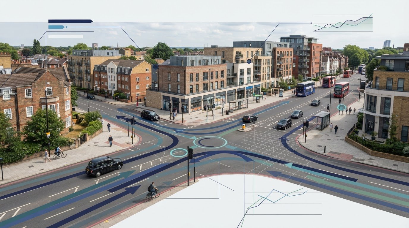
  • The Role of a Traffic Consultant in Securing UK Planning Approvals in 2026

    The Role of a Traffic Consultant in Securing UK Planning Approvals in 2026

    In London, 42% of minor development applications face immediate delays at the validation stage simply because they lack sufficient highway data. This statistic highlights a growing trend across the UK where planning authorities are becoming increasingly stringent about transport impact. You likely understand the frustration of seeing a project stall because of a highway authority objection or confusion over whether you need a Transport Statement or a full Assessment. Securing planning permission in 2026 requires more than just a good design; it demands technical precision and a deep understanding of evolving regulations like the revised National Planning Policy Framework. Engaging a professional traffic consultant is no longer optional for developers who want to avoid costly setbacks.

    A specialist traffic consultant acts as a strategic partner to turn transport constraints into planning assets. We provide the technical reporting and data-driven insights, such as swept path analysis and parking surveys, needed to satisfy even the most demanding local authorities. This article explores how expert consultancy navigates complex 2026 regulations to secure approvals and optimize site layouts. You’ll discover how to minimize transport-related conditions and deliver cost-effective technical reports that keep your development on track and within budget.

    Key Takeaways

    • Understand how a traffic consultant manages transport risks to ensure your project aligns with the latest National Planning Policy Framework (NPPF) requirements.
    • Learn the critical differences between Transport Statements and Transport Assessments to ensure you submit the correct technical documentation for your development size.
    • Discover how technical data collection, including Parking Surveys and Swept Path Analysis, can justify lower parking provisions and optimise your site layout.
    • Identify why early engagement during the site feasibility stage is essential to prevent costly highway authority objections and application delays.
    • Gain insights into streamlining the approval process through comprehensive reporting that meets specific Local Highway Authority standards in England.

    What is a Traffic Consultant and Their Role in UK Planning?

    A traffic consultant is a technical expert tasked with managing the transport-related risks of a development project. Their primary objective is ensuring that a scheme complies with the National Planning Policy Framework (NPPF) and local highway standards. In the context of the 2026 planning cycle, where revisions to the NPPF emphasize efficient land use and sustainable transport hubs, this role is critical for securing a viable planning permission. They don’t just provide data; they act as a strategic bridge between your development goals and the strict requirements of local authorities.

    To better understand the distinction between the technical roles involved in this field, watch this helpful video:

    While the terms are often used interchangeably, a traffic engineer typically focuses on the physical movement of vehicles and site geometry, whereas a transport planner examines broader policy and the transportation planning process. A professional traffic consultant integrates both disciplines to provide a robust evidence base for local authorities. They ensure that your site is not only accessible but also policy-compliant in an environment where sustainable and active travel are now mandatory priorities.

    Consultancy vs. Construction: Clearing the Confusion

    It’s a common misconception that traffic consultants are involved in physical road construction. While Companies House often groups consultancy under “Construction of roads,” the reality is strictly technical and analytical. We specialize in what we do: reporting, analysis, and negotiation. We don’t lay asphalt; we provide the data that justifies the road layout or parking provision. Our focus remains on securing technical approval from Local Highway Authorities through rigorous reporting and adherence to industry benchmarks.

    The Planning Application Lifecycle

    Effective consultancy follows a logical, sequential flow that mirrors the progression of your project. This includes:

    • Pre-application: Identifying potential highway “showstoppers” like poor visibility splays before they become costly.
    • Submission: Providing the technical evidence base, such as Transport Statements, required by planning officers.
    • Post-decision: Discharging transport-related planning conditions effectively so construction can begin.

    Engaging a consultant early in the 2026 planning cycle is essential. With planning fees in England increasing by 3.8% from April 2026, the cost of a failed application is higher than ever. Precision in your initial submission is the most reliable way to protect your investment.

    Core Services: From Transport Statements to Technical Surveys

    Securing planning approval in 2026 requires a robust technical evidence base tailored to your development’s scale. With planning fees in England rising by 3.8% as of April 2026, getting the submission right the first time is a financial necessity. A professional traffic consultant identifies the exact reporting requirements to satisfy UK government guidance, ensuring you don’t overspend on unnecessary data while meeting every statutory obligation. These services range from preliminary statements for minor schemes to comprehensive assessments for major projects.

    For residential developments of 10 to 49 units, Transport Statements are typically the standard requirement. These concise reports address minor transport impacts and demonstrate that the existing network can accommodate new residents without compromising safety. Larger schemes with significant traffic generation require full Transport Assessments. These detailed documents analyze capacity, safety, and mitigation across a wider area. Getting this distinction right at the validation stage prevents the 42% delay rate often seen in complex urban planning environments where highway data is frequently found insufficient.

    The Technical Evidence Base

    Digital vehicle simulations provide the precision needed to satisfy highway officers and planning committees. Swept Path Analysis (SPA) uses specialized software to prove fire tenders and refuse vehicles can safely navigate your site. Without SPA, designs often face immediate rejection due to access concerns. We also use the TRICS database for trip forecasting and Travel Plans to support sustainable transport goals. These tools ensure your layout is both functional and policy-compliant from the start.

    Specialised Surveys for Local Authorities

    Authorities often demand specific data like the Lambeth Methodology for parking surveys. These overnight stress assessments prove the local network can absorb parking overflow, which is vital for car-free or low-parking schemes. We also conduct traffic counts and speed surveys to determine visibility splays at site entrances. These provide the hard evidence needed for technical negotiations. Explore these options on our What We Do page. Consulting with a traffic consultant early prevents technical objections and keeps your project moving forward.

    Why Developers Need a Traffic Consultant in 2026

    The financial stakes of UK development have never been higher. With planning appeal rates for residential schemes dropping by 22% when robust transport documentation is used, the ROI of professional technical support is clear. A traffic consultant does more than just fill out forms; they mitigate the risk of planning refusal by addressing highway safety and capacity concerns before they reach a committee. By providing an evidence based approach, we protect your project from the subjective objections that often stall applications.

    Land use optimization is another critical area where expert input pays for itself. In urban environments, the London Plan 2026 now mandates car-free developments in areas with a Public Transport Accessibility Level (PTAL) score of 4 or higher. We use empirical data from parking surveys to justify lower parking provisions, freeing up valuable square footage for additional units or amenities. Our members often hold qualifications from the Chartered Institution of Highways & Transportation, ensuring that all justifications meet the highest industry standards for technical excellence and safety.

    Beyond the initial application, we manage the complex negotiation of Section 278 Agreements. These legal requirements for permanent highway works can become a significant bottleneck if not handled with technical precision. If a project does face a challenge, we provide expert witness services for planning appeals, defending our technical findings with authoritative clarity to ensure your development moves forward.

    Cost Savings Through Design Optimization

    Accurate data prevents the expensive over-engineering of access roads and junctions. By using precise trip generation models, we often prove that standard, less invasive designs are sufficient for the projected traffic flow. This approach can also eliminate the need for costly underground parking. A robust transport assessment might demonstrate that local network capacity can support your density without such heavy infrastructure investment. We resolve the common “architect vs. highways” conflict by providing engineering led designs that satisfy both aesthetic goals and safety requirements.

    For commercial or industrial developments in 2026, ensuring that site access is optimized for heavy logistics is a key part of the planning process. To see how professional logistics providers manage complex freight movements, you can learn more about Tranzit Express Inc. and their role in the transportation industry.

    Navigating Local Authority Objections

    Professional credibility is your strongest asset when dealing with council engineers. We speak their language and understand their specific regional concerns. When an objection arises, we don’t just relay the bad news. We translate technical objections into actionable design changes that maintain your project’s viability. For a deeper look at how this works in complex urban settings, see our Transport Assessment London Guide. Rapid response and technical authority are essential for keeping your project on schedule.

    When to Engage a Traffic Consultant for Your Project

    The “Early Engagement” principle is the foundation of a successful planning strategy. Many developers make the mistake of waiting until they receive a formal objection from the Local Highway Authority before seeking expert advice. This reactive approach is costly. By the time an objection is raised, design changes are often expensive and time consuming to implement. Engaging a professional traffic consultant during the initial site feasibility stage allows you to determine if a site can actually support your proposed density. This foresight prevents you from investing in a scheme that is fundamentally flawed from a transport perspective.

    Coordinating with your design team during RIBA Stage 2 and 3 ensures that transport requirements are baked into the site’s DNA. This collaboration prevents the common conflict where an architect’s vision is compromised by late stage highway requirements. Additionally, the timing of survey data collection is critical for a valid submission. We strictly avoid school holidays and bank holidays to ensure the data is representative of typical network conditions. Unrepresentative data is a frequent cause for council rejection and can force you to repeat expensive data collection exercises.

    Pre-Application Strategy

    Using a consultant to scope the transport requirements with the council early is a proactive step that reduces regulatory pressure. This process identifies the specific need for specialized surveys before the application is submitted, allowing for a smoother validation process. Implementing early Swept Path Analysis can save weeks of redesign time by ensuring the site layout accommodates essential service vehicles from the first draft. This technical readiness demonstrates professional integrity to planning officers from the outset.

    The Submission Phase

    During the submission phase, we ensure all reports are current and meet 2026 policy standards, such as the latest NPPF revisions. We also manage technical requests for further information from authorities, including formal Regulation 25 requests. Given that 42% of minor applications face delays at validation due to insufficient data, your evidence base must be beyond reproach. If you are preparing a new application, you can request a technical review of your site feasibility to ensure compliance before submission.

    Checklist for developers: Is your transport evidence ready for submission?

    • Is your survey data representative and collected outside of holiday periods?
    • Does your Travel Plan align with the 2026 London Plan or regional standards?
    • Has your SPA been conducted using the specific refuse vehicle dimensions required by the local council?
    • Is your traffic consultant prepared to negotiate directly with highway engineers?

    The Role of a Traffic Consultant in Securing UK Planning Approvals in 2026

    Choosing ML Traffic Engineers for Your 2026 Planning Success

    ML Traffic Engineers UK has provided technical reporting and data collection for planning applications across England since 2014. We understand that precision is a functional necessity in the high-stakes environment of property development. As your traffic consultant, we manage the full project lifecycle from inception to completion. Our team balances technical authority with a client-focused approach to reduce the logistical and regulatory pressures on your business. We don’t just provide reports; we act as a reliable partner that understands intricate regional regulations so you don’t have to. This dedication to accuracy ensures that every submission meets the rigorous standards expected by planning committees and highway officers.

    Our methodology is rooted in specialized industry terminology and strict adherence to legislative requirements. We take immense pride in our precision and adherence to standards, which serves as the foundation for every project we undertake. Whether you’re developing a minor residential scheme or a complex mixed-use commercial site, our solutions are tailored to meet the specific requirements of the Local Highway Authority. This commitment to formal excellence ensures that our technical reports carry the weight and credibility needed to build trust with planning officers, effectively streamlining the path to approval.

    Expertise in London and Regional Planning

    Managing the unique challenges of urban site constraints requires a deep understanding of evolving policies. While the London Plan 2026 places significant emphasis on connectivity and sustainable density, our role is to translate these requirements into viable site layouts that satisfy both local and national targets. We have a consistent track record in delivering Transport Statements that win approval by directly addressing local authority concerns with empirical data. Our comprehensive approach moves your project from the initial feasibility stage through to final technical approval with efficiency and readiness, ensuring that no technical detail is overlooked.

    The ML Traffic Engineers UK Advantage

    The ML Traffic Engineers UK advantage lies in our precision-led engineering paired with a client-focused advisory approach. We provide an all-encompassing service that includes everything from raw data collection to expert technical reporting. This fully managed service model ensures you have a single, dependable point of contact for all transport-related planning matters, reducing the need for multiple vendors. We invite you to explore our project types to see how we’ve supported various residential and commercial developments across the country.

    Success in the 2026 planning cycle depends on technical accuracy and rapid response capabilities. We maintain a standard of professional integrity and civic responsibility that positions us as vital guardians of public safety. Don’t let transport objections stall your development’s progress or lead to unnecessary costs. Contact ML Traffic Engineers UK today to secure the technical expertise your project requires for a successful planning outcome.

    Secure Your Development’s Future in 2026

    Planning success in the current regulatory environment depends on technical precision and early strategic action. By integrating transport requirements into the earliest design phases, you avoid the common pitfalls of highway objections and validation delays. A professional traffic consultant provides the evidence base needed to justify site density and parking provisions, ensuring your project aligns with national standards. This proactive approach minimizes the risk of costly redesigns and protects your development’s timeline from unpredictable regulatory hurdles.

    ML Traffic Engineers UK acts as a reliable partner for Local Highway Authority negotiations, offering specialist consultants for NPPF compliance and expert Swept Path Analysis services. We manage the full lifecycle of your transport planning needs to ensure a seamless approval process. Our team is ready to provide the technical authority required to move your project from the feasibility stage through to successful completion with unwavering reliability.

    Get a Professional Quote for Your Transport Planning Needs

    Your vision for a successful development starts with a solid technical foundation. We’re ready to help you move your project forward with confidence and professional integrity.

    Frequently Asked Questions

    What is the difference between a Transport Statement and a Transport Assessment?

    The primary difference lies in the scale of the proposed development and the depth of analysis required. A Transport Statement is a concise report for smaller projects, typically residential schemes between 10 and 49 units, that have limited transport impacts. A Transport Assessment is a comprehensive document for larger developments. It requires detailed modeling of network capacity, safety, and mitigation measures to satisfy the Local Highway Authority.

    How much does a traffic consultant cost for a planning application?

    Fees for professional consultancy depend on the project’s complexity and the specific technical requirements of the local council. Costs vary based on whether the scheme requires a simple Statement or a full Assessment supported by extensive data collection. To ensure you receive a cost-effective solution that meets all regulatory benchmarks, it is best to request a tailored quote based on your specific site layout and development goals.

    Is a Swept Path Analysis always required for a new driveway or access?

    Local Highway Authorities frequently mandate Swept Path Analysis for any new access point to prove that essential vehicles, such as fire tenders and refuse trucks, can safely enter and turn. Proving these maneuvers through digital simulation is a functional necessity for modern planning approvals. Even for smaller sites, this analysis prevents immediate objections regarding highway safety and ensures your design complies with the latest street design standards.

    Once planning approval is secured, working with experienced contractors such as McCready Home Improvements ensures that the physical construction of driveways and property access meets the required quality and durability standards.

    How long does it take to produce a Transport Statement in 2026?

    A professional traffic consultant typically requires two to four weeks to produce a standard Transport Statement. This timeline depends heavily on the availability of representative survey data. In 2026, data collection must strictly avoid school holidays and bank holidays to ensure the findings are accurate and acceptable to planning officers. Early engagement ensures that your technical evidence is ready well before your planned submission date.

    Can a traffic consultant help if my planning application has already been refused?

    Yes, we can analyze the specific reasons for refusal and provide the technical evidence needed for a resubmission or appeal. We specialize in translating highway authority objections into actionable design changes that maintain project viability. Using robust transport documentation has been shown to reduce planning appeal rates by 22% for residential schemes, providing a clear path forward after an initial setback from the council.

    Do I need a traffic survey if my site is in a low-traffic area?

    You may still need a traffic survey to determine visibility splays or to prove that the local network can absorb even a minor increase in vehicle movements. Local authorities often demand empirical data rather than assumptions, regardless of current traffic levels. Surveys provide the technical evidence needed to justify your site’s access safety and capacity, ensuring your application isn’t delayed at the validation stage due to insufficient data.

    What information does a traffic consultant need from me to start?

    To begin the technical assessment, we require a clear site location plan, the proposed site layout, and details regarding the development’s scale and intended use class. Providing any previous correspondence with the council or the site’s planning history is also vital. This information allows us to scope the transport requirements accurately and identify potential highway “showstoppers” before they become costly issues during the formal application process.

    How does a Travel Plan differ from a Transport Assessment?

    A Transport Assessment analyzes the physical impact of a development on the highway network’s capacity and safety. In contrast, a Travel Plan is a long-term strategy focused on promoting sustainable transport modes like cycling and public transport. While the Assessment deals with vehicle movements and infrastructure, the Travel Plan outlines measures to reduce car dependency, which is a mandatory requirement for many schemes under the 2026 London Plan.

    Michael Lee

    Article by

    Michael Lee

    Transport planner with over 35 years' experience.

    Disclaimer

    The content on mltraffic.co.uk, including all technical articles, guides, and resources, is provided for general informational and educational purposes only. It is not intended to constitute professional advice in traffic engineering, transportation planning, development approvals, or any other technical or legal field.
    While ML Traffic Engineers makes every reasonable effort to ensure the accuracy, completeness, and timeliness of the information published, we do not provide any warranties or representations (express or implied) regarding its reliability, suitability, or availability for any particular purpose. Any reliance you place on the content is strictly at your own risk.
    In no event shall ML Traffic Engineers, its directors, employees, authors, or affiliates be liable for any direct, indirect, incidental, special, consequential, or punitive damages (including, without limitation, loss of profits, data, or business opportunities) arising out of or in connection with the use of, or inability to use, any information provided on this website.
    The articles and guides on this site are not a substitute for engaging a qualified, professional traffic engineer to assess your specific project requirements. For tailored advice, compliance assessments, or traffic engineering services, please contact a competent professional.
    This disclaimer may be updated from time to time without notice. By accessing or using this website, you agree to be bound by the most current version of this disclaimer.
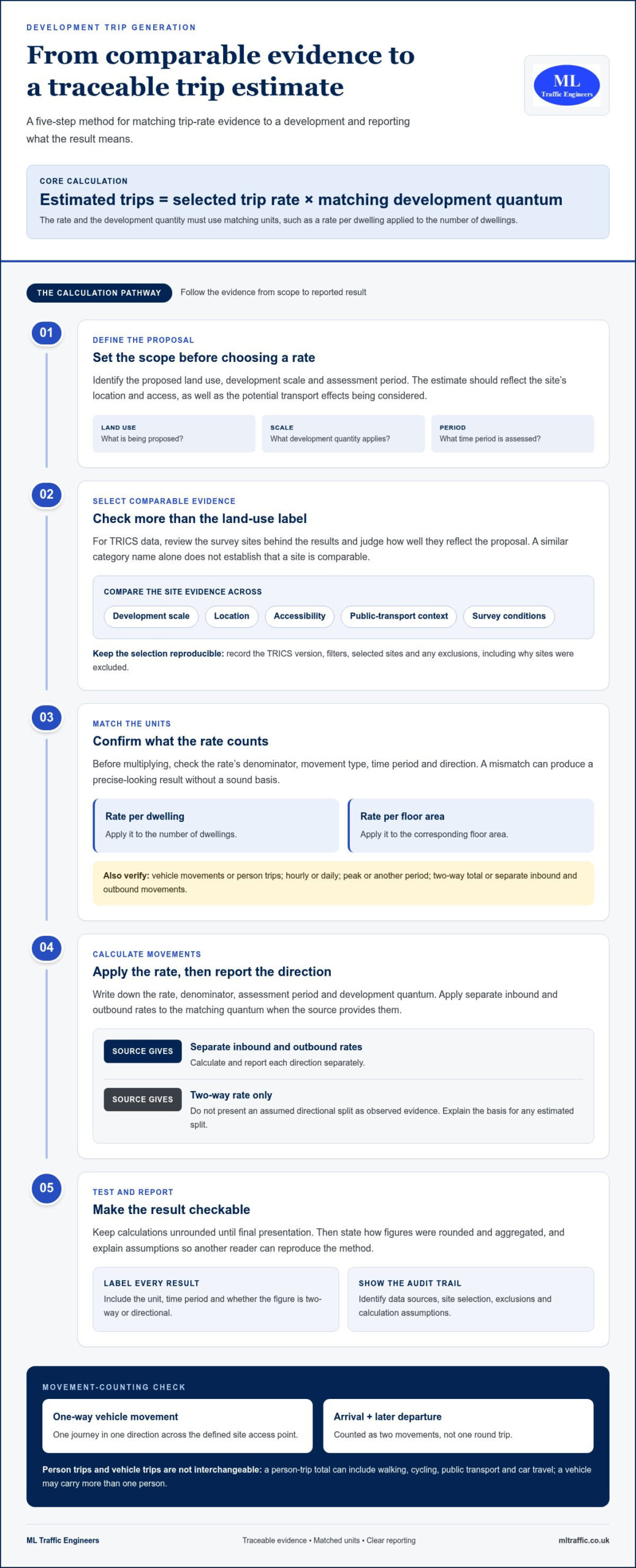
  • What is a Vehicle Tracking Diagram?  A Guide for Developers

    What is a Vehicle Tracking Diagram? A Guide for Developers

    Approximately one in five planning applications in the UK are initially rejected as invalid, with non-compliant site maps cited as the most frequent cause for failure. For any developer, a vehicle tracking diagram is far more than a simple technical drawing; it serves as the definitive legal proof that your proposed site layout is functional and safe. You likely recognize the stress of selecting the correct vehicle templates, such as fire tenders or refuse trucks, knowing that a single unworkable access point can lead to a costly planning refusal from the Local Highway Authority.

    We understand the pressure of meeting stringent highway standards while trying to maximize every square meter of your site. This guide provides a clear understanding of Swept Path Analysis (SPA) and explains how a professional vehicle tracking diagram functions as critical evidence for your application. You’ll learn how to ensure your layout meets the latest 2026 regulatory benchmarks, including updates to the Manual for Streets. We will preview how to bridge the gap between software features and engineering requirements to deliver a site that is both compliant and highly efficient.

    Key Takeaways

    • Understand why a vehicle tracking diagram is a mandatory requirement for proving site accessibility to Local Highway Authorities and emergency services.
    • Distinguish between wheel paths and body envelopes to ensure your layout accommodates the full physical footprint of a manoeuvring vehicle.
    • Identify the specific design templates required for your project, including the standard 11.4m refuse collection vehicle used by most UK councils.
    • Learn how professional interpretation of swept path data can justify tighter site layouts without compromising on safety or regulatory compliance.
    • Recognise the limitations of automated software and why expert engineering oversight is essential for securing planning approval.

    What is a Vehicle Tracking Diagram in UK Planning?

    A vehicle tracking diagram is a technical illustration that visualises the physical space required for a vehicle to manoeuvre through a site layout. It serves as a vital piece of evidence in the UK planning system, proving that a proposed design can safely accommodate the vehicles expected to use it. These diagrams aren’t just for show; they’re essential for securing approval from Local Highway Authorities who must ensure that emergency and service vehicles don’t get stuck or cause hazards on the public highway. By mapping the ‘swept path’ of a vehicle, developers can demonstrate that their site is functional before a single brick is laid.

    The role of these diagrams extends throughout the entire planning lifecycle. During the pre-application stage, they help identify potential access issues before they become expensive design flaws. Later, they’re frequently submitted as part of a formal application or used to discharge planning conditions once permission is granted. By integrating professional Swept Path Analysis services, developers provide the technical assurance that highway officers require to recommend an application for approval.

    A common oversight in many planning submissions is failing to integrate these diagrams into the broader Transport Statement. A vehicle tracking diagram shouldn’t stand alone. It provides the empirical data that supports the access and safety arguments within your Transport Statement. Without this visual proof, claims about site accessibility are merely anecdotal and often face immediate rejection from the council. Precision here is a functional necessity, not an optional extra.

    Terminology: Vehicle Tracking vs. Swept Path Analysis

    While often used interchangeably, ‘vehicle tracking’ refers to the simulation process itself, whereas the ‘diagram’ is the physical or digital output. This technical field has evolved significantly since the development of AutoTrack, the world’s first swept path analysis software. In professional engineering reports, ‘swept path’ specifically describes the area covered by the vehicle’s body plus a necessary safety margin. This margin is critical because it accounts for driver error and minor variations in vehicle dimensions, ensuring the layout works in the real world.

    Who Requires These Diagrams?

    Several statutory consultees will scrutinise your site’s accessibility. Local Planning Authorities (LPAs) and Highway Officers are the primary gatekeepers. They use these diagrams to verify road safety and traffic flow. Additionally, Fire and Rescue services require proof of statutory access for fire tenders to meet building regulations. Finally, waste management departments won’t approve a development unless a vehicle tracking diagram proves that a standard refuse collection vehicle can enter, turn, and exit the site safely in forward gear.

    The Technical Anatomy of an Accurate Tracking Diagram

    A professional vehicle tracking diagram is a composite of several critical data layers. It isn’t merely a drawing of a vehicle moving through a space; it’s a calculated projection of physical limits. The most fundamental layer is the ‘Wheel Path’, which tracks the exact trajectory of the tyres. This data is vital for engineers to determine curb heights and pavement structural requirements. However, the ‘Body Envelope’ is often the primary focus for planning officers. This represents the outer limits of the vehicle’s chassis, including mirrors and overhangs. In a tight turn, the body of a refuse truck or fire tender will often swing wider than the wheels. Ignoring this distinction is a common reason for planning failure.

    Precision is mandatory. Real-world driving isn’t perfect, so a safety clearance is essential. Most UK authorities expect a buffer of 300mm to 500mm between the vehicle’s body envelope and any physical obstruction like a wall or a parked car. For developments involving underground car parks or low bridges, vertical clearance must also be factored into the vehicle tracking diagram. A layout that works on a 2D plane might still fail if it doesn’t account for the height of a standard delivery van or emergency vehicle. If you’re concerned about these technical margins, our experts can provide a detailed Swept Path Analysis to ensure your site remains functional and compliant.

    Visual Standards for Planning Submission

    Clarity is just as important as accuracy. Planning officers often review dozens of applications a week, so your diagram must be legible and professional. High-resolution PDF outputs are the industry standard; raw CAD files are rarely accepted because they require specialised software to view. We recommend colour-coding different vehicle types to make the diagram intuitive. For example, using red for fire tenders and blue for passenger cars allows a reviewer to quickly verify access for different services. Adhering to these UK government requirements for vehicle tracking plans ensures your base map, typically an OS MasterMap, is up-to-date and provides an accurate context for the manoeuvres.

    Interpreting ‘Lock-to-Lock’ Time

    One technical detail that frequently trips up developers is ‘lock-to-lock’ time. This is the time it takes a driver to turn the steering wheel from one extreme to the other. If a diagram assumes a steering speed that’s too fast for a heavy refuse vehicle, the resulting arc will be unrealistically tight. Most residential manoeuvres occur at slow speeds, often under 5mph. Your vehicle tracking diagram must reflect these slow-speed realities. Applications are often rejected when highway officers spot steering assumptions that don’t align with the physical capabilities of the chosen design vehicle.

    Software Tools vs. Professional Engineering Services

    Autodesk Vehicle Tracking has become the dominant force in digital site modeling, providing developers with powerful tools to simulate vehicle movement. While this software is the industry standard for precision, it’s vital to remember that it is a tool, not a solution. A vehicle tracking diagram generated by a computer is only as reliable as the parameters defined by the operator. Simply owning the software doesn’t mean a developer can produce a document that will withstand the scrutiny of a Local Highway Authority. Expert interpretation remains the bridge between a technical drawing and a successful planning approval.

    One of the most significant risks in using automated software is the reliance on ‘default settings’. Standard vehicle libraries often include templates that don’t align with specific UK council requirements. For instance, using a generic ‘Garbage Truck’ template might result in a manoeuvre that is either too optimistic or unnecessarily restrictive. Most English councils require a specific 11.4m Refuse Collection Vehicle (RCV) template. If your diagram uses a 10.5m default model, your application will likely be rejected for being ‘unworkable’. Hiring a transport consultant ensures that the correct, council-specific design vehicles are used from the start, avoiding costly redesigns.

    The Limitations of Automated Software

    Software lacks the ability to understand local policy or the nuances of the ‘human element’ in driving. While a computer might flag a turn as ‘failing’ because of a 50mm overlap, an experienced engineer can often optimise the layout or provide a technical justification for the manoeuvre. We focus on finding functional solutions that maximise your site’s developable area. A professional report includes the commentary necessary to explain why a specific path is safe, even in ‘tight’ site layouts that automated software might struggle to validate.

    Why Professional Certification Matters

    Highway Officers give significantly more weight to a vehicle tracking diagram submitted by a recognised traffic engineering firm. This isn’t just about the drawing; it’s about the accountability that comes with it. Professional firms carry Professional Indemnity (PI) insurance, which protects the developer against design errors that could lead to structural or operational failures. Furthermore, we ensure these diagrams are seamlessly integrated into a comprehensive Transport Statement London. This holistic approach provides the statutory consultees with all the evidence they need in a single, authoritative package, significantly reducing the likelihood of a planning refusal.

    What is a Vehicle Tracking Diagram? A Guide for Developers

    Critical Vehicle Templates for UK Planning Approval

    Selecting the correct ‘Design Vehicle’ is the most consequential decision in the creation of a vehicle tracking diagram. A design vehicle is the largest or most frequent vehicle expected to use the site, and its dimensions dictate the layout’s feasibility. Using a generic or undersized template is a common error that leads to immediate planning rejection. For most residential developments in England, the 11.4m Refuse Collection Vehicle (RCV) is the non-negotiable standard. Highway officers require proof that this specific vehicle can navigate the site without mounting kerbs or endangering pedestrians.

    Statutory access for emergency services is equally critical. Fire tenders must meet the 12.5m outer turning circle rule, as specified in Building Regulations. If your site layout cannot accommodate this manoeuvre, it won’t pass safety inspections regardless of how well the rest of the design performs. For commercial and retail schemes, the focus shifts to delivery logistics. This often requires tracking for 16.5m Articulated HGVs or smaller Rigid HGVs for urban environments. If you are unsure which templates your local council requires, our team can provide expert Swept Path Analysis to ensure your submission is accurate from the start.

    Residential Development Requirements

    In residential schemes, the vehicle tracking diagram must demonstrate that refuse trucks can enter and exit in forward gear. This often involves designing ‘turning heads’ at the end of cul-de-sacs. If a dead-end road is longer than 20 metres, a turning facility is a mandatory requirement for fire access. Larger residential developments may also need to show tracking for a Pantechnicon, or standard removal van, to ensure residents can move in and out without blocking the entire street. For premium developments, ensuring that high-end private hire services like Hyper Executive Travel can easily access drop-off points is equally important for the end-user experience. Precision here prevents the ‘unworkable’ label that highway officers often apply to poorly planned access points.

    Commercial and Industrial Standards

    Industrial developments face different challenges, particularly regarding warehouse loading bays. These sites require tracking for 16.5m Articulated HGVs to prove that vehicles can reverse into bays without multiple shunts that disrupt traffic flow. Urban retail units often rely on Rigid HGV templates, which are more manoeuvrable but still require significant clearance. Some specialist developments, such as petrol stations or industrial plants, may even require tracking for fuel tankers or abnormal loads. For developers managing the logistics of industrial site setup, silver-knight.co.uk offers a detailed guide on heavy equipment transport costs. We ensure every vehicle tracking diagram uses the specific manufacturer data required for these high-stakes manoeuvres, maintaining the safety-conscious standards your project demands.

    Securing Planning Approval with Accurate Vehicle Tracking

    A professional vehicle tracking diagram serves as a persuasive tool during negotiations with the Local Highway Authority. It transforms subjective concerns about site access into objective, data-driven discussions. When a highway officer or a local resident raises an objection based on perceived congestion or “unworkable” turns, your diagram provides the empirical proof needed to mitigate those concerns. By demonstrating that every manoeuvre is within safe physical limits, you can often justify “tight” site layouts that maximise your developable land without compromising on safety standards.

    Engaging in pre-application tracking is one of the most effective ways to avoid expensive redesigns. Identifying a conflict between a refuse truck’s body envelope and a proposed building corner is far easier to fix during the initial design phase than after a formal submission. At ML Traffic Engineers UK, we provide compliant, planning-ready documentation that integrates seamlessly into your wider application. We ensure that every vehicle tracking diagram we produce adheres to the latest 2026 standards, providing the technical authority required to satisfy statutory consultees and streamline the approval process.

    Integrating Tracking into Your Design Process

    Tracking should never be an afterthought. We recommend conducting a Swept Path Analysis before your final site plan is frozen. This proactive approach allows you to determine the absolute minimum road widths required for safe passage. It also helps you find the critical balance between maximizing parking provision and ensuring necessary vehicle manoeuvrability. When you design with tracking data from the start, you create a layout that is both functional for users and acceptable to highway officers.

    Next Steps for Your Planning Application

    Securing a professional assessment is a straightforward process that provides immediate clarity for your project. You can request a quote for a professional Swept Path Analysis by contacting our team with your current site plans. We understand the urgency of planning deadlines; we prioritise efficient turnaround times to keep your application moving forward. For more developer guides and technical insights, visit our resources page. Our goal is to act as your dependable partner, managing the intricate regional regulations so you can focus on the broader vision of your development.

    Advancing Your Development with Technical Certainty

    A compliant site layout depends on more than just a drawing; it requires the precise application of highway standards and physical limits. You’ve seen how the body envelope and safety clearances dictate the success of your application. Choosing the correct design vehicles, from refuse trucks to fire tenders, ensures your layout remains functional under real-world conditions. A professional vehicle tracking diagram acts as your definitive evidence against planning objections and helps you avoid the high costs of post-submission redesigns.

    Expertise matters when navigating the specific requirements of London and England planning authorities. We provide technical analysis that is accepted by all UK Highway Authorities, ensuring your project meets every regulatory benchmark. We understand that planning deadlines move quickly, so we offer a rapid turnaround to keep your development on track. Request a Professional Swept Path Analysis for Your Project today to secure your site access. Our team is ready to provide the precision your application needs for a smooth path to approval.

    Frequently Asked Questions

    Is a vehicle tracking diagram required for every planning application?

    Not all applications require a vehicle tracking diagram, but they’re mandatory for any development creating new access points or involving significant changes to vehicle movement. Local Highway Authorities typically demand them for residential schemes of three or more dwellings and all commercial developments. If your project requires service or emergency vehicle access, you’ll need to provide this technical proof to avoid an invalid application status.

    What is the standard size of a fire tender for UK swept path analysis?

    The standard fire tender used for UK swept path analysis typically measures 8 metres in length and 2.55 metres in width. However, the most critical metric is the 12.5 metre outer turning circle requirement specified in Building Regulations. We ensure your diagram accounts for these dimensions plus the necessary safety buffers to ensure statutory access is guaranteed for emergency services without any risk of collision.

    Can I use a standard car for my tracking diagram?

    You can use a standard car template for tracking individual parking spaces, but it won’t satisfy access requirements for a planning application. Highway officers focus on the largest vehicles expected on site, such as refuse trucks or fire tenders. A vehicle tracking diagram that only shows a passenger car doesn’t prove that the site is functional for essential services or emergency responders.

    What happens if my site layout fails the vehicle tracking test?

    If your site layout fails the test, you’ll need to redesign the access or turning areas before submitting your application. This often involves widening internal junctions, increasing the radius of a turning head, or slightly relocating buildings to provide the necessary clearance. Identifying these failures during the pre-application stage prevents a formal refusal and the associated costs of starting the process over again.

    Do I need a separate diagram for every entrance and exit?

    You must provide tracking for every entrance and exit that serves different vehicle types or has unique geometric constraints. While you don’t necessarily need separate drawings, the diagrams must clearly show that all access points are functional for their intended use. This includes demonstrating that a refuse truck can safely enter and exit the site in forward gear at every designated point.

    How much does a professional swept path analysis cost in 2026?

    The cost of a professional swept path analysis varies depending on the complexity of the site and the number of vehicle manoeuvres required. While industry rates in London for standard CAD assessments can range significantly, every project has unique requirements. We recommend requesting a tailored quote to ensure you receive a comprehensive report that meets your specific local authority’s stringent standards.

    What software do transport engineers use for vehicle tracking?

    Transport engineers primarily use specialised software such as Autodesk Vehicle Tracking, AutoTURN 2026, and RapidPath. These tools allow us to simulate precise manoeuvres using up-to-date libraries of UK-specific vehicle templates. By using industry-standard software, we produce a verifiable vehicle tracking diagram that highway officers can trust, ensuring your technical evidence aligns with the digital systems used by local planning departments.

    Does the diagram need to show the vehicle reversing?

    Your diagram must show reversing manoeuvres if they’re a necessary part of the site’s operation, such as in turning heads or loading bays. However, councils generally prefer designs that allow refuse and emergency vehicles to enter and exit in forward gear. If reversing is required, the diagram must prove the manoeuvre is safe and doesn’t conflict with pedestrian paths or structural boundaries.

    Michael Lee

    Article by

    Michael Lee

    Transport planner with over 35 years' experience.

    Disclaimer

    The content on mltraffic.co.uk, including all technical articles, guides, and resources, is provided for general informational and educational purposes only. It is not intended to constitute professional advice in traffic engineering, transportation planning, development approvals, or any other technical or legal field.
    While ML Traffic Engineers makes every reasonable effort to ensure the accuracy, completeness, and timeliness of the information published, we do not provide any warranties or representations (express or implied) regarding its reliability, suitability, or availability for any particular purpose. Any reliance you place on the content is strictly at your own risk.
    In no event shall ML Traffic Engineers, its directors, employees, authors, or affiliates be liable for any direct, indirect, incidental, special, consequential, or punitive damages (including, without limitation, loss of profits, data, or business opportunities) arising out of or in connection with the use of, or inability to use, any information provided on this website.
    The articles and guides on this site are not a substitute for engaging a qualified, professional traffic engineer to assess your specific project requirements. For tailored advice, compliance assessments, or traffic engineering services, please contact a competent professional.
    This disclaimer may be updated from time to time without notice. By accessing or using this website, you agree to be bound by the most current version of this disclaimer.
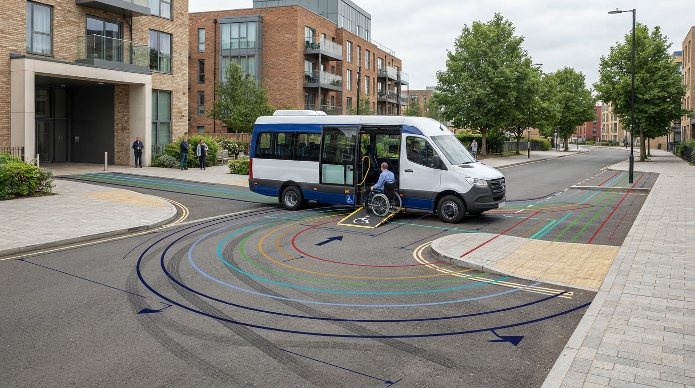
  • Traffic Survey for Planning Applications

    Traffic Survey for Planning Applications

    A traffic survey is not just a simple count; it’s the critical legal evidence that proves your development is safe and sustainable for the UK highway network. You’re likely aware of the immense pressure to meet statutory deadlines, such as the 13-week limit for major applications, while fearing that "outdated" or "flawed" data could lead to an immediate planning refusal. It’s frustrating when technical acronyms like ATC or MCC cause confusion, especially when you must hit specific "neutral" survey windows to satisfy rigorous Highway Authority standards.

    This guide helps you identify exactly which traffic survey for planning application UK requirements your specific project must meet to succeed. We’ll show you how to secure accurate data that satisfies decision-makers the first time, reducing regulatory friction and avoiding costly delays. You’ll gain a clear understanding of essential survey types, the impact of the London Plan 2026, and the new PAS 2161 monitoring standards. We also preview how professional Transport Statements, Travel Plans, and Swept Path Analysis create a reliable, data-driven path toward your planning approval.

    Key Takeaways

    • Learn why precise traffic data serves as the legal foundation for development impact assessments and satisfies Local Highway Authority safety standards.
    • Determine which traffic survey for planning application UK your project requires, from 7-day ATC volume data to detailed Manual Classified Counts.
    • Compare methodology options like pneumatic tubes and side-detection radar to capture the accurate vehicle speeds and classifications your site demands.
    • Identify the critical “neutral periods” for data collection to ensure your survey isn’t rejected due to school holidays or bank holiday anomalies.
    • Discover how to integrate raw survey findings into professional Transport Statements and Travel Plans to secure a smooth route to planning consent.

    Table of Contents

    Why Traffic Surveys are Essential for UK Planning Applications

    A traffic survey serves as the evidentiary foundation for every development impact assessment in England. It transforms subjective claims about road capacity into objective, verifiable data. Without this technical precision, your project risks an immediate refusal on highways grounds from the Local Highway Authority (LHA). These authorities review every submission to ensure public safety and network efficiency remain uncompromised. Your survey data directly informs your Transport Statement, providing the baseline for all subsequent technical analysis.

    A professional Traffic count identifies existing vehicle movements, speeds, and queue lengths. This technical clarity is vital because decision-makers prioritize road safety above all else. When you submit a traffic survey for planning application UK approval, you’re providing the LHA with the tools they need to validate your access designs and visibility splays. Accurate data reduces the regulatory pressure on your team and builds a transparent case for your development.

    To better understand how your data fits into the wider planning process, watch this helpful video on finding current applications:

    Meeting Statutory Planning Requirements

    The National Planning Policy Framework (NPPF) mandates that all developments promote sustainable transport and safe site access. Local Plans further define these requirements, often setting specific thresholds based on the scale of your project. For major developments, where the 13-week determination period applies, the LHA expects high-resolution data. Relying on "estimated" figures or national averages is no longer sufficient; most departments now require site-specific counts to verify that the local network can handle the proposed trip generation.

    The Consequences of Poor Data Collection

    Inaccurate data is a primary driver of costly planning appeals. If a survey under-counts peak hour traffic, the resulting safety assessments will be fundamentally flawed, potentially leading to dangerous road conditions. Highway Authorities are also quick to reject surveys conducted outside of "neutral" windows. Data collected during school holidays or local disruptions fails to represent typical conditions. This leads to delays that can push your project past the government’s 26-week Planning Guarantee for major applications, resulting in significant financial loss.

    Key Types of Traffic Surveys Required by Highway Authorities

    The specific data required for a traffic survey for planning application UK depends on the scale and location of your project. Local Highway Authorities rarely accept a one size fits all approach. Instead, they require a tailored suite of data collection methods to validate your site access and impact. It’s essential to match the survey type to the specific highway concern, whether that involves junction capacity or pedestrian safety. Developers should consult the government guidance on transport assessments to understand the baseline expectations for their specific development tier.

    Automatic Traffic Counters (ATC) and Volume Data

    ATCs provide a continuous, 24/7 record of vehicle movements over a minimum seven-day period. We typically deploy pneumatic tubes across the carriageway or use side-detection radar sensors to capture volume, speed, and vehicle classification. This data is critical for establishing the 85th percentile speed, which is the standard metric used to design safe visibility splays at new access points. Without accurate ATC data, your junction modeling will lack the necessary baseline flows required for a successful audit. These automated systems are the most cost-effective way to gather long-term data for less complex road sections.

    Manual Classified Counts (MCC) for Complex Junctions

    While automated systems are efficient for volume, complex junctions require the nuance of human observation or advanced video analytics. MCCs allow us to differentiate between cyclists, HGVs, buses, and private cars. This granularity is essential for capturing specific turning movements at existing junctions near your site. If you don’t provide this level of detail, Highway Authorities may question your impact analysis. These detailed counts are a non-negotiable component of Transport Assessment London requirements, where active travel and heavy vehicle interactions are under intense scrutiny.

    Parking Surveys and the Lambeth Methodology

    Urban developments with limited on-site provision often face resistance due to potential overspill. In these cases, a parking "stress test" is necessary for a traffic survey for planning application UK in high-density areas. Using the Lambeth Methodology, we record all parked vehicles and legal spaces within a 200-meter radius on two separate weekday nights between 00:30 and 05:30. This evidence proves whether the local network can absorb additional demand, justifying "car-free" or low-parking schemes. This data also directly supports a robust Travel Plan by demonstrating the feasibility of sustainable transport choices.

    Our team manages the full lifecycle of these surveys, ensuring every data point meets the strict standards of UK Highway Authorities. You can view our full range of technical survey services to see which methodology fits your project constraints.

    Manual vs. Automated Traffic Counts: Choosing the Right Methodology

    Selecting the correct methodology for a traffic survey for planning application UK is a technical decision that directly impacts both data reliability and project costs. While some guidelines suggest a blanket preference for automated systems to reduce human error, the reality is more nuanced. The choice depends entirely on your specific Project Type and the physical characteristics of the highway network involved. For high-speed rural roads, we often prefer automated side-detection radar (SDR) over traditional pneumatic tubes. SDR systems are non-intrusive and help eliminate the "Surveyor Effect." This phenomenon occurs when visible human observers or bulky roadside equipment cause drivers to instinctively change their behavior, often by slowing down, which artificially skews the speed data required for your visibility splay calculations.

    Precision is a functional necessity in this high-stakes environment. Using covert data collection methods ensures that the captured vehicle movements reflect genuine, everyday conditions. This objective data is what Highway Authorities demand. It reduces the logistical pressure on your planning team by providing a "neutral" baseline that decision-makers can trust. Whether you’re managing a small residential access or a major infrastructure project, the methodology must align with the rigorous accuracy standards of PAS 2161 to ensure your data remains valid throughout the determination period.

    When to Use Automated Traffic Counters (ATC)

    ATCs are the most efficient tool for generating 7-day speed profiles and total volume counts on straight, free-flowing road sections. They offer significant cost benefits for long-term monitoring, as they don’t require manual shifts or constant supervision. However, ATCs have technical limitations in congested urban areas. Pneumatic tubes can fail or provide "noisy" data when slow-moving queues sit directly over the sensors for extended periods. In these environments, the risk of data dropouts is high. We evaluate the site conditions first to ensure the equipment can handle the expected traffic density without compromising the 85th percentile speed results.

    The Necessity of Manual Classified Counts (MCC)

    Manual Classified Counts remain the gold standard for complex multi-arm roundabout analysis and detailed junction modeling. While automated tubes are excellent for volume, they cannot reliably distinguish between a heavy goods vehicle (HGV) and a light van during complex turning movements. MCCs provide the granular "Classification" data essential for modern planning. This includes capturing pedestrian and cyclist data that automated tubes often miss entirely. If your development must satisfy "Healthy Streets" indicators or active travel policies, MCCs are a non-negotiable requirement. They provide the detailed evidence needed to prove your site is safe for all road users, not just motorists.

    Timing Your Survey: Neutral Periods and Local Authority Standards

    Timing is often the critical factor that determines whether your data is accepted or discarded by decision-makers. Local Highway Authorities require evidence of "normal" traffic conditions to assess the true impact of a development. If you conduct a traffic survey for planning application UK during a school holiday or near a bank holiday, the results will likely be rejected as unrepresentative. This leads to expensive re-surveys and missed planning committee dates. We ensure your data collection aligns with these strict regulatory windows to maintain your project’s momentum. Integrating these findings with Swept Path Analysis further proves site feasibility by showing how vehicles move within the actual, recorded traffic flow.

    A single-day "snapshot" is rarely sufficient for volume data. Authorities typically demand a 7-day profile to account for daily variations in road use. This longitudinal approach identifies the genuine morning and evening peaks, providing a robust baseline for your Transport Statement. Precision in timing reduces the risk of an "atypical" data set, which is a common reason for planning refusal. By capturing data when the network is at its most stable, you provide the LHA with the objective evidence they need to approve your site access designs.

    The Planning Calendar: Avoiding Invalid Data

    In the transport planning industry, May, June, September, and October are considered "planning gold." These months offer the most reliable "neutral" conditions. You must avoid specific dates that skew results, such as:

    • School half-terms and summer holidays.

    • The weeks immediately surrounding Christmas and Easter.

    • Local major events, festivals, or significant roadworks.

    • Periods of extreme weather, such as heavy snow or flooding, which alter driver behaviour.

    It’s also vital to verify that no temporary traffic management or diversions are active near your site. Atypical traffic from a nearby closed road can artificially inflate your counts, leading to over-engineered and unnecessarily expensive junction designs.

    Local Authority Specific Requirements

    Each Local Highway Authority maintains its own bespoke protocols for survey length and detail. While a 12-hour manual count might suffice for a small residential access, larger commercial schemes often require 24-hour automated monitoring over a full week. London boroughs are particularly rigorous, frequently demanding specific "peak hour" manual counts to assess pedestrian and cyclist interactions in high-density areas. You should always check for regional variations before deploying equipment. Secure your compliant Traffic Surveys today to ensure your data meets these local standards on the first attempt.

    The Ultimate Guide to transport planning consultants england

    From Raw Data to Planning Approval: The ML Traffic Approach

    Raw data provides the foundation, but professional interpretation is what secures a planning approval. We don’t just deliver spreadsheets; we translate every traffic survey for planning application UK into a cohesive technical argument. Our approach integrates these findings into our full suite of services, from initial assessments to detailed junction design. By applying 2026-standard modeling techniques, we predict future traffic growth with precision, ensuring your development remains viable throughout its operational lifecycle. This comprehensive oversight is part of what we do to reduce regulatory pressure on our clients and their design teams.

    Precision is a functional necessity in this high-stakes environment. We use the latest industry benchmarks to ensure your data is defensible during the rigorous LHA review process. Our team manages the full project lifecycle, moving from initial assessment to execution with a sense of readiness and urgency. This logical flow ensures that the data collected during neutral windows remains valid throughout the statutory determination period, whether your project faces an 8-week or 13-week deadline.

    Technical Analysis and Junction Modeling

    We feed your survey data directly into industry-standard modeling software like PICADY, ARCADY, and LinSig. These tools allow us to simulate how your development will interact with the existing network under peak conditions. Under the National Planning Policy Framework (NPPF), we must prove that the "residual cumulative impact" of your project is not severe. Precise visibility splay calculations, derived from our 85th percentile speed data, provide the safety evidence Highway Officers require. This technical rigour ensures that every access point is justified by objective data rather than estimation, meeting the requirements of PAS 2161 for road condition monitoring and data collection.

    Securing Your Planning Permission

    Professional data presentation reduces friction with Highway Officers and planning committees. Authorities are more likely to approve applications supported by clear, compliant datasets that follow a logical and sequential technical narrative. When authorities challenge survey findings or request additional clarification, we provide a robust "Response to Comments" service to defend the data integrity. This proactive communication prevents minor technical queries from turning into costly delays or unnecessary appeals. We understand the tight statutory deadlines and work with unwavering reliability to keep your project on track. If you need reliable data that satisfies UK Highway Authorities the first time, contact ML Traffic for a bespoke survey quote and secure the technical evidence your project demands.

    Secure Your Planning Success with Precise Data

    Securing planning approval requires more than just raw numbers; it demands a technically sound traffic survey for planning application UK that aligns with the latest 2026 regulatory standards. You’ve seen how strategic timing during neutral windows and the correct choice between automated or manual methodologies can prevent costly delays and planning refusals. By choosing a partner who understands intricate regional regulations, you ensure that your data satisfies Highway Authorities on the first submission. Precision is a functional necessity in this high-stakes environment, and we’re ready to provide the unwavering reliability your development requires.

    Our team provides expert interpretations of Local Authority requirements and ensures a fast turnaround for ATC and Speed surveys. We manage the full project lifecycle, delivering comprehensive reporting that includes professional Transport Statements and Assessments. We’ve built our reputation on technical authority and a client-focused approach that reduces regulatory pressure. Don’t let flawed data stall your progress. Get a Professional Traffic Survey Quote for Your Project today and move forward with the confidence that your technical evidence is robust, compliant, and ready for review.

    Frequently Asked Questions

    How long is a traffic survey valid for a planning application?

    Traffic surveys are typically valid for three years from the date of collection. Local Highway Authorities often consider data older than this obsolete because it fails to reflect current network conditions or recent infrastructure changes. If your data is approaching this limit, you should verify its acceptability with your planning officer before submission. Providing current evidence ensures your application remains compliant with the latest standards for road monitoring.

    What is a "neutral period" for traffic surveys in the UK?

    A neutral period refers to months where traffic flow is stable and representative of typical daily conditions. In the UK, these months are May, June, September, and October. You must avoid school half-terms, bank holidays, and major local events. Collecting data during these windows is essential for a traffic survey for planning application UK because it prevents skewed results that could lead to an immediate planning refusal.

    Do I need a 7-day traffic survey or just a one-day count?

    Most authorities require a 7-day survey for volume and speed data to establish a reliable 85th percentile speed. This duration accounts for daily fluctuations and provides a robust profile for technical analysis. A one-day count, typically a 12-hour Manual Classified Count, is usually reserved for analyzing specific turning movements at complex junctions. You should always check your local authority’s bespoke protocols to ensure your survey duration meets their requirements.

    How much does a professional traffic survey cost in 2026?

    Costs for professional surveys vary based on the project’s scale, the equipment used, and the survey’s duration. Factors such as the number of monitoring locations and the complexity of the data required, like HGV classification, will influence the final quote. While some local authorities provide historical data sets for a fee, this rarely replaces the need for a fresh, site-specific study that reflects the most recent network conditions.

    Can I conduct my own traffic survey for a small development?

    You cannot conduct your own survey for a formal planning submission because it lacks technical authority. Local Highway Authorities require independent, professional data to ensure accuracy and unbiased reporting. Professional surveys utilize calibrated equipment and follow standardized methodologies that satisfy legal and safety requirements. Submitting DIY counts often leads to rejection because the data isn’t considered a reliable baseline for a Transport Statement or Assessment.

    What happens if the traffic survey shows the road is too busy?

    If a survey indicates high congestion, the data serves as a baseline for mitigation strategies. We use this information to optimize your site access design or to develop a robust Travel Plan that encourages sustainable transport. Precise data allows you to prove that the residual cumulative impact of your development is not severe under NPPF guidelines. Professional interpretation helps you find technical solutions that satisfy the Highway Authority’s safety standards.

    Does the Highway Authority provide the traffic data for me?

    Highway Authorities may hold historical records, but they don’t provide current, site-specific surveys for your development. While you can sometimes purchase existing data sets, this information is often outdated or lacks the granular detail required for visibility splay design. You will almost always need a new traffic survey for planning application UK to provide the objective evidence necessary for a successful determination and to meet modern regulatory expectations.

    What is the difference between an ATC and an MCC survey?

    An Automatic Traffic Counter (ATC) uses sensors or radar to collect volume and speed data 24/7, usually over a full week. A Manual Classified Count (MCC) involves human observers or video analytics to categorize specific vehicle types and record turning movements at junctions. ATCs are best for long-term speed profiles, while MCCs are the gold standard for understanding complex junction capacity and interactions between different road users like cyclists and HGVs.

    Which areas in London do you cover?

    We service Acton, Balham, Barking, Barnes, Barnet, Battersea, Beckenham, Bexleyheath, Brentford, Brixton, Bromley, Camberwell, Carshalton, Charlton, Chelsea, Chiswick, Clapham, Coulsdon, Croydon, Crystal Palace, Dagenham, Dulwich, Ealing, Edgware, Eltham, Enfield, Finchley, Forest Gate, Fulham, Golders Green, Greenwich, Hackney, Hammersmith, Hampstead, Harrow, Hayes, Highgate, Hounslow, Ilford, Islington, Kensington, Kentish Town, Kingston upon Thames, Lewisham, Mitcham, Muswell Hill, New Malden, Notting Hill, Orpington, Peckham, Pinner, Purley, Putney, Richmond, Romford, Ruislip, Sidcup, Southall, Southgate, Streatham, Surbiton, Sutton, Tooting, Tottenham, Twickenham, Uxbridge, Walthamstow, Wembley, West Norwood, Wimbledon, Wood Green, Woolwich, Bethnal Green, Shoreditch, Canary Wharf, Deptford, Leyton, Palmers Green, Stanmore, Upminster, Chislehurst, Erith, Feltham.

    Which cities in England do you cover?

    We service London, Birmingham, Manchester, Liverpool, Sheffield, Leeds.

    Michael Lee

    Article by

    Michael Lee

    Transport planner with over 35 years' experience.

    Disclaimer

    The content on mltraffic.co.uk, including all technical articles, guides, and resources, is provided for general informational and educational purposes only. It is not intended to constitute professional advice in traffic engineering, transportation planning, development approvals, or any other technical or legal field.
    While ML Traffic Engineers makes every reasonable effort to ensure the accuracy, completeness, and timeliness of the information published, we do not provide any warranties or representations (express or implied) regarding its reliability, suitability, or availability for any particular purpose. Any reliance you place on the content is strictly at your own risk.
    In no event shall ML Traffic Engineers, its directors, employees, authors, or affiliates be liable for any direct, indirect, incidental, special, consequential, or punitive damages (including, without limitation, loss of profits, data, or business opportunities) arising out of or in connection with the use of, or inability to use, any information provided on this website.
    The articles and guides on this site are not a substitute for engaging a qualified, professional traffic engineer to assess your specific project requirements. For tailored advice, compliance assessments, or traffic engineering services, please contact a competent professional.
    This disclaimer may be updated from time to time without notice. By accessing or using this website, you agree to be bound by the most current version of this disclaimer.