Getting a planning application over the line in Chester rarely comes down to drawings alone. But strong the architecture or commercial case may be, transport is often where schemes either gain momentum or start to stall. Access, parking, servicing, junction impact, walking and cycling links, Travel Plan commitments, these points are regularly scrutinised by Cheshire West and Chester Council, and for good reason.
Transport Planning in Chester now sits in a policy environment that is more joined-up, sustainability-led and evidence-heavy than many applicants expect. The borough’s transport strategy is not just about moving vehicles. It is about supporting growth, improving place quality, reducing car dependence where possible, and making sure development is genuinely accessible.
For architects, planners, developers, lawyers and local authorities, that means transport evidence has to be proportionate, technically sound and locally aware. A generic report lifted from another authority area usually shows. And it tends to create delays.
In this guide, we set out how transport planning works in Chester in practical terms: what local policy is looking for, when a Transport Statement or Transport Assessment is likely to be needed, the issues that commonly trigger objections, and how to assemble a stronger planning submission from the outset. Drawing on the realities of development management and transport engineering practice, we will focus on what actually helps schemes move forward in 2026.
Why Transport Planning Matters For Development In Chester
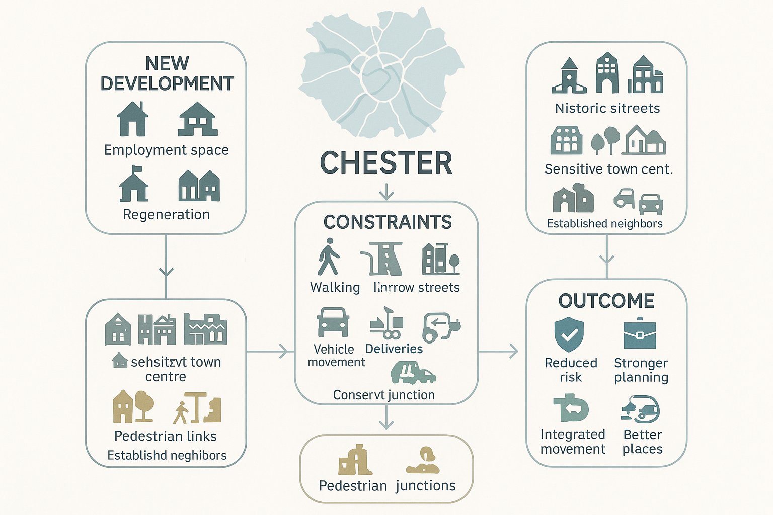
Transport planning matters in Chester because it sits right at the meeting point between growth and constraint. The city and wider borough need new homes, employment floorspace, education provision and regeneration. But they also contain historic streets, sensitive centres, established neighbourhoods, and road corridors that can experience congestion quickly if development is not planned carefully.
In practice, transport evidence helps answer a simple question: can a proposal be accommodated safely and sustainably? That covers more than vehicle capacity. We need to show how people will walk, cycle, catch the bus, receive deliveries, access the site in an emergency, and move through surrounding streets without creating unacceptable impacts.
For Cheshire West and Chester, transport planning also supports wider economic and environmental goals. The borough-wide Local Transport Plan Core Strategy for 2025-2045 places strong emphasis on accessibility, cleaner movement, integrated networks and better places. So when we prepare transport reports, we are not only justifying a planning application: we are showing how development contributes to a broader public strategy.
That is especially important in Chester, where a seemingly modest scheme can affect a constrained junction, a town-centre servicing route, or a key walking connection. Good transport planning identifies those issues early, tests them properly and, where necessary, builds in mitigation before they become reasons for objection. Done well, it reduces risk, strengthens planning arguments and gives the whole design team a much firmer footing.
Chester’s Planning And Movement Context At A Glance
Chester sits within the administrative area of Cheshire West and Chester Council, so transport planning for local applications is framed by borough-wide policy rather than a city-only rulebook. That matters because development in Chester is assessed not just against urban conditions in the centre, but also against strategic movement patterns across the wider authority area, including surrounding settlements, commuter corridors and rural connections.
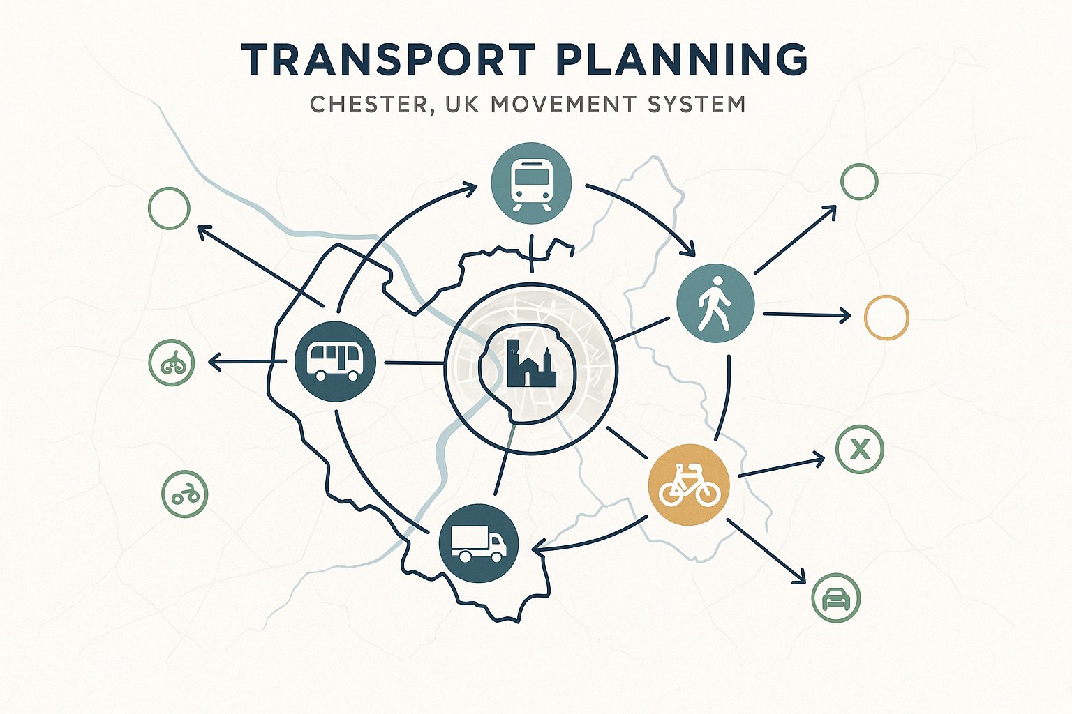
The current direction of travel is clear. The council’s Local Transport Plan Core Strategy looks across buses, rail, walking, cycling, freight and private car travel, with a strong focus on sustainability, accessibility and place quality. In other words, applicants are increasingly expected to think beyond simple highway capacity and address how a site fits into a broader movement network.
Chester itself adds another layer of complexity. It is a historic city with constrained streets, sensitive frontages, popular visitor destinations and well-used radial routes. Parking pressure can be acute. Servicing can be awkward. Small geometric changes may have outsized consequences. And because some routes are already busy at peak times, local concerns about queuing and rat-running can become central to planning discussions.
At the same time, Chester has real opportunities for sustainable travel. Many sites are within reach of bus services, walkable destinations and cycle routes, especially in and around the urban area. That means well-located schemes can often make a credible case for lower car dependence, but only if the evidence is realistic, site-specific and tied to genuine design measures rather than wishful statements.
How Local Highway And Planning Policy Shapes Transport Evidence
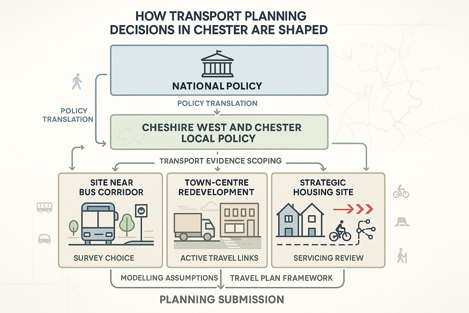
Transport evidence in Chester is shaped by a combination of national planning policy, local planning policy, and the transport priorities embedded in the borough’s Local Transport Plan. At national level, the National Planning Policy Framework sets the broad test: development should provide safe and suitable access for all users, and impacts on the transport network should not be severe. Useful as that is, it is only the starting point.
At local level, Cheshire West and Chester’s policies give those national principles sharper edges. The Local Transport Plan Core Strategy establishes the authority’s long-term transport vision and its core policies around sustainable movement, accessibility, integrated modes and network function. Those themes directly influence what highways and transport officers expect to see in a planning submission.
So the scope of a Transport Statement or Transport Assessment is rarely neutral. A site near a bus corridor may need stronger public transport analysis. A town-centre redevelopment may require closer scrutiny of servicing and pedestrian interaction. A strategic housing site may need phased modelling, active travel links and a robust Travel Plan framework.
This is why locally tailored reporting matters. We cannot assume that a report format accepted by another authority will satisfy CWAC. The policy emphasis, local standards, network sensitivities and evidence expectations may differ considerably. Our job is to translate policy into technical work: selecting the right surveys, defining the right study area, using transparent assumptions and addressing the transport outcomes the council is actually trying to achieve.
For applicants, that policy alignment often makes the difference between a report that merely exists and one that genuinely assists determination.
When A Transport Statement, Transport Assessment, Or Travel Plan Is Needed
Not every development in Chester needs a full Transport Assessment, but many more schemes require transport input than applicants first assume. The trigger is usually not the size of the building by itself. It is whether the proposal is likely to have material effects on traffic, highway safety, access arrangements or sustainable travel patterns.
In broad terms, a Transport Statement (TS) is used for developments with relatively limited transport impacts, where the main issues can be addressed proportionately through a concise assessment. A Transport Assessment (TA) is appropriate where impacts are more significant, the site is more complex, or network effects need to be tested in detail through trip analysis and modelling. A Travel Plan is usually required for developments expected to generate sustained person trips over time and where mode shift measures can realistically influence travel behaviour.
CWAC will often apply national and local threshold thinking in practice, particularly for major housing, employment, retail, leisure, education and healthcare uses. But thresholds should never be treated as automatic safe harbours. A modest proposal on a constrained street in Chester can justify transport evidence, while a larger site in a highly accessible location may be scoped proportionately if impacts are well understood.
The practical lesson is simple: scope early. A brief pre-application discussion with highways officers can clarify whether a TS, TA, Travel Plan, or a package of all three is likely to be expected. That can save weeks of rework later.
Typical Development Types That Trigger Transport Planning Input
In Chester, transport planning input is commonly required for major residential schemes, whether they are strategic allocations, edge-of-settlement sites or denser urban redevelopments. Housing tends to raise familiar questions around peak-hour trip generation, access design, internal street hierarchy, school travel, and cumulative impact at nearby junctions.
Retail and leisure developments are also regular triggers because trip profiles can be intense, seasonal or weekend-led, and parking demand can become contentious very quickly. Employment parks, logistics uses and mixed-use commercial schemes often require close review of HGV access, servicing patterns, staff travel and shift-based demand.
Education and health facilities deserve particular care. School arrivals and departures can place heavy pressure on local roads within narrow time windows, while healthcare uses may generate a wider mix of visitor, patient, staff and servicing trips across the day. Town-centre redevelopments can be equally sensitive, especially where they interact with pedestrian-heavy streets, bus movements, loading restrictions or historic constraints.
Even smaller schemes may need transport analysis if they affect a known problem junction, rely on substandard access geometry, or sit on a corridor where sustainable travel connections are weak. In other words, use class matters, but local context matters just as much.
Key Transport Issues Commonly Raised In Chester Planning Applications
Certain transport issues come up repeatedly in Chester planning applications, and they are worth anticipating from the start rather than answering defensively later. The first is junction performance. Because parts of the network are constrained and already busy, objections often focus on whether a development will worsen queueing, delay or driver behaviour at nearby nodes, particularly on radial routes and key urban links.
The second is how the scheme fits into the street around it. A proposal may appear acceptable in isolation but still raise concerns if it disrupts bus operations, weakens a walking route, introduces awkward turning movements, or increases pressure on parking in nearby streets. In Chester’s historic and mixed-use areas, these street-level details are not secondary issues: they are often the core planning issues.
A third recurring theme is whether the development genuinely supports sustainable travel. Councils are increasingly sceptical of boilerplate claims that residents will simply walk or cycle more. They want to see direct routes, practical cycle parking, bus accessibility, legible layouts and credible Travel Plan measures.
And finally, there is safety. Visibility, vehicle tracking, crossing provision, speed environment, servicing conflict and road-user interaction all feature regularly in consultee responses. Where access changes are material, the authority may also expect Stage 1 Road Safety Audit input or at least a clear demonstration that the design has been safety-tested.
Access, Parking, Servicing, And Highway Safety Considerations
Access design in Chester has to do more than meet minimum geometry. We need to show that the site can be entered and exited safely by all expected users, including pedestrians, cyclists, refuse vehicles, delivery vehicles and emergency services. That usually means clear visibility splays, suitable junction form, workable gradients, and turning layouts that function in the real world rather than just on a neat drawing.
Parking is another classic flashpoint. Too little parking can generate overspill and neighbour objection: too much can undermine sustainable travel claims and consume valuable site area. The right answer depends on land use, accessibility, local standards and how the site will actually operate day to day. In Chester, historic streets and space constraints often make the parking balance especially sensitive.
Servicing is often underestimated. A scheme may have acceptable general access but still fail because delivery vehicles cannot manoeuvre safely, waiting areas are poorly placed, or refuse collection relies on awkward reversing. These issues are magnified in tighter urban sites, mixed-use schemes and locations with pedestrian activity.
Highway safety threads through all of this. If there are collision patterns nearby, speed concerns, difficult crossing points or unusual turning conflicts, they need to be addressed openly. Trying to skate past them rarely works.
Sustainable Travel, Walking, Cycling, And Public Transport Expectations
Chester’s policy context increasingly expects developments to offer real travel choices rather than defaulting to car access. For us, that means assessing whether a site is genuinely walkable, whether cycle links are usable rather than tokenistic, and whether public transport access is practical for everyday trips.
Walking should start with directness and convenience. Are there continuous footways? Safe crossing points? Attractive routes to schools, shops, bus stops and local services? A site can be geographically close to destinations but functionally poor if the walking environment is unpleasant or fragmented.
Cycling expectations are also rising. Secure cycle parking, internal permeability, connections to surrounding routes and conflict-free access all matter. For larger schemes, we should also think about how cycling works for different users, not just confident commuters but families, younger people and occasional riders.
Public transport analysis needs to go beyond listing nearby bus stops. Frequency, destination coverage, stop quality, walk routes and service reliability all shape whether bus use is plausible. Where appropriate, mitigation might include stop upgrades, information provision or contributions secured through planning obligations.
Travel Plans tie these strands together. The better ones are practical documents with targets, monitoring and incentives. The weaker ones read like afterthoughts. Officers can tell the difference in about two pages.
The Core Stages Of A Transport Planning Assessment
A strong transport planning assessment usually follows a clear sequence, even though the level of detail varies by scheme. The first stage is scoping. We engage early with Cheshire West and Chester highways or transport officers to agree what the application needs: study area, survey requirements, assessment years, committed development assumptions, modelling approach and whether a Travel Plan is expected. This is one of the most valuable stages because it reduces later disagreement.
Next comes the baseline review. We examine planning policy, transport policy, site accessibility, local network characteristics, collision data, existing traffic conditions and known constraints. That baseline should tell a coherent story about how the site currently functions and where pressure points are likely to arise.
After that we assess trip generation, distribution and mode split. For some schemes this can be relatively straightforward: for others, especially mixed-use or strategic development, it requires more nuanced judgement. We estimate person and vehicle trips, identify where they are likely to travel, and test assumptions against local evidence where possible.
The fourth stage is impact testing, often including junction capacity modelling. We compare baseline and future scenarios, consider committed development, and determine whether mitigation is needed. Alongside this, we review access design, internal layout and operational matters such as parking, servicing and active travel links.
Finally, we prepare the Transport Statement or Transport Assessment, and where needed a Travel Plan. The report should be proportionate, transparent and technically robust, but also readable. Decision-makers need to follow the logic, not just receive a stack of appendices.
Surveys, Data Collection, And Junction Capacity Modelling
Good transport evidence depends on good inputs. In Chester, that usually means collecting a mix of traffic, movement and accessibility data that reflects both the site and the surrounding network. Typical survey work may include automatic traffic counts, turning counts at junctions, queue length surveys, speed surveys, parking beat surveys, pedestrian and cycle counts, and public transport observations where relevant.
The key is not to gather everything possible, but to gather the right data and make sure it is agreed, recent and representative. Survey timing matters. So do school terms, local events, roadworks and seasonal distortions. We have all seen cases where a technically valid count still becomes unusable because it captured an abnormal day.
Junction capacity modelling is then used to test how the network performs with and without the development. The modelling method depends on junction type: priority, roundabout and signalised junctions each require appropriate tools and assumptions. For Chester applications, officers will often want to understand not just headline ratios or delays, but what the outputs mean on the ground. Does queueing block another arm? Does it affect a crossing point? Does the development materially worsen an already sensitive condition?
Growth assumptions and future year scenarios also need care. They should align with agreed datasets, committed development and local evidence wherever possible. Transparent modelling is vital. If assumptions are hidden, unexplained or overly optimistic, objections tend to follow.
This is where experience counts. A concise, accurate report backed by credible modelling often carries more weight than a longer document that buries key judgements.
How To Prepare A Strong Planning Submission And Avoid Delays
If we want to avoid delays, the best approach is usually boringly effective: start early, scope properly and resolve obvious transport risks before the application is lodged. Most transport-related delays are not caused by one fatal flaw. They stem from avoidable gaps, missing surveys, unclear assumptions, untested access points, weak Travel Plans or policy references that do not quite fit Chester’s context.
Pre-application engagement is the first safeguard. A short, focused discussion with CWAC can confirm what level of assessment is needed, which junctions are likely to be in scope, whether sustainable travel measures will be expected, and what local concerns may shape the review. That early clarity can save major redesign later.
The submission itself should be proportionate and easy to interrogate. We should explain assumptions openly, set out baseline conditions clearly, and make sure plans, swept paths, parking layouts and modelling outputs all align. Internal inconsistencies are surprisingly common and can erode confidence quickly.
It also helps to address likely objections before they are raised. If parking will be tight, explain the rationale and management approach. If a junction is sensitive, present the mitigation honestly. If bus accessibility is central to the case, demonstrate it properly.
From our perspective at ML Traffic, speed matters, but only when paired with precision. A concise report tailored to CWAC thresholds and local planning realities is usually far more effective than a generic national template. That is what gives planning officers and consultees something they can work with rather than push back on.
Working With Developers, Design Teams, And Local Authorities
Transport planning works best when it is integrated into the project team rather than bolted on near submission. In Chester, that is particularly important because access geometry, parking strategy, street design, drainage constraints, landscape treatment and even heritage considerations can all interact. If transport input arrives too late, the design may already be fighting against the site.
We typically need to work closely with architects, masterplanners, drainage engineers, environmental consultants, planning advisers and, on larger schemes, viability and legal teams as well. A change in one discipline can ripple across the transport case. Move a building entrance, for example, and the walking desire line changes. Relocate a substation, and suddenly a service yard no longer tracks properly. These are not rare problems.
Dialogue with the local authority matters just as much. Ongoing engagement with CWAC officers can help narrow issues, confirm assumptions and keep the application focused on the real points of concern. Depending on the site, there may also be a need to engage bus operators, rail interests or National Highways if strategic routes are affected.
Then there is delivery. Some mitigation measures are secured through planning conditions, while others rely on legal and highway mechanisms such as Section 106 contributions or Section 278 works. Those routes should be considered early, not after determination, so that costs, land requirements and programme implications are understood.
In short, transport planning in Chester is rarely a solo exercise. It is collaborative work, and the schemes that progress most smoothly are usually the ones where that collaboration starts early and stays practical.
Conclusion
Transport planning in Chester is no longer a narrow highways exercise. It is a core part of how development is tested, shaped and eventually approved. The borough’s Local Transport Plan Core Strategy, together with national policy and local development management practice, pushes all of us toward a more rounded approach, one that balances growth with safety, accessibility, place quality and lower-carbon travel.
For applicants, the message is straightforward. Scope transport work early. Base it on local policy and local evidence. Treat access, parking, servicing and sustainable travel as design issues, not reporting afterthoughts. And make sure the submission is proportionate, transparent and technically credible.
When that happens, transport evidence stops being a hurdle and starts becoming a useful planning tool. It helps de-risk applications, supports better negotiation with officers, and gives developments in Chester a stronger foundation for delivery in 2026 and beyond.
Transport Planning in Chester – Frequently Asked Questions
Why is transport planning important for developments in Chester?
Transport planning in Chester supports housing and employment growth by ensuring safe, accessible routes for all users. It helps balance growth with sustainability, reducing car dependence, and fits developments within the borough’s Local Transport Plan Core Strategy to create greener, more accessible communities.
When is a Transport Statement or Transport Assessment required in Chester?
A Transport Statement (TS) is needed for developments with limited transport impact, while a Transport Assessment (TA) is required for major or complex schemes affecting traffic, safety or sustainable travel. Cheshire West and Chester Council applies national and local thresholds based on development type and local context to decide requirements.
How does the Local Transport Plan influence transport planning submissions?
The Local Transport Plan Core Strategy (2025–2045) guides the transport evidence needed by emphasizing sustainability, accessibility and place quality. It shapes scope, data requirements, and mitigation expectations to ensure developments support public transport, walking, cycling, and reduce highway impacts in line with Cheshire West and Chester policies.
What common transport issues cause objections in Chester planning applications?
Objections frequently arise from junction capacity and congestion concerns, impacts on bus routes and pedestrian or cycle links, inadequate parking or servicing arrangements, especially in historic areas, and road safety issues such as poor visibility or unsafe crossings around development sites.
How can developers prepare strong transport planning submissions to avoid delays?
Early engagement with Cheshire West and Chester highways officers to scope requirements, clear and locally tailored transport reports, transparent assumptions, robust junction modelling and addressing likely objections—like access or parking—help streamline approvals. Coordinating with design teams and aligning with local policies is also essential.
What sustainable travel measures are expected in Chester developments?
Developments should prioritise walkable layouts, safe cycle networks with good parking, and integrate effectively with public transport including quality bus stops. Travel Plans with practical, monitored targets to reduce car use are expected, ensuring real travel choices that align with the borough’s focus on accessibility and lower-carbon transport.