Norwich isn’t a place where transport evidence can be treated as a box-ticking exercise. It’s a compact historic city with medieval streets, busy radial routes, a sensitive inner ring road, and a planning environment that increasingly expects developments to support walking, cycling and public transport rather than simply absorb more car trips. For developers, architects, planners and local authorities, that creates both risk and opportunity.
Done badly, transport planning can slow an application, trigger objections from Norfolk County Council as highway authority, and force late design changes that cost time and money. Done properly, it helps a scheme fit its context, respond to local policy, and move through planning with fewer surprises.
That matters even more in 2026. Norwich’s growth agenda continues through the Greater Norwich Local Plan, while the Transport for Norwich approach keeps the focus on sustainable movement, strategic connections and managing pressure on a constrained network. City-centre schemes face one set of issues: edge-of-city employment and mixed-use sites face another.
In this guide, we set out what teams really need to know about Transport Planning in Norwich: when a Transport Assessment or Statement is likely to be required, what local officers usually expect, the evidence that tends to make applications more robust, and the common pitfalls we see in practice. Where useful, we also draw on the kind of concise, locally tailored reporting approach used by teams such as ML Traffic, where speed and accuracy matter just as much as technical compliance.
Why Transport Planning Matters For Norwich Developments

Transport planning matters in Norwich because the city’s network has very little slack in it. A modest change in vehicle demand at the wrong location can have noticeable effects on queueing, journey time reliability and the experience of people walking or cycling nearby. That’s especially true on radial corridors feeding the centre and around key junctions on the inner ring road.
For planning teams, the purpose of transport work is not just to forecast traffic. It is to show that development can be accessed safely, function acceptably within the local network, and support policy objectives around sustainable travel. Under national planning policy, schemes should provide safe and suitable access for all users, and residual cumulative impacts should not be severe. In Norwich, that test tends to be applied with close attention to local context rather than in the abstract.
There’s also a strategic layer. The Greater Norwich Local Plan supports growth, but that growth is expected to be planned around realistic travel choices. So a credible transport strategy often needs to do more than show there is room for cars. It needs to demonstrate walkability, cycle connectivity, bus accessibility and sensible servicing arrangements.
In our experience, the strongest applications are the ones that treat transport planning as part of placemaking early on. That usually leads to better layouts, cleaner evidence, and fewer planning headaches later.
How Norwich’s Local Context Shapes Transport Planning Requirements

Norwich has a transport planning context that is unusually layered for a city of its size. Norwich City Council is the local planning authority for many schemes, while Norfolk County Council acts as highway authority. That split means transport submissions need to be technically robust and framed in a way that aligns with both development management and highway concerns.
Policy context matters too. The Transport for Norwich strategy has long pushed a more sustainable approach to movement, with attention on bus reliability, active travel and the management of pressure on constrained corridors. The Greater Norwich Local Plan adds another dimension by directing growth across the wider area, including locations where travel patterns are more car-dependent.
That combination changes what “good” looks like. A suburban employment scheme, for example, may be judged not only on junction performance but on whether it creates realistic bus, walking and cycling links. Likewise, a city-centre proposal may need to accept that highway capacity gains are limited and focus instead on access quality, demand management and servicing discipline.
So the local context is not background detail. It directly shapes scope, methodology, mitigation and, often, the tone of discussions with officers.
When A Transport Assessment, Transport Statement, Or Travel Plan Is Needed
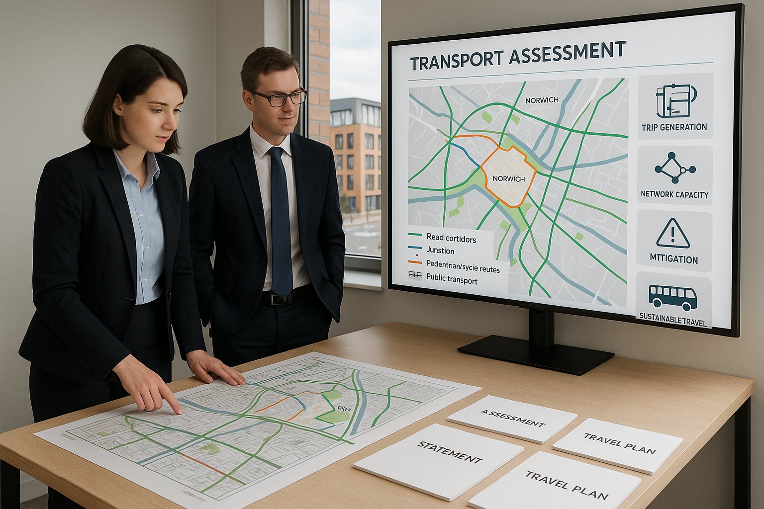
Whether a scheme needs a Transport Assessment (TA), Transport Statement (TS) or Travel Plan (TP) depends on scale, use, trip generation and site sensitivity. In Norwich, that last point is important. A development that might appear modest in floorspace terms can still trigger detailed transport scrutiny if it sits on a constrained corridor, near a sensitive junction, or in an area with strong sustainable travel expectations.
As a rule, larger or more traffic-intensive proposals will normally require a TA supported by a Framework or Full Travel Plan. Smaller schemes may only need a TS, sometimes paired with a lighter-touch Travel Plan Statement. Norfolk County Council will typically screen applications against development thresholds, expected trips and local network characteristics.
The practical difference is worth understanding:
- Transport Assessment: a fuller technical document covering baseline conditions, trip generation, distribution, assignment, capacity testing, access design and mitigation.
- Transport Statement: a proportionate report for smaller schemes, usually more concise and less modelling-heavy.
- Travel Plan: a strategy to encourage sustainable travel, with measures, monitoring and targets.
The trap is assuming one document type can be swapped for another late in the process. If a scheme is likely to generate debate over network impact or mode share, it is usually better to agree scope early with the highway authority. That can prevent under-scoping at validation stage, then over-correcting once comments come in.
What Norwich Planning Officers And Highway Authorities Commonly Expect
Across Norwich applications, officers and highway reviewers usually want the same core thing: evidence that is proportionate, locally grounded and honest about constraints. They are rarely impressed by generic transport text copied from another authority area.
Early engagement is often expected, particularly on schemes with non-standard access, sensitive land uses, significant trip generation or constrained servicing arrangements. In practice, that means speaking with both the planning authority and Norfolk County Council before layouts are fixed. It is far easier to agree assumptions on scope, assessment years, committed development and modelling approach at the start than to argue over them after submission.
They also tend to expect proposals to reflect local priorities. In Norwich, that means reducing car dominance where reasonable, maximising sustainable travel opportunities, and demonstrating access for all users rather than only drivers. Walking routes, cycle storage, bus stop connections and crossing quality matter.
Another common expectation is clarity. Officers want to see a clear narrative from site context through to mitigation: what the issue is, how it has been assessed, what impact is predicted, and why the proposed response is enough. If cumulative impact is relevant, say so plainly and test it properly. If there are trade-offs, acknowledge them. That kind of straightforwardness tends to carry weight.
Core Evidence Required To Support A Planning Application
Most Norwich transport submissions stand or fall on the quality of their evidence base. The exact package varies by scheme, but a robust planning application will usually include a clear site description, access strategy, baseline traffic conditions, collision data review, trip forecasting, sustainable travel appraisal, parking and servicing proposals, and an appropriate Travel Plan.
What matters is not just having the right headings. It is showing that the evidence has been assembled in a way that matches the site and the authority’s likely concerns. For example, a city-centre scheme may need more focus on delivery management, swept paths and pedestrian environment quality than on major junction modelling. An edge-of-city site may need the opposite, with more work on strategic distribution and bus accessibility.
We also find that presentation matters more than people admit. Officers are working through large volumes of material. A concise report that explains assumptions, references accepted tools, and keeps appendices organised is often more useful than a long document full of boilerplate.
For consultancies like ML Traffic, that balance between brevity and technical accuracy is part of the value: reports need to be quick to review without leaving obvious gaps that invite follow-up queries.
Trip Generation, Distribution, And Junction Capacity
Trip forecasting is usually the backbone of the assessment. For Norwich schemes, that often starts with TRICS or a comparable evidence source to derive person trips and vehicle trips by time period. But raw rates are only the beginning. The real question is whether the selected sites, assumptions and adjustments reflect local reality.
Distribution and assignment should respond to actual movement patterns in and around Norwich. Census journey-to-work data can help, but it should be read alongside local network logic: radial trips into the centre, orbital movements between edge-of-city destinations, and interactions with the ring road and strategic junctions. Committed development and background growth assumptions need to be reasonable and transparent.
Where capacity testing is required, the choice of tool matters. Priority junctions may call for PICADY, roundabouts for ARCADY, signalised junctions for LINSIG, and more strategic effects may need broader modelling discussion. The goal is not to produce impressive spreadsheets. It is to demonstrate, credibly, whether a development causes material operational issues and whether mitigation is proportionate.
In Norwich, mitigation is not always about adding lanes. Sometimes optimisation, revised access arrangements, mode shift measures or servicing controls will be the more realistic answer.
Walking, Cycling, Public Transport, And Accessibility Review
Accessibility work is where many applications either become convincing or start to unravel. Norwich policy and strategy place real weight on sustainable travel, so an audit cannot stop at measuring straight-line distances to a bus stop and calling it done.
A useful review should examine pedestrian routes to nearby facilities, local centres, schools, employment areas and transport interchanges. Are footways continuous? Are crossings convenient and safe? Is the route legible, lit and direct? A 600-metre walk on paper can feel much longer if the route is poor.
Cycling analysis should look at how the site connects into existing and planned corridors, including key radial and orbital routes associated with the Transport for Norwich approach. Secure, covered cycle parking is important, but so is the quality of the onward route once someone leaves the site.
Public transport review should cover stop locations, service frequency, operating hours, journey times and likely attractiveness to end users. For larger sites, it may also need to consider opportunities for service enhancement, travel information, or integration with park-and-ride and interchange facilities. The strongest Norwich submissions show not just that alternatives exist, but that people are genuinely likely to use them.
Parking, Servicing, Refuse Collection, And Site Access Design
These issues sound routine. In Norwich, they often aren’t.
Parking needs to be considered against Norfolk standards, but with proper regard to context. Central and highly accessible sites may justify lower car parking provision, particularly where sustainable travel opportunities are strong. That said, a reduced parking strategy only works if the rest of the transport case is coherent. If cycle parking is poor, bus access is weak and local on-street conditions are already stressed, officers may question whether the strategy is realistic.
Servicing and refuse collection are common flashpoints, especially on constrained streets and mixed-use sites. Swept-path analysis is often essential to show that delivery vehicles, refuse wagons and emergency vehicles can enter, turn and leave safely. On tighter urban plots, timed deliveries, smaller vehicles, shared loading arrangements or off-site servicing management may be necessary. Heritage-sensitive locations can make all of this trickier, because kerb changes, widening and visibility improvements may be heavily constrained.
Site access design must also stand up technically. Visibility splays, gradients, turning radii, pedestrian crossing points, cycle interactions and the effect of waiting restrictions all need to be thought through. One weak point here can overshadow an otherwise decent assessment.
If there is a recurring lesson, it is this: don’t leave servicing and access to the end. They have a habit of becoming the reason a scheme stalls.
Common Transport Planning Challenges In Norwich And How To Address Them
The first big challenge is historic constraint. Norwich city centre was not laid out for modern servicing patterns, large refuse vehicles or frequent private car access. Narrow streets, tight geometry and conservation considerations limit what can be altered. In these locations, the answer is often not more highway engineering. It is a more disciplined transport strategy: car-lite design, consolidated servicing, delivery time controls, smaller vehicle assumptions and very strong walking and cycling provision.
The second challenge is congestion on radial routes and around the ring road. Developments can quickly become controversial if they appear to add traffic at already pressured points. Trying to solve that solely through capacity expansion is often unrealistic. Better responses may include demand management, revised site access strategy, travel plan measures, bus priority support, or targeted junction optimisation.
The third is the wider catchment. Greater Norwich includes travel patterns that remain relatively car-oriented, especially for trips from rural areas and edge-of-city employment destinations. That doesn’t mean sustainable travel arguments are impossible. But they need to be credible. For some sites, that may mean better interchange with bus services, links to park-and-ride, high-quality cycle facilities and phasing that supports mode shift over time.
And finally, there is the challenge of overconfidence. Teams sometimes assume Norwich is small enough to be straightforward. It isn’t. The city rewards detail, local knowledge and proportionate realism.
How Early Transport Input Can Reduce Planning Delays And Objections
Early transport input saves time because it changes the design conversation before positions harden. If access geometry, tracking, parking demand or junction effects are tested while a layout is still flexible, the project team can adapt quickly. If the same issues emerge after submission, they become delay, redesign and negotiation.
This is particularly important in Norwich, where small layout choices can have outsized consequences. Moving an access point a short distance, adjusting servicing arrangements, or improving cycle permeability early can remove a future objection entirely. Left late, those same issues may require revised drawings, updated modelling and another round of consultation.
There is also a policy benefit. When transport work is aligned early with Transport for Norwich priorities and Greater Norwich Local Plan expectations, applications tend to read as intentional rather than reactive. Officers can see that sustainable travel, not just car access, has shaped the proposal from the outset.
Pre-application discussion helps too. Agreeing survey scope, assessment years, committed development assumptions and document requirements with Norfolk County Council can significantly reduce argument later. It won’t remove every issue, obviously. But it usually means disagreements are narrower and easier to resolve.
That’s why we almost always recommend bringing transport consultants in before the planning statement is drafted, not after.
Conclusion
Good transport planning in Norwich is less about producing a thick report and more about producing the right evidence, at the right time, in the right local context. The city’s historic core, constrained network, edge-of-city growth areas and strong sustainable travel policy direction mean generic approaches rarely work well.
For developers and planning teams in 2026, the priorities are fairly clear: engage early, scope properly with the highway authority, respond to Transport for Norwich and GNLP objectives, and make sure the scheme works for pedestrians, cyclists, bus users and servicing vehicles as well as drivers. If cumulative effects could be an issue, address them directly. If constraints limit conventional highway mitigation, be realistic and design around them.
That’s usually what gets applications moving.
And, in practice, that’s where experienced local support can make a real difference: concise technical work, tailored to thresholds, policy and site conditions, is often what separates a smooth determination from months of unnecessary back-and-forth.
Transport Planning in Norwich – Frequently Asked Questions
Why is transport planning particularly important for developments in Norwich?
Transport planning is crucial in Norwich due to its constrained road network and historic city layout. Appropriate planning helps manage congestion on busy radial routes and the inner ring road, supports sustainable travel priorities, and ensures developments provide safe, suitable access without causing severe traffic impacts.
When is a Transport Assessment or Transport Statement required for a Norwich development?
Larger or more traffic-intensive projects in Norwich typically require a detailed Transport Assessment and a full or framework Travel Plan. Smaller developments may only need a concise Transport Statement and a lighter Travel Plan Statement. Norfolk County Council screens schemes based on size, expected trips, and local sensitivities.
How do Norwich’s local policies influence transport planning requirements?
Transport planning must align with Transport for Norwich (TfN) and Greater Norwich Local Plan strategies. This means prioritising walking, cycling, and public transport, reflecting sustainable growth targets, and addressing travel patterns unique to Norwich’s historic centre and surrounding rural areas with car-dependent travel.
What evidence do planning officers and highway authorities expect in transport submissions?
They expect proportionate, locally relevant evidence including site descriptions, trip forecasting, network impact assessments, sustainable travel audits, parking and servicing strategies, and Travel Plans. Early engagement and clear explanation of assessment and mitigation measures in line with local priorities are also important.
How can early transport consultant involvement benefit a Norwich planning application?
Early involvement enables identification and resolution of access, servicing, and traffic impact issues before designs are fixed, reducing delays, costly redesigns, and objections. It helps align proposals with TfN and GNLP objectives, facilitating smoother approval processes with planning and highway authorities.
What are common transport challenges in Norwich and how can they be addressed?
Key challenges include historic city centre constraints limiting road capacity and servicing, congested radial routes and ring roads, and car-oriented travel in rural catchments. Solutions focus on car-lite designs, demand management, enhanced walking, cycling and bus infrastructure, timed deliveries, and strategic public transport links including park-and-ride.