Getting a planning application over the line in Sunderland rarely comes down to drawings alone. But strong the architecture or commercial case may be, transport planning in Sunderland often becomes the point where applications either move forward smoothly or stall in rounds of technical queries. Access, parking, servicing, walking links, bus connectivity, junction performance, these aren’t side issues. They’re central to whether a scheme looks safe, workable and policy-compliant.
For developers, planners, architects and consultants, that matters even more in 2026. Local authorities continue to expect better quality evidence, clearer mitigation and a more convincing sustainable transport case. And in Sunderland, proposals sit within both local development management expectations and the wider North East transport strategy, with its emphasis on connected, affordable and resilient movement networks.
We see this in practice all the time. A modest scheme can trigger difficult questions if access geometry is weak or parking is poorly justified. On the other hand, a larger development can progress surprisingly well when the transport submission is proportionate, locally aware and technically robust from day one.
In this guide, we’ll break down what developers need to know: the policy background, the highway issues Sunderland applications commonly face, when a Transport Statement or Transport Assessment is needed, and how to prepare evidence that helps secure faster planning decisions rather than avoidable delays.
Why Transport Planning Matters For Development In Sunderland
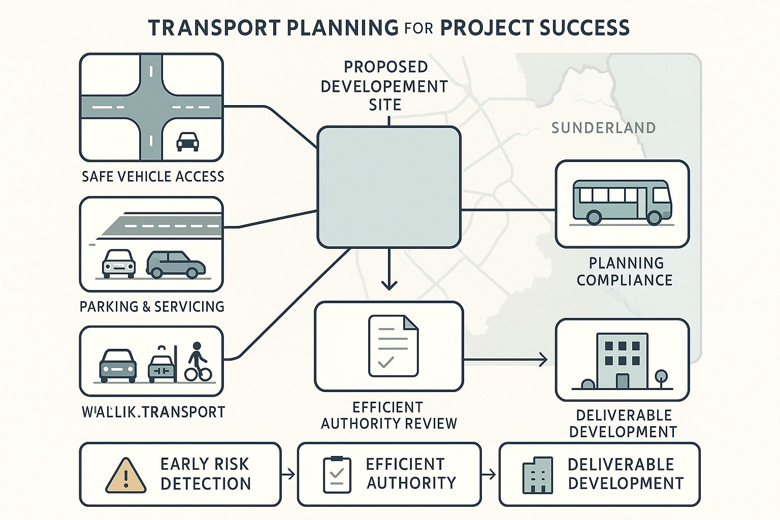
Transport planning is where planning policy meets day-to-day reality. A site may look developable on paper, but if vehicles can’t enter safely, deliveries can’t turn, residents overspill onto nearby streets, or the scheme leaves people dependent on the car with poor alternatives, the local planning authority is likely to push back.
In Sunderland, that scrutiny is not unusual: it is exactly what we should expect. Development proposals are typically assessed against highway safety, network operation, parking standards, sustainable travel opportunities and the wider effect on how people move around an area. That means transport evidence is not just a supporting document. It often shapes the design itself.
For developers, good transport planning creates three practical benefits. First, it identifies risk early, before access or capacity issues become expensive redesign problems. Second, it gives planning officers and highway consultees the information they need in a format they can review efficiently. Third, it helps demonstrate that a proposal is deliverable, not just aspirational.
This is especially relevant in locations where surrounding roads are already busy, bus links matter to staff or residents, or neighbouring uses create competing parking and servicing pressures. In those cases, proportionate but well-targeted analysis can make the difference between a straightforward consultation response and a prolonged negotiation.
In short, transport planning in Sunderland matters because it affects safety, policy compliance, viability and timescales all at once.
The Sunderland Planning And Transport Policy Context
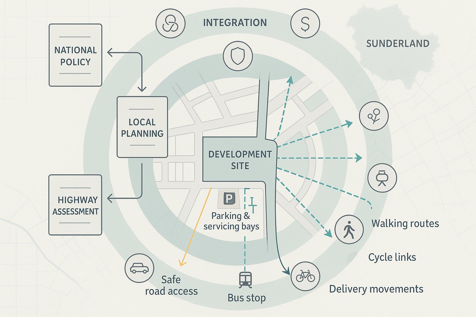
Sunderland applications do not sit in a vacuum. They are considered in the context of local planning policy, development management practice and the broader direction of transport strategy across the North East. That wider context increasingly emphasises integration: safer roads, stronger public transport connections, better walking and cycling provision, and networks that are resilient as travel patterns evolve.
The North East Combined Authority transport framework is part of that picture. Its themes around connectivity, affordability, safety and mode choice matter because they influence how transport impacts are interpreted. A proposal that relies entirely on private car access, with weak pedestrian links and no convincing public transport story, can look out of step even if its junction impacts are technically manageable.
At local level, planning officers and highway engineers will usually focus on whether a scheme provides safe access, suitable parking and servicing, and realistic opportunities for sustainable travel. National policy and guidance also remain relevant, especially around severe residual cumulative impacts, sustainable transport, accessibility and design quality.
For applicants, the key point is this: policy compliance is not only about quoting documents. It is about showing, through the layout and the evidence, that the development responds properly to its location. We find that stronger submissions make policy practical. They explain how people will arrive, where they will park, how deliveries will work, whether buses are accessible, and what mitigation is actually deliverable rather than theoretical.
How Local Highway Considerations Shape Development Proposals
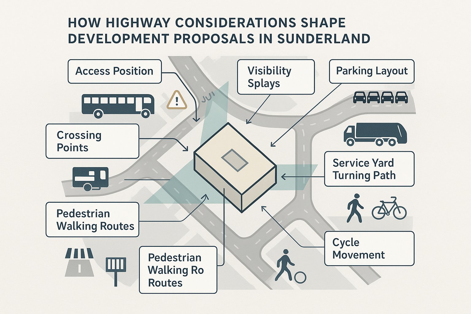
Local highway considerations often influence a scheme much earlier than many teams expect. They can affect site capacity, building position, frontage treatment, parking ratios, service yard dimensions and even the mix of uses proposed.
In Sunderland, highway review is likely to look beyond the red line boundary. Officers and consultees will want to understand how the site connects to the existing network, whether nearby junctions can accommodate additional movement, and whether the proposal creates new safety conflicts for drivers, pedestrians or cyclists. That can shape the scheme in very practical ways.
A simple example: a development may appear capable of accommodating more floorspace, but if the access is too close to a junction, visibility is constrained, or refuse and delivery vehicles cannot manoeuvre without reversing onto the highway, the layout may need to change. Similarly, if the surrounding area has fragile on-street parking conditions, the parking strategy may become a major design issue rather than a final-stage detail.
Walking routes, crossing points and bus stop access also matter more than they once did. Authorities increasingly expect developments to function as part of a connected transport environment, not an isolated traffic generator.
This is why we usually advise treating transport inputs as design inputs, not just report-writing tasks. When access, servicing and movement are resolved early, applications tend to progress faster and with fewer rounds of challenge.
Key Issues Commonly Reviewed In Sunderland Planning Applications
Most transport reviews in Sunderland return to the same core questions: can the site be accessed safely, can it operate efficiently, and does it support realistic travel choices beyond the car? The exact weighting varies by scheme, but these issues come up again and again.
Site Access, Junction Performance, And Highway Safety
Access is usually the first technical pressure point. The authority will want to know whether vehicles can enter and leave safely, whether visibility is adequate, whether the access location conflicts with nearby junctions or crossings, and whether the development causes unacceptable operational stress on surrounding junctions.
For smaller schemes, that may be a relatively straightforward review of geometry and traffic impact. For larger proposals, it can extend to modelling, queue assessment or mitigation testing. Safety is not limited to collision history either. Layouts that create awkward turning movements, excessive reversing, or conflict with pedestrians can all trigger concern.
Parking Provision, Servicing, And Internal Layout
Parking is rarely just about numbers. Reviewers will test whether spaces are usable, whether disabled and cycle parking are sensibly located, and whether overspill is likely. They will also look at servicing: can refuse vehicles, delivery vans and larger commercial vehicles enter, manoeuvre and exit in a safe and practical manner?
Internal layout is where many submissions become vulnerable. Tight corners, unclear circulation, poor bin store access or informal service arrangements can undermine an otherwise credible proposal.
Walking, Cycling, And Public Transport Connectivity
Sustainable travel is now a live planning issue, not a box-tick. A submission should show how people can walk to nearby services, access cycle routes, and reach bus stops comfortably and safely. Distance alone is not enough. Route quality matters: footway continuity, crossing opportunities, gradients, lighting and legibility all influence whether a connection is genuinely usable.
Where the sustainable transport case is weak, applications often face requests for stronger mitigation, more evidence or design amendments.
When A Transport Statement, Transport Assessment, Or Travel Plan Is Needed
One of the most common early questions is what level of transport evidence the application needs. The answer depends on scale, use, location and likely impact.
A Transport Statement is generally used where the development is expected to have relatively limited transport effects. It normally sets out the site context, existing access conditions, likely trip generation at a proportionate level, parking and servicing arrangements, and whether any localised mitigation is required.
A Transport Assessment goes further. It is typically needed where a scheme is likely to generate more substantial traffic movements, raise capacity concerns, alter access arrangements materially, or create wider effects on the surrounding network. A TA usually includes a more detailed appraisal of baseline conditions, trip distribution, junction impacts, sustainable travel opportunities and mitigation.
A Travel Plan is different again. Its purpose is not simply to describe impacts, but to manage and reduce travel demand through measures that support walking, cycling, public transport, car sharing and other alternatives to single-occupancy car use. For some schemes, it is standalone supporting material: for others, it accompanies a TS or TA.
In Sunderland, the expectation is usually proportionality. Not every site needs a heavy technical package. But under-scoping can be just as damaging as over-complicating matters. We generally find it best to agree the likely scope early, especially where the site sits on a constrained network or the development type has obvious servicing or peak-hour sensitivities.
How Trip Generation And Traffic Impact Are Typically Assessed
Trip generation is the starting point for understanding how a development may affect the highway network. In simple terms, we estimate how many arrivals and departures a proposed use is likely to generate, when they happen, and how those movements compare with what the site already does or could lawfully do.
That assessment usually draws on recognised survey databases, comparable sites, census-style context, local observations and professional judgement. The aim is not to pretend forecasting is perfect. It is to provide a reasonable and transparent estimate that reflects the proposal and its location.
From there, trips are distributed across the network to identify which junctions and links are likely to experience change. For some applications, a qualitative review is enough. For others, especially where peak-hour pressure is an issue, a more detailed capacity assessment may be needed.
The existing lawful use of the site can be important. A redevelopment proposal may generate less traffic than a previous use, even if the new scheme appears more intense in planning terms. Equally, a modest floorspace increase can still be problematic if the local junction arrangement is already brittle.
Good traffic impact work in Sunderland should hence do two things well: explain the assumptions clearly and connect them to the real behaviour of the surrounding network. Raw numbers on their own rarely persuade. Decision-makers want to know what those numbers mean in practice for queues, turning movements, safety and day-to-day operation.
The Role Of Road Safety Audits, Tracking, And Junction Modelling
Some transport questions cannot be answered convincingly with narrative alone. That is where technical tools become essential.
A Road Safety Audit is commonly used when a proposal introduces a new access, alters the highway layout or changes movement patterns in a way that warrants an independent safety review. It helps identify potential hazards for all road users at a stage when changes can still be made sensibly.
Vehicle tracking is particularly important where servicing, refuse collection or constrained access is involved. It tests whether the design can physically accommodate the vehicles that need to use it. This is often crucial for residential courtyards, retail servicing areas, care uses and tight urban sites. Many applications stumble on something surprisingly basic: a refuse vehicle can enter, but cannot leave in a safe forward gear movement.
Junction modelling comes into play when the likely traffic impact needs more than a broad statement. Priority junctions, roundabouts and signalised junctions can all be assessed using recognised software tools to understand reserve capacity, queues and delay. Modelling is only as useful as the assumptions behind it, though. Poor baseline data or unrealistic trip distribution can create false confidence.
Used properly, these tools make a submission more credible. They demonstrate that the proposed access works, that large vehicles can manoeuvre, and that nearby junctions can operate within acceptable limits, or, just as importantly, what mitigation is required if they cannot.
Transport Planning For Residential, Commercial, And Mixed-Use Schemes
Different development types raise different transport priorities, even though the core review topics remain broadly the same.
For residential schemes, the recurring issues are safe access, parking demand, internal road layout, refuse collection, visitor parking, and walking links to schools, shops, bus stops and local services. Family housing and apartment schemes can behave quite differently, so parking and trip assumptions need to reflect the likely occupier profile rather than generic averages.
For commercial development, servicing often becomes the dominant issue. Employment, industrial, roadside and retail uses may generate staff trips, customer trips, timed deliveries and larger vehicle movements that all need to coexist. Peak-hour traffic can vary sharply depending on the use class, shift patterns and customer profile.
For mixed-use schemes, complexity increases because internal trip capture, shared parking, phased delivery and multiple peak periods all come into play. A mixed-use site can, in some cases, spread demand more efficiently across the day. But it can also create conflict between servicing, residential amenity and visitor circulation if the layout is unresolved.
In Sunderland, the strongest submissions are use-specific rather than template-driven. They explain how the proposed land use will actually function on that site, in that part of the city, with those surrounding roads and transport links. That sounds obvious, but it is exactly where weak reports fall down. They describe a standard development type instead of the development being proposed.
Common Reasons Transport Submissions Are Delayed Or Challenged
Most transport-related delays are avoidable. They usually arise not because a site is impossible to develop, but because the submission leaves too many practical questions unanswered.
One common problem is incomplete baseline information. If drawings, site photographs, traffic assumptions and access details do not line up, reviewers lose confidence quickly. Another is unclear access design, for example, visibility splays not shown properly, conflicting dimensions across plans, or no convincing explanation of how pedestrians move through the access point.
Parking and servicing are frequent pressure points. We often see applications where parking numbers are stated but not justified, cycle parking is added as an afterthought, or service vehicles have no clear turning arrangement. These gaps invite further queries and sometimes full redesign.
A weak sustainable transport case is another recurring issue. Simply listing nearby bus stops is not enough if the route to them is poor or if likely users have limited practical alternatives to driving.
Then there is disproportionate scoping. Some submissions are too light for the impact they are trying to justify: others bury the key points in unnecessary technical bulk. Neither helps planning officers working to deadlines.
From our side, the lesson is straightforward: clarity wins. When the report, the plans and the operational logic all tell the same story, consultees can focus on the merits of the scheme instead of spending weeks trying to work out how it is supposed to function.
How To Prepare A Stronger Transport Submission For Sunderland
The best way to speed up planning is to make the transport case clear, proportionate and site-specific from the outset. That starts with early review. Before the application is lodged, we should already know the likely pressure points: access geometry, nearby junction sensitivity, parking demand, service vehicle movements, pedestrian links and the quality of public transport access.
It also helps to scope the work properly. A concise Transport Statement can be more persuasive than a bloated assessment if it answers the right questions. Equally, where a fuller TA or Travel Plan is justified, it is better to address that need upfront than to invite a holding objection and a later request for more evidence.
Good submissions usually share a few characteristics:
- Consistent drawings and narrative so that dimensions, layouts and swept paths all align
- Transparent assumptions on trip rates, distributions and baseline conditions
- A realistic parking and servicing strategy, not one that relies on informal overspill or awkward manoeuvres
- A genuine sustainable transport story, including walk routes, cycle provision and bus accessibility
- Deliverable mitigation, whether that is access amendment, lining, crossing improvements, travel planning measures or junction works
For teams working to tight planning programmes, local knowledge matters too. Sunderland is not reviewed in the abstract: it is reviewed through local roads, local constraints and local authority expectations. That is why we focus on concise, accurate reporting tailored to the authority context, drawing on more than 30 years of transport engineering experience at ML Traffic.
If the goal is faster planning decisions in 2026, the formula is not flashy. It is simple: anticipate the questions, test the scheme honestly, and submit transport evidence that is complete, practical and easy to trust.
A strong submission also leaves room for common sense. Not every site is perfect, and planning officers know that. What they need is confidence that the development has been thought through, that its impacts are understood, and that any mitigation can actually be delivered. When we provide that level of clarity, applications tend to move with far less friction.
Transport Planning in Sunderland: Frequently Asked Questions
Why is transport planning important for development proposals in Sunderland?
Transport planning is crucial because Sunderland’s planning applications are assessed on highway safety, access, parking, servicing, sustainable travel options, and network impacts, ensuring developments are safe, policy-compliant, and practically deliverable within the local and North East transport strategy context.
What are the key transport policies influencing planning applications in Sunderland?
Applications in Sunderland must align with local development management policies and the North East Combined Authority’s transport framework, which emphasises connected, affordable, safe, and resilient transport networks promoting sustainable modes like walking, cycling, and public transit alongside proper highway access and parking.
When is a Transport Statement, Transport Assessment, or Travel Plan required for a Sunderland development?
A Transport Statement is generally for smaller projects with limited traffic effects; a Transport Assessment is needed for larger schemes with significant traffic or access impacts; and a Travel Plan supports sustainable travel demand management, often accompanying the other documents when justified by scale, location, or impact in Sunderland.
How do highway considerations affect the design of a development in Sunderland?
Local highway reviews influence site layout by assessing access safety, junction capacity, parking and servicing needs, vehicle manoeuvrability, and walking, cycling, and bus connectivity, often requiring design adjustments to address visibility, turning space, and sustainable transport link quality before planning approval.
What causes delays or challenges in Sunderland transport planning submissions?
Delays commonly arise from incomplete baseline data, unclear or unsafe access and parking designs, unresolved servicing or refuse collection logistics, weak sustainable transport evidence, and disproportionate or poorly scoped transport assessments, leading to additional queries or redesign requirements.
How can developers strengthen their transport planning submissions in Sunderland?
Strong submissions are clear, locally tailored, and consistent across plans and narrative; they transparently justify trip assumptions; provide realistic parking, servicing, and sustainable transport arrangements; and propose practical, deliverable mitigation measures, reflecting Sunderland’s specific road conditions and policy expectations.