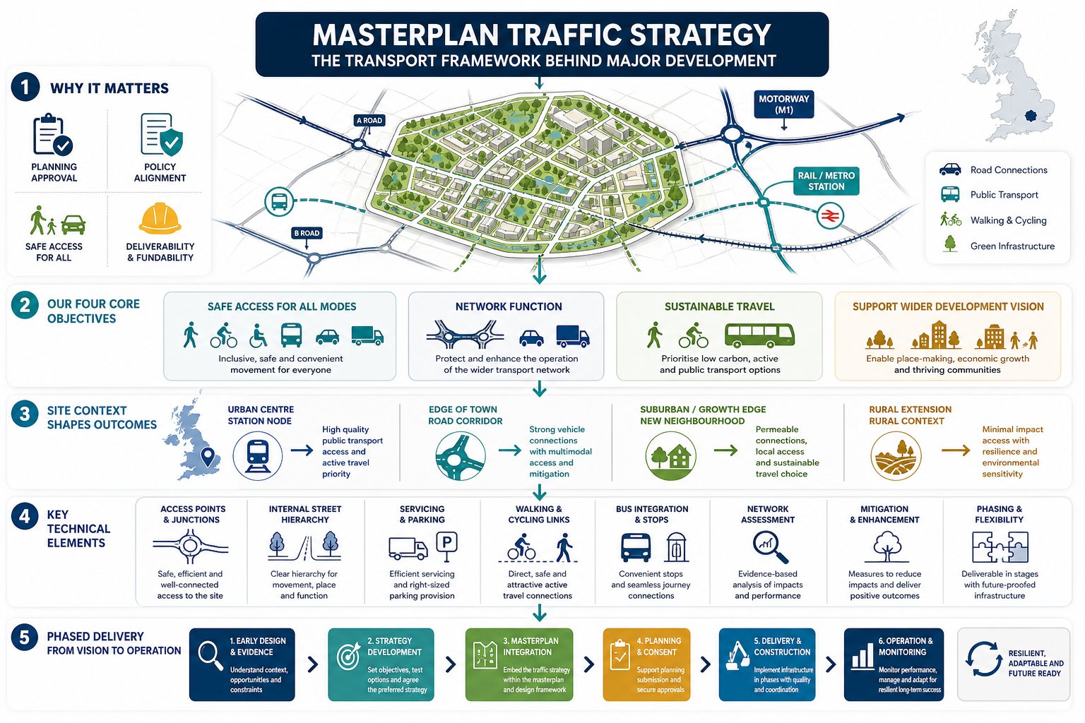
Big sites rarely fail on ambition alone. More often, they stall because movement was treated as a technical afterthought rather than a design driver. A well-prepared masterplan traffic strategy fixes that early. It sets out, in practical terms, how people, vehicles, servicing and public transport will reach a site, move through it and connect to the wider area as a scheme grows.
For architects, planners, lawyers, surveyors, developers and local authorities, this matters because transport evidence increasingly shapes whether a proposal feels credible, policy-aligned and deliverable. If access is unsafe, junctions are over capacity, bus links are weak, or active travel routes are vague, those issues tend to surface quickly in pre-app discussions and planning responses.
In our experience, the strongest strategies do more than forecast traffic. They connect land use, layout, phasing, placemaking and infrastructure into one coherent transport story. That is especially important in 2026, when planning applications are expected to demonstrate not just acceptable highway impact, but a realistic path to sustainable travel and long-term network resilience.
In this text, we break down what a masterplan traffic strategy is, when it is needed, what it should contain, and how site context should shape the right response. The aim is simple: help project teams build stronger applications with transport thinking embedded from the outset, not patched in at the end.
What A Masterplan Traffic Strategy Is And Why It Matters
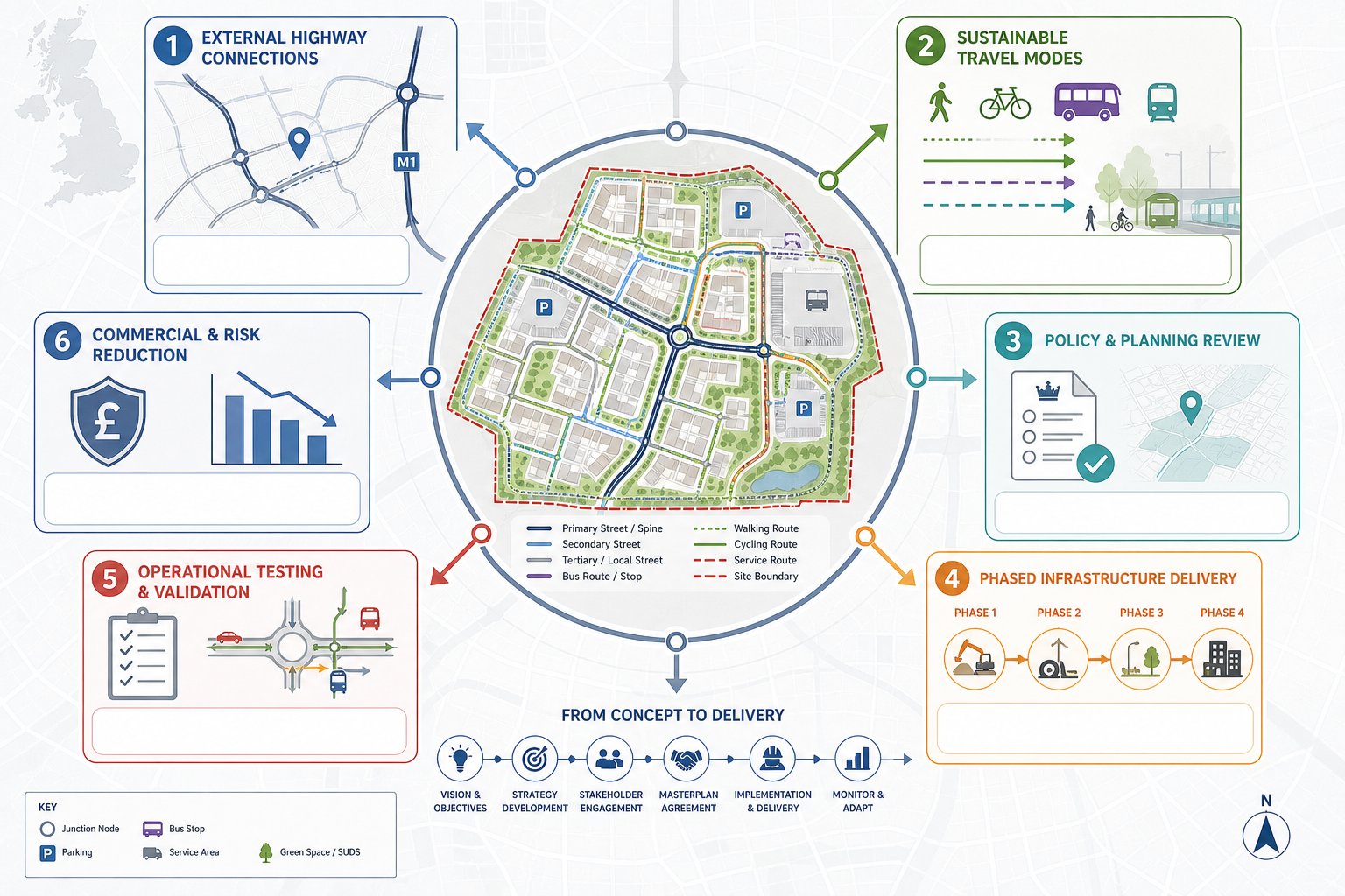
A masterplan traffic strategy is the transport framework that supports a wider development masterplan. It explains how access will work, how movement will be organised within the site, how different travel modes will be prioritised, and how the scheme will interact with the surrounding highway and transport network over time.
That sounds straightforward, but the practical role is bigger than many teams first assume. It influences access points, junction form, internal street hierarchy, parking approach, servicing, bus penetration, walking and cycling routes, and often the sequencing of infrastructure across phases. In other words, it is not just a highways note. It is one of the documents that helps turn a concept plan into something planning officers, highway authorities and delivery teams can test with confidence.
This is why a strategy prepared early tends to add value. It helps avoid the classic late-stage clash where an otherwise strong masterplan needs redesign because a junction will not operate, a refuse vehicle cannot turn, or the pedestrian network feels secondary. The best outcomes happen when transport principles sit alongside urban design, viability and planning policy from the start. That broader thinking is reflected in related work on Masterplan Transport Inputs: which shows how early evidence often strengthens both layout and application quality.
Why does it matter in policy terms? Because planning decisions now look well beyond private car access. A robust strategy should demonstrate accessibility by walking, cycling and public transport, align with local plan policies, and show that environmental and operational impacts have been understood. Where proposals are substantial, authorities often expect clear evidence that growth can be accommodated without severe residual cumulative impacts.
And there is a commercial angle too. A good strategy reduces uncertainty. It helps developers understand likely mitigation needs, infrastructure triggers, land take implications and programme risk before those issues become expensive surprises.
When A Traffic Strategy Is Needed In The Masterplanning Process
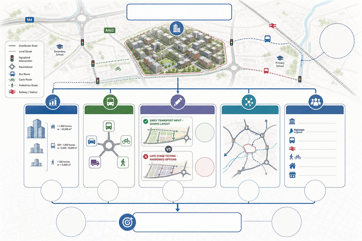
Not every planning proposal needs a full masterplan-level transport strategy. But once a scheme moves into the territory of major development, urban extension, strategic allocation, campus expansion, logistics park, mixed-use regeneration or new settlement, it usually becomes essential.
The trigger is rarely just size on paper. What really drives the need is whether transport and access are central to deliverability. If a site relies on new junctions, altered highway priorities, internal distributor roads, phased public transport provision or a substantial shift towards active travel, a structured strategy is needed to tie those strands together.
Timing matters. We would normally want transport thinking involved before the layout hardens. Too often, teams wait until an application is nearly assembled and then ask whether the access can be made to work. By that point, options are narrower. Front-loading the transport response allows the masterplan to evolve around movement patterns rather than resisting them. That principle is reflected in an Access Strategy Transport approach, where access and layout are tested as part of design development rather than at the end.
A strategy is also needed where risk sits outside the red line. For example, a site may have acceptable internal geometry but still affect nearby roundabouts, signalised junctions, bus reliability or school pick-up patterns. In those cases, the planning authority will want evidence on wider network operation and likely mitigation.
There is another reason to prepare one early: stakeholder alignment. Developers, architects, planning consultants, highway engineers and local councils often have slightly different assumptions about how a place should move. A transport strategy creates a common reference point. It gives the team something testable and shareable in pre-application discussions, committee reporting and reserved matters progression.
In short, if transport could influence land use quantum, layout, phasing, policy compliance or planning risk, a masterplan traffic strategy is not an optional extra. It is part of the core planning case.
Core Objectives A Masterplan Traffic Strategy Should Address
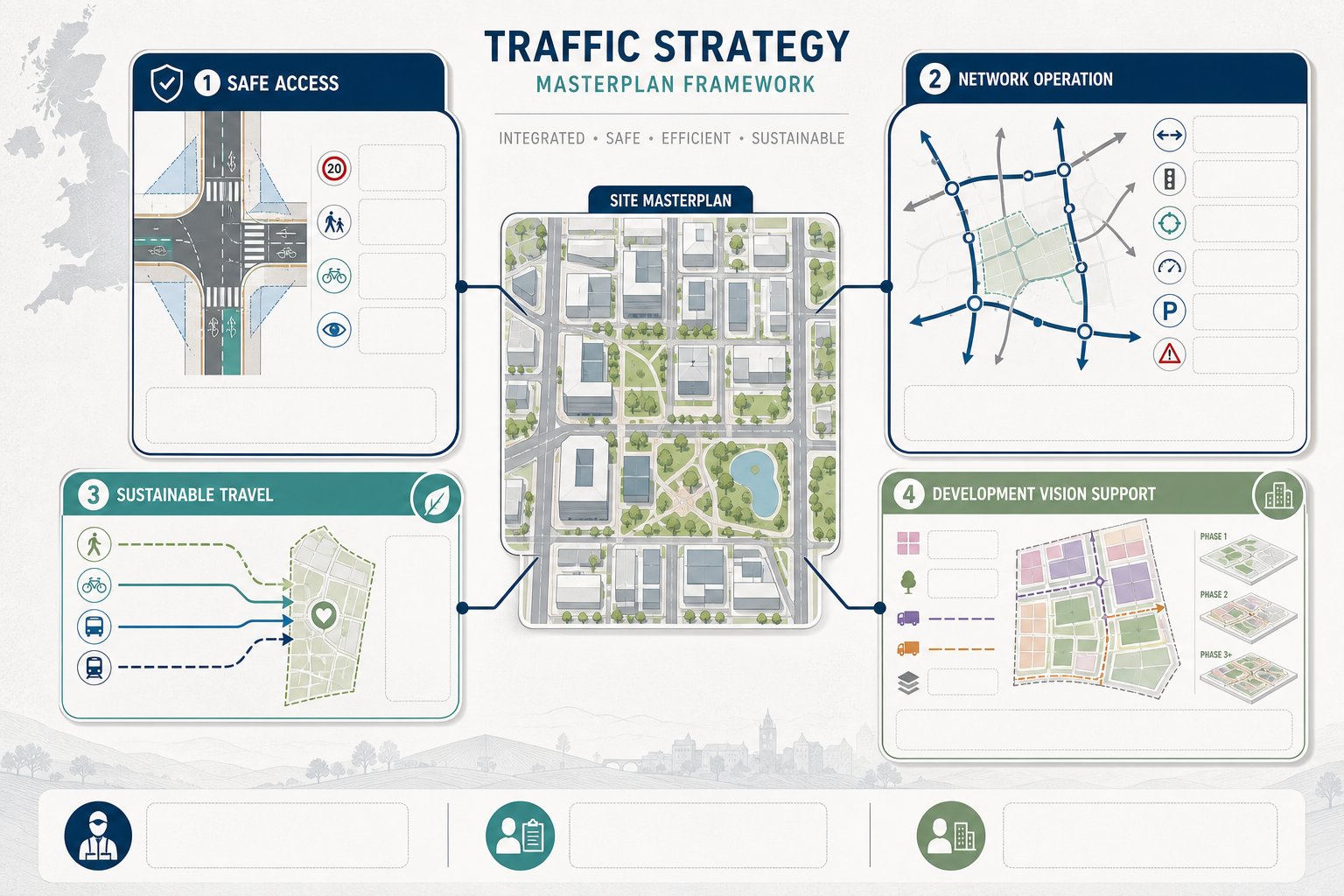
A robust strategy should be built around a small number of clear objectives rather than a long list of disconnected technical tasks. At masterplan level, we usually want the document to show four things: that access is safe, that the network can function, that sustainable travel is realistic, and that transport supports the wider development vision.
That last point is often overlooked. Transport should not simply react to land use: it should help shape it. If a scheme aims to create a walkable mixed-use quarter, the movement framework should reinforce that. If it proposes employment floorspace with significant servicing demand, freight and routeing need to be designed in properly. If it is phased over a decade or more, infrastructure triggers should be credible and proportionate.
A good strategy should also speak to both technical and non-technical readers. Highway officers will examine capacity, geometry and safety. Planning officers and members will want to understand how the movement plan supports place quality, accessibility and policy compliance. Developers will focus on cost, programme and deliverability. The document needs to work for all three audiences.
In practice, two technical objectives usually sit at the centre of the exercise: safe and efficient access for all modes, and acceptable network operation with mitigation where required. Those deserve explicit treatment.
Safe And Efficient Access For All Modes
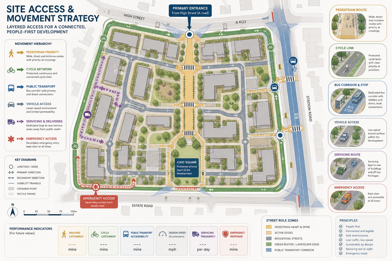
A site that works only for drivers is unlikely to be considered a successful modern masterplan. Current planning and transport policy in the UK places real emphasis on a movement hierarchy that gives proper weight to walking, cycling and public transport before defaulting to private car dominance.
So the first objective is not just “get vehicles in and out”. It is to create access arrangements that are safe, legible and practical for everyone: residents, workers, visitors, delivery drivers, emergency services, bus operators, pedestrians and cyclists, including people with impaired mobility.
That means asking basic but important questions early. Where should primary access be located? Can pedestrians reach nearby services directly, or are they forced onto long, indirect routes? Is there a bus corridor worth connecting to? Are cycle links continuous or do they stop awkwardly at the site boundary? What happens to servicing movements in places intended to feel civic or residential?
Design speed, visibility, junction type, crossing provision and route priority all matter here. But so does the character of the place. In a successful masterplan, movement is structured rather than accidental. Streets have roles. Crossings sit where people will actually walk. Bus stops are reachable without detours. Service yards do not cut across school routes.
For mixed and more complex schemes, this often overlaps with mixed use masterplan decisions, where retail, residential, employment and community uses create different patterns of demand through the day. The strategy should turn those patterns into a coherent access hierarchy instead of hoping they will sort themselves out.
Network Capacity, Operation And Impact
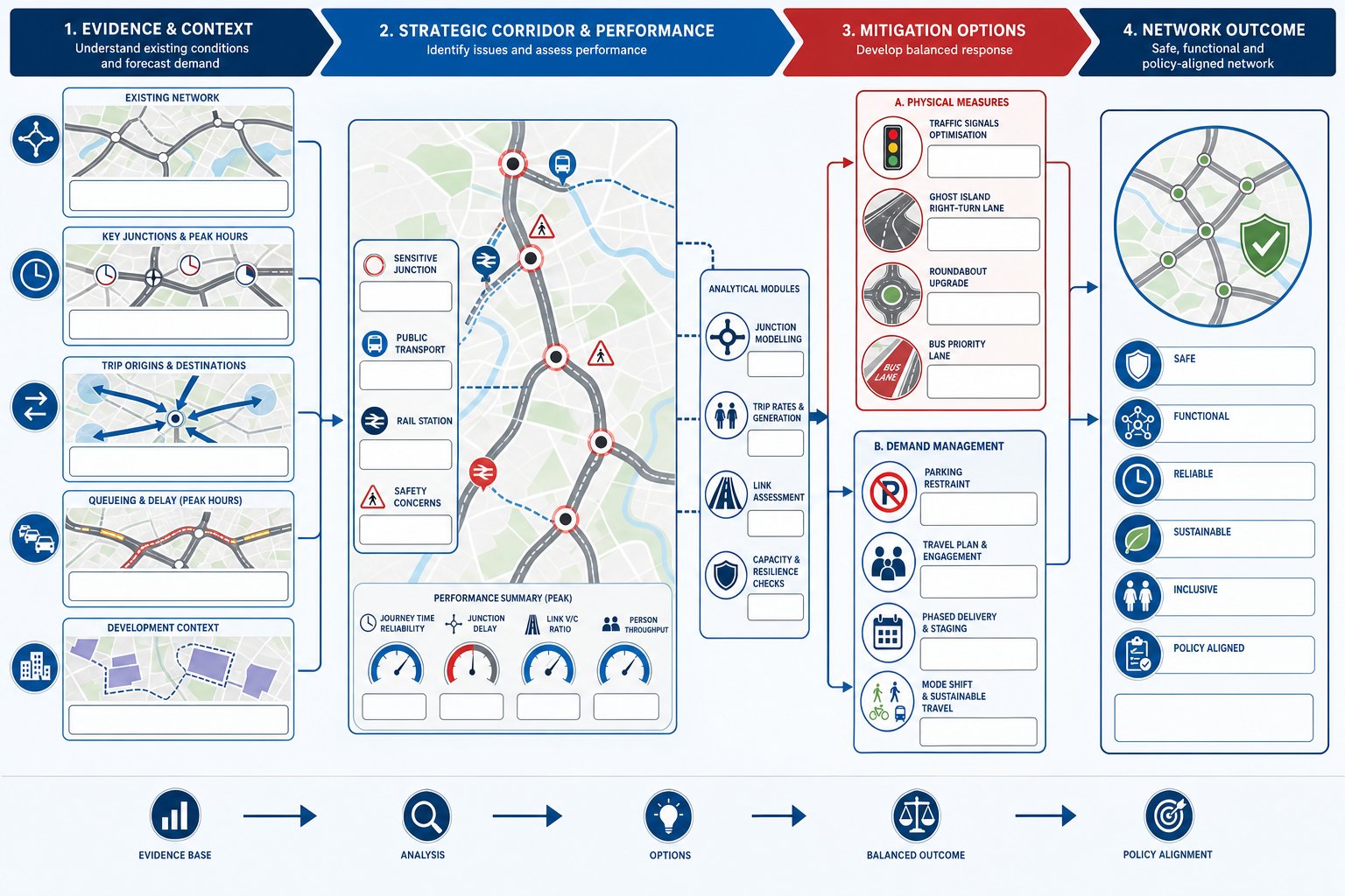
The second core objective is making sure the surrounding network can continue to operate acceptably once the development is in place. That usually requires an evidence-led review of existing conditions, forecast demand, peak periods, junction performance and corridor effects.
At this stage, the conversation moves beyond site access drawings. We need to understand where trips are likely to come from, when they will occur, which junctions are sensitive, whether queues already spill back, and what cumulative growth is committed nearby. Depending on the scale of the proposal, that may involve junction modelling, multi-modal trip rate analysis, link assessments, accident review and public transport capacity considerations.
But the objective is not to produce technical output for its own sake. It is to answer the planning question: will the development create unacceptable impacts, and if there are pressures, what is the proportionate response?
Sometimes the response is physical mitigation, such as signal optimisation, a new ghost island right-turn lane, a roundabout improvement or a bus priority measure. Sometimes it is demand management: reducing car dependence through mode share assumptions, parking restraint, travel planning and phased infrastructure delivery. Often it is a combination. The logic behind those interventions should be explicit, not tacked on. A useful parallel sits in mitigation measures traffic: where mitigation is treated as part of strategy, not just a defensive appendix.
Crucially, network impact should be judged in context. A busy urban site may never produce free-flowing conditions, and that is not the benchmark. The issue is whether the network remains safe, functional and policy-compliant, with impacts understood and managed.
How Site Context Shapes The Right Transport Approach
There is no universal template for a masterplan traffic strategy because site context changes almost everything. A dense urban infill site next to a rail station should not be approached in the same way as an edge-of-town employment allocation, and neither should be assessed like a rural strategic extension dependent on new spine roads.
Context starts with location in the settlement. Is the site central, peripheral or isolated? Does it sit on a corridor already served by frequent buses? Can people reasonably walk to schools, shops and jobs? Are there barriers such as dual carriageways, rivers, rail lines or steep gradients? Those questions affect mode share assumptions, infrastructure priorities and what the planning authority will expect.
Context also includes the role the development is meant to play. Some sites are intended to be low-car neighbourhoods. Others need to accommodate significant goods movement or school-run peaks. Some are simple enough to hinge on one access. Others depend on a network of connections delivered in phases over years. The strategy has to reflect that complexity honestly.
This is where local knowledge matters. Thresholds, evidence preferences and policy emphasis vary between authorities. A technically sound strategy still needs to be tuned to local plan wording, supplementary guidance and the practical stance of the highway authority. That local calibration is often the difference between a report that merely exists and one that genuinely supports a planning application.
Existing Highway Conditions, Constraints And Opportunities
The baseline review is more than a site visit and a few traffic counts. We need a rounded picture of how the area currently functions, because constraints and opportunities often sit in the details.
Existing highway conditions usually cover road hierarchy, junction form, traffic flow patterns, observed congestion, speed environment, collision history, parking stress, servicing activity, bus routes, stop quality, footway continuity, crossing points and cycle infrastructure. Each of those influences what is realistic. A site may have spare junction capacity but poor pedestrian permeability. Or excellent bus accessibility but a constrained bridge that limits HGV routing.
Physical constraints can be stubborn: protected trees, listed walls, narrow frontages, watercourses, level changes, utilities, rights of way, school frontages, environmental designations. These are not side notes. They shape whether an access can be widened, whether a crossing can be signalised, or whether active travel links can be made direct enough to be attractive.
Yet context is not only about problems. Opportunities matter just as much. There may be dormant desire lines worth formalising, road space that could be reallocated, nearby development funding to pool, a bus service open to diversion, or a junction whose renewal cycle aligns with the application programme. In some cases, a thoughtful traffic impact assessment helps reveal which constraints are genuinely material and which can be managed through design.
The best strategies are candid at this stage. They do not pretend every issue disappears. They show that the team understands the network as it is, and knows where intervention will have the most value.
Land Use, Phasing And Future Demand
Transport strategy and land-use strategy should be developed together. If they are separated, the masterplan often becomes internally inconsistent: density ends up remote from public transport, employment plots generate routing conflicts, and early phases come forward before the infrastructure needed to support them.
Land-use mix directly affects trip patterns. Residential uses create morning and evening commuter peaks, but also school, leisure and shopping movement. Employment and logistics uses may bring concentrated peak arrivals, servicing and larger vehicle requirements. Retail and leisure can flatten demand across the day but increase weekend pressure. Community uses add their own pulse. The strategy should translate that mix into realistic assumptions about mode choice, timing and route distribution.
Density matters too. Higher-density development near strong public transport corridors and local services usually has a better chance of achieving lower car dependence. Lower-density peripheral development often requires stronger intervention to avoid car-led outcomes. The point is not ideology: it is matching the spatial plan to the accessibility profile.
Phasing then turns the strategy from concept to delivery plan. Which access is needed first? At what occupation threshold is a secondary junction triggered? When should bus service enhancements start? Can active travel routes be provided from phase one rather than promised for later? Parking supply, too, may need to evolve, which is why a linked Parking Strategy For developments approach is often useful on larger schemes.
Future demand should be assessed with enough realism to withstand scrutiny. That means accounting for committed development, background growth where appropriate, behavioural assumptions, and how the site may mature over time rather than only at day-one occupation.
The Key Technical Elements Within A Robust Strategy
A strong masterplan traffic strategy needs structure. Decision-makers should be able to move from principles to evidence to design response without guessing how one relates to another.
In practical terms, the technical content normally covers baseline conditions, policy context, development proposals, movement hierarchy, access principles, internal street framework, active travel strategy, public transport integration, servicing, parking, trip generation, distribution, network assessment, mitigation and phasing. Depending on the scale of the site, it may also include framework drawings, swept path testing, parameter plans, preliminary junction layouts and delivery triggers.
The exact package should be proportionate. A strategic urban extension will need more than a modest redevelopment. But proportionality does not mean vagueness. Authorities are rarely persuaded by broad statements that access “can be accommodated” without enough supporting logic.
Two areas usually deserve particular attention because they connect design, operation and deliverability most directly: first, access and internal movement: second, sustainable travel measures that make lower-car patterns plausible rather than aspirational.
Access, Junctions, Internal Layout And Servicing
Access strategy starts with the external interface. How many access points are needed, what function each serves, and how they protect both safety and network resilience. A single all-purpose access may be efficient on paper, but on a large site it can undermine legibility, resilience and emergency response. Conversely, too many connections can create conflict and weaken place quality.
Junction design must respond to expected flows, speed environment, road status, land take and user priority. Priority junctions, roundabouts, signals and compact urban forms all have different implications. The right answer is not always the one with the highest nominal capacity. Sometimes a lower-speed, more integrated junction aligns better with urban design and active travel goals while still performing adequately.
Inside the site, the street network should reflect a clear movement hierarchy. Primary streets carry strategic movement and, often, public transport. Secondary streets distribute traffic within neighbourhood parcels. Tertiary streets are more local and place-led. That hierarchy then informs carriageway width, crossing strategy, parking location, street trees, frontage treatment and design speed.
Servicing is where many masterplans wobble. Refuse vehicles, delivery vans, HGVs and maintenance access all need to function without dominating the public realm. Routes should minimise conflict with pedestrians and cyclists, especially near schools, centres and squares. Tracking, loading locations and management assumptions should be tested early. Where parking is a sensitive issue, parking strategy traffic decisions also feed directly into street operation, visibility and servicing efficiency.
None of this is glamorous, but it is exactly the level of detail that often determines whether a scheme feels credible at application stage.
Walking, Cycling, Public Transport And Sustainable Travel Measures
If a masterplan claims to support sustainable travel, the evidence needs to show how. That starts with direct, continuous and safe walking routes linking homes, workplaces and community uses to each other and to off-site destinations. The same principle applies to cycling: routes should connect, not dissolve at awkward edges or force riders into hostile traffic conditions.
Public transport should be integrated spatially and operationally. Stops need sensible spacing, accessible routes, good waiting environments and, where justified, priority measures to protect reliability. On larger sites, bus penetration and turning arrangements must be resolved early enough that they influence street layout rather than compromise it later.
Travel plans and demand management measures then give the strategy behavioural depth. These may include parking restraint, car clubs, cycle parking, e-bike charging, personalised travel planning, real-time information, freight consolidation, delivery management and support for ultra-low emission vehicles. Done properly, these are not cosmetic additions. They help explain why forecast mode shares are credible.
For applications moving toward formal assessment, related evidence in Traffic Impact Assessments often helps tie sustainable measures back to network outcomes and policy compliance.
There is also a broader planning point here. Sustainable transport is not just about reducing traffic counts. It affects health, inclusion, air quality, carbon and the everyday usability of the place. A parent deciding whether to walk a child to school is not thinking about paragraph numbers in policy. They are judging whether the route feels obvious and safe. Good strategy design understands that human test.
When these measures are embedded early, the masterplan becomes easier to defend. It shows growth can happen in a way that is accessible, deliverable and better aligned with how planning decisions are increasingly made in 2026.
Conclusion
A masterplan traffic strategy is not a box-ticking transport chapter. It is one of the main tools for proving that a development can function in the real world: safely, efficiently and in line with modern planning policy.
When prepared properly, it connects access, land use, phasing, mitigation and sustainable travel into a single narrative that planners, highway authorities and development teams can rely on. That is especially important on major schemes, where transport issues can quietly decide whether an application moves forward smoothly or gets dragged into redesign, delay and dispute.
Our view is simple. The strongest planning applications treat transport as part of place-making from day one. When movement strategy is built into the masterplan early, growth becomes easier to explain, easier to assess and far more likely to be deliverable.
Masterplan Traffic Strategy FAQs
What is a masterplan traffic strategy and why is it important?
A masterplan traffic strategy is the framework for how people and vehicles access and move within a development site, integrating with the wider transport network. It ensures safe, efficient access for all modes and supports sustainable travel, helping to make large developments deliverable and policy-compliant.
When is it necessary to prepare a masterplan traffic strategy?
A masterplan traffic strategy is needed for major developments, urban extensions, or significant regeneration projects where transport and access shape deliverability. It is essential when new junctions, phased public transport, or a shift to sustainable travel modes are required to support growth.
How does a masterplan traffic strategy address sustainable travel?
The strategy prioritises walking, cycling, and public transport through safe, continuous routes and integration with services. It includes demand management like travel plans and parking restraint, making lower car dependence realistic rather than aspirational, aligning with modern planning policy.
What role does site context play in shaping a masterplan traffic strategy?
Site context—such as urban or rural location, existing infrastructure, and role in the settlement—influences mode share assumptions, access design, and infrastructure priorities. Tailoring the strategy to local conditions and policies ensures it supports site-specific needs and network connectivity.
How does transport evidence influence the planning application process?
Transport evidence from a masterplan traffic strategy demonstrates safe access, acceptable network impacts, and sustainable modal shift. Robust evidence helps planning officers and highway authorities assess credibility and ensures compliance with local policy, reducing risk of redesign or delays.
What key technical elements are included in a masterplan traffic strategy?
Key elements include baseline highway conditions, access and junction design, internal street hierarchy, pedestrian and cycling networks, public transport integration, servicing arrangements, parking strategy, trip generation, network impact assessment, mitigation measures, and phasing aligned with development.