Salford is not the sort of place where transport can be treated as an afterthought. With sustained growth across Greater Manchester, pressure on road space, stronger expectations around active travel, and tighter scrutiny of how development affects existing communities, transport planning in Salford has become a decisive part of the planning process.
For architects, developers, planning consultants, solicitors, and local authorities, that has a practical consequence: a scheme can be well designed in planning terms, commercially sound, and still run into trouble if movement, access, parking, servicing, or highway impact haven’t been dealt with properly. We see this regularly. The transport work isn’t just a technical appendix to satisfy a condition: it often shapes whether an application moves smoothly, gets delayed, or attracts objection.
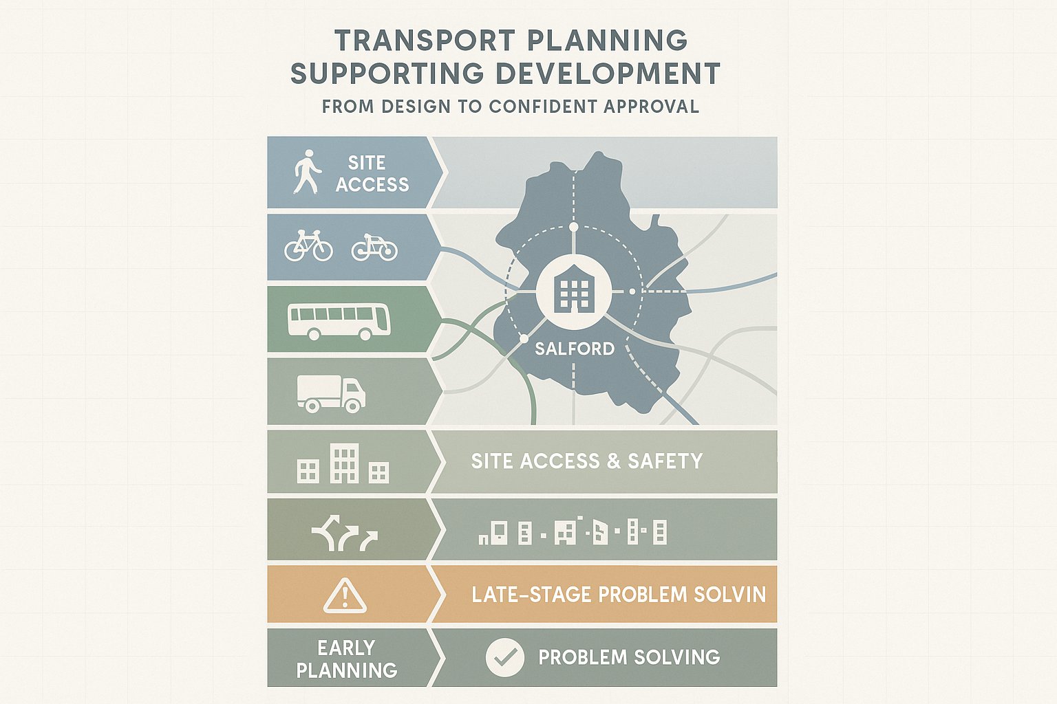
In Salford, the strongest applications usually do a few things well. They respond to the real transport character of the site, align with local and Greater Manchester policy, and show clearly how people will reach the development by car, bus, rail, tram, walking, and cycling. They also tackle the less glamorous issues early: servicing, visibility, swept paths, road safety, and parking management.
In this guide, we set out what transport planning in Salford typically involves in 2026, when a Transport Assessment or Travel Plan may be needed, the local factors that matter most, and how early technical input can materially improve planning outcomes.
Why Transport Planning Matters For Development In Salford
Transport planning matters in Salford because development here does not happen in a vacuum. Each proposal adds trips, changes movement patterns, affects local streets, and interacts with a wider transport system that already serves homes, employment areas, district centres, the regional core, and strategic routes across Greater Manchester.
At a basic level, good transport planning helps answer questions decision-makers will immediately ask: can the site be accessed safely, will the surrounding network operate acceptably, is parking realistic, can servicing take place without conflict, and are there credible alternatives to private car use? If those questions are answered well, an application feels more robust. If they are left vague, risk rises quickly.
There is also a broader place-making point. In Salford, transport planning is tied to growth management and accessibility. A scheme that supports walking links, practical cycling access, bus connectivity, and sensible vehicle arrangements is usually stronger than one that simply demonstrates cars can enter and leave the site. Planning officers, highway officers, and consultees increasingly expect development to support movement in the round, not just highway operation.
That matters for all scales of proposal. A modest residential development may raise local parking stress or visibility concerns. A town-centre scheme may generate objections if trip intensity, servicing, or pedestrian movements are poorly understood. Larger mixed-use development can trigger deeper scrutiny around cumulative impact, junction capacity, and travel demand management.
In our experience, transport planning is most valuable when it is used to shape a scheme, not defend it after the event. Done early, it reduces uncertainty. Done late, it often becomes expensive problem-solving under pressure.
The Planning And Transport Policy Context Shaping Salford Schemes
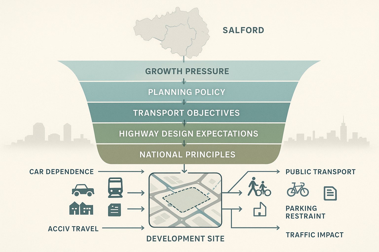
Any serious approach to transport planning in Salford needs to start with policy context. Salford sits within the wider Greater Manchester growth picture, where planned increases in homes, jobs, and city-centre activity continue to place pressure on transport capacity, network resilience, and connectivity between places.
That means individual developments are rarely assessed only on their own immediate footprint. They are considered in relation to wider objectives: reducing unnecessary car dependence, improving access to jobs and services, supporting public transport, and embedding active travel into everyday movement. In practical terms, applicants need to show that proposals align with place-based planning rather than treating transport as a narrow engineering exercise.
The local planning framework, Greater Manchester transport objectives, highway design expectations, and national planning principles all play a part. While exact requirements vary by site and scale, the direction of travel is consistent. Schemes in accessible locations are usually expected to make more of that advantage. Schemes in constrained locations may need clearer justification for parking, access design, or traffic impact. And proposals that intensify use in already busy areas often face more detailed scrutiny of cumulative effects.
Policy context also affects how evidence is framed. It is not enough to present raw traffic numbers. A strong submission explains how the development supports sustainable movement, whether the access strategy is proportionate to the location, and how the proposal responds to existing and planned transport conditions nearby.
This is where experienced local input matters. At ML Traffic, our role is often to translate broad policy expectations into concise, authority-aware reporting that fits the realities of the site. That balance, between policy alignment and practical design, is often what makes an application feel credible to decision-makers.
Key Local Factors That Influence Transport Planning Outcomes
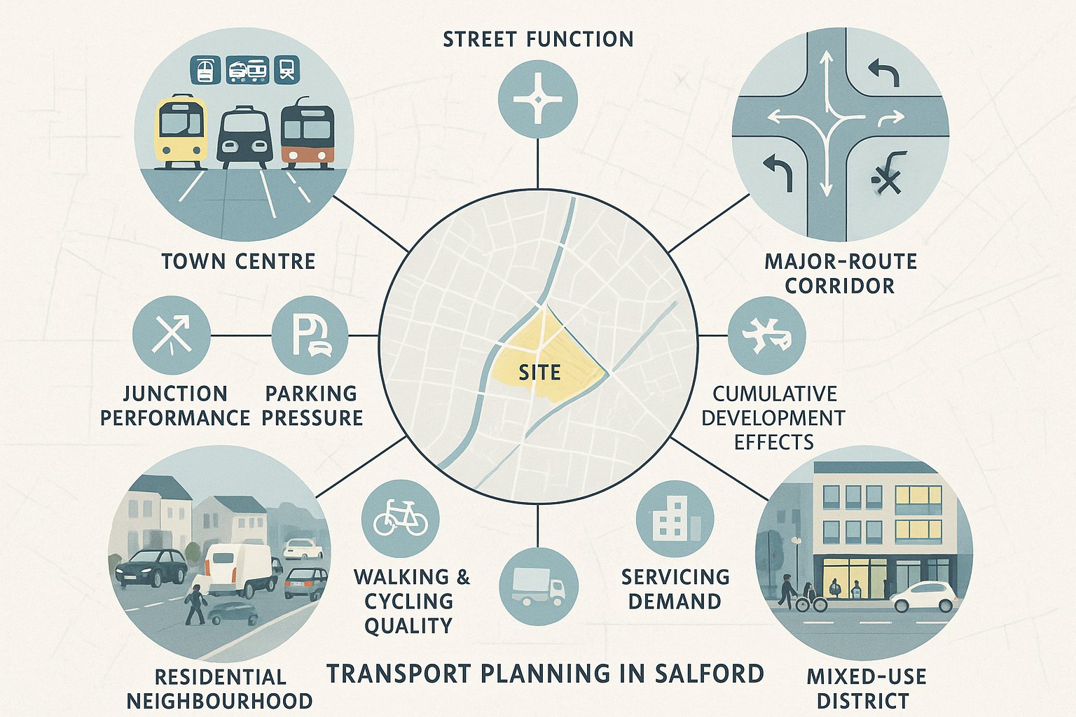
Salford is not one transport environment. Outcomes vary sharply depending on whether a site sits in or near the regional centre, within an established residential neighbourhood, close to strategic roads, or in an area where public transport and active travel opportunities are already strong.
Because of that, transport planning in Salford works best when it is genuinely local in its analysis. Generic assumptions can quickly unravel. A parking approach that appears reasonable in one part of the city may be challenged elsewhere. A servicing strategy that works on a wide frontage may fail on a tighter urban street. And a development that looks sustainable on a map may perform less well if walking routes are indirect, crossing points are weak, or bus access is less practical than first assumed.
The key factors usually include street function, nearby junction performance, local parking conditions, collision history, public transport proximity, quality of walking and cycling links, and the relationship between the development type and the surrounding movement pattern. Existing land use matters too. Intensifying a previously low-activity site often changes peak-hour pressure, kerbside demand, and servicing needs.
There is also a cumulative dimension. In a growing urban area, a proposal may be technically modest on its own but still attract scrutiny because of nearby committed development or known network sensitivity. That is why we tend to look beyond the red line early. Understanding local context at application stage is far easier than trying to explain it away after consultation responses arrive.
Town Centre, Residential, And Mixed-Use Contexts
Different development contexts in Salford call for different transport emphases.
Town-centre and highly accessible urban locations usually require a stronger multimodal case. Decision-makers will expect applicants to engage seriously with walking, cycling, bus, rail, and tram access, and to justify parking in relation to local accessibility and likely travel behaviour. Trip intensity can be a particular issue here, especially where several uses interact across the day and evening economy.
Residential schemes often turn on more everyday questions: will the access work safely, is parking demand being understood realistically, are refuse and delivery movements workable, can residents walk to nearby services, and will the development worsen existing on-street pressure? Small schemes can still become contentious if they overlook local realities like school-run congestion or narrow estate roads.
Mixed-use development tends to be more complex because it combines peak patterns, servicing needs, dwell times, and competing demands for space. One use may offset another, but sometimes the opposite happens. We need to test those interactions carefully rather than assuming internal capture will solve everything.
Major Routes, Public Transport, And Active Travel Connections
The surrounding network often determines how much confidence a local authority has in a scheme. Sites near major routes may benefit from strategic accessibility, but they can also raise concerns about safe access design, queuing interaction, and the effect of additional turning movements on already sensitive junctions.
Public transport matters just as much. Salford benefits from strong connections in many locations, but proximity alone is not the full story. Frequency, destination choice, walking route quality, step-free access, and the realism of mode share assumptions all affect how convincing a transport case will be.
Active travel is no longer a soft add-on. Walking and cycling connections are now central to the planning conversation, particularly in urban and regeneration locations. We need to consider directness, crossing opportunities, frontage conditions, cycle storage, and whether the development genuinely enables people to choose non-car modes. If those links are weak, officers will notice.
When A Transport Assessment, Transport Statement, Or Travel Plan Is Needed
One of the most common early questions is simple: what level of transport reporting will the application need? The honest answer is that it depends on the scale, type, and likely impact of the proposal, as well as local authority expectations and site-specific constraints.
In broad terms, a Transport Assessment is usually required where a development is expected to generate material transport effects. That may include noticeable changes in traffic flow, junction operation, access demand, servicing activity, or parking pressure. A TA is the fuller document. It typically supports larger or more complex schemes, or smaller schemes in sensitive locations.
A Transport Statement is generally more proportionate for proposals with lower transport impacts. It still needs to be evidence-based, but it is usually narrower in scope and less modelling-heavy than a full assessment. Even so, it cannot be superficial. If a site has difficult access, known safety issues, or local parking sensitivity, a short document that skips over those points will not help.
A Travel Plan may be required alongside either document, particularly where the authority wants to see active management of travel demand. For employment, education, healthcare, residential, or mixed-use schemes, this can be a key part of the package. A decent Travel Plan sets out practical measures, targets, monitoring, and responsibility rather than vague aspirations about encouraging sustainable travel.
What matters most is not the label on the document but whether the scope is right. We usually advise agreeing the scope early where possible, especially for borderline cases. That reduces the chance of preparing the wrong level of evidence and then being asked for more after submission.
What A Salford Transport Assessment Typically Needs To Cover
A well-prepared Transport Assessment in Salford should explain, in a clear and proportionate way, how the development interacts with the surrounding network and whether its impacts are acceptable. It should also show that access and movement have been thought through as part of the design, not bolted on at the end.
The exact scope varies, but most assessments need to cover existing site and highway conditions, development proposals, baseline accessibility, predicted trips, traffic assignment, operational impact, access design, parking, servicing, road safety, and any mitigation or travel planning measures. The document should be rooted in the real site context, using surveys, observations, technical drawings, and a methodology suited to the development.
A common mistake is producing a report that is technically busy but strategically thin. Local authorities want to understand what the development will actually do on the ground. How many trips are likely? Where will they come from? Will nearby junctions continue to operate acceptably? Can vehicles enter, manoeuvre, and leave safely? Will pedestrians, cyclists, bus users, and servicing vehicles be accommodated properly?
The best assessments answer those questions directly and in plain English, even when the underlying analysis is detailed. They also deal honestly with constraints. A constrained urban site does not have to be perfect, but the report should show that trade-offs have been understood and managed.
Trip Generation, Distribution, And Junction Impact
Trip generation is often the first area officers and highway consultees test. The assumptions need to be credible, locally relevant, and proportionate to the proposal. That means using defensible data sources, applying sensible reductions or adjustments where justified, and explaining the basis for mode share assumptions rather than simply presenting them as given.
Trip distribution matters just as much. If development traffic is assigned unrealistically, the entire impact assessment becomes vulnerable. In Salford, routing needs to reflect actual travel patterns, local network hierarchy, committed development, and the practical attractiveness of different approaches to the site.
Where junction capacity is assessed, methodology should match the scale and nature of the likely impact. Sometimes a straightforward priority junction review is enough. In other cases, more detailed modelling is appropriate, especially where the surrounding network is already under stress or where cumulative growth is relevant.
Importantly, the narrative around impact should be balanced. Not every change in queue length is severe, but neither should small technical exceedances be brushed aside if the local context is sensitive. We find that decision-makers respond best when the assessment is candid, measured, and tied to practical mitigation where needed.
Access, Parking, Servicing, And Road Safety Considerations
A transport report can stand or fall on the basics. Access design needs to work geometrically, operationally, and in safety terms. That includes visibility, junction form, vehicle tracking, gradient, pedestrian crossing conditions, and any interaction with nearby junctions, bus stops, or loading activity.
Parking is another frequent pressure point. In Salford, parking provision is rarely just a numbers exercise. We need to consider likely demand, local restraint, overspill risk, disabled provision, electric vehicle charging, cycle parking, and how the development fits the accessibility of the location. Under-provision can trigger objection, but over-provision may also undermine the sustainability case in some contexts.
Servicing is often underestimated. Refuse collection, deliveries, and maintenance access need to be workable in real life, not just on a swept path drawing. If a vehicle blocks pedestrian desire lines, conflicts with peak arrival periods, or depends on awkward reversing in a constrained street, the issue will come back during consultation.
Road safety should be evidenced properly, usually with review of local collision data and site conditions. The key is to show whether the proposal introduces new conflict points or exacerbates existing ones, and what design measures reduce risk. This is where detail matters: kerb lines, visibility splays, crossing points, tracking, and frontage activity can all influence the final planning outcome.
Common Transport Planning Issues That Delay Applications
Most transport-related delays are not caused by exotic modelling disputes. They come from predictable weaknesses that could have been resolved earlier.
One of the biggest is poor scoping. Applicants sometimes submit a Transport Statement where a fuller assessment was clearly needed, or they provide a TA that technically exists but fails to cover the issues the authority actually cares about. That creates the worst kind of delay: avoidable additional information requests after validation or consultation.
Another frequent problem is weak site access design. Visibility, turning, refuse movements, dropped kerbs, pedestrian crossing routes, and cycle access are often left too late in the design process. By the time concerns are raised, changing the layout may affect unit numbers, frontage treatment, or viability assumptions.
Parking is a close second. We regularly see applications stumble because the strategy does not reflect local conditions. A spreadsheet may suggest adequacy, but if nearby streets are already under pressure, or if servicing and resident parking compete for the same space, objections are likely. The same applies where cycle parking is tokenistic or badly located.
Sustainable transport provision is another area where reports can feel thin. Authorities increasingly expect realistic, site-specific walking, cycling, and public transport analysis. Generic statements about a nearby bus stop are not enough if the route to it is indirect or unpleasant.
And then there is simple inconsistency. A planning statement, site layout, swept path drawing, and transport report that all tell slightly different stories can undermine confidence fast. In our experience, coordinated technical input is one of the easiest ways to avoid a long, messy determination period.
How To Strengthen A Planning Application With Early Transport Input
The best time to solve transport problems is before they become planning objections. Early input lets us influence layout, access, parking, servicing, and movement strategy while the design still has room to flex.
That usually starts with a short feasibility review. We look at the site context, likely reporting requirements, possible access constraints, surrounding network sensitivity, and whether there are obvious red flags around parking, servicing, or road safety. Even that early stage can be valuable. It helps project teams understand whether the emerging scheme is aligned with the location or drifting toward avoidable conflict.
Early transport input also improves coordination across disciplines. Architects can test frontage and circulation with proper vehicle tracking in mind. Planning consultants can frame the application around realistic transport strengths and constraints. Legal teams and developers get a clearer sense of risk before significant time and cost are committed.
Where pre-application engagement is appropriate, transport evidence can help make those discussions more productive. A concise technical note, initial trip review, or access appraisal often draws out concerns before submission, when they are still manageable. That is far better than receiving a late objection that forces redesign.
There is a commercial upside too. Faster, clearer reporting that matches local thresholds and planning context reduces uncertainty. That is a big part of what we focus on at ML Traffic: concise, accurate transport engineering reports, prepared quickly and grounded in over 30 years of practical experience. In a place like Salford, that mix of speed and local planning awareness can make a real difference to programme risk and planning success.
Conclusion
Transport planning in Salford is eventually about fit: fit with the site, fit with the network, and fit with the policy direction of a growing urban authority. The strongest planning applications show that clearly. They do not rely on generic assumptions or last-minute technical paperwork. They demonstrate, with proportionate evidence, that access is safe, impacts are understood, and sustainable travel has been properly built into the proposal.
For professionals working on development in Salford, the practical lesson is straightforward. Start transport work early, scope it properly, and make sure it responds to local conditions rather than template reporting. That applies whether you are promoting a small residential scheme, a town-centre redevelopment, or a more complex mixed-use site.
When transport issues are addressed at the right stage, they stop being a barrier and start becoming part of the solution. And in a competitive planning environment, that shift can be the difference between a delayed application and a credible, decision-ready scheme.
Transportation Planning in Salford: Frequently Asked Questions
Why is transport planning important for development projects in Salford?
Transport planning ensures developments in Salford operate safely and efficiently, supporting economic growth while managing impacts on congestion, road safety, and community accessibility across Greater Manchester.
What local factors influence transport planning outcomes in Salford?
Key factors include the local street network, nearby junction performance, public transport availability, quality of walking and cycling links, parking conditions, road safety records, and how the development fits into existing movement patterns.
When is a Transport Assessment or Travel Plan required for a Salford development?
A Transport Assessment is generally needed when a development may significantly affect traffic, access, parking, or servicing. A Travel Plan is often required alongside to manage travel demand sustainably, depending on site scale and local authority requirements.
How can early transport input improve planning applications in Salford?
Early transport input helps shape site layout, access, parking, and active travel strategies before submission, reducing objections and delays by aligning proposals with local conditions and policy expectations from the start.
What transport issues commonly delay planning applications in Salford?
Delays often result from poor scoping of transport reports, inadequate site access designs, inappropriate parking strategies, insufficient sustainable transport provision, and inconsistency between transport and planning documents.
How does transport planning support active travel and public transport in Salford developments?
Transport planning promotes walking, cycling, and public transport by ensuring developments have quality access routes, safe crossings, cycle storage, convenient public transport connections, and by limiting car dependence in line with Greater Manchester policies.