For years, many UK streets were asked to do too much at once: function as through-routes, parking reservoirs, delivery corridors and, somehow, pleasant places to live. The result is familiar. Rat-running on residential roads, poor walking conditions, fragmented cycle routes, avoidable severance, and planning debates that get stuck between growth needs and transport impacts.
That is exactly why liveable neighbourhoods planning has moved from a niche urban design idea to a mainstream planning and transport issue in 2026. For architects, planners, developers, local authorities and their advisers, it offers a practical framework for shaping places around people rather than defaulting to vehicle movement as the starting point. Done well, it can support better planning outcomes, healthier travel habits, stronger local centres and more resilient development proposals.
In the UK context, liveable neighbourhoods are not about banning cars outright or ignoring servicing realities. They are about managing movement intelligently: reducing unnecessary through-traffic, retaining essential access, and improving the everyday experience of walking, wheeling, cycling and using public transport. That means the concept sits squarely within planning applications, transport assessments and design codes.
In this text, we look at what liveable neighbourhoods planning means in practice, why it matters, how it fits within UK policy, and what evidence is usually needed to support schemes at application stage. We also cover the less glamorous but crucial bit: access, servicing and emergency vehicle considerations, because that is often where projects stand or fall.
What Liveable Neighbourhoods Planning Means In Practice
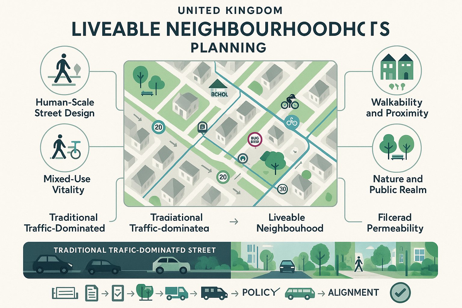
At its simplest, liveable neighbourhoods planning means designing streets and local centres so they work first for the people who live, learn, shop and move through them every day. In practice, that usually involves reducing the dominance of through-traffic on residential streets while keeping access for residents, deliveries, refuse, blue badge users and emergency services.
The tools are now well established in UK schemes. We see modal filters, traffic cells, one-way changes, bus gates, 20mph limits, upgraded crossings, continuous footways, pocket planting, cycle links and parking management used together rather than as isolated interventions. The aim is not cosmetic improvement alone. It is to reshape how a neighbourhood functions.
A useful way to think about it is this: a liveable neighbourhood should still be easy to get into, but harder to cut through at speed if you do not need to be there. That distinction matters in planning terms, because many objections assume access removal when the proposal is actually access management.
For development and planning teams, this approach also changes the evidence base. We cannot rely on vehicle capacity alone as the test of success. We need to consider street quality, network permeability for active travel, public health, equalities, road safety and the performance of nearby centres. In our experience, the strongest planning submissions explain those relationships early, before the scheme is reduced to a debate about a single junction model.
Core Principles That Shape A Liveable Neighbourhood
Most successful schemes rest on a handful of principles that are easy to state but harder to deliver consistently.
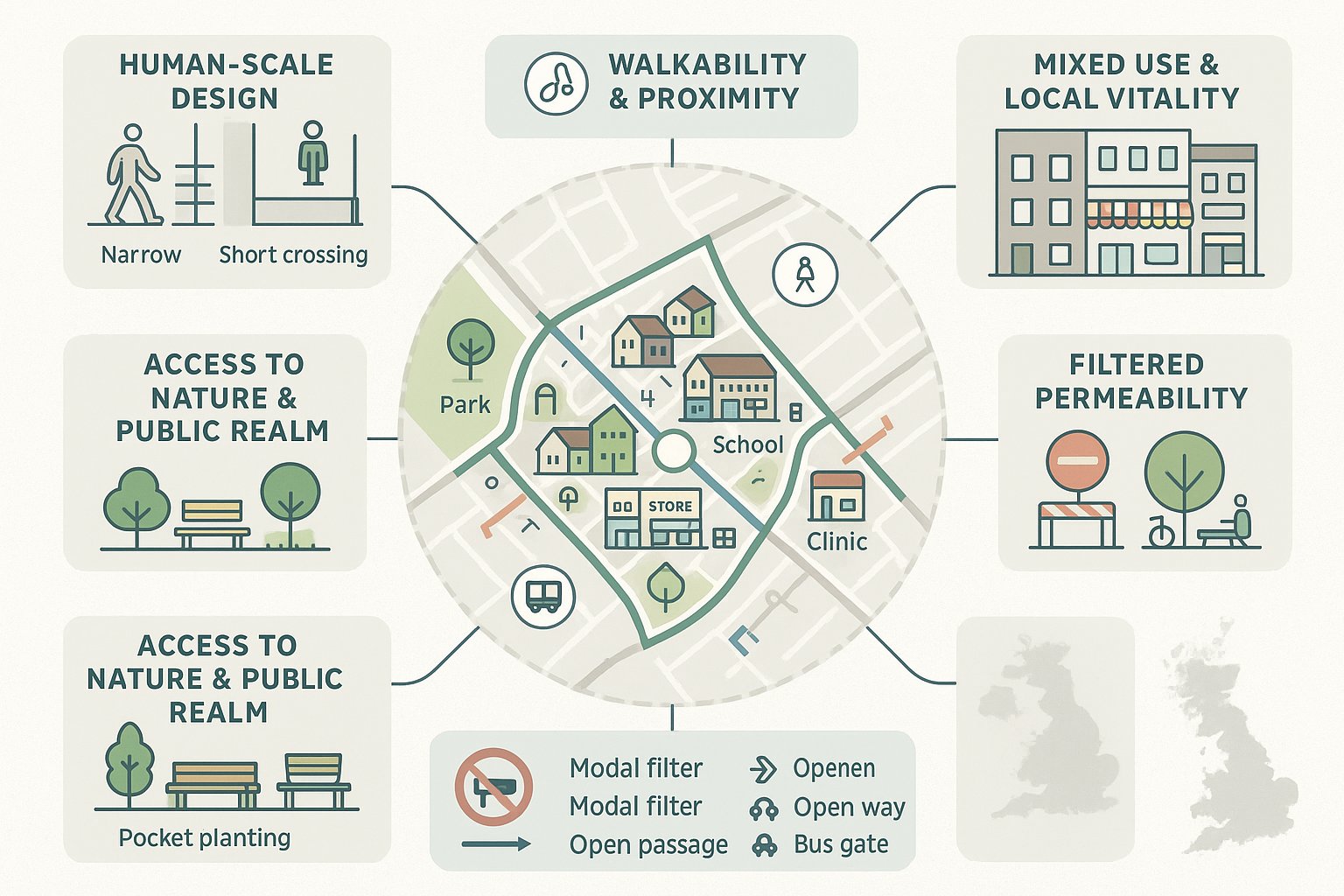
First, human-scale design. Streets should feel legible, safe and comfortable at walking speed, not only from behind a windscreen. That affects carriageway widths, crossing distances, boundary treatments, lighting and the treatment of junctions.
Second, walkability and proximity. A neighbourhood becomes more liveable when daily needs are within a reasonable walk or cycle: schools, small shops, parks, healthcare, bus stops and community facilities. This is where the wider conversation around 15-minute or 20-minute neighbourhoods overlaps with UK planning practice.
Third, mixed use and local vitality. Mono-functional estates often generate unnecessary trips and deaden street life. A better mix of homes, services and social infrastructure supports both convenience and resilience.
Fourth, access to nature and quality public realm. Trees, planting, seating, shade and pocket spaces are not decorative extras. They influence thermal comfort, drainage, wellbeing and whether people actually choose to spend time outdoors.
Finally, filtered permeability. People walking and cycling should often have more direct routes than through-drivers. That principle is central to changing behaviour without isolating communities.
Why Liveable Neighbourhoods Matter For Planning Outcomes
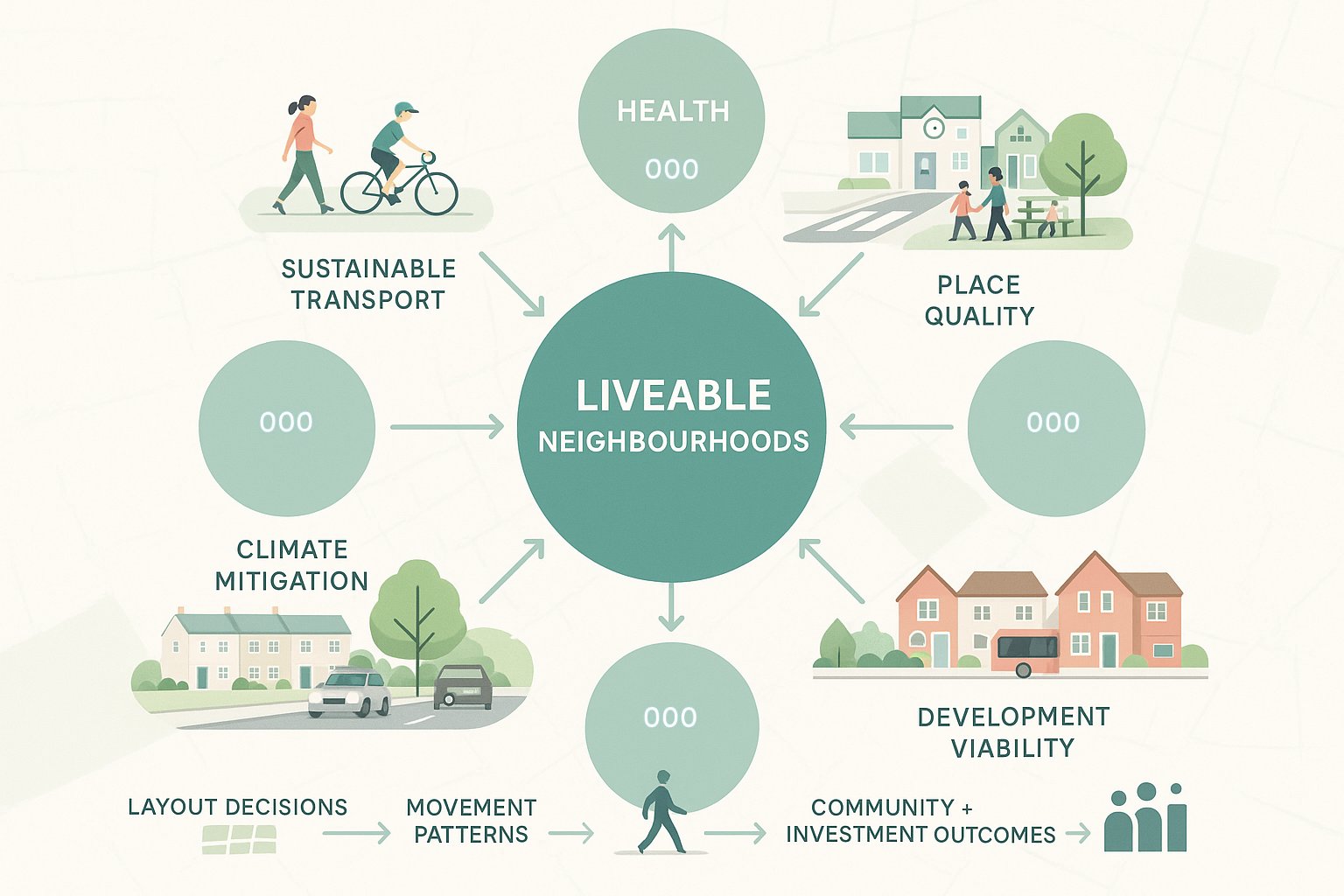
Liveable neighbourhoods matter because they help planning decisions resolve several objectives at the same time. That is rare. A well-designed scheme can support sustainable transport targets, improve place quality, contribute to climate mitigation, reduce road danger and strengthen the practical case for development in accessible locations.
For local plans and planning applications, that matters enormously. Authorities are under pressure to accommodate housing and regeneration while also reducing car dependency, cutting emissions and improving health outcomes. Traditional highway-led design often struggles to do all of that. It may move traffic efficiently, but not necessarily create places where people want to live or invest.
This is where liveable neighbourhoods planning is useful as a decision-making framework rather than a slogan. It gives weight to questions such as: will this layout encourage short trips on foot? Does the scheme improve access to schools and centres without generating avoidable traffic? Are public spaces safe and inclusive? Will growth overload residential streets, or can movement be managed more intelligently?
There is also a viability angle. Places that feel safer, quieter and better connected are generally easier to market, easier to justify in policy terms and more likely to win community support than schemes that appear to export traffic problems onto surrounding streets. Not always, of course. But often enough that developers and councils ignore liveability at their peril.
Transport, Health And Place Benefits
The evidence base behind liveable neighbourhoods is broader than many planning debates suggest. Transport effects are the obvious starting point: more walking, more cycling, lower traffic volumes on residential streets and reduced rat-running. Some UK schemes have reported significant reductions in motor traffic on internal roads, with shifts in route choice and mode share rather than simple displacement everywhere.
Then there are the health benefits, which are not abstract. Quieter streets tend to mean less noise exposure, cleaner local air, easier school journeys, more independent mobility for children, and better conditions for older people or disabled people who may be discouraged by hostile road environments. When we talk about prevention in public health, this is part of it.
Place benefits matter too. A street with slower traffic and better crossings becomes more than a corridor: it can support doorstep play, neighbour interaction, café spill-out, local shopping and a stronger sense of identity. That is hard to capture in a spreadsheet but easy to recognise on the ground.
From a planning perspective, the strongest argument is cumulative. Liveable neighbourhoods help align transport, urban design, climate and social outcomes rather than treating them as separate disciplines. That is why they are increasingly relevant not just to retrofit programmes, but to masterplanning, estate renewal and town-centre edge development.
The Policy Context For Liveable Neighbourhoods In The UK
The UK policy context has become increasingly supportive of liveable neighbourhoods, even where the terminology varies. National planning and transport policy now consistently points toward healthier streets, sustainable travel and reduced reliance on private car use for short trips.
At national level, the National Planning Policy Framework pushes development towards sustainable locations and expects schemes to give priority first to pedestrian and cycle movements, then to public transport, so far as possible. The wider transport decarbonisation agenda reinforces the same direction of travel. Put bluntly, proposals that depend on unconstrained car movement everywhere are becoming harder to defend.
In London, the direction is even clearer. The London Plan, TfL’s Healthy Streets Approach and the Liveable Neighbourhoods Programme all support growth patterns built around walking, cycling and public transport access. But this is not just a London issue. Councils across England increasingly use local transport plans, supplementary planning documents, design guides and area strategies to back low-traffic and liveability measures.
For applicants, the message is straightforward: liveable neighbourhood principles are no longer fringe policy aspirations. They are often embedded, directly or indirectly, in the documents that determine whether a scheme is considered acceptable.
National, Regional And Local Planning Considerations
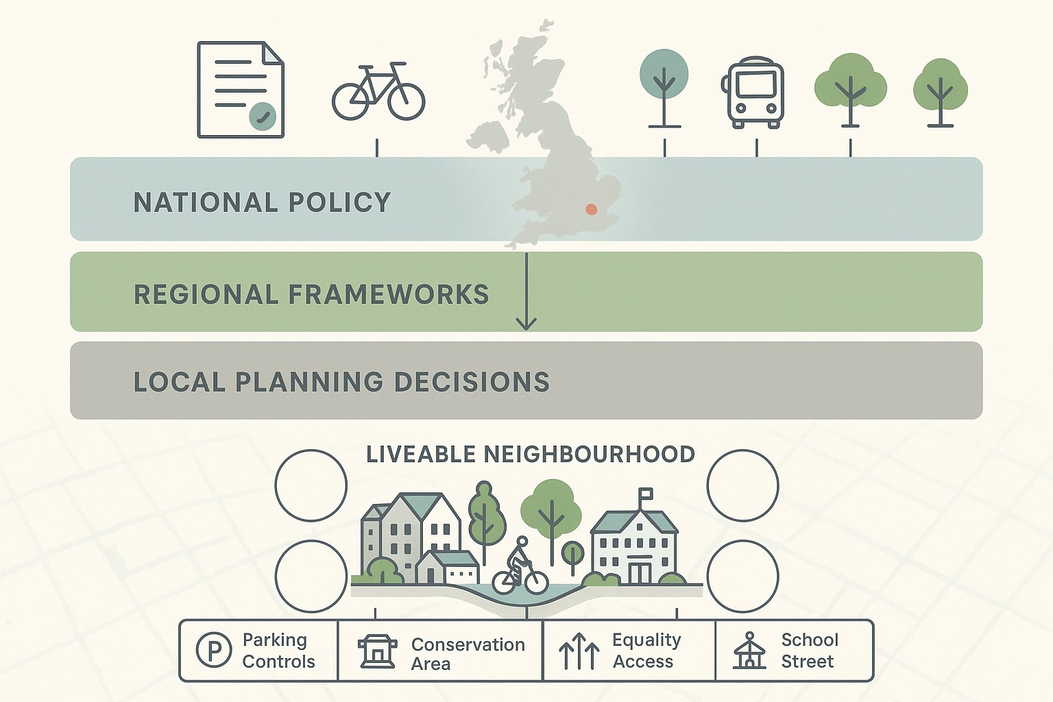
The practical challenge is that policy support does not remove the need for scheme-specific judgement. National policy may favour sustainable movement, but local authorities still need confidence that proposals will function operationally and equitably.
At national level, we usually need to show consistency with sustainable transport, safe access, good design and climate objectives. At regional level, especially in combined authority areas or London, there may be stronger expectations around mode shift, public transport integration, Healthy Streets indicators or corridor strategies. At local level, detail becomes everything: school street priorities, controlled parking zones, conservation considerations, freight routes, equality issues, or concerns about boundary roads.
This is why policy reading has to be more than a cut-and-paste exercise. A credible planning case will connect the scheme to the exact policy hooks that matter in that borough, district or county. If a council has adopted a liveable neighbourhood programme, cite it properly. If local design guidance supports filtered permeability, show how the layout delivers it. If there are known traffic sensitivity issues nearby, address them rather than hoping they are overlooked.
For transport consultants such as us at ML Traffic, that local tailoring is often the difference between a report that simply exists and one that actually helps determine an application.
Street Design And Movement Hierarchies That Support Liveability
Street design is where liveable neighbourhood ambitions either become real or quietly disappear. Plenty of schemes claim to prioritise people, then revert to geometry that tells everyone the car still comes first.
A movement hierarchy is the discipline that prevents that drift. In UK practice, the broad order is familiar: pedestrians and wheelchair users first, then cyclists, then public transport, then essential motor traffic. That does not mean cars are irrelevant. It means street design begins with the most space-efficient, inclusive and sustainable modes, not with maximum vehicle throughput.
Design responses flow from that choice. We may tighten junction radii to slow turning traffic, provide continuous footways across side roads, shorten crossing distances, remove surplus carriageway width, introduce modal filters, and create low-stress cycle links that feel usable by ordinary people, not just the confident few. On busier roads, segregation and crossing quality become critical. On quieter streets, filtered permeability may do more than expensive infrastructure.
Manual for Streets remains influential here, as do Healthy Streets principles. The key is to think in networks, not one-off interventions. A lovely raised table means little if the route still breaks down at the next junction or if the nearest school can only be reached via a hostile distributor road.
Prioritising Walking, Cycling, Public Transport And Essential Access
Priority in a liveable neighbourhood should be visible in both plan and operation. If walking is top of the hierarchy, footways need to be wide enough, continuous enough and protected enough to make that meaningful. If cycling is meant to grow, routes must be coherent, low-stress and connected to destinations rather than ending abruptly at the scheme boundary.
Public transport deserves the same seriousness. Bus priority, reliable stop access, direct walking routes to stations and reduced delay from neighbourhood traffic management can all improve the attractiveness of non-car travel. Sometimes a bus gate or filtered street delivers more public benefit than a general traffic lane ever could.
And yet, essential access still matters. Residents need to reach their homes. Disabled users may depend on door-to-door access. Servicing, refuse collection, maintenance and emergency response cannot be hand-waved away. Good liveable neighbourhood design does not deny that: it plans for it clearly.
Typical measures include exemption arrangements, controlled routes, strategically located loading, car-club bays, blue badge parking, EV provision and layouts that preserve access while deterring through-trips. The balance is delicate. If a scheme over-prioritises free vehicle movement, it loses its liveability gains. If it ignores practical access, it will struggle politically and operationally. The art lies in distinguishing necessary traffic from unnecessary traffic, then designing accordingly.
How To Assess Traffic And Access Impacts In Liveable Neighbourhood Schemes
Assessment is often where liveable neighbourhood proposals become contentious. Everyone asks the same basic question in different ways: if we change access or traffic patterns here, what happens somewhere else?
A robust answer needs more than a single traffic count. We typically assess baseline movement patterns, route choice, sensitive receptors, collision history, active travel conditions, servicing demands and emergency access constraints. Depending on scale, that may involve a Transport Assessment, junction capacity modelling, traffic redistribution analysis, queue observations, turning counts, parking stress surveys and site access reviews.
Crucially, the assessment scope should match the proposal. A simple filtered permeability intervention may not justify the same modelling depth as a large mixed-use masterplan, but neither should small schemes escape proper scrutiny if they affect strategic routes, bus reliability or town-centre servicing.
In liveable neighbourhoods planning, the framing of the assessment matters almost as much as the data. If we test only highway capacity, we can miss the actual scheme objectives. We also need to assess whether walking routes become safer, whether cycle permeability improves, whether school access is more attractive, and whether boundary roads experience manageable or material changes.
This is where concise, locally aware reporting helps. At ML Traffic, our approach is to align technical evidence to the authority’s thresholds and concerns rather than drowning the application in unnecessary modelling that answers the wrong question.
Common Planning Application Evidence And Technical Reporting
Most planning authorities will expect a package of documents rather than one catch-all report. The exact list varies, but common submissions for liveable neighbourhood or low-traffic schemes include:
- Transport Assessment or Transport Statement addressing trip patterns, access, redistribution and network effects
- Travel Plan setting out how mode shift will be supported over time
- Road Safety Audit or road safety review, particularly where geometry or priority changes are proposed
- Walking and cycling audits, Healthy Streets checks, or level of service assessments
- Parking surveys and parking management evidence where displacement is a concern
- Equalities Impact Assessment, especially where access changes may affect disabled users or protected groups
- Air quality and noise assessments where rerouting or traffic concentration could affect nearby receptors
- Swept path analysis for refuse, servicing and emergency vehicles
- Construction Logistics Plan and Servicing/Delivery Management Plan for larger or phased schemes
Good reporting does two things. It demonstrates technical competence, and it anticipates the committee questions before they are asked. That means being candid about trade-offs, not pretending every link will improve equally. Decision-makers tend to trust evidence that acknowledges pressure points and explains mitigation sensibly.
Balancing Resident Needs, Servicing And Emergency Access
This is the section many project teams leave too late, and it shows. But strong the vision, a liveable neighbourhood proposal can unravel quickly if residents believe they are being cut off, businesses fear lost servicing access, or emergency responders are not properly consulted.
The first principle is clarity. We should explain exactly what is changing: where vehicles can still go, where movements are restricted, what exemptions apply, and how deliveries, refuse and drop-off activity will operate. Ambiguity breeds opposition.
The second is to distinguish between access and through-movement. In most successful UK schemes, motor access is restricted, not abolished. Residents still reach homes. Blue badge users still need practical arrangements. Trades, carers and deliveries still need functional routes. The goal is to remove unnecessary traffic from residential streets, not to create a fortress.
Operationally, that can mean time-windowed loading, relocated loading bays, turning heads, permit controls, camera-enforced filters, collapsible bollards, emergency override access, or revised refuse strategies. Sometimes a small design change solves a large political problem.
Emergency access deserves early, documented liaison. Swept path checks, route testing and discussion with ambulance, fire and police representatives can identify concerns before they become objections. Not every service will agree on every detail, but a proposal that ignores response implications is asking for trouble.
The best schemes are realistic. They accept that neighbourhoods are lived-in systems, not diagrams. When resident needs, servicing and emergency access are taken seriously from the outset, liveability becomes easier to defend and far more likely to last.
Conclusion
In 2026, liveable neighbourhoods planning is no longer a side conversation in UK planning and transport. It is a practical way to deliver healthier streets, safer local movement, lower-carbon growth and better everyday places.
For architects, developers, councils and their advisers, the challenge is not whether the principle sounds attractive. It is whether the proposal is designed and evidenced well enough to work in the real world. That means grounding ambition in policy, applying a clear movement hierarchy, testing traffic and access impacts properly, and dealing honestly with servicing and emergency access.
When that is done well, liveable neighbourhoods stop being treated as anti-car experiments and start being recognised for what they are: disciplined, people-centred planning strategies that manage traffic, improve place quality and support sustainable development.
And that, really, is the opportunity. Not to make streets look nicer in drawings, but to make neighbourhoods function better for the people who actually use them.
Frequently Asked Questions on Liveable Neighbourhoods Planning
What does liveable neighbourhoods planning mean in the UK context?
It means designing local areas where streets prioritise people over through-traffic, managing movement to reduce unnecessary vehicles while ensuring essential access for residents, deliveries, and emergency services, thereby improving walkability, cycling, and public transport use.
What are the core principles that shape a liveable neighbourhood?
Core principles include human-scale design, walkability with daily needs nearby, mixed land uses to enhance local vitality, accessible quality public spaces with nature, and filtered permeability allowing more direct routes for pedestrians and cyclists than for through-drivers.
Why is liveable neighbourhoods planning important for planning outcomes?
It helps meet multiple objectives simultaneously, such as supporting sustainable transport, improving place quality, reducing emissions, enhancing health, and encouraging development that is compatible with low-car dependency and strong community support.
How do liveable neighbourhood schemes benefit transport, health, and local places?
They typically reduce motor traffic and rat-running, increase walking and cycling rates, improve air quality and noise levels, enhance road safety, support independent mobility, and foster vibrant local centres with safer, more pleasant streets.
How does UK policy support liveable neighbourhoods planning?
UK national and regional policies like the National Planning Policy Framework and the London Plan promote healthier streets, sustainable travel, and reduced car reliance. Local councils adopt supplementary plans and strategies explicitly endorsing liveable, low-traffic, walkable neighbourhood designs.
How are traffic and access impacts assessed in liveable neighbourhood planning applications?
Assessments include multi-modal transport analysis, junction modelling, walking and cycling audits, parking stress surveys, road safety reviews, and emergency access checks, all tailored to demonstrate how the scheme manages traffic rationally while improving safety and accessibility.