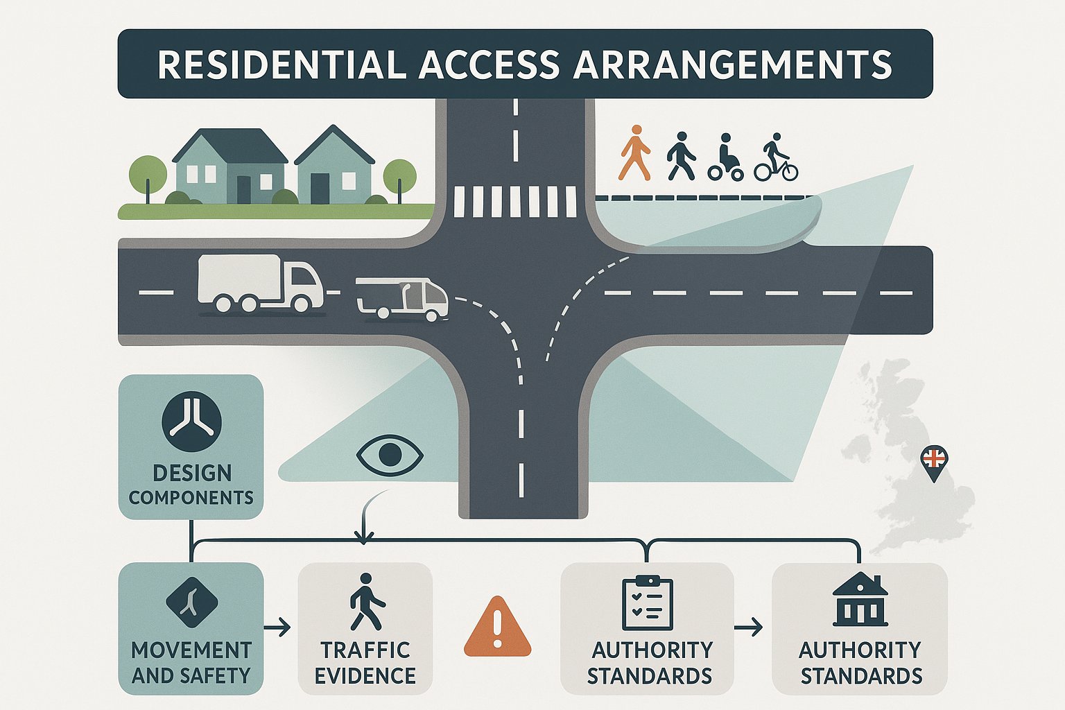
A residential scheme can look perfectly sensible on a layout plan and still run into trouble the moment a highway officer asks a simple question: “How does it actually work at the site entrance?” That’s where residential access arrangements move from being a drawing-note to a planning-critical issue. In practice, they shape whether vehicles can enter and leave safely, whether people can walk comfortably, whether visibility is adequate, and whether the local authority believes the development can operate without creating unreasonable risk or delay.
For architects, planners, developers and councils, access is rarely a box-ticking exercise. It sits at the intersection of design, highway safety, policy compliance and deliverability. A narrow frontage, an awkward bend, parked cars near the bellmouth, or a missed tracking issue can all derail an otherwise well-prepared application.
We see this regularly in planning work: the strongest access proposals are not always the most complicated, but they are the most clearly reasoned. They reflect local standards, respond to the surrounding highway network, and are supported by proportionate transport evidence. For projects moving through planning in 2026, that matters more than ever.
In this guide, we set out what residential access arrangements mean in planning and highway terms, the design components officers usually focus on, the standards worth checking early, and the common mistakes that slow applications down.
What Residential Access Arrangements Mean In Planning And Highway Terms
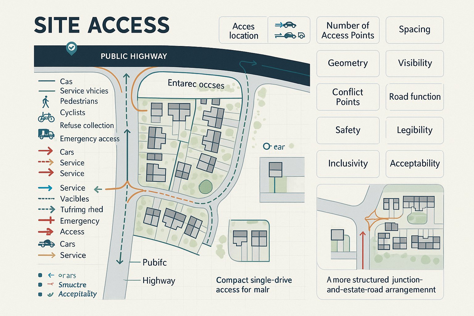
In planning and highway terms, residential access arrangements describe how a housing site connects to the public highway and how movement is organised once people enter the site. That includes the location, number, spacing and geometry of access points, together with internal routes for cars, service vehicles, pedestrians and, where relevant, cyclists.
This is broader than a dropped kerb or a simple driveway detail. Highway officers usually consider whether the arrangement preserves safety, avoids unnecessary conflict points, respects the function of the host road, and allows the development to operate in a predictable way. In other words, access is part of wider access management.
For smaller schemes, that may mean demonstrating that a single private drive can serve the site without poor visibility or awkward reversing. For larger developments, it often means designing a junction, estate road hierarchy, pedestrian links, refuse collection routes and emergency access in a coordinated way.
There is also a planning distinction worth keeping in mind: “access” is one of the recognised planning considerations in its own right, but the technical assessment usually sits across planning policy, highway design practice and transport evidence. So when we prepare or review access proposals, we are rarely asking only “Can a vehicle get in?” We are asking whether the whole arrangement is safe, legible, inclusive and acceptable to the local highway authority.
Why Access Arrangements Matter For Planning Approval, Safety, And Site Deliverability
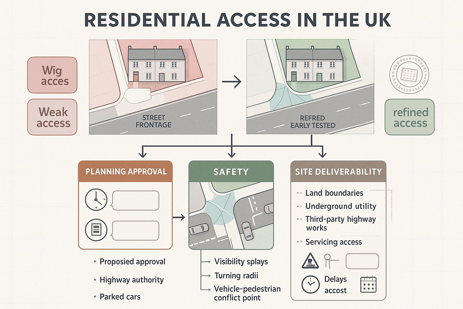
Access arrangements matter because they can determine whether a residential application is approved quickly, delayed for revisions, or refused outright. Planning officers and highway authorities typically want confidence that the proposed development will not create unacceptable impacts on highway safety or severe residual impacts on the road network. If the access is weak, that confidence disappears fast.
Safety is the obvious issue, but not the only one. Poorly designed access can reduce usable frontage, compromise parking layout, create conflict between pedestrians and vehicles, and make servicing difficult. On constrained sites, it can even reduce the achievable unit count. We have seen schemes where a small change to radii, visibility splays or footway continuity altered the entire development capacity.
Deliverability is just as important. A plan may secure consent in principle, but if the access cannot be built within land control, clashes with statutory undertakers’ equipment, or requires third-party highway works that have not been thought through, the programme slips. Lenders, purchasers and legal teams tend to notice those problems late, and expensively.
That is why access should be tested early, not patched in near submission. At ML Traffic, this is often where concise transport input adds the most value: identifying what the authority is likely to query before those issues harden into objections.
The Core Elements Of A Residential Access Design
A sound residential access design brings together geometry, visibility, movement hierarchy and operational practicality. The exact solution depends on scale, frontage constraints and local policy, but the principles are consistent: the access must be safe, readable and proportionate to the development it serves.
For planning purposes, officers usually want to see more than a red-line connection to the road. They want evidence that the proposed arrangement works for the likely users, can accommodate the expected vehicle types, and supports a coherent internal layout. That often means combining engineering design with planning judgement.
Vehicle Access, Junction Layout, And Visibility Requirements
Vehicle access starts with the relationship to the host highway. Is the site entering onto a quiet residential street, a classified road, or a route with frontage parking and constrained forward visibility? The answer affects almost everything: junction form, width, radii, visibility splays, stopping sight distance considerations, and whether intensification of use is likely to be acceptable.
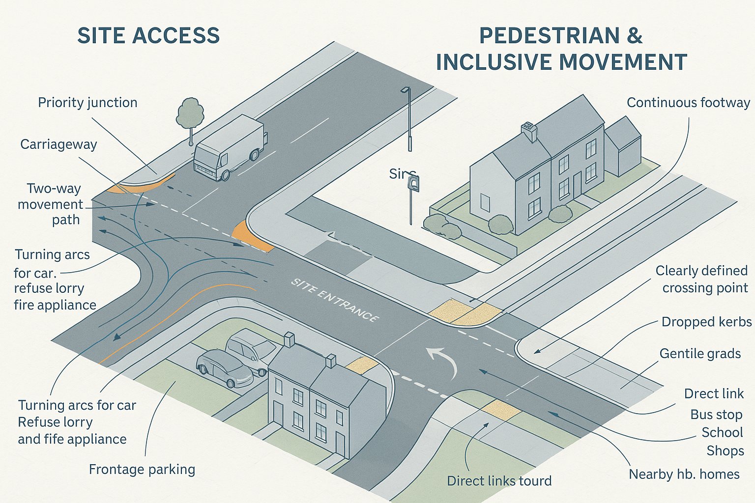
A standard priority access may suit many sites, but its geometry still needs to reflect tracking requirements and likely two-way movements. Authorities often expect visibility to be measured to recognised standards and shown clearly on plan, with confirmation that splays can be kept free of obstruction within land under control or highway land. That point is missed surprisingly often.
Refuse vehicles, fire appliances and occasional delivery vans also matter. If they cannot enter, turn and leave in a practical way, the access proposal may be challenged even where day-to-day car movements seem straightforward.
Pedestrian Routes, Crossing Points, And Inclusive Movement
Vehicle access is only half the picture. Residential sites also need legible pedestrian routes that connect naturally to surrounding footways, bus stops, schools, shops and other daily destinations. If people are forced into the carriageway or across undefined crossing points, the design is weaker, and the policy case usually is too.
Inclusive movement should be designed in from the start. That means thinking about dropped kerbs, tactile provision where appropriate, gradients, route widths, visibility between drivers and pedestrians, and whether wheelchair users or parents with prams can move through the site without awkward detours.
On many schemes, the quality of the pedestrian environment at the access point is what tips officer opinion. A wide bellmouth without footway priority can feel vehicle-led and hostile. A better design may tighten geometry, continue footway materiality or clearly define crossing movements, depending on the road context and local authority preferences.
In short, good access design is not just about allowing entry. It is about making arrival and movement safe for everyone who will actually use the place.
How Trip Generation And Traffic Impact Influence Access Proposals
Trip generation and traffic impact help answer a practical planning question: how much pressure will this access arrangement actually be under? A single dwelling replacing a house may not materially change access performance. A 20-unit infill scheme, or a larger edge-of-settlement development, is a different matter.
Trip rates are usually estimated using established evidence sources and professional judgement, then tested against the local road context. Authorities may focus on peak-hour arrivals and departures, likely turning patterns, queue interaction near nearby junctions, and whether the access sits on a route already affected by congestion, school traffic or on-street parking.
The point is not to overcomplicate every scheme. It is to show that the proposed access is proportionate to the level of use. If traffic flows are low, that can support a simple design approach. If flows are higher, more detailed justification may be needed, including junction capacity checks, swept path analysis or review of collision history.
Trip generation also influences internal design. More vehicle movements may justify wider sections, passing opportunities on longer drives, or clearer visitor parking strategy to prevent obstruction near the site entrance. And where sustainable travel opportunities are good, that should be reflected sensibly in the assessment rather than ignored.
Done well, traffic analysis does not make an access proposal look more complicated. It makes it look credible.
Key Standards, Guidance, And Local Authority Expectations To Check
The tricky part of residential access work is that there is rarely one document that answers everything. We usually need to cross-check national planning policy, local plan policies, highway design guides, and the development management requirements of the relevant authority.
At a national level, the familiar test remains whether there would be an unacceptable impact on highway safety or a severe impact on the road network. But that broad principle is only the starting point. Detailed design often relies on a mix of guidance such as Manual for Streets, Manual for Streets 2, local highway design guides, parking standards, refuse vehicle requirements, and visibility/stopping sight approaches accepted by the authority.
Local expectations can vary more than many applicants assume. Some councils are comfortable with shared private drives serving a limited number of dwellings: others become cautious quickly, especially where forward gear exit, pedestrian segregation or refuse collection are constrained. Some authorities place strong emphasis on bin drag distances and emergency access, while others scrutinise visibility land ownership first.
That is why an early authority-specific review is worth doing. Before fixing the site layout, check:
- the authority’s residential design guide and highway adoption standards:
- thresholds for a Transport Statement or Transport Assessment:
- parking and cycle parking standards:
- refuse, servicing and emergency access expectations:
- any local history of objections on the site or nearby junction.
Those checks rarely make headlines, but they save revisions.
Common Types Of Residential Access Arrangements
Most schemes fall into a handful of recurring access typologies, though each has its own design pressures. Understanding the typical form helps us frame what level of evidence and detail is likely to be needed at planning stage.
Priority Junctions, Shared Private Drives, And Estate Roads
For many small to medium-sized housing schemes, the starting point is a priority junction onto the existing highway. This may be a simple private access for a few dwellings or a more formal estate road entrance intended for potential adoption. The key differences usually relate to width, radii, pedestrian provision, and the expected frequency of two-way vehicle interaction.
Shared private drives can work well on compact sites, particularly for backland or minor infill development, but they need careful thought. Passing places, turning provision, refuse collection strategy and pedestrian safety can all become points of objection if the drive is long or intensively used. What looks efficient on paper can feel cramped in operation.
Estate roads bring another layer: hierarchy. The access point has to function not as an isolated entrance but as the first part of a wider internal movement network. That includes carriageway widths, turning heads or loop arrangements, visitor parking behaviour and how people walk through the site.
Access For Apartments, Infill Sites, And Larger Housing Schemes
Apartment schemes often concentrate movements into tighter urban frontages. Access may need to serve basement or podium parking, service bays, cycle stores and refuse collection points with very little spare space. In those cases, the interface with the public footway becomes critical.
Infill sites are often the most awkward. Existing boundaries, retained buildings, trees, level changes and neighbouring driveways can all squeeze the available geometry. A technically acceptable access can still look poor if it relies on excessive retaining structures, awkward reversing or weak pedestrian connections.
Larger housing schemes tend to raise strategic issues: whether more than one point of access is needed, whether emergency-only links are appropriate, how buses or service vehicles interact with the layout, and whether the access strategy supports phased delivery. On these sites, access is not a detail. It is part of the masterplanning logic.
Frequent Design Issues That Delay Or Jeopardise Applications
Some access problems are genuinely complex. Many, frankly, are avoidable. The most common issue we see is a layout being advanced too far before anyone has tested whether the frontage can deliver compliant visibility and workable geometry. Once parking courts, boundary treatments and unit positions are fixed, access revisions become painful.
Other frequent design issues include:
- visibility splays obstructed by third-party land, walls, vegetation or parked vehicles:
- insufficient tracking for refuse or emergency vehicles:
- substandard drive lengths or turning areas, leading to reversing onto the highway:
- pedestrian routes that disappear at the site entrance or conflict with vehicle overrun areas:
- overreliance on informal assumptions, such as “it’s a quiet road, so it will be fine”: and
- mismatch with local standards, especially on private drives, gradients and adoption expectations.
There is also a presentation problem. Sometimes a technically defensible scheme is delayed because the submitted plans do not explain the design clearly enough. Missing dimensions, unclear land ownership, absent swept paths or inconsistent drawing notes can trigger requests for further information that could have been avoided.
And then there is context. Access arrangements that ignore nearby schools, junctions, bus stops or parking stress often look under-analysed. Highway officers know their network. If a submission appears generic, confidence drops.
The fix is usually simple in principle: test early, draw clearly, and support the proposal with proportionate evidence.
What To Include In A Transport Statement Or Supporting Access Report
A good Transport Statement or access report should make the highway authority’s job easier. It should explain the proposal, show the access clearly, and answer the obvious technical questions before they are raised in consultation.
For most residential access arrangements, the report should cover:
- the site location and surrounding highway context:
- the existing access situation, where relevant:
- local planning and transport policy context:
- the proposed development quantum and land use:
- access geometry, visibility, pedestrian connections and internal circulation:
- trip generation and, where needed, distribution and traffic impact:
- swept path analysis for relevant vehicle types:
- parking, servicing, refuse and emergency access arrangements:
- personal injury collision review, if proportionate:
- sustainable travel context, including walking, cycling and public transport:
- a clear conclusion on highway safety and operational acceptability.
The strongest reports are concise but specific. They do not drown a small scheme in unnecessary modelling, and they do not try to wave away genuine constraints with vague language. If a compromise is being made, it should be identified and justified properly.
Plans matter as much as text. Visibility splays, dimensions, tracking and pedestrian routes should be easy to read and consistent across the drawing set. If the authority has scheme-specific validation requirements, follow them closely.
Where the project team needs quick, authority-aware input, that is often where specialist support helps most: translating access design into a planning-ready technical narrative that stands up to scrutiny.
Conclusion
In 2026, residential access arrangements remain one of the clearest tests of whether a housing proposal is ready for planning. They affect safety, policy compliance, layout efficiency, and the practical ability to build and occupy the site as intended.
The recurring lesson is simple: access works best when it is considered early and explained clearly. A scheme does not need an overengineered solution, but it does need one that responds to the host road, supports inclusive movement, accommodates the right vehicles and aligns with local authority expectations.
For architects, planners, developers and councils, that means treating access as part of the development strategy, not a last-minute drawing exercise. When the geometry, visibility, trip context and reporting all line up, applications move more smoothly, and the design itself is usually better for it.
If there is one worthwhile takeaway, it is this: the earlier we test access properly, the fewer planning surprises we create later.
Residential Access Arrangements – Frequently Asked Questions
What are residential access arrangements in planning terms?
Residential access arrangements describe how a housing site safely and efficiently connects to public highways, including the location, number, spacing, and design of access points as well as internal routes for vehicles, pedestrians, and cyclists.
Why do residential access arrangements matter for planning approval?
They are critical because they affect highway safety, site deliverability, and compliance with local standards. Poor access design can cause delays or refusal in planning applications due to safety concerns or operational difficulties.
How does trip generation influence residential access design?
Trip generation estimates vehicle movements from a development, helping to ensure that access designs are proportionate to use, assess traffic impact, and support safe internal circulation and parking strategies.
What are the key design elements for safe residential access?
Key elements include suitable junction geometry, adequate visibility splays, clear pedestrian routes with inclusive features, and accommodation for refuse, emergency, and service vehicles to ensure safe and practical site operation.
How can developers avoid delays caused by residential access issues?
By testing access arrangements early against local authority standards, ensuring clear design and evidence of visibility and vehicle tracking, and properly addressing pedestrian safety and trip impacts before submission.
What types of residential access arrangements are commonly used?
Common types include priority junctions, shared private drives, and estate roads, each with different design requirements based on site scale, expected traffic, and local highway policies.