If you’re pursuing planning approval for a new development, whether it’s residential, commercial or mixed‑use, you’ll quickly encounter the demands of transportation engineering and planning. Architects, developers, planners and local authorities all need to be confident that a scheme delivers safe access, manages traffic impacts and promotes sustainable travel. The challenge is translating technical highway concerns into reports that satisfy both statutory tests and local policy thresholds. In 2026 the discipline continues to evolve, blending traditional junction design with real-time modelling and active-travel priorities. This guide unpacks what transportation engineering and planning actually involves, the core principles behind a robust transport assessment, and how the right expertise keeps your project moving forward.
Key Takeaways
- Transportation engineering and planning ensures new developments integrate safely with transport networks whilst managing traffic impacts and promoting sustainable travel modes.
- Transport assessments must follow a modal hierarchy prioritising walking, cycling and public transport over private-car travel, supported by evidence-based modelling and GIS visualisations.
- Highway safety and access design requires detailed attention to visibility splays, vulnerable-user provision, junction selection and independent road safety audits before construction commences.
- Traffic impact analysis uses specialist software such as VISSIM or ARCADY to simulate queuing and network performance, with results compared against local authority thresholds to identify proportionate mitigation.
- Early engagement with local planning and highway authorities through pre-application meetings clarifies policy expectations, design standards and modelling methodologies, reducing delays and late-stage objections.
- Experienced transportation engineering consultants balance competing pressures—developer density aspirations, authority network performance concerns and community safety expectations—throughout the planning and consent process.
What Is Transportation Engineering and Planning?
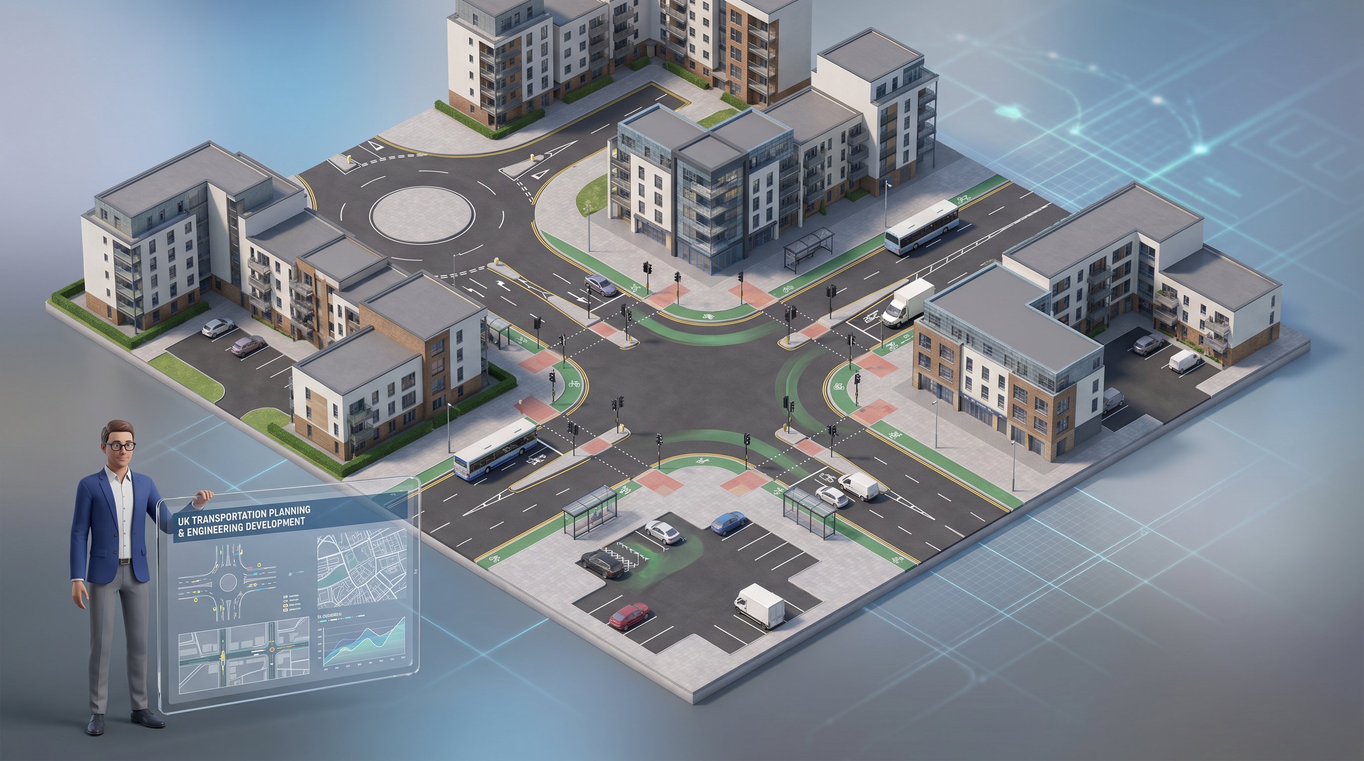
Transportation engineering and planning is a branch of civil engineering focused on the planning, design, operation and management of transport systems to move people and goods safely, efficiently and sustainably. It spans highways, streets, public transport networks, rail corridors, airports and the associated control systems, including traffic signals, signage and intelligent transport systems (ITS).
Practitioners gather and analyse travel data, run simulation models, and use geographic information systems to understand existing conditions and forecast future demand. They collaborate closely with urban planners, environmental consultants and local highway authorities to shape land-use strategies that support economic growth without sacrificing safety or environmental quality. At the development scale, the discipline ensures that new schemes integrate smoothly with surrounding infrastructure, deliver appropriate access for all users, including pedestrians, cyclists and public-transport patrons, and mitigate any adverse impacts on network capacity or road safety. In short, highway and traffic engineering consultants translate policy goals and physical constraints into workable designs and evidence-based assessments.
Core Principles of Transport Assessment for Planning Applications
A transport assessment (TA) or transport statement underpins most planning applications that generate significant trip volumes. The core principles that frame a TA include demonstrating safe and suitable access for all users, quantifying trip generation and mode split, assessing impacts on network capacity, promoting sustainable travel modes, and proposing proportionate mitigation where residual impacts remain significant.
The starting point is characterising baseline conditions, traffic flows, accident records, pedestrian and cycle provision, public-transport accessibility, and establishing future scenarios with and without the development. Trip rates are typically drawn from industry databases or bespoke surveys, then distributed across the network according to census journey-to-work patterns or routing algorithms. Capacity assessments use recognised junction-modelling software and compare metrics such as queue length, delay and degree of saturation against local thresholds.
Equally important is the modal hierarchy: walking, cycling and public transport sit at the top, with private-car travel accommodated only where necessary. TAs must show how a scheme reduces car dependency through layout, parking restraint, travel-plan measures and improved connectivity to existing active-travel networks. Many transport planning consultants now embed GIS mapping and interactive visualisations to communicate these principles clearly to non-technical stakeholders. The ultimate test is whether the proposal aligns with national planning policy, local transport strategy and design guidance, an evidence-based demonstration that the development can be safely and sustainably accommodated.
How Transportation Engineers Support Development Schemes
Transportation engineers bring the blend of technical rigour and pragmatic judgement needed to navigate the planning process. Their work begins early, often at the feasibility or pre-application stage, when they advise on site access options, parking provision and whether a full transport assessment will be required. They then prepare the formal submission documents, transport assessments, travel plans, construction-management plans and design drawings, that accompany a planning application.
Once an application is validated, engineers liaise with local highway and planning officers, responding to consultation comments and refining designs or mitigation proposals. If an objection arises or the scheme goes to appeal, they provide expert evidence at hearings or public inquiries, defending their methodologies and demonstrating compliance with policy tests. Throughout, they balance competing pressures: developer aspirations for maximum density, authority concerns about network performance, and community expectations around safety and environmental impact. Firms with end to end transport planning capabilities can manage every stage from scoping through to discharge of planning conditions, ensuring consistency and responsiveness.
Highway Safety and Access Design
Highway safety and access design sit at the heart of any development proposal. Engineers must select an appropriate junction form, priority, roundabout, signalised or grade-separated, based on forecast flows, collision history and site constraints. Visibility splays are calculated according to design-speed standards, ensuring that drivers exiting the site have adequate sight lines. Geometry is checked against manual-for-streets principles or highway-authority design guides, with particular attention to swept paths for refuse vehicles, emergency tenders and delivery lorries.
Provision for vulnerable users is non-negotiable. Footways must be wide enough and continuous, with tactile paving and dropped kerbs at crossing points. Cycle infrastructure, whether segregated lanes, shared paths or advanced stop lines, should connect to the wider network and follow latest design standards. Bus-stop locations, shelter provision and real-time information displays all feature in schemes that prioritise public transport. Before construction, the detailed design undergoes a road safety audit, an independent review that identifies potential hazards and recommends remedial measures. Only when the audit is closed out, and any residual risks accepted by the highway authority, can works proceed.
Traffic Impact Analysis and Modelling
Traffic impact analysis quantifies how a development will alter travel patterns and network performance. Engineers start by estimating trip generation, the number of vehicle, pedestrian and cycle movements entering and leaving the site during peak periods. These trips are then distributed across the surrounding road network using origin-destination matrices, gravity models or observed routing from comparable sites.
The distributed flows feed into junction models, PICADY, ARCADY, LinSig or specialist microsimulation packages such as VISSIM or Aimsun, that simulate queuing, delay and throughput under different scenarios. Engineers test a range of future years and sensitivity cases, accounting for committed development, planned infrastructure schemes and variations in trip rates. Performance metrics, mean maximum queue, degree of saturation, level of service, are compared against local thresholds or industry benchmarks. Where thresholds are breached, mitigation options are explored: signal retiming, additional lanes, banned turns or off-site highway improvements. The modelling output becomes the evidential backbone of the transport assessment, demonstrating that impacts are acceptable or can be made acceptable through proportionate intervention. Transparent documentation of assumptions, input data and model validation is essential: highway authorities rightly scrutinise methodologies, and any opacity invites challenge.
Working With Local Authority Thresholds and Requirements
Every local planning and highway authority publishes its own suite of policies, thresholds and technical notes that define when a transport assessment is required and what it must contain. Thresholds are typically expressed as trip-generation rates, for instance, any development forecast to generate more than 30 two-way vehicle movements in a peak hour may trigger a full TA, while smaller schemes need only a transport statement or basic access drawing.
Beyond trip thresholds, authorities set standards for car and cycle parking, electric-vehicle charging points, servicing and refuse arrangements. Some districts adopt blanket maxima to discourage car use: others differentiate by location, applying lower ratios in town centres with good public-transport accessibility. Design expectations also vary: one authority may insist on Manual for Streets compliance, another on its own highway-design guide with stricter geometry or materials specifications.
Successful highway engineering consultants maintain up-to-date knowledge of these local nuances, tailoring each assessment to the relevant policy framework and pre-empting objections. Early engagement, through pre-application meetings or scoping notes, clarifies expectations, identifies sensitive junctions or routes, and agrees modelling methodologies before significant resources are committed. This collaborative approach reduces the risk of late-stage surprises and keeps the planning timetable on track. It also demonstrates professionalism and good faith, building the trust that speeds negotiation when mitigation measures or planning conditions need to be finalised.
Conclusion
Transportation engineering and planning underpins safe, efficient and sustainable development, ensuring that new schemes integrate with transport networks, manage impacts and support wider planning and environmental objectives. Whether you’re an architect shaping site layouts, a developer navigating authority thresholds, or a planner balancing competing policy tests, the technical rigour and local insight of experienced engineers remain indispensable in 2026’s evolving regulatory landscape.
Frequently Asked Questions
What is transportation engineering and planning?
Transportation engineering and planning is a branch of civil engineering focused on the planning, design, operation and management of transport systems to move people and goods safely, efficiently and sustainably. It encompasses highways, streets, public transport networks, rail corridors, airports and associated control systems, including traffic signals and intelligent transport systems (ITS).
Why is a transport assessment required for planning applications?
A transport assessment demonstrates that a development delivers safe access, manages traffic impacts and promotes sustainable travel. It quantifies trip generation, tests network capacity against local thresholds, and proposes mitigation where residual impacts remain significant, satisfying both statutory tests and local policy requirements.
What are the core principles of transport assessment?
Core principles include demonstrating safe and suitable access for all users, quantifying trip generation and mode split, assessing impacts on network capacity, promoting sustainable travel modes (walking, cycling and public transport), and proposing proportionate mitigation where impacts are significant.
How do transportation engineers support development schemes?
Transportation engineers prepare transport assessments, travel plans and design drawings; model network impacts; propose mitigation measures; liaise with local authorities; and provide expert evidence at planning appeals. They work from feasibility through to discharge of planning conditions, balancing developer aspirations with authority concerns and community expectations.
What role does traffic modelling play in development proposals?
Traffic modelling quantifies trip generation and distribution across the road network, simulating queuing, delay and throughput using software such as VISSIM or Aimsun. Engineers test multiple future scenarios and compare performance metrics against local thresholds, using results to demonstrate acceptability or justify mitigation measures.
Why do local authorities have different transport assessment thresholds?
Local authorities publish their own policies, thresholds and technical guidance based on local conditions, network capacity and planning priorities. Thresholds typically relate to trip-generation rates or development scale; authorities also set standards for parking, electric-vehicle charging and design compliance to manage local impacts proportionately.