Urban transport networks are under pressure. More vehicles, more people, and more complexity mean traditional traffic management simply can’t keep up. That’s where intelligent traffic systems (ITS) come in, technology-enabled networks that use sensors, real-time data and automated controls to move traffic more efficiently, safely and sustainably. In 2026, ITS isn’t just a nice-to-have: it’s becoming essential infrastructure for cities that want to cut congestion, reduce emissions and support smarter growth. For planners, developers and local authorities, understanding how ITS works, and how to integrate it into transport assessments, is critical.
Key Takeaways
- Intelligent traffic systems use real-time sensors, data and AI to manage traffic dynamically, reducing congestion and emissions more effectively than traditional static infrastructure.
- Adaptive traffic signals, vehicle-to-infrastructure communication and incident detection systems enable proactive traffic management that responds within seconds to changing conditions.
- ITS strengthens transport assessments by providing accurate baseline data and predictive modelling, allowing planners to test mitigation strategies digitally before development.
- Safety improvements include faster crash detection, wrong-way alerts, pedestrian detection systems and emergency vehicle pre-emption that protect vulnerable road users in urban environments.
- Smoother traffic flow from intelligent traffic systems reduces stop-start driving, lowering fuel consumption, emissions and vehicle wear whilst supporting cities’ net-zero and air quality targets.
- Local authorities increasingly expect developments to demonstrate how intelligent traffic systems can integrate into transport assessments, making smart infrastructure engagement essential for planning applications.
What Are Intelligent Traffic Systems?
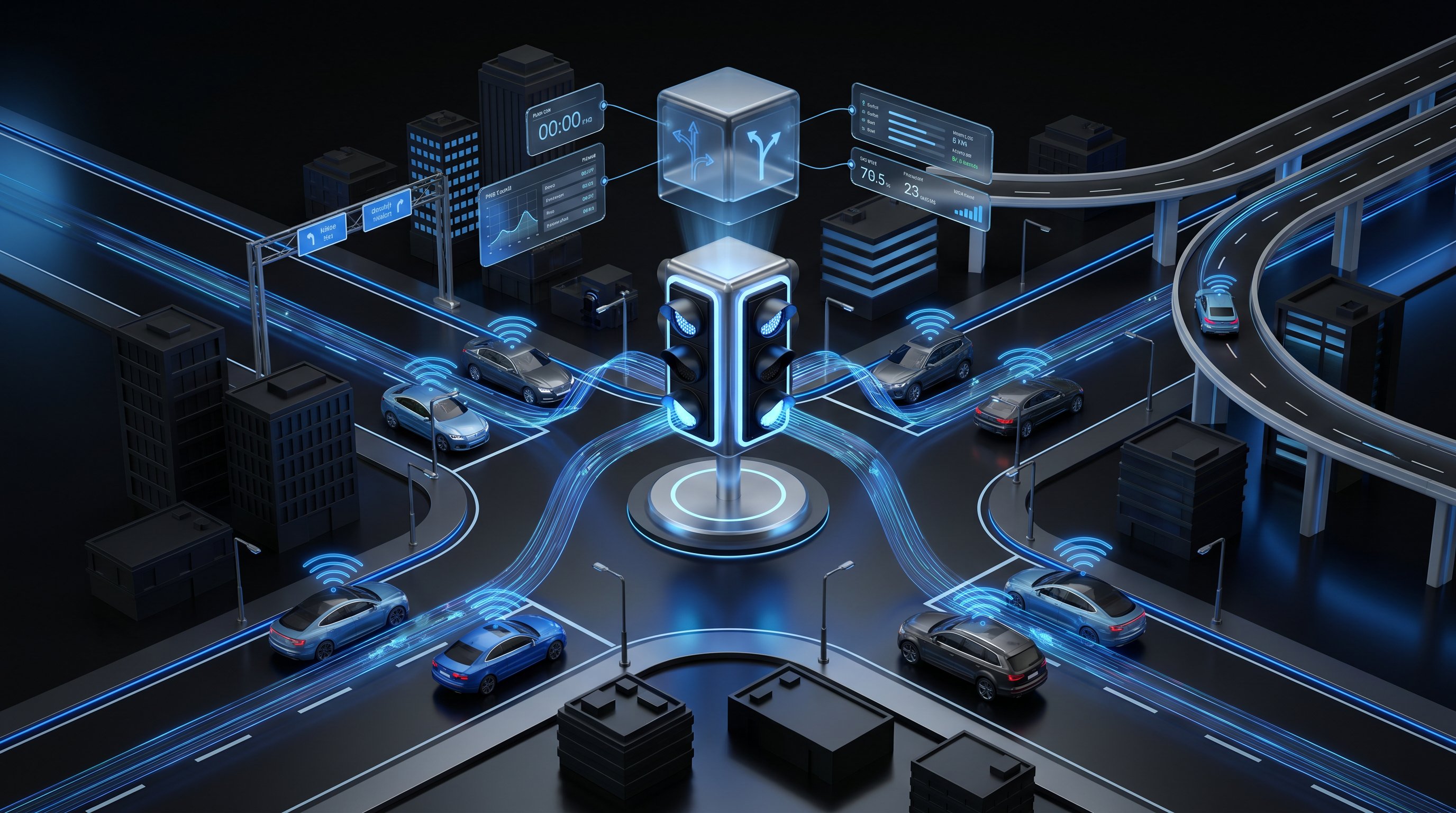
Intelligent traffic systems are transport networks equipped with technology that enables real-time communication, monitoring and control. Unlike static infrastructure, ITS brings together roads, vehicles and users through constant data exchange. The goal is simple: manage traffic dynamically rather than passively.
ITS applications include adaptive traffic signals that adjust timing based on live traffic volumes, connected vehicle communications that allow cars to ‘talk’ to infrastructure and each other, incident detection systems that alert operators the moment something goes wrong, and route guidance that steers drivers away from delays. These aren’t futuristic concepts, they’re already deployed across cities worldwide.
What sets ITS apart is its ability to respond. Rather than relying on fixed signal timings or scheduled maintenance, these systems adapt continuously. If congestion builds in one corridor, signals can be adjusted in real-time. If a crash occurs, warnings can be sent to approaching vehicles before drivers even see the queue. This shift from reactive to proactive management is the core value proposition for urban planners and transport engineers.
Core Technologies Powering Intelligent Traffic Systems
ITS relies on a stack of interconnected technologies, each playing a distinct role in how traffic is monitored, analysed and controlled.
Sensors and cameras form the eyes of the network. Induction loops embedded in road surfaces, radar sensors mounted on poles, and cameras with computer vision capabilities monitor vehicle speeds, flow rates, queue lengths and even road surface conditions. This data feeds into central systems that build a real-time picture of what’s happening across the network.
IoT (Internet of Things) and connectivity are the nervous system. Wireless networks enable live data transmission between vehicles and infrastructure, often referred to as V2V (vehicle-to-vehicle), V2I (vehicle-to-infrastructure) and V2X (vehicle-to-everything). This connectivity allows traffic signals to communicate with buses for priority, or warns drivers about hazards ahead before they’re visible.
AI and analytics turn raw data into decisions. Machine learning models can predict congestion before it forms, detect incidents within seconds, and optimise signal timing dynamically. Algorithms can also suggest better signal coordination across entire corridors or networks.
Big data and cloud systems provide the muscle. With thousands of data points generated every second, cloud platforms handle storage, processing and visualisation. They allow traffic managers to review historical patterns, test scenarios and make evidence-based decisions at scale. Together, these technologies enable a level of responsiveness and precision that wasn’t possible even a decade ago.
Benefits of Intelligent Traffic Systems for Urban Planning
For architects, planners and developers, ITS offers more than operational improvements, it provides better data and more flexible design options. Real-time and predictive datasets strengthen transport assessments by offering granular insights into peak flows, journey times and network behaviour under different conditions.
ITS also shifts planning from reactive to proactive. Instead of waiting for congestion to become unbearable before widening a road, planners can use predictive models to identify where bottlenecks are likely to form and test mitigation strategies digitally. Corridor prioritisation, signal timing reviews and network management strategies can all be informed by live data rather than outdated surveys.
For local authorities reviewing planning applications, ITS data adds rigour. Baseline traffic conditions can be measured with higher accuracy, and the impact of new developments can be forecast with greater confidence. Mitigation measures, such as adaptive signal installations or incident management protocols, become easier to specify and justify.
Reducing Congestion and Improving Traffic Flow
One of the most visible benefits of ITS is its ability to smooth traffic flow. Adaptive traffic lights adjust green and red phases based on real-time demand, reducing unnecessary stops and cutting delays. Queue warning systems alert drivers to slow-moving or stopped traffic ahead, helping prevent secondary crashes and reducing the ripple effect of congestion.
Dynamic route guidance, delivered via apps or variable message signs, steers drivers towards less congested routes. This doesn’t just save time, it also balances demand across the network. Connected systems can support transit signal priority, giving buses a green light when they’re running late, and emergency vehicle pre-emption, which clears intersections for ambulances or fire engines. These interventions, when combined, can significantly improve travel times and network reliability.
Enhancing Safety and Environmental Outcomes
Safety is another major win. ITS can detect crashes faster than manual reporting, triggering automatic alerts to emergency services and traffic management centres. Wrong-way detection systems can warn drivers who’ve entered a carriageway in the wrong direction, while school-zone alerts can slow traffic automatically during drop-off and pick-up times.
Vulnerable road users, pedestrians, cyclists, mobility aid users, benefit from pedestrian detection systems that extend crossing times or trigger warnings to drivers. These technologies are especially valuable in urban environments where mixed-use streets are common.
On the environmental side, ITS reduces stop-start driving, which is a major source of fuel consumption and emissions. Smoother traffic flow means less idling, less braking, and less wear on vehicles. By optimising routes and reducing unnecessary travel, ITS can also lower overall vehicle kilometres travelled. For cities targeting net-zero or air quality improvements, this makes ITS a practical tool in the sustainability toolkit. Many developments now include swept path analysis alongside ITS planning to ensure both vehicle manoeuvrability and network efficiency.
Planning Applications and Transport Assessments: Integrating Intelligent Traffic Systems
When preparing transport assessments for planning applications, ITS data can strengthen every stage of the process. Baseline analysis benefits from granular, real-time traffic counts and journey time data, offering a more accurate picture than traditional manual surveys. This is especially useful in corridors where flow patterns are variable or where seasonal or event-based peaks are relevant.
Forecasting impacts becomes more robust when ITS models are used to simulate how a proposed development will interact with the existing network. Planners can test different access arrangements, signal timings and mitigation strategies digitally before a single metre of tarmac is laid.
Mitigation measures can also be more targeted. Instead of generic recommendations, transport assessments can propose specific ITS interventions, adaptive signal installations at key junctions, incident detection systems along access routes, or speed control measures linked to school zones or pedestrian crossings. These measures are not only more effective but also easier to monitor and adjust post-occupation.
For urban planning more broadly, ITS supports road safety audits by highlighting high-risk locations, informs corridor studies with live data on bottlenecks and delays, and enables parking management strategies that reduce circling and improve turnover. Multimodal network planning also benefits, as ITS data can reveal where bus lanes, cycle routes or pedestrian crossings would have the greatest impact.
Local authorities increasingly expect transport assessments to engage with ITS where relevant, particularly for large or sensitive sites. Demonstrating an understanding of how smart infrastructure can support development proposals shows foresight and adds credibility.
Conclusion
Intelligent traffic systems are reshaping how cities manage mobility. By combining real-time monitoring, automated control and predictive analytics, ITS makes transport networks more efficient, safer and more responsive. For planners, developers and local authorities, the challenge isn’t whether to engage with ITS, it’s how to integrate it thoughtfully into transport assessments and design strategies that deliver lasting benefits.
Frequently Asked Questions About Intelligent Traffic Systems
What is an intelligent traffic system and how does it work?
An intelligent traffic system (ITS) is a technology-enabled network that uses sensors, real-time data and automated controls to manage traffic more efficiently and safely. ITS continuously monitors vehicle flow through cameras and induction loops, communicates via IoT connectivity, and uses AI to optimise signal timing and predict congestion dynamically rather than relying on fixed schedules.
How can intelligent traffic systems reduce congestion in cities?
ITS reduces congestion through adaptive traffic signals that adjust in real-time, queue warning systems that alert drivers to slow traffic, and dynamic route guidance that steers vehicles toward less congested routes. These systems balance demand across networks, support transit signal priority for buses, and can reduce unnecessary stops, significantly improving travel times and network reliability.
What core technologies power intelligent traffic systems?
ITS relies on sensors and cameras for monitoring, IoT and V2V/V2I/V2X connectivity for live data transmission between vehicles and infrastructure, AI and machine learning for predicting congestion and optimising signals, and cloud systems for processing thousands of data points. Together, these create a responsive network that detects incidents within seconds and adjusts operations continuously.
Why are intelligent traffic systems important for urban planning and transport assessments?
ITS provides planners with real-time and predictive data that strengthen transport assessments by offering granular insights into traffic flow and network behaviour. This enables evidence-based decision-making on corridor prioritisation, mitigation strategies and development impacts, allowing authorities to test scenarios digitally before implementation and move from reactive to proactive planning approaches.
How do intelligent traffic systems improve road safety and environmental outcomes?
ITS enhances safety through faster crash detection, wrong-way warnings, school-zone alerts and pedestrian detection systems that protect vulnerable road users. Environmentally, ITS reduces stop-start driving, idling and fuel consumption, lowering vehicle emissions and wear. By optimising routes and reducing unnecessary travel, it supports cities targeting net-zero and air quality improvements.
Can intelligent traffic systems be integrated into new development planning applications?
Yes. ITS data strengthens planning applications by providing accurate baseline traffic analysis, forecasting development impacts through digital simulation, and enabling targeted mitigation measures such as adaptive signals or incident detection systems. When combined with swept path analysis, ITS ensures both vehicle manoeuvrability and network efficiency, demonstrating foresight to local authorities.