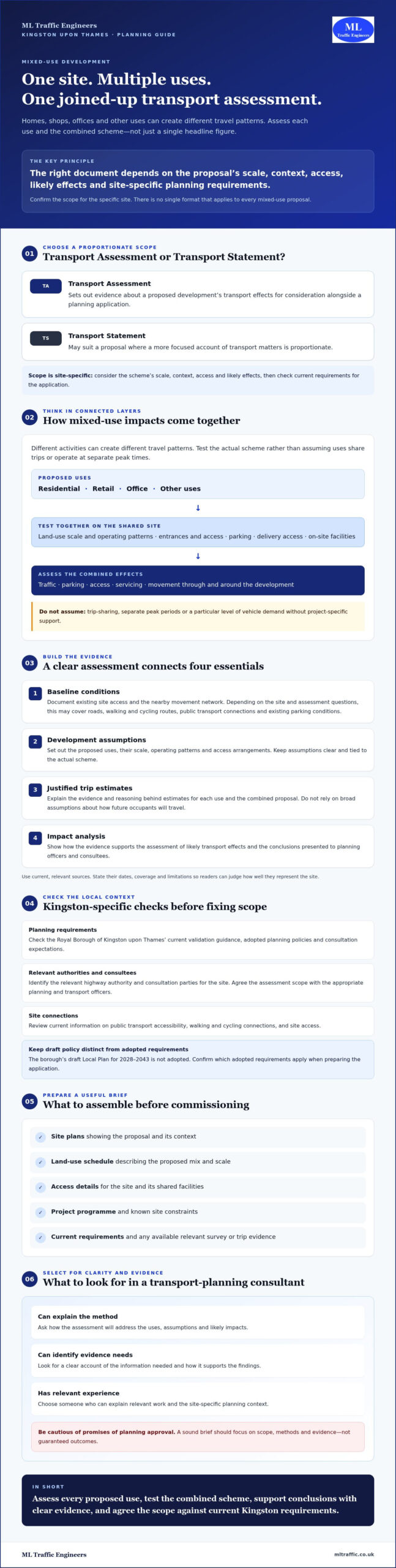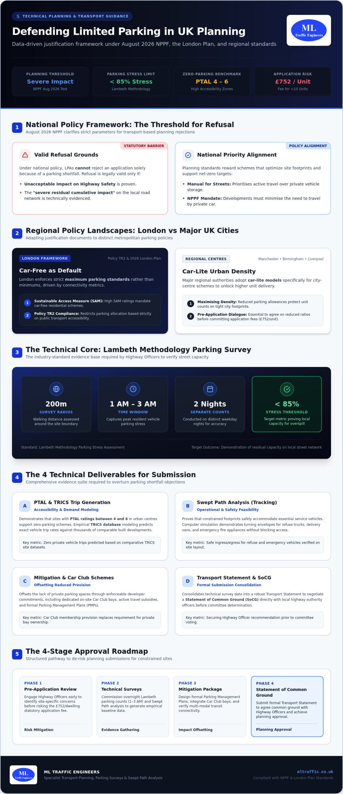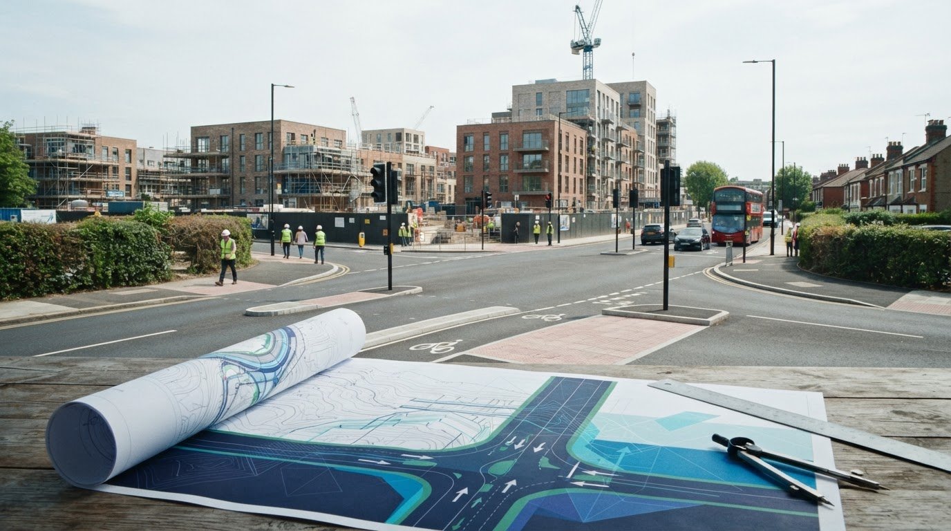
Author: adminmltuk

  • Swept Path Analysis for Loading Bays: A UK Developer’s Guide

    Swept Path Analysis for Loading Bays: A UK Developer’s Guide

    What if a loading bay fits neatly on the plan but a delivery vehicle can’t reach it without crossing a pedestrian route or striking an obstruction? Swept path analysis for loading bays tests whether vehicles can enter, manoeuvre into position and leave within the proposed layout. The result depends on one crucial choice: modelling a vehicle that reflects the site’s actual operations.

    It’s understandable to want certainty early. A design based on an unsuitable or undersized vehicle can conceal access problems until later reviews, when changing the layout may be more difficult. The assessment also needs clear drawings and agreed assumptions, so the results answer the right operational question instead of simply showing a vehicle moving across a plan.

    This guide explains how vehicle tracking can help test a loading-bay layout, how to choose a suitable design vehicle and what information to provide when commissioning an assessment. It also explains what the analysis can show, and where its limits lie, giving developers a practical framework for reviewing access and manoeuvring before design decisions are fixed.

    Key Takeaways

    • Check whether the vehicle can complete the full arrival, positioning and departure sequence, not just reach the site entrance.
    • Choose a design vehicle that reflects the site’s expected operations. One vehicle type won’t suit every loading bay.
    • Use consistent vehicle and manoeuvre assumptions to compare layout options and identify fixed constraints.
    • For useful swept path analysis for loading bays, prepare clear operational requirements and current site drawings before commissioning.
    • An independent assessment can help the project team review vehicle access and manoeuvring, but it doesn’t guarantee planning approval or compliance.

    Why swept path analysis matters for a loading bay

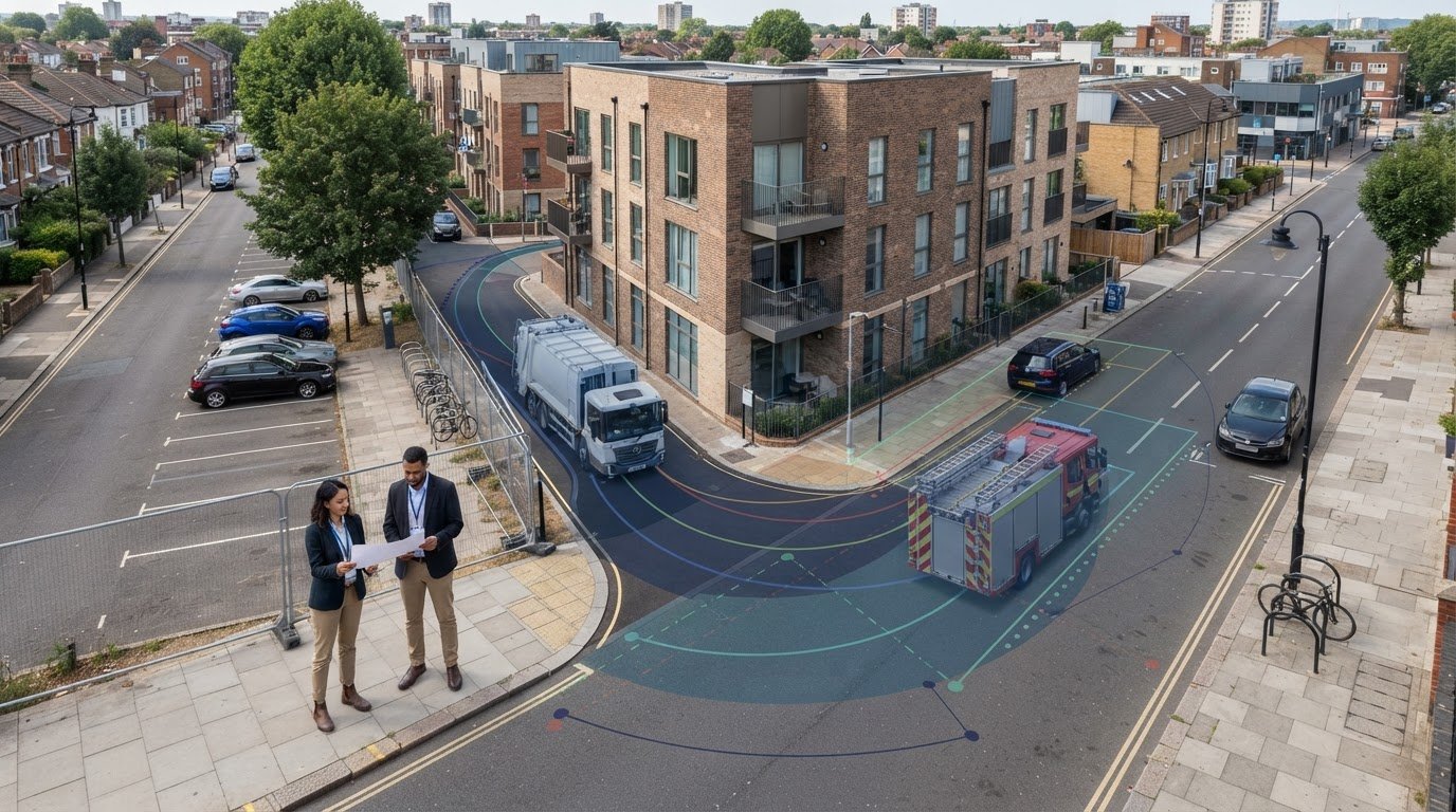
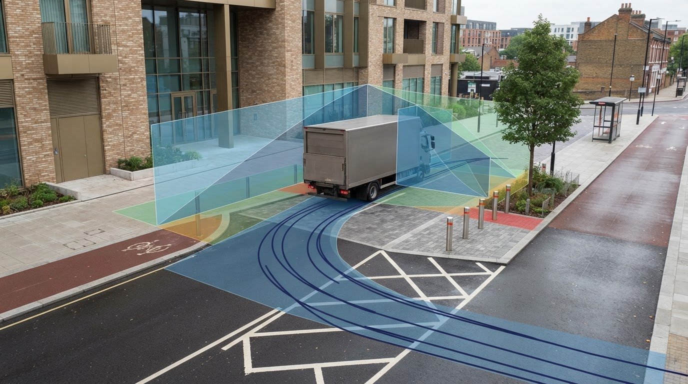
    A vehicle may be able to reach a site entrance but still be unable to line up with a loading bay or leave without conflicting with fixed features. Swept path analysis for loading bays is a drawing-based assessment that plots a selected vehicle’s movement through a proposed layout, following specified manoeuvres.

    A swept path drawing shows the vehicle’s body and wheel paths as it moves. The plotted envelope can be compared with kerbs, walls, columns, doors and other fixed constraints. This tests geometric fit, but it isn’t a complete assessment of how loading operations will work in practice.

    For a visual example of a vehicle manoeuvring with a large load, watch this video:

    What does a loading-bay swept path drawing show?

    The vehicle’s turning radius and dimensions affect the space its body and wheels occupy during a manoeuvre. For background on the geometry, see the explanation of a vehicle’s turning radius. The assessment overlays the movement envelope on the site drawing to help identify potential clashes or tight clearances.

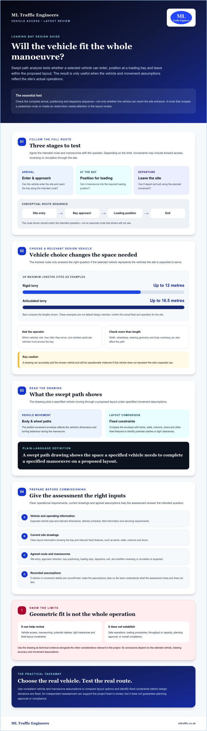
    Quotable definition: A swept path drawing shows the space a specified vehicle needs to complete a specified manoeuvre on a proposed layout. It doesn’t prove the site is safe to operate or that the entire loading process will work. Its conclusions depend on the selected vehicle, the accuracy of the drawing geometry and the movement assumptions.

    Which loading-bay access questions can it help answer?

    The assessment can test whether the selected vehicle can approach the bay, enter the site, position for loading and leave. Depending on the operating brief, movements may include forward access, reversing or circulation through the site. The route shown should reflect the intended operation, not an assumed route that drivers won’t use.

    Vehicle manoeuvrability is only one part of the design. The drawing doesn’t assess loading procedures, throughput or capacity, and it doesn’t replace wider transport planning. Nor does it establish safe operations or secure planning approval. Use it as technical evidence to review vehicle access and layout constraints alongside the other considerations relevant to the project.

    How vehicle choice and manoeuvres shape loading-bay swept paths

    The tracked route is useful only if it represents the vehicles the site is expected to serve. A residential development with refuse collections and occasional deliveries may have different access needs from a logistics site receiving articulated lorries. UK maximum lengths illustrate the difference: a rigid lorry may be up to 12 metres long, while an articulated lorry may be up to 16.5 metres. These are examples, not default design vehicles. Confirm the actual fleet and operation before selecting a vehicle for assessment.

    An unsuitable design vehicle can make a technically accurate swept path drawing operationally irrelevant. A model can faithfully plot the selected vehicle yet fail to represent the vehicle that will use the bay. For reliable swept path analysis for loading bays, establish the vehicle type and relevant dimensions with the client or operator. Start with their delivery schedule, fleet information and servicing requirements. If details remain unconfirmed, record the assumptions clearly so the project team understands what the assessment does and doesn’t test.

    How should a project select its design vehicle?

    Ask the operator which vehicles visit, how often they arrive and whether particular vehicles must access the bay. Consider the largest vehicle the site is genuinely expected to accommodate, rather than choosing one simply because it appears to fit the current plan. Vehicle length is only one factor: width, wheelbase, steering geometry and body overhang can also affect the path. Verify the available vehicle information for the assessment instead of relying on an unconfirmed template.

    Which manoeuvres should the loading-bay assessment test?

    Define the complete route: site entry, approach, bay entry, loading position, departure and exit. Establish whether the vehicle is expected to enter or leave in reverse, and where it stops during loading. The approach direction and available turning space affect the tracked envelope. Testing only the final turn into the bay can miss a constraint earlier in the route.

    Show relevant features on the layout, including gates, barriers, kerbs, columns and any parked vehicles or circulation routes that could affect movement. Test the operating sequence the site is intended to use. If a route works only when a gate is open, a parking space is empty or other traffic is absent, review the drawing against those assumptions. The Health and Safety Executive’s guidance on safety in loading areas provides relevant workplace context, but a swept path drawing alone doesn’t establish safe operations.

    For project-specific support testing proposed vehicle access and manoeuvring, consider ML Traffic Engineers UK’s Swept Path Analysis service.

    How to assess loading-bay swept path drawings and design options

    A swept path drawing is most useful when you review it against the design it is intended to test. Check that the vehicle is identified, its direction of travel is clear and the manoeuvre reflects the intended site operation. Then compare the plotted envelope with the current layout, not an earlier plan that may show different boundaries or obstructions.

    For swept path analysis for loading bays, distinguish vehicle clearance from the space needed to carry out loading. A plotted path may appear to avoid a wall, but the drawing won’t necessarily show whether doors can open, people can move safely around the vehicle or loading can take place without obstructing circulation. Review those practical requirements separately with the relevant design and operations teams.

    What should a reviewer check on the drawing?

    Verify that the vehicle type and movement sequence are clear, then check that the site geometry reflects the latest design information. Pay particular attention to boundaries and fixed features near turning points, such as kerbs, columns, gates and barriers. Note unclear clearances, conflicts or missing assumptions, then ask the designer to confirm whether these are intentional or need further assessment.

    How should teams compare alternative bay layouts?

    Compare options using the same confirmed vehicle and movement criteria. Otherwise, a layout may appear to perform better simply because it was tested with a different vehicle or an easier manoeuvre. Record any extra turns or reversing required, and flag options that depend on unconfirmed conditions, such as a gate being open or an adjacent area being clear. Coordinate proposed changes with the architect and relevant transport or highway advisers.

    Record a short review list for each option to make the comparison clear:

    • Design option: Identify the layout revision being assessed.
    • Vehicle: Record the vehicle used and whether its details are confirmed.
    • Manoeuvre: Note the route and any additional movements required.
    • Constraints: Identify nearby fixed features and any apparent conflicts.
    • Unresolved assumptions: List information that needs confirmation before the option can be judged.

    This approach makes differences easier to explain at design reviews. It also helps the team distinguish a genuine layout improvement from a change in assessment assumptions, and directs follow-up questions to the right project participants.
    Swept Path Analysis for Loading Bays: A UK Developer’s Guide

    What information to prepare before commissioning loading-bay analysis

    A useful assessment starts with a clear brief, not just a plan. For swept path analysis for loading bays, the engineer needs to understand the intended operation and test it against the current site design. If some details are preliminary, identify them openly so assumptions can be recorded and checked before the results inform design decisions.

    Which drawings and operational details should you provide?

    Work through this preparation sequence before commissioning:

    1. Define the operation. Explain what the bay will serve, how loading will take place and any relevant servicing requirements.
    2. Confirm the vehicles. Ask the operator to identify expected vehicle types and provide dimensions where available. Include delivery frequency and any differences between routine and occasional visits.
    3. Describe the route. Mark the intended approach, site entry, bay manoeuvre and exit. Note whether reversing is expected and where vehicles will stop.
    4. Identify restrictions. Flag gates, access controls, parking, operating hours or other known conditions that could affect vehicle movements.
    5. Send current drawings. Provide the latest site layout with dimensions, access points, kerbs and fixed obstructions. Make sure relevant boundaries and design features are shown.

    Consistent, current information helps the engineer assess the layout you intend to build. If vehicle dimensions, site details or operating arrangements are missing, say so. The assessment may need to proceed on stated assumptions. The project team should review and confirm those assumptions rather than treat them as verified facts.

    For more background on swept-path methods used in planning applications, read this practical AutoTURN swept path guidance.

    How does the assessment fit into the design and planning process?

    Arrange the review while the layout can still be coordinated and revised. If a manoeuvre reveals a constraint, the design team can consider it alongside other project requirements before plans are finalised. For a London scheme, confirm directly with the relevant planning or highway authority what project-specific information it expects. Requirements can vary, so don’t assume one assessment format or set of inputs will suit every application.

    Before commissioning, agree the assessment scope, vehicle information, proposed manoeuvres and drawing revision with the engineer. ML Traffic Engineers provides Swept Path Analysis to assess vehicle manoeuvrability and access feasibility within site designs. Discuss your loading-bay assessment requirements with ML Traffic Engineers.

    Commission a loading-bay swept path assessment for your project

    An independent review can help when a proposed bay has tight geometry, the intended vehicle route is uncertain or the design team wants to test access before fixing the layout. Swept path analysis for loading bays assesses vehicle manoeuvrability and access feasibility against the site information and movement assumptions provided. It can help identify constraints for the team to review, but it doesn’t guarantee planning approval or establish that every aspect of site operation is suitable.

    ML Traffic Engineers provides Swept Path Analysis as independent technical support for testing vehicle access and manoeuvring within site designs. Before appointing a consultant, make sure the proposed scope addresses the actual operation and the questions the project needs answered.

    What to ask a swept path consultant before appointing?

    Clarify the assessment basis before work starts. Ask which design vehicle and manoeuvres will be tested, and how the assessment will record assumptions, constraints and any design changes. Confirm that the proposed scope reflects the operational brief and any relevant feedback from the planning or highway authority. If vehicle details or drawings are provisional, agree how those uncertainties will be identified and reviewed.

    Also confirm the project-specific scope and intended deliverables directly with the consultant. These should be clear enough for the design team to understand what the assessment covers and what information it relies on.

    How can a project team take the next step?

    Prepare a concise brief before opening the discussion. Include:

    • The latest site layout, showing dimensions, access points and fixed features.
    • The vehicle type and dimensions, if confirmed by the operator.
    • A short description of delivery operations, including the approach, bay manoeuvre, loading position and exit route.
    • Any known constraints, authority feedback or assumptions that still need confirmation.

    This gives the consultant a basis for discussing the assessment scope and any information gaps. ML Traffic Engineers’ Swept Path Analysis service can support project teams testing proposed vehicle manoeuvrability and access feasibility. Share your operational brief, vehicle information and current drawings to discuss a loading-bay swept path assessment.

    Test your loading-bay layout with confidence

    A reliable assessment starts with the right design vehicle and a realistic account of how it will enter, position and leave the bay. Swept path analysis for loading bays can help the project team test proposed manoeuvres against the layout and identify constraints for review. Findings depend on the vehicle, drawing information and assumptions used, so confirm these before treating a drawing as a basis for design decisions.

    Prepare the operator’s requirements, vehicle details and latest site drawings to support a focused assessment. Vehicle tracking tests manoeuvrability and access feasibility, but it doesn’t by itself confirm that loading operations are safe or secure planning approval.

    ML Traffic Engineers provides Swept Path Analysis and supports development projects across Greater London, Manchester, Birmingham, the West Midlands, Liverpool, Surrey, East Sussex, West Sussex, Hampshire, Berkshire and Buckinghamshire. If you’re reviewing a proposed bay or need independent technical input on vehicle access, discuss a swept path assessment for your loading bay. Share a clear brief and current information to help your team make informed decisions and move the design forward with greater confidence.

    Frequently Asked Questions

    What is swept path analysis for a loading bay?

    Swept path analysis for a loading bay is a drawing-based assessment of how a specified vehicle moves through a proposed site layout. It plots the vehicle’s body and wheel paths along an agreed route, helping the design team review manoeuvres against features such as kerbs, walls, columns and gates. The result depends on the vehicle, drawing geometry and movement assumptions, and doesn’t assess every aspect of loading operations.

    Which vehicles should be included in a loading-bay swept path analysis?

    Include vehicles that reflect the site’s intended operations, as confirmed by the operator or client. Consider regular deliveries, waste collection, servicing and any larger vehicles the site is expected to accommodate. A logistics site and a residential development may need different design vehicles. Provide vehicle types and dimensions where available. If details aren’t confirmed, make sure the assessment records the assumptions so the team can check them.

    Can swept path analysis show whether a vehicle can reverse into a loading bay?

    Yes. The assessment can plot a reversing manoeuvre if that movement is part of the intended operation and the route is specified. The brief should identify the site entrance, approach, reversing path, loading position and exit route, along with relevant fixed features. A drawing can help reveal geometric conflicts, but it doesn’t by itself establish that reversing or other site operations are safe in practice.

    What drawings and information are needed for a loading-bay swept path assessment?

    Provide the latest site layout, with dimensions, boundaries, access points, kerbs and fixed obstructions. Include the vehicle type and dimensions if known, plus a brief describing delivery frequency, approach routes, loading arrangements and whether reversing is expected. Flag gates, access controls, parking and operational restrictions. Preliminary or missing details may require assumptions, so identify these clearly and arrange for the project team to confirm them.

    Does a loading-bay swept path drawing guarantee planning approval?

    No. A swept path drawing tests specified vehicle movements against the proposed layout. It doesn’t guarantee planning approval or prove that every planning, highway or operational requirement has been met. The relevant planning or highway authority may have project-specific information requirements. Treat the assessment as technical evidence for design review, and confirm the wider requirements for your site with the appropriate authority and project advisers.

    When should a project commission swept path analysis for a loading bay?

    Commission an assessment while the layout can still be reviewed and coordinated, particularly if vehicle access or bay manoeuvres are uncertain. Early testing can help the team identify constraints before plans are finalised, though it can also inform review of an existing proposal. ML Traffic Engineers provides Swept Path Analysis for projects across Greater London, Manchester, Birmingham, the West Midlands, Liverpool, Surrey, East Sussex, West Sussex, Hampshire, Berkshire and Buckinghamshire.

    How do you compare two loading-bay layouts using swept path analysis?

    Test both layouts with the same confirmed design vehicle, route and manoeuvre assumptions. Then compare whether each option accommodates the movement, what extra turns or reversing it requires, and whether its path conflicts with fixed features. Record any unresolved assumptions, such as a gate being open or a parking area being clear. This keeps the comparison fair and helps the design team identify which differences need further review.

    Michael Lee

    Article by

    Michael Lee

    Transport planner with over 35 years' experience.

    Disclaimer

    The content on mltraffic.co.uk, including all technical articles, guides, and resources, is provided for general informational and educational purposes only. It is not intended to constitute professional advice in traffic engineering, transportation planning, development approvals, or any other technical or legal field.
    While ML Traffic Engineers makes every reasonable effort to ensure the accuracy, completeness, and timeliness of the information published, we do not provide any warranties or representations (express or implied) regarding its reliability, suitability, or availability for any particular purpose. Any reliance you place on the content is strictly at your own risk.
    In no event shall ML Traffic Engineers, its directors, employees, authors, or affiliates be liable for any direct, indirect, incidental, special, consequential, or punitive damages (including, without limitation, loss of profits, data, or business opportunities) arising out of or in connection with the use of, or inability to use, any information provided on this website.
    The articles and guides on this site are not a substitute for engaging a qualified, professional traffic engineer to assess your specific project requirements. For tailored advice, compliance assessments, or traffic engineering services, please contact a competent professional.
    This disclaimer may be updated from time to time without notice. By accessing or using this website, you agree to be bound by the most current version of this disclaimer.
  • Transport Assessment: Town Centre Regeneration 2026 Guide

    Transport Assessment: Town Centre Regeneration 2026 Guide

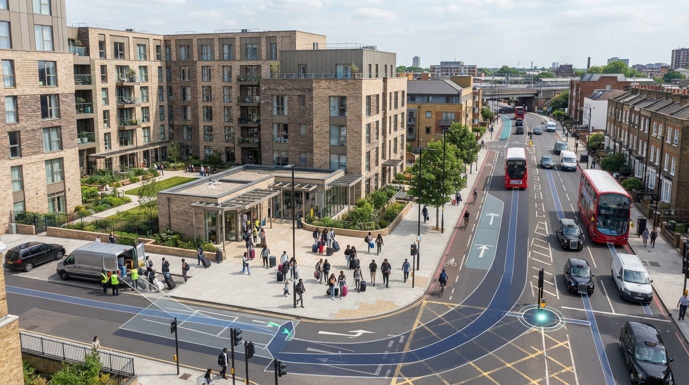
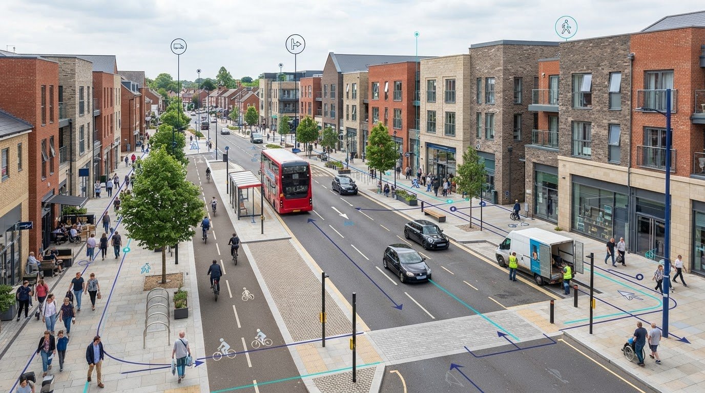
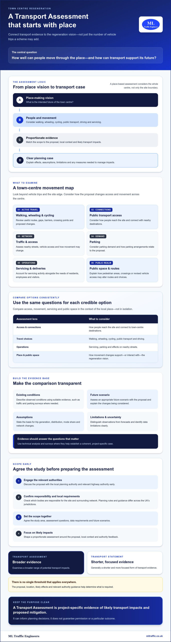
    What if the success of town centre regeneration depended less on how many vehicle trips a scheme adds and more on how well people can move through the place? A transport assessment for town centre regeneration should connect transport evidence to the vision for the area, not simply count development trips. That means considering how people will walk, wheel, cycle and use public transport, alongside servicing, parking and traffic effects.

    It’s understandable to be unsure which impacts need detailed assessment. Regeneration schemes often combine new uses, changing travel patterns and public-realm ambitions, while local planning and highway authority requirements can vary. Agreeing a proportionate scope early helps focus evidence on the issues that matter and reduces the risk of gaps holding up a planning application.

    This guide explains what a regeneration-focused Transport Assessment should examine, how to choose suitable evidence and how to relate the analysis to the place-making vision. It also covers traffic and parking surveys, access and movement, servicing, and cumulative effects, so you can build a clearer transport case for your proposal.

    Key Takeaways

    • A transport assessment for town centre regeneration should show how movement supports the place-making vision, not just quantify vehicle trips.
    • Scope the assessment around the proposal, local context and likely transport impacts. Distinguish observed conditions from assumptions and forecasts.
    • Compare credible regeneration options by considering access, walking, wheeling, cycling, public transport, servicing and public space.
    • Agree the study area, assessment questions, data requirements and future scenarios with the relevant authorities early in the planning process.
    • Traffic surveys, parking surveys and technical analysis can help build a coherent evidence base for a planning submission where needed.

    What a Transport Assessment means for town centre regeneration

    A transport assessment for town centre regeneration explains how a proposal could affect movement and access, and what measures may be needed to manage those effects. It relates transport evidence to the intended future of the place, rather than treating the scheme as a standalone source of vehicle trips. This place-based perspective is consistent with regenerative urban development, where change is considered in relation to the wider urban environment.

    In brief: A Transport Assessment is project-specific evidence of likely transport impacts and proposed mitigation. It can inform planning decisions, but it does not guarantee permission or a particular outcome.

    The appropriate document depends on the development and its context. A Transport Statement is generally a shorter, more focused form of transport evidence, while a Transport Assessment examines a broader range of potential impacts. There is no single threshold that applies everywhere. The proposal, location, likely effects and relevant authority guidance all help determine what is required.

    To see how town centre regeneration can shape a place, watch Town Centre Regeneration from Owen Thompson MP for Midlothian:

    How regeneration differs from a single-use development

    A town centre scheme can combine homes, shops, workplaces and community uses. Their travel patterns may vary by time of day: residents travel for work or everyday needs, employees arrive for shifts, visitors come to shop or attend activities, and deliveries serve businesses. The assessment should consider these groups alongside people already using the centre, not only trips associated with new buildings.

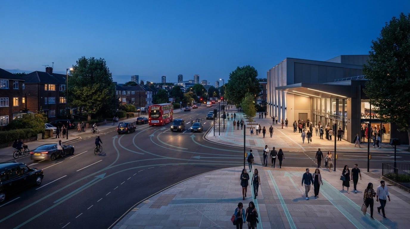
    Public-realm proposals also matter. A new pedestrian area, changed crossing point or revised vehicle access may alter routes and choices for people walking, wheeling, cycling, driving or using public transport. Explain how these changes interact with existing movement and the regeneration vision.

    Who helps shape the assessment scope?

    Engage the local planning authority and relevant highway authority early. The scope should reflect the proposal, its location, likely transport effects and feedback from those authorities. Confirm which bodies are responsible for the site and surrounding network before agreeing evidence requirements.

    Planning policy and responsibilities differ across the UK, so check the rules and guidance for the project’s jurisdiction rather than assuming requirements are identical in England, Scotland, Wales and Northern Ireland. Early scoping can establish the study area, key questions and suitable evidence before the assessment is prepared.

    What transport impacts should a regeneration assessment examine?

    A regeneration assessment should examine how the proposal changes access and movement across the town centre, not just at the site boundary. Relevant effects may include walking and cycling connections, public transport access, traffic on nearby streets, parking demand, servicing activity and changes to public space. The official government guidance provides a starting point, but the scope should reflect the development and local authority requirements.

    Build the analysis around a clear comparison: describe observed existing conditions, then assess an appropriate future scenario with the proposal. State the assumptions behind trip generation, distribution, mode share and network changes. Identify data limitations so decision-makers can see what the analysis establishes and where uncertainty remains.

    Access, walking, cycling, and public transport

    Review how people reach the site and connect with nearby streets, shops, services and other town centre destinations. For walking and cycling, map useful routes, gaps, barriers, crossing points and proposed changes. Consider whether public-realm proposals redirect movement or change access for existing users. Assess public transport access and, where relevant, capacity using current, project-specific evidence. Set study area boundaries to capture the routes and connections likely to be affected, and discuss them with the relevant authorities.

    Traffic, parking, servicing, and inclusive access

    Explain how trip-generation and distribution assumptions were selected, and use methods suited to the proposal. Consider how new trips interact with existing traffic and other committed or proposed development where cumulative effects may be relevant. Compare the future scenario with the baseline, distinguishing observed data from forecasts and assumptions.

    Parking analysis should relate to the proposed uses and local context. Examine how servicing activity could affect access, street operation and public space. Check movement needs for different users, including people who walk, cycle, use public transport, drive, wheel or require step-free access. Local standards and authority expectations can vary, so confirm applicable requirements rather than assuming one approach fits every town centre.

    In practice, link each identified impact to its evidence, the people or routes affected, and proportionate mitigation. This makes the assessment traceable: readers can understand what may change, why the conclusion is reasonable and how proposed measures respond. For a transport assessment for town centre regeneration, agree the study area, assessment questions and relevant development scenarios with the local planning and highway authorities early. Specialist Transport Assessment support, informed by traffic or parking surveys where needed, can help bring that evidence together.

    How to assess regeneration options without overlooking local context

    Comparing credible options shows how design choices may affect movement through a town centre. Start with a clearly described baseline, then distinguish it from assumptions, forecast scenarios and proposed interventions. For each option, explain what changes and why. A transport assessment for town centre regeneration should make these distinctions clear so readers can trace the evidence behind each conclusion.

    Assessment area Option A: retain current access Option B: revise access and public space
    Access and movement How existing routes connect the site to town centre destinations Which routes or connections change, and for whom
    Servicing How existing delivery access operates How revised arrangements affect servicing and nearby streets
    Public space How current vehicle and pedestrian space is used What space is reallocated and how movement responds

    Adapt the comparison to the actual proposals. The table exposes trade-offs; it does not imply that an option is preferred before its effects are assessed. A place-based approach also reflects the case for long-term transport investment, connecting transport decisions with wider town centre objectives.

    Building a reliable baseline and choosing evidence

    Gather evidence that answers the agreed assessment questions. Depending on the location and proposal, this may include traffic and parking data, walking and cycling conditions, and public transport information. Use surveys when available records do not provide a suitable picture. Record survey dates, locations, coverage and limitations, and explain any adjustments made for analysis. This allows decision-makers to judge how well the evidence represents the conditions being assessed.

    Comparing options and cumulative effects

    Set out the baseline and future scenarios separately. Identify nearby committed proposals using information agreed with the relevant authorities, then explain which are included in the cumulative assessment and how their effects are represented. If development is phased, uses may change or information is incomplete, state what has been assumed and how this could affect forecasts.

    Forecasts and model outputs are estimates, not certainty. Explain the method, key inputs and limitations, then interpret what the results mean for access, movement, servicing and public space. For London projects, the Transport Assessment London guide offers a location-specific companion; it is not a substitute for checking requirements elsewhere in the UK.

    Where specialist evidence would help bring the options and supporting data together, review Transport Assessment support.

    Transport Assessment: Town Centre Regeneration 2026 Guide

    How to scope and prepare a town centre Transport Assessment

    A clear scope gives the assessment a practical purpose: explain the proposal, identify likely transport effects and provide evidence for proportionate recommendations. For a transport assessment for town centre regeneration, agree the questions and study area before commissioning surveys or technical analysis. This keeps the work focused on the proposal and local context.

    A practical sequence from proposal review to assessment

    1. Describe the proposal. Set out the uses, scale, phasing, access arrangements and regeneration objectives. Note what is fixed and what may change.
    2. Identify assessment questions. Consider which routes, users and transport operations could be affected, including walking, cycling, public transport, traffic, parking and servicing.
    3. Agree the scope with authorities. Consult the local planning authority and relevant highway authority on the study area, evidence requirements, baseline and future scenarios. Confirm which nearby proposals should be considered.
    4. Collect suitable evidence. Use existing information where it answers the agreed questions. Where it does not, identify whether traffic surveys, parking surveys or other relevant data are needed.
    5. Analyse and report. Explain methods, assumptions, survey dates and limitations. Present findings against the agreed scenarios, then connect identified effects to appropriate mitigation.

    Let the scope determine the evidence, rather than collecting data first and deciding later how to use it. For example, a parking survey may help establish existing demand if parking effects are a key assessment question. Traffic data may be needed to understand how a proposed access interacts with nearby streets, while footfall analytics from providers such as Smart Urban Sensing Ltd can clarify pedestrian movement patterns. Choose methods to address identified information gaps, not as a default checklist.

    Turning findings into proportionate mitigation

    Recommendations should respond directly to evidenced impacts. Explain what measure is proposed, which effect it addresses and who would be responsible for taking it forward. Keep the assessment’s recommendations distinct from any separately commissioned design work or audit services. The assessment can identify a transport issue and intended response without implying that every related service forms part of the assessment commission.

    A Travel Plan may complement the assessment where it suits the proposal, helping set out measures to support travel choices associated with the development. Its role should be consistent with the assessment’s assumptions and conclusions.

    ML Traffic Engineers UK prepares Transport Assessments and related transport evidence for development proposals. Developers can review project types and planning support to consider relevant experience. To discuss assessment evidence for a regeneration proposal, contact ML Traffic Engineers UK.

    How specialist Transport Assessment support can strengthen the planning submission

    A well-structured assessment gives decision-makers a clear line of sight from the regeneration proposal to its likely transport effects and proposed mitigation. It brings together development details, local context, supporting evidence and analysis, while making assumptions and limitations visible. For a transport assessment for town centre regeneration, this joined-up account helps explain how transport considerations relate to the scheme’s objectives. It supports planning decisions, but cannot guarantee permission or a particular outcome.

    Specialist input can help establish what evidence a project needs. Traffic surveys may inform analysis of network conditions, while parking surveys can help describe existing demand. Technical analysis then relates suitable evidence to the proposal and agreed assessment questions. Each method should have a clear purpose, rather than being included by default.

    What to look for when appointing assessment support

    Check whether the consultant has experience preparing transport documentation for planning proposals relevant to your development type. Ask how they will agree the assessment scope with you and the relevant authorities, identify data requirements, and document assumptions in the report. Confirm which services suit the brief, such as a Transport Assessment, traffic or parking surveys, or Swept Path Analysis where vehicle movement needs to be examined.

    Clarity on responsibilities also matters. Establish what the assessment will cover, what evidence is required from other project contributors, and which recommendations may need separate design or delivery work. This keeps the report focused and makes its conclusions easier to follow.

    Prepare for an initial project discussion

    Gather information that will help define the scope and identify gaps. A useful starting pack includes:

    • A site location plan and current proposal details, including uses and phasing where known.
    • Available information on site access, parking, servicing and connections to nearby streets.
    • Transport data already collected, with dates and coverage if known.
    • Planning milestones, authority feedback and any known transport constraints.
    • Unresolved questions, such as which scenarios or nearby proposals may need consideration.

    This preparation helps focus early discussions on the project’s actual requirements. It also gives the assessment team a basis for identifying proportionate survey and analysis needs, rather than making assumptions before the proposal and local context are understood.

    ML Traffic Engineers prepares Transport Assessments and related transport evidence for development proposals. Its transport services include traffic and parking surveys and Swept Path Analysis where appropriate to the project. Details of these services can help you identify support relevant to the brief.

    Set your regeneration proposal up for a clear transport case

    A strong transport assessment for town centre regeneration connects the development vision with the way people and goods move through the area. Its scope should reflect local conditions, the proposal’s likely effects and relevant authority feedback. Clear assumptions, proportionate evidence and mitigation linked to identified impacts make the planning submission easier to assess.

    Start by agreeing the study area, assessment questions and relevant scenarios. Then use suitable evidence, including traffic or parking surveys where needed, to explain existing conditions and potential change. A coherent report supports informed planning decisions, but it cannot guarantee planning permission.

    ML Traffic Engineers is a UK consultancy providing Transport Assessments for planning submissions, with traffic and parking survey capabilities to inform project evidence. Its local focus includes Greater London, Manchester, Birmingham, the West Midlands, Liverpool, Surrey, East Sussex, West Sussex, Hampshire, Berkshire and Buckinghamshire. If you’re preparing a regeneration proposal, discuss your town centre regeneration assessment to explore the scope and evidence it may require.

    Frequently Asked Questions

    What is a Transport Assessment for town centre regeneration?

    A Transport Assessment is a project-specific report that examines how a development may affect transport and sets out potential mitigation. A transport assessment for town centre regeneration considers the scheme alongside existing town centre movement, planned changes and local conditions. It may draw on traffic or parking surveys and technical analysis where needed. The report supports planning decisions by presenting evidence, but it doesn’t guarantee permission.

    When is a Transport Assessment required for a regeneration project?

    The need for a Transport Assessment depends on the proposal, its location, likely transport effects and local authority requirements. There isn’t one threshold that applies to every regeneration project across the UK. Discuss the scope early with the local planning authority and relevant highway authority. They can help determine whether a Transport Assessment or a more focused Transport Statement is appropriate and what evidence the submission should include.

    What should a town centre Transport Assessment include?

    A town centre Transport Assessment should address the transport questions raised by the proposal. Depending on its scope, this can include site access, walking and cycling connections, public transport, traffic, parking, servicing and public-realm changes. It should describe existing conditions, assess suitable future scenarios, explain assumptions and limitations, and connect identified impacts to proportionate mitigation. Traffic surveys, parking surveys or other technical analysis may inform the report where the agreed scope requires them.

    How do you assess transport impacts for a mixed-use regeneration scheme?

    Assess each proposed use and consider how travel patterns may vary across the day. Homes, shops, workplaces and community uses can attract different residents, employees, visitors and deliveries. Compare the existing baseline with appropriate future scenarios, explaining assumptions about trips and how nearby development is treated. Consider access, movement choices, network operation, parking and servicing together so the analysis reflects how the mixed-use scheme may function as part of the town centre.

    Should a Transport Assessment consider walking and cycling in a town centre?

    Yes. The assessment should consider how the proposal connects with existing walking and cycling routes and whether access or movement may change. Examine route continuity, barriers, crossing points and links to town centre destinations. Where the scheme changes public space or street access, explain how those changes could affect people walking, cycling or wheeling. The scope should reflect local conditions and authority feedback, rather than assuming the same analysis applies to every site.

    How early should a transport consultant be involved in town centre regeneration?

    Involve a transport consultant while the proposal and access arrangements are still being developed. Early input can help identify likely transport questions, agree a study area with relevant authorities and establish whether traffic or parking surveys are needed. This applies whether the site is in Greater London, Manchester, Birmingham, the West Midlands, Liverpool, Surrey, East Sussex, West Sussex, Hampshire, Berkshire or Buckinghamshire, where project requirements must be checked locally.

    Can a Transport Assessment help support planning permission?

    A Transport Assessment can support a planning application by providing evidence about likely transport effects and proposed mitigation. A clear report helps decision-makers understand the proposal, local context, analysis and how identified impacts may be addressed. It doesn’t secure planning permission or guarantee a particular decision. The assessment should follow current, relevant planning policy and authority guidance for the project’s location, with its methods and limitations explained clearly.

    Michael Lee

    Article by

    Michael Lee

    Transport planner with over 35 years' experience.

    Disclaimer

    The content on mltraffic.co.uk, including all technical articles, guides, and resources, is provided for general informational and educational purposes only. It is not intended to constitute professional advice in traffic engineering, transportation planning, development approvals, or any other technical or legal field.
    While ML Traffic Engineers makes every reasonable effort to ensure the accuracy, completeness, and timeliness of the information published, we do not provide any warranties or representations (express or implied) regarding its reliability, suitability, or availability for any particular purpose. Any reliance you place on the content is strictly at your own risk.
    In no event shall ML Traffic Engineers, its directors, employees, authors, or affiliates be liable for any direct, indirect, incidental, special, consequential, or punitive damages (including, without limitation, loss of profits, data, or business opportunities) arising out of or in connection with the use of, or inability to use, any information provided on this website.
    The articles and guides on this site are not a substitute for engaging a qualified, professional traffic engineer to assess your specific project requirements. For tailored advice, compliance assessments, or traffic engineering services, please contact a competent professional.
    This disclaimer may be updated from time to time without notice. By accessing or using this website, you agree to be bound by the most current version of this disclaimer.
  • 2026 Transport Assessment: Waltham Forest Events Venue

    2026 Transport Assessment: Waltham Forest Events Venue

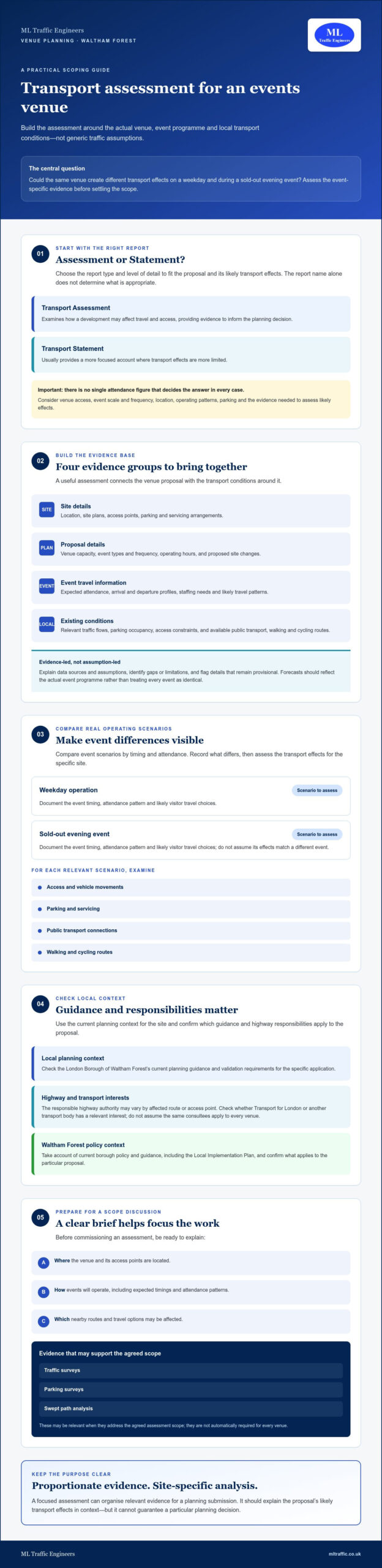
    Could the same venue create very different transport impacts on a weekday and during a sold-out evening event? A transport assessment for events venue in Waltham Forest should start with event-specific evidence, not generic traffic assumptions. Attendance, event schedules and visitor travel choices can all affect access, parking, servicing and public transport.

    It’s understandable to be unsure what the planning authority will expect, especially when different event formats can produce different travel patterns. The right scope depends on the venue, its location and its likely transport effects. A proportionate assessment can organise relevant evidence for a planning submission, but it cannot guarantee a particular planning decision.

    This guide explains what a venue-focused Transport Assessment should examine, when a Transport Statement may be more appropriate, and what site, event and travel information can help. It also covers surveys and other supporting evidence, the importance of current Waltham Forest guidance, and what to consider when appointing a transport consultant. Use it to prepare for a scope discussion and planning application.

    Key Takeaways

    • Match the report type and level of detail to the proposal and its likely transport effects, then check the scope against current authority guidance.
    • A transport assessment for events venue in Waltham Forest should use evidence about the site, event programme and existing travel conditions, not generic assumptions.
    • Compare event scenarios by timing and attendance. Assess access, parking, servicing and travel by public transport, walking and cycling in the context of the specific site.
    • Before commissioning work, clarify the proposal, agree the assessment scope and ask how relevant evidence will be gathered and analysed.
    • Traffic surveys, parking surveys and swept path analysis may support a venue planning application when relevant to the agreed scope.

    When does an events venue in Waltham Forest need a transport assessment?

    A venue proposal doesn’t automatically require the same transport report as every other venue. The appropriate scope depends on what’s proposed and the likely effects on the surrounding transport network. A transport assessment for events venue in Waltham Forest should be scoped to the actual site and operating plans, not selected using an assumed attendance or trip threshold.

    A Transport Assessment examines how a development may affect travel and access, providing evidence to inform the planning decision. A Transport Statement usually provides a more focused account where transport effects are more limited. Neither report type should be chosen by name alone. Consider the venue’s access, event scale, location and operating pattern, along with current authority guidance and the information needed to assess likely effects.

    Transport assessment forms part of the wider transportation planning process, which considers how people and goods move through a network. For a venue, that means looking beyond vehicle movements to how the proposal connects with different travel options and the local context.

    Transport Assessment or Transport Statement for a venue proposal?

    An early scoping discussion can help establish the proportionate level of assessment before evidence is commissioned. Relevant factors may include venue capacity, event types and frequency, arrival and departure patterns, access design, parking provision and proximity to public transport. No single attendance figure determines the answer in every case. For broader background on assessment content, see this London Transport Assessment guide.

    Which local authorities and transport bodies may be relevant?

    The London Borough of Waltham Forest is the local planning context, so check its current planning guidance and validation requirements for the specific application. Highway consultation may involve the authority responsible for roads affected by the proposal, which can vary by route or access point. Check whether Transport for London or another transport body has a relevant interest in the site or network instead of assuming the same consultees apply to every venue.

    Before settling the scope, prepare a clear description of the proposal and identify:

    • Where the venue and its access points are located.
    • How events will operate, including expected timings and attendance patterns.
    • Which nearby routes and transport options may be affected.

    Confirm relevant guidance and highway responsibilities early. This gives the assessment a defined purpose and helps avoid collecting evidence that doesn’t address the planning questions for the site.

    What evidence should a Waltham Forest venue transport assessment use?

    A useful assessment starts with a clear picture of the venue proposal and the transport conditions around it. Bring together:

    • Site details: location, site plans, access points, parking and servicing arrangements.
    • Proposal details: capacity, event types and frequency, operating hours, and any proposed changes to the site.
    • Event travel information: expected attendance, arrival and departure profiles, staffing needs and likely travel patterns.
    • Existing conditions: relevant traffic flows, parking occupancy, access constraints, and available public transport, walking and cycling routes.

    A Transport Assessment is evidence-led analysis of how a proposed development may affect the transport network and how those effects relate to the site and its users. For an events venue, forecasts should reflect the actual programme rather than assume every event generates the same travel demand. The report should identify its data sources and assumptions, explain gaps or limitations in the available information, and flag details that remain provisional.

    Local context matters. Take account of current borough policy and guidance, including Waltham Forest’s Local Implementation Plan, while checking which requirements apply to the specific planning proposal.

    What venue and event information should the client prepare?

    Provide the latest available site plans and a schedule covering capacity, event types, frequency and operating hours. Add expected arrival and departure patterns, staffing requirements, parking provision and your best estimate of how visitors may travel. Mark unconfirmed figures and plans as provisional. This makes assumptions visible and helps the assessment team consider how changes to the proposal could affect the analysis.

    When are traffic or parking surveys useful?

    Surveys can help establish existing conditions when published information or initial evidence doesn’t answer the planning questions. Depending on the site, proposal and authority feedback, this could include traffic flows, parking occupancy or observations of access conditions. The assessment should explain why each survey is relevant and how its results inform the analysis. Determine the survey type and timing for the project rather than copying an assumed standard.

    Clear evidence lets the reader trace how the assessment moves from observed conditions to event-specific forecasts. For a planning submission, ML Traffic Engineers UK prepares Transport Assessments, Transport Statements and supporting traffic or parking surveys where they fit the agreed scope.

    How should the assessment analyse event traffic, parking, and travel choices?

    Event impacts depend on timing, travel choices and site context. A sound assessment tests realistic event scenarios rather than relying on one average day or assuming every visitor travels in the same way. Compare event start and finish times, attendance profiles and event frequency, then consider how those patterns could coincide with ordinary peak-hour demand or other nearby activities.

    How do event arrival and departure peaks affect the analysis?

    Map expected arrivals and departures against the event schedule and relevant local network conditions. A performance with a concentrated arrival period may create a different pattern from an event with staggered entry or a gradual exit. If events could overlap with one another or nearby activities, explain how this is reflected in the scenarios. Keep observed survey evidence separate from forecasts and professional assumptions, so readers can tell what was measured and what was modelled.

    Trip-generation tools such as TRICS may help estimate development trips when the method and available comparison sites are suitable. For an events venue, comparators should reflect relevant characteristics such as use and operating pattern. Generic matches may not represent event peaks. State the source, explain why the sites are comparable and note any limitations. Check the latest applicable guidance before relying on a particular method.

    How should parking, public transport, and active travel be considered?

    Assess parking demand against the venue’s supply and access arrangements, including whether event demand could affect surrounding streets. Consider public transport connections and the routes people would use to walk or cycle, while recognising that practical choices depend on the site and audience. Don’t assume one travel mode suits everyone. Identify location-specific constraints and test whether the proposal’s travel assumptions are credible.

    Review servicing at the site too. Consider how service vehicles reach and use the venue, and whether their movements could coincide with visitor arrivals or departures. The aim is to understand how different transport needs interact, rather than assessing each in isolation.

    A Travel Plan may support measures to encourage appropriate travel choices and provide a framework for monitoring, where relevant to the proposal. Its role should follow from the assessment’s findings, not depend on broad, untested promises. For more on this planning document, see the guide to Travel Plans for planning applications.

    2026 Transport Assessment: Waltham Forest Events Venue

    How can you choose the right assessment scope and consultant?

    Start with a defined proposal, not a request for a report chosen before its purpose is clear. For a transport assessment for events venue in Waltham Forest, use this sequence to make decisions and responsibilities easier to track:

    • Confirm the proposal: assemble the site location and plans, event and operating details, planning status, and relevant authority correspondence.
    • Check current guidance: review Waltham Forest’s requirements and identify which highway authority or transport bodies may need to be consulted.
    • Agree the scope: establish whether a Transport Assessment or Transport Statement is appropriate and whether supporting evidence is needed.
    • Gather information: confirm who will provide site, event and operational data, and whether traffic or parking surveys should be considered.
    • Review assumptions: make sure forecasts, data sources, limitations and unresolved details are recorded clearly.

    A consultant should explain how the proposed work addresses the planning questions, not simply list standard outputs. Ask about experience preparing transport reports for planning, collecting or analysing relevant data, and addressing requirements for comparable proposals. The aim is a proportionate, evidence-based scope, not the largest possible report.

    What should you confirm before requesting a proposal?

    Share the site plans and location, proposed capacity, event types and operating pattern, planning status, and any correspondence with the council or highway authority. Ask the consultant to set out the recommended report type, potential survey needs, deliverables, client inputs and dependencies. The proposal should identify anything unknown or provisional so both parties can see which assumptions may need review as the scheme develops.

    Which services may support the venue assessment?

    A Transport Assessment or Transport Statement can provide transport evidence for a planning application. Depending on the site and agreed scope, traffic or parking surveys may establish existing conditions, while swept path analysis may help examine vehicle movements at the site. These services aren’t automatic requirements. Their relevance should be explained in relation to the proposal. See the consultant’s transport planning services for an overview of its stated work.

    If the assessment identifies a role for a Travel Plan, clarify its purpose, proposed measures and any monitoring expectations. The London Travel Plans guide provides further context on how this document may support a planning application.

    Before appointing a consultant, confirm the scope, outputs and responsibilities in writing. Discuss your venue transport assessment requirements with ML Traffic Engineers UK as a potential provider of Transport Assessments, Transport Statements, Travel Plans and relevant supporting surveys.

    How ML Traffic Engineers UK can support an events venue planning application

    A well-scoped transport report brings together the venue proposal, relevant data and transport analysis for a planning application. ML Traffic Engineers UK prepares Transport Assessments, Transport Statements and Travel Plans. The appropriate document depends on the proposal and its likely transport effects, so consider the scope against the site, event programme and current authority guidance.

    Supporting evidence can be tailored to the project. Traffic or parking surveys may help establish existing conditions where relevant, while swept path analysis may examine vehicle movements within or accessing the site. These aren’t automatic additions to every commission. The scope should explain why each is needed and how it will inform the planning documentation.

    For a transport assessment for events venue in Waltham Forest, clear assumptions matter as much as the report type. Identify the sources of event schedules, attendance information and travel forecasts, and make provisional details and limitations visible. No assessment can guarantee planning permission or a particular authority response. Its role is to present relevant evidence and analysis for consideration of the proposal.

    What information helps start an assessment discussion?

    Prepare the venue address, a description of the proposal, available site plans, event types and operating details, plus any correspondence with the planning authority or highway authority. Note known questions about access, parking, servicing or public transport. If design or operating decisions are still open, flag them rather than treating them as confirmed. This gives the project review a clear basis for identifying information gaps and discussing a suitable scope.

    What happens after the initial project review?

    The next step is to clarify the report scope and whether supporting surveys or analysis may be relevant. The agreed work can then organise the available site and event evidence into planning documentation, making sources, assumptions and outstanding information clear. The scope should also set out expected outputs, client inputs and any responsibilities to coordinate as the proposal develops.

    To discuss a venue proposal, share the location, available plans, event details and current planning stage with ML Traffic Engineers UK. This provides a starting point for considering appropriate transport evidence without presuming a fixed scope or outcome.

    Take the next step towards a well-supported venue application

    The right transport evidence depends on the venue, its event programme and the surrounding network. A proportionate assessment should make its assumptions clear and consider how event timing and travel choices may affect access, parking and other transport options. Confirm the scope against current authority guidance before commissioning surveys or analysis.

    For a transport assessment for events venue in Waltham Forest, ML Traffic Engineers UK can prepare Transport Assessments, Transport Statements and Travel Plans, with traffic surveys and parking surveys where relevant to the agreed scope. The consultancy supports projects in Greater London, Manchester, Birmingham, the West Midlands, Liverpool, Surrey, East Sussex, West Sussex, Hampshire, Berkshire and Buckinghamshire. No report can guarantee a planning outcome, but clear, project-specific evidence gives an application a sound basis for consideration.

    Start with the venue location, available plans, event details and planning stage. Discuss your venue transport assessment with ML Traffic Engineers UK to define a practical scope for your proposal.

    Frequently Asked Questions

    Does an events venue in Waltham Forest need a Transport Assessment?

    Not every venue proposal automatically needs a full Transport Assessment. The appropriate response depends on the development, its likely transport effects and current planning guidance. Check requirements with the London Borough of Waltham Forest and, where relevant, the highway authority responsible for affected routes. A transport consultant can review the venue details and help establish whether a Transport Assessment, Transport Statement or other proportionate response may be suitable.

    What should a venue Transport Assessment include?

    The scope is project-specific, but it may cover the proposal, event schedules, expected travel demand, access, parking, public transport, walking, cycling and servicing. The assessment should explain the evidence and assumptions behind its analysis, including any limits in the available information. For a transport assessment for events venue in Waltham Forest, use the venue’s actual design and operating plans, and check current authority guidance rather than relying on a generic checklist.

    How are traffic impacts from events assessed?

    Event traffic analysis considers factors such as event timing, likely arrival and departure patterns, existing network conditions and expected travel choices. Survey data and recognised trip-generation sources may inform forecasts when appropriate to the proposal. The report should distinguish observed evidence from forecast scenarios and professional assumptions. It should explain why the scenarios suit the venue and disclose relevant limitations, so the planning authority can understand how the conclusions were reached.

    Is a parking survey needed for an events venue planning application?

    Not necessarily. Whether a parking survey is useful depends on the site, proposal, available evidence and questions raised by the relevant authority. A survey may help establish existing parking conditions or inform an assessment, but it isn’t automatically required for every venue. Before commissioning one, clarify its purpose, the area to be covered and suitable survey timing with the consultant, taking account of the planning questions the evidence needs to address.

    Can a Transport Statement be enough instead of a Transport Assessment?

    Yes, a Transport Statement may be appropriate for some proposals, but no universal rule determines the report type for every venue. Consider the development’s scale and characteristics, likely transport effects and current authority guidance. An early scope review can help identify proportionate documentation and whether supporting evidence, such as traffic or parking surveys, may be relevant. Confirm the proposed scope with the planning authority where appropriate.

    What information should I give a transport consultant for a venue assessment?

    Provide the site address, available plans, proposal description, expected venue capacity, event frequency and operating hours. Include known access and parking arrangements, relevant planning correspondence and existing survey information, if available. Outline expected arrival and departure patterns and any known public transport or servicing questions. Mark details that aren’t final as provisional. This helps the consultant identify information gaps and explain how assumptions could affect the scope and assessment.

    Does a venue Transport Assessment guarantee planning permission?

    No. A Transport Assessment provides evidence and analysis about transport matters; it can’t guarantee planning permission or a particular decision. The planning authority considers the full application and relevant planning issues, and may request clarification or further evidence. A well-scoped assessment can help explain the proposal and make its assumptions transparent, but its conclusions aren’t a promise of approval. Keep the report aligned with the submitted scheme and current authority guidance.

    Michael Lee

    Article by

    Michael Lee

    Transport planner with over 35 years' experience.

    Disclaimer

    The content on mltraffic.co.uk, including all technical articles, guides, and resources, is provided for general informational and educational purposes only. It is not intended to constitute professional advice in traffic engineering, transportation planning, development approvals, or any other technical or legal field.
    While ML Traffic Engineers makes every reasonable effort to ensure the accuracy, completeness, and timeliness of the information published, we do not provide any warranties or representations (express or implied) regarding its reliability, suitability, or availability for any particular purpose. Any reliance you place on the content is strictly at your own risk.
    In no event shall ML Traffic Engineers, its directors, employees, authors, or affiliates be liable for any direct, indirect, incidental, special, consequential, or punitive damages (including, without limitation, loss of profits, data, or business opportunities) arising out of or in connection with the use of, or inability to use, any information provided on this website.
    The articles and guides on this site are not a substitute for engaging a qualified, professional traffic engineer to assess your specific project requirements. For tailored advice, compliance assessments, or traffic engineering services, please contact a competent professional.
    This disclaimer may be updated from time to time without notice. By accessing or using this website, you agree to be bound by the most current version of this disclaimer.
  • How to Appeal a Planning Refusal on Highway Grounds

    How to Appeal a Planning Refusal on Highway Grounds

    What if the key to challenging a highway refusal isn’t repeating your original case, but answering the concern the decision-maker says it left unresolved? Appealing a planning refusal on highway grounds can be difficult when highway authority advice, planning officer comments and your transport evidence don’t appear to align.

    A refusal is frustrating, especially if you believed access, traffic or parking had already been addressed. The right next step depends on the precise reasons given and whether your evidence can respond to them. The highway authority’s advice can carry significant weight, but the planning authority makes the decision on the application.

    This guide explains how to assess a refusal, compare an appeal with a revised application, and identify transport evidence that may help address each objection. Visibility, access design, parking, turning space, traffic effects, and walking or cycling provision can each call for a different response. A Transport Statement, Transport Assessment, traffic data or Swept Path Analysis may be relevant, but the evidence should be chosen to answer the specific concern. Check current official guidance for the applicable appeal route, deadline and process before deciding how to proceed.

    Key Takeaways

    • Use the decision notice and officer report to pinpoint the highway concerns the planning authority relied on.
    • When appealing a planning refusal on highway grounds, address the stated objections and evidence gaps rather than simply restating the original application.
    • Compare an appeal, revised application and further pre-application engagement against the design changes and evidence each route may require.
    • Match each concern, such as traffic generation, access visibility, parking or vehicle manoeuvring, to relevant technical evidence and a clear next action.
    • Gather the planning documents, confirm the current appeal process, then agree the evidence scope with your planning agent and relevant specialists.

    What a planning refusal on highway grounds means for your application

    A refusal on highway grounds means the planning authority considers that a transport-related aspect of the proposal weighs against permission. The stated concern might relate to traffic effects, access, highway safety or how the road network would operate. For example, the notice may refer to restricted visibility at a proposed access, insufficient space for vehicles to turn, or the effect of additional traffic.

    Start with the decision notice, which sets out the formal refusal reasons, then read the officer report for the reasoning behind them. The report may explain how the authority considered the submitted plans, technical evidence and consultation responses. Read the two documents together: the notice tells you what was refused, while the report can show which evidence or policy considerations informed that conclusion. This is the starting point for deciding what needs further investigation before appealing a planning refusal on highway grounds.

    The Town and Country Planning Act 1990 provides statutory context for planning in England and Wales, but it isn’t a guide to appeal procedure. Planning rules and appeal arrangements vary across the UK. Confirm the correct route, current requirements and submission process for the relevant jurisdiction using official guidance.

    How to identify the highway issues in the decision notice

    Break each refusal reason into an issue to investigate. Note the plans, surveys, assumptions, policy references and consultee responses cited in the notice and officer report. Then classify the concern: is it about highway safety, access geometry, trip generation, parking or another transport effect? This distinction helps you avoid using evidence that doesn’t answer the objection. Traffic-volume analysis, for example, may not resolve a concern about visibility at an access.

    Who makes the decision and who advises on highways?

    The local planning authority decides the application, taking account of relevant planning considerations. The highway authority provides technical advice under the arrangements that apply locally. Its comments can inform the decision, but they are not the planning decision itself. Read the officer report to see how the authority treated that advice, whether the refusal relies on it, and whether it raises additional concerns.

    For applicable appeals in England, the Planning Inspectorate handles the appeal process. Other UK jurisdictions have their own arrangements, so check official guidance before selecting a route or relying on procedural information. Technical transport evidence can help clarify a highway issue, but it doesn’t replace planning advice or guarantee an appeal outcome.

    How to assess an appeal against a planning refusal on highway grounds

    Before appealing a planning refusal on highway grounds, establish whether the refusal identifies a concern your evidence did not answer, or whether the authority has interpreted that evidence differently. A persuasive response should deal with the actual reason for refusal. Repeating the application case without addressing the gap is unlikely to clarify the issue or change how it is understood.

    What to review before deciding whether to appeal

    Work through the documents in sequence and record what each tells you:

    1. Decision notice: Separate the formal refusal reasons so you can assess each one on its own.
    2. Officer report: Find the reasoning behind each reason, including how the planning authority treated technical advice and relevant policy references.
    3. Submitted evidence: Compare each concern with the Transport Statement or Transport Assessment, plans, surveys and assumptions submitted with the application.
    4. Consultation record: Review the highway authority’s comments and any response from the applicant. Check whether the response resolved the concern or left a specific question unanswered.
    5. Outstanding issue: Classify the problem as factual, methodological, design-related or policy-based. A dispute about traffic assumptions needs a different response from an access layout that may need to change.

    Compare the objection with the evidence on the same point. If the concern is peak-hour traffic, check whether the analysis covers the relevant movements and explains its assumptions. If it concerns access visibility, check whether the submitted plans and supporting information address that specific issue. The government’s guidance on transport evidence bases can help frame the role of transport evidence in planning decisions.

    When a revised application may be worth considering

    An appeal and a revised submission address different situations. If the objection appears to arise from a misunderstanding or a gap in the evidence, further analysis may help explain the existing proposal. If the concern depends on the design itself, such as the position or arrangement of an access, a revised layout may address it more directly. Discuss the options with your planning agent and, where relevant, the highway authority.

    A Transport Assessment should be proportionate to the proposal and the issues being examined. For context on the report’s role, see this Transport Assessment guide. A technical review may also help identify what evidence is missing before you commission further work. You can review ML Traffic Engineers UK’s transport planning services to understand the reports and analysis available.

    Don’t assume an appeal can introduce any new evidence, or that a revised application is automatically the better route. Procedures differ by jurisdiction and may depend on the application and appeal type. Check current official guidance for the correct route, evidence rules and deadline before deciding.

    Appeal or revised application: compare your options on highway evidence

    Choose the next step by identifying what would need to change to resolve each highway objection. If the dispute concerns how the existing evidence was interpreted, an appeal may be worth investigating. If the refusal identifies a design issue, such as an access arrangement, a revised proposal may address it more directly. Further pre-application engagement can help clarify the authority’s concerns before you commit to either route.

    Route May suit where… Key point to check
    Appeal You dispute the authority’s assessment of the submitted evidence or its reasoning. Can the case and supporting material be presented under the current appeal procedure?
    Revised application A specific design change or further analysis could respond to the objection. What must change, and what evidence will support the revised proposal?
    Pre-application engagement You need to clarify an unresolved highway issue or discuss potential changes. What feedback can the relevant authority provide, and how will you record and use it?

    Timing and procedure matter. An appeal follows the rules for the relevant jurisdiction and appeal type, while a revised submission involves preparing and determining a new application. Neither route guarantees a particular outcome. Before appealing a planning refusal on highway grounds, check current official guidance for eligibility, procedure and deadlines. The GOV.UK guide explains how to appeal a planning decision.

    When an appeal may be the route to investigate

    Consider an appeal if you believe the authority’s conclusion doesn’t fairly reflect the Transport Statement, Transport Assessment or other material already submitted. First confirm that the proposal and its evidence can be presented through the applicable process. Don’t assume you can introduce new technical material later: appeal evidence rules can vary, so check current guidance before deciding.

    When a revised submission may address the problem more directly

    A revised application may be more practical where the objection identifies a design or access deficiency that can be changed. If the proposal remains suitable but the evidence is incomplete, updated survey data or a clearer explanation of the transport case may help. In either situation, scope the work against the precise refusal reason. Another report will not resolve an objection unless it answers the question the authority raised.

    For background on the purpose and scope of a Transport Assessment, see this Transport Assessment guide. Discuss the evidence needed with your planning agent and, where appropriate, the relevant highway authority before commissioning further technical work.

    How to Appeal a Planning Refusal on Highway Grounds

    Build a focused technical response to each highway refusal reason

    A useful response connects each refusal reason to the evidence that can answer it, the action required, the person responsible and any decision still outstanding. This keeps the work focused and helps the planning agent, transport consultant, applicant and relevant highway authority coordinate around the same issues. Scope the evidence to the refusal wording and site circumstances, not to a generic checklist.

    Use a reason-by-reason matrix to manage the response:

    • Objection: Quote or accurately summarise the specific refusal reason.
    • Evidence needed: Identify what would test or clarify the concern, such as trip-generation assumptions, access-visibility information, parking data or vehicle-manoeuvring drawings.
    • Action and owner: Record the analysis, plan change or information required, and who will prepare or confirm it.
    • Outstanding decision: Note any point that requires agreement or clarification from the planning agent, applicant or relevant authority.

    For example, a concern about vehicle manoeuvring calls for evidence that tests the relevant movements against the proposed layout. A concern about traffic effects may instead require analysis of trip assumptions and network impacts. Don’t commission every possible report by default. New evidence is useful only if it addresses the identified issue and is appropriate to the chosen planning route.

    Match transport evidence to the objection

    A Transport Statement or Transport Assessment may be relevant where trip impacts or transport policy are disputed. Swept Path Analysis can test whether vehicles can access or manoeuvre within a proposed layout. Traffic or parking surveys may be appropriate where current, relevant data is needed to examine a specific concern. Each report is an evidence input, not a guaranteed solution to the refusal.

    Where manoeuvring is the central issue, this Swept Path Analysis planning guide explains the role of that type of assessment in planning applications.

    Prepare a clear response for the decision-maker

    Address the exact wording of each refusal reason first, then explain how the analysis responds. Identify the assumptions used, evidence sources, relevant drawings and any limitations. If a plan has changed, make clear which revision you are discussing and how it relates to the objection. Ask the planning agent and transport consultant to check that the technical response is consistent with the application or appeal material. Where appropriate, coordinate unresolved points with the relevant authority.

    For technical analysis matched to your highway concerns, discuss transport evidence requirements with ML Traffic Engineers UK.

    Get specialist transport evidence for your next planning step

    Before commissioning further work, make sure it responds to the refusal rather than adding evidence without a clear purpose. An independent transport review can help identify whether the issue is missing analysis, an assumption that needs testing, a design constraint or a question for the planning agent or highway authority. This can help you scope proportionate work, but it cannot predict or guarantee the outcome of an appeal.

    Use this sequence to prepare:

    1. Gather the record: Collect the decision notice, officer report, application plans and submitted transport documents.
    2. Confirm the route: Check current official guidance for the applicable appeal or resubmission process, including relevant deadlines and evidence requirements.
    3. Scope the evidence: Link each refusal reason to the information or design response that may address it.
    4. Coordinate advice: Discuss the technical issues with your planning agent, transport consultant and, where appropriate, the relevant highway authority.
    5. Record decisions: Note what evidence will be prepared, who is responsible and which issues remain unresolved.

    What to prepare before speaking with a transport consultant

    Bring the full decision record, not just the refusal notice. Include highway authority consultation comments, relevant correspondence, any applicant responses and revised drawings. A short list of the refusal issues, site or project constraints, and decisions still requiring professional advice will help focus the discussion. Note which documents or assumptions you believe relate to each concern.

    How ML Traffic Engineers UK can support transport evidence

    ML Traffic Engineers UK prepares transport planning reports and technical analysis for planning submissions. Depending on the refusal reasons and project scope, relevant evidence may include a Transport Statement, Transport Assessment, traffic or parking surveys, Travel Plan or Swept Path Analysis. The appropriate work depends on the issue being examined. Scope each report to the specific transport concern rather than selecting it simply because a refusal has occurred.

    Support with technical evidence is distinct from legal representation. If you’re appealing a planning refusal on highway grounds, confirm the appeal route and evidence rules through current official guidance, and coordinate the technical scope with your planning agent. ML Traffic Engineers UK can discuss the refusal reasons and relevant transport evidence for your project, without guaranteeing an appeal outcome.

    For schemes in Greater London, Manchester, Birmingham, the West Midlands, Liverpool, Surrey, East Sussex, West Sussex, Hampshire, Berkshire and Buckinghamshire, discuss your planning project with ML Traffic Engineers UK.

    Choose your next step with confidence

    A highway refusal doesn’t automatically mean an appeal is the right response. Start by identifying the exact concerns in the decision notice, then check whether the existing transport evidence answers them. If the issue is a design deficiency, a revised proposal may be worth considering. If it’s a disagreement about the evidence or its interpretation, investigate whether an appeal is appropriate.

    For appealing a planning refusal on highway grounds, focus on evidence that directly addresses each stated reason. The right technical work depends on the site, proposal and refusal. Commissioning another report without a clear purpose may not resolve the underlying concern.

    ML Traffic Engineers UK prepares Transport Statements and Transport Assessments for planning submissions, as well as traffic surveys and Swept Path Analysis. These services can contribute relevant technical evidence, but they don’t constitute legal representation or guarantee an appeal outcome. Coordinate your next steps with your planning agent and check current official guidance on the applicable process.

    To discuss the transport evidence that may be relevant to your project, contact ML Traffic Engineers UK about your planning project. A focused review can help clarify what evidence may be needed for your next step.

    Frequently Asked Questions

    Can I appeal a planning refusal on highway grounds?

    Yes, you can appeal a refusal if you’re entitled to appeal under the rules for your application and jurisdiction. When appealing a planning refusal on highway grounds, focus on the authority’s specific reasons and whether the evidence supports a different conclusion. Check current official guidance before proceeding, especially if the refusal relates to access safety, traffic effects or parking. An appeal does not guarantee that permission will be granted.

    How long do I have to appeal a planning refusal?

    In England, the general deadline is six months from the decision date, while householder appeals generally have a shorter 12-week deadline. If an enforcement notice is involved, the time limit may be shorter still. These periods can depend on the application and appeal route, and procedures differ across the UK. Check the date on your decision notice and promptly confirm the applicable deadline and submission process through current official guidance.

    What evidence can help challenge a highway-related planning refusal?

    Useful evidence depends on the exact objection. A traffic or parking survey may provide relevant data; a Transport Statement or Transport Assessment may address trip effects or transport policy; and access plans or Swept Path Analysis may help respond to layout or manoeuvring concerns. First compare the refusal reason with the evidence already submitted. New material is most useful when it answers a specific gap rather than repeating the original case.

    Should I appeal or submit a revised planning application?

    Consider an appeal if you dispute the authority’s assessment of the proposal or existing evidence. A revised application may be more direct if the refusal identifies a design issue that can be changed, such as an access arrangement. Further pre-application engagement may help clarify what the relevant authority would need to see. For a project in Greater London, Manchester or Birmingham, discuss options with your planning agent and check current procedures before choosing a route.

    Can a Transport Assessment address a highway objection?

    Yes, a Transport Assessment may help where the refusal concerns matters such as trip generation, network effects or transport policy, provided its scope matches the objection. It should make its assumptions, evidence sources and limitations clear. It won’t automatically resolve a design or access-safety concern, and submitting another report alone doesn’t guarantee a different decision. Coordinate its scope with your planning agent and, where appropriate, the relevant highway authority.

    Is Swept Path Analysis useful when access or manoeuvring is disputed?

    It can be useful when the objection concerns whether a vehicle can enter, leave or manoeuvre within the proposed layout. The analysis tests vehicle movements against the drawings and site arrangement, helping show where clearance or turning constraints may arise. It won’t answer unrelated issues such as trip generation or parking demand. Confirm that the vehicle type and layout assessed reflect the concern raised and the proposal under consideration.

    Who decides a planning appeal involving highway concerns?

    The local planning authority decides the original planning application, taking account of highway advice and other relevant planning matters. In England, the Planning Inspectorate handles applicable appeals, and an Inspector typically considers the appeal and makes a decision under the relevant procedure. Arrangements differ across the UK, so confirm which body and process apply to your location. The highway authority advises on technical highway matters but doesn’t make the planning appeal decision.

    Michael Lee

    Article by

    Michael Lee

    Transport planner with over 35 years' experience.

    Disclaimer

    The content on mltraffic.co.uk, including all technical articles, guides, and resources, is provided for general informational and educational purposes only. It is not intended to constitute professional advice in traffic engineering, transportation planning, development approvals, or any other technical or legal field.
    While ML Traffic Engineers makes every reasonable effort to ensure the accuracy, completeness, and timeliness of the information published, we do not provide any warranties or representations (express or implied) regarding its reliability, suitability, or availability for any particular purpose. Any reliance you place on the content is strictly at your own risk.
    In no event shall ML Traffic Engineers, its directors, employees, authors, or affiliates be liable for any direct, indirect, incidental, special, consequential, or punitive damages (including, without limitation, loss of profits, data, or business opportunities) arising out of or in connection with the use of, or inability to use, any information provided on this website.
    The articles and guides on this site are not a substitute for engaging a qualified, professional traffic engineer to assess your specific project requirements. For tailored advice, compliance assessments, or traffic engineering services, please contact a competent professional.
    This disclaimer may be updated from time to time without notice. By accessing or using this website, you agree to be bound by the most current version of this disclaimer.
  • Redbridge Sports Facility Transport Assessment Guide

    Redbridge Sports Facility Transport Assessment Guide

    A busy match or tournament can put very different demands on local roads, parking and public transport than an ordinary weekday. For a transport assessment for sports facility in Redbridge, the key is to show how event-day peaks relate to the site’s access and the surrounding transport network.

    It can be difficult to know whether a Transport Statement or a full Transport Assessment is appropriate, which surveys to commission, and what Redbridge planners will expect. The right scope depends on the proposal and its likely transport effects, so deciding too early can leave important questions unanswered.

    This guide explains what to consider before commissioning work and how to prepare a site-specific evidence base. It covers event and user travel patterns, vehicle access, parking, and walking, cycling and public transport connections, as well as the local policy context. It also outlines what to ask a consultant about scope, survey methods and report contents. Agreeing requirements for the specific proposal helps ensure the report addresses relevant planning questions.

    Key Takeaways

    • For a transport assessment for sports facility in Redbridge, agree the scope against the proposal’s likely transport effects and the relevant authority’s requirements.
    • Compare typical operating conditions with busy sessions, competitions and other event peaks when identifying potential transport impacts.
    • Check which current Redbridge planning requirements and London-wide guidance apply before deciding what evidence to prepare.
    • When appointing a consultant, clarify relevant experience, proposed surveys and analysis, and exactly what the report will include.
    • Coordinate assumptions and drawings across the client, architect, planning agent and transport consultant to keep the assessment consistent.

    When does a sports facility in Redbridge need a transport assessment?

    A Transport Assessment (TA) provides evidence about how a proposed development could affect transport and how people are expected to travel to and from it. Its scope should reflect the proposal and the planning authority’s requirements. For a sports venue, that means considering not only the building, but also the activity it is expected to generate and when it will take place.

    A Transport Statement (TS) generally gives a more concise, proportionate account where transport effects are more limited. There is no single facility-size rule that determines the right document in every case. Check Redbridge’s requirements for the specific application, including whether the planning or highway authority expects a TA, a TS or other supporting evidence. The broader transportation planning process helps explain why evidence should connect proposed activity with the transport network.

    A sports-facility proposal may need transport evidence when its expected travel demand or access arrangements could affect the surrounding network. Confirm the appropriate report and scope in the planning context.

    Which sports-facility proposals may prompt transport scrutiny?

    Consider what is changing, not just the venue’s floor area. A new sports centre, an extension to an existing club, upgraded pitches, a change of use or an increase in activity can each raise different transport questions. For operators also managing facility upkeep or pitch installations during venue redevelopments, learn more about professional equipment inspections and surfacing maintenance. A facility with regular classes may create steady arrival and departure patterns. A venue hosting occasional competitions may have sharper peaks and a different visitor profile.

    Capacity, opening hours, event frequency, and the balance between participants, spectators and staff can all affect the evidence needed. The local planning authority determines its requirements in light of the proposal, site and planning context. Do not assume an existing use or a modest building means transport effects are automatically limited.

    What should a Redbridge project team clarify first?

    Before commissioning a transport assessment for sports facility in Redbridge, assemble the site address, proposed use, expected capacity, operating hours and planning status. Note planned changes to event frequency or visitor numbers, and identify what is known about access and parking. These details help a consultant assess the likely scope rather than relying on a generic brief.

    Ask whether pre-application advice or a discussion with a planning officer is appropriate, and confirm current local requirements before agreeing the assessment methodology. For wider context on transport evidence for London planning applications, see the Transport Assessment London guide. ML Traffic Engineers UK prepares project-specific Transport Assessments and Transport Statements, with supporting evidence considered where required.

    What should a transport assessment for sports facility in Redbridge examine?

    A clear report follows a logical chain: describe the proposal, establish existing transport conditions, forecast travel demand, assess impacts and identify proportionate mitigation where needed. For a transport assessment for sports facility in Redbridge, that chain should reflect how the venue will operate, rather than treating every day as a typical weekday.

    Set out the site and proposed use, then describe relevant access and travel options. Evidence may cover walking, cycling, public transport and road conditions, alongside vehicle access and parking. The assessment should explain the basis for its forecasts and how the proposal could affect the transport network. The official government guidance is a starting point, but check survey methods and data requirements against the project and confirm them with the relevant authority.

    A sports venue’s busiest transport period may be driven by session changeovers or event schedules, not the conventional weekday peak. Assess ordinary operating periods separately from busy classes, competitions or special events, when arrivals and departures may overlap or concentrate.

    How should event-day travel demand be described?

    Make attendance assumptions clear. Explain expected numbers of participants, staff, teams and spectators, along with session turnover, event schedules and any information that remains unconfirmed. Where timings could affect nearby streets or public transport, show arrival and departure profiles separately instead of relying on a single daily total.

    For example, a competition where spectators arrive before a session ends may create a different pattern from classes with staggered start times. Identify which figures come from the client and which are estimates, so the project team can verify them before they inform the assessment.

    Which access, parking, and movement questions matter?

    Test how people can reach the facility on foot, by cycle and by public transport, as well as by car. Consider vehicle access, servicing, accessible arrival arrangements and how parking supply compares with expected demand. Check the local parking requirements that apply rather than assuming a generic standard fits the site.

    Use surveys or trip-generation methods where they are relevant to the proposal and agreed scope. If vehicle manoeuvring or access geometry needs to be demonstrated, swept path analysis can test whether relevant vehicles can move through the proposed layout. ML Traffic Engineers also prepares traffic surveys and parking surveys where appropriate to the evidence brief. See ML Traffic Engineers’ transport planning services for project-specific assessment support.

    How do Redbridge policy and local transport conditions shape the evidence?

    A transport assessment should respond to both the proposal and the policies and validation requirements that apply to its site. Redbridge’s Local Plan covers 2015-2030, while the London Plan 2021 provides a strategic London-wide framework. Before relying on either, check the council’s current planning pages for adopted updates, relevant policies and application validation requirements. A policy reference alone does not establish what evidence a particular sports-facility proposal needs.

    Review the council’s Redbridge local transport policy, including its Local Implementation Plan, and confirm whether other borough transport strategies are relevant. Establish which authority is responsible for roads or transport facilities affected by the proposal. Depending on the location and scope, confirm whether Transport for London (TfL) or another highway authority has a role. Check current Department for Transport guidance and any applicable TfL guidance before agreeing survey methods or report scope.

    Which local sources should the project team verify?

    Use current, authoritative documents rather than copied thresholds or assumptions from another site. Check Redbridge Council’s planning and local application requirements, applicable Local Plan policies, the London Plan and relevant national guidance. Where documents do not settle a question, confirm requirements with the planning or highway officer. Distinguish confirmed policy and validation requirements from points that still need officer advice.

    How should local access and travel conditions be evidenced?

    Describe the site’s actual connections: access points and surrounding streets, walking and cycling routes, public transport options, and relevant parking conditions. Use current, appropriately scoped evidence, and record its sources and dates. Include Public Transport Accessibility Level (PTAL) information only if it helps explain accessibility for this proposal, and identify its source and assessment date. Do not describe a road as congested or parking as under pressure without supporting evidence.

    The table below helps the project team track what is known and what still needs confirmation for a transport assessment for sports facility in Redbridge.

    Transport question Evidence to check Source and verification status
    Which planning requirements apply? Relevant policies and validation documents Redbridge Council; confirm against the live proposal
    Who is the relevant highway authority? Road responsibility and any TfL involvement Confirm for the site and affected routes
    How accessible is the site? Walking, cycling, public transport and, if relevant, PTAL Use current sources; record dates and applicability
    What local transport effects need evidence? Access, parking and network conditions Use suitable project evidence; agree unresolved matters with officers

    This approach keeps the report focused: cite confirmed requirements and clearly label assumptions or points awaiting authority advice.

    Redbridge Sports Facility Transport Assessment Guide

    How can you choose the right transport assessment consultant?

    Choose a consultant who can explain how the report will answer planning questions for your venue, not simply provide a standard document. For a transport assessment for sports facility in Redbridge, ask how the approach will account for event peaks, site access, parking and travel alternatives, and how it will reflect current authority requirements.

    Use this shortlist to compare potential consultants:

    1. Define the scope. Ask which planning questions the assessment will address and whether the proposal calls for a Transport Assessment or Transport Statement.
    2. Test relevant experience. Ask about comparable projects and how the consultant has considered sports-facility schedules, attendance patterns and local planning contexts.
    3. Agree the evidence. Confirm which existing information can be used, whether traffic surveys, parking surveys or swept path analysis are justified, and who will arrange any required data collection.
    4. Confirm deliverables and coordination. Agree report contents, assumptions, review stages, responsibilities and how the consultant will coordinate with the client, architect and planning agent.

    What should a sports-facility consultant brief include?

    Provide the site plan and address, proposed uses, capacity, opening hours, event calendar and known access constraints. Share available parking, travel, survey and operational information with its source and date, so the consultant can assess whether it remains suitable. Include the planning timetable, application status and any feedback already received from the planning or highway authority.

    Flag provisional information. If event attendance or session times are not confirmed, ask the consultant to record those assumptions and explain how they affect the evidence and conclusions.

    How can you compare scope and technical approach?

    Compare proposals by what each report will cover, which evidence sources it will use, and how it will handle uncertainty and planning coordination. A survey or technical analysis should have a clear purpose tied to the site, rather than appear as an unexplained default. Ask how findings will be reviewed and shared with the wider design team before submission.

    For broader context, consult ML Traffic Engineers’ Transport Assessment London guide. The company’s What We Do page also sets out its transport planning services, including Transport Assessments, Transport Statements, surveys and swept path analysis.

    Once you have prepared a project brief, review ML Traffic Engineers’ services to see how its transport planning work may fit your proposal.

    What happens after commissioning a Redbridge transport assessment?

    Once the brief is agreed, the work should move through clear stages: confirm the scope, check project information, gather or review relevant evidence, assess the proposal and prepare the report for review. For a transport assessment for sports facility in Redbridge, keep design and operating assumptions consistent. A change to access, capacity or event timings may affect the analysis, so the transport consultant needs the latest information as the scheme develops.

    What information and decisions keep the work moving?

    At the start, confirm the current site layout, access design, proposed capacity, operating schedule and planning proposals. The client should nominate a contact who can answer operational questions, verify attendance or event assumptions and provide missing information. Agree who will arrange site or survey access, when any data collection should take place and how drawing revisions will be issued.

    Coordination matters. The architect should share current drawings, the planning agent should flag application requirements and authority feedback, and the client should confirm how the facility will operate. Set review responsibilities and timings in advance. If the layout changes during the assessment, the team can identify whether the evidence or conclusions need updating before the report is finalised.

    What should the completed report enable?

    The finished report should provide a traceable account of the proposal, evidence considered, assessment undertaken and resulting conclusions. It should make clear which inputs are verified, which are assumptions, and how the findings relate to the proposed development. This gives the planning team a coherent document to submit and helps the relevant authority understand the transport matters considered.

    Submission does not guarantee planning approval. The authority may ask for clarification, further information or revisions, depending on its review of the application and evidence. If questions arise, the planning agent, client and transport consultant should coordinate responses and ensure revised drawings or assumptions remain aligned with the report.

    Before delivery, check that the report references the correct scheme version and that the client has confirmed key operational details. A final consistency check can help prevent queries caused by outdated plans or conflicting assumptions.

    For an overview of the company’s services, visit ML Traffic Engineers.

    Set your Redbridge transport evidence on a clear path

    A well-scoped assessment connects the facility’s operating pattern, including busy sessions and events, to transport evidence relevant to its site. Confirm whether a Transport Assessment or Transport Statement is appropriate, check current Redbridge and London requirements, and agree assumptions, surveys and report scope before work begins. Coordination between the client, design team and transport consultant helps keep the evidence aligned with the evolving proposal.

    ML Traffic Engineers provides transport planning services, including Transport Assessments, Transport Statements, traffic and parking surveys, and swept path analysis. The consultancy supports projects across Greater London, Manchester, Birmingham, the West Midlands, Liverpool, Surrey, East Sussex, West Sussex, Hampshire, Berkshire and Buckinghamshire. The appropriate evidence depends on the project, and the authority makes its own assessment of the application.

    If you’re ready to clarify the scope for a transport assessment for sports facility in Redbridge, contact ML Traffic Engineers to discuss your proposal and the supporting evidence that may be appropriate.

    Frequently Asked Questions

    Does a sports facility in Redbridge need a Transport Assessment?

    Possibly. A transport assessment for sports facility in Redbridge may be requested when a proposal could affect travel patterns, site access or the surrounding transport network. The appropriate evidence depends on the development, its operation and the local planning context, not just the building’s size. Check Redbridge Council’s current application requirements and seek planning or highway authority advice if the scope is unclear before commissioning a report.

    What should a sports-facility transport assessment include?

    It should explain the proposal, describe relevant existing transport conditions, forecast development-related travel demand, assess potential effects and present proportionate conclusions or mitigation. For a sports venue, the evidence may need to distinguish routine operation from classes, competitions or other busy periods. It can consider access by car, public transport, walking and cycling, as well as parking. The final scope and evidence should suit the site and confirmed authority requirements.

    How are event-day traffic peaks assessed for a sports facility?

    Start with clear assumptions about attendance, event schedules, session changeovers, staff, teams and spectators. The assessment can compare ordinary operating patterns with event-day arrivals and departures, especially where timings may concentrate trips on local streets or public transport. Traffic or parking surveys may help establish existing conditions if justified for the project. Record the source and date of inputs, and confirm provisional attendance or scheduling details with the facility operator.

    Is a Transport Assessment different from a Transport Statement?

    Yes. Both provide transport evidence for planning, but a Transport Assessment typically examines effects in greater depth, while a Transport Statement is generally more concise and proportionate where transport effects are more limited. There is no single facility-size rule that determines which applies in every case. The development proposal, likely effects and planning authority’s requirements should guide the choice. Confirm the expected report type and scope for the specific Redbridge application.

    Will Redbridge Council require traffic or parking surveys?

    Not automatically for every sports-facility proposal. Redbridge Council may require or seek survey evidence depending on the site, the proposal and the transport questions that need answering. Traffic or parking surveys can help establish existing conditions, but their location, timing and scope should suit the assessment and be checked against current application requirements or authority advice. Ask the consultant to explain why each survey is proposed and what decision it will inform.

    Can a sports facility transport assessment address walking and public transport?

    Yes. A transport assessment can examine how people could reach the facility by walking, cycling and public transport, alongside vehicle access and parking. It should describe relevant routes and connections using current, appropriately sourced information, and consider whether the proposal’s operating hours or event schedule affect those options. Accessibility measures such as PTAL should only be included where relevant, with the source and date stated, rather than treated as a substitute for site-specific analysis.

    When should I appoint a transport planning consultant for a Redbridge sports facility?

    Appoint a consultant early enough to clarify the report scope before the planning submission and while site access and layout can still be reviewed. Share the site plan, proposed use, capacity, hours, event information, planning status and any authority feedback. The consultant can then advise whether a Transport Assessment or Transport Statement is appropriate and whether surveys or swept path analysis are justified. ML Traffic Engineers prepares transport reports and supporting technical evidence.

    Michael Lee

    Article by

    Michael Lee

    Transport planner with over 35 years' experience.

    Disclaimer

    The content on mltraffic.co.uk, including all technical articles, guides, and resources, is provided for general informational and educational purposes only. It is not intended to constitute professional advice in traffic engineering, transportation planning, development approvals, or any other technical or legal field.
    While ML Traffic Engineers makes every reasonable effort to ensure the accuracy, completeness, and timeliness of the information published, we do not provide any warranties or representations (express or implied) regarding its reliability, suitability, or availability for any particular purpose. Any reliance you place on the content is strictly at your own risk.
    In no event shall ML Traffic Engineers, its directors, employees, authors, or affiliates be liable for any direct, indirect, incidental, special, consequential, or punitive damages (including, without limitation, loss of profits, data, or business opportunities) arising out of or in connection with the use of, or inability to use, any information provided on this website.
    The articles and guides on this site are not a substitute for engaging a qualified, professional traffic engineer to assess your specific project requirements. For tailored advice, compliance assessments, or traffic engineering services, please contact a competent professional.
    This disclaimer may be updated from time to time without notice. By accessing or using this website, you agree to be bound by the most current version of this disclaimer.
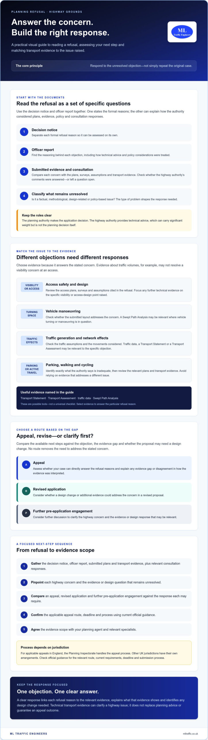
  • Transport Assessment for a Mixed-Use Scheme in Kingston upon Thames

    Transport Assessment for a Mixed-Use Scheme in Kingston upon Thames

    Could a scheme with individually modest uses still create a substantial combined transport impact? That’s the key question behind a transport assessment for mixed-use scheme in Kingston upon Thames. Residential, retail, office and other uses can generate different travel patterns, and their combined effects may influence traffic, parking, access and servicing. Whether a Transport Assessment or Transport Statement is appropriate depends on the proposal and its site-specific planning requirements, not just a single headline figure.

    Before commissioning technical work, it helps to know what evidence the planning submission may need and which local considerations could affect the analysis. This article explains how to assess each use alongside the overall scheme, what site information can support a robust submission, and how to brief a transport-planning consultant. Checking current Kingston Council requirements and agreeing the scope early can help identify missing evidence before it affects the application programme.

    Key Takeaways

    • Whether a Transport Assessment or Transport Statement is appropriate depends on the scheme’s scale, context and planning requirements. Confirm the scope for the specific site.
    • A transport assessment for mixed-use scheme in Kingston upon Thames should examine each proposed use and the combined effects of the development.
    • Build the evidence around baseline conditions, development assumptions, trip estimates and analysis of likely transport impacts.
    • Prepare site plans, a land-use schedule, access details, the project programme and known constraints to support a useful assessment brief.
    • Choose a consultant who can explain their methods, evidence needs and relevant experience. Avoid relying on promises of planning approval.

    When do you need a transport assessment for mixed-use scheme in Kingston upon Thames?

    A Transport Assessment (TA) presents evidence about a proposed development’s transport effects for consideration with a planning application. A Transport Statement (TS) may suit a proposal where a more focused account of transport matters is proportionate. The right document depends on the scheme’s scale, context, access and likely effects. There is no reason to assume one format applies to every mixed-use proposal.

    A mixed-use development brings activities such as homes, shops and offices together. Each can generate different travel demand, while the shared site may connect access, parking, servicing and other facilities. A transport assessment for mixed-use scheme in Kingston upon Thames should consider each use and test the combined proposal, rather than treating the uses as unrelated projects.

    For a brief visual introduction to Kingston upon Thames, watch this video:

    What makes mixed-use transport demand different?

    Start with the proposed uses, their scale and their operating patterns. A residential element may have different travel peaks from a workplace or shop, for example, but the assessment should test those assumptions against the actual scheme. Shared entrances, parking, delivery access and on-site facilities can also affect how people and vehicles move through the development.

    Use the land-use schedule, access plans and relevant survey or trip evidence to identify what needs testing. Don’t assume that uses will share trips, operate at separate peak times or create a particular level of vehicle demand without project-specific support.

    Which Kingston planning and transport context should be checked?

    Check the Royal Borough of Kingston upon Thames’ current validation guidance, adopted planning policies and consultation expectations before fixing the scope. The borough’s draft Local Plan for 2028-2043 is not adopted; its Regulation 19 consultation closed on 4 September 2026. The GLA’s draft London Plan consultation runs until 15 October 2026. Confirm which adopted requirements apply when preparing the application.

    Identify the relevant highway authority and consultation parties for the site. Review current information on public transport accessibility, walking and cycling connections, and site access. These checks help define a proportionate scope, but they do not replace agreement with the relevant planning and transport officers. For a wider overview of assessment considerations, see this Transport Assessment guide for London developers.

    What evidence should a Kingston mixed-use Transport Assessment examine?

    The assessment scope should reflect the scheme’s land-use mix, scale, access arrangements and the planning questions raised by the site. It should explain what evidence supports each conclusion, rather than relying on broad assumptions about how future occupants will travel. The UK government guidance on Transport Assessments is a starting point for understanding the purpose and preparation of this evidence. Confirm the project scope against current requirements for the specific application.

    Core evidence includes baseline transport conditions, clearly stated development assumptions, justified trip estimates and analysis of likely impacts. Keeping these elements distinct helps planning officers and other consultees understand how the assessment reaches its findings.

    How should the baseline and development trips be established?

    First, document the site’s existing access and nearby movement network. Depending on the site and assessment questions, this may include roads, pedestrian and cycle routes, public transport connections and existing parking conditions. Use current, relevant sources, and state their dates, coverage and limitations so readers can judge how well they represent the site.

    Then set out the development assumptions for each use. Record proposed floorspace or unit numbers, operating patterns and access arrangements, and explain how the separate elements combine. Trip estimates should be traceable to their inputs and method. If an assumption is uncertain, identify it rather than presenting it as a confirmed travel pattern.

    When might surveys and technical analysis be useful?

    Surveys can answer specific questions that existing data cannot resolve. A traffic survey may provide evidence about movements on relevant roads or at access points; a parking survey may help establish existing parking conditions. Neither is automatically necessary. Agree the survey purpose, locations, timing, coverage and method with the relevant parties, then explain any limitations and how the results inform the analysis.

    Further technical analysis should also be proportionate to the issues being tested. For example, the assessment may need to examine how estimated trips interact with access arrangements or nearby network conditions. The appropriate level depends on the proposal and agreed scope, not a preset assumption.

    ML Traffic Engineers provides traffic and parking surveys to support evidence gathering where appropriate. Link each proposed survey or analysis task to a planning question, so data collection has a clear purpose.

    • Establish the baseline and record source dates.
    • Define assumptions separately for each use and the combined scheme.
    • Use surveys or technical analysis to address an agreed evidence gap.

    Developers and planning agents can discuss the assessment scope and programme with ML Traffic Engineers before commissioning project-specific evidence.

    How should the assessment address combined impacts, access, and parking?

    A mixed-use assessment should test how the proposed uses work together. Simply adding separate trip estimates may not capture the full picture. Compare likely peak periods, visitor patterns, access needs and servicing requirements using evidence and stated assumptions. Different uses may generate travel at different times, or their demands may overlap. Shared facilities could affect travel choices, but any reduction or increase in demand needs to be supported by analysis.

    How can different uses affect one another’s travel patterns?

    Consider whether residents, employees, customers and visitors are likely to arrive at similar times, and how long each group may stay. Check whether proposed shared parking, cycle facilities or other site arrangements could influence journeys between uses. Don’t assume people will combine trips or use shared facilities simply because they are available. Explain the basis for each assumption, and assess the proposal as a whole as well as its individual elements.

    A use-specific and site-wide comparison helps clarify what the assessment needs to test:

    Use-specific questions Shared site-wide questions
    What are the likely operating hours, visitor patterns and travel needs for each use? Do peak demands overlap, and how might combined trips affect nearby movement networks?
    Does a use need dedicated parking, loading or servicing arrangements? How do access points, parking provision and servicing areas work across the site?
    What pedestrian, cycle and public transport connections are relevant to its users? Can people move between uses and connect safely with routes beyond the site?

    What should be checked for site access and movement?

    Review the access design against the proposed layout and expected movements. Relevant checks may include access geometry, visibility, pedestrian routes and cycle access. Consider vehicle access, parking, loading and servicing where they form part of the scheme, and assess how these arrangements work across the site. Match the scope to the planning questions rather than assuming every topic needs the same level of analysis.

    Where vehicle movements make manoeuvring a relevant issue, swept path analysis can illustrate how the selected design vehicle moves through access points or servicing areas. It should use plans and vehicle assumptions that apply to the proposal. See this swept path analysis planning guide for more on this type of evidence.

    A transport assessment for mixed-use scheme in Kingston upon Thames should bring these strands together, considering combined vehicle, pedestrian, cycle and public transport effects. The conclusions should explain how the assessment has treated shared demand and site constraints, distinguishing evidenced findings from assumptions that still need confirmation.

    Transport Assessment for a Mixed-Use Scheme in Kingston upon Thames

    How can developers prepare to commission a Kingston transport assessment?

    A clear brief helps a consultant identify the evidence needed, avoid using outdated design information and agree a proportionate scope with the project team. For a transport assessment for mixed-use scheme in Kingston upon Thames, cover both the separate uses and their combined effects, while leaving site-specific requirements open for confirmation.

    Use this sequence to move from an initial brief to an agreed scope:

    1. Set out the proposal. Provide the site location, latest plans, land-use schedule and proposed access details.
    2. Explain the planning context. Share the application status, known planning questions and any discussions or consultation expectations identified so far.
    3. Confirm current requirements. Check the Royal Borough of Kingston upon Thames’ validation guidance and relevant adopted policy. Establish which highway authority and consultation parties apply to the site.
    4. Identify evidence needs. Review available transport data and consider whether traffic or parking surveys, or other analysis, would answer specific planning questions. Agree the scope before fixing assumptions or commissioning evidence.
    5. Agree the method and programme. Confirm the assessment tasks, information dependencies, deliverables and review stages with the consultant and wider planning team.

    For broader context on the purpose and preparation of this work, read the Transport Assessment guide for London developers.

    What information should the project team provide?

    Send the latest site location and layout plans, access details, proposed uses and their scale, the project programme, and known site constraints. Include relevant planning correspondence, available surveys and design changes that could affect movement or access. A concise information pack gives the consultant a clearer basis for scoping the assessment.

    Separate confirmed facts from working assumptions. For example, identify which access arrangements appear on the current design and which remain under review. Note the date and coverage of available survey information so its relevance can be checked before it informs the assessment.

    What should you ask a Transport Assessment consultant?

    Ask how the proposed method will address each use and the combined site-wide effects. Clarify the data sources, assumptions, survey recommendations and reasoning behind the scope. Check what information the consultant needs from the project team, which deliverables are included and when reviews will take place.

    Discuss how findings will be coordinated with the wider planning team, particularly if the design or land-use mix changes. A well-defined scope should make responsibilities and evidence gaps visible early, without promising a particular planning outcome.

    To discuss a project brief and assessment scope, contact ML Traffic Engineers.

    Choosing a consultant for your Kingston mixed-use Transport Assessment

    The right consultant should make the assessment process clear from the outset. Look for experience preparing planning evidence for mixed-use proposals and coordinating it with the wider project team. Ask how they will check current local requirements and identify relevant consultees for your site, rather than relying on general claims of Kingston expertise.

    Compare the proposed scope and method, not promises of planning approval. A clear proposal should explain the work, deliverables, information needed from your team and how assumptions or limitations will be reported. This gives you a practical basis for comparing consultants.

    What indicates a suitable transport-planning partner?

    Ask how the consultant will respond to design changes and relevant stakeholder feedback. Check whether they will explain how updates affect the evidence, analysis or agreed scope, and how they will communicate those changes to the project team. Proposed surveys or technical work should have a defined purpose linked to planning questions.

    Local context matters, but ask how the consultant will establish what applies to your site. This may include checking current Royal Borough of Kingston upon Thames guidance, access arrangements and relevant transport information.

    How can ML Traffic Engineers UK support the assessment process?

    ML Traffic Engineers UK prepares Transport Assessments, Transport Statements and Travel Plans for planning applications. The consultancy works across Greater London, Manchester, Birmingham, the West Midlands, Liverpool, Surrey, East Sussex, West Sussex, Hampshire, Berkshire and Buckinghamshire. Where appropriate to the agreed scope, traffic and parking surveys can provide project-specific evidence, while swept path analysis can examine vehicle manoeuvring shown in the proposed design. The consultancy was founded in 2014.

    Before appointing a consultant, agree the information required from your project team, proposed deliverables and how the assessment will align with the planning programme. These discussions establish a clear basis for the work without implying a guaranteed planning decision.

    Ready to discuss the scheme and appropriate next steps? Discuss your Kingston mixed-use scheme with the transport team.

    Set a clear course for your planning submission

    A robust assessment depends on a clear, site-specific scope and evidence that addresses the proposal’s planning questions. Confirm current local requirements, and make sure the report distinguishes established information from assumptions that still need checking.

    Early coordination helps keep the assessment aligned with the scheme as it develops. ML Traffic Engineers prepares Transport Assessments, and traffic and parking surveys can support project-specific evidence where appropriate. Discussing the brief and programme early can help clarify suitable next steps.

    Discuss your Kingston mixed-use scheme with the transport team to agree a suitable scope for your planning submission.

    Frequently Asked Questions

    Does a mixed-use development in Kingston upon Thames need a Transport Assessment?

    Not automatically. The appropriate evidence depends on the proposal’s scale, land-use mix, access, location and likely transport effects, alongside current planning requirements. Check the Royal Borough of Kingston upon Thames’ current validation guidance and relevant policy, and confirm the scope with the relevant officers. Don’t rely on a single threshold without verifying whether it applies to your specific scheme.

    What should a Transport Assessment for a mixed-use scheme include?

    It should set out existing transport conditions, describe the development and its assumptions, estimate travel demand and assess likely effects. For a transport assessment for mixed-use scheme in Kingston upon Thames, the analysis should consider each proposed use and the combined development, including relevant effects on vehicle movement, walking, cycling, public transport, parking, access and servicing. The final scope should address the planning questions raised by the site.

    How is a Transport Assessment different from a Transport Statement?

    A Transport Assessment generally provides a more detailed examination of a development’s transport effects, while a Transport Statement is a more proportionate document for proposals with more limited transport considerations. The distinction is not determined by a universal rule for every site. Check the Royal Borough’s current validation requirements and discuss the proposal’s scale, context and likely effects with the relevant planning team before commissioning either document.

    What surveys might a Kingston mixed-use Transport Assessment require?

    Depending on the evidence gap, the assessment may use traffic surveys to understand movements on relevant roads or access points, or parking surveys to establish existing parking conditions. Surveys are not automatically required for every application. Agree their purpose, locations, timing, coverage and method for the project, and explain the data’s relevance and limitations in the report. Existing sources may also be suitable if they address the planning questions.

    Who reviews a Transport Assessment for a development in Kingston upon Thames?

    The planning authority considers the assessment as part of the application, and relevant transport or highway officers may provide input. The appropriate highway authority and consultation parties depend on the site and the network affected, so confirm them for the specific proposal. Other consultees may be involved where relevant. Check current Kingston validation guidance and clarify consultation expectations rather than assuming the same review route applies to every site.

    When should I appoint a transport assessment consultant?

    Appoint a consultant early enough to inform the development brief and coordinate transport evidence with design and planning work. Early scoping can identify what site information is available, which assumptions need confirmation and whether surveys may be useful. It also gives the team an opportunity to check current local requirements before fixing the assessment method. If plans change, share updated information so the scope and analysis can be reviewed.

    Can one Transport Assessment cover several uses in a single development?

    Yes. A single Transport Assessment can be scoped to examine multiple uses within one development, considering both their individual travel characteristics and their combined effects. The report should explain how its assumptions and analysis apply to each use and the site as a whole. Confirm the appropriate approach with the planning team, particularly if the proposal involves separate applications, distinct phases or changing development details.

    Michael Lee

    Article by

    Michael Lee

    Transport planner with over 35 years' experience.

    Disclaimer

    The content on mltraffic.co.uk, including all technical articles, guides, and resources, is provided for general informational and educational purposes only. It is not intended to constitute professional advice in traffic engineering, transportation planning, development approvals, or any other technical or legal field.
    While ML Traffic Engineers makes every reasonable effort to ensure the accuracy, completeness, and timeliness of the information published, we do not provide any warranties or representations (express or implied) regarding its reliability, suitability, or availability for any particular purpose. Any reliance you place on the content is strictly at your own risk.
    In no event shall ML Traffic Engineers, its directors, employees, authors, or affiliates be liable for any direct, indirect, incidental, special, consequential, or punitive damages (including, without limitation, loss of profits, data, or business opportunities) arising out of or in connection with the use of, or inability to use, any information provided on this website.
    The articles and guides on this site are not a substitute for engaging a qualified, professional traffic engineer to assess your specific project requirements. For tailored advice, compliance assessments, or traffic engineering services, please contact a competent professional.
    This disclaimer may be updated from time to time without notice. By accessing or using this website, you agree to be bound by the most current version of this disclaimer.
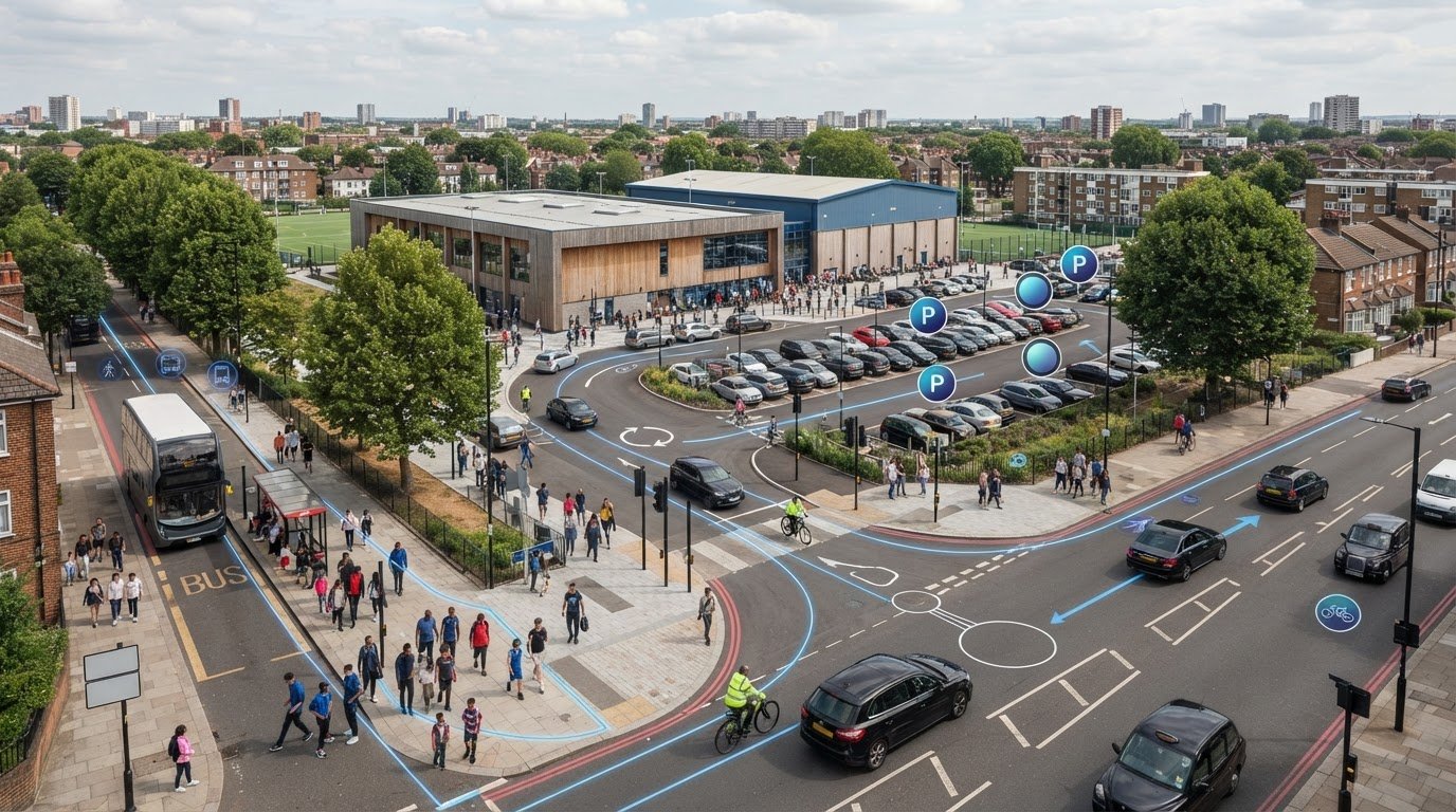
  • How to Get Planning Permission with Limited Parking: A 2026 Developer’s Guide

    How to Get Planning Permission with Limited Parking: A 2026 Developer’s Guide

    The days of rigid parking ratios are officially over, yet a shortfall in spaces remains the fastest route to a planning refusal in 2026. You likely feel the pressure of balancing maximum unit density against strict local standards that seem designed to restrict your site footprint. It’s frustrating to see a viable project stalled because of highway objections, especially when you’re navigating the latest NPPF updates and the new Sustainable Access Measure (SAM) metrics.

    Securing approval isn’t about luck; it’s about shifting the narrative from a deficiency to a data-driven justification. Understanding how to get planning permission with limited parking requires a precise, technical approach that satisfies both local planners and national policy. This guide provides the expert strategies you need to defend reduced parking provision through professional Parking Surveys and Swept Path Analysis. We’ll examine how to align your submission with the 2026 London Plan’s car-lite default and the specific requirements of Policy TR2. By the end of this article, you’ll have a clear roadmap to produce compliant transport documentation that protects your density and satisfies the most stringent regulatory environments.

    Key Takeaways

    • Align your site with the August 2026 NPPF and London Plan SAM metrics to leverage the national shift toward car-lite urban development.
    • Learn how to get planning permission with limited parking by using professional Parking Surveys to demonstrate sufficient on-street capacity.
    • Utilise Swept Path Analysis to prove that constrained footprints can still accommodate essential refuse and emergency service access safely.
    • Implement robust mitigation measures, such as formal Parking Management Plans and Car Club schemes, to offset the impact of reduced on-site spaces.
    • Consolidate your technical data into a professional Transport Statement to secure a Statement of Common Ground with local highway authorities.

    Planners often prioritize unit density and sustainable transport over traditional parking bays. Understanding how to get planning permission with limited parking begins with acknowledging that Local Planning Authorities (LPAs) must align with the National Planning Policy Framework (NPPF). While local plans set specific standards, the NPPF encourages flexibility, especially in accessible locations where car-free development supports net-zero targets. The shift toward “car-lite” urban living isn’t just a trend; it’s a policy requirement designed to optimize site footprints and reduce carbon emissions.

    The NPPF and the Threshold for Refusal

    The August 2026 NPPF update clarifies that transport grounds are only valid for refusal if the impact on highway safety is unacceptable or the “severe residual cumulative impact” on the road network is proven. This test means that a shortfall in parking spaces isn’t enough for a rejection on its own. Planners need technical evidence that your development will cause dangerous overspill or gridlock. We help you demonstrate that your site remains safe and functional by following the principles in the Manual for Streets, which prioritizes active travel over private vehicle storage. The “severe residual cumulative impact” test is a high bar that requires the authority to prove that the combined transport effects of a development will lead to a significant breakdown in the local road network’s efficiency.

    Local Borough Variations: London vs. The Regions

    Policy requirements shift significantly depending on your site’s geography. In London, the 2026 Draft London Plan makes car-free development the default in areas with a high Sustainable Access Measure (SAM) rating. Conversely, cities like Manchester, Birmingham, and Liverpool are increasingly adopting “car-lite” models for city-centre residential schemes to maximize housing delivery. If you’re developing in the capital, you’ll need to navigate specific maximum standards rather than minimums. For a deeper look at these requirements, see our Transport Statement London: A Developer’s Buying Guide for 2026.

    Getting pre-application advice is non-negotiable for constrained sites. It allows us to identify the Highway Officer’s specific concerns early. By addressing these through a tailored strategy, you can justify a reduced parking provision before the full application fee, which is currently £752 per dwelling for schemes under 10 units, is committed. We focus on providing the technical data needed to bypass these logistical hurdles and secure a positive recommendation from transport officers.

    Proving Sustainability: PTAL Ratings and Parking Surveys

    Sustainability isn’t a buzzword in planning; it’s a measurable metric. When determining how to get planning permission with limited parking, your strongest asset is a high Public Transport Accessibility Level (PTAL) rating. In urban centres, a PTAL score between 4 and 6 often allows for zero-parking residential schemes, provided you can demonstrate that residents won’t need private vehicles. We use TRICS data to reinforce this by comparing your site against thousands of similar developments, predicting actual vehicle trip generation with high accuracy. This evidence-based approach aligns with the National Planning Policy Framework (NPPF), which mandates that developments should be located where they can minimize the need for travel.

    The Lambeth Methodology for Parking Stress Surveys

    Local authorities won’t just take your word for it. They require a formal Parking Survey conducted using the Lambeth Methodology. This industry standard involves assessing on-street parking stress within a 200-metre walking distance of the site. Crucially, these counts happen between 1 a.m. and 3 a.m. on two separate weekday nights. This data proves that even with “limited parking” on-site, the local street network has the capacity to absorb any residual overspill without compromising safety or access. If the survey shows parking stress is below 85%, planners are far more likely to approve reduced provision. Our team manages these professional Parking Surveys to provide the precise data Highway Officers demand.

    Beyond PTAL: Assessing Multi-Modal Connectivity

    Accessibility extends beyond bus and rail frequency. We also evaluate the quality of local cycle infrastructure and pedestrian links. If a site is within a “15-minute city” context-close to groceries, schools, and healthcare-the argument for a car-free lifestyle becomes undeniable. We look at the Sustainable Access Measure (SAM) to provide a granular view of connectivity. By demonstrating that future residents have immediate access to multi-modal transport, we clarify how to get planning permission with limited parking by proving that private car ownership is a choice, not a necessity. This data-driven narrative shifts the focus from what the site lacks to what it offers in terms of modern, sustainable living.

    Effective Mitigation Strategies for Low-Parking Developments

    Mitigation is the bridge between a parking shortfall and a successful planning outcome. Understanding how to get planning permission with limited parking often hinges on the quality of your mitigation package. We focus on creating robust Parking Management Plans that control on-site behaviour and prevent unauthorized use of visitor spaces. By formalizing these arrangements, you reassure the Local Planning Authority that the development won’t negatively impact the surrounding highway network. Another powerful tool is the Section 106 agreement. Many urban councils will approve car-lite schemes if you agree to “permit-free” legal clauses. These prevent residents from applying for on-street parking permits, effectively neutralizing concerns about overspill in Controlled Parking Zones (CPZs).

    High-quality cycle storage also plays a critical role. Don’t just meet the minimum standards; exceed them. Providing secure, easily accessible, and weather-protected storage for cargo bikes and electric cycles demonstrates a genuine commitment to active travel. This proactive approach helps shift the planning officer’s focus away from the lack of car bays and toward the site’s modern, sustainable credentials.

    Implementing a Robust Travel Plan

    A Travel Plan isn’t just a document; it’s a legal commitment to sustainable transport. Following official government guidance, we develop bespoke packages that include public transport vouchers, bike-share memberships, and resident information packs. These measures are designed to influence travel behaviour from day one. If you’re looking for technical support in this area, our Travel Plan Consultants: Strengthening Planning Applications in 2026 can help you design incentives that satisfy both the LPA and future occupants. A well-structured plan reduces the predicted trip generation of your site, making a low-parking provision much easier to justify.

    Car Clubs and Shared Mobility Solutions

    Developers often ask how to get planning permission with limited parking when site footprints are tight; the answer often lies in shared mobility. One Car Club bay can replace between 10 and 20 private parking spaces, significantly increasing your developable area. We assist in negotiating with providers to install on-site bays or fund nearby infrastructure. Integrating EV charging points with a minimum 7kW output, as required by Building Regulations Part S, further strengthens your case. This infrastructure shows the council that you’re preparing for the future of transport without cluttering the streetscape with underutilised private vehicles. It’s a precise, functional solution that balances density with regulatory compliance.

    Maximizing Efficiency with Swept Path Analysis and Smart Design

    Planning success often depends on proving that a constrained site functions safely in the real world. While previous sections focused on policy and sustainability, this stage requires technical proof of vehicle movement. Swept Path Analysis (SPA) is the tool that turns architectural concepts into functional evidence. It simulates the turning circles of specific vehicles to ensure that a development doesn’t cause a detrimental impact to highway safety. When you’re figuring out how to get planning permission with limited parking, SPA prevents refusals by showing that vehicles can enter and exit in a forward gear, even when space is at a premium.

    Smart design goes beyond just fitting cars into bays. We often recommend “Shared Space” principles to reduce the visual dominance of vehicles. By using high-quality materials and removing traditional kerbs, you can create areas where pedestrians and vehicles coexist safely. This design approach, supported by technical analysis, reassures planners that your site prioritizes people without compromising operational safety. If you need to demonstrate that your layout is viable, order a professional Swept Path Analysis to secure your submission.

    Ensuring Access for Service and Emergency Vehicles

    Local Planning Authorities (LPAs) prioritize refuse collection and emergency access over resident parking. If a refuse truck cannot maneuver safely or a fire tender is blocked by tight corners, the application will fail regardless of your PTAL score. We use SPA to map the exact requirements for a standard UK refuse vehicle, typically 9.2 metres to 11.5 metres in length. Our AutoTURN Swept Path Analysis: A Practical Guide for 2026 explains how this software provides the precision needed to satisfy Highway Officers. By demonstrating that vital service vehicles have clear paths, you protect your unit density while meeting strict safety benchmarks.

    Optimizing Car Park Layouts for Constrained Sites

    When horizontal space is limited, we look at vertical and unallocated solutions. Car lifts and automated parking systems can significantly reduce the footprint required for vehicle storage, allowing for more residential units. We also help justify tandem parking or unallocated parking strategies, which are often more efficient than assigning specific bays to specific flats. SPA justifies the narrowest possible compliant access routes by showing exactly how much clearance a vehicle requires at every point of a turn. This level of detail allows you to maximize every square metre of your site while maintaining full regulatory compliance. Precise data ensures that “limited parking” is seen as a deliberate, safe, and efficient design choice rather than a logistical failure.

    How to Get Planning Permission with Limited Parking: A 2026 Developer’s Guide

    Building a Robust Transport Case for Your Planning Application

    A successful submission requires more than just raw data; it requires a synthesis of every technical report into a singular, persuasive narrative. When determining how to get planning permission with limited parking, you must present your mitigation strategies as a cohesive “Sustainability Package.” This approach demonstrates that your site isn’t just “lacking” bays, but is actively designed for a modern, post-car environment. We consolidate your Parking Surveys, Swept Path Analysis, and Travel Plans into a professional Transport Statement or Assessment that speaks the language of the Local Planning Authority. Precise documentation reduces the regulatory pressure on planners, making it easier for them to recommend your project for approval.

    A vital part of this process is securing a “Statement of Common Ground” with Highway Officers. This document outlines the points where both the developer and the authority agree, effectively narrowing the scope of potential conflict. It shows that you’ve engaged with their concerns and provided technical solutions for every logistical hurdle. If a project reaches a planning committee, having this agreement in place significantly increases the likelihood of a positive vote. Professional representation at these committees is essential to defend the technical data and ensure that the “severe impact” threshold remains the standard for any transport-related objections.

    The Anatomy of a Successful Transport Statement

    The executive summary must address the parking shortfall head-on. Don’t hide the numbers; justify them through the lens of accessibility and safety. The “Policy Compliance” chapter is equally critical, as it links your specific design choices to the 2026 London Plan or your relevant local framework. For developers working in the capital, our Transport Assessment London: The Developer’s 2026 Guide provides a deeper breakdown of how to structure these documents for maximum impact. We ensure that every paragraph reinforces the site’s sustainability and compliance with national standards.

    Engaging with the Local Highway Authority

    Proactive communication is the best way to reduce the risk of formal objections. We recommend sharing draft findings with the Highway Authority early in the process. This allows us to respond to “Further Information” requests regarding parking stress or vehicle maneuvering before they become barriers to approval. By maintaining a transparent, data-led dialogue, we build the trust necessary to secure planning permission on even the most constrained sites. Ready to justify your site? Contact ML Traffic Engineers UK for a professional assessment. Our team provides the technical authority and regulatory expertise needed to navigate high-stakes planning environments with confidence.

    Securing Your Development’s Future in a Car-Lite Landscape

    The shift toward sustainable, high-density urban development is a regulatory reality that developers must embrace to avoid costly planning refusals. Success depends on moving beyond basic policy compliance to provide high-resolution technical data that Highway Officers cannot ignore. By integrating professional Parking Surveys with Expert Swept Path Analysis, you transform a potential parking shortfall into a robust, safe, and sustainable design choice.

    Established in 2014, ML Traffic Engineers UK acts as specialist UK transport planning consultants, helping you navigate intricate regional regulations across Greater London and major UK cities. We’ve explored how SAM metrics and mitigation strategies like Car Clubs effectively replace private bays. These elements provide the technical foundation for how to get planning permission with limited parking in 2026. Our team is ready to deliver the precision reports your project requires to satisfy strict safety benchmarks and protect your unit density.

    Get a Transport Statement Quote for Your Project

    Your project’s approval is within reach when backed by technical authority and a clear transport strategy. Let’s secure your site’s potential today.

    Frequently Asked Questions

    Can I get planning permission with zero parking spaces?

    Yes, especially in urban centres like Greater London or Manchester where Public Transport Accessibility Levels (PTAL) are high. The August 2026 NPPF and local plans increasingly favour car-free developments in sustainable locations. You must prove that residents have access to high-quality active travel and public transport alternatives. A robust Travel Plan and a permit-free legal agreement usually support these applications to prevent local parking stress.

    What is a PTAL rating and how does it affect my planning application?

    PTAL stands for Public Transport Accessibility Level, a standard UK metric that measures the distance from a point to the nearest public transport stops and the frequency of services. Ratings range from 0 to 6b. A high PTAL rating is essential for justifying a shortfall in spaces. Planners use this score to determine maximum parking standards, often allowing zero-parking schemes in areas with ratings of 4 or higher.

    What happens if my development doesn’t meet local parking standards?

    Failure to meet local standards often triggers a highway objection, but it isn’t an automatic refusal. You must provide technical evidence, such as a professional Parking Survey, to prove that any overspill won’t impact highway safety or local amenity. We use this data to demonstrate how to get planning permission with limited parking by showing that the local street network has sufficient capacity to absorb residual demand without causing congestion.

    How much does a professional parking survey cost for planning?

    Costs for Parking Surveys vary based on the site location, the number of streets surveyed, and the specific methodology required by the Local Planning Authority. Factors like overnight stress testing or the need for multi-day counts influence the total project fee. Developers should budget for specialized data collection that meets the Lambeth Methodology standards to ensure the results are accepted by Highway Officers during the application process.

    Is a Travel Plan mandatory for small developments with limited parking?

    A formal Travel Plan is often required if you’re proposing a significant reduction in parking, regardless of the development size. It acts as a legal commitment to encourage sustainable transport through measures like public transport vouchers or cycle-share schemes. For smaller sites, a Travel Plan Statement might suffice. These documents are vital for proving that the development won’t lead to an unacceptable increase in private vehicle trips on local roads.

    How does Swept Path Analysis help with parking-constrained sites?

    Swept Path Analysis (SPA) uses specialized software to simulate vehicle movements within your site layout. It proves that despite limited space, essential vehicles can enter and exit safely in a forward gear. SPA is a critical component in understanding how to get planning permission with limited parking because it provides technical proof of safety. This analysis reassures planners that the development remains functional for all users, preventing refusals based on highway safety grounds.

    What is a “car-free” legal agreement in planning?

    A car-free agreement is a legal clause, often under Section 106, that prevents residents of a new development from obtaining on-street parking permits. This is a common requirement in Controlled Parking Zones (CPZs) within Greater London and other major UK cities. It effectively mitigates the impact of a low-parking scheme on the surrounding community. Planners view this as a non-negotiable tool for managing local road network capacity and promoting sustainable travel.

    Can refuse vehicle access requirements stop my project?

    Yes, inadequate service vehicle access is a frequent cause of planning refusal. Local authorities prioritize the safe movement of refuse trucks and emergency tenders over resident parking bays. If your layout doesn’t accommodate the turning circles of a standard 11.5-metre refuse vehicle, the project will likely be rejected. We use Swept Path Analysis to ensure your design meets these critical operational requirements while maximizing your site’s unit density and overall footprint efficiency.

    Michael Lee

    Article by

    Michael Lee

    Transport planner with over 35 years' experience.

    Disclaimer

    The content on mltraffic.co.uk, including all technical articles, guides, and resources, is provided for general informational and educational purposes only. It is not intended to constitute professional advice in traffic engineering, transportation planning, development approvals, or any other technical or legal field.
    While ML Traffic Engineers makes every reasonable effort to ensure the accuracy, completeness, and timeliness of the information published, we do not provide any warranties or representations (express or implied) regarding its reliability, suitability, or availability for any particular purpose. Any reliance you place on the content is strictly at your own risk.
    In no event shall ML Traffic Engineers, its directors, employees, authors, or affiliates be liable for any direct, indirect, incidental, special, consequential, or punitive damages (including, without limitation, loss of profits, data, or business opportunities) arising out of or in connection with the use of, or inability to use, any information provided on this website.
    The articles and guides on this site are not a substitute for engaging a qualified, professional traffic engineer to assess your specific project requirements. For tailored advice, compliance assessments, or traffic engineering services, please contact a competent professional.
    This disclaimer may be updated from time to time without notice. By accessing or using this website, you agree to be bound by the most current version of this disclaimer.
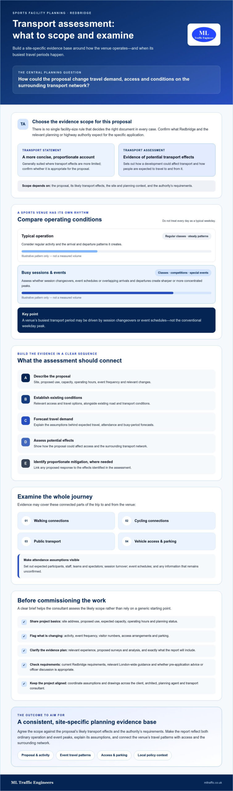
  • What Are Section 106 Transport Contributions? A 2026 Developer Guide

    What Are Section 106 Transport Contributions? A 2026 Developer Guide

    Section 106 transport contributions are negotiable legal mechanisms, not non-negotiable development taxes. When developers ask what are the section 106 transport contributions that local highway authorities demand, they are often met with rigid council formulas that threaten overall scheme viability. Protracted planning debates over these financial payments frequently stall full planning permission, while the line between Section 106 developer contributions and Section 278 works remains frustratingly blurred.

    You don’t have to accept arbitrary local authority demands at face value. In this 2026 guide, you’ll discover how transport obligations are calculated, how statutory planning tests protect your scheme against double-dipping alongside the Community Infrastructure Levy, and how commissioning robust technical evidence, such as defensible Transport Assessments and Travel Plans, gives you the leverage to challenge excessive financial requests.

    Below, we examine the legal framework governing council requests, distinguish your financial contributions from physical highway obligations, and detail the technical documentation required to safeguard your project budget.

    Key Takeaways

    • Understand what are the section 106 transport contributions and how the Town and Country Planning Act 1990 defines them as targeted site mitigations rather than blanket infrastructure taxes.
    • Apply the three statutory tests under Regulation 122 of the CIL Regulations 2010 to ensure council financial requests remain strictly necessary, directly related, and proportionate in scale.
    • Distinguish negotiated Section 106 developer contributions from standard Community Infrastructure Levy charges and Section 278 highway works to eliminate double-charging risks.
    • Identify the formula-driven metrics local highway authorities use to calculate trip generation and evaluate where standard council models overestimate traffic impact.
    • Deploy defensible technical evidence, including Transport Assessments, Traffic Surveys, and Travel Plans, to challenge inflated contribution requests and safeguard your scheme’s viability.

    What Are Section 106 Transport Contributions in UK Planning?

    When preparing planning submissions for major or minor schemes, developers frequently ask: what are the section 106 transport contributions that local highway authorities routinely demand? In simple terms, these contributions are bespoke, legally binding planning obligations negotiated between a developer and a local planning authority (LPA). Their operational purpose is clear: to deliver financial payments or targeted physical interventions that directly counteract the traffic, public transit, and highway safety impacts generated by a new development.

    Left unmitigated, development-generated vehicle trips can overload junctions, erode pedestrian safety, and strain public transport capacity. Transport contributions ensure that the financial responsibility for absorbing site-specific impact remains with the developer, protecting existing public services and surrounding road networks from severe residual operational harm.

    Statutory Basis Under the Town and Country Planning Act 1990

    These legal commitments derive their authority directly from Section 106 of the Town and Country Planning Act 1990. Formalised as planning deeds executed under seal, these agreements bind anyone holding an interest in the land. Crucially, S106 obligations run with the land title rather than the individual applicant. If ownership transfers before discharge, all liabilities transfer to the successor in title.

    Under this legal structure, highway authorities secure three core mechanisms:

    • Negative covenants: Restricting the commencement, fit-out, or occupation of buildings until defined highway milestones or transport provisions are completed.
    • Positive obligations: Requiring the developer to carry out specific operational actions or monitoring programmes over set delivery windows.
    • Financial contributions: Direct monetary transfers allocated to local highway authorities to fund off-site transport interventions.

    Common Types of Transport Mitigation Funded via Section 106

    Understanding precisely what are the section 106 transport contributions that authorities seek helps developers scrutinise local council claims early. Common mitigation provisions include:

    • Public transit enhancements: Direct revenue subsidies to increase local bus route frequencies or fund bus stop upgrades within walking distance.
    • Active travel infrastructure: Capital funding for dedicated cycle tracks, pedestrian footway widening, and signalised road crossings.
    • Parking and traffic management: Developer funding for local traffic regulation orders (TROs) to extend controlled parking zones (CPZs) or alter junction signals.
    • Multi-year monitoring fees: Dedicated financial sums enabling highway officers to audit operational performance under an approved Travel Plan over three to five years.

    The Statutory Tests Governing Section 106 Transport Obligations

    Local planning authorities cannot levy open-ended financial requests on a whim. While highway officers routinely issue standardized contribution schedules, establishing precisely what are the section 106 transport contributions developers legitimately owe requires testing those claims against statutory benchmarks. Under Regulation 122 of the Community Infrastructure Levy (CIL) Regulations 2010, an obligation can only constitute a lawful reason for granting planning permission if it complies with three strict legal tests. If an authority’s request fails even one requirement, it cannot be legally enforced.

    The Three Mandatory Legal Tests of Regulation 122

    To pass statutory scrutiny under Section 106 of the Town and Country Planning Act 1990 and Regulation 122, transport obligations must satisfy three cumulative criteria:

    • Necessary to make the development acceptable in planning terms: The payment must prevent an unacceptable highways impact, such as severe junction congestion or compromised road safety. It cannot simply fund general council wish lists.
    • Directly related to the development: The physical intervention or transit upgrade must have an unambiguous operational link to the proposed site.
    • Fairly and reasonably related in scale and kind: The requested financial sum must reflect only the specific proportion of impact caused by the scheme’s net new trips.

    Scrutinizing Cumulative Traffic Impact and Pooling Restrictions

    Highway authorities often attempt to use private schemes to resolve pre-existing network deficits. However, developers aren’t responsible for fixing historical congestion or funding deferred council maintenance. Planning obligations must exclusively address the direct, residual impact created by the proposed change of use or new floorspace.

    Scrutinizing what are the section 106 transport contributions requested on your site means cross-examining the baseline network assumptions used by the local authority. Technical reviews isolate site-generated trips from background traffic growth, exposing arbitrary funding requests or double-dipping alongside broad community levies. When facing contentious highway obligations, consulting with ML Traffic Engineers UK equips your planning team with the empirical baseline data required to challenge inflated council demands and safeguard scheme viability.

    Section 106 Contributions vs. CIL vs. Section 278 Agreements

    Planning conditions and developer levies frequently overlap, creating significant confusion during planning determinations. When evaluating what are the section 106 transport contributions for a specific site, applicants must separate site-specific mitigation payments from blanket infrastructure levies and direct highway works. Confusing these three distinct legal mechanisms often causes developers to pay twice for the same road improvements.

    The table below provides a clear, side-by-side comparison of the core instruments used by local planning authorities to fund and deliver highway infrastructure:

    Mechanism Primary Legislation Core Purpose Financial Format
    Section 106 Town and Country Planning Act 1990 Site-specific mitigation of immediate impacts Negotiated financial sums or positive covenants
    CIL Planning Act 2008 / CIL Regulations 2010 Sub-regional and strategic capital projects Non-negotiable fixed tariff per square metre
    Section 278 Highways Act 1980 Direct physical construction on adopted roads Works delivered directly or secured via bond

    Key Distinctions Between Section 106 and Community Infrastructure Levy

    The Community Infrastructure Levy (CIL) operates as a mandatory, area-wide charge based on net additional gross internal floor area. Local authorities pool these funds to deliver sub-regional capital works, such as new bypasses or major rail enhancements. In contrast, Section 106 obligations remain strictly site-specific and negotiable.

    Under national statutory tests for planning obligations, councils cannot use Section 106 to double-fund infrastructure items already scheduled under their local CIL spending strategy. Councils turn to Section 106 only when localized issues, such as a deficient nearby pedestrian crossing or lack of bus stop capacity outside the site boundary, cannot wait for broad CIL allocation cycles.

    Financial Section 106 Obligations vs. Direct Section 278 Works

    A critical operational boundary separates Section 106 contributions from Section 278 agreements. Section 106 primarily secures financial payments or operational policies, transferring cash to the council so they can deliver off-site transport services. Section 278 of the Highways Act 1980, however, governs the actual physical modifications made to adopted highways, such as installing a new priority junction, site bellmouth, or dedicated right-turn lane.

    On complex residential and commercial sites, these two mechanisms operate in tandem. A Section 106 agreement establishes the overarching planning requirement and financial triggers, while technical highway delivery proceeds under an approved highway design S278 and S38 agreement. Distinguishing these agreements early ensures developers don’t mistakenly pay cash under Section 106 for road layouts they are already constructing under Section 278.

    What Are Section 106 Transport Contributions? A 2026 Developer Guide

    How Authorities Calculate Section 106 Highway Contributions

    Local highway authorities rarely use identical formulas when calculating infrastructure payments. Instead, individual councils set out their preferred calculation methodologies in Supplementary Planning Documents (SPDs). When evaluating what are the section 106 transport contributions applicable to a development, planning officers generally calculate charges either per net vehicular trip or as a standard tariff per residential unit or commercial floorspace band.

    Because baseline trip projections directly dictate your financial liability, accepting generic council calculations without independent technical scrutiny can inflate project costs significantly.

    Trip Generation Metrics and Standard Local Tariffs

    Most local authorities determine impact using computerised trip-generation databases, primarily TRICS. Planning officers apply average trip rates across selected land-use classes to establish how many peak-hour vehicle trips a scheme will add to surrounding junctions during morning and evening commuter windows.

    In highly accessible urban areas, councils adjust these formulas using Public Transport Accessibility Levels (PTAL). Where car ownership is actively discouraged, authorities redirect their contribution requests toward public transport, cycling infrastructure, and pedestrian improvements.

    Challenging Unsubstantiated Local Authority Demands

    Developers don’t have to accept standard council formulas without question. Standard contribution matrices often treat brownfield sites as vacant land, ignoring the historic traffic previously handled by surrounding junctions. This oversight routinely leads to inflated financial demands.

    The most reliable strategy to challenge what are the section 106 transport contributions levied by a council is proving your net trip impact. If an existing commercial building or active facility already generates trips, those existing movements must be deducted from the proposed scheme’s projected traffic. If the net change in peak-hour vehicle movements is negligible, the authority loses its legal justification for requesting heavy highway mitigation payments.

    Commissioning an independent, highly detailed Transport Assessment provides the multi-modal trip evidence you need to challenge arbitrary formulas, offset existing site trip rates, and prevent budget overruns during planning negotiations.

    Mitigating Transport Contributions with Robust Planning Reports

    When developers examine what are the section 106 transport contributions requested by planning officers, they often overlook their greatest negotiation asset: technical documentation. Precise transport reports serve as the primary line of defence against arbitrary or inflated financial obligations. Under national planning policy, planning applications should only be refused on highway grounds if there would be an unacceptable impact on highway safety, or the residual cumulative impacts on the road network would be severe. Producing robust technical evidence during pre-application stages prevents councils from imposing disproportionate funding formulas on your development.

    Demonstrating Minimal Impact via Statements and Assessments

    For smaller commercial or residential proposals, submitting a focused transport statement establishes baseline accessibility without triggering expansive network obligations. For larger, higher-density schemes, a comprehensive transport assessment provides detailed junction capacity modelling, showing whether existing road infrastructure can accommodate projected trips without capital works.

    Integrating empirical parking surveys and swept path analyses directly within these reports resolves internal access and servicing concerns on-site. By proving operational safety within your red-line boundary, you eliminate the planning justification for speculative off-site junction levies.

    Leveraging Travel Plans to Offset Capital Demands

    Financial mitigation isn’t the only solution for managing highway impact. Delivering an active, enforceable Travel Plan allows developers to substitute expensive capital contributions with measurable demand-management strategies. By committing to targeted mode shifts toward public transport, car clubs, and cycle infrastructure, you demonstrate that your site won’t overburden local road corridors during commuter peaks.

    Engaging specialized travel plan consultants ensures your monitoring package meets local planning authority criteria while keeping long-term operational costs controlled. Instead of accepting vague estimates of what are the section 106 transport contributions developers must pay, presenting defensible travel planning documentation shifts discussions from expensive highway expansion to efficient, sustainable trip management.

    Protect Your Scheme Viability Against Excessive S106 Demands

    Managing planning agreements requires technical clarity and commercial vigilance. Knowing precisely what are the section 106 transport contributions requested on your site ensures you don’t overpay for wider council infrastructure. These obligations aren’t fixed taxes. By applying Regulation 122 statutory tests and separating site-specific mitigation from CIL and Section 278 works, developers retain the legal right to challenge unsubstantiated financial levies.

    Defensible technical evidence remains your strongest asset at the negotiating table. Since 2014, our team has delivered robust planning reports that protect scheme viability across Greater London, Birmingham, Manchester, and Southern regions. Don’t let speculative council formulas derail your timeline or inflate your project costs. Instruct ML Traffic Engineers UK to assess and optimize your planning transport documentation, from rapid Transport Statements and Assessments to enforceable Travel Plans, and secure the planning approvals your project deserves.

    Frequently Asked Questions

    Can a developer refuse to pay a Section 106 transport contribution?

    Yes, developers can challenge or refuse an obligation if the council’s request fails Regulation 122 statutory tests. However, outright refusal without empirical counter-evidence typically results in an immediate planning refusal. Developers challenge demands by submitting technical assessments showing negligible net traffic impact or by presenting viability assessments proving the contribution threatens scheme deliverability.

    How do councils calculate the cost per trip for transport contributions?

    Councils calculate cost per trip by dividing total planned infrastructure costs by projected trips across a local plan area. When determining what are the section 106 transport contributions for an individual site, officers multiply this standard cost-per-trip figure by the scheme’s net additional peak-hour trips derived from TRICS modelling. Independent transport data often proves council trip estimates overestimate actual impact.

    What is the difference between a Section 106 contribution and a Section 278 agreement?

    The distinction lies between funding off-site community mitigation and executing direct physical construction. Section 106 contributions provide financial compensation to local authorities for network-wide mitigation, such as bus route subsidies or active travel upgrades. Section 278 agreements under the Highways Act 1980 permit developers to physically build modifications on the adopted highway network, including new site junctions, pedestrian refuges, or road widening schemes.

    Can Section 106 highway contributions be refunded if the funds are not spent?

    Yes, Section 106 transport contributions must be repaid with interest if the local planning authority fails to spend them within an agreed timeframe. Standard planning deeds include clawback clauses that mandate repayment if funds remain uncommitted after a defined period, typically between five and ten years. Developers can review annual Infrastructure Funding Statements to verify expenditure and initiate formal recovery procedures.

    Do minor commercial developments require Section 106 transport contributions?

    Minor commercial developments generally avoid Section 106 transport contributions unless they generate substantial localized highway impacts. Thresholds vary across authorities in Greater London, Birmingham, and the South East, but Section 106 agreements usually apply to major schemes of ten or more dwellings or commercial floorspace exceeding 1,000 square metres. If a minor scheme introduces high trip turnover, officers may investigate what are the section 106 transport contributions needed to fund local parking controls.

    How does an approved Travel Plan reduce Section 106 financial liabilities?

    An approved Travel Plan reduces financial liabilities by formally committing the development to sustainable transport targets that suppress vehicle trip generation. By embedding enforceable mode-shift measures, such as car club bays, cycle facilities, and transit subsidies, developers demonstrate lower peak-hour highway demand. Lowering projected private vehicle trips directly reduces the trip-generation multiplier used in council formulas, significantly decreasing or entirely eliminating requested capital junction payments.

    Can Section 106 obligations be renegotiated after planning permission is granted?

    Michael Lee

    Article by

    Michael Lee

    Transport planner with over 35 years' experience.

    Disclaimer

    The content on mltraffic.co.uk, including all technical articles, guides, and resources, is provided for general informational and educational purposes only. It is not intended to constitute professional advice in traffic engineering, transportation planning, development approvals, or any other technical or legal field.
    While ML Traffic Engineers makes every reasonable effort to ensure the accuracy, completeness, and timeliness of the information published, we do not provide any warranties or representations (express or implied) regarding its reliability, suitability, or availability for any particular purpose. Any reliance you place on the content is strictly at your own risk.
    In no event shall ML Traffic Engineers, its directors, employees, authors, or affiliates be liable for any direct, indirect, incidental, special, consequential, or punitive damages (including, without limitation, loss of profits, data, or business opportunities) arising out of or in connection with the use of, or inability to use, any information provided on this website.
    The articles and guides on this site are not a substitute for engaging a qualified, professional traffic engineer to assess your specific project requirements. For tailored advice, compliance assessments, or traffic engineering services, please contact a competent professional.
    This disclaimer may be updated from time to time without notice. By accessing or using this website, you agree to be bound by the most current version of this disclaimer.

  • Hounslow Logistics Warehouse Transport Assessment: 2026

    Hounslow Logistics Warehouse Transport Assessment: 2026

    Road transport generates one-third of all carbon emissions across the borough, placing commercial distribution sites under intense scrutiny from local highway teams. If you are developing industrial or distribution floor space across the M4 corridor or western approaches, preparing a rigorous transport assessment for logistics warehouse in Hounslow is the essential first step toward securing planning permission without protracted negotiations.

    Developers know that planning delays caused by Transport for London highway objections or disputed HGV trip generation thresholds can stall a viable project for months. You shouldn’t have to compromise your yard layout or commit to unnecessary infrastructure costs just to satisfy planning conditions. In this guide, you will learn the exact technical standards needed to obtain rapid planning approval from the London Borough of Hounslow while protecting your operational site capacity. We examine local junction modelling, strict London Plan active travel benchmarks, and the precise vehicle tracking required to deliver a rock-solid submission.

    Key Takeaways

    • Understand the precise highway capacity and trip generation thresholds that trigger statutory scrutiny from the council and Transport for London.
    • Discover the critical evidence needed in a transport assessment for logistics warehouse in Hounslow, including calibrated TRICS forecasting and multi-modal transport audits.
    • Learn how advanced swept path analysis prevents on-street HGV stacking while protecting maximum usable yard area.
    • Implement a structured approval roadmap using early pre-application scoping to resolve potential highway objections before formal submission.
    • Balance demanding operational distribution requirements with the London Plan’s strict parking and sustainable transport standards to secure rapid planning consent.

    Why Hounslow Logistics Developments Face Rigorous Transport Assessment Thresholds

    A Transport Assessment provides highway authorities with technical proof that a proposed scheme functions safely, preserves highway capacity, and encourages sustainable travel modes. In West London, logistics hubs must operate alongside complex arterial freight corridors serving Heathrow Airport. Major routes like the Great West Road (A4), Great South-West Road (A30), and The Parkway (A312) operate near peak capacity throughout the working week. Because road transport produces one-third of all local carbon emissions, delivering a comprehensive transport assessment for logistics warehouse in Hounslow is vital whenever an industrial development triggers over 30 two-way vehicle movements in a peak hour.

    To see how commercial vehicle turning circles directly influence warehouse layout efficiency and site access design, watch this informative analysis:

    Unlike generic edge-of-town distribution parks elsewhere in the UK, Hounslow developments must satisfy dual layers of urban freight policy within established transportation planning frameworks. A robust submission addresses acute local congestion while aligning directly with regional zero-emission goals.

    Planning Policy Triggers: NPPF and The London Plan

    National planning policies require full technical appraisals whenever a scheme creates noticeable highway impacts. Under London Plan Policy T7, industrial proposals must actively demonstrate sustainable freight integration, off-street servicing, and site designs that eliminate queuing on public roads. In the London Borough of Hounslow, statutory validation lists enforce these principles strictly. Commercial floor space exceeding 2,500 square metres automatically triggers a mandatory assessment. However, council transport officers also require formal assessments for smaller sites positioned near Air Quality Management Areas or congested junctions to safeguard network performance.

    The Strategic Road Network in Hounslow: TfL vs Council Roads

    Industrial logistics sites in this borough inevitably encounter split highway management responsibilities:

    • Transport for London (TfL): Controls the Transport for London Road Network (TLRN), protecting strategic corridors such as the A4 and A30 from adverse delay and safety hazards.
    • London Borough of Hounslow: Manages borough distributor roads, monitoring local junction capacity, kerbside loading, and pedestrian infrastructure.

    Navigating this split jurisdiction requires an integrated technical methodology. Preparing a defensible transport assessment for logistics warehouse in Hounslow means addressing council road access and strategic trunk corridors simultaneously, preventing TfL holding directions that stall statutory determination.

    Core Components of a Compliant Warehouse Transport Assessment in Hounslow

    Securing highway approval requires technical precision across every chapter of your submission. Following official government guidance, a transport assessment for logistics warehouse in Hounslow must prove that daily distribution operations will not degrade local network resilience or pedestrian safety. Baseline multi-modal transport audits document walking routes, cycling networks, and local bus feeder services. From there, highway engineers evaluate local junction capacity using empirical traffic counts and software modeling to verify roundabout and priority junction performance.

    Trip Generation and TRICS Database Modelling for B8 Use

    Trip forecasting for logistics operations cannot rely on generic nationwide samples. For outer London sites near major corridors, engineers must filter TRICS database records to select comparable Greater London industrial facilities. We separate light commercial vans from multi-axle articulated heavy goods vehicles across distinct operational profiles. Because warehouse distribution often runs continuously, the assessment must evaluate shift-change vehicle arrivals against the morning and evening highway network peaks, demonstrating that freight peaks won’t compound background congestion.

    Parking Provision and Electric Vehicle Fleet Infrastructure

    Workplace Travel Plans for Logistics Staff

    Logistics personnel frequently work early morning or overnight shifts when public transport runs on reduced timetables, making standard travel plans ineffective. Low Public Transport Accessibility Level scores in industrial pockets demand creative active travel measures, such as secure cycling storage, shower facilities, and carpool incentives. Review our guide on Travel Plan Consultants to strengthen your workplace travel strategy. For developers seeking complete submission clarity, partnering with ML Traffic Engineers provides the technical assurance required to align operational freight demands with borough sustainability policies.

    HGV Access and Swept Path Analysis for Industrial Yards

    Rigorous vehicle tracking analysis forms the operational core of any warehouse planning submission. When you prepare a transport assessment for logistics warehouse in Hounslow, council transport teams and TfL scrutinise site ingress and internal yard geometry before evaluating wider traffic impacts. Inadequate turning space creates tailbacks onto active carriage lanes, creating immediate safety risks. By integrating advanced AutoTURN computer simulations into the design phase, developers prove that heavy goods vehicles can enter, manoeuvre, and leave a parcel safely without conflicting with pedestrians or structural columns.

    Precision simulation protects commercial floor space. Reviewing our technical guide on AutoTURN Swept Path Analysis demonstrates how dynamic turning envelopes verify functional yard depths before planning submission, safeguarding site viability.

    Design Vehicle Selection for Modern Logistics

    Selecting appropriate design templates prevents costly planning refusals. Logistics operations around Heathrow rely on diverse fleet profiles that standard refuse vehicle tracking cannot replicate:

    • 16.5-metre articulated HGVs: Represents the primary benchmark for UK distribution centres and regional fulfillment hubs.
    • 18.75-metre drawbar combinations: Essential for high-cube air freight forwarding applications near Heathrow cargo terminals.
    • London Fire Brigade appliances: Emergency access requires distinct width, turning radius, and load-bearing parameters under local design codes.

    Tracking software models real-world steering angles, body swing, and rear-axle cut-through. Testing these paths against site boundaries, structural supports, and security barriers confirms that large vehicles navigate circulation loops without encroaching onto footways or cycle lanes.

    Loading Bay Turnaround and On-Street Stacking Mitigation

    Hounslow planning policy strictly prohibits HGVs reversing directly from or onto public roads. Vehicles must enter and exit in a forward gear at all times. In dense industrial zones where land values remain high, internal yard space faces severe pressure. The technical assessment must demonstrate that loading bays accommodate continuous turnarounds, even when adjacent berths are occupied.

    Planning officers will reject schemes that risk on-street vehicle stacking. Incorporating dedicated internal waiting bays or holding lanes within your transport assessment for logistics warehouse in Hounslow proves that arriving delivery vehicles will not obstruct local distributor routes. This proactive engineering validation ensures smooth approvals while securing maximum operational yard efficiency for your asset. If you are managing ongoing haulage or require dependable freight transport services for warehouse distribution, check out NS Logistics Solutions Limited.

    Hounslow Logistics Warehouse Transport Assessment: 2026

    Step-by-Step Approval Strategy for London Borough of Hounslow Planning

    Securing planning consent for distribution facilities requires a proactive technical strategy rather than passive form-filling. The difference between an on-time committee approval and months of costly holding objections lies in procedural timing. By systematically addressing baseline traffic data, highway capacity thresholds, and internal circulation before formal submission, developers keep their applications moving forward smoothly.

    A structured approach ensures that your technical documentation withstands statutory examination:

    1. Formal Scoping: Engage both borough engineers and Transport for London early to freeze study junction selections.
    2. Traffic & Parking Surveys: Commission automated traffic counts and queue length surveys across defined neutral periods.
    3. Capacity & Tracking Refinement: Run junction capacity simulations and swept path checks concurrently to optimise site access points.
    4. Unified Technical Reporting: Compile the final evidence base alongside workplace travel measures into a coherent submission package.

    Pre-Application Scoping with Hounslow and TfL Highways

    Never commission extensive junction surveys until the relevant highway officers formally sign off your scoping note. Reaching an early consensus on study boundaries, TRICS database land-use subcategories, and baseline survey dates avoids disputed methodologies later. Surveys must occur during neutral working weeks, strictly avoiding school holidays, public bank holidays, and major local network disruptions. Review the technical frameworks detailed in our Transport Assessment London Guide to align your scoping submissions with regional standards.

    Resolving Statutory Highway Authority Consultations

    After submission, TfL and council officers review documentation against London-wide Vision Zero and Healthy Streets criteria. Technical holding objections frequently arise over minor issues like missing junction flare details, incomplete night-shift vehicle trip rates, or swept path clearances along access radii. An experienced engineering team resolves these queries swiftly with precise supplementary modeling iterations, avoiding determination deferrals. If you need robust technical support to de-risk your upcoming commercial planning submission, consult with ML Traffic Engineers to secure timely, fully defended highway approvals.

    Delivering an airtight transport assessment for logistics warehouse in Hounslow protects development timelines and demonstrates safety compliance, positioning your application for rapid planning officer sign-off.

    Partnering with ML Traffic Engineers for Hounslow Industrial Approvals

    Industrial distribution schemes operate within tight commercial margins and demanding construction timetables. Securing planning consent hinges on presenting technical reports that satisfy statutory highway teams while preserving every square metre of viable warehouse space. When commissioning a transport assessment for logistics warehouse in Hounslow, developers need an engineering partner who understands both local network sensitivities and logistics yard realities. Established in 2014, ML Traffic Engineers UK delivers defensible highway documentation that bridges the gap between complex municipal regulations and real-world operational needs. We craft balanced technical submissions that prevent unnecessary off-site infrastructure burdens and disproportionate Section 278 financial liabilities.

    Our engineering methodology focuses on de-risking applications from day one. Through direct, active communication, we keep planning milestones on track, resolving technical highway matters before they turn into formal planning objections.

    Technical Precision and Defensible Planning Data

    Local highway authorities and TfL examine traffic models down to individual queue metrics. Our engineers eliminate technical vulnerability by building evidence bases on validated TRICS trip data, empirical traffic surveys, and transparent junction capacity modelling. We integrate advanced AutoTURN swept path simulations straight into architectural CAD layouts, ensuring loading docks, yard circulation, and structural clearances function seamlessly without sacrificing usable warehouse floor space. Explore our comprehensive Transport Planning Services to discover how our technical analysis supports commercial schemes across London.

    Request Your Transport Assessment Proposal

    Planning deadlines demand rapid responses and dependable technical execution. We remove regulatory guesswork by establishing an agreed assessment scope aligned with the London Borough of Hounslow validation requirements from day one. You can send us your site boundary drawings and proposed operational parameters for an immediate technical appraisal.

    Our team identifies potential access constraints, determines required survey parameters, and delivers a clear, fully scoped engineering roadmap. Contact ML Traffic Engineers UK to secure a compliant transport assessment for logistics warehouse in Hounslow that protects your development programme and delivers planning success.

    Accelerate Your Logistics Planning Approval in Hounslow

    Securing planning consent for industrial space in West London requires absolute technical clarity. Between heavy freight movements along Heathrow corridors and strict regional active travel mandates, submitting an unverified proposal risks months of costly deferrals. A defensible transport assessment for logistics warehouse in Hounslow validates your trip generation, safeguards internal yard circulation through precision vehicle tracking, and satisfies statutory highway officers early in the planning process.

    Founded in 2014, ML Traffic Engineers UK brings extensive UK transport planning expertise and a proven track record of securing highway authority clearances across London boroughs. Our advanced in-house swept path analysis and traffic modelling capabilities give your development team the exact data needed to resolve complex highway issues without compromising commercial operational space. Take control of your submission schedule today. Instruct ML Traffic Engineers UK for Your Transport Assessment and move your industrial scheme toward a swift, confident planning approval.

    Frequently Asked Questions

    Do I need a Transport Assessment or a Transport Statement for a Hounslow warehouse?

    The required document depends on floor space and anticipated traffic impact. For B8 storage and distribution schemes, floor space exceeding 2,500 square metres or proposals generating over 30 two-way peak-hour vehicle trips require a full transport assessment for logistics warehouse in Hounslow. Schemes below these thresholds typically require a simpler Transport Statement, though council officers may still request a comprehensive assessment if the site borders congested corridors or air quality zones.

    How does London Plan Policy T7 affect warehouse planning applications in Hounslow?

    London Plan Policy T7 regulates freight and servicing to protect road safety and promote sustainable logistics. For warehouse proposals, it mandates that all servicing and turning occur off-street within site boundaries. The policy requires developers to demonstrate low-emission fleet accommodation, rapid electric vehicle charging, and consolidation practices. Planning teams will refuse applications that fail to prove that delivery vehicles can access and leave the facility without disrupting surrounding network operations.

    What design vehicles must be included in swept path analysis for industrial developments?

    Industrial developments must simulate maximum-sized fleet vehicles alongside statutory emergency services. Standard assessments test 16.5-metre articulated heavy goods vehicles and, where relevant for air cargo hubs near Heathrow, 18.75-metre drawbar lorries. Layouts must also verify access for London Fire Brigade pumping appliances, refuse collection vehicles, and standard 7.5-tonne box vans. Each simulation accounts for vehicle cut-through, mirror clearances, and body overhangs across internal junctions and loading bays.

    Can commercial vehicles reverse out onto the public highway in London?

    No, commercial vehicles cannot reverse out onto the public highway in London. Highway authorities and borough development management policies strictly require all heavy goods vehicles and servicing vans to enter and leave sites in a forward gear. Reversing onto live carriageways presents serious safety hazards to pedestrians, cyclists, and traffic flow. Site plans must incorporate dedicated internal turning heads or sufficient yard depth to allow complete on-site turnarounds.

    How long does it take to complete a Transport Assessment for a logistics facility?

    Preparing a robust assessment typically takes between four and eight weeks, depending on survey scope and consultation requirements. Commissioning baseline traffic counts requires neutral term-time survey weeks without holiday anomalies. Once traffic data and site plans are finalised, engineers complete junction capacity modelling, swept path simulations, and trip forecasting. Engaging engineers early during pre-application discussions helps align survey windows with council milestones, avoiding critical planning programme delays.

    What happens if Transport for London objects to my warehouse planning proposal?

    A TfL holding objection pauses the planning process until identified highway issues are resolved. Objections usually focus on junction capacity deficits, unsafe access onto the Strategic Road Network, or inadequate active travel integration. To overturn an objection, your engineering team must submit technical rebuttals, such as revised junction modelling or updated swept paths. Resolving these points collaboratively ensures TfL withdraws its holding direction so the borough can grant approval.

    How are HGV trips calculated for a new storage and distribution warehouse?

    Engineers calculate freight movements using the national TRICS database, filtering comparable sites across Greater London with similar operational characteristics. For a transport assessment for logistics warehouse in Hounslow, we calibrate trip generation rates per 100 square metres of gross floor area across specific vehicle classes. The calculation splits light vans from multi-axle HGVs and profiles arrival and departure patterns across 24-hour cycles, ensuring night shifts and morning peaks are accurately captured.

    Michael Lee

    Article by

    Michael Lee

    Transport planner with over 35 years' experience.

    Disclaimer

    The content on mltraffic.co.uk, including all technical articles, guides, and resources, is provided for general informational and educational purposes only. It is not intended to constitute professional advice in traffic engineering, transportation planning, development approvals, or any other technical or legal field.
    While ML Traffic Engineers makes every reasonable effort to ensure the accuracy, completeness, and timeliness of the information published, we do not provide any warranties or representations (express or implied) regarding its reliability, suitability, or availability for any particular purpose. Any reliance you place on the content is strictly at your own risk.
    In no event shall ML Traffic Engineers, its directors, employees, authors, or affiliates be liable for any direct, indirect, incidental, special, consequential, or punitive damages (including, without limitation, loss of profits, data, or business opportunities) arising out of or in connection with the use of, or inability to use, any information provided on this website.
    The articles and guides on this site are not a substitute for engaging a qualified, professional traffic engineer to assess your specific project requirements. For tailored advice, compliance assessments, or traffic engineering services, please contact a competent professional.
    This disclaimer may be updated from time to time without notice. By accessing or using this website, you agree to be bound by the most current version of this disclaimer.
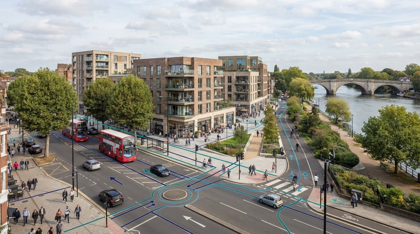
  • Newham Student Housing Transport Assessment: 2026 Guide

    Newham Student Housing Transport Assessment: 2026 Guide

    PBSA planning approval in East London rarely collapses over architectural design; it falls apart at the kerbside. Securing highway officer sign-off demands strict alignment with borough priorities, making a comprehensive transport assessment for student accommodation in Newham essential for schemes exceeding 150 bedspaces. If you’re facing statutory holding objections from Transport for London (TfL), struggling with trip generation justifications in high PTAL corridors, or trying to resolve move-in logistics within strict car-free zones, you know how quickly highways scrutiny can derail project timelines.

    Mastering Newham’s planning policies and transport assessment requirements allows you to protect your programme and secure approval without costly late-stage redesigns. Following the return of full planning powers from the LLDC to Newham and the adoption of an ambitious 83% sustainable mode share target, planning officers expect watertight technical submissions. This 2026 guide delivers a clear roadmap through Newham’s Local Plan transport criteria, detailing exact submission thresholds, Section 106 car-free obligations, and robust operational booking strategies for peak student arrival weekends.

    Key Takeaways

    • Identify statutory thresholds determining whether your PBSA scheme requires a Transport Statement or full assessment under Newham’s direct planning jurisdiction.
    • Discover how to build a robust transport assessment for student accommodation in Newham that substantiates non-car trip generation within high PTAL corridors.
    • Resolve arrival and departure peak bottlenecks using structured booking frameworks that fully satisfy car-free Section 106 requirements.
    • Streamline pre-application engagement with Newham Highways and TfL to eliminate statutory holding objections before reaching the planning committee.
    • Leverage precision technical modelling, including Swept Path Analysis and baseline Traffic Surveys, to safeguard layouts against costly redesigns.

    Statutory Triggers & Thresholds for Student Housing TAs in Newham

    Delivering purpose-built student accommodation (PBSA) in East London requires clearing stringent statutory hurdles. Following the dissolution of the London Legacy Development Corporation’s (LLDC) planning powers on 1 December 2024, Newham Council now exercises direct planning authority over key intensification zones such as Stratford and Pudding Mill. A robust transport assessment for student accommodation in Newham is critical to prevent validation delays, holding objections, and costly project pauses.

    To see how transport planners evaluate urban highway capacity and active travel integration, watch this visual breakdown:

    When Is a Full Transport Assessment Required Instead of a Statement?

    The scale of development dictates your documentation path under Newham Local Plan policies and London Plan Policy T4:

    • 50 to 149 Bedspaces: Schemes within this bracket generally qualify for concise Transport Statements, provided the site sits away from sensitive junctions and exhibits low local highway impact.
    • 150+ Bedspaces or 20,000 sqm GFA: Triggers the non-negotiable requirement for a full Transport Assessment. This scale also initiates a statutory referral to the Mayor of London (TfL) under the Town and Country Planning Order.
    • Strategic Highway Interfaces: Proposals with access onto classified distributor roads or near the Transport for London Road Network (TLRN), such as the A11 or A12, face immediate escalation to a full assessment regardless of bedroom totals.

    Stratford and Canning Town sites carry heightened sensitivity. Because Stratford delivered over 9,300 PBSA beds between 2019 and 2026, Newham planning officers apply intense scrutiny to cumulative highway impacts even on mid-scale schemes.

    Newham Local Plan and London Plan Policy Context for 2026

    Submitting a successful transport assessment for student accommodation in Newham requires technical alignment with the borough’s emerging Local Plan Policy H8. In the Stratford and Maryland neighbourhood, PBSA is restricted to sites within 300 metres of an existing higher education campus. Elsewhere, sites must achieve a Public Transport Accessibility Level (PTAL) of 4 or higher.

    Every submission must demonstrate compliance with the Healthy Streets Approach and Newham’s ambitious target of achieving an 83% sustainable mode share by 2041. Designs must integrate the Mayor’s Vision Zero safety principles, proving that servicing arrangements, pedestrian crossings, and cycle paths eliminate road danger at the site boundary.

    Core Technical Components of a Newham Student Housing Assessment

    Generic highways methodology fails in East London’s dense regeneration corridors. Officers at Newham Council evaluate submissions against stringent criteria established in statutory government guidance on Transport Assessments, demanding bespoke analytical outputs. Ensuring your technical documentation follows the structured frameworks detailed in our London Transport Assessment guide prevents procedural pushback from both borough officers and statutory bodies like TfL.

    TRICS Trip Generation and Multi-Modal Split Modelling

    Standard trip rates do not reflect student behaviour. To produce an acceptable transport assessment for student accommodation in Newham, TRICS database interrogations must exclude suburban or car-dependent university halls. The dataset must strictly isolate car-free, inner-London schemes with identical public transport connectivity.

    Your multi-modal model must demonstrate that daily operational vehicle trips remain virtually zero during the morning (08:00-09:00) and evening (17:00-18:00) highway network peaks. Trip distributions must realistically assign student flows:

    • Rail and Mass Transit: Quantifying passenger entries and exits onto the Elizabeth line, DLR, and London Underground networks serving Stratford, West Ham, or Canning Town.
    • Active Travel Desire Lines: Mapping direct, high-volume walking journeys toward regional institutions, including Birkbeck, UCL East, and UEL campuses.
    • Bus Capacity Impact: Analysing route capacities across local bus corridors passing adjacent stops.

    Public Transport Accessibility Levels (PTAL) and Active Travel Audits

    Most viable PBSA development land in Newham falls within high PTAL brackets, ranging from 4 to 6b. This high level of connectivity justifies zero resident parking provision, but it escalates expectations for pedestrian infrastructure.

    Highway officers enforce comprehensive Active Travel Zone (ATZ) audits. Your assessment must evaluate key walking and cycling routes within a 20-minute journey envelope from the scheme entrance. These audits score surface conditions, footway widths, crossing provision, and street lighting along primary links to transport hubs. Any highlighted deficiencies often become triggers for Section 278 highway works or Section 106 financial contributions.

    Cycle Parking and End-of-Trip Infrastructure Standards

    Design teams must follow London Plan Policy T5 standards. PBSA developments require 0.75 long-stay cycle spaces per bedroom, alongside 1 short-stay space per 40 beds. In accordance with London Cycling Design Standards (LCDS), a minimum of 5% of this total must cater to non-standard cycles, such as adapted bikes and cargo cycles.

    If you’re assembling documentation for an upcoming submission, engaging ML Traffic Engineers UK early ensures your trip distribution, cycle layout geometry, and baseline modelling satisfy borough highways officers from the outset.

    Overcoming Key PBSA Hurdles: Move-In Peaks, Parking, and Servicing

    Start-of-term arrival weekends represent the single greatest operational concern for Newham Highways DM officers. While day-to-day student life generates minimal private vehicle movement, concentrated turnover in September and June threatens surrounding residential streets with severe gridlock. Overcoming these specific challenges within your transport assessment for student accommodation in Newham requires a legally binding operational framework rather than broad reassurances.

    Student Move-In and Move-Out Operational Logistics Plans

    Planning committees routinely secure a Move-In and Move-Out Management Plan (MIMOP) via pre-occupation planning conditions. Under national statutory guidance on Travel Plans, Transport Assessments and Statements, applicant teams must demonstrate that temporary arrival spikes will not compromise highway safety or network efficiency. Your submission should detail four key controls:

    • Staggered Arrival Windows: A mandatory digital booking platform allocating fixed 20- to 30-minute unloading slots per student, preventing uncontrolled curb-side stacking.
    • On-Site Marshal Protocols: Trained personnel positioned at site access gates and loading pads to direct traffic, check booking QR codes, and enforce slot deadlines.
    • Off-Highway Unloading: Designated internal loading bays or segregated off-street zones designed to turn vehicles around without obstructing public footways.
    • Tenancy Restrictions: Clear lease clauses prohibiting personal vehicle ownership and informing students of parking permit disqualifications.

    Car-Free Design Justifications and Blue Badge Provision

    Under Newham Local Plan Policy T3 and London Plan Policy T6.1, student accommodation is strictly car-free. Developers must accept Section 106 legal agreements that explicitly exclude occupants from applying for on-street permits within Newham’s Controlled Parking Zones (CPZs) and Residential Parking Zones (RPZs).

    Car-free does not mean zero parking. Highway standards require accessible Blue Badge bays from day one, generally allocated at 1 space or between 3% and 4% of total bedspaces, supported by passive layout expansion plans. These bays must feature dedicated active electric vehicle charging points and level thresholds directly connecting to building cores.

    Refuse Collection and Servicing Swept Path Analysis

    Weekly operational deliveries require clear geometric justification. Applying precision AutoTurn swept path analysis models the complex tracks of Newham Council’s standard 10.2-metre refuse collection vehicles and typical 8.5-metre medium goods delivery vans.

    Highway officers reject designs relying on dangerous reverse manoeuvres onto the public highway. Your swept path analysis must confirm that all servicing vehicles can pull into dedicated bays, turn fully, and exit the site safely in forward gear. Bin store layouts must align with maximum collection pull distances, which must not exceed 10 metres from vehicle tailgate to storage threshold under local waste collection guidelines.

    Newham Student Housing Transport Assessment: 2026 Guide

    Securing Newham Highway Approval: Pre-App to Committee

    Navigating East London highways determinations requires a disciplined, multi-stage strategy. In major growth corridors like Stratford and the Royal Docks, schemes interface simultaneously with Newham Council’s Highways Development Management team and Transport for London (TfL) Spatial Planning. Managing this dual scrutiny through structured pre-application engagement is the fastest way to resolve technical friction before your scheme reaches the Strategic Development Committee.

    Achieving smooth highway sign-off follows four progressive stages:

    • Step 1: Baseline Scoping & Surveys: Define the transport study area, agree on TRICS donor site criteria with officers, and commission multi-modal baseline traffic counts during standard university term-time weeks.
    • Step 2: Dual Pre-Application Submission: Lodge formal pre-app technical notes jointly to Newham and TfL to test junction capacity, bus network absorption, and pedestrian comfort levels.
    • Step 3: Technical Iteration: Refine layouts based on highway engineer feedback, incorporating swept path tracking for servicing bays and addressing local footway pinch points.
    • Step 4: Final Package & Legal Heads of Terms: Submit the finalized transport assessment for student accommodation in Newham alongside an integrated Travel Plan and agreed Section 106 obligations.

    Early Consultation with Newham Highways and Transport for London

    Pre-application scoping agreements lock down key parameters before design freeze. Early discussions clarify whether TfL will seek Section 278 kerbside alterations or financial contributions toward strategic bus corridors like the A118 or Romford Road. Agreeing on methodology early eliminates late statutory holding objections that stall committee target dates.

    Drafting Student Travel Plans That Satisfy Borough Planners

    Planning officers will not sign off major PBSA schemes without a robust, long-term operational framework. An effective Student Travel Plan provides enforceable commitments aligned with Newham’s 83% sustainable transport mode target. The submission must detail:

    • Designated on-site travel coordinators responsible for freshers’ week sustainable transit inductions.
    • Cycle loan schemes, maintenance workshops, and active travel welcome packs for arriving residents.
    • Annual TRICS-compliant monitoring surveys for a minimum of five years post-occupation.
    • Automated remedial triggers, including increased micromobility funding, if monitoring reveals private car reliance.

    Addressing Local Resident and Ward Councillor Concerns

    Highways representations at planning committee frequently stem from resident anxiety regarding on-street parking stress and student turnover congestion. Transparent empirical data defuses these challenges. Clear parking beats and rigorous move-in logistics protocols assure ward councillors that surrounding neighbourhoods will remain protected.

    If you need expert representation to steer your East London scheme through highway scoping and formal determination, partner with ML Traffic Engineers UK to deliver your technical submission with precision.

    Why Partner with ML Traffic Engineers UK on Newham PBSA Schemes

    Delivering major student accommodation within East London’s dense regeneration quarters demands technical authority and clear communication with highway authorities. With over 35 years of senior engineering expertise across London boroughs, ML Traffic Engineers UK acts as your strategic partner from initial site feasibility through to final determination. We transform complex transport planning requirements into compliant, defensible submissions that satisfy both Newham Council and Transport for London (TfL).

    Specialist Transport Planning and Technical Analysis

    Our core services directly resolve the technical challenges unique to purpose-built student housing:

    • Bespoke Transport Documentation: We prepare comprehensive Transport Assessments and concise Transport Statements specifically tailored to PBSA operational profiles and local highway constraints.
    • Advanced Swept Path Analysis: Using specialised AutoTurn software, we model exact turning envelopes for refuse freighters, delivery vans, and emergency tenders, ensuring on-site layouts function safely.
    • Defensible Data Collection: We coordinate robust Traffic Surveys and parking surveys, establishing accurate baseline network conditions that withstand highway officer examination.
    • TRICS Modelling Precision: Our engineers isolate relevant, car-free urban comparator sites to justify low trip generation and active travel splits.

    By collaborating closely with your project architects during early design stages, we optimize site layouts, servicing access, and cycle storage configurations before planning submission. This proactive approach prevents costly redesigns late in the planning cycle.

    Strategic Guidance from Project Feasibility to Determination

    Navigating the planning process requires sustained technical negotiation. We represent your scheme during pre-application meetings, responding directly to queries from Newham’s Highways Development Management team and TfL Spatial Planning. Our proactive engagement addresses concerns around network capacity, Vision Zero design interventions, and pedestrian comfort levels before statutory consultation concludes.

    We deliver an end-to-end service, supporting your scheme through Section 106 heads of terms negotiations and post-permission planning condition discharge. Rapid turnarounds ensure your application programme stays on track while maintaining the highest engineering rigor. When you need a reliable transport assessment for student accommodation in Newham, our experienced engineering team provides the technical backing necessary to secure committee approval with confidence.

    Protect your development timeline today. Contact ML Traffic Engineers UK for a project assessment and discuss your upcoming East London student housing scheme with our senior engineers.

    Secure Your Student Housing Highway Approval with Confidence

    Securing planning consent across Stratford, Canning Town, and the Royal Docks requires strict attention to transport mechanics. Achieving swift highway officer sign-off hinges on proving car-free Section 106 compliance, establishing workable arrival slot frameworks, and aligning multi-modal trip distribution with Newham’s 83% sustainable transport mode target. Submitting a rigorous, evidence-led transport assessment for student accommodation in Newham eliminates statutory holding objections and keeps your development program on course.

    Don’t let avoidable highway disputes delay your project milestones. ML Traffic Engineers UK pairs technical precision with practical planning advocacy. Backed by a senior highway engineering team with over 35 years of planning experience, we hold a proven track record securing technical approvals across London boroughs and TfL. We resolve complex urban access constraints and defend your layout from initial scoping right through to determination. Instruct ML Traffic Engineers UK for your Newham Transport Assessment today and advance your PBSA scheme toward committee approval with complete confidence.

    Frequently Asked Questions

    Do all student accommodation schemes in Newham require a full Transport Assessment?

    No, smaller schemes accommodating between 50 and 149 bedspaces typically require only a concise Transport Statement, provided network impact remains negligible. Schemes exceeding 150 student bedspaces automatically trigger a full transport assessment for student accommodation in Newham and mayoral referral. Developments under 50 bedspaces rarely require full assessments unless they sit at sensitive highway junctions or access classified distributor roads.

    How does Newham Council enforce car-free policies on student housing developments?

    Newham enforces car-free development through legally binding Section 106 agreements. These covenants prohibit student occupants from applying for or obtaining parking permits within local Controlled Parking Zones (CPZs) or Residential Parking Zones (RPZs). Tenancy contracts must explicitly notify students of this restriction. On-site provision is strictly limited to essential operational servicing bays and designated Blue Badge accessible parking spaces equipped with electric vehicle charging points.

    What is an Active Travel Zone assessment and why is it needed for PBSA?

    An Active Travel Zone (ATZ) assessment evaluates pedestrian and cycling route quality across key routes within a 20-minute catchment. Transport for London and Newham Council require it for PBSA schemes to prove students can safely navigate toward transit hubs and university campuses. Highway officers examine audit scores for footway widths, crossing safety, and street lighting, often using identified deficiencies to justify Section 278 off-site highway improvements.

    How are student move-in and move-out days managed within transport planning submissions?

    Move-in and move-out turnover is regulated through a formal management strategy secured by pre-occupation condition. Developers implement an online booking system that allocates staggered 20- to 30-minute unloading windows across turnover weekends. On-site traffic marshals check bookings and supervise off-street bays to prevent curbside queues. Incorporating this operational framework into your transport assessment for student accommodation in Newham reassures officers that local road networks won’t suffer gridlock.

    Will Transport for London be involved in reviewing my student housing transport assessment?

    Yes, TfL reviews your scheme if it exceeds 150 bedspaces, creates over 20,000 square metres of gross internal area, or borders the Transport for London Road Network (TLRN). Arterial routes like the A11 and A12 trigger statutory referrals to the Mayor of London. Even on non-referable proposals, Newham highway officers frequently invite TfL Spatial Planning to assess local bus capacity and nearby rail interchange impacts.

    What cycle parking standards apply to student accommodation under the London Plan?

    London Plan Policy T5 mandates 0.75 long-stay cycle parking spaces per student bedroom and 1 short-stay space per 40 beds. Under London Cycling Design Standards (LCDS), at least 5% of this total must support wider, non-standard cycles like adapted bikes and cargo tricycles. All cycle facilities must be secure, weather-protected, well-lit, and accessible via step-free routes, supported by charging points for electric bicycles.

    How does swept path analysis assist in securing planning permission for student residences?

    Swept path analysis uses specialized CAD software to simulate vehicle tracking envelopes across your proposed site layout. For student accommodation schemes, it demonstrates to highway officers that Newham’s 10.2-metre refuse trucks, parcel delivery couriers, and fire tenders can enter, turn, and leave safely in forward gear. Demonstrating clear vehicle clearance eliminates highway safety objections and avoids costly architectural layout changes late in the planning process.

    Michael Lee

    Article by

    Michael Lee

    Transport planner with over 35 years' experience.

    Disclaimer

    The content on mltraffic.co.uk, including all technical articles, guides, and resources, is provided for general informational and educational purposes only. It is not intended to constitute professional advice in traffic engineering, transportation planning, development approvals, or any other technical or legal field.
    While ML Traffic Engineers makes every reasonable effort to ensure the accuracy, completeness, and timeliness of the information published, we do not provide any warranties or representations (express or implied) regarding its reliability, suitability, or availability for any particular purpose. Any reliance you place on the content is strictly at your own risk.
    In no event shall ML Traffic Engineers, its directors, employees, authors, or affiliates be liable for any direct, indirect, incidental, special, consequential, or punitive damages (including, without limitation, loss of profits, data, or business opportunities) arising out of or in connection with the use of, or inability to use, any information provided on this website.
    The articles and guides on this site are not a substitute for engaging a qualified, professional traffic engineer to assess your specific project requirements. For tailored advice, compliance assessments, or traffic engineering services, please contact a competent professional.
    This disclaimer may be updated from time to time without notice. By accessing or using this website, you agree to be bound by the most current version of this disclaimer.