Author: adminmltuk

  • Traffic Control Management: Essential Strategies for Planning Applications in 2026

    Getting planning permission isn’t just about what you build, it’s about proving you can manage what happens around it. Traffic control management has become a make-or-break component of development applications, particularly as local authorities scrutinise the movement of vehicles, construction logistics, and pedestrian safety more closely than ever. Whether you’re submitting a Transport Assessment, a Construction Traffic Management Plan, or simply trying to demonstrate your scheme won’t gridlock the local high street, understanding how traffic control management works, and what planners expect, can be the difference between approval and a costly refusal.

    Key Takeaways

    • Traffic control management is essential to planning approval, as it demonstrates to local authorities that a development won’t cause unacceptable congestion, safety risks, or parking stress.
    • Effective traffic control management combines clear signage, appropriate traffic signals, safe pedestrian provision, certified traffic controllers, and ongoing monitoring to keep people and vehicles moving safely.
    • A comprehensive Transport Assessment or Construction Traffic Management Plan must prove that residual impacts are acceptable, access arrangements comply with standards, and sustainable transport is maximised.
    • Understanding local authority thresholds and transport policies is critical, as requirements for formal assessments vary significantly—some authorities require assessments for 30+ vehicle movements, whilst others set thresholds at 50 or 100.
    • Mitigation measures should address both temporary construction impacts (phased deliveries, speed limits, protected pedestrian routes) and permanent operational safety features (traffic calming, visibility improvements).
    • Regular audits, complaint monitoring, and real-time adjustments to traffic control measures maintain public confidence and ensure schemes comply with highways authority requirements throughout construction and operation.

    What Is Traffic Control Management?

    Traffic control management is the planning, design, implementation, and monitoring of measures that regulate the safe and efficient movement of vehicles and pedestrians. It’s most visible around developments, construction sites, and roadworks, anywhere the normal flow of traffic is disrupted or altered by new activity.

    At its core, it covers three overlapping responsibilities:

    • Designing traffic control plans that specify signage, lane closures, diversions, and pedestrian routes tailored to site conditions.
    • Organising and controlling transport flows and services, ensuring vehicles can move predictably and safely through temporary or permanent changes.
    • Coordinating with local authorities and emergency services to manage disruptions, maintain access, and respond to incidents.

    In the context of planning applications, traffic control management isn’t an afterthought, it’s part of the evidence base planners use to judge whether a development is viable. It underpins formal documents like Transport Assessments, Travel Plans, and Construction Traffic Management Plans, all of which demonstrate that you’ve thought through how your project will interact with the existing transport network.

    Why Traffic Control Management Matters in Planning Applications

    Planning authorities need to be convinced that a development won’t cause unacceptable congestion, safety risks, or parking stress. That means showing that your scheme has suitable access for residents, delivery vehicles, and emergency services, and that construction activity won’t paralyse local roads for months on end.

    Traffic control management provides that assurance. Without it, even well-designed schemes can be refused on highways grounds. A development might tick every box architecturally, but if the council’s highways officer believes it’ll create rat-runs, obstruct bus routes, or leave pedestrians dodging lorries, the application is in trouble.

    This is where formal assessments come in. Transport Assessments and Construction Traffic Management Plans rely on traffic control management principles to model impacts, propose mitigations, and satisfy policy tests. Experienced traffic flow management consultants help applicants navigate these requirements, particularly when local thresholds are unclear or cumulative impacts with neighbouring sites need careful handling.

    In short, traffic control management turns abstract concerns, will this development work?, into demonstrable, enforceable commitments that give planners confidence to approve.

    Key Components of Effective Traffic Control Management

    Vertical infographic showing traffic control management components, assessment cycle, and mitigation measures in UK context.

    A robust traffic control management system is built from several interlocking elements, each designed to keep people and vehicles moving safely:

    • Clear signage and road markings that communicate lane changes, hazards, speed limits, and diversions unambiguously.
    • Appropriate traffic signals and control devices, including temporary lights, bollards, barriers, and delineation tailored to site-specific risks.
    • Safe pedestrian and cyclist provision, such as protected walkways, advanced warning signage, and crossing points that don’t force vulnerable users into conflict with construction traffic.
    • Competent, certified traffic controllers where manual control is required, particularly at site entrances, single-lane working, or complex junctions during peak hours.
    • Monitoring and adjustment of measures during operation, ensuring that what works on paper also works on the ground, with flexibility to respond to complaints, incidents, or unforeseen conditions.

    These components aren’t static. Effective traffic control management anticipates change: phasing of construction, seasonal traffic patterns, school holidays, and local events all influence how measures perform. Schemes that bake in adaptability, and regular review, tend to avoid the enforcement notices and neighbour complaints that derail projects mid-construction.

    Traffic Assessment and Impact Analysis

    Before you can manage traffic, you need to understand it. That starts with a baseline assessment: surveys of existing traffic volumes, vehicle speeds, junction performance, and collision history. This data establishes what “normal” looks like, so you can credibly model what happens when your development adds trips to the network.

    Impact analysis then models how those new trips, both operational (residents, customers, deliveries) and construction-related (HGVs, worker vehicles), affect junctions, links, and parking. It identifies pinch points, capacity constraints, and safety risks. For larger schemes, this might involve junction modelling software: for smaller sites, a simpler trip generation calculation and qualitative assessment may suffice.

    Crucially, impact analysis must also consider cumulative effects: nearby developments, planned highway works, and background traffic growth. A scheme that looks benign in isolation can tip a junction into gridlock when considered alongside other committed developments. Understanding this bigger picture often requires input from specialists who know local transport models and traffic impact assessment protocols inside out.

    Mitigation Measures and Safety Protocols

    Once impacts are identified, mitigation measures address them. These fall broadly into two categories: temporary measures for construction and permanent measures for operational phases.

    Common temporary measures include:

    • Phased construction and delivery times to avoid peak hours, reducing pressure on already-congested roads and limiting disruption to school runs or commuter traffic.
    • Temporary speed limits, barriers, and delineation that protect workers, pedestrians, and drivers from each other.
    • Safe pedestrian crossings and protected walkways, particularly where footways are narrowed or diverted.
    • Training and deployment of certified traffic controllers, ensuring that manual interventions, banksmen, stop-go boards, are carried out safely and consistently.
    • Emergency access plans and incident procedures that maintain ambulance, fire, and police access even when sites are active.

    Permanent measures often overlap with traffic calming design principles: speed tables, raised junctions, visibility splays, and junction improvements that reduce collision risk and manage speeds around new developments.

    Safety protocols also extend to monitoring. Regular audits, complaint logs, and liaison with local residents and businesses allow schemes to adjust measures in real time, maintaining public confidence and highways authority sign-off. This is where experienced consultants add value: they know what works, what fails, and how to carry out mitigation measures that satisfy both planners and neighbours.

    Meeting Local Authority Requirements and Thresholds

    Every local authority has its own transport policies, design standards, and thresholds that trigger formal assessments. Some require a full Transport Assessment for developments generating 30+ two-way vehicle movements in peak hours: others set the bar at 50 or 100. Some expect Construction Traffic Management Plans for any scheme involving more than a handful of HGV movements: others take a lighter-touch approach.

    Navigating this patchwork requires familiarity with local plan policies, supplementary planning documents, and highways authority guidance. National standards, Manual for Streets, Design Manual for Roads and Bridges, Traffic Signs Manual, provide the technical baseline, but local interpretation varies.

    Your Transport Assessment or Statement must demonstrate that:

    • Residual impacts are acceptable after mitigation, not zero-impact, but within policy tests and capacity thresholds.
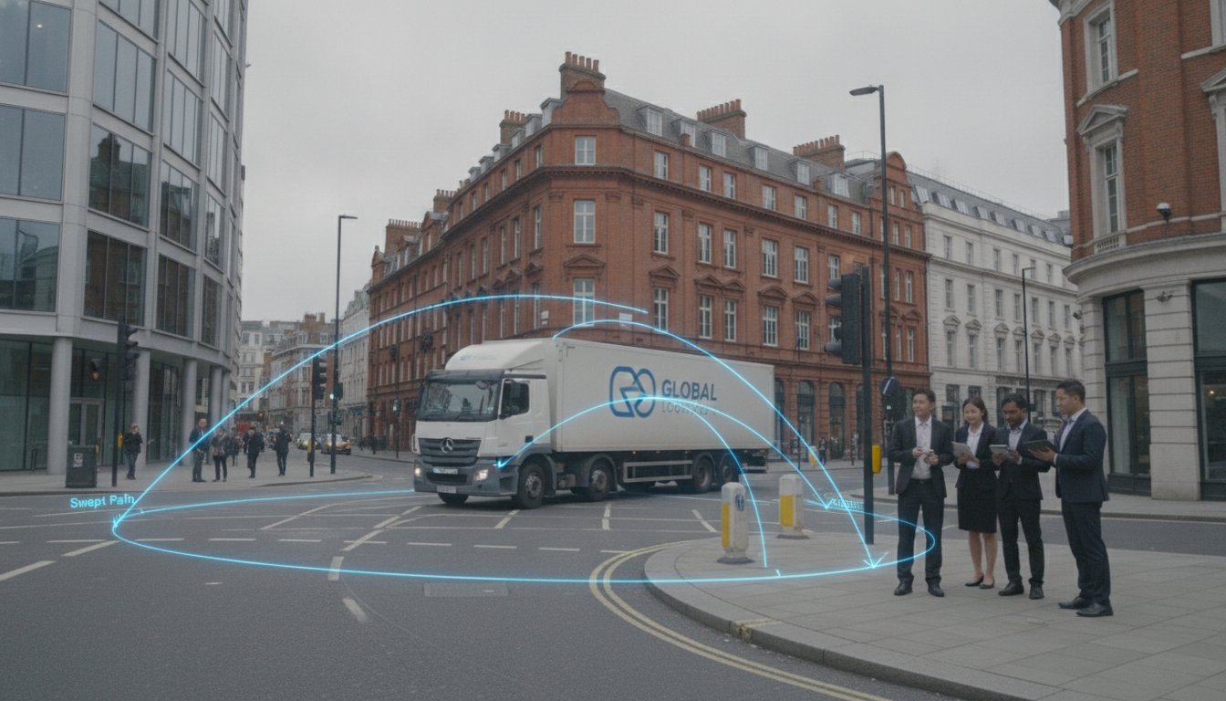
    • Access arrangements comply with visibility splay standards, swept path analysis for service vehicles, and emergency access requirements.
    • Sustainable transport is maximised, with demand management strategies such as Travel Plans, cycle parking, and public transport contributions where appropriate.
    • Parking provision aligns with local standards, balancing the need to avoid overspill with policies that discourage car dependency. A well-considered parking strategy is often scrutinised closely by highways officers and ward councillors alike.

    Meeting these requirements isn’t just about ticking boxes, it’s about building a credible, proportionate case that your scheme fits the local context. That’s where over 30 years of experience and knowledge of local authority thresholds can make applications smoother, faster, and far less likely to hit a highways objection.

    Conclusion

    Effective traffic control management is central to safe, efficient development. It enables planning permission by showing that traffic and safety impacts are understood, assessed, and robustly mitigated in line with local authority requirements. Get it right, and your scheme moves forward: get it wrong, and even the best designs can stall at committee.

    Frequently Asked Questions About Traffic Control Management

    What is traffic control management and why does it matter for planning applications?

    Traffic control management is the planning, design, implementation, and monitoring of measures that regulate safe, efficient vehicle and pedestrian movement. It matters for planning because it provides evidence that developments won’t cause unacceptable congestion, safety risks, or parking stress, underpinning Transport Assessments and Construction Traffic Management Plans that planners require for approval.

    What are the key components of an effective traffic control management system?

    Effective systems comprise clear signage and road markings, appropriate traffic signals and barriers, safe pedestrian and cyclist provision, competent certified traffic controllers for manual control, and ongoing monitoring with flexibility to adjust measures. These elements work together to anticipate changes like construction phasing, seasonal patterns, and local events.

    How do traffic impact assessments help with development proposals?

    Traffic impact assessments establish baseline data on existing volumes, speeds, and collisions, then model how new operational and construction trips affect junctions, links, and parking. This identifies pinch points and cumulative effects from neighbouring developments, allowing applicants to propose credible, evidence-based mitigation measures that satisfy planning authorities.

    What temporary and permanent mitigation measures reduce traffic and safety impacts?

    Temporary measures include phased construction to avoid peak hours, temporary speed limits, barriers, safe pedestrian crossings, and certified traffic controller deployment. Permanent measures involve traffic calming design such as speed tables, raised junctions, and visibility splays that reduce collision risk and manage speeds around new developments long-term.

    How can experienced traffic consultants help navigate local authority requirements?

    Traffic consultants understand local thresholds triggering formal assessments, local plan policies, and highways authority guidance that varies by authority. They build proportionate cases demonstrating residual impacts are acceptable after mitigation, access complies with standards, sustainable transport is maximised, and parking aligns with local policy—reducing refusal risk.

    What should a Transport Assessment demonstrate to planning authorities?

    A Transport Assessment must show that residual impacts are acceptable after mitigation, access arrangements comply with visibility and emergency access standards, sustainable transport is maximised through demand management strategies, and parking provision aligns with local standards, balancing overspill prevention with policies discouraging car dependency.

  • Traffic Control Engineering: Your Expert Guide to Safer Roads and Smarter Planning

    Every new housing development, retail park, or infrastructure project changes how people move. The difference between a scheme that sails through planning and one that stalls often comes down to how well its transport impacts are understood and mitigated. Traffic control engineering sits at the heart of that process, turning data, design standards, and safety principles into control measures that keep roads functioning and communities safe. Whether you’re submitting a planning application or advising a client, understanding what traffic control engineers do and why their work matters can be the difference between approval and refusal.

    Key Takeaways

    • Traffic control engineering is the specialist discipline that designs and evaluates measures—from signal timings to markings and speed limits—to optimise traffic flow, reduce congestion, and enhance road safety in development and infrastructure projects.
    • Local authorities require traffic control engineers to assess transport impacts through data-driven analysis, traffic counts, crash investigations, and modelling to determine whether developments can operate safely and acceptably within established standards.
    • Early engagement with an experienced traffic control engineer is critical to planning approval, as their robust evidence and mitigation recommendations help avoid costly conditions or refusal on highway grounds.
    • Traffic control engineers balance competing demands—safety versus efficiency—using human factors research, capacity analysis, and traffic flow theory to design controls that work in real-world conditions where drivers must perceive, understand, and react appropriately.
    • Establishing consistency across networks through manuals and uniform design standards ensures that control devices such as signs and markings function reliably and are understood by all road users, regardless of location.

    What Is Traffic Control Engineering?

    Traffic engineer analyzing digital road network display with blue data visualizations.

    Traffic control engineering is a specialist branch of transportation engineering focused on the design, implementation, and evaluation of measures that regulate and guide the movement of vehicles and pedestrians. Think of it as the discipline that decides where traffic lights go, how fast a road should be, what markings drivers see, and how to keep a junction safe during rush hour.

    It covers everything from signal timings and regulatory signs to pavement markings, speed limits, roundabouts, ramp metering, and traffic calming schemes. The aim is always threefold: optimise traffic flow, reduce congestion, and enhance road safety, whilst supporting sustainable transport objectives. These engineers don’t just design devices: they evaluate how well they work in the real world, using traffic counts, crash data, and modelling to refine and improve.

    Unlike broader transport planning, which might look at long-term strategy or mode shift, traffic control engineering is about the nuts and bolts, what happens on the ground, day to day, to keep people moving safely.

    The Role of a Traffic Control Engineer in Modern Development

    Traffic control engineers bring engineering principles and data analysis together to assess how developments, road schemes, and policy changes affect traffic patterns and safety. Their work spans both short‑term measures, such as work zone control plans and temporary detours during construction, and long‑term planning, like evaluating the transport impacts of a new residential or commercial scheme.

    For developers and planning teams, the engineer’s role is to translate a proposal into traffic terms: Will this development increase queuing at the local roundabout? Does the site access meet visibility standards? What mitigation measures are needed to keep the network operating acceptably? The answers shape conditions, section 106 agreements, and eventually whether a scheme gets the green light.

    Core Responsibilities and Expertise

    Typical responsibilities include designing and modifying traffic signals, signs, and pavement markings to meet current standards and local conditions. Engineers also prepare temporary traffic control plans for construction and maintenance work zones, ensuring workers and road users stay safe during disruption.

    Conducting traffic volume and impact studies is central to their work, assessing baseline flows, forecast growth, and development-generated trips. They investigate high‑crash locations, propose safety countermeasures, and develop or apply standards and guidelines, such as manuals of uniform traffic control devices that ensure consistency across the network.

    Their expertise covers traffic flow theory, human factors (how drivers perceive and react to signs), road safety, geometric design, intelligent transportation systems (ITS), and the relevant regulations and standards that govern highways and planning. For commercial traffic engineering schemes, this blend of skills is essential to demonstrate compliance and safety.

    Key Principles and Methods in Traffic Control Engineering

    At the core of traffic control engineering are two primary objectives: safety and efficiency. Every design decision, from signal phasing to sign placement, must balance keeping people safe with keeping them moving.

    Data‑driven analysis underpins everything. Engineers rely on traffic counts, crash data, queue surveys, and modelling to understand what’s happening now and predict what will happen if a change is made. Consistency, clarity, and visibility in signs and markings are critical: if a driver can’t see or understand a control device, it fails. That’s why established standards and manuals for uniform devices and practices exist, to ensure that a 30mph sign in Somerset looks and functions the same as one in Surrey.

    Methods range from capacity and level‑of‑service analysis (how well a junction or link performs under different traffic loads) to microsimulation (modelling individual vehicle movements), signal timing optimisation, and safety audits. Many traffic flow management consultants use these methods to advise on complex development sites.

    Engineers also apply human factors research, understanding driver reaction times, legibility distances, and decision-making under stress, to design controls that work in the real, messy world of human behaviour.

    Why Traffic Control Engineering Matters for Planning Applications

    For architects, planners, and developers, traffic control engineering is often the gatekeeper to planning approval. Local authorities require traffic impact assessments to determine how a proposal affects surrounding roads, and whether those impacts are acceptable or require mitigation.

    Engineers identify what mitigation measures are needed: a new signal phase, junction capacity improvements, traffic calming measures to protect a school route, or parking controls to prevent overspill. They also demonstrate that a scheme can operate safely and acceptably within local and national standards, providing the evidence that supports planning decisions and conditions.

    Without robust traffic control engineering input, applications risk refusal on highway grounds, or approval subject to costly, unexpected conditions. Getting it right early, with experienced input, keeps projects on track and budgets under control. Understanding parking strategy and site layout is also part of this puzzle.

    Working with Traffic Control Engineers: What to Expect

    When you engage a traffic control engineer, expect a structured, evidence-led process. They’ll request and analyse traffic data, existing counts, accident records, development trip generation, and review your development details: land use, floor areas, access arrangements, and phasing.

    From there, they produce technical reports and drawings of proposed control measures and layouts: signal heads, sign schedules, marking plans, visibility splays, and swept path analysis showing that service vehicles can manoeuvre safely. These documents form the backbone of your Transport Assessment or Transport Statement.

    Engineers liaise with highway authorities to ensure compliance with manuals and policies, such as the Traffic Signs Manual, the Manual for Streets, and local design guides. They review designs iteratively, addressing safety, capacity, and community concerns raised by planning officers, councillors, or residents.

    Transparency and communication matter. A good engineer explains trade-offs, flags risks early, and works collaboratively with your design team to integrate transport measures into the site layout from the start, not as an afterthought.

    Conclusion

    Traffic control engineering is essential to safe, efficient, and sustainable road and development planning. It ensures that transport impacts are understood, mitigated, and managed through rigorous engineering methods and established standards. For anyone involved in planning applications, from developers to local councils, working with skilled engineers early means better outcomes, fewer surprises, and schemes that work for everyone.

    Frequently Asked Questions About Traffic Control Engineering

    What exactly is traffic control engineering?

    Traffic control engineering is a specialist branch of transportation engineering focused on designing, implementing, and evaluating measures that regulate and guide vehicle and pedestrian movement. It encompasses traffic signals, signs, pavement markings, speed limits, roundabouts, and traffic calming schemes—all aimed at optimising flow, reducing congestion, and enhancing road safety.

    Why is traffic control engineering important for planning applications?

    Traffic control engineering is essential for planning approval because local authorities require traffic impact assessments demonstrating how proposals affect surrounding roads. Engineers identify necessary mitigation measures and provide evidence that schemes operate safely within local and national standards, preventing costly refusals or unexpected conditions.

    What are the core responsibilities of a traffic control engineer?

    Traffic control engineers design traffic signals, signs, and markings; prepare temporary traffic control plans for construction; conduct traffic volume and impact studies; investigate high-crash locations; and propose safety countermeasures. They apply traffic flow theory, human factors research, and established standards to ensure safe, efficient network operation.

    How do traffic control engineers use data to improve road safety?

    Engineers rely on traffic counts, crash data, queue surveys, and modelling to understand current conditions and predict impacts of changes. This data-driven analysis, combined with safety audits and human factors research on driver behaviour, underpins every design decision—from signal phasing to sign placement—ensuring controls work in real-world conditions.

    What should I expect when working with a traffic control engineer?

    Expect a structured, evidence-led process: engineers request and analyse traffic data, development details, and existing counts, then produce technical reports, drawings of proposed measures, and compliance verification with manuals like the Traffic Signs Manual and Manual for Streets. They liaise with highway authorities and review designs iteratively with your team.

    How do traffic control engineers differ from traffic flow management consultants?

    While closely related, traffic control engineers focus specifically on designing and evaluating control devices and measures (signals, signs, markings) to regulate movement. Traffic flow management consultants take a broader approach, advising on complex development sites using capacity analysis and microsimulation to optimise overall network performance and efficiency.

  • Traffic Control: Essential Strategies for Safe and Efficient Site Management in 2026

    Every planning application lives or dies on its ability to prove safe, efficient access. Yet too many developments stumble at the highway authority stage, not because the scheme itself is flawed, but because the traffic control strategy hasn’t been clearly articulated or properly evidenced. Whether you’re designing a twenty‑home infill or a mixed‑use quarter, your ability to plan, manage and regulate vehicle, pedestrian and cyclist movements will determine whether the case officer recommends approval or refusal. This guide walks through what traffic control actually means in a planning context, who does what on site, and how to structure your traffic management plans to meet local authority expectations.

    Key Takeaways

    • Traffic control is essential for planning applications as highway authorities assess site access safety, internal circulation hazards, and whether construction and operational traffic will create unacceptable congestion on surrounding networks.
    • A well-evidenced traffic control strategy backed by swept-path plots, signal timing and construction phasing gives local authority officers and members confidence to approve development without harm.
    • Traffic controllers on site must set out signs, cones and barriers as specified, adapt layouts when conditions change, and monitor compliance with agreed routing, signage visibility and pedestrian access.
    • Construction traffic management plans must include site-specific scaled layouts, traffic and pedestrian flow analysis, emergency procedures, and a named 24/7 contact, with monthly reports and incident logs required by most authorities.
    • Temporary measures during construction follow a hierarchy of advance warning signs, transition zones, buffer zones, work zones and termination zones, with quality maintenance and professional equipment being critical to reduce driver confusion and risk.
    • Permanent traffic control solutions for new developments include new or modified junctions, pedestrian crossings, cycle facilities and internal site layouts that accommodate service vehicles, with swept path analysis confirming safe turning movements for refuse trucks and fire appliances.

    What Is Traffic Control and Why Does It Matter for Planning Applications?

    Traffic control is the planning, management and regulation of all road users, drivers, pedestrians, cyclists, to keep movements safe, maintain capacity and ensure roads and access routes operate efficiently. In practical terms, it’s the system that assigns right‑of‑way, organises flows at junctions, and prevents conflicts that could lead to collisions or gridlock.

    For planning applications, traffic control underpins three core tests every highway authority applies: whether the site can be accessed safely, whether internal circulation avoids hazards, and whether construction and operational traffic will produce unacceptable congestion or safety risks on the surrounding network. Your transport assessment and travel plan must demonstrate that each phase of development, from first excavator to final occupation, can be controlled without tipping adjacent junctions into severe queuing or creating new accident clusters.

    Local authorities scrutinise how you’ll manage HGV routes during demolition, coordinate deliveries during fit‑out, and handle peak‑hour turning movements once the scheme is occupied. If your submission lacks a credible traffic control narrative, expect a holding objection from highways. Conversely, a well‑evidenced control strategy, backed by swept‑path plots, signal timing and construction phasing, gives both officers and members confidence that the development can proceed without harm.

    Key Responsibilities of a Traffic Controller on Development Sites

    On site, the traffic controller is the person who translates your approved management plan into day‑to‑day reality. Their role starts before the first lorry arrives and continues until the last cone is lifted.

    Typical duties include setting out signs, cones, barriers and temporary lane closures exactly as specified in the plan, then directing traffic using stop/slow bats or hand signals to protect both workers and the public. When conditions shift, a burst water main closes a diversion route, or afternoon rainfall turns a haul road to mud, the controller adapts the layout, repositions barriers, and communicates changes to the site team and, if necessary, the highway authority.

    Controllers also monitor compliance: are delivery drivers following the agreed routing? Is signage visible and undamaged? Are pedestrian routes still passable? Any incident, near miss, complaint, or actual collision, triggers an immediate review and often a revised risk assessment. In practice, a competent traffic controller saves schemes from enforcement action and protects the developer’s reputation, because small lapses (a missing advance warning sign, a lane closure that extends beyond permitted hours) can quickly escalate into formal complaints and stop notices. Competence, vigilance and clear communication are non‑negotiable.

    Traffic Management Plans: Requirements for Local Authority Approval

    Three-tier infographic showing traffic control requirements, temporary measures, and permanent solutions in UK context.

    Most authorities will condition consent on submission and approval of a construction traffic management plan (CTMP) before any works begin. What do they expect to see?

    First, site‑specific layouts: scaled drawings showing every diversion, lane closure, signing location and access point, tied to Ordnance Survey grid references. Second, a traffic and pedestrian flow analysis that quantifies baseline volumes, predicts construction‑phase increases, and identifies pinch‑points or vulnerable user groups, school routes, bus stops, cycle lanes. Third, compliance with recognised standards: in the UK that typically means the Traffic Signs Manual, Chapter 8 guidance, and any local authority streetworks codes.

    Your plan must also cover emergency procedures (how will an ambulance pass if you’ve closed a lane?), arrangements for public transport (will bus stops need relocation?), servicing and deliveries (time windows, booking systems), and a named contact available 24/7. Authorities increasingly ask for a monitoring and review schedule, monthly reports, incident logs, and a commitment to update the plan if conditions change. It’s also worth addressing Traffic Flow Management early in the design process, so that any consultant input is embedded before submission rather than bolted on at condition‑discharge stage.

    Temporary Traffic Control Measures During Construction

    Temporary measures are the visible, physical interventions that protect the work zone and guide road users safely past or around it. The hierarchy is straightforward: advance warning signs alert drivers early: a transition zone tapers lanes and reduces speed: the buffer zone provides a safety margin: the work zone itself is coned or barriered: and a termination zone returns traffic to normal running.

    Common elements include temporary speed limits (often 30 or 20 mph), single‑lane shuttle working controlled by temporary signals or flaggers, and protected pedestrian diversions with temporary footway and barrier fencing. Staging work outside peak periods, overnight closures for utility diversions, weekend possessions for junction remodelling, minimises disruption and is often a condition of approval. Where space is tight, consider traffic calming principles to slow approaches naturally and reduce reliance on signage alone.

    Quality matters: faded signs, displaced cones and unswept mud all erode driver confidence and increase risk. Budget for regular inspections, prompt repairs and professional supply of compliant equipment.

    Permanent Traffic Control Solutions for New Developments

    Once construction wraps, permanent measures take over to manage the operational traffic your development generates. These might include new or modified junctions, simple priority T‑junctions for smaller schemes, signalised crossroads or compact roundabouts for larger flows, designed using junction capacity software and validated by Traffic Engineering principles.

    Pedestrian crossings (zebra, signal‑controlled or refuge islands), dedicated cycle facilities, road markings and permanent signage schemes all form part of the control suite. Internal site layouts deserve equal attention: carriageway widths and geometry must accommodate service vehicles, and swept path analysis confirms that refuse trucks, fire appliances and delivery vans can turn, pass and reverse safely without mounting kerbs or blocking through routes.

    Authorities often require a commuted sum or bond to cover future maintenance of new signals or street lighting. Factor these costs into your viability appraisal early, and confirm adoption agreements with the highway authority before you pour the first base course. A well‑designed parking strategy also plays a role: overspill parking on adjacent streets undermines even the best junction design, so provision, management and enforcement need to be coherent from day one.

    Common Traffic Control Challenges in Transport Assessments

    Even experienced teams encounter recurring headaches. Limited space in dense urban areas makes it hard to carve out safe temporary layouts without closing entire streets or requiring night working, both of which inflate cost and programme risk. Peak‑hour congestion and event‑related surges, match days, festivals, term‑time school runs, compress your margin for error: a junction that just copes at 08:45 can fail catastrophically when your construction traffic coincides with a local event.

    Ensuring adequate, visible signage sounds simple but requires co‑ordination across utilities, neighbours and the highway authority, especially when multiple schemes overlap. Trained, certified personnel are in finite supply: if your programme assumes six flaggers for a four‑week road closure, book them well in advance.

    Finally, demonstrating that residual impacts remain acceptable is as much about narrative as numbers. Raw queue‑length or RFC figures can alarm non‑technical readers: contextualise them with before‑and‑after comparisons, explain why a forecast increase of fifteen vehicles in the peak hour is well within junction capacity, and show how your proposed mitigation measures address any hotspots. A transport assessment that anticipates officer questions and provides clear, proportionate answers will always outperform one that buries the reader in raw PICADY outputs.

    Conclusion

    Effective traffic control, expressed through robust management plans, appropriate temporary measures and well‑designed permanent infrastructure, is central to securing planning permission, protecting safety and maintaining efficient movement on and around development sites. Get it right, and highways officers become allies rather than obstacles: get it wrong, and even the best architectural vision can stall at committee.

    Frequently Asked Questions

    What is traffic control in the context of planning applications?

    Traffic control is the planning, management and regulation of vehicle, pedestrian and cyclist movements to ensure safety, maintain capacity and keep roads operating efficiently. For planning applications, it underpins whether a site can be accessed safely, internal circulation avoids hazards, and construction or operational traffic won’t cause unacceptable congestion or safety risks on the surrounding network.

    What are the main responsibilities of a traffic controller on a development site?

    A traffic controller implements approved management plans by setting out signs, cones and barriers, then directing traffic using stop/slow bats or hand signals. They monitor compliance with agreed routings, adapt layouts when conditions change (e.g., road flooding), and report incidents or near misses to the site team and highway authority immediately.

    What must a construction traffic management plan include for local authority approval?

    A CTMP must contain site-specific scaled layouts with signing and access points, analysis of baseline and construction-phase traffic volumes, compliance with Traffic Signs Manual Chapter 8 guidance, emergency procedures, public transport arrangements, servicing schedules, and a named 24/7 contact. Monthly monitoring reports and incident logs are increasingly required too.

    How should temporary traffic control measures be structured during construction?

    Temporary measures follow a hierarchy: advance warning signs alert drivers early, a transition zone tapers lanes and reduces speed, a buffer zone provides safety margins, the work zone is coned or barriered, and a termination zone returns traffic to normal. Common elements include temporary speed limits (20–30 mph), single-lane shuttle working, and protected pedestrian diversions with temporary fencing.

    What permanent traffic control solutions are needed after construction completes?

    Permanent measures manage operational traffic through new or modified junctions, signalised crossings, roundabouts, pedestrian crossings, cycle facilities and road markings. Internal site layouts must be designed so refuse trucks, fire appliances and delivery vans can turn and reverse safely. A coherent parking strategy prevents overspill parking that undermines junction design.

    Why is demonstrating residual network impacts so challenging in transport assessments?

    Raw queue-length or RFC figures often alarm non-technical readers. Success requires contextualising forecast increases with before-and-after comparisons, explaining why additional peak-hour traffic remains within junction capacity, and showing how mitigation measures address hotspots. A narrative-led assessment that anticipates officer questions outperforms data-heavy submissions lacking clarity.

  • Road Traffic Engineering: Essential Principles for Planning and Development Success

    Every new housing estate, retail park or office block creates ripples on the surrounding road network. Too often, developments stall, or attract fierce local opposition, because the traffic implications weren’t properly understood or addressed. Road traffic engineering is the discipline that turns those ripples into manageable waves, balancing safety, capacity and accessibility from the drawing board through to opening day. Whether you’re an architect sketching a mixed-use scheme or a council officer reviewing a contentious application, grasping the fundamentals of traffic engineering can make the difference between planning approval and costly delays.

    Key Takeaways

    • Road traffic engineering balances safety, capacity and accessibility in development planning, turning potential network disruptions into manageable outcomes that secure planning approval and avoid costly delays.
    • Safety, efficiency, functionality and multimodal accommodation form the core principles of road traffic engineering, underpinned by data-driven decisions based on measured traffic volumes, speeds and collision statistics.
    • Traffic generation forecasts and junction capacity assessments are critical to evaluating how developments impact surrounding roads, determining whether mitigation measures such as signal upgrades or dedicated turn lanes are required.
    • Geometric design, signal timing, traffic calming measures and intelligent transport systems translate engineering assessments into safe, efficient infrastructure that serves cars, public transport, cyclists and pedestrians alike.
    • Engaging experienced traffic engineering consultants with local planning authority expertise reduces approval timescales and protects projects against opposition, making specialist knowledge a worthwhile investment for developers and councils.

    What Is Road Traffic Engineering?

    3D isometric render of urban intersection with traffic signals, vehicles, and data visualization overlays.

    Road traffic engineering, more commonly known simply as traffic engineering, is a branch of civil and transportation engineering. It concentrates on the planning, design and operation of streets and highways, with one overarching goal: achieving the safe and efficient movement of people and goods.

    In practical terms, traffic engineers analyse how vehicles, pedestrians, cyclists and public transport interact on existing networks and at proposed developments. They study traffic flow, optimise junction layouts, specify signal timings, and design road geometry, signs and markings. The remit extends from high-speed motorway interchanges down to quiet residential streets that need traffic calming, and encompasses parking areas, pedestrian crossings and cycle lanes. At its heart, the discipline uses empirical data, counts, speeds, collision records, to inform decisions that improve safety and reduce congestion.

    Core Principles of Road Traffic Engineering

    Several enduring principles guide traffic engineering practice, and they underpin every assessment and design.

    Safety comes first. Systematic crash analysis identifies black spots and recurring collision patterns, allowing engineers to propose targeted countermeasures, be that improved sight lines, guard rails or revised signal phasing. Every element, from road width to speed limit, is evaluated for its impact on risk.

    Efficiency is the second pillar: minimising delay and congestion through intelligent design and control. This might mean rationalising signal cycles, adding turn lanes, or modelling queuing at peak hours to avoid bottlenecks.

    Functionality and hierarchy matter, too. Roads are stratified, motorways carry long-distance traffic at high speed, arterials distribute it across regions, and local streets serve access to individual properties. Mixing functions (for example, allowing heavy through traffic on a residential cul-de-sac) leads to danger and frustration.

    Multimodal accommodation ensures that the network serves not just cars but also buses, bicycles, pedestrians and increasingly micromobility users like e-scooters. Balancing these often-competing needs demands careful space allocation and priority rules.

    Finally, the best traffic engineering is data-driven. Decisions rest on measured traffic volumes, observed speeds, origin-destination surveys and collision statistics, rather than guesswork or anecdote.

    Traffic Flow and Capacity Analysis

    At the heart of quantitative traffic engineering lies the study of relationships between flow (vehicles per hour), speed and density on links and at junctions. These relationships determine a road’s level of service, the metric that grades congestion from free-flowing (A) to gridlocked (F).

    Capacity analysis calculates the maximum number of vehicles that can pass through a lane or intersection in a given period. Engineers use formulae and software to estimate saturation flow (the theoretical maximum discharge rate at a green signal) and compare it against forecast demand. When demand approaches or exceeds capacity, delays spiral. Traffic Flow Management Consultants apply these techniques to pinpoint where improvements, such as additional lanes, signal optimisation or junction redesigns, are essential to maintain acceptable performance.

    Road Traffic Engineering in Planning Applications

    For developers and their design teams, traffic engineering enters the picture early. Local planning authorities require transport statements or transport assessments (depending on the scale and context) to evaluate how a proposed development will affect the surrounding highway network.

    A traffic engineer tests the proposed site access arrangements, entry and exit points, visibility splays, junction types, and models the additional trips the development will generate. That modelling feeds into junction capacity assessments at nearby intersections, revealing whether existing infrastructure can cope or whether mitigation is necessary. Mitigation might range from new pedestrian crossings and cycle paths through to dedicated turn lanes, traffic signal upgrades or even off-site junction improvements funded by the developer.

    Because commercial traffic engineering must align with local authority thresholds and policy frameworks, experienced consultants tailor the scope and depth of each study to match what planning officers and highways teams expect. A well-prepared assessment anticipates objections, demonstrates compliance with design standards, and provides the evidence needed to support a robust planning case.

    Key Traffic Engineering Assessments for Developments

    What does a comprehensive traffic engineering study actually contain? Several core elements recur across most projects.

    Traffic generation and distribution forecasts estimate how many vehicle trips (and person trips by all modes) the development will produce at different times of day, and where those trips will go. Trip rates come from national databases, comparable sites, or bespoke surveys, and are adjusted for local public transport provision and walking/cycling accessibility.

    Junction capacity assessments compare baseline conditions, often gathered through manual or automatic traffic counts, against the ‘with development’ scenario. Engineers model queues, delays and reserve capacity at roundabouts, priority junctions and signalised crossings. If a junction is already near capacity, even a modest increase in traffic can trigger severe congestion, making traffic impact assessment a critical step in securing planning consent.

    Parking and circulation studies ensure that the proposed layout provides adequate, well-located spaces and that internal roads allow safe manoeuvring by delivery vehicles and emergency services. Modern parking strategy also considers EV charging infrastructure and car-club provision.

    Road safety audits review collision history on nearby roads and assess the proposed design for potential hazards. Finally, assessments evaluate walking, cycling and public transport accessibility, mapping isochrones, footway widths, crossing points and bus stop locations to encourage sustainable travel.

    Designing Safe and Efficient Road Infrastructure

    Once the need for infrastructure changes is established, detailed design begins. Geometric design governs the alignment, cross-section and gradient of roads, along with critical parameters like design speed and stopping sight distance. Every curve radius, lane width and kerb height is specified to national standards, ensuring vehicles can negotiate the route safely at the intended speed.

    At junctions and pedestrian crossings, signal design and timing become paramount. Modern controllers adjust cycle lengths and green splits dynamically in response to real-time demand, reducing unnecessary red time and smoothing traffic flow. Signs, road markings and street lighting complete the control package, guiding drivers and highlighting hazards.

    In residential areas, traffic calming measures, speed humps, chicanes, raised tables, discourage through traffic and protect vulnerable road users. Access design must balance the need for easy site entry with the imperative to prevent rat-running and maintain pedestrian comfort.

    For complex schemes, engineers deploy micro-simulation software that models individual vehicle movements second-by-second, testing alternative layouts and signal strategies before anything is built. Intelligent transport systems, variable message signs, CCTV, inductive loops, can be layered in where network conditions justify the investment.

    Working With Traffic Engineering Professionals

    Traffic engineers are typically chartered civil or transportation engineers who have specialised in the movement and control of traffic. Membership of professional bodies, such as the Institution of Civil Engineers or the Chartered Institution of Highways & Transportation, signals up-to-date knowledge of standards, best practice and evolving regulations.

    The services they offer span the project lifecycle: early feasibility and trip-rate advice, detailed transport assessments and Highway Engineering Consultants support for planning submissions, junction and access design, construction-phase traffic management plans, and post-opening monitoring. Many also conduct road safety audits, prepare travel plans, and advise on work-zone layouts that keep traffic moving during roadworks.

    For developers, choosing the right consultant means looking beyond price. Speed of turnaround, familiarity with the local planning authority’s requirements, and a track record of securing approvals all matter. Over thirty years of experience and a laser focus on concise, accurate reports mean that some practices deliver precisely what’s needed, nothing more, nothing less, helping projects stay on track and within budget. In a field where delays cost money and opposition can derail schemes, that expertise is worth every penny.

    Frequently Asked Questions About Road Traffic Engineering

    What is road traffic engineering and why does it matter for new developments?

    Road traffic engineering is a branch of civil engineering focused on the planning, design and operation of streets and highways to achieve safe and efficient movement of people and goods. For new developments, it ensures that traffic implications are properly understood and addressed before planning approval, preventing costly delays and local opposition.

    How do traffic engineers assess the impact of a new housing estate or retail park on surrounding roads?

    Traffic engineers conduct transport assessments that model traffic generation, test site access arrangements, and assess junction capacity at nearby intersections. They prepare detailed forecasts of trips generated at different times of day and identify necessary mitigation measures, such as new signal timings or dedicated turn lanes.

    What are the core principles of road traffic engineering?

    The five core principles are: safety first (through crash analysis and targeted countermeasures); efficiency (minimising delay and congestion); functionality and hierarchy (assigning appropriate road types); multimodal accommodation (serving cars, pedestrians, cyclists and public transport); and data-driven decisions based on traffic counts and collision records.

    What assessments are included in a comprehensive traffic engineering study for planning applications?

    A comprehensive study typically includes traffic generation forecasts, junction capacity assessments, parking and circulation studies, road safety audits reviewing collision history, and evaluation of walking, cycling and public transport accessibility to support sustainable travel planning.

    How does capacity analysis help traffic engineers prevent congestion at junctions?

    Capacity analysis calculates the maximum vehicles a junction can handle by comparing saturation flow (theoretical maximum discharge at green signal) against forecast demand. When demand approaches capacity, engineers recommend improvements such as additional lanes, signal optimisation or junction redesigns to maintain acceptable performance.

    What qualifications and services should I expect from a traffic engineering consultant?

    Traffic engineers are typically chartered civil or transportation engineers with specialisation in traffic movement and control. They offer services spanning feasibility studies, transport assessments, detailed design, construction-phase traffic management, post-opening monitoring and road safety audits tailored to local planning authority requirements.

  • Road Traffic Control: Essential Guidance for Planning Applications in 2026

    If you’re submitting a planning application for a development that touches or affects public highways, understanding road traffic control isn’t optional, it’s fundamental. Whether you’re an architect designing a residential scheme, a town planner navigating local authority requirements, or a developer managing a commercial build, road traffic control can make or break the viability of your project. It determines how safely vehicles and pedestrians move around works, how disruption is managed during construction, and how permanent highway infrastructure keeps everyone safe long after the project is complete. In 2026, with heightened scrutiny on safety, sustainability, and traffic flow, knowing when and how to integrate traffic control into your planning strategy is more crucial than ever.

    Key Takeaways

    • Road traffic control is a fundamental requirement for planning applications affecting public highways, determining safe movement of vehicles and pedestrians whilst managing construction disruption and long-term safety.
    • Local planning authorities typically require a Construction Traffic Management Plan (CTMP) when developments involve footway closures, new road access, significant HGV movements, or works within the highway boundary.
    • Trained road traffic controllers act as a critical dynamic element in traffic management, adapting to real-time conditions on narrow roads and congested sites, and are often a mandatory planning condition and CDM safety requirement.
    • An effective traffic control strategy uses a coordinated framework with advance warning, transition, activity, and termination zones, supported by appropriate devices such as cones, barriers, variable message signs, and temporary traffic lights.
    • Permanent highway measures including traffic signals, markings, tactile paving, and guardrails must comply with Design Manual for Roads and Bridges standards and be agreed through Section 278 or Section 38 agreements with the highway authority.
    • Submitting a detailed, proportionate traffic control strategy upfront demonstrates responsible project management, reduces planning delays, and protects developers from liability whilst ensuring the scheme integrates safely into the public realm.

    What Is Road Traffic Control and Why Does It Matter?

    Road traffic control is the systematic management of vehicles and pedestrians around roadworks, incidents, or other disruptions to ensure safe and orderly movement. It’s the framework that keeps workers alive, traffic flowing, and emergency responders able to do their jobs when a road is compromised.

    At its core, road traffic control involves directing traffic through or around a disrupted space using a combination of signs, signals, road markings, barriers, cones, and, when needed, trained personnel standing in high-visibility gear with a stop/go paddle. The dual purpose is safety and continuity of movement. Without it, a simple kerb replacement can turn into a hazard zone: a major development can gridlock an entire neighbourhood.

    For anyone involved in planning applications, road traffic control matters because local planning authorities assess how your project will affect the highway network. If your scheme generates construction traffic, narrows carriageways, or changes junction geometry, you’ll need to demonstrate that you’ve planned for safe traffic control. Failure to do so can result in planning refusal, enforcement action, or, worst case, liability if someone is injured on site. It’s not just a box-ticking exercise: it’s a legal and moral obligation that underpins every successful development.

    The Role of a Road Traffic Controller in Development Projects

    A road traffic controller (sometimes called a traffic marshal or banksman) is the person on the ground who stops, slows, and safely directs traffic through construction sites. They’re the human interface between moving vehicles and active works, giving clear hand signals, protecting workers in the carriageway, and keeping traffic moving with minimal delay.

    Their role becomes critical when other passive control methods, signs, cones, barriers, aren’t adequate on their own. This typically happens on narrow roads, at junctions, or where sightlines are poor. The controller acts as a dynamic, responsive element in the traffic control plan, adapting in real time to changing conditions: a delivery lorry arriving early, a school run creating a sudden surge, or an emergency vehicle needing priority access.

    In development projects, traffic impact assessment documents often specify when controllers are required and for how long. Planners and local highways officers expect to see evidence that controllers will be properly trained (usually to Chapter 8 or equivalent standards), have the right equipment, and work within a documented traffic management plan. Without this level of detail, your planning application may be deemed incomplete or risky.

    Controllers aren’t just a nice-to-have. They’re often a planning condition, a safety requirement under CDM regulations, and a practical necessity to avoid complaints from residents and businesses. For developers, budgeting for trained personnel is as essential as budgeting for skips or scaffolding.

    When Road Traffic Control Is Required for Planning Permission

    Flowchart showing when road traffic control is required for UK planning applications.

    Road traffic control planning is required before occupying a temporary traffic control zone for highway construction, utility work, maintenance operations, or incident management. In the context of planning applications, this means any time your development affects the public highway, even temporarily.

    Local planning authorities and highway authorities will typically ask for a Construction Traffic Management Plan (CTMP) or similar document as part of your submission. This plan must show how you’ll handle traffic through the work zone, what devices you’ll use, and how long disruptions will last. The threshold for requiring formal traffic control varies by council, but as a rule of thumb, if your works involve:

    • Closing a footway or carriageway
    • Creating a new access onto a classified road
    • Generating more than a certain number of HGV movements per day (often 20–50 depending on the authority)
    • Working within or adjacent to the highway boundary

    …then you’ll need a traffic control plan. In many cases, developments involving swept path analysis for large vehicles will also trigger the need for temporary control measures during construction, particularly if access is tight or shared with existing properties.

    Even minor works can require formal traffic control if they pose a safety risk or cause significant disruption. Councils have broad discretion here, and it’s wise to consult with the highways department early. Submitting a detailed, realistic traffic control strategy upfront can save months of back-and-forth and demonstrate that you’re a responsible applicant who takes safety seriously.

    Key Components of an Effective Traffic Control Strategy

    An effective traffic control strategy isn’t a single document or device, it’s a coordinated system that anticipates risk and manages flow across multiple zones. The standard framework divides the work area into advance warning, transition, activity, and termination areas, each serving a distinct purpose.

    The advance warning area alerts road users to what’s ahead, giving them time to slow down, change lanes, or prepare to stop. Transition zones guide them safely into the controlled area using cones, barriers, or temporary signals. The activity area is where the work happens, protected by physical barriers and clear signage. Finally, the termination area eases traffic back to normal conditions.

    Beyond layout, an effective strategy relies on trained staff who understand how to set up, maintain, and dismantle controls safely. It also depends on choosing appropriate devices, not every situation needs full lane closures: sometimes a simple cone taper or advance warning sign will do. Coordination with adjacent works is essential too, especially in urban areas where multiple utilities or developments may be active simultaneously.

    Engineering judgement plays a big role in device placement. Cookie-cutter plans rarely work because every site has unique geometry, traffic volumes, and constraints. That’s why experienced traffic engineering input is invaluable, it ensures your strategy is proportionate, compliant, and realistic.

    Temporary Traffic Management During Construction

    Temporary traffic control plans maintain safe and efficient road user flow during work zones, incidents, or special events. They’re the tactical measures that keep a project moving without causing chaos on the network.

    Typical measures include variable message signs (VMS) to warn drivers in advance, channelising devices like cones and barriers to delineate safe routes, temporary traffic lights at single-lane working sections, pavement markings to guide lane use, and sometimes police or dedicated traffic management operatives in high-risk or high-traffic locations. Work vehicles with flashing beacons also form part of the visible control environment.

    For construction projects, temporary traffic management is often phased. Early works might involve minor footway closures: later phases could require full carriageway occupation or night-time working to minimise disruption. The plan must specify timing, duration, and contingency measures, what happens if works overrun, or if there’s an emergency?

    Local authorities increasingly expect developers to consider mitigation measures that reduce the impact of temporary controls, such as scheduling HGV deliveries outside peak hours, providing alternative pedestrian routes, or using smaller plant to avoid full road closures. These aren’t just nice gestures, they can be the difference between planning approval and refusal, especially in sensitive areas near schools, hospitals, or major transport corridors.

    Permanent Highway Measures and Safety Features

    Permanent traffic control uses signs, signals, markings, and other devices installed by the road authority to regulate, guide, or warn road users for the long term. Once your development is complete, the temporary cones and barriers come down, but permanent measures often remain to manage the ongoing impact of your scheme.

    Examples include traffic signals at new junctions, stop signs or give-way markings at site access points, tactile paving and dropped kerbs for pedestrian safety, speed limit signs and road markings to manage vehicle speeds, and crash attenuators or guardrails at high-risk locations.

    These permanent features are typically designed as part of a Section 278 or Section 38 agreement (depending on whether you’re altering an existing highway or building a new one). The highway authority will have strict technical standards, usually based on the Design Manual for Roads and Bridges (DMRB) or local design guides, and will expect detailed drawings, safety audits, and sometimes independent review before approving your proposals.

    Permanent measures also tie into broader parking strategy and access design. For instance, if your development introduces a new junction, you’ll need to demonstrate that sightlines are adequate, that turning movements are safe, and that signage is clear and conspicuous. This is where road traffic control overlaps with transport planning: it’s not just about construction, it’s about the lifetime safety and operation of the highway network.

    Failure to provide adequate permanent control measures can result in planning conditions requiring post-occupation improvements, or worse, accidents that expose the developer and design team to legal liability. Getting it right from the start, through competent design and early engagement with the highway authority, is essential.

    Conclusion

    Road traffic control is a core safety and operations measure in construction and highway management, supporting safe access, worker protection, and traffic efficiency. For anyone involved in planning applications, it’s not an afterthought, it’s a strategic component that shapes approval, phasing, cost, and community relations. Whether you’re managing temporary controls during a build or designing permanent highway features, the quality and thoroughness of your traffic control strategy will influence how smoothly your project progresses and how safely it integrates into the public realm.

    Frequently Asked Questions About Road Traffic Control

    What is road traffic control and why is it essential for planning applications?

    Road traffic control is the systematic management of vehicles and pedestrians around roadworks using signs, signals, barriers, and trained personnel to ensure safe and orderly movement. It’s essential for planning applications because it demonstrates to local authorities that your scheme manages safety, minimises disruption, and protects workers and the public. Local planning authorities assess how your project affects the highway network and require evidence of proper traffic control planning before approval.

    When do I need to include road traffic control in my planning application?

    You’ll need a traffic control plan if your development closes a footway or carriageway, creates a new access onto a classified road, generates significant HGV movements (typically 20–50+ per day), or works within the highway boundary. Even minor works require formal control if they pose safety risks or cause disruption. Consulting with the highways department early helps determine your specific requirements and avoids delays.

    What does a road traffic controller do on a construction site?

    A road traffic controller stops, slows, and safely directs traffic through construction zones using hand signals and equipment. They protect workers in the carriageway, keep traffic flowing with minimal delay, and adapt in real time to changing conditions like delivery vehicles or emergency access needs. Controllers are often a planning condition and a requirement under CDM regulations for high-risk or high-traffic locations.

    What are the key components of an effective traffic control strategy?

    An effective strategy includes advance warning areas (alerting road users), transition zones (guiding safe entry), activity areas (protecting active works), and termination areas (easing return to normal). Success also depends on trained staff, appropriate devices proportionate to the site, coordination with adjacent works, and sound engineering judgement. Cookie-cutter plans rarely work; each site’s unique geometry and constraints require tailored design.

    How can I reduce the impact of temporary traffic control on my development?

    Consider mitigation measures such as scheduling HGV deliveries outside peak hours, providing alternative pedestrian routes, and using smaller plant to avoid full road closures. These aren’t just gestures—they can be the difference between planning approval and refusal, especially near schools, hospitals, or major transport corridors. Working with mitigation measures traffic strategies early strengthens your application.

    What permanent traffic control measures remain after construction is complete?

    Permanent measures include traffic signals at new junctions, stop signs, give-way markings, tactile paving, dropped kerbs, speed limit signs, and crash attenuators. These are designed via Section 278 or Section 38 agreements based on standards like the Design Manual for Roads and Bridges. Swept path analysis ensures permanent features are safe and legally compliant for the scheme’s lifetime.

  • Intelligent Transportation Systems: Shaping the Future of Urban Mobility in 2026

    As cities grapple with congestion, air quality targets and the growing complexity of development proposals, intelligent transportation systems have moved from the margins to the mainstream. For architects, planners and developers preparing planning applications, understanding how ITS can inform transport assessments, and satisfy local authority requirements, is no longer optional. These technologies are reshaping how we manage traffic, measure impact and design mitigation. Whether you’re submitting a Transport Statement for a modest scheme or a full Transport Assessment for a major mixed-use development, ITS offers the data, tools and infrastructure to demonstrate compliance, reduce risk and unlock consent.

    Key Takeaways

    • Intelligent transportation systems have become essential for planners and developers preparing planning applications, helping demonstrate compliance and unlock consent for new schemes.
    • ITS technologies—including ANPR cameras, adaptive signal controllers and real-time information systems—enable cities to reduce congestion by 10–15 per cent at existing junctions without costly road widening.
    • Integration of ITS-derived data into Transport Assessments demonstrates rigour and aligns with local authority evidence bases far better than outdated manual traffic counts.
    • Local authorities increasingly expect developers to fund or deliver digital ITS interventions such as adaptive signals, bus priority measures and parking guidance systems as part of planning obligations.
    • Connected and automated mobility, AI-driven traffic prediction and Mobility as a Service platforms will reshape how developments are assessed and designed over the next decade.
    • Early engagement with local authority ITS teams and clear understanding of data governance, maintenance costs and technical standards are critical to avoiding delays, design rework and post-consent surprises.

    What Are Intelligent Transportation Systems?

    Intelligent Transportation Systems (ITS) are advanced applications that use information and communication technologies to improve the efficiency, safety and sustainability of transport networks. They span roads, public transport, freight and multi-modal travel, pulling together real-time data, automated control and user information to manage movement more intelligently.

    Unlike traditional fixed-time signals or manual traffic management, ITS responds dynamically to conditions on the ground, adjusting signal timings during peak hours, rerouting vehicles around incidents, or informing passengers of delays before they leave home. The UK’s approach, aligned with European frameworks, emphasises interoperability, open data and integration across modes.

    For practitioners in the built environment, ITS isn’t an abstract concept. It’s the ANPR camera capturing queue lengths on a development access road, the adaptive signal controller that can prioritise buses serving your site, and the journey-planning app that residents will use to decide whether to drive or take the train. It’s infrastructure, digital and physical, that local planning authorities increasingly expect developers to acknowledge, integrate and sometimes fund as part of planning obligations.

    Core Technologies Driving Intelligent Transport Systems

    Four layers of technology underpin modern ITS, each playing a distinct role in capturing, transmitting and acting on transport data.

    Sensing and detection sits at the foundation. Inductive loops embedded in carriageways count axles and measure speed: radar and LiDAR provide non-intrusive vehicle classification: CCTV and automatic number plate recognition (ANPR) monitor junctions and enforce bus lanes. Weather sensors and pavement condition monitors feed into winter maintenance and surface management. These devices generate the raw intelligence that makes adaptive control possible.

    Communications infrastructure moves that data to where it’s needed. Fibre-optic links connect roadside equipment to traffic management centres: 4G and 5G support mobile apps and connected vehicle services: dedicated short-range communications (DSRC) and cellular V2X (C-V2X) enable vehicles to talk to each other and to roadside units, laying the groundwork for cooperative intelligent transport systems.

    Data and control systems turn information into action. Traffic management centres run decision-support software, AI and machine learning models that predict congestion, optimise signal plans and detect incidents in real time. These systems inform operators and, increasingly, act autonomously to adjust network settings.

    User-facing systems close the loop. Real-time passenger information screens, journey-planning apps, smart ticketing and contactless payment make the network legible and accessible, encouraging modal shift and reducing reliance on the private car, outcomes that most local authorities now expect development proposals to support.

    Benefits for Urban Planning and Development Projects

    ITS delivers measurable improvements in the three pillars that shape local transport policy: efficiency, safety and sustainability.

    Reduced congestion and improved capacity are perhaps the most visible benefits. Adaptive signal control can squeeze 10–15 per cent more throughput from existing junctions without widening a single carriageway. Queue management and ramp metering smooth flow on strategic corridors. For development schemes on constrained urban sites, that incremental capacity can mean the difference between a refusal on highway grounds and a recommended approval.

    Improved road safety follows from better enforcement, quicker incident response and real-time speed management. Average-speed cameras and variable message signs reduce collisions on key routes: automatic incident detection cuts emergency-service response times. When highway authorities review a Transport Assessment, evidence that a scheme integrates or enables ITS measures, such as upgrading a signal controller to MOVA (Microprocessor Optimised Vehicle Actuation) or installing pedestrian countdown timers, can strengthen the safety case.

    Lower emissions and Net Zero alignment are increasingly central to planning decisions. Smoother traffic flow reduces stop-start driving and particulate emissions: real-time information encourages public transport use: integrated ticketing lowers the friction of modal shift. Many local plans now require developers to demonstrate carbon reduction, and ITS-enabled travel demand management is one of the few levers available at the site scale.

    Better accessibility and inclusiveness round out the picture. Real-time audio-visual information aids passengers with sensory impairments: journey-planning apps support those unfamiliar with local services. For mixed-use schemes aiming to reduce car dependency, accessible, legible transport information isn’t a luxury, it’s infrastructure.

    ITS Applications in Transport Assessments and Planning Applications

    Transport Assessments and Statements must now engage with ITS at several levels: as existing baseline infrastructure, as a source of robust data, and as part of proposed mitigation.

    Many highway authorities use traffic modelling fed by real-time ITS data, loop counts, ANPR journey times, bus AVL (automatic vehicle location), to validate development impact forecasts. A TA that draws on these datasets, rather than outdated manual counts, demonstrates rigour and aligns with the authority’s own evidence base. Firms such as ML Traffic, with over 30 years of experience in transport engineering, routinely integrate ITS-derived data into assessments tailored to local authority thresholds and planning contexts.

    Mitigation measures increasingly involve ITS. Rather than (or alongside) geometric improvements, developers may be asked to fund or deliver:

    • Adaptive signal controllers at site access junctions to manage increased turning movements.
    • Bus priority measures, queue relocation, signal pre-emption, where the scheme depends on sustainable travel.
    • Real-time travel information kiosks or digital boards within the development to support modal shift.
    • Parking guidance systems that reduce circulating traffic and improve air quality in town centres.

    Section 106 agreements and planning conditions now routinely reference these digital interventions. Developers who understand the technology, and its cost, can negotiate more effectively and avoid post-consent surprises.

    Finally, monitoring and evaluation of travel plans often relies on ITS. Automatic counters track cycle and pedestrian movements: ANPR surveys measure car-sharing uptake: app-based surveys capture mode choice. Demonstrating compliance with trip caps or modal-share targets is simpler, cheaper and more credible when the infrastructure is already in place.

    Implementation Challenges and Local Authority Considerations

    3D render of urban traffic control workstation with floating data visualization elements and transport professional.

    Even though clear benefits, ITS deployment faces practical and institutional obstacles that planners and developers must navigate.

    Funding and whole-life costs top the list. Capital grants may cover initial installation, but maintenance, software licences and periodic hardware replacement require revenue budgets that many councils struggle to commit. A developer contribution for a new signal controller is welcome, but the authority must also resource its operation for decades.

    Interoperability and standards compliance matter, especially where equipment must integrate with existing urban traffic control (UTC) systems or regional data hubs. The UK follows European ITS Directive frameworks and national Technical Approval schemes: specifying non-compliant kit risks orphaned assets that can’t be upgraded or networked.

    Data governance, cyber security and privacy are rising concerns. ITS generates vast streams of personal and commercially sensitive data, journey patterns, vehicle identities, payment records. GDPR compliance, secure communications and resilience against cyber-attack require skills and protocols that many smaller authorities are still developing.

    Institutional capacity and procurement models can be a bottleneck. Designing, procuring and managing digital infrastructure demands multi-disciplinary teams, transport planners, IT specialists, data scientists, that few councils retain in-house. Outsourcing introduces contract-management overhead and potential lock-in to vendors.

    For developers, the implication is clear: early engagement with the local authority’s ITS team (where one exists) and highway officers is essential. Understanding what infrastructure is planned, what standards apply and who will maintain it avoids abortive design work and smooths the path to consent.

    Future Trends in Intelligent Transportation Systems

    Three waves of innovation are poised to redefine ITS over the next decade, each with implications for how we plan, assess and deliver development.

    Connected and automated mobility is moving from trial to deployment. Cooperative ITS (C-ITS) allows vehicles to exchange safety and efficiency messages with infrastructure and each other: dedicated AV-ready corridors with enhanced lane markings, 5G coverage and digital maps are already being piloted. For large mixed-use or employment sites, designing roads and junctions to C-ITS standards, even if not immediately activated, future-proofs the scheme and may unlock additional capacity assumptions in traffic modelling.

    Artificial intelligence, digital twins and predictive analytics are transforming traffic management. Rather than reacting to congestion, AI models predict it hours in advance, adjusting signals, rerouting freight and informing travellers pre-emptively. Digital twins, virtual replicas of the transport network, allow planners to test development scenarios, temporary traffic management and new signal timings in silico before committing resources. Expect local authorities to demand evidence that proposals have been modelled in these environments.

    Mobility as a Service (MaaS) platforms integrate planning, booking and payment across bus, rail, bike-share, taxi and car-club into a single app. Several UK cities are piloting or procuring MaaS: where successful, they reduce car ownership and reframe how developers calculate parking requirements and trip generation. Transport Assessments for schemes in MaaS zones will need to account for this behavioural shift and the data it generates.

    Staying abreast of these trends isn’t academic. It’s about designing schemes that align with the transport network of 2030, not 2015, and satisfying planning officers who increasingly think the same way.

    Conclusion

    Intelligent Transportation Systems are a core enabler of safer, cleaner and more efficient transport, increasingly embedded in UK transport policy and local planning practice. For the professionals preparing and determining planning applications, ITS is both evidence base and infrastructure, shaping how impact is measured, mitigation designed and compliance monitored. Engaging with it early, understanding the technologies and anticipating local authority expectations will smooth consents, reduce costs and future-proof developments in an era of rapid digital transformation.

    Frequently Asked Questions

    What are intelligent transportation systems and how do they work?

    Intelligent transportation systems (ITS) use information and communication technologies to improve transport efficiency, safety and sustainability. They combine sensing devices (inductive loops, ANPR, radar), communications infrastructure (4G, 5G, fibre), data management systems with AI, and user-facing apps to capture real-time traffic data and respond dynamically to conditions on the ground.

    How can intelligent transportation systems help with planning applications and transport assessments?

    ITS provides robust real-time data—loop counts, ANPR journey times, bus location data—that strengthens Transport Assessments and validates development impact forecasts. Developers can also propose ITS mitigation measures such as adaptive signal controllers, bus priority systems and real-time travel information to satisfy local authority requirements and reduce congestion.

    What are the main benefits of intelligent transportation systems for urban development?

    ITS delivers three key benefits: reduced congestion and improved capacity (adaptive signals can increase throughput by 10–15%), enhanced road safety through automated incident detection and speed management, and lower emissions by smoothing traffic flow and encouraging public transport use—critical for meeting Net Zero planning requirements.

    What are the core technologies that make up intelligent transportation systems?

    ITS comprises four layers: sensing and detection (inductive loops, CCTV, ANPR), communications infrastructure (fibre, 4G/5G, C-V2X), data and control systems (traffic management centres, AI and machine learning), and user-facing systems (journey-planning apps, real-time information screens and smart ticketing).

    What challenges do local authorities face when implementing intelligent transportation systems?

    Key challenges include funding and maintenance costs, compliance with UK and European ITS standards, data governance and cyber security, and institutional capacity to design and procure digital infrastructure. Early developer engagement with local authority ITS teams helps avoid design rework and smooths the planning consent process.

    How is Mobility as a Service (MaaS) changing transport planning and development?

    MaaS platforms integrate bus, rail, bike-share, taxi and car-club into a single app, reducing car ownership and enabling behavioural shift. Developers in areas piloting MaaS must account for this modal shift in Transport Assessments, including revised parking requirements and trip generation calculations.

  • Intelligent Traffic Systems: How Smart Technology Is Transforming Urban Mobility in 2026

    Urban transport networks are under pressure. More vehicles, more people, and more complexity mean traditional traffic management simply can’t keep up. That’s where intelligent traffic systems (ITS) come in, technology-enabled networks that use sensors, real-time data and automated controls to move traffic more efficiently, safely and sustainably. In 2026, ITS isn’t just a nice-to-have: it’s becoming essential infrastructure for cities that want to cut congestion, reduce emissions and support smarter growth. For planners, developers and local authorities, understanding how ITS works, and how to integrate it into transport assessments, is critical.

    Key Takeaways

    • Intelligent traffic systems use real-time sensors, data and AI to manage traffic dynamically, reducing congestion and emissions more effectively than traditional static infrastructure.
    • Adaptive traffic signals, vehicle-to-infrastructure communication and incident detection systems enable proactive traffic management that responds within seconds to changing conditions.
    • ITS strengthens transport assessments by providing accurate baseline data and predictive modelling, allowing planners to test mitigation strategies digitally before development.
    • Safety improvements include faster crash detection, wrong-way alerts, pedestrian detection systems and emergency vehicle pre-emption that protect vulnerable road users in urban environments.
    • Smoother traffic flow from intelligent traffic systems reduces stop-start driving, lowering fuel consumption, emissions and vehicle wear whilst supporting cities’ net-zero and air quality targets.
    • Local authorities increasingly expect developments to demonstrate how intelligent traffic systems can integrate into transport assessments, making smart infrastructure engagement essential for planning applications.

    What Are Intelligent Traffic Systems?

    3D render of an intelligent traffic system with connected vehicles and adaptive signals in urban network.

    Intelligent traffic systems are transport networks equipped with technology that enables real-time communication, monitoring and control. Unlike static infrastructure, ITS brings together roads, vehicles and users through constant data exchange. The goal is simple: manage traffic dynamically rather than passively.

    ITS applications include adaptive traffic signals that adjust timing based on live traffic volumes, connected vehicle communications that allow cars to ‘talk’ to infrastructure and each other, incident detection systems that alert operators the moment something goes wrong, and route guidance that steers drivers away from delays. These aren’t futuristic concepts, they’re already deployed across cities worldwide.

    What sets ITS apart is its ability to respond. Rather than relying on fixed signal timings or scheduled maintenance, these systems adapt continuously. If congestion builds in one corridor, signals can be adjusted in real-time. If a crash occurs, warnings can be sent to approaching vehicles before drivers even see the queue. This shift from reactive to proactive management is the core value proposition for urban planners and transport engineers.

    Core Technologies Powering Intelligent Traffic Systems

    ITS relies on a stack of interconnected technologies, each playing a distinct role in how traffic is monitored, analysed and controlled.

    Sensors and cameras form the eyes of the network. Induction loops embedded in road surfaces, radar sensors mounted on poles, and cameras with computer vision capabilities monitor vehicle speeds, flow rates, queue lengths and even road surface conditions. This data feeds into central systems that build a real-time picture of what’s happening across the network.

    IoT (Internet of Things) and connectivity are the nervous system. Wireless networks enable live data transmission between vehicles and infrastructure, often referred to as V2V (vehicle-to-vehicle), V2I (vehicle-to-infrastructure) and V2X (vehicle-to-everything). This connectivity allows traffic signals to communicate with buses for priority, or warns drivers about hazards ahead before they’re visible.

    AI and analytics turn raw data into decisions. Machine learning models can predict congestion before it forms, detect incidents within seconds, and optimise signal timing dynamically. Algorithms can also suggest better signal coordination across entire corridors or networks.

    Big data and cloud systems provide the muscle. With thousands of data points generated every second, cloud platforms handle storage, processing and visualisation. They allow traffic managers to review historical patterns, test scenarios and make evidence-based decisions at scale. Together, these technologies enable a level of responsiveness and precision that wasn’t possible even a decade ago.

    Benefits of Intelligent Traffic Systems for Urban Planning

    For architects, planners and developers, ITS offers more than operational improvements, it provides better data and more flexible design options. Real-time and predictive datasets strengthen transport assessments by offering granular insights into peak flows, journey times and network behaviour under different conditions.

    ITS also shifts planning from reactive to proactive. Instead of waiting for congestion to become unbearable before widening a road, planners can use predictive models to identify where bottlenecks are likely to form and test mitigation strategies digitally. Corridor prioritisation, signal timing reviews and network management strategies can all be informed by live data rather than outdated surveys.

    For local authorities reviewing planning applications, ITS data adds rigour. Baseline traffic conditions can be measured with higher accuracy, and the impact of new developments can be forecast with greater confidence. Mitigation measures, such as adaptive signal installations or incident management protocols, become easier to specify and justify.

    Reducing Congestion and Improving Traffic Flow

    One of the most visible benefits of ITS is its ability to smooth traffic flow. Adaptive traffic lights adjust green and red phases based on real-time demand, reducing unnecessary stops and cutting delays. Queue warning systems alert drivers to slow-moving or stopped traffic ahead, helping prevent secondary crashes and reducing the ripple effect of congestion.

    Dynamic route guidance, delivered via apps or variable message signs, steers drivers towards less congested routes. This doesn’t just save time, it also balances demand across the network. Connected systems can support transit signal priority, giving buses a green light when they’re running late, and emergency vehicle pre-emption, which clears intersections for ambulances or fire engines. These interventions, when combined, can significantly improve travel times and network reliability.

    Enhancing Safety and Environmental Outcomes

    Safety is another major win. ITS can detect crashes faster than manual reporting, triggering automatic alerts to emergency services and traffic management centres. Wrong-way detection systems can warn drivers who’ve entered a carriageway in the wrong direction, while school-zone alerts can slow traffic automatically during drop-off and pick-up times.

    Vulnerable road users, pedestrians, cyclists, mobility aid users, benefit from pedestrian detection systems that extend crossing times or trigger warnings to drivers. These technologies are especially valuable in urban environments where mixed-use streets are common.

    On the environmental side, ITS reduces stop-start driving, which is a major source of fuel consumption and emissions. Smoother traffic flow means less idling, less braking, and less wear on vehicles. By optimising routes and reducing unnecessary travel, ITS can also lower overall vehicle kilometres travelled. For cities targeting net-zero or air quality improvements, this makes ITS a practical tool in the sustainability toolkit. Many developments now include swept path analysis alongside ITS planning to ensure both vehicle manoeuvrability and network efficiency.

    Planning Applications and Transport Assessments: Integrating Intelligent Traffic Systems

    When preparing transport assessments for planning applications, ITS data can strengthen every stage of the process. Baseline analysis benefits from granular, real-time traffic counts and journey time data, offering a more accurate picture than traditional manual surveys. This is especially useful in corridors where flow patterns are variable or where seasonal or event-based peaks are relevant.

    Forecasting impacts becomes more robust when ITS models are used to simulate how a proposed development will interact with the existing network. Planners can test different access arrangements, signal timings and mitigation strategies digitally before a single metre of tarmac is laid.

    Mitigation measures can also be more targeted. Instead of generic recommendations, transport assessments can propose specific ITS interventions, adaptive signal installations at key junctions, incident detection systems along access routes, or speed control measures linked to school zones or pedestrian crossings. These measures are not only more effective but also easier to monitor and adjust post-occupation.

    For urban planning more broadly, ITS supports road safety audits by highlighting high-risk locations, informs corridor studies with live data on bottlenecks and delays, and enables parking management strategies that reduce circling and improve turnover. Multimodal network planning also benefits, as ITS data can reveal where bus lanes, cycle routes or pedestrian crossings would have the greatest impact.

    Local authorities increasingly expect transport assessments to engage with ITS where relevant, particularly for large or sensitive sites. Demonstrating an understanding of how smart infrastructure can support development proposals shows foresight and adds credibility.

    Conclusion

    Intelligent traffic systems are reshaping how cities manage mobility. By combining real-time monitoring, automated control and predictive analytics, ITS makes transport networks more efficient, safer and more responsive. For planners, developers and local authorities, the challenge isn’t whether to engage with ITS, it’s how to integrate it thoughtfully into transport assessments and design strategies that deliver lasting benefits.

    Frequently Asked Questions About Intelligent Traffic Systems

    What is an intelligent traffic system and how does it work?

    An intelligent traffic system (ITS) is a technology-enabled network that uses sensors, real-time data and automated controls to manage traffic more efficiently and safely. ITS continuously monitors vehicle flow through cameras and induction loops, communicates via IoT connectivity, and uses AI to optimise signal timing and predict congestion dynamically rather than relying on fixed schedules.

    How can intelligent traffic systems reduce congestion in cities?

    ITS reduces congestion through adaptive traffic signals that adjust in real-time, queue warning systems that alert drivers to slow traffic, and dynamic route guidance that steers vehicles toward less congested routes. These systems balance demand across networks, support transit signal priority for buses, and can reduce unnecessary stops, significantly improving travel times and network reliability.

    What core technologies power intelligent traffic systems?

    ITS relies on sensors and cameras for monitoring, IoT and V2V/V2I/V2X connectivity for live data transmission between vehicles and infrastructure, AI and machine learning for predicting congestion and optimising signals, and cloud systems for processing thousands of data points. Together, these create a responsive network that detects incidents within seconds and adjusts operations continuously.

    Why are intelligent traffic systems important for urban planning and transport assessments?

    ITS provides planners with real-time and predictive data that strengthen transport assessments by offering granular insights into traffic flow and network behaviour. This enables evidence-based decision-making on corridor prioritisation, mitigation strategies and development impacts, allowing authorities to test scenarios digitally before implementation and move from reactive to proactive planning approaches.

    How do intelligent traffic systems improve road safety and environmental outcomes?

    ITS enhances safety through faster crash detection, wrong-way warnings, school-zone alerts and pedestrian detection systems that protect vulnerable road users. Environmentally, ITS reduces stop-start driving, idling and fuel consumption, lowering vehicle emissions and wear. By optimising routes and reducing unnecessary travel, it supports cities targeting net-zero and air quality improvements.

    Can intelligent traffic systems be integrated into new development planning applications?

    Yes. ITS data strengthens planning applications by providing accurate baseline traffic analysis, forecasting development impacts through digital simulation, and enabling targeted mitigation measures such as adaptive signals or incident detection systems. When combined with swept path analysis, ITS ensures both vehicle manoeuvrability and network efficiency, demonstrating foresight to local authorities.

  • Intelligent Traffic Management Systems: How Smart Technology Is Reshaping Urban Planning in 2026

    If you’re preparing a transport assessment for a residential extension, a mixed-use scheme or a logistics hub, you’ve likely been asked how your development will affect the surrounding road network, and what you’ll do to mitigate that impact. For decades, the answer was straightforward: model the junction, widen a lane, maybe add a roundabout. But in 2026, local authorities increasingly expect proposals to demonstrate how they’ll integrate with digital, adaptive infrastructure already managing urban traffic in real time. An intelligent traffic management system isn’t just a nice-to-have for future-proofing: it’s becoming a baseline expectation in planning policy, transport modelling and mitigation design. This article explains what these systems are, how they work, and, crucially, what they mean for architects, planners and developers navigating the planning process.

    Key Takeaways

    • An intelligent traffic management system uses real-time data, sensors and AI algorithms to dynamically optimise traffic flow, congestion and safety without relying on fixed signal timings.
    • UK local authorities increasingly expect transport assessments and planning applications to demonstrate compatibility with existing ITMS infrastructure, making it a baseline requirement rather than an optional enhancement.
    • Intelligent traffic management systems can provide developers with high-quality observed data for transport modelling and enable cost-effective mitigation through adaptive signal control and demand management instead of costly geometric infrastructure changes.
    • IoT sensors including inductive loops, radar detectors, ANPR cameras and floating car data feed continuous streams of information to central platforms, enabling detection of incidents and congestion within seconds.
    • Development contributions to ITMS upgrades—such as enhanced detection coverage or signal controller improvements—can unlock network capacity and support sustainable modes without requiring major land-take or new physical infrastructure.
    • Planning conditions tied to ITMS infrastructure allow ongoing monitoring through automated dashboards and data-sharing arrangements, reducing long-term survey costs and administrative burden for both developers and local authorities.

    What Is an Intelligent Traffic Management System?

    An intelligent traffic management system (ITMS) is a technology-driven platform that uses real-time data, connectivity and automation to monitor, control and optimise traffic across road networks. Unlike traditional fixed-time signal controllers or manual traffic management, an ITMS integrates sensing, communication, data analytics and control functions into a single coordinated framework.

    The goal is to manage congestion, improve safety, reduce emissions and coordinate multimodal mobility, buses, cyclists, pedestrians and private vehicles, dynamically, as conditions change. Rather than responding hours or days after a problem emerges, an ITMS detects incidents, bottlenecks or unusual demand patterns within seconds and adjusts signal timings, variable message signs or diversion routes accordingly.

    For those involved in planning applications, understanding ITMS matters because many local authorities now operate or are procuring these systems as part of their Local Transport Plans. That means your transport assessment may need to demonstrate compatibility with existing UTC (Urban Traffic Control) infrastructure, or even propose upgrades to detection, communications or signal hardware as part of your mitigation package.

    Core Technologies Driving Intelligent Traffic Management

    Several layers of technology underpin a modern ITMS. At the heart sits a central traffic management platform, a software environment that integrates data from across the network, presents live visualisation dashboards to operators, and hosts the control algorithms that generate signal plans, incident alerts and performance reports. These platforms typically run in local authority control rooms or cloud environments, with secure access for engineers and planners.

    Connecting the field devices to the control centre requires robust communication networks. Historically this meant dedicated fibre-optic cables, but many authorities now use 4G/5G cellular links or Dedicated Short-Range Communications (DSRC) to reduce installation costs and improve coverage. The choice of communications technology influences both capital cost and the types of real-time applications that can run, high-bandwidth video analytics, for instance, need more capacity than simple loop counts.

    Finally, decision-support algorithms and AI sit atop the data layer, performing tasks such as traffic flow optimisation, demand forecasting, incident classification and scenario simulation. Machine learning models can predict congestion hotspots 15–30 minutes ahead, enabling pre-emptive signal adjustments or proactive driver information. For developers, this means the network you’re modelling isn’t static: it adapts continuously, and your transport assessment should reflect that dynamic behaviour.

    Real-Time Data Collection and IoT Sensors

    ITMS relies on continuous streams of data from a diverse array of sensors and sources. Traditional inductive loops embedded in the road surface remain widespread, but many authorities now supplement or replace them with radar detectors and video analytics cameras mounted on signal poles. These devices count vehicles, classify them by type, measure speeds and queue lengths, and, in some systems, even detect near-miss events or pedestrians waiting at crossings.

    Automatic Number Plate Recognition (ANPR) cameras provide journey-time data by matching registration plates at successive sites, offering a direct measure of network performance without requiring probe vehicles. Meanwhile, floating car data from connected vehicles, navigation apps and fleet operators supplies origin-destination matrices and real-time speed profiles across entire corridors, not just instrumented junctions.

    Rounding out the sensor ecosystem are variable message signs (VMS), parking occupancy sensors and environmental monitors (air quality, noise). All these feeds are consolidated and analysed in near real-time, enabling the system to detect congestion, bottlenecks and incidents, and to generate short-term forecasts that inform both signal control and traveller information.

    For planning consultants preparing baseline surveys, ITMS data can be invaluable: rather than a single week of manual counts, you may be able to access months of validated flow and journey-time records, offering greater confidence in your model calibration.

    AI-Powered Traffic Signal Optimisation

    One of the most transformative capabilities of an ITMS is AI-based adaptive signal control, which adjusts green times, phase sequences and coordination offsets to match prevailing demand rather than following a fixed timetable. Systems such as SCOOT (Split Cycle Offset Optimisation Technique) and similar platforms use real-time detector data to optimise cycle lengths and create network-wide “green waves,” smoothing traffic flow and reducing stops.

    Advanced implementations go further, using machine learning to simulate thousands of signal-timing scenarios every few minutes and select the plan that minimises delay, emissions or fuel consumption. Some systems can prioritise specific vehicle classes, buses, emergency vehicles, freight, dynamically, rather than via pre-programmed phases.

    From a planning perspective, this capability changes how you model mitigation. Instead of designing a fixed geometric improvement, you might propose funding upgrades to detection coverage or contributing to the authority’s adaptive signal programme. Traffic flow management consultants can help structure these proposals to meet both technical and policy requirements, ensuring your scheme integrates smoothly with existing network operations.

    Benefits for Planning Applications and Development Projects

    For development-led schemes, ITMS offers several strategic advantages during the planning process. First, it can demonstrate network capacity improvements without major new infrastructure. Rather than land-take for a new lane or junction, a development contribution might fund enhanced detection, upgraded signal controllers or expanded UTC coverage, unlocking latent capacity through better coordination.

    Second, ITMS supports mitigation of development traffic via adaptive control and demand management measures, dynamic parking pricing, real-time bus information, or priority for sustainable modes, integrated into a single platform. This can be particularly persuasive for schemes in constrained town centres or sensitive environments where physical works face planning or heritage objections.

    Third, ITMS provides robust baseline and forecast data for transport modelling and masterplanning. High-quality observed flows, journey times and queue lengths improve model calibration, whilst the system’s scenario-testing tools let you explore the sensitivity of your scheme to different growth assumptions or policy interventions.

    Growing UK investment in intelligent transport, driven by government funding for digital infrastructure and net-zero commitments, means ITMS is increasingly embedded in local transport strategies. For developers, aligning your proposals with these priorities can strengthen the case for approval and signal your commitment to sustainable, future-ready infrastructure.

    Implications for Transport Assessments and Local Authority Requirements

    3D render of transport consultant with intelligent traffic management system display in UK planning office.

    When preparing a transport assessment or Transport Statement, ITMS has direct implications for data collection, modelling and mitigation design. Many authorities now expect applicants to use high-quality observed data from their UTC or ITMS platforms to calibrate junction and corridor models, rather than relying solely on manual surveys. Some publish anonymised flow and journey-time datasets as part of their digital infrastructure strategy, whilst others will provide data on request for planning applications.

    ITMS also enables you to test signal strategies and ITS measures as mitigation within your junction models. For example, you might model adaptive signal timings, bus priority phases or real-time diversion routing as alternatives to geometric changes, demonstrating that your scheme can be accommodated with lower cost, lower carbon interventions.

    Increasingly, local authorities require evidence that developments will integrate with existing UTC or ITMS frameworks. This might mean specifying detector types, communication protocols or software compatibility in your highway design drawings, or committing to fund upgrades that extend coverage to serve your site. Some authorities also seek data-sharing arrangements, allowing the development’s internal trip generation or parking occupancy to feed into the authority’s network-wide optimisation algorithms.

    Finally, ongoing monitoring obligations secured through planning conditions are easier to discharge when ITMS infrastructure is in place. Rather than commissioning annual manual surveys, you can agree to provide ANPR, SCOOT or parking-sensor data via automated dashboards, reducing cost and administrative burden for both developer and authority. Transport consultants with over 30 years of experience, such as those at ML Traffic, can tailor these arrangements to meet local authority thresholds and ensure your submission is both compliant and evidence-led.

    Conclusion

    An intelligent traffic management system is much more than a technical curiosity: it’s a core enabler of data-led, AI-supported network management with measurable benefits in capacity, reliability, safety and emissions. For UK planning and development in 2026, ITMS provides both the evidence base, through rich, real-time datasets, and the mitigation toolkit, through adaptive control, priority systems and demand management, that local authorities increasingly expect. Understanding how these systems work, and how to integrate your proposals with them, will help you navigate the planning process more confidently and deliver schemes that genuinely improve the communities they serve.

    Frequently Asked Questions About Intelligent Traffic Management Systems

    What is an intelligent traffic management system and how does it work?

    An intelligent traffic management system (ITMS) is a technology platform using real-time data, sensors and AI to monitor and optimise traffic across road networks. It integrates detection devices, communication networks and adaptive signal control to manage congestion, improve safety and reduce emissions dynamically, rather than using fixed signal timings.

    How can an intelligent traffic management system help with planning applications?

    ITMS allows developments to demonstrate network capacity improvements without major infrastructure investment. Rather than land-take for new lanes, a scheme might fund detection upgrades or contribute to adaptive signal programmes. It also provides high-quality observed data for transport modelling and enables testing of mitigation strategies like bus priority and real-time information systems.

    What types of sensors and data does an ITMS use?

    ITMS uses inductive loops, radar detectors, video analytics and ANPR cameras to monitor traffic flow, vehicle speeds and queue lengths. It also integrates floating car data from connected vehicles, variable message signs, parking occupancy sensors and environmental monitors. All data feeds are consolidated in real time to detect congestion and generate forecasts.

    How does AI-powered adaptive signal control improve traffic flow?

    Adaptive signal systems like SCOOT adjust green times and phase sequences in real time based on detected demand, rather than following fixed schedules. Machine learning models simulate thousands of signal-timing scenarios and select optimal plans to minimise delay and emissions. Systems can also dynamically prioritise buses and emergency vehicles to improve efficiency.

    What do local authorities expect regarding ITMS in transport assessments?

    Authorities increasingly expect applicants to use high-quality observed ITMS data for model calibration, demonstrate integration with existing UTC frameworks, and propose compatible detection and communications hardware. Some require data-sharing arrangements and ongoing monitoring via automated dashboards, reducing manual survey costs whilst supporting network-wide optimisation.

    Why is ITMS becoming important for sustainable transport in the UK?

    Growing government investment in digital infrastructure and net-zero commitments has embedded ITMS in local transport strategies. It enables demand management, real-time bus information and priority for active travel—all within one platform—supporting sustainable planning objectives. Aligning development proposals with these priorities strengthens planning applications and demonstrates future-ready infrastructure.

  • Highway Traffic Control: Essential Principles for Planning Applications in 2026

    When you’re submitting a planning application, whether it’s a residential development, commercial extension, or infrastructure project, one phrase you’ll encounter again and again is highway traffic control. It’s more than a tick-box exercise. It’s a critical framework that determines whether your scheme can safely manage vehicle and pedestrian movement during construction and once it’s operational. Get it wrong, and you risk refusal, expensive mitigation demands, or approval conditions that hobble your project. This article explains what highway traffic control actually involves, breaks down the core systems and components, and shows how it’s assessed in transport statements and transport assessments, the documents your local authority will scrutinise closely before granting consent.

    Key Takeaways

    • Highway traffic control is a critical framework combining devices, rules, and operations that determines whether developments can safely manage vehicle and pedestrian movement during construction and operation.
    • Comprehensive highway traffic control systems comprise multiple layers including traffic signs and signals, road markings, barricades, traffic control personnel, and intelligent transport systems that work together to minimise conflicts.
    • Transport assessments must demonstrate how traffic will be managed safely and efficiently both during construction (via temporary measures and Construction Traffic Management Plans) and post-occupation (via permanent infrastructure design).
    • Signal coordination and phasing at junctions must be modelled using specialist software to ensure developments don’t exceed capacity, with developers often required to show both existing and optimised layouts.
    • Compliance with design standards such as the Design Manual for Roads and Bridges, Traffic Signs Regulations 2016, and local authority design guides strengthens planning applications and reduces the risk of refusal or expensive mitigation demands.
    • Local authorities increasingly expect developers to contribute to or upgrade intelligent transport systems infrastructure, variable message signs, and traffic monitoring equipment where schemes generate strategic-level impacts.

    What Is Highway Traffic Control?

    At its simplest, highway traffic control is the combination of devices, rules, and operations used to manage the movement of vehicles and pedestrians on roads and highways. The objective is threefold: improve safety, boost efficiency, and maintain smooth traffic flow, even when conditions change.

    In practice, this covers both permanent infrastructure (traffic lights, road markings, fixed signs) and temporary measures (site access controls during construction, diversions, barriers around work zones). The system is underpinned by legislation and design standards, including the Traffic Signs Regulations and General Directions 2016 (TSRGD) and guidance from the Department for Transport.

    When a development is proposed, highway traffic control measures are scrutinised as part of the planning process. Local authorities, and often the statutory highway authority, want to see evidence that road users will be protected, that existing junctions won’t be overwhelmed, and that temporary disruption during construction will be contained. This is where transport assessments and construction traffic management plans become vital.

    For planners and developers, understanding highway traffic control isn’t optional. It informs site layout, access design, phasing strategies, and the content of supporting documents. It also shapes discussions with highways officers and can be the difference between straightforward approval and protracted negotiation.

    Key Components of Highway Traffic Control Systems

    A comprehensive highway traffic control system comprises multiple layers, each addressing a different aspect of road user behaviour and safety. These elements work together to create a predictable, legible environment where conflicts are minimised and compliance is high.

    Traffic signs and signals are the most visible components. They communicate regulatory instructions (speed limits, no entry), warnings (sharp bends, pedestrian crossings ahead), and directional information. Signals, whether at junctions, pedestrian crossings, or variable message signs, add dynamic control, responding to real-time demand or scheduled timing plans.

    Road markings include lane lines, stop bars, hatching, and cycle lane demarcation. They guide positioning, indicate where stopping or overtaking is prohibited, and delineate zones for different user groups. In work zones, markings are often supplemented by temporary cones, delineators, and coloured surfacing to channel traffic safely past hazards.

    Barricades and barriers separate traffic from construction sites, roadworks, and other temporary or permanent hazards. Water-filled barriers, Armco, and pedestrian guardrails all fall into this category, and their specification must comply with standards such as Chapter 8 of the Traffic Signs Manual.

    Traffic control personnel, often flaggers or trained marshals, direct flow where signals or signs alone can’t manage complexity or risk. They’re common on construction sites with restricted sightlines or where vehicles must reverse onto the highway.

    Finally, technology and intelligent transport systems (ITS) enable centralised monitoring and adaptive control. Urban traffic control (UTC) software coordinates signals across networks, while CCTV, incident detection, and variable message signs allow operators to respond quickly to congestion, collisions, or breakdowns. Increasingly, local authorities expect developers to demonstrate how their schemes interact with, or contribute to, these wider systems, especially for larger sites that generate significant traffic.

    Traffic Signal Coordination and Phasing

    Signal coordination is the process of linking multiple junctions so that vehicles travelling along a corridor encounter fewer red lights and smoother progression. This is achieved by setting offsets between signals based on average travel time, traffic speed, and distance. When done well, it reduces stops, lowers emissions, and improves journey time reliability, all metrics that matter in transport assessments.

    Phasing, by contrast, refers to the sequence and duration of green, amber, and red stages at a single junction. A typical four-arm crossroads might have two or three phases, each allowing certain movements while holding back conflicting streams. More complex junctions, especially those with pedestrian crossings, cycle phases, or bus priority, can have four or more phases.

    Getting phasing right is essential for both capacity and safety. Too short a green time and queues build: too long and minor arms suffer excessive delay. Highway and traffic engineering specialists use junction modelling software, LINSIG, VISSIM, or similar, to test different phasing strategies and demonstrate that a proposed development won’t tip a junction over capacity.

    For planning applications, you’ll often need to model both the existing phasing and a proposed optimised layout, showing how signal timings can be adjusted (or whether physical improvements are required) to accommodate additional demand.

    Highway Signage and Road Markings

    Signs and markings are the grammar of the road. They establish expectations, warn of hazards, and guide decision-making, often in fractions of a second.

    Regulatory signs (mandatory speed limits, no waiting, one-way) carry legal force: ignoring them is an offence. Warning signs alert drivers to upcoming hazards, bends, junctions, school zones, and are positioned based on approach speed and stopping sight distance. Directional signs help unfamiliar users navigate, which is particularly important where new developments introduce junctions or roundabouts onto existing roads.

    Road markings perform similar functions but do so continuously. Centre lines prevent head-on collisions: edge lines define the carriageway: hatching protects ghost islands and turning lanes. In urban settings, markings also delineate cycle lanes, bus lanes, and loading bays, all of which must be factored into site access design.

    Temporary signs and markings are equally important during construction. Chapter 8 layouts dictate how works should be signed and guarded, with prescribed sequences for advance warning, taper lengths, and lane closures. Developers are typically required to submit a traffic management plan showing compliance with these standards before works begin, and highway authorities can (and do) inspect sites to ensure adherence.

    Highway Traffic Control in Transport Assessments

    Two-column infographic comparing construction and post-occupation highway traffic control measures in UK transport assessments.

    When you’re preparing a transport assessment (TA) or transport statement (TS) for a planning application, highway traffic control isn’t just background context, it’s a central theme. The document must demonstrate how traffic will be managed safely and efficiently both during construction and once the development is occupied.

    During the construction phase, the focus is on temporary traffic control. You’ll need to outline site access arrangements, delivery routes, vehicle types and frequencies, hours of operation, and measures to protect pedestrians and cyclists. Larger schemes often require a Construction Traffic Management Plan (CTMP) as a planning condition, detailing swept path analyses for HGVs, wheel-washing facilities, banksmen protocols, and liaison with the highway authority.

    Post-occupation, the assessment shifts to permanent highway traffic control measures. This includes showing that new junctions or accesses have adequate visibility splays, that turning movements can be accommodated without blocking through traffic, and that any proposed signals or roundabouts are appropriately designed and phased. If your development increases traffic at existing junctions, you may need to model whether signal timings can be optimised or whether physical mitigation, widening, additional lanes, pedestrian phases, is necessary.

    Transport assessments also consider how your scheme interacts with wider highway traffic control networks. Will your traffic affect coordinated signal corridors? Does your site rely on bus priority measures or cycle infrastructure that must be maintained? Are there cumulative impacts from other consented developments that need factoring in?

    Local authorities increasingly expect developers to contribute to or upgrade ITS infrastructure, variable message signs, CCTV, traffic monitoring equipment, especially where schemes generate strategic-level impacts. This is often secured through Section 106 agreements or Section 278 works.

    Finally, the TA should address compliance with relevant design standards: the Design Manual for Roads and Bridges (DMRB) for trunk roads, local highway authority design guides, and Manual for Streets for urban contexts. Demonstrating that your highway traffic control measures meet or exceed these benchmarks strengthens the application and reduces the risk of objections or costly late-stage changes.

    Conclusion

    Highway traffic control is the connective tissue between your development and the public highway network. Whether you’re managing construction logistics or designing permanent access, the principles remain the same: safety, efficiency, and compliance with recognised standards. For architects, planners, and developers, getting this right early, and presenting it clearly in your transport assessment, will smooth the path to planning consent and reduce the risk of expensive mitigation down the line.

    Frequently Asked Questions About Highway Traffic Control

    What is highway traffic control and why does it matter for planning applications?

    Highway traffic control comprises devices, rules, and operations that manage vehicle and pedestrian movement to improve safety, efficiency, and traffic flow. For planning applications, it’s critical because it demonstrates to local authorities that your development won’t overwhelm existing junctions, will protect road users during construction, and complies with recognised design standards.

    What are the main components of a highway traffic control system?

    Key components include traffic signs and signals (communicating rules and directions), road markings (lane lines and crosswalks), barricades and barriers (protecting hazards), traffic control personnel (flaggers and marshals), and technology systems like UTC software and CCTV. Together, these create a predictable environment that minimises conflicts and improves compliance.

    How do signal coordination and phasing affect traffic flow at junctions?

    Signal coordination links multiple junctions so vehicles encounter fewer red lights along a corridor, reducing stops and emissions. Phasing controls the sequence and timing of movements at a single junction, separating conflicting traffic streams. Proper phasing reduces queues and improves capacity, which is essential when assessing development impacts.

    What information about highway traffic control must be included in a transport assessment?

    Transport assessments must detail how traffic will be managed during construction (site access, delivery routes, protective measures) and post-occupation (junction visibility, signal timing, any required mitigation). For significant schemes, a Construction Traffic Management Plan showing swept path analyses and compliance with design standards is typically required as a planning condition.

    Do highway traffic control measures differ between construction and permanent operations?

    Yes. During construction, temporary measures such as site access controls, diversions, and barriers protect workers and nearby residents. Permanent measures focus on new junctions, access visibility, and integration with existing signal networks. Both must comply with relevant design standards and be assessed in planning documentation.

    How can specialists help demonstrate compliance with highway traffic control standards?

    Highway and traffic engineering consultants use junction modelling software, swept path analyses, and design guidance to show how your development will meet safety and capacity benchmarks. Their expertise strengthens applications, reduces objections, and helps secure planning consent without costly late-stage changes.

  • Transportation Engineering and Planning: A Practical Guide for Development Projects in 2026

    If you’re pursuing planning approval for a new development, whether it’s residential, commercial or mixed‑use, you’ll quickly encounter the demands of transportation engineering and planning. Architects, developers, planners and local authorities all need to be confident that a scheme delivers safe access, manages traffic impacts and promotes sustainable travel. The challenge is translating technical highway concerns into reports that satisfy both statutory tests and local policy thresholds. In 2026 the discipline continues to evolve, blending traditional junction design with real-time modelling and active-travel priorities. This guide unpacks what transportation engineering and planning actually involves, the core principles behind a robust transport assessment, and how the right expertise keeps your project moving forward.

    Key Takeaways

    • Transportation engineering and planning ensures new developments integrate safely with transport networks whilst managing traffic impacts and promoting sustainable travel modes.
    • Transport assessments must follow a modal hierarchy prioritising walking, cycling and public transport over private-car travel, supported by evidence-based modelling and GIS visualisations.
    • Highway safety and access design requires detailed attention to visibility splays, vulnerable-user provision, junction selection and independent road safety audits before construction commences.
    • Traffic impact analysis uses specialist software such as VISSIM or ARCADY to simulate queuing and network performance, with results compared against local authority thresholds to identify proportionate mitigation.
    • Early engagement with local planning and highway authorities through pre-application meetings clarifies policy expectations, design standards and modelling methodologies, reducing delays and late-stage objections.
    • Experienced transportation engineering consultants balance competing pressures—developer density aspirations, authority network performance concerns and community safety expectations—throughout the planning and consent process.

    What Is Transportation Engineering and Planning?

    Transportation engineering and planning is a branch of civil engineering focused on the planning, design, operation and management of transport systems to move people and goods safely, efficiently and sustainably. It spans highways, streets, public transport networks, rail corridors, airports and the associated control systems, including traffic signals, signage and intelligent transport systems (ITS).

    Practitioners gather and analyse travel data, run simulation models, and use geographic information systems to understand existing conditions and forecast future demand. They collaborate closely with urban planners, environmental consultants and local highway authorities to shape land-use strategies that support economic growth without sacrificing safety or environmental quality. At the development scale, the discipline ensures that new schemes integrate smoothly with surrounding infrastructure, deliver appropriate access for all users, including pedestrians, cyclists and public-transport patrons, and mitigate any adverse impacts on network capacity or road safety. In short, highway and traffic engineering consultants translate policy goals and physical constraints into workable designs and evidence-based assessments.

    Core Principles of Transport Assessment for Planning Applications

    A transport assessment (TA) or transport statement underpins most planning applications that generate significant trip volumes. The core principles that frame a TA include demonstrating safe and suitable access for all users, quantifying trip generation and mode split, assessing impacts on network capacity, promoting sustainable travel modes, and proposing proportionate mitigation where residual impacts remain significant.

    The starting point is characterising baseline conditions, traffic flows, accident records, pedestrian and cycle provision, public-transport accessibility, and establishing future scenarios with and without the development. Trip rates are typically drawn from industry databases or bespoke surveys, then distributed across the network according to census journey-to-work patterns or routing algorithms. Capacity assessments use recognised junction-modelling software and compare metrics such as queue length, delay and degree of saturation against local thresholds.

    Equally important is the modal hierarchy: walking, cycling and public transport sit at the top, with private-car travel accommodated only where necessary. TAs must show how a scheme reduces car dependency through layout, parking restraint, travel-plan measures and improved connectivity to existing active-travel networks. Many transport planning consultants now embed GIS mapping and interactive visualisations to communicate these principles clearly to non-technical stakeholders. The ultimate test is whether the proposal aligns with national planning policy, local transport strategy and design guidance, an evidence-based demonstration that the development can be safely and sustainably accommodated.

    How Transportation Engineers Support Development Schemes

    3D render of UK transportation engineer with urban junction model and planning elements.

    Transportation engineers bring the blend of technical rigour and pragmatic judgement needed to navigate the planning process. Their work begins early, often at the feasibility or pre-application stage, when they advise on site access options, parking provision and whether a full transport assessment will be required. They then prepare the formal submission documents, transport assessments, travel plans, construction-management plans and design drawings, that accompany a planning application.

    Once an application is validated, engineers liaise with local highway and planning officers, responding to consultation comments and refining designs or mitigation proposals. If an objection arises or the scheme goes to appeal, they provide expert evidence at hearings or public inquiries, defending their methodologies and demonstrating compliance with policy tests. Throughout, they balance competing pressures: developer aspirations for maximum density, authority concerns about network performance, and community expectations around safety and environmental impact. Firms with end to end transport planning capabilities can manage every stage from scoping through to discharge of planning conditions, ensuring consistency and responsiveness.

    Highway Safety and Access Design

    Highway safety and access design sit at the heart of any development proposal. Engineers must select an appropriate junction form, priority, roundabout, signalised or grade-separated, based on forecast flows, collision history and site constraints. Visibility splays are calculated according to design-speed standards, ensuring that drivers exiting the site have adequate sight lines. Geometry is checked against manual-for-streets principles or highway-authority design guides, with particular attention to swept paths for refuse vehicles, emergency tenders and delivery lorries.

    Provision for vulnerable users is non-negotiable. Footways must be wide enough and continuous, with tactile paving and dropped kerbs at crossing points. Cycle infrastructure, whether segregated lanes, shared paths or advanced stop lines, should connect to the wider network and follow latest design standards. Bus-stop locations, shelter provision and real-time information displays all feature in schemes that prioritise public transport. Before construction, the detailed design undergoes a road safety audit, an independent review that identifies potential hazards and recommends remedial measures. Only when the audit is closed out, and any residual risks accepted by the highway authority, can works proceed.

    Traffic Impact Analysis and Modelling

    Traffic impact analysis quantifies how a development will alter travel patterns and network performance. Engineers start by estimating trip generation, the number of vehicle, pedestrian and cycle movements entering and leaving the site during peak periods. These trips are then distributed across the surrounding road network using origin-destination matrices, gravity models or observed routing from comparable sites.

    The distributed flows feed into junction models, PICADY, ARCADY, LinSig or specialist microsimulation packages such as VISSIM or Aimsun, that simulate queuing, delay and throughput under different scenarios. Engineers test a range of future years and sensitivity cases, accounting for committed development, planned infrastructure schemes and variations in trip rates. Performance metrics, mean maximum queue, degree of saturation, level of service, are compared against local thresholds or industry benchmarks. Where thresholds are breached, mitigation options are explored: signal retiming, additional lanes, banned turns or off-site highway improvements. The modelling output becomes the evidential backbone of the transport assessment, demonstrating that impacts are acceptable or can be made acceptable through proportionate intervention. Transparent documentation of assumptions, input data and model validation is essential: highway authorities rightly scrutinise methodologies, and any opacity invites challenge.

    Working With Local Authority Thresholds and Requirements

    Every local planning and highway authority publishes its own suite of policies, thresholds and technical notes that define when a transport assessment is required and what it must contain. Thresholds are typically expressed as trip-generation rates, for instance, any development forecast to generate more than 30 two-way vehicle movements in a peak hour may trigger a full TA, while smaller schemes need only a transport statement or basic access drawing.

    Beyond trip thresholds, authorities set standards for car and cycle parking, electric-vehicle charging points, servicing and refuse arrangements. Some districts adopt blanket maxima to discourage car use: others differentiate by location, applying lower ratios in town centres with good public-transport accessibility. Design expectations also vary: one authority may insist on Manual for Streets compliance, another on its own highway-design guide with stricter geometry or materials specifications.

    Successful highway engineering consultants maintain up-to-date knowledge of these local nuances, tailoring each assessment to the relevant policy framework and pre-empting objections. Early engagement, through pre-application meetings or scoping notes, clarifies expectations, identifies sensitive junctions or routes, and agrees modelling methodologies before significant resources are committed. This collaborative approach reduces the risk of late-stage surprises and keeps the planning timetable on track. It also demonstrates professionalism and good faith, building the trust that speeds negotiation when mitigation measures or planning conditions need to be finalised.

    Conclusion

    Transportation engineering and planning underpins safe, efficient and sustainable development, ensuring that new schemes integrate with transport networks, manage impacts and support wider planning and environmental objectives. Whether you’re an architect shaping site layouts, a developer navigating authority thresholds, or a planner balancing competing policy tests, the technical rigour and local insight of experienced engineers remain indispensable in 2026’s evolving regulatory landscape.

    Frequently Asked Questions

    What is transportation engineering and planning?

    Transportation engineering and planning is a branch of civil engineering focused on the planning, design, operation and management of transport systems to move people and goods safely, efficiently and sustainably. It encompasses highways, streets, public transport networks, rail corridors, airports and associated control systems, including traffic signals and intelligent transport systems (ITS).

    Why is a transport assessment required for planning applications?

    A transport assessment demonstrates that a development delivers safe access, manages traffic impacts and promotes sustainable travel. It quantifies trip generation, tests network capacity against local thresholds, and proposes mitigation where residual impacts remain significant, satisfying both statutory tests and local policy requirements.

    What are the core principles of transport assessment?

    Core principles include demonstrating safe and suitable access for all users, quantifying trip generation and mode split, assessing impacts on network capacity, promoting sustainable travel modes (walking, cycling and public transport), and proposing proportionate mitigation where impacts are significant.

    How do transportation engineers support development schemes?

    Transportation engineers prepare transport assessments, travel plans and design drawings; model network impacts; propose mitigation measures; liaise with local authorities; and provide expert evidence at planning appeals. They work from feasibility through to discharge of planning conditions, balancing developer aspirations with authority concerns and community expectations.

    What role does traffic modelling play in development proposals?

    Traffic modelling quantifies trip generation and distribution across the road network, simulating queuing, delay and throughput using software such as VISSIM or Aimsun. Engineers test multiple future scenarios and compare performance metrics against local thresholds, using results to demonstrate acceptability or justify mitigation measures.

    Why do local authorities have different transport assessment thresholds?

    Local authorities publish their own policies, thresholds and technical guidance based on local conditions, network capacity and planning priorities. Thresholds typically relate to trip-generation rates or development scale; authorities also set standards for parking, electric-vehicle charging and design compliance to manage local impacts proportionately.