Planning teams rarely lose time on the obvious problems. It is usually the transport issue that looked manageable at concept stage, then grows teeth once the local highway authority starts asking harder questions. A junction that seemed fine suddenly needs modelling. A modest residential layout raises visibility concerns. A mixed-use scheme that looked policy-friendly turns into a debate about servicing, parking restraint, bus accessibility and whether the cumulative impact has really been tested.
That is where a development transport assessment matters. Done properly, it is far more than a technical appendix. It is the evidence base that explains how a scheme will function, how people will reach it, what pressure it places on the surrounding network, and what mitigation is needed to make the proposal acceptable in planning terms.
In 2026, that job is getting broader rather than narrower. Local authorities are under pressure to support growth, but they are also looking more closely at active travel, network resilience, road safety, Healthy Streets principles, carbon-conscious design and realistic travel behaviour. The result is simple enough: weak assessments delay applications: strong ones help move decisions forward.
In this guide, we set out what a development transport assessment is, when it is required, what it usually contains, why it is challenged, and how we can prepare one that stands up to scrutiny from planners, highway officers, legal teams and development stakeholders alike.
What A Development Transport Assessment Is And When It Is Required
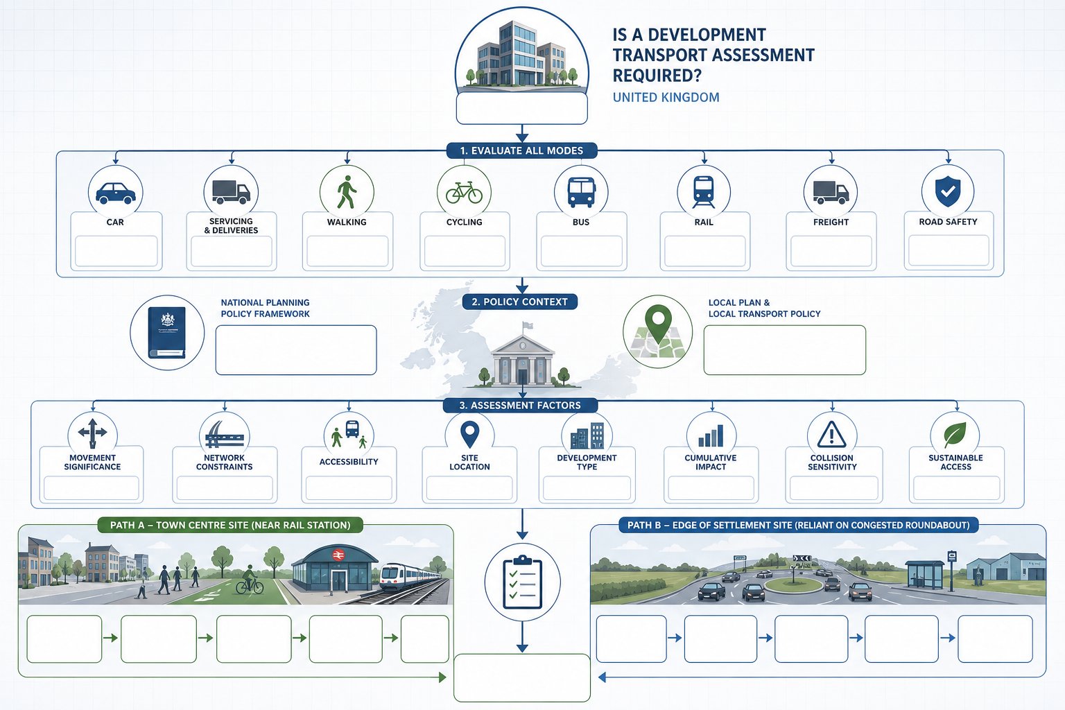
A development transport assessment is a structured appraisal of the transport effects of a proposed scheme across all relevant modes: private car, servicing, walking, cycling, public transport and, where relevant, freight and road safety. Its core purpose is to show whether the development would create significant movement, whether that impact is acceptable, and what mitigation or design changes are needed to support planning approval.
In practice, the trigger comes from national and local policy working together. The National Planning Policy Framework places transport at the centre of good development management and allows proposals to be refused on transport grounds where residual cumulative impacts would be severe. Local planning authorities then apply that test in a local context: network constraints, policy priorities, accessibility, site location and the type of development all matter.
That is why there is no single national numeric threshold that settles every case. A town-centre infill scheme beside a rail station may need less detailed analysis than an edge-of-settlement site reliant on one congested roundabout. Equally, a relatively small proposal can still require a full assessment if the surrounding network is already sensitive, collision history is poor, or sustainable access is limited.
For planning teams, the practical question is not just “Will we need a TA?” but “How much evidence will the authority expect?” A well-scoped transport assessment for developments should answer that early, before design and programme drift out of step with transport reality.
How A Transport Assessment Differs From A Transport Statement And Travel Plan
These three documents are often mentioned together, but they do different jobs.
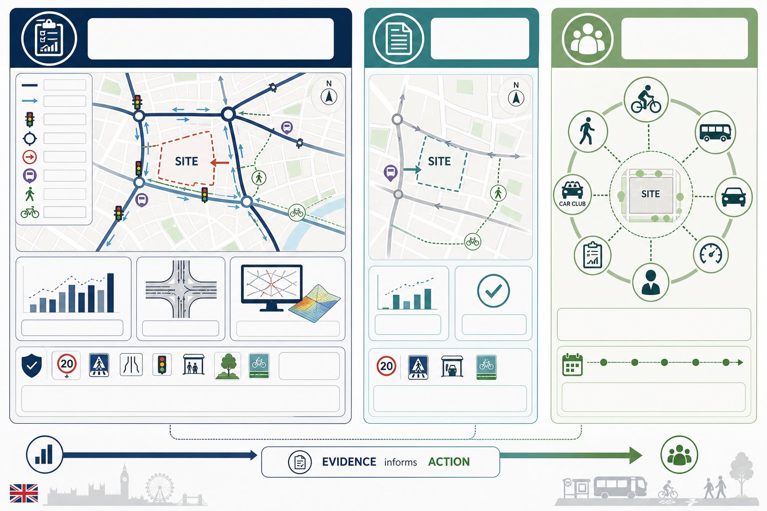
A Transport Assessment is the full technical study. It examines baseline conditions, forecasts demand, reviews access arrangements, models traffic effects where necessary, assesses sustainable travel options and identifies mitigation. It is used where a scheme is expected to generate material impacts or where the authority needs detailed evidence before determining the application.
A Transport Statement is a lighter-touch version for smaller schemes with more limited impacts. It still needs to be credible, policy-aware and based on evidence, but it will usually involve less modelling and a narrower range of analysis. The mistake we sometimes see is assuming a statement is merely a shorter TA. It is better to think of it as a proportionate response to a lower-risk proposal.
A Travel Plan, by contrast, is not primarily an impact assessment. It is a behaviour-change and management tool. It sets out how mode share will be influenced over time through measures such as cycle facilities, welcome packs, bus information, car club provision, monitoring, targets and coordinator responsibilities.
The relationship between them is important. A TA often identifies the site’s transport challenges and opportunities: the Travel Plan then turns that evidence into ongoing action. On larger or more sensitive projects, planning teams often benefit from involving Transport Assessment Consultants: early so the right document is prepared at the right level from the outset.
Typical Planning Triggers, Local Authority Thresholds, And Site Types
Most authorities assess the need for a development transport assessment by looking at significance, not just scale. That sounds obvious, but it has real consequences. A scheme does not need to be enormous to justify detailed transport work.
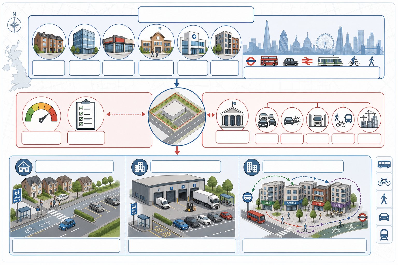
Typical triggers include major residential development, employment floorspace, retail parks, education uses, healthcare facilities and mixed-use regeneration schemes. Strategic sites and mayoral or referable schemes in London usually attract a more comprehensive multi-modal review, often with stronger emphasis on Healthy Streets, public transport capacity and mode shift.
Local thresholds vary. Some councils publish formal guidance with trip-rate, dwelling or floorspace triggers. Others rely more heavily on officer judgement at pre-application stage. Highway authorities may request a TA even below a nominal threshold if one of the following applies:
- the local network is already congested
- there are known safety concerns
- access arrangements are constrained
- the site has weak pedestrian, cycle or bus connections
- cumulative impacts from nearby committed development are material
Site type also changes the analytical focus. Residential proposals often turn on peak-hour trip generation, school-run patterns, parking stress and internal street design. Commercial schemes may hinge on servicing, HGV routing and staff travel demand. Mixed-use sites add another layer, because internalisation and linked trips can reduce external traffic if assessed properly. That is where a Residential Development Transport approach or a wider development-led strategy needs to reflect the actual land-use mix rather than default assumptions.
What A Development Transport Assessment Usually Includes
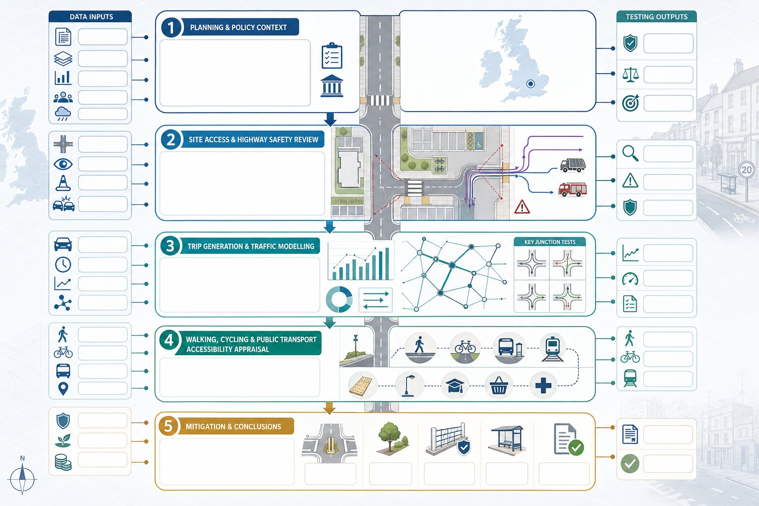
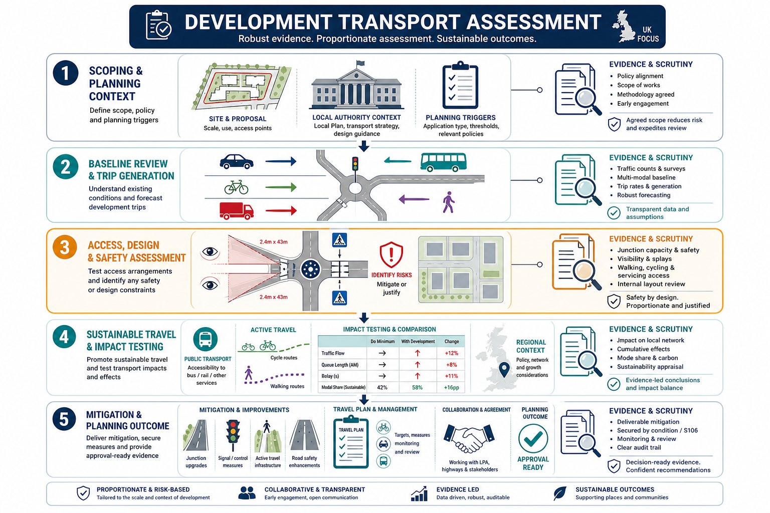
A robust TA usually starts with policy and scope, then builds a clear evidence chain from existing conditions to forecast impact and mitigation. Authorities do not just want outputs: they want to understand the logic of the assessment.
Most reports will cover the policy framework, the development proposals, baseline transport conditions, agreed study area, survey information, forecast trip generation, distribution and assignment, impact testing, accessibility, parking and servicing, mitigation and conclusions. Depending on the project, appendices may include survey schedules, accident data, modelling assumptions, swept paths, visibility splays and draft Travel Plan measures.
The strongest assessments are proportionate. They do not throw every dataset imaginable at the application, but they do address the points that matter most to decision-makers. For more complex sites, the TA may also align with wider regional transport planning considerations, especially where cumulative growth, strategic corridors or neighbouring allocations shape the authority’s response.
Site Access, Internal Layout, And Highway Safety Review
This part examines whether the site can be accessed safely and operate sensibly on day one. It usually covers junction form, visibility splays, access width, pedestrian crossing opportunities, refuse and delivery vehicle tracking, emergency access, gradients, car parking, cycle parking and the relationship between users inside the site.
And this is where many planning applications become vulnerable. A scheme can generate acceptable traffic levels overall but still stumble because the access geometry is poor, servicing conflicts with pedestrian movement, or the internal layout creates avoidable safety issues. Collision data and local site observations often carry as much weight here as spreadsheet forecasts.
Reviewing the surrounding highway network is equally important. Does the proposed access sit near a bend, school entrance, bus stop or existing queue tail? Are there desire lines that suggest a formal crossing is needed? Are disabled users catered for from the public highway right into the site?
Good transport work joins these details up rather than treating them as a separate design afterthought.
Trip Generation, Distribution, And Traffic Impact Modelling
Trip generation estimates how many journeys the development is likely to create and when. In the UK, that usually means using TRICS or similarly recognised evidence, adjusted where necessary for local context, land use, location, parking restraint and mode share assumptions.
Distribution and assignment then consider where those trips are likely to come from and go to. That may draw on census travel-to-work data, mobile or mobility data, existing site patterns, gravity models or network logic agreed with the authority. Once assigned, impacts can be tested at key junctions and links using standard modelling tools.
Authorities will usually look closely at three points: are the assumptions transparent, are committed developments included, and have future year growth factors been applied correctly? If any of those are weak, confidence in the whole exercise drops quickly. On more demanding schemes, a separate traffic impact assessment may sit alongside or within the TA to test detailed junction performance.
For mixed-use development, we should also consider internalisation and linked trips. Otherwise, the model can overstate external traffic and produce mitigation requirements that do not reflect how the place will actually function.
Walking, Cycling, Public Transport, And Accessibility Appraisal
A modern development transport assessment is not just about vehicle movements. Authorities expect a credible view of how people can reach the site without driving, and whether the scheme supports sustainable travel in a practical, not merely aspirational, way.
That means auditing walking routes, crossing facilities, footway quality, cycle connections, gradients, personal security, bus stop quality, service frequency, rail access where relevant, and the site’s relationship with schools, shops, healthcare and employment. In London and many urban authorities, that extends to Healthy Streets or active travel appraisal. Elsewhere, it still matters because the same planning logic applies: developments should enable realistic travel choices.
This section is often where a proposal either feels well integrated or isolated. A short distance to a bus stop on paper means little if the path is unlit, indirect or missing dropped kerbs. Equally, cycle parking inside the site will not solve poor external links.
A stronger assessment ties the appraisal to tangible improvements and, where appropriate, a vision led transport approach that starts with movement and place quality together, not in separate silos.
The Data, Surveys, And Evidence Needed To Support The Assessment
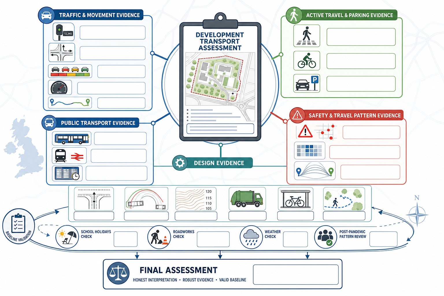
Transport assessments stand or fall on evidence quality. Even a well-written report will struggle if the input data is stale, unrepresentative or incomplete.
Common requirements include automatic traffic counts, manual classified turning counts, queue length surveys, journey time information, pedestrian and cycle counts, parking stress surveys and speed data. Depending on the site, we may also need collision records, bus frequency and capacity information, rail service data, census travel patterns, site-specific operational information and detailed topographical drawings.
Timing matters. Surveys collected during school holidays, abnormal roadworks or unusual weather may be questioned unless properly adjusted. Post-pandemic travel patterns have also made authorities more cautious about relying on old databases without local sense-checking. For larger schemes, baseline validation is often as important as forecast modelling.
The physical design evidence is just as critical as traffic numbers. Access drawings, vehicle tracking, level information, refuse strategy, cycle provision and pedestrian desire lines all shape whether the TA reads as realistic. Increasingly, schemes with wider environmental effects may also need transport evidence to align with an environmental impact assessment where cumulative movement, mitigation and network effects overlap.
In short, authorities are not looking for the biggest technical bundle. They are looking for the right data, gathered at the right time, interpreted honestly.
How The Assessment Supports The Planning Application Process
A development transport assessment helps move an application from assertion to evidence. It gives planning officers, highway engineers, committee members and legal teams something concrete to test.
At the most basic level, it demonstrates whether the proposal’s transport impacts are acceptable or can be mitigated so that residual cumulative effects are not severe. But it also does more than that. It frames the conversation with the authority, identifies what works need to be delivered, supports conditions, informs Section 106 or Section 278 discussions and provides the basis for a Travel Plan.
That is especially useful in pre-application and determination periods, when uncertainty can derail programme. If the scope is agreed early, key junctions are tested properly, and mitigation is realistic, fewer surprises emerge late in the process. The TA also helps align transport evidence with architecture, drainage, landscape and viability work, which is often where project teams lose coherence.
For applicants, this is not just about answering objections. It is about showing command of the scheme. Strong reports demonstrate that the development team understands local constraints, has considered all travel modes, and is prepared to address impacts proportionately. That tends to produce better consultations and, just as importantly, more focused officer feedback.
Common Reasons Transport Assessments Are Challenged Or Delayed
Most challenged TAs are not rejected because transport is impossible to resolve. They are challenged because confidence in the evidence has been undermined.
The biggest issue is poor scoping. If the study area, assessment years, scenarios, committed developments or modelling tools have not been agreed with the authority, technical debate can reopen halfway through determination. That burns time and budget very quickly.
Outdated or selective data is another regular problem. Authorities will question survey information that no longer reflects current conditions, especially if major nearby development, highway changes or school travel patterns have shifted demand. Ignoring background growth or cumulative development is a common way to lose credibility.
We also see delays where non-car modes are treated superficially. A few paragraphs on bus stops and cycle parking will not satisfy an authority that is actively testing accessibility and policy compliance. The same applies to safety concerns. If a site has collision history, poor visibility or awkward pedestrian movement, the TA needs to address it directly.
Finally, there is methodology drift: unconventional assumptions, poorly calibrated models, opaque TRICS selections or mitigation that looks aspirational rather than deliverable. Often the fix is not dramatic. It is simply earlier coordination with the LPA and a clearer technical audit trail.
How To Prepare A Stronger Assessment For Residential, Commercial, And Mixed-Use Schemes
The best way to strengthen a TA is to start earlier than feels comfortable. Once the layout is fixed and the programme is tight, transport advice becomes reactive. Before that point, it can genuinely improve the scheme.
For residential projects, we should focus on realistic peak profiles, school and commuter travel patterns, parking demand, refuse movements, street hierarchy and the quality of walking and cycling links to local services. A residential site that looks numerically acceptable can still attract objection if the internal layout feels car-dominated or access for vulnerable users is weak.
Commercial development needs a slightly different emphasis. Staff mode share, peak spreading, delivery patterns, yard operation, HGV routing and shift changes often matter more than simple daily traffic totals. If a business park or logistics use relies on local roads with environmental or safety sensitivities, routing assumptions should be explicit.
Mixed-use schemes require the most care because they can be over-assessed as easily as under-assessed. Internalisation, pass-by trips, shared parking logic and linked journeys all need to be handled carefully. A place where people can live, work and shop on one site should not automatically be modelled as if every movement becomes an external car trip.
This is also where experienced Developer Transport Consultants: can add real value. They help agree scope early, match evidence to local thresholds and keep the assessment aligned with a practical planning strategy rather than a purely academic exercise.
Transport Assessment Costs, Timescales, And Consultant Input
There is no honest flat rate for a development transport assessment, because cost depends on complexity far more than on the document title. A small site with good existing access and no modelling may need a concise package and limited survey work. A strategic mixed-use scheme can require months of data gathering, modelling, mitigation design, authority meetings and revisions.
The main cost drivers are usually:
- scheme size and land-use mix
- number of access points and affected junctions
- survey requirements and seasonality
- whether modelling is needed, and at what level
- local policy demands, especially in constrained urban areas
- the amount of iteration during pre-app and application stages
Timescales are similarly variable. Straightforward work may be completed within a few weeks once drawings are fixed and surveys are available. More complex schemes can take significantly longer, particularly where junction models must be agreed, resubmitted or audited by the authority. Lead-in time for counts, school-term surveys and stakeholder review is often underestimated.
Consultant input matters because the TA sits between planning, design and highway engineering. We need technical competence, yes, but also judgement: what to scope in, what to leave out, when to challenge assumptions and when to concede a mitigation point. Firms with long-standing local authority experience, including teams such as ML Traffic, are often valuable precisely because they know how thresholds and expectations play out in real planning cases rather than in theory alone.
Conclusion
A development transport assessment is not just a planning formality. It is one of the clearest tests of whether a scheme is genuinely workable in its local setting.
When the assessment is proportionate, evidence-led and scoped properly, it helps everyone: applicants understand risk earlier, planners have a defensible basis for decision-making, highway authorities can focus on the real issues, and mitigation can be tied to outcomes that are actually deliverable. When it is rushed or generic, delays are almost inevitable.
In 2026, the strongest transport assessments do more than count vehicles. They explain access, safety, movement, place quality and realistic travel behaviour in one joined-up narrative. That is what gives planning applications resilience.
For architects, developers, planners, lawyers and councils alike, the takeaway is straightforward: get the transport strategy right early, and the rest of the application usually stands on firmer ground.
Development Transport Assessment FAQs
What is a development transport assessment and when is it required?
A development transport assessment (TA) is a detailed study evaluating the transport impact of a proposed development across all modes—car, walking, cycling, public transport, and freight. It is required when a development is expected to generate significant movement, as defined by local planning authorities under the National Planning Policy Framework (NPPF).
How does a transport assessment differ from a transport statement and a travel plan?
A transport assessment is a comprehensive technical study of transport impacts and mitigation measures. A transport statement is a simpler, scaled-down version for smaller projects with limited effects. A travel plan focuses on ongoing strategies to change travel behaviour, such as promoting cycling or car share schemes, often informed by the findings of the TA or statement.
What typical elements does a development transport assessment include?
A thorough TA includes policy context, baseline transport conditions, site access and internal layout review, trip generation, distribution and traffic modelling, accessibility appraisal for walking, cycling and public transport, parking and servicing plans, and identification of necessary mitigation measures to support planning approval.
Why are some development transport assessments challenged or delayed during planning?
Common reasons include poor scoping with local authorities, outdated or incomplete data, insufficient consideration of non-car modes, unagreed or poorly calibrated traffic modelling, and failure to address key safety or local policy requirements such as Healthy Streets principles, leading to reduced confidence in the evidence provided.
How can developers prepare stronger development transport assessments to improve planning success?
By engaging early in pre-application discussions to agree scope and modelling approaches, using recent and robust data sets, providing clear strategies for safe access and parking, addressing sustainable travel realistically, and considering internalisation in mixed-use schemes. Specialist Developer Transport Consultants can provide valuable support.
What is the typical cost and timescale for preparing a development transport assessment?
Costs and timescales vary widely depending on scheme size, complexity, local policy demands, and data needs. Smaller, straightforward assessments may take a few weeks, while strategic or mixed-use developments requiring detailed multi-modal modelling and extensive surveys can take several months. Engaging experienced Transport Assessment Consultants helps manage these aspects efficiently.