Tag: Residential Development

  • Traffic Calming for Residential Areas: 2026 Planning Guide

    Traffic Calming for Residential Areas: 2026 Planning Guide

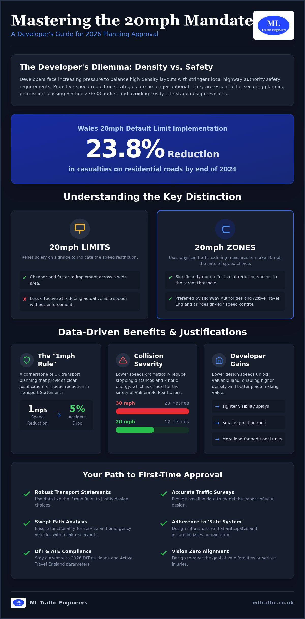
    Did you know that the 20mph default limit implementation in Wales contributed to a 23.8% reduction in casualties on residential roads by the end of 2024? As a developer or planner, you understand the increasing pressure to balance high-density site layouts with the stringent safety requirements of local highway authorities. It’s frustrating when essential traffic calming measures for residential developments lead to failed Swept Path Analysis or expensive design revisions at the eleventh hour.

    This 2026 planning guide helps you master the technical implementation of speed reduction to secure planning approval and pass Section 278 audits the first time. We will examine the latest 2026 Road Safety Strategy targets, the specific costs of physical interventions like £22,500 road narrowing features, and how to use data-driven Transport Statements to justify your site design. You’ll gain the technical authority needed to turn regulatory mandates into enhanced place-making value while ensuring every layout remains functional and compliant.

    Key Takeaways

    • Distinguish between signage-led 20mph limits and physical 20mph zones to align your site design with the latest 2026 Vision Zero safety standards.
    • Learn how implementing strategic traffic calming measures for residential developments can optimize land use by enabling tighter visibility splays and smaller junction radii.
    • Utilize the “1mph Rule” and evidence from national rollouts to provide robust justification for speed reduction within your Transport Statements.
    • Understand the role of accurate Traffic Surveys and Swept Path Analysis in securing first-time approval for Section 278 and Section 38 audits.
    • Stay compliant with 2026 DfT guidance and Active Travel England parameters to reduce regulatory friction and avoid expensive layout revisions.

    The Evolution of 20mph Speed Limits and Traffic Calming in 2026

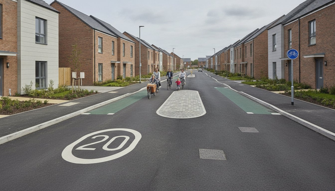
    The 2026 planning environment demands a sophisticated approach to road safety. Planners no longer view traffic calming as a reactive fix for speed complaints. Instead, it’s a proactive requirement for securing planning permission. A major distinction exists between 20mph limits, which rely solely on signage, and 20mph zones, which use physical traffic calming measures for residential developments. While limits are cheaper to implement, zones are significantly more effective at reducing speeds to the desired threshold. For a deeper look at these interventions, you can consult this comprehensive overview of traffic calming.

    Vision Zero has evolved from a metropolitan ambition into a standard local authority benchmark. In Wales, the default 20mph limit introduced in September 2023 has already shown a 23.8% reduction in casualties on residential roads by the end of 2024. Scotland continues its nationwide rollout, while England maintains a local-choice model, though Active Travel England now heavily influences these decisions. Design-led speed control is the preferred standard. Highway authorities want to see layouts that naturally restrict speed through geometry rather than relying on retrospective enforcement or signage that drivers might ignore.

    National vs. Local Implementation Trends

    Active Travel England now sets rigorous infrastructure standards that developers must follow to unlock funding and approval. In high-density areas like London, 20mph mandates aren’t just safety measures; they’re tools to support site density. Lower design speeds allow for tighter visibility splays, which saves valuable land for additional units. Moving from a 30mph to a 20mph default design speed for new-build estates is now the expected starting point for any Transport Statement.

    Technological Shifts in Speed Management

    Technology now supports physical design. Mandatory Intelligent Speed Assistance (ISA) in new vehicles helps keep drivers within limits, but it doesn’t replace the need for physical traffic calming measures for residential developments. Connected vehicle data now provides authorities with real-world compliance maps, showing exactly where speeds exceed thresholds without the need for manual spot checks. The ‘Safe System’ approach used by UK highway authorities defines safety as a shared responsibility where the road system is designed to accommodate human error and limit impact forces to survivable levels. This shift ensures that even when mistakes happen, the infrastructure prevents fatal outcomes.

    Quantifiable Benefits: Safety, Environment, and Urban Quality

    Implementing traffic calming measures for residential developments isn’t just a regulatory hurdle. It’s a data-led strategy for risk mitigation. The ‘1mph Rule’ is a cornerstone of UK transport planning. Evidence shows that every 1mph reduction in average vehicle speed correlates to a 5% drop in accident frequency. This metric provides developers with a clear, quantifiable justification for speed reduction in their planning submissions. By designing for lower speeds, you’re directly reducing the likelihood of collisions from the outset.

    Road Safety and Collision Severity

    The physics of urban collisions are unforgiving. At 30mph, a vehicle’s stopping distance is approximately 23 metres, but at 20mph, this nearly halves to 12 metres. This reduction is critical for child safety in high-density residential layouts where reaction times are shorter. Kinetic energy in a collision increases with the square of the vehicle’s speed, meaning a 10mph difference dramatically alters survival outcomes. Vulnerable Road Users (VRUs), such as cyclists and pedestrians, face a significantly higher fatality risk at 30mph compared to 20mph. Beyond physical safety, lower speeds reduce the ‘severance’ effect. This allows residents to move freely across the site without the psychological barrier of fast-moving traffic, effectively reconnecting communities within the development.

    Air Quality and Smooth Traffic Flow

    Critics often argue that lower speed limits increase emissions due to constant braking. However, well-designed traffic calming measures for residential developments promote a steady-state driving style. Maintaining a consistent 20mph reduces the heavy acceleration and braking cycles that spike NO2 and particulate matter levels. This smoother flow also results in a measurable decibel drop, improving the acoustic environment for residents. There are many proven outcomes of traffic calming, including the promotion of active travel for ‘last-mile’ trips. When people feel safe, they’re more likely to walk or cycle, which directly supports the targets in your Travel Plan. Lower speeds also reduce the mechanical stress on road surfaces, extending the longevity of the infrastructure and lowering long-term maintenance costs for the management company.

    UK Case Studies: Evidence-Based Planning Success

    Securing planning approval in 2026 requires more than just a compliant design. It requires evidence. Local authorities increasingly look to established case studies to justify the inclusion of traffic calming measures for residential developments. These real-world examples prove that lower speed environments don’t just improve safety; they enhance the commercial and social value of a site. By referencing successful rollouts, developers can provide the robust justification needed in a Transport Assessment to satisfy highway officers.

    The Welsh Default Model: A 2026 Retrospective

    The Welsh national rollout remains the most significant data set for 20mph implementation. Following the 2023 shift, casualty figures on 20mph and 30mph roads fell by 23.8% by the end of 2024. By 2026, this downward trend has stabilized, providing a clear baseline for residential safety. While initial public resistance was high, residential preference has shifted as the benefits became tangible. Real-world GPS data from Welsh urban centres shows that while journey times saw marginal increases, bus reliability actually improved in many areas due to more predictable traffic flow. This data helps developers counter arguments that lower speeds will lead to gridlock or service delays.

    London Borough Innovations

    London has pioneered the integration of 20mph limits with Low Traffic Neighbourhoods (LTNs) in boroughs like Hackney and Islington. A comprehensive analysis published in May 2025 by Transport for London (TfL) evaluated 157 schemes. The results were stark. Total casualties dropped by 36%, while fatal or serious injuries decreased by 34%. Most notably, child casualties saw a 46% reduction. These figures provide an unassailable argument for “Vision Zero” milestones. For those seeking a foundational understanding of these principles, the Federal Highway Administration’s Traffic Calming ePrimer offers an authoritative look at how these measures integrate with broader safety initiatives.

    The economic argument for speed management is equally compelling. The Bristol Study highlighted long-term health outcomes and property value increases in calmed areas, as buyers increasingly prioritize safety and “place-making” quality. While installing traffic calming measures for residential developments involves upfront costs, such as the £27,500 required for a pair of road narrowing features, these are balanced against massive societal savings. Reducing collisions saves millions in healthcare and emergency service costs. For developers, the primary economic benefit is a smoother path to Section 278 approval and a more marketable, high-quality residential product.

    The Developer’s Perspective: Traffic Calming in Transport Planning

    Traffic calming is often viewed as a cost burden, but for savvy developers, it’s a strategic tool. It’s about land optimization. Integrating traffic calming measures for residential developments allows you to design site layouts in ways that 30mph zones simply don’t permit. Lower design speeds directly influence the technical requirements in your Transport Statements. By committing to a 20mph environment, you can justify tighter visibility splays and smaller junction radii. This reduction in land take for highway infrastructure translates into more sellable floor area or higher unit density. In constrained urban sites, 20mph limits facilitate ‘Shared Space’ designs. These layouts remove the traditional distinction between pavement and road, creating a high-quality public realm that increases the overall marketability of the development.

    Impact on Swept Path Analysis and Site Layout

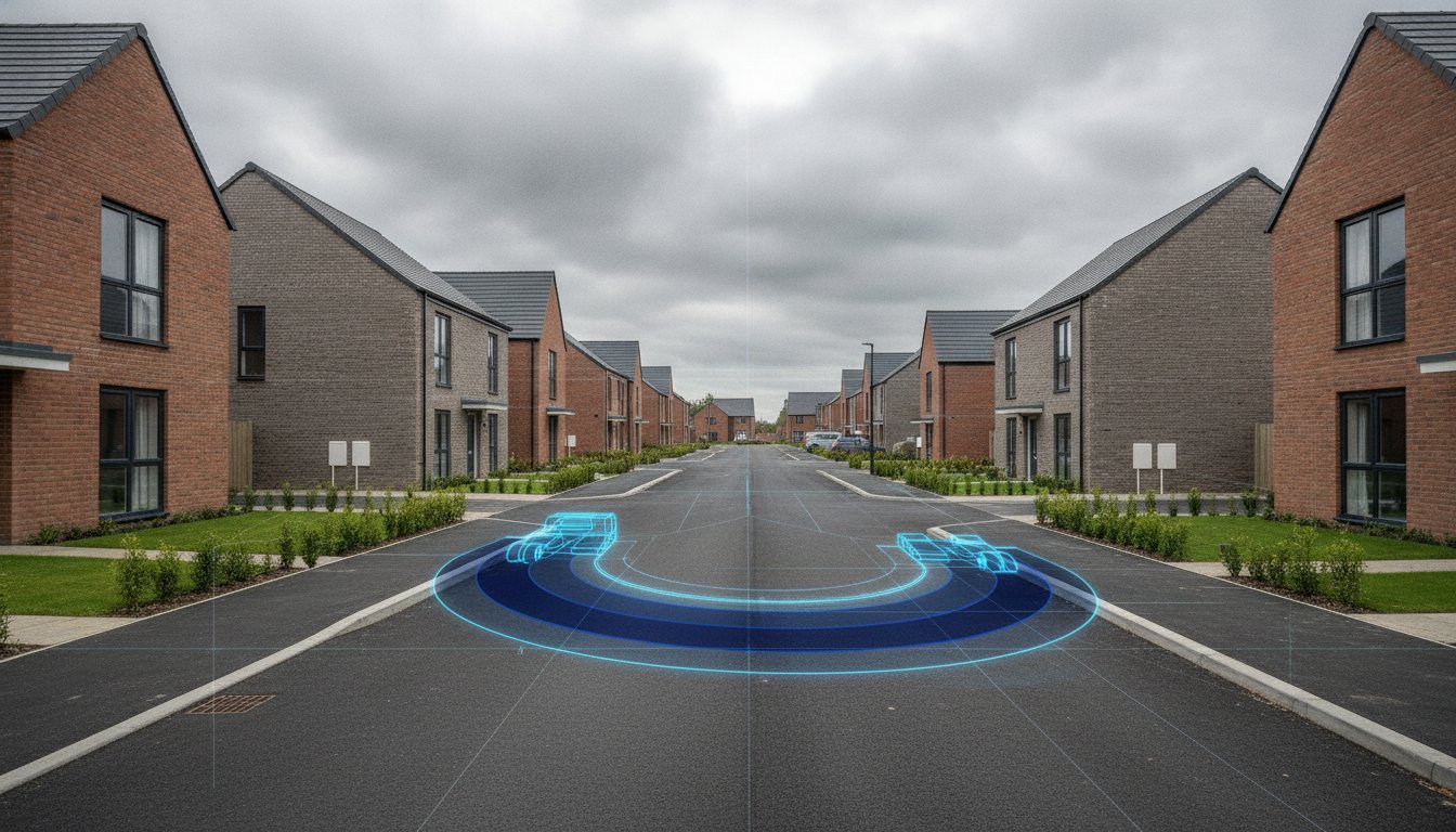
    A successful layout must balance speed reduction with operational functionality. Integrating 20mph geometry into your Swept Path Analysis is critical to ensure fire tenders and refuse vehicles can navigate the site without mounting kerbs. Developers must choose between horizontal deflection, such as chicanes, and vertical deflection, like speed tables. While vertical measures are highly effective for speed, they can sometimes delay emergency vehicle response times if poorly placed. We recommend using ‘tight’ urban design, building lines close to the street and reduced forward visibility, to naturally enforce speed limits. This approach reduces the need for unsightly signage and physical humps that residents often dislike.

    Justifying Development through Safety Compliance

    Securing planning permission for high-density schemes often hinges on mitigating the impact on sensitive local roads. Using speed data from comprehensive Traffic Surveys allows you to establish a baseline and prove that your proposed traffic calming measures for residential developments will maintain safety standards. This evidence is vital during S278 negotiations for off-site infrastructure. A 20mph environment also significantly strengthens your Travel Plan. When walking and cycling feel safe, modal shift targets become realistic rather than aspirational. This safety compliance makes your application much harder for local authorities to refuse on highway grounds.

    If you are facing challenges with a constrained layout, our team can help you optimize your site design with expert Swept Path Analysis.

    Traffic Calming for Residential Areas: 2026 Planning Guide

    Implementing traffic calming measures for residential developments requires a balance of technical precision and regulatory insight. At ML Traffic Engineers UK, our Transport Planning Consultants specialize in adapting site designs to meet the evolving speed policies of 2026. We bridge the gap between your commercial goals and the safety mandates of local Highway Authorities. By applying Manual for Streets principles within 20mph environments, we optimize site access and layout efficiency. This ensures your development remains functional while satisfying the most stringent safety audits. Our approach focuses on reducing the logistical pressure on your team by managing the entire technical justification process.

    Technical Expertise for Planning Success

    Our team prepares comprehensive Transport Assessments that leverage lower design speeds to mitigate traffic impact. We provide expert witness services for planning hearings when road safety or speed management becomes a point of contention. Additionally, we offer tailored advice on Section 278 and Section 38 highway design agreements. This technical support ensures that any off-site infrastructure is delivered cost-effectively without compromising on compliance. We understand the specific requirements of both London-specific and national UK planning frameworks, allowing us to navigate regional variations in speed limit mandates with confidence.

    Why Precision Data Matters

    Precision data is the foundation of any successful speed reduction request. We conduct detailed Traffic Surveys and Parking Surveys to establish existing speed profiles and justify design changes. Accurate data reduces regulatory pressure by providing highway officers with the evidence they need to approve your scheme. We use specialized industry terminology and regulatory compliance language to ensure our reports stand up to scrutiny. When you use traffic calming measures for residential developments as part of a data-backed strategy, you reduce the risk of costly design revisions. If you’re ready to secure planning approval for your next residential project, contact ML Traffic Engineers UK today to request a consultation and ensure your site layout is fully optimized.

    Securing Your Development’s Future Through Technical Precision

    The transition toward 20mph environments represents a fundamental change in UK highway design that requires a proactive response from developers. By integrating traffic calming measures for residential developments early in the design phase, you don’t just meet safety targets. You create more efficient, high-density layouts that satisfy local authorities while maximizing sellable land. We’ve explored how evidence from national rollouts and London-specific schemes provides the necessary weight to support your planning application and secure Section 278 approval.

    ML Traffic Engineers UK has been a dependable partner in UK transport planning since 2014. We provide the technical authority needed to navigate both London Borough and national highway standards so you don’t have to. Our comprehensive reporting, ranging from detailed Swept Path Analysis to robust Travel Plans, ensures your project moves through the planning process without costly delays. Don’t let layout revisions stall your progress. Contact ML Traffic Engineers UK for a Transport Statement Quote to ensure your site is fully optimized for the 2026 planning landscape. We’re ready to help you turn safety requirements into a strategic asset for your next residential project.

    Frequently Asked Questions

    What is the difference between a 20mph zone and a 20mph limit?

    A 20mph zone utilizes physical engineering features to self-enforce speeds, whereas a 20mph limit relies solely on signage and road markings. Zones are generally more effective because they use traffic calming measures for residential developments, such as speed tables or chicanes, to naturally restrict vehicle velocity. Local authorities often prefer zones for new-build estates to ensure the design speed is maintained without constant police enforcement.

    Do 20mph limits actually reduce the number of road accidents in residential areas?

    Yes, implementing 20mph limits is associated with a 23% reduction in road casualties and a 26% decrease in collisions across the UK. Data from the Wales rollout showed that casualties on residential roads fell by 23.8% between Q2 2023 and Q4 2024. These reductions occur because lower speeds provide drivers with more reaction time and significantly decrease the kinetic energy involved in impacts, making collisions more survivable.

    How do 20mph limits affect vehicle emissions and local air quality?

    20mph environments typically improve air quality by encouraging a smoother, steady-state driving style that reduces the heavy acceleration and braking cycles responsible for emission spikes. While some critics suggest lower speeds increase pollution, evidence indicates that reducing the stop-start nature of urban driving helps lower NO2 and particulate matter levels. This shift also supports a transition toward walking and cycling for shorter trips, further reducing total vehicle emissions.

    Will a 20mph limit significantly increase journey times for residents?

    The impact on journey times is usually minimal, often adding just seconds to short urban trips. In residential areas, average speeds are already constrained by junctions, parked cars, and pedestrian activity. Real-world data suggests that while peak speeds are lower, more predictable traffic flow can actually improve the reliability of public transport services. For most residents, the safety and noise reduction benefits far outweigh the negligible increase in travel time.

    Is a Transport Statement required if my development is in an existing 20mph zone?

    Yes, a Transport Statement is still required to demonstrate how your specific development interacts with the existing network and to justify site access safety. Even in an established 20mph zone, you must prove that your internal layout and access points comply with national highway standards. This document provides the technical evidence needed to satisfy the local authority that your scheme won’t negatively impact the prevailing safety environment or traffic flow.

    How does a 20mph design speed impact the required length of visibility splays?

    Lowering the design speed from 30mph to 20mph significantly reduces the required length of visibility splays at junctions and access points. According to Manual for Streets principles, a 20mph design speed allows for shorter ‘Y’ distances, which reduces the amount of land that must be kept clear of obstructions. This enables developers to optimize site layouts and potentially increase the number of units or sellable floor area on constrained residential sites.

    Are 20mph limits legally enforceable for all vehicle types in the UK?

    20mph limits are legally enforceable for all motor vehicles in the UK, provided the correct Traffic Regulation Order is in place and signage is compliant. Enforcement is typically carried out by the police using mobile speed cameras or fixed ANPR technology. While some drivers believe these limits are advisory, they carry the same legal weight and penalties as any other speed limit on the public highway, including fines and license points.

    Can a developer request a 20mph limit as part of their planning application?

    Developers frequently request 20mph limits as part of their planning application to mitigate the traffic impact of their schemes. Proposing traffic calming measures for residential developments as part of a Section 278 agreement can help secure planning approval for high-density layouts that might otherwise be refused on safety grounds. This proactive approach demonstrates to the Highway Authority that you’ve prioritized the safety of vulnerable road users from the inception of the project.

    Michael Lee

    Article by

    Michael Lee

    Transport planner with over 35 years' experience.

    Disclaimer

    The content on mltraffic.co.uk, including all technical articles, guides, and resources, is provided for general informational and educational purposes only. It is not intended to constitute professional advice in traffic engineering, transportation planning, development approvals, or any other technical or legal field.
    While ML Traffic Engineers makes every reasonable effort to ensure the accuracy, completeness, and timeliness of the information published, we do not provide any warranties or representations (express or implied) regarding its reliability, suitability, or availability for any particular purpose. Any reliance you place on the content is strictly at your own risk.
    In no event shall ML Traffic Engineers, its directors, employees, authors, or affiliates be liable for any direct, indirect, incidental, special, consequential, or punitive damages (including, without limitation, loss of profits, data, or business opportunities) arising out of or in connection with the use of, or inability to use, any information provided on this website.
    The articles and guides on this site are not a substitute for engaging a qualified, professional traffic engineer to assess your specific project requirements. For tailored advice, compliance assessments, or traffic engineering services, please contact a competent professional.
    This disclaimer may be updated from time to time without notice. By accessing or using this website, you agree to be bound by the most current version of this disclaimer.
  • Transport Assessment: 2026 Residential Developer’s Guide

    Transport Assessment: 2026 Residential Developer’s Guide

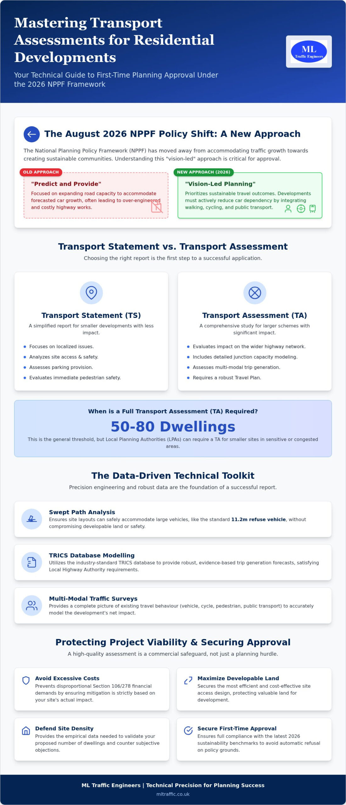
    Did you know that 42% of minor development applications in London face immediate delays at the validation stage because of insufficient highway data? For a residential developer, these technical hurdles represent more than just paperwork. They are often the primary cause of stalled timelines and unexpected costs from off-site highway works. Securing a robust transport assessment for residential development is no longer just a box-ticking exercise. It’s a critical strategic tool used to preempt council objections through data-driven precision.

    We understand that the confusion between Transport Statements and full Assessments, combined with the 2026 shift toward a vision-led planning approach, creates significant regulatory pressure. This guide provides the technical clarity you need to master these requirements and secure planning approval with confidence. You’ll learn how to navigate the latest NPPF revisions, manage 100% EV charging mandates, and ensure your highway mitigation remains cost-effective. We’ll examine the specific evidence required to satisfy local authorities and keep your project moving from inception to completion.

    Key Takeaways

    • Utilize TRICS data and Swept Path Analysis to provide technical proof that your site can safely accommodate emergency and refuse vehicle movements.
    • Distinguish between a Transport Statement and a full Assessment to ensure your submission is proportionate to your project’s scale and avoids unnecessary modelling costs.
    • Align your site design with Active Travel England standards and Vision Zero principles to satisfy the 2026 shift toward sustainable transport infrastructure.
    • Secure a robust transport assessment for residential development to act as a strategic negotiation tool that preempts highway objections and reduces project risk.
    • Engage with expert Travel Plan Consultants early to implement effective car-reduction strategies that strengthen the sustainability profile of your planning application.

    What is a Transport Assessment for Residential Development?

    A transport assessment for residential development is a comprehensive technical document required by planning authorities to evaluate the impact of new housing on the existing highway network. It serves as a piece of the wider transportation planning process, acting as the bridge between your architectural vision and the functional reality of local infrastructure. Unlike a generic traffic report, this document uses empirical data to forecast how future residents will move. It ensures that the local area can absorb additional demand without compromising public safety or network efficiency.

    The legal foundation for these reports rests on the National Planning Policy Framework (NPPF). As of the Summer 2026 revisions, the framework has shifted from a “predict and provide” model to a “vision-led” approach. This change requires developers to define desired place-making outcomes first, rather than simply reacting to traffic forecasts. Residential projects face unique scrutiny compared to industrial or commercial sites. While a warehouse focuses on heavy goods vehicle timing, a housing development must account for complex multi-modal patterns. This includes school run peaks, grocery deliveries, and pedestrian safety for vulnerable road users.

    The Local Highway Authority (LHA) acts as the primary guardian of these standards. They review your submission to ensure that your project doesn’t just “fit” the road but actively contributes to its long-term viability. Their feedback can make or break an application, which is why precision in your initial data is a functional necessity for securing planning permission.

    The Threshold: When do you need a full Assessment?

    Differentiating between a small-scale site and a major development is the first step in your planning strategy. In many regions, including most London boroughs, schemes under 50 units usually require a Transport Statement. This is a lighter, more concise report focused on immediate site access. However, once a project exceeds 80 dwellings, a full Assessment becomes mandatory. Local authority variations exist, so checking the specific Local Validation List for your borough is essential to avoid immediate validation delays at the start of the project lifecycle.

    Core Objectives of a Successful Assessment

    A successful assessment must prove three specific points to the LHA. First, it must demonstrate safe and suitable access for all users, including those with mobility impairments. Second, it must show that any “residual cumulative impact” on the road network isn’t severe. Finally, it must promote sustainable travel. By integrating a robust Travel Plan, you can reduce car dependency and satisfy the strict 2026 environmental benchmarks that councils now prioritize.

    The Technical Engine: Data and Analysis Requirements

    A transport assessment for residential development relies on a technical engine of precise, empirical data. Without accurate modeling, even the most sustainable architectural designs can fail at the planning stage. We prioritize high-resolution data to ensure your project meets both local highway authority standards and international sustainability goals for reduced carbon impact. Precision here isn’t just about compliance. It’s about protecting your project from the 42% of applications that face immediate delays due to insufficient highway evidence.

    Technical reporting must go beyond surface-level observations. It requires a rigorous combination of trip generation modeling, vehicle movement simulations, and real-world surveys. This data counters outdated council records and provides a factual basis for your development’s impact. Our team provides the technical analysis required to satisfy these rigorous council standards.

    TRICS Trip Generation for Residential Sites

    We use the 2026 TRICS database to predict how many vehicle and pedestrian trips your site will generate. Selecting comparable sites is the most critical part of this process. A site in a high-density urban area with a PTAL score of 5 behaves differently than a rural development. We analyze peak hour data for both morning and evening commutes to ensure the network can handle the highest levels of demand. This multi-modal approach accounts for the 80% sustainable trip target set by the London Plan, shifting the focus from cars to active travel.

    Swept Path Analysis (SPA) and Site Layout

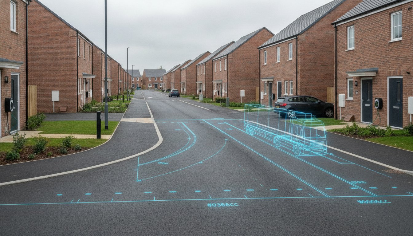
    Ensuring that fire tenders and refuse trucks can navigate your estate is a non-negotiable safety requirement. We utilize Swept Path Analysis to simulate these movements during the early design stages. This prevents costly redesigns after you’ve already committed to a layout. With light van movements increasing by 30% in urban centers, your site must accommodate frequent delivery vehicles without blocking emergency access routes. Integrating SPA into your car park design ensures every turn and junction is functionally safe and compliant with Building Regulations Part S.

    Parking surveys provide the final layer of technical defense. As of 2026, 100% of new residential parking spaces must include EV charging infrastructure. We conduct parking stress surveys to justify “low-car” or car-free developments in high-accessibility areas. This data-led approach proves to local authorities that your parking provision is sufficient, sustainable, and safe.

    Transport Statement vs. Assessment: Which One Do You Need?

    Choosing the wrong technical document is a primary cause of planning delays and unnecessary expenditure. A transport assessment for residential development is required when a project’s impact is significant, while a Transport Statement suffices for smaller schemes with lower traffic implications. The UK government guidance on Transport Assessments emphasizes that these documents must be proportionate to the scale of the development. However, the line between the two isn’t always determined by unit count alone. It’s often defined by the existing capacity of the local highway network.

    Under-reporting is a major risk that leads to immediate friction with local authorities. If you submit a Statement for a site that the council deems “sensitive,” they will likely reject the application or demand a full upgrade mid-process. Approximately 15% of London applications face deferral due to insufficient transport evidence. This results in wasted technical fees and months of project stagnation. Budgeting for the correct level of consultancy from the start is more cost-effective than attempting to “downgrade” a report that requires more technical weight to pass the validation stage.

    Key Differences in Scope and Detail

    A full Assessment requires detailed junction capacity modelling using specialized software like Junctions 9 or 10. This analysis tests how specific junctions perform under peak pressure and predicts the cumulative impact of your development alongside other local projects. Statements rarely require this level of complex simulation. Both documents now require a high depth of sustainable transport analysis to meet 2026 standards, focusing on pedestrian and cycle connectivity. For a detailed breakdown of costs and requirements for smaller sites, see our Developer’s Buying Guide for Transport Statements.

    Decision Factors for Developers

    Site location and surrounding infrastructure often dictate the report type more than unit numbers alone. A 40-unit scheme in a rural area might trigger a full transport assessment for residential development if the local road network is already at capacity or has a poor safety record. Identifying “sensitive” highway areas is a functional necessity. These include sites near schools, hospitals, or within Air Quality Management Areas (AQMAs) where any increase in traffic is heavily scrutinized. We always recommend securing pre-application advice from the Local Highway Authority (LHA). This “scoping” exercise confirms the exact level of detail and the specific junctions that need testing before you commit to technical work.

    Securing planning permission in 2026 requires more than just technical data. It requires a deep understanding of the policy shift toward Vision Zero and Active Travel England standards. Local authorities now prioritize the safety of vulnerable road users and the quality of the pedestrian environment over vehicle throughput. Your transport assessment for residential development must reflect these priorities to avoid immediate pushback. We take an active approach to these regulations, ensuring your project meets the latest legislative benchmarks from the first day. This includes aligning with the “Healthy Streets” approach and the goal of eliminating all transport-related deaths by 2041.

    Specific regions present unique challenges. For example, Transport Planning in London involves mandatory oversight from TfL for any site within 100 metres of a red route. These applications often trigger Section 106 financial contributions for public transport improvements or Section 278 agreements for physical highway modifications. Navigating these negotiations requires a reliable partner who understands regional variations so you don’t have to. We manage the full project lifecycle, from initial scoping to the final highway works agreement, ensuring you remain compliant with the London Plan’s strict parking mandates.

    The 5-Step Roadmap to Approval

    We follow a logical, sequential flow to ensure your application remains on track. This systematic approach reduces logistical pressure and minimizes the risk of technical objections during the validation stage.

    • Step 1: Scoping. We agree on the assessment’s scope with the Local Highway Authority early. This prevents redundant work and ensures we test the correct junctions.
    • Step 2: Data Collection. Our teams conduct parking and traffic surveys to build a factual evidence base that counters outdated council records.
    • Step 3: Technical Modelling. We perform impact analysis to predict future network performance and justify your site’s access strategy.
    • Step 4: Mitigation Strategy. We develop robust Travel Plans and highway works to offset any identified impacts and promote sustainable travel.
    • Step 5: Negotiation. We manage post-submission queries from planning officers to keep your timeline moving and reach a successful decision.

    Common Objections and How to Preempt Them

    Council objections often focus on three areas: parking provision, pedestrian safety, and local congestion. If a council objects to a “car-free” design, we use parking stress surveys to justify the provision level based on the site’s PTAL score. When pedestrian links are deemed inadequate, we propose sustainable infrastructure improvements as part of the mitigation strategy. For congestion concerns, we use precise junction modelling to prove that the residual cumulative impact is not severe. This data-led precision is your best defense against planning delays.

    Don’t let regulatory hurdles stall your project. Contact our technical team today to secure a compliant transport assessment for residential development.

    Why Expert Consultancy is Vital for Residential Success

    A transport assessment for residential development represents more than a data set; it’s a strategic negotiation document. Professional Travel Plan Consultants provide the necessary foresight to reduce car dependency and meet the high sustainability expectations of 2026 planning committees. This expertise ensures your scheme remains functional while satisfying the strict legislative benchmarks that define modern housing projects. Technical precision is a functional necessity in this high-stakes environment, where even minor data gaps can lead to costly delays.

    ML Traffic Engineers UK acts as a dependable partner throughout the full project lifecycle. Since our inception in 2014, we’ve focused on delivering technical authority with a client-focused approach. We understand the logistical and regulatory pressures that developers face during the planning phase. Our team manages every technical detail from initial site scoping to post-submission negotiations. This comprehensive support ensures your project adheres to industry benchmarks without unnecessary delays. By identifying potential highway objections before they reach the council, we protect your investment and reduce project risk.

    Beyond the Report: Strategic Planning Support

    Expert consultants provide a reassuring voice in high-stakes environments. We represent developers in technical meetings with highway officers to defend the data and the proposed access strategy. We utilize a technical lexicon rooted in regulatory compliance to communicate effectively with planning authorities. This ensures that technical arguments for specific junction designs are framed in a way that planning officers can readily accept. We also advise on site layout early in the process to maximize developable area while ensuring every road and junction meets safety standards. This proactive involvement prevents the technical bottlenecks that often stall residential applications during the consultation period.

    Efficiency and Reliability

    The fast-moving nature of the infrastructure sector requires a partner with constant accessibility. ML Traffic Engineers UK maintains a sense of readiness and urgency to ensure your project stays on schedule. Our deep understanding of regional regulations across England and London allows us to provide a fully-managed service that addresses intricate local requirements. We take pride in our adherence to standards and our role as professional guardians of public safety. This rhythmic efficiency suggests a brand that values your time and understands the unpredictable nature of planning timelines.

    Contact ML Traffic Engineers UK for a tailored Transport Assessment quote to secure your project’s success with a robust transport assessment for residential development.

    Secure Your Planning Approval with Technical Precision

    The 2026 planning landscape demands a transition from traditional traffic forecasting to a vision-led, outcome-focused methodology. By prioritizing sustainable movement and high-resolution data, you address the core concerns of the Local Highway Authority before they result in application deferrals. A robust transport assessment for residential development is no longer just a technical requirement; it’s your strongest asset in negotiating complex planning conditions and minimizing off-site highway costs. This strategic approach ensures your site remains both compliant with the latest NPPF revisions and commercially viable.

    Since 2014, ML Traffic Engineers UK has provided the specialized technical authority needed to navigate these high-stakes regulatory environments. Our all-encompassing service manages the full project lifecycle, offering expertise in TRICS modeling and Swept Path Analysis from initial scoping through to final approval. We understand the urgency of housing delivery and maintain a constant readiness to prevent technical bottlenecks in your timeline. Get a Professional Transport Assessment for Your Residential Project and partner with an expert team dedicated to precision, safety, and your project’s success. We look forward to securing the planning results your development deserves.

    Frequently Asked Questions

    Do I need a Transport Assessment for a small residential conversion?

    Most small conversions involving fewer than 50 units only require a Transport Statement rather than a full Assessment. However, if your project is located in a sensitive area or has complex access issues, the council may request a more detailed report. You should always consult the local authority’s validation list to confirm the specific requirements for your site location.

    How long does it take to complete a Transport Assessment for a housing development?

    A standard assessment typically takes between three to six weeks to complete. This timeframe includes essential site observations, data collection from the TRICS database, and technical modeling of local junctions. More complex projects that require extensive negotiation with highway officers or Transport for London (TfL) may take longer to reach the final submission stage.

    What is the difference between a Transport Assessment and a Travel Plan?

    A Transport Assessment evaluates the physical impact of a development on the highway network, while a Travel Plan is a strategic document designed to manage and reduce that impact. The Assessment focuses on infrastructure capacity and safety. In contrast, the Travel Plan promotes sustainable travel habits, such as cycling and public transport use, among future residents.

    Can a Transport Assessment help reduce my Section 106 contributions?

    A robust transport assessment for residential development can justify lower financial contributions by providing empirical proof that the project’s impact is less severe than predicted. Accurate modeling can demonstrate that your on-site mitigations are sufficient to handle the new demand. This technical evidence often prevents developers from being overcharged for unnecessary off-site highway works.

    What happens if the local council objects to my Transport Assessment?

    We immediately engage in technical negotiations with highway officers to address their specific concerns. This process often involves providing additional data or refining the proposed mitigation strategy to satisfy safety standards. Our team defends the precision of the original report while finding a functional solution that allows the project to move forward toward approval.

    Is Swept Path Analysis always required for residential planning?

    Most residential applications require Swept Path Analysis to prove that fire tenders and refuse trucks can safely navigate the proposed site layout. Councils prioritize emergency access and service vehicle movements as non-negotiable safety benchmarks. Providing this visual evidence early in the design stage prevents costly layout revisions and ensures your application meets mandatory Building Regulations.

    How much does a Transport Assessment cost for a UK residential project?

    The cost of an assessment depends on the scale of the development and the complexity of the required junction modeling. Factors such as the number of sites to be surveyed and the specific requirements of the local highway authority will influence the total fee. Developers should seek a tailored quote that reflects the unique technical demands of their specific residential scheme.

    What is TRICS data and why is it used in residential planning?

    TRICS is the industry-standard database used to predict trip generation for new developments by analyzing surveys from comparable existing sites. It provides the factual foundation needed to forecast vehicle and pedestrian movements accurately. Using the latest TRICS data is essential for producing a compliant transport assessment for residential development that stands up to council scrutiny.

    Michael Lee

    Article by

    Michael Lee

    Transport planner with over 35 years' experience.

    Disclaimer

    The content on mltraffic.co.uk, including all technical articles, guides, and resources, is provided for general informational and educational purposes only. It is not intended to constitute professional advice in traffic engineering, transportation planning, development approvals, or any other technical or legal field.
    While ML Traffic Engineers makes every reasonable effort to ensure the accuracy, completeness, and timeliness of the information published, we do not provide any warranties or representations (express or implied) regarding its reliability, suitability, or availability for any particular purpose. Any reliance you place on the content is strictly at your own risk.
    In no event shall ML Traffic Engineers, its directors, employees, authors, or affiliates be liable for any direct, indirect, incidental, special, consequential, or punitive damages (including, without limitation, loss of profits, data, or business opportunities) arising out of or in connection with the use of, or inability to use, any information provided on this website.
    The articles and guides on this site are not a substitute for engaging a qualified, professional traffic engineer to assess your specific project requirements. For tailored advice, compliance assessments, or traffic engineering services, please contact a competent professional.
    This disclaimer may be updated from time to time without notice. By accessing or using this website, you agree to be bound by the most current version of this disclaimer.

  • Residential Transport Plans for Planning Permission

    Residential Transport Plans for Planning Permission

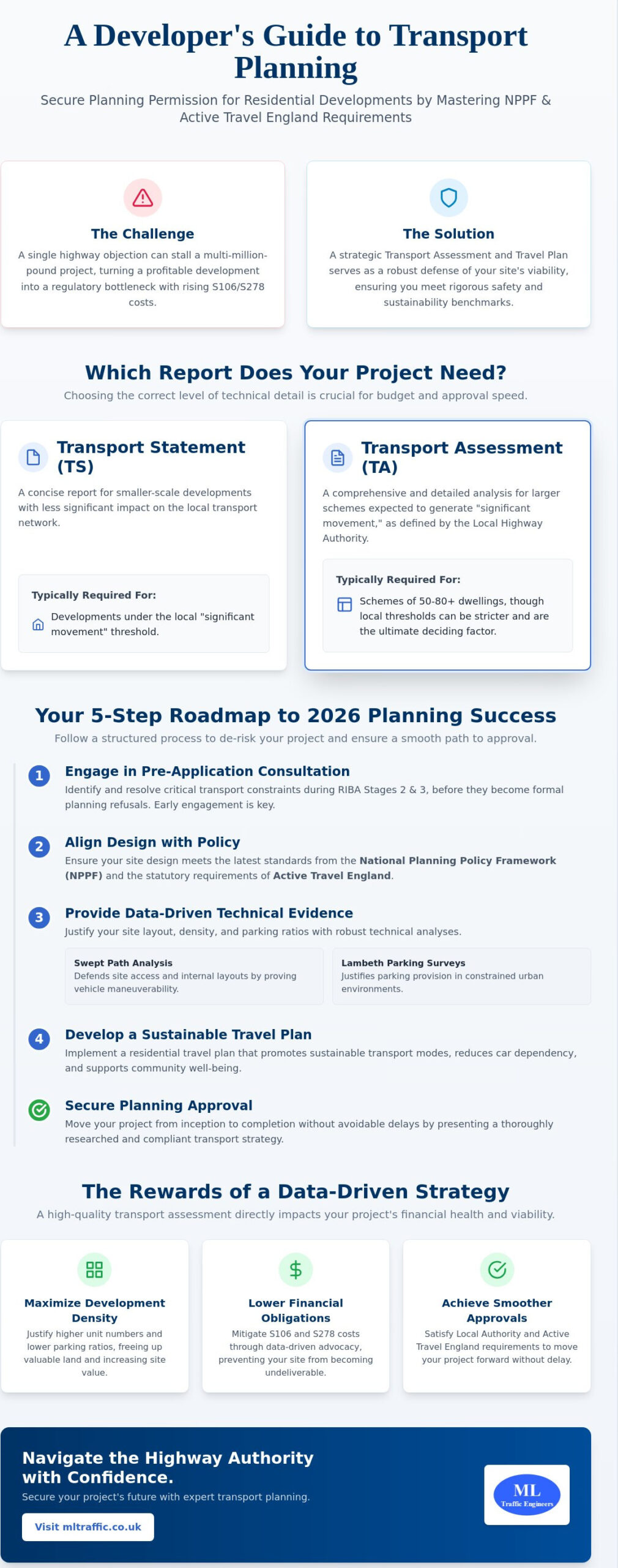
    A single highway objection can stall a multi-million-pound residential development for months, turning a profitable site into a regulatory bottleneck. You’re likely facing increased pressure from local authorities regarding parking ratios and the rising costs of sustainability mitigation. It’s a high-stakes environment where precision isn’t just a preference; it’s a functional necessity for your project’s survival. Securing a robust transport assessment and travel plan for planning permission residential projects is no longer just a box-ticking exercise. It is a strategic defense of your site’s commercial viability.

    We understand that navigating the December 2024 National Planning Policy Framework and Active Travel England’s statutory requirements can feel like an unnecessary hurdle. This article provides a clear roadmap to help you master these technical nuances and secure planning approval with confidence. You’ll learn how to utilize specialized reports to maximize development density while minimizing S106 and S278 financial obligations through data-driven advocacy. We’ll examine the specific documentation you need to pass planning in 2026 and move your project from inception to completion without avoidable delays.

    Key Takeaways

    • Align your site design with the latest NPPF standards to maximize unit numbers while meeting stringent Active Travel England requirements.
    • Differentiate between Transport Statements and Assessments to ensure you provide the exact level of technical detail required for your scheme’s scale.
    • Implement a strategic transport assessment and travel plan for planning permission residential developments to mitigate highway objections and lower S106 financial burdens.
    • Use Swept Path Analysis and Lambeth Methodology parking surveys to defend site layouts and density in constrained urban environments.
    • Engage in pre-application consultations to identify and resolve critical transport constraints before they become formal planning refusals.

    Transport Planning for Residential Developments: Why It Is the Key to Approval

    The National Planning Policy Framework (NPPF) 2026 mandates that all residential developments prioritize sustainable transport to support the goal of building 1.5 million homes. Precision in Transportation planning is no longer a secondary consideration; it’s the primary mechanism for securing site viability. Local authorities now scrutinize how a project integrates into existing networks before considering architectural merits. A robust transport assessment and travel plan for planning permission residential schemes ensures your project meets these rigorous safety and sustainability benchmarks from the outset.

    To better understand how these strategies integrate into the planning process, watch this overview of travel plan fundamentals:

    Modern planning has shifted toward a “Vision-Led” approach. This methodology moves away from traditional “predict and provide” models that often resulted in over-engineered road layouts. Instead, it focuses on the desired outcomes for a community, such as high active travel rates and reduced car dependency. By adopting this vision early in the RIBA Stage 2 and 3 design phases, you can prevent the costly redesigns that frequently plague projects at RIBA Stage 4. Early transport intervention allows you to defend higher site densities by proving that the local infrastructure can handle the increased movement through smart mitigation rather than just physical expansion.

    The “Significant Movement” Threshold for Residential Sites

    Determining whether your project requires a simple Transport Statement or a comprehensive Assessment depends on the “significant movement” your site generates. While national guidelines often point to a range of 50 to 80 dwellings, local borough variations are common and can be much stricter. In the context of 2026 residential standards, the “significant movement” threshold is a qualitative trigger determined by the local planning authority based on a site’s potential to impact the local highway network’s safety and capacity. We help you identify these triggers early to ensure your reporting matches the specific expectations of the statutory consultees, including Active Travel England for larger schemes.

    Impact on Land Value and Planning Viability

    Transport reports directly influence the financial health of your development. High-quality data can justify lower parking ratios in areas with high accessibility, which frees up land for additional units and increases the overall land value. Conversely, poor planning leads to excessive S106 and S278 financial obligations that can render a site undeliverable. To understand how these principles apply to high-density urban environments, consult our Transport Assessment London: The Developer’s 2026 Guide to Planning Success. By establishing transport feasibility early, you ensure your site remains a “deliverable” asset in the eyes of the planning committee.

    Transport Assessments vs. Statements: Which Does Your Project Require?

    Choosing between a Transport Statement (TS) and a Transport Assessment (TA) is a decision that dictates your project’s technical scope and consultant budget. While both documents support a transport assessment and travel plan for planning permission residential application, their depth and geographic focus vary significantly. The official government guidance on transport assessments provides the foundation for this choice, but local highway authorities often apply their own specific thresholds based on local network sensitivity. Precision at this stage prevents you from over-investing in unnecessary data or, conversely, facing a refusal for insufficient evidence.

    Transport Statements for Smaller Residential Schemes

    Small sites don’t always mean simple approvals. A Transport Statement is typically required for residential schemes falling between 10 and 50 units, though this varies by borough. This report focuses on accessibility audits, local policy reviews, and fundamental safety analysis. You must demonstrate that the site is safely accessible by foot, cycle, and public transport without requiring extensive network upgrades. For those operating in the capital, our Transport Statement London: A Developer’s Buying Guide for 2026 details how borough-specific requirements can influence your submission. Even “minor” sites must prove they won’t compromise the safety of existing road users.

    Full Transport Assessments for Major Developments

    Major schemes, usually exceeding 50 to 80 units, trigger a full Transport Assessment. This document goes far beyond basic accessibility. It requires rigorous junction capacity modelling and multi-modal impact analysis to evaluate how new residents will affect the wider highway network during peak hours. You must also address the cumulative impact of neighbouring residential sites to ensure the infrastructure can handle the total growth. TRICS data is the industry standard for residential trip forecasting because it provides a statistically robust database of observed multi-modal trip rates from comparable land uses across the UK. This data allows us to predict future traffic flows with a high degree of accuracy, satisfying the demands of highway officers.

    The primary difference lies in the scope of the assessment. A TS primarily looks at the site access and its immediate vicinity. A TA expands this scope to include the wider network impact, often requiring detailed modelling of junctions several miles away. If you’re unsure which document your project requires, exploring our technical transport services can clarify your regulatory obligations before you submit. Getting the scope right during the pre-application stage is the most effective way to avoid the logistical and regulatory pressures of a planning delay.

    Designing for Sustainability: The Residential Travel Plan

    A Residential Travel Plan is a dynamic management tool rather than a static document. It creates a mandatory link between your development’s occupancy and its long-term impact on the local transport network. By securing a comprehensive transport assessment and travel plan for planning permission residential projects, you demonstrate a clear commitment to reducing single-occupancy vehicle trips. This strategic shift often allows developers to mitigate the need for extensive, and expensive, highway capacity works. Instead of widening roads or adding lanes, you invest in behavioral change and sustainable infrastructure that supports the local authority’s modal shift goals.

    The success of these plans hinges on a dedicated Travel Plan Coordinator (TPC). This individual manages the implementation of the strategy, acting as the primary liaison between residents, the developer, and the local planning authority. They ensure that the measures promised during the planning phase actually materialize once the site is occupied. Effective TPCs provide residents with the information and incentives they need to choose walking, cycling, or public transport over private car use, which is essential for meeting the strict sustainability targets set in 2026.

    To ensure residents have reliable options for longer journeys without needing a private vehicle, developers often include services like Brighton Airport Taxis in their travel packs; click here to learn more about their professional transfer offerings.

    Sustainable Mitigation Measures for 2026

    Planning requirements in 2026 place a heavy emphasis on future-proofed infrastructure. Integrating car club bays and rapid EV charging points is now a standard expectation rather than an optional extra, especially in areas with lower Public Transport Accessibility Levels (PTAL). Cycle parking must also evolve beyond the basic “shed” requirement. Local authorities now demand high-quality, secure, and accessible storage that accommodates non-standard cycles, such as cargo bikes. For those navigating these specific urban requirements, our London Travel Plans: The Essential Guide for Planning Applications in 2026 provides a detailed breakdown of current expectations and how to meet them efficiently.

    Monitoring and Section 106 Obligations

    Travel Plans are legally binding through Section 106 agreements, which often include specific monitoring fees and remedial “fallback” measures. A typical 5-year monitoring cycle for residential travel plans involves conducting baseline surveys within six months of first occupation, followed by annual or biennial monitoring reports to verify that the site is meeting its sustainability targets. If these targets aren’t met, the developer may be required to implement pre-agreed fallback measures, such as additional cycle vouchers or enhanced car club subsidies. We help you negotiate these conditions during the planning stage to maintain project flexibility while ensuring long-term compliance and safety.

    Residential Transport Plans for Planning Permission

    Technical Requirements: Parking Surveys and Swept Path Analysis

    Technical evidence serves as the backbone of any successful transport assessment and travel plan for planning permission residential application. While policy sets the strategic direction, technical data like parking surveys and swept path analysis provide the physical proof that a site functions safely. Highway authorities prioritize these reports because they address the immediate operational impacts on the existing infrastructure. Precision in these technical submissions reduces the likelihood of late-stage objections that could derail your construction timeline or force expensive last-minute redesigns.

    Justifying Residential Parking Standards

    Defending your proposed parking ratios requires a data-led approach that balances local car ownership trends with Public Transport Accessibility Level (PTAL) ratings. In high PTAL areas, “car-free” developments are increasingly the standard; however, in low PTAL zones, you must justify every space provided to ensure the development remains marketable and functional. We use 2021 Census data and local car ownership statistics to build a robust case for your specific unit mix. This evidence prevents the local authority from imposing arbitrary parking reductions that could impact the commercial appeal of your homes.

    For urban infill projects, a Parking Stress Survey using the Lambeth Methodology is often essential. This survey assesses the availability of on-street parking within a 200-meter radius of the site during peak demand times, typically between 00:30 and 05:30 on two separate weekday nights. By proving that the surrounding streets can accommodate any potential overspill, you protect your site density from being reduced due to perceived highway capacity issues. This level of technical detail is a non-negotiable foundation of our comprehensive traffic survey services.

    Proving Access with Swept Path Analysis (SPA)

    Site safety hinges on the ability of large vehicles to navigate the internal layout without conflict. Swept Path Analysis (SPA) simulates the movement of fire tenders and standard 11.2m refuse vehicles to ensure they can enter, turn, and exit the site in a forward gear. This technical validation is a mandatory requirement for modern residential planning, specifically to satisfy the access needs of emergency services and waste management teams. For developers and landlords seeking to maintain high safety standards post-occupancy, UK Fire Risk Assessments provides professional assessment services across the country. If a refuse vehicle cannot reach within 25 meters of a bin store, or a fire tender cannot reach within 45 meters of all points in a dwelling, the application faces immediate refusal.

    Beyond mere compliance, SPA allows you to refine your site layout to avoid “dead” space. Accurate simulations ensure that every square meter of the development is utilized efficiently, maximizing the number of units while maintaining safe access. Our Swept Path Analysis Services in London: Securing Planning Approval in 2026 provides a comprehensive look at how these simulations satisfy the specific requirements of the London Fire Brigade and local councils. You can order a professional Swept Path Analysis to validate your design before formal submission, ensuring your project is ready for immediate review.

    Negotiating with the Highway Authority is the final strategic hurdle for any residential project. Pre-application consultation acts as a safety net, allowing you to identify “showstopper” issues before you commit to a formal submission. These issues, such as inadequate visibility splays or severe junction capacity constraints, lead to immediate refusal if they aren’t resolved early. By engaging with officers before the clock starts, you transition from a reactive stance to a proactive partnership. This approach significantly reduces the risk of receiving Regulation 25 requests for further information, which frequently stall the determination period.

    The Pre-Application Roadmap

    The primary goal of pre-application is to agree on a formal Scope of Works. This agreement prevents scope creep during the assessment phase and ensures that the highway officer’s technical expectations align with your project scale. It’s also the stage where you should begin negotiating Section 278 and Section 38 requirements. Understanding these obligations early allows you to factor potential highway improvement costs into your initial viability assessments. For developers operating in high-density areas, our Highway Design S278 & S38: The London Developer’s Guide for 2026 offers specific insights into managing these complex legal agreements. Early agreement on the scope of the transport assessment and travel plan for planning permission residential applications ensures a smoother path through the planning committee.

    Why Partner with ML Traffic Engineers UK

    Operating within the intricate regional regulations of London Boroughs and the wider requirements of Active Travel England demands specialized expertise. We provide an all-encompassing, fully-managed service that takes the logistical pressure off your team. Our “Right First Time” approach ensures that every report adheres to current legislative requirements and industry benchmarks. We take immense pride in our precision and our ability to manage full project lifecycles from inception to completion. Our team understands that planning is a high-stakes environment where time is a critical asset, so we prioritize the rapid delivery of information.

    A dependable partner understands that precision is a functional necessity. We offer constant accessibility and rapid response capabilities to handle post-submission clarifications efficiently. Whether you’re dealing with urban infill or major residential growth, our team ensures your site meets the highest standards of safety and sustainability. You can contact ML Traffic Engineers UK today for a technical review of your residential site to ensure your project is ready for 2026 planning success.

    Secure Your Residential Development’s Future

    Mastering the technical requirements of transport reports is the most effective way to protect your site’s commercial viability against highway objections. By integrating precise data from Swept Path Analysis and parking surveys, you provide the evidence needed to maximize unit numbers while meeting strict 2026 sustainability standards. A comprehensive transport assessment and travel plan for planning permission residential schemes serves as your strategic defense against excessive S106 and S278 financial obligations.

    Navigating these complex regulations requires a partner who understands the intricate nuances of London and England-wide planning policies. We provide full lifecycle support, from initial capacity modelling using the TRICS database to final technical reviews. Our “Right First Time” approach reduces regulatory pressure and eliminates avoidable delays in your project timeline. We take pride in being specialists who manage the entire process so you don’t have to.

    Ready to move your development forward? Request a Transport Planning Quote for Your Residential Project to ensure your site meets every technical benchmark with precision. We look forward to helping you achieve a seamless path to planning approval.

    Frequently Asked Questions

    Is a Transport Assessment always required for residential planning permission?

    A full assessment isn’t always mandatory for every site. The requirement depends on the scale of the development and the potential impact on the local highway network. While major schemes usually trigger an assessment, smaller residential projects between 10 and 50 units often only require a Transport Statement. Local planning authorities make this determination during pre-application based on the “significant movement” threshold.

    What is the difference between a Transport Statement and a Travel Plan?

    A Transport Statement is a technical report that evaluates the immediate physical impact, accessibility, and safety of a development’s access point. In contrast, a Travel Plan is a long-term management strategy designed to influence how people travel. It focuses on encouraging residents to use sustainable modes like cycling and public transport, helping to meet carbon reduction targets over the project’s lifetime.

    How much does a residential Transport Assessment cost?

    Fees for these technical reports vary based on the project’s complexity and the specific requirements of the local highway authority. Factors such as the number of junctions requiring capacity modelling and the need for fresh traffic surveys will influence the final cost. We recommend requesting a bespoke quote to ensure the technical scope matches your site’s specific regulatory challenges and unit density.

    Can I get planning permission for a residential development with no car parking?

    Yes, car-free developments are entirely possible, particularly in urban areas with high Public Transport Accessibility Level (PTAL) ratings. You must demonstrate through a transport assessment and travel plan for planning permission residential applications that the site is perfectly situated for walking, cycling, and public transport. Councils may also require a Parking Survey to prove that residents won’t simply park on neighboring streets.

    How long does it take to produce a Transport Assessment and Travel Plan?

    Developing a transport assessment and travel plan for planning permission residential projects typically takes between 2 and 4 weeks. This timeframe accounts for data analysis, policy review, and report drafting. If your site requires fresh traffic surveys, you must also factor in the time to collect data during neutral weeks when traffic patterns are representative of normal conditions.

    What happens if the Highway Authority objects to my residential development?

    A highway objection indicates that the authority has concerns regarding safety, capacity, or sustainability that haven’t been fully addressed. It’s often possible to resolve these issues by providing further technical evidence or refining the site layout. We analyze the specific grounds for the objection and use tools like Swept Path Analysis to prove the site functions safely and efficiently.

    Do I need a new Transport Assessment for a change of use to residential?

    A new transport report is usually required because residential use has a different trip profile compared to commercial or industrial uses. Even if the total number of trips is lower, the timing of those trips during morning and evening peaks is critical. We assess how this change affects the local network to ensure the new residential use doesn’t compromise highway safety.

    What is a Section 106 agreement in relation to transport planning?

    Section 106 agreements are legal contracts used to offset the impact of a development on local infrastructure and the community. In a transport context, these agreements often secure financial contributions for highway improvements or cycle path extensions. They also mandate the implementation of travel plans, ensuring that developers remain accountable for the long-term sustainability and safety of their residential schemes.

    Michael Lee

    Article by

    Michael Lee

    Transport planner with over 35 years' experience.

    Disclaimer

    The content on mltraffic.co.uk, including all technical articles, guides, and resources, is provided for general informational and educational purposes only. It is not intended to constitute professional advice in traffic engineering, transportation planning, development approvals, or any other technical or legal field.
    While ML Traffic Engineers makes every reasonable effort to ensure the accuracy, completeness, and timeliness of the information published, we do not provide any warranties or representations (express or implied) regarding its reliability, suitability, or availability for any particular purpose. Any reliance you place on the content is strictly at your own risk.
    In no event shall ML Traffic Engineers, its directors, employees, authors, or affiliates be liable for any direct, indirect, incidental, special, consequential, or punitive damages (including, without limitation, loss of profits, data, or business opportunities) arising out of or in connection with the use of, or inability to use, any information provided on this website.
    The articles and guides on this site are not a substitute for engaging a qualified, professional traffic engineer to assess your specific project requirements. For tailored advice, compliance assessments, or traffic engineering services, please contact a competent professional.
    This disclaimer may be updated from time to time without notice. By accessing or using this website, you agree to be bound by the most current version of this disclaimer.
  • Garden Neighbourhood Transport & Placemaking

    Garden Neighbourhood Transport & Placemaking

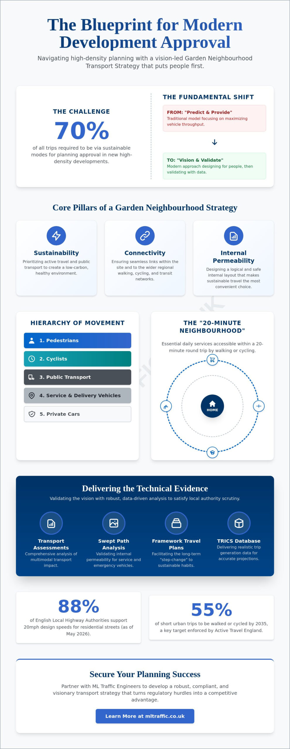
    How do you secure planning approval for a high-density development when local authorities demand that 70% of all trips occur via sustainable modes? Achieving this target requires more than just drawing cycle lanes on a map; it demands a fundamental shift from traditional “predict and provide” models to a vision-led approach. Success hinges on a robust garden neighbourhood transport strategy and placemaking framework that prioritizes human movement over vehicle throughput. With 88% of English Local Highway Authorities now supporting 20mph design speeds for residential streets as of May 2026, the regulatory environment has moved firmly toward people-centric design.

    You likely recognize the complexity of balancing multi-modal transport assessments with the need for vibrant, walkable spaces. We’ve developed this guide to help you master the technical requirements and placemaking principles necessary to navigate these high-stakes regulatory hurdles. You’ll learn how to align your project with the April 2026 Local Transport Plan guidance and utilize data-driven strategies to reduce logistical pressures. This article previews the essential components of modern transport assessments and travel plans that turn strict sustainability targets into a functional advantage for your development.

    Key Takeaways

    • Understand how to leverage a garden neighbourhood transport strategy and placemaking framework to meet National Planning Policy Framework requirements and secure planning approval.
    • Identify the technical precision needed in Swept Path Analysis and Transport Assessments to validate your development’s internal permeability and safety standards.
    • Learn how to prioritize a hierarchy of movement that treats residential streets as vital social spaces rather than mere conduits for vehicle traffic.
    • Discover the critical role of Framework Travel Plans in facilitating the “step-change” toward sustainable, car-free residential environments.
    • Master the use of TRICS database projections to deliver realistic trip generation data that satisfies rigorous local authority scrutiny.

    What is a Garden Neighbourhood Transport Strategy?

    A garden neighbourhood transport strategy and placemaking framework serves as the technical blueprint for sustainable community growth. It’s far more than a simple mitigation plan; it aligns with the National Planning Policy Framework (NPPF) vision-led approach to prioritize people over cars. These modern communities draw inspiration from the historical Garden city movement, which emphasized self-contained towns with integrated green space and efficient transit. Unlike a standard Transport Statement, this strategy requires a comprehensive analysis of connectivity, internal permeability, and long-term sustainability goals.

    Local authorities now demand rigorous evidence that new developments won’t simply add to existing congestion. This requires a shift toward three core pillars: sustainability, connectivity, and internal permeability. A successful strategy demonstrates how residents will move within the site and how the site connects to the wider regional network. To better understand how these concepts bridge the gap between people and place, watch this helpful video:

    Active Travel England now plays a pivotal role in reviewing garden community proposals. They ensure projects meet the standards outlined in the Cycling and Walking Investment Strategy (CWIS3) for the 2025 to 2030 period. This scrutiny ensures that developers move beyond basic infrastructure to create environments that actively encourage walking and cycling for at least 55% of all short stages by 2035. Precision in these early stages reduces regulatory friction and speeds up the path to planning approval.

    The 20-Minute Neighbourhood Concept

    The 20-minute neighbourhood serves as the primary planning metric for 2026, requiring that residents can access all essential daily services within a 20-minute round trip by walking or cycling. This model relies on high-quality density and a diverse mix of uses to reduce the necessity of car ownership. By placing schools, shops, and health facilities within easy reach, we lower the demand for short vehicle journeys and improve public health outcomes across the development.

    Placemaking vs. Traffic Engineering

    Traditional traffic engineering often focuses on “predict and provide” models that prioritize vehicle flow. Modern garden neighbourhood transport strategy and placemaking uses a “vision and validate” approach instead. This means we design the desired social outcome first, then use technical data to validate the infrastructure needed to support it. The street’s design dictates the neighbourhood’s feel; narrow, winding paths with integrated greenery naturally slow traffic and create safer social spaces for residents. Balancing these aesthetic goals with statutory requirements is the key to a successful Transport Assessment.

    Integrating Placemaking with Sustainable Movement

    Streets in modern developments must function as more than asphalt conduits for private vehicles. A successful garden neighbourhood transport strategy and placemaking approach reconceptualises the street as a high-quality public realm where social interaction and safety take precedence. This requires strict adherence to the hierarchy of movement. Pedestrians and cyclists sit at the apex, followed by public transport, with private cars at the base. By prioritising active travel from the initial layout, developers create environments that naturally discourage vehicle use and promote healthier lifestyles.

    Filtered permeability is a critical tool in this transition. It involves designing the network to allow through-trips for walkers and cyclists while physically restricting through-traffic for motorised vehicles. This prevents “rat-running” and ensures residential zones remain quiet and safe. Integrating green infrastructure, such as rain gardens and tree canopies, within these corridors further reinforces the sense of place. These elements provide natural cooling and manage runoff while defining the aesthetic character of the transport route.

    Bridging the gap between these “soft” placemaking goals and “hard” engineering is where many planning applications fail. You must prove that your people-centric design remains functionally safe and accessible. Using Swept Path Analysis allows you to demonstrate to local authorities that while cars are de-prioritised, essential service and emergency vehicles can still navigate the tight, social streetscapes without difficulty. This technical precision provides the reassurance planning officers need to approve innovative layouts.

    Healthy Streets Principles in Practice

    Street design must meet specific qualitative criteria to be effective. This includes providing adequate shade, frequent places to stop, and maintaining low noise levels to encourage outdoor activity. Car park design is also a major factor. Instead of vast asphalt expanses, parking should be integrated discreetly into the landscape or tucked behind building lines to preserve the public realm. You can explore our Principles of Safe & Efficient Car Park Design to see how we balance these aesthetic and functional requirements.

    The 70% Modal Shift Target

    Securing approval for modern garden communities often hinges on achieving a 70% sustainable travel target. This is a massive step-change from conventional suburban developments. To convince planning officers, your strategy must include high-quality, segregated cycle networks that feel safe for all ages. It also requires passive provision for future technologies. We recommend including micro-mobility hubs that offer shared e-bikes or scooters to bridge the gap between the front door and public transport links. If you need help proving these shifts are viable, our team can provide the detailed Traffic Surveys and data needed to support your case.

    Technical Evidence: Transport Assessments and Swept Path Analysis

    Technical precision forms the bedrock of any successful garden neighbourhood transport strategy and placemaking proposal. While visionary design captures interest, empirical data secures the approval. Planning officers require more than just intent; they need rigorous evidence that your development will function safely without placing undue strain on existing infrastructure. We bridge the gap between creative masterplanning and statutory compliance by providing the hard data needed to satisfy Highway Officers and local stakeholders.

    We use the TRICS database to project realistic trip generation for modern garden communities. Standard suburban data often overestimates vehicle trips because it relies on car-centric developments. For your project, we select comparable sites that already feature high-quality sustainable travel infrastructure. This ensures your Transport Assessment reflects the actual behaviour of residents in a vision-led environment, preventing the need for unnecessary and costly road capacity upgrades.

    The most common objection to garden communities involves parking overspill. Local authorities often fear that reduced on-site parking will lead to congestion on surrounding residential roads. We counter this by conducting detailed Parking Surveys. These surveys provide a snapshot of current street capacity and resident behaviour, allowing us to justify lower parking ratios. By proving that existing streets can absorb any minor fluctuations, we help you maintain the high-density, people-focused layout essential for garden neighbourhood status.

    The Role of Swept Path Analysis (SPA)

    High-quality placemaking often involves tighter corner radii and narrower carriageways to naturally slow traffic. You must prove these designs don’t hinder emergency or service vehicles. Our Swept Path Analysis Services in London provide digital simulations that overlay vehicle movements onto your masterplan. We demonstrate that a 12m refuse vehicle or a fire tender can navigate your social streetscapes safely. This technical validation allows you to keep your pedestrian-friendly street widths while meeting all safety and accessibility benchmarks.

    Transport Statements for Smaller Garden Infill Projects

    Smaller garden infill projects may not require a full Assessment, but they still need a clear strategy. A Garden Neighbourhood-aligned Transport Statement ensures that even minor developments support the broader garden neighbourhood transport strategy and placemaking objectives of the region. We focus on proving compliance with local “Core Strategy” policies and demonstrating how your site connects to the wider sustainable network. This proactive approach reduces the risk of delays and ensures your project contributes to the local authority’s long-term environmental goals.

    Garden Neighbourhood Transport & Placemaking

    Achieving the “Step-Change”: Travel Plans and Car-Free Design

    Success in a garden neighbourhood transport strategy and placemaking framework requires moving beyond physical infrastructure to influence long-term resident behaviour. It’s not enough to build cycle paths; you must ensure people use them. This “step-change” involves a transition from car ownership to a “Mobility as a Service” (MaaS) model. By integrating car clubs and shared transport options from day one, you reduce the perceived need for private vehicles and lower the overall trip generation of the site.

    Large-scale garden communities require a Framework Travel Plan to manage this transition effectively. This document serves as a high-level strategy that coordinates individual travel plans across various phases of the development. We recommend moving parking from on-plot locations to peripheral parking hubs. This strategy removes cars from the immediate public realm, which frees up space for higher-quality social areas and creates safer environments for children. When residents park on the edge of the neighbourhood, the “last mile” of their journey becomes a walk through a landscaped environment, naturally reinforcing the hierarchy of movement.

    Strategic parking management is the technical key to unlocking car-free zones. By centralising vehicle storage, you can maintain the high-density requirements of garden communities without sacrificing green space. This approach requires careful coordination with local authorities to ensure that off-site parking doesn’t negatively impact existing residents. If you need a partner to develop these complex strategies, our Travel Plan Consultants provide the technical expertise required to secure local authority buy-in and satisfy Section 106 requirements.

    Developing an Actionable Travel Plan

    An effective plan must include SMART targets for modal shift over a 5 to 10 year period. These targets should be measurable and realistic, based on the specific demographics and location of your development. A dedicated Travel Plan Coordinator usually manages this process, acting as a liaison between residents and transport providers to ensure the community hits its sustainability goals. For a deeper look at the regulatory requirements for these documents, consult our London Travel Plans: The Essential Guide.

    Electric Vehicle (EV) Infrastructure Integration

    Future-proofing is a non-negotiable requirement for modern garden communities. With the UK target for 100% EV adoption by 2035, your strategy must account for comprehensive charging networks from the outset. This involves balancing high charging demand with existing grid capacity, which often requires innovative energy management systems. We help developers design efficient layouts for both on-street and off-street charging points. This ensures your neighbourhood remains functional and compliant with evolving legislative standards without compromising the aesthetic quality of the streetscape.

    Partnering with ML Traffic Engineers UK for Planning Success

    Securing planning approval for modern developments requires a partner who understands that a garden neighbourhood transport strategy and placemaking framework is a technical necessity; it’s not just a design preference. ML Traffic Engineers UK provides the specialized industry expertise needed to navigate the increasingly strict regulatory environments of England’s local authorities. Our team balances technical authority with a client-focused approach, aiming to reduce the logistical and regulatory pressures on your development team. By delivering precise, data-driven reports, we ensure your vision for a sustainable community meets every statutory benchmark.

    Our all-encompassing service model manages the full project lifecycle from inception to completion. We begin with comprehensive Traffic Surveys and Parking Surveys to establish an accurate baseline of existing conditions. This data informs the development of robust Transport Assessments and Travel Plans tailored to the specific requirements of your site. ML Traffic Engineers UK understands these intricate regional regulations so you don’t have to, positioning your project as a model of professional integrity and public safety.

    Why Technical Precision Matters in 2026

    Local councils have significantly increased their scrutiny of planning applications following the updated Local Transport Plan guidance in April 2026. Inaccurate data or poorly modeled vehicle movements can lead to costly design errors and lengthy delays in the planning queue. ML Traffic Engineers UK prevents these setbacks by utilizing advanced digital tools for Swept Path Analysis. This ensures that your pedestrian-friendly layouts remain functionally safe for essential services. Our commitment to precision reflects the high-stakes nature of the industry and provides the reassurance planning officers need to grant approval.

    Get Started with Your Transport Strategy

    Early engagement in the planning lifecycle is the most effective way to avoid regulatory friction. We recommend a comprehensive review of your car park and access layout during the initial design phase to identify potential issues before they become permanent obstacles. Whether you’re working on a large-scale community or a smaller infill project, we provide the technical evidence required to justify your design choices. You can contact ML Traffic Engineers UK for a professional Transport Statement or Assessment to ensure your garden neighbourhood transport strategy and placemaking objectives are both visionary and technically sound.

    Securing Future-Proof Planning Approval

    Mastering the balance between high-density placemaking and strict sustainable travel targets ensures your project withstands intense local authority scrutiny. You’ve seen how technical precision in Swept Path Analysis and vision-led transport assessments creates a functional foundation for modern, car-free environments. By prioritising the hierarchy of movement from the inception of your design, you turn complex regulatory hurdles into a distinct competitive advantage for your development. It’s the technical evidence that ultimately bridges the gap between a visionary masterplan and a successful planning outcome.

    A robust garden neighbourhood transport strategy and placemaking approach requires an all-encompassing partner who understands intricate UK statutory requirements. Founded in 2014, ML Traffic Engineers UK brings over a decade of planning success and reliability to your project team. We are proven specialists in Swept Path Analysis and Transport Statements, providing the expert knowledge necessary to navigate the rigorous 2026 planning landscape. Secure your development’s future with a professional Transport Strategy from ML Traffic Engineers UK. Our team is ready to help you transform your architectural vision into a technically sound and approved reality.

    Frequently Asked Questions

    What is the difference between a Transport Strategy and a Transport Assessment?

    A transport strategy provides the long-term vision and policy framework for movement across a development area, while a Transport Assessment is the site-specific technical document that evaluates the impact of a project on the local highway network. The strategy sets the high-level goals for sustainable travel and connectivity. In contrast, the assessment uses empirical data to prove those goals are both safe and achievable for a specific planning application.

    Is a 70% sustainable travel target mandatory for all garden communities?

    While not a statutory national requirement for every single development, many local authorities mandate a 70% sustainable travel target to grant official “Garden” status to a project. This high benchmark reflects the government’s CWIS3 goals for the 2025 to 2030 period. Meeting this target usually requires a comprehensive garden neighbourhood transport strategy and placemaking framework that prioritizes walking, cycling, and public transport over private vehicle use.

    How does Swept Path Analysis help with placemaking?

    Swept Path Analysis allows designers to create narrower, more social streetscapes by digitally proving that essential service and emergency vehicles can still navigate the layout safely. This technical validation gives planning officers the confidence to approve people-centric designs that deviate from traditional, car-heavy highway standards. It ensures that your aesthetic and social goals don’t compromise the functional safety or accessibility of the neighbourhood for refuse trucks or fire tenders.

    Can I still include car parking in a garden neighbourhood transport strategy?

    You can still include car parking, but modern strategies often shift away from traditional on-plot parking toward peripheral parking hubs or discreetly integrated spaces. This approach removes vehicles from the immediate public realm to enhance the social quality of the streets for residents. Strategic parking management, supported by detailed Parking Surveys, allows you to maintain necessary vehicle access while adhering to the core principles of garden community design.

    What is a “20-minute neighbourhood” in the context of UK planning?

    The 20-minute neighbourhood is a planning metric used in 2026 to ensure residents can access all daily essential services within a 20-minute round trip via active travel. This concept relies on high-density, mixed-use layouts to reduce car dependency for short journeys. It’s a key component of the vision-led approach now favored in Local Transport Plan guidance to create self-sustaining, healthier communities that reduce pressure on the wider road network.

    How do I prove my development meets Healthy Streets principles?

    You prove compliance by conducting a qualitative audit against the ten Healthy Streets indicators, which include factors like shade, air quality, and places to stop. This evidence is typically integrated into your Transport Assessment to demonstrate that the development supports public health and wellbeing. Providing specific data on noise levels and pedestrian comfort levels helps convince local authorities that your street design prioritizes the human experience over vehicle throughput.

    What role does the TRICS database play in garden neighbourhood planning?

    The TRICS database allows us to project realistic trip generation rates by comparing your project to similar, existing sustainable developments across the UK. Using accurate TRICS data prevents the over-estimation of vehicle traffic that often occurs with standard suburban models. This precision is vital for a garden neighbourhood transport strategy and placemaking plan, as it justifies reduced road capacity and supports your sustainability claims with empirical, site-specific evidence.

    Will a Travel Plan actually help me get planning permission?

    A Travel Plan is a statutory requirement for most significant developments and acts as a primary tool for mitigating the transport impacts of a project. It provides a structured roadmap for achieving behavioural change through measurable targets and long-term monitoring. By demonstrating a clear commitment to reducing car dependency, a robust Travel Plan reduces regulatory friction and significantly increases your chances of securing planning permission from the local authority.

    Michael Lee

    Article by

    Michael Lee

    Transport planner with over 35 years' experience.

    Disclaimer

    The content on mltraffic.co.uk, including all technical articles, guides, and resources, is provided for general informational and educational purposes only. It is not intended to constitute professional advice in traffic engineering, transportation planning, development approvals, or any other technical or legal field.
    While ML Traffic Engineers makes every reasonable effort to ensure the accuracy, completeness, and timeliness of the information published, we do not provide any warranties or representations (express or implied) regarding its reliability, suitability, or availability for any particular purpose. Any reliance you place on the content is strictly at your own risk.
    In no event shall ML Traffic Engineers, its directors, employees, authors, or affiliates be liable for any direct, indirect, incidental, special, consequential, or punitive damages (including, without limitation, loss of profits, data, or business opportunities) arising out of or in connection with the use of, or inability to use, any information provided on this website.
    The articles and guides on this site are not a substitute for engaging a qualified, professional traffic engineer to assess your specific project requirements. For tailored advice, compliance assessments, or traffic engineering services, please contact a competent professional.
    This disclaimer may be updated from time to time without notice. By accessing or using this website, you agree to be bound by the most current version of this disclaimer.