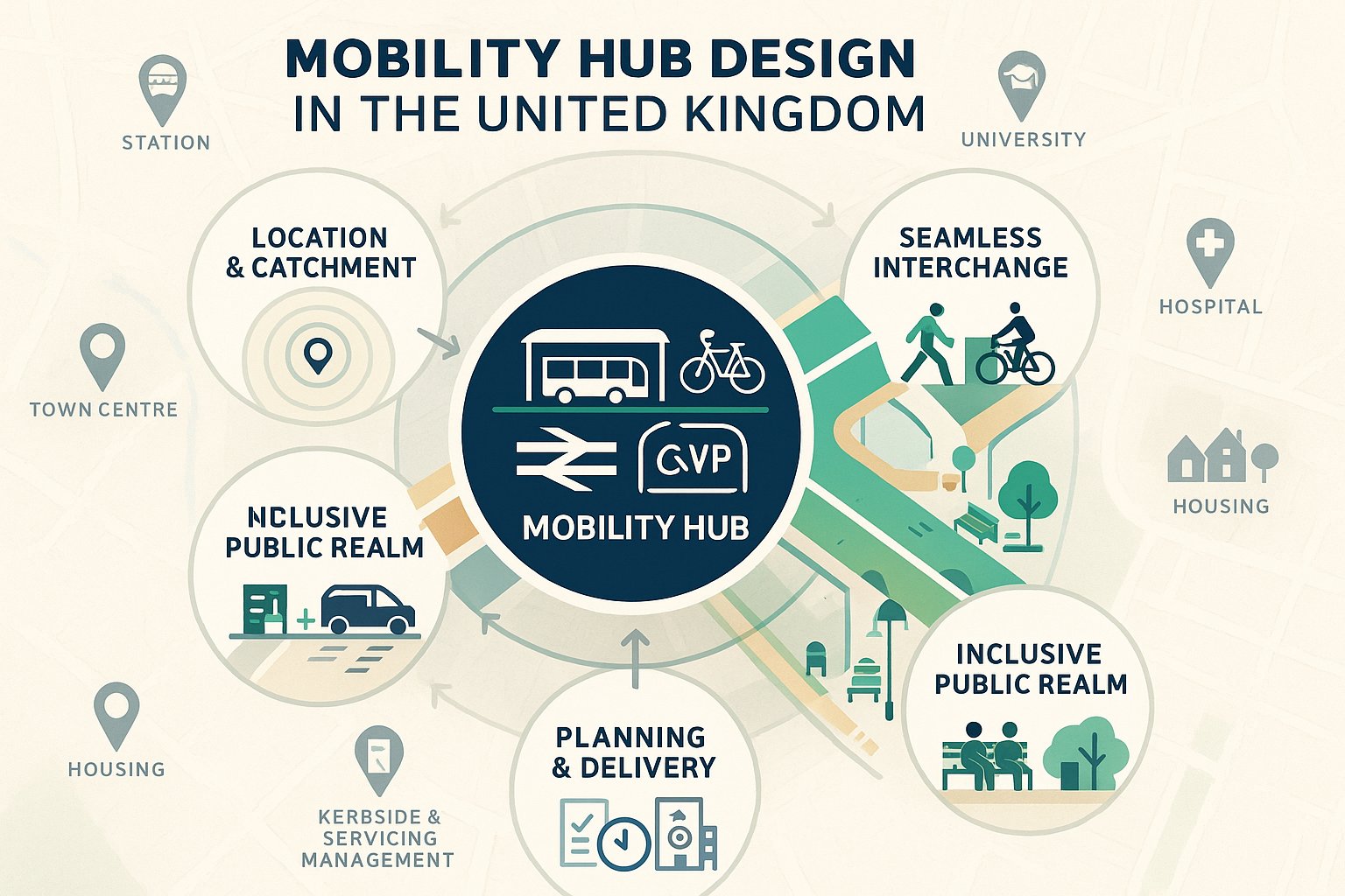
If a place still treats every journey as a car journey, it usually shows. Oversized parking courts, awkward bus stops, cycle parking tacked on as an afterthought, and public realm that feels more like leftover space than somewhere people actually want to be. Good mobility hub design flips that logic.
In 2026, the strongest schemes aren’t just adding a few travel options in one location. They’re creating clearly identifiable, policy-ready places where walking, cycling, public transport, shared mobility and essential servicing work together without friction. That matters to architects shaping masterplans, planners writing policy-compliant applications, developers managing viability, and local authorities assessing whether a proposal will genuinely support sustainable travel rather than simply claim to.
From our side, transport strategy is where these projects either gain momentum or come unstuck. A hub that looks impressive on a concept drawing can still fail in practice if the catchment is wrong, interchange routes are clumsy, kerbside activity is unresolved, or the Transport Assessment doesn’t properly evidence likely mode shift. Equally, a well-planned hub can strengthen placemaking, improve accessibility, reduce car dependence and make a planning submission much more robust.
In this guide, we’ll look at what makes a mobility hub work, where it should sit, how it should function, and what needs to be addressed in policy, assessment and delivery so it performs in the real world, not just in a design statement.
What A Mobility Hub Is And Why It Matters In Modern Placemaking
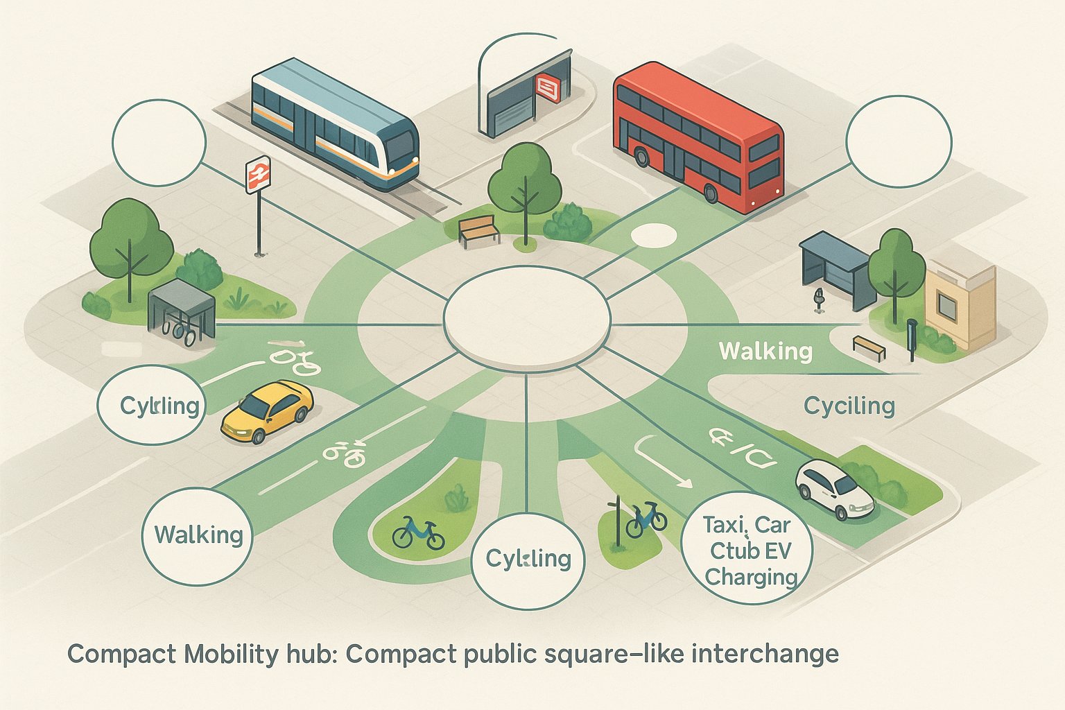
A mobility hub is a recognisable place where several transport modes come together in one coordinated setting. Typically that means some combination of bus, rail, walking routes, cycle infrastructure, secure cycle parking, shared bikes or scooters, car club bays, taxi provision and high-quality public realm. The point is not simply co-location. It is integration.
When done well, a hub acts as the link between mass transit and the first or last mile of a journey. Someone might arrive by train, pick up a shared cycle, walk safely through a legible public space, or transfer to a bus without having to navigate a cluttered, hostile interchange. That sounds simple, but it requires deliberate planning.
It also matters far beyond transport. In modern placemaking, mobility hubs help reclaim land from general traffic and long-stay parking, allowing more space for trees, seating, spill-out activity, SuDS, and streets that feel useful rather than merely functional. They can support town centres, stations, mixed-use regeneration, campuses and new communities alike.
For planning applications, mobility hubs are increasingly relevant because they help convert broad sustainability goals into physical, assessable infrastructure. They give applicants something tangible to point to when demonstrating accessibility, mode shift potential and consistency with local and national policy.
The Core Elements That Define An Effective Mobility Hub
Most effective hubs share a fairly consistent set of ingredients, even though the exact mix varies by scale and context.
At a minimum, we would usually expect direct walking access, safe wheeling routes, high-quality cycle connections, secure cycle parking, public transport stops or stands with shelter, and clear wayfinding. On larger sites, that often expands to include micromobility docks, car club bays, EV charging, seating, planting, real-time information, parcel lockers, toilets or small retail uses where viable.
But the ingredients alone do not create a successful hub. What matters is how they relate to one another. If cycle parking is hidden round the back, if bus boarding requires crossing a busy access road, or if shared mobility is placed too far from the main desire line, the hub starts to fragment.
We find the best mobility hub design is compact, obvious and easy to understand within seconds. Users should be able to see where to go, what their options are, and how to transfer between them with minimal effort. Good branding helps. So do consistent materials, intuitive signage and a strong public-realm identity.
Green infrastructure is often underestimated here. Planting, shade, rain gardens and surface water features are not decorative extras: they improve comfort, resilience and dwell time, making the hub feel like part of a place rather than a transport utility box.
How Mobility Hubs Support Planning, Accessibility And Net Zero Goals
Mobility hubs have gained traction because they help solve several planning problems at once.
First, they support mode shift. By making walking, cycling, public transport and shared travel easier and more visible, they reduce the practical advantage of default car use. That can help lower transport emissions, improve air quality and reduce pressure for extensive private parking provision. In net zero terms, this is one of the clearest ways a development can influence everyday travel behaviour rather than relying on distant offsetting claims.
Second, they improve accessibility. A well-placed hub can widen access to jobs, services, schools and healthcare for people who do not drive, cannot drive or simply do not want to rely on a private car. That includes younger people, older residents, lower-income households and many disabled users, provided the design is genuinely inclusive and not just nominally step-free.
Third, they align neatly with current policy themes: decarbonisation, healthy streets, 15-minute neighbourhoods, town centre renewal and sustainable placemaking. For local councils, that makes hubs attractive because they convert policy intent into a practical delivery mechanism.
And from an evidence perspective, they give a Transport Assessment more substance. Rather than asserting that sustainable modes are “available nearby”, we can assess a defined intervention with a measurable catchment, clear facilities and realistic user benefits.
Choosing The Right Location And Catchment For A Mobility Hub
Location is usually the make-or-break decision. A beautifully designed hub in the wrong place won’t generate meaningful use, while a modest but well-sited one can quickly become part of daily travel behaviour.
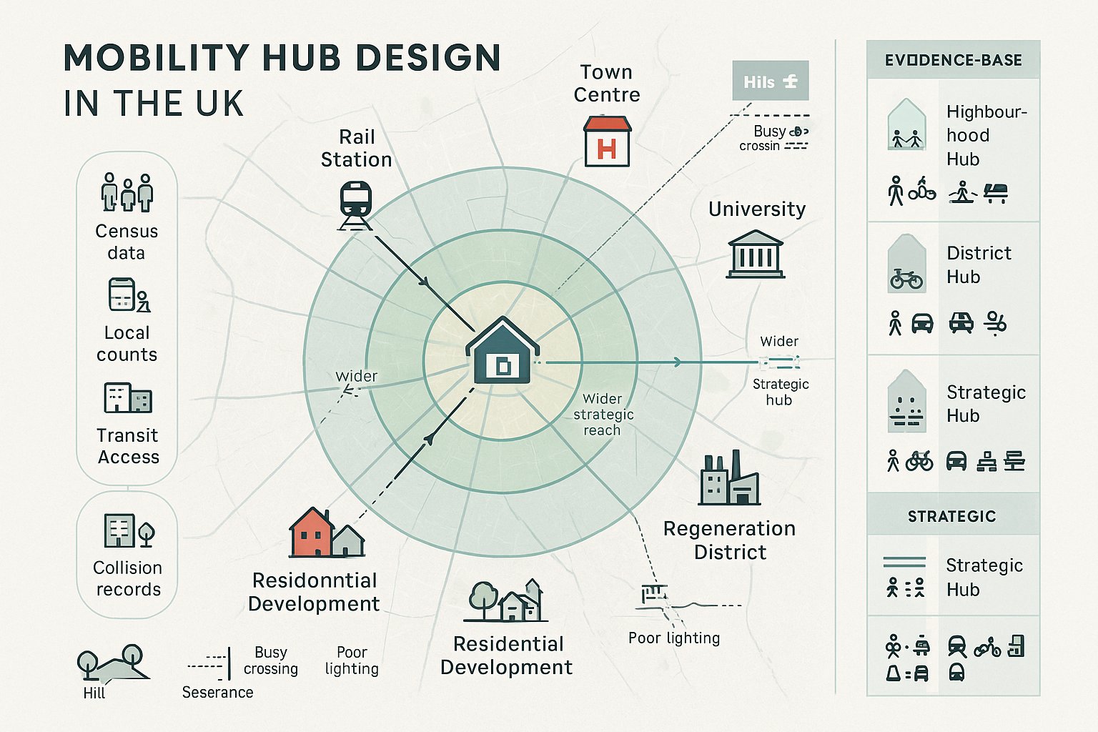
The strongest locations tend to sit where demand already exists or can credibly be created: rail stations, town and district centres, edge-of-centre regeneration areas, hospitals, universities, employment clusters, and larger residential-led developments. In new communities, the hub should not be a remote add-on at the edge of the site. It needs to sit on natural desire lines and connect to the parts of the scheme people will actually use every day.
Catchment matters just as much. For neighbourhood-scale hubs, a walkable radius of around 400 to 800 metres is often a sensible starting point, though topography, severance, road crossings and quality of public realm can shrink or expand the effective catchment very quickly. Strategic hubs, especially those tied to rail or rapid transit, can draw from much wider areas.
We always need to distinguish mapped distance from real distance. A route that looks close on a plan may feel much longer if it involves steep gradients, poor lighting, indirect crossings or unsafe junctions. In mobility hub design, perceived convenience is often more important than geometry.
Using Demand, Land Use And Local Movement Patterns To Shape The Brief
Before fixing the brief, we need to understand how people currently move and how they are likely to move once the development is occupied. That means looking beyond headline trip rates.
Census travel-to-work data still has value, but it should be supplemented with local counts, public transport accessibility, land use analysis, collision data, parking stress, and, where available, mobile or anonymised location data that shows origin-destination patterns. These sources help identify whether the proposed hub is responding to real movement patterns or merely following a fashionable template.
Land use mix is central. A residential neighbourhood with a primary school and local retail has different time-of-day peaks from a commercial quarter or a hospital campus. That affects the size of waiting areas, the likely take-up of cycle parking, whether car club demand is realistic, and whether parcel lockers or servicing consolidation would add value.
Different tiers of hub should also be recognised. A neighbourhood hub might focus on walking, cycles, bus access and a small number of shared vehicles. A district hub may need more interchange capacity and stronger branding. A strategic hub linked to rail or a major bus corridor will require a more robust operational and spatial response.
In planning terms, this early evidence base is crucial. It allows us to justify scale, assess likely mode share impacts and explain why the chosen offer is proportionate to local conditions.
Designing For Seamless Interchange Between Modes
Seamless interchange is one of those phrases everyone uses and not enough schemes genuinely deliver. In practice, it means people can move from one mode to another quickly, intuitively and without stress.
That starts with distance. Transfer routes should be short, direct and step-free wherever possible. If users have to cross multiple carriageways, negotiate awkward level changes, or hunt for the next mode behind servicing yards and parking aisles, interchange breaks down. Waiting time also matters. Coordinated services are not always within a developer’s control, but physical design can reduce perceived delay through good shelter, information, comfort and visibility.
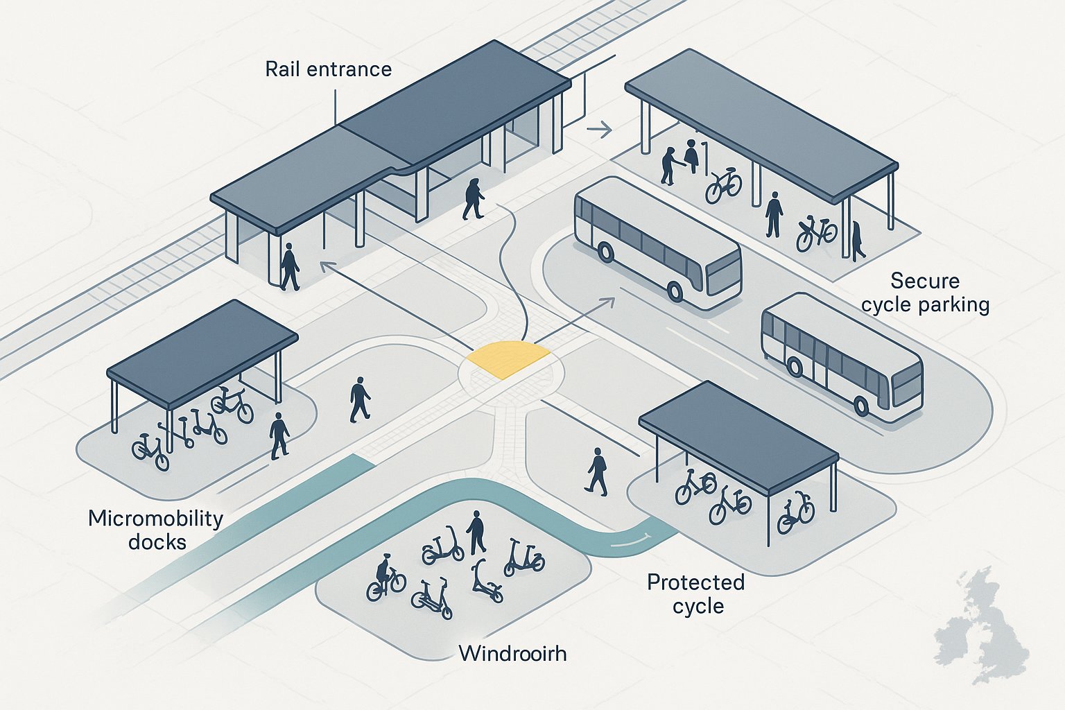
Co-location is especially important for buses, rail entrances, cycle parking and micromobility docks. The further apart these functions sit, the less likely users are to combine them. Sightlines should make the relationship obvious. Someone arriving by bus should be able to see where cycle parking is. Someone walking in from the surrounding streets should understand immediately where public transport departs.
Weather protection sounds mundane until you watch people make choices in February. Covered waiting, wind mitigation and dry walking links can have a very real effect on whether people stick with sustainable modes.
For larger schemes, interchange should be tested through movement diagrams and user journeys, not just plan annotations. We often ask a simple question: could a first-time visitor navigate the space without instructions? If the answer is no, the design probably needs simplification.
Prioritising Walking, Cycling, Public Transport And Micromobility
A hub only supports sustainable travel if the layout clearly prioritises it. That means walking and wheeling first.
Pedestrian routes should follow desire lines, not be squeezed around vehicle geometry. Crossing points need to be frequent, direct and easy to read, with signal timings and junction design that do not punish people for choosing to walk. For disabled users, step-free access, tactile paving, dropped kerbs, appropriate gradients and rest opportunities are basic requirements, not optional embellishments.
Cycling needs the same seriousness. Continuous, protected connections into and out of the site are more important than an isolated patch of attractive surfacing within it. Secure cycle parking should be close to entrances, visible, well-lit and suited to different cycle types, including adapted cycles and cargo bikes where relevant.
Public transport should be given spatial priority too. Bus stops buried behind parking courts send a clear message about what really matters. Stops, stands and waiting facilities should be prominent, convenient and easy to reach without conflict. Where a scheme can support bus priority measures, that should be explored early rather than value-engineered out later.
Micromobility can be highly effective for short onward trips, but only if it is organised. Docking or parking areas should sit prominently near key entrances and interchange points, with enough management to avoid clutter and conflict. Done badly, scooters and cycles become obstructions. Done properly, they expand the practical catchment of the hub.
Layout, Safety And User Experience In Mobility Hub Design
A good layout reduces friction. A poor one creates small frustrations that add up fast: hidden entrances, uncertain crossing points, shared surfaces that no one understands, waiting areas exposed to wind and rain, or service traffic cutting across pedestrian desire lines.
In mobility hub design, we aim for a simple hierarchy of spaces. Primary pedestrian routes should be obvious. Cycle movements should be legible and protected where conflict risk is high. Vehicle access should be low-speed, controlled and visually secondary unless there is a clear operational reason otherwise. Compactness helps, but not at the expense of comfort or inclusive access.
The user experience is broader than movement alone. People need shelter, seating, intuitive information, and enough amenity for the space to feel safe and worth using. On larger or higher-dwell hubs, toilets, lockers, drinking water, retail kiosks or parcel collection can materially improve viability and convenience.
Inclusive design should run through every decision. That includes width, gradients, turning space, boarding conditions, dropped kerbs, tactile information, hearing loops where relevant, and seating placed where people actually need it. Too many schemes still treat accessibility as a compliance checklist rather than a design principle.
We also need to think about maintenance from the outset. If drainage, planting, paving, docks or information systems are difficult to maintain, the user experience can deteriorate surprisingly quickly. The best hubs still work after a wet winter and a few years of heavy use.
Visibility, Legibility, Lighting And Personal Security
People use places they can understand and trust. That makes visibility and legibility fundamental.
A mobility hub should be clearly identifiable from the main approaches, with consistent signage, strong visual cues and a recognisable layout. Users should not need to decode the site every time they arrive. This is especially important for visitors, occasional users and anyone making a multi-leg journey under time pressure.
Lighting deserves more care than it often gets. Even where formal lux levels are met, poor uniformity, shadowed corners or excessive glare can make a space feel uncomfortable. Lighting should support walking routes, waiting areas, cycle parking, entrances and information points in a coherent way, while avoiding hidden zones.
Personal security is not just about CCTV, though CCTV may well have a role. Active frontages, passive surveillance from nearby uses, clear sightlines, visible staffing where appropriate, and the avoidance of concealed recesses all matter. Fear of crime can suppress use just as effectively as actual crime.
Information design is part of security too. Real-time displays, clear maps, simple symbols and consistent branding reduce cognitive load and help people make quick decisions. The more uncertain a person feels, the less safe the environment tends to feel.
CoMoUK-style branding and consistent wayfinding principles can help give hubs a recognisable identity across a wider network. That continuity is useful because it signals reliability: if people understand one hub, they can usually understand the next.
Integrating Kerbside Management, Servicing And Parking Strategy
This is where many otherwise strong schemes get messy. A mobility hub cannot function properly if the kerbside is left to chance.
Buses, pick-up and drop-off, taxis, blue badge parking, car club bays, cycle access, freight loading, refuse collection and micromobility all compete for limited edge space. If those demands are not actively managed, conflicts show up immediately, often affecting pedestrians first.
A clear kerbside strategy should define who can stop where, for how long, at what times, and under what controls. In mixed-use schemes, time-based management is often essential. Morning servicing, daytime bus priority, evening pick-up activity and weekend leisure demand may all need different arrangements. Trying to solve that with generic “shared” kerbspace rarely works.
Servicing should be consolidated where possible and routed to minimise crossing conflicts with main pedestrian and cycle desire lines. If delivery vans regularly reverse through the heart of the hub, the design intent has already been undermined. For larger developments, micro-consolidation, parcel lockers or managed delivery points can reduce pressure on the frontage.
Parking strategy is equally important. The role of a mobility hub is not to replicate conventional parking-led design with a few sustainable extras attached. Long-stay private parking should generally be restrained, while priority is given to accessible bays, car club vehicles, short-stay needs and EV infrastructure where justified.
From a planning perspective, these choices need to align with the wider accessibility offer. Reduced parking provision becomes far more credible when backed by a visible, functional hub and a robust transport evidence base. Without that, objections around overspill and practical usability become much harder to answer.
Planning Policy, Transport Assessment And Delivery Considerations
A mobility hub might be an appealing design proposition, but for planning purposes it also has to be policy-aligned, evidenced and deliverable.
The first step is checking the policy stack properly. That normally means the local plan, local transport plan, parking standards, design codes, town centre or area action frameworks, and any county-level guidance on sustainable travel, placemaking or highways adoption. National guidance matters too, including Department for Transport direction on accessibility and active travel, as well as industry guidance from bodies such as CoMoUK. The hub should not be presented as a bolt-on sustainability feature: it should be shown to respond directly to adopted policy objectives.
Transport Assessment is where that argument is tested. We would typically expect to assess accessibility by mode, likely trip distribution, interaction with the surrounding highway network, parking implications, and the extent to which the hub can support realistic mode shift. Depending on the scheme, a Travel Plan, Delivery and Servicing Plan, Framework Construction Traffic Management Plan, or parking management strategy may also be relevant.
Importantly, the assessment should be proportionate and local-authority aware. Different councils apply thresholds differently, and after more than 30 years of supporting planning applications, we know that tailoring reports to local validation requirements and decision-making context can make a substantial difference. A generic report, but polished, often creates avoidable delay.
Delivery also deserves early thought. Who funds the hub? Who manages car club contracts, micromobility operators, maintenance, cleaning, real-time information systems and enforcement? Is the hub delivered in phase one, or deferred until later occupations, and if later, what protects that commitment?
In many cases, phased delivery is sensible. A hub can start with strong walking, cycling, bus infrastructure and shared mobility provision, then expand as demand matures. Pilot schemes and monitoring can help refine the offer. But governance must be clear. Without ownership, operational accountability and a realistic commercial model, even well-designed hubs can drift into underperformance.
Conclusion
The best mobility hubs do not happen because a plan labels an area “hub” and adds a few icons. They work because location, catchment, interchange, safety, kerbside strategy, policy alignment and delivery have all been thought through as one system.
For architects, planners, developers and councils, that is the real opportunity in mobility hub design: it can strengthen placemaking and planning compliance at the same time. It can also make lower-car development patterns more practical and defensible, provided the evidence is there.
Our view is simple. Start early, test the hub against real movement patterns, design for users rather than diagrams, and make sure the transport assessment explains not just what is proposed but why it will work in that location. That is usually the difference between a hub that looks good in consultation material and one that performs once people actually start using the place.
Frequently Asked Questions about Mobility Hub Design
What is a mobility hub and why is it important in modern placemaking?
A mobility hub is a clearly identifiable place integrating buses, trains, walking, cycling, shared bikes, car clubs, and taxis with high-quality public spaces. It supports placemaking by reducing car dependence, enhancing accessibility, and creating welcoming environments beyond mere transport functions.
What are the core elements that define an effective mobility hub?
Effective mobility hubs commonly include safe walking and cycling access, secure cycle parking, public transport stops with shelters, car club bays, clear wayfinding, real-time information, good lighting, shelter, seating, and green infrastructure like planting and sustainable drainage.
How does mobility hub design support net zero and accessibility goals?
Mobility hubs facilitate mode shift from private cars to active and shared travel modes, cutting emissions and improving air quality. They also improve access to jobs, education, and services for non-drivers or those with mobility challenges, thus promoting social inclusion and aligning with decarbonisation policies.
Where should a mobility hub be located for maximum effectiveness?
Mobility hubs work best at places with existing or potential travel demand, such as rail stations, town centres, hospitals, universities, and residential developments. They should be within a walkable catchment of 400–800 metres for neighbourhood hubs and be well connected to key transport corridors.
How is seamless interchange between transport modes achieved in mobility hub design?
Seamless interchange requires short, direct, step-free routes; co-located stops with clear sightlines; intuitive signage; weather protection; and minimal level changes. This design reduces transfer time and effort, encouraging users to combine walking, cycling, public transport, and shared mobility modes efficiently.
What role does kerbside management play in mobility hub functionality?
Kerbside management coordinates space for buses, drop-off/pick-up, taxis, micromobility, freight, and parking to prevent conflicts and ensure safety. It includes designated zones with time-based controls and consolidated servicing areas to maintain smooth, accessible movement for pedestrians and cyclists.