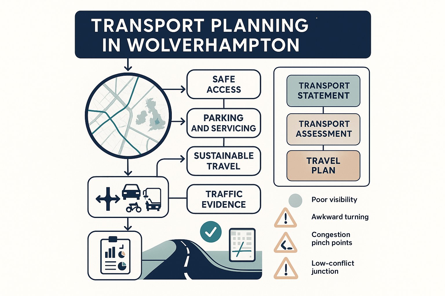
A planning application in Wolverhampton can look perfectly sound on land use, design and drainage, then stall because the transport piece was treated as an afterthought. We see it often. A scheme that appears straightforward on paper can quickly become contentious once questions arise about access geometry, parking stress, delivery movements, pedestrian safety, or whether the surrounding network can absorb extra trips.
That is exactly why transport planning in Wolverhampton deserves early attention in 2026. The city sits within a busy West Midlands transport system, shaped by strategic corridors, local centres, bus movement, active travel ambitions and changing expectations around road safety. Wolverhampton Council is not reviewing applications in a vacuum: decisions are influenced by local highway realities and the wider direction of the West Midlands Local Transport Plan.
For developers, architects, planners, surveyors and legal teams, the practical question is simple: what transport evidence is likely to be needed, and what tends to satisfy officers first time? In this guide, we set out the reports commonly requested, the design and policy issues that matter most, and the mistakes that regularly lead to delays. Drawing on the kind of work we deliver at ML Traffic, the aim is to make the route to a robust submission clearer, quicker and far less painful.
Why Transport Planning Matters In Wolverhampton
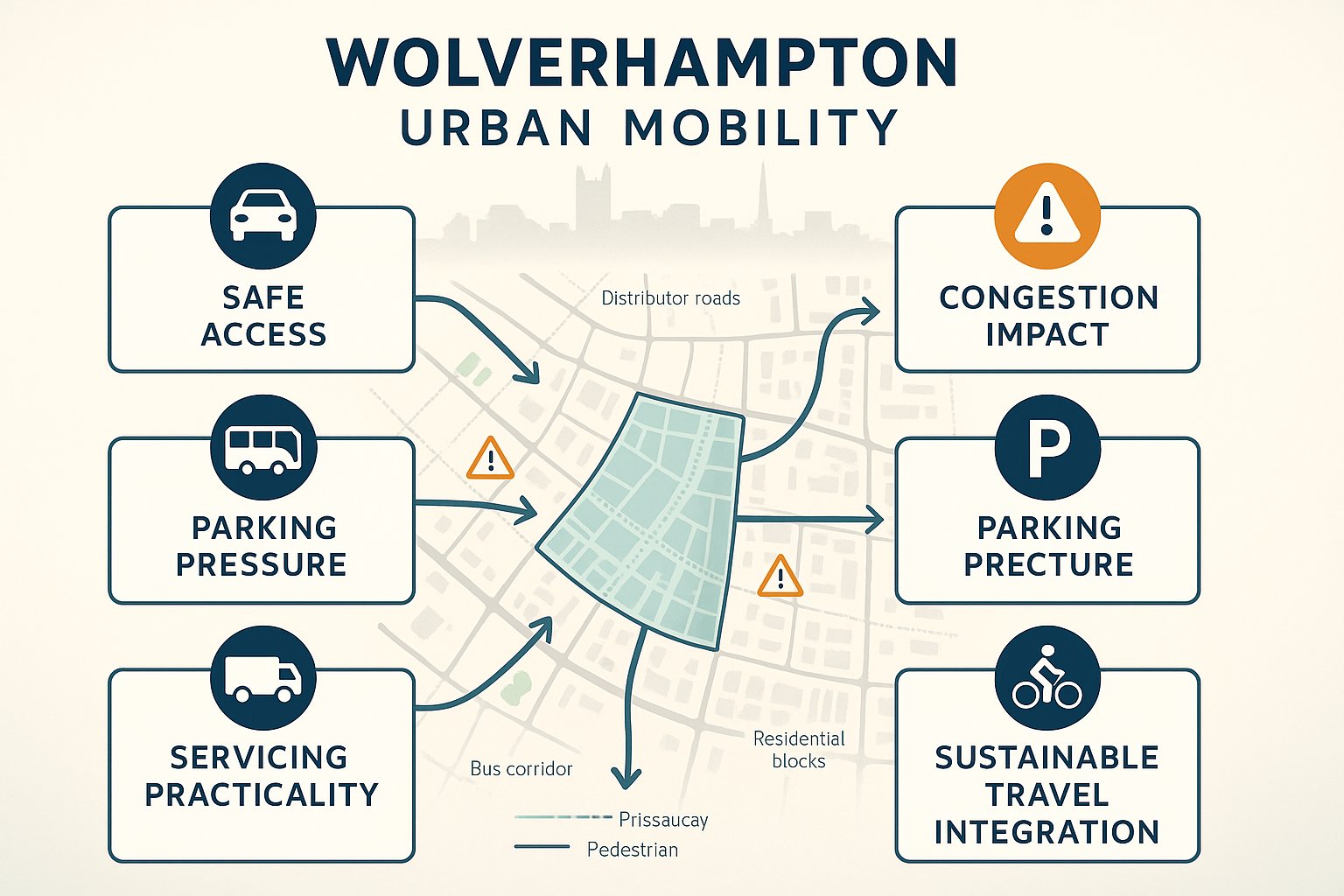
Transport planning matters because it sits at the point where development ambition meets everyday movement. A site may be commercially attractive and planning policy may support the use, but if people cannot reach it safely, if servicing is awkward, or if the scheme worsens congestion at a sensitive junction, objections arrive quickly.
In Wolverhampton, that issue is particularly live. The city is part of an interconnected urban area where local streets, distributor roads, public transport corridors and walking routes all influence each other. A modest development in the wrong place can create pinch points at school-run times, interfere with buses, or intensify parking pressure on nearby residential roads.
From a planning perspective, transport evidence helps answer a few core questions:
- Can the site be accessed safely by all users?
- Will the development create severe residual cumulative impacts?
- Are parking and servicing arrangements workable in real life, not just on a drawing?
- Does the proposal support wider policy aims for sustainable travel?
Those questions flow from national policy and local practice alike. Wolverhampton has also shown a willingness to manage movement and road layouts actively where safety and network function require it. So transport is not a box-ticking exercise here. It is often one of the main ways officers judge whether a proposal is genuinely deliverable.
How Wolverhampton’s Growth And Transport Network Shape Planning Decisions
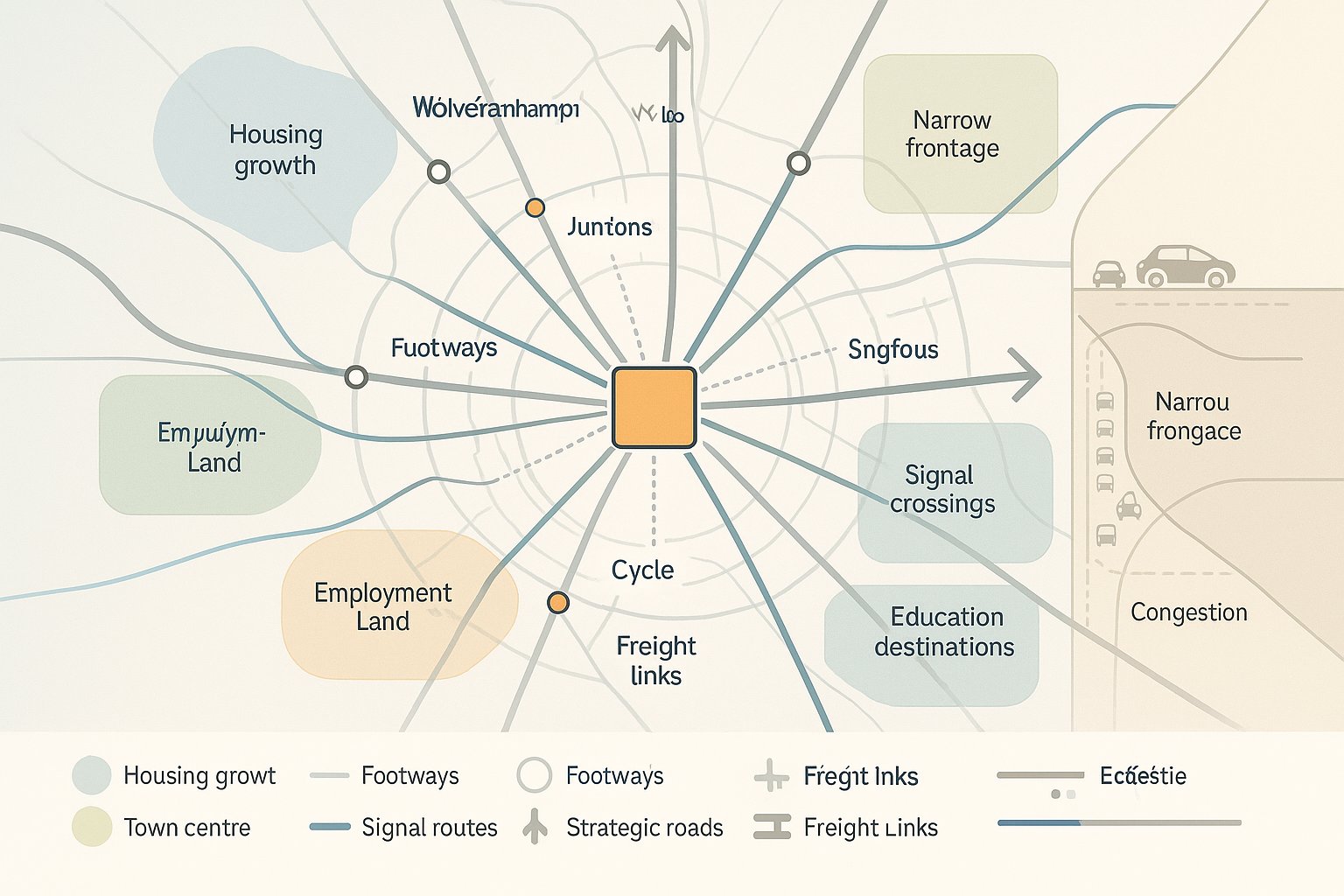
Wolverhampton’s growth story affects how transport submissions are reviewed. New housing, town centre activity, employment space, regeneration sites and education uses all add demand to a network that already serves local trips, regional commuting and freight movement across the Black Country and wider West Midlands.
That means officers will usually look beyond the red line boundary. They will want to understand how a proposal interacts with nearby junctions, bus services, footways, crossing points, cycle links and strategic routes identified in council mapping and regional transport planning. In plain English: a site does not operate in isolation, even if the development itself looks relatively contained.
The local network also has a layered character. Some sites sit near corridors that can support higher trip levels if access is designed well and sustainable options are realistic. Others are constrained by narrow frontages, on-street parking, visibility issues or existing congestion. The same quantum of development can hence produce very different transport outcomes depending on location.
This is where proportionate analysis matters. We need to show not just how many trips are likely to arise, but when they occur, where they distribute, and whether the surrounding infrastructure can accommodate them safely. In Wolverhampton, applications tend to progress more smoothly when the transport case reflects those local conditions rather than relying on generic assumptions.
The Main Types Of Transport Planning Reports For Planning Applications
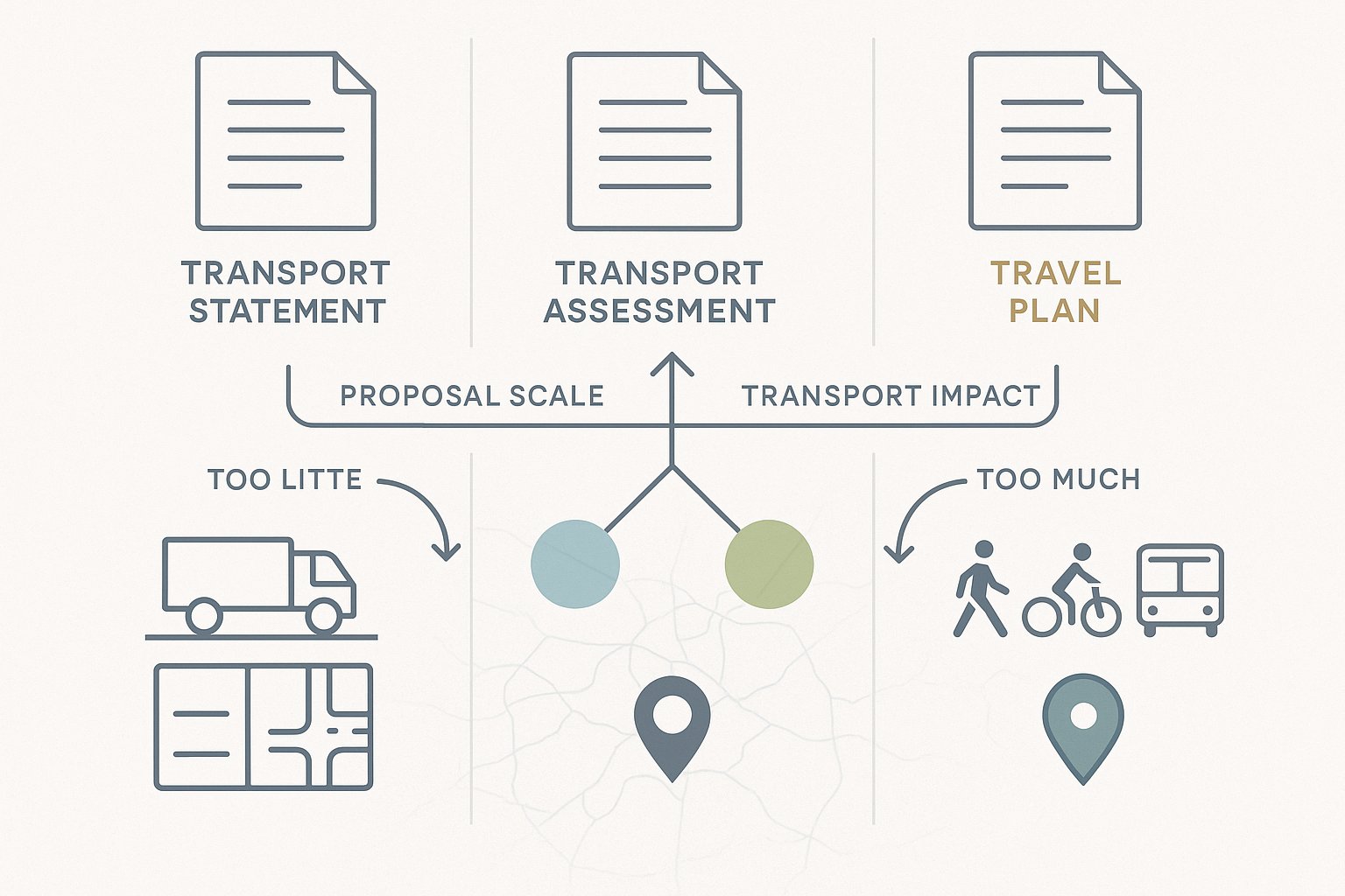
Most planning applications in Wolverhampton that raise highway or movement issues fall into three familiar report types: the Transport Statement, the Transport Assessment, and the Travel Plan. The right one depends on the scale, type and likely transport effect of the proposal.
The point is not to produce the biggest report possible. It is to provide evidence that is proportionate, credible and aligned with likely authority expectations. Overshooting can waste time and budget: undershooting is more dangerous, because it often leads to a holding objection and a request for further work.
A concise, accurate report should usually cover the site context, existing transport conditions, access arrangements, parking and servicing, likely trip generation, and the effect on the surrounding network. For more complex schemes, junction assessment, distribution analysis and mitigation proposals may also be required.
Where long-term travel behaviour matters, a Travel Plan adds another layer by showing how walking, cycling, public transport and lower-car travel choices will be supported once the development is occupied.
In practice, the best submissions are tailored to Wolverhampton’s local highway context and the development’s actual characteristics. That sounds obvious, but plenty of weak reports still rely on standard templates with barely any site-specific thought behind them.
When A Transport Statement Is Likely To Be Required
A Transport Statement is typically suited to smaller developments where transport impacts are expected to be limited and can be explained without detailed modelling. Think modest residential schemes, small commercial changes of use, or infill development where access and parking are the main issues rather than wider junction capacity.
That does not mean a Transport Statement is light-touch in the lazy sense. Officers will still expect enough evidence to demonstrate that the proposal is safe and acceptable. In Wolverhampton, that usually means a clear review of:
- existing site access conditions
- nearby highway characteristics
- pedestrian and cycle connections
- parking provision and likely demand
- servicing needs
- visibility and manoeuvrability
- a reasoned estimate of trip generation, where relevant
The key is proportionality. If the scheme is unlikely to materially affect the wider network, we do not need to bury decision-makers under unnecessary technical appendices. But we do need to show that the basic transport fundamentals have been tested properly.
A well-prepared Transport Statement often resolves concerns early because it speaks directly to the scale of the proposal. A poor one, by contrast, tends to read like a stripped-down Transport Assessment without enough detail to satisfy anyone.
When A Transport Assessment Or Travel Plan May Be Needed
A Transport Assessment is usually needed where a development is larger, generates more trips, or has the potential to affect the operation of surrounding roads, junctions, sustainable travel links or public transport services. That could include larger housing developments, mixed-use schemes, retail floorspace, employment uses, schools, care facilities or sites with unusual traffic characteristics.
Here, the authority is more likely to expect detailed trip generation analysis, distribution and assignment, a review of accident history where relevant, and capacity testing at key junctions if impact is likely. The document needs to explain not just whether trips increase, but whether the increase is acceptable and what mitigation, if any, is needed.
A Travel Plan may accompany either a Statement or an Assessment where influencing travel behaviour matters over time. This is common for workplaces, schools, larger residential schemes and developments in accessible locations where there is a realistic opportunity to reduce single-occupancy car use.
A credible Travel Plan usually includes measures, targets, monitoring and management responsibilities. That might involve cycle parking, welcome packs, public transport information, car club promotion, shower facilities, appointment of a Travel Plan coordinator, or incentives linked to occupation.
In Wolverhampton, officers generally respond better when the Travel Plan is practical and deliverable, not a list of worthy-sounding promises nobody will track.
Key Local And National Planning Considerations
The policy backdrop for transport planning in Wolverhampton sits at two levels: national planning policy and local or regional transport strategy. Both matter, and good submissions connect the two rather than treating them separately.
At national level, the core transport themes are familiar: safe and suitable access for all users, opportunities for sustainable travel, and avoidance of unacceptable impacts on highway safety or severe residual cumulative impacts on the road network. Those tests influence whether officers view a scheme as acceptable in principle.
Locally, Wolverhampton decisions are shaped by development plan policy, site-specific constraints and the wider transport priorities of the West Midlands. The regional transport framework places weight on movement efficiency, public safety, public transport, walking, cycling and network resilience. Those priorities are not abstract. They affect what officers expect to see in applications, particularly in accessible urban areas and along strategic corridors.
We also need to watch the practical side of local standards and officer expectations. Parking provision, cycle storage, refuse collection access, delivery arrangements and visibility design often become just as important as broad policy wording.
The strongest reports hence do three things at once:
- show the proposal is safe and workable:
- demonstrate policy compliance: and
- explain why the development supports, or at least does not undermine, wider transport objectives.
Miss one of those, and even a technically competent submission can feel incomplete.
Typical Development Types That Trigger Transport Review
Some development categories attract transport scrutiny almost automatically in Wolverhampton, either because of trip generation, movement complexity, or the sensitivity of the site context.
Residential development is the obvious one. Even relatively modest schemes can raise questions about peak-hour traffic, parking overspill, refuse vehicle access and pedestrian routes to local facilities.
Mixed-use schemes tend to draw closer review because they combine different trip profiles across the day. What looks balanced in planning terms can be awkward operationally if servicing, short-stay parking and pedestrian circulation overlap.
Retail and food-led uses often trigger concern because of turnover, delivery activity and short-duration parking demand. A small convenience format in the wrong location can create more local friction than a larger but better-planned site.
Employment and industrial development usually requires careful review of staff travel, HGV routes, yard operation and shift patterns. One forgotten swept-path check can cause a surprising amount of trouble later.
Education, healthcare and community uses also receive attention because arrival patterns can be intense and highly concentrated. School-related schemes, for example, are rarely judged only on average daily traffic: officers will focus on the sharp edges of drop-off and pick-up periods.
In short, if a proposal creates notable vehicle, cycle or pedestrian movement, or alters how a site is accessed and serviced, some level of transport review is likely.
What Wolverhampton Highways And Planning Officers Usually Examine
When Wolverhampton officers review a transport submission, they are usually trying to answer a practical question: will this scheme function safely and sensibly once built? That sounds simple, but it covers quite a lot.
First, they will examine access. Is the junction arrangement appropriate for the road type and expected traffic? Can vehicles enter and leave without conflict? Is there a risk to pedestrians, cyclists or existing traffic flow?
Second comes parking and layout efficiency. Officers will want to know whether parking numbers are adequate, whether disabled and cycle spaces are properly integrated, and whether vehicles can manoeuvre without awkward reversing onto the highway.
Third is servicing and operational realism. Can refuse vehicles, delivery vans or larger goods vehicles access the site, turn and leave in a forward gear where required? Many schemes look acceptable until servicing is tested properly.
They may also review:
- visibility splays and obstruction risks
- likely junction impacts nearby
- walkability to local facilities and public transport
- quality of cycling provision
- conflict points within the site
- road safety history in the area, where relevant
Importantly, officers often spot the gap between a design that technically fits and one that would work comfortably in daily use. That gap is where objections often live. Good transport planning closes it before submission.
Access, Parking, Servicing And Visibility: Common Technical Design Issues
This is the section where many planning applications wobble. Not because the site is impossible, but because the technical details were left too late or coordinated poorly between the architect, planning team and transport consultant.
Access design needs to reflect actual vehicle behaviour, not idealised line drawings. Kerb radii, gateway width, gradients, pedestrian crossing points and relationship to nearby junctions all matter. A tight urban site in Wolverhampton may need very different access thinking from an edge-of-centre plot with more frontage.
Parking is another frequent flashpoint. Too little parking can cause overspill and objections from neighbours: too much can undermine sustainable travel arguments and weaken site layout. The real test is whether the proposed provision matches the development type, local accessibility and user profile.
Servicing is often underestimated. Delivery vans, refuse trucks and occasional larger vehicles need space to stop, turn and operate without blocking the highway or compromising safety. If servicing relies on vague future management, officers may push back.
Visibility remains fundamental. Sightlines must be realistic and achievable on the ground, with land control, boundary treatments and vegetation all considered. A visibility splay that works only if everyone parks perfectly and no shrub ever grows is, bluntly, not much of a visibility splay.
These technical issues are rarely glamorous, but they can decide whether an application moves smoothly or gets stuck in revisions.
Sustainable Travel Expectations For New Development
Sustainable travel is no longer a polite extra in Wolverhampton planning. It is part of the core transport case. New development is generally expected to support walking, cycling and public transport use where feasible, in line with local accessibility and wider West Midlands transport priorities.
What that means in practice depends on the site. In highly accessible locations, officers may expect stronger measures to reduce car dependence because the alternatives are genuinely there. On more peripheral sites, the question becomes whether the scheme has done enough to improve connections and make non-car choices realistic rather than theoretical.
A robust submission should usually consider:
- walk routes to nearby facilities and bus stops
- crossing opportunities and footway quality
- cycle access and secure cycle parking
- public transport availability and frequency
- electric vehicle infrastructure where relevant
- Travel Plan measures that support behaviour change over time
The trick is credibility. Saying a site is sustainable because a bus stop exists somewhere within a broad radius is not persuasive if the walking route is poor or the service is infrequent. Equally, a development should not be judged unfairly if practical improvements can meaningfully improve choice.
We find that sustainable travel arguments land best when they are evidence-led, site-specific and tied to actual design features rather than policy slogans.
How Traffic Surveys And Trip Assessments Support An Application
Traffic surveys and trip assessments turn transport planning from opinion into evidence. They help show how a site and its surrounding network currently operate, how many trips a development is likely to generate, and whether those extra movements create a material problem.
Depending on the scheme, the evidence base may include classified turning counts, queue observations, parking beat surveys, pedestrian counts, automatic traffic counts or site access observations. The right survey scope matters just as much as the data itself. Collect too little, and the findings look thin. Collect irrelevant data, and everyone wastes time.
Trip assessment then builds on that baseline. We estimate likely trip generation, often using recognised databases and comparable land use evidence, then consider distribution and assignment across the local network. For more significant schemes, junction modelling may be needed to test operational effect during relevant peak periods.
Done properly, this analysis can answer several common officer concerns before they become objections:
- Will the scheme materially worsen congestion?
- Are local junctions likely to remain within acceptable operation?
- Is there evidence for the scale of parking demand?
- Do the access arrangements fit the forecast traffic?
The important point is that surveys are only useful if interpreted intelligently. Raw numbers alone do not make a persuasive planning case: reasoned explanation does.
Common Reasons Transport Submissions Are Delayed Or Challenged
Most delayed transport submissions are not derailed by one dramatic flaw. More often, they suffer from a cluster of smaller weaknesses that together reduce officer confidence.
A common issue is insufficient baseline evidence. Surveys may be outdated, undertaken at the wrong time, or too limited to support the conclusions being drawn. If the authority cannot trust the starting point, the rest of the document becomes shaky.
Another frequent problem is poorly justified trip generation. Unrealistically low trip rates, weak modal assumptions or unexplained reductions are easy targets for challenge, especially on larger schemes.
Then there is design mismatch. The report may say servicing works, but the drawings do not show a workable turning path. Or the site plan shows parking that conflicts with pedestrian movement. These coordination failures are surprisingly common.
Other recurring causes of delay include:
- visibility splays that are not achievable
- missing swept-path analysis
- inadequate cycle parking or Travel Plan content
- failure to assess nearby junction effects
- lack of response to local context or policy
- over-reliance on generic template wording
And perhaps the biggest one: transport input arrives too late. By the time issues are identified, the layout is fixed, viability is tight and everyone is negotiating around a preventable problem. Early review nearly always costs less than late redesign.
How To Prepare A Strong Transport Submission In Wolverhampton
A strong submission starts early, stays proportionate and is grounded in the actual conditions of the site. That is the formula. Not especially glamorous, but it works.
First, we should review likely transport requirements before the design is locked. That means checking whether the proposal is likely to need a Transport Statement, Transport Assessment or Travel Plan, and identifying survey needs early enough to avoid programme drift.
Second, the transport work needs to be coordinated with the evolving layout. Access geometry, parking numbers, cycle storage, bin collection, delivery activity and visibility should all be tested while change is still easy. Waiting until the week before submission is how avoidable problems become planning delays.
Third, the report should be proportionate but complete. Officers do not need a dense technical document for every scheme. They do need confidence that the essentials have been addressed properly and honestly.
A reliable Wolverhampton submission will usually:
- respond to local highway context
- align with national and regional policy expectations
- provide suitable survey and trip evidence
- test access, servicing and visibility thoroughly
- address walking, cycling and public transport realistically
- explain mitigation or management measures where needed
At ML Traffic, this is exactly where concise, accurate reporting adds value. The best outcome is not the longest report. It is the report that gives planning and highway officers enough clarity to say yes, or at least to ask far fewer questions before they do.
If there is one takeaway, it is this: in transport planning in Wolverhampton, early technical clarity usually creates smoother planning applications than late-stage technical defence.
Transport Planning FAQs for Wolverhampton
Why is transport planning important for development in Wolverhampton?
Transport planning ensures developments are accessible, safe, and do not worsen congestion. In Wolverhampton, it aligns proposals with local and regional priorities, supports sustainable travel, and helps prevent objections related to parking, access, and network impacts.
What types of transport reports are commonly required for planning applications in Wolverhampton?
Wolverhampton typically requires a Transport Statement for smaller developments, a Transport Assessment for larger or more impactful schemes, and sometimes a Travel Plan to manage long-term sustainable travel behaviour associated with the development.
When is a Travel Plan needed as part of a transport submission?
A Travel Plan is usually needed for workplaces, schools, larger residential schemes, or developments in accessible locations where reducing car use is realistic. It outlines measures to support walking, cycling, and public transport and includes monitoring and management.
What are common reasons for delays in transport planning applications in Wolverhampton?
Delays often result from insufficient baseline data, poorly justified trip generation, design mismatches between reports and plans, inadequate parking or servicing arrangements, and lack of early transport input during design stages.
How does Wolverhampton’s transport network influence planning decisions?
Wolverhampton’s role in the West Midlands transport system means planning decisions consider strategic corridors, local routes, and sustainable travel infrastructure to assess if developments can be safely accommodated without causing severe impacts on the network.
What practical steps help prepare a strong transport submission for Wolverhampton planning applications?
Early identification of required transport reports, coordination of access, parking, servicing, and visibility with design, provision of proportionate and site-specific evidence, and clear demonstration of compliance with local and regional transport policies enhance submission quality.