A planning application can be well designed, commercially sound, and policy-led, and still stall because the transport evidence is thin, late, or simply the wrong type. We see that more often than many teams expect. A scheme may look modest on paper, but if it changes access, affects parking stress, adds turning movements, or raises questions about sustainable travel, the local planning authority and highway authority will want clear answers.
That is where planning application transport evidence comes in. In practical terms, it is the body of transport information submitted to show how a proposal will function on the network, how people will reach it, whether it will be safe, and what mitigation may be needed. Sometimes that means a full Transport Assessment. Sometimes a shorter Transport Statement is enough. In other cases, the decisive document is a Travel Plan, a junction note, swept path analysis, or targeted technical evidence supporting the application.
For architects, planners, surveyors, developers, legal teams, and councils, getting this right early can save weeks of rework and avoid frustrating validation queries. In this guide, we set out what planning application transport evidence means, when it is likely to be required, how authorities judge the right level of detail, and what a robust package should include if you want a smoother route to determination in 2026.
What Planning Application Transport Evidence Means
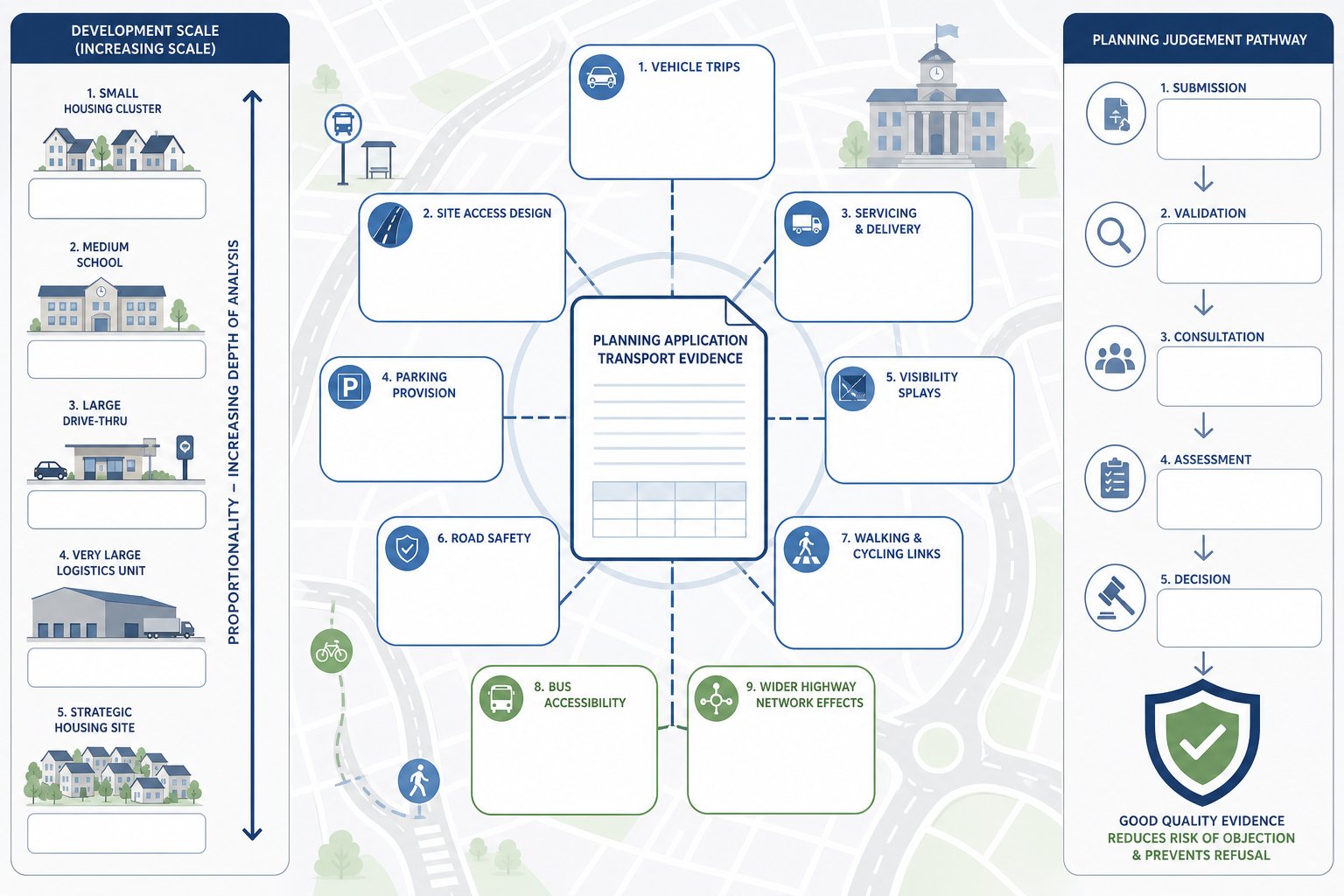
Planning application transport evidence is the transport-related material submitted with an application to explain the likely effects of a development on movement and the wider highway network. That sounds straightforward, but in practice it covers a fairly wide range of issues: vehicle trips, access design, servicing, parking provision, visibility, road safety, walking and cycling links, bus accessibility, and the overall suitability of the site in transport terms.
The key point is that it is not just “traffic data”. It is evidence used to support planning judgement. A local planning authority is asking: will this development work here, safely and acceptably, and if not, what needs to change? The answer may sit in a detailed transport assessment for larger schemes, or in a shorter statement for lower-impact proposals. Either way, the role is the same: give decision-makers enough confidence to validate, consult on, and determine the application.
In UK planning practice, proportionality matters. A ten-dwelling scheme on a constrained access road does not need the same level of analysis as a logistics unit, roadside drive-thru, school expansion, or strategic housing site. But even smaller proposals can trigger transport questions if they alter access, intensify use, or sit in sensitive locations.
We generally advise clients to think of transport evidence as part technical document, part risk-management tool. Done well, it anticipates objections before they harden into refusal reasons.
Why Transport Evidence Matters To Validation And Decision-Making
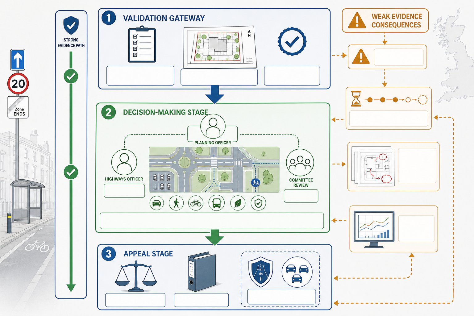
Transport evidence matters at two distinct stages: validation and determination. At validation, the authority checks whether the application includes the documents required by its local list and by the specific characteristics of the site and proposal. If transport evidence is expected and missing, the application may not be registered at all. That alone can throw a programme off course.
Once validated, the same evidence becomes central to decision-making. Planning officers, highways officers, and sometimes committee members rely on it to judge whether impacts are acceptable, whether residual cumulative impacts would be severe, and whether mitigation can make the scheme policy-compliant. Weak evidence tends to create the same pattern: requests for clarification, delayed consultations, revised drawings, and fresh modelling late in the process.
It also matters at appeal. If a refusal turns on highway safety, parking stress, accessibility, or network impact, the quality of the transport case becomes critical. A thin report rarely improves with age.
For that reason, transport work should not be treated as a box-ticking exercise. A credible evidence base can help unlock agreement on scope, frame the narrative of the application, and support negotiations on conditions or obligations. In more complex schemes, an end to end transport approach is often what prevents fragmented advice and conflicting assumptions.
And, frankly, highway concerns have a habit of becoming the “easy” reason to delay a scheme if the supporting material is vague.
The Main Types Of Transport Reports Used In Planning
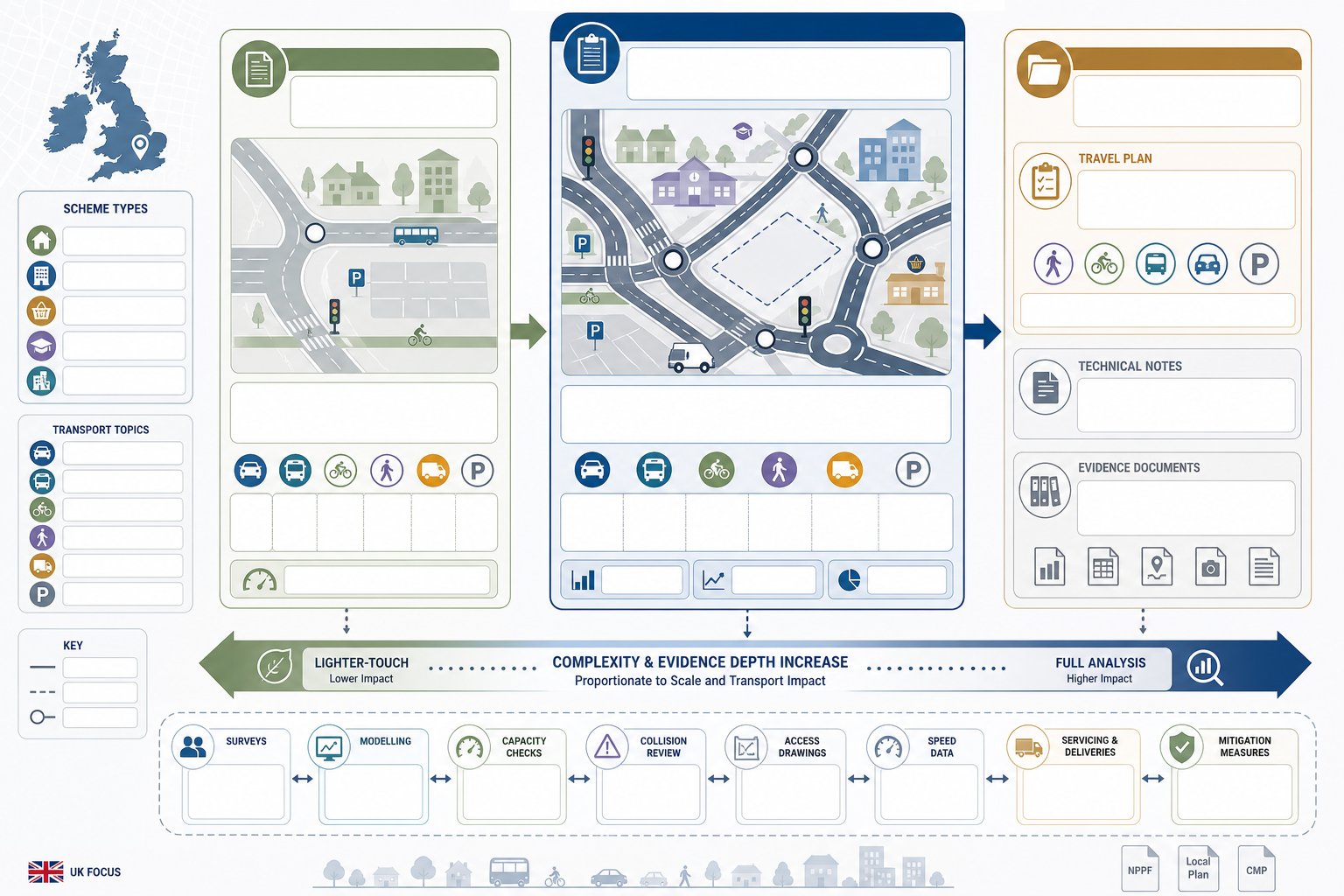
Not every development needs the same report. The right document depends on scale, context, and likely effect. The common categories are outlined below.
Transport Assessment
A Transport Assessment is the most detailed of the standard planning transport documents. It is generally prepared where a development is expected to generate significant movement or where the site raises material transport questions that need structured analysis. That may include larger residential schemes, schools, employment sites, mixed-use projects, retail, roadside uses, and sites with complex access or junction issues.
A full assessment usually covers baseline conditions, relevant policy, trip generation, trip distribution, assignment, junction impact, sustainable travel opportunities, parking, servicing, road safety, and mitigation. It may include survey data, modelling, capacity testing, and appendices such as visibility splays or swept path drawings.
The objective is not just to present numbers. It is to show that the proposal has been tested properly and that any impacts are understood and manageable. For many major applications, a detailed Development Transport Assessment: can shape the whole planning strategy because access and movement assumptions influence layout, density, and viability.
Transport Statement
A Transport Statement is a lighter-touch, proportionate document used where impacts are likely to be limited. It still needs to be evidence-led, but it is usually shorter and more focused than a full assessment.
Typical uses include smaller residential schemes, changes of use, local extensions, infill development, or proposals where the main issue is simply demonstrating that existing access, parking, and local accessibility are acceptable. A statement may summarise forecast trips rather than undertake extensive modelling, particularly where generation is low and no junction capacity concern is expected.
That said, “statement” should never mean superficial. We have seen modest schemes delayed because a short report ignored delivery arrangements, disabled parking, or the way vehicles would actually enter and leave the site. Where a proportionate report is suitable, the analysis still needs to answer the authority’s likely questions. Advice from experienced Transport Statement Consultants can be useful when the line between statement and assessment is not obvious.
Travel Plan, Technical Note, And Supporting Evidence
Some applications stand or fall on supporting documents rather than the main report title. A Travel Plan, for example, sets out practical measures to reduce car dependency and encourage walking, cycling, public transport, car sharing, and smarter travel behaviour. It is often requested for schools, offices, larger residential schemes, healthcare, student accommodation, and mixed-use developments.
Technical notes are narrower but often decisive. They may deal with a specific junction, compare parking demand, review collision data, respond to consultee comments, or justify assumptions used in the main report. Supporting evidence can also include speed surveys, vehicle tracking, access drawings, construction routing information, and location-specific accessibility analysis.
Where transport effects overlap with wider environmental topics, linked work on environmental impact assessment may also be relevant. The strongest submissions are usually the ones where every transport document tells the same story, rather than behaving like separate pieces written in isolation.
When A Development Is Likely To Need Transport Evidence
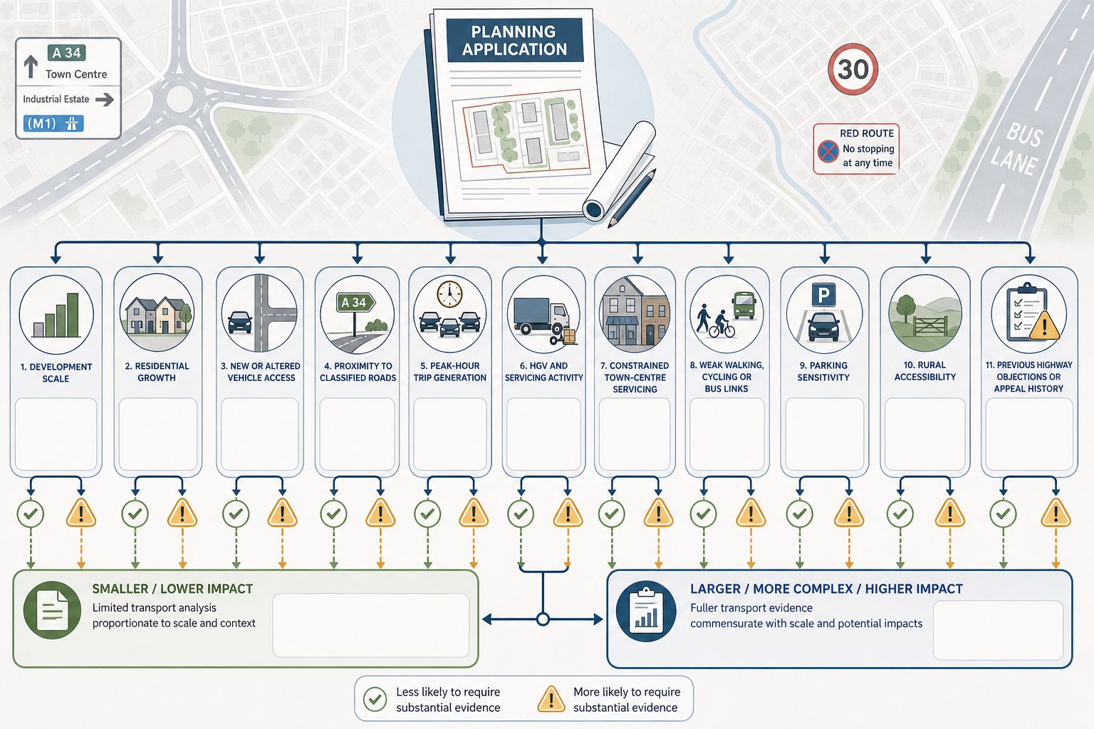
The short answer is: whenever a proposal could materially affect movement, access, or highway safety. In practice, transport evidence is commonly needed for major development, but that is not the whole picture. Smaller schemes can also trigger the requirement if local roads are constrained, the access is substandard, parking is sensitive, or the use itself generates atypical movements.
Residential development is an obvious example. A handful of new dwellings on a quiet estate may need only limited analysis, while a scheme of 30, 50, or 100 homes is likely to require a more developed case. Specialist guidance on Residential Development Transport issues often becomes important where parking standards, school-run traffic, or rural accessibility are under scrutiny.
Other common triggers include:
- creation or alteration of a vehicular access:
- development on or near a classified road:
- uses with concentrated peak-hour demand:
- proposals involving HGVs, servicing yards, or frequent deliveries:
- sites in town centres with constrained servicing and limited parking:
- locations where walking, cycling, or bus access is weak and must be justified:
- schemes with previous appeal history or known local highway objections.
The safest assumption is not “is this major?” but “what transport questions will the authority ask?” If the honest answer is more than one or two, some form of structured evidence is probably needed.
Pre-application discussion can save a lot of guesswork here. So can reviewing local validation lists and highway guidance before design work becomes fixed.
How Local Planning Authorities Decide What Level Of Evidence Is Required
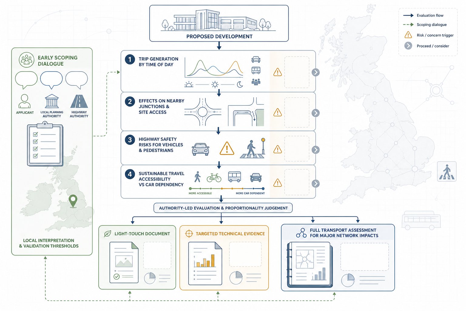
Authorities do not usually choose between no report, a statement, or a full assessment at random. They look at a mix of scale, use, location, sensitivity, and likely impact. National guidance supports a proportionate approach, but each local planning authority and highway authority may also have local thresholds or validation expectations.
In broad terms, they ask four questions. First, how many trips is the proposal likely to generate, and at what times? Second, will those trips create material effects on nearby junctions, roads, or site access? Third, are there highway safety concerns, including visibility, conflict with pedestrians, or manoeuvring problems? Fourth, does the site offer credible sustainable travel options, or will the scheme depend heavily on private car use?
The answers shape the level of detail required. A low-trip proposal in a highly accessible area may need only a concise statement. A moderate scheme with a difficult access may need targeted technical work. A major site with network implications will typically require a full assessment, often agreed through scoping.
This is why early dialogue matters. If scope is not agreed, teams can end up producing the wrong report, too little, and the authority asks for more: too much, and time and budget are wasted. Working with experienced Transport Assessment Consultants: helps because thresholds are only part of the story: local interpretation matters just as much.
At ML Traffic, that local-authority-led judgement is usually where the real planning value sits: knowing what will satisfy the case officer and highways officer before the formal submission lands.
What A Strong Transport Evidence Package Should Cover
A strong package is clear, proportionate, and specific to the site. It should explain the development proposal accurately, describe existing conditions honestly, test impacts using defensible assumptions, and present mitigation in a way that is practical rather than aspirational. Too many reports fail because they are technically competent but disconnected from the drawings, design code, or actual operation of the site.
At minimum, we would expect a good transport evidence package to address baseline transport conditions, policy context, forecast travel demand, access design, parking and servicing arrangements, active travel links, public transport, and any required mitigation or monitoring. The level of detail changes from scheme to scheme, but the logic should always be easy to follow.
Importantly, consistency matters. The red line boundary, unit mix, floor areas, access width, parking numbers, and delivery assumptions must align across all submitted documents. If the transport report says one thing and the site plan another, the authority notices.
For sites with delivery courts, refuse collection constraints, or tight internal geometry, practical design support such as Onsite Delivery Transport input can make the difference between a smooth consultation and a drawn-out request for revisions.
Below are the core technical themes most authorities expect to see covered properly.
Trip Generation, Distribution, And Junction Impact
This is usually the heart of the technical case. The report should explain how many trips the development is expected to generate, what evidence base has been used, and why the assumptions are reasonable. Depending on the proposal, that might involve TRICS-informed forecasting, comparable sites, committed development review, census and travel survey context, or observed local conditions.
Distribution matters just as much as generation. Even a modest number of trips can become contentious if they are expected to route through a constrained junction, a village centre, or a school frontage. The evidence should hence show where trips are likely to come from and go to, and why.
Where capacity is in issue, the package should include proportionate junction assessment. That may range from simple priority-junction review to more detailed modelling. But the aim is always the same: demonstrate whether the residual impact is acceptable and whether mitigation is needed.
The strongest reports also explain uncertainty. Peak spreading, linked trips, pass-by trips, and existing lawful fallback positions can all be relevant, but they need to be argued carefully, not used as convenient optimism.
Access, Parking, Servicing, And Road Safety
Many applications run into trouble here because these are the issues people can picture immediately. If a councillor can imagine cars queuing into the road, a refuse vehicle reversing awkwardly, or overspill parking on neighbouring streets, the transport case needs to deal with that head-on.
A robust package should show that site access is suitable in geometry and visibility terms, that internal circulation works for expected vehicles, and that parking is policy-compliant or justified if there is a departure. That includes disabled spaces, cycle parking, electric vehicle provision where relevant, turning areas, and realistic servicing arrangements.
Road safety analysis should not be tokenistic. Collision records, local observations, and site-specific risks all matter. If there is a history of recorded incidents, the report should interpret that evidence carefully rather than pretending it does not exist.
Quite often, these practical points are the reason a lighter report becomes a longer one. A “small” scheme with a poor access can require more technical explanation than a larger site with an excellent frontage.
Walking, Cycling, Public Transport, And Accessibility
Transport evidence now needs to do more than prove cars can get in and out. Authorities increasingly expect a clear account of how the development supports sustainable travel and whether day-to-day journeys can be made without over-reliance on the private car.
That means assessing footway continuity, crossing opportunities, cycle routes, bus stop access, service frequency, rail links where relevant, and the real usability of those options for likely occupants or users. A bus stop within 400 metres on paper is not much help if the walking route is unlit, indirect, or lacks dropped kerbs.
A good report should connect accessibility analysis to the nature of the development. Office workers, warehouse staff, school pupils, care home visitors, and suburban family households do not all travel in the same way. The resulting measures in a Travel Plan should reflect that reality.
When this part of the package is done properly, it strengthens the planning balance. It shows not only that impacts are manageable, but that the proposal is aligned with wider policy objectives around mode shift, health, and place quality.
Common Problems That Delay Planning Applications
Most transport-related delays are avoidable. They tend to come from the same recurring issues, and nearly all of them start earlier in the process than teams think.
The first is missing or mis-scoped evidence. A report is commissioned too late, based on an outdated layout, or prepared without checking local validation requirements. The authority then asks for a fuller assessment, a revised Travel Plan, or additional junction work after submission.
The second is weak technical justification. Trip rates are asserted but not defended. Parking demand is guessed. Servicing is mentioned but not tracked. Sustainable travel is described in generic language with no link to the site. In those cases, consultees naturally push back.
The third is inconsistency across the application set. Floor areas change, access drawings evolve, unit numbers shift, yet the transport report is not updated to match. That undermines confidence fast.
A fourth problem is failing to engage with local concerns. If neighbours are likely to worry about rat-running, school gate congestion, rural lane safety, or overspill parking, the evidence should address those topics directly. Silence tends to be read as weakness.
Finally, there is timing. Surveys, speed data, swept path testing, and authority discussions all take time. When teams try to compress transport work into the final days before submission, quality drops and risk rises.
The practical lesson is simple enough: agree scope early, align the report with the evolving design, and make sure the evidence answers the real transport questions the site raises. That is how we avoid the kind of delays that feel sudden but, in truth, were building from the start.
A well-prepared planning application rarely succeeds because of one document alone. But poor transport evidence can derail an otherwise strong scheme remarkably quickly. In 2026, with authorities still under pressure and validation standards closely watched, the safest route is proportionate, site-specific, and early transport input. If the likely issues are understood at concept stage, the right report can be scoped, the right surveys can be commissioned, and the planning narrative can be built around evidence rather than assumption.
For architects, planners, developers, lawyers, surveyors, and councils, that means treating planning application transport evidence as a strategic part of the submission, not a late attachment. When it is aligned with the drawings, responsive to local thresholds, and clear about mitigation, it gives decision-makers what they need: confidence. And confidence, more than most teams care to admit, is often what moves an application from delay to determination.
Planning Application Transport Evidence FAQs
What is planning application transport evidence and why is it important?
Planning application transport evidence is the transport-related information submitted with a planning application to demonstrate how a development will affect movement, access, safety, parking, servicing, and the wider network. It helps local authorities assess whether the scheme is acceptable and what mitigation may be necessary.
When is a Transport Assessment required over a Transport Statement in planning applications?
A Transport Assessment is needed for developments expected to generate significant traffic or raise complex transport issues, such as larger housing schemes or employment sites. Smaller or lower-impact proposals usually require a lighter Transport Statement, but it must still be evidence-led and proportionate.
How do local planning authorities decide the level of transport evidence needed?
Authorities consider factors like development size, expected trip generation, location sensitivity, and highway safety concerns. They then decide whether no report, a Transport Statement, or a full Transport Assessment is appropriate, ensuring the evidence matches the site’s transport impact and local thresholds.
What key topics should a strong planning application transport evidence package cover?
A robust package should address baseline transport conditions, trip generation and distribution, junction impacts, access design, parking and servicing, road safety, walking, cycling, public transport links, and mitigation measures. Consistency with site plans and clear practical solutions are essential.
How can poor planning application transport evidence delay a development?
Delays often arise from missing or mis-scoped reports, weak technical justification, inconsistencies in submitted data, failure to address local concerns, and last-minute surveys or revisions. Early engagement and clear, accurate evidence help avoid validation issues and prolonged consultations.
What role do Travel Plans play in planning application transport evidence?
Travel Plans outline strategies to reduce car dependency by encouraging walking, cycling, public transport, and car sharing. They are often required for developments like schools, offices, and large residential sites to support sustainable travel and complement other transport evidence.