
Bath is one of those places where transport planning can’t be treated as a box-ticking exercise. A scheme that might move smoothly through planning elsewhere can run into real friction here, simply because Bath’s streets, heritage constraints, parking controls and movement priorities are unusually tight. Add in local expectations around active travel, public transport and carbon reduction, and the transport case behind a planning application becomes central rather than peripheral.
That matters for architects, developers, planners, solicitors and project teams trying to keep programmes on track. In our experience, the difference between a clean submission and a delayed one often comes down to whether transport issues were understood early enough: not just traffic numbers, but servicing, access geometry, cycle provision, walking links, CPZ pressures and the practical question of how people will actually reach the site.
Transport Planning in Bath is shaped heavily by Bath & North East Somerset Council’s strategic direction, especially the city’s movement and delivery plans, which push clearly towards lower-carbon travel, reduced car dependence and protection of Bath’s historic fabric. So in 2026, the strongest submissions are the ones that respond to Bath as it really is, constrained, highly sensitive and policy-led, rather than relying on generic national templates.
In this guide, we set out what planning teams need to know, where applications most often come unstuck, and how to prepare transport evidence that is proportionate, credible and much easier for the Council to review.
Why Transport Planning Matters For Development In Bath

In Bath, transport planning sits close to the heart of development management. That’s partly because the city has to balance growth with a long list of competing pressures: congestion on constrained corridors, air quality, climate commitments, public realm quality, heritage protection and the day-to-day functioning of a compact city centre. The Council’s direction of travel is clear. Development is expected to support mode shift away from private car use and towards walking, cycling and public transport, while avoiding harm to a network that already operates under strain.
For planning teams, that means transport evidence does more than measure traffic. It helps show whether a proposal fits Bath’s wider movement strategy, whether access and servicing are workable, whether parking is realistic, and whether the site can function safely for all users. In practice, transport is often one of the disciplines that joins up planning policy, urban design, highways and viability.
We’ve found that this is especially important on schemes in or near the city centre, along strategic corridors, close to Park & Ride routes, and around sensitive heritage locations. A robust transport approach can reduce objections, focus design decisions early and give decision-makers confidence that the development will work in the real world, not only on a drawing.
How Bath’s Historic Street Network Shapes Transport Strategy
Bath’s transport strategy is inseparable from its physical form. The Georgian street pattern, narrow carriageways, limited river crossings and compact World Heritage setting leave very little room for conventional capacity-led highway solutions. Put simply, Bath cannot widen its way out of transport pressure.
That has a direct effect on development expectations. The Council tends to favour measures such as traffic reduction, access management, improved crossings, better cycle links, public transport accessibility and public realm enhancement over proposals that assume significant growth in car movements can be absorbed without consequence. In historic streets, even seemingly small changes in access arrangement, turning movements or kerbside demand can create disproportionate effects.
This is why site context matters so much in Bath. A development may have acceptable trip generation in headline terms, yet still trigger concern if it relies on awkward servicing, poor visibility, excessive on-street loading or movements through already sensitive streets. For us, the key is to understand the local network from the outset: how the street actually operates, where conflict points sit, and which movements the Council is trying to reduce rather than accommodate.
When A Transport Assessment Or Transport Statement Is Needed

Not every Bath planning application needs a full Transport Assessment, but many more require transport input than applicants initially assume. Broadly, the need depends on scale, likely trip generation, site sensitivity and whether the proposal could affect the safe or efficient operation of the network. A smaller scheme may only justify a concise Transport Statement. A larger or more sensitive one may need a detailed assessment, technical appendices, junction modelling, a Travel Plan and supporting plans for parking or servicing.
The important point is proportionality. The Council is unlikely to welcome an overblown national-template report that says a lot without resolving local issues. Equally, an undercooked statement that avoids core questions usually creates delay. In Bath, threshold questions are only the start. A site in a constrained central location, near a key junction, within a Controlled Parking Zone, or on an important walking and bus route can require more transport evidence than the floor area alone might suggest.
That is where early judgement matters. We normally advise teams to test likely requirements before the application is finalised, especially for residential, education, mixed-use and commercial schemes where travel patterns, servicing and parking need careful justification.
How Local Validation Requirements And Planning Thresholds Influence Scope
Bath & North East Somerset Council’s local validation requirements are critical here. They set out when documents such as a Transport Assessment, Transport Statement, Travel Plan and Parking Strategy are expected, and they help officers decide whether an application is valid in the first place.
But thresholds don’t operate in a vacuum. Scope is influenced by local context, planning history, access conditions and strategic importance. A scheme above a threshold may need modelling of nearby junctions, queue analysis, swept paths, delivery management detail and sustainable travel measures. A scheme below that threshold may still need transport evidence if it sits in a highly constrained location or raises local concern.
Pre-application discussion is often the smartest route. It allows the applicant team to agree what level of assessment is likely to be proportionate and where effort should be focused. That can save a surprising amount of time. It also helps avoid the common problem of submitting the wrong type of report, or the right type of report with the wrong scope.
For specialist consultants, this is where local experience genuinely counts. Tailoring a report to Bath’s thresholds and planning context is far more useful than recycling a standard format from another authority.
Key Transport Issues Commonly Reviewed In Bath Planning Applications
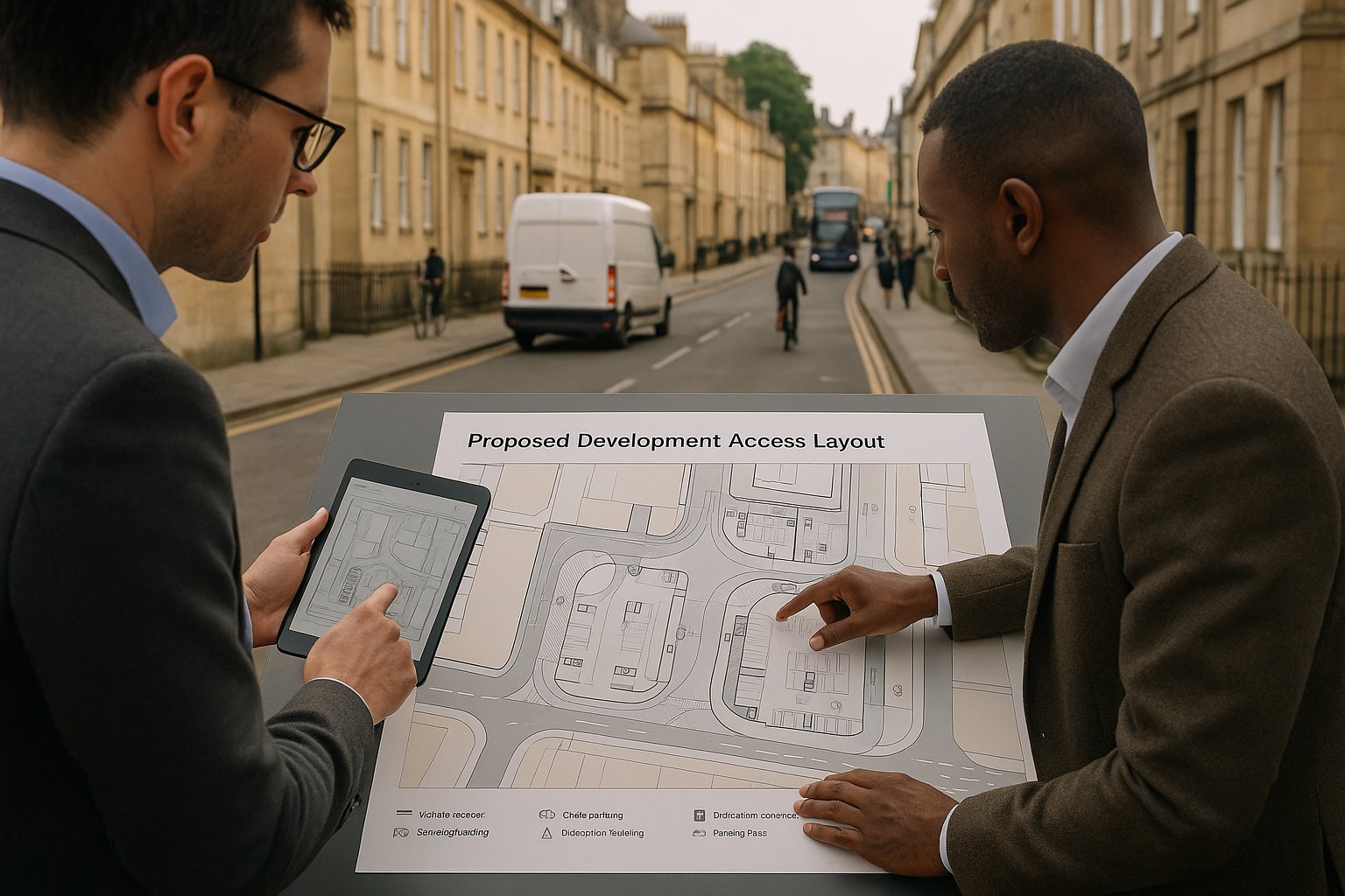
When Bath applications are reviewed from a transport perspective, a fairly consistent set of issues tends to come under scrutiny. Access arrangements are usually first. Can vehicles enter and leave safely? Are visibility splays realistic in a dense urban context? Is the geometry suitable for the intended vehicles without harming pedestrian movement or heritage setting?
Then there’s operational practicality. Can refuse vehicles access the site? Is there space for emergency access? Will servicing happen on-site, at the kerbside, or by informal loading that spills into the street? In Bath, these aren’t minor technical details. They often become deciding issues because the margin for error on the network is small.
Parking is another regular pressure point. The Council will look closely at parking numbers, the balance between car and cycle parking, likely overspill into surrounding streets, and whether the proposal aligns with local standards and Controlled Parking Zone conditions. This is particularly important in areas where residents and existing businesses already feel the network and kerbside are stretched.
Finally, highway safety runs through everything. Officers will consider the effect on pedestrians, cyclists, buses and general traffic, not just vehicle-to-vehicle conflict. A proposal that works for a driver but creates friction for vulnerable users is unlikely to satisfy policy expectations in Bath.
Access, Servicing, Parking, And Highway Safety Considerations
These four topics are often where a scheme either settles into credibility or starts to wobble.
Access needs to be designed around actual site constraints, not idealised geometry. Tight corners, gradients, walls, listed structures and pedestrian activity all matter.
Servicing needs to be realistic. If deliveries are expected, there must be a workable strategy for vans, refuse collection and, where relevant, larger vehicles. Unsupported assumptions like “servicing can occur from the street” rarely survive scrutiny in constrained parts of Bath.
Parking has to be justified rather than simply provided. The Council will consider maximum standards, local car ownership patterns, public transport accessibility, cycle provision and CPZ context. Too much parking can be a policy problem: too little, without evidence, can suggest overspill risk.
Highway safety is broader than collision data. It includes whether pedestrians can cross comfortably, whether cyclists are protected from turning conflicts, whether vehicles reverse unsafely, and whether the design supports legible, low-stress movement.
A well-prepared submission joins these threads together. It shows that the site can function day to day, not merely that a vehicle can technically squeeze in and out.
Walking, Cycling, And Public Transport Expectations For New Schemes
In Bath, sustainable travel is not a decorative add-on to a planning submission. It is a core expectation. The Council’s strategy places clear emphasis on walking, cycling and public transport, particularly in locations where daily needs can be met without routine car use. For new development, that means the quality of non-car access often carries as much weight as the treatment of vehicle access.
For walking, the basic test is straightforward: can people reach the site safely, directly and comfortably? But the detail matters. Missing dropped kerbs, poor crossing opportunities, indirect links, steep gradients, cluttered footways and awkward frontage design can all weaken the case.
For cycling, Bath’s topography and historic streets mean design has to be practical rather than tokenistic. Secure cycle parking, step-free access to stores where possible, links to existing or planned routes, and low-stress access on surrounding streets all matter. A bike store hidden behind multiple doors and stairs won’t persuade anyone.
Public transport expectations are similarly grounded in real use. Applications should show access to bus stops, service frequency, walk routes and, where relevant, links to Park & Ride. For larger trip generators, there is often an expectation that the scheme will actively support mode shift rather than merely point to nearby bus services.
In other words, if a scheme says it will reduce car dependence, the site layout and local connections need to prove it.
Traffic Impact, Junction Capacity, And Network Performance
Traffic impact in Bath has to be assessed with care because the network is constrained, sensitive and often already operating close to practical limits at key times. That is particularly true around river crossings, radial routes and city-centre approaches, where small increases in traffic can have visible effects on queues and delay.
A sound assessment typically looks at peak-hour trip generation, distribution, assignment and the likely impact on nearby junctions and links. But raw numbers alone aren’t enough. The question is whether the proposal creates material harm in a location where resilience is limited. In Bath, one stressed junction can influence a wider corridor, and the cumulative effect of development is often part of the conversation.
This is why local network understanding matters so much. Not every site needs complex modelling, but many need more than a generic traffic note. Junction capacity assessments, queue observations, sensitivity testing and evidence on network performance may all be relevant depending on scale and location.
Mitigation also needs to be realistic. Sometimes that means junction optimisation or access redesign. Sometimes it means traffic management, delivery controls, improved walking and cycling infrastructure, or contributions to sustainable transport measures. The strongest transport planning in Bath does not treat mitigation as a shopping list at the end. It is built into the development strategy from the start.
And frankly, that is usually what makes the difference between a defensible assessment and one that invites a long round of technical queries.
The Role Of Travel Plans In Bath Developments
Travel Plans play a bigger role in Bath than some applicants expect. For major residential, education, employment and university-related schemes in particular, they are often a key mechanism for showing how mode shift will actually happen once the development is occupied.
A good Travel Plan is not a generic appendix copied from another scheme. It sets out clear targets, realistic measures, management responsibilities, monitoring arrangements and review points. It explains how residents, staff, students or visitors will be encouraged to walk, cycle, use public transport and reduce unnecessary car trips. In Bath, that might include cycle facilities, public transport information, personalised travel support, car club measures, parking restraint, visitor management, welcome packs or ticketing initiatives.
The Council is usually looking for deliverability. Who is responsible for implementation? When do measures start? How is monitoring secured? What happens if targets are missed? These questions matter because a Travel Plan is meant to be an operational tool, not just a planning statement.
We’ve seen many schemes improve significantly once the Travel Plan is treated as part of the design and management strategy rather than a late-stage obligation. For developments in Bath’s constrained locations, that shift in mindset is often essential. If the proposal depends on reduced car use, the Travel Plan is part of the evidence that the assumption is credible.
How Transport Planning Supports Different Types Of Development
Transport planning in Bath is never one-size-fits-all. The issues, evidence base and likely mitigation vary sharply depending on what is being proposed and how people will use it. That is why transport strategy should be shaped around development type from the outset, rather than retrofitted once the site layout is fixed.
For some schemes, the key challenge is daily resident travel and parking behaviour. For others, it is delivery activity, visitor turnover, school peaks or the interaction between multiple land uses sharing one constrained frontage. Bath’s policy context pushes all of these towards lower-car, better-connected outcomes, but the route to get there differs by scheme.
This is where tailored advice can save time. A residential site with limited parking and strong bus access needs a different transport narrative from a commercial redevelopment with regular servicing demand. An education proposal may stand or fall on peak-period management and safe walking routes. A mixed-use site often needs all of the above, plus careful internal coordination.
The common thread is this: transport planning helps show that the development can function in a way that matches Bath’s streets, policy priorities and practical constraints. Without that, even a well-designed scheme can look unresolved.
Residential, Mixed-Use, Education, And Commercial Scheme Considerations
Residential schemes are usually judged on low-car design, safe internal movement, access to buses, cycle parking, walkability and likely parking stress. Family housing, student accommodation and later-living schemes may all generate different travel patterns, so assumptions should be evidence-based.
Mixed-use development needs a coordinated approach. Different uses may peak at different times, which can help, or complicate matters. Shared servicing areas, visitor parking, refuse strategy and pedestrian priority all need careful handling.
Education and university schemes attract close attention in Bath. Peak-hour concentrations, school run behaviour, coach or drop-off activity, and safe walking and cycling routes can be decisive. Travel Plans are often central here.
Commercial development typically raises questions around staff travel, visitor access, servicing, freight routing and loading controls. If the site relies on tight urban streets, the logistics strategy has to be especially robust.
In each case, a proportionate but locally informed assessment gives the planning authority confidence that the proposal has been designed around real movement patterns rather than assumptions.
Common Mistakes That Delay Transport Approval
Most transport delays in Bath are avoidable. They tend to arise not from obscure technical disputes, but from a handful of recurring mistakes.
One of the most common is underestimating trip generation or selecting weak comparators to make impacts look lower than they are. That rarely ends well, especially where officers know the local network is sensitive. Another is failing to assess the right junctions. Applicants sometimes focus narrowly on the site access while overlooking constrained nearby nodes, river crossings or city-centre approaches where impacts are more likely to be felt.
Parking is another frequent stumbling block. Submissions can fall into either extreme: too much parking without policy justification, or too little without a credible explanation of why overspill will not occur. In Bath, Controlled Parking Zones and local kerbside pressure make this especially important.
We also see weak sustainable transport provision dressed up as strong policy compliance. A token bike store, poor walking links or a vague reference to nearby buses will not carry much weight. The same goes for generic Travel Plans with no meaningful targets or implementation detail.
And then there is timing. Bringing transport consultants in after the layout is effectively fixed can leave the team trying to defend poor access, awkward servicing or impossible refuse arrangements. By that point, choices narrow fast.
If there’s one practical lesson, it’s this: Bath rewards early, site-specific transport thinking and exposes generic reporting very quickly.
How To Prepare A Strong Transport Submission For Bath
A strong transport submission for Bath starts well before the application is lodged. We’d usually begin with the obvious but often skipped step: understand the site in its actual context. That means reviewing local policy, visiting the area, observing movement patterns, checking parking controls, identifying sensitive junctions and testing whether the design genuinely supports sustainable travel.
Pre-application engagement with Bath & North East Somerset Council is often worth the effort. It can help confirm whether a Transport Assessment or Transport Statement is required, what modelling may be expected, and whether a Travel Plan, Parking Strategy or servicing detail will be needed. Early agreement on scope can prevent wasted work later.
The submission itself should be proportionate, current and local. Refer to the city’s movement and delivery strategies, use up-to-date survey data where needed, and explain assumptions clearly. Show the quality of walking and cycling links, not just their existence. Be realistic about parking demand. Address servicing and refuse without hand-waving. If junction impacts are relevant, assess them properly and present mitigation that is deliverable.
Just as importantly, make the report readable. Decision-makers and consultees should be able to see the logic: existing conditions, proposal, likely effects, and how any impacts are managed. Concise, accurate reporting usually travels further than bulk.
For teams needing specialist input, firms with experience in local authority thresholds and planning contexts can make a tangible difference. That is very much the approach we take at ML Traffic: clear, tailored transport engineering reports produced quickly, with local planning realities in mind.
In Bath, the strongest submission is rarely the longest. It is the one that understands the city, answers the real questions and leaves as little room for doubt as possible.
Transport Planning in Bath: Frequently Asked Questions
Why is transport planning particularly important in Bath?
Transport planning in Bath is crucial due to its constrained historic street network, heritage protections, and local policies promoting low-carbon travel. It ensures developments support growth while managing congestion, air quality, and protecting the city’s unique fabric, aligning with Bath & North East Somerset Council’s strategic movement plans.
When is a Transport Assessment or Transport Statement required for planning applications in Bath?
Transport Assessments or Statements are needed based on local thresholds related to scheme size, trip generation, and site sensitivity. Larger or strategically located developments demand detailed assessment, while smaller or less sensitive proposals may require a concise Transport Statement, as defined in Bath & North East Somerset Council’s local validation requirements.
How does Bath’s historic street network influence transport strategy and development expectations?
Bath’s narrow Georgian streets and limited river crossings restrict conventional road capacity, so transport strategy favours traffic reduction, access management, improved crossings, and sustainable travel over road widening. Developments must respect these constraints with workable servicing, safe access, and minimised car movements to preserve the city’s heritage and functionality.
What are the key transport issues planners focus on in Bath development applications?
Planning teams scrutinise vehicular access safety and visibility, practical servicing and refuse arrangements, parking quantity aligned with Controlled Parking Zones, and overall highway safety for pedestrians and cyclists. These factors ensure developments function safely without adding pressure to Bath’s sensitive transport network.
How do walking, cycling, and public transport feature in Bath’s transport planning for new developments?
Sustainable travel modes are central; developments must provide safe, direct, and comfortable walking routes, secure cycle facilities with step-free access, and easy access to frequent bus services and Park & Ride. Proposals should demonstrate credible support for reduced car dependence in line with Bath’s transport strategy.
What common mistakes delay transport approval for developments in Bath?
Delays often result from underestimating trip generation, ignoring the impact on sensitive junctions, non-compliance with parking standards, vague or weak Travel Plans, poor sustainable travel provision, and consulting transport experts too late. Early, Bath-specific, detailed transport planning helps avoid these pitfalls and expedites approval.