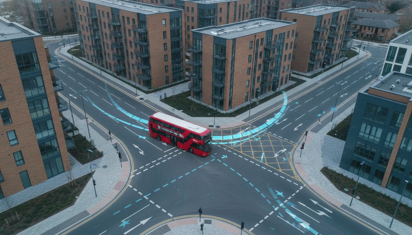
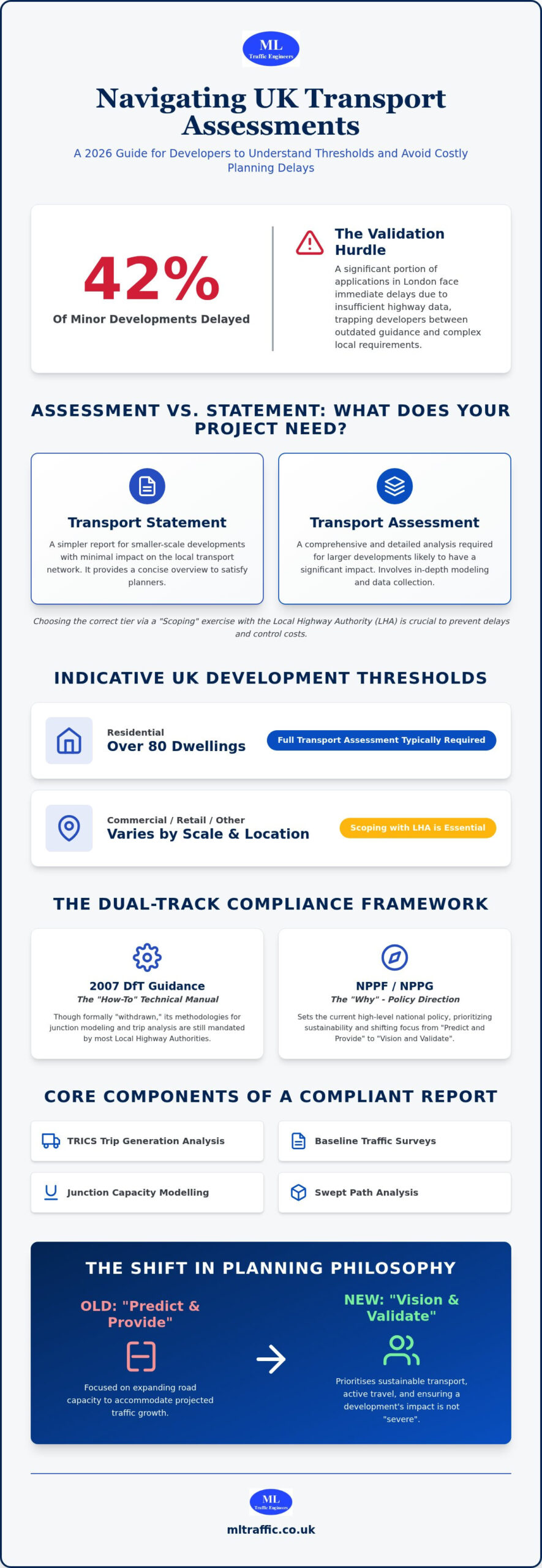
Did you know that 42% of minor development applications across London boroughs face immediate delays at the validation stage because of insufficient highway data? It’s a frustrating reality for developers who find themselves caught between the “withdrawn” 2007 DfT guidance and the nuanced requirements of the current National Planning Practice Guidance. Understanding the specific transport assessment thresholds uk planners expect is no longer about following a static checklist; it’s about navigating a landscape where local authorities hold significant discretionary power.
You likely recognize that a “one size fits all” approach leads to over-engineered reports that inflate project costs or, worse, insufficient data that stalls your application for months. This 2026 manual provides the clarity you need to move forward with confidence. We’ll break down the latest triggers for full assessments versus simpler statements, including the specific 80-unit residential threshold in London and the “vision-led” shift in the delayed NPPF. By the end of this guide, you’ll know how to secure a professional report that passes council scrutiny the first time while keeping your technical documentation proportionate to your project’s impact.
Key Takeaways
- Recognise why the 2007 DfT Guidance remains the essential technical framework for Local Highway Authorities despite its formal withdrawal.
- Understand the specific transport assessment thresholds uk local authorities use to determine if your project requires a full Assessment or a simpler Statement.
- Identify the mandatory components of a compliant report, including TRICS trip generation analysis and baseline traffic surveys.
- Leverage technical data such as Swept Path Analysis to justify your site design and meet statutory requirements efficiently.
- Manage the project lifecycle from initial scoping to final negotiation to prevent validation delays and minimise technical reporting costs.
What is the DfT Guidance on Transport Assessment in 2026?
The Department for Transport (DfT) Guidance on Transport Assessment (GTA) remains the foundational technical framework for transport planning across the United Kingdom. Although the original 2007 document was formally “withdrawn” by the government, its technical methodologies are still mandated by the majority of Local Highway Authorities. This guidance provides the specific analytical tools required to determine if a project meets the transport assessment thresholds uk planners monitor for validation. Without this framework, there would be no consistent way to measure a development’s impact on highway safety and network capacity.
To better understand how these technical assessments fit into the wider planning framework, watch this helpful video:
In 2026, the industry has shifted away from the traditional “Predict and Provide” model toward “Vision and Validate” strategies. This approach prioritises sustainable transport outcomes and active travel infrastructure over simple road capacity expansion. The primary technical goal of any modern report is to demonstrate that a development’s residual cumulative impact is not “severe.” Under current planning law, “severe” is the specific legal benchmark that determines whether a highway authority will object to your application. ML Traffic Engineers UK uses these DfT principles to ensure that every technical submission is robust enough to withstand legal and planning scrutiny.
The Evolution from 2007 DfT Standards to NPPF
The National Planning Policy Framework (NPPF) and National Planning Practice Guidance (NPPG) have streamlined reporting requirements, but they lack the granular engineering detail found in the 2007 GTA. This is why professional consultants still rely on the older guidance for junction modelling and trip distribution. While the NPPG sets the policy direction, the GTA provides the technical “how-to” that keeps the road network functional. This dual-track approach ensures that your project complies with both high-level sustainability goals and ground-level safety requirements, providing a reassuring path to approval.
Why Thresholds Matter for Your Planning Application
Identifying the correct reporting tier is essential for avoiding unnecessary technical work and inflated consultancy fees. If you incorrectly identify the level of reporting required, you risk receiving a “Regulation 25” request for further information. These formal demands for data can stall a project for weeks or months while additional surveys are gathered. ML Traffic Engineers UK identifies the correct transport assessment thresholds uk planners expect during the pre-application phase. This ensures your submission aligns with local borough or county-wide policies from the start, preventing the validation delays that frequently derail development timelines.
Indicative Transport Assessment Thresholds for UK Developments
Determining the correct transport assessment thresholds uk local authorities apply is the most critical step in your pre-application strategy. While national guidelines exist, these figures are indicative rather than absolute. The actual requirement often hinges on a “Scoping” exercise where we negotiate the scale of reporting with the Local Highway Authority (LHA). This prevents you from paying for a full Assessment when a leaner Statement would suffice. Our team uses the Department for Transport’s Transport Analysis Guidance (TAG) to align technical methodologies with council expectations from day one.
Thresholds are generally based on the land-use class and the physical scale of your proposed development. Residential schemes usually require a full Transport Assessment once they exceed 80 dwellings. However, in sensitive areas or congested urban centres, this threshold can drop significantly. For instance, our London Transport Assessment guide highlights that some boroughs require full reporting for as few as 30 to 40 units if the site sits within an Air Quality Focus Area. Commercial and retail projects generally face triggers between 1,000sqm and 2,500sqm of gross floor area.
Common Triggers for Transport Statements vs. Assessments
A Transport Statement is typically sufficient for smaller sites, such as residential developments between 30 and 50 dwellings. These reports focus on localised impacts and immediate site access. A full Assessment becomes mandatory for larger schemes or any project impacting the strategic road network. You should be aware that a council might “upgrade” a Statement to a full Assessment in high-congestion zones. This usually happens if the development is expected to generate between 30 and 50 vehicle movements during peak hours, regardless of the unit count. If you’re unsure which tier applies to your site, our transport planning services can provide an initial scoping opinion.
Land-Use Specific Threshold Examples
The type of activity on-site dictates the level of scrutiny. Retail developments (A1/A3) have varying triggers; a food retail outlet often requires a full Assessment at a lower floor area than a non-food warehouse because of higher trip frequencies. For office spaces (B1), square footage isn’t the only metric. Planners look closely at employee density and the resulting pressure on local public transport hubs. Industrial sites (B2/B8) focus heavily on HGV movements. In these cases, the LHA prioritises swept path requirements and delivery scheduling over simple car trip counts to ensure the local network remains safe and functional.
Core Components of a DfT-Compliant Transport Report
A DfT-compliant report must be precise to withstand the scrutiny of Local Highway Authority officers. Every successful submission begins with a detailed baseline of existing site conditions. We examine the current transport network, identifying existing bottlenecks and safety records within the immediate vicinity. This evidence base is essential for determining how your project fits within the established transport assessment thresholds uk planners use to judge impact. We follow the Planning Practice Guidance for Transport Assessments to ensure every technical chapter aligns with national standards.
Trip generation analysis is the technical heart of the report. Using the latest TRICS database standards for 2026, we calculate the expected volume of vehicle, pedestrian, and cycle movements. This isn’t just about cars; we must demonstrate a holistic understanding of how people will access your site. We audit sustainable travel options, assessing the quality of walking and cycling routes and calculating Public Transport Accessibility Level (PTAL) scores. If our analysis identifies potential network stress, we develop a robust mitigation strategy. This ensures your planning application remains viable by addressing negative impacts before they become grounds for refusal.
The Critical Role of the Scoping Note
We never start a full report without first securing a Scoping Note. This allows us to negotiate the study area with the Highway Authority, ensuring we only model the junctions that truly matter. We agree on the appropriate software for the task, whether that’s ARCADY for roundabouts, PICADY for priority junctions, or LinSig for traffic signals. The Scoping Note serves as the formal technical agreement that prevents redundant work and ensures the council accepts our methodology from the outset.
Trip Generation and Modal Split
TRICS data allows us to predict trip volumes based on real-world surveys from similar developments. We refine these “standard” rates by applying local factors, such as high PTAL ratings in urban centres. This process, known as modal split analysis, determines the percentage of users arriving by each transport mode. Travel Plan consultants are often brought in at this stage to introduce measures that actively reduce car dependency. By shifting trips toward walking or cycling, we can often lower the predicted traffic impact enough to meet local policy requirements.
Technical Methodologies: Moving Beyond the Guidance
Technical precision is the only way to prove a site functions safely once you’ve identified the relevant transport assessment thresholds uk local authorities require. Meeting these benchmarks involves more than just interpreting policy; it requires empirical data that demonstrates your design is viable. We follow a logical, sequential process to build this evidence base. Our methodology ensures that even if your development sits just below major transport assessment thresholds uk, the technical data remains robust enough to withstand planning committee scrutiny. This process moves from initial baseline surveys to advanced digital simulations and junction capacity modelling.
Swept Path Analysis: Proving Design Feasibility
A critical component of any modern submission is proving that essential vehicles can navigate your site without conflict. We use Swept Path Analysis to ensure refuse trucks, fire tenders, and delivery vehicles can enter, turn, and exit safely. Swept Path Analysis is a digital simulation of vehicle movement used to prevent costly physical redesigns by identifying potential collisions with kerbs or buildings before construction begins. This technical rigor is especially important for multi-use developments where HGV movements must coexist with pedestrian zones. By providing this data early, we reduce the regulatory pressure on your team and ensure the Local Highway Authority (LHA) remains satisfied with your site layout.
Traffic and Parking Surveys
Accurate data collection is the foundation of a successful report. We determine whether your site requires Manual Classified Counts (MCC) to identify specific vehicle types and pedestrian movements, or Automated Traffic Counts (ATC) for 7-day volume and speed data. This choice depends on the specific concerns of the LHA regarding local network stress. In sustainable urban locations, we use this data to justify lower parking provision, aligning with modern “car-free” planning mandates. For residential projects, we strictly adhere to the “Lambeth” or “Bentley” methodologies for parking surveys. These industry benchmarks ensure that our findings on overnight parking stress are accepted as a reliable basis for decision-making.
Secure your project’s future and avoid validation delays by requesting a professional traffic survey or swept path analysis from our expert team today.
Navigating the Planning Process with ML Traffic Engineers UK
ML Traffic Engineers UK provides the technical rigor needed to satisfy DfT standards in 2026. We manage the entire project lifecycle from the first scoping note to the final LHA negotiation. Our reports are decision-ready. This proactive approach minimizes technical queries that often stall developers at the validation stage. We understand that a rejected statement can stall a project for up to 16 weeks. We balance technical compliance with a commercial understanding of project viability. Our team ensures your documentation is proportionate to the development’s impact, reducing unnecessary technical overhead while maintaining safety standards.
Expert Reporting for UK Developers
We specialize in the preparation of Transport Statements and Assessments for all development scales. Since our founding in 2014, we’ve built deep expertise in UK planning law and regional highway requirements. We ensure your project adheres to the latest 2026 industry benchmarks and safety standards. Navigating the transport assessment thresholds uk planners use requires a tailored approach rather than a generic template. We use technical data, such as Swept Path Analysis, to justify lower-tier reporting where appropriate. This saves you from unnecessary consultancy fees while maintaining full regulatory compliance. View our Transport Statement buying guide for smaller sites to see how we streamline the process for minor developments.
Get Started on Your Transport Assessment
Contact our team for a preliminary review of your site’s specific transport triggers. We identify the exact transport assessment thresholds uk authorities will apply to your specific land-use class. Our integrated survey services provide the data foundations your application needs to succeed. We handle everything from TRICS data collection to complex junction modelling and Travel Plan coordination. This comprehensive support means you don’t have to manage multiple technical vendors or worry about conflicting data. We act as your dependable expert partner, ensuring every report passes council scrutiny the first time. Contact ML Traffic Engineers UK today for expert guidance on your transport assessment and secure your project’s timeline with reliable data.
Securing Your Project Timeline with Technical Precision
Successfully navigating the transport assessment thresholds uk local authorities demand is about balancing technical evidence with strategic negotiation. You now understand that a “vision-led” approach, supported by accurate TRICS modelling and Swept Path Analysis, is essential for bypassing validation delays and minimising technical reporting costs. These rigorous methodologies ensure your site design is safe, functional, and compliant with both national and local policy frameworks.
Since 2014, ML Traffic Engineers UK has acted as a vital partner for developers across England. We provide the technical authority needed to satisfy statutory requirements while maintaining a clear focus on your project’s commercial viability. By managing the full project lifecycle from initial scoping to final negotiation, we reduce the regulatory pressure on your team and ensure every report is decision-ready for the planning committee.
Secure your planning approval with a DfT-compliant Transport Assessment from ML Traffic Engineers UK.
With the right technical foundations in place, you can move forward with confidence that your development meets every safety and sustainability benchmark required for a successful outcome.
Frequently Asked Questions
Is the 2007 DfT Guidance on Transport Assessment still valid in 2026?
The 2007 DfT Guidance is formally withdrawn, but its technical methodologies remain the industry standard for most Local Highway Authorities in 2026. Planners still expect reports to follow its rigorous structure for junction modelling and trip distribution. It provides the mathematical foundation that modern NPPF policies lack, ensuring technical consistency across different UK regions and providing a reliable framework for developers.
What is the specific threshold for a Transport Assessment for a residential site?
Residential developments typically require a full Assessment once they exceed 80 units, though this varies significantly by borough. In sensitive urban areas or Air Quality Focus Areas, the transport assessment thresholds uk planners apply can drop to as few as 30 to 40 dwellings. You should always consult the local highway authority’s specific policy during the pre-application phase to confirm the required reporting tier.
Can a Transport Statement be rejected if the development is below the threshold?
Yes, a council can reject a Transport Statement or demand an “upgrade” to a full Assessment if the site’s impact is deemed significant. This often occurs if a development generates more than 30 vehicle movements during peak hours or sits near a congested junction. Insufficient highway data is a leading cause of validation delays, even for projects that fall below indicative national thresholds.
How long does it take to prepare a DfT-compliant Transport Assessment?
Preparation usually takes between four and eight weeks, depending on the complexity of the required traffic surveys. This timeline includes the initial scoping period with the local authority, data collection, and technical modelling. Factoring in the time needed for Manual Classified Counts or 7-day Automated Traffic Counts is essential for maintaining your project’s overall delivery schedule and avoiding last-minute delays.
Do I need a Travel Plan if my development requires a Transport Assessment?
Most developments that trigger a full Transport Assessment also require a Travel Plan to promote sustainable transport. This document outlines specific measures to reduce car dependency, such as cycle parking or public transport incentives. Integrating these reports ensures your application meets the sustainability criteria set out in the National Planning Policy Framework and aligns with local borough environmental goals.
What happens if the assessment shows a ‘severe’ impact on the local road network?
If an assessment identifies a “severe” impact, you must propose a robust mitigation strategy to resolve the issue. This might involve junction improvements, site access redesigns, or financial contributions toward local infrastructure. Failure to mitigate a severe residual cumulative impact is a primary ground for refusal under current UK planning laws, making technical precision and early mitigation planning vital for success.
What is the TRICS database and why is it required for transport reporting?
TRICS is the national standard system for trip generation analysis, providing data from thousands of established sites across the UK. It allows engineers to predict how many vehicle, pedestrian, and cycle trips a new development will generate based on similar existing land uses. Using the latest 2026 TRICS version is a non-negotiable requirement for any report to be accepted by a Local Highway Authority.
How much does a professional Transport Assessment cost for a UK developer?
The cost of a professional report depends on the scale of the development and the complexity of the required technical surveys. A full Assessment for a major scheme involves higher technical overhead than a simple Statement due to the extensive junction modelling and data collection involved. We recommend requesting a site-specific quote to ensure your technical documentation is correctly sized for the transport assessment thresholds uk councils enforce.

Disclaimer
The content on mltraffic.co.uk, including all technical articles, guides, and resources, is provided for general informational and educational purposes only. It is not intended to constitute professional advice in traffic engineering, transportation planning, development approvals, or any other technical or legal field.
While ML Traffic Engineers makes every reasonable effort to ensure the accuracy, completeness, and timeliness of the information published, we do not provide any warranties or representations (express or implied) regarding its reliability, suitability, or availability for any particular purpose. Any reliance you place on the content is strictly at your own risk.
In no event shall ML Traffic Engineers, its directors, employees, authors, or affiliates be liable for any direct, indirect, incidental, special, consequential, or punitive damages (including, without limitation, loss of profits, data, or business opportunities) arising out of or in connection with the use of, or inability to use, any information provided on this website.
The articles and guides on this site are not a substitute for engaging a qualified, professional traffic engineer to assess your specific project requirements. For tailored advice, compliance assessments, or traffic engineering services, please contact a competent professional.
This disclaimer may be updated from time to time without notice. By accessing or using this website, you agree to be bound by the most current version of this disclaimer.