Category: Articles

  • Transport Assessment for a Place of Worship in Harrow: When Is It Needed

    Transport Assessment for a Place of Worship in Harrow: When Is It Needed

    A place of worship doesn’t automatically need a full Transport Assessment. The requirement depends on the proposal’s scale and likely effects on the transport network. In London, strategically important developments that are legally referable to the Mayor should have one unless Transport for London agrees another approach in writing before the planning application. A transport assessment for a place of worship in Harrow may also be required for a non-referable application, and planning permission may be refused if transport impacts are severe.

    It’s understandable to want a clear answer before preparing a planning application. The practical distinction is that a Transport Statement can be a shorter, simpler alternative when transport impacts are limited. A fuller assessment may be needed when the proposal could affect local journeys, parking or access.

    This article explains what can trigger either document for a place of worship in Harrow and what to include in an initial scope. It also covers how to describe visitor movements, public transport, walking and cycling connections, parking, inclusive access and servicing, so the assessment reflects the site and its use.

    Key Takeaways

    • A full Transport Assessment isn’t automatic for a place of worship; the proposal’s scale and likely effects on local transport help determine the level of assessment needed.
    • A Transport Statement may suit a proposal with limited transport impacts, while more complex effects may call for a fuller assessment.
    • Build the scope around how people will arrive and move around the site, including walking, cycling, public transport and inclusive access.
    • Consider parking, servicing and vehicle manoeuvres together so the assessment reflects how the site will operate during worship and other activities.
    • A site location, intended use and approximate scale provide a practical starting point for defining the transport work required.

    Cycle parking, servicing and inclusive access

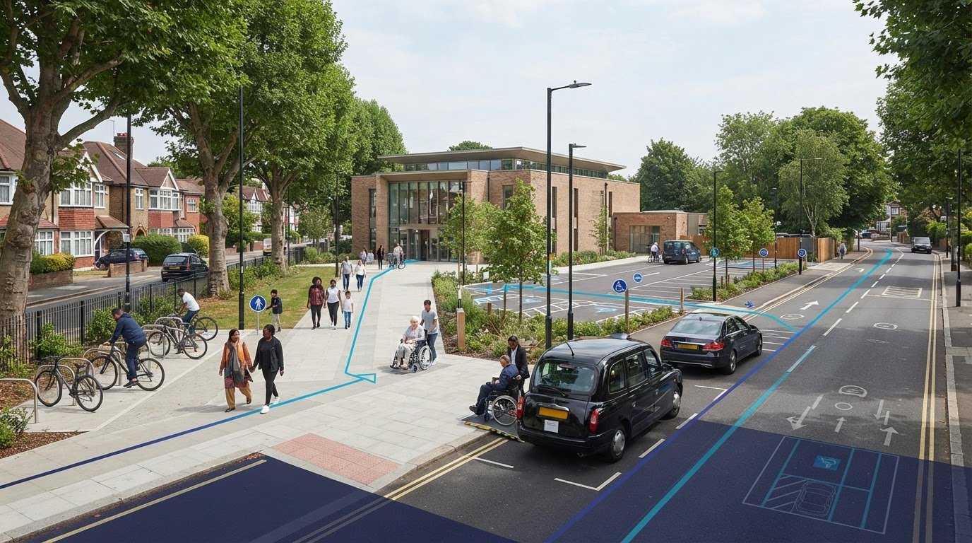
    For a place of worship in Harrow, parking provision depends on the proposal and site context, not the borough name alone. Review Harrow’s development plan alongside London Plan transport policies, then explain how visitors, staff and service vehicles will use the site.

    Cycle and Car Parking Evidence

    Cycle and car parking evidence records the spaces provided and how they serve expected users. It helps explain whether parking arrangements fit the site’s access, activities and surrounding routes. London planning applications must show how they encourage walking and cycling. A proposed Canons Park development includes a station cycle hub with 71 spaces, illustrating how cycle facilities can form part of a wider access plan. A parking survey can capture existing demand and availability near the worship site, including relevant time periods.

    Accessible Parking and Drop-Off

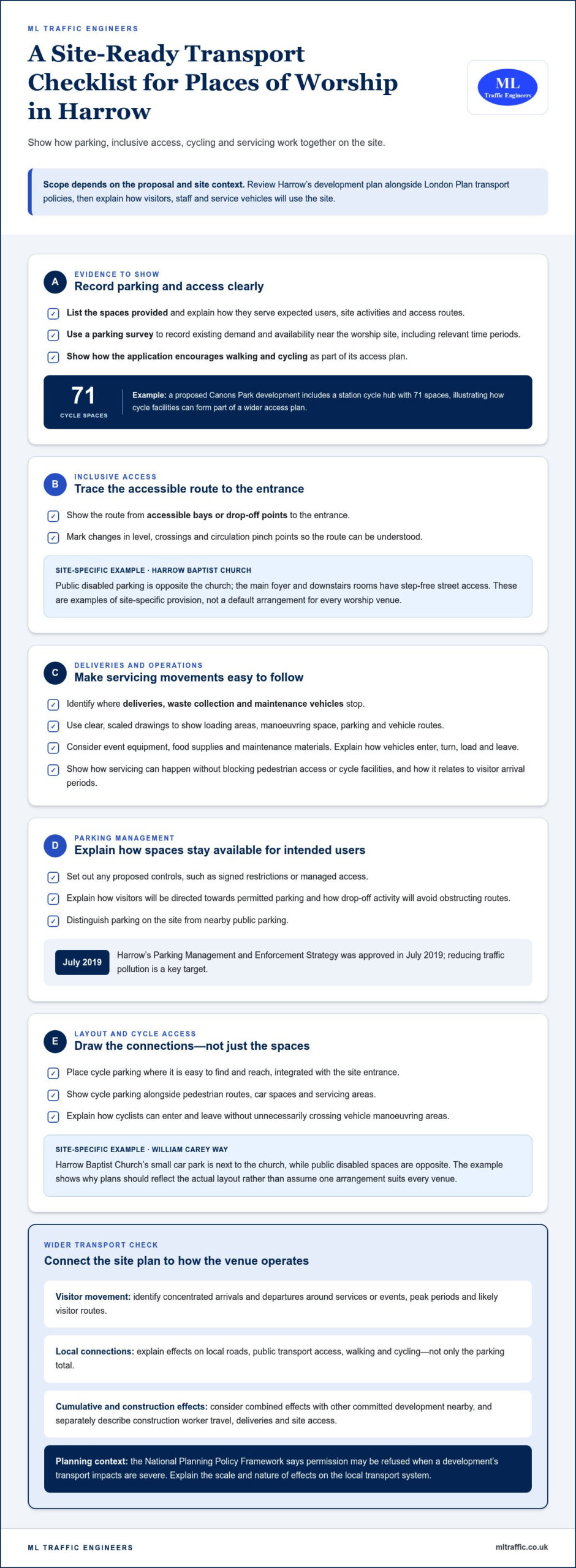
    Accessible parking and drop-off arrangements show how people with mobility difficulties can reach the entrance. Harrow Baptist Church has public disabled parking opposite the church, and its main foyer and downstairs rooms have step-free street access. These are examples of site-specific provisions, not a default standard for every worship venue. Plans should show the route from accessible bays or drop-off points to entrances, including changes in level, crossings and circulation pinch points.

    Loading and Servicing Arrangements

    Servicing plans should identify where deliveries, waste collection and maintenance vehicles stop. Use clear, scaled drawings to show loading areas, manoeuvring space, parking and vehicle routes. Explain how each activity can take place without blocking pedestrian access or cycle facilities. For a worship site, consider event equipment, food supplies and maintenance materials. Make clear how vehicles enter, turn, load and leave, and how these movements relate to visitor arrival periods.

    Parking Management and Enforcement

    Parking management explains how spaces will be allocated and kept available for their intended users. Harrow’s Parking Management and Enforcement Strategy was approved in July 2019, and reducing traffic pollution is a key target. Set out any controls proposed for the site, such as signed restrictions or managed access. Explain how visitors will be directed towards permitted parking, and how drop-off activity will avoid obstructing routes. These details help distinguish site parking from nearby public parking.

    Cycle Facilities and Site Layout

    Cycle parking should be easy to find and reach, and integrated with the site entrance. Show its location alongside pedestrian routes, car spaces and servicing areas. A plan should explain how cyclists can enter and leave without unnecessarily crossing vehicle manoeuvring areas. Harrow Baptist Church’s small car park is next to the church in William Carey Way, while its public disabled spaces are opposite. This local example illustrates why drawings should show the actual layout rather than assume one arrangement suits every venue.

    When is a transport assessment needed?

    A proposal’s likely effect on local transport helps determine whether its planning application needs transport evidence. Common concerns include severe transport impacts, unclear access arrangements and inadequate consideration of effects on existing routes.

    Planning and Local Transport Impacts

    Transport impacts describe how a proposed use could change movement around its site. They matter because the National Planning Policy Framework says planning permission may be refused when a development’s transport impacts are severe. For a place of worship in Harrow, consider visitor arrivals, surrounding roads and pedestrian access together. Explain how the proposal could affect the local transport system.

    Cumulative and Construction Impacts

    Cumulative impacts are the combined effects of a proposal and other committed development nearby. Separate schemes may affect the same roads, junctions or walking routes. Construction creates a different set of movements, including worker travel, deliveries and site access. Describe how these activities could affect local movement during building work, rather than focusing only on the completed venue.

    Assess how the proposal will actually operate. A worship venue may have concentrated arrivals and departures around services or events, unlike a use with steady daily visits. Identify peak periods and likely visitor routes. Explain the effects on local roads, public transport access, walking and cycling. This gives the planning authority a clearer picture than a parking total alone.

    London policy context also matters. For Harrow, review the borough development plan alongside London Plan transport policies. The National Planning Policy Framework’s severe-impact test means it is important to explain the scale and nature of effects, not simply list them. If a proposal changes a venue’s use or extends it, set out how that could alter travel demand and access.

    Consider construction impacts separately from the venue’s ongoing operation. Describe how construction vehicle access could interact with pedestrian routes and nearby activity. Identify any potential conflict between deliveries or site access and worship-related arrivals. Clear drawings and a concise account of vehicle movements can show how the construction phase relates to the surrounding transport network.

    Equality considerations offer another useful planning perspective. Harrow’s Equality Impact Assessment considers how policies may affect different groups, including disabled or older residents. Apply that perspective when assessing whether people can reach the site and use its routes. Address access needs alongside general traffic effects, rather than treating visitor movement as a single, uniform pattern.

    To frame the planning evidence, compare the proposed use, access and likely movement effects with the site’s surroundings. The London transport assessment guide provides a related overview of assessment considerations.

    Vehicle movements and service-vehicle access

    Assess how vehicles, pedestrians and public transport connect with the site. For a place of worship in Harrow, the assessment should reflect its actual location and periods of activity, not a borough-wide assumption.

    Start with existing access conditions. Map the site entrance, nearby junctions, walking routes, crossings and public transport links. Record how visitors, staff and service vehicles currently arrive, then compare those patterns with the proposal. Whitchurch Lane provides a local example of parking controls affecting access: 69 on-street spaces have a single-yellow-line restriction from 8am to 6.30pm, Monday to Friday. Restrictions and their operating hours can influence where visitors stop or park.

    Explain the proposed vehicle journeys from arrival to departure. Identify where service vehicles enter, stop, manoeuvre and turn, and how those movements relate to visitor access. Standard vehicle and load widths in the UK are 2.55 m, or 2.6 m for refrigerated units. These dimensions can inform access planning, but the assessment should reflect the vehicles expected to serve the particular site. Show any constrained entrances or turning areas on clear plans.

    Public transport accessibility needs a site-specific review. Check relevant bus routes, operating hours and walking connections, then consider whether services align with worship times and events. A borough name alone doesn’t establish a site’s Public Transport Accessibility Level, or PTAL. The proposed Canons Park development has a PTAL score ranging from 4 to 6, but that example cannot determine the rating or parking needs of another Harrow site.

    Walking and wheeled access should connect the surrounding routes with the entrance. Trace the approach from nearby stops, crossings and drop-off points, noting steps, narrow sections and points where people meet vehicle movements. The Mayor’s Transport Strategy aims for 80% of Londoners’ trips to be made by walking, cycling or public transport by 2041, according to Transport for London. TfL also recommends a night-time assessment in its Active Travel Zone assessment, relevant where worship or events finish after dark.

    A Travel Plan can set out measures to support public transport access and reduce reliance on car journeys. Link each measure to the site’s actual routes and operating patterns instead of relying on generic commitments. For example, assess whether bus service hours align with evening events and whether the walk from stops is direct. Use this evidence to explain how people and vehicles move through the site without unnecessary conflict.

    Information needed for an initial transport scope

    Estimate attendance from the venue’s intended capacity, service schedule and expected event types. Then identify when visitors are likely to arrive and leave, including concentrated peaks around services or larger gatherings.

    For an initial scope in Harrow, start with the site location, intended use and approximate scale. These establish the proposal’s basic transport context. Describe whether the venue is new, changing use or being extended, and outline its worship and community activities. Regular services and one-off events may create different travel patterns, so explain both where relevant.

    Base the attendance estimate on how the venue will operate, rather than a generic figure. Consider usable capacity, the typical service timetable, the event calendar and expected attendance for each activity. Separate regular worship from occasional events, then describe likely arrival and departure periods. Explain the assumptions, including whether visitors are expected to arrive together or over a longer period.

    • Site: identify its location, entrances and relationship to surrounding streets.
    • Proposal: describe the intended use, approximate scale and planned changes.
    • Activity: outline services, events and expected attendance patterns.
    • Access: note nearby roads, bus routes, operating hours and walking connections.

    Responsibilities can cross boundaries. For a Harrow site, the planning authority and the authority responsible for the road may differ. Identify both for the specific location, then consider which roads and junctions visitors would use. Review bus routes, operating hours and walking connections together. A nearby stop alone doesn’t show whether public transport suits the venue’s service times.

    The need for formal transport evidence depends on the proposal’s likely effects. TfL uses national guidance from 2007 to help decide when Transport Assessments and Transport Statements are needed for different development types and sizes. In London, strategically important developments legally referable to the Mayor should have a Transport Assessment, unless TfL agrees another approach in writing before the planning application. Non-referable applications may also need one.

    A Transport Statement is a shorter, simpler alternative for developments with limited transport impacts. A fuller Transport Assessment may be appropriate where the proposal could affect local roads, access or travel patterns more substantially. The National Planning Policy Framework says permission may be refused when transport impacts are severe. For Harrow proposals, consider the borough development plan alongside London Plan transport policies.

    Use the initial details to define the scope, rather than assume a standard answer. Compare the proposed activity with existing site access and nearby transport conditions. If attendance peaks coincide with constrained access or limited public transport hours, assess those issues closely. This gives the planning submission a clear basis for explaining travel demand and the proposal’s effects.
    Transport Assessment for a Place of Worship in Harrow: When Is It Needed

    When a Transport Assessment or Transport Statement is required

    For Harrow applications, review the borough development plan alongside London Plan transport policies. The proposal’s scale and likely transport effects help determine whether a Transport Assessment or shorter Transport Statement is appropriate.

    Transport Assessment and Statement Requirements

    A Transport Assessment examines transport conditions and the likely effects of a proposal; a Transport Statement is a shorter alternative for limited impacts. This distinction helps applicants scope proportionate evidence. TfL uses national guidance from 2007 when considering requirements across development types and sizes. Strategic developments legally referable to the Mayor should have an assessment, unless TfL agrees another approach in writing before the planning application.

    A non-referable London application may also require a Transport Assessment. For a place of worship, consider whether a new venue, extension or change of use could alter visitor journeys, access or local movement. Focus on how the proposed activity changes existing conditions. The decision isn’t based on the building’s label alone: anticipated transport implications matter.

    Council Transport and Travel Plan Requirements

    Assess Harrow’s transport requirements against its development plan and relevant London Plan policies. The borough name alone cannot establish a site’s PTAL or justify parking provision. A Travel Plan can describe measures that support public transport access and reduce car reliance. Its relevance depends on the proposal and the travel effects the application needs to address.

    There isn’t one universal trigger that makes every place of worship require the same document. A Transport Statement can suit a proposal with limited transport impacts. A fuller assessment is more relevant when the proposed development could affect the surrounding transport system. The scope should reflect the development’s size and the extent of its likely effects.

    Consider the proposal’s practical operation before selecting the evidence. A small change with little effect on visitor journeys may have different implications from an extension that increases attendance or changes access. Explain how people will arrive, walk to the entrance and leave. Include relevant public transport connections, parking demand and vehicle access where they help describe the likely effects.

    For strategically important schemes, establish whether the application is legally referable to the Mayor. If it is, a Transport Assessment is expected unless TfL agrees another approach in writing before submission. Other London applications can still require an assessment. The National Planning Policy Framework also identifies severe transport impacts as a reason planning permission may be refused.

    Define the evidence early by matching the proposal’s scale and transport implications to the appropriate document. The Transport Statement guide explains the shorter document’s role in planning applications.

    ML Traffic Engineers UK: Transport Statements

    ML Traffic Engineers UK prepares Transport Statements and Transport Assessments for planning applications. For a place of worship in Harrow, these documents can explain expected travel patterns, site access and a proposal’s likely transport effects. A Transport Statement may suit limited impacts, while a Transport Assessment provides more detailed analysis where needed.

    Where parking demand needs evidence, Parking Surveys can describe existing conditions. Swept Path Analysis can show whether relevant vehicles can manoeuvre within the proposed layout. These services connect the planning question with practical details of access and movement.

    Contact ML Traffic Engineers UK or visit mltraffic.co.uk to discuss transport evidence for your proposed development.

    Set a Clear Direction for Your Planning Application

    The next step is to turn the site proposal into a focused transport brief. Clarify the intended use, operating pattern and key access questions before deciding what evidence will support the planning application. A transport assessment for a place of worship in Harrow should respond to the specific proposal, not rely on a generic template.

    ML Traffic Engineers UK can develop that evidence through Parking Surveys, Transport Statements and Swept Path Analysis. These services address different planning questions, from understanding parking conditions to documenting vehicle manoeuvres. The appropriate scope depends on what the application needs to demonstrate.

    Bring together the site location, proposed use and approximate scale to start a focused discussion. This gives the assessment a practical foundation and helps identify which transport issues need attention first.

    Contact ML Traffic Engineers UK to discuss the transport evidence for your proposal. A clear scope is a constructive next step towards a well-supported planning application.

    Frequently Asked Questions

    Why do a TA?

    A Transport Assessment gives the planning authority a reasoned account of how a proposal may affect travel. It connects expected visitor activity with local transport conditions and explains the basis for the planning decision. For example, a venue hosting simultaneous community events may create different arrival patterns from one serving a single regular congregation. Setting out these operational details makes the transport case clearer and helps identify issues that need further analysis.

    What is a transport assessment for a place of worship in Harrow?

    A transport assessment for a place of worship in Harrow is a technical planning document that examines transport conditions and the likely effects of a proposed development. It considers how the venue’s use relates to journeys, access and the surrounding transport network. Its scope reflects the proposal, not just the building type. It can explain how the site will function for visitors, staff and deliveries in its specific Harrow location.

    When is a transport assessment required for a place of worship planning application in Harrow?

    A Transport Assessment may be needed when a proposal could affect the local transport system, while a Transport Statement may suit limited effects. In London, strategically important developments legally referable to the Mayor should have an assessment unless TfL agrees another approach in writing before application. Non-referable applications may also need one. The proposal’s scale and likely transport implications guide the scope, rather than a universal rule for every place of worship.

    What traffic, parking and accessibility surveys are needed for a place of worship in Harrow?

    Survey requirements depend on the transport question the application needs to answer. Traffic Surveys can establish movement patterns on relevant roads, while Parking Surveys can record how nearby spaces are used. Accessibility evidence should examine routes between the site, public transport stops and entrances, including barriers for people with mobility needs. A venue with concentrated event arrivals may need evidence focused on those periods, rather than information that misses its busiest activity.

    How are public transport, walking and cycling access assessed for a Harrow place of worship?

    Assess the complete journey between transport connections and the venue, not just the distance to a stop. For example, check whether a bus serves the area during evening worship and whether the walking route provides a continuous, usable connection to the entrance. Cycling access should consider how riders reach cycle parking and avoid conflict with vehicle movements. A site’s PTAL must reflect its location; Harrow as a borough doesn’t determine it.

    What planning policies and national guidance govern transport assessments in Harrow?

    Harrow proposals should be considered against the borough development plan and London Plan transport policies, alongside the National Planning Policy Framework. The Framework says planning permission may be refused where transport impacts are severe. TfL uses national guidance from 2007 to help determine when assessments and statements are needed. Together, these sources provide the planning context; the proposal’s location, scale and likely effects shape how that context applies.

    What parking standards apply to places of worship in Harrow?

    Parking provision depends on the proposal and site context, not the borough name alone. Review Harrow’s development plan alongside London Plan transport policies, and use a parking survey to assess existing demand and availability near the site.

    Michael Lee

    Article by

    Michael Lee

    Transport planner with over 35 years' experience.

    Disclaimer

    The content on mltraffic.co.uk, including all technical articles, guides, and resources, is provided for general informational and educational purposes only. It is not intended to constitute professional advice in traffic engineering, transportation planning, development approvals, or any other technical or legal field.
    While ML Traffic Engineers makes every reasonable effort to ensure the accuracy, completeness, and timeliness of the information published, we do not provide any warranties or representations (express or implied) regarding its reliability, suitability, or availability for any particular purpose. Any reliance you place on the content is strictly at your own risk.
    In no event shall ML Traffic Engineers, its directors, employees, authors, or affiliates be liable for any direct, indirect, incidental, special, consequential, or punitive damages (including, without limitation, loss of profits, data, or business opportunities) arising out of or in connection with the use of, or inability to use, any information provided on this website.
    The articles and guides on this site are not a substitute for engaging a qualified, professional traffic engineer to assess your specific project requirements. For tailored advice, compliance assessments, or traffic engineering services, please contact a competent professional.
    This disclaimer may be updated from time to time without notice. By accessing or using this website, you agree to be bound by the most current version of this disclaimer.
  • Swept Path Analysis for UK Basement Construction Access

    Swept Path Analysis for UK Basement Construction Access

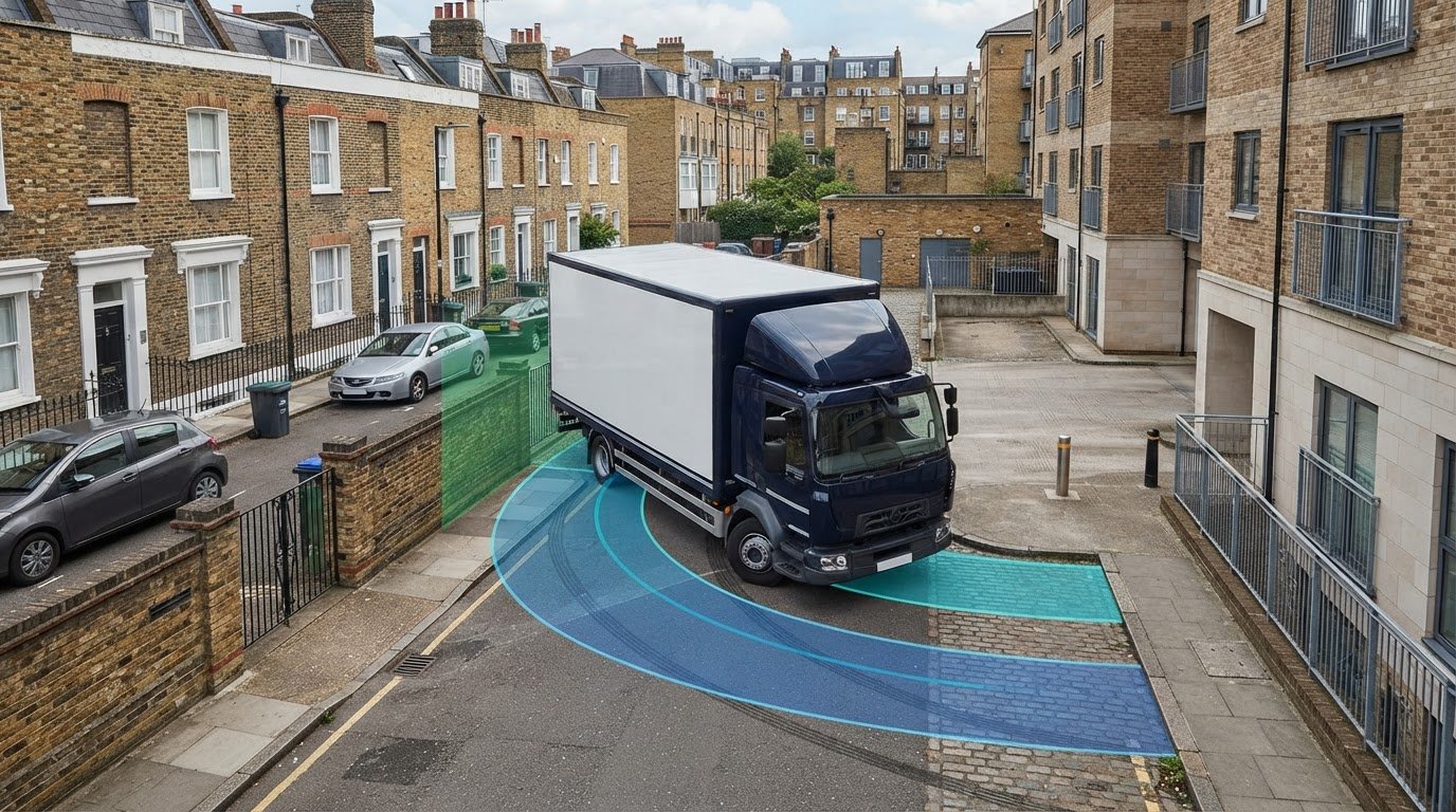
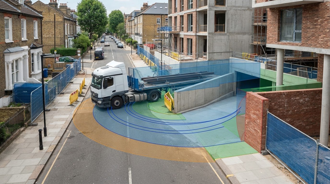
    What if a basement ramp fits on the plan but the vehicle using it cannot make the turn? Swept path analysis for basement construction access tests the vehicle’s full journey, from the approach outside the site through the entrance, down the ramp and around any internal turning area. It models the selected vehicle’s path and swept envelope to identify potential conflicts with walls, columns, corners and other fixed obstacles.

    A tight basement layout can leave little room to address a problem once the design is advanced. The assessment is useful only when it reflects the intended vehicle and accurate project information. This guide explains which parts of the route to test, what drawings and vehicle assumptions to prepare, and how to identify geometric issues early enough to inform design discussions.

    It also explains how a project-specific review can reflect the local planning context and how access findings may support a wider Transport Statement or Transport Assessment. ML Traffic Engineers UK provides Swept Path Analysis for development access feasibility, drawing on senior staff with over 35 years of traffic engineering experience.

    Key Takeaways

    • Distinguish a vehicle’s wheel track from the wider space its body occupies when assessing clearances.
    • Use swept path analysis for basement construction access to test each movement, including entry, ramp descent, positioning and exit.
    • Choose design vehicles to match the movement being assessed, and distinguish construction-phase needs from those of the completed development.
    • Provide coordinated basement drawings and clear vehicle assumptions so the assessment can identify potential conflicts early.
    • A project-specific review can relate access findings to the local planning context and, where relevant, a wider Transport Statement or Transport Assessment.

    Why basement construction access needs a full swept path test

    A ramp can appear wide enough on a plan yet leave a vehicle unable to negotiate the turn at its foot. Swept path analysis for basement construction access assesses whether a defined vehicle can manoeuvre along a proposed route, using the supplied design information. It examines more than whether the vehicle’s wheels stay within the roadway or ramp.

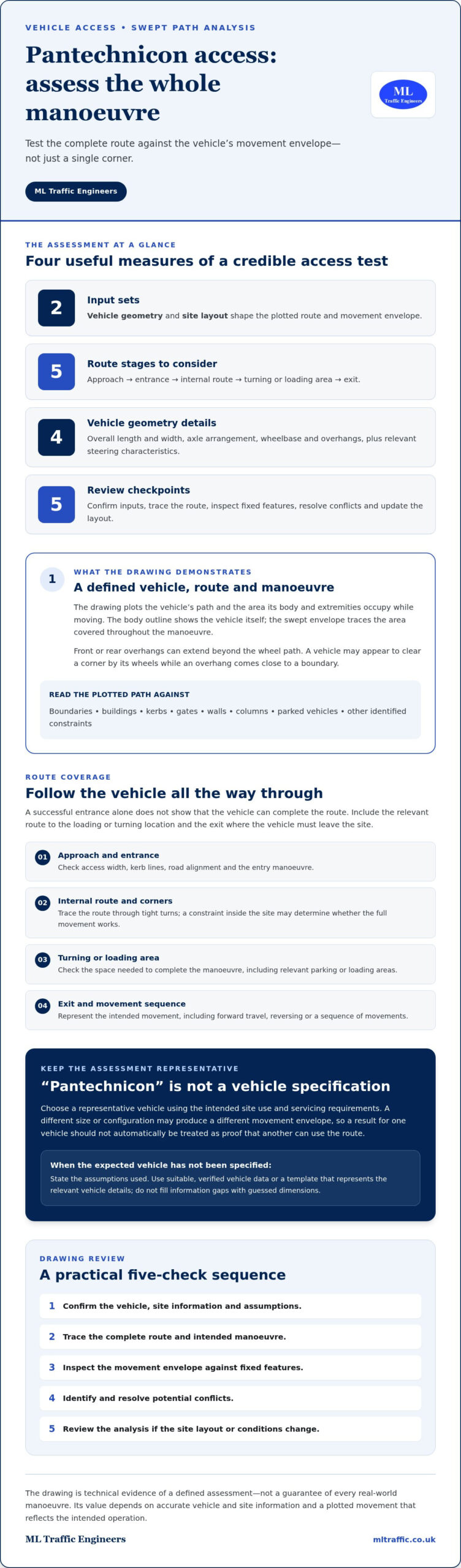
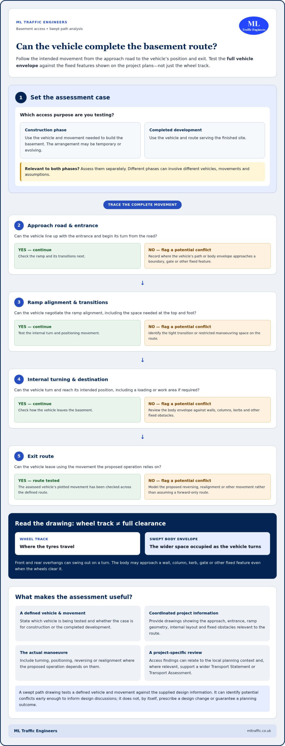
    The wheel track shows where the tyres travel. The vehicle’s body follows a wider envelope because its front and rear overhangs can swing out as it turns. That envelope may approach a wall, column, kerb, gate or other fixed feature even when the wheels clear it. In an enclosed basement, limited headroom, narrow ramps and restricted turning areas can make each part of the movement relevant to the assessment.

    The scope should match the access purpose. Construction-phase access may involve vehicles needed to build the basement, while access for the completed development concerns vehicles serving the finished site. These can involve different movements and vehicle assumptions. If both phases matter, assess them separately rather than treating one vehicle path as evidence that every vehicle can use the route.

    What does a swept path drawing show at basement access?

    A swept path drawing plots the assumed vehicle as it moves through the proposed route, not just at the entrance. Depending on the assessment brief, it can show the approach, entry, ramp descent, turning and exit. The plotted body envelope helps reveal where overhang may approach walls, columns or kerbs. The result tests a defined vehicle and movement against the plans and other design information provided.

    Specialist tools can model vehicle movements. AutoTrack (swept path analysis software) is one example. For a basement, the value lies in applying the assessment to the actual route and its constraints. A line showing wheel movement alone cannot show the full clearance picture.

    Why assess access before the basement design is fixed?

    Early testing can expose a tight turn or potential conflict while the layout is still being developed. The design team can consider the finding before relying on a route that only appears workable in plan. The analysis provides evidence about the vehicle movement assessed. It does not, by itself, prescribe a design change or guarantee a particular planning outcome.

    In basement access design, swept path analysis tests whether an assumed vehicle’s full manoeuvring envelope can follow the proposed route without conflicting with features shown on the plans. The usefulness of that test depends on clear vehicle assumptions and coordinated information, including the entrance, ramp geometry, internal layout and fixed obstacles. A project-specific guide to swept path analysis for planning applications provides related context for understanding how vehicle movements are assessed.

    How construction vehicles move through a basement access route

    A useful route assessment follows the vehicle from the approach road to its intended position, then considers how it leaves. The entrance is only one part of that journey. A vehicle may clear the site boundary but encounter a tight transition at the top of the ramp, need additional space at the ramp foot, or lack room to turn within the basement.

    For swept path analysis for basement construction access, describe the actual movement being tested. Construction-phase vehicles may use a temporary or evolving arrangement, while vehicles serving the completed development may follow a different route or have different dimensions. Treat these as distinct assessment cases where both are relevant. One vehicle’s movement does not establish that another can use the same layout.

    Which parts of the basement route should be tested?

    Set out the route in sequence and identify where the vehicle changes direction, negotiates a transition or needs room to align with its destination. Include the approach road and entrance, ramp alignment and transitions, internal turning area, destination point and exit route where they form part of the project question.

    Review the route against the features shown on the drawings, including boundary walls, columns, kerbs, gates and other fixed obstacles. If a vehicle must enter a loading or work area, assess the movement into that position as well as the route to reach it. Match the level of detail to the access question. Reaching the basement entrance is not necessarily the end of the journey.

    • Approach and entry: Consider how the vehicle lines up with the entrance and begins its turn from the road.
    • Ramp and transition: Examine changes in alignment and the available manoeuvring space at the top and foot of the ramp.
    • Internal movement: Include turning, positioning and exit movements that the proposed operation relies on.

    How do reversing and tight turns affect the assessment?

    Show the manoeuvre as proposed. If the vehicle needs to reverse into or out of a position, model that movement rather than assuming it can travel forwards throughout. A turn may bring the body’s front or rear overhang closer to an obstacle than the wheel track suggests, so review the full vehicle envelope against the available clearances along the route.

    Restricted sightlines or limited space can also make the sequence of movements relevant. For example, a vehicle may need to pause, realign or reverse where the ramp meets an internal turning area. Include these operational details in the brief and drawings when they affect the movement being assessed.

    The assessment demonstrates the defined vehicle movement against the supplied design information. It does not establish that every possible site operation, vehicle or traffic interaction has been tested. A clear route brief helps keep the analysis focused. ML Traffic Engineers UK provides traffic engineering support tailored to the project and its planning context.

    What design vehicle and basement details make the analysis useful?

    A swept path assessment is only as relevant as the vehicle and movement it represents. For swept path analysis for basement construction access, define the access question first: is the test for a vehicle needed during construction, for servicing the completed development, or for both? A vehicle selected for one purpose should not be treated as a stand-in for another with different dimensions or manoeuvring needs.

    Set out the intended vehicle and route with the project team, then provide plans showing the geometry the vehicle must negotiate. Where construction and operational access both matter, identify each as a separate case. This makes the assessment’s scope clear and helps prevent a result for one movement being applied to another.

    How should the design vehicle match the project?

    Select the vehicle to reflect the movement being assessed, using project information rather than an unsupported assumption or generic template. A construction vehicle accessing a work area may have a different purpose and route from a vehicle serving the completed development. Record the relevant vehicle assumptions and manoeuvre for each case so the assessment can test the intended scenario.

    Assessment case Information to define
    Construction phase The vehicle required for the construction-related access question, its approach and route, and the position it needs to reach.
    Completed development The vehicle serving the finished site, the access route it will use, and any internal positioning or exit movement being assessed.

    These categories describe different assessment purposes, not fixed vehicle types. The project brief should identify the actual vehicle assumptions and movements to be tested. If a vehicle or route changes as the design develops, review the assessment basis against the updated information.

    Which basement drawings and constraints should be reviewed?

    Provide a coordinated base plan that makes the full route legible, from the entrance and ramp through internal circulation to the turning area and intended destination. Include dimensions and levels where available, together with the ramp alignment, transitions and relevant approach geometry. Use drawings with a suitable scale and dimensions for assessing the movement, rather than relying on visual estimates from an unclear or incomplete plan.

    Show fixed features that could affect vehicle movement, including walls, columns, kerbs, gates and other obstructions. If a feature is absent from the drawing, it cannot be reliably considered in the plotted assessment. Check that the information describes the same design layout and that key dimensions and levels are consistent across the supplied plans.

    Vehicle assumptions and base-plan accuracy shape what a swept path assessment can show: the result tests the defined vehicle against the geometry represented in the supplied drawings. Clear inputs make the findings more useful for design discussion and keep conclusions tied to the specific movement and layout assessed.

    Swept Path Analysis for UK Basement Construction Access

    Reviewing Basement Access Results and Conflicts

    A swept path drawing is evidence of a defined movement, not a general approval of the whole basement layout. Review it in sequence: establish what has been tested, trace the vehicle envelope through each constrained area, then record any conflicts with the design features shown. This keeps the discussion specific and makes it easier for the project team to identify what needs further attention.

    How should a project team read the swept path output?

    Start by checking the vehicle, direction of travel, manoeuvre and route shown on the drawing. Then follow the plotted envelope through the entrance, along the ramp and around internal obstacles. Compare it with the features shown, not just the wheel track. Keep the result within its scope: a drawing demonstrates the movement modelled against supplied information, not movements, conditions or obstructions it does not represent.

    1. Confirm the assumptions. Verify that the vehicle and movement match the access question, including whether the route is for entry, exit, reversing or internal positioning.
    2. Trace the full manoeuvre. Follow the vehicle from its start point through each change in direction. Do not focus only on the entrance or the tightest-looking turn.
    3. Review the vehicle envelope. Check the body path against entrance edges, ramp boundaries, walls, columns, kerbs, gates and other fixed features represented on the plans.
    4. Note the constrained locations. Record where the envelope approaches or conflicts with a feature, and identify the route segment and movement involved.
    5. Separate findings from assumptions. Distinguish clearances demonstrated on the drawing from details that were not shown or movements outside the assessment scope.

    This sequence helps the team communicate a finding precisely. For example, “the vehicle envelope approaches the column during the turn at the ramp foot” identifies a location and movement for design discussion. It is more useful than a broad statement that the basement access is too tight. The practical AutoTURN swept path analysis guide offers further context on interpreting vehicle movement drawings.

    What can the design team do when a movement conflicts?

    First, identify the exact conflict and the assumptions behind it. The design team can then discuss potential layout revisions, such as changing the route geometry or the arrangement of an obstruction. These are design considerations, not guaranteed solutions. Assess any revision using updated project drawings and agreed vehicle assumptions so the result reflects the design being considered.

    Findings can support access-feasibility discussions and inform planning evidence, but they do not guarantee planning approval. Keep the assessment clear about what was tested and what it demonstrates. For project-specific swept path analysis for basement construction access, discuss your access requirements with ML Traffic Engineers UK.

    How ML Traffic Engineers UK supports basement access assessment

    ML Traffic Engineers UK provides Swept Path Analysis to assess proposed vehicle movements and support development access feasibility. For a basement project, the work focuses on the defined route, vehicle assumptions and design information, providing technical evidence for access discussions. The assessment is tailored to the project and its local planning context, rather than relying on a generic route or vehicle scenario.

    The consultancy takes a hands-on approach to each project. Every senior staff member has over 35 years of traffic engineering experience. ML Traffic Engineers UK works across Greater London, Manchester, Birmingham, the West Midlands, Liverpool, Surrey, East Sussex, West Sussex, Hampshire, Berkshire and Buckinghamshire, where assessments can be tailored to the relevant local planning context.

    What information helps scope a basement access assessment?

    A clear brief helps define what the assessment needs to demonstrate. Set out the access question, vehicle, movement and intended destination, then provide the latest available drawings so the analysis reflects the current proposal. Include relevant dimensions, levels and fixed constraints along the route. ML Traffic Engineers UK tailors its review to the project information and local planning context, keeping the assessment focused on the movement under consideration.

    • Access question: Explain whether the review concerns construction-phase access, the completed development, or both.
    • Vehicle and movement: Identify the vehicle assumptions and whether the proposed manoeuvre involves entry, reversing, turning, positioning or exit.
    • Design information: Supply drawings showing the entrance, ramp, internal route, destination and relevant walls, columns, kerbs, gates or other fixed features.
    • Project context: Note the planning stage and any relevant local access or drawing requirements identified for the project.

    These inputs establish the assessment’s scope and make its findings easier to interpret alongside the proposed design. If the layout or vehicle assumptions change, updated information can inform a further review of the movement.

    What are the next steps for a UK development project?

    First, establish whether the project needs a focused access drawing or whether vehicle access forms part of wider transport planning documentation. A specific basement manoeuvre may call for a targeted assessment. Where a broader review of transport effects is relevant, a guide to Transport Assessments for London development explains the wider planning context. The appropriate scope depends on the project and its planning requirements.

    For a focused review, bring together the access question, vehicle assumptions and current design drawings. ML Traffic Engineers UK can tailor Swept Path Analysis to assess the proposed movements and support development access feasibility, with the findings considered alongside the design and local planning context.

    Discuss your basement access requirements with ML Traffic Engineers UK.

    Set the next design decision in motion

    Make the access question clear while the basement layout is still being developed. Identify the vehicle movement that needs testing and align the assessment with the current design information. If the proposal changes, updated drawings and assumptions help ensure any further review relates to the layout now under consideration.

    Use swept path analysis for basement construction access to inform design discussions, not as a substitute for project-specific planning judgement. Clear evidence of the movement assessed can help the project team focus on the relevant access issue and consider it alongside the wider development proposal.

    ML Traffic Engineers UK takes a hands-on approach, tailoring its assessment to the project and local planning context. Its senior staff each have over 35 years of traffic engineering experience. For support with your proposed basement access, discuss your access requirements with ML Traffic Engineers UK.

    Start with a clearly defined movement and the latest available design information. That gives your team a sound basis for the next design discussion.

    Frequently Asked Questions

    What is swept path analysis for basement construction access?

    It is a technical assessment of how a selected vehicle moves through a proposed basement access layout. The review can test a defined route, such as entering from the site approach, descending a ramp and turning towards a destination. Its conclusions apply to the vehicle and manoeuvre represented, not every vehicle that might use the site. This makes it useful for discussing a specific access question with the design team.

    Can swept path analysis show whether a construction vehicle can enter a basement?

    Yes. It can test whether a defined construction vehicle movement can be accommodated by the access geometry shown in the project information. The brief should describe the intended approach and manoeuvre, such as entering forwards or reversing to reach a work area. The result is evidence about that tested movement. It does not establish how every site operation will be managed or resolve matters beyond the drawing’s scope.

    What information is needed for a basement swept path assessment?

    Provide the current access and basement drawings, the vehicle and movement to be assessed, and relevant dimensions, levels and fixed constraints. Identify the drawing revision and make clear which layout represents the current proposal. If plans show different arrangements, specify which one applies to the assessment. This helps avoid interpreting a result against superseded geometry or assumptions that no longer match the design.

    Does swept path analysis check ramp gradients and headroom?

    Not by itself. A plan-view swept path drawing focuses on vehicle movement across the layout shown; it should not be read as verification of vertical clearance or ramp gradients. For example, a plotted route may indicate that a vehicle can turn in plan without establishing whether its height is compatible with the available clearance. Treat vertical geometry as a separate design consideration, supported by the relevant project information and checks.

    Can swept path analysis test a vehicle reversing into a basement?

    Yes. A reversing manoeuvre can be modelled if it is part of the access question and the route is clearly defined. The assessment brief should identify where the vehicle starts, where it needs to finish and which direction it travels during the manoeuvre. This is useful when the intended position requires a turn or reverse movement. The result applies only to that vehicle and movement, not untested operating arrangements.

    When should basement access be assessed during design?

    Assess it while the access layout is still being developed, when findings can inform design discussion. Timing depends on the stage of the proposal and the drawings available. Local planning context can differ across Greater London, Manchester, Birmingham, the West Midlands, Liverpool, Surrey, East Sussex, West Sussex, Hampshire, Berkshire and Buckinghamshire. If the geometry changes, base any further assessment on the revised design.

    Is a swept path drawing the same as a construction logistics plan?

    No. A swept path drawing illustrates and tests a defined vehicle movement against a proposed layout. A construction logistics plan addresses broader arrangements associated with construction, so one document should not be treated as a substitute for the other. For example, a movement drawing may show whether a vehicle can negotiate a basement entrance, but it does not set out wider site logistics. The project’s planning requirements determine what supporting documents are relevant.

    Michael Lee

    Article by

    Michael Lee

    Transport planner with over 35 years' experience.

    Disclaimer

    The content on mltraffic.co.uk, including all technical articles, guides, and resources, is provided for general informational and educational purposes only. It is not intended to constitute professional advice in traffic engineering, transportation planning, development approvals, or any other technical or legal field.
    While ML Traffic Engineers makes every reasonable effort to ensure the accuracy, completeness, and timeliness of the information published, we do not provide any warranties or representations (express or implied) regarding its reliability, suitability, or availability for any particular purpose. Any reliance you place on the content is strictly at your own risk.
    In no event shall ML Traffic Engineers, its directors, employees, authors, or affiliates be liable for any direct, indirect, incidental, special, consequential, or punitive damages (including, without limitation, loss of profits, data, or business opportunities) arising out of or in connection with the use of, or inability to use, any information provided on this website.
    The articles and guides on this site are not a substitute for engaging a qualified, professional traffic engineer to assess your specific project requirements. For tailored advice, compliance assessments, or traffic engineering services, please contact a competent professional.
    This disclaimer may be updated from time to time without notice. By accessing or using this website, you agree to be bound by the most current version of this disclaimer.

  • Brent Retail Park Transport Assessment: Developer’s Guide

    Brent Retail Park Transport Assessment: Developer’s Guide

    Could a retail park’s transport case be weakened by a report that counts vehicles but misses how shoppers, staff and deliveries move? A transport assessment for retail park in Brent should reflect the proposal and its actual location, not rely on a generic account of traffic. A key early decision is whether the planning application needs a detailed Transport Assessment or a more concise Transport Statement, and what evidence will explain the proposal’s effects.

    This guide explains the factors that shape the assessment scope, from trip patterns, site access and parking to walking, cycling and public transport. It also outlines how the site’s local planning context can inform the evidence, so you can prepare a clear, proportionate submission.

    You’ll find the project information to assemble and the local considerations to investigate before the report is developed. ML Traffic Engineers UK prepares Transport Assessments and Transport Statements tailored to the proposal and local authority context. Its hands-on approach is supported by senior staff who each have over 35 years of traffic engineering experience.

    Key Takeaways

    • Start by identifying how the proposal changes site access, traffic and other movement, rather than judging its transport requirements by the “retail park” label.
    • A transport assessment for retail park in Brent should focus on the proposal’s relevant effects and the site’s specific circumstances.
    • Understand how a detailed Transport Assessment differs from a concise Transport Statement, then consider which best fits the scheme and planning context.
    • Bring together current plans, proposed uses, access details and operational assumptions to support a clear, well-grounded assessment.
    • ML Traffic Engineers UK tailors planning documents to the local context, with over 35 years of traffic engineering experience for every senior staff member.

    When might a Brent retail park proposal need a transport assessment?

    Start by asking what the proposal would change about movement and access. A new retail park, an expansion, a change of use or a substantial alteration to an existing site can each affect travel in different ways. The development’s label alone doesn’t determine the assessment scope. The proposal, the site and the planning context do.

    A Transport Assessment is a project-specific analysis of how a development may affect travel and transport, and how those effects relate to its location and design. It supports a planning application; it isn’t the planning decision itself or a guarantee of approval. A Transport Assessment is required for development of strategic importance that is legally referable to the Mayor of London. For other schemes, Brent Council determines whether a full assessment or a more concise Transport Statement is appropriate, considering the proposal and its likely effects.

    Which retail park changes can affect transport assessment scope?

    Focus on what is changing in practice: proposed floor space and uses, site access, parking arrangements, and how the existing operation may change. A new retail destination could generate different journeys from an extension to an established park. A change of use may alter visitor patterns, while revised access or servicing arrangements can affect how vehicles enter, leave and circulate.

    Customer journeys are only part of the picture. Employees may travel at different times, and servicing and deliveries can involve distinct vehicle types, routes or operating patterns. The evidence required depends on the application and site circumstances. Define the proposed operation clearly rather than assuming a fixed survey or report scope.

    Why does Brent’s local context matter?

    A site’s surroundings help explain where its transport effects may be felt. Examine the streets serving the access, pedestrian routes, public transport connections and nearby destinations that could influence travel patterns. A proposal near Wembley may have a different context from one in Harlesden or Neasden. Use area-specific detail only when it accurately describes the site and its connections.

    Brent’s adopted Local Plan, alongside the London Plan and wider transport policy, provides planning context for proposals. Check the current policy wording and site conditions rather than treating borough-wide assumptions as evidence about a particular location. For background on how a major retail destination connects with its surroundings, see Brent Cross Shopping Centre and its transport considerations. Brent Cross is a separate example, not a substitute for evidence about a site in the London Borough of Brent.

    For a transport assessment for retail park in Brent, set out a clear chain of reasoning: what is proposed, how it changes travel, and which local connections or streets may be affected. Establishing that logic early helps the planning evidence address the actual scheme, without assuming that every retail park needs the same level of analysis.

    What should a retail park transport assessment in Brent examine?

    A useful assessment connects the proposed retail activity to the way people and vehicles will reach, use and leave the site. It should consider access, movement, parking, trip patterns and the effects relevant to the particular scheme. A new store, a change in the mix of retail uses and an expansion can each produce different travel patterns, so analysis should follow the proposal rather than a standard checklist.

    Assessment scope should be proportionate to the proposal, its likely transport effects and the specific context of the site. The UK Government guidance on Transport Assessments and Statements provides a framework for preparing planning-related transport evidence. Use current, relevant information and explain clearly how the conclusions follow from the evidence.

    How should retail trips, access, and junction effects be considered?

    Start with the proposed uses and operating assumptions. Different retail activities can attract different customer patterns, while opening hours, staffing and servicing arrangements shape when and how journeys occur. Explain how the assessment estimates the number and distribution of trips, including likely arrival and departure routes. Avoid treating every visit as a car journey.

    Then distinguish three things: existing transport conditions, forecast movement associated with the proposal, and any mitigation being considered. Review the site access and relevant nearby junctions in light of those forecasts. This helps show where development traffic may interact with existing movement and whether further analysis or a response is relevant. Don’t invent impacts or apply an assumed threshold. The method and focus should reflect the site and the authority’s requirements.

    How do parking, servicing, and sustainable travel fit in?

    Consider parking in relation to the proposed uses, expected demand, site layout and applicable Brent planning context. Stating the number of spaces alone may not explain how parking supports the operation or affects access and surrounding streets. Make the assumptions behind the provision clear, using current policy and site information to assess its suitability.

    Service activity needs its own consideration. Deliveries, refuse collection and other servicing can involve different vehicle movements from customer visits, so their routes, access and interaction with site circulation may be relevant. Describe the operational assumptions used rather than implying that all movements happen in the same way or at the same time.

    Assess walking, cycling and public transport through the connections people can actually use to reach the site. Consider where those routes lead and how the site entrance relates to them. Verify local conditions instead of relying on general statements about Brent’s transport network.

    • Access: explain how vehicles, pedestrians and cyclists reach the site.
    • Movement: set out the basis for trip estimates and route distribution.
    • Parking and servicing: connect provision and operational assumptions to the proposed uses.
    • Mitigation: identify responses only where the assessment establishes a relevant effect.

    This evidence-led approach keeps a transport assessment for retail park in Brent focused and proportionate. ML Traffic Engineers UK tailors Transport Assessments to the proposal and local planning context. Read about transport assessment support from ML Traffic Engineers UK for planning applications.

    Transport Assessment or Transport Statement: which suits a Brent retail park?

    A retail park doesn’t automatically require a full Transport Assessment simply because of its name. The right document depends on what the application proposes, the likely transport effects and the relevant planning context. A new development, a change to an existing site or a revised mix of uses may each call for a different level of analysis.

    In London, a Transport Assessment is required for developments of strategic importance that are legally referable to the Mayor. For other proposals, the local planning authority considers whether a Transport Assessment or Transport Statement is appropriate. The report should provide enough evidence to address the scheme’s relevant effects, without adding analysis that isn’t needed to explain them.

    What distinguishes a Transport Assessment from a Transport Statement?

    A Transport Assessment is the more detailed document. It may examine a wider range of transport effects and provide more in-depth analysis where the proposal and its context call for it. A Transport Statement is more concise, presenting relevant information for a scheme whose transport effects can be addressed at a simpler level.

    There’s no universal floor-space, trip or cost threshold to use as a shortcut. The application, the site and the evidence needed to understand potential effects shape the report type. The London Transport Assessment guide explains the broader distinction and planning context.

    What questions help define a proportionate scope?

    To identify the appropriate level of evidence, work through the proposal and its likely transport implications. Useful questions include:

    • What scale and mix of uses are proposed, and how do they differ from the existing site?
    • Will access arrangements, site circulation or operating patterns change?
    • Which customer, employee or servicing movements could be affected, and where?
    • What reliable site and transport information is already available, and what gaps remain?

    The answers help identify which topics are material, rather than importing a generic report template. For example, a proposal that changes site access may need focused consideration of how vehicles enter and leave. A change in use may make the revised travel pattern central to the assessment. These questions guide the scope; they are not automatic rules for requiring a particular survey or analysis.

    Consider Brent-specific requirements against the current planning context and the circumstances of the site. Early discussion with the relevant planning authority can help establish what evidence it expects for the application. Record the reasoning behind the selected report type and its scope, so the submission shows how the analysis responds to the proposal.

    A proportionate transport assessment for retail park in Brent is neither a generic checklist nor an oversized report. ML Traffic Engineers UK prepares Transport Assessments and concise Transport Statements tailored to the proposal and local authority context, helping applicants develop focused planning evidence.

    Brent Retail Park Transport Assessment: Developer's Guide

    How can applicants prepare transport evidence for a Brent retail park?

    Good preparation starts with a stable description of the proposal and a clear record of what is known, what is assumed and what is still changing. This gives the assessment a reliable basis and keeps its analysis focused on the scheme. Use this sequence to organise the information before developing the transport evidence.

    1. Define the proposal. Set out the site location, proposed uses and scale, and explain whether the application involves a new development, an expansion or changes to an existing operation.
    2. Assemble current plans. Gather site and layout plans showing proposed access points, internal circulation, parking and relevant pedestrian or cycle connections. Make sure the plans reflect the design being assessed.
    3. Describe how the site will operate. Record known assumptions about opening hours, customer activity, staffing, deliveries, servicing and refuse collection. Distinguish confirmed details from estimates or design options.
    4. Set out the transport changes. Identify changes to access, parking or movement patterns, and note which surrounding routes or connections may be relevant to the proposal.
    5. Check the evidence base. Review current planning material and verified information about local streets, public transport, walking and cycling connections. Flag gaps that may affect the assessment scope.

    What project information should be assembled first?

    Start with the development description, drawings and access proposals, then add operational information that can influence travel. This may include the proposed use mix, parking arrangements, delivery assumptions and expected site activity. If the design or operating details are unsettled, identify the options clearly rather than treating a draft assumption as final. That allows the analysis to reflect the proposal being considered and makes later revisions easier to trace.

    Consider how the characteristics of the development affect the transport evidence it needs. The useful question is not simply whether the site is described as retail, but which features of this particular proposal could shape the assessment.

    How should local policy and evidence be checked?

    Check the current wording and status of Brent planning documents and relevant transport guidance before describing a policy requirement in the submission. Then use site-specific information, such as the actual access arrangement and nearby connections, instead of assuming conditions are the same across the borough. Where information has not been verified, mark it as an assumption or identify it as a gap.

    Keep the report narrative organised: explain what the evidence shows, state the assumptions used to interpret it, and distinguish both from any recommendations. This makes the reasoning easier to follow and helps ensure that proposed responses relate to identified issues. A carefully prepared transport assessment for retail park in Brent can clarify the proposal’s transport context, but it cannot guarantee a planning outcome.

    ML Traffic Engineers UK takes a hands-on approach to planning-related transport evidence, tailoring Transport Assessments and concise Transport Statements to the scheme and local authority context. Read about transport assessment support from ML Traffic Engineers UK.

    How ML Traffic Engineers supports retail park assessments in Brent

    A retail park proposal needs transport evidence that reflects its design, use and location. ML Traffic Engineers UK prepares Transport Assessments and concise Transport Statements for planning applications, tailoring the scope to the scheme and the relevant local authority context. The aim is clear, project-specific analysis, not a universal template applied regardless of the site.

    Every senior staff member has over 35 years of traffic engineering experience. The team takes a hands-on approach, considering the proposal and available information to develop transport evidence suited to Brent’s planning context. ML Traffic Engineers UK serves Greater London, Manchester, Birmingham, the West Midlands, Liverpool, Surrey, East Sussex, West Sussex, Hampshire, Berkshire and Buckinghamshire.

    What does a hands-on, locally tailored assessment involve?

    It starts with understanding what the application proposes and which transport questions are relevant to that specific site. The assessment can then focus on the evidence needed to explain the proposal’s transport implications, taking account of applicable local planning considerations and verified site information.

    This matters because two retail schemes can differ in their uses, access arrangements and operation. An analysis tailored to one site may need to address different issues from a report for another location. ML Traffic Engineers UK’s approach keeps the assessment aligned with the project rather than treating a standard checklist as a substitute for professional judgement. Scope and analysis are shaped by the proposal and planning context; a report does not determine the planning decision or guarantee a particular outcome.

    Clear communication is part of a useful assessment. The report should make its evidence and assumptions understandable, explain how they relate to the proposed scheme and identify relevant considerations without overstating what the available information shows. This gives the planning submission a coherent transport narrative to be considered alongside its other material.

    What is the next step for a Brent retail park proposal?

    Bring together the information already available, such as current site plans, the development description, proposed uses and access details. Explain the planning stage and identify operational details that are known, provisional or still being developed. These inputs help shape an initial discussion around the proposal and the appropriate transport evidence.

    Whether the project is at an early design stage or being prepared for submission, ML Traffic Engineers UK provides hands-on support with a Transport Assessment or Transport Statement tailored to the scheme. Its work across Greater London, including Brent, takes account of differences in local authority planning context.

    For a transport assessment for retail park in Brent, begin with the proposal, its planning stage and the information available. This focuses the assessment on the site’s requirements and the evidence needed to support a clear application.

    Explore transport assessment support from ML Traffic Engineers UK.

    Move your Brent retail proposal towards a clear next step

    Transport planning is most useful when it starts early enough to inform the proposal, not just describe it after key design decisions have been made. A well-scoped transport assessment for retail park in Brent can bring transport considerations into the planning process while the scheme is taking shape.

    ML Traffic Engineers UK takes a hands-on approach, tailoring assessment work to the development and local planning context. Every senior staff member brings over 35 years of traffic engineering experience, supporting clear, considered advice as project details develop. The aim is to establish a sound basis for the transport evidence, not to promise a particular planning outcome.

    Share where your proposal stands and what information is available. A focused discussion can help identify a practical direction for the next stage of your planning work.

    Discuss your Brent retail park transport assessment and take the next step with ML Traffic Engineers UK.

    Frequently Asked Questions

    Does every retail park planning application in Brent need a Transport Assessment?

    No, a Transport Assessment isn’t automatically required for every retail park application in Brent. The need depends on the proposal, its likely transport effects and the planning context. For a transport assessment for retail park in Brent, establish whether the application is strategically referable and identify the proportionate evidence for the scheme. This is a decision about the evidence needed, not planning approval: submitting a report doesn’t itself secure permission.

    Can an existing Transport Assessment be reused for a retail park extension?

    It may provide useful background, but review its relevance before using it for an extension application. Check when the data was collected, which development and operating assumptions it examined, and whether the current proposal changes uses, access or servicing. Also consider whether surrounding transport conditions have changed since the report was prepared. Earlier material can inform the new assessment, but shouldn’t be treated as automatically current or sufficient.

    How early should a developer commission a retail park transport assessment?

    Consider transport evidence while the proposal and access arrangements are still being developed. This gives the project team an opportunity to identify movement questions and evidence needs before the design is fixed for submission. The right point depends on the project programme and how much reliable information is available. Early coordination can clarify the assessment scope, but there’s no single lead time that suits every scheme.

    Can a Transport Assessment support a change of use at a Brent retail park?

    Yes, transport evidence can help explain the effects of a proposed change of use. A different use may alter visitor travel patterns, parking demand, servicing activity or access requirements, even if the site boundaries stay the same. The appropriate document and level of analysis depend on the proposed use, site circumstances and planning context. Focus on what changes operationally, rather than assuming every change needs the same report.

    Does a Transport Assessment guarantee planning permission for a retail park?

    No. A Transport Assessment provides technical evidence to help decision-makers understand a proposal’s transport implications; it doesn’t guarantee planning permission. The planning authority considers the application as a whole, including relevant planning matters beyond transport. A clear, evidence-based report can explain the assessment and its assumptions, but the decision rests with the authority after considering the submitted application and applicable planning context.

    Can a retail park Transport Assessment include walking, cycling, and public transport?

    Yes, these modes can be examined where they’re relevant to the proposal and site. The assessment should consider actual routes and connections serving the development, using verified information rather than broad assumptions about accessibility across Brent. The borough’s transport strategy includes accessibility and inclusion objectives, but check current local documents before citing policy wording or drawing conclusions about a particular site.

    What should I send a consultant before discussing a Brent retail park assessment?

    Useful starting information includes a short development description, available site and access plans, the proposed uses, known parking and servicing arrangements, and the current application stage. If drawings are under revision, indicate which version reflects the latest design. These materials aren’t a fixed checklist or a prerequisite for an initial conversation. They help frame the proposal and identify what further transport evidence may be relevant.

    Michael Lee

    Article by

    Michael Lee

    Transport planner with over 35 years' experience.

    Disclaimer

    The content on mltraffic.co.uk, including all technical articles, guides, and resources, is provided for general informational and educational purposes only. It is not intended to constitute professional advice in traffic engineering, transportation planning, development approvals, or any other technical or legal field.
    While ML Traffic Engineers makes every reasonable effort to ensure the accuracy, completeness, and timeliness of the information published, we do not provide any warranties or representations (express or implied) regarding its reliability, suitability, or availability for any particular purpose. Any reliance you place on the content is strictly at your own risk.
    In no event shall ML Traffic Engineers, its directors, employees, authors, or affiliates be liable for any direct, indirect, incidental, special, consequential, or punitive damages (including, without limitation, loss of profits, data, or business opportunities) arising out of or in connection with the use of, or inability to use, any information provided on this website.
    The articles and guides on this site are not a substitute for engaging a qualified, professional traffic engineer to assess your specific project requirements. For tailored advice, compliance assessments, or traffic engineering services, please contact a competent professional.
    This disclaimer may be updated from time to time without notice. By accessing or using this website, you agree to be bound by the most current version of this disclaimer.
  • Swept Path Analysis for Abnormal Loads: UK Project Guide

    Swept Path Analysis for Abnormal Loads: UK Project Guide

    Will the proposed entrance accommodate the actual abnormal-load vehicle, or only the dimensions assumed during early design? For projects involving oversized indivisible loads, that distinction can determine whether a manoeuvre is feasible. Swept path analysis for abnormal load vehicles models movement through a defined route segment or site layout, showing the space the vehicle’s wheels and body may occupy as it turns.

    A drawing can give a clear answer to a specific design question, but only when the vehicle details, manoeuvre and layout are accurate. A swept path envelope can reveal pinch points and potential conflicts. It cannot show conditions that are outside the model or the supplied information.

    This guide explains what the envelope represents, which project information supports a useful assessment, and how to interpret findings when considering access and design changes. ML Traffic Engineers UK provides project-specific Swept Path Analysis, with hands-on technical input from senior staff who each have over 35 years of traffic engineering experience. Projects across Greater London, South-East England, the West Midlands and North-West England can use a vehicle model matched to the proposed movement to inform access decisions.

    Key Takeaways

    • Swept path analysis for abnormal load vehicles tests whether specific manoeuvres fit the geometry shown in a project layout.
    • Off-tracking means front- and rear-wheel paths can differ as a vehicle turns, while the body or load may swing outwards.
    • Compare each relevant manoeuvre, such as turning at an entrance or navigating a junction, against the constraints it tests.
    • Provide the vehicle configuration, load dimensions and current access or site layout to give the assessment a clear basis.
    • Project-specific Swept Path Analysis can inform access feasibility and design decisions when its assumptions match the movement being considered.

    What swept path analysis for abnormal load vehicles can, and cannot, show

    Swept path analysis models the space a specified vehicle occupies while completing a defined manoeuvre. The modelled path is compared with the access or site layout to assess whether the vehicle can negotiate the geometry shown. For an abnormal-load vehicle, this can reveal tight turns, restricted turning areas and potential pinch points before design decisions are made.

    The result is evidence about a particular movement under stated assumptions. It does not prove that every journey condition has been accounted for, that the full route is feasible, or that the movement has the required permissions. Treat the drawing as a focused test of geometry, not as a complete transport or approval assessment.

    What makes abnormal-load vehicle movements different?

    Vehicle length, width, articulation and load overhang all affect the space needed to turn. A long combination may need extra room for its front to swing out, while its rear wheels track inside the front-wheel path. An overhanging load may extend beyond the vehicle body and create a separate clearance concern.

    The model should distinguish the towing vehicle, trailer and load wherever their dimensions affect the envelope. No single set of dimensions represents every abnormal-load movement. A 50.0-metre articulated vehicle, for example, is an illustrative case, not a default project vehicle or a suitable assumption for another site. Use the intended configuration and manoeuvre as the basis for the assessment.

    What does a swept path drawing establish?

    A drawing shows the modelled vehicle path and swept envelope against the supplied layout. Depending on how the vehicle is represented, it can show how wheels track through a turn and how far the body or load extends around it. This helps identify potential conflicts with kerbs, boundaries, islands or other features visible on the drawing.

    The comparison supports a practical access decision: does the modelled movement appear to fit the available geometry, or does it highlight a location that needs design attention? Software such as AutoTrack software for swept path analysis can model vehicle movements, but the output still depends on accurate inputs and assumptions. ML Traffic Engineers UK also explains the role of AutoTURN swept path analysis in project assessments.

    Keep the drawing’s limits in view. It does not assess whether a bridge or road has the structural capacity for the vehicle, establish permit requirements, or confirm that every part of a route is workable. It addresses the manoeuvre represented on the drawing. The vehicle model, load configuration, layout and movement assumptions should therefore match the project decision the assessment is intended to inform.

    How abnormal-load swept path analysis models vehicle movement

    The assessment places a digital vehicle model on the project drawing and simulates a defined manoeuvre, such as entering a site and turning into a delivery area. The modelled path is compared with the available space. This helps show whether the vehicle’s wheels, body and load remain within the intended manoeuvring area or appear to cross a kerb, boundary or other constraint.

    The result depends on more than the vehicle’s overall length. Steering geometry affects how tightly the front wheels can turn, while articulation between a tractor and trailer changes how the units follow each other. Load overhang can extend beyond the trailer, creating a wider or longer envelope than the vehicle alone suggests. A difference in configuration can change where the model shows potential encroachment.

    Which vehicle and load details shape the model?

    Relevant inputs include the towing vehicle, the number and arrangement of trailer units, axle and wheel positions, overall dimensions, articulation points, and the load’s length, width and overhang. A generic model may not represent the planned transport combination, particularly if its trailer arrangement or steering differs. In commercial freight planning, consulting with an experienced logistics operator such as DKN Transport helps secure precise fleet dimensions and trailer configurations. Use vehicle and load specifications from the supplier or operator as project inputs, and verify that they match the intended configuration before modelling.

    How to read the swept path envelope

    Check what each line on the drawing represents. A vehicle centreline indicates the route followed by a reference point, while wheel tracks show where the wheels travel. The body and load envelope represents the space occupied by the vehicle’s outer edges and any relevant overhang. These lines answer different questions: the wheels may clear an obstruction even when the body or load passes close to it.

    Off-tracking is the difference between the paths of the front and rear wheels during a turn. As the front wheels steer around a corner, the rear wheels usually follow a tighter arc and cut closer to the inside. The vehicle’s outer body may also swing outward. At a constrained entrance, this can create potential conflicts on both sides. Inspect the full envelope rather than following only the front-wheel line.

    Simple plan-view schematic, not to scale:

    Site boundary: ┌────────────────────

    Vehicle path: Entry → front-wheel arc around corner

    Rear-wheel track: Tighter inside arc

    Body and load envelope: Outer swept area to compare with the boundary

    Use the drawing as a comparison, not a standalone guarantee. Its reliability depends on accurate vehicle details, site geometry and clearly stated manoeuvre assumptions. Before using it to inform a design decision, check that it represents the relevant layout and turning movement. For project-specific input on manoeuvrability and site access, ML Traffic Engineers UK’s Swept Path Analysis assesses the movement against the supplied design.

    Compare manoeuvres and constraints before accepting an abnormal-load layout

    A layout that works for a straight approach may still fail at the turn into a site. Review the manoeuvres that matter to the proposed movement instead of relying on a single path through the drawing. For each one, link the modelled envelope to a design question: is the entrance wide enough, can the vehicle align in the turning area, or could the trailer or load encroach on a feature shown on the plan?

    The table links common manoeuvres to the geometry they test. Include the movements relevant to the project.

    Manoeuvre Geometry or constraint tested Design question
    Straight access Entrance width, gates, walls and approach alignment Can the vehicle enter without its body or load conflicting with the edges shown?
    Turn into a site Corner radius, kerbs, islands and available turning area Can the vehicle complete the turn without the envelope crossing a constrained feature?
    Junction movement Road width, corner geometry and the position of adjacent boundaries Does the selected turn fit within the layout being assessed?
    Roundabout movement Entry, circulating space and exit geometry Can the vehicle follow the intended route through the roundabout shown?

    Which constraints should the drawing make visible?

    Review the features shown on the supplied layout, including kerbs, site boundaries, islands, gates and nearby structures. Compare each with the full vehicle, wheel and load envelope. If the model overlaps a kerb, that is a geometric conflict to address in the design. It does not establish whether the feature can withstand vehicle loading or whether an operational workaround is appropriate. Those are separate questions requiring their own assessment.

    Also distinguish plan-view clearance from overhead clearance. A swept path drawing can show where a vehicle travels across the mapped layout, but it does not establish clearance beneath a canopy, sign or other overhead feature unless suitable information is used to assess it. A clear path on the plan is not evidence of structural capacity either.

    When does a site manoeuvre differ from a whole-route question?

    Site-access swept path analysis tests specified movements against a defined area on the drawing, such as an entrance and internal turning space. A journey may encounter constraints beyond that boundary, including other junctions, structures or route restrictions. A site-access drawing therefore does not prove that the full route is feasible or provide route permission.

    Use each identified conflict to frame the next project decision: should the layout change, should another manoeuvre be assessed, or does the issue need a separate technical or operational review? This keeps swept path analysis for abnormal load vehicles focused on evidence the drawing can support. For project-specific analysis of vehicle manoeuvrability and site access, ML Traffic Engineers UK provides Swept Path Analysis.

    Swept Path Analysis for Abnormal Loads: UK Project Guide

    Prepare a reliable abnormal-load swept path assessment

    Start with a clear project question: which vehicle movement needs testing, and against which layout? Define the access point or route segment, then identify the manoeuvres that affect the design. Keep the scope specific. A drawing of a site entrance, for example, will not answer whether a separate junction elsewhere on the journey is workable.

    Set the assessment scope and assemble project information

    Bring together the intended vehicle and load configuration, the current site or access layout, and a description of the movement to test. Record which information has been supplied and which details have been verified against the project. This helps reviewers understand the model’s basis and identify assumptions that could affect the result.

    1. Define the movement. Identify the access point or route segment, direction of travel, entry or exit, and each relevant turn or manoeuvre.
    2. Specify the vehicle. Provide the towing vehicle and trailer arrangement, dimensions, articulation details and other configuration information that affects movement.
    3. Describe the load. Include its dimensions and any overhang beyond the vehicle or trailer. Identify which details are confirmed for the planned transport configuration.
    4. Supply the layout. Use the current drawing for the area being assessed, with relevant kerbs, boundaries, gates, islands and other constraints visible.
    5. Record assumptions. State the turning sequence, direction and any constraints included in the model. Separate assumptions from supplied or verified project information.
    6. Review the output. Compare the modelled envelope with the layout and note potential conflicts, drawing limitations and design questions that need attention.

    This process ties swept path analysis for abnormal load vehicles to a defined movement and traceable project inputs. If the vehicle configuration changes or the access layout is revised, the previous drawing may no longer represent the design under consideration. Keep the assessment with the relevant layout and assumptions so the project team can review them together.

    Review findings and communicate design implications

    Check that the drawing clearly identifies the vehicle, movement and layout, and explains the relevant assumptions. For each apparent pinch point, describe its location and the feature involved, then frame the design question: does the entrance geometry need reconsideration, or should another manoeuvre be tested? This presents the evidence without implying that the drawing resolves separate engineering or operational matters.

    For a practical explanation of the modelling approach, see the practical AutoTURN swept path guide. To apply project-specific vehicle details and access layouts, explore ML Traffic Engineers’ Swept Path Analysis, supported by hands-on technical input from senior staff with over 35 years of traffic engineering experience.

    How ML Traffic Engineers supports abnormal-load swept path projects

    For an abnormal-load project, the practical question is whether the specified vehicle can complete the required manoeuvre within the proposed access layout. ML Traffic Engineers provides Swept Path Analysis to examine vehicle manoeuvrability and access feasibility against project drawings. The assessment is tailored to the vehicle, load, layout and movement under consideration, helping project teams understand what the modelled geometry shows before making a design decision.

    A drawing is useful only when its assumptions reflect the intended movement. The analysis connects the vehicle configuration and load dimensions with the relevant entrance, turning area or other site constraint. Findings can identify where the layout may need further consideration, with conclusions kept specific to the information and manoeuvres assessed.

    Apply the analysis to the project’s planning context

    ML Traffic Engineers takes a hands-on approach to each project and considers variations in local planning context. An access arrangement needs to be understood within its site design and local authority context. Every senior staff member has over 35 years of traffic engineering experience, bringing technical perspective to the assessment and its interpretation.

    The drawing can inform discussion of access geometry, but its conclusions remain specific to the supplied vehicle, layout and manoeuvre. Swept Path Analysis does not guarantee planning approval or establish route permission. It gives project teams a focused way to examine manoeuvrability and consider whether the proposed layout accommodates the movement being assessed.

    ML Traffic Engineers supports projects across Greater London, Manchester, Birmingham, the West Midlands, Liverpool, Surrey, East Sussex, West Sussex, Hampshire, Berkshire and Buckinghamshire. This regional coverage enables the assessment to be considered in the context of the project location and its local planning circumstances.

    Take the next step with a project-specific discussion

    Before discussing an assessment, bring together the project location, intended vehicle and trailer configuration, load dimensions, current access layout and manoeuvre to examine. If some details are still assumptions, identify them clearly. This gives the discussion a practical starting point and focuses it on the access question the project needs answered.

    For a tailored assessment of vehicle movement and site-access feasibility, discuss your swept path analysis requirements with ML Traffic Engineers. Share the relevant project information to focus the assessment on the proposed manoeuvre and supplied layout.

    Turn access questions into a clear project decision

    Connect the movement you need to assess with the information that will make the drawing useful: the intended vehicle and load, the relevant access layout, and the manoeuvre under consideration. This gives the project team a clear basis for discussing what the model can demonstrate and where further design attention may be needed. Swept path analysis for abnormal load vehicles is most useful when its assumptions reflect the movement the project is planning.

    ML Traffic Engineers brings a hands-on approach to each assessment, with attention to local planning context. Every senior staff member has over 35 years of traffic engineering experience. That experience supports considered technical input, while keeping findings tied to the supplied project details rather than implying a particular approval or route outcome.

    Have an access question to resolve? Discuss your swept path analysis requirements with ML Traffic Engineers and take a considered next step for your project.

    Frequently Asked Questions

    Can swept path analysis guarantee that an abnormal-load vehicle can complete its journey?

    No. The assessment applies to the vehicle, layout and manoeuvres represented in the model, so it cannot guarantee passage through every journey condition. Temporary obstructions or a changed delivery configuration, for example, may differ from the drawing’s assumptions. Use the result to inform the specific design decision it tests, and treat wider route feasibility and permission as separate matters.

    Does a swept path analysis assess bridge strength or road loading capacity?

    No. Swept path analysis examines vehicle movement, not whether a bridge, road or other structure can carry the vehicle’s load. A model showing a vehicle passing over a bridge on plan is not evidence of structural capacity. Keep that question separate and use the relevant project documentation and technical assessment for the structure. The swept path drawing should state its scope clearly, without implying a structural conclusion.

    Can one swept path drawing be used for different abnormal-load vehicles?

    Only if the drawing’s vehicle model and manoeuvre assumptions represent each vehicle being considered. Two combinations carrying the same load, for example, may have different trailer arrangements or steering characteristics. Compare the specifications, not just the overall length. If a vehicle’s dimensions, articulation or overhang differ, assess whether the existing model still represents it before using the drawing to inform access arrangements.

    Does swept path analysis include overhead clearance?

    Not automatically. A plan-view drawing shows horizontal movement, so it cannot establish clearance beneath a canopy, sign or bridge simply because the vehicle envelope fits on the plan. Height assessment requires suitable vertical information and a scope that addresses clearance. If overhead features could affect the movement, identify them separately and make sure the project review considers relevant heights rather than inferring clearance from a horizontal tracking result.

    Can a swept path assessment model a vehicle reversing?

    Yes, if reversing is defined as a movement and the model reflects the intended vehicle configuration and sequence. A site may require a vehicle to reverse from an entrance into a turning area, for example, which differs from entering forwards and turning. The drawing should make the direction and stages clear. Do not assume a forward movement demonstrates reverse access too; specify each movement the design needs to examine.

    Is swept path analysis the same as an abnormal-load permit?

    No. Swept path analysis assesses a specified vehicle movement; the drawing does not grant route permission. Keep these workstreams distinct in project records. Requirements and planning context can vary by location, including across Greater London, Manchester, Birmingham, the West Midlands, Liverpool, Surrey, East Sussex, West Sussex, Hampshire, Berkshire and Buckinghamshire. Consult the relevant UK authority for current requirements before making regulatory decisions.

    Can swept path analysis identify a problem at a roundabout?

    Yes, if the roundabout and intended vehicle movement are included in the model. An assessment might examine whether the vehicle’s envelope conflicts with an island during a specified turn, for example. Be precise about which entry, circulating movement or exit the drawing covers. Swept path analysis for abnormal load vehicles can help identify a geometric issue at that location, but it does not assess every approach or onward route condition.

    Michael Lee

    Article by

    Michael Lee

    Transport planner with over 35 years' experience.

    Disclaimer

    The content on mltraffic.co.uk, including all technical articles, guides, and resources, is provided for general informational and educational purposes only. It is not intended to constitute professional advice in traffic engineering, transportation planning, development approvals, or any other technical or legal field.
    While ML Traffic Engineers makes every reasonable effort to ensure the accuracy, completeness, and timeliness of the information published, we do not provide any warranties or representations (express or implied) regarding its reliability, suitability, or availability for any particular purpose. Any reliance you place on the content is strictly at your own risk.
    In no event shall ML Traffic Engineers, its directors, employees, authors, or affiliates be liable for any direct, indirect, incidental, special, consequential, or punitive damages (including, without limitation, loss of profits, data, or business opportunities) arising out of or in connection with the use of, or inability to use, any information provided on this website.
    The articles and guides on this site are not a substitute for engaging a qualified, professional traffic engineer to assess your specific project requirements. For tailored advice, compliance assessments, or traffic engineering services, please contact a competent professional.
    This disclaimer may be updated from time to time without notice. By accessing or using this website, you agree to be bound by the most current version of this disclaimer.
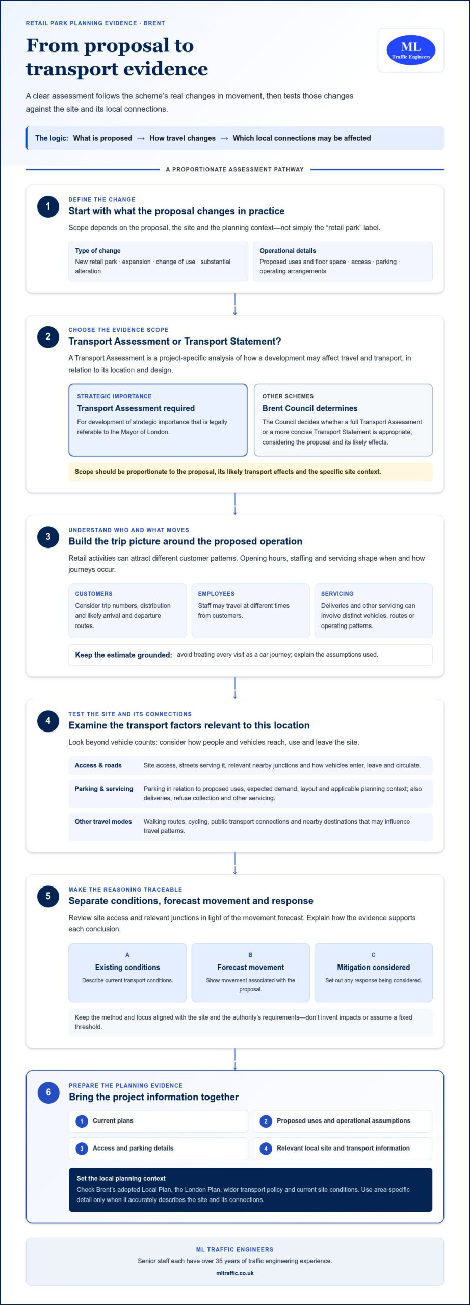
  • Swept Path Analysis: UK Delivery Vehicle Turning Circles

    Swept Path Analysis: UK Delivery Vehicle Turning Circles

    Will a delivery vehicle that can turn on paper actually fit through your proposed access? Swept path analysis for delivery vehicle turning circles answers a more site-specific question than turning-circle data alone: whether the selected vehicle can complete the required manoeuvre without its body encroaching on kerbs, buildings or pedestrian space.

    It’s easy to focus on a vehicle’s turning circle when planning access. That figure describes turning capability under stated conditions, but it doesn’t show the full area the vehicle occupies while entering, turning or leaving a site. This difference matters where roads are narrow, corners are tight, or space is shared with pedestrians and other vehicles.

    This article explains how turning-circle information differs from a swept path assessment, how to select a suitable design vehicle, and which manoeuvres and layout constraints to consider. It also explains how a project-specific assessment can present delivery access clearly for planning consideration. ML Traffic Engineers UK provides Swept Path Analysis tailored to the site and local planning context, drawing on senior traffic engineering experience to help identify access issues early.

    Key Takeaways

    • Use turning-circle data as a starting point, then assess the vehicle’s full movement against the site layout.
    • Consider vehicle length, width, wheelbase and steering characteristics when reviewing rear-wheel tracking and body swing at tight corners.
    • Select a design vehicle and manoeuvre that reflect the delivery movements the development needs to accommodate.
    • When reviewing a tracking drawing, check that the base plan, vehicle model, route and manoeuvre match the project brief.
    • Project-specific swept path analysis for delivery vehicle turning circles can help the design team identify access constraints in context.

    What does a delivery vehicle turning circle show, and what does it leave out?

    A turning circle describes the space a vehicle needs to change direction under stated test conditions. Swept path analysis models a vehicle’s movement through a particular manoeuvre on a drawn layout, showing where its wheels and body travel in relation to surrounding features. For delivery access, swept path analysis for delivery vehicle turning circles uses turning-circle information as a starting point, then tests whether the proposed route works in practice.

    A turning-circle figure describes vehicle geometry, not every constraint on a development site. Its meaning depends on the vehicle and how the figure is measured or presented. It may refer to a kerb-to-kerb turning circle, based on the path of the wheels, or a wall-to-wall circle, which accounts for the vehicle body. The figure alone doesn’t show whether a vehicle can negotiate a site entrance, avoid an obstruction or complete a turn without encroaching on adjacent space.

    For a visual introduction to vehicle movement and tracking, watch this educational video:

    What information does a turning-circle figure provide?

    A turning-circle measurement indicates how tightly a vehicle can turn under the conditions used to establish the measurement. It helps describe the vehicle’s turning capability, but it isn’t a drawing of a proposed access route. Two figures for the same vehicle can also describe different limits if one records the wheel path and the other includes the bodywork.

    That distinction matters in a constrained layout. A vehicle might have a turning circle that appears suitable, yet still need more room at the entrance because of its approach angle, a gate position or its direction of travel. Treat the figure as vehicle data to interpret, not proof that the access works.

    Why is a swept path different from a turning circle?

    Vehicle tracking plots movement across a specific plan, from an agreed starting point through the manoeuvre and, where relevant, out again. It can show the front wheels taking a wider line while the rear wheels cut closer to the inside of a turn. The body may also swing beyond the wheel paths, particularly at the front or rear, so checking wheel tracks alone can miss potential conflicts.

    The assessment depends on both the vehicle model and the site geometry. It can help reveal whether the tracked movement conflicts with kerbs, buildings, parking spaces or areas used by pedestrians. The AutoTrack Wikipedia page provides general background on vehicle tracking software and its use in transport design. For more detail on preparing and interpreting tracking drawings, see this practical AutoTURN swept path guide.

    Turning-circle data describes a vehicle’s turning capability; a site-specific swept path tests whether its complete movement fits the proposed layout. That is the key distinction when assessing delivery access.

    How delivery vehicle geometry shapes a turning manoeuvre

    A vehicle’s turning performance depends on several dimensions working together. Overall length, width, wheelbase and steering geometry affect how much room it needs and where its wheels and body travel during a turn. A delivery vehicle may enter comfortably but still struggle to turn within the site or leave without crossing a kerb or entering a pedestrian area.

    Assess the vehicle expected to serve the development, not a convenient substitute. A layout tested for a smaller van may not demonstrate that a longer or wider delivery vehicle can make the same movement. In swept path analysis for delivery vehicle turning circles, the chosen vehicle model and manoeuvre need to reflect the delivery operation the access is intended to accommodate.

    Which vehicle dimensions matter for delivery access?

    Overall length affects how much space a vehicle needs to clear an entrance and complete a turn. Width influences clearance alongside walls, parked vehicles and other boundaries. Wheelbase, the distance between the axles, affects how closely the rear wheels follow the front wheels around a corner. Steering geometry also shapes how sharply the vehicle can turn.

    These factors interact. For example, a longer vehicle negotiating a tight entrance may need a wider approach before turning in. Its front wheels can take a broad line while the rear wheels track closer to the inside edge. The body may also swing out, bringing a front or rear corner nearer to an obstacle than the wheel paths suggest.

    How do site constraints change the manoeuvre?

    Vehicle geometry is only one part of the assessment. The available access width, boundary positions and internal layout determine how the vehicle can use its turning capability. Test the movement as a sequence: approach, entry, travel through the site, turn and exit. A vehicle that can complete a turn in an open area may not manage the same movement when an entrance is narrow or the route bends around a building.

    On the drawing, identify features that could limit clearance or shape the driver’s route:

    • Kerbs and walls can restrict the inside of a turn or reduce the usable width of an access.
    • Parked vehicles can narrow a route and limit the space available to line up for a turn.
    • Pedestrian areas need consideration alongside the vehicle’s tracked route, particularly where the manoeuvre passes near footways or shared spaces.
    • Entrances and boundaries can affect the approach angle and the space needed for the vehicle to enter or leave.

    The relevant constraints depend on the site plan and the movement being tested. A vehicle’s steering capability can’t be assessed in isolation from the route available to use it.

    Turning performance depends on the vehicle and the layout together: change either one, and the space needed for the manoeuvre can change. A project-specific tracking assessment brings those factors into view, helping the design team review constrained access in context. For support with delivery access planning, explore ML Traffic Engineers UK transport planning services.

    Which delivery vehicle and turning scenario should the assessment test?

    The design vehicle should represent the delivery activity the development is intended to accommodate. A tracking drawing based on a vehicle that is smaller or easier to manoeuvre than the expected delivery vehicle may not answer the access question that matters. Match the vehicle model to the proposed use and specify the movement being tested.

    The table below summarises how broad vehicle categories can create different tracking demands. These are selection prompts, not fixed specifications: actual dimensions and manoeuvring characteristics depend on the vehicle chosen.

    Vehicle type Characteristics to consider Manoeuvre demands to assess
    Rigid delivery vehicle A single rigid vehicle body; length, width and steering characteristics vary by model. Entry alignment, turning within the site and clearance around the vehicle body.
    Articulated vehicle A tractor unit and trailer move in relation to each other, affecting the path through a turn. Approach space, articulation through corners, internal circulation and room to depart.
    Van or other project-relevant vehicle Vehicle size and configuration should reflect the servicing activity, rather than an assumed standard model. Access width, turning space and whether the vehicle can reach the intended loading or servicing area.

    How should the design vehicle reflect site use?

    Start with the development’s intended use and the delivery arrangements it needs to support. A site expecting routine stock deliveries may need a different design vehicle from one receiving occasional smaller consignments. State the basis for the choice, including the vehicle type and relevant assumptions, so the assessment can be understood in context. These assumptions describe the scenario tested; they aren’t universal requirements for every site.

    Where more than one vehicle type is relevant, assess the movements that matter to the proposal rather than assuming one model represents every delivery. Traffic engineering input can help relate the vehicle choice to the site layout and local planning context.

    Which manoeuvres should the drawing examine?

    Define the route as a sequence, from arrival to departure. Depending on the layout, this may include approach and entry, circulation within the site, access to a loading area shown on the plan, and the exit movement. If the vehicle needs to reverse, include that movement where it forms part of the proposed arrangement. Don’t imply the drawing tests reversing if it only shows a forward route.

    Make the drawing’s scope clear. Identify the vehicle model, starting position, direction of travel and movements included. For example, a plan showing entry and a turn towards a loading area doesn’t necessarily demonstrate that the vehicle can also leave the site. A well-scoped swept path analysis for delivery vehicle turning circles tests a defined vehicle against a defined access question.

    Choose the design vehicle to match the delivery activity, then test the manoeuvre the layout must accommodate. That keeps the assessment focused and makes its assumptions and limits clear to the project team.

    Swept Path Analysis: UK Delivery Vehicle Turning Circles

    How to review a delivery vehicle swept path drawing

    A swept path drawing is useful only if it tests the right vehicle on the right layout, using the movement the project needs to accommodate. Review it against the project brief and proposed site plan, not as a standalone graphic. The sequence below helps identify mismatches and potential conflicts before the drawing informs design or planning discussions.

    What should the drawing and project inputs show?

    Start with the base plan. It should represent the proposed access and internal arrangement being assessed, including the relevant boundaries and site features. If the layout has changed since the tracking was prepared, check whether the drawing still reflects the current proposal. A movement plotted against an earlier arrangement may not demonstrate access under the latest design.

    Then follow this review sequence:

    1. Confirm the base layout. Compare the entrance, internal route, turning area and relevant site features with the project plan. Look for differences that could affect usable space or the vehicle’s route.
    2. Identify the design vehicle. Check that the vehicle model or type matches the delivery activity described in the brief. If the vehicle is unclear, it’s difficult to relate the result to the intended use.
    3. Check the movement and direction. Trace the route from its starting point through the site. Confirm whether the drawing shows arrival, entry, circulation, access to the relevant area and departure, as required by the assessment brief.
    4. Read the assumptions and scope. Note any stated assumptions about the route or manoeuvre. Identify information that is missing or unclear, without assuming that every project or planning authority requires the same drawing format.
    5. Compare the result with the brief. Check that the vehicle, route and manoeuvre shown answer the access question the project set out to assess.

    This review makes the scope visible. A drawing that illustrates entry and turning, for example, doesn’t necessarily show how the vehicle leaves the site. The practical swept path analysis guide explains how tracking drawings can support planning applications.

    How can the drawing reveal a layout conflict?

    Follow the vehicle through each stage of the manoeuvre and look for overlap between its tracked path and fixed or potentially occupied areas. Check kerbs, buildings, site boundaries, parking spaces and pedestrian areas. Consider the full vehicle envelope represented in the drawing, not just the path of its wheels. A tight corner may appear clear at one stage while the body or rear tracking conflicts elsewhere on the turn.

    Check that the movement completes the stated task. Does it reach the intended access or loading area? Is the departure shown, and does the vehicle follow the route described in the brief? If the drawing tests only part of the journey, record that limit clearly.

    Describe any concern precisely: identify the manoeuvre, the location and the feature affected. For instance, note that the tracked vehicle overlaps a parking space while turning into the internal route. This gives the design team a clear point to consider when reviewing the layout, without presuming a particular design response.

    For a project-specific review of delivery access, see ML Traffic Engineers UK’s Swept Path Analysis service.

    When project-specific swept path analysis supports delivery access planning

    A delivery access question becomes specific as soon as a vehicle must negotiate a particular entrance, internal route or turning area. Project-specific swept path analysis tests the intended vehicle movement against the development layout, helping the design team see where space is constrained and what the drawing does, or doesn’t, demonstrate. This is especially useful where a tight access, nearby boundary or internal corner could affect the proposed route.

    The assessment relates to the vehicle, layout and manoeuvre being considered. It can help clarify whether a delivery vehicle can arrive, reach the intended area and depart using the route shown. The result gives the project team a defined movement to discuss and a clearer basis for reviewing the access arrangement.

    How does the analysis support a planning submission?

    A swept path drawing can communicate the vehicle and movement assessed by showing the tracked route in relation to the site plan. Clear scope helps readers understand which parts of the journey the drawing demonstrates and how the movement relates to the proposed layout. It can support consideration of delivery access as part of a wider planning submission where relevant to the project.

    Not every proposal needs the same supporting documents. Where a project also requires wider transport assessment, the delivery movement can be considered alongside other transport matters. The Transport Assessment London guide provides related context on transport planning for development proposals.

    What does project-specific traffic engineering input add?

    Project-specific input brings the actual vehicle, proposed layout and relevant planning context together. This matters when access is constrained or when the drawing needs to communicate a precise movement clearly. Local planning considerations can vary, so an assessment tailored to the project location helps the team present the proposed delivery route in context rather than relying on a generic turning assumption.

    ML Traffic Engineers UK provides Swept Path Analysis and transport planning documentation for development projects in Greater London, Manchester, Birmingham, the West Midlands, Liverpool, Surrey, East Sussex, West Sussex, Hampshire, Berkshire and Buckinghamshire. Every senior staff member has over 35 years of traffic engineering experience, supporting careful review of vehicle movements and site layouts. The primary keyword, swept path analysis for delivery vehicle turning circles, captures the distinction: turning-circle information informs the assessment, while project-specific tracking tests a defined manoeuvre against the site.

    Early assessment can make access constraints clearer while the layout is being considered. It gives the design team a practical opportunity to understand what the proposed movement shows and where further layout review may be useful, without implying a guaranteed planning outcome.

    For a project-specific assessment of delivery access, explore Swept Path Analysis with ML Traffic Engineers UK.

    Make delivery access part of the next design decision

    Use the access assessment as a live design reference, not a drawing that sits apart from evolving plans. As the site layout develops, keep the intended delivery vehicle and movement assumptions visible to the project team. If an entrance, boundary or internal arrangement changes, revisit the tracking so it still reflects the proposal being progressed. This keeps the purpose of swept path analysis for delivery vehicle turning circles clear through design development and planning consideration.

    A useful next step is to bring the access plan and delivery movement into the same conversation. That gives the team a practical basis for considering constraints early and deciding whether the layout needs further review. ML Traffic Engineers provides project-specific Swept Path Analysis, with assessments tailored to the local planning context and senior staff who each have over 35 years of traffic engineering experience.

    Discuss your delivery access assessment with ML Traffic Engineers and take the next step with a clearer basis for planning your site access.

    Frequently Asked Questions

    Is a delivery vehicle turning circle the same as swept path analysis?

    No. A turning circle describes a vehicle’s turning geometry under specified measurement conditions, while swept path analysis models its movement along a particular route. For a development access, the analysis relates the vehicle’s track to the site plan. A circle figure by itself can’t show whether the vehicle can complete the proposed route. When reviewing drawings, check what the stated turning figure measures before comparing it with the layout.

    Can a delivery vehicle turn within a site if its turning circle fits the access?

    Not necessarily. An access width or turning-circle comparison alone doesn’t establish that the whole manoeuvre is feasible. The outcome can also depend on the vehicle’s starting position, its angle of entry, the route through the site and nearby features such as a gate or parked cars. Assess the intended movement against the site plan, including the approach and departure, rather than relying on one dimension.

    How is a delivery vehicle swept path assessed?

    The assessment starts by defining the vehicle and the movement the project needs to examine. The vehicle is then tracked against the relevant site layout, and the plotted route is reviewed for potential conflicts with site features. For example, the brief might ask whether a delivery vehicle can enter and reach a servicing area. The drawing should identify the vehicle and movement assumptions so readers can understand the scope of the result.

    What information is needed for a delivery vehicle swept path analysis?

    Typically, the assessment needs a layout showing the access and relevant internal arrangement, the vehicle to be tested and a clear description of the manoeuvre. The project brief can help define whether the drawing should examine arrival, circulation, access to a loading area or departure. Changes to the plan or delivery assumptions can affect the assessment, so align the inputs with the current proposal rather than relying on an outdated layout.

    Does a turning-circle drawing prove that delivery access is suitable?

    No. A turning-circle drawing can indicate turning capability, but it doesn’t by itself demonstrate that the proposed site movement fits the available space. Suitability depends on the vehicle’s route and the layout features around it. A swept path drawing relates the movement to those features, giving the project team a clearer basis for reviewing access. It can inform planning consideration, but it doesn’t guarantee a planning decision.

    Which delivery vehicle should be used for swept path analysis?

    Choose a design vehicle that reflects the delivery activity the development is intended to accommodate. A site receiving routine larger deliveries may need a different assessment vehicle from one served by smaller vehicles; the relevant choice depends on the proposed use and servicing arrangements. Record the vehicle and assumptions clearly. ML Traffic Engineers provides project-specific Swept Path Analysis in Greater London, Manchester, Birmingham, the West Midlands, Liverpool, Surrey, East Sussex, West Sussex, Hampshire, Berkshire and Buckinghamshire.

    Michael Lee

    Article by

    Michael Lee

    Transport planner with over 35 years' experience.

    Disclaimer

    The content on mltraffic.co.uk, including all technical articles, guides, and resources, is provided for general informational and educational purposes only. It is not intended to constitute professional advice in traffic engineering, transportation planning, development approvals, or any other technical or legal field.
    While ML Traffic Engineers makes every reasonable effort to ensure the accuracy, completeness, and timeliness of the information published, we do not provide any warranties or representations (express or implied) regarding its reliability, suitability, or availability for any particular purpose. Any reliance you place on the content is strictly at your own risk.
    In no event shall ML Traffic Engineers, its directors, employees, authors, or affiliates be liable for any direct, indirect, incidental, special, consequential, or punitive damages (including, without limitation, loss of profits, data, or business opportunities) arising out of or in connection with the use of, or inability to use, any information provided on this website.
    The articles and guides on this site are not a substitute for engaging a qualified, professional traffic engineer to assess your specific project requirements. For tailored advice, compliance assessments, or traffic engineering services, please contact a competent professional.
    This disclaimer may be updated from time to time without notice. By accessing or using this website, you agree to be bound by the most current version of this disclaimer.
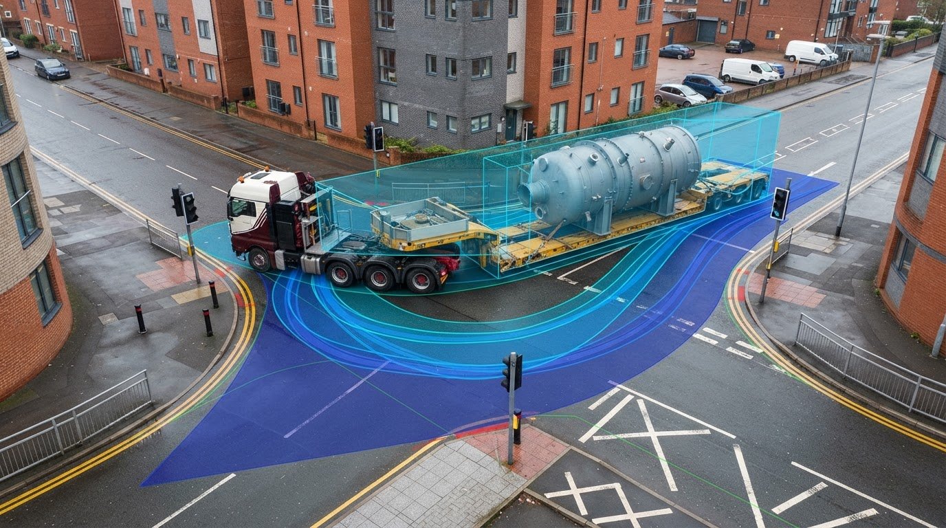
  • What Is a Cycle Audit and Review? A UK Guide for 2026

    What Is a Cycle Audit and Review? A UK Guide for 2026

    Is a cycle audit simply a road safety audit with a different name, or a review of how well a route works for people on bikes? If you’re searching for what is a cycle audit and review, the terminology can be confusing, especially when “audit cycle” also appears in clinical and financial contexts.

    In transport planning, a cycle audit examines cycling infrastructure and conditions against relevant design principles and guidance. It can consider whether a route is safe, direct, comfortable and coherent, including how it connects at junctions and crossings. That is broader than checking collision risks alone, and it is not the same as a Transport Assessment, which considers a development’s wider transport impacts.

    This guide explains the purpose and typical scope of a cycle audit and review, what evidence can make its findings useful, and how it differs from a Road Safety Audit and other assessments. It also explains how cycling observations can inform development planning and contribute to a Transport Statement or Transport Assessment without being mistaken for either.

    Key Takeaways

    • Understanding what is a cycle audit and review helps clarify how a cycling-focused assessment can identify route issues and opportunities.
    • Assess a route in context by considering its users, nearby land uses and scheme objectives, alongside relevant observations, plans and data.
    • Distinguish a cycle review from a Road Safety Audit and Transport Assessment by comparing each assessment’s purpose and scope.
    • Set a clear review question, boundary and decision context before choosing evidence and an approach suited to the project.
    • Use relevant cycling findings to inform design discussions and wider transport planning, with the development and local authority context in view.

    What Is a Cycle Audit and Review, and What Is It For?

    A cycle audit and review is a cycling-focused assessment of an existing route, its conditions or proposed infrastructure. It examines how people can access and use the route, where the design or connections may create difficulties, and what could make cycling more practical. The findings inform decisions about a route or scheme. They are not a one-size-fits-all pass or fail result.

    If you’re asking what is a cycle audit and review, the key point is that its scope depends on the project, the question being examined and the relevant guidance. A review of a proposed access road, for example, may focus on its effect on nearby cycle connections. A route review may instead look at continuity and the experience along its length. In England, LTN 1/20 provides guidance on cycle infrastructure design; other UK nations have their own guidance.

    The transport meaning is distinct from clinical and financial audit cycles. A Clinical audit concerns healthcare practice, while a financial audit examines accounts.

    What does a cycle audit and review examine?

    The assessment can consider whether a route is continuous and easy to follow, whether people can reach it from nearby destinations, and how junctions, crossings or changes in provision affect the journey. It may also consider how the route works for different people cycling, including those who may need more space or a less stressful environment. The relevant questions depend on the scheme, rather than a single checklist applied to every project.

    Both current conditions and proposed changes can be reviewed. Site observations may reveal features that drawings alone do not show, such as a confusing transition or difficult connection. Plans and available data help reviewers understand the intended layout, network connections and scheme objectives. Together, these sources provide a fuller picture of how cycling fits into the route or proposal.

    Why might a development or highway scheme need one?

    For a development, cycling considerations can help explain how the site connects with surrounding routes and whether the proposed access arrangements support cycling. For a highway scheme, a review can bring potential effects on existing cycle movements into design discussions. These findings help decision-makers consider how proposed changes respond to local conditions and project objectives.

    Timing matters. Considering cycling while proposals are still being developed can bring design issues into view before the layout is finalised, when alternatives may still be discussed. A review can also provide context for wider transport planning, including a Transport Statement or Transport Assessment where appropriate. It informs decisions; it does not guarantee planning approval, funding or a particular design outcome. The final decision depends on the full proposal and applicable planning context.

    What Does a Cycle Audit Review? Routes, Users, and Design Context

    A useful review starts with the route and the reason for examining it. It considers how the route functions within its surroundings, who may use it, and what the development or highway scheme is intended to achieve. That context keeps the review focused on relevant issues rather than applying a generic checklist without regard to the project.

    Reviewers may consider continuity, directness, comfort, accessibility and legibility. These are useful aspects to investigate, not a universal test or standard for every project. Applicable guidance depends on the location and scheme. In England, Department for Transport guidance such as Local Transport Note 1/20 may be relevant to cycle infrastructure design. The review should use guidance appropriate to its purpose and location.

    How route conditions and connections shape the review

    Assessing a route in isolation can miss problems at its edges. A path may appear usable along one stretch yet connect poorly to a nearby crossing, local destination or neighbouring route. Consider how people reach the route and where they can go next, including links to public transport or other existing transport connections where relevant.

    At key points, the review may examine barriers, crossing locations, junction arrangements and transitions between different types of cycling provision. For example, a proposed development access could affect how people cycling move past an entrance or continue towards a nearby route. Plans show the intended layout and connections; site observations help relate those features to actual surroundings. Neither source answers every question on its own.

    The scheme’s objectives also matter. A review focused on access to a new site may ask different questions from one examining changes to an established route. Define the review area and its connections to identify whether an issue is specific to one feature or affects the wider journey.

    Whose cycling experience should be considered?

    People cycle for different reasons and have varied ages, abilities and levels of confidence. A route that feels straightforward to an experienced commuter may present challenges for a less confident rider, a child, or someone using a cycle that needs more space. Considering inclusive access means examining how conditions may affect different users, rather than assuming one design or experience suits everyone equally.

    Ground those judgements in evidence. Site observations can record changes in provision, restricted access or places where a route’s direction is unclear. Plans and project information help assess how the proposal is expected to function and which destinations it serves. Where evidence is limited, distinguish observed conditions from assumptions rather than presenting an unverified user pattern as fact.

    For development proposals, cycling observations can sit alongside wider transport planning. A transport planning assessment can consider how site access and the surrounding transport context relate to the scheme, with its scope shaped by the planning context.

    Cycle Audit and Review vs Road Safety Audit and Transport Assessment

    These terms describe different kinds of work, even when they relate to the same development or highway scheme. A cycle audit and review focuses on cycling conditions or the implications of a proposal for people cycling. A Road Safety Audit has a distinct road-safety remit, while a Transport Assessment considers a development’s wider transport effects. The name alone does not determine scope: the project question and applicable requirements matter.

    Assessment Purpose and typical focus Planning context
    Cycle audit and review Examines cycling conditions, route function or how a scheme may affect cycling. Can inform consideration of a route or proposed development or highway scheme.
    Road Safety Audit Considers road safety implications associated with a highway scheme. May be required or commissioned within a scheme’s design and delivery process, depending on its context.
    Transport Assessment Considers the transport effects of a proposed development, with scope shaped by the project. Supports planning decisions by addressing relevant transport matters.

    How a cycle review differs from a Road Safety Audit

    A cycle review might ask whether a proposed access interrupts an existing cycling connection or whether people can follow the route clearly. A Road Safety Audit asks road-safety questions about a highway scheme. The assessments may consider some of the same features, such as a junction, but that does not make their processes interchangeable. One does not automatically replace or include the other.

    Terminology and requirements can vary with the scheme and the relevant highway authority. Clarify the project scope so that cycling experience and road safety are considered appropriately, without treating one assessment as a substitute for another.

    How cycling considerations fit within transport planning

    A Transport Statement or Transport Assessment can address cycling where it is relevant to a development’s transport context. For example, the document may explain how site access relates to nearby routes or consider how a proposal could affect connections to local destinations. The extent of this analysis should reflect the project and planning context.

    Including cycling within a planning document does not automatically make that document a cycle audit. A cycle-focused review examines cycling conditions or scheme implications; a Transport Assessment considers the wider transport effects of a development. They may provide complementary information, but their purposes remain distinct.

    For a London development, London Transport Assessment guidance can help explain the planning-document context. Local authority expectations can differ, so establish the appropriate scope for the specific proposal rather than assuming it is identical across locations.

    What Is a Cycle Audit and Review? A UK Guide for 2026

    How to Carry Out a Useful Cycle Audit and Review

    A useful review starts with a clear question, uses evidence suited to the project and records how findings relate to design or planning decisions. There is no fixed method for every scheme. Define the scope and relevant guidance first, then choose a proportionate desk-based review and site observations where they will help answer the question. The aim is a transparent assessment, not a score based on an assumed universal checklist.

    Set the scope and gather relevant evidence

    Establish what the work needs to inform before reviewing details. This keeps the assessment focused and makes its limitations clear.

    1. Define the review question and boundary. Identify the route or scheme, the features under consideration and the decision the findings will support. Set out how far the review extends beyond the site, including relevant links to existing routes or destinations.
    2. Understand the local context. Identify the relevant local authority and planning context. Establish which guidance applies to the project and location, rather than assuming a single standard governs every UK scheme.
    3. Gather available information. Review current layouts, relevant planning documents and available cycling data. Drawings can show proposed geometry and connections; existing data may help explain route use or network context. Use evidence relevant to the stated question.
    4. Observe the site where it adds value. A site visit can help relate drawings to conditions on the ground, such as access points, crossing locations or transitions between types of provision. Record what was observed and the circumstances of the observation.

    Keep evidence gaps visible. If current cycling data is unavailable, do not present an assumption about route use as an observed fact. State what information was reviewed, what remains uncertain and how that affects the conclusions. This distinction matters when findings inform a planning submission or design discussion.

    Record findings and make them useful

    For each finding, identify the location, describe the supporting evidence and explain the potential implication for the scheme. For instance, a drawing may show a route connection ending at a site boundary. The review can record that feature and explain why continuity beyond the boundary may warrant further consideration. Separate the observation from any recommendation, then explain the reasoning behind the suggested action.

    Prioritise findings to suit the project. Explain which issues most directly affect the review question, which need more evidence and which may be addressed through design development. Do not imply that a rating or ranking is an official standard unless the applicable method says so. A concise record should state the review’s scope, evidence sources, limitations and implications, so readers can understand how conclusions were reached.

    Where cycling forms part of a development’s wider transport context, ML Traffic Engineers UK prepares Transport Statements and Transport Assessments tailored to local planning considerations. Read more about transport planning assessments.

    Using Cycle Audit Findings in Development and Transport Planning

    Once a cycle review has identified relevant conditions or scheme implications, its findings can make design discussions and planning documents more evidence-led. For example, a documented gap between a site access and a nearby cycle route may prompt consideration of how the proposal connects with the surrounding network. The value lies in relating an observation to the development, not presenting it as a conclusion about the entire transport system.

    Local planning context matters. The information an authority expects and the issues that need attention can vary with the proposal and its location. A review can contribute evidence to the wider case, but it cannot promise planning permission, determine a design decision or replace the judgement of the relevant decision-makers.

    Connecting cycling findings to a planning application

    Planning documents can set cycling observations alongside other relevant transport considerations, such as site access and connections to nearby destinations. The detail should be proportionate to the proposal. A finding about a route connection may help explain how a development relates to its surroundings, while a design-specific point may be more useful in a scheme discussion. In either case, state the evidence and its relevance clearly.

    Different development types and planning projects raise different transport questions. A Transport Statement or Transport Assessment can address relevant cycling context within its wider scope, but neither document is automatically a cycle audit. ML Traffic Engineers UK prepares Transport Statements and Assessments for planning submissions and appeals, tailoring its work to the project and local planning context.

    Choosing a proportionate next step

    Start with the planning question the evidence needs to answer. Is the issue how a proposed access relates to a nearby route, or how the development’s transport context should be explained? Clarifying the question helps identify relevant information and whether further project evidence is needed. It also keeps the review’s conclusions within the limits of its scope.

    ML Traffic Engineers UK takes a hands-on approach to each project. Senior staff have over 35 years of traffic engineering experience, and assessments are fine-tuned to the local planning context and variations between local authorities. The consultancy works across Greater London, Manchester, Birmingham, the West Midlands, Liverpool, Surrey, East Sussex, West Sussex, Hampshire, Berkshire and Buckinghamshire.

    Explore how transport planning can support your development proposal with ML Traffic Engineers UK.

    Turn Cycling Evidence Into a Clear Planning Direction

    Knowing what is a cycle audit and review helps you ask a more useful question at the next stage: what does the available cycling evidence mean for this particular development? The answer may shape which transport issues need further consideration, how the proposal explains its relationship with local routes, or what should be discussed as the design develops.

    That judgement depends on project details and planning context. ML Traffic Engineers UK draws on over 35 years of traffic engineering experience among its senior staff and tailors assessments to the local planning context. This helps connect relevant transport evidence to a specific development without treating one approach as suitable for every location.

    Set out the planning question your evidence needs to address, then discuss your development’s transport planning needs with ML Traffic Engineers UK.

    Frequently Asked Questions

    What does a cycle audit and review assess?

    It assesses how route conditions or a proposed scheme affect cycling. The review might examine whether a site entrance interrupts an existing cycle connection, whether route signs help people find their way, or whether a crossing creates a point of difficulty. The specific questions depend on the project. Tie findings to identifiable locations and evidence so the design team can understand what may need further consideration.

    When should a cycle audit and review be carried out?

    Carry it out when cycling evidence can still inform the decision at hand. For a development, that could mean reviewing relevant connections while access and layout options are being considered, rather than after the design has been fixed. A review may also help when a change to a route raises a new question. Agree its purpose and timing with the project team so findings can feed into the appropriate stage.

    Who is involved in a cycle audit and review?

    Involvement depends on the project, but may include the organisation responsible for the scheme, transport or highway professionals, and the design team. A local authority may help set the planning or highway context, depending on the proposal. Where appropriate, evidence from people who use the route can add useful context. Agree responsibilities early, including who supplies plans or data and who will consider the findings.

    Is a cycle audit the same as a Road Safety Audit?

    No. A cycle audit and review examines cycling conditions or the implications of a scheme for people cycling. A Road Safety Audit has a separate road-safety remit and should not be treated as interchangeable with a cycle review. A scheme may raise questions relevant to both, but one process does not automatically replace or include the other.

    Can an existing route be subject to a cycle audit and review?

    Yes. An existing route can be reviewed to understand how its current layout and connections work for cycling, or to examine a specific concern such as an unclear transition between sections. Define the purpose first so the review focuses on relevant conditions rather than assuming every route needs the same assessment. If a proposed development could affect the route, that relationship may also be considered.

    Does a cycle audit guarantee planning permission?

    No. A cycle review can provide evidence to inform design discussions or transport planning, but it cannot determine the planning decision. Permission depends on the proposal as a whole and the relevant planning considerations. Identifying a cycle connection in supporting material does not by itself demonstrate that every transport or design issue has been resolved. Present findings accurately, including their scope and limitations.

    What UK guidance may inform a cycle audit and review?

    Guidance depends on where the project is located and what it proposes. In England, Local Transport Note 1/20 provides guidance on cycle infrastructure design. Scotland has its Cycling by Design guidance, while Wales has separate active travel design guidance. These documents do not replace the need to establish the project’s scope or local context. Consider which guidance applies to the scheme and the particular question being reviewed.

    Michael Lee

    Article by

    Michael Lee

    Transport planner with over 35 years' experience.

    Disclaimer

    The content on mltraffic.co.uk, including all technical articles, guides, and resources, is provided for general informational and educational purposes only. It is not intended to constitute professional advice in traffic engineering, transportation planning, development approvals, or any other technical or legal field.
    While ML Traffic Engineers makes every reasonable effort to ensure the accuracy, completeness, and timeliness of the information published, we do not provide any warranties or representations (express or implied) regarding its reliability, suitability, or availability for any particular purpose. Any reliance you place on the content is strictly at your own risk.
    In no event shall ML Traffic Engineers, its directors, employees, authors, or affiliates be liable for any direct, indirect, incidental, special, consequential, or punitive damages (including, without limitation, loss of profits, data, or business opportunities) arising out of or in connection with the use of, or inability to use, any information provided on this website.
    The articles and guides on this site are not a substitute for engaging a qualified, professional traffic engineer to assess your specific project requirements. For tailored advice, compliance assessments, or traffic engineering services, please contact a competent professional.
    This disclaimer may be updated from time to time without notice. By accessing or using this website, you agree to be bound by the most current version of this disclaimer.
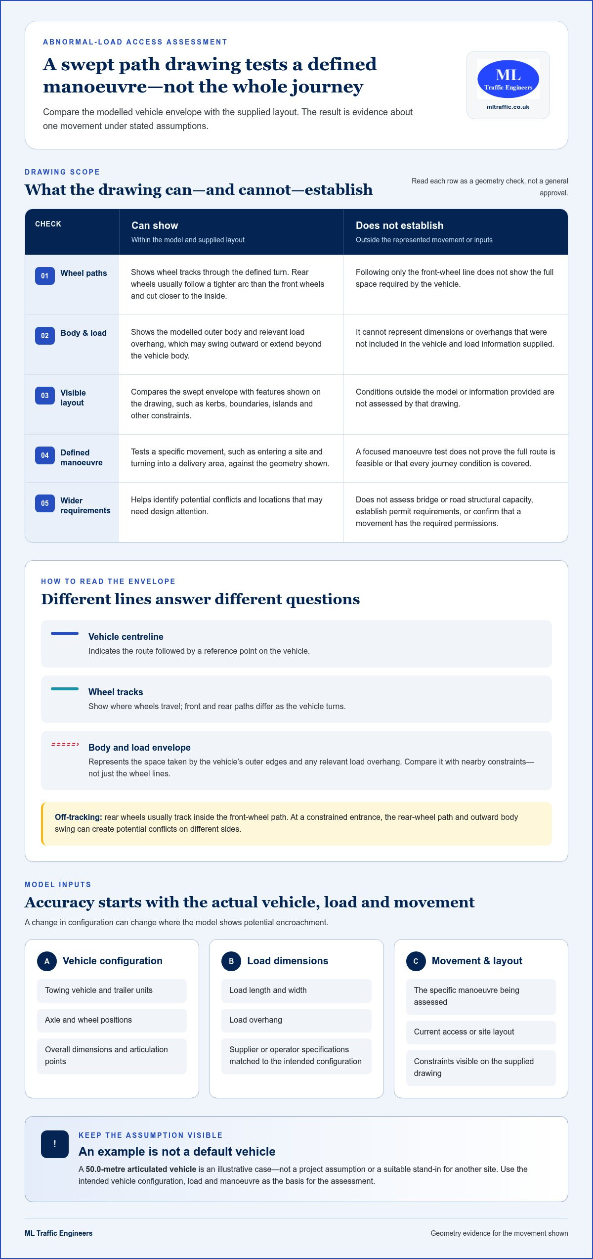
  • Enfield Waste Facility Transport Assessment: 2026 Guide

    Enfield Waste Facility Transport Assessment: 2026 Guide

    A waste facility’s transport case is only as credible as its account of the vehicles it will generate. A transport assessment for a waste management facility in Enfield should explain how operational traffic will reach the site, enter and manoeuvre, and affect nearby roads and people walking or cycling. A generic report may miss the local planning context that shapes how those effects are assessed.

    It can be difficult to know what information to gather or how to describe day-to-day vehicle movements. This guide explains the transport questions a proposed Enfield waste facility may need to address, from vehicle activity and site access to local transport priorities. It also outlines how to scope a clear, site-specific planning submission in light of Enfield’s planning context and the shift towards vision-led transport planning.

    You’ll find practical pointers on preparing the evidence and working with an experienced transport planning consultancy. ML Traffic Engineers UK takes a hands-on approach to planning work, with senior staff who each have over 35 years of traffic engineering experience. The aim is a focused assessment that reflects the proposal and its setting, rather than a template that leaves key questions unanswered.

    Key Takeaways

    • Assess the waste operation’s actual activity, access arrangements and vehicle movements, rather than relying on the site’s land-use label alone.
    • A transport assessment for a waste management facility in Enfield should address site access, vehicle routing and potential effects on the surrounding network.
    • Choose between a Transport Statement and a Transport Assessment based on the proposal’s scale, likely transport effects and applicable planning context.
    • Build a clear assessment brief by setting out the proposal, site activity, vehicle details, access and relevant routes.
    • ML Traffic Engineers UK prepares tailored Transport Assessments for planning submissions, with a hands-on approach and senior staff who each have over 35 years of traffic engineering experience.

    Why an Enfield waste management facility needs a site-specific transport assessment

    A Transport Assessment (TA) is technical evidence used to examine a development’s transport effects and access arrangements. For a proposed waste site, it should connect the operation as designed with the way vehicles and people will travel to and from it. A transport assessment for a waste management facility in Enfield should therefore reflect the specific proposal, not rely on a standard account of what waste facilities generally do.

    The land-use label alone cannot establish the likely transport effects. The assessment needs to reflect the proposed activities, how the site will operate and how it relates to the surrounding road network. This evidence helps planning decision-makers understand the transport implications and consider them alongside other planning matters. It supports a decision, but does not guarantee planning permission or determine the outcome on its own.

    What makes a waste facility’s transport profile different?

    Vehicle types, operating patterns and site activity shape the questions an assessment needs to answer. A proposal might involve vehicles bringing waste, taking materials away, or both. The relevant movements and access considerations depend on the facility’s operations, so the report should not assume a standard vehicle mix, frequency or schedule.

    Keep different trip sources distinct. Operational vehicle movements are not the same as journeys by staff, visitors or other users. Separating them helps explain what activity is expected, when it may occur and which parts of the transport case relate to site operations. The assessment can then focus on relevant access arrangements and effects instead of presenting a single unexplained total.

    How Enfield’s planning context informs the assessment

    Enfield’s planning context includes topics such as waste management, transport infrastructure, roads, walking and cycling, public transport and freight. These themes help frame the questions a proposal may need to address, but they do not automatically determine the scope or findings of every TA. Identify the current policy wording and guidance that apply to the proposal and its location.

    The North London Waste Plan and Enfield’s transport and planning documents may be relevant, alongside London-wide policy. The applicable highway authority or transport bodies can also depend on the site and affected routes. Avoid treating a policy reference as a fixed conclusion. Identify the relevant documents, explain their connection to the proposal and make the transport analysis specific to the site.

    Edmonton EcoPark provides local context because it demonstrates that waste infrastructure is part of Enfield’s planning environment. It is not a template for another site. Different access points, nearby routes, surrounding land uses and operating arrangements can raise different assessment questions. A credible report explains those distinctions rather than borrowing assumptions from a separate project.

    For an overview of the evidence and structure involved, see this Transport Assessment guide for London planning applications. The central principle is to establish the applicable planning context, then assess the actual proposal and its transport effects.

    What a transport assessment for an Enfield waste facility should examine

    A Transport Assessment evaluates transport effects arising from a specific development. For a proposed waste site, its scope should connect the operation to the access arrangements, vehicle movements, routes and surrounding network that could be affected. It should explain how its conclusions follow from the proposal’s details and location, rather than rely on assumed or generic activity.

    Start with the operational information available, then identify which transport questions that evidence can answer. The appropriate level of analysis depends on the scale and nature of the proposal, the site setting, relevant routes and the planning context. Enfield’s waste and transport policies provide context, but the assessment should show how relevant policy topics relate to this particular operation, not simply list them.

    Vehicle movements, access and routing

    Vehicle types and operating patterns help determine which movements to assess. The report should distinguish vehicles associated with the facility’s operations from other relevant trips, and use project information to describe how each group would access the site. Avoid unsupported vehicle totals, trip rates or operating hours. Where details are not settled, identify assumptions clearly so readers can understand the basis of the assessment.

    Consider access alongside the routes vehicles are expected to use and the network effects that may follow. The appropriate level of route analysis depends on the proposal and its location. For example, a constrained site entrance may prompt different questions from a site with straightforward access. The assessment should show the actual circumstances rather than assume a problem or its absence.

    Network users and local transport context

    Assess the road network alongside people walking and cycling and public transport, where relevant to the site and likely effects. Freight is part of the picture too: describe the proposal’s vehicle movements and routing considerations without assuming a particular route or transport authority requirement. Enfield’s wider priorities and applicable waste planning context can help frame these questions. Check current policy wording before making a policy-specific claim.

    The Scottish Government’s Scottish Government Transport Assessment Guidance offers a reference point for assessment principles, but it is Scottish guidance, not Enfield policy. For broader London planning context, the Transport Assessment guide for London planning applications provides related background. Neither replaces checking the current requirements relevant to the proposal and location.

    A useful scope makes the evidence traceable: readers can see which project details informed the assessment, what effects were considered and why the analysis is proportionate. ML Traffic Engineers UK prepares site-specific Transport Assessments for planning submissions. Explore ML Traffic’s transport planning support for information about shaping an assessment around the proposal and its local context.

    Transport Assessment or Transport Statement: choosing the right scope for Enfield

    A Transport Statement (TS) is generally a concise document for explaining a proposal’s transport implications where the issues are limited. A Transport Assessment (TA) provides broader analysis when the proposal raises more extensive or interconnected transport questions. The right choice depends on the development and applicable planning context, not simply on whether the proposal involves waste.

    For Enfield, consider the proposal’s actual activity, site setting, likely effects and relevant planning guidance before settling the scope. A small change to an existing operation may raise different questions from a new facility with more complex access and network effects. Neither document type should leave relevant issues unanswered.

    Consideration Transport Statement Transport Assessment
    Scope Concise account of relevant transport effects and access issues. Broader analysis of multiple transport effects and their relationship.
    Proposal complexity May suit a proposal with a more limited, clearly defined transport scope. May be appropriate where the proposal or location raises several connected questions.
    Questions answered What are the main transport implications, and can they be clearly explained with focused evidence? What range of effects needs examination, and how do they interact across access and the surrounding network?

    When a concise Transport Statement may be proportionate

    A TS may be suitable where the proposal’s transport effects are limited and can be addressed clearly without wider analysis. Judge suitability against the specific site, access and operational changes, along with Enfield’s current planning context. A shorter document is not a way to avoid relevant evidence. It should still explain the issues that matter and the basis for its conclusions.

    For example, a contained change to an established site may call for a narrower scope than a new operation with several access or network questions. This comparison is illustrative, not a universal rule. The evidence required depends on the proposal and the planning authority’s expectations.

    When a broader Transport Assessment may be appropriate

    A broader TA may be warranted when operational activity, access, routing and surrounding network effects raise multiple questions that need to be examined together. The proposal’s location and current local planning context also matter. The assessment should be proportionate to those circumstances, rather than selected automatically based on the waste-related label.

    Defining scope early helps align the document with the decision-makers’ transport questions. If you’re comparing document formats, ML Traffic’s Transport Statement guide for London explains the distinction in more detail. The essential test is whether the chosen document gives a clear, site-specific account of the relevant effects.

    Enfield Waste Facility Transport Assessment: 2026 Guide

    How to prepare an Enfield waste facility transport assessment brief

    A clear brief gives the transport planner a reliable starting point and keeps the assessment focused on the proposal. Assemble what is known, distinguish confirmed details from assumptions and use the information to identify which transport questions need answers.

    1. Define the proposal. Summarise the site location, proposed use and planned activities. Explain whether the proposal is new, an extension or a change to an existing operation.
    2. Describe how the site will function. Set out the operational process and any known patterns of activity. Separate operational movements from staff, visitor and other relevant trips.
    3. Record access and vehicle information. Provide available details about site access and vehicle types. Include operating patterns or movement estimates where known, and label provisional information rather than filling gaps with standard assumptions.
    4. Identify relevant routes and surroundings. Show the routes considered for access and note nearby road connections or transport features that may be relevant. The scope should follow the site’s actual location, not a presumed route.
    5. Agree the assessment questions. Connect each potential transport effect with a question the evidence should answer, then establish a proportionate scope in the current planning context.

    Information to assemble before scoping

    Useful starting material may include a site plan, access layout, proposal description and available operational details. Bring together information on vehicle types, expected activity patterns, staff or visitor travel and surrounding routes. These are practical inputs, not a universal list of mandatory documents. If an item is unavailable or still being developed, say so clearly so the assessment can distinguish known facts from working assumptions.

    Land use can also shape which transport considerations are relevant. ML Traffic’s project types for transport planning show how different development contexts inform transport work. For a waste proposal, describe the particular operation rather than relying on a generic category.

    Turning project information into a clear assessment scope

    Translate the brief into specific questions. If access is a concern, define what needs to be examined about the entrance and the vehicles using it. If routes are relevant, identify which connections and potential network effects the assessment should consider. If walking, cycling or public transport may be affected, explain why those users matter in this location.

    Review current Enfield planning and transport documents when identifying relevant local policy topics. Confirm the wording and applicability rather than assuming a policy automatically determines the evidence required. The final scope should make the link between each project detail, the question it raises and the analysis proposed.

    ML Traffic Engineers UK takes a hands-on approach to project-specific Transport Assessments. Discuss your Enfield transport assessment brief with ML Traffic to develop a scope grounded in the proposal and its planning context.

    Commission an Enfield waste management facility Transport Assessment

    ML Traffic Engineers UK prepares Transport Assessments for planning submissions, tailoring each document to the proposal and its local planning context. A transport assessment for a waste management facility in Enfield needs to reflect the site’s operational details and the transport questions raised by its location. Project-specific analysis is essential; a standard template cannot take its place.

    Each senior member of the ML Traffic team has over 35 years of traffic engineering experience. The consultancy takes a hands-on approach, using available project information to develop a clear assessment scope and report. This expertise supports a well-evidenced planning submission, but no Transport Assessment can guarantee a planning decision.

    What an experienced transport planning consultancy contributes

    Good assessment work starts by understanding the proposal, not by assuming every development presents the same transport issues. The site layout, access, intended activity and relevant surrounding routes help shape the scope. Local authority context matters too: current planning policies and guidance can influence which questions the assessment should address and how the evidence is presented.

    ML Traffic tailors assessments to local planning contexts, including differences between local authorities. This keeps technical reporting relevant to the application rather than relying on generic wording. The purpose is to explain the transport evidence clearly so decision-makers can consider it alongside the wider planning case, not to predict or promise the outcome.

    To understand how this work fits with the consultancy’s wider planning support, see ML Traffic’s transport planning work. The assessment itself remains focused on the specific proposal and the issues its evidence needs to resolve.

    Discuss the project and agree the next step

    To begin a useful discussion, bring together a concise description of the proposed facility, its Enfield location, any available site or access plans, known operational and vehicle details, and the transport questions already identified. Distinguish confirmed project information from assumptions or details still being developed. This gives the assessment scope a clear starting point.

    ML Traffic can use those details to discuss a suitable Transport Assessment approach for the planning submission. A well-defined scope relates the evidence to the project information and its planning requirements.

    Share your Enfield proposal and its transport planning needs through ML Traffic’s contact route to discuss the next step with an experienced team.

    Move your Enfield proposal forward with a clear next step

    Use the transport assessment as a working part of the planning process. If the facility layout, access arrangements or operational details change, revisit the transport evidence so it continues to reflect the proposal being submitted. This keeps the assessment connected to the project as it develops, rather than leaving decision-makers to interpret outdated assumptions.

    A transport assessment for a waste management facility in Enfield needs sound technical judgement and a clear understanding of local planning context. ML Traffic Engineers UK brings a hands-on approach, with senior staff who each have over 35 years of traffic engineering experience. The team tailors assessments to the proposal and relevant authority context while supporting the planning process without promising an approval outcome.

    ML Traffic’s transport planning work covers Greater London, Manchester, Birmingham, the West Midlands, Liverpool, Surrey, East Sussex, West Sussex, Hampshire, Berkshire and Buckinghamshire. For your Enfield proposal, share the site details and transport questions you’re working through. Discuss your Enfield waste facility project with ML Traffic to take the next step towards a clear, project-specific planning submission.

    Frequently Asked Questions

    Does every waste management facility in Enfield need a Transport Assessment?

    No. The document required depends on the proposal’s likely transport effects and the applicable planning context. A development with limited effects may be addressed through a Transport Statement, while a proposal likely to have significant effects may require a Transport Assessment. Strategic schemes referable to the Mayor of London also require a Transport Assessment. Compare current Enfield guidance and thresholds with the site and proposal rather than assuming one report type applies to every waste facility.

    What transport information should I prepare for an Enfield waste facility planning application?

    Prepare a clear description of the proposed operation, the site location and access, and any available layout plans. Include known vehicle types, expected operational patterns, and information about staff or visitor activity. Note which details are settled and which remain provisional. If you have traffic or parking survey results, include their context and collection basis. This helps the assessment distinguish observed conditions from forecasts and project assumptions.

    How are waste facility vehicle movements considered in a Transport Assessment?

    The assessment considers movements in relation to the proposed operation, including vehicle type and purpose and how vehicles would use site access and relevant routes. It should distinguish operational trips from staff, visitor or other traffic where relevant. For example, vehicles delivering waste and vehicles removing processed material may represent different activities. The analysis should explain its evidence and assumptions rather than rely on a standard movement profile for all waste sites.

    Can a Transport Statement be suitable for a waste management proposal?

    Yes. A Transport Statement can be appropriate if the proposal’s transport effects are limited and can be explained with concise evidence. The fact that a proposal relates to waste does not, by itself, settle the report scope. Consider the specific activity, site circumstances and applicable planning guidance. A TS still needs to address relevant transport questions; it should not be used to avoid analysis that the proposal’s effects call for.

    Which Enfield planning policies are relevant to a waste facility’s transport assessment?

    Potentially relevant documents include the North London Waste Plan, Enfield’s Local Plan and transport strategy, the London Plan and the Mayor’s Transport Strategy, alongside national planning policy. Which policies apply depends on the proposal and site. Check the current adopted wording and relevant guidance before citing a policy or drawing a conclusion. Establish whether the site’s location or routes engage another highway authority or transport body.

    Does a Transport Assessment guarantee planning permission for a waste management facility?

    No. A Transport Assessment provides evidence about transport matters for decision-makers to consider as part of the wider planning application. It can explain the proposal’s effects and the basis for the transport analysis, but it does not determine every planning issue or guarantee a favourable decision. Other planning considerations and the application as a whole remain relevant. Treat the report as a technical contribution to the submission, not a promise of consent.

    When should transport assessment scope be considered during a waste facility proposal?

    Consider scope early, while the proposal and access arrangements can still be refined. Early planning helps identify what information is available, which transport questions need analysis and whether the proposed report type fits the likely effects. Where appropriate, scope discussions can involve Enfield’s planning or highways teams and TfL, depending on the site and routes. Revisit the approach if the operation, layout or access changes materially before submission.

    Michael Lee

    Article by

    Michael Lee

    Transport planner with over 35 years' experience.

    Disclaimer

    The content on mltraffic.co.uk, including all technical articles, guides, and resources, is provided for general informational and educational purposes only. It is not intended to constitute professional advice in traffic engineering, transportation planning, development approvals, or any other technical or legal field.
    While ML Traffic Engineers makes every reasonable effort to ensure the accuracy, completeness, and timeliness of the information published, we do not provide any warranties or representations (express or implied) regarding its reliability, suitability, or availability for any particular purpose. Any reliance you place on the content is strictly at your own risk.
    In no event shall ML Traffic Engineers, its directors, employees, authors, or affiliates be liable for any direct, indirect, incidental, special, consequential, or punitive damages (including, without limitation, loss of profits, data, or business opportunities) arising out of or in connection with the use of, or inability to use, any information provided on this website.
    The articles and guides on this site are not a substitute for engaging a qualified, professional traffic engineer to assess your specific project requirements. For tailored advice, compliance assessments, or traffic engineering services, please contact a competent professional.
    This disclaimer may be updated from time to time without notice. By accessing or using this website, you agree to be bound by the most current version of this disclaimer.
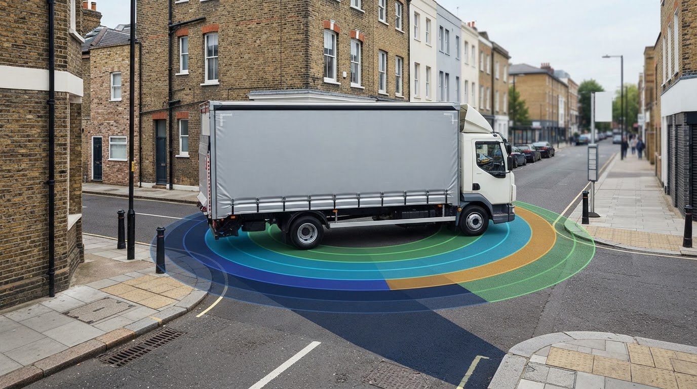
  • What Is a Pedestrian Environment Review System (PERS)?

    What Is a Pedestrian Environment Review System (PERS)?

    Can a street score capture what it’s actually like to walk there? If you’re asking what is a pedestrian environment review system (PERS), the answer starts with a distinction: PERS gives planners a structured way to assess pedestrian conditions, but its scores are not the whole story. A route may look adequate on a plan, while barriers, crossing conditions or the quality of the surroundings shape the experience on foot.

    PERS reviews pedestrian facilities and records findings so strengths and issues can be compared and prioritised. This structure is useful when a development could affect how people reach local destinations. However, a score needs to be read alongside the site context and the needs of people using the route, not treated as a standalone verdict.

    This article explains what PERS covers, how its findings are documented and how to interpret scores without losing sight of people’s experience. It also explains that PERS is an assessment tool whose place in a planning process depends on the project context. Finally, it looks at how pedestrian evidence can inform wider transport planning, including Transport Statements and Transport Assessments shaped around local planning considerations.

    Key Takeaways

    • Understand what is a pedestrian environment review system (PERS) and how it organises observations about walking conditions.
    • Follow the audit process from defining the review area to recording findings, with attention to the methodology used.
    • Interpret PERS scores as evidence about specific conditions, rather than a complete judgement of a place.
    • See how pedestrian evidence can inform development decisions alongside a Transport Statement or Transport Assessment.
    • Use a practical checklist to clarify the review’s purpose, scope and planning context before treating PERS as a project requirement.

    What Is a Pedestrian Environment Review System (PERS)?

    The Pedestrian Environment Review System (PERS) is a structured system for reviewing pedestrian environments and recording observations about walking conditions. It gives assessors a consistent framework for examining what people encounter on foot, rather than relying on general impressions. In practical terms, what is a pedestrian environment review system (PERS) designed to capture? The physical conditions and features of pedestrian spaces, assessed in a structured way.

    That distinction matters. A pedestrian count records how many people pass a point during a set period; PERS focuses on the environment they use. It can help identify features that support or hinder walking, but it does not, by itself, explain how many people walk, why they choose a route or how they experience it in every circumstance.

    For a visual introduction to a PERS walking review, watch this demonstration:

    What does PERS stand for, and what is it designed to do?

    PERS stands for Pedestrian Environment Review System. It aims to make reviews of pedestrian conditions more consistent by directing attention to features of the environment and recording observations for later consideration. Published accounts associate the system’s development with the Transport Research Laboratory (TRL) and the London Borough of Bromley. The Pedestrian Environment Review System (PERS) is also discussed as a walking-audit tool, providing context for readers new to the term.

    A structured review makes observations easier to communicate and compare, but the findings still need interpretation. They describe conditions within the area and scope reviewed. They do not automatically establish what caused a problem or which improvement is appropriate. Those decisions depend on the location, the people using it and the planning context.

    What is meant by the pedestrian environment?

    The pedestrian environment includes walking routes and the public-realm conditions around them. A route may include a footway or shared path, junctions and crossing points, as well as places where people wait or change between modes of travel. PERS descriptions commonly refer to elements such as links and crossings; wider summaries also identify routes, public transport waiting areas, public spaces and interchange spaces. The elements considered depend on the audit scope and methodology.

    For example, reviewing a link means considering the walking space along a stretch of route, while reviewing a crossing focuses on a place where pedestrians cross a road or another route. These are different parts of a journey, so a finding about one should not be treated as a complete account of the other. Together, recorded observations can give planners a clearer picture of the pedestrian environment around a site. They describe the reviewed environment, but do not replace an assessment of how a proposed development connects with its surroundings.

    How Does a PERS Audit Work, from Site Review to Findings?

    A PERS audit moves from defining what to review to recording observations in a consistent format. The exact scope and reporting format can vary with the project brief and methodology, so findings should be read alongside the guidance used for the assessment. In practice, the process follows a clear sequence:

    1. Set the review purpose and area. Identify the question the audit needs to inform and map the relevant site and walking connections.
    2. Select the pedestrian elements. Establish which parts of the environment fall within scope, such as links or crossings.
    3. Review conditions on site. Observe the selected elements using the criteria in the applicable PERS guidance.
    4. Record and score observations. Document findings against the relevant criteria, identifying each location and element.
    5. Present the results. Organise the evidence so it can be reviewed and used to identify issues for further consideration.

    How are routes and review areas defined?

    The review boundary should match the audit’s purpose. For a development, that may mean considering the site entrance and the walking connections to nearby destinations, rather than drawing a boundary around the site alone. There is no single boundary-setting rule for every project. The brief, local context and walking connections of interest all help define the area under review.

    Mapping the area first makes the assessment easier to follow. It shows which links and crossing points are included, where one element ends and another begins, and whether a relevant connection falls outside the boundary. This gives context to individual observations: a finding about one stretch of footway can be understood as part of a mapped route, not an isolated note. The report should also state any exclusions so readers can see what the findings do and do not cover.

    How do observations become PERS findings?

    During a site review, the auditor records conditions against the relevant PERS criteria and links those observations to the pedestrian elements being assessed. Published summaries describe a PERS scoring approach that uses a seven-point scale from -3 to +3. Check the applicable methodology before interpreting the scale: this description does not establish score bands, thresholds or the meaning of any particular result across every version or project.

    A PERS score represents an assessment of a specific pedestrian element against the criteria used for that review. It is not a score for every aspect of walking in the area, nor does it explain the cause of a condition on its own. A useful record connects the score to its location, the observed evidence and the method applied. Some PERS workflows also use GIS software to organise and analyse collected data, although the tools and outputs depend on the assessment setup.

    Before relying on a finding, look for a clear audit boundary, a list of the elements reviewed, the methodology and a record linking observations to their locations. This helps keep conclusions proportionate to the evidence. If the results need to inform a development proposal, locally tailored transport planning can place pedestrian evidence in the wider project context.

    What Does PERS Assess, and How Should You Interpret Its Scores?

    PERS findings are most useful when you know what was reviewed, where it was reviewed and which observations support each score. A summary score can help organise evidence, but it cannot describe every feature of a place or represent every pedestrian’s experience. Read it as one part of the assessment, not a standalone verdict.

    Which pedestrian elements can PERS review?

    Links and crossings are identifiable PERS elements. A link is a stretch of pedestrian route; a crossing is a place where people move across a road or another route. These parts of a journey have different functions, so reviewing them separately helps show where a condition occurs.

    Element What the review considers
    Link Conditions along a section of pedestrian route.
    Crossing Conditions at a place where pedestrians cross.

    Other elements may appear in PERS descriptions, but the categories in a particular audit should be checked against the applicable methodology and project scope. Do not assume every assessment covers the same set. A pedestrian review is also not a comprehensive cycling assessment: the modes, questions and assessment criteria are not interchangeable.

    What can a PERS score tell you, and what can it not?

    A PERS score summarises how a reviewed element was assessed against the criteria used in that audit. Across a mapped area, scores can make observations easier to organise, compare and communicate. They can help a project team identify where further investigation or design consideration may be useful.

    A score is evidence about the conditions of a particular reviewed element, not a complete verdict on a place. On its own, it cannot explain why a condition exists, establish how every person experiences it or determine the right response. For example, a crossing score should be considered alongside the recorded observations and the crossing’s relationship to the wider route, rather than interpreted in isolation.

    Context matters. A summary can conceal differences between locations or between the conditions that informed the assessment. Check the audit boundary, methodology, observations and any limitations before drawing conclusions. The method records and organises evidence; professional interpretation connects it with the site and the question being examined. Project teams then use the relevant wider evidence and planning context to make decisions.

    PERS scores do not, by themselves, certify safety, demonstrate legal compliance or determine a planning decision. If you’re asking what is a pedestrian environment review system (PERS), this distinction is central: the system provides a structured way to review pedestrian conditions, while the meaning and use of its findings depend on scope, evidence and context.

    What Is a Pedestrian Environment Review System (PERS)?

    When Can PERS Findings Help with Development and Planning?

    PERS findings can add site-specific evidence to a development discussion by showing pedestrian conditions along routes people may use to reach a proposed site. They can help identify constraints, connections or design questions for further consideration. Their value depends on how clearly the review relates to the project, its location and the walking routes included.

    How might PERS inform a development discussion?

    Imagine a proposed development near a local high street. A review records a narrow section of footway or a crossing that may affect a route between the site and nearby shops. That finding raises practical questions: does the proposed access connect well with the existing route, and should the design team consider how people would move through this point?

    The finding frames a discussion; it does not prescribe a solution or prove that a proposal is acceptable or unacceptable. A project team can consider it alongside site plans, access arrangements and other relevant evidence, then assess whether design changes or further investigation are appropriate. PERS findings do not secure planning permission and should not be presented as a substitute for a planning authority’s assessment.

    Planning expectations can vary with the authority, proposal and site context. Do not assume every development needs a PERS audit or that one approach applies across the UK. Review the relevant authority’s project-specific expectations and guidance before treating a particular assessment as necessary.

    How does PERS differ from transport planning reports?

    PERS focuses on reviewing pedestrian-environment conditions within a defined scope. A Transport Statement or Transport Assessment addresses wider transport matters relevant to a proposal. Depending on the project, these reports may consider how a development relates to transport networks and access. PERS findings can provide useful pedestrian evidence, but they are not interchangeable with these planning reports and do not replace them.

    The appropriate report depends on the proposal and its planning context. A Transport Assessment London guide explains the broader role of transport assessment in development planning. Pedestrian evidence may form one part of a wider assessment, considered alongside the project’s other transport issues and local authority expectations.

    Understanding what is a pedestrian environment review system (PERS) helps keep its role clear: it can inform a development discussion with structured pedestrian evidence, but it is not itself a planning decision or a complete transport assessment. For support with wider transport planning requirements, discuss your development’s transport planning needs with ML Traffic Engineers UK.

    What Should You Do Next if Your Project Raises PERS Questions?

    A PERS report is most useful when its scope and purpose are clear. Before relying on its findings in a development discussion, check what was assessed, how the method was applied and how the results relate to the planning question. Review the relevant planning authority’s project-specific expectations before treating a PERS audit as a requirement. Expectations can vary by authority and proposal, so avoid assuming one approach applies everywhere.

    Questions to clarify before relying on a PERS report

    Use this checklist to understand what the report can and cannot tell you:

    • Purpose: What project question was the review intended to inform?
    • Area: Which routes, links, crossings or other pedestrian elements were included, and what fell outside the review boundary?
    • Methodology: Which PERS methodology or version was applied? Check that the report identifies it clearly.
    • Findings: Can you connect each score or conclusion to the relevant location and recorded observation?
    • Limitations: Does the report explain any gaps in coverage or constraints on how the findings should be interpreted?
    • Planning context: What does the relevant authority expect for this proposal, and how does the pedestrian evidence relate to that expectation?

    If the report does not make these points clear, interpret its conclusions cautiously. A summary may help identify issues, but decisions should account for the evidence behind it and the wider development context. Use the relevant authority’s guidance or application discussions to understand project-specific planning expectations, rather than assuming PERS is automatically required.

    How wider transport planning can support a development

    Pedestrian-environment evidence may be relevant to a wider assessment of how a development connects with its surroundings. It does not replace a Transport Statement or Transport Assessment, which address broader transport considerations. The appropriate documentation depends on the proposal, its location and the planning context.

    ML Traffic Engineers UK prepares Transport Statements, Transport Assessments and Green Travel Plans, with assessments tailored to local planning context and variations between authorities. Senior staff have over 35 years of traffic engineering experience. This wider transport planning perspective can place pedestrian questions alongside other relevant issues for a planning submission, without treating a PERS score as the sole basis for a project decision. The company works across Greater London, Manchester, Birmingham, the West Midlands, Liverpool, Surrey, East Sussex, West Sussex, Hampshire, Berkshire and Buckinghamshire.

    Once you’ve clarified the review scope and planning expectations, consider how pedestrian evidence fits the development’s transport requirements. Discuss your project’s transport planning requirements with ML Traffic Engineers UK.

    Put pedestrian evidence into your next project decision

    Start by deciding what the pedestrian evidence needs to help you understand. Consider how it connects with the development’s access strategy, nearby destinations and the planning authority’s expectations. This keeps the discussion focused on practical project questions instead of treating a PERS result as an answer in itself.

    If you began by asking what is a pedestrian environment review system (PERS), the key takeaway is that pedestrian findings can support planning decisions when considered in context. They sit alongside, rather than replace, wider transport planning. The right approach depends on the proposal and local planning context, so clarity at an early stage can help identify the relevant evidence and reporting needs.

    ML Traffic Engineers UK prepares transport planning reports with local authority variations in mind, drawing on senior staff with over 35 years of traffic engineering experience. Discuss your project’s transport planning requirements and consider how pedestrian evidence may fit into the wider assessment. A clear, context-led next step can help move your project forward.

    Frequently Asked Questions

    Is a Pedestrian Environment Review System assessment required for planning permission?

    A PERS assessment should not be assumed to be a requirement for every planning application. The relevant planning authority may set project-specific information expectations, depending on the proposal and its context. If you’re asking “what is a pedestrian environment review system (PERS), and do I need one?”, start with the authority’s guidance or application advice for your site. Expectations may differ, for example, between a town-centre scheme and a development on the edge of a settlement.

    Who developed the Pedestrian Environment Review System?

    PERS was developed by the Transport Research Laboratory (TRL) and the London Borough of Bromley, according to available accounts. The research information for this article dates its original development to 2001. That history gives the system a London connection, but does not mean the methodology is restricted to London. If citing its origins in a formal report, refer to the relevant original methodology so the attribution and date match the version being discussed.

    Can PERS assess crossings separately from walking links?

    Yes. Links and crossings can be treated as distinct pedestrian elements in a PERS review, so findings can relate to a particular part of a journey. For example, a report might record a condition on a footway link separately from one at a nearby crossing. When reviewing the results, check that each observation is associated with the correct element and location. This helps prevent a finding about one point from being applied to the whole route.

    Can PERS be used to assess cycle routes?

    PERS is a pedestrian-environment review, so it should not be treated as a comprehensive assessment of cycle-route provision. A shared path could be considered for its pedestrian environment when it falls within the audit scope, but that would not automatically assess the route from a cyclist’s perspective. If a proposal raises questions about both walking and cycling, treat them as separate assessment needs and identify which methods address each mode.

    How long does a PERS audit take?

    There is no single duration that applies to every PERS audit. The time required depends on the area included, the pedestrian elements selected, site-review arrangements and the work needed to record and present findings. A small, clearly bounded review differs from one covering a wider network. For project planning, establish the scope and reporting outputs first, then set a programme that reflects the assessment tasks.

    Can PERS be used outside London?

    PERS is not inherently limited to London. Although its development is associated with TRL and the London Borough of Bromley, the system can be considered for pedestrian reviews elsewhere in the UK. Its suitability for a particular proposal is a separate question: authorities may have different expectations, and the project team should establish whether the methodology fits the site and planning purpose. This is relevant for schemes in Manchester or Birmingham as well as London.

    What information should a project team review in a PERS report?

    Check that the report explains its purpose, boundary and methodology, and identifies the pedestrian elements covered. Look for observations tied to mapped locations, an explanation of how scores relate to those observations, and any stated limitations or exclusions. Note when the site review took place and whether the report explains relevant conditions at the time. These details help the team judge whether the findings address its project question or whether further evidence may be needed.

    Michael Lee

    Article by

    Michael Lee

    Transport planner with over 35 years' experience.

    Disclaimer

    The content on mltraffic.co.uk, including all technical articles, guides, and resources, is provided for general informational and educational purposes only. It is not intended to constitute professional advice in traffic engineering, transportation planning, development approvals, or any other technical or legal field.
    While ML Traffic Engineers makes every reasonable effort to ensure the accuracy, completeness, and timeliness of the information published, we do not provide any warranties or representations (express or implied) regarding its reliability, suitability, or availability for any particular purpose. Any reliance you place on the content is strictly at your own risk.
    In no event shall ML Traffic Engineers, its directors, employees, authors, or affiliates be liable for any direct, indirect, incidental, special, consequential, or punitive damages (including, without limitation, loss of profits, data, or business opportunities) arising out of or in connection with the use of, or inability to use, any information provided on this website.
    The articles and guides on this site are not a substitute for engaging a qualified, professional traffic engineer to assess your specific project requirements. For tailored advice, compliance assessments, or traffic engineering services, please contact a competent professional.
    This disclaimer may be updated from time to time without notice. By accessing or using this website, you agree to be bound by the most current version of this disclaimer.
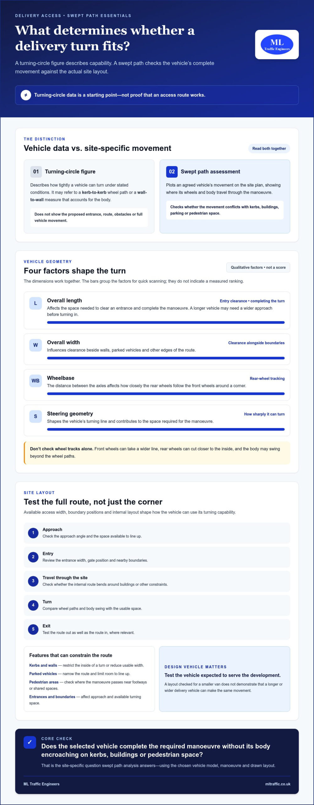
  • What Is a Local Implementation Plan (LIP)? London Guide 2026

    What Is a Local Implementation Plan (LIP)? London Guide 2026

    A Local Implementation Plan can shape a development’s transport context without serving as evidence about the development itself. If you’re asking what is a local implementation plan (LIP), it’s a borough-level plan for putting the Mayor of London’s Transport Strategy into practice through local priorities and schemes.

    Official guidance can be difficult to interpret, especially when London-wide goals meet borough-specific decisions. Each London borough prepares a LIP, while the Mayor’s Transport Strategy sets the broader direction, including a goal for 80% of trips to be made by walking, cycling or public transport by 2041.

    This guide explains who prepares and uses a LIP, how it informs borough transport priorities, and when those priorities may matter to a development. It also clarifies the key distinction: a LIP provides policy context, while a Transport Assessment or Transport Statement addresses the transport effects of a specific proposal. Understanding that difference helps you interpret local priorities and put project-specific evidence in the right planning context.

    Key Takeaways

    • Understand what is a local implementation plan (LIP) and how it translates London-wide transport policy into borough priorities.
    • Follow the relationship between strategic goals, borough programmes and local transport schemes.
    • Distinguish borough policy from a Transport Statement or Transport Assessment prepared for a specific development.
    • Use the relevant borough’s published priorities as context when assessing a project, without treating them as a prediction of a planning decision.
    • See how ML Traffic Engineers UK can reflect local planning context in project-specific Transport Statements, Transport Assessments and Green Travel Plans.

    What Is a Local Implementation Plan (LIP) in London?

    A Local Implementation Plan (LIP) is a borough-level plan for implementing the Mayor of London’s Transport Strategy through local priorities and programmes. It sets out how an area will contribute to the strategy while reflecting the transport conditions and needs of that part of London.

    If you’re asking what is a local implementation plan (LIP), its scope is the key distinction: it guides transport planning across a borough or the City of London, rather than assessing the effects of one development. The Greater London Authority Act 1999 requires each London borough and the Common Council of the City of London to prepare a LIP. The Mayor’s Transport Strategy provides the strategic direction; the local plan explains how it will be implemented in the relevant area.

    A general overview of the related Local Transport Plan (LTP) framework in England can help explain the wider planning context, though London’s LIPs have their own statutory relationship with the Mayor’s Transport Strategy.

    The following video introduces the general idea of an implementation plan. It isn’t specific guidance on London’s LIP framework.

    Who prepares a Local Implementation Plan?

    The relevant London borough prepares its LIP, and the Common Council of the City of London prepares the plan for the Square Mile. TfL does not write every borough’s plan. The borough or City Corporation sets out how it will take forward local transport priorities in line with the Mayor’s strategic direction, while the Mayor and TfL have roles in the wider strategy and funding framework.

    This division supports local decision-making within a London-wide policy structure. Boroughs understand local streets and travel needs; the Mayor’s Transport Strategy sets shared objectives for transport across the capital. A LIP connects these levels, rather than replacing local judgement or citywide strategy.

    What does a LIP aim to achieve?

    A LIP translates broad transport aims into borough-level priorities. For example, the Mayor’s Transport Strategy’s Healthy Streets Approach and goal of increasing the proportion of trips made by walking, cycling or public transport give boroughs a strategic basis for considering measures such as safer crossings, cycle routes and improved bus priority. The relevant priorities and actions depend on the local plan.

    These are policy aims and borough-wide programmes, not automatic requirements for every development. A LIP can provide useful context for a proposal in that area, but it doesn’t determine the outcome of an individual planning application or replace project-specific evidence. Understanding the plan’s scope helps keep local policy, transport strategy and development assessment distinct.

    How Does a London LIP Turn Transport Strategy into Borough Action?

    The Mayor’s Transport Strategy sets the shared direction for transport across London. Each borough and the City of London Corporation then translates that direction into local priorities and delivery programmes through its LIP. In short: the Mayor’s Transport Strategy sets the strategic direction; each LIP sets out how that direction will be implemented at borough level.

    How does a LIP relate to the Mayor’s Transport Strategy?

    The Greater London Authority Act 1999 establishes the relationship between the Mayor’s strategy and borough implementation plans. The Mayor sets the citywide transport strategy, while local authorities prepare plans showing how they will contribute to it. TfL supports delivery and allocates funding for borough projects; it does not prepare every borough’s LIP.

    The policy-to-delivery relationship can be understood as a sequence:

    1. Set the direction. The Mayor’s Transport Strategy establishes London-wide objectives, including healthier streets and more trips by walking, cycling and public transport.
    2. Identify local needs. A borough considers its streets, travel patterns and transport challenges when deciding where local action is needed.
    3. Set out priorities and programmes. The LIP explains how the borough intends to contribute to the strategy through local transport measures.
    4. Plan and review delivery. Current borough programmes use a three-year planning period, covering 2025/26 to 2027/28, with annual reviews.

    This structure links strategic policy to local action without requiring every borough to choose identical measures. A LIP must fit the Mayor’s Transport Strategy, but its priorities can respond to the specific conditions of the area it covers.

    How can borough priorities differ across London?

    Transport needs vary with local geography, land use and travel patterns. One area may focus on making town-centre streets safer for people walking and cycling; another may prioritise bus movement, safer routes to schools or better connections between neighbourhoods and public transport. These are examples of possible policy emphases, not commitments that apply uniformly across London.

    Local authorities can pursue different measures while supporting shared objectives such as active travel and safer streets. To understand a particular borough’s approach, review its published LIP and current delivery programme rather than assuming that a London-wide policy translates into the same scheme everywhere.

    TfL’s 2026/27 borough LIP funding allocation is £94.8 million across London’s 32 boroughs and the City of London. This supports projects included in borough plans, but a citywide allocation does not mean every proposed measure receives funding. The current multi-year programme and annual review provide important context when checking which priorities are being taken forward.

    For a development, the LIP helps identify relevant local policy priorities, but it doesn’t establish how a planning authority will decide an individual application. Project-specific transport evidence still needs to address the proposal itself. Where that work must account for local planning context, transport planning support can help connect borough priorities with development-level reporting.

    How Is a LIP Different from a Transport Statement or Assessment?

    These documents operate at different scales. A LIP sets borough transport priorities and helps implement London-wide policy; a Transport Statement or Transport Assessment examines transport matters linked to a particular development proposal. A Travel Plan is also development-related, but focuses on measures to support more sustainable travel associated with a site.

    Put simply, a LIP provides policy context, while project documents provide evidence about a proposal. Knowing what is a local implementation plan (LIP) helps prevent a borough-wide strategy from being mistaken for an application report.

    Document Scale Purpose Authoring context Typical planning relevance
    Local Implementation Plan Borough or City of London area Set out how local transport priorities support the Mayor’s Transport Strategy Prepared by the relevant local authority Provides local policy context for transport decisions and development proposals
    Transport Statement One development proposal Summarise relevant transport considerations and likely effects Prepared for a planning application Provides project-level information proportionate to the proposal and its context
    Transport Assessment One development proposal Analyse transport implications in greater detail Prepared for a planning application Supports consideration of the proposal’s transport effects
    Travel Plan A development or site Set out measures to encourage sustainable travel Prepared in connection with a development Addresses how travel to and from the site can be influenced

    LIP versus Transport Statement

    A Transport Statement focuses on the proposal, not the whole borough. It may describe site access, existing transport conditions and the development’s relevant travel implications. The appropriate document depends on the proposal and planning context, so a LIP cannot replace this project-specific work. For further detail on the application document, see this London Transport Statement guidance.

    LIP versus Transport Assessment and Travel Plan

    A Transport Assessment provides project-specific analysis of transport effects. Its scope depends on the development and planning context; there is no single threshold that should be assumed to apply universally. A Travel Plan has a related but distinct function: it sets out development-level measures intended to support sustainable travel. Neither document is the borough’s policy implementation plan.

    For a development submission, use the LIP to understand the local policy setting, then ensure the relevant project documents address the proposal itself. A London Transport Assessment guide can help clarify the role of project-level analysis. Keep the distinction clear: borough priorities inform the assessment, but they don’t prove the transport effects of an individual scheme or determine the planning authority’s decision.

    What Is a Local Implementation Plan (LIP)? London Guide 2026

    How Should Developers Use a LIP When Planning a London Project?

    Use the LIP as a local policy reference, not as a checklist that automatically determines a planning decision. It can help identify the borough’s stated transport priorities and inform how a proposal’s transport effects are assessed. It doesn’t guarantee planning permission or remove the need for project-specific evidence.

    A clear review follows a practical sequence:

    1. Identify the relevant authority. Confirm which London borough or the City of London Corporation covers the site. Don’t rely only on a nearby town-centre name or postal address, as boundaries and decision-making responsibilities may differ.
    2. Find current policy. Review the relevant authority’s published LIP and delivery information alongside the Mayor’s Transport Strategy and other applicable planning policy. Check publication dates, status and updates against official sources.
    3. Relate priorities to the proposal. Consider which published transport objectives are relevant to the site and development. Distinguish a genuine policy connection from an assumption about what the planning authority will require or decide.
    4. Establish the project evidence needed. Consider the development’s characteristics and planning context to determine whether a Transport Statement or Transport Assessment is appropriate.

    What should a developer check in the relevant borough policy?

    Look for the borough’s stated transport priorities, planned measures and current delivery information that relate to the site or surrounding network. Check the source document and its date, and cite the correct title and version in project work. If a LIP describes a broad aim, such as supporting active travel, present it as borough policy context. Don’t recast it as a site-specific requirement unless the relevant policy or planning advice supports that interpretation.

    Accuracy matters. Separate what the published document says from your assessment of how the proposal relates to it. If you refer to a borough priority, explain the connection clearly and avoid predicting the planning authority’s conclusion. The LIP can inform the assessment; it isn’t a decision notice or a substitute for the planning authority’s consideration of the application.

    When might a project need transport planning evidence?

    The planning authority’s requirements depend on the development and its context. A Transport Statement or Transport Assessment provides evidence about a specific proposal, with the document and scope shaped by the issues that need to be considered. A borough’s LIP can help frame that work, but it cannot establish the proposal’s transport effects on its own. For more detail on project-level reporting, see this London Transport Assessment guide.

    ML Traffic Engineers UK prepares Transport Statements, Transport Assessments and Green Travel Plans for planning applications, tailoring its work to local planning contexts. For support connecting borough policy with project-specific transport evidence, discuss your London project with ML Traffic Engineers UK.

    How ML Traffic Engineers Connect Local Policy Context with Project Reports

    A borough’s transport priorities can help shape the context for a development report, but they don’t replace analysis of the proposal itself. A sound planning submission distinguishes what local policy says from what the project’s evidence demonstrates. For teams asking what is a local implementation plan (LIP), that distinction is central: the LIP informs the local context, while project reports address development-specific transport matters.

    ML Traffic Engineers UK prepares Transport Statements, Transport Assessments and Green Travel Plans for planning applications. Its work is tailored to local planning contexts, recognising that borough priorities and policy frameworks can differ. This connects relevant local policy with the proposal without treating a borough-wide objective as proof of a particular site’s effects or as a prediction of the planning decision.

    Turning borough context into relevant development evidence

    Local context becomes useful when a report explains how the proposal relates to published priorities and then assesses the development on its own merits. For example, if a borough’s policy highlights walking and cycling, a project report can consider relevant access and travel issues for that proposal. The policy provides a reference point; the assessment must still be grounded in the development, its location and the evidence relevant to it.

    A LIP alone doesn’t determine a report’s scope. The information needed depends on the project and planning context. A Transport Statement may suit one proposal, while another may need the fuller project-specific analysis of a Transport Assessment. A Green Travel Plan may be relevant where development circumstances and planning considerations support one. These documents have distinct purposes, and none should be treated as interchangeable with borough policy.

    Choosing the right next step for a planning application

    Start by identifying the proposal’s relevant transport issues and reviewing current local policy. Then establish which project document best addresses the application’s needs. A Transport Statement or Transport Assessment can set out evidence about the development; a Green Travel Plan can address measures to support sustainable travel where appropriate. The LIP informs the local policy context, but it doesn’t guarantee permission or replace the planning authority’s assessment.

    ML Traffic Engineers UK brings local planning context into its project work, with senior staff who each have over 35 years of traffic engineering experience. Its hands-on approach supports a focused review of how policy relates to a proposal and keeps the distinction between strategic priorities and project evidence clear. The consultancy supports projects across Greater London, Manchester, Birmingham, the West Midlands, Liverpool, Surrey, East Sussex, West Sussex, Hampshire, Berkshire and Buckinghamshire. A London LIP applies to its relevant London authority; projects elsewhere need to be considered in their own local planning context.

    If you’re preparing a planning application, explore ML Traffic Engineers UK’s transport planning support to see how project-specific reports can be tailored to local planning contexts.

    Make Local Policy Part of Your Project Brief

    Bring borough transport policy into the project discussion early, while the proposal can still respond to relevant local priorities. Record the policy sources reviewed, note which objectives may affect the site, and identify where project-specific evidence is needed. This gives the planning and design teams a clearer basis for coordination.

    Knowing what is a local implementation plan (LIP) also helps keep the planning conversation precise. Treat published policy as context to assess, not as a substitute for professional judgement or a promise about the application outcome. Where the relevance of a borough priority is uncertain, frame it as a matter for assessment rather than presenting an assumption as a formal requirement.

    ML Traffic Engineers UK can bring local planning context into transport reports tailored to the proposal. Discuss your planning project with ML Traffic Engineers UK.

    Frequently Asked Questions

    What does LIP stand for in London transport planning?

    LIP stands for Local Implementation Plan. In London transport planning, it refers to the plan through which a borough or the City of London Corporation sets out its local approach to implementing the Mayor’s Transport Strategy. The term describes a policy and delivery framework for an area, not a report prepared for an individual planning application. If you see “LIP” in borough transport material, check which authority and plan the document covers.

    Who is responsible for preparing a Local Implementation Plan?

    The relevant London borough prepares its Local Implementation Plan, while the Common Council of the City of London prepares the plan for the City. The Mayor sets the strategic transport direction through the Mayor’s Transport Strategy, and Transport for London has a role in supporting delivery and funding. This division matters when checking a policy source: use the local authority’s published plan for its priorities, rather than treating TfL as the author of every LIP.

    Is a Local Implementation Plan a statutory document?

    Yes. London boroughs and the City of London Corporation are required to prepare Local Implementation Plans under the Greater London Authority Act 1999. That statutory basis makes a LIP part of London’s formal transport planning framework. For practical use, identify the published plan and its status through the relevant authority’s official material. A statutory plan sets policy and implementation context, but it isn’t itself a decision on an individual development application.

    Can a Local Implementation Plan affect a planning application?

    A LIP can provide relevant local transport policy context when a planning application is considered. It may help a project team identify issues to address, such as how a proposal relates to borough priorities for travel or local streets. However, it doesn’t guarantee permission or dictate the authority’s decision. Applicants should distinguish statements directly supported by the published plan from their own interpretation, and support project-specific claims with evidence appropriate to the proposal.

    What is the difference between a LIP and a Transport Assessment?

    A LIP addresses transport priorities and implementation across a borough or the City of London. A Transport Assessment examines transport matters associated with a specific development proposal. For instance, a LIP may identify local priorities relevant to an area, while an assessment considers how a particular scheme relates to transport conditions and effects. The local plan can inform the assessment, but it cannot replace development-specific analysis or evidence.

    How often are London borough Local Implementation Plans reviewed?

    Current borough delivery programmes cover a three-year period, from 2025/26 to 2027/28, and are reviewed annually. This annual review applies to delivery programming, so check the latest borough and TfL publications before relying on a specific project or funding detail. Don’t assume that an annual programme review means the full Local Implementation Plan has been rewritten; verify the status and date of the policy document itself.

    Michael Lee

    Article by

    Michael Lee

    Transport planner with over 35 years' experience.

    Disclaimer

    The content on mltraffic.co.uk, including all technical articles, guides, and resources, is provided for general informational and educational purposes only. It is not intended to constitute professional advice in traffic engineering, transportation planning, development approvals, or any other technical or legal field.
    While ML Traffic Engineers makes every reasonable effort to ensure the accuracy, completeness, and timeliness of the information published, we do not provide any warranties or representations (express or implied) regarding its reliability, suitability, or availability for any particular purpose. Any reliance you place on the content is strictly at your own risk.
    In no event shall ML Traffic Engineers, its directors, employees, authors, or affiliates be liable for any direct, indirect, incidental, special, consequential, or punitive damages (including, without limitation, loss of profits, data, or business opportunities) arising out of or in connection with the use of, or inability to use, any information provided on this website.
    The articles and guides on this site are not a substitute for engaging a qualified, professional traffic engineer to assess your specific project requirements. For tailored advice, compliance assessments, or traffic engineering services, please contact a competent professional.
    This disclaimer may be updated from time to time without notice. By accessing or using this website, you agree to be bound by the most current version of this disclaimer.
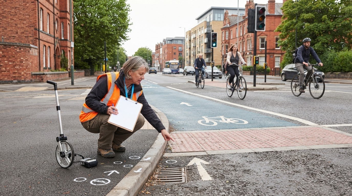
  • Swept Path Analysis for a Pantechnicon Vehicle: UK Guide

    Swept Path Analysis for a Pantechnicon Vehicle: UK Guide

    What if a pantechnicon can turn into a site but cannot complete the route once inside? A swept path analysis for pantechnicon vehicle access should assess the full manoeuvre, from the approach and entrance to the turning area and exit, rather than focusing on a single corner. Tight access, gates and narrow internal routes can all affect whether the vehicle can move through the site without conflicting with buildings, kerbs or other features.

    Choosing a vehicle template and understanding what a swept path drawing demonstrates can be challenging. The assessment depends on project-specific information, including the proposed site layout and reliable dimensions for the vehicle expected to use it. This guide explains what the assessment tests, what information is needed and how to review the drawing for constraints while the design can still be revised. It also explains how the drawing can provide technical evidence of the manoeuvre assessed, with vehicle assumptions and site conditions made clear. ML Traffic Engineers UK prepares Swept Path Analysis to inform site design and transport planning documentation.

    Key Takeaways

    • Swept path analysis for pantechnicon vehicle access tests the vehicle’s movement envelope against the proposed route and site constraints.
    • Use accurate, project-specific vehicle information and manoeuvre assumptions rather than relying on a generic vehicle label.
    • Assess the complete route, including entrances, internal roads, corners, gates and loading areas, to identify potential conflicts.
    • Review the drawing in sequence: confirm inputs, trace the route, inspect fixed features, resolve conflicts and update the layout.
    • Clear, relevant drawings can inform site design and provide technical evidence for planning documentation.

    What does swept path analysis for a pantechnicon vehicle show?

    Swept path analysis for pantechnicon vehicle access plots the movement envelope of a selected vehicle completing a specified manoeuvre. It tests the proposed route against the site geometry, including boundaries, buildings, kerbs, gates and other identified constraints. The drawing shows the vehicle’s path and where its extremities may extend as it turns. It assesses a defined vehicle, route and set of manoeuvre assumptions, not every movement a driver might make on site.

    Why a pantechnicon needs a representative vehicle assessment

    A removal vehicle may need more manoeuvring space than a car or small van, particularly where its length and overhang affect turning. But “pantechnicon” does not describe one fixed set of dimensions or configuration. Select a representative vehicle using the information available about the intended site use and servicing requirements, rather than relying on the name alone. The Pantechnicon Wikipedia article provides background on the term and its use for removal vehicles.

    For example, if a site is designed to receive a specific removals vehicle, assess it using that vehicle’s relevant dimensions and steering characteristics where available. If the expected vehicle has not yet been specified, state the assumptions used. A different size or configuration may produce a different movement envelope, so a result for one vehicle should not automatically be treated as proof that another can use the route.

    What the swept path drawing communicates

    A drawing typically shows the vehicle outline at points along the manoeuvre, its travel path and the wider area it occupies while turning. The body outline represents the vehicle itself; the swept envelope traces the area covered by its body and extremities throughout the movement. Front or rear overhangs can extend beyond the wheel path, making the envelope particularly relevant near corners, walls and parked vehicles.

    Read the plotted movement against fixed site features. A tight corner may bring an overhang close to a boundary even when the wheels appear to clear it. An entrance, gate, loading area or obstruction may also restrict the route. Clear labels for the vehicle, direction of travel, manoeuvre and relevant assumptions help readers understand exactly what has been tested.

    The drawing is technical evidence of a defined assessment, not a guarantee that every real-world manoeuvre will be completed in the same way. Its value depends on accurate vehicle and site information and on whether the plotted movement reflects the intended operation. If the design changes, for example, if a gate moves or the internal layout is revised, review the assessment against the new plan.

    For a London development, swept path findings can form part of wider transport-planning evidence. The London transport assessment guide explains that broader planning context. The relevant highway authority guidance and planning requirements depend on the specific site. ML Traffic Engineers prepares Swept Path Analysis to inform site design and transport planning documentation.

    How vehicle geometry and site layout shape a pantechnicon’s swept path

    A plotted route depends on two sets of inputs: the vehicle’s geometry and the site layout. Overall dimensions alone do not tell the whole story. Turning behaviour also depends on characteristics such as wheelbase, steering geometry and front or rear overhang. Assumptions about speed or driving style cannot replace accurate vehicle information. The assessment should represent the intended vehicle and the manoeuvre it needs to perform.

    Vehicle information needed for a credible assessment

    Start with the vehicle type and configuration that reflect the project’s servicing requirements. Use suitable, verified vehicle data or a template that represents those details. Do not select a template simply because it is labelled “pantechnicon”: vehicles in this category can differ, and a mismatch can change the plotted envelope. If the operational vehicle has not been specified, record the assumptions so the drawing’s scope is clear.

    Useful information may include the vehicle’s overall length and width, axle arrangement, wheelbase and overhangs, along with relevant steering characteristics. Use a source appropriate to the project vehicle, such as vehicle data provided for the intended operation. Do not fill gaps with guessed dimensions. A swept path analysis for pantechnicon vehicle access is only as representative as its vehicle inputs. If those inputs change, the assessment may need to be revisited.

    Site features that can change the manoeuvre

    The base plan needs to show the route and the features that could limit movement. Review more than the entrance: include the route to the loading or turning location and the exit if the vehicle must leave the site. A drawing that starts at a gate but omits a tight internal corner can miss the constraint that determines whether the whole movement works.

    Check that the plan represents relevant physical features, including:

    • Access width, kerb lines and changes in road alignment.
    • Walls, columns, gates and other fixed obstructions near turning areas.
    • Parking bays, loading areas and any space needed to complete the manoeuvre.
    • The intended movement, including forward travel, reversing or a sequence of movements.

    For example, a vehicle may clear an entrance when approaching straight on but need more room if it must turn immediately inside the boundary. A parked vehicle or gate position can further narrow the usable space. Show these details on the plan or reflect them in the assessment assumptions rather than treating the area as clear.

    Use a current, dimensioned site layout and check that the vehicle and site information relate to the same design stage. Label assumptions and any clearance criteria clearly so reviewers can see what the drawing tests. ML Traffic Engineers prepares project-specific swept path analysis to assess proposed access and manoeuvring against site constraints.

    Which vehicle template and manoeuvre should a pantechnicon analysis test?

    Choose the vehicle the site is expected to accommodate, not the template that produces the simplest drawing. The right selection depends on the project brief and intended operation. A smaller vehicle may appear to clear an entrance or turn within a yard, but that result does not demonstrate that a larger removals vehicle can follow the same route.

    Match the template to the intended operation

    Use confirmed vehicle details where available and identify provisional assumptions separately. If several vehicle types will use the site, decide which distinct movements need assessment rather than treating one template as proof for all vehicles. The comparison below shows how to structure that choice without assuming that a generic vehicle label supplies reliable dimensions.

    Assessment option Dimensions to use Manoeuvre to test How to interpret it
    Project pantechnicon Use the intended vehicle’s verified data. One example template in the research material lists 9.570 m overall length, 2.520 m overall width and a 10.450 m kerb-to-kerb turning radius. These are example values, not universal pantechnicon dimensions. Test the access, internal route, loading or turning position, and exit required by the operation. Use as the principal assessment when this is the vehicle the site is designed to serve.
    Smaller alternative Enter dimensions from the selected vehicle’s own data. Do not estimate them from “van” or another broad label. Test its own route and turning movements if it is a genuine planned alternative. A successful smaller-vehicle route does not establish access for the larger project vehicle.
    Operational substitute Use verified dimensions and steering information for the specific substitute vehicle. Assess the manoeuvres it would actually make, including any different approach or loading position. Include it only where it reflects a credible site operation described in the project brief.

    The example template can illustrate the information a comparison needs, but it should not be adopted automatically for a live proposal. Confirm the dimensions against the actual vehicle data or project brief. If the exact vehicle remains provisional, label the selected template and assumptions clearly so readers can distinguish an indicative assessment from one based on a confirmed vehicle.

    Choose the access and turning scenarios

    Set out the movement to be demonstrated: entry from the relevant approach, circulation to the required location and exit. Include constrained points such as a gate, tight corner or loading area. The assumed manoeuvre should match the operating arrangement, whether the vehicle can turn in one movement, needs to reverse or must reposition in stages.

    Keep the scenario specific. A drawing of the entry alone will not test whether the vehicle can reach its destination and leave. Testing an unplanned reversing movement may also misrepresent how the site is intended to work. For further context on how analysis drawings present vehicle movements and assumptions, see the AutoTURN swept path analysis guide.

    By comparing the project vehicle with credible alternatives, a swept path analysis for pantechnicon vehicle access can show which vehicle and manoeuvre the layout has actually been assessed for. ML Traffic Engineers provides project-specific swept path analysis support to turn those defined inputs into technical evidence for site design and planning documentation.

    Swept Path Analysis for a Pantechnicon Vehicle: UK Guide

    How to review a pantechnicon swept path before finalising the site layout

    Review the drawing as a test of a defined vehicle movement against the current site plan. A line that appears to clear a corner at first glance may still pass close to a wall, gate or boundary elsewhere on the route. Work through the assessment in order, keeping its vehicle, manoeuvre and layout assumptions visible throughout.

    1. Confirm the inputs. Check that the drawing uses the intended vehicle information, current site layout and required manoeuvre. Note provisional assumptions so they are not treated as confirmed project facts.
    2. Trace the full route. Follow the vehicle from its approach through the entrance and internal circulation to the relevant destination, then check the exit movement. Look for changes in direction and any point where the vehicle needs to pause, reverse or reposition.
    3. Inspect constraints. Compare the plotted envelope with boundaries and fixed features such as walls, columns, kerbs and gates. Check entrance geometry, tight turns and available circulation space, not just the final turning area.
    4. Resolve potential conflicts. Identify where the envelope appears to overlap an obstruction or cross a boundary. Distinguish a plotted conflict from questions about the base plan, assumptions or intended operation that need project-team review.
    5. Update and review the drawings. If the layout or manoeuvre changes, revise the assessment and check it against the latest plan. Record the selected layout and any remaining assumptions consistently across project drawings.

    Reading the plotted route and identifying conflicts

    The vehicle envelope shows the area occupied during the assessed movement, so inspect its nearest approach to each relevant feature along the route. A line crossing a wall or gate on the plan flags a potential conflict under the plotted assumptions. On its own, it does not show whether the issue comes from the vehicle data, site information or an operational assumption. Resolve that distinction before treating the drawing as evidence that the layout works.

    Pay close attention to the entrance and turns immediately beyond it. A manoeuvre may clear one location but become constrained further along by a change in alignment or a fixed object. Read the analysis as one continuous route, rather than as isolated snapshots that overlook the connection between movements.

    Using findings to inform a revised layout

    Where a conflict appears, the design team can assess options such as changing access geometry, adjusting the internal arrangement or reconsidering the manoeuvre. These are options to test against the site and operating requirements, not guaranteed fixes. Any material change to the vehicle, layout or movement assumptions may alter the result, so update the drawing before relying on it in design or planning documentation.

    For a pantechnicon proposal, project-specific swept path analysis can help clarify whether a revised arrangement addresses the identified constraints. The AutoTURN swept path analysis guide offers further context on interpreting analysis drawings. ML Traffic Engineers’ swept path analysis support is tailored to the site layout and proposed movement.

    How ML Traffic Engineers can support pantechnicon swept path analysis

    Project-specific swept path analysis can assess whether a pantechnicon’s proposed access and internal route suit the vehicle and manoeuvre the development intends to accommodate. ML Traffic Engineers prepares Swept Path Analysis to help identify potential constraints and inform site design. The drawing can also support wider transport-planning evidence by showing what movement has been assessed and how it relates to the proposed layout. It informs a planning proposal but does not guarantee planning approval.

    ML Traffic Engineers supports development projects across Greater London, Manchester, Birmingham, the West Midlands, Liverpool, Surrey, East Sussex, West Sussex, Hampshire, Berkshire and Buckinghamshire. For projects in these areas, a site-specific assessment can help the design team understand how the proposed vehicle movement relates to the current layout.

    What to provide for a project-specific assessment

    Useful project information helps ensure the drawing reflects the intended operation. Provide the latest available site layout and identify the entrance, route and destination the vehicle needs to reach. Include verified vehicle information or the specified template, and describe the site use and manoeuvre the assessment needs to demonstrate.

    • Site layout: Share a current plan showing the access, internal circulation, loading or turning area, and relevant fixed features.
    • Vehicle information: Provide the intended vehicle’s verified dimensions or project-specified template. Identify any details that remain provisional.
    • Operational purpose: Explain why the pantechnicon will use the site and where it needs to travel.
    • Required manoeuvre: Describe the movement to be tested, including whether it involves forward travel, reversing or repositioning.

    These inputs allow the assessment to reflect the project brief rather than a generic vehicle label. If the vehicle, route or proposed layout changes, review the drawing against the updated information. Keeping the plan and assessment assumptions aligned also makes it easier for the project team to understand the drawing’s scope and use it during design development.

    Turning the analysis into useful planning evidence

    A clear drawing should let a reviewer follow the vehicle movement and understand how it relates to the site. Legible route lines, vehicle identification and stated assumptions help distinguish the tested manoeuvre from movements the drawing does not assess. This makes the analysis more useful alongside other transport-planning documents, while keeping its conclusions tied to the information and scenario shown.

    Planning and highway authority requirements depend on the location and proposal, so consider the assessment in that specific context. For London developments, the London transport assessment planning guide provides wider context on transport evidence for planning. The swept path drawing can inform a submission, but the relevant decision-maker considers it as part of the wider application.

    For a development project that needs to demonstrate pantechnicon access, ML Traffic Engineers provides pantechnicon swept path analysis. A project-specific assessment can clarify the movement being tested and provide technical information to support site design and planning documentation.

    Carry the access assessment into your next design decision

    A swept path drawing is most useful when it helps the project team make a clear design decision. Use the assessment to identify access questions that need resolving, then keep the vehicle and manoeuvre assumptions aligned with the layout being progressed. This gives the team a consistent basis for coordinating the site design and its planning evidence.

    If your proposal depends on pantechnicon access, a project-specific swept path analysis for pantechnicon vehicle movements can clarify the route being assessed and inform the next design step. ML Traffic Engineers provides Swept Path Analysis and prepares transport planning documents for development proposals, including planning applications.

    Discuss your pantechnicon swept path analysis with ML Traffic Engineers to move your project forward with a clearer understanding of the proposed access. A project-specific assessment can help inform the design and the next planning steps.

    Frequently Asked Questions

    Is a pantechnicon the same as a standard removal van?

    Not always. “Pantechnicon” is commonly used for a removal vehicle, but it does not identify one standard size or configuration. A vehicle used for a household move may differ from another removals vehicle in its dimensions and steering characteristics. For an access assessment, use the actual vehicle details where available, rather than assuming any vehicle described as a removal van represents the one expected to visit the site.

    Can one swept path drawing cover more than one pantechnicon?

    It can show more than one vehicle or movement if each is identified clearly, but the result for one vehicle should not be taken as proof for another. For example, two vehicles with different dimensions may have different clearance needs at the same entrance. Make the drawing or drawing set clear about which vehicle, route and manoeuvre each plotted path represents, so the assessment’s scope is easy to understand.

    Does swept path analysis account for people walking across the access route?

    Not by itself. A swept path assessment plots vehicle movement, so a pedestrian crossing the route is not automatically represented as a person or as a conflict in the drawing. If people may walk through the access, consider that interaction in the wider site and transport review. A vehicle path that fits within the layout does not, on its own, demonstrate how pedestrian movement will be managed.

    Can the analysis use an estimated vehicle size if the exact pantechnicon is unknown?

    It can use a suitable provisional template to explore a design, but the assumptions should be stated and the result treated as indicative for that vehicle representation. Do not invent dimensions to fill gaps. For a swept path analysis for pantechnicon vehicle access, record the template source or basis and revisit the assessment if the specified vehicle differs, since even a modest change could affect a constrained turn.

    Will a successful pantechnicon swept path prove that a site is safe?

    No. A successful plot shows that the selected vehicle can complete the defined manoeuvre within the represented layout and assumptions. It does not prove that every operating condition is safe or cover issues outside the assessment, such as pedestrian activity, visibility, driver behaviour or changing site conditions. Use the drawing as one piece of technical evidence, alongside the project team’s wider consideration of how the site will operate.

    Do planning authorities always require pantechnicon swept path drawings?

    No, a pantechnicon drawing is not automatically required for every proposal. Whether vehicle tracking is needed depends on the development, proposed access and relevant planning or highway authority requirements. A constrained entrance or specific removals servicing arrangement may make a drawing useful to explain the design. For projects in Greater London, Manchester or elsewhere in the UK, assess the proposal against the requirements applicable to its site.

    What should be labelled on a pantechnicon swept path drawing?

    Label the vehicle or template, its key dimensions where available, direction of travel, route and manoeuvre being tested. Identify the drawing scale or plan reference and make the relevant assumptions clear, including any provisional vehicle details. The site features needed to interpret the result, such as boundaries and fixed obstructions, should be legible. Clear labels help a reviewer distinguish the assessed movement from routes or vehicles the drawing does not cover.

    Michael Lee

    Article by

    Michael Lee

    Transport planner with over 35 years' experience.

    Disclaimer

    The content on mltraffic.co.uk, including all technical articles, guides, and resources, is provided for general informational and educational purposes only. It is not intended to constitute professional advice in traffic engineering, transportation planning, development approvals, or any other technical or legal field.
    While ML Traffic Engineers makes every reasonable effort to ensure the accuracy, completeness, and timeliness of the information published, we do not provide any warranties or representations (express or implied) regarding its reliability, suitability, or availability for any particular purpose. Any reliance you place on the content is strictly at your own risk.
    In no event shall ML Traffic Engineers, its directors, employees, authors, or affiliates be liable for any direct, indirect, incidental, special, consequential, or punitive damages (including, without limitation, loss of profits, data, or business opportunities) arising out of or in connection with the use of, or inability to use, any information provided on this website.
    The articles and guides on this site are not a substitute for engaging a qualified, professional traffic engineer to assess your specific project requirements. For tailored advice, compliance assessments, or traffic engineering services, please contact a competent professional.
    This disclaimer may be updated from time to time without notice. By accessing or using this website, you agree to be bound by the most current version of this disclaimer.