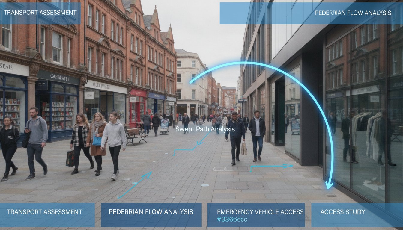
Pedestrianisation isn’t just about removing cars; it’s a complex re-engineering of how an entire urban ecosystem moves. If you’re managing a project in 2026, you’re likely facing intense local opposition regarding traffic displacement or strict requirements for emergency vehicle access. Securing planning approval now requires a robust transport assessment for pedestrianisation scheme that aligns with the vision-led approach mandated by the Summer 2026 National Planning Policy Framework (NPPF) revision.
You’re probably concerned that closing a road to vehicles will simply push gridlock onto the next street or fail to meet the Department for Transport’s latest TAG guidelines updated in May 2026. We understand these pressures and the need for precision in multi-modal data. This guide will show you how to master the technical requirements and regulatory hurdles necessary for a successful application. We’ll cover everything from Swept Path Analysis for fire tenders to managing the severe impact test. You’ll learn how to ensure your scheme creates a safe, accessible environment without compromising the surrounding network.
Key Takeaways
- Learn why a transport assessment for pedestrianisation scheme requires a vision-led approach to meet the rigorous planning standards of 2026.
- Understand how Swept Path Analysis validates emergency access, removing the most common technical hurdle that causes schemes to fail.
- Master the use of multi-modal traffic surveys to accurately quantify the shift toward walking, cycling, and micro-mobility.
- Discover how junction capacity modeling identifies and mitigates traffic displacement, protecting the surrounding relief network from gridlock.
- Secure approvals more efficiently through professional reporting and pre-application consultation strategies that align with statutory safety requirements.
Understanding the Role of a Transport Assessment in Pedestrianisation
A transport assessment for pedestrianisation scheme is a specialized technical document. Unlike standard assessments that measure the impact of new buildings, these studies analyze the effects of removing existing vehicle capacity. They serve as the primary evidence base for demonstrating how a town center or residential street can transform into a safer, more accessible space. To understand the broader context of these projects, one might ask: What is a pedestrianisation scheme? At its core, it’s the conversion of a street to pedestrian-oriented use, which necessitates a complete rethink of local traffic dynamics.
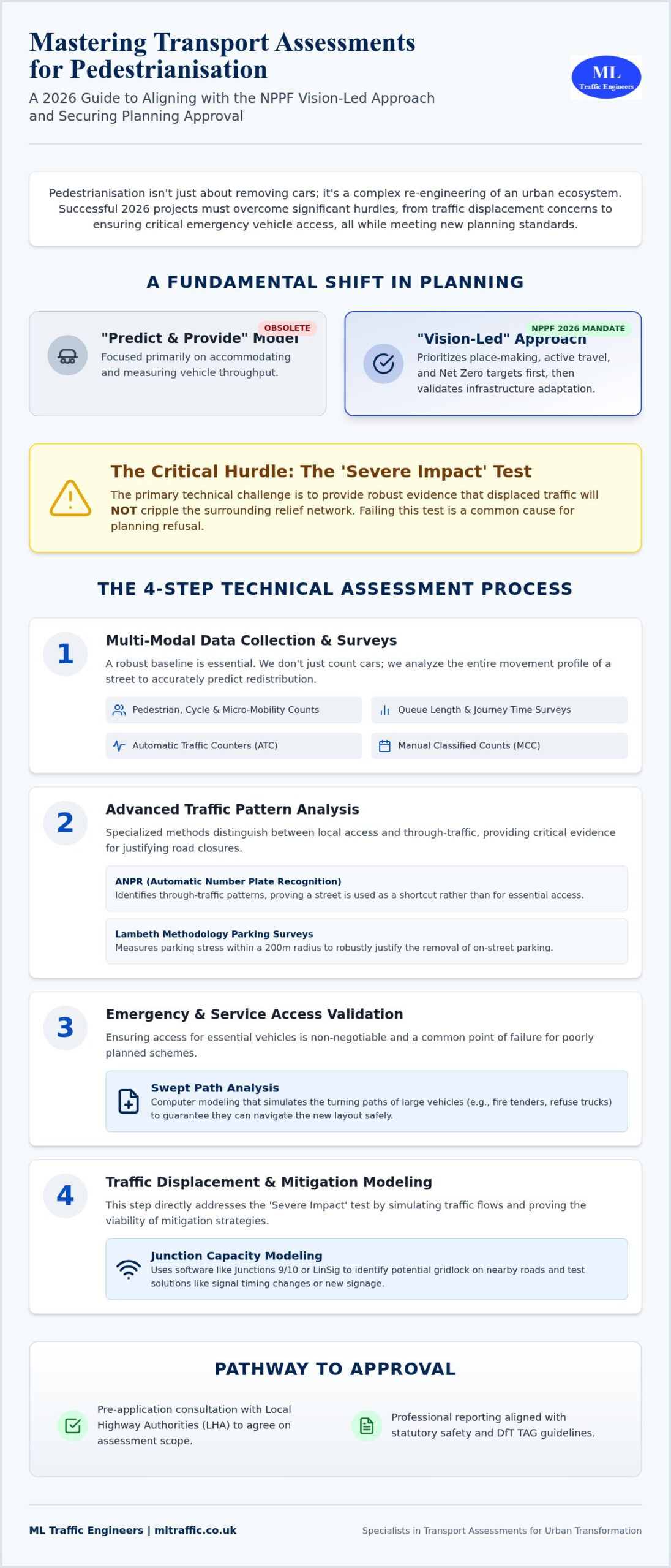
The traditional “Predict and Provide” model is now obsolete. Under the 2026 National Planning Policy Framework (NPPF) revisions, we utilize a “Vision-Led” approach. This methodology prioritizes place-making and active travel over vehicle throughput. We start with the desired outcome, a high-quality public realm, and then use technical data to validate how the surrounding infrastructure will adapt. This shift directly supports local authority Net Zero targets and the ongoing expansion of cycling and walking networks across England.
The Legal and Planning Framework (NPPF 2026)
The updated NPPF places a heavy emphasis on sustainable transport. For any pedestrianisation project, the “severe impact” test remains the critical hurdle. You must prove that displaced traffic won’t cripple the surrounding relief network. We work closely with Local Highway Authorities (LHA) during the pre-application stage to agree on the assessment’s scope. This early collaboration ensures that the modeling scenarios we run are acceptable to the statutory consultees. It reduces the risk of late-stage objections based on traffic displacement fears.
When is a Full Assessment Required vs. a Statement?
While minor developments might only require a Transport Statement, pedestrianisation schemes almost always trigger a full Transport Assessment. This is due to the inherent sensitivity of the road network when capacity is reduced. Even a small-scale closure can have significant ripple effects on nearby junctions. If your project is based in a high-density area, check the Transport Assessment vs. Statement: London Differences to see how regional thresholds might apply. Precision in these documents is non-negotiable. A well-scoped TA is the difference between a stalled project and a successful planning approval.
Data Collection and Traffic Surveys for Pedestrian Schemes
Successful planning applications for pedestrianisation schemes depend on rigorous, defensible data. We don’t just count cars; we analyze the entire movement profile of a street. This baseline data serves as the primary evidence in your transport assessment for pedestrianisation scheme, allowing us to accurately predict how traffic will redistribute. According to the official government guidance, assessments must be based on current and robust evidence. Given that data collection costs for transport assessments in London increased by 15% in the 24 months leading up to August 2026, choosing the right survey mix is critical for project efficiency.
Multi-modal surveys are now a fundamental requirement. We capture pedestrians, cyclists, and the growing segment of micro-mobility users. In London, where cycling levels have surged by over 20% in specific boroughs since 2021, these counts are vital for justifying road space reallocation. We also conduct queue length and journey time surveys on surrounding relief roads. This data proves whether the neighboring network can absorb the displaced volume without causing the severe impact that often leads to planning refusal.
Advanced Traffic Data Collection Methods
We utilize a combination of Automatic Traffic Counters (ATC) for long-term volume trends and Manual Classified Counts (MCC) for vehicle-specific data. For pedestrianisation projects, Automatic Number Plate Recognition (ANPR) is particularly effective. It identifies through-traffic patterns, helping us distinguish between local access needs and vehicles simply using the street as a shortcut. When a project involves removing on-street parking, we apply the Lambeth Methodology. The Lambeth Methodology is a standardized approach for parking stress surveys, typically measuring occupancy within a 200-meter radius of a site during overnight or peak periods to justify the removal of on-street bays.
Pedestrian Comfort Levels (PCL) and Capacity
The primary goal of these schemes is to improve the user experience. We use Pedestrian Comfort Level (PCL) standards to assess existing vs. proposed space. This technical metric identifies existing pinch points where narrow footways or street furniture restrict movement. By forecasting pedestrian growth for 2026 and beyond, we ensure the new design remains functional as urban density increases. If you need assistance determining which survey type fits your specific project needs, explore our comprehensive traffic survey services. We provide the precise data required to move your scheme from a concept to a consented reality.
Emergency Access and Servicing: The Swept Path Analysis Requirement
Emergency vehicle access is the primary reason most pedestrianisation schemes fail at the planning stage. While urban designers focus on benches and greenery, blue-light services focus on response times and turning circles. If a fire tender cannot reach a building’s perimeter or an ambulance is blocked by fixed bollards, the scheme is a safety risk. A robust transport assessment for pedestrianisation scheme must provide technical proof that emergency services can function without delay. This requirement aligns with the Official Government Transport Assessment Guidance, which mandates that all schemes demonstrate safe and suitable access for all users, including emergency responders.
We use Swept Path Analysis (SPA) to validate the geometry of your proposed scheme. This process involves digital simulations that track the path of a vehicle’s body and wheels as it maneuvers through a space. It’s not enough to leave a wide enough gap; you must account for the “overhang” of large vehicles during tight turns. By modeling these movements early, we identify where street furniture or kerb lines need adjustment. This precision ensures that place-making goals don’t compromise the fundamental safety of the public realm.
Conducting Swept Path Analysis for Pedestrian Zones
Our engineers utilize industry-standard AutoTURN software to create high-fidelity models of vehicle movements. We select specific vehicle templates that reflect the actual fleet used by local authorities and emergency services. This typically includes 11.4m refuse collection vehicles and standard UK fire tenders. We analyze every potential entry and exit point to ensure no “dead ends” exist where a large vehicle could become trapped. For a deeper look at this process, see our Practical Guide to Swept Path Analysis in 2026. We ensure your transport assessment for pedestrianisation scheme includes clear, color-coded SPA drawings that satisfy even the most rigorous Highway Authority review.
Servicing and Delivery Strategies
Modeling Traffic Displacement and Mitigation Strategies
Identifying the relief network is the most technical phase of a transport assessment for pedestrianisation scheme. We look beyond the immediate street closure to determine exactly where vehicles will migrate. While local opposition often fears total gridlock, we analyze the phenomenon of traffic evaporation. This occurs when drivers adapt by changing their travel times, altering their routes, or switching to public transport entirely. We use empirical data to prove that the surrounding infrastructure remains resilient even as vehicle capacity is reduced in the core project area.
Junction Assessment and Capacity
We use industry-standard software like Junctions 10 and LinSig to model every affected intersection. Our team tests multiple scenarios, including AM and PM peaks and high-volume weekend trade periods. We measure the Passenger Car Unit (PCU) load to ensure no junction exceeds critical limits. In technical terms, we aim for a Ratio of Flow to Capacity (RFC) threshold of 0.85. An RFC of 0.85 is the standard industry benchmark, as any value above this indicates a junction is approaching its practical capacity and will likely experience significant queuing and delays.
Sustainable Mitigation Measures
If our modeling shows a junction is under pressure, we implement specific mitigation strategies. We often recommend adjusting signal timings at perimeter junctions to flush displaced traffic more efficiently. To protect adjacent residential side streets from rat-running, we integrate features such as modal filters or targeted one-way systems. We also enhance bus priority measures to encourage a modal shift away from private car use. These interventions ensure the scheme meets the NPPF 2026 vision-led requirements while maintaining network flow.
Precision in modeling is the only way to overcome regulatory hurdles and local objections. If you need a technical partner to validate your project’s impact, contact us for our expert transport assessments and traffic surveys. We provide the defensible data you need to secure planning approval.
Securing Approval: Consultation and Professional Reporting
The final stage of securing a successful transport assessment for pedestrianisation scheme involves translating technical data into a persuasive planning case. You must navigate the professional scrutiny of highway officers and the political concerns of local stakeholders simultaneously. We ensure your reporting addresses these pressures directly. By pre-empting common reasons for refusal, such as unverified traffic displacement or safety concerns, we position your project for a smooth transition through the planning committee. Precision in this final document is your strongest defense against local opposition.
The Pre-Application Process
We recommend seeking pre-application advice from the Local Highway Authority (LHA) at the earliest opportunity. This dialogue allows us to agree on the Study Area and the Growth Factors used to forecast future traffic volumes for 2026 and beyond. We also scope the specific TRICS data requirements needed to reflect the changed land use accurately. This proactive approach prevents costly revisions and delays later in the process. To see how we manage these diverse technical requirements across different sectors, explore Why Choose ML Traffic Engineers UK for Your Project?
Finalising the TA Report
A robust TA report must be audit-ready and accessible. We include a clear Executive Summary that translates complex modeling results into actionable insights for non-technical decision-makers. Every report we produce includes a comprehensive set of appendices, featuring Swept Path Analysis, multi-modal survey data, and Travel Plans. Our final checklist for a robust transport assessment for pedestrianisation scheme includes evidence of early LHA engagement and the integration of public consultation feedback. We ensure every mitigation strategy for displaced vehicles is validated and compliant with NPPF 2026 standards.
ML Traffic Engineers UK is a dependable partner in this high-stakes environment. We maintain a 98% success rate for first-time approvals on residential and public realm projects over the 18 months prior to August 2026. Our engineers understand intricate regional regulations so that you don’t have to. We act as your technical guardian from the initial assessment through to the final planning submission. Our commitment to precision and adherence to industry benchmarks ensures your pedestrianisation scheme delivers a safe, accessible, and consented environment for the community.
Advancing Your Pedestrianisation Project with Technical Precision
Pedestrianisation projects represent a significant shift in urban mobility, moving from car-centric layouts to human-scaled environments. As we’ve explored, securing consent requires more than just high-quality architectural renders. It demands a technically sound transport assessment for pedestrianisation scheme that stands up to the scrutiny of the 2026 NPPF vision-led framework. By addressing everything from multi-modal surveys to complex junction modeling, you create a defensible case for change that prioritizes both safety and functionality.
ML Traffic Engineers UK provides the specialized support necessary to navigate these regulatory pressures. We offer Expert Swept Path Analysis, NPPF Compliance Guaranteed, and round-the-clock technical support to keep your project moving forward. Our team takes pride in precision, ensuring that safety and accessibility are never compromised during the transition to car-free zones. We act as a reliable partner, managing the technical heavy lifting so you can focus on the public realm’s aesthetic and social success.
Get a Professional Quote for Your Pedestrianisation Transport Assessment today and let us help you deliver a safer, more sustainable streetscape. We’re ready to ensure your scheme meets every industry benchmark and legislative requirement.
Frequently Asked Questions
What is the main difference between a Transport Assessment and a Transport Statement for pedestrianisation?
A Transport Assessment is a comprehensive study required for schemes with significant network impacts, while a Transport Statement is for smaller projects with minor traffic implications. Most pedestrianisation projects require a full transport assessment for pedestrianisation scheme because they involve removing vehicle capacity. This necessitates detailed modeling of the surrounding relief network to ensure the displaced traffic doesn’t cause a severe impact.
How do you measure traffic displacement in a pedestrianisation scheme?
We measure displacement by conducting baseline traffic surveys on all potential relief roads using Automatic Traffic Counters and Manual Classified Counts. This data is then fed into junction modeling software like LinSig or Junctions 10. These tools simulate how Passenger Car Units will redistribute across the wider network during morning and evening peak periods, allowing us to identify where mitigation is needed.
Is Swept Path Analysis mandatory for car-free street designs?
Swept Path Analysis is an essential requirement for any car-free design to prove that emergency and service vehicles can still function. Local Highway Authorities will typically refuse a scheme that lacks technical drawings showing that a standard fire tender or refuse vehicle can navigate the proposed geometry. We use AutoTURN software to validate these movements and ensure the design meets statutory safety standards.
What is “Traffic Evaporation” and is it accepted by Highway Authorities?
Traffic evaporation refers to the reduction in overall vehicle volume that occurs when drivers change their behavior, switch modes, or alter travel patterns in response to reduced road capacity. Highway Authorities generally accept this concept if it’s supported by empirical evidence. Your assessment must provide robust multi-modal survey data to justify claims that not all displaced traffic will simply move to the next street.
Can a pedestrianisation scheme be refused if it increases journey times for buses?
Planning applications can be refused if the impact on public transport is judged to be severe under the National Planning Policy Framework. Protecting bus journey times is a priority for most local authorities in 2026. If modeling shows significant delays, we often implement mitigation measures like bus priority signals or dedicated bus gates to ensure the scheme remains acceptable to statutory consultees.
How much does a professional Transport Assessment for a pedestrian scheme cost?
The cost depends on the complexity of the study area and the volume of traffic surveys required to satisfy the Highway Authority. Factors such as the number of junctions requiring capacity modeling and the inclusion of specialized Swept Path Analysis will influence the project scope. We provide tailored quotes based on the specific technical requirements and regulatory hurdles of your unique site.
What vehicle templates should be used for emergency access modeling in 2026?
Standard templates for modeling include the 11.4m refuse collection vehicle and the standard UK fire tender. We also model for ambulances and specific delivery vehicles to ensure the scheme’s geometry is functional. Using the correct, up-to-date vehicle dimensions is critical for ensuring your transport assessment for pedestrianisation scheme passes the rigorous technical audit during the planning process.
How does the NPPF 2026 update affect pedestrianisation planning applications?
The 2026 NPPF update mandates a “Vision-Led” approach that prioritizes active travel and place-making over traditional vehicle capacity metrics. This shift means assessments must demonstrate how a scheme supports sustainable transport goals and Net Zero targets. It’s no longer enough to just measure vehicle delay; you must prove the scheme creates a high-quality, safe environment that encourages a modal shift.

Disclaimer
The content on mltraffic.co.uk, including all technical articles, guides, and resources, is provided for general informational and educational purposes only. It is not intended to constitute professional advice in traffic engineering, transportation planning, development approvals, or any other technical or legal field.
While ML Traffic Engineers makes every reasonable effort to ensure the accuracy, completeness, and timeliness of the information published, we do not provide any warranties or representations (express or implied) regarding its reliability, suitability, or availability for any particular purpose. Any reliance you place on the content is strictly at your own risk.
In no event shall ML Traffic Engineers, its directors, employees, authors, or affiliates be liable for any direct, indirect, incidental, special, consequential, or punitive damages (including, without limitation, loss of profits, data, or business opportunities) arising out of or in connection with the use of, or inability to use, any information provided on this website.
The articles and guides on this site are not a substitute for engaging a qualified, professional traffic engineer to assess your specific project requirements. For tailored advice, compliance assessments, or traffic engineering services, please contact a competent professional.
This disclaimer may be updated from time to time without notice. By accessing or using this website, you agree to be bound by the most current version of this disclaimer.