Category: High Frequency Posts

  • Transport Planning In Kingston Upon Hull: A Practical Guide For Smoother Planning Applications In 2026

    Transport Planning In Kingston Upon Hull: A Practical Guide For Smoother Planning Applications In 2026

    Planning applications in Hull rarely succeed on land use arguments alone. If a scheme changes how people, goods, and service vehicles move, transport planning quickly becomes central to whether an application progresses smoothly or stalls in validation, consultation, or determination.

    That is especially true in a city like Kingston upon Hull. The local network has to support everyday commuting, school travel, port activity, city-centre access, logistics, and regeneration ambitions, all while cutting congestion and moving towards lower-carbon travel. Hull City Council’s Local Transport Plan 2020–2026 sets a clear direction: growth is expected to work with the network, not simply add pressure to it.

    For architects, planners, surveyors, developers, legal teams, and local authorities, that means transport evidence needs to be proportionate, policy-led, and grounded in the realities of the site. A strong submission doesn’t just answer whether vehicles can get in and out. It shows how the development fits into walking routes, cycle links, bus accessibility, parking demand, servicing, highway safety, and wider network performance.

    In this guide, we set out the practical side of transport planning in Kingston upon Hull: when evidence is likely to be needed, which documents usually matter, how Hull’s transport priorities affect development proposals, and where applications most often come unstuck. The aim is simple, help teams prepare better evidence earlier, reduce avoidable objections, and improve the chances of a smoother planning outcome in 2026.

    Why Transport Planning Matters In Kingston Upon Hull
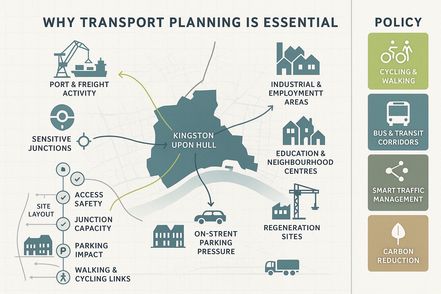
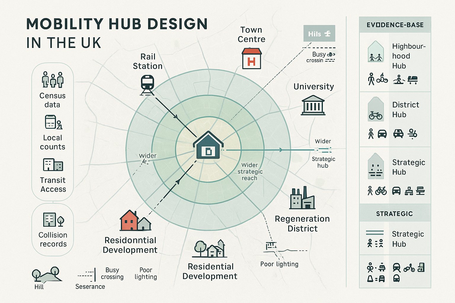
    Infographic map showing key transport planning factors in Kingston upon Hull.

    Transport planning matters in Hull because access is tied directly to economic function, placemaking, and policy compliance. This is a city shaped by its port, industrial activity, education uses, neighbourhood centres, and regeneration sites. A proposal that works in pure site-layout terms can still run into trouble if it creates unsafe access, overloads a junction, worsens parking stress, or ignores opportunities for walking, cycling, and bus travel.

    Hull City Council’s Local Transport Plan 2020–2026 is important here. It is not just a background strategy document: it signals how the authority expects growth to interact with the transport network. Its priorities include a stronger cycling and walking city, better transit corridors, smarter network management, and movement towards carbon neutrality. In practical planning terms, that means applicants are expected to show more than basic vehicle access. We need to demonstrate that development can support efficient, safe, and sustainable movement patterns.

    There is also a local realism to this. Some parts of Hull have established urban streets, constrained frontages, on-street parking pressure, and sensitive junctions. Others sit close to strategic freight routes or employment areas where servicing and HGV activity are a major issue. So transport planning in Kingston upon Hull is not a generic box-ticking exercise. It is a matter of understanding the street, the network, and the planning policy context early enough to design around them rather than react later.

    When A Development In Hull Is Likely To Need Transport Evidence
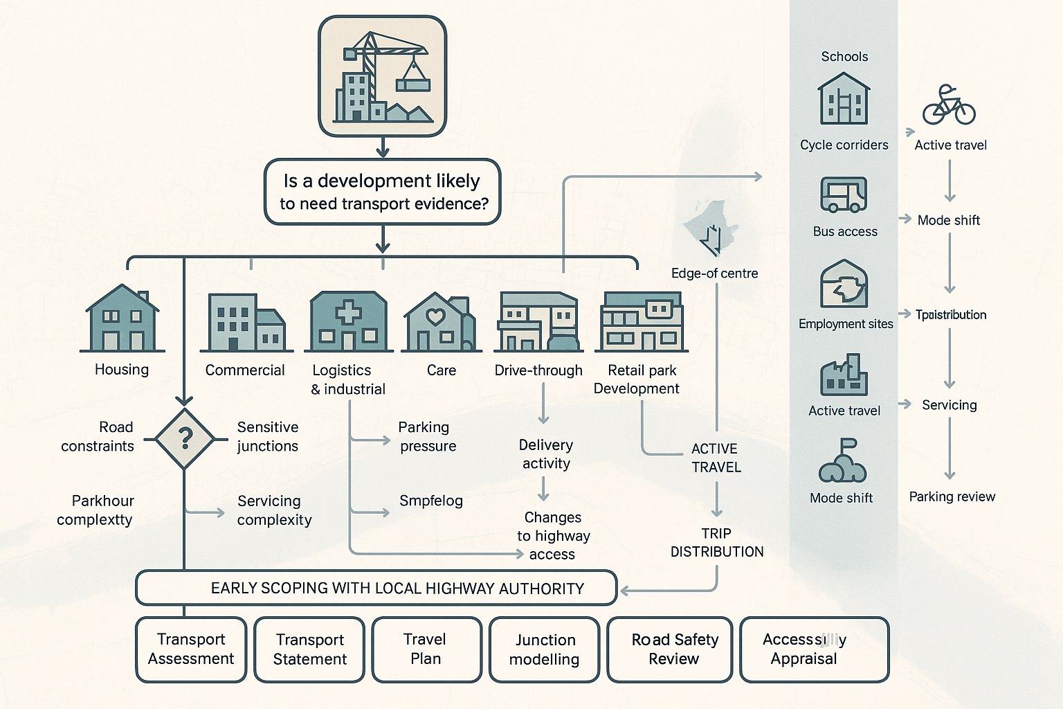
    Infographic showing when Hull developments may need transport planning evidence.

    Not every planning application in Hull needs a full technical transport package, but many do need some level of evidence. As a rule, the bigger the development, the more likely it is to require a formal Transport Assessment, Transport Statement, Travel Plan, or a combination of these. Size is only part of the picture, though. A relatively modest proposal can still trigger transport scrutiny if the site sits on a constrained road, near a sensitive junction, in an area of parking stress, or where servicing arrangements are awkward.

    In practice, larger housing schemes, commercial development, logistics and industrial proposals, care uses, education sites, drive-throughs, retail parks, and town-centre schemes often require structured transport input. So do developments expected to generate noticeable peak-hour trips, attract deliveries, involve significant staff movements, or alter access arrangements onto the public highway.

    We also look at context. A scheme close to schools, near established cycle corridors, or in an area with realistic bus access may face stronger expectations around active travel and mode shift. Conversely, edge-of-centre or employment sites may need more detailed justification on trip distribution, servicing, and parking.

    The safest approach is to review likely requirements before submission rather than guessing from floor area alone. Early scoping with the local highway authority can save weeks. It clarifies whether the authority expects a TA, TS, Travel Plan, junction modelling, swept-path work, road safety commentary, or an accessibility appraisal, and that clarity often makes the difference between a clean validation and a messy one.

    The Main Transport Planning Documents Used In Planning Applications
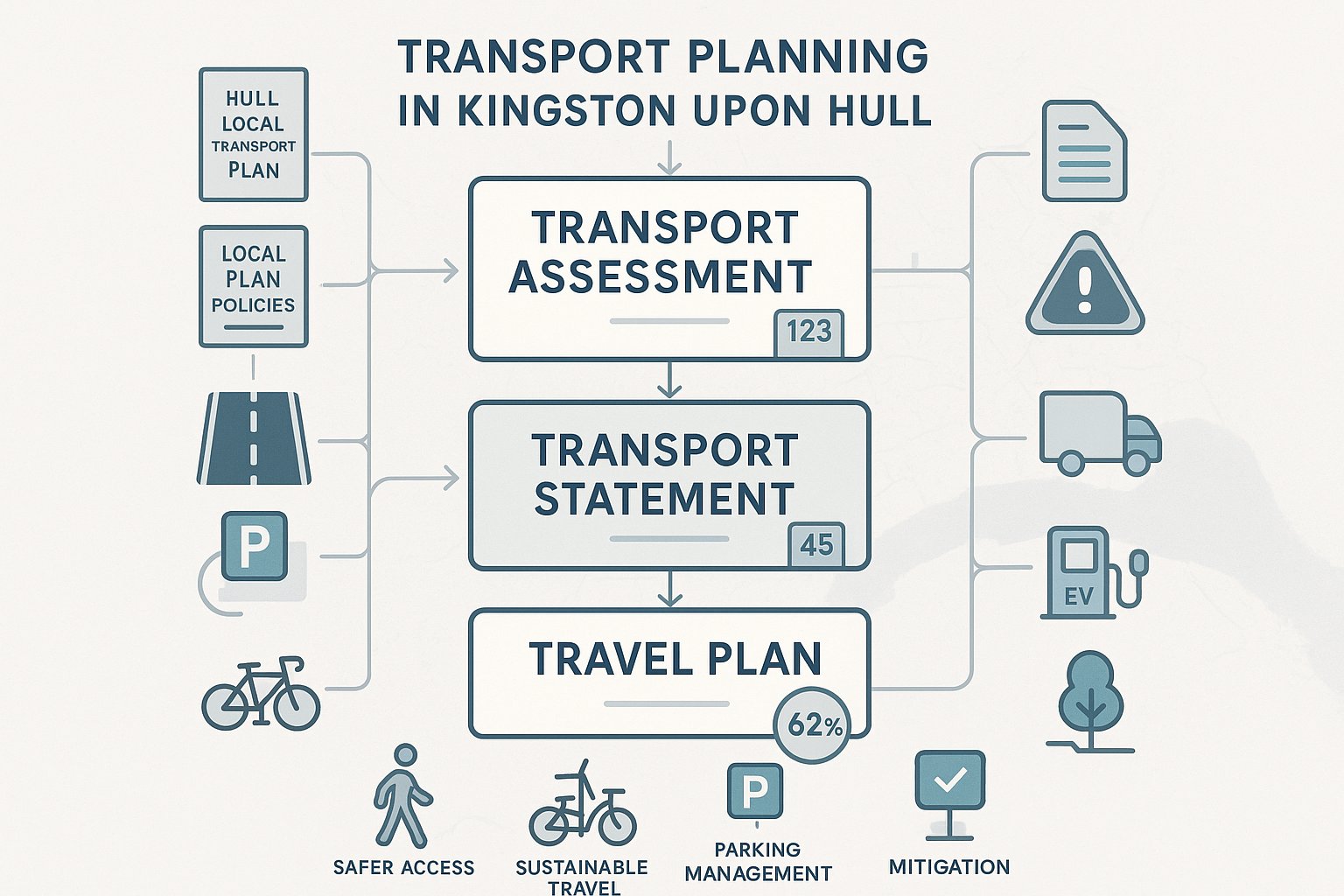
    Infographic comparing Transport Assessment, Transport Statement, and Travel Plan in Hull.

    Most transport submissions in Hull are built around a small group of core documents, supported by drawings and technical appendices where needed. The exact package depends on the scale and complexity of the proposal, but the starting point is usually the local and national policy framework.

    At local level, the Hull Local Transport Plan 2020–2026 is a key reference point because it sets out how the city intends to manage and improve movement. Alongside that, applicants need to consider Local Plan transport and parking policies, plus any relevant development management guidance, sustainable travel expectations, and highway design standards. National planning and transport practice then shapes methodology, proportionality, and impact assessment.

    From there, the technical reports usually do the heavy lifting. Depending on the scheme, these may include a Transport Assessment or Transport Statement, a Travel Plan, an access appraisal, junction-capacity work, collision analysis, swept-path drawings, parking studies, and framework servicing information. For some developments, especially where access or parking is contentious, the drawings can be just as important as the written report.

    Good documentation is not about volume. We have seen concise reports succeed because they answer the right questions clearly, with credible assumptions and a realistic mitigation strategy. Equally, lengthy reports can still fail if they dodge core issues such as poor pedestrian links, unclear servicing, or an over-optimistic parking case.

    Transport Assessment Vs Transport Statement Vs Travel Plan

    A Transport Assessment is the most detailed of the three. It is typically used for larger or more traffic-intensive development and provides a structured, evidence-based review of how the scheme will affect the transport network across all relevant modes. That often includes trip generation, trip distribution, junction-capacity analysis, road safety considerations, servicing, parking, accessibility, and mitigation.

    A Transport Statement is lighter touch. It is still a technical document, but proportionate to smaller schemes with more limited transport effects. A TS may focus on existing conditions, likely trip impact, access suitability, parking, and sustainable travel opportunities without extensive modelling.

    A Travel Plan is different again. Rather than simply assessing impact, it sets out how travel behaviour will be influenced over time. That may include measures such as cycle parking, bus information, car sharing, personalised travel information, EV provision, or staff incentives. In Hull, where policy emphasis falls heavily on active travel, public transport, and lower-emission movement, weak Travel Plans can look tokenistic very quickly. The best ones are practical, monitored, and tailored to the actual users of the site.

    How Hull’s Local Transport Network Shapes Development Planning

    Hull’s transport network has a distinct planning character. It combines dense urban neighbourhoods, key radial corridors, city-centre movements, industrial areas, and strategic freight connections linked to the port and wider regional economy. That means development planning here is shaped not only by local street design but by how a site interacts with bigger movement patterns.

    The Local Transport Plan 2020–2026 sets out three particularly relevant themes: strengthening walking and cycling, improving city transit corridors, and supporting a smart green city. Those priorities feed directly into planning expectations. If a proposal sits near a route with active-travel potential, we should expect scrutiny of footway quality, crossing opportunities, cycle access, and permeability. If it fronts a key corridor, public transport interaction and junction performance may become more important. If it is car-led in a location with realistic alternatives, it may face tougher questions.

    Hull’s network also creates location-specific constraints. In established urban areas, narrow frontages, closely spaced junctions, frontage parking, and regular bus movements can limit access options. In employment or port-related areas, HGV routing and peak operational traffic can dominate the analysis. Around centres and mixed-use areas, the issue is often not whether access exists, but whether it works safely and efficiently without harming existing network operation.

    This is why transport planning in Kingston upon Hull needs a local reading of the network. We cannot assess sites in abstract terms. The same development quantum can be acceptable in one part of the city and problematic in another simply because route choice, street hierarchy, public transport offer, and active-travel conditions differ.

    Key Site Access, Highway Safety, And Parking Considerations

    Three issues appear in almost every transport review in Hull: access, safety, and parking. They sound straightforward, but they are usually where the difficult planning conversations happen.

    First, site access. The authority will want confidence that vehicles can enter and leave safely, that the proposal does not create conflict with pedestrians or cyclists, and that the access arrangement is suitable for the street type. Existing vehicle crossings are not automatically acceptable for intensified use. A quiet former access can become problematic if a new scheme increases turning movements, introduces delivery vehicles, or changes the timing of activity.

    Second, highway safety. This is not limited to recorded collision data, though collision history matters. We also need to consider geometry, visibility, traffic speeds, crossing desire lines, cycle movements, likely driver behaviour, and whether the proposal introduces unusual conflict points. In many urban locations, safety concerns arise less from headline traffic volume and more from awkward manoeuvres, poor driver inter-visibility, or vehicles overrunning footways.

    Third, parking. Hull applications often attract strong comments on parking even where wider transport impacts are modest. Under-provision can trigger overspill concerns: over-provision can undermine sustainable travel objectives and weaken the policy case. The right answer is rarely “as much as possible”. We need a balanced, evidence-led response based on local standards, likely user profile, accessibility, and actual demand patterns.

    What helps most is alignment between the report and the drawings. If the text says servicing is acceptable but the layout leaves vans reversing awkwardly across pedestrian routes, the weakness will be obvious.

    Junction Capacity, Visibility, Servicing, And Internal Layout

    Where an application generates noticeable traffic, junction capacity quickly moves up the agenda. That may involve simple priority-junction review, committed development context, or formal modelling where impacts could be material. The key is proportionality. We do not need elaborate modelling for every site, but we do need enough evidence to show whether queues, delay, or reserve capacity become an issue.

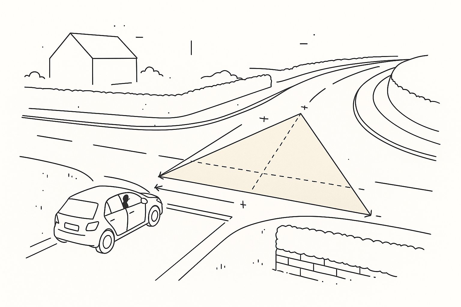
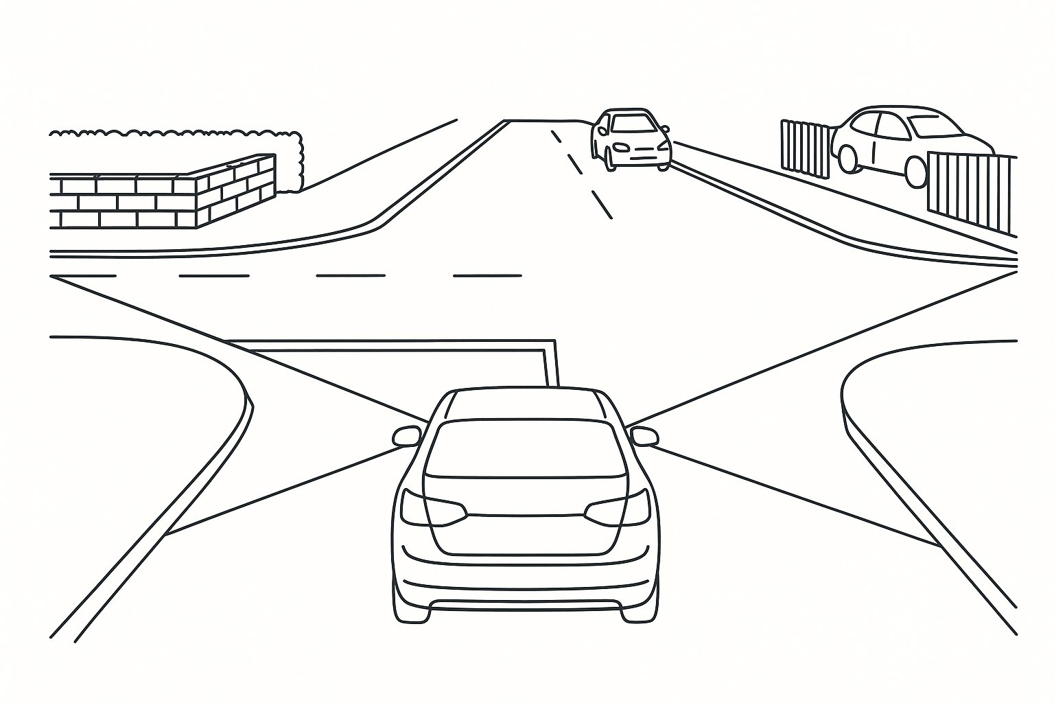
    Visibility is another recurring point. Appropriate visibility splays depend on speed environment, street form, parked vehicles, boundary treatment, and vulnerable road users. In built-up parts of Hull, achieving textbook visibility can be difficult, so the argument often turns on actual operating conditions rather than idealised geometry alone.

    Servicing deserves more attention than it sometimes gets. Bin collection, parcel deliveries, trade vehicles, and larger service movements can make or break a scheme. If a site relies on on-street loading in a sensitive location, or if large vehicles need to reverse excessively, objections are far more likely. Swept-path analysis and a realistic servicing plan usually repay the effort.

    Then there is internal layout. It needs to function for cars, cycles, pedestrians, refuse vehicles, and emergency access without feeling improvised. Tight corners, blocked footway links, hidden cycle parking, or unusable turning heads are all classic warning signs. Good transport planning catches these issues before the application drawings are locked in.

    Sustainable Travel Expectations For New Development In Hull

    Hull’s policy direction is clear: development should support lower-carbon movement and make walking, cycling, and public transport realistic choices, not afterthoughts. That does not mean every site can achieve the same level of modal shift, but it does mean applicants are expected to engage properly with sustainable travel rather than mention it briefly and move on.

    For many schemes, this starts with location efficiency. Is the site near jobs, schools, shops, health services, and bus routes? Are there practical walking connections? Can cyclists access the site directly and safely? Are secure cycle facilities designed in from the outset? If the answer to those questions is broadly yes, the transport submission should reflect that in parking strategy, trip assumptions, and any Travel Plan commitments.

    Hull’s Local Transport Plan promotes active travel as the first choice for short trips and supports improved public transport corridors and low-emission infrastructure. In planning terms, that can translate into expectations around cycle parking quality, pedestrian permeability, EV charging provision, bus stop accessibility, and user information. A scheme that defaults to maximum car access while doing the bare minimum elsewhere can look out of step with local policy.

    That said, sustainable travel arguments need to be credible. We should not overstate bus attractiveness where service frequency is weak, or pretend an inconvenient walking route is acceptable just because it exists on a map. The strongest submissions are honest about current conditions, then set out practical measures that genuinely improve travel choice.

    Walking, Cycling, Public Transport, And Accessibility Appraisal

    Accessibility appraisal is where a lot of transport statements quietly win or lose credibility. It is not enough to note that a bus stop sits within a certain distance, or that a footway exists on one side of the road. We need to consider actual usability.

    For walking, that means route directness, crossing points, lighting, footway width, frontage activity, and whether key local destinations can be reached comfortably. For cycling, it means route continuity, crossing quality, traffic stress, cycle parking design, and links to existing or planned corridors. For public transport, it means stop quality, frequency, destination coverage, service reliability in broad terms, and whether the likely users of the development would see it as a genuine option.

    A sound accessibility appraisal in Hull should reflect the city’s emphasis on integrated travel. If a development is in a relatively sustainable location, we should say so and explain why. If it is not, we should be equally clear and identify mitigation that is realistic, whether that is improved pedestrian access, travel information, bus stop upgrades, or better cycle facilities. Vague claims about “encouraging sustainable travel” do not carry much weight anymore.

    Typical Development Types And Their Transport Planning Challenges

    Different development types create different transport risks, and one of the easiest mistakes in planning is to recycle a standard transport approach across all of them.

    Residential development in Hull often raises questions around parking accumulation, school-run traffic, refuse access, and walkability to local facilities. Even smaller schemes can become contentious where surrounding streets already experience heavy on-street parking or where access sits close to junctions. Family housing and flatted schemes may also behave differently in parking and servicing terms, so assumptions need to match the product.

    Employment, industrial, and logistics development bring another set of issues. HGV routing, shift change traffic, staff car demand, servicing yards, and junction performance tend to dominate. On port-related or freight-sensitive sites, the timing and composition of traffic can matter as much as total volume. A development that looks acceptable on daily flows may still create operational problems at gate peaks or on specific freight corridors.

    Retail and leisure uses often generate sharper peak effects, with parking turnover, weekend demand, linked trips, and short-stay behaviour all relevant. Town-centre and edge-of-centre sites may also need careful treatment of servicing windows and pedestrian conflict.

    Education, healthcare, and community uses can be especially sensitive because activity is concentrated around distinct periods and user groups. A school expansion, for instance, may create more concern about drop-off behaviour than about formal junction capacity.

    The lesson is simple enough: the transport evidence should reflect the actual use class, likely user profile, and operational pattern of the scheme, not just its floor area.

    The Transport Planning Process From Initial Review To Decision

    A smoother application usually starts long before the planning submission. In our experience, the transport planning process works best when it follows a clear sequence and feeds into the design team early.

    First comes the initial review. We look at planning policy, highway context, site constraints, likely trip characteristics, nearby junctions, sustainable travel opportunities, and whether there are obvious red flags such as substandard access width or servicing conflict. This stage often tells us whether a full TA is likely or whether a TS may be enough.

    Next is scoping. Where appropriate, we engage with the local highway authority to agree the broad scope of work. That can cover assessment years, committed development, survey requirements, accident data, modelling approach, Travel Plan expectations, and drawing needs. A short scoping discussion can prevent a lot of rework later.

    Then comes data collection and analysis. Depending on the site, that may include traffic counts, parking surveys, speed data, accessibility review, collision analysis, trip generation benchmarking, and junction modelling. We then prepare the TA, TS, or Travel Plan, making sure the narrative matches the design proposals.

    After submission, the process often moves into negotiation. Comments may focus on parking, off-site works, access geometry, Travel Plan measures, or planning conditions. Some schemes need amendments or further justification. Others move cleanly because the evidence was proportionate and site-specific from the start.

    If permission is granted, that is not always the end. Travel Plans, in particular, may involve monitoring, coordinator roles, or phased review. That follow-through matters because authorities increasingly expect sustainable travel commitments to be real, not decorative.

    Common Reasons Transport Submissions Run Into Problems

    Most weak transport submissions do not fail because the site is impossible. They fail because the evidence is thin, poorly targeted, or disconnected from the scheme design.

    A common issue is underestimating trip generation. That can happen through selective benchmarking, unrealistic mode share assumptions, or failure to account for how the development will actually operate. In Hull, where local context varies sharply, generic national comparisons without local judgement can look flimsy.

    Another regular problem is ignoring cumulative impact. Committed developments, background growth, and nearby changes to the network matter, especially around busy corridors and urban junctions. If a report treats the site in isolation when everyone knows the area is changing, trust drops quickly.

    Junction and safety analysis are also frequent weak spots. We sometimes see reports rely on broad assurances where a targeted capacity review or collision analysis is clearly needed. Equally, access drawings may be submitted with unresolved visibility, servicing, or swept-path issues that should have been fixed before validation.

    Travel Plans can be another stumbling point. A generic document full of standard measures but no delivery framework, targets, or monitoring arrangements tends not to carry much weight. Authorities want to know who will do what, by when, and how success will be measured.

    And finally, poor treatment of walking, cycling, and public transport remains a classic mistake. In a policy environment shaped by active travel and decarbonisation, these modes cannot be covered in two paragraphs. They need proper analysis.

    For project teams that want quick, accurate reporting, that is often where experienced local transport input earns its keep. Firms such as ML Traffic focus on concise, planning-ready evidence tailored to authority expectations, which is often exactly what keeps an otherwise good application from drifting into avoidable transport objections.

    Conclusion

    Transport planning in Kingston upon Hull is eventually about fit: fit with the street, the network, the policy framework, and the real travel behaviour a development will generate. Hull’s Local Transport Plan 2020–2026 sets a clear direction of travel, and successful planning applications are the ones that respond to it directly, not defensively.

    For applicants, that means starting early, scoping properly, and producing evidence that is proportionate but robust. Safe access, realistic parking, workable servicing, junction performance, and strong treatment of walking, cycling, public transport, and low-carbon travel all matter. So does honesty. A clear, well-reasoned report that acknowledges constraints and sets out sensible mitigation will usually travel further than a glossy document that avoids the hard points.

    Done well, transport planning is not a hurdle added at the end. It is part of how better development gets designed, justified, and approved in Hull.

    Transport Planning FAQs for Kingston upon Hull

    Why is transport planning particularly important for developments in Kingston upon Hull?

    Transport planning is crucial in Kingston upon Hull because the city’s network supports diverse needs including commuting, port operations, and regeneration, while aiming to reduce congestion and promote low-carbon travel as outlined in the Local Transport Plan 2020–2026.

    When does a development proposal in Hull require a Transport Assessment, Statement, or Travel Plan?

    Major, traffic-intensive developments like large housing, commercial, retail, and logistics schemes usually need formal Transport Assessments or Statements and Travel Plans. Even smaller schemes near constrained roads or sensitive junctions may require transport evidence to address local network impacts.

    What are the key differences between a Transport Assessment, a Transport Statement, and a Travel Plan?

    A Transport Assessment provides a detailed appraisal of all transport impacts for larger schemes. A Transport Statement is a lighter, proportionate review for smaller developments. A Travel Plan focuses on ongoing strategies to encourage sustainable travel modes, such as cycling and public transport, over time.

    How does Hull’s Local Transport Plan 2020–2026 influence transport planning for development?

    The Local Transport Plan 2020–2026 guides developments to align with goals such as enhancing walking and cycling routes, improving public transit corridors, smart green infrastructure, and carbon neutrality, requiring transport proposals to support safe, sustainable, and integrated travel choices.

    What access, safety, and parking considerations are essential in Hull transport submissions?

    Transport evidence in Hull must demonstrate safe and suitable site access, appropriate junction capacity and visibility, effective servicing arrangements, and balanced parking provision consistent with local standards, ensuring no adverse effects on highway safety or network performance.

    How can developers ensure their transport submissions avoid common pitfalls in Kingston upon Hull?

    Developers should prepare robust, site-specific transport evidence early, accurately estimate trip generation including cumulative impacts, conduct necessary junction and safety analyses, develop realistic and monitored Travel Plans, and thoroughly assess walking, cycling, and public transport connectivity.
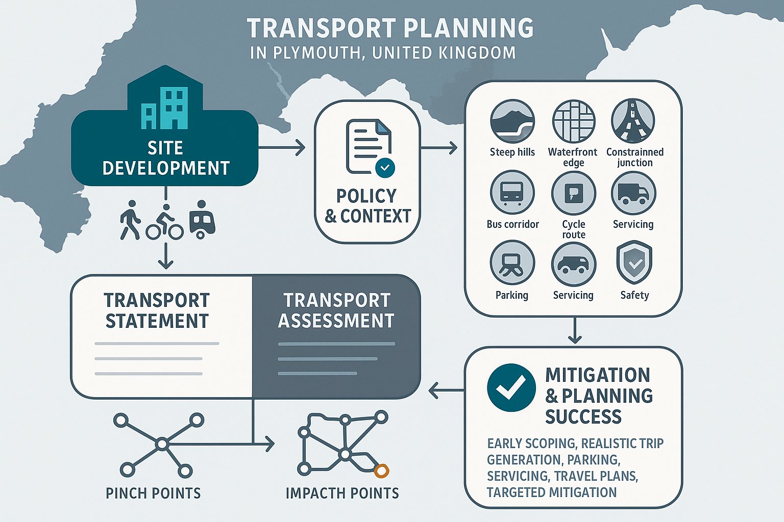
  • Transport Planning In Plymouth: A Practical Guide To Assessments, Policy, And Planning Success In 2026

    Transport Planning In Plymouth: A Practical Guide To Assessments, Policy, And Planning Success In 2026

    Plymouth is not a place where transport can be treated as an afterthought. The city’s steep topography, historic street pattern, waterfront edges, strategic growth ambitions, and constrained junctions all mean one thing: if a planning application is likely to change how people travel, it needs transport evidence that is grounded in local policy and realistic network conditions.

    That is why Transport planning in Plymouth sits so close to planning success. For architects, developers, planners, surveyors, and legal teams, the issue is rarely just whether a site can be accessed. The harder question is whether a proposal aligns with the city’s wider direction of travel: growth in accessible locations, stronger walking and cycling links, better use of the existing network, and mitigation that stands up to scrutiny.

    In our experience, the best outcomes usually come from getting the transport strategy right early. A well-scoped Transport Assessment, a proportionate Transport Statement, robust trip generation, sensible parking and servicing, and a credible Travel Plan can make the difference between a smooth application and months of avoidable delay.

    In this guide, we set out the practical planning and policy picture for Plymouth in 2026, including when transport reports are likely to be needed, how impacts are usually assessed, and which local issues tend to matter most. The aim is simple: help project teams prepare evidence that is clear, proportionate, and persuasive.

    What Transport Planning In Plymouth Covers And Why It Matters

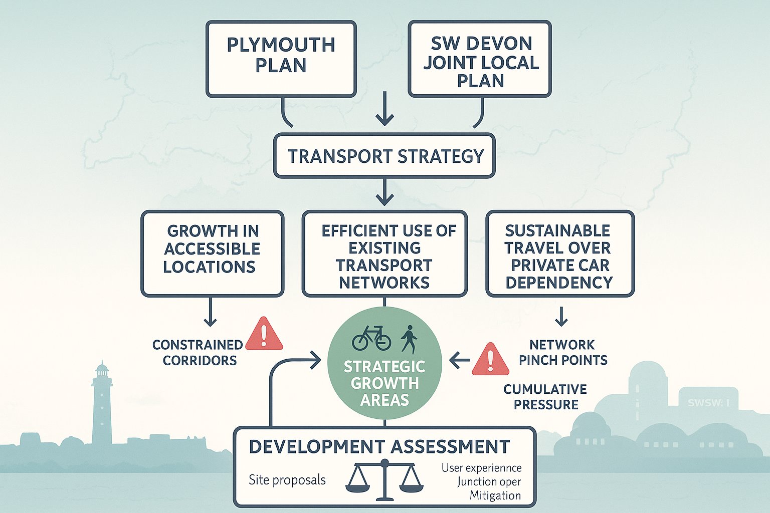
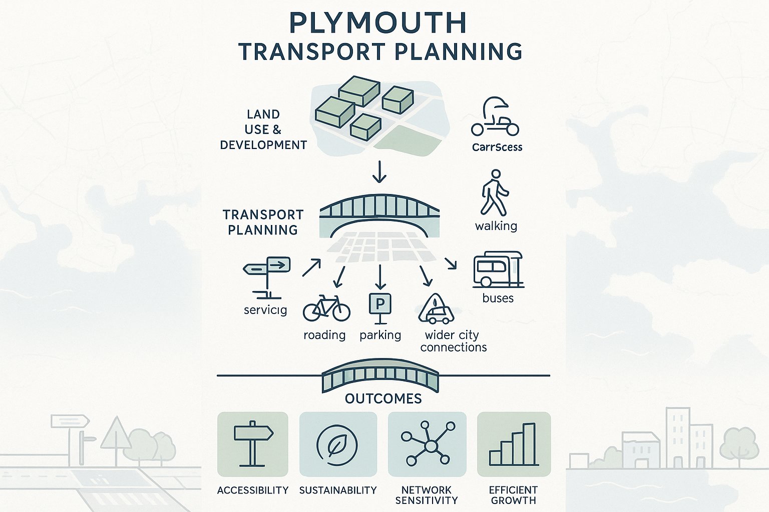
    Infographic showing how transport planning connects development, travel options, and city growth in Plymouth.

    At its core, transport planning in Plymouth is about how development, movement, and network performance fit together. It covers access by car, yes, but also walking, cycling, buses, servicing, road safety, parking demand, trip generation, and how a site connects to the wider city. In practice, it is the bridge between land use planning and day-to-day movement.

    That matters because Plymouth’s growth strategy is not simply about building more homes, employment space, or community facilities. It is about directing growth into locations where people can move around safely and efficiently without creating unacceptable pressure on already sensitive parts of the network. The planning system is hence looking for more than a red line boundary and a visibility splay. It wants evidence that a scheme supports accessibility, sustainability, and placemaking.

    For applicants, that means transport work often feeds directly into site layout, quantum of development, access arrangements, parking levels, and mitigation packages. A transport issue can quickly become a viability issue, or a programme issue, if it is left too late.

    We also see transport planning play an important role in helping teams avoid over-engineering. Not every proposal needs a long, data-heavy assessment. But almost every meaningful proposal benefits from early advice on what the local authority is likely to expect and where the real risks sit.

    The Plymouth Planning And Transport Policy Context

    Infographic of Plymouth transport planning policy shaping development and sustainable travel decisions.

    Plymouth’s planning and transport framework is shaped primarily by the Plymouth Plan and the Plymouth and South West Devon Joint Local Plan, adopted in March 2019. Those documents do more than set broad aspirations. They provide the policy logic behind why certain schemes are supported, challenged, or required to provide mitigation.

    For transport professionals, the key point is that the city’s strategy links development patterns very closely to sustainable movement. The council’s position has long favoured growth in accessible locations, better use of existing transport networks, and interventions that improve connectivity and reduce pressure on constrained corridors before defaulting to major highway expansion.

    That policy context affects how applications are assessed. A site may appear acceptable in purely geometric terms, but still face resistance if it relies too heavily on private car travel, performs poorly against sustainable travel objectives, or adds stress to known network pinch points without a convincing response.

    It is also worth remembering that policy interpretation is rarely abstract. Officers usually read transport evidence through the lens of local growth priorities, the surrounding street environment, and cumulative development pressure. So transport reporting in Plymouth needs to be technically sound and locally literate.

    Local Plan, Strategic Growth Areas, And Decision-Making Priorities

    Policy SPT9 is especially relevant because it ties strategic transport choices to land use distribution and network efficiency. In broad terms, it promotes a balanced approach: concentrate growth in the city’s principal growth areas, maximise the value of existing infrastructure, and support realistic alternatives to private car dependency.

    That has practical implications. Development in or near accessible urban locations may be viewed more positively where walking, cycling, and public transport connections are strong. By contrast, proposals in weaker locations often need more work to demonstrate that the transport effects are acceptable.

    Decision-making priorities in Plymouth also tend to focus on whether a scheme contributes to a coherent place rather than just avoiding severe impact in a narrow highway sense. We hence look beyond junction operation alone and consider connectivity, severance, user experience, and whether the transport strategy helps the site function as part of the city.

    When A Transport Assessment Or Transport Statement Is Likely To Be Required

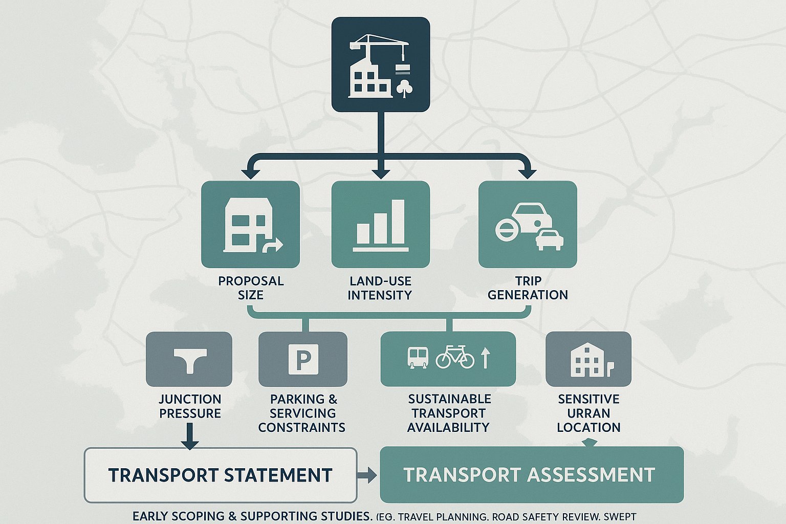
    Decision tree showing when a transport statement or assessment is needed.

    A Transport Assessment (TA) or Transport Statement (TS) is usually required when a development could materially affect travel demand, access arrangements, parking pressure, servicing activity, or the operation of the surrounding network. The exact threshold is not fixed in one simple rule for every site, so the right starting point is always the scale, location, and likely impact of the proposal.

    In Plymouth, a TS is often suitable for smaller schemes where effects are limited and can be explained proportionately. A TA is more likely for major development, mixed-use schemes, education, healthcare, student accommodation, large residential projects, or proposals in sensitive locations where existing conditions are already under strain.

    Common triggers include:

    • a new or altered vehicular access
    • material increases in trip generation
    • impacts on junctions or strategic corridors
    • constrained parking or servicing conditions
    • sites with weak sustainable transport links
    • development within busy urban areas or growth locations

    The local authority’s transport team will generally expect evidence to be proportionate but credible. If a scheme is likely to generate concern, under-scoping rarely saves time. It usually just results in further queries, delayed validation, or requests for additional modelling later in the process.

    That is why we recommend early scoping. A short conversation at the outset can clarify whether the council is likely to expect a TS, a full TA, a Travel Plan, road safety input, swept path analysis, or other supporting material.

    How Trip Generation, Distribution, And Junction Impact Are Typically Assessed

    This is usually the analytical core of transport evidence. We begin by estimating how many trips a development is likely to generate, then consider where those trips will go, which modes they will use, and whether nearby junctions or links can accommodate them acceptably.

    Trip generation is often informed by recognised databases, census data, local surveys, comparable sites, and professional judgement. But the local context matters a lot. A city-centre site in Plymouth with good bus access and walkable surroundings should not be assessed in the same way as a more peripheral site with limited alternatives to the car.

    Trip distribution then maps likely routing patterns across the network. That step needs to be realistic, because weak assumptions can undermine everything that follows. We normally look at the strategic road hierarchy, local one-way systems, existing turning patterns, major destinations, and constraints that make some routes more attractive than others.

    Junction impact is then tested using proportionate tools. Depending on the case, that might include priority junction modelling, signal modelling, roundabout assessment, or a more qualitative review for smaller schemes. Queueing, delay, reserve capacity, and interaction with nearby junctions may all be relevant.

    The aim is not just to prove a point on paper. It is to show that the proposal has been properly understood and that any residual impact can either be accepted or mitigated in a practical way.

    Key Local Considerations That Can Influence Transport Evidence In Plymouth

    Plymouth has a transport character of its own, and that shapes what good evidence looks like. The city’s hills, waterfront geography, historic urban form, bridge and corridor dependencies, and locally constrained junctions all affect accessibility and capacity. A report that ignores those realities will feel generic very quickly.

    One recurring issue is that site performance can vary sharply depending on where it sits relative to the city’s strategic routes and main destinations. A development may be physically close to services but still offer poor walking permeability because of severance, level changes, or busy roads. Equally, a location that appears highway-convenient may be policy-sensitive if it reinforces car-led travel patterns.

    Cumulative impact also matters. Even modest development can draw scrutiny where there is known pressure from nearby allocations, committed schemes, or established congestion points. In those situations, applicants need to show not only what their own traffic does, but how it interacts with a wider moving picture.

    For that reason, local transport planning in Plymouth often benefits from a joined-up evidence base: site access, sustainable travel, parking, servicing, road safety, and network operation should all speak to each other rather than sitting in separate silos.

    City Centre Constraints, Waterfront Areas, And Strategic Corridors

    The city centre and waterfront locations often need particularly careful handling. These areas may offer excellent sustainable access, which is a planning advantage, but they can also present tight street geometry, competing user demands, loading constraints, and limited room for conventional highway solutions.

    Strategic corridors are another focal point. Where development loads onto busy routes or sensitive junctions, officers will typically want comfort that the scheme does not worsen reliability, safety, or severance without suitable mitigation.

    In practical terms, that means evidence should reflect the actual place. We may need to test delivery arrangements more carefully in a waterfront setting, examine pedestrian desire lines in central areas, or take a harder look at route assignment where one corridor already carries significant stress.

    Walking, Cycling, Public Transport, And Sustainable Travel Expectations

    Plymouth’s policy direction is clear: development should support genuine alternatives to private car use wherever possible. So a transport submission that focuses narrowly on vehicle access is rarely enough, especially for urban sites, major schemes, or locations near public transport corridors.

    A robust assessment will usually examine walking catchments, crossing opportunities, footway continuity, gradients, cycling links, local bus services, service frequency, and access to day-to-day destinations such as schools, shops, employment, and healthcare. The quality of these connections matters as much as their existence. A bus stop within range is helpful: a bus stop reached via an indirect or uncomfortable route is less persuasive.

    For cycling, secure and usable parking is important, but it is only part of the picture. Decision-makers will also be interested in whether people can realistically ride to and from the site, how they join the local network, and whether the development removes or worsens barriers.

    For larger schemes, sustainable travel measures often need to be designed in from the start: direct pedestrian routes, filtered permeability, cycle storage, travel information, bus stop improvements, and incentives through a Travel Plan.

    This is where many applications either gain momentum or lose it. If the sustainable transport story feels real and site-specific, the overall case becomes stronger. If it feels tokenistic, officers tend to notice.

    Parking, Servicing, Access Design, And Highway Safety Issues

    Parking and access are often where technical detail becomes highly visible to planning officers, highways teams, and local residents. Even where strategic transport principles are sound, poor practical design can cause trouble.

    Parking provision in Plymouth usually needs to strike a balance. Too little parking can create overspill and neighbour concern: too much can undermine sustainable travel objectives and consume valuable site area. The right answer depends on location, land use, public transport availability, likely user profile, and local constraints. We normally set parking numbers in a policy-led context and then test whether the operational reality supports them.

    Servicing is another frequent pressure point. Refuse collection, deliveries, emergency access, and turning requirements should be resolved early, especially on constrained urban or mixed-use sites. Swept path analysis can be critical here, but it should reflect realistic vehicle types and practical manoeuvres rather than idealised diagrams.

    Highway safety runs through the whole exercise. Visibility, access geometry, pedestrian interaction, internal layout, speed environment, and collision history may all be relevant. If there is a known safety issue nearby, ignoring it is not an option.

    In short, the safest route through planning is usually to show that the proposal works in day-to-day use, not just that it can be made to work in theory.

    Travel Plans, Mitigation Measures, And Planning Conditions

    Where development generates meaningful travel demand, a Travel Plan is often the mechanism that turns sustainable transport ambition into something measurable. It sets out how travel behaviour will be influenced over time, who will be responsible, what measures will be implemented, and how outcomes will be monitored.

    A decent Travel Plan is not a generic appendix pasted in at the end. In Plymouth, it should reflect the site’s actual opportunities and limits. For a residential scheme, that might mean welcome packs, cycle vouchers, real-time travel information, and links to local walking and bus services. For employment uses, it may include coordinator roles, car-sharing measures, cycle facilities, shower provision, or staff travel surveys.

    Mitigation measures can be physical, behavioural, or both. Examples include junction improvements, crossing upgrades, footway links, bus stop enhancements, traffic management, wayfinding, or contributions secured through planning obligations.

    Planning conditions often require details to be submitted later, but the broad strategy should be visible at application stage. If an applicant waits until after consent to think about mitigation, confidence drops.

    The best mitigation packages are proportionate and targeted. They respond directly to identified impacts, fit the character of the site, and avoid the sense of a shopping list assembled to satisfy everyone and no one.

    Common Challenges In Plymouth Planning Applications And How To Address Them Early

    Some issues come up again and again in Plymouth applications. The first is underestimating local network constraints. A proposal may look modest in isolation, but if it feeds into an already sensitive junction or corridor, scrutiny can rise quickly.

    The second is weak sustainable access evidence. Applicants sometimes point to nearby facilities without properly testing walkability, gradient, severance, or public transport quality. In a city like Plymouth, those details matter. A route that works on a plan may feel very different on the ground.

    Third, there is often a disconnect between transport reporting and site design. Parking, servicing, refuse collection, cycle storage, frontage activity, and pedestrian routes are prepared separately and only reconciled late in the day. That is when awkward compromises appear.

    We usually advise teams to address these challenges early by:

    • agreeing scope with the local authority where possible
    • visiting the site and surrounding streets in person
    • testing realistic access and servicing arrangements at concept stage
    • reviewing local collision data and known pinch points
    • aligning transport work with architecture and planning strategy

    For many schemes, the real value is not just in producing a report. It is in using transport input early enough to shape a better application. That tends to save time, money, and a fair bit of frustration later.

    Choosing The Right Scope, Surveys, And Supporting Technical Reports

    Scoping is where good transport work starts. The aim is to identify what evidence is necessary, proportionate, and locally relevant before design teams disappear too far down the road. That sounds obvious, but it is one of the most common points of failure.

    The right scope will depend on development type, scale, local sensitivity, and whether there are known issues around access, capacity, road safety, or sustainable travel. One scheme may only need a concise Transport Statement with a basic access review. Another may require a full Transport Assessment, junction modelling, a Travel Plan, swept path analysis, speed surveys, parking accumulation work, or a road safety audit response.

    Surveys should be chosen carefully and timed sensibly. Depending on the case, we may need traffic counts, queue observations, site access surveys, parking beat surveys, non-motorised user audits, bus service reviews, or collision analysis. Out-of-date or poorly timed data can create avoidable arguments.

    Supporting technical reports should also tell one coherent story. If the transport note says one thing, the Design and Access Statement says another, and the refuse strategy says something else, confidence falls apart.

    For project teams working to tight programmes, experienced input really matters here. On projects we support through ML Traffic, the emphasis is usually on concise, accurate reporting tailored to local authority expectations, so clients are not paying for unnecessary analysis but are still properly covered.

    Conclusion

    Transport planning in Plymouth is eventually about fit: fit with local policy, fit with the surrounding network, and fit with how people will actually move to and from a site. The city’s planning framework expects growth to be accessible, sustainable, and realistic about existing constraints, so transport evidence needs to do more than tick a validation box.

    For applicants and advisers, the practical lesson is straightforward. Start early, scope properly, and build the transport strategy into the design rather than bolting it on later. When trip generation, sustainable access, parking, servicing, safety, and mitigation are considered together, applications tend to be stronger and the planning process tends to be smoother.

    And in Plymouth, that joined-up approach is not a luxury. It is usually the difference between a report that merely exists and one that genuinely helps secure consent.

    Transport Planning in Plymouth: Frequently Asked Questions

    What is transport planning in Plymouth and why is it important?

    Transport planning in Plymouth coordinates development, movement, and network capacity to support growth without undermining accessibility, safety, or sustainability. It aligns with the city’s growth strategy to promote accessible locations, stronger walking and cycling links, and effective use of existing networks.

    When is a Transport Assessment or a Transport Statement required in Plymouth?

    A Transport Assessment or Statement is usually required for developments that materially affect travel demand, access, parking, servicing, or network operation. Major schemes, developments in growth areas, or sites with network constraints generally need detailed assessments to demonstrate acceptable transport impacts.

    How does Plymouth’s local planning policy influence transport planning decisions?

    Plymouth’s planning policies, including the Plymouth Plan and Joint Local Plan, emphasize growth in accessible locations with sustainable travel options. Policy SPT9 guides decision-making by promoting efficient use of existing networks and prioritizing alternatives to car dependency before major highway expansion.

    What are some key local considerations unique to transport planning in Plymouth?

    Plymouth’s steep topography, historic street layout, waterfront areas, and constrained junctions create unique transport challenges. Developments must consider local route priorities, cumulative impacts, and the need to support walking, cycling, and public transport to fit the city’s transport character and policy objectives.

    How are trip generation and junction impacts assessed for planning applications in Plymouth?

    Trip generation estimates how many trips a development will generate based on local data and comparable sites, while trip distribution maps likely travel routes. Junction impacts are then tested using modelling and qualitative reviews to ensure the network can accommodate additional demand safely and efficiently.

    What role do Travel Plans and mitigation measures play in Plymouth’s transport planning?

    Travel Plans outline how travel behaviour will be influenced through initiatives like cycle parking, car-sharing, and travel information, ensuring sustainable transport use. Mitigation measures may include junction improvements or bus stop enhancements, forming a targeted strategy to address identified transport impacts and support sustainable development.

  • AutoTURN Swept Path Analysis: A Practical Guide For Planning Applications In 2026

    AutoTURN Swept Path Analysis: A Practical Guide For Planning Applications In 2026

    If a site layout looks tidy on paper but a refuse lorry can’t turn, a fire appliance can’t reach the building, or a delivery vehicle has to reverse half the length of an access road, the problem usually shows up late, and expensively. That’s exactly why AutoTURN swept path analysis has become such a standard part of transport and planning work.

    For architects, planners, developers and local authorities, swept path drawings do more than illustrate vehicle movements. They provide technical evidence that a scheme can actually function in day-to-day use. And in planning terms, that matters. Highway officers rarely want broad assurances: they want to see whether the right vehicle can enter, manoeuvre, service the site and leave safely, often in forward gear.

    We’ve seen this repeatedly across planning applications, reserved matters submissions and highway approvals: a well-prepared swept path assessment can resolve concerns quickly, while a vague or poorly coordinated one can trigger delays, redesigns and awkward technical queries.

    In this guide, we explain what AutoTURN is, when swept path analysis is usually required, which vehicles are commonly tested, how assessments are carried out, and what local authorities generally expect to see in a submitted drawing. The focus is practical. We’re not treating this as a software demo: we’re looking at how AutoTURN swept path analysis supports real planning outcomes in 2026, especially where sites are constrained, servicing is tight, or highways officers need clear evidence rather than assumptions.

    What AutoTURN Swept Path Analysis Is And Why It Matters

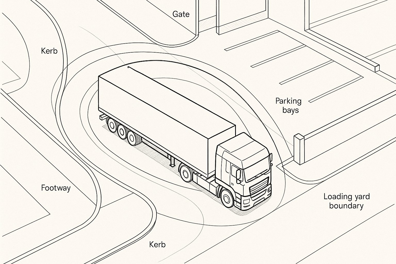
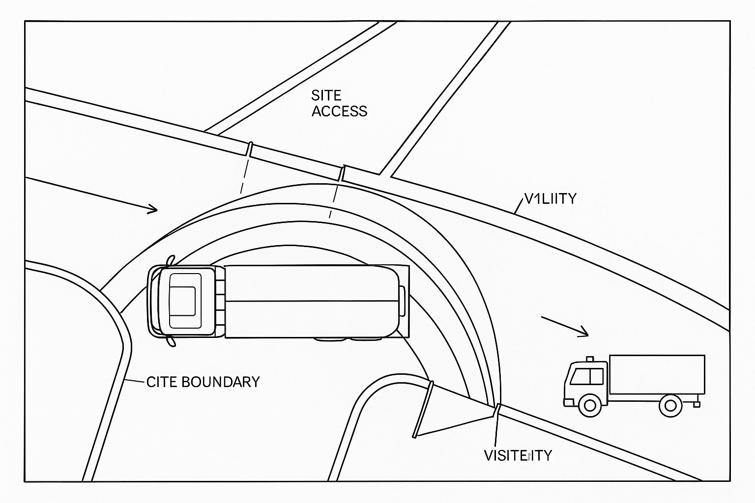
    articulated lorry turning through a constrained site with swept path lines

    AutoTURN swept path analysis is a method of testing how much space a vehicle needs when it turns, circulates, enters a site, reverses into a bay, or exits onto the public highway. Using specialist software, we simulate the movement of a chosen vehicle over a scaled drawing so we can see its wheel tracks, body envelope and overhang in relation to kerbs, walls, parking bays, footways, gates and other constraints.

    That sounds straightforward, but the value is significant. A site can appear compliant in plan form while still being unworkable for real vehicles. The front wheels may clear a bend while the rear wheels mount the kerb. A refuse vehicle may reach a turning head but need a shunt to get out. An articulated lorry may enter a loading yard only by cutting across opposing lanes or pedestrian space.

    Swept path analysis turns those risks into measurable evidence. It shows whether geometry works before construction, before occupation and, ideally, before a planning officer or highway engineer raises an objection.

    It matters because poor manoeuvrability creates practical and legal problems. Unsafe reversing, damage to street furniture, blocked footways, inaccessible servicing areas and emergency access failures all have planning implications. They also create operational headaches long after permission is granted.

    In our experience, the best swept path work does two things at once: it protects design quality and it reduces approval risk. It gives the project team confidence that the layout is not just visually neat, but genuinely usable by the vehicles that will depend on it.

    How Swept Path Analysis Supports Planning And Highway Approval

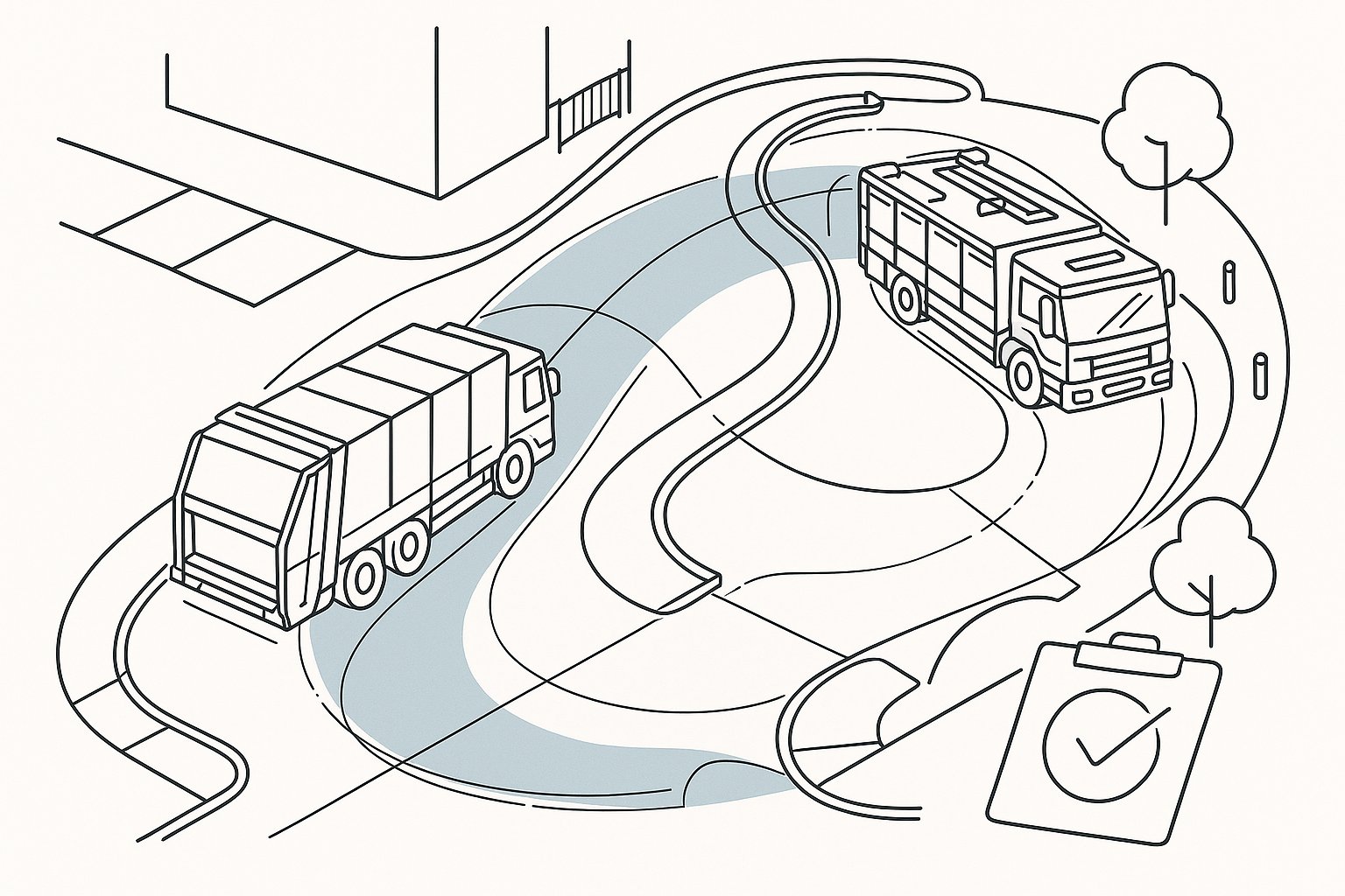
    Swept path drawing of a service vehicle turning through a UK site access.

    Planning and highway decisions increasingly rely on drawings that demonstrate operational realism. That is where swept path analysis carries real weight. Instead of asking officers to accept a narrative statement such as “service vehicles can access the site safely”, we provide a technical drawing showing exactly how that manoeuvre works.

    For planning applications, this can be crucial where access arrangements, internal circulation, refuse collection, delivery strategy or emergency access form part of the assessment. If a proposal depends on a fire appliance reaching a specific point, or if bins are meant to be collected from inside the site boundary, the authority will often want to see the tracking.

    For highway approval, the same principle applies. Local highway authorities commonly review whether vehicles can enter and leave in forward gear, whether turning movements interfere with opposing traffic, and whether a design places pressure on footways, verges or visibility splays. A swept path drawing gives them visual and dimensional evidence.

    It also helps align different technical disciplines. Architects, transport consultants, civil engineers and planning teams can all work from the same tested geometry. That often avoids the familiar problem of one drawing saying the access works while another quietly assumes a different kerb line.

    From a practical standpoint, good vehicle tracking can shorten the approval process. It doesn’t remove every planning issue, of course, but it can answer one of the most common and most avoidable questions: can the site actually function for the vehicles it needs to accommodate?

    When A Swept Path Assessment Is Typically Required

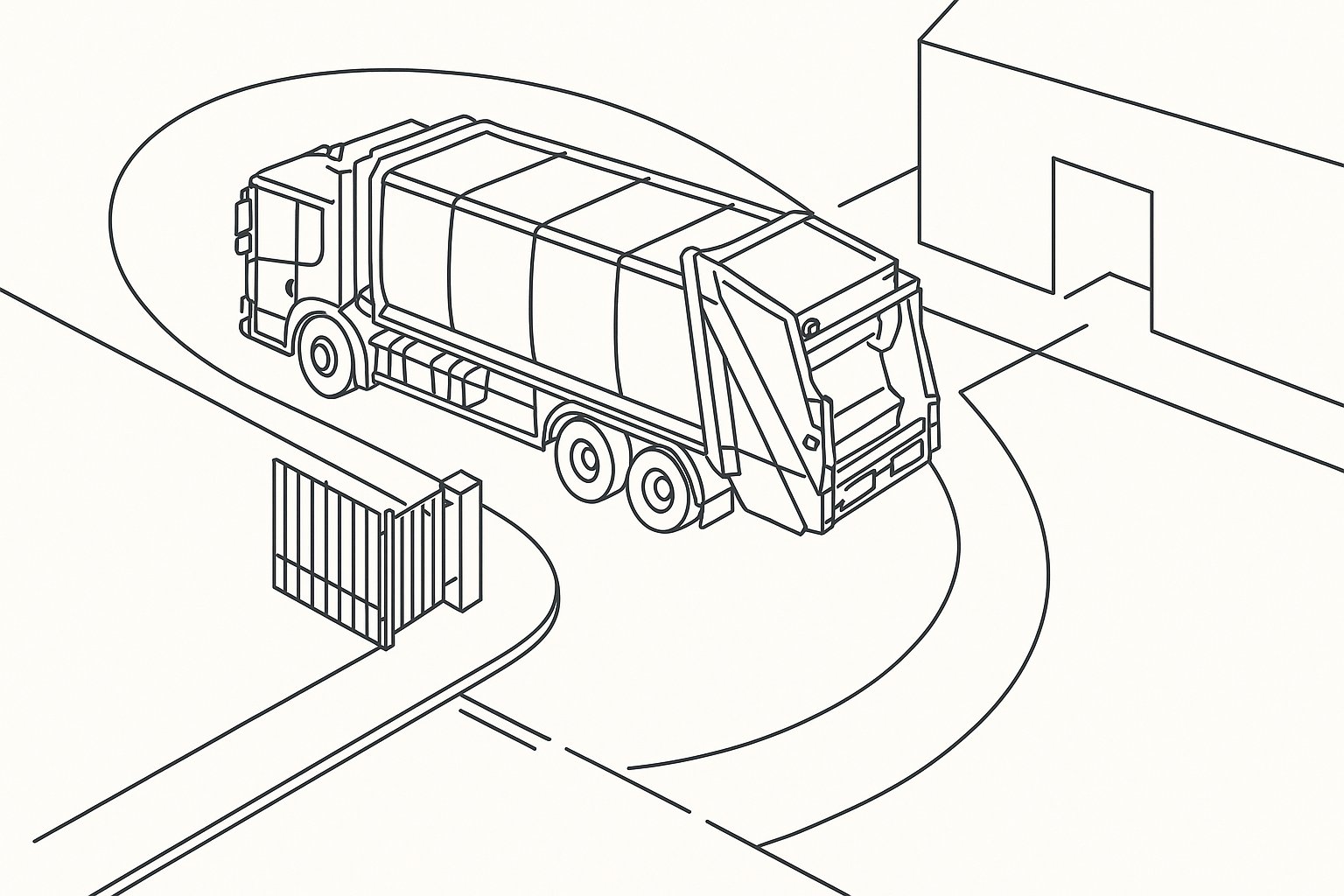
    Large service vehicle turning through a tight site entrance.

    Not every development needs a formal swept path exercise, but many do. The usual trigger is simple: if the safe operation of a site depends on larger vehicles, constrained geometry or non-standard manoeuvres, a tracking assessment is likely to be needed.

    This often arises on compact urban plots, backland developments, new estate roads, commercial yards, schools, care schemes, mixed-use projects and sites with underground parking or narrow access points. Junctions with tight radii, loading areas, internal bends, gated accesses and turning heads are all common pressure points.

    Authorities are also more likely to request swept path evidence where reversing is proposed, where a vehicle must enter from a busy road, or where the consequences of getting the geometry wrong are obvious, think refuse collection, emergency response, servicing strategy or coach access.

    Sometimes the requirement is explicit in pre-application advice or local guidance. Sometimes it emerges later through consultee comments. Either way, waiting too long can be expensive. If the assessment is left until after the layout has been fixed, small geometric problems can become major redesign issues.

    Below are two of the most common planning contexts in which a swept path assessment becomes essential.

    Planning Applications And Reserved Matters

    At planning stage, swept path drawings are often used to prove that the broad development concept is deliverable. On outline or full applications, they may support access strategy, internal road layouts, parking courts, servicing arrangements or refuse collection points. The aim is not always to finalise every dimension, but to demonstrate that the proposal is viable in highway terms.

    At reserved matters or detailed design stage, the drawings usually become more precise. Kerb lines, parking bay dimensions, building offsets, gate positions and landscape features are better defined, so the tracking can be refined accordingly. This is often when conditions attached to a planning permission need to be discharged.

    We regularly find that reserved matters submissions benefit from revisiting earlier assumptions. A layout that worked at concept stage may tighten once levels, walls, planting, bin stores or cycle parking are added. The manoeuvre still needs to work in the real scheme, not the cleaner earlier version.

    This is where a lot of applications either gain momentum or stall. If the vehicle tracking clearly matches the submitted layout, officers can assess it with confidence. If the drawings are inconsistent, underspecified or based on outdated geometry, that tends to invite requests for revision.

    In short, swept path analysis is often part of proving not just that a scheme is acceptable in principle, but that it remains workable as the design develops.

    Access Design, Servicing, And Refuse Collection

    Access and servicing are among the most frequent reasons for carrying out an AutoTURN assessment. A development may look perfectly reasonable until we test the route of a refuse vehicle, rigid delivery lorry or fire appliance. Then the awkward bits appear: a gate set too close to the carriageway, an internal bend that narrows near visitor parking, or a turning head that works only if two spaces are kept empty.

    Refuse collection is a classic example. Many local authorities have clear operational expectations around collection distances, reversing, turning and forward exit. If a refuse vehicle is expected to enter private land, the layout usually needs to demonstrate that this can happen safely and without unrealistic manoeuvres.

    Servicing strategy raises similar issues. Retail units, apartment schemes, schools and employment sites all need practical arrangements for deliveries and collections. Loading bays have to be reachable. Vehicles need sufficient clearance to align, turn and leave. And if a vehicle overhangs a footway or blocks circulation while manoeuvring, the design may need to change.

    Fire access can be even more sensitive. Building control, fire strategy and highway design don’t always speak the same language, so swept path analysis can help bridge that gap by showing whether the required appliance can physically reach the intended location.

    In short, access design is where theory meets operation. The drawing either proves the route works, or it reveals that it doesn’t.

    The Vehicles Commonly Tested In AutoTURN

    One of AutoTURN’s practical strengths is its library of design vehicles. Rather than relying on a generic “large vehicle”, we can select a vehicle type that reflects the actual use of the site or the authority’s expected standard. That makes the resulting assessment much more defensible.

    Commonly tested vehicles include:

    • Passenger cars, often for basement parking, tight ramps and internal circulation checks
    • Light goods vehicles (LGVs) for smaller servicing arrangements
    • Rigid HGVs for deliveries, commercial access and some industrial sites
    • Articulated lorries where larger freight movements are expected
    • Buses and coaches for public transport access, schools, visitor facilities and highway schemes
    • Refuse collection vehicles for residential and mixed-use development
    • Fire appliances for emergency access testing

    The right vehicle choice matters more than many teams first assume. Testing a site with a smaller vehicle than the one likely to use it can produce a reassuring but misleading result. Equally, selecting an overly onerous vehicle without justification can create unnecessary design pressure.

    Good practice is to tie the chosen vehicle to the proposed operation, relevant standards and, where available, local authority expectations. If the council’s waste team expects a particular refuse vehicle format, that should inform the assessment. If a warehouse will genuinely receive articulated deliveries, we need to test that, not a rigid stand-in.

    The goal is realism. A swept path drawing is only as persuasive as the vehicle assumptions behind it.

    How An AutoTURN Assessment Is Carried Out

    At its core, an AutoTURN assessment begins with a reliable base drawing and a clear question: which vehicle needs to go where, and under what conditions? We import or work from the proposed layout, select the appropriate vehicle from the software library, and then test the manoeuvre in forward and, where necessary, reverse movement.

    The path can be generated interactively, allowing us to steer through the design in a realistic way, or refined iteratively until the vehicle movement reflects a credible operation. The output typically shows tyre tracks, body sweep and vehicle positions at key points in the manoeuvre.

    But pressing “run” is the easy part. The technical judgement sits around it. We need to understand the planning context, the site constraints, the authority’s likely concerns and the difference between a manoeuvre that is merely possible and one that is genuinely acceptable in operation.

    For example, a rigid lorry may be able to enter a service yard if driven with precision and with no conflicting traffic present. That does not necessarily mean the arrangement is suitable for approval. We still need to consider tolerance, clearance, visibility, pedestrian interaction and whether the movement feels realistic rather than theoretical.

    Two parts of the process are especially important: the quality of the underlying assumptions, and the way the final manoeuvre is reviewed. Those are where good assessments are either built properly, or quietly undermined.

    Base Drawings, Tracking Parameters, And Design Assumptions

    A swept path assessment is only as sound as the drawing it sits on. If the base plan is inaccurate, outdated or missing critical constraints, the tracking result can be technically neat and completely unhelpful. That’s why we start by checking the geometry carefully: carriageway widths, kerb lines, radii, parking layouts, gates, visibility features, walls, islands, loading bays and any fixed street furniture that could affect movement.

    We then select the right vehicle template and set parameters that reflect real-world operation. Depending on the scenario, that may include steering behaviour, turning radii, direction of travel and assumptions about how the vehicle approaches the manoeuvre. On some sites, even a small shift in starting position can alter whether the turn works.

    Design assumptions should be transparent. If a manoeuvre relies on a vehicle crossing the centre line, using part of an opposing lane, or encroaching into an area that may be occupied, that needs to be visible and justified. Hidden assumptions are one of the main reasons authorities challenge submitted tracking.

    We also need consistency with the wider planning package. If the landscape drawing adds trees within the swept envelope, or the architect’s revised plan narrows a bend that the tracking depends on, the analysis needs updating. This happens more often than teams like to admit.

    In practice, careful setup saves time. It is far better to resolve assumptions at the start than to explain later why a “passing” drawing no longer matches the scheme being determined.

    Reviewing Manoeuvres, Overhang, And Conflict Points

    Once the tracking has been generated, the real assessment begins. We look beyond whether the wheels physically make the turn. The key questions are about clearance, overhang, tolerance and conflict.

    Vehicle body overhang is often where problems emerge. The wheels may stay within the carriageway while the front or rear of the vehicle swings across a footway, clipped verge, parking space, boundary wall or gate pier. On constrained sites, that swing can be the deciding factor between a workable design and one that needs amendment.

    We also review how the manoeuvre relates to surrounding activity. Does the vehicle cut across opposing traffic lanes? Does it obstruct pedestrian desire lines or cycle routes? Is it dependent on an adjacent parking bay being empty? Does reversing create a long blind movement that an authority is unlikely to support?
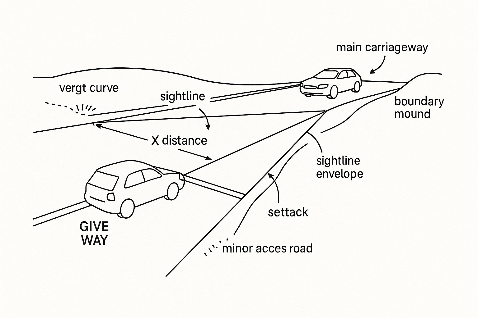
    Conflict points matter because highway officers do not assess drawings in isolation. They think operationally. A manoeuvre that technically fits but creates regular conflict with pedestrians, deliveries, parked cars or oncoming traffic may still be unacceptable.

    That is why we usually review movements at key stages rather than only as one continuous trace. Entry position, steering lock, apex, overhang at the tightest point, alignment into a bay and forward exit are all worth checking separately.

    Good swept path analysis is not just about proving success. It is about exposing pinch points honestly enough that the design can be improved before those pinch points become planning objections.

    Common Design Issues Revealed By Swept Path Analysis

    Swept path analysis has a habit of revealing problems that are easy to miss in a static layout. Some are minor and can be fixed with a small kerb adjustment. Others point to a deeper issue in the site design.

    Among the most common are:

    • Insufficient junction radii, especially on tight urban accesses
    • Vehicle overrun of footways or verges, creating pedestrian safety concerns
    • Turning heads that are nominally present but operationally ineffective
    • Parking spaces that obstruct servicing manoeuvres
    • Loading bays that cannot be entered or exited cleanly
    • Long or awkward reversing movements
    • Conflicts between opposing vehicles in narrow internal roads
    • Gate locations or boundary features that constrain the turning arc

    One issue often leads to another. A designer may widen an access to help a refuse vehicle turn, only to discover that the revised geometry pushes overhang into a proposed planting strip or visibility splay. Or a servicing court may function in isolation but fail once parked cars and pedestrian routes are considered.

    This is why we treat vehicle tracking as a design tool, not just a submission drawing. It can guide iteration early, when changes are still manageable. By the time a planning officer comments that a fire appliance cannot turn within the site, the scheme may already be under timetable pressure.

    The uncomfortable truth is that many swept path problems are not software problems. They are layout problems. The analysis simply makes them impossible to ignore.

    What Makes A Swept Path Drawing Acceptable To Local Authorities

    Local authorities vary in style, but their expectations are usually more consistent than people think. An acceptable swept path drawing should be clear, proportionate, technically credible and obviously linked to the submitted layout.

    In practical terms, authorities typically want to see:

    • A readable scale and north point
    • A clearly identified vehicle type, ideally with a recognisable standard reference
    • Distinction between forward and reverse paths where both are shown
    • Visible wheel tracks and body envelope/overhang
    • Key clearance dimensions where manoeuvres are tight or contested
    • A base drawing that matches the current proposed arrangement
    • No hidden geometry, unexplained assumptions or selective omission of constraints

    Presentation matters more than many applicants realise. If a drawing is cluttered, cropped too tightly or based on faint background geometry, officers may struggle to verify what is being shown. That often leads to a request for clarification even where the movement itself is satisfactory.

    Context also matters. A good submission usually includes a concise explanation of what is being tested, why that vehicle has been chosen and what the result demonstrates. Not a long essay, just enough to make the drawing easy to assess.

    From our perspective, the best way to secure confidence is simple: give the authority a drawing that answers their likely questions before they have to ask them. In planning, that is half the battle.

    Conclusion

    In 2026, AutoTURN swept path analysis remains one of the clearest ways to demonstrate that a development can operate safely and practically, not just look acceptable on a layout plan. For planning applications, reserved matters, access design and highway approval, it provides evidence that the right vehicles can enter, manoeuvre, service and leave without creating avoidable safety or operational problems.

    For architects, planners, developers and councils, that evidence is valuable because it reduces uncertainty. It helps identify design weaknesses early, supports coordination between disciplines and gives decision-makers something more reliable than assumption.

    We’ve found that the strongest outcomes usually come from carrying out swept path analysis early enough to influence design, not late enough merely to defend it. When the base drawings are accurate, the vehicle assumptions are realistic and the presentation is clear, the assessment becomes much more than a technical appendix. It becomes part of how a scheme earns confidence.

    And on constrained sites, that confidence can make all the difference.

    Frequently Asked Questions about AutoTURN Swept Path Analysis

    What is AutoTURN swept path analysis and why is it important in planning?

    AutoTURN swept path analysis simulates vehicle movements to show the space required for turning, reversing, and servicing a site. It ensures that layouts are operationally safe and feasible, reducing costly redesigns and helping planning authorities approve schemes confidently.

    When is a swept path assessment typically required for a development project?

    Swept path assessments are usually needed when large vehicles must manoeuvre in constrained spaces, such as urban plots, new estate roads, loading bays, or where reversing is proposed. They help prove that vehicles like refuse trucks, fire appliances, or delivery lorries can access and exit safely.

    How does AutoTURN support highway approvals and planning applications?

    AutoTURN provides technical drawings showing exact vehicle paths, validating that service, emergency, and delivery vehicles can navigate the site safely, often in forward gear. This visual evidence assists highway officers and planners in assessing operational realism rather than relying on narrative assurances.

    Which types of vehicles are commonly tested using AutoTURN swept path analysis?

    AutoTURN’s extensive vehicle library includes passenger cars, light goods vehicles, rigid and articulated lorries, buses, coaches, refuse collection vehicles, and fire appliances. Selecting the correct vehicle type relevant to the site operation ensures realistic and defensible assessments.

    What makes a swept path drawing acceptable to local authorities?

    Authorities expect clear drawings with a readable scale, north point, clearly identified vehicle types, distinguishable forward and reverse paths, visible wheel tracks and overhang, critical clearance dimensions, and consistency with the proposed site layout. Transparency and clarity are key to approval.

    How can swept path analysis help identify and resolve design issues?

    Swept path analysis reveals practical problems like insufficient junction radii, vehicle overhang blocking footways, ineffective turning heads, and conflicts with pedestrian or vehicle movements. Identifying these early allows designers to adjust layouts before costly planning objections or construction.

  • Area Movement Strategy For Planning Applications: What It Is, Why It Matters, And How To Get It Right In 2026

    Area Movement Strategy For Planning Applications: What It Is, Why It Matters, And How To Get It Right In 2026

    Planning applications rarely succeed on site access drawings alone, especially on complex urban sites, regeneration areas, town centres, or strategic allocations where movement issues spill well beyond the red line boundary. That is where an area movement strategy becomes valuable. It gives us a practical, evidence-led way to look at how people and goods move across a defined area, not just into and out of one development parcel.

    In our experience, this is often the difference between a transport case that feels piecemeal and one that stands up to scrutiny from highways officers, planners, consultees, and planning inspectors. A strong area movement strategy connects transport engineering with planning policy, street design, accessibility, safety, and place-making. It helps us show not only that a development can function, but that it can support a better pattern of movement overall.

    For architects, planners, developers, lawyers, surveyors, local councils, and project teams preparing transport evidence, that wider view matters more than ever in 2026. Authorities increasingly expect planning submissions to demonstrate modal shift, safer streets, better public realm, and realistic mitigation tied to local policy.

    In this guide, we explain what an area movement strategy is, when it is needed, how it supports planning applications, what evidence typically goes into it, and where teams most often go wrong. The aim is simple: help you get the strategy right early, reduce planning risk, and produce transport evidence that feels joined-up rather than reactive.

    What An Area Movement Strategy Is And When It Is Needed

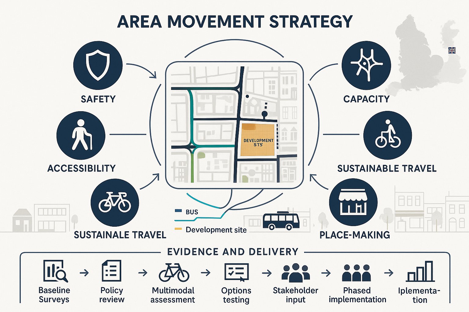
    Infographic of a UK area movement strategy linking transport, development, and priorities.

    An area movement strategy is a structured, spatially based transport strategy for a defined location. Rather than focusing on a single junction or one development access point, it sets out how people, vehicles, servicing activity, and public transport should move across a wider area in a safe, efficient, and policy-compliant way.

    In practice, we use it to answer a bigger question: what kind of movement network should this place have, and how should future development fit within it? That makes it particularly useful where individual planning applications sit inside a changing urban context.

    It is typically needed where transport effects are cumulative, politically sensitive, or closely tied to place-making. Common examples include:

    • town centres facing public realm change
    • growth areas and urban extensions
    • regeneration zones
    • strategic corridors
    • mixed-use masterplans
    • Local Plan allocations with multiple landowners

    An AMS is also valuable where there are competing priorities. A local authority may want more walking and cycling, businesses may need loading access, bus operators may need better reliability, and developers may need workable access arrangements. Without an area-wide framework, those objectives can clash.

    This is why many schemes that appear straightforward on paper become contentious during determination. The issue is not simply traffic impact: it is whether the proposal supports the desired future function of the area. A well-prepared area movement strategy helps define that function early and gives decision-makers a clear basis for judging what is acceptable.

    How It Supports Planning Applications And Wider Transport Evidence

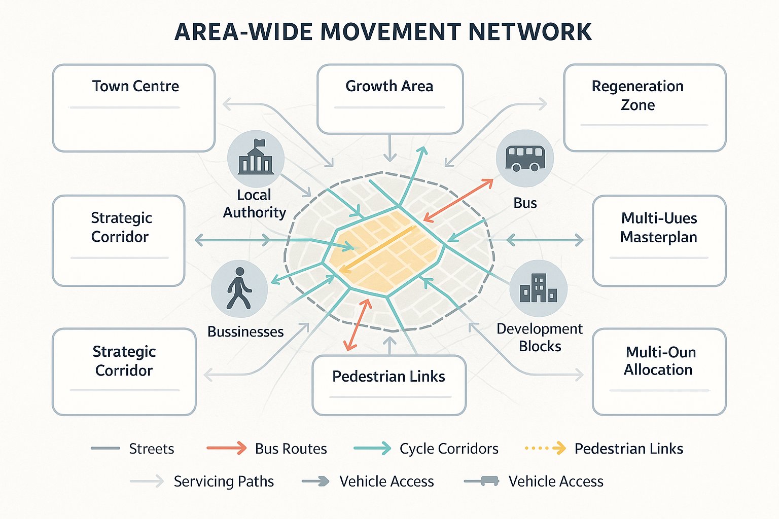
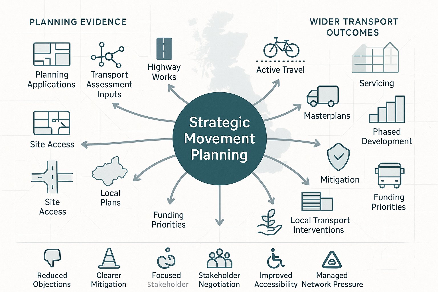
    Infographic showing area movement strategy linking planning evidence to wider transport goals.

    For planning applications, an area movement strategy provides the transport narrative that ties everything together. A Transport Assessment may quantify trip generation, assign flows, and assess junction operation, but an AMS explains how the scheme fits into the wider movement pattern and policy direction of the area.

    That matters because planning decisions are rarely made on model outputs alone. Highways officers and planners want to understand whether site access, highway works, active travel measures, servicing, and mitigation are consistent with broader aims for the area. The AMS provides that framework.

    It can support:

    • Local Plans and allocation evidence
    • masterplans and design codes
    • major planning applications
    • phased development strategies
    • funding bids and infrastructure prioritisation
    • Local Transport Plan interventions

    For developers, it helps show that proposals are not isolated engineering fixes. Instead, they become part of an area-wide package that can improve accessibility, support modal shift, and manage network pressure. For local authorities, it helps align development control with longer-term transport and street design ambitions.

    At M L Traffic, we often see the benefit of this approach where authorities require concise but robust reporting. With over 30 years of transport engineering experience, the key lesson is consistent: planning evidence is stronger when site-specific analysis is clearly linked to area-wide movement priorities. That link can reduce objections, clarify mitigation expectations, and make negotiations with stakeholders more focused and productive.

    The Core Objectives Of An Effective Area Movement Strategy

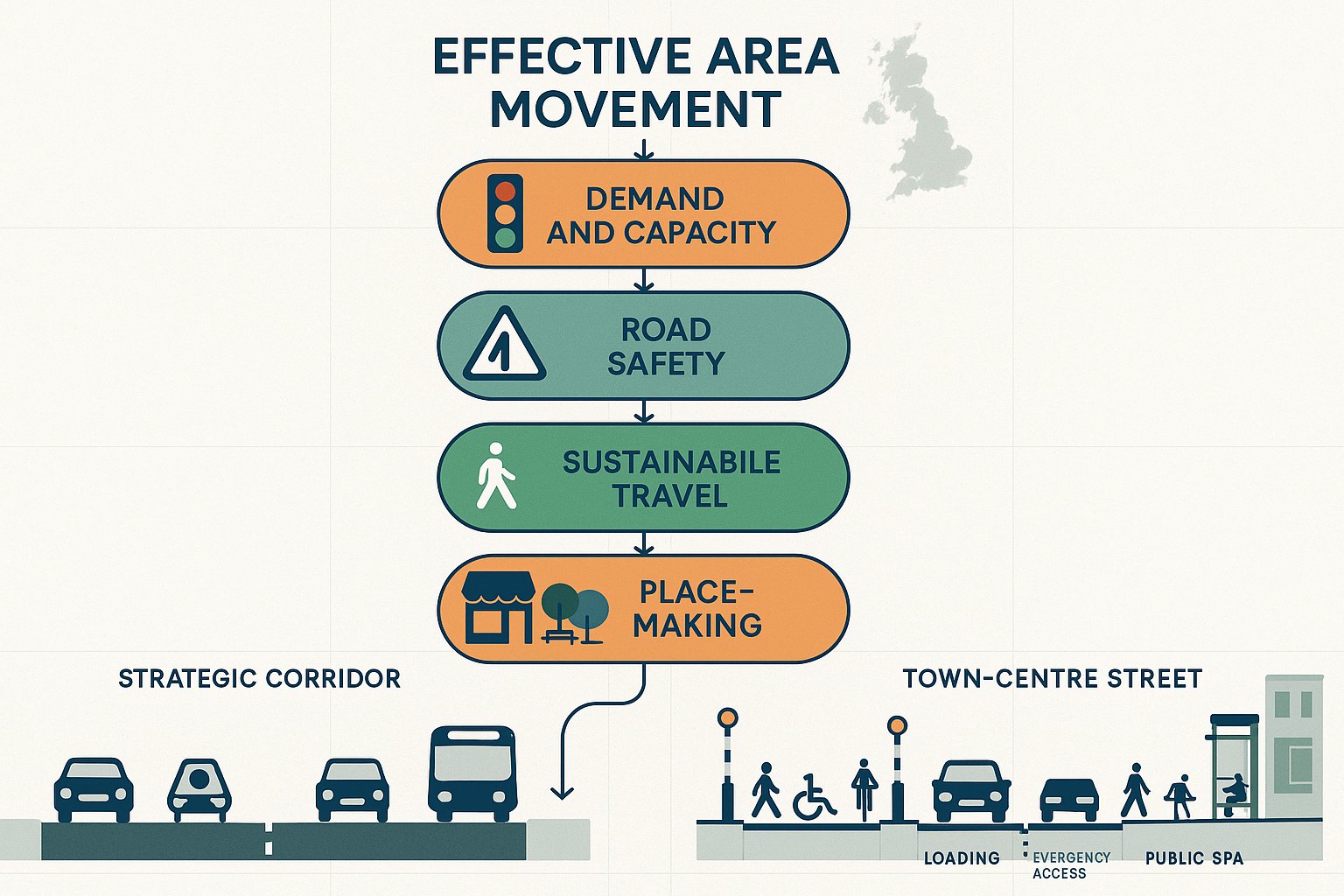
    Infographic showing five goals of an area movement strategy in the UK.

    An effective area movement strategy should do more than list transport problems. It needs to establish clear objectives that can guide design decisions, evidence gathering, and mitigation testing.

    Usually, the core objectives fall into five connected themes.

    First, managing demand and capacity. That means understanding where network stress exists and where future development will increase pressure. But it does not automatically mean road widening. In many locations, better signal staging, demand management, bus priority, or changes to access strategy can be more appropriate.

    Second, improving road safety. Collision reduction remains central, especially around junctions, school routes, town centre gateways, and areas with high pedestrian activity.
    Third, enhancing accessibility. We need to consider how easily people can reach jobs, schools, services, and public transport, including disabled users and those without car access.

    Fourth, promoting sustainable travel. Most authorities now expect walking, cycling, and public transport to be treated as core movement modes, not afterthoughts. This is tied to mode share, public health, and carbon objectives.

    Fifth, supporting place-making and economic vitality. Streets are not just traffic corridors. In centres and mixed-use areas, movement strategy must also support dwell time, street quality, legibility, and a sense of place.

    A good AMS keeps these objectives visible throughout. If they are vague at the start, the technical work tends to drift into a narrow capacity exercise, and that is where planning friction often begins.

    Balancing Safety, Capacity, Accessibility, And Place-Making

    This is usually the hardest part. And, frankly, it is where weak strategies unravel.

    Most urban streets serve more than one function. They move traffic, yes, but they also front homes, shops, schools, bus stops, and civic spaces. So we cannot judge success by queue length alone.

    A practical way forward is to apply a movement and place approach or a clear street hierarchy. That helps us decide where through-movement should be prioritised, where lower design speeds are appropriate, and where street space should be reallocated towards walking, cycling, waiting, loading, or public realm.

    For example, reducing carriageway dominance in a town centre may slightly affect vehicle capacity at peak periods, but materially improve crossings, safety, and footfall. Equally, on a strategic corridor, maintaining bus reliability and essential servicing access may be more important than maximising private car throughput.

    The balance has to be evidence-led. We should test safety, accessibility, and operational effects together, not in silos. We also need to retain practical functions such as loading, refuse collection, emergency access, and disabled parking. Good place-making is not anti-movement: it is about matching movement to the character and purpose of the street.

    Key Policy And Planning Context To Review At The Outset

    Before we define interventions, we need to understand the policy framework that will shape what is acceptable. This is one of the most overlooked early steps in an area movement strategy.

    At national level in England, the starting point is usually the National Planning Policy Framework (NPPF), supported by relevant transport and design guidance such as Manual for Streets and LTN 1/20 for cycling infrastructure. Depending on the project, other guidance on accessibility, bus service integration, public realm, freight, or environmental assessment may also be relevant.

    Then comes local policy. That often carries more weight in practical terms because it tells us how the authority expects movement issues to be handled in that area. We would typically review:

    • the adopted or emerging Local Plan
    • Local Transport Plan priorities
    • site allocation policies
    • town centre, corridor, or regeneration strategies
    • parking standards
    • climate and air quality policies
    • equalities and accessibility commitments
    • public realm or design guidance

    This review should not be a cut-and-paste policy appendix. It should identify what the policy framework is actually asking the development to achieve. Is the emphasis on modal shift? On town centre vitality? On reducing severance? On bus priority? On healthier streets?

    When the policy picture is clear from the outset, the technical scope becomes sharper. It also helps us avoid proposing movement measures that may be operationally sensible but politically or policy-wise misaligned. In planning, that distinction matters more than many teams expect.

    Understanding The Existing Movement Conditions In The Study Area

    Every credible area movement strategy starts with a disciplined understanding of existing conditions. If the baseline is thin, the whole strategy becomes vulnerable.

    First, we define the study area properly. That means identifying not only the site frontage and immediate junctions, but also the wider links, centres, public transport hubs, schools, freight routes, and attractors that influence movement patterns. The correct boundary is functional, not arbitrary.

    Next, we review land uses, committed development, and fixed constraints. Rail lines, waterways, listed structures, conservation areas, topography, air quality management areas, and existing highway boundaries can all shape what is deliverable.

    Then we assess how the network performs today. Typical questions include:

    • Where are the busiest pedestrian routes?
    • Which junctions experience recurring delay or safety concerns?
    • Are there severance issues that make short walking trips unattractive?
    • Is cycling fragmented by hostile junctions or missing links?
    • How reliable are bus services through the area?
    • Where do parking, loading, and servicing disrupt traffic flow or street quality?

    This baseline should be both quantitative and qualitative. Traffic counts matter, but so do observations from site visits. A crossing may technically exist, for instance, yet be so indirect or uncomfortable that people do not use it. Those details often explain why policy aspirations are not being realised on the ground.

    Assessing Walking, Cycling, Public Transport, And General Traffic

    A multi-modal review is essential because movement problems rarely sit neatly inside one transport mode.

    For walking, we assess desire lines, footway width, surface quality, gradients, dropped kerbs, crossing provision, personal safety, lighting, and accessibility for wheelchair users and people with visual impairments. A short route that feels unsafe or inconvenient is not truly accessible.

    For cycling, we look at continuity, level of protection, junction treatment, speed environment, cycle parking, and wayfinding. One painted lane that ends at a hostile roundabout is not a meaningful network.

    For public transport, we review routes, service frequency, punctuality, reliability, interchange quality, stop infrastructure, and step-free access. The strategic question is whether public transport is a realistic choice for key trip types, not merely whether a bus stop exists nearby.

    For general traffic, we examine classified flows, turning movements, speeds, queueing, journey time reliability, routing patterns, and interaction with servicing or parking activity. We also need to understand freight, taxis, and school traffic where relevant.
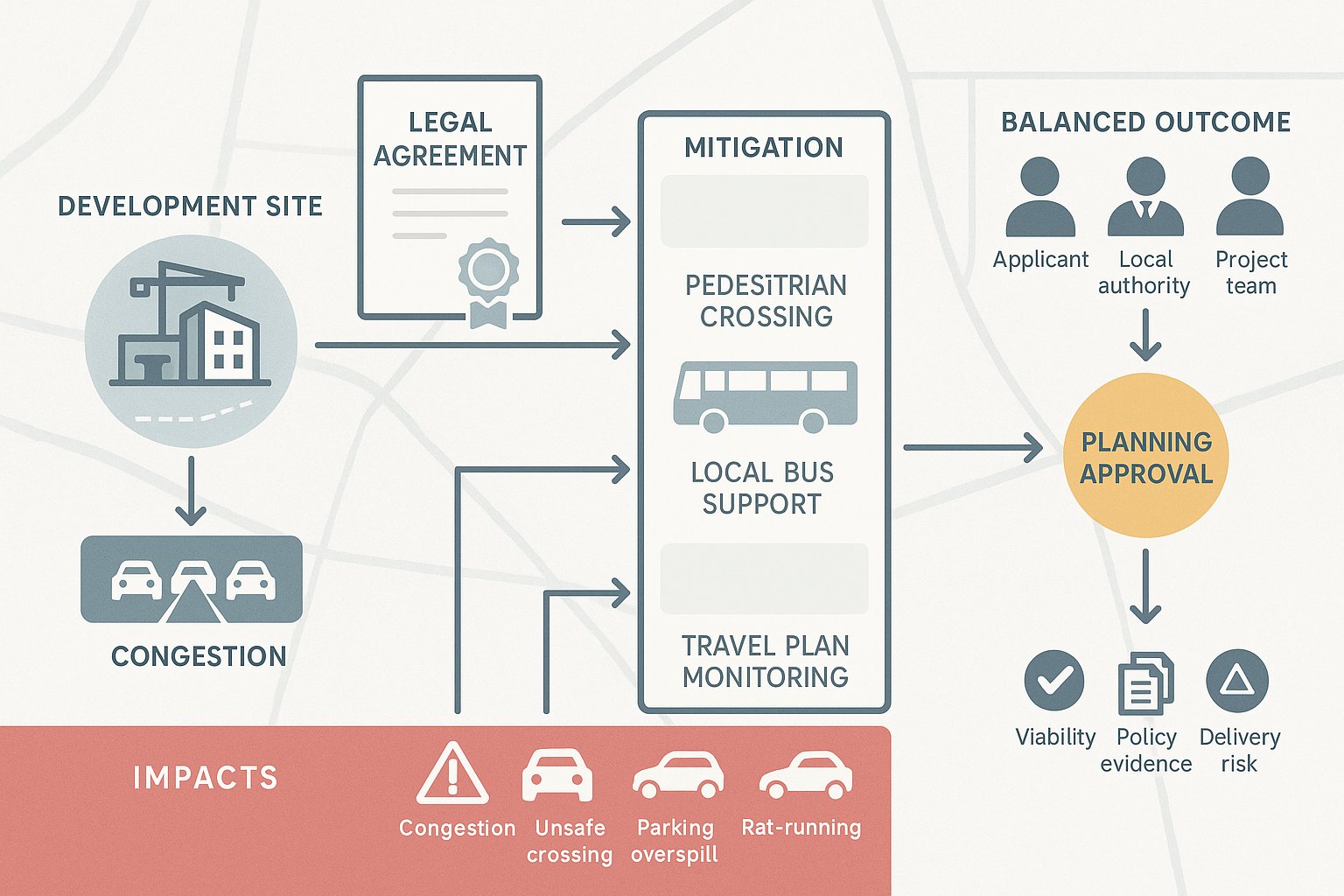
    Only once these modes are assessed together can we identify the real pinch points and the best opportunities for improvement.

    Common Data Sources, Surveys, And Technical Inputs

    The strength of an area movement strategy depends heavily on the quality of its evidence base. We do not need to collect every dataset under the sun, but we do need the right data for the issues being examined.

    Common inputs include automatic traffic counts (ATCs), manual classified counts (MCCs), turning counts at key junctions, queue surveys, and journey time data. These help establish baseline traffic patterns and identify pressure points.

    For road safety, we would normally review STATS19 collision data alongside local authority records where available. Patterns matter more than raw totals. A cluster of slight collisions at one junction may point to design confusion, while isolated incidents elsewhere may not justify the same response.

    For public transport, useful sources include operator data, published timetables, patronage information, reliability records, and real-time service feeds. For walking and cycling, audits such as pedestrian environment reviews, cycle route audits, or level-of-service assessments can add depth beyond simple mapping.

    Other valuable inputs often include:

    • parking beat surveys
    • loading and servicing surveys
    • freight and delivery observations
    • school travel patterns
    • accessibility mapping
    • topographical and highway boundary information
    • air quality or noise constraints
    • land ownership checks

    Where operational issues are central, modelling may be needed, junction modelling, corridor assessments, microsimulation, or wider strategic modelling depending on scale. But modelling should support judgement, not replace it. We have all seen schemes where modelled capacity looked acceptable while the on-street experience remained plainly poor. Good strategy work uses data to sharpen decisions, not to hide them.

    Developing Options And Testing Potential Movement Improvements

    Once the baseline and policy context are clear, the next step is to develop options. This should begin with a broad long list before narrowing into realistic packages.

    Typical measures might include junction redesign, signal optimisation, new or upgraded crossings, segregated cycle links, bus priority, revised parking controls, loading bays, access consolidation, traffic calming, turn restrictions, public realm improvements, and wayfinding upgrades. In some cases, the most effective intervention is not major construction but better network management.

    The key is to package measures into coherent scenarios rather than assess isolated tweaks. A single crossing upgrade may help locally, but pairing it with speed reduction, cycle continuity, and bus stop improvements may unlock a much bigger accessibility benefit.

    Option testing should consider multiple criteria:

    • capacity and delay
    • road safety
    • walking and cycling quality
    • accessibility and inclusion
    • public transport reliability
    • environmental effects
    • carbon and mode share outcomes
    • deliverability and cost

    Stakeholder engagement is part of testing too. Highways authorities, bus operators, developers, disability groups, landowners, and town centre representatives often expose practical issues that desktop work misses.

    The best options process is iterative. We test, refine, and retest. That may sound obvious, but in reality many planning teams jump too quickly from baseline to preferred scheme. A credible area movement strategy shows the logic of how options were generated, filtered, and improved.

    Prioritising Junction Changes, Access Arrangements, And Network Management

    Not every intervention can be delivered at once, so prioritisation matters.

    We usually start with critical junctions, collision clusters, congestion hotspots, gateways to centres, and locations where poor design undermines walking, cycling, or bus performance. These points often have outsized influence on the success of the wider network.

    Access strategy is equally important. Rationalising access points, improving visibility, reducing turning conflicts, or separating servicing from customer access can materially improve both safety and operation. For development sites, this is often where a planning application lives or dies.

    Then there is network management. One-way systems, turn bans, loading controls, signal coordination, school street measures, bus gates, and low-traffic approaches can sometimes achieve more than expensive civil engineering works. Not always popular, of course, but often effective when grounded in evidence.

    Prioritisation should reflect impact, affordability, land requirements, statutory process, and deliverability. There is no point relying on a theoretically perfect intervention if it requires third-party land, major utility diversions, and a traffic regulation process nobody has scoped. The best strategies balance ambition with what can actually be delivered within planning and funding realities.

    How Area Movement Strategies Are Used By Local Authorities And Developers

    Local authorities and developers use area movement strategies for related, but not identical, reasons.

    For local authorities, an AMS helps guide investment decisions, development management, infrastructure bids, and street design expectations across a defined area. It creates a framework for saying yes, no, or not yet to particular proposals. It also helps authorities coordinate contributions from multiple sites rather than negotiate each application in isolation.

    For developers, the value is slightly different. An area movement strategy can demonstrate that a scheme aligns with the direction of travel for the area, supports sustainable movement objectives, and contributes proportionately to mitigation. That can be especially helpful for larger or phased schemes where site-specific modelling alone does not tell the full story.

    It can also improve conversations across the project team. Architects, transport consultants, planning consultants, and legal advisers are more effective when they are working from one shared movement framework. Otherwise, access design, public realm ambition, viability, and planning negotiation can drift apart.

    In practical terms, developers may rely on an AMS to:

    • justify access and servicing arrangements
    • support parameter plans or masterplans
    • inform Section 106 or Section 278 discussions
    • explain off-site mitigation priorities
    • demonstrate compliance with Local Plan expectations

    Authorities, meanwhile, may use the same strategy to defend committee recommendations, support funding bids, or phase improvements sensibly. When both sides are working from a robust area movement strategy, the planning process tends to be less adversarial and far more predictable.

    Common Pitfalls That Delay Approval Or Weaken The Evidence Base

    Most weak area movement strategies fail in familiar ways.

    The first pitfall is insufficient baseline evidence. If surveys are out of date, too narrow in scope, or blind to seasonal and peak variations, objections are almost inevitable. The same applies where committed developments are ignored or only partially accounted for.

    The second is treating modes separately. A strategy that assesses traffic in detail but gives walking, cycling, and bus access only a few generic paragraphs will look unbalanced, because it is. Authorities increasingly expect integrated, multi-modal thinking.

    Third, many documents rely too heavily on capacity metrics alone. Queue reduction is not the same as successful place-making. If the strategy says little about safety, severance, accessibility, inclusion, or urban quality, it will feel dated very quickly.

    Another common issue is weak policy linkage. It is surprising how many technical reports mention policy but do not show how the proposed measures actually respond to it. That creates an easy line of challenge for consultees.

    Stakeholder engagement is another pressure point. Failing to involve the highways authority, public transport operators, disability groups, or key land interests early can store up avoidable conflict.

    And then there is deliverability. Some strategies read well but underestimate cost, land take, utilities, legal orders, or programme risk. If an intervention cannot realistically be delivered, it should not sit at the centre of the planning case.

    The better approach is blunt but effective: define the area properly, gather robust data, integrate all modes, test options honestly, and be realistic about what can be built. That is usually what separates persuasive evidence from paperwork that merely looks busy.

    Conclusion

    An area movement strategy is more than a transport report. At its best, it is the framework that connects land use, network operation, accessibility, safety, and street design across a defined area. That makes it highly valuable for major planning applications, regeneration schemes, Local Plan allocations, and town centre change.

    When grounded in robust baseline evidence, aligned with policy, and developed through genuinely multi-modal thinking, an AMS gives planning decision-makers confidence. It shows that a proposal is not just workable at the site boundary, but supports the wider function and future character of the area.

    For developers and consultants, that means lower planning risk and a clearer route through negotiation. For local authorities, it means a stronger basis for investment, mitigation, and development control.

    And in 2026, that joined-up approach is no longer a nice extra. It is increasingly the standard expected. Get the area movement strategy right early, and the rest of the transport evidence usually becomes clearer, sharper, and far easier to defend.

    Frequently Asked Questions about Area Movement Strategy

    What is an area movement strategy and why is it important?

    An area movement strategy is a spatial transport plan for a defined area that guides safe, efficient movement of people and goods, supporting land use and place-making. It ensures developments fit within wider movement networks and aligns with local policies, reducing planning risks.

    When should an area movement strategy be prepared?

    An area movement strategy is needed for complex urban sites, regeneration zones, town centres, growth areas, strategic corridors, or Local Plan allocations with multiple landowners, where transport effects are cumulative or politically sensitive.

    How does an area movement strategy support planning applications?

    It provides the transport narrative that connects site access, highway works, and active travel to broader area-wide movement patterns and policy aims, helping decision-makers assess proposals beyond isolated junction impacts.

    What are the core objectives of an effective area movement strategy?

    Core objectives include managing demand and capacity, improving road safety, enhancing accessibility, promoting walking, cycling and public transport, and supporting place-making and economic vitality within the area.

    How do local authorities and developers use area movement strategies differently?

    Local authorities use AMS to guide investment, infrastructure bids, and development control, while developers use it to demonstrate scheme alignment with area-wide priorities, justify access arrangements, and negotiate mitigation.

    What common pitfalls should be avoided when preparing an area movement strategy?

    Avoid insufficient baseline data, siloed mode assessments, overemphasis on capacity alone, weak policy linkage, poor stakeholder engagement, and unrealistic delivery assumptions to ensure robust, defensible strategies.

  • Mobility Hub Design In 2026: How To Plan Connected, Policy-Ready Places That Actually Work

    Mobility Hub Design In 2026: How To Plan Connected, Policy-Ready Places That Actually Work

    If a place still treats every journey as a car journey, it usually shows. Oversized parking courts, awkward bus stops, cycle parking tacked on as an afterthought, and public realm that feels more like leftover space than somewhere people actually want to be. Good mobility hub design flips that logic.

    In 2026, the strongest schemes aren’t just adding a few travel options in one location. They’re creating clearly identifiable, policy-ready places where walking, cycling, public transport, shared mobility and essential servicing work together without friction. That matters to architects shaping masterplans, planners writing policy-compliant applications, developers managing viability, and local authorities assessing whether a proposal will genuinely support sustainable travel rather than simply claim to.

    From our side, transport strategy is where these projects either gain momentum or come unstuck. A hub that looks impressive on a concept drawing can still fail in practice if the catchment is wrong, interchange routes are clumsy, kerbside activity is unresolved, or the Transport Assessment doesn’t properly evidence likely mode shift. Equally, a well-planned hub can strengthen placemaking, improve accessibility, reduce car dependence and make a planning submission much more robust.

    In this guide, we’ll look at what makes a mobility hub work, where it should sit, how it should function, and what needs to be addressed in policy, assessment and delivery so it performs in the real world, not just in a design statement.

    What A Mobility Hub Is And Why It Matters In Modern Placemaking

    Infographic of a UK mobility hub linking transport, public space, and sustainability benefits.

    A mobility hub is a recognisable place where several transport modes come together in one coordinated setting. Typically that means some combination of bus, rail, walking routes, cycle infrastructure, secure cycle parking, shared bikes or scooters, car club bays, taxi provision and high-quality public realm. The point is not simply co-location. It is integration.

    When done well, a hub acts as the link between mass transit and the first or last mile of a journey. Someone might arrive by train, pick up a shared cycle, walk safely through a legible public space, or transfer to a bus without having to navigate a cluttered, hostile interchange. That sounds simple, but it requires deliberate planning.

    It also matters far beyond transport. In modern placemaking, mobility hubs help reclaim land from general traffic and long-stay parking, allowing more space for trees, seating, spill-out activity, SuDS, and streets that feel useful rather than merely functional. They can support town centres, stations, mixed-use regeneration, campuses and new communities alike.

    For planning applications, mobility hubs are increasingly relevant because they help convert broad sustainability goals into physical, assessable infrastructure. They give applicants something tangible to point to when demonstrating accessibility, mode shift potential and consistency with local and national policy.

    The Core Elements That Define An Effective Mobility Hub

    Most effective hubs share a fairly consistent set of ingredients, even though the exact mix varies by scale and context.

    At a minimum, we would usually expect direct walking access, safe wheeling routes, high-quality cycle connections, secure cycle parking, public transport stops or stands with shelter, and clear wayfinding. On larger sites, that often expands to include micromobility docks, car club bays, EV charging, seating, planting, real-time information, parcel lockers, toilets or small retail uses where viable.

    But the ingredients alone do not create a successful hub. What matters is how they relate to one another. If cycle parking is hidden round the back, if bus boarding requires crossing a busy access road, or if shared mobility is placed too far from the main desire line, the hub starts to fragment.

    We find the best mobility hub design is compact, obvious and easy to understand within seconds. Users should be able to see where to go, what their options are, and how to transfer between them with minimal effort. Good branding helps. So do consistent materials, intuitive signage and a strong public-realm identity.

    Green infrastructure is often underestimated here. Planting, shade, rain gardens and surface water features are not decorative extras: they improve comfort, resilience and dwell time, making the hub feel like part of a place rather than a transport utility box.

    How Mobility Hubs Support Planning, Accessibility And Net Zero Goals

    Mobility hubs have gained traction because they help solve several planning problems at once.

    First, they support mode shift. By making walking, cycling, public transport and shared travel easier and more visible, they reduce the practical advantage of default car use. That can help lower transport emissions, improve air quality and reduce pressure for extensive private parking provision. In net zero terms, this is one of the clearest ways a development can influence everyday travel behaviour rather than relying on distant offsetting claims.

    Second, they improve accessibility. A well-placed hub can widen access to jobs, services, schools and healthcare for people who do not drive, cannot drive or simply do not want to rely on a private car. That includes younger people, older residents, lower-income households and many disabled users, provided the design is genuinely inclusive and not just nominally step-free.

    Third, they align neatly with current policy themes: decarbonisation, healthy streets, 15-minute neighbourhoods, town centre renewal and sustainable placemaking. For local councils, that makes hubs attractive because they convert policy intent into a practical delivery mechanism.

    And from an evidence perspective, they give a Transport Assessment more substance. Rather than asserting that sustainable modes are “available nearby”, we can assess a defined intervention with a measurable catchment, clear facilities and realistic user benefits.

    Choosing The Right Location And Catchment For A Mobility Hub

    Infographic of mobility hub location, catchment, movement patterns, and hub types.

    Location is usually the make-or-break decision. A beautifully designed hub in the wrong place won’t generate meaningful use, while a modest but well-sited one can quickly become part of daily travel behaviour.

    The strongest locations tend to sit where demand already exists or can credibly be created: rail stations, town and district centres, edge-of-centre regeneration areas, hospitals, universities, employment clusters, and larger residential-led developments. In new communities, the hub should not be a remote add-on at the edge of the site. It needs to sit on natural desire lines and connect to the parts of the scheme people will actually use every day.

    Catchment matters just as much. For neighbourhood-scale hubs, a walkable radius of around 400 to 800 metres is often a sensible starting point, though topography, severance, road crossings and quality of public realm can shrink or expand the effective catchment very quickly. Strategic hubs, especially those tied to rail or rapid transit, can draw from much wider areas.

    We always need to distinguish mapped distance from real distance. A route that looks close on a plan may feel much longer if it involves steep gradients, poor lighting, indirect crossings or unsafe junctions. In mobility hub design, perceived convenience is often more important than geometry.

    Using Demand, Land Use And Local Movement Patterns To Shape The Brief

    Before fixing the brief, we need to understand how people currently move and how they are likely to move once the development is occupied. That means looking beyond headline trip rates.

    Census travel-to-work data still has value, but it should be supplemented with local counts, public transport accessibility, land use analysis, collision data, parking stress, and, where available, mobile or anonymised location data that shows origin-destination patterns. These sources help identify whether the proposed hub is responding to real movement patterns or merely following a fashionable template.

    Land use mix is central. A residential neighbourhood with a primary school and local retail has different time-of-day peaks from a commercial quarter or a hospital campus. That affects the size of waiting areas, the likely take-up of cycle parking, whether car club demand is realistic, and whether parcel lockers or servicing consolidation would add value.

    Different tiers of hub should also be recognised. A neighbourhood hub might focus on walking, cycles, bus access and a small number of shared vehicles. A district hub may need more interchange capacity and stronger branding. A strategic hub linked to rail or a major bus corridor will require a more robust operational and spatial response.

    In planning terms, this early evidence base is crucial. It allows us to justify scale, assess likely mode share impacts and explain why the chosen offer is proportionate to local conditions.

    Designing For Seamless Interchange Between Modes

    Infographic of a UK mobility hub with seamless walking, cycling and transit connections.

    Seamless interchange is one of those phrases everyone uses and not enough schemes genuinely deliver. In practice, it means people can move from one mode to another quickly, intuitively and without stress.

    That starts with distance. Transfer routes should be short, direct and step-free wherever possible. If users have to cross multiple carriageways, negotiate awkward level changes, or hunt for the next mode behind servicing yards and parking aisles, interchange breaks down. Waiting time also matters. Coordinated services are not always within a developer’s control, but physical design can reduce perceived delay through good shelter, information, comfort and visibility.

    Co-location is especially important for buses, rail entrances, cycle parking and micromobility docks. The further apart these functions sit, the less likely users are to combine them. Sightlines should make the relationship obvious. Someone arriving by bus should be able to see where cycle parking is. Someone walking in from the surrounding streets should understand immediately where public transport departs.

    Weather protection sounds mundane until you watch people make choices in February. Covered waiting, wind mitigation and dry walking links can have a very real effect on whether people stick with sustainable modes.

    For larger schemes, interchange should be tested through movement diagrams and user journeys, not just plan annotations. We often ask a simple question: could a first-time visitor navigate the space without instructions? If the answer is no, the design probably needs simplification.

    Prioritising Walking, Cycling, Public Transport And Micromobility

    A hub only supports sustainable travel if the layout clearly prioritises it. That means walking and wheeling first.

    Pedestrian routes should follow desire lines, not be squeezed around vehicle geometry. Crossing points need to be frequent, direct and easy to read, with signal timings and junction design that do not punish people for choosing to walk. For disabled users, step-free access, tactile paving, dropped kerbs, appropriate gradients and rest opportunities are basic requirements, not optional embellishments.

    Cycling needs the same seriousness. Continuous, protected connections into and out of the site are more important than an isolated patch of attractive surfacing within it. Secure cycle parking should be close to entrances, visible, well-lit and suited to different cycle types, including adapted cycles and cargo bikes where relevant.

    Public transport should be given spatial priority too. Bus stops buried behind parking courts send a clear message about what really matters. Stops, stands and waiting facilities should be prominent, convenient and easy to reach without conflict. Where a scheme can support bus priority measures, that should be explored early rather than value-engineered out later.

    Micromobility can be highly effective for short onward trips, but only if it is organised. Docking or parking areas should sit prominently near key entrances and interchange points, with enough management to avoid clutter and conflict. Done badly, scooters and cycles become obstructions. Done properly, they expand the practical catchment of the hub.

    Layout, Safety And User Experience In Mobility Hub Design

    A good layout reduces friction. A poor one creates small frustrations that add up fast: hidden entrances, uncertain crossing points, shared surfaces that no one understands, waiting areas exposed to wind and rain, or service traffic cutting across pedestrian desire lines.

    In mobility hub design, we aim for a simple hierarchy of spaces. Primary pedestrian routes should be obvious. Cycle movements should be legible and protected where conflict risk is high. Vehicle access should be low-speed, controlled and visually secondary unless there is a clear operational reason otherwise. Compactness helps, but not at the expense of comfort or inclusive access.

    The user experience is broader than movement alone. People need shelter, seating, intuitive information, and enough amenity for the space to feel safe and worth using. On larger or higher-dwell hubs, toilets, lockers, drinking water, retail kiosks or parcel collection can materially improve viability and convenience.

    Inclusive design should run through every decision. That includes width, gradients, turning space, boarding conditions, dropped kerbs, tactile information, hearing loops where relevant, and seating placed where people actually need it. Too many schemes still treat accessibility as a compliance checklist rather than a design principle.

    We also need to think about maintenance from the outset. If drainage, planting, paving, docks or information systems are difficult to maintain, the user experience can deteriorate surprisingly quickly. The best hubs still work after a wet winter and a few years of heavy use.

    Visibility, Legibility, Lighting And Personal Security

    People use places they can understand and trust. That makes visibility and legibility fundamental.

    A mobility hub should be clearly identifiable from the main approaches, with consistent signage, strong visual cues and a recognisable layout. Users should not need to decode the site every time they arrive. This is especially important for visitors, occasional users and anyone making a multi-leg journey under time pressure.

    Lighting deserves more care than it often gets. Even where formal lux levels are met, poor uniformity, shadowed corners or excessive glare can make a space feel uncomfortable. Lighting should support walking routes, waiting areas, cycle parking, entrances and information points in a coherent way, while avoiding hidden zones.

    Personal security is not just about CCTV, though CCTV may well have a role. Active frontages, passive surveillance from nearby uses, clear sightlines, visible staffing where appropriate, and the avoidance of concealed recesses all matter. Fear of crime can suppress use just as effectively as actual crime.

    Information design is part of security too. Real-time displays, clear maps, simple symbols and consistent branding reduce cognitive load and help people make quick decisions. The more uncertain a person feels, the less safe the environment tends to feel.

    CoMoUK-style branding and consistent wayfinding principles can help give hubs a recognisable identity across a wider network. That continuity is useful because it signals reliability: if people understand one hub, they can usually understand the next.

    Integrating Kerbside Management, Servicing And Parking Strategy

    This is where many otherwise strong schemes get messy. A mobility hub cannot function properly if the kerbside is left to chance.

    Buses, pick-up and drop-off, taxis, blue badge parking, car club bays, cycle access, freight loading, refuse collection and micromobility all compete for limited edge space. If those demands are not actively managed, conflicts show up immediately, often affecting pedestrians first.

    A clear kerbside strategy should define who can stop where, for how long, at what times, and under what controls. In mixed-use schemes, time-based management is often essential. Morning servicing, daytime bus priority, evening pick-up activity and weekend leisure demand may all need different arrangements. Trying to solve that with generic “shared” kerbspace rarely works.

    Servicing should be consolidated where possible and routed to minimise crossing conflicts with main pedestrian and cycle desire lines. If delivery vans regularly reverse through the heart of the hub, the design intent has already been undermined. For larger developments, micro-consolidation, parcel lockers or managed delivery points can reduce pressure on the frontage.

    Parking strategy is equally important. The role of a mobility hub is not to replicate conventional parking-led design with a few sustainable extras attached. Long-stay private parking should generally be restrained, while priority is given to accessible bays, car club vehicles, short-stay needs and EV infrastructure where justified.

    From a planning perspective, these choices need to align with the wider accessibility offer. Reduced parking provision becomes far more credible when backed by a visible, functional hub and a robust transport evidence base. Without that, objections around overspill and practical usability become much harder to answer.

    Planning Policy, Transport Assessment And Delivery Considerations

    A mobility hub might be an appealing design proposition, but for planning purposes it also has to be policy-aligned, evidenced and deliverable.

    The first step is checking the policy stack properly. That normally means the local plan, local transport plan, parking standards, design codes, town centre or area action frameworks, and any county-level guidance on sustainable travel, placemaking or highways adoption. National guidance matters too, including Department for Transport direction on accessibility and active travel, as well as industry guidance from bodies such as CoMoUK. The hub should not be presented as a bolt-on sustainability feature: it should be shown to respond directly to adopted policy objectives.

    Transport Assessment is where that argument is tested. We would typically expect to assess accessibility by mode, likely trip distribution, interaction with the surrounding highway network, parking implications, and the extent to which the hub can support realistic mode shift. Depending on the scheme, a Travel Plan, Delivery and Servicing Plan, Framework Construction Traffic Management Plan, or parking management strategy may also be relevant.

    Importantly, the assessment should be proportionate and local-authority aware. Different councils apply thresholds differently, and after more than 30 years of supporting planning applications, we know that tailoring reports to local validation requirements and decision-making context can make a substantial difference. A generic report, but polished, often creates avoidable delay.

    Delivery also deserves early thought. Who funds the hub? Who manages car club contracts, micromobility operators, maintenance, cleaning, real-time information systems and enforcement? Is the hub delivered in phase one, or deferred until later occupations, and if later, what protects that commitment?

    In many cases, phased delivery is sensible. A hub can start with strong walking, cycling, bus infrastructure and shared mobility provision, then expand as demand matures. Pilot schemes and monitoring can help refine the offer. But governance must be clear. Without ownership, operational accountability and a realistic commercial model, even well-designed hubs can drift into underperformance.

    Conclusion

    The best mobility hubs do not happen because a plan labels an area “hub” and adds a few icons. They work because location, catchment, interchange, safety, kerbside strategy, policy alignment and delivery have all been thought through as one system.

    For architects, planners, developers and councils, that is the real opportunity in mobility hub design: it can strengthen placemaking and planning compliance at the same time. It can also make lower-car development patterns more practical and defensible, provided the evidence is there.

    Our view is simple. Start early, test the hub against real movement patterns, design for users rather than diagrams, and make sure the transport assessment explains not just what is proposed but why it will work in that location. That is usually the difference between a hub that looks good in consultation material and one that performs once people actually start using the place.

    Frequently Asked Questions about Mobility Hub Design

    What is a mobility hub and why is it important in modern placemaking?

    A mobility hub is a clearly identifiable place integrating buses, trains, walking, cycling, shared bikes, car clubs, and taxis with high-quality public spaces. It supports placemaking by reducing car dependence, enhancing accessibility, and creating welcoming environments beyond mere transport functions.

    What are the core elements that define an effective mobility hub?

    Effective mobility hubs commonly include safe walking and cycling access, secure cycle parking, public transport stops with shelters, car club bays, clear wayfinding, real-time information, good lighting, shelter, seating, and green infrastructure like planting and sustainable drainage.

    How does mobility hub design support net zero and accessibility goals?

    Mobility hubs facilitate mode shift from private cars to active and shared travel modes, cutting emissions and improving air quality. They also improve access to jobs, education, and services for non-drivers or those with mobility challenges, thus promoting social inclusion and aligning with decarbonisation policies.

    Where should a mobility hub be located for maximum effectiveness?

    Mobility hubs work best at places with existing or potential travel demand, such as rail stations, town centres, hospitals, universities, and residential developments. They should be within a walkable catchment of 400–800 metres for neighbourhood hubs and be well connected to key transport corridors.

    How is seamless interchange between transport modes achieved in mobility hub design?

    Seamless interchange requires short, direct, step-free routes; co-located stops with clear sightlines; intuitive signage; weather protection; and minimal level changes. This design reduces transfer time and effort, encouraging users to combine walking, cycling, public transport, and shared mobility modes efficiently.

    What role does kerbside management play in mobility hub functionality?

    Kerbside management coordinates space for buses, drop-off/pick-up, taxis, micromobility, freight, and parking to prevent conflicts and ensure safety. It includes designated zones with time-based controls and consolidated servicing areas to maintain smooth, accessible movement for pedestrians and cyclists.

  • Streets For All Design Guidance: A Practical 2026 Guide For Planning, Heritage, And Highway Design

    Streets For All Design Guidance: A Practical 2026 Guide For Planning, Heritage, And Highway Design

    Historic streets rarely fail because people care too much about them. They fail because projects treat them like ordinary roads. A junction gets widened, signs multiply, bollards appear one by one, surfacing changes without much thought, and before long, the very qualities that made the place distinctive are harder to see.

    That is exactly why streets for all design guidance matters. Produced by Historic England, it gives planners, highway engineers, architects, developers and local authorities a practical framework for improving safety, accessibility and street function in sensitive historic places without eroding their character. It is not anti-change, and it is not a nostalgic plea to freeze streets in time. It is a method for making change more intelligent.

    For teams preparing planning applications, transport statements or detailed public realm proposals, the guidance is especially useful because it helps bridge disciplines that too often work in silos: transport, heritage, urban design and accessibility. In our experience, that is where many delays begin. A scheme may be technically workable from a traffic point of view, yet still attract objections because the design has not responded properly to setting, materials, visual clutter or conservation significance.

    In this guide, we explain what Streets for All is, how it supports heritage-led design, and how to apply it in a real project workflow. We also look at the mistakes that commonly trigger planning pushback, and how to avoid them early.

    What Streets For All Design Guidance Is And Why It Matters

    Infographic showing context-led street design for historic places in the United Kingdom.

    Streets for All is Historic England’s design guidance for highways and public realm works in sensitive historic environments. It was created for practitioners who have to make modern streets work, highway designers, transport consultants, planners, urban designers, conservation officers and developers, while respecting the special interest of historic places.

    Its importance lies in its practicality. Rather than speaking only in broad conservation principles, it addresses the real design decisions that shape a street: kerbs, signs, paving, crossings, traffic management, parking, lighting, guardrailing and clutter. The central message is simple: historic places can accommodate change, but the response must start with the place itself, not with a default highway template.

    That matters because many planning and highway problems stem from standardisation. A design developed for a suburban distributor road can cause real harm if dropped into a conservation area, around listed buildings or within a historic market town. Streets for All helps teams avoid that mismatch by requiring a more careful reading of significance, setting and local character.

    It also matters from a planning-risk perspective. In historic areas, design quality is not decorative: it is material. Schemes that overlook townscape character, views, or the cumulative effect of street equipment can face objections, redesign requests or delays. Using the guidance early can strengthen planning, heritage and transport submissions by showing that accessibility, safety and functionality have been considered alongside historic character rather than at its expense.

    How The Guidance Supports Heritage-Led Street Design

    Infographic of heritage-led street design steps for a calm historic UK street.

    Heritage-led street design does not mean designing by sentiment. It means understanding what is significant about a place and letting that understanding guide technical choices. Streets for All supports this approach by beginning with significance and setting.

    In practice, that means asking different first questions. Not just: how many vehicles use the street, what is the recorded speed, or where can signs be installed? But also: what are the important views, how do building frontages define enclosure, which materials are locally characteristic, what historic patterns of movement still survive, and which features contribute to the area’s identity?

    That shift is powerful. Once we understand a street as part of a historic environment, the design task becomes one of revealing character rather than obscuring it. Traffic management, servicing arrangements, surfacing upgrades and accessibility improvements are still possible, often necessary, but they are shaped to support the place. Good schemes reduce visual noise, simplify cluttered edges and make the townscape easier to read.

    Historic England’s wider body of guidance, alongside Streets for All, has been influential because it shows that heritage-sensitive design can still be robust, safe and contemporary. The strongest schemes usually look calm, not because little has changed, but because every change has been edited. And that, frankly, is where many successful town-centre and conservation-area projects differ from schemes that feel over-engineered from day one.

    Core Principles That Shape Streets For All Schemes

    Infographic showing key principles for designing accessible historic streets in the UK.

    Several core principles run through streets for all design guidance, and they are as relevant in 2026 as ever.

    First, place comes before pure traffic movement. Streets are not simply corridors for vehicles: they are civic spaces, settings for historic buildings, and places where people walk, wait, meet, shop and navigate. Second, design should be context-led and character-sensitive. Historic streets are rarely interchangeable, so standard details should never be applied without challenge. Third, the guidance promotes minimum necessary intervention. In other words, do what is needed for function and safety, but do not add signs, barriers, markings or furniture just because they are available in the catalogue.

    A fourth principle is inclusive design. Heritage value is not protected by making a place harder to use. Step-free movement, legible routes, crossing opportunities and appropriate surface contrasts matter. The task is to integrate them with care.

    Finally, Streets for All aligns closely with wider good practice, especially the place-focused thinking found in Manual for Streets. That overlap is useful for planning teams because it creates a common language across transport, urban design and conservation disciplines.

    Place Before Movement

    The phrase sounds obvious now, but it still cuts against some deeply embedded habits in highway design. For decades, too many schemes judged success mainly by capacity, deflection geometry, visibility splays and traffic throughput. Streets for All challenges that narrow lens.

    In historic centres especially, traffic dominance can quickly damage character. Wide carriageways, over-marked junctions and fast vehicle speeds do more than alter movement patterns: they change how a place feels. They make streets harder to cross, less pleasant to linger in, and visually less coherent. A market square starts reading like a traffic machine.

    Putting place before movement does not mean ignoring vehicles. It means balancing movement with civic, commercial and social value. That can lead to lower design speeds, tighter geometry, simpler layouts, stronger pedestrian priority or a reallocation of kerbside space. Sometimes the best intervention is not adding more hardware, but removing what has accumulated over time.

    Context-Led And Character-Sensitive Design

    This principle is where many proposals either become convincing or unravel. Context-led design starts with observation. We need to understand local materials, kerb traditions, plot rhythm, enclosure, views, surface hierarchy, drainage patterns, tree presence, street widths and the relationship between buildings and carriageway.

    Why does that matter? Because historic character is often carried by subtle things. A flush kerb where a conservation area historically used granite upstands. A bright, standard paving module where the town’s identity comes from irregular stone. A sign placed in front of a key facade. None of these decisions seems dramatic in isolation, but together they can erode the legibility of a place.

    Streets for All rejects one-size-fits-all design. It asks us to respond to the street that is actually there, not the one assumed by a standard drawing pack. For design teams, that usually means more analysis early on, but fewer surprises later.

    Accessibility, Safety, And Inclusion In Historic Streets

    One of the most persistent myths in historic street design is that accessibility and heritage are somehow in tension by default. They are not. Poorly considered design creates the tension: thoughtful design resolves it.

    Streets for All is clear that historic places must still work for everyone. That includes older people, wheelchair users, blind and partially sighted people, parents with prams, visitors unfamiliar with the area, and those moving through the street under time pressure rather than leisurely admiration. Inclusive design is not an optional add-on for modern schemes: it is part of making a street function properly.

    In practical terms, that means providing clear and legible pedestrian routes, avoiding unnecessary level changes, ensuring crossing points are where people actually want to cross, and using tonal and tactile contrasts carefully. It also means recognising that some apparently “traditional” details can create barriers if used without thought. Uneven surfaces, awkward drainage channels and poorly repaired paving may look authentic, but they can exclude people very effectively.

    Safety needs the same balanced approach. In historic streets, safety measures should not automatically default to the most visually intrusive option. Guardrail, excessive lining, oversized signing and cluttered islands may solve one perceived issue while creating several others. Lower speeds, simpler layouts, better crossing alignment and reduced ambiguity can often improve safety more elegantly.

    For planning submissions, this is where joined-up evidence matters. We have seen stronger outcomes when transport, heritage and accessibility arguments are prepared together rather than in separate documents that barely acknowledge each other. On projects requiring transport assessments, that integration can also help demonstrate to local authorities that functionality and historic character have been weighed in a coherent way.

    Materials, Street Furniture, And Public Realm Details

    If strategy sets the direction, materials and details decide whether a scheme actually feels right on the ground. Historic streets are highly sensitive to small components. A dozen minor decisions can shape the result more than one grand masterplan diagram.

    Streets for All hence places strong emphasis on durable, repairable and locally appropriate materials. Natural stone, traditional kerbs and finishes that reflect local precedent are often preferred where justified, not because they are quaint, but because they weather better visually, support continuity and reinforce local identity. That said, appropriateness is not the same as expensive mimicry. The best material choice is usually the one that matches context, performs well in use and can be maintained realistically.

    Street furniture deserves the same discipline. Bollards, signs, lighting columns, bins, guardrail, planters, benches and cabinets can quickly overwhelm a historic street if each is chosen in isolation. The guidance pushes us towards rationalisation: fewer items, better placed, with a coherent visual language.

    Three details matter especially:

    • Number: only keep what is genuinely necessary.
    • Placement: avoid blocking views, pinching footways or cluttering building frontages.
    • Consistency: use coordinated families of elements rather than piecemeal additions.

    This sounds modest, but it has major impact. Many objection-prone schemes are not rejected because of one catastrophic design move. They struggle because they look busy, generic or unresolved. In contrast, a disciplined palette of surfaces and furniture can make even technically complex interventions read as calm and considered.

    Managing Traffic, Parking, And Servicing Without Harming Character

    Traffic, parking and servicing are usually where idealism meets delivery. Historic centres still need to function. Shops need loading. Residents need access. Buses need to move. Emergency services cannot be designed out of the conversation. Streets for All is useful precisely because it does not ignore these realities: it asks us to manage them more intelligently.

    A heritage-sensitive approach starts by questioning whether traffic dominance has become normalised. Do all vehicle movements need to be there, in that form, at that speed, all day? Could servicing be time-managed? Could parking be consolidated, reduced or better designed? Could signage be simplified? Could kerbside space be reallocated to improve pedestrian comfort or support cycling and public transport?

    Often, the answer is yes, at least in part. Rationalised parking layouts, carefully located loading bays, lower-speed environments and cleaner kerbside management can reduce harm without undermining function. The trick is precision. A few badly sited parking spaces can damage the setting of listed buildings more than a modest reduction in general carriageway width ever would.

    The visual impact of management measures also matters. Markings, upright signs, ticket machines, cameras and protective barriers can colonise a street surprisingly quickly. The guidance encourages restraint and integration, with the minimum equipment needed to make a management regime work.

    For development-led schemes, we often advise clients to address these issues early in transport work rather than leaving them to late-stage landscape or public realm notes. If the access and servicing strategy fights the heritage logic of the scheme, that conflict usually surfaces during consultation, and by then redesign is more painful and more expensive.

    The Role Of Streets For All In Planning And Transport Assessments

    For planning professionals and transport consultants, Streets for All is not just background reading: it can be a useful evidential tool. In historic settings, it helps show that a proposal has been developed with recognised good practice in mind and that design choices have been tested against more than traffic operation alone.

    That is important because schemes in conservation areas or near designated heritage assets are often judged through multiple policy lenses at once: design quality, accessibility, highway safety, heritage impact, public realm quality and local character. Streets for All helps connect those strands. Used alongside Manual for Streets, local plan policy, conservation area appraisals and authority-specific guidance, it strengthens the logic behind a proposal.

    In transport statements and transport assessments, the guidance can support narrative around:

    • why lower-speed or place-led design is appropriate:
    • how crossing, servicing or parking arrangements have been balanced with townscape sensitivity:
    • why clutter reduction or simplified geometry improves the street as a whole:
    • how the scheme responds to the significance and setting of heritage assets.

    For a specialist practice such as ML Traffic, this is exactly where clear reporting matters. Local authorities do not just want data: they want confidence that the transport case understands the planning context. A concise, accurate assessment that reflects local thresholds and historic-place sensitivities can make the broader application more persuasive.

    And there is a practical benefit too: when transport evidence is aligned with heritage-led design principles from the start, the planning team spends less time trying to reconcile contradictory consultant outputs later.

    Common Design Mistakes That Trigger Objections Or Delays

    Most objections in historic street projects are not caused by ambition. They are caused by carelessness, standardisation or unresolved trade-offs. A few mistakes appear again and again.

    Over-engineered junctions are a classic example. Large corner radii, multiple lanes, heavy lining and excessive islands may satisfy a narrow highway instinct, but in a historic town centre they can dominate the entire scene and make pedestrian movement feel secondary.

    Suburban or generic materials are another frequent problem. Bright concrete block paving, oversized kerbs or standard precast details can jar badly in historic cores, especially where local stone, restrained palettes and finer grain are part of the area’s identity.

    Too much equipment is probably the most common issue of all. Sign proliferation, bollard creep, unnecessary guardrail, duplicate poles and poorly coordinated cabinets create clutter and weaken visual coherence. One sign may be justified. Fifteen often are not.

    There are also more subtle errors:

    • failing to assess key views and settings before fixing layout:
    • treating accessibility as a late compliance exercise instead of a design principle:
    • using standard details without understanding local character:
    • separating transport, heritage and public realm design into silos.

    What triggers delay is not just the presence of these issues, but the impression they create: that the scheme has not really understood the place. Once that concern takes hold among planners, conservation officers or local stakeholders, even sensible parts of the proposal can come under heavier scrutiny. Prevention, as ever, is cheaper than redesign.

    How To Apply The Guidance In A Real Project Workflow

    The best way to use streets for all design guidance is not as a final polish, but as a workflow. Applied early, it helps teams make better decisions before positions harden.

    1. Baseline

    Start with a proper understanding of the street. That means heritage significance, conservation context, listed buildings, views, materials, movement patterns, collision data, accessibility barriers, servicing needs and existing clutter. Photographs, character analysis and on-site observation matter here. Desk work alone rarely captures why a street feels as it does.

    2. Objectives

    Set project objectives that balance place, movement, safety and inclusion. Be explicit. Are we trying to reduce vehicle dominance? Improve crossings? Rationalise parking? Protect setting? Support town-centre vitality? Vague briefs tend to produce compromised design.

    3. Concept design

    Test options against place-before-movement and inclusive design principles. At this stage, we should be willing to compare genuinely different approaches rather than polishing the first highway layout produced. Simple sketches can reveal whether a concept respects building lines, views and pedestrian desire lines.

    4. Detail design

    Once the concept is right, develop materials, kerbs, furniture, drainage, lighting and traffic measures with discipline. Every element should justify its presence. This is where many schemes drift back into standardisation, so design review is vital.

    5. Assessment and iteration

    Quality audit the scheme through transport, heritage and accessibility lenses. If a crossing point works technically but damages an important setting, revisit it. If a material is beautiful but fragile in a high-turnover area, reconsider. Iteration is normal, not failure.

    6. Implementation and maintenance

    Finally, protect the design through delivery and long-term management. Poor workmanship, ad hoc repairs and uncoordinated future additions can undo a thoughtful scheme surprisingly fast. Historic streets need maintenance strategies, not just capital works approval.

    Conclusion

    Used well, streets for all design guidance gives us a practical way to design streets that are safer, more inclusive and easier to manage without sacrificing the qualities that make historic places distinctive. Its value lies in that balance. It does not ask us to choose between movement and character, or between accessibility and heritage. It asks us to design well enough to serve both.

    For architects, planners, surveyors, highway engineers, developers and local authorities, that makes it more than a heritage document. It is a delivery tool, especially when combined with Manual for Streets, local policy and robust transport evidence.

    The projects that succeed are rarely the ones with the most intervention. They are the ones with the clearest understanding of place, the strongest coordination between disciplines, and the discipline to remove as much as to add. In historic streets, that restraint is not a limitation. It is usually the difference between a scheme that belongs and one that merely arrives.

    Streets for All Design Guidance – Frequently Asked Questions

    What is Streets for All design guidance and why is it important?

    Streets for All is Historic England’s practical design guidance for highways and public realm works in sensitive historic areas. It helps improve accessibility, safety, and street function without harming the heritage character, reducing the risk of planning refusals or delays.

    How does Streets for All support heritage-led street design?

    It begins with understanding the significance and setting of historic places, guiding technical choices to reveal rather than obscure character. This ensures that traffic management, surfacing, and street equipment respect local identity while accommodating necessary modern functions.

    What are the core principles behind Streets for All schemes?

    Core principles include prioritising place and character over pure traffic movement, context-sensitive design, minimum necessary street clutter, inclusive accessibility, and alignment with the people-centred approach of Manual for Streets.

    How can designers balance accessibility and heritage in historic streets?

    By adopting inclusive design that provides step-free routes, clear crossings, and appropriate surface contrasts while using discreet safety measures. Thoughtful design avoids tension by integrating accessibility needs with historic fabric and visual sensitivity.
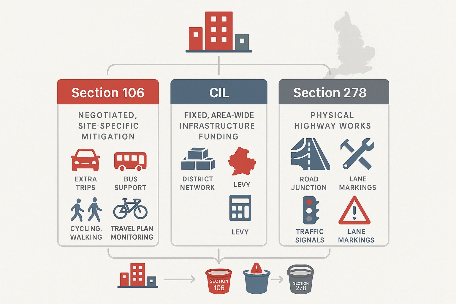
    Why is managing traffic and parking carefully important in historic areas?

    Because traffic dominance and poorly located parking or signage can damage heritage settings. Streets for All encourages traffic restraint, rationalised signage, and kerbside management that supports local character and reallocates space to pedestrians, cyclists, and public transport where possible.

    How should Streets for All be applied in a real project workflow?

    Use it from the start by assessing heritage significance and street function, setting clear objectives, testing concepts with place-first and inclusive principles, selecting appropriate materials and furniture, iterating with quality audits, and ensuring good implementation and maintenance to safeguard character.

  • Synthetic Traffic Matrix Development: A Practical Guide For Planning-Led Transport Assessments In 2026

    Synthetic Traffic Matrix Development: A Practical Guide For Planning-Led Transport Assessments In 2026

    When a planning application depends on credible transport evidence, one weak input can unravel the whole assessment: the traffic demand matrix. In practice, we’re not always handed pristine origin–destination survey data for every movement through a study area. More often, we have partial counts, turning movements, local knowledge, land-use context, and a network that still needs to be tested properly. That’s where synthetic traffic matrix development becomes essential.

    For architects, planners, developers, councils, and legal teams, this matters because junction modelling is only as reliable as the demand fed into it. If the matrix is unrealistic, the model can look precise while telling the wrong story. And that’s usually where objections, delay, or costly rework begin.

    In our work on planning-led transport assessments, we use synthetic matrices to bridge the gap between observed traffic data and the practical need to assess base, committed, and future-year scenarios. Done well, they provide a defensible, transparent representation of how trips are likely to move across the network. Done badly, they create obvious inconsistencies that reviewers will spot quickly.

    This guide explains what a synthetic traffic matrix is, how it is built, where the evidence comes from, and how to present it clearly in a planning report. The aim is simple: help teams understand what good looks like, and why a robust matrix can make the difference between a smooth planning process and a very long one.

    What A Synthetic Traffic Matrix Is And When It Is Used

    Infographic of observed traffic data becoming a synthetic origin-destination traffic matrix.

    A synthetic traffic matrix is an estimated origin–destination representation of traffic demand created where full direct O-D survey data does not exist, is incomplete, or would be disproportionate to collect. In simple terms, it tells us how many vehicles are likely to travel from each origin zone to each destination zone within a modelled network.

    In planning work, this matrix sits behind much of the testing. It provides the demand layer used in transport assessment, junction modelling, network assignment, and future-year forecasting. Without it, we may know that vehicles passed a count point, but we do not properly understand how those vehicles connect across the wider system.

    Synthetic traffic matrix development is most commonly used when we have a sensible package of observed data, link counts, turning counts, classified surveys, ATCs, and local network information, but not a complete picture of trip origins and destinations. That is normal on planning projects. Full roadside interviews, ANPR-based O-D capture, or mobile data may be unavailable, unnecessary, or too costly for the scale of the application.

    So we infer. We assemble the best available evidence, establish plausible movement patterns, and create a matrix that can be assigned through the network and checked against observed flows. The key point is that “synthetic” does not mean speculative. It should mean evidence-led, transparent, and proportionate to the planning question being asked.

    Why Planning Applications Need A Robust Matrix

    Infographic showing a robust traffic matrix guiding UK planning and junction assessment.

    Planning applications need a robust matrix because impact assessment is not just about counting traffic at a site access. We need to understand where traffic comes from, where it goes, which routes it uses, and how those movements interact with nearby junctions under existing and future conditions.

    A weak matrix can distort all of that. It may overstate pressure on one arm of a junction, understate demand at another, or assign trips along routes no local driver would reasonably choose. On paper, the model still runs. But the conclusions become fragile, and that creates risk for applicants, consultants, and decision-makers alike.

    For local planning authorities, a robust matrix gives confidence that the submitted transport assessment is based on realistic demand. For developers and design teams, it reduces the chance of challenge late in the process. For lawyers and planning advisers, it provides a clearer evidence trail if technical assumptions are scrutinised.

    This is especially important in 2026, when planning decisions are often taken against a backdrop of constrained networks, cumulative development pressure, and closer review of assumptions around mode share and trip generation. A sound synthetic matrix helps us test not only the base case, but also committed development, forecast growth, mitigation, and residual effects.

    In short: if the matrix is credible, the modelling discussion becomes more productive. If it is not, everything downstream becomes harder.

    The Main Data Sources Used To Build A Synthetic Matrix

    Infographic of data sources feeding a synthetic traffic matrix in the UK.

    A synthetic matrix should never be built from one data source alone. The most reliable results come from layering observed surveys with land-use and network context, then checking that the emerging demand pattern makes sense both numerically and geographically.

    In most planning-led studies, we start with observed traffic data because it anchors the matrix to real-world conditions. We then use broader contextual datasets to infer the missing connections between count sites, define zones, and estimate likely trip distribution patterns.

    The quality of the final matrix depends heavily on whether those datasets are compatible. Count dates, school term conditions, temporary roadworks, weather disruption, and seasonal distortions all matter more than people sometimes assume. A “good” count can still be the wrong count if it reflects an abnormal network.

    The best approach is usually pragmatic rather than elaborate: use enough evidence to explain traffic behaviour credibly, and document why each source was chosen.

    Traffic Counts, Turning Counts, And Classified Surveys

    Traffic counts are the backbone of most synthetic traffic matrix development. Automatic traffic counts help us understand hourly variation, daily profiles, and directional flow. Manual classified counts give richer detail at junctions, showing how traffic actually turns between arms during the critical peaks. That turning information is often what allows us to trace likely through-movements between adjacent nodes.

    Classified data also matters because not all vehicles behave the same way. Cars, LGVs, and HGVs can have different routing patterns, operating periods, and sensitivity to constraints. Where a development has a freight element, or where local restrictions affect larger vehicles, class-specific treatment is often essential.

    The practical challenge is that counts rarely line up perfectly. One junction may show more outbound flow than the next junction shows inbound. That is normal. We reconcile those differences through matrix estimation and balancing rather than assuming the surveys are unusable.

    Land Use, Census, And Highway Network Information

    Observed counts tell us what happened at survey points. Land-use, census, and highway network information help explain why it happened, and where trips are likely to start or end.

    Land-use context is particularly useful when defining zones and testing plausibility. Retail parks, schools, employment areas, housing estates, hospitals, and town centres generate very different movement patterns. If the matrix implies large flows to or from places with no obvious trip attraction, that is usually a warning sign.
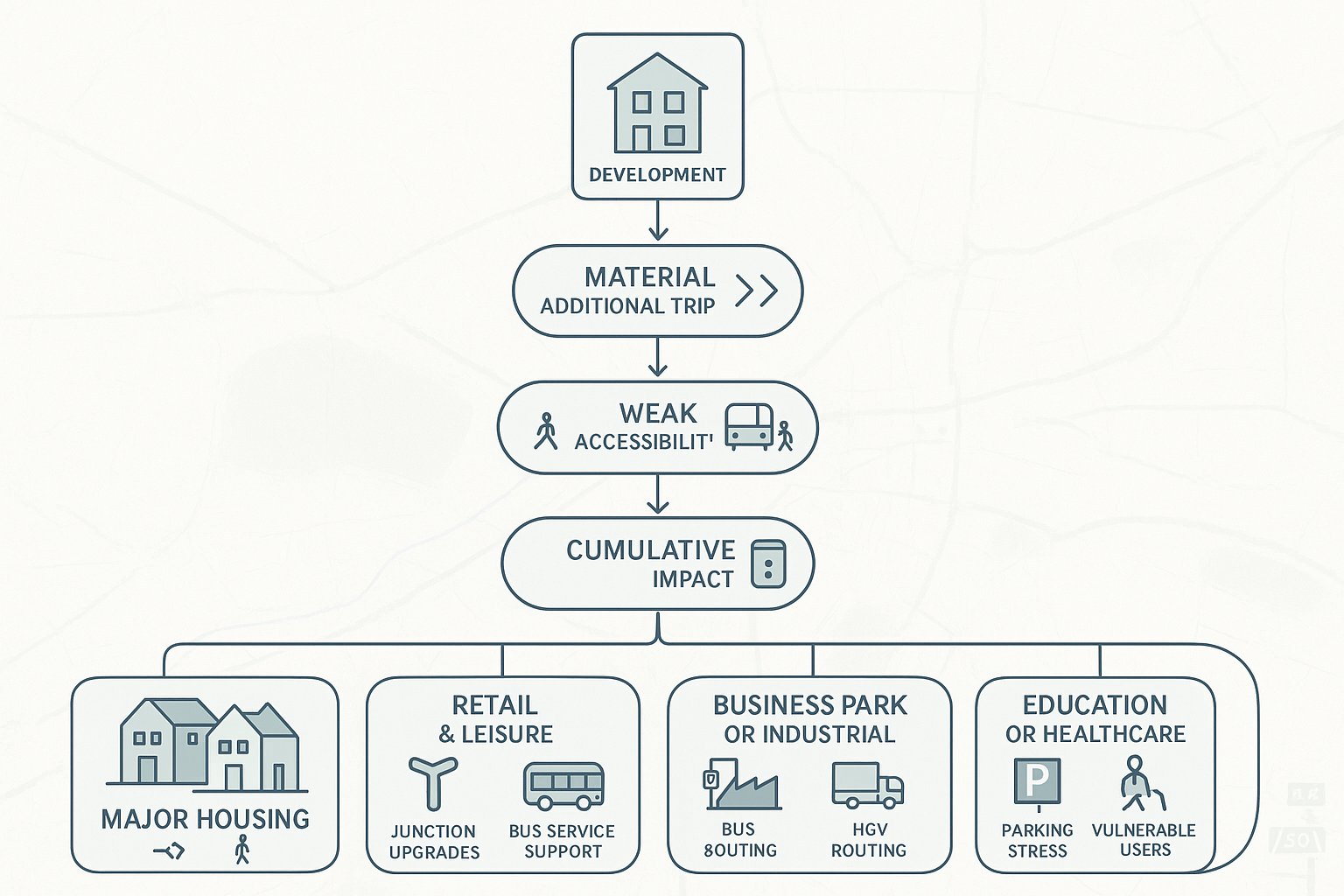
    Census journey-to-work data can still offer useful directional insight, especially for broader commuting patterns, even though it should not be treated as a direct traffic assignment dataset. We use it carefully, as one input among several. Highway network information is equally important: route hierarchy, one-way systems, banned turns, speed environment, signal control, and known rat-runs all influence likely path choice.

    When these datasets are combined properly, they stop the matrix becoming a purely mathematical exercise. They keep it grounded in how the area actually functions.

    How Existing Demand Is Estimated Across The Network

    Estimating existing demand across a network usually begins with observed flows at key screenlines and junctions, then works outward to identify how those flows must connect. We are effectively solving a puzzle with some pieces missing: we know what entered and left parts of the network, and we need to infer the internal movement pattern that best explains those observations.

    A common method is to trace plausible movement paths between count locations using the network structure and turning data. If one junction records strong northbound through-demand and the next junction downstream shows corresponding arrivals, we can start building a consistent picture of existing movement. Where the numbers do not reconcile neatly, we assess whether the gap is likely to arise from local access activity, survey variance, uncontrolled side roads, or route alternatives.

    Zoning matters here. If zones are too coarse, the matrix hides important local detail. If they are too fine, it becomes unstable and overly sensitive to weak assumptions. Good zoning reflects the geography of trip-making and the level of modelling required for the planning issue.

    At this stage, professional judgement matters as much as arithmetic. We want the matrix to fit counts, yes, but we also want it to reflect realistic travel behaviour. An exact fit built on implausible routing is not a robust base model.

    How Origin-Destination Patterns Are Inferred Without Direct O-D Surveys

    Without direct O-D surveys, we infer origin-destination patterns from a mix of observed traffic behaviour, land-use relationships, route choice logic, and trip-cost assumptions. That sounds technical, but the principle is straightforward: drivers do not move randomly, and the network leaves clues.

    One approach is synthetic distribution based on known attractions and productions across zones. Another is a gravity-style method, where trips are more likely between places with stronger trip-making potential and lower perceived separation. “Separation” might reflect distance, time, congestion, route quality, or barriers such as river crossings and one-way systems.

    Turning counts are often the bridge between local observation and wider inference. They show how traffic entering a node splits by direction, which can then inform the likely continuation of trips through the surrounding network. If several adjacent junctions tell a consistent directional story, we can derive a plausible O-D structure even without number-plate matching or roadside interviews.

    Of course, this is where synthetic traffic matrix development can either look thoughtful or look shaky. Unrealistic long-distance local movements, excessive use of minor roads, or improbable cross-town routing patterns are red flags. We hence test the inferred patterns against local knowledge and observed congestion. If the matrix says one thing but everyone familiar with the area knows another, we go back and fix it.

    Methods For Balancing And Validating The Matrix

    Once an initial matrix has been built, it needs to be balanced and validated. In practice, that means adjusting demand iteratively so that assigned flows align reasonably with observed counts while preserving realistic movement structure.

    Balancing typically seeks consistency between row and column totals and target flows at key points in the network. Matrix estimation tools can do this mathematically, but the process still needs supervision. If an algorithm improves count fit by producing odd routing patterns or unstable trip patterns, the answer is not to accept it blindly because the statistics look tidy.

    Validation is about demonstrating that the matrix performs acceptably against observed conditions. Depending on the study, that may involve comparing modelled and surveyed link flows, turning movements, and journey patterns across the network. A commonly used sense-check is whether differences are broadly within around 5% at critical locations, though the acceptable threshold depends on model type, data quality, and authority expectations.

    We also look for consistency rather than isolated “wins”. A matrix that fits one junction beautifully but misses the surrounding area is not validated in any meaningful planning sense. The objective is a coherent, defensible representation of demand. At ML Traffic, that usually means prioritising transparency: showing what was adjusted, why it was adjusted, and where limitations remain.

    Factoring Development Traffic Into The Base And Future-Year Matrices

    Once the base matrix is accepted, development traffic can be added for testing. This step sounds simple, but it is often where strategic mistakes creep in.

    First, we establish the site-generated trips using the agreed trip generation and distribution assumptions. Those trips then need to be loaded onto the correct base-year matrix or scenario matrix, not simply dropped into a model in isolation. The surrounding network is already carrying demand: development traffic changes how that demand interacts at key junctions.

    For future-year assessment, the process is usually layered. We start with a base matrix, apply background growth where appropriate, account for committed developments, and then add the proposed development traffic. Depending on the modelling framework, internalisation, pass-by trips, reassignment, and mode share assumptions may also need to be reflected.

    The important point is consistency. If the development trip distribution assumes one pattern but the base synthetic matrix implies a conflicting route logic, the forecast becomes harder to defend. The same applies where committed schemes alter route choice but the matrix has not been updated to reflect those changes.

    A good future-year matrix is not just “bigger” than the base matrix. It is structurally credible. And in planning terms, that is what allows us to test mitigation and residual impact with confidence.

    Peak Period Selection, Vehicle Classes, And Time-Slice Decisions

    Peak period selection can make or break the usefulness of a matrix. Planning assessments usually focus on network conditions when pressure is highest, but the “peak” is not always the standard weekday commuter hour. For schools, retail, logistics, leisure, or mixed-use sites, the critical period may be different from the default assumptions.

    That is why we start with evidence. ATC profiles, local count data, site context, and authority expectations should guide the selection of AM, PM, inter-peak, Saturday, or bespoke assessment periods. Choosing the wrong peak can lead to an apparently compliant assessment that misses the actual stress point.

    Vehicle classes also deserve care. A single all-vehicle matrix may be enough for some schemes, but many applications benefit from separating cars, light goods vehicles, and heavy goods vehicles. Different classes have different growth patterns, routing constraints, and operational implications, especially at tight junctions or on roads with environmental sensitivities.

    Then there is the question of time slices. For LINSIG, ARCADY, PICADY, or microsimulation work, 15-minute demand profiles may be necessary even where hourly matrices exist. If the peak quarter-hour is materially sharper than the average hour, smoothing demand can understate queueing and delay. So we do not just ask, “What data do we have?” We ask, “What temporal resolution does the decision actually require?”

    Common Errors That Undermine Matrix Credibility

    Most weak matrices do not fail because of one dramatic mistake. They fail because several smaller issues combine into something reviewers no longer trust.

    One common problem is inconsistent survey data: counts taken on different dates, in different months, or under abnormal conditions, then treated as though they describe one stable network. Another is poor zoning, where the model is either so aggregated that it conceals key local movements or so fragmented that it invents precision without evidence.

    Unrealistic routing is another frequent issue. If the matrix sends substantial traffic along minor residential streets, banned turns, or obviously unattractive routes, credibility drops very quickly. The same happens when gaps between survey sites are ignored rather than explained. Missing side-road demand, local access traffic, and short internal trips can all distort balancing if left unresolved.

    There is also a reporting problem. Some matrices may be technically salvageable, but the supporting note does not explain assumptions clearly enough for anyone else to follow. That is risky in planning.

    In our experience, the best safeguard is simple: challenge the matrix as if you were reviewing it for the local authority. Does it fit counts? Does it reflect the network? Does it make everyday sense? If not, it probably needs more work.

    How Synthetic Traffic Matrices Support Junction Modelling And Transport Assessment

    A synthetic matrix is not an end in itself. Its value lies in what it enables us to test.

    For junction modelling, the matrix provides the demand input that drives operational assessment. Whether we are using priority, roundabout, signal, or wider network models, we need a realistic pattern of traffic entering, passing through, and leaving the system. Turning counts alone may describe one surveyed moment at one junction: a matrix links that junction to the wider movement context.

    That matters particularly where developments influence several nodes rather than one access point. A robust synthetic matrix allows traffic to be assigned across the study area so we can examine queueing, reserve capacity, delay, and interaction effects in a more coherent way. It also supports comparison between scenarios: base, future year, with development, and with mitigation.

    For the transport assessment itself, the matrix underpins the narrative around impact. It helps show why particular junctions were tested, how distribution assumptions were derived, and whether observed and forecast patterns are consistent with local conditions. This is often the difference between a report that merely presents outputs and one that genuinely explains them.

    In planning terms, that clarity is useful for everyone involved, applicants, officers, members, and sometimes inspectors. A good matrix turns modelling from a black box into evidence.

    Presenting Assumptions, Limitations, And Results Clearly In Planning Reports

    Even a well-built matrix can become vulnerable if it is presented badly. Planning reports should explain, plainly and in sequence, what data was used, what the study area covers, how zones were defined, which time periods were assessed, how vehicle classes were treated, and what balancing or estimation process was applied.

    We should also be honest about limitations. If direct O-D survey data was not available, say so. If one count location was affected by an abnormal event and required adjustment, document it. If the matrix fits most locations well but remains weaker at a peripheral arm with limited influence on the development impact, explain that too. Reviewers are generally more comfortable with a transparent limitation than with an unexplained inconsistency.

    Tables and figures help, but only if they are selective and readable. A concise matrix methodology section, flow comparison tables, turning diagrams, and a short note on assumptions usually do more good than pages of opaque appendices dropped in without comment.

    And the tone matters. We should not oversell a synthetic matrix as though it were direct observation. It is an informed estimate, validated against evidence and suited to the planning purpose. Presented that way, it becomes far easier for decision-makers to rely on.

    In the end, clear reporting is not decoration. It is part of the technical case, and often the part people remember when the application is reviewed.

    Frequently Asked Questions about Synthetic Traffic Matrix Development

    What is a synthetic traffic matrix and when is it used in transport assessment?

    A synthetic traffic matrix is an estimated origin–destination representation of traffic demand created when full direct O-D survey data is unavailable or incomplete. It is used to distribute trips across a network for transport assessment, junction modelling, and future-year forecasting in planning projects.

    Why is a robust synthetic traffic matrix essential for planning applications?

    A robust synthetic traffic matrix provides realistic traffic demand patterns necessary to test junction performance and network impacts under existing and future conditions. It ensures credible modelling outputs, reducing the risk of objections, delays, or costly rework in the planning process.

    Which main data sources are used to build a synthetic traffic matrix?

    Key inputs include observed traffic counts, manual classified surveys, automatic traffic counts, turning movement data, land-use information, census journey-to-work data, and highway network characteristics. Combining these ensures the matrix is evidence-led and reflects local travel behaviour.

    How are origin–destination traffic patterns inferred without direct O-D surveys?

    Without direct surveys, O-D patterns are inferred by analysing observed turning movements, land-use relationships, route choice logic, and trip-cost assumptions using synthetic distribution or gravity-based methods to estimate likely flows between zones across the network.

    How is a synthetic traffic matrix validated and balanced for accuracy?

    Matrices are balanced iteratively so that row and column totals match observed traffic counts. Validation involves checking modelled flows against surveyed link and turning counts, aiming for differences generally within about 5% at key locations, ensuring movement patterns remain realistic and consistent.

    How does synthetic traffic matrix development support junction modelling and future-year transport assessment?

    Synthetic traffic matrices provide the demand input driving junction and network models, enabling analysis of traffic flow, queueing, and delay under base, committed development, and future scenarios. This supports confident testing of mitigation measures and impact forecasting in transport assessments.

  • Parking Demand Study: What Planners Need to Know for Stronger Planning Applications in 2026

    Parking Demand Study: What Planners Need to Know for Stronger Planning Applications in 2026

    A parking demand study can look deceptively simple from the outside. Count some cars, compare the result with a standard, and move on. In practice, it rarely works like that.

    For architects, planning consultants, developers, councils and project teams preparing planning applications in 2026, parking is still one of the quickest routes to delay, objection, or a costly redesign. A scheme may be well considered in design terms, policy-led in principle, and supported by highways access information, yet still run into trouble if the likely parking demand has not been evidenced properly. That is especially true for larger sites, mixed-use schemes, constrained urban plots, or developments in areas where residents already feel parking pressure.

    We see this regularly in transport planning work: local planning authorities are not simply asking how many spaces can fit on a drawing. They want to know how parking will actually operate once the development is occupied. That means understanding demand, nearby supply, likely overspill, user behaviour, and whether any management measures are realistic.

    In this guide, we explain what a parking demand study is, when it is needed, what data it relies on, and how it should sit within a wider planning and transport evidence base. Done properly, it strengthens the application. Done poorly, it creates questions you could have avoided.

    What A Parking Demand Study Is And When It Is Required

    Infographic comparing parking demand, parking stress, and parking capacity in UK planning.

    A parking demand study is an evidence-based assessment that estimates how much parking a proposed development is likely to need and whether that demand can be accommodated on site or within the surrounding area without unacceptable effects. In UK planning terms, it is not just a parking count. It is a structured piece of planning and transport evidence used to test whether a scheme is workable in real-world conditions.

    Authorities usually ask for a parking demand study where standard maximum or minimum parking standards do not tell the full story. That often happens when a proposal is large, complex, car-sensitive, or located in a constrained area. Town centre schemes, edge-of-centre developments, suburban infill, sites near controlled parking zones, and proposals with limited on-site parking are common examples.

    We would usually expect a parking demand study to be considered where:

    • the scale of development could materially change local parking conditions:
    • existing on-street parking is already heavily used:
    • the proposal departs from local parking standards:
    • the site has unusual user characteristics or operating hours:
    • parking demand will vary significantly by time of day or day of week: or
    • planning officers or highways officers need clearer evidence on overspill risk.

    It can be submitted as a standalone technical note, but more often it forms part of a Transport Statement or Transport Assessment. For firms such as ML Traffic, the value lies in tailoring the study to local policy thresholds, local authority expectations, and the actual operational pattern of the development rather than relying on generic assumptions.

    How Parking Demand Differs From Parking Stress And Capacity Assessments

    These three terms get mixed up all the time, but they are not interchangeable.

    Parking demand is the level of parking likely to be used by the development. It is forward-looking and predictive. It asks: how many spaces will residents, staff, visitors, customers or service users actually need at peak times?

    Parking stress describes how full an area is at a given moment, usually expressed as a percentage of occupied spaces. A street with 90% occupancy is under high parking stress. This is often used to understand how much headroom exists nearby.

    Parking capacity is the physical or practical number of spaces available. That may include marked bays, legal on-street opportunities, private spaces, or managed car parks. Capacity says what exists: demand says what will want to use it.

    A robust parking demand study may compare all three. For example, if a development generates 20 additional parked vehicles at peak times, but nearby streets are already operating at 88% occupancy, the practical spare capacity may be too limited to absorb any overspill. That distinction matters in planning decisions.

    Why Local Planning Authorities Ask For Parking Demand Evidence

    Infographic showing why parking demand evidence supports UK planning decisions.

    Local planning authorities ask for parking demand evidence because parking is rarely just a parking issue. It quickly becomes a highway safety issue, an amenity issue, a policy compliance issue, and sometimes a political issue as well.

    From an authority’s perspective, the main concern is whether a proposal will function acceptably once built and occupied. If parking demand is underestimated, the consequences can spread beyond the red line boundary: overspill parking on nearby streets, obstruction near junctions, pressure on residents’ bays, poor visibility, blocked servicing areas, and friction with existing land uses.

    That is why officers often want something more site-specific than a simple reference to local standards. Standards are useful benchmarks, but they do not always capture local behaviour. Car ownership can vary sharply by location, dwelling type, tenure, public transport accessibility, and the demographic profile of likely users. A one-size-fits-all ratio can miss that.

    A parking demand study helps authorities test several planning questions at once:

    • Will the proposed level of parking be enough?
    • If not, where will overspill go?
    • Is nearby supply genuinely available at peak times?
    • Are management measures, such as permit controls or allocated spaces, credible?
    • Does the proposal align with adopted parking policy and broader transport strategy?

    In 2026, this matters even more because authorities are balancing two pressures at once. On one hand, they want efficient land use, lower car dependency and support for sustainable travel. On the other, they still need developments to operate safely and realistically. Good parking evidence helps reconcile those aims instead of forcing officers to choose between design ambition and operational practicality.

    Common Development Types That Benefit From A Parking Demand Study

    Infographic showing development types that benefit from a parking demand study.

    Not every proposal needs a detailed parking demand study, but many schemes benefit from one even where it is not explicitly requested at validation stage. In practice, the more a development’s parking profile depends on timing, user mix, or local constraints, the stronger the case for proper evidence.

    Residential Schemes

    Residential development is one of the most common contexts for a parking demand study. That includes flats, housing estates, specialist accommodation, build-to-rent schemes, student housing in some cases, and redevelopment of brownfield sites with tight layouts.

    The reason is simple: residential parking demand is not uniform. A two-bed flat in a town centre with strong rail access may behave very differently from a family house on the edge of a village. Car ownership often varies by dwelling size, tenure, affordability, and resident profile. Visitor parking adds another layer, especially in higher-density developments where on-site visitor provision is limited.

    Authorities are often cautious where schemes propose parking below adopted standards. They may accept a lower provision, but they will want evidence explaining why. A study can show whether lower demand is credible because of location, accessibility, or comparable local schemes. Just as importantly, it can identify where risk remains, for example around evening peaks, informal visitor parking, or unallocated spaces that may be used inefficiently.

    Commercial, Mixed-Use, And Community Developments

    Commercial and community uses can be even more complex because demand changes by hour, by day, and by user group. Offices, retail, food and drink uses, health facilities, places of worship, schools, leisure venues, and village halls all generate different parking patterns.

    Mixed-use sites are especially sensitive. Shared parking can work very well if peak periods are complementary, but poorly if they overlap. An office and gym may not peak at the same time: a café and community hall might. A parking demand study tests those interactions rather than assuming spaces can be shared without conflict.

    Community developments often attract particular local scrutiny because parking demand may spike during events, weekend activity or seasonal use. In those situations, a single weekday survey is rarely enough. We need evidence that reflects actual operation, not just an average day. That is where good study design becomes the difference between a persuasive planning submission and a weak one.

    What Data Is Collected In A Parking Demand Study

    The credibility of a parking demand study depends on the quality of its inputs. If the data is thin, the conclusions will be thin too.

    At a minimum, we would usually collect information on the proposed development itself: land use, floor area or unit mix, number of proposed spaces, allocation arrangements, visitor provision, disabled parking, cycle parking, servicing arrangements, and access constraints. But the surrounding parking environment matters just as much.

    Typical study data includes:

    • Existing parking supply: on-site spaces, nearby private parking, on-street spaces, marked bays, and any off-street public car parks.
    • Occupancy levels: how many spaces are occupied at different times.
    • Turnover and duration: whether spaces are used briefly, repeatedly, or for long stays.
    • User type: residents, employees, visitors, customers, blue badge holders, delivery drivers, and other users where relevant.
    • Parking controls: permit schemes, time limits, pay-and-display, yellow lines, loading restrictions, and private enforcement.
    • Site context: accessibility by walking, cycling and public transport, nearby competing land uses, and local street characteristics.
    • Behavioural indicators: informal parking patterns, double parking, parking on verges, or use of spaces that are technically available but operationally poor.

    Good studies also record the practical quality of spaces, not just their existence. A narrow space beside a bin store, or a legal kerbside opportunity on a heavily trafficked road, may count as capacity on paper but not in reality. That distinction is often where objections begin.

    Where appropriate, the dataset can also include census-based car ownership context, TRICS-informed benchmarks, and observations from comparable developments. The key is to use evidence as support, not as a substitute for site-specific judgement.

    Survey Methods, Timing, And Peak Period Selection

    Method matters. A parking demand study can be undermined by poor survey design even if the final report looks polished.

    Most studies rely on parking beat surveys or occupancy counts undertaken at regular intervals across a defined study area. The survey area should be large enough to capture realistic overspill behaviour, not just the spaces immediately outside the site. For a constrained urban development, that may mean several surrounding streets. For a rural or edge-of-settlement site, it may involve fewer locations but a wider understanding of practical parking choices.

    Timing is crucial. Surveys should capture the highest realistic parking demand for the proposed land use, and that is not always the obvious weekday commuter peak. Residential schemes often need evening and overnight observations. Retail and leisure may require weekend peaks. Community uses may need event-based surveying. Mixed-use schemes usually require more than one survey period.

    Common survey considerations include:

    • weekday and weekend coverage where relevant:
    • seasonal representativeness:
    • school term versus holiday conditions:
    • weather and one-off local events:
    • interval frequency, often every 30 minutes or hour depending on the use:
    • whether repeat surveys are needed to confirm consistency.

    The best approach is not simply to gather the maximum amount of data, but to gather the right data. We need periods that are representative, defensible, and linked directly to the operational profile of the development. If a proposed medical centre will peak on weekday mornings and a church hall peaks on Sunday afternoons, the survey strategy should reflect that. Otherwise the authority may reasonably conclude that the evidence misses the critical demand window.

    How A Parking Demand Study Is Analysed And Presented

    Analysis should turn raw survey information into clear planning evidence. That means moving beyond tables of parked cars and explaining what the numbers mean for decision-makers.

    A typical analysis looks at occupancy by location and by time period, identifies peak demand, and compares existing and future conditions. For many applications, the central question is whether the development can be accommodated within the parking supply available on site and, where policy allows, in the surrounding area without causing material harm.

    Useful outputs often include:

    • peak occupancy percentages:
    • spare capacity calculations:
    • parking accumulation profiles across the day:
    • parking ratios by unit, floor area or use class:
    • demand comparisons with local standards or comparable sites:
    • plans showing where parking pressure occurs:
    • sensitivity testing for visitor peaks or lower-than-expected sustainable mode share.

    Presentation matters more than people think. Planning officers, members and local residents respond better to findings that are transparent and visual. Annotated plans, simple charts and concise methodology notes are often more persuasive than dense technical appendices.

    We also need to explain assumptions plainly. If a study assumes that a proportion of visitors will arrive on foot, by cycle or by public transport, the report should show why that is credible. If spaces are shared between uses, the analysis should demonstrate how overlapping peaks have been tested. And if there is a residual overspill risk, that should be acknowledged and addressed with mitigation rather than buried in the wording.

    A good report feels balanced. It should support the scheme, yes, but it should do so by being rigorous enough that a highways officer can follow the logic and agree with it.

    Key Policy, Design, And Planning Considerations

    A parking demand study does not sit in a vacuum. It needs to respond to planning policy, design quality, and the wider transport case for the development.

    First, local parking standards remain a key reference point, even where they are flexible. Some authorities set minimum standards, some maximums, and many use location-specific guidance. We need to understand whether the proposal complies, departs, or seeks a justified exception. That policy context should be explicit.

    Second, accessibility matters. A lower parking provision is easier to support where the site has strong public transport links, walkable services, safe cycle connections, and realistic travel plan measures. But those factors should be evidenced, not asserted. A bus stop nearby is not the same as an attractive, frequent, and useful service.

    Third, design and operation matter just as much as numbers. Questions typically include:

    • Are spaces allocated or unallocated?
    • Is visitor parking adequate and convenient?
    • Can disabled users park close to entrances?
    • Will refuse, delivery and servicing activity interfere with parking operation?
    • Are turning areas protected from informal parking?
    • Is EV charging provision aligned with likely use?

    There is also the issue of lived experience. A scheme can technically meet policy while still creating awkward day-to-day parking behaviour because spaces are poorly located, too small, or difficult to use. Conversely, a slight policy shortfall may be acceptable if the operational case is strong.

    This is why parking demand studies are most effective when integrated early with site layout and planning strategy. They should influence design, not merely defend it after the fact.

    Common Issues That Delay Approval Or Trigger Objections

    Most parking objections are predictable. They usually arise not because the principle of the scheme is impossible, but because the evidence leaves too many unanswered questions.

    One of the most common problems is poor survey timing. If residential parking is surveyed at midday, or a community use is assessed only on a quiet weekday, the study will not carry much weight. Authorities and local residents are quick to spot that.

    Another frequent issue is a study area that is too narrow. Overspill does not respect neat boundaries. If nearby streets are excluded without a clear reason, the authority may conclude that parking pressure has been understated.

    Other recurring weaknesses include:

    • relying on a single survey with no justification:
    • ignoring visitor parking or short-stay demand:
    • treating all legal spaces as equally usable:
    • failing to account for permit controls or private restrictions:
    • assuming shared parking works without testing overlapping peaks:
    • not addressing what happens if sustainable travel uptake is lower than forecast.

    There is also a communication problem in some reports. Technical evidence may exist, but it is buried in jargon, inconsistent tables, or plans that are hard to read. That creates friction where none was needed.

    From a planning strategy perspective, delay often happens when parking evidence is disconnected from mitigation. If the study identifies pressure but offers no response, objections become more likely. Sometimes the answer is extra parking. Sometimes it is allocation changes, visitor controls, a car club bay, permit restrictions, layout amendments, or a stronger travel plan. The point is that evidence should lead somewhere. A parking demand study that finds risk and then stops short of a practical solution rarely helps an application move smoothly.

    How To Use A Parking Demand Study Within A Wider Transport Assessment

    A parking demand study is strongest when it is not treated as a standalone appendix that nobody revisits. It should inform the wider Transport Statement or Transport Assessment and help create a coherent development case.

    At the most basic level, parking demand evidence supports the proposed parking provision and tests whether the site access and internal layout will operate effectively. But its value goes further than that.

    Within a wider transport assessment, the study can inform:

    • Trip generation assumptions: car ownership and parking availability often influence mode split and vehicle trip rates.
    • Access design: if parking turnover is high, entry and exit arrangements may need more scrutiny.
    • Servicing strategy: loading activity should not displace parking or vice versa.
    • Travel planning: measures to reduce single-occupancy car use need to be proportionate to the actual parking context.
    • Mitigation proposals: overspill risk may justify controls, monitoring, or highway management measures.
    • Street design and safety: likely kerbside demand affects visibility, refuse collection, cycle infrastructure and pedestrian movement.

    This joined-up approach is increasingly important because planning decisions are seldom made on one metric alone. Authorities want to see that parking, access, sustainable travel, and highway operation have been considered together.

    That is where concise, locally aware transport reporting makes a real difference. On schemes across England and Wales, we often find that a targeted parking demand study can resolve one of the most contentious parts of the application, provided it is aligned with the transport narrative as a whole. In other words, the study should not only answer ‘how many spaces?’. It should also help answer ‘will this development work here?’.

    Conclusion

    A parking demand study is not just a technical extra for difficult schemes. It is often the piece of evidence that turns a planning application from arguable to defensible.

    For planners, architects, developers and local authorities, the real value lies in clarity. A well-prepared study shows how much parking a development is likely to generate, when that demand will peak, whether nearby supply can absorb any pressure, and what mitigation is needed if it cannot. That gives decision-makers something firmer than assumption or local anxiety.

    In 2026, with tighter sites, evolving policy and continued concern about overspill parking, that level of evidence matters more than ever. The strongest applications do not wait for parking to become an objection. They address it early, realistically and in context.

    When a parking demand study is based on representative surveys, sound analysis and clear planning judgement, it does exactly what good transport evidence should do: reduce uncertainty and help the right scheme move forward with confidence.

    Parking Demand Study FAQs

    What is a parking demand study and when is it necessary?

    A parking demand study estimates the likely parking needs of a proposed development and assesses whether these can be met on-site or locally without causing issues. It is usually required for large, complex, or sensitive sites where standard parking standards don’t fully apply.

    How does parking demand differ from parking stress and parking capacity?

    Parking demand predicts how many spaces a development will need, parking stress shows how full parking is at a given time, and parking capacity is the actual number of available spaces. A study compares all three to understand parking impacts accurately.

    Why do local planning authorities request parking demand studies?

    Authorities ask for these studies to ensure developments won’t cause overspill parking, highway safety problems, or policy conflicts. The study helps them assess actual parking impacts beyond just fitting spaces on a plan.

    Which types of developments benefit most from a parking demand study?

    Residential schemes with variable car ownership, as well as commercial, mixed-use, and community developments with fluctuating parking needs, especially where parking demand changes by time or user type, benefit greatly from tailored demand studies.

    What data and methods are used in conducting a parking demand study?

    Studies collect data on proposed parking provision, existing local supply, occupancy levels, turnover, user types, nearby controls, and site context. Surveys are timed to capture representative peak demand periods, often including weekdays and weekends.

    How is a parking demand study integrated within a wider Transport Assessment?

    The study informs trip generation, access design, servicing, and sustainable travel proposals. It links parking evidence to overall transport planning, helping balance operational feasibility with policy goals to support smoother planning approvals.

  • Visibility Splay Assessment: A Practical Guide For Planning Applications In 2026

    Visibility Splay Assessment: A Practical Guide For Planning Applications In 2026

    A visibility splay assessment can look deceptively simple on a drawing: a pair of lines, a triangle of clear space, a few dimensions. But in planning terms, those lines often decide whether a proposed access is acceptable, whether a site layout survives highways scrutiny, and sometimes whether a development is viable at all.

    We see this regularly across planning applications for housing, commercial schemes, schools, rural sites and industrial uses. An access may appear workable on paper, yet once measured speeds, gradients, bends, hedges, walls and vehicle movements are properly tested, the required visibility can be very different from what was first assumed. That is exactly why local planning authorities and highway officers treat visibility as a core safety issue rather than a drafting exercise.

    In UK practice, a visibility splay assessment examines whether drivers emerging from a junction or site access can see approaching traffic far enough in advance to make a safe manoeuvre. The work sits at the intersection of transport planning, highway design, topographical survey and planning strategy. Get it right early and the application process tends to move more smoothly. Get it wrong and objections, conditions, redesigns or refusals can follow.

    In this guide, we explain what a visibility splay assessment involves, when it is needed, how it is undertaken, which standards usually apply in the UK, the common reasons schemes fail, and what can be done to resolve problems before they become planning obstacles.

    What A Visibility Splay Assessment Is And Why It Matters

    Car at a junction with visibility splay lines and roadside obstructions.

    A visibility splay assessment is a technical review of the sightlines available at a proposed or existing access, junction or priority-controlled connection. In practical terms, we are checking whether a driver waiting to emerge can see oncoming vehicles on the main road at a sufficient distance to react and proceed safely.

    The visibility splay itself is usually represented as a clear triangular area. One point sits back from the give-way line at the driver’s eye position, and the other points extend along the edge of the major road in each direction. If walls, fences, vegetation, embankments, parked vehicles, buildings or even changes in vertical alignment interrupt that sightline, the access may not meet policy or design guidance.

    Why does this matter so much? Because visibility is tied directly to stopping sight distance and collision risk. If an approaching driver cannot be seen in time, or if the emerging driver has an incomplete view of the carriageway, the junction becomes less forgiving. Highway authorities know that poor visibility can turn an otherwise modest development into a material road safety concern.

    For planning applications, that means a visibility splay assessment is often more than a supporting drawing. It can influence access location, internal layout, boundary treatment, land ownership requirements and the overall prospects of consent. On constrained sites, visibility can be the issue that shapes the whole scheme.

    When A Visibility Splay Assessment Is Required

    Site access with visibility sightlines onto a public road.

    A visibility splay assessment is typically required whenever development introduces a new vehicular access, intensifies the use of an existing one, or alters junction arrangements in a way that could affect highway safety. In some cases the need is obvious from the outset. In others, it emerges through pre-application discussions or transport scoping with the local highway authority.

    As a rule, the more a development relies on vehicles entering or leaving the public highway, the more likely visibility will need to be demonstrated. That applies to both greenfield and infill sites, urban and rural contexts, and private accesses that connect onto adopted roads.

    Planning officers and highway officers often expect visibility evidence at application stage, particularly where the site sits on a faster road, close to bends, near a crest, or behind existing front boundary features. Even where outline consent is being sought, they may still require enough information to be satisfied that a compliant access can be achieved. On other schemes, visibility is secured by condition, with detailed drawings submitted later.

    Either way, treating the assessment as an afterthought is risky. If the access geometry is designed first and visibility checked later, teams can find themselves redesigning the frontage, reducing developable area or facing refusal on highways grounds.

    The Core Elements Of A Visibility Splay

    Car at junction with visibility splay lines and measured road distances.

    At the heart of any visibility splay assessment are a few core geometric and operational components: the X distance, the Y distance, the setback from the carriageway edge or give-way line, and the sightline envelope itself.

    These are not arbitrary dimensions. They are linked to how a driver actually waits, looks, judges a gap and enters the main road, and to how quickly approaching traffic can stop under wet-road conditions. That is why the same site can produce very different requirements depending on road speed, access type and the standard being applied.

    A common misconception is that visibility is only a horizontal plan issue. It is not. We also need to understand levels, gradients and the vertical relationship between the observer, target object and road profile. A clean-looking plan can still fail once crest curves, verge build-up or boundary mounding are properly modelled.

    For planners, architects and developers, understanding these elements early helps avoid simplistic assumptions. A 2.4 metre setback and a standard pair of splays might work on a calm residential street, but a rural road with higher actual speeds or an industrial access serving larger vehicles may demand something quite different.

    How A Visibility Splay Assessment Is Carried Out

    A proper visibility splay assessment starts with evidence, not guesswork. We first establish the nature of the access or junction being tested, the road classification, the surrounding layout, and the standard most likely to govern the design. From there, we gather the data needed to test visibility in a way that will stand up to scrutiny.

    That usually means obtaining a topographical survey that captures carriageway edges, kerbs, verges, footways, levels, gradients and all relevant obstructions within the required envelope. If speed is a determining factor, we also review existing speed data or commission speed surveys to establish realistic 85th percentile wet-weather approach speeds. On many sites, that speed evidence is the difference between a modest Y distance and a very demanding one.

    The geometry is then plotted in CAD, with the driver’s eye position set at the relevant X distance and the required Y distances projected along the nearside edge of the main road. We test whether the sightlines remain clear within the specified eye and target height range and, where necessary, examine long-sections or 3D relationships to confirm vertical visibility.

    Finally, we compare the results against the applicable national or local guidance and report whether the access is compliant, constrained or capable of improvement through design changes or mitigation.

    Key Standards And Guidance Used In The UK

    In the UK, visibility splay assessments are not governed by a single universal rulebook. The applicable standard depends on the road environment, the nature of the development and, crucially, the stance of the local highway authority.

    For lower-speed streets and many urban contexts, Manual for Streets and Manual for Streets 2 remain central references. They set out the relationship between vehicle speed, stopping sight distance and visibility at junctions, and they are often the starting point for residential developments and local street networks.

    For higher-speed roads, strategic routes and situations where a more rigorous trunk-road style approach is needed, the Design Manual for Roads and Bridges (DMRB) is often more relevant. Its stopping sight distance principles and junction visibility expectations can produce substantially larger requirements than those seen on quieter streets.

    Then there are local highway design guides. Counties and unitary authorities frequently publish their own requirements on X distances, eye and object heights, frontage treatments and acceptable relaxations. These local documents matter because they are often what development management officers apply in day-to-day decisions.

    We also see value in CIHT-led research and sector good practice on visibility and road safety at priority junctions, particularly when dealing with constrained existing networks or when a professional justification for a design response is needed. In short: the right standard is context-specific, and choosing it correctly is half the battle.

    Typical Problems That Cause A Visibility Splay To Fail

    Most failed visibility splay assessments are not the result of obscure technicalities. They usually come down to a handful of recurring issues.

    The most obvious is physical obstruction. A hedge that looked harmless during a desktop review turns out to sit within the splay. A boundary wall is too high. A neighbouring building clips the sightline. A bend or crest in the carriageway shortens what drivers can actually see. Rural sites are especially prone to this, because verges, ditches, banks and vegetation create messy real-world conditions that flat plans often hide.

    Speed evidence is another common weak point. If a scheme relies on assumed speeds that are lower than actual observed vehicle behaviour, the Y distance can be underestimated. Highway officers are rarely persuaded by optimistic assumptions, especially on roads that feel faster than the posted limit.

    Survey quality also matters more than many teams expect. Incomplete survey extents, poor level data, missing obstruction heights, or a mis-plotted give-way line can all invalidate the exercise. We have seen cases where a few centimetres at the wrong reference point materially changed the conclusion.

    And then there is geometry. If the vehicle path, waiting position or turning arrangement is unrealistic, the access may appear compliant in theory but fail in operational terms once real vehicle movements are considered.

    How Visibility Splay Issues Can Be Resolved

    The good news is that a failed or marginal visibility splay does not always mean a site is undeliverable. But it does mean the response needs to be technical, proportionate and, ideally, early.

    The most effective solution is often to relocate the access to a straighter, flatter section of road. That sounds obvious, but on many constrained sites the first proposed access point is driven by layout convenience rather than highway performance. A modest shift in position can transform the available sightline.

    Where the access must remain broadly where it is, we may be able to clear the splay by removing, lowering or setting back obstructions. Walls can be reduced, fences changed, vegetation management specified, and embankments regraded. For planning purposes, though, the key question is control: can the applicant actually deliver and maintain that land as clear visibility space?

    In some locations, reducing approach speed can also help. That might involve traffic calming, gateway features or a lower speed environment, although such measures need authority support and robust justification. They cannot simply be assumed.

    Other options include revising the junction form, altering the critical movement pattern, introducing one-way operation, or supporting a constrained design with additional safety evidence. The right answer depends on whether the problem is horizontal geometry, vertical alignment, driver behaviour, land ownership or all four at once.

    Visibility Splay Assessments Within Planning Applications And Appeals

    Within planning applications, visibility splay assessments usually sit alongside a Transport Statement, Transport Assessment, access appraisal or standalone technical note. Their role is straightforward: demonstrate that the proposed access arrangement is safe, policy-compliant and capable of implementation.

    Highway authorities will typically want to see dimensioned splay drawings, the basis for any speed assumptions, details of obstruction removal where relevant, and confirmation that the land needed for the splays is within the applicant’s control or can be secured. If that information is missing, the authority may ask for further detail, impose conditions, or recommend refusal.

    Conditions commonly require visibility splays to be provided before the access is first used and retained thereafter free of obstruction above a stated height, often around 1.0 metre within the relevant envelope. Those conditions sound routine, but they have real design consequences for landscaping, boundary treatments and ongoing site management.

    At appeal, visibility evidence tends to receive close attention because it goes directly to highway safety. Inspectors often look at whether the chosen standard was appropriate, whether the speed data is robust, whether the drawings reflect actual site conditions, and whether any shortfall is minor, justified and mitigated. Weak evidence rarely improves with age. Clear, measured and well-reasoned assessment does.

    Conclusion

    A visibility splay assessment is one of those highway exercises that can seem routine until it decides the fate of a planning application. It links measured speed, stopping sight distance, site geometry and driver behaviour into a single test of whether an access can operate safely.

    For architects, planners, surveyors, developers and councils, the practical lesson is simple: visibility should be tested early, with proper survey information and the right UK guidance for the road in question. Assumptions made too casually at concept stage often become expensive later.

    We have found that the strongest outcomes come from combining accurate survey work, realistic speed evidence and planning-aware design advice from the outset. That is especially true on constrained or high-speed frontages where access strategy can shape the entire development.

    Handled well, a visibility splay assessment does more than satisfy a highway officer. It gives the wider project team confidence that the proposed access is defensible, deliverable and less likely to unravel under planning scrutiny or at appeal.

    Visibility Splay Assessment FAQs

    What is a visibility splay assessment and why is it important?

    A visibility splay assessment evaluates drivers’ sightlines at a junction or access, ensuring approaching traffic can be seen early enough to stop safely. It is vital for highway safety, planning approval, and determines if a new or modified access meets required safety standards.

    When is a visibility splay assessment required in the UK?

    It is usually needed when a development creates or intensifies vehicular access to a public highway, or alters junctions that affect road safety. This includes housing, commercial, industrial, and school developments, often requested at the planning application stage or as a condition for approval.

    How are the key distances in a visibility splay defined and applied?

    The assessment uses an X distance (setback from the give-way line, commonly 2.4m) representing the driver’s eye position, and Y distances along the main road in each direction based on stopping sight distance derived from the 85th percentile wet-weather speeds. These ensure safe visibility for drivers entering the road.

    What are common reasons for visibility splay assessment failure?

    Failures are frequently caused by physical obstructions like hedges, walls, buildings, or road bends and crests limiting sightlines. Inaccurate speed data, incomplete surveys, and unrealistic vehicle movement assumptions also contribute to non-compliance, risking planning refusal on highway safety grounds.

    How can visibility splay issues be resolved if a site fails assessment?

    Solutions include relocating the access to a straighter or flatter section of road, removing or reducing obstructions within the splays, introducing traffic calming to reduce approach speeds, or redesigning junction layouts. Early and technical intervention improves compliance and planning outcomes.

    What UK standards guide the visibility splay assessment process?

    For lower-speed urban roads, Manual for Streets and Manual for Streets 2 provide guidance, while Design Manual for Roads and Bridges (DMRB) applies to higher-speed or trunk roads. Local Highway Design Guides and CIHT research further inform specific X/Y distances and sightline requirements.

  • S106 Transport Contributions Explained: What Developers And Planning Teams Need To Know In 2026

    S106 Transport Contributions Explained: What Developers And Planning Teams Need To Know In 2026

    If you’ve worked on a planning application of any scale in England or Wales, you’ll know the transport discussion rarely stops at vehicle trip rates and a junction model. Sooner or later, the conversation turns to mitigation, delivery, and cost. That’s where S106 transport contributions come in.

    These obligations can shape whether a scheme is acceptable, viable, or stuck in negotiation for months. For developers, they affect land value, cashflow, and programme. For planning officers, highway authorities, architects, and legal teams, they’re one of the main tools for making sure growth doesn’t create unsafe access, overloaded junctions, or car-dependent layouts that fail policy tests.

    In practice, the challenge isn’t just knowing that a contribution may be requested. It’s understanding why, when, how much, and whether the request is actually justified. Too many projects still reach committee stage with transport evidence that’s either too thin, too late, or disconnected from the wording eventually drafted into the planning obligation.

    We see this regularly in our work at ML Traffic: the strongest outcomes usually come from getting the transport strategy, assessment scope, and negotiation position aligned early. Done properly, S106 can be precise and proportionate. Done badly, it becomes a vague catch-all for costs that should have been challenged, refined, or structured differently.

    This guide explains what planning teams need to know in 2026.

    What S106 Transport Contributions Are And Why They Matter

    Infographic showing how S106 transport contributions mitigate development impacts in the UK.

    A Section 106 agreement is a legally binding planning obligation made under section 106 of the Town and Country Planning Act 1990. In transport terms, it is used to secure payments, works, or actions needed to mitigate the specific impacts of a development.

    That site-specific link is the key point. These are not general taxes on development. They are intended to make a proposal acceptable in planning terms where, without mitigation, the transport effects would be problematic. Depending on the scheme, that might mean funding a junction improvement, delivering a pedestrian crossing, supporting a bus service, or securing travel plan measures and monitoring.

    Why does this matter so much? Because transport impacts are often among the most visible and politically sensitive effects of development. Residents notice congestion, unsafe crossings, parking overspill, and rat-running almost immediately. Planning committees do too.

    For applicants, S106 transport contributions can be material enough to affect viability and land negotiations. For authorities, they are one of the few practical mechanisms available to secure targeted mitigation that cannot simply be conditioned. And for project teams, they sit at the intersection of planning policy, transport evidence, legal drafting, and delivery risk.

    In other words, this isn’t just a legal appendix. It’s part of the scheme strategy. If the contribution is well evidenced and proportionate, it helps unlock consent. If it’s vague or overstated, it can derail a perfectly workable proposal.

    How Section 106 Differs From CIL And Section 278

    Comparison infographic of Section 106, CIL, and Section 278 in the UK.

    These three mechanisms are often mentioned together, but they do different jobs.

    Section 106 is negotiated and site-specific. It addresses impacts arising from the particular development. In transport, that usually means obligations tied directly to additional trips, altered travel patterns, or a need for sustainable transport measures linked to the scheme.

    Community Infrastructure Levy (CIL) is different. It is generally a fixed charge, usually based on floorspace, set by the charging authority through a published schedule. The purpose is broader: funding infrastructure needed to support growth across an area, rather than mitigating one development’s specific impacts. So if a council seeks money through CIL for strategic infrastructure, it should not then seek the same item again through S106.

    Section 278, under the Highways Act 1980, is about works on the public highway. If a development needs a new access, amended kerbs, signal upgrades, road widening, or other physical works within highway land, those works are often delivered through a s278 agreement with the highway authority.

    In real schemes, the lines can overlap operationally. A development might have:

    • a S106 contribution for bus service support and travel plan monitoring,
    • a CIL liability for wider infrastructure, and
    • a s278 agreement for the off-site junction works themselves.

    That’s normal. The trick is making sure each item sits in the correct bucket and that no one is paying twice for the same mitigation.

    When A Transport Contribution Is Likely To Be Requested

    Flowchart of development types and transport issues triggering S106 transport contributions.

    A transport contribution is most likely to be requested where a development creates material additional demand on the local network or where existing accessibility is weak enough that mitigation is needed to make the scheme policy-compliant.

    The phrase “material additional trips” matters. Authorities are not supposed to ask for contributions simply because a development exists. They need a rational connection between the proposal and the measure being sought. That usually emerges through the Transport Assessment, local policy, site context, and comments from the highway authority.

    Larger schemes naturally attract more scrutiny: residential-led developments, employment sites, retail parks, mixed-use allocations, logistics uses, student housing, roadside foodstores, and leisure schemes can all trigger requests. But smaller developments can also do so in constrained locations, especially where there are known safety issues, narrow footways, poor crossing opportunities, school-related parking stress, or junctions already operating close to capacity.

    Another common trigger is a mismatch between the scale of development and the quality of sustainable transport access. If a site is heavily car-oriented and the proposal does little to improve walking, cycling, or bus access, authorities may seek contributions to address that gap.

    And sometimes the issue is cumulative impact. A single development may not justify a full intervention on its own, but it may still be expected to contribute a fair share toward a package of local transport measures identified through policy or infrastructure planning.

    Typical Development Scenarios That Trigger Contributions

    Some patterns come up again and again.

    Major housing schemes often trigger requests for bus service pump-priming, pedestrian and cycle links, traffic calming, crossings, and junction upgrades. On urban extensions, contributions can be substantial because the transport package is usually multi-layered and phased over time.

    Retail and leisure schemes can prompt contributions where they generate high car trip rates, weekend peaks, servicing pressure, or parking effects on nearby streets. In town centre locations, the focus may be more on pedestrian access, servicing management, and public transport integration.

    Business parks and industrial developments commonly raise questions around HGV routing, access geometry, queueing at site entrances, employee travel options, and shift-time public transport provision. If the nearest bus stop is a muddy pole on the verge half a mile away, the authority will notice.

    We also see requests on education, healthcare, and roadside developments, particularly where vulnerable users, school-run traffic, or strategic road interfaces are involved.

    The Policy And Legal Tests Contributions Must Meet

    This is where negotiation stops being just commercial and becomes legal.

    Under Regulation 122 of the Community Infrastructure Levy Regulations 2010, a planning obligation must meet three core tests. It has to be:

    1. Necessary to make the development acceptable in planning terms
    2. Directly related to the development
    3. Fairly and reasonably related in scale and kind to the development

    Those tests are not optional. If a requested transport contribution fails them, it should not be imposed simply because it appears on a wish list or because “similar schemes paid before”.

    In practice, the first test asks whether the mitigation is genuinely needed. The second asks whether there is a clear connection between the development and the item. The third is about proportionality: the scale of the contribution must reflect the development’s actual impact.

    This is especially important where authorities seek pooled or strategic contributions. They need to show how the scheme contributes to the need for the measure and how the share requested has been calculated. A vague statement that a junction upgrade is “in the area” is not enough.

    National policy supports this approach by requiring planning obligations to be justified and relevant. For transport professionals, that means the evidence base matters. A robust assessment can show whether a requested measure is truly necessary, whether a cheaper alternative would work, or whether the authority’s proposed package goes too far.

    Good negotiations usually turn on evidence, not volume. The better the evidence, the cleaner the legal justification.

    How Local Planning Authorities Calculate Transport Contributions

    There is no single national formula for calculating transport contributions. Methods vary by authority, by development type, and by the maturity of local planning guidance.

    Some councils use Supplementary Planning Documents (SPDs) or similar guidance that set out contribution rates or methodologies. These may include cost-per-dwelling figures, cost-per-trip calculations, zone-based formulas, or standard charges for defined sustainable transport improvements. Others rely more heavily on bespoke negotiation informed by the Transport Assessment and local infrastructure evidence.

    A typical calculation starts with the transport evidence:

    • forecast trip generation,
    • distribution and assignment,
    • expected mode share,
    • network impacts,
    • road safety considerations, and
    • accessibility gaps.

    From there, the authority may identify a package of measures needed to mitigate those impacts. If the package serves several developments, costs may be apportioned according to trip share, dwelling numbers, floorspace, or another defensible metric.

    For example, if a bus corridor improvement package costs a defined sum and several allocated sites feed into the same corridor, each scheme may be asked to fund a proportion. Equally, if a site-specific crossing or footway link is needed solely because of one development, the full cost may sit with that scheme.

    This is why early review of local policy documents, Infrastructure Delivery Plans, and previous committee reports is useful. They often reveal the authority’s preferred logic before formal negotiations begin.

    We usually advise clients not to focus only on the headline number. Just as important is how that number has been derived, what infrastructure item it relates to, whether the cost basis is current, and whether the scheme is already funding overlapping measures elsewhere.

    Common Types Of Transport Measures Funded Through S106

    The menu is broader than many people expect, though every item still needs to satisfy the legal tests.

    Common examples include pedestrian and cycle infrastructure: new footways, widened links, dropped kerbs, controlled crossings, shared-use routes, lighting, wayfinding, and local permeability improvements. These are often crucial where a development claims good sustainable access but the route to the nearest school, stop, or centre is plainly poor.

    Public transport measures are another frequent category. Contributions may support new bus stops, shelter upgrades, raised kerbs, real-time information, service pump-priming, or timetable enhancements. On larger sites, obligations can include travel vouchers, resident bus passes, or support for demand-responsive services in early phases.

    Then there are highway-related measures, such as junction improvements, local capacity works, traffic management, waiting restrictions, speed reduction features, or safety interventions. Some physical works may instead be delivered through s278, but S106 can still secure related funding or linked measures.

    Authorities also use S106 to secure travel plan measures: monitoring fees, travel plan coordinators, cycle parking, car-club support, welcome packs, cycle vouchers, and behavioural incentives aimed at reducing car dependency.

    In some locations, contributions may also go toward rail station access, interchange upgrades, or first/last-mile improvements, provided the direct relationship to the development is clear.

    The strongest mitigation packages are usually mixed. A scheme that combines access design, walk-cycle links, public transport support, and realistic travel plan measures will often negotiate more effectively than one relying on highway capacity works alone.

    The Role Of Transport Assessments And Travel Plans In Negotiations

    This is the heart of the discussion. If the Transport Assessment is weak, the negotiation position is weak. Simple as that.

    A Transport Assessment (TA) provides the technical case on trip generation, distribution, junction performance, access design, sustainable travel opportunities, and sometimes road safety. It tells the authority what the likely effects of the development are and what mitigation is needed. Or, just as importantly, what mitigation is not needed.

    A solid TA can narrow the S106 ask by showing that:

    • impacts are lower than assumed,
    • certain mitigation is unnecessary,
    • an alternative intervention would work better,
    • or sustainable mode opportunities reduce pressure on the highway network.

    The Travel Plan plays a different but connected role. It sets out how the development will encourage non-car travel through practical measures, targets, incentives, and monitoring. When prepared properly, it becomes a negotiation tool rather than an afterthought.

    For instance, if a residential or employment scheme includes credible travel plan funding, cycle facilities, bus incentives, appointment of a coordinator, and meaningful monitoring, the authority may be more willing to moderate a broader contribution request. Not always, but often.

    Poorly timed documents create problems. We’ve seen schemes where the TA is submitted late, key assumptions are untested, and the Travel Plan is generic boilerplate. At that point, the authority has little confidence and tends to reach for broader, more conservative obligations.

    That’s why we push for early scoping, authority engagement, and locally grounded evidence. A TA and Travel Plan should not just support the application: they should actively shape the legal and financial outcome.

    How Heads Of Terms And Planning Obligations Are Structured

    By the time an application is heading toward committee, the transport debate usually needs to be distilled into a form lawyers and decision-makers can work with. That is where heads of terms come in.

    Heads of terms are a summary of the principal planning obligations proposed or agreed in principle. They are often referenced in officer reports or in the resolution to grant planning permission subject to completion of a S106 agreement.

    For transport items, the heads of terms should be specific enough to avoid drift later. Typically, each obligation should identify:

    • the purpose of the contribution or works,
    • the amount payable or scope of works,
    • the trigger for payment or delivery,
    • any indexation mechanism,
    • monitoring fees,
    • time limits for spending,
    • and repayment or clawback provisions where relevant.

    The final S106 agreement then turns that summary into binding legal wording. It will also address who is bound, mortgagee exclusions, notice provisions, interest on late payments, dispute clauses, and obligations that pass to successors in title.

    Details matter more than they first appear. A contribution payable “before first occupation” is very different in cashflow terms from one split across phases or linked to occupation thresholds. Likewise, a vague contribution toward “sustainable transport improvements in the vicinity” is far less satisfactory than a clearly defined item or package.

    From a project perspective, the structure should reflect how the scheme will actually be funded, phased, sold, and built. If it doesn’t, a seemingly acceptable obligation can become a delivery headache later.

    Key Risks For Developers, Landowners, And Project Teams

    The first obvious risk is viability. Transport obligations can become significant, especially where they stack alongside affordable housing, education, public open space, nutrient mitigation, and other policy requirements. If transport costs are uncertain at option stage, they can distort land deals from day one.

    Second is delay. Applications often stall because the principle of mitigation is accepted but the quantum, wording, or trigger points are not. A technically minor transport item can still hold up committee, decision issue, funding drawdown, or start on site.

    Then there is scope creep. This happens when obligations start drifting beyond development-specific mitigation into wider aspiration. It can also happen when authorities seek transport contributions without clearly separating them from CIL-funded infrastructure. If no one challenges the overlap, double-charging risk creeps in quietly.

    A more technical but very real issue is future disposal and phasing risk. Because S106 obligations bind the land, badly structured provisions can complicate phased implementation, parcel sales, refinancing, or reserved matters strategy. That’s especially relevant on strategic sites with multiple land interests.

    Finally, there is non-spend risk. If contributions are not spent within a defined period and there is no repayment mechanism, developers may fund mitigation that never materialises. Clawback provisions do not solve everything, but they matter.

    For consultants and legal teams, the practical lesson is clear: the risk is rarely just the amount. It is the amount, timing, wording, evidence base, and deliverability of the obligation taken together.

    How To Challenge, Reduce, Or Refine A Proposed Contribution

    Challenging a transport contribution does not mean refusing mitigation outright. Usually, the better approach is to test, refine, and evidence.

    Start with the three legal tests. Is the contribution genuinely necessary? Is it directly related to the development? Is it fair and proportionate in scale and kind? Those questions sound basic, but they cut through a lot of noise.

    Next, go back to the transport evidence. A robust TA may show lower trip generation, different distribution patterns, or a reduced need for a particular intervention. Alternative mitigation can also be persuasive. For example, a stronger package of travel plan measures, on-site accessibility improvements, or a more targeted off-site works package may address the issue more efficiently than a broad cash contribution.

    If viability is genuinely strained, bring evidence rather than assertion. Authorities may not accept every argument, but a transparent viability position can support rebalancing or phasing of obligations, especially where cumulative asks threaten deliverability.

    Watch carefully for double-charging. If the same transport infrastructure is already intended to be funded through CIL, it should not simply reappear under S106 without a clear and lawful basis.

    Then negotiate the drafting:

    • cap contribution amounts where possible,
    • tie payments to sensible triggers,
    • define the funded measure clearly,
    • include time limits for spend,
    • and secure clawback for unspent sums where appropriate.

    In our experience, the most successful challenges are measured, evidence-led, and practical. Not combative for the sake of it, just precise.

    Practical Steps To Prepare For S106 Transport Discussions Early

    The best time to think about S106 is before anyone has drafted heads of terms.

    Start at pre-application stage with transport planners or highway consultants who understand local authority thresholds, validation expectations, and the transport policy context. Agreeing the scope of the TA early can avoid a lot of circular debate later.

    Review the local Local Plan, transport SPD, parking standards, committee history, and any Infrastructure Delivery Plan relevant to the site. These documents often signal likely asks long before they appear in formal consultee comments.

    Build an access and movement strategy that prioritises sustainable travel from the outset. If the scheme layout makes walking, cycling, and public transport use realistic, the mitigation conversation usually becomes more focused and defensible.

    Prepare an outline Travel Plan early, with costed measures rather than generic aspirations. That gives the project team something positive to negotiate around, instead of reacting to requests late in the process.

    Model phasing and cashflow. A contribution that looks manageable in total can still be painful if triggered too early. Understanding payment timing against occupations, sales, and infrastructure delivery is essential.

    Finally, keep an audit trail. Record the basis of assumptions, authority feedback, mitigation options considered, and reasons for any challenge. When negotiations tighten, as they often do, that record becomes invaluable.

    This is also where experienced support helps. At ML Traffic, we focus on concise, authority-aware transport evidence that gives teams a clearer basis for those discussions, not just a report to upload and hope for the best.

    Conclusion

    S106 transport contributions are a core part of modern development management, not a side issue to be dealt with after the application is submitted. They sit at the point where transport evidence, planning policy, legal drafting, and scheme viability all meet.

    The fundamentals are straightforward enough: the obligation must be site-specific, justified, and proportionate. But the real-world detail is where projects either move smoothly or get bogged down. The amount requested, the infrastructure item, the delivery route, the trigger points, and the wording of the agreement all matter.

    For developers, landowners, architects, planners, lawyers, and councils, the best results usually come from early preparation and disciplined evidence. A well-scoped Transport Assessment, a credible Travel Plan, and a clear understanding of local policy put everyone in a stronger position to agree mitigation that is lawful, practical, and deliverable.

    In 2026, that early clarity is still the difference between a negotiated solution and an expensive surprise.

    Frequently Asked Questions about S106 Transport Contributions

    What are Section 106 transport contributions and why are they important?

    Section 106 transport contributions are site-specific payments or works secured through a legal planning agreement to mitigate the transport impacts of a development. They ensure developments do not cause unsafe conditions, congestion, or unsustainable travel patterns, making proposals acceptable in planning terms.

    How do Section 106 transport contributions differ from CIL and Section 278 agreements?

    S106 contributions are negotiated obligations specific to a development’s impacts, particularly transport. Community Infrastructure Levy (CIL) is a fixed charge used for broader area-wide infrastructure. Section 278 agreements fund or deliver works on the public highway, such as new accesses or junction improvements, often complementing S106.

    When is a transport contribution likely to be requested by local authorities?

    Transport contributions are typically requested when a development generates material additional trips or alters travel patterns requiring mitigation. This often applies to medium to large residential, employment, retail, or mixed-use schemes, and smaller developments in sensitive locations with constrained transport capacity.

    What types of transport measures can be funded through S106 agreements?

    Common measures include off-site junction improvements, bus service enhancements, cycleways and footpaths, pedestrian crossings, traffic calming, travel plan initiatives like cycle parking and car club bays, and sometimes rail station access improvements, provided they are directly related to the development.

    How do Transport Assessments and Travel Plans influence S106 transport negotiations?

    A robust Transport Assessment provides evidence of trip generation, network impacts, and required mitigation, forming the basis for negotiated contributions. A well-prepared Travel Plan shows measures to reduce car use and encourage sustainable travel, potentially reducing broader contribution requests through effective mitigation.

    What steps can developers take to challenge or reduce a proposed S106 transport contribution?

    Developers should test contributions against legal tests of necessity, direct relation, and proportionality. Using detailed Transport Assessment evidence, proposing alternative mitigation like enhanced Travel Plans, providing viability evidence, checking for double-charging with CIL, and negotiating clear wording with payment caps and clawback provisions can help refine obligations.