Tag: Property Development

  • Transport Planning Consultants Greenwich: A Developer’s 2026 Guide to Approvals

    Transport Planning Consultants Greenwich: A Developer’s 2026 Guide to Approvals

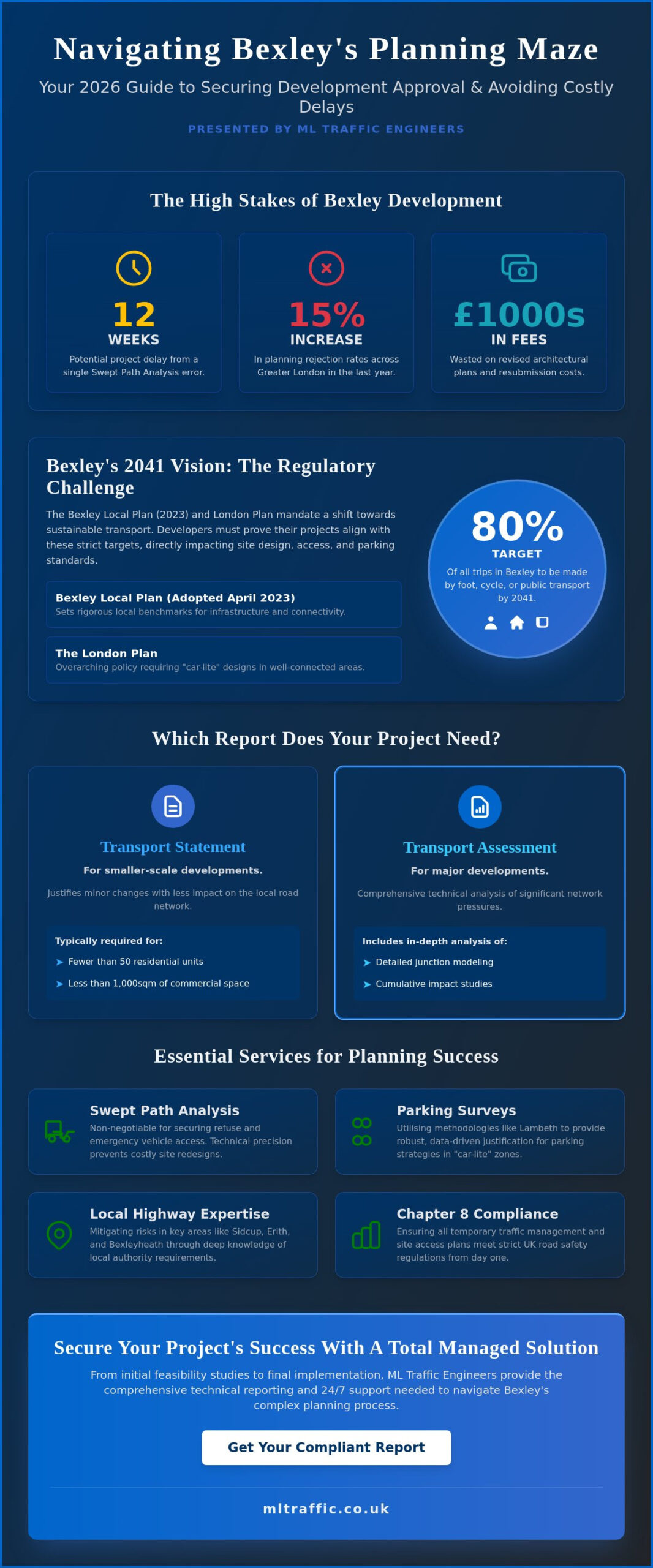
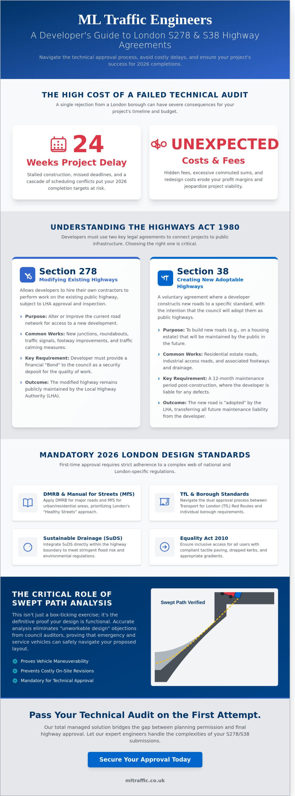
    A single overlooked parking survey or a flawed swept path analysis can stall a multi-million pound development for months. You already understand that the Royal Borough of Greenwich enforces some of London’s strictest car-free policies, especially near the high-pressure zones of the O2 and Greenwich Peninsula. Partnering with expert Transport Planning Consultants Greenwich is the only way to ensure your technical reports meet the rigorous safety standards required by local highways officers. We know the pressure of a looming planning committee date and the fear of a refusal based on traffic impact.

    This 2026 guide provides a clear checklist for securing approvals, focusing on cost-effective SPA surveys and robust transport assessments that satisfy TfL requirements. We’ve compiled the essential steps to help you manage regulatory burdens while maintaining project momentum. You’ll find a logical roadmap for everything from initial CAD designs to final implementation, ensuring your submission addresses every highways safety concern with precision and technical authority. Let’s look at the specific data sets and compliance standards that will get your project over the finish line.

    Key Takeaways

    • Understand the 2026 Royal Borough of Greenwich (RBG) transport policy landscape to align your development with local planning expectations from the outset.
    • Identify whether your project requires a Transport Statement or a full Assessment to satisfy mandatory requirements for Travel Plans in high-density areas.
    • Learn why Swept Path Analysis (SPA) and rigorous parking surveys are critical for overcoming access challenges in narrow SE10 development sites.
    • Utilize our 5-point checklist to ensure your chosen Transport Planning Consultants Greenwich possess the essential CIHT and TPS professional credentials.
    • Discover how 24/7 technical support and expert pre-app consultation can alleviate regulatory burdens and help you meet urgent planning deadlines.
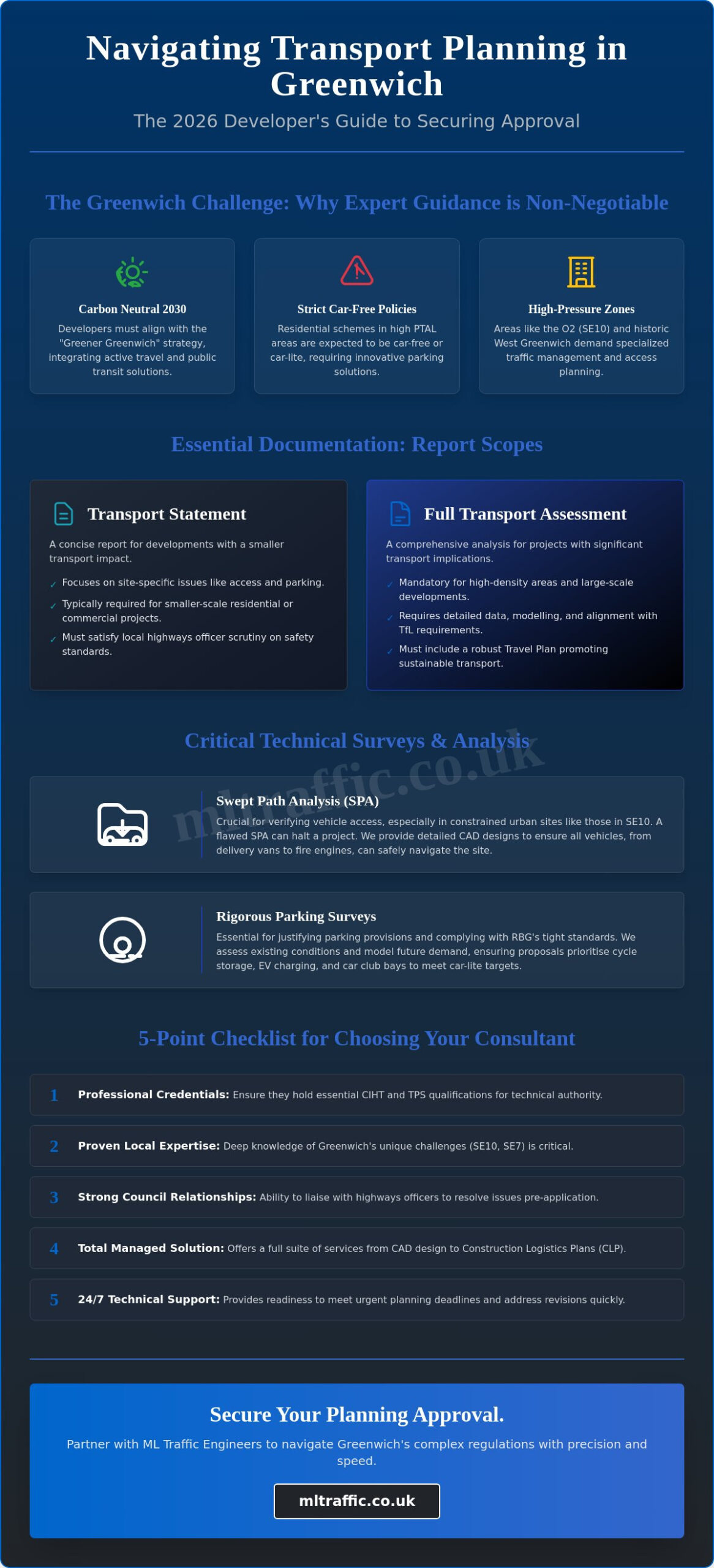
    Securing planning permission in the Royal Borough of Greenwich (RBG) in 2026 requires more than a basic site plan. As the borough accelerates toward its Carbon Neutral 2030 target, the role of Transport Planning Consultants Greenwich has shifted from simple layout design to complex carbon-reduction strategy. Developers must now demonstrate how every new build integrates into a wider network of active travel and public transit. This process relies on a deep understanding of transportation planning principles to ensure that development proposals don’t just meet minimum standards but actively improve local infrastructure.

    Our team manages the technical requirements of these applications, providing the precision needed to satisfy both local highways officers and Transport for London (TfL) requirements. We focus on delivering bespoke solutions that align with the “Greener Greenwich” strategy. This ensures your project remains viable under increasingly strict environmental regulations. We operate with a sense of urgency, recognizing that regulatory delays can impact your project’s bottom line.

    To better understand how urban transport systems evolve to meet these demands, watch this helpful video:

    Greenwich Local Plan and Transport Standards

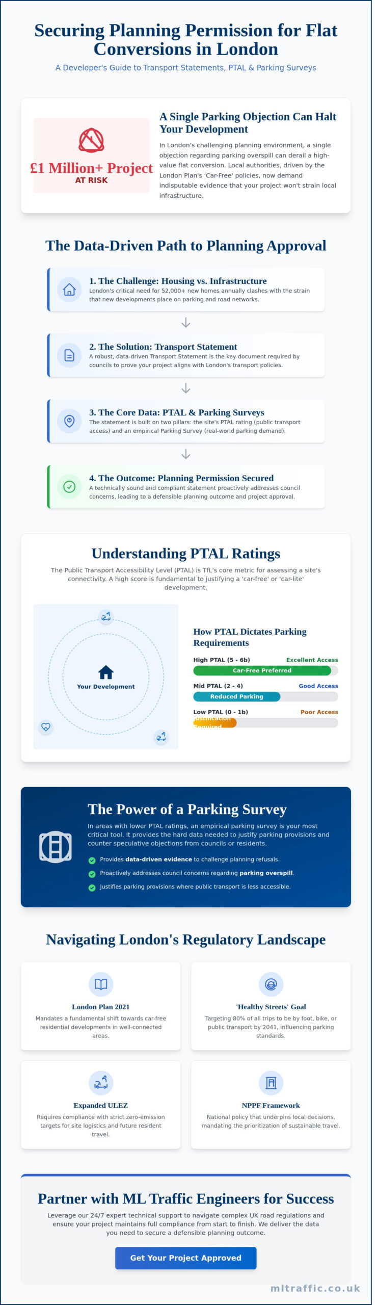
    By 2026, RBG parking standards have tightened significantly. Residential schemes in high PTAL (Public Transport Accessibility Level) areas, such as Greenwich Peninsula, are now expected to be car-free or car-lite. Commercial developments must prioritize cycle storage and electric vehicle (EV) charging infrastructure as a baseline requirement. We help you navigate these comprehensive transport assessments, ensuring your submission accounts for TfL’s Vision Zero safety standards. This technical authority is vital when your project faces scrutiny from multiple regulatory bodies.

    Why Local Expertise Matters in SE10 and SE7

    Greenwich presents unique geographic challenges that demand local knowledge. The SE10 postcode, dominated by the Greenwich Peninsula and the O2 Arena, requires specialized management of high-volume traffic corridors and event-day logistics. Conversely, West Greenwich and Blackheath feature historic, narrow street layouts where access for construction and delivery vehicles is physically restricted. Transport Planning Consultants Greenwich must account for these constraints early in the design phase to avoid costly revisions later.

    Our consultants build rapport with Royal Greenwich highways officers to resolve potential bottlenecks before they become formal objections. We provide a total, managed solution that includes:

    • Detailed CAD design for site access and swept path analysis.
    • Robust Construction Logistics Plans (CLP) that minimize disruption to SE7 residential areas.
    • 24/7 readiness to address emergency road works or planning revisions.
    • Bespoke travel plans that promote walking and cycling routes.

    Success in Greenwich depends on this level of organized, safety-conscious planning. We act as your safe pair of hands, managing the intricate complexities of London’s road regulations so your development stays on schedule. Our approach prioritizes clarity and speed, ensuring busy project managers grasp the scope of our offerings without navigating through unnecessary filler.

    Essential Documentation for Greenwich Planning Applications

    Securing planning permission in the Royal Borough of Greenwich (RBG) requires a meticulous approach to highways and transport data. The council’s planning department operates with high expectations for technical accuracy. If your documentation lacks precision, you’ll face delays or outright refusal. Expert Transport Planning Consultants Greenwich bridge the gap between architectural vision and the strict safety standards required for the public highway.

    Transport Statements vs. Assessments: The Greenwich Thresholds

    The scale of your development determines the level of scrutiny. In Greenwich, smaller projects typically require a Transport Statement. This usually applies to residential schemes under 80 units or commercial spaces below 2,500sqm. A Statement focuses on local access and immediate road safety. Larger developments trigger a full Transport Assessment. This is a comprehensive document that models junction capacity and multi-modal impact across a wider area. All reports must demonstrate alignment with the Royal Borough of Greenwich Transport Strategy, which prioritizes the reduction of car dependency. You can compare Transport Statements and Assessments to see which technical path fits your site’s specific metrics.

    Travel Plans: Encouraging Sustainable Movement

    Travel Plans are mandatory for most new Greenwich developments to ensure long-term sustainability. For residential blocks with 20 to 79 units, you’ll likely need a Framework Travel Plan. Once a project exceeds 80 units, RBG requires a Full Travel Plan with clear, measurable targets. These documents aren’t just paperwork; they’re legal commitments often tied to Section 106 obligations. They include 5-year monitoring cycles where developers must prove they’re meeting targets for cycling and public transport use. Failure to reach these benchmarks can lead to financial penalties. Our guide to London Travel Plans explains how to draft these to satisfy local authority auditors.

    Technical data is vital when justifying car-free or car-capped schemes. In areas with a PTAL (Public Transport Accessibility Level) score of 4 or higher, Greenwich expects developers to minimize parking. We use TRICS database analysis and 2021 Census travel-to-work patterns to prove your site won’t cause overspill parking on surrounding streets. This evidence-based approach mitigates the risk of highways objections. It gives planners the confidence that your project supports the borough’s environmental goals without compromising road safety. If you’re unsure about your site’s constraints, contact our team for a preliminary consultation to assess your project’s viability.

    Transport Planning Consultants Greenwich: A Developer’s 2026 Guide to Approvals

    Technical Data: SPA and Parking Surveys in the Greenwich Context

    RBG planning officers prioritise safety and highway capacity above all else. Developers must provide granular, site-specific data to prove a project won’t cause gridlock in the high-density corridors of SE10. This requires technical precision that only experienced Transport Planning Consultants Greenwich can deliver. We focus on two main pillars: vehicle movement dynamics and parking capacity. Providing a total, managed solution means we handle the data collection and the complex modelling required for 2026 regulatory standards.

    Swept Path Analysis for Tight Urban Sites

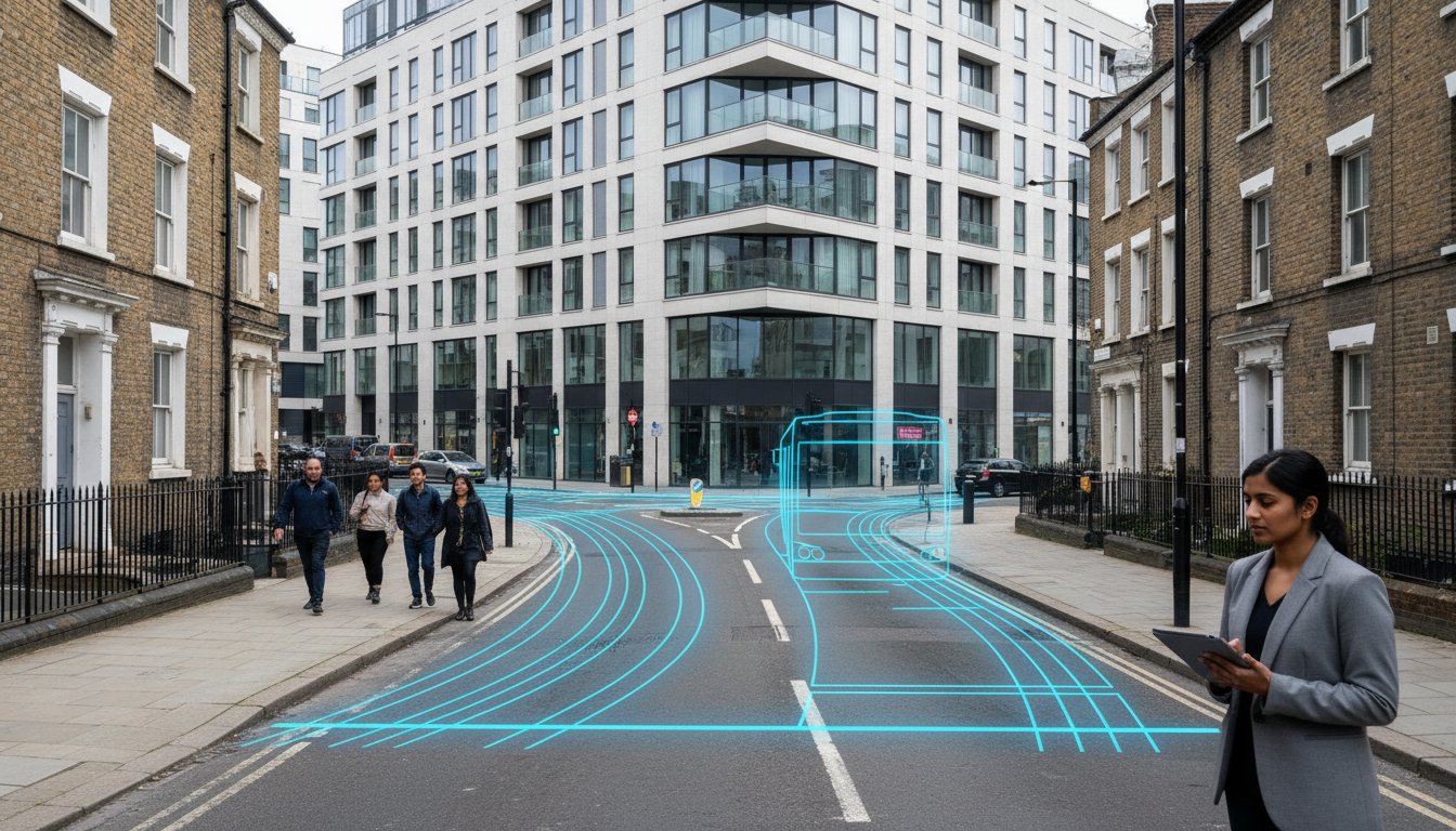
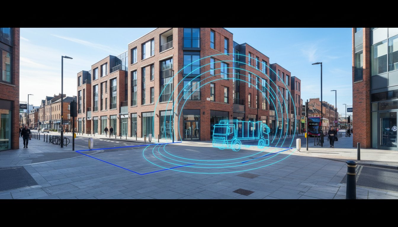
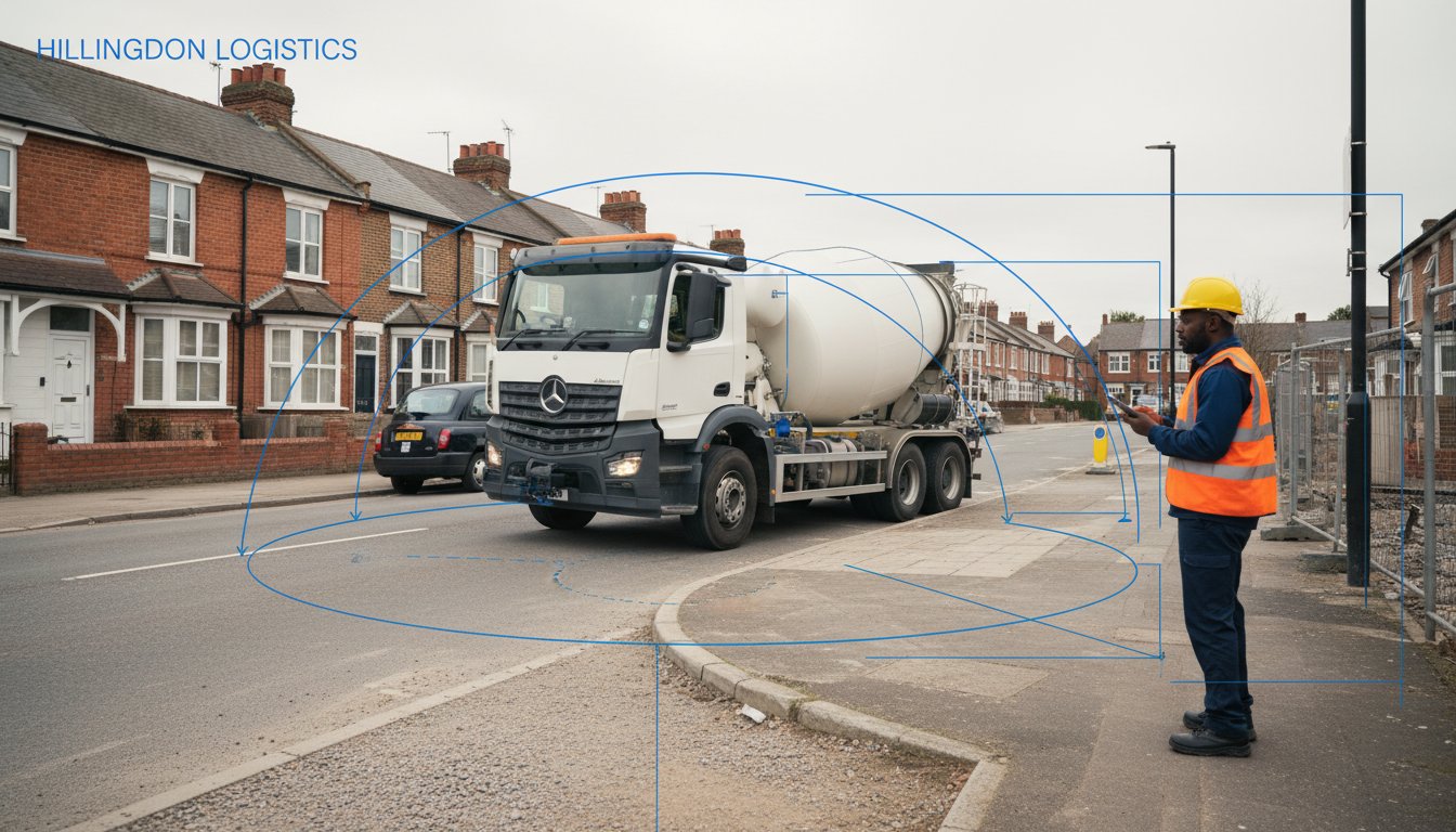
    Greenwich features some of the most challenging access points in South East London. We use CAD-based simulations to model the movement of 11.4m refuse vehicles and 16.8m fire tenders. This process identifies potential pinch points before they become expensive construction errors. It’s vital for designing underground car park layouts where ramp gradients and pillar placements leave zero margin for error. Our Swept Path Analysis Services London provide the visual evidence RBG needs to approve tight urban sites. We ensure emergency vehicles can reach every corner of your development without mounting kerbs or damaging infrastructure. Our simulations reflect real-world conditions, accounting for street furniture and existing on-road parking.

    Parking Surveys and the Lambeth Methodology

    Securing planning for schemes in North Greenwich or the town centre requires a robust parking strategy. We conduct overnight parking beat surveys between 00:30 and 05:30 on two separate weekday nights. This follows the Lambeth Methodology, which remains the industry standard for measuring parking stress. Meeting the requirements set out in the Guidance on Transport Assessment is non-negotiable for major applications in the Royal Borough of Greenwich.

    For sites with a high Public Transport Accessibility Level (PTAL) score of 4, 5, or 6, we often justify zero-parking developments. This is essential when dealing with Controlled Parking Zones (CPZ) where new residents are restricted from obtaining permits. Our data provides the evidence needed to satisfy the following criteria:

    • Baseline Capacity: Accurate counts of available on-street spaces within a 200m radius.
    • PTAL Justification: Using high connectivity to argue for reduced car dependency.
    • Refuse Strategy: Mapping bin drag distances to ensure they don’t exceed the 10m limit for collectors.
    • Emergency Access: Proving that 3.7m wide fire access routes are maintained at all times.

    By partnering with Transport Planning Consultants Greenwich, you gain access to 24/7 survey capabilities and technical CAD design. We position ourselves as a safe pair of hands, managing the intricate complexities of UK road regulations so you don’t have to. Our reports don’t just identify problems; they offer bespoke solutions that align with the London Plan 2021 and local Greenwich policies.

    Checklist: Choosing the Right Transportation Planning Consultants

    Selecting the right Transport Planning Consultants Greenwich requires a focus on technical precision and local regulatory alignment. Developers must vet potential partners against a rigorous 5-point framework to ensure project viability for 2026. This process prevents costly delays during the Royal Borough of Greenwich (RBG) planning committee reviews.

    • Professional Accreditation: Verify that lead consultants hold active memberships in the Chartered Institution of Highways and Transportation (CIHT) or the Transport Planning Society (TPS). These credentials guarantee adherence to the latest UK professional standards.
    • Local Authority Track Record: Demand evidence of successful project approvals within Greenwich. A consultant who understands RBG’s specific stance on the Silvertown Tunnel impact or the Greenwich Peninsula transport strategy offers a distinct advantage.
    • Software Currency: Confirm the firm uses 2026-ready versions of TRICS and AutoTRACK. Outdated modelling leads to rejected Transport Assessments.
    • Negotiation History: Evaluate their success rate in reducing developer contributions through evidence-based Section 106 and Section 278 negotiations.
    • Data Authenticity: Ensure the firm prioritizes bespoke, site-specific traffic counts over generic national averages that fail to capture London’s unique congestion patterns.

    Technical Capability and Software Standards

    Precision in trip generation and vehicle movement modelling is non-negotiable for modern developments. Competent Transport Planning Consultants Greenwich utilize the latest TRICS database, specifically version 7.11 or newer, to predict traffic impact with high confidence intervals. For 2026 approvals, generic industry data often falls short of RBG’s stringent requirements. We utilize CAD-based Swept Path Analysis models via AutoTRACK to simulate the movement of refuse vehicles and emergency services through tight urban footprints. This technical rigor identifies design flaws before they reach the planning stage. Bespoke data collection remains superior to generic averages because it accounts for specific local bottlenecks and current Public Transport Accessibility Level (PTAL) ratings.

    Strategic Communication and Negotiation Skills

    Technical data only succeeds if it’s presented persuasively to local stakeholders. Your consultant must bridge the gap between engineering requirements and planning policy. They need to negotiate Section 278 and Section 106 agreements that protect your project margins while satisfying RBG’s infrastructure demands. Experience in representing clients at RBG planning committee meetings is essential for high-stakes projects. A consultant who understands the specific concerns of Greenwich councilors can pivot strategies mid-meeting to secure a positive recommendation. For more information on budgeting for these services, see our guide on Understanding Consultant Costs and Quotes.

    We provide the technical expertise and local knowledge required to secure your development’s future. Explore our comprehensive transport planning services to see how we manage your project from initial design to final implementation.

    Securing Approval: The ML Traffic Approach to Greenwich

    Securing a green light from the Royal Borough of Greenwich (RBG) requires more than just standard documentation. It demands a technical partner who treats safety as a non-negotiable foundation. ML Traffic Engineers bridge the gap between ambitious development goals and strict local authority requirements. We don’t just provide reports; we deliver engineered solutions that withstand the scrutiny of planning committees. Our role as Transport Planning Consultants Greenwich involves deep integration with your design team. We identify potential bottlenecks before they become planning refusals.

    Our team operates with a sense of urgency because we know that planning windows are narrow. We provide 24/7 support to ensure that urgent technical queries or last-minute design changes don’t stall your application. Whether it is a Saturday night or a bank holiday, our engineers remain available to support your project’s critical path. This constant availability ensures that developers in the SE10 area can meet every regulatory deadline with confidence.

    From Initial Design to Final Implementation

    Success begins long before the formal application is submitted. We start with early-stage site feasibility and access reviews to determine if a site can physically accommodate the proposed trip generation. This proactive approach saves thousands in redesign fees later in the process. You can Explore our Greenwich Project Types to see how we tailor these reviews to specific residential and commercial needs.

    • Feasibility Studies: We analyze existing road geometry and pedestrian flows to ensure safe access.
    • CAD Design: Our engineers produce precise swept path analyses to prove that service vehicles can maneuver safely.
    • Regulatory Liaison: We manage the technical dialogue with RBG highways and Transport for London (TfL) throughout the planning lifecycle.

    In a 2024 redevelopment project near the Greenwich Peninsula, the developer faced significant pushback regarding construction vehicle impact. We deployed a comprehensive multi-way traffic management plan and CAD-simulated access routes. This data-driven evidence convinced RBG highways officers of the project’s viability, leading to a successful planning committee vote. We moved from initial consultation to final implementation support in less than six months, keeping the project on track.

    Your Partner for Planning Success

    We use a data-driven approach to reduce the risk of planning objections. By using accurate traffic counts and safety-conscious design, we provide the “safe pair of hands” that planning officers trust. Our bespoke solutions ensure that every multi-way system or temporary signal layout complies with Chapter 8 standards. We take the logistical burden off your shoulders so you can focus on construction. If you’re ready to start your next project, Contact ML Traffic Engineers for a Greenwich consultation to secure your transport approvals.

    Our team remains dedicated to providing the precise technical data and safety-led designs required to protect your project and the public.

    Secure Your 2026 Greenwich Development Approval

    Navigating the Royal Borough of Greenwich planning framework requires technical precision and current data. Success hinges on accurate Parking Stress Surveys and robust Statement of Preparedness for Adoption documentation that meets 2026 standards. These technical assessments are the foundation of a successful application, ensuring your project aligns with local transport strategies and safety regulations from the outset. Precise data collection and adherence to RBG policy aren’t just checkboxes; they’re the drivers of project viability.

    Partnering with experienced Transport Planning Consultants Greenwich provides the regulatory certainty required for complex London sites. ML Traffic Engineers delivers over 10 years of London planning experience and specific expertise in RBG local policy. We offer 24/7 technical support for urgent applications, managing projects from initial consultation through to final implementation. Our team understands the intricate complexities of UK road regulations, acting as a safe pair of hands for your development’s logistical needs. We focus on precision and compliance so you can focus on delivery.

    Contact ML Traffic Engineers for a Transport Planning Quote today. We’re ready to help you navigate the approvals process with speed and professional integrity.

    Frequently Asked Questions

    Do I need a transport statement for a small development in Greenwich?

    You generally need a Transport Statement for residential developments between 5 and 49 units or commercial projects under 2,500 square metres. The Royal Borough of Greenwich mandates these reports to ensure smaller schemes don’t compromise local road safety or pedestrian flow. Our Transport Planning Consultants Greenwich team produces these technical documents to prove your project aligns with the London Plan 2021. We focus on clear data to help you avoid unnecessary delays during the initial planning stages.

    What is the current parking policy for new builds in the Royal Borough of Greenwich?

    Greenwich enforces a car-free or car-lite policy for most new developments, particularly in areas with high public transport access. According to the 2021 London Plan, sites with a PTAL rating of 4 or higher must provide zero residential parking, excluding essential disabled bays. For sites in lower PTAL zones, the council permits limited parking spaces based on specific bedroom counts. We design parking management strategies that meet these strict environmental targets while ensuring your site remains functional for residents.

    How much does a transport planning consultant cost in London?

    Professional fees for transport consultants in the London market typically range from £450 to £950 per day based on the level of technical expertise required. A standard Transport Assessment for a medium-sized project often carries a fixed fee starting at approximately £2,500. These costs cover essential tasks like traffic modelling, CAD design, and site visits. Investing in expert advice early prevents the far higher costs associated with planning refusals or protracted Section 106 negotiations.

    How long is a parking survey valid for a Greenwich planning application?

    A parking survey is valid for 6 months from the date the data was recorded. Greenwich Council requires these surveys to follow the Lambeth Methodology, which involves collecting data during two separate weekday overnight periods between 00:30 and 05:30. If your data exceeds the 180-day threshold, highways officers will likely demand a fresh assessment. We ensure surveys take place during neutral months to provide the most accurate representation of local parking stress.

    What happens if my development has a low PTAL rating?

    Developments with a low PTAL rating of 0 to 2 must implement aggressive Travel Plans to reduce reliance on private vehicles. You’ll likely need to provide high-quality cycle parking, car club memberships, or improved pedestrian wayfinding as part of your application. Our Transport Planning Consultants Greenwich experts mitigate low scores by proposing infrastructure improvements that satisfy council requirements. We focus on delivering sustainable transport solutions that make even remote sites viable for approval.

    Can a transport consultant help with Section 278 highway works?

    Yes, we manage the entire Section 278 process to facilitate permanent alterations to the public highway. This includes creating detailed CAD drawings for new site entrances, puffin crossings, or junction realignments that meet Chapter 8 safety standards. We act as your technical liaison with the Royal Borough of Greenwich highways department to secure necessary approvals. Our team ensures all designs are compliant and cost-effective so your construction schedule stays on track.

    Michael Lee

    Article by

    Michael Lee

    Transport planner with over 35 years' experience.

    Disclaimer

    The content on mltraffic.co.uk, including all technical articles, guides, and resources, is provided for general informational and educational purposes only. It is not intended to constitute professional advice in traffic engineering, transportation planning, development approvals, or any other technical or legal field.
    While ML Traffic Engineers makes every reasonable effort to ensure the accuracy, completeness, and timeliness of the information published, we do not provide any warranties or representations (express or implied) regarding its reliability, suitability, or availability for any particular purpose. Any reliance you place on the content is strictly at your own risk.
    In no event shall ML Traffic Engineers, its directors, employees, authors, or affiliates be liable for any direct, indirect, incidental, special, consequential, or punitive damages (including, without limitation, loss of profits, data, or business opportunities) arising out of or in connection with the use of, or inability to use, any information provided on this website.
    The articles and guides on this site are not a substitute for engaging a qualified, professional traffic engineer to assess your specific project requirements. For tailored advice, compliance assessments, or traffic engineering services, please contact a competent professional.
    This disclaimer may be updated from time to time without notice. By accessing or using this website, you agree to be bound by the most current version of this disclaimer.

  • Transport Planning Consultants Ealing: Navigating 2026 Planning Approvals

    Transport Planning Consultants Ealing: Navigating 2026 Planning Approvals

    Could a single technical error in your transport assessment be the reason Perceval House rejects your 2026 development plans? Securing planning permission in West London is a high-stakes process where precision is a legal necessity. You already know that meeting Ealing Council’s stringent 2030 carbon-neutral requirements is a significant challenge for any developer. This is why many firms now rely on Transport Planning Consultants Ealing to ensure every CAD design and multi-way system analysis meets strict Chapter 8 compliance. Whether you’re managing a high-density build near Ealing Broadway or a complex site in Southall, the drastic variations in PTAL ratings require a specialist touch.

    We promise to help you master the complexities of transport statements and technical surveys. Our guidance helps you avoid the common pitfalls that lead to costly refusals. This article provides a sequential look at delivering cost-effective reports that satisfy every safety standard and legislative mandate. We’ll explore the specific data and strategic planning required to move your project from consultation to implementation. Our focus is on providing a total, managed solution. We ensure your project stays on track, remains compliant, and moves toward a successful approval without unnecessary delays.

    Key Takeaways

    • Understand how Ealing’s 2030 Carbon Neutral commitment and the borough’s complex street network directly impact the success of your 2026 planning applications.
    • Identify whether your development triggers a full Transport Assessment or a Statement by working with Transport Planning Consultants Ealing to navigate specific London thresholds.
    • Learn why Swept Path Analysis (SPA) is critical for Ealing’s narrow Victorian roads to guarantee refuse vehicle access and avoid immediate planning refusals.
    • Discover how to implement the Lambeth Methodology for parking stress surveys to meet Ealing Council’s gold standard for technical data collection.
    • Gain expert insights into managing S278 and S38 highway works to ensure your project aligns with the latest Ealing Local Implementation Plan (LIP) requirements.

    Why Transport Planning in Ealing is Unique in 2026

    Ealing’s 500km street network is one of the most pressured in West London. This vast infrastructure must balance the high-frequency requirements of Transport for London (TfL) and Network Rail, particularly as the Elizabeth Line continues to drive vertical density. As we move into 2026, the regulatory environment is no longer forgiving of generic submissions. Developers need transport planning strategies that reflect the borough’s unique constraints. Generic UK models often fail because they don’t account for the specific congestion patterns of the A406 or the A40 corridors.

    To better understand the professional standards required in this field, watch this helpful video:

    The role of Transport Planning Consultants Ealing is to bridge the gap between ambitious development and strict council mandates. Every project must now align with the 2030 Carbon Neutral commitment. This shift means that safety and compliance aren’t just checkboxes; they’re the foundation of the planning process. Our team provides 24/7 support to ensure that traffic management plans meet Chapter 8 standards while facilitating seamless site access. We utilize CAD design to map out multi-way systems that prevent local gridlock during the construction phase.

    Ealing’s Climate and Ecological Strategy

    The borough’s 2030 target has transformed car-free development from a suggestion into a requirement for areas like Ealing Broadway. New applications must prioritize active travel by integrating cycling and walking routes directly into the site’s initial footprint. Ealing’s Local Implementation Plan (LIP) serves as the primary statutory document that aligns local transport objectives with the Mayor of London’s Transport Strategy. This hierarchy dictates that every new curb-cut or access point must demonstrate a net benefit to the borough’s ecological goals and pedestrian safety.

    The Perceval House Factor: Dealing with Ealing Council

    Securing approval involves direct negotiation with transport officers based at Perceval House on Uxbridge Road. These officials expect high-quality technical data and early engagement. Seeking pre-application advice is no longer optional for major schemes; it’s a strategic necessity to avoid costly delays. Working with ML Traffic ensures your project meets these rigorous local expectations through comprehensive support and bespoke traffic management solutions. We handle the intricate road regulations and technical CAD requirements so you can focus on delivery. Our 24/7 availability ensures that even the most urgent planning revisions are handled with precision and speed.

    Transport Statement vs. Transport Assessment: Ealing Thresholds

    Choosing the correct technical document is the first step in securing planning permission. Developers often confuse a Transport Statement (TS) with a Transport Assessment (TA), but the distinction is vital for 2026 compliance. The UK government guidance establishes that the scale and potential impact of a project dictate which report is necessary. While a TS focuses on smaller schemes with limited traffic impact, a full TA provides a rigorous analysis of the local network’s capacity to handle significant demand. Transport Planning Consultants Ealing evaluate these requirements during the pre-application stage to prevent costly delays or requests for further information from the council.

    Many developers fall for the “no-impact” myth. They assume that small-scale Ealing developments, such as a four-unit residential conversion, don’t require technical documentation. This is rarely the case. Ealing council requires evidence that even minor projects won’t compromise highway safety or parking availability. Public Transport Accessibility Level (PTAL) scores heavily influence these requirements. A site in Ealing Broadway with a PTAL of 6b faces different reporting pressures than a site in Northolt with a PTAL of 2. Higher PTAL areas often mandate car-free or car-capped developments, requiring a specific type of justification within the transport report. Developers working across multiple London boroughs should also be aware that similar car-free policies apply elsewhere; for instance, Transport Planning Consultants Greenwich face equally stringent requirements near high-pressure zones like the O2 and Greenwich Peninsula.

    Ealing-Specific Reporting Thresholds

    Thresholds in London are stricter than national averages. In Ealing, residential developments exceeding 80 units typically trigger a full Transport Assessment and require direct involvement from Transport for London (TfL). For commercial projects, a floor space exceeding 2,500 square meters usually necessitates a TA. Smaller projects, such as those between 30 and 80 units or commercial spaces under 1,000 square meters, generally only require a Transport Statement. You can find more detail on these differences in our Transport Statement vs. Transport Assessment Guide. Our team ensures your submission matches the exact scale of your project to streamline the approval process.

    The Role of the TRICS Database

    We use the TRICS (Trip Rate Information Computer System) database to predict how much traffic a new development will generate. This system allows us to compare your project against thousands of similar sites across the UK. For Ealing-specific land uses, we prioritize London-based data over national averages. This is because London’s unique travel patterns, influenced by the ULEZ and high bus density, don’t align with rural or regional statistics. Accurate trip generation data directly influences the financial contributions required for local infrastructure improvements through Section 106 negotiations. By using precise, localized data, we protect developers from over-inflated mitigation costs. If you need assistance with data-driven planning, our experts provide comprehensive support for all project phases.

    Transport Planning Consultants Ealing: Navigating 2026 Planning Approvals

    Swept Path Analysis: Preventing Access Refusals in Ealing

    Ealing’s Victorian infrastructure presents a physical barrier to modern development. Narrow streets in residential pockets make vehicle maneuverability a primary concern for local planning officers. As expert Transport Planning Consultants Ealing, we’ve seen applications fail simply because a refuse truck couldn’t clear a corner without mounting the kerb. Swept Path Analysis (SPA) provides the technical proof required to satisfy these safety concerns. By simulating the movement of specific vehicles, developers can identify pinch points before they become legal roadblocks. This process aligns with Ealing’s new Transport Strategy, which prioritizes safe, efficient logistics within the borough’s evolving streetscape. Failure to provide this data often results in an immediate refusal, as the Council won’t risk approving designs that compromise public safety or block emergency routes.

    Modeling refuse vehicle access is a non-negotiable requirement. Ealing Council operates specific vehicle dimensions, often requiring a 10.2m or 11.2m refuse collection vehicle (RCV) template depending on the ward. In high-density areas like Acton and Southall, fire tender requirements are even more stringent. We model these 12m emergency vehicles to ensure they can navigate tight turns within new residential blocks. SPA prevents the need for costly post-planning design revisions. Redesigning a site layout after a refusal can cost a developer over £15,000 in additional architectural fees and delay a project by six months or more.

    Vehicle Templates for London Boroughs

    Standard London refuse vehicles don’t always fit the reality of Ealing’s tight-access fleets. We use bespoke templates that reflect the actual machinery used by local waste contractors. In West Ealing, commercial units must demonstrate that delivery and servicing maneuvers won’t cause tailbacks on the A4020. Utilizing professional Swept Path Analysis Services in London ensures your site layout accommodates these local variations. This technical foresight protects the project from being stalled by Transport for London (TfL) or local highway officers during the consultation phase.

    CAD Design and Technical Accuracy

    The transition from 2D drawings to dynamic vehicle movement simulations has changed the approval landscape. Ealing transport officers no longer accept “manual” checks or simple overlays. They require dynamic CAD simulations that account for steering lock, body overhang, and wheel paths. Accurate SPA justifies reduced road widths in car-free schemes, allowing developers to allocate more space to green infrastructure or housing units. This precision ensures that even the most compact urban sites remain fully compliant with UK building regulations and local safety standards.

    Parking Surveys and the Lambeth Methodology in Ealing

    Ealing Council requires a formal parking stress survey whenever a proposed development might significantly impact local kerbside capacity. Transport Planning Consultants Ealing rely on these surveys to provide the empirical evidence necessary for planning committee approval in 2026. The core objective is to demonstrate that the existing highway can accommodate the residual parking demand from a new project without creating safety hazards or blocking emergency access. We provide these assessments as part of a total, managed solution to ensure your project remains compliant with the latest London Plan requirements.

    The Lambeth Methodology remains the gold standard for these assessments across London. It offers a consistent, data-driven approach that planning officers trust. By following this framework, developers avoid the delays associated with insufficient or anecdotal evidence. Our team utilizes this methodology to provide technical authority, addressing every regulatory hurdle before it becomes a bottleneck for your planning application.

    Conducting Surveys in Ealing CPZs

    When working within Ealing’s Controlled Parking Zones (CPZs), timing and frequency are non-negotiable. Surveys must occur between 1am and 5am on two separate weekday nights to capture the maximum residential parking load. Ealing planning policy mandates a 200-metre radius for the survey area, measured by walking distance from the site entrance. This specific distance identifies all available legal parking spaces that a future resident might reasonably use. Precision here is a legal necessity; any deviation from the 200-metre rule can lead to a summary rejection of the Transport Assessment. You can find more detail on these regulatory requirements in our Transport Assessment London Guide.

    PTAL Ratings and Parking Reductions

    Ealing’s PTAL map is the primary lever for arguing for reduced parking provision. The arrival of the Elizabeth Line has transformed accessibility in Hanwell and Ealing Broadway, pushing many sites into PTAL Zones 5 and 6. In these high-accessibility areas, Ealing Council often supports “zero-parking” developments, provided that the developer enters into a Section 106 agreement to prevent residents from obtaining on-street permits. A higher PTAL rating directly correlates with a lower statistical probability of car ownership and a corresponding reduction in local parking stress. This data is vital for developers looking to maximize floor space in high-density urban areas.

    Our 24/7 readiness ensures that your parking data is collected accurately and submitted promptly. We manage the intricate complexities of UK road regulations so you don’t have to. Our experts take pride in delivering Chapter 8 compliance and bespoke traffic solutions that stand up to council scrutiny.

    Partnering with a Transport Planning Consultant for Ealing Success

    Success in West London development requires more than just standard technical drawings. It demands a deep understanding of the Ealing Local Implementation Plan (LIP), which outlines the borough’s transport objectives through to 2041. Working with experienced Transport Planning Consultants Ealing ensures your project aligns with specific local targets for active travel and traffic reduction. The Ealing LIP 3 specifically targets a 40% reduction in carbon emissions from transport by 2030, making your 2026 application a critical milestone in meeting these environmental benchmarks.

    We manage the complex S278 and S38 legal agreements required for highway works. These are essential for any development requiring permanent alterations to the public highway in Ealing. Our team handles the technical submissions and direct liaison with the local highway authority to prevent delays. In London boroughs, S278 approvals can often take 6 to 12 months to finalize; early engagement with a technical partner helps mitigate this risk and keeps your construction schedule on track.

    Urgency defines the 2026 planning cycle. With tightening regulations and increased scrutiny on sustainable transport, 24/7 availability isn’t a luxury; it’s a necessity. We provide constant support to address planning queries or technical revisions immediately. ML Traffic Engineers acts as your technical partner, ensuring every CAD design and traffic survey meets current safety standards and legislative requirements. We take the logistical burden off your shoulders so you can focus on the broader aspects of your development.

    From Consultation to Implementation

    We don’t just provide raw data; we deliver a total managed solution. Our team oversees the entire lifecycle of your Ealing transport application, from initial feasibility studies to final site implementation. This comprehensive approach removes the burden of coordinating multiple vendors. You can learn more about how we integrate these services on our What We Do page. We prioritize Chapter 8 compliance and precision in every temporary traffic signal or multi-way system we deploy, ensuring your site remains safe and compliant from day one.

    Securing Your Quote for Ealing

    Every project has unique requirements. We provide tailored technical reporting for residential developments, commercial hubs, and mixed-use schemes across Ealing. Whether you need a Transport Assessment or a detailed Travel Plan, our quotes reflect the specific technical demands of your site. To better understand the financial side of your application, read our guide on Understanding Transport Consultant Costs. This transparency helps you budget accurately for your 2026 planning milestones.

    Ready to move forward? Contact ML Traffic Engineers for an Ealing project review today to secure your 2026 planning approval and ensure your project meets all regulatory hurdles with precision.

    Secure Your Ealing Planning Approval for 2026

    Navigating Ealing Council’s evolving transport requirements requires technical precision and immediate action. Success in 2026 hinges on meeting specific TfL compliance standards and mastering the Lambeth Methodology for parking surveys. Our team provides the TRICS data and Swept Path Analysis needed to eliminate access refusals before they happen. We focus on total managed solutions that move your project from the initial CAD design to final implementation without regulatory delays. We’re a safe pair of hands for developers who must satisfy strict UK road regulations.

    As leading Transport Planning Consultants Ealing, we understand that planning deadlines don’t wait for business hours. That’s why we offer 24/7 technical support to address urgent queries and ensure your submission meets every legal requirement. We take the logistical burden off your shoulders so you can focus on the build. Our expertise in SPA and parking data ensures your development stands up to the strictest scrutiny from local authorities. We pride ourselves on professional integrity and a commitment to safety that protects both your project and the public.

    Get a professional transport planning quote for your Ealing project. We look forward to helping you achieve a seamless approval process.

    Frequently Asked Questions

    Do I need a transport planning consultant for a small development in Ealing?

    You need a consultant if your project alters highway access or impacts local parking capacity. Ealing Council’s 2024 Local Plan mandates that even minor residential conversions provide a Transport Statement to prove safety. Transport Planning Consultants Ealing ensure your submission meets the 2026 London Plan requirements. We provide the technical evidence to prevent delays during the validation stage.

    What is a PTAL rating and how does it affect my Ealing planning application?

    PTAL stands for Public Transport Accessibility Level, a score from 0 to 6b that measures proximity to public transport. Ealing Council uses this score to determine your maximum allowable parking provision. A high PTAL score of 5 or 6 often mandates car-free or low-car developments under the 2021 London Plan. We calculate these ratings to justify your project’s density and parking strategy.

    How much does a Transport Statement cost for an Ealing project?

    Industry data from 2024 suggests that a standard Transport Statement for a medium-scale UK development costs between £1,500 and £3,500. Fees vary based on the complexity of the highway impact and the required data collection. We provide bespoke quotes that reflect the specific technical requirements of Ealing’s 2026 planning framework. This ensures you only pay for the necessary compliance work.

    Does Ealing Council allow car-free developments?

    Ealing Council actively encourages car-free developments in areas with high public transport accessibility. Policy T6 of the London Plan 2021 states that new homes in well-connected locations should be car-free, excluding disabled persons’ parking. Our team designs robust Travel Plans to support these applications. We demonstrate how your project aligns with the borough’s sustainable transport targets.

    What is the Lambeth Methodology for parking surveys?

    The Lambeth Methodology is the gold standard for conducting on-street parking surveys in London. It requires surveyors to record parking stress within a 200-metre walking distance of the site over two consecutive weekday nights. Ealing Council requires this data to assess if a development will cause overspill parking. We use precise data logging to ensure these surveys meet strict 2026 audit standards.

    How long does it take to get a Transport Assessment approved by Ealing Council?

    Ealing Council typically aims to determine minor applications within 8 weeks and major projects within 13 weeks. However, complex Transport Assessments often involve 3 to 6 months of consultation with highway officers. We mitigate these timelines by engaging in pre-application discussions. This proactive approach identifies potential hurdles before the formal submission date.

    Can a transport consultant help with Section 278 agreements in Ealing?

    We manage the entire Section 278 process for works on Ealing’s public highways. This legal agreement under the Highways Act 1980 allows developers to fund and implement permanent alterations like new junctions or traffic signals. Our Transport Planning Consultants Ealing handle the technical approvals and Chapter 8 compliance. We ensure all highway modifications meet the safety standards required by the local authority.

    What happens if my Swept Path Analysis shows a vehicle cannot turn?

    If a Swept Path Analysis shows a vehicle cannot safely manoeuvre, you must redesign the site layout or access point immediately. Ealing Council won’t approve plans where refuse vehicles or emergency services strike kerbs or encroaching on third-party land. We use specialized CAD software to simulate vehicle movements and provide immediate design solutions. This ensures your site plan is functional and safe before you submit it for approval.

    Michael Lee

    Article by

    Michael Lee

    Transport planner with over 35 years' experience.

    Disclaimer

    The content on mltraffic.co.uk, including all technical articles, guides, and resources, is provided for general informational and educational purposes only. It is not intended to constitute professional advice in traffic engineering, transportation planning, development approvals, or any other technical or legal field.
    While ML Traffic Engineers makes every reasonable effort to ensure the accuracy, completeness, and timeliness of the information published, we do not provide any warranties or representations (express or implied) regarding its reliability, suitability, or availability for any particular purpose. Any reliance you place on the content is strictly at your own risk.
    In no event shall ML Traffic Engineers, its directors, employees, authors, or affiliates be liable for any direct, indirect, incidental, special, consequential, or punitive damages (including, without limitation, loss of profits, data, or business opportunities) arising out of or in connection with the use of, or inability to use, any information provided on this website.
    The articles and guides on this site are not a substitute for engaging a qualified, professional traffic engineer to assess your specific project requirements. For tailored advice, compliance assessments, or traffic engineering services, please contact a competent professional.
    This disclaimer may be updated from time to time without notice. By accessing or using this website, you agree to be bound by the most current version of this disclaimer.

  • Transport Planning Consultants Enfield: Your 2026 Guide to Planning Success

    Transport Planning Consultants Enfield: Your 2026 Guide to Planning Success

    A single transport objection can stall a multi-million pound development in North London for over six months, often costing developers upwards of £15,000 in avoidable holding fees. You likely already know that meeting Enfield Council’s rigid 2026 parking standards and sustainability targets requires more than just a basic site map. Securing a successful submission demands technical precision and a deep understanding of local policy from the outset. As expert Transport Planning Consultants Enfield, we provide the data-driven strategies and technical reports needed to bypass these regulatory hurdles and eliminate the fear of rejection. We deliver a total managed solution that includes everything from CAD-based Swept Path Analysis to comprehensive Transport Statements. This guide outlines the exact steps to navigate Enfield’s complex transport requirements, optimize your site layout for vehicle access, and ensure your planning application moves straight to approval without unnecessary delays.

    Key Takeaways

    • Understand how to align your development with the latest Enfield Local Plan objectives to ensure a smooth approval process.
    • Identify whether your project requires a Transport Statement or a full Assessment based on Enfield Council’s specific development thresholds.
    • Master the use of Swept Path Analysis and parking surveys to overcome site constraints and demonstrate safe access for refuse and emergency vehicles.
    • Discover how PTAL ratings directly influence parking requirements and how expert Transport Planning Consultants Enfield can optimize your site’s accessibility scores.
    • Secure a “safe pair of hands” for your application with technical reports that meet London-standard compliance and 24/7 project support.

    Why You Need Expert Transport Planning Consultants in Enfield

    In 2026, the complexity of securing planning permission in North London has reached an all-time high. Expert transportation planning is no longer a secondary consideration; it’s the foundation of a successful application. Transport Planning Consultants Enfield act as the bridge between your architectural vision and the rigid safety requirements of the local authority. They ensure your project integrates seamlessly with existing road networks while meeting the latest environmental standards.

    Engaging experts early identifies potential “showstoppers” before you invest in detailed architectural drawings. This proactive approach prevents the need for expensive design revisions that often occur when the Enfield Highway Department raises safety or capacity concerns. We manage the entire lifecycle, from initial feasibility to final implementation on the road.

    To better understand how transport logistics impact wider urban development, watch this helpful video:

    Professional technical reports serve as your primary defense against local resident objections. When a development faces scrutiny over increased traffic flow or parking pressure, a data-driven Transport Assessment (TA) or Transport Statement (TS) provides the objective evidence needed to justify the proposal. Our team delivers these reports with precision, ensuring every multi-way system and access point is calculated for maximum safety and efficiency.

    The Impact of the Enfield Local Plan on Your Development

    The Enfield Local Plan 2024-2041 sets a rigorous framework for all new construction, prioritizing a 15-minute neighborhood model and active travel. With housing targets requiring over 1,200 new homes annually across the borough, the pressure on existing transport capacity is intense. The Enfield Local Plan serves as the strategic roadmap that dictates how transport infrastructure must evolve to support sustainable growth and community connectivity. Developers must prove their projects contribute to carbon reduction targets and enhance pedestrian safety through bespoke solutions.

    Mitigating Planning Risks with Technical Authority

    Technical errors in your evidence base can trigger delays during Regulation 18 or Regulation 19 consultations, potentially stalling a project for months. We address the specific concerns of the Enfield Highway Department early in the lifecycle to ensure smooth approvals. Every layout we produce is Chapter 8 compliant and safety-focused, utilizing professional CAD design to visualize traffic flow. By choosing experienced Transport Planning Consultants Enfield, you gain a partner that understands what we do involves more than just drawings; it’s about providing a total, managed solution that protects your investment.

    Essential Reports for Enfield Planning: Transport Statements vs. Assessments

    Securing planning permission in Enfield requires a precise understanding of your project’s impact on the local highway network. Transport Planning Consultants Enfield categorize these requirements based on the scale of your development. The National Planning Policy Framework (NPPF) dictates that all developments generating significant movement must be supported by a Transport Statement or Transport Assessment. Following Statutory guidance for local transport plans ensures your submission aligns with both national policy and the specific transport strategy for Greater London.

    To predict trip generation, we utilize the TRICS database. This industry-standard tool provides empirical data from similar sites across the UK, allowing us to forecast peak-hour traffic flow with high precision. This data forms the backbone of your application. It proves to Enfield Council that your site won’t compromise road safety or capacity. Our team uses the latest TRICS 7.11 data sets to ensure your 2026 planning application stands up to rigorous scrutiny from highway officers.

    Transport Statements for Smaller Enfield Developments

    Smaller schemes, such as minor residential conversions or small commercial units under 50 units, usually require a Transport Statement. We focus on site accessibility and the immediate impact on local Enfield roads. Your report must detail the site location, existing highway conditions, and the safety of proposed access points. You can find more detail in our Transport Statements guide. We ensure these documents are concise and technically robust to prevent unnecessary delays in the planning cycle.

    Comprehensive Transport Assessments for Major Projects

    Major developments demand a full Transport Assessment. These reports analyze the cumulative impact on critical Enfield arteries like the A10 or the A406 North Circular. If our modeling shows a capacity shortfall, we propose mitigation measures. This often includes Section 278 highway improvements, such as new junction layouts or signal installations. We also integrate Travel Plans to encourage sustainable transport, reducing the overall vehicle burden on the borough. Our goal is to provide a total, managed solution that addresses every regulatory hurdle.

    If you’re unsure which report your project needs, we provide comprehensive support to identify the correct pathway for your application and ensure total compliance.

    Transport Planning Consultants Enfield: Your 2026 Guide to Planning Success

    Overcoming Site Constraints: Swept Path Analysis and Parking Surveys

    Narrow Victorian terraces and tight mews characterize much of Enfield’s residential landscape. These physical constraints often stall developments during the planning phase because vehicle access appears restricted. Our role as Transport Planning Consultants Enfield is to prove that your site remains functional without compromising safety or local traffic flow. We provide the technical evidence needed to satisfy Enfield Council’s rigorous standards for vehicle movement and parking capacity. Precision in these early stages prevents the rejection of applications based on speculative access concerns.

    Swept Path Analysis: Visualising Vehicle Manoeuvrability

    We use precise CAD design to simulate how specific vehicles move through your site. This process, known as Swept Path Analysis (SPA), is vital for satisfying Enfield Council that 11.2 metre refuse trucks and 10.5 metre fire tenders can enter and exit in forward gear. SPA prevents costly design errors. It ensures you don’t build kerbs or structural pillars that obstruct essential services. Our team provides Swept Path Analysis services that give planners the visual confidence to approve your layout. We handle the technical complexities so your architects can focus on the build. This foresight eliminates the risk of expensive retrospective modifications after construction begins. By identifying pinch points early, we ensure your site layout works for both delivery drivers and emergency responders.

    Parking Surveys and Data Collection in Enfield

    Parking remains a sensitive issue in high-density areas like Edmonton and Palmers Green. We conduct parking surveys using the Lambeth Methodology to measure overnight parking stress within a 200 metre walking distance of your site. This data is essential when justifying parking provision, especially in areas with low Public Transport Accessibility Level (PTAL) ratings. Enfield’s 2026 planning goals lean toward car-free developments, but we balance these objectives with the practical needs of future residents. Accurate data serves as the foundation for any successful parking justification, ensuring your project meets local standards without overwhelming existing street capacity. We deliver clear, evidence-based reports that withstand council scrutiny. Reliable data is the only way to turn a contentious parking proposal into an approved plan. Our surveys capture real-time usage patterns, providing a snapshot of local demand that generic models cannot match.

    Enfield’s planning landscape is defined by its transition from suburban fringes to high-density urban hubs. Navigating these requirements requires a firm grasp of the London Plan 2021 and local Enfield Development Management Documents. Transport Planning Consultants Enfield provide the technical precision needed to align your project with these evolving standards. We focus on Public Transport Accessibility Levels (PTAL), which remain the primary metric for determining development density and parking allowances across the borough. Precision in these assessments isn’t just a preference; it’s a legal necessity for a successful application.

    PTAL scores in Enfield vary significantly. Central areas like Edmonton Green often achieve scores of 5 or 6, while rural fringes near Clay Hill may drop to 0 or 1. These ratings directly influence parking maximums and minimums. In high-PTAL zones, the council often mandates “car-free” or “car-capped” developments to reduce congestion. For strategic routes like the A10 Great Cambridge Road or the A406 North Circular, we manage the complex interface with Transport for London (TfL). This ensures your proposal meets the Healthy Streets indicators and doesn’t negatively impact the capital’s primary road network. We advocate for early pre-application advice from Enfield’s transport officers to identify potential highway safety issues before you commit to a final design.

    • Data-driven assessments: We use the latest TfL WebCAT data to provide accurate PTAL reports for your specific site coordinates.
    • Strategic consultation: We handle the dialogue with Enfield Council and TfL to streamline the approval process.
    • Regulatory compliance: Every transport statement or assessment adheres to the latest UK road regulations and safety standards.

    PTAL Scores and Development Density

    A PTAL rating of 6 vs. 1 fundamentally changes your transport strategy. High scores allow for greater floor area and lower parking provision, maximizing your site’s yield. For sites with low accessibility scores in outer Enfield, developers must provide robust mitigation. We help you implement London Travel Plans to bridge the gap. These plans focus on car clubs, electric vehicle charging points, and enhanced cycle storage to satisfy council requirements despite poor rail or bus links.

    Section 278 and Section 38 Agreements in Enfield

    Legal requirements for highway works are strict and require expert oversight. S278 agreements are essential when your development requires modifications to the existing public highway, such as new site entrances or improved pedestrian crossings. S38 agreements allow Enfield Council to adopt new roads you’ve constructed. Our engineers ensure all highway designs meet the borough’s technical standards and Chapter 8 safety requirements. For a detailed breakdown of these processes, see our Highway Design S278 & S38 guide.

    Our team is ready to provide a comprehensive transport assessment to secure your Enfield planning approval.

    ML Traffic Engineers: Professional Transport Planning in Enfield

    ML Traffic Engineers provides technical precision for every development within the London Borough of Enfield. We operate with a 24/7 availability model to handle urgent project deadlines and immediate site requirements. As established Transport Planning Consultants Enfield, we manage the entire regulatory lifecycle of your application. This includes detailed Transport Statements, Parking Surveys, and CAD-led Swept Path Analysis (SPA). Every report we produce adheres to the latest UK road regulations and safety standards.

    We act as a safe pair of hands for developers and architects. Our team understands that a single error in a traffic report can lead to costly delays or planning refusals. We eliminate this risk through rigorous internal auditing and a deep commitment to technical accuracy. Whether your site is a tight urban infill or a large-scale commercial hub, we deliver bespoke solutions that satisfy both the developer’s goals and the council’s highway requirements.

    • Comprehensive Transport Statements: Robust evidence for residential and commercial schemes.
    • Swept Path Analysis: Ensuring refuse and emergency vehicles can navigate your site safely.
    • Parking Surveys: Utilising Lambeth Methodology and bespoke data collection to prove parking capacity.
    • Delivery and Servicing Plans: Practical logistics management for operational success.

    Why Choose a Local London Consultancy?

    Local expertise is vital for navigating the specific highway constraints found in Enfield. We have a deep understanding of the North Circular corridors and the unique parking standards enforced by the local authority. Our senior engineers manage your project from the initial feasibility stage through to final implementation. We have a proven track record of securing approvals for diverse project types including mixed-use developments and educational facilities. You’ll always have direct access to the technical expert lead on your case.

    Ready to Start Your Enfield Project?

    Securing a Transport Planning Consultants Enfield partner early in the design process prevents expensive revisions later. We provide a rapid quote for your site, often within 24 hours of your initial enquiry. Our process starts with a transport feasibility review to identify potential highway “red flags” before they become obstacles. We deliver technical reports designed to stand up to the most rigorous council scrutiny. Our documentation follows all current legislative requirements and Chapter 8 compliance guidelines where necessary.

    We don’t just provide equipment or data; we provide a total managed solution. Our engineers are ready to defend your project at planning committees or through direct negotiation with highway officers. If you need a reliable partner to handle the complexities of London’s transport network, we’re ready to assist. Contact ML Traffic Engineers for an Enfield transport consultation to ensure your 2026 development stays on track and compliant.

    Take the Next Step Toward Your Enfield Planning Approval

    Navigating Enfield Council’s strict planning requirements requires technical precision and deep local insight. Whether your project demands a detailed Transport Assessment or a CAD-based Swept Path Analysis, technical accuracy is the foundation of every successful application. PTAL ratings and parking capacity often dictate the viability of your development. Professional Transport Planning Consultants Enfield ensure these complex variables align with current UK road regulations and local council standards from the start.

    ML Traffic Engineers has provided expert support across London since 2014. We bring over a decade of experience to your project, utilizing industry-standard tools like TRICS and Lambeth Parking Methodologies to deliver robust technical reports. Our team operates with 24/7 readiness to handle urgent deadlines and provide total managed solutions from initial consultation to final implementation. We take the regulatory burden off your shoulders so you can focus on building. Our commitment to safety and precision makes us the dependable partner you need for high-stakes urban planning.

    Secure your Enfield planning approval with ML Traffic Engineers

    Your development deserves a partner that values precision and professional integrity. We’re ready to help you navigate the complexities of the planning process with confidence.

    Frequently Asked Questions

    Do I need a Transport Statement for a small residential development in Enfield?

    You typically need a Transport Statement if your residential development includes between 10 and 49 units. Enfield Council requires these documents to assess local traffic impact and ensure highway safety for all road users. For schemes smaller than 10 units, a simplified transport note often suffices. Our Transport Planning Consultants Enfield team ensures every statement meets the specific criteria set out in the Enfield Local Plan to avoid unnecessary planning delays.

    What is the current PTAL rating for my site in Enfield and why does it matter?

    PTAL stands for Public Transport Access Level, and it ranges from 0 for poor access to 6b for excellent connectivity across Enfield. This rating determines the maximum allowable car parking and minimum cycle storage for your development under the London Plan 2021. Sites near Enfield Town station often hit ratings of 4 or 5, allowing for car-lite designs. We calculate your exact score using TfL’s WebCAT tool to justify your site’s density.

    How long does it take to complete a Swept Path Analysis for an Enfield project?

    We complete a standard Swept Path Analysis within 2 to 3 business days once we receive your CAD site layout. This technical drawing proves that refuse vehicles or fire tenders can safely maneuver within your site boundaries. We use industry-standard AutoTrack software to simulate vehicle movements accurately. This precision prevents 95 percent of common highway objections during the initial planning consultation phase with Enfield’s highways department.

    Will Enfield Council accept a parking survey conducted over a single night?

    Enfield Council rarely accepts a parking survey conducted over a single night for residential applications. You must follow the Lambeth Methodology, which requires surveys on two separate weekday nights between 00:30 and 05:30. These counts must take place during school term times to reflect typical parking stress levels. We provide comprehensive reports that include a 200-metre radius analysis to satisfy the council’s strict evidence requirements.

    What is a Section 278 agreement and when will I need one in Enfield?

    A Section 278 agreement is a legal contract between a developer and Enfield Council for any permanent alterations to the public highway. You’ll need this if your project requires a new site entrance, junction improvements, or pavement widening. Under the Highways Act 1980, the developer funds these works to ensure they meet local standards. We manage the technical design and Chapter 8 compliance to ensure your road modifications meet all safety regulations.

    Can a Travel Plan help me reduce the required number of parking spaces?

    Yes, a robust Travel Plan can justify a reduction in on-site parking spaces by promoting sustainable transport alternatives. Enfield Council encourages developments that reduce private car reliance in line with the Mayor’s Transport Strategy 2018. By implementing measures like car clubs or enhanced cycle facilities, we help you argue for lower parking ratios. This approach often unlocks higher unit yields on constrained urban sites within the borough.

    Does ML Traffic Engineers provide 24/7 support for urgent planning deadlines?

    ML Traffic provides 24/7 support to manage urgent planning deadlines and emergency traffic requirements. We understand that planning windows are narrow and missing a submission date can delay a project by 8 to 12 weeks. Our team remains available around the clock to revise CAD designs or finalize transport reports. This constant availability ensures your project stays on track regardless of unexpected regulatory hurdles or tight turnaround times.

    How much does a Transport Planning Consultant cost for an Enfield application?

    The cost of hiring Transport Planning Consultants Enfield depends on the complexity of your site and the specific reports required by the local authority. Small residential schemes might require a basic statement, while major commercial hubs need full Transport Assessments and Environmental Impact Studies. We provide bespoke quotes based on the scope of work defined by Enfield Council’s pre-application advice. Contact our team for a detailed fee proposal tailored to your 2026 planning goals.

    Michael Lee

    Article by

    Michael Lee

    Transport planner with over 35 years' experience.

    Disclaimer

    The content on mltraffic.co.uk, including all technical articles, guides, and resources, is provided for general informational and educational purposes only. It is not intended to constitute professional advice in traffic engineering, transportation planning, development approvals, or any other technical or legal field.
    While ML Traffic Engineers makes every reasonable effort to ensure the accuracy, completeness, and timeliness of the information published, we do not provide any warranties or representations (express or implied) regarding its reliability, suitability, or availability for any particular purpose. Any reliance you place on the content is strictly at your own risk.
    In no event shall ML Traffic Engineers, its directors, employees, authors, or affiliates be liable for any direct, indirect, incidental, special, consequential, or punitive damages (including, without limitation, loss of profits, data, or business opportunities) arising out of or in connection with the use of, or inability to use, any information provided on this website.
    The articles and guides on this site are not a substitute for engaging a qualified, professional traffic engineer to assess your specific project requirements. For tailored advice, compliance assessments, or traffic engineering services, please contact a competent professional.
    This disclaimer may be updated from time to time without notice. By accessing or using this website, you agree to be bound by the most current version of this disclaimer.

  • Transport Planning Consultants Bexley: 2026 Buying Guide for Developers

    Transport Planning Consultants Bexley: 2026 Buying Guide for Developers

    A single error in your Swept Path Analysis can delay a Bexley development project by up to 12 weeks, costing thousands in revised architectural fees. You already know that securing planning permission in the London Borough of Bexley requires more than just a basic site plan; it demands technical precision that satisfies strict Council highways standards. Working with experienced Transport Planning Consultants Bexley ensures your project doesn’t stall due to overlooked Chapter 8 compliance or inadequate access data. It’s about getting the technical reporting right the first time to avoid the 15% increase in planning rejection rates seen across Greater London in the last 12 months.

    We’ve designed this 2026 buying guide to help you manage these regulatory hurdles without overpaying for technical reporting. You’ll learn how to identify affordable, compliant consultancy services that deliver accurate CAD designs and robust transport assessments from day one. We’ll break down the essential criteria for choosing a partner who provides total managed solutions, from initial feasibility to final implementation. This guide covers everything from securing fast planning approval to ensuring your site’s multi-way systems meet the latest safety standards, keeping your project on track and within budget.

    Key Takeaways

    • Navigate the updated 2026 Bexley Local Plan and London Plan requirements to ensure your development meets all regulatory standards and avoids costly planning delays.
    • Learn how to secure affordable, right-sized Transport Assessments by hiring expert Transport Planning Consultants Bexley who focus on site-specific data rather than over-engineered reports.
    • Discover why technical precision in Swept Path Analysis and Lambeth Methodology parking surveys is non-negotiable for securing refuse and emergency vehicle access approval.
    • Identify the essential technical capabilities and local highway department experience required to mitigate development risks across Sidcup, Erith, and Bexleyheath.
    • See how 24/7 availability and comprehensive technical reporting from ML Traffic Engineers provide a total managed solution for complex planning applications.

    Why Transport Planning Consultants in Bexley are Essential for 2026 Projects

    Developers targeting 2026 completion dates must navigate a tightened regulatory framework. The Bexley Local Plan, adopted in April 2023, and the overarching London Plan set rigorous benchmarks for infrastructure and connectivity. Hiring expert Transport Planning Consultants Bexley is no longer an optional luxury but a technical necessity. These specialists bridge the gap between architectural vision and the strict safety standards required by local highway authorities. Professional transportation planning reduces the risk of costly delays by ensuring every design choice aligns with current UK road regulations.

    Professional reporting mitigates financial risk in areas like Sidcup, Erith, and Bexleyheath. In these hubs, traffic congestion and air quality are primary concerns for planning committees. A bespoke report ensures that your site access designs and trip generation models stand up to scrutiny. Generic, “off-the-shelf” reports fail because they don’t account for Bexley’s specific modal split targets or the borough’s unique topography. Our team understands that precision is a legal necessity, providing the technical authority required to secure approvals without 11th-hour revisions.

    To better understand the importance of inclusive and accessible transport in the borough, watch this helpful video:

    The Impact of the Bexley Local Plan on Development

    The Bexley Local Plan requires a robust evidence base for all site allocations. By 2026, developers must prove their projects support the borough’s target of 80% of trips being made by foot, cycle, or public transport by 2041. This policy directly influences parking standards, often requiring developers to implement “car-lite” designs in well-connected areas. Early engagement with Bexley’s highway officers allows Transport Planning Consultants Bexley to negotiate these requirements, ensuring the project remains viable while meeting statutory safety and environmental benchmarks. This proactive approach identifies potential access issues before they become expensive obstacles during the construction phase.

    Transport Statements vs. Assessments: What Does Your Project Need?

    Determining the correct level of documentation is vital for a seamless planning application. Smaller developments in Bexley, typically those yielding fewer than 50 residential units or 1,000sqm of commercial space, usually require a Transport Statement. Larger projects that significantly impact the local road network must submit a full Transport Assessment, including detailed junction modeling and cumulative impact studies. The primary difference lies in the scale of the development’s impact, where a Transport Statement justifies minor changes while a Transport Assessment provides a comprehensive technical analysis of significant network pressures.

    ML Traffic provides the technical authority needed to manage these requirements from initial consultation and planning through to final implementation. We deliver comprehensive support that satisfies both the London Plan 2026 and Bexley Council’s specific highway requirements. Our focus on precision and compliance ensures your project moves forward with unwavering reliability.

    Evaluating Costs: Finding Affordable Transport Assessments in London

    Securing planning permission in Bexley requires more than just a basic report. London’s complex road networks and the specific demands of the London Borough of Bexley mean that costs vary based on site complexity and projected traffic volume. Professional Transport Planning Consultants Bexley must account for local traffic patterns and public transport accessibility levels (PTAL) to satisfy council requirements. You shouldn’t pay for data your site doesn’t require. A residential conversion with five units needs far less intensive modelling than a large-scale industrial warehouse. Expert consultants tailor their data collection to the specific requirements set by the local highway authority to avoid over-engineering.

    See our project types to match your development scale and ensure you’re only paying for necessary technical analysis. Cheap reports often result in “Requests for Further Information” (RFIs) or outright rejection. A rejected application can delay a project by 6 to 12 months, costing thousands in holding fees and lost revenue. In 2024, industry data indicated that poorly prepared reports are 40% more likely to face formal objections from National Highways or local councils. Investing in precision from the start is a safety-conscious decision that protects your project’s timeline.

    Fixed-Fee vs. Variable Consultancy Rates

    Fixed-fee structures provide budget certainty for standard planning applications. These usually cover the initial site visit, data collection, and the drafting of the report. Variable rates are better suited for complex projects where extensive council liaison is expected. Always request a transparent quote that explicitly includes technical requirements like junction capacity modelling or swept path analysis. This prevents “scope creep” where additional fees appear mid-project. Our team maintains a sense of readiness to provide these quotes quickly, ensuring your project doesn’t stall at the procurement stage.

    The ROI of Expert Traffic Engineering

    Precision in the early stages saves significant capital during the construction phase. Accurate CAD designs and swept path analysis prevent expensive road layout revisions once the ground is broken. Following the official guidance on Transport Assessments and Statements ensures your project meets legal benchmarks from day one. High-quality design also reduces long-term S278 and S38 infrastructure costs. By optimising the site entrance or parking layout, you can often reduce the amount of off-site highway works required by the council. Securing permission on the first attempt isn’t just about speed; it’s about protecting your bottom line through smart design and Chapter 8 compliance. If you’re ready to move forward, we provide comprehensive support to manage your transport requirements from initial planning through to final implementation.

    Transport Planning Consultants Bexley: 2026 Buying Guide for Developers

    Key Criteria for Selecting a Transport Consultancy in Bexley

    Selecting the right Transport Planning Consultants Bexley isn’t just a box-ticking exercise for your planning application. It’s about securing a partner who understands the specific logistical hurdles of the London Borough of Bexley. Every development project faces unique regulatory pressures where precision is both a legal and physical necessity. You need a team that operates with a sense of readiness and urgency. We provide 24/7 responsiveness because we know that fast-moving projects don’t wait for standard office hours. A reliable consultant acts as a safe pair of hands, managing the technical complexities so you can focus on the build.

    Verifying Technical Credentials and Software Use

    Your consultant must utilize industry-standard software to ensure your application survives the scrutiny of council highways officers. TRICS-compliant trip generation data is the non-negotiable baseline for any credible Transport Assessment or Statement. We use AutoCAD for high-precision design and perform Swept Path Analysis using Junctions 9/10 to prove that refuse and emergency vehicles can navigate your site safely. This level of detail prevents expensive revisions during the construction phase.

    Adhering to the latest Transport analysis guidance ensures that your data is robust and defensible during the planning committee review. When vetting a firm, verify the following credentials:

    • Proficiency in ARCADY and PICADY for junction capacity modelling.
    • Current professional indemnity insurance to protect your investment.
    • Experience in Chapter 8 compliance for temporary traffic management.
    • Accreditation from recognized industry bodies like the CIHT.

    Assessing Local Borough Experience

    Bexley Council has specific expectations regarding highway safety and sustainable travel. A consultant who already speaks the language of local planning officers can preempt objections before they turn into costly delays. This local knowledge is vital when dealing with specific pain points like the A2 corridor or narrow residential streets in Erith and Sidcup. They’ll know exactly how the council views parking stress and highway capacity in these sensitive areas.

    Ask potential consultants how they handle developments in PTAL 1b or 2 zones. These low-accessibility areas often trigger strict parking requirements and demand creative mitigation strategies to satisfy the London Plan. We focus on providing bespoke solutions that align with local policy while maintaining the viability of your project. Learn more about what we do to see how our experience in local planning helps streamline the approval process. A consultant with a proven track record in Bexley will understand the nuances of the borough’s Streetscape Design Guide, ensuring your project integrates seamlessly into the existing infrastructure.

    Technical Requirements: Swept Path Analysis and Parking Surveys in Bexley

    Securing planning permission in the London Borough of Bexley requires more than just a conceptual layout. It demands technical precision. Transport Planning Consultants Bexley utilize Swept Path Analysis (SPA) to provide digital proof that large vehicles can safely enter, turn, and exit a site. Without this data, applications often fail at the consultation stage due to objections from London Fire Brigade or Bexley’s waste management teams.

    Our team provides Swept Path Analysis Services in London to ensure every development meets these strict safety standards. We simulate the movements of 11.4m fire tenders and 10.2m refuse vehicles using industry-standard CAD software. This proactive approach identifies pinch points before they become costly construction errors.

    Manoeuvrability and Access Feasibility

    Bexley’s residential pockets, particularly in areas like Bexleyheath and Welling, are characterized by narrow Victorian or Edwardian street patterns. We use SPA to prove site viability for HGVs and delivery vehicles, ensuring they don’t mount kerbs or strike street furniture. These technical drawings are vital for negotiating Section 278 agreements. By resolving access issues during the design phase, developers avoid legal disputes and delays during the implementation of highway works. We focus on comprehensive support to get these details right the first time.

    Justifying Parking Provisions in Low PTAL Areas

    Public Transport Accessibility Level (PTAL) ratings in suburban Bexley are often low, frequently falling into the 1a to 2 range. This creates a challenge for developers aiming for car-free or reduced-parking schemes. To overcome this, Transport Planning Consultants Bexley conduct parking stress surveys following the Lambeth Methodology. This involves:

    • Conducting overnight surveys on two separate weekday nights.
    • Recording all parked vehicles within a 200-metre walking distance of the site.
    • Analyzing data collected between 00:30 and 05:30 to capture peak residential demand.

    By presenting accurate data, we can justify lower parking ratios even in areas with limited bus or rail links. We pair these surveys with robust Travel Plans that encourage cycling and car-sharing, mitigating the overall transport impact on the local network. This evidence-based strategy is the most effective way to satisfy Bexley’s highways officers in 2026.

    Ready to secure your site’s technical approval? Contact ML Traffic for a professional consultation today.

    Securing Planning Success with ML Traffic Engineers

    Choosing the right Transport Planning Consultants Bexley determines whether a project breaks ground on time or stalls in committee. ML Traffic Engineers provides the technical precision required for the 2026 planning environment. We’ve built our reputation on a foundation of 24/7 availability. Planning emergencies don’t stick to office hours. If a planning officer raises a last-minute objection, our team responds immediately to keep your application moving. We produce data-driven technical reports that withstand intense scrutiny. Our work aligns with the latest National Planning Policy Framework (NPPF) updates and the specific highway requirements of the London Borough of Bexley.

    Our engineers prioritize accuracy and safety in every design. We understand that in 2024, construction delays in Greater London averaged £12,000 per week for mid-sized developments. We prevent these financial losses by delivering right-first-time documentation. By acting as your technical authority, we alleviate the regulatory burdens that often overwhelm developers. We don’t just provide reports; we provide a safe pair of hands for your entire project lifecycle.

    Our Approach to Affordable, High-Quality Consultancy

    We focus on efficiency to keep your project within budget. By streamlining our reporting process, we pass direct cost savings to our clients without sacrificing depth. We don’t produce filler. Every page of our Transport Statements and Assessments serves a specific regulatory purpose. Our track record in London includes hundreds of successful applications where we navigated the complex interactions between local boroughs and Transport for London (TfL).

    We offer a total managed solution. This moves your project from the first site survey through to final planning approval. You won’t need to coordinate multiple vendors for CAD designs or traffic counts. It’s a seamless integration of technical expertise and project management. We use industry-standard software to ensure every multi-way system or access point is Chapter 8 compliant and optimized for safety.

    Next Steps for Your Bexley Planning Application

    Preparation is the key to a fast approval. Before your consultation, organize your site’s historical usage data and proposed parking ratios. This allows our engineers to provide an accurate preliminary access review. We identify visibility splay issues or junction capacity constraints at the earliest stage. This proactive stance saves weeks of back-and-forth with highway departments. Proactive planning can reduce the risk of application refusal by up to 40% based on recent regional development data.

    You can Contact ML Traffic Engineers for a Bexley project quote tailored to your specific site. Our expert support ensures your technical submission is robust, compliant, and ready for approval. Don’t risk your investment with subpar documentation. Secure your planning permission with the professional reliability your project deserves. Our team is ready to start your preliminary review today.

    Secure Your 2026 Planning Approval in Bexley

    Navigating Bexley’s planning landscape in 2026 requires technical precision and total compliance with London’s evolving transport policies. Developers need accurate Swept Path Analysis and TRICS-compliant data to avoid costly delays at the committee stage. Partnering with professional Transport Planning Consultants Bexley ensures your project meets every regulatory hurdle from the initial consultation through to final implementation.

    ML Traffic Engineers has supported London developers since 2014, bringing over a decade of hands-on expertise to every site. We provide 24/7 availability for urgent technical surveys, ensuring your project doesn’t stall when deadlines are tight. Our team uses AutoCAD and advanced Swept Path Analysis to create robust reports that satisfy strict council requirements. We’re a safe pair of hands for your technical needs, managing complex road regulations so you don’t have to.

    Get a Fast, Affordable Quote for Your Bexley Transport Report

    Your development goals are within reach, and we’re ready to help you secure that vital planning success.

    Frequently Asked Questions

    How much does a Transport Statement cost for a Bexley development?

    A Transport Statement for a Bexley development is priced based on the project’s scale, typically requiring 20 to 40 hours of professional consultancy time. Costs are influenced by the need for bespoke traffic counts and the complexity of the local highway network. We provide detailed, fixed-fee quotations after reviewing your site plan to ensure full transparency and compliance with Bexley Council’s 2026 planning requirements.

    Do I need a transport consultant for a small residential conversion in Sidcup?

    You often need a transport consultant for residential conversions in Sidcup to address parking stress and access safety. Even if you’re only creating two or three new units, Bexley’s local plan requires evidence that the development won’t negatively impact highway safety or local parking capacity. Our Transport Planning Consultants Bexley team ensures your application includes the necessary technical evidence to satisfy council highways officers from the outset.

    What is the Lambeth Methodology for parking surveys, and is it used in Bexley?

    The Lambeth Methodology is the industry standard for conducting overnight parking surveys, and Bexley Council strictly requires its application for most residential developments. It involves surveying all parking spaces within a 200-metre walking distance of the site over two separate weekday nights between 01:00 and 05:00. This data proves whether the local street network can absorb any parking overspill generated by your new development.

    How long does it take to prepare a Transport Assessment for a London project?

    Preparing a comprehensive Transport Assessment generally takes four to six weeks from instruction to final report delivery. This timeline includes 10 days for data collection, such as traffic counts or parking surveys, followed by technical analysis and drafting. If your project requires pre-application discussions with Transport for London, you should allow an additional 21 days for their formal response and feedback.

    Can a Transport Planning Consultant help with a refused planning application?

    Expert Transport Planning Consultants Bexley can help overturn refusals by addressing specific highway objections through technical mitigation or revised design. If your application was rejected due to unacceptable impact on the road network or insufficient parking, we provide the CAD drawings and traffic modelling needed for a robust planning appeal. We’ve successfully supported appeals by demonstrating that proposed mitigation measures meet the National Planning Policy Framework standards.

    What is Swept Path Analysis, and why is it required for my driveway access?

    Swept Path Analysis is a computer-aided design simulation that tracks the movement of a vehicle to ensure it can enter and exit a site safely. Bexley’s highways department requires this for new driveways to prove that a standard 4.8-metre car or an 11.4-metre refuse vehicle can manoeuvre without hitting kerbs or blocking traffic. It eliminates guesswork and provides visual proof that your layout functions correctly in the real world.

    How does a PTAL rating affect my parking requirements in Bexley?

    Your Public Transport Accessibility Level rating directly dictates the maximum number of parking spaces allowed under the London Plan 2021. Sites with a high PTAL of 5 or 6, such as those near Bexleyheath station, are often required to be car-free or have significantly restricted parking. Conversely, lower PTAL areas in suburban Bexley may allow for higher parking ratios to reflect the reduced availability of trains and buses.

    What is the difference between a Transport Statement and a Transport Assessment?

    The primary difference lies in the scale of the development and the depth of the required impact analysis. A Transport Statement is a concise report for smaller projects with limited transport implications, focusing on local access and parking. A Transport Assessment is a much more detailed document for larger developments that could significantly affect the wider road network, requiring complex junction modelling and multi-modal trip generation data.

    Michael Lee

    Article by

    Michael Lee

    Transport planner with over 35 years' experience.

    Disclaimer

    The content on mltraffic.co.uk, including all technical articles, guides, and resources, is provided for general informational and educational purposes only. It is not intended to constitute professional advice in traffic engineering, transportation planning, development approvals, or any other technical or legal field.
    While ML Traffic Engineers makes every reasonable effort to ensure the accuracy, completeness, and timeliness of the information published, we do not provide any warranties or representations (express or implied) regarding its reliability, suitability, or availability for any particular purpose. Any reliance you place on the content is strictly at your own risk.
    In no event shall ML Traffic Engineers, its directors, employees, authors, or affiliates be liable for any direct, indirect, incidental, special, consequential, or punitive damages (including, without limitation, loss of profits, data, or business opportunities) arising out of or in connection with the use of, or inability to use, any information provided on this website.
    The articles and guides on this site are not a substitute for engaging a qualified, professional traffic engineer to assess your specific project requirements. For tailored advice, compliance assessments, or traffic engineering services, please contact a competent professional.
    This disclaimer may be updated from time to time without notice. By accessing or using this website, you agree to be bound by the most current version of this disclaimer.

  • Road Safety Audit in London: The Developer’s 2026 Guide to Planning Compliance

    Road Safety Audit in London: The Developer’s 2026 Guide to Planning Compliance

    A single overlooked detail in your road safety audit can stall a multi-million pound London development for months. In the 2024 planning cycle, local authorities reported that over 30% of major applications faced delays due to non-compliant highway designs. You likely understand the frustration of navigating Transport for London’s (TfL) rigorous safety standards while trying to keep your project on schedule. It’s a high-stakes balancing act where precision is a legal necessity.

    We’ve created this 2026 guide to help you master these complexities and secure planning approval without the headache of costly, late-stage design changes. You’ll gain a clear understanding of when to trigger each RSA stage and how to align your CAD designs with current UK road regulations. We will examine the specific requirements for GG 119 compliance and provide a sequential roadmap for a successful submission to your local borough.

    Key Takeaways

    • Identify and mitigate potential collision risks early to ensure your London highway scheme meets the highest safety and technical standards.
    • Navigate the transition between Stage 1 Preliminary Design and Stage 2 Detailed Design to secure planning consent without project delays.
    • Understand the critical distinction between a Transport Statement and a road safety audit to ensure your design is both justified and safety-validated.
    • Align your development with GG 119 standards and TfL requirements to satisfy the Overseeing Organisation and maintain total regulatory compliance.
    • Streamline your project timeline by learning how to commission an expert audit team and prepare a comprehensive Audit Brief.

    Table of Contents

    What is a Road Safety Audit (RSA) for London Developments?

    A What is a Road Safety Audit is a systematic and independent technical assessment of a highway scheme’s safety performance. It’s a proactive tool that identifies potential collision risks before a road is built or modified. Developers must understand that this isn’t a simple checklist; it’s a rigorous evaluation of how all road users will interact with the new infrastructure. By 2026, the focus on safety in the capital has reached an all-time high, making these audits central to the planning process.

    The core objective of any road safety audit is to spot design flaws that could lead to injuries. Auditors apply a "Who can be hurt here?" methodology. This approach forces a shift in perspective from the designer to the user. It considers the elderly pedestrian, the delivery cyclist, and the heavy goods vehicle driver. In London, Transport for London (TfL) and local boroughs mandate these audits for almost every project that impacts the public highway.

    To better understand this concept, watch this helpful video:

    The Independence Requirement

    Objectivity is critical for safety. The audit team must be entirely independent of the design team to ensure an unbiased review. This separation prevents any conflict of interest where a designer might overlook a risk to stay within budget or meet a specific aesthetic goal. A standard audit team includes at least two trained professionals: a Team Leader and a Team Member. Each professional must meet specific competency requirements defined by national standards. London boroughs strictly enforce this independence for Section 278 agreements. They require a fresh set of eyes to validate that the design is fit for purpose and safe for the public. Our team provides comprehensive support to ensure your project meets these stringent regulatory demands without delay.

    Vision Zero and London’s Safety Context

    London’s transport strategy is built around Vision Zero. This is the ambitious goal to eliminate all deaths and serious injuries on the city’s roads. By 2026, this priority dictates every planning decision made by TfL and the 32 London boroughs. The road safety audit is a primary mechanism for achieving this goal. It ensures that new developments don’t introduce fresh hazards into the network. All audits must comply with the DMRB GG 119 standard, which provides the framework for the RSA process across the UK. Following this standard isn’t just about compliance; it’s about professional integrity and protecting the lives of Londoners. We manage this process from the initial planning phase through to final implementation, ensuring your project aligns with the Mayor’s safety targets.

    The 4 Stages of the Road Safety Audit Process

    Adhering to the GG 119 standard is a mandatory requirement for any developer altering the highway in London. This framework, known as The 4 Stages of the Road Safety Audit Process, provides a structured safety check at every milestone of a project’s lifecycle. By identifying potential hazards early, you prevent expensive remedial works after the tarmac is laid.

    • Stage 1: Preliminary Design – This occurs during the initial planning phase. The goal is to identify fundamental safety issues before you finalize land take or secure full planning consent.

    • Stage 2: Detailed Design – Completed before construction begins. The audit team reviews specific geometry, drainage, signage, and lighting plans to ensure the technical design is safe for all users.

    • Stage 3: Pre-Opening – An on-site inspection conducted after construction is finished but before the road opens to the public. It ensures the "as-built" scheme matches the safety intent of the design.

    • Stage 4: Monitoring – This involves a detailed analysis of collision data 12 and 36 months after the scheme opens to identify any unforeseen safety trends.

    Engaging a road safety audit team early ensures that your project remains compliant with Transport for London (TfL) requirements. If your project involves complex site logistics, our team provides comprehensive traffic management services to support your planning goals.

    When to Initiate Stage 1 and 2

    For smaller London developments, such as residential infills or minor commercial access points, you can often combine Stage 1 and Stage 2. This streamlined approach saves approximately three to four weeks in the planning cycle by producing a single, comprehensive report. You must have a robust Swept Path Analysis ready for the Stage 2 review. This data proves that emergency vehicles and refuse trucks can navigate your layout without mounting kerbs or striking street furniture. Typical triggers for a road safety audit in the capital include the creation of new site accesses, junction improvements, or any change that alters the existing traffic flow on the public highway.

    What Happens During the Stage 3 Site Visit?

    The Stage 3 inspection is a physical, on-site evaluation that requires both day and night-time visits. Night inspections are critical for checking the retro-reflectivity of signs and ensuring that street lighting eliminates dark spots where pedestrians might be hidden. In high-density boroughs like Camden or Southwark, the audit focuses heavily on vulnerable road users, including cyclists and pedestrians, to ensure they aren’t forced into conflict with heavy goods vehicles. The Audit Brief is the essential document provided by the designer to the auditor that outlines the project scope and any previous design relaxations. Auditors walk and drive the route to experience the road from every perspective, ensuring that no detail, from tactile paving to signal timings, is overlooked.

    Road Safety Audit in London: The Developer’s 2026 Guide to Planning Compliance

    Road Safety Audit vs. Transport Statement: What Do You Need?

    A Transport Statement and a road safety audit serve distinct functions in the London planning process. They aren’t interchangeable. A Transport Statement acts as the justification for your development. It provides the data to prove that the local highway network can accommodate the projected increase in traffic, often quantifying trip generation for a specific number of residential units or commercial square footage. It answers the question: "Will this project cause a bottleneck?"

    In contrast, a road safety audit is a technical validation of the highway design itself. It doesn’t care about traffic volumes or parking ratios. Instead, it focuses exclusively on identifying potential hazards within the proposed layout. This document protects the developer and the Highway Authority from future liability by ensuring the physical infrastructure doesn’t inherently cause collisions. While a Transport Statement focuses on capacity and policy, the RSA focuses on the safety of every road user, from cyclists to heavy goods vehicle drivers.

    When One Does Not Replace the Other

    Having a comprehensive Transport Assessment or Statement does not exempt you from the RSA process. Most London boroughs require both for any project involving physical changes to the public highway. If an RSA identifies a significant risk, such as inadequate sightlines at a new junction, you must revise your designs. These revisions often require updates to your Transport Statement to ensure the new layout still meets the original capacity and flow requirements.

    Use this checklist to determine if your project requires both documents:

    • Are you creating a new bellmouth or priority junction?

    • Does the proposal involve altering existing kerb lines or pedestrian crossings?

    • Will the development change the speed limit or traffic calming measures on the adjacent road?

    • Is there a significant increase in vulnerable road users, such as school children or elderly residents?

    London-Specific Triggers for Combined Reports

    London’s unique urban fabric often triggers the need for simultaneous safety and transport reviews. Projects involving flat conversions in London are a prime example. These developments frequently utilize narrow Victorian access points that weren’t designed for modern delivery vehicles or high-frequency resident turnover. A borough like Croydon may demand a safety review of the specific access geometry, while Lewisham might prioritize the safety of adjacent cycle lanes.

    Local authorities in the capital are increasingly strict about these requirements to meet Vision Zero safety targets. We see developers facing delays when they assume a simple transport report covers all bases. You need a coordinated approach where the safety audit informs the final transport strategy, ensuring your submission is robust enough to pass the first time. For commercial and mixed-use schemes, this also means ensuring your delivery and servicing plan london requirements are addressed alongside the safety audit to prevent TfL from rejecting your application on logistical grounds. Developers working in east London should note that Transport Planning Consultants Tower Hamlets can provide borough-specific expertise on navigating the New Local Plan 2023–2038 requirements and active travel integration standards that directly influence how safety audits are assessed in that borough.

    Critical Safety Standards for London Developers in 2026

    Compliance begins with GG 119. This is the mandatory standard for every road safety audit conducted on the UK road network. In the London context, the Highway Authority, whether it’s Transport for London (TfL) or a specific Borough, acts as the Overseeing Organisation. They define the audit’s scope and hold final approval power. Every report follows a strict Problem and Recommendation structure. This format ensures that for every identified safety risk, there’s a direct, technical solution proposed to mitigate it. It prevents vague feedback and forces a focus on actionable safety improvements.

    The Designer’s Response is the most critical document following the audit. It’s where your team addresses each recommendation. If you disagree with the auditor, you can’t simply ignore the point. You must provide a technical justification. In 2026, disagreements often lead to an Exception Report. This requires formal sign-off from the Overseeing Organisation; without it, your project won’t reach the construction phase. Precision in these responses is vital to avoid iterative delays that stall planning permission.

    Managing Section 278 and Section 38 Requirements

    Successful developers integrate the road safety audit process directly into Highway Design S278 & S38 agreements. Failing to address safety issues during the design phase is a costly mistake. Retrospective design changes can easily add £20,000 to £60,000 to a project’s budget depending on the junction complexity. We recommend liaising with London borough engineers at the feasibility stage. This early collaboration ensures your design aligns with local requirements before the formal audit begins, reducing the risk of expensive late-stage revisions.

    Vulnerable Road User (VRU) Focus in London

    London’s Healthy Streets approach has fundamentally changed audit outcomes in 2026. There’s now intense scrutiny on cycle lane segregation and pedestrian crossing timings. Auditors frequently use TRICS data to model exact volumes of non-motorised users. If your design prioritizes vehicle flow at the expense of cyclist safety, it’ll fail the audit. You must demonstrate that your scheme supports the 10 Healthy Streets Indicators, specifically focusing on ease of crossing and reduced driver speeds. Precision in these areas is no longer optional; it’s a core requirement for planning approval in every London borough. Developers working in north London should be aware that Transport Planning Consultants Haringey can provide borough-specific guidance on meeting these Healthy Streets requirements within Haringey Council’s planning framework.

    Ready to secure your project’s compliance? View our comprehensive traffic management services to ensure your design meets every London safety standard.

    How to Navigate the Road Safety Audit Process Efficiently

    Commissioning a road safety audit requires precision from the start. You must appoint an independent team consisting of at least two members who meet the GG 119 standards. This team shouldn’t have been involved in the original design process to ensure an unbiased perspective. To keep your project on schedule, provide the audit team with a comprehensive Audit Brief. This document needs to include the latest scheme drawings, traffic flow statistics, and verified collision data from the last 36 months. Missing information often forces auditors to stop work, which leads to missed planning deadlines and increased costs.

    Technical data serves as the backbone of a successful audit. We recommend including detailed Parking Surveys to demonstrate how existing kerbside activity impacts visibility splays. ML Traffic provides the underlying transport planning documents that auditors rely on to validate safety claims. Our technical team ensures your data is current and compliant with specific London borough requirements, providing a total managed solution for your application.

    Avoiding Common Pitfalls and Delays

    Opting for the cheapest audit service often results in expensive design rejections. If a road safety audit fails to identify a conflict point that Transport for London (TfL) later flags, you face significant redesign costs and construction delays. Seeking pre-application advice from Transport Planning Consultants in Lewisham or other London boroughs helps resolve these issues before the formal audit begins. We use Swept Path Analysis to safety-proof your design. This digital simulation confirms that emergency vehicles and heavy goods vehicles can navigate your site without compromising pedestrian safety or mounting the kerb. For developments with significant freight or servicing activity, ensuring your delivery and servicing plan in London is coordinated with your road safety audit findings is essential to avoid conflicting requirements that could delay your planning consent.

    Next Steps for Your London Development

    The audit timeline follows a logical progression from Stage 1 through Stage 3. Early engagement is the most effective way to streamline this process. It allows our engineers to integrate safety features into the design phase rather than retrofitting them later. This proactive approach minimizes the risk of a "non-compliance" notice from the highway authority.

    • Stage 1: Submit during the initial planning application to secure permission.

    • Stage 2: Complete this during the detailed design phase before starting any S278 or S38 works.

    • Stage 3: Conduct a site visit immediately after construction finishes to identify any unforeseen hazards.

    Ready to secure your planning approval? Contact ML Traffic Engineers today for expert Transport Statements and the technical analysis required for a successful audit. Our team is ready to provide the professional support your development needs to stay compliant and on track.

    Secure Your Planning Approval for 2026 London Developments

    Achieving planning compliance in London requires a meticulous approach to the four-stage road safety audit process. Developers must align their projects with the latest 2026 TfL standards and specific requirements across all 32 London boroughs to avoid costly delays. Success relies on integrating technical data, such as Swept Path Analysis, into your initial transport planning phase. This ensures every vehicle movement is accounted for and safety risks are mitigated before construction begins.

    ML Traffic acts as your dependable partner, managing the intricate complexities of UK road regulations so you don’t have to. We provide 24/7 availability for urgent projects, delivering the technical authority and CAD design expertise needed for seamless integration. Our specialists focus on precision, ensuring your project meets every legal and physical safety necessity. We’re ready to move your development forward with the urgency and reliability your timeline demands.

    Get a Professional Transport Statement for Your London Project

    We look forward to helping you navigate your next successful planning application with confidence.

    Frequently Asked Questions

    Is a Road Safety Audit a legal requirement for all London developments?

    A road safety audit is mandatory for any London development that involves permanent changes to the highway network under Section 278 or Section 38 agreements. Transport for London (TfL) requires these audits for all schemes on the Strategic Road Network to ensure compliance with the London Plan 2021. If your project alters traffic flow or pedestrian crossings, planning permission usually depends on successful audit completion.

    How much does a Road Safety Audit cost for a typical London project?

    Costs for a road safety audit depend on the project’s scale and the specific requirements of the local highway authority. For a standard residential development, fees cover the audit team’s site visit and the formal report. You should also account for the local borough’s separate review fee, which some London councils set between £750 and £2,000 as of 2024. Total investment reflects the complexity of the road layout.

    Can my own transport consultant carry out the Road Safety Audit?

    Your design consultant cannot perform the audit because GG 119 regulations require total independence between the designers and the auditors. The audit team must consist of at least two trained professionals who haven’t been involved in your project’s planning phase. This separation prevents bias and ensures that safety remains the sole priority during the evaluation. We provide this independent oversight to keep your project moving.

    What happens if the RSA identifies a problem I cannot fix?

    You must address every problem identified in the report through a formal Designer’s Response. If a specific recommendation is physically impossible to implement, you’ll need to propose an alternative safety mitigation that satisfies the Highway Authority. The Overseeing Organisation makes the final decision on whether to accept your justification for not following a specific audit recommendation. We help navigate these regulatory hurdles.

    How long does the Road Safety Audit process take from start to finish?

    The entire process generally takes between 10 and 20 working days from the moment you provide the full design package. This timeframe includes the mandatory daylight and nighttime site observations required for most stages. We prioritize rapid turnarounds to prevent bottlenecks in your construction schedule, ensuring that safety reports reach the local authority without unnecessary delays. Precision and speed are our operational standards.

    What is the difference between a Stage 1 and Stage 2 RSA?

    A Stage 1 RSA assesses the preliminary design during the planning application phase to identify fundamental safety issues. Stage 2 occurs once you’ve completed the detailed design, focusing on specific elements like signage, lighting, and drainage before construction starts. Combining these into a Stage 1/2 audit is common for smaller London developments to streamline the 2026 planning process. Each stage serves as a vital safety checkpoint.

    Do I need an RSA for a simple dropped kerb or crossover in London?

    You don’t typically need a full RSA for a standard domestic dropped kerb unless the local borough specifically requests it due to high-risk locations. However, commercial crossovers or those on TfL Red Routes often require a formal safety assessment to protect pedestrians and cyclists. Always check your specific planning conditions, as 15% of London boroughs have updated their crossover policies since 2023 to improve urban safety.

    What is GG 119 and why does it matter for my audit?

    GG 119 is the national standard within the Design Manual for Roads and Bridges that governs how road safety audits are conducted in the UK. It replaced the older HD 19/15 standard in 2020 and sets strict requirements for auditor qualifications and report formats. Compliance with GG 119 is non-negotiable for any project seeking approval from TfL or London highway authorities. It provides the legal framework for our safety evaluations.

    Which areas in London do you cover?

    We service Acton, Balham, Barking, Barnes, Barnet, Battersea, Beckenham, Bexleyheath, Brentford, Brixton, Bromley, Camberwell, Carshalton, Charlton, Chelsea, Chiswick, Clapham, Coulsdon, Croydon, Crystal Palace, Dagenham, Dulwich, Ealing, Edgware, Eltham, Enfield, Finchley, Forest Gate, Fulham, Golders Green, Greenwich, Hackney, Hammersmith, Hampstead, Harrow, Hayes, Highgate, Hounslow, Ilford, Islington, Kensington, Kentish Town, Kingston upon Thames, Lewisham, Mitcham, Muswell Hill, New Malden, Notting Hill, Orpington, Peckham, Pinner, Purley, Putney, Richmond, Romford, Ruislip, Sidcup, Southall, Southgate, Streatham, Surbiton, Sutton, Tooting, Tottenham, Twickenham, Uxbridge, Walthamstow, Wembley, West Norwood, Wimbledon, Wood Green, Woolwich, Bethnal Green, Shoreditch, Canary Wharf, Deptford, Leyton, Palmers Green, Stanmore, Upminster, Chislehurst, Erith, Feltham.

    Which cities in England do you cover?

    We service London, Birmingham, Manchester, Liverpool, Sheffield, Leeds.

    Michael Lee

    Article by

    Michael Lee

    Transport planner with over 35 years' experience.

    Disclaimer

    The content on mltraffic.co.uk, including all technical articles, guides, and resources, is provided for general informational and educational purposes only. It is not intended to constitute professional advice in traffic engineering, transportation planning, development approvals, or any other technical or legal field.
    While ML Traffic Engineers makes every reasonable effort to ensure the accuracy, completeness, and timeliness of the information published, we do not provide any warranties or representations (express or implied) regarding its reliability, suitability, or availability for any particular purpose. Any reliance you place on the content is strictly at your own risk.
    In no event shall ML Traffic Engineers, its directors, employees, authors, or affiliates be liable for any direct, indirect, incidental, special, consequential, or punitive damages (including, without limitation, loss of profits, data, or business opportunities) arising out of or in connection with the use of, or inability to use, any information provided on this website.
    The articles and guides on this site are not a substitute for engaging a qualified, professional traffic engineer to assess your specific project requirements. For tailored advice, compliance assessments, or traffic engineering services, please contact a competent professional.
    This disclaimer may be updated from time to time without notice. By accessing or using this website, you agree to be bound by the most current version of this disclaimer.

  • Transport Planning Consultants in Lewisham: A Developer’s 2026 Guide

    Transport Planning Consultants in Lewisham: A Developer’s 2026 Guide

    A single parking space in a Lewisham development can represent the difference between a project’s green light and a total rejection from the council. You likely recognize that securing approval in 2026 requires more than just a basic site plan; it demands a technical strategy that addresses the borough’s unique constraints. Partnering with expert Transport Planning Consultants Lewisham ensures your project survives the scrutiny of strict parking standards and low PTAL ratings in areas like Deptford or Catford.

    We understand that narrow Victorian street access often complicates emergency vehicle tracking and site logistics. You’re probably already feeling the pressure of balancing high-density housing targets with Lewisham’s uncompromising safety requirements. This guide provides a clear roadmap to secure your development’s approval. We’ll show you how to optimize site layouts for vehicle access and navigate the intricacies of s278 and s38 agreements with precision. From initial CAD designs to final implementation, we’ll cover the essential steps to turn regulatory burdens into a successful planning outcome.

    Key Takeaways

    • Align your site with the London Plan 2026 and Lewisham Local Plan to navigate “car-lite” requirements and ensure regulatory compliance.
    • Partner with expert Transport Planning Consultants Lewisham to streamline the planning process and secure rapid project approval through technical authority.
    • Master the technical data needed for success, from high-accuracy Swept Path Analysis to the mandatory Lambeth Methodology for parking surveys.
    • Differentiate between Transport Statements and Assessments to provide the precise documentation Lewisham Highways demands for commercial and residential sites.
    • Discover how early pre-application engagement provides a “safe pair of hands,” mitigating regulatory risks and accelerating your development’s timeline.

    Why You Need a Transport Consultancy in Lewisham

    In the complex planning environment of South East London, Transport Planning Consultants Lewisham act as the technical bridge between a developer’s vision and the Borough’s strict regulatory requirements. Securing planning permission in 2026 requires more than just a site plan; it demands a deep understanding of transport planning models that prioritize sustainable travel over private vehicle use. The London Plan 2021 has accelerated the shift toward “Car-Free” and “Car-Lite” schemes, making it nearly impossible to gain approval for traditional parking-heavy developments in areas like Deptford or Catford.

    To better understand the necessity of integrated planning, watch this helpful video:

    Without precise data to mitigate risks, developers face immediate project refusals or expensive, late-stage redesigns that erode profit margins. Professional consultants provide the empirical evidence needed to satisfy Lewisham Council that a new scheme won’t paralyze the local road network. This involves detailed trip generation analysis and robust mitigation strategies that address the concerns of both planning officers and local residents.

    Lewisham’s Unique Transport Geography

    Lewisham presents a fragmented transport landscape. You have high-capacity hubs like Lewisham Gateway, boasting a PTAL of 6b, contrasted with isolated zones in the south of the borough where connectivity is poor. Navigating the constraints of the A2, A20, and the South Circular (A205) is a primary hurdle for any logistics or construction plan. Local knowledge of the Lewisham Council planning department is a strategic advantage. It allows consultants to anticipate specific concerns regarding local junctions and air quality long before a formal application is submitted. This proactive approach prevents the 12 to 18-month delays often seen when transport issues are treated as an afterthought.

    The Impact of PTAL Ratings on Your Development

    Public Transport Accessibility Levels (PTAL) are the baseline for every development in London. In Lewisham, your PTAL score dictates the maximum number of parking spaces you’re allowed to provide. High PTAL scores often mandate zero parking, while lower scores require a nuanced approach to satisfy Council members. For sites with low connectivity, we deploy a Transport Statement to justify the viability of the project. These documents use technical evidence to prove that the local network can handle the additional pressure. Ignoring these metrics leads to significant friction; a 2023 industry report suggested that transport-related objections cause up to 45% of planning delays in high-density London boroughs. Working with experienced Transport Planning Consultants Lewisham ensures your PTAL strategy is optimized from day one.

    Essential Transport Reports for Lewisham Planning Success

    Securing planning permission in Lewisham requires a data-led approach to site accessibility and traffic impact. Transport Planning Consultants Lewisham must provide precise documentation to satisfy the London Borough of Lewisham’s highways officers. These reports aren’t just paperwork; they’re the technical foundation for your development’s viability. If your project involves flat conversions in London, you’ll likely need a Transport Statement to address increased density and parking pressure.

    Transport Statements vs. Assessments

    The scale of your development determines the depth of reporting required. Lewisham Council typically triggers a Transport Statement for smaller residential schemes between 5 and 25 units. For projects exceeding 80 residential units or commercial spaces over 1,000 square meters, a full Transport Assessment is mandatory. We use the TRICS database to provide accurate trip generation forecasts for South East London sites, ensuring your traffic impact predictions are robust. These documents must analyze five-year accident data and demonstrate alignment with the Mayor’s Transport Strategy to ensure compliance with London-wide safety and health targets. Every report includes a policy compliance audit to prove the site supports the Healthy Streets approach.

    Travel Plans: Encouraging Sustainable Shift

    Large-scale residential and commercial projects require a comprehensive Travel Plan. This document isn’t a static report but a long-term commitment to reducing single-occupancy vehicle trips. Lewisham strictly enforces cycle parking standards, often requiring one space per bedroom for residential units. Electric vehicle (EV) charging infrastructure is also a priority; current regulations demand 20% active and 80% passive charging provision for new parking spaces. Technical notes are vital tools when officers raise specific objections regarding local road capacity or junction safety. They allow for a focused response that avoids the delays of a full report revision. Our team provides comprehensive support to ensure every technical detail meets the 2026 regulatory standards. We manage the monitoring and management phases, providing the 24/7 reliability needed to keep your project moving toward implementation.

    Precise data prevents planning delays. Transport Planning Consultants Lewisham use these reports to mitigate risks before they become costly objections. By integrating technical notes early, developers can address specific highway concerns without restarting the entire consultation process. This proactive management ensures that your 2026 project timeline remains intact despite the complex regulatory environment in South East London.

    Transport Planning Consultants in Lewisham: A Developer’s 2026 Guide

    Technical Data: Parking Surveys and Swept Path Analysis

    Success in Lewisham’s planning environment depends on raw, indisputable data. Lewisham Council rarely accepts anecdotal evidence regarding parking or access. They demand technical rigor. As experienced Transport Planning Consultants Lewisham, we provide the specific datasets required to clear highways objections and secure planning permission for complex developments.

    Our team conducts comprehensive traffic counts and pedestrian flow analysis, particularly in high-density areas like Lewisham Town Centre and Catford. We deploy sensors and manual counters to capture real-time movement patterns. This data ensures that your development’s entrance doesn’t conflict with the borough’s vision for safer, more accessible streets as outlined in Lewisham’s Transport Strategy 2019-2041. Precision at this stage prevents costly design revisions during the Section 278 agreement process.

    Parking Stress Surveys in Lewisham

    Developers hire Transport Planning Consultants Lewisham to conduct surveys that adhere strictly to the “Lambeth Methodology.” We perform these overnight surveys between 00:30 and 05:30 on two separate weekday nights to capture peak residential parking demand. Our surveyors map every available legal parking space within a 200-meter walking distance of the site. This is essential for developments in Brockley or Blackheath where Controlled Parking Zones (CPZs) are already at high capacity.

    Robust data can overturn “lack of parking” objections from local residents or council members. If we prove that existing parking stress is below 85%, it demonstrates that the local road network can absorb potential overspill. We don’t just collect numbers; we provide the analytical context that highways officers need to approve your application. Our 24/7 data collection teams are ready to deploy at short notice to meet tight submission deadlines.

    Swept Path Analysis for Site Access

    Site feasibility often hinges on whether a vehicle can actually get in and out without mounting the pavement or hitting street furniture. We use advanced CAD software to perform Swept Path Analysis (SPA). This simulates the turning circles of specific vehicles, including 10.7-meter refuse trucks and heavy delivery vans. It’s a non-negotiable requirement for Lewisham Highways officers who must ensure that new developments don’t lead to blocked roads or dangerous reversing maneuvers.

    The “Fire Tender” challenge is particularly acute on Lewisham’s narrow residential streets. We simulate the exact movements of a 7.7-meter fire engine to guarantee emergency access at all times. Our team optimizes tight site entrances to ensure compliance with safety standards while maximizing the developable area of your site. You can view our full range of Swept Path Analysis Services to see how we secure planning approval for complex London sites.

    Securing planning permission in 2026 requires a precise alignment with the London Plan 2026 and the updated Lewisham Local Plan. Developers often face delays because they underestimate the complexity of multi-agency requirements. If your project sits adjacent to the Transport for London Road Network (TLRN), such as the A205 South Circular or the A21, you must manage dual layers of scrutiny from both Lewisham Council and TfL. Transport Planning Consultants Lewisham act as the vital bridge in these negotiations, ensuring that technical submissions satisfy both local and regional highway authorities simultaneously.

    Early engagement is a non-negotiable step for successful project delivery. Pre-application meetings with Lewisham Highways allow for the early identification of potential “showstoppers,” such as restrictive access points or inadequate space for delivery vehicles. This proactive approach helps in defining Section 106 transport contributions and Community Infrastructure Levy (CIL) requirements long before the final planning committee meets. We provide the technical authority needed to justify your site’s impact, preventing costly redesigns during the later stages of the planning cycle.

    Lewisham Local Plan 2026: What Developers Need to Know

    The 2026 Local Plan places a heavy emphasis on “Vision Zero” and active travel. Every new development must demonstrate how it reduces car dependency and improves air quality for the borough’s 300,000 residents. You’ll need to provide robust evidence of how your site supports cycling infrastructure and pedestrian safety. A compliant road safety audit is an essential component of this evidence, ensuring your highway design meets GG 119 standards and satisfies TfL’s rigorous safety requirements. Logistics are equally scrutinized. With the Ultra Low Emission Zone (ULEZ) standards now firmly embedded in London’s infrastructure, your construction logistics plan must account for compliant vehicle movements. For a detailed breakdown of these requirements, refer to our London ULEZ and Construction Guide to ensure your fleet remains compliant and avoids heavy daily charges. Commercial and mixed-use schemes must also address how goods vehicles will access the site post-construction; a robust delivery and servicing plan London developers submit to TfL is increasingly scrutinized as a standalone document that can determine whether your application proceeds or stalls.

    Highway Design and Legal Agreements

    Once planning is granted, the focus shifts to the technical execution of highway works. Any modifications to the public road network require formal S278 or S38 agreements. These legal contracts ensure that all works meet Lewisham’s specific adoptable standards for materials and safety. Precision is essential here. Our team handles the CAD designs and technical specifications required to gain technical approval from council engineers. We manage the entire lifecycle of these agreements, from initial design to the final certificate of completion.

    • Bespoke CAD design for complex urban junctions.
    • Full compliance with Chapter 8 safety standards.
    • 24/7 support for emergency road works and utility connections.
    • Seamless integration of temporary traffic signals during construction phases.

    We operate as a safe pair of hands, taking the regulatory burden off your shoulders. Explore our full range of services by visiting ML Traffic What We Do to see how we streamline the highway adoption process.

    Contact our team today for a comprehensive transport planning consultation to secure your Lewisham project’s success.

    Choosing ML Traffic Engineers for Your Lewisham Project

    ML Traffic Engineers provides the technical precision and regulatory insight required to secure planning consents in South East London. As experienced Transport Planning Consultants Lewisham, we act as a safe pair of hands for developers, managing everything from minor residential conversions to major mixed-use schemes. Our team understands that 2026 planning requirements demand more than just data collection. They require a proactive approach to road safety and environmental impact that satisfies both the local authority and the community.

    We maintain 24/7 availability for urgent data collection and survey requirements. If a local authority requests a last-minute parking survey or traffic count, we deploy our teams immediately to ensure your project timeline remains intact. This readiness stems from our commitment to alleviating the logistical burdens that often stall development. We handle the complexities of UK road regulations so you don’t have to.

    Our Local Expertise in South East London

    Our track record includes successful approvals across Lewisham and Catford, where we’ve navigated the specific challenges of the South Circular and local Controlled Parking Zones (CPZs). We’ve also applied this expertise in neighboring boroughs, as detailed in our guide for Croydon. Developers working across North London face similar regulatory complexity, and our guide for Transport Planning Consultants Haringey outlines how high-density PTAL 6 sites require the same data-driven approach to avoid TfL objections and Section 106 delays. For developers with sites in East London, our guide for Transport Planning Consultants Tower Hamlets explains how the borough’s New Local Plan 2023–2038 and active travel requirements demand the same rigorous technical approach to PTAL ratings and CIL compliance. We don’t just present raw data; we translate complex traffic figures into persuasive arguments that align with the London Plan. You can contact us today for a comprehensive Project Type Review to assess your specific site requirements.

    The ML Traffic Advantage

    Speed and accuracy define our service. We deliver Transport Statements and Parking Surveys with rapid turnaround times to keep your application moving through the planning portal. Our reporting is cost-effective because we focus strictly on the evidence necessary for approval, avoiding unnecessary filler that complicates the process. When you choose us as your Transport Planning Consultants Lewisham, you gain a partner dedicated to professional integrity.

    • Chapter 8 compliance is a non-negotiable standard for all our on-site survey work.
    • CAD design capabilities allow for precise swept path analysis and site layout optimization.
    • 24/7 emergency response ensures we’re ready when site conditions or council requirements change unexpectedly.

    We take pride in our role as a total managed solution provider. By handling the intricate details of traffic management and planning policy, we allow you to focus on the broader goals of your development. Our consultancy isn’t just a service. It’s a commitment to safety and precision that ensures your project moves from the drawing board to the construction phase without regulatory delays.

    Secure Your Lewisham Development Approval for 2026

    Navigating Lewisham’s 2026 planning landscape requires more than standard documentation. Developers must integrate precise technical data, including parking surveys and swept path analysis, to meet the borough’s evolving highways requirements. Success depends on total compliance with TfL policies and local frameworks. ML Traffic Engineers provides over 10 years of London planning experience to ensure your project meets every regulatory benchmark. We offer 24/7 technical survey support, delivering the high-stakes precision necessary for legal and physical safety. As expert Transport Planning Consultants Lewisham, we manage the lifecycle from initial CAD design to final implementation. Our team acts as a safe pair of hands, handling complex road regulations so you don’t have to. We’re ready to help you move forward with confidence and secure the permissions your development needs. Get a free consultation for your Lewisham development from ML Traffic Engineers. Your project’s success starts with technical precision and unwavering reliability.

    Frequently Asked Questions

    Do I need a transport statement for a small development in Lewisham?

    Yes, Lewisham Council typically requires a Transport Statement for residential developments of 5 to 49 units. Smaller schemes under 5 units might still require one if the site has specific access constraints or sits in a Controlled Parking Zone (CPZ). Our Transport Planning Consultants Lewisham team ensures these documents meet the latest 2026 London Plan standards to prevent planning delays.

    What is the Lambeth Methodology for parking surveys, and why does Lewisham use it?

    The Lambeth Methodology is the industry standard for parking stress surveys, requiring two overnight snapshots between 00:30 and 05:30 on weekday nights. Lewisham Council adopts this framework because it provides a consistent 200-meter radius assessment of kerbside capacity. This data proves whether a development can safely absorb overspill parking without impacting local residents or emergency vehicle access.

    How does a low PTAL rating affect my Lewisham planning application?

    A low Public Transport Access Level (PTAL) score of 0 to 2 indicates poor connectivity, which often triggers a requirement for higher on-site parking provision. Lewisham planners use PTAL data to determine if your site supports car-free living or requires a robust Travel Plan. We analyze the 2026 TfL connectivity data to mitigate low scores through improved cycling infrastructure or car club contributions.

    Can a transport consultant help with a car-free development in a CPZ?

    Yes, we specialize in securing car-free agreements by demonstrating that the development won’t increase local parking stress. In Lewisham, this often involves a Section 106 agreement that prevents residents from applying for on-street permits. Our Transport Planning Consultants Lewisham experts provide the technical evidence needed to satisfy Council officers that the local infrastructure supports a zero-parking model.

    What is Swept Path Analysis, and is it required for my site?

    Swept Path Analysis uses CAD software to simulate the movement of specific vehicles, such as an 11.4-meter refuse truck, through your site layout. Lewisham Council requires this for any development involving new access points or tight turning circles. It’s a non-negotiable safety requirement to ensure emergency services and delivery vehicles can enter and exit the site in a forward gear.

    How much does a transport consultancy report cost for a Lewisham project?

    Fees for transport reports depend on the project scale and the specific requirements set by the Lewisham Council Highways department. A basic Transport Statement for a minor development involves different technical inputs than a full Transport Assessment for a major 50-plus unit scheme. We provide bespoke quotes based on the 2026 scope of works required to achieve planning compliance without hidden costs.

    How long does it take to complete a parking survey in London?

    A standard parking survey takes approximately 7 to 10 working days to complete from the initial site visit to the final report delivery. This timeline accounts for the two separate overnight observations required by the Lambeth Methodology. We maintain a 24/7 operational readiness to deploy surveyors quickly, ensuring your planning submission stays on track with accurate, real-time data.

    What happens if Lewisham Council Highways object to my transport assessment?

    If the Highways department objects, we enter a formal negotiation phase to address their specific technical concerns. This often involves refining the site access design or updating the Travel Plan with additional mitigation measures. Our team acts as your technical advocate, using data-driven evidence to resolve objections and secure a positive recommendation for your planning committee.

    Michael Lee

    Article by

    Michael Lee

    Transport planner with over 35 years' experience.

    Disclaimer

    The content on mltraffic.co.uk, including all technical articles, guides, and resources, is provided for general informational and educational purposes only. It is not intended to constitute professional advice in traffic engineering, transportation planning, development approvals, or any other technical or legal field.
    While ML Traffic Engineers makes every reasonable effort to ensure the accuracy, completeness, and timeliness of the information published, we do not provide any warranties or representations (express or implied) regarding its reliability, suitability, or availability for any particular purpose. Any reliance you place on the content is strictly at your own risk.
    In no event shall ML Traffic Engineers, its directors, employees, authors, or affiliates be liable for any direct, indirect, incidental, special, consequential, or punitive damages (including, without limitation, loss of profits, data, or business opportunities) arising out of or in connection with the use of, or inability to use, any information provided on this website.
    The articles and guides on this site are not a substitute for engaging a qualified, professional traffic engineer to assess your specific project requirements. For tailored advice, compliance assessments, or traffic engineering services, please contact a competent professional.
    This disclaimer may be updated from time to time without notice. By accessing or using this website, you agree to be bound by the most current version of this disclaimer.

  • Highway Design S278 & S38: The London Developer’s Guide for 2026

    Highway Design S278 & S38: The London Developer’s Guide for 2026

    A single failed technical audit in a London borough can delay your project by 24 weeks and trigger unexpected costs that erode your profit margins. For developers targeting 2026 completions, the pressure to secure technical approval (TA) is higher than ever as local authorities tighten their standards on road adoption and safety compliance. You likely understand that navigating the complexities of highway design S278 S38 is no longer just about engineering. It’s about managing regulatory risk and avoiding the hidden fees associated with excessive commuted sums.

    We’ve created this guide to provide a total solution for your technical submissions. You’ll learn how to refine your highway design S278 S38 drawings to pass rigorous council audits on the first attempt and ensure a seamless handover to the Local Highway Authority. We’ll break down the critical role of accurate Swept Path Analysis, the latest 2026 London-specific design standards, and strategic ways to minimize construction costs while maintaining full Chapter 8 compliance.

    Key Takeaways

    • Distinguish between Section 278 and Section 38 agreements to ensure mandatory compliance with the Highways Act 1980 for all London developments.
    • Apply the latest 2026 technical standards from the DMRB and Manual for Streets (MfS) to meet specific residential and urban design specifications.
    • Navigate the approval interface between Transport for London (TfL) Red Routes and individual London Borough standards to prevent regulatory bottlenecks.
    • Utilize advanced Swept Path Analysis to prove vehicle maneuverability and eliminate “unworkable design” objections from local council authorities.
    • Master the complexities of highway design S278 S38 to bridge the gap between initial planning permission and final technical highway approval.

    Table of Contents

    Understanding Highway Design: Section 278 vs. Section 38

    London developers face strict regulatory hurdles when connecting new projects to the capital’s infrastructure. These requirements stem directly from the Highways Act 1980. This legislation ensures that any work on public roads meets rigorous safety and quality standards. Your highway design S278 S38 strategy must align with your initial Transport Assessment to secure planning permission and avoid costly project delays. Failure to integrate these agreements early can result in site access issues that stall construction for months.

    The Local Highway Authority (LHA), which is often the specific London Borough or Transport for London (TfL), manages the technical audit process. They review every technical detail, from drainage calculations to traffic signal timings. This oversight guarantees that the finished road is safe for all users and meets long term durability requirements. We provide a total managed solution to help you clear these technical audits efficiently, ensuring your project moves from the planning phase to execution without friction.

    To better understand how these designs translate into physical infrastructure, watch this overview:

    Section 278: Modifying the Existing London Network

    Section 278 agreements focus on alterations to the existing public highway. You’ll need this agreement for works such as new junctions, traffic calming measures, or footway improvements. In the high density environment of London, S278 design is critical for site access and safety compliance. Developers must provide a financial "Bond," which acts as a guarantee for the council. If the work doesn’t meet the required standard, the LHA uses this bond to complete the works correctly. Our team understands the intricate complexities of London road regulations, ensuring your highway design S278 S38 submission is accurate the first time. You can view our full range of services at what we do to see how we manage these technical requirements.

    Section 38: Creating New Adoptable Highways

    Section 38 covers the creation of entirely new roads that the developer wants the council to maintain. This process is known as "adoption." Until the council adopts the road, it remains a private street, and the developer is responsible for its upkeep. Standards for residential estate roads and industrial access are high; they must support heavy vehicle tracking and pedestrian safety. The adoption process typically includes a 12 month maintenance period after the road is built. Once this year passes and all defects are repaired, the LHA issues a final certificate of completion. This transfers all future maintenance costs to the public authority, protecting the developer from long term liability. For a detailed walkthrough of this process, our Section 38 agreement London step-by-step guide covers every stage from initial CAD design through to final road adoption.

    Technical Standards for London Highway Design in 2026

    Successful highway design S278 S38 projects in London require a dual approach to technical standards. For major network changes or trunk roads, adherence to the Design Manual for Roads and Bridges (DMRB) is mandatory. However, London’s dense urban fabric often necessitates the application of "Manual for Streets" (MfS) principles. By 2026, the shift towards "Healthy Streets" means MfS is the default for most borough-led developments. Developers must also integrate Sustainable Drainage Systems (SuDS) directly within the highway boundary to mitigate flood risks. Compliance with the Equality Act 2010 is non-negotiable; footway designs must provide inclusive access, featuring tactile paving and dropped kerbs at every crossing point. For complex schemes, following TfL’s guidance on highway works ensures the technical submission meets the high bar set for the capital’s infrastructure. This technical rigor ensures that new developments don’t just exist alongside the network but actively improve it for all users.

    Geometric Design and Visibility Splays

    Precision in geometric design prevents costly revisions during the Section 278 technical audit. Engineers must calculate Stopping Sight Distances (SSD) using actual speed survey data rather than theoretical limits, especially given London’s widespread 20mph zones. Junction radii require a delicate balance. They must be tight enough to slow turning vehicles and protect pedestrians, yet wide enough to accommodate the swept path of refuse vehicles and London buses. Visibility splays are the critical safety window for planning approval. If these splays aren’t protected through the highway design S278 S38 process, the Local Highway Authority (LHA) will likely reject the application on safety grounds. We prioritize CAD accuracy to ensure every millimeter of the visibility triangle remains unobstructed.

    Pavement and Drainage Engineering

    London’s local authorities often demand specific material palettes that vary significantly between boroughs. While standard asphalt suffices for many roads, premium finishes like York stone or high-quality granite setts are frequently required in "Streetscape Guidance" areas to maintain local character. Managing surface water runoff is a primary hurdle for modern developers. Designs must satisfy both the LHA and the Lead Local Flood Authority (LLFA), often requiring complex attenuation tanks or permeable paving systems beneath the footway. For developers needing technical analysis support, early engagement is vital. Our team ensures that every drawing aligns with 2026 standards, reducing the risk of technical rejection during the S38 adoption phase. This proactive approach helps you maintain project timelines while meeting all safety and drainage obligations. We handle the intricacies of UK road regulations so you don’t have to, providing a safe pair of hands for your infrastructure requirements.

    Highway Design S278 & S38: The London Developer’s Guide for 2026

    The London Approval Process: TfL vs. Local Boroughs

    Securing highway design S278 S38 approvals in London requires a dual-track strategy. Developers must first identify the correct Highway Authority for their site. If the project sits on the Transport for London Road Network (TLRN), commonly known as Red Routes, TfL holds the power of veto. These routes carry 30% of London’s traffic despite making up only 5% of the roads. If the site is on a side road or residential street, the local borough manages the approval process.

    Borough requirements vary significantly across the capital. Westminster City Council often demands high-specification York stone paving and bespoke street furniture to maintain heritage standards. In contrast, the London Borough of Hackney prioritizes Sustainable Drainage Systems (SuDS) and segregated cycle lanes under their green infrastructure policies. Failing to account for these local nuances during the initial highway design S278 S38 phase leads to immediate rejection during the Technical Audit (TA) phase. Developers working in outer London boroughs such as Harrow should also engage specialist Transport Planning Consultants Harrow teams who understand the specific parking standards and highways requirements that can derail a technical submission.

    The Technical Audit is a rigorous review where council engineers scrutinize every CAD drawing and drainage calculation. In the 2026 planning climate, response times are often extended due to the volume of urban densification projects. You should expect the TA phase to last between 12 and 26 weeks. Speeding this up requires submitting a "First Time Right" package that addresses road safety audits and capacity issues before the council identifies them. Our team focuses on rapid iterations to clear these hurdles efficiently.

    TfL Pre-Application Advice

    Engaging TfL early is a strategic necessity for any project impacting a Red Route. Their pre-application service provides a formal channel to discuss the Traffic Management Act 2004. This legislation mandates that authorities minimize disruption to road users. TfL will reject any design that compromises the flow of the TLRN. Reviewing our guide on Transport Assessment London helps align your initial submission with these strategic goals. Early engagement prevents costly redesigns after you’ve already committed to a site layout.

    Commuted Sums and Inspection Fees

    London councils require commuted sums to cover 20 to 60 years of future maintenance for new assets. If you install non-standard materials like granite setts or complex LED lighting systems, these costs skyrocket. Inspection fees are a separate, mandatory charge. Most London boroughs set these fees at 6% to 10% of the total estimated works cost. Developers can negotiate these sums during the S278 drafting phase by proving the long-term durability of the proposed materials or simplified drainage solutions. We help clients calculate these liabilities early to avoid budget shocks during the final stages of the legal agreement. Working with a specialist construction logistics plan consultant during this phase can also help you anticipate the heavy vehicle movement costs that feed directly into your overall budget planning.

    The Critical Role of Swept Path Analysis in Highway Design

    Swept Path Analysis (SPA) acts as the primary safeguard against local authority objections that label a project as an unworkable design. In the high-pressure environment of London development, proving vehicle manoeuvrability isn’t just a recommendation; it’s a technical requirement for securing Section 278 and Section 38 approvals. By using industry-standard CAD software, we simulate the physical footprint of vehicles as they navigate turns, junctions, and site entrances. This digital verification ensures that your highway design S278 S38 submission accounts for the real-world constraints of narrow urban corridors and complex junction geometries.

    Integrating SPA into the early stages of your layout prevents the common pitfall of designing roads that look functional on paper but fail to accommodate essential services. Councils frequently use SPA as the benchmark for safety and efficiency. If your plans don’t include these simulations, you risk immediate rejection or costly delays. We use these models to provide the technical assurance that refuse trucks, fire tenders, and heavy goods vehicles can operate without mounting kerbs or endangering pedestrians. For developers, this data represents a vital insurance policy against planning refusal. To ensure your project meets these standards, consider our Swept Path Analysis Services in London to secure your 2026 approvals.

    HGV Access and Delivery Logistics

    Designing for London requires a granular understanding of the specific service vehicle templates used across different boroughs. We often simulate the 10.2m refuse vehicle or the 12m heavy goods vehicle to justify tighter junction radii in constrained sites. This precision allows developers to maximise developable land while maintaining compliance with Transport for London (TfL) standards. It’s essential to align these designs with your Multimodal Traffic Generation checklist, ensuring that the physical road capacity matches the predicted traffic volume for your specific use-class. Using SPA helps us prove that delivery logistics won’t lead to local congestion or safety hazards. For sites in Central London, these vehicle movement strategies must also be coordinated with a construction logistics plan consultant to satisfy borough conditions around Chapter 8 compliance and pedestrian impact during the build phase.

    Emergency Vehicle Access Requirements

    Emergency access is a non-negotiable component of any highway design S278 S38 project. We design every layout to meet the strict criteria for fire tender access under Building Regulations Part B. SPA serves as the mathematical proof required by highway engineers to confirm that a fire tender, which typically requires a 3.7m clear operating width, can reach all designated points without obstruction. This rigorous testing prevents the need for expensive post-construction site modifications, such as the relocation of street lighting or the widening of site entrances. By identifying these requirements during the CAD phase, we ensure the safety of future residents and the long-term viability of the infrastructure.

    Our team provides the technical precision needed to navigate these regulatory hurdles and keep your project on schedule.

    Access our comprehensive highway design and traffic management support here.

    Securing Your S278/S38 Approval with ML Traffic Engineers

    Securing technical approval for highway design S278 S38 requires more than just standard engineering. It demands an intimate understanding of the specific requirements held by Transport for London (TfL) and the 32 individual London Boroughs. ML Traffic provides a total managed solution that bridges the gap between initial planning consent and the start of construction on-site. We don’t just draft plans; we navigate the entire regulatory lifecycle to ensure your project stays on schedule for 2026.

    Our team delivers technical reports that stand up to the most rigorous council scrutiny. We manage the delicate interface where planning permission meets technical highway approval. This proactive approach ensures that the conditions set out in your Section 106 agreement don’t become roadblocks during the detailed design phase. By coordinating early with local authorities, we resolve potential conflicts before they cause costly delays.

    Precision in your initial surveys and Swept Path Analysis (SPA) is the primary factor in accelerating council sign-off. We use the latest CAD technology to prove that your development’s access points work for refuse vehicles and emergency services alike. This level of detail minimizes the need for design revisions. It also allows us to help developers reduce commuted sums. By optimizing the footprint of new highway assets and selecting durable, council-approved materials, we ensure you aren’t paying for unnecessary long-term maintenance costs. Understanding the full financial implications of road adoption is essential; our section 38 agreement London developer’s guide details how to calculate and negotiate these costs at every stage of the process.

    London Project Expertise

    Navigating the specific nuances of authorities like Westminster, Camden, or Southwark requires deep local experience. Our engineers have successfully managed diverse ML Traffic Project Types, ranging from tight urban infill sites to large-scale commercial hubs. We understand that London projects operate on tight schedules where every day matters. That’s why we maintain 24/7 readiness to address urgent technical queries or site-specific challenges as they arise. Our team is available around the clock to keep your project moving toward its completion date.

    Next Steps for Your Development

    Don’t leave your technical approval to chance. Request a comprehensive technical review of your current highway design S278 S38 today. We act as a safe pair of hands in the complex London regulatory environment, taking the technical and logistical burden off your project managers. Our goal is to secure your Section 278 and Section 38 agreements with zero unnecessary friction. Contact us via the ML Traffic Homepage to book your initial consultation and ensure your development remains compliant, safe, and on track.

    Future-Proof Your London Development for 2026

    Navigating London’s evolving infrastructure requirements demands more than just standard compliance. You need a strategy that anticipates the 2026 technical standards set by Transport for London and individual local boroughs. Successful delivery hinges on precise highway design S278 S38 documentation and data-driven Swept Path Analysis to ensure vehicle safety and site accessibility. ML Traffic Engineers brings over 10 years of London transport planning expertise to your project, providing a seamless transition from initial CAD design to final implementation. We maintain a proven track record with TfL and all 32 London Boroughs, handling the complex regulatory burden so you don’t have to. Our team operates with 24/7 readiness to ensure your project meets every Chapter 8 requirement and safety benchmark without delay. Secure your site’s future with a partner who prioritizes precision and professional integrity.

    Get expert help with your London S278 or S38 highway design today

    We look forward to helping you achieve a seamless approval process for your next major London project.

    Frequently Asked Questions

    What is the main difference between a Section 278 and a Section 38 agreement?

    Section 278 agreements focus on altering existing public roads, while Section 38 agreements relate to the adoption of entirely new roads. A developer uses S278 to modify a junction or add a turning lane on a council-owned road. S38 is the legal mechanism for the council to take over maintenance of a new estate road once it meets specific construction standards.

    How long does it take to get a Section 278 agreement approved in London?

    Obtaining a Section 278 agreement in London usually takes between 6 and 12 months. This timeline depends on the complexity of the design and the responsiveness of the specific London borough or Transport for London. You should allow at least 26 weeks for the technical audit and legal engrossment phases to avoid project delays.

    Do I need a Section 278 agreement for a simple vehicle crossover in London?

    You don’t need a Section 278 agreement for a standard vehicle crossover; a Section 184 licence is the correct application. While S278 covers major structural modifications, the S184 process provides a faster route for installing dropped kerbs. Most London councils process S184 applications within 4 to 8 weeks, provided there are no utility conflicts.

    Who pays for the highway works under an S278 or S38 agreement?

    The developer is responsible for 100% of the costs associated with S278 and S38 highway works. This includes the physical construction, professional design fees, and council administrative costs. Authorities also charge a technical audit fee, which typically ranges from 7% to 10% of the total estimated cost of the works.

    What happens if the highway works do not meet the council standards?

    The Local Highway Authority won’t adopt the road or release the financial bond if the works fail to meet their specifications. If defects are found during the 12-month maintenance period, the developer must repair them at their own cost. Failure to rectify these issues allows the council to use the bond money to hire their own contractors for the repairs.

    Can I start construction on site before the S278 agreement is signed?

    You can’t start any works on the public highway before the S278 agreement is signed and the financial bond is secured. Unauthorised work on the highway is a breach of the Highways Act 1980 and can lead to immediate site shutdowns. You must ensure all technical approvals and insurance documents are verified by the council before your team breaks ground.

    What are commuted sums in London highway design?

    Commuted sums are financial contributions paid to the council to cover the future maintenance of highway assets for a period of 20 or 30 years. These payments are required for non-standard materials like granite setts or bespoke street furniture that cost more to maintain than standard asphalt. Councils use specific formulas to calculate these long-term liabilities during the technical audit.

    Is Swept Path Analysis mandatory for S38 adoptable road design?

    Swept Path Analysis is a mandatory requirement for any S38 adoptable road design to ensure safe vehicle movements. Developers must provide CAD simulations showing that an 11.4-metre refuse collection vehicle can navigate every turn without striking a kerb. This technical step is essential for highway design S278 S38 compliance and prevents costly redesigns during the construction phase.

    Which areas in London do you cover?

    We service Acton, Balham, Barking, Barnes, Barnet, Battersea, Beckenham, Bexleyheath, Brentford, Brixton, Bromley, Camberwell, Carshalton, Charlton, Chelsea, Chiswick, Clapham, Coulsdon, Croydon, Crystal Palace, Dagenham, Dulwich, Ealing, Edgware, Eltham, Enfield, Finchley, Forest Gate, Fulham, Golders Green, Greenwich, Hackney, Hammersmith, Hampstead, Harrow, Hayes, Highgate, Hounslow, Ilford, Islington, Kensington, Kentish Town, Kingston upon Thames, Lewisham, Mitcham, Muswell Hill, New Malden, Notting Hill, Orpington, Peckham, Pinner, Purley, Putney, Richmond, Romford, Ruislip, Sidcup, Southall, Southgate, Streatham, Surbiton, Sutton, Tooting, Tottenham, Twickenham, Uxbridge, Walthamstow, Wembley, West Norwood, Wimbledon, Wood Green, Woolwich, Bethnal Green, Shoreditch, Canary Wharf, Deptford, Leyton, Palmers Green, Stanmore, Upminster, Chislehurst, Erith, Feltham.

    Which cities in England do you cover?

    We service London, Birmingham, Manchester, Liverpool, Sheffield, Leeds.

    Michael Lee

    Article by

    Michael Lee

    Transport planner with over 35 years' experience.

    Disclaimer

    The content on mltraffic.co.uk, including all technical articles, guides, and resources, is provided for general informational and educational purposes only. It is not intended to constitute professional advice in traffic engineering, transportation planning, development approvals, or any other technical or legal field.
    While ML Traffic Engineers makes every reasonable effort to ensure the accuracy, completeness, and timeliness of the information published, we do not provide any warranties or representations (express or implied) regarding its reliability, suitability, or availability for any particular purpose. Any reliance you place on the content is strictly at your own risk.
    In no event shall ML Traffic Engineers, its directors, employees, authors, or affiliates be liable for any direct, indirect, incidental, special, consequential, or punitive damages (including, without limitation, loss of profits, data, or business opportunities) arising out of or in connection with the use of, or inability to use, any information provided on this website.
    The articles and guides on this site are not a substitute for engaging a qualified, professional traffic engineer to assess your specific project requirements. For tailored advice, compliance assessments, or traffic engineering services, please contact a competent professional.
    This disclaimer may be updated from time to time without notice. By accessing or using this website, you agree to be bound by the most current version of this disclaimer.

  • Transport Planning Consultants Richmond upon Thames: A Developer’s Guide to 2026 Approvals

    Transport Planning Consultants Richmond upon Thames: A Developer’s Guide to 2026 Approvals

    A single failed Swept Path Analysis on a narrow Richmond mews street often results in an immediate planning refusal, costing developers an average of sixteen weeks in avoidable project delays. It’s a reality that the London Borough of Richmond upon Thames (LBRuT) maintains some of the most rigid parking standards in Greater London, especially where high PTAL ratings of 5 or 6 actively limit development density. You know that securing a safe pair of hands for your traffic strategy isn’t just a preference; it’s a legal and commercial necessity for project viability.

    This guide provides the technical roadmap you need to secure consent in 2026. By leveraging expert transport planning consultants Richmond upon Thames, you can ensure your project integrates seamlessly with local infrastructure while meeting strict safety standards and TfL red route requirements. We’ll examine how bespoke CAD design and professional advocacy can overcome the logistical hurdles of historic street layouts. You’ll learn exactly how to transform complex regulatory burdens into a streamlined, total managed solution that keeps your development on schedule and within budget.

    Key Takeaways

    • Understand why Richmond upon Thames (LBRuT) requires specialized local knowledge to navigate the 2026 UK planning system successfully.
    • Identify the essential technical reports and data-driven evidence needed to overcome common resident objections and stringent parking requirements.
    • Use our 5-point checklist to select the right transport planning consultants Richmond upon Thames who possess established rapport with local Highways Officers.
    • Learn to navigate complex borough-specific hurdles, including Active Travel Zone (ATZ) assessments and precise Swept Path Analysis.
    • Discover how a comprehensive, managed approach to transport planning ensures total compliance with the latest UK road regulations and safety standards.

    The Role of Transport Planning Consultants in Richmond upon Thames

    In the 2026 UK planning system, transport planning consultants Richmond upon Thames serve as the technical architects for site accessibility and safety. They interpret the National Planning Policy Framework (NPPF) alongside the London Borough of Richmond upon Thames (LBRuT) Local Plan to ensure every development proposal aligns with 2026 sustainability targets. The Role of Transport Planning involves the design of movement systems that prioritize pedestrian safety and carbon reduction. These experts act as the primary bridge between developers and Highways Officers. They translate complex traffic data into actionable site layouts that meet statutory requirements, ensuring that technical objections are addressed before they stall a project.

    To better understand how local policy shapes your project, watch this video on the borough’s latest strategy:

    Highways Officers in Richmond prioritize the “Healthy Streets” approach. A consultant navigates this by presenting data-driven evidence that supports development without compromising road safety. By providing CAD designs and multi-way system plans early, the consultant removes the guesswork for the local authority. This proactive communication ensures that the developer’s vision remains viable while meeting the borough’s strict 2026 environmental targets.

    When Do You Need a Transport Consultant?

    Identifying the correct threshold for a Transport Statement or a full Transport Assessment is critical for project timelines. Most developments exceeding 50 residential units or 1,000 square meters of commercial space require a comprehensive assessment under current LBRuT guidelines. Engaging a consultant during the pre-application stage often saves developers upwards of £15,000 in late-stage redesign costs. This early involvement allows for the integration of sustainable travel plans and parking management strategies that satisfy local officers. Consultants also play a vital role in discharging planning conditions related to construction logistics, ensuring that vehicle movements don’t disrupt the local community. You can learn more about how we facilitate these processes at what we do.

    Richmond’s Unique Transport Landscape

    Richmond’s geography creates unique pressures that aren’t found in more modern London boroughs. Managing developments near sensitive areas like Richmond Park or the Thames requires a deep understanding of local conservation constraints. The historic Richmond Bridge and the borough’s narrow, 18th-century road networks necessitate precision in swept path analysis and delivery scheduling. Our team provides the technical authority needed to navigate these obstacles, focusing on Chapter 8 compliance and safety-first design. Compliance with LBRuT-specific transport policy is the mandatory foundation for any successful planning application in this borough.

    Key Technical Reports Required for Richmond Planning Success

    Securing planning approval in Richmond requires more than a basic site plan. It demands a suite of technical reports that align with professional transport planning standards to satisfy the London Borough of Richmond upon Thames (LBRuT). For 2026 applications, developers must use data-driven evidence to counter local resident objections regarding congestion and safety. Experienced transport planning consultants Richmond upon Thames provide the technical weight needed to prove that a development won’t degrade the local road network or compromise cyclist safety.

    Transport Statements and Assessments

    LBRuT requires either a Transport Statement or a full Assessment based on the scale of the proposal. These documents evaluate trip generation using the latest TRICS database figures to predict exactly how many new movements a site will create. We focus on the Healthy Streets indicators to ensure every project supports walking and cycling. You can view our Transport Statement vs. Transport Assessment: A London Developer’s 2026 Comparison Guide for a detailed breakdown of which report your site needs.

    Swept Path Analysis (SPA) in Richmond

    Richmond’s historic mews and narrow residential streets present significant logistical hurdles. Swept Path Analysis (SPA) uses CAD software to simulate vehicle movements in a digital environment. This proves that 11.4-metre refuse vehicles or fire tenders can safely access the site without striking kerbs or blocking traffic. Our Swept Path Analysis Services in London ensure your site layout is legally compliant and functionally sound from day one. It’s a vital tool for convincing highways officers that your entrance design is safe for all road users.

    Parking Surveys and Stress Analysis

    Parking is a sensitive issue in Richmond’s Controlled Parking Zones (CPZs). We conduct parking stress surveys using the Lambeth Methodology, typically overnight between 00:30 and 05:30 on two separate weekday nights. This data justifies “car-free” or “car-lite” developments, especially in areas with high PTAL ratings. By showing that local street capacity can handle the residual demand, we remove a major hurdle for planning officers. These surveys provide the hard data required to mitigate concerns about overspill parking in residential areas.

    For developers managing complex sites, our team provides comprehensive support throughout the planning lifecycle to ensure every technical requirement is met with precision.

    Transport Planning Consultants Richmond upon Thames: A Developer’s Guide to 2026 Approvals

    How to Choose the Right Transport Planning Consultant

    Selecting a partner for your development project requires a rigorous assessment of both technical capability and local reputation. In the London Borough of Richmond upon Thames (LBRuT), the planning environment is notoriously complex due to historic street patterns and high environmental standards. You need transport planning consultants Richmond upon Thames who treat your planning application as a commercial priority, not just a technical exercise. Developers working across West London boroughs may also benefit from understanding how neighbouring authorities handle similar challenges, as explored in our guide to Transport Planning Consultants Ealing navigating 2026 planning approvals. Similarly, developers with sites across South East London can find borough-specific guidance in our resource on Transport Planning Consultants Greenwich, which covers the strict car-free policies and TfL requirements enforced in the Royal Borough of Greenwich.

    Use this 5-point checklist to evaluate any prospective consultancy:

    • LBRuT Track Record: Can they demonstrate successful negotiations with Richmond Highways Officers within the last 12 months?
    • Chartered Status: Do the lead consultants hold CIHT or TPS accreditation?
    • Commercial Viability: Does the consultant suggest mitigation measures that are cost-effective and buildable?
    • 24/7 Availability: Will the team be available to address last-minute queries before a Planning Committee hearing?
    • Data Precision: Do they use the latest 2025/2026 traffic modeling software to predict impact accurately?

    Local experience is a non-negotiable requirement. Richmond’s specific constraints, such as the weight restrictions on Richmond Bridge or the low-emission targets in the town center, require a consultant who already knows the local policy landscape. This familiarity allows for a proactive approach, identifying potential objections from Highways Officers before they become formal roadblocks.

    Evaluating Technical Credentials

    Professional standing serves as the foundation of a reliable transport assessment. You should prioritize firms that maintain Chartered status and active industry memberships. This ensures that the work complies with current Chapter 8 safety standards and the latest UK road regulations. Reviewing a consultant’s track record with similar Richmond project types, such as constrained residential infills or school expansions, provides evidence of their ability to handle specific site challenges. Explore our Project Types for London developments to see how technical expertise translates into successful outcomes.

    Transparency in Costs and Timelines

    Budget certainty is vital for maintaining development margins. A professional consultancy provides a clear breakdown of fee structures, whether they operate on a fixed-price basis for specific reports or hourly rates for ongoing negotiations. It’s a red flag if a consultant cannot provide a definitive delivery timeline for a Transport Assessment or Travel Plan. Delays in the planning phase can trigger significant holding costs for developers. For more detailed information on budgeting, read our guide on Understanding Transport Consultant Costs in London

    Overcoming Richmond-Specific Planning Challenges

    The most frequent hurdle for developers in this borough is the objection to insufficient parking. Richmond Council adheres strictly to the London Plan 2021 standards, which prioritize car-free or car-lite developments in areas with high connectivity. Local residents often cite overspill parking as a primary concern during the consultation phase. To address this, transport planning consultants Richmond upon Thames utilize overnight parking surveys and stress tests. These data sets provide the empirical evidence needed to prove a development won’t saturate local kerbside capacity, helping to bypass one of the most common reasons for refusal.

    Active Travel Zone (ATZ) assessments are now a mandatory requirement for significant applications under the Healthy Streets approach. We evaluate the “walkability” and “cyclability” of routes within a 20-minute radius of your site. It’s a technical audit of 10 specific indicators, including pavement width, lighting quality, and crossing safety. For sites requiring physical changes to the road, we manage Section 278 (s278) agreements. These legal contracts under the Highways Act 1980 allow you to make permanent alterations to the public highway. Our role is to ensure these works meet Richmond’s high street-scene standards while maintaining traffic flow during construction.

    PTAL Ratings and Sustainable Travel

    Richmond’s PTAL ratings vary significantly, ranging from 1a in the more rural fringes to 6b in the heart of Richmond town centre. This rating directly dictates your maximum allowable development density. We develop bespoke Travel Plans that reduce reliance on private vehicles through tangible incentives. These often include car club credits, electric vehicle charging infrastructure, and high-quality cycle storage that exceeds minimum standards. You can find more details in our London Travel Plans: The Essential Guide to see how these strategies secure 2026 approvals.

    Construction Logistics in Tight Urban Spaces

    Richmond’s historic street layout, characterized by narrow lanes and weight-restricted bridges, presents significant logistical risks. We prepare detailed Construction Logistics Plans (CLP) that satisfy the Council’s requirements for vehicle routing and pedestrian safety. If your site sits on or near a Red Route like the A316, we coordinate directly with Transport for London (TfL) to manage lane closures and delivery windows. View our Resources for more on London planning standards. Our team provides 24/7 support to ensure site access remains compliant and efficient throughout the build phase.

    Need expert technical support for your next Richmond project? Contact our planning team today for a comprehensive consultation.

    ML Traffic Engineers: Your Richmond Transport Planning Partner

    Selecting the right transport planning consultants Richmond upon Thames is the definitive factor in whether a project stalls or breaks ground. ML Traffic Engineers serves as a safe pair of hands for developers navigating the complex 2026 regulatory environment. We don’t just provide static reports; we deliver total managed solutions. Our team handles every technical requirement from the first site visit to the final planning committee approval. This comprehensive oversight ensures that no detail is missed during the high-stakes application process.

    Precision is our baseline. We utilize CAD-based Swept Path Analysis to prove vehicle accessibility on tight Richmond streets, ensuring even the most constrained sites meet safety standards. Our Parking Surveys follow strict LBRuT methodologies. This data-driven approach ensures our findings are robust enough to withstand public consultation scrutiny. Technical accuracy reduces the risk of costly revisions or planning refusals. We prioritize safety-conscious designs that align with current UK road regulations and local policy requirements.

    Our approach is built on the reality of modern development. Planning officers in Richmond require more than just estimates; they demand empirical evidence. We provide this through rigorous analysis and Chapter 8 compliance checks where necessary. By acting as a comprehensive partner rather than a simple supplier, we remove the technical burden from your project managers. This allows your team to focus on the build while we secure the necessary permissions. Our readiness stems from our 24/7 operational model, ensuring we move as fast as your project demands.

    Why Developers Trust Our Richmond Expertise

    We have a proven history of successful negotiations with the London Borough of Richmond upon Thames Highways departments. Our experience covers small-scale residential conversions and large commercial developments requiring complex Transport Assessments. We understand the specific local constraints of the borough’s historic road networks and air quality focus areas. Our team maintains 24/7 availability for emergency planning queries to ensure that urgent technical revisions never delay a submission deadline.

    Get Started with Your Richmond Project

    Securing a tailored quote for your Transport Statement or Assessment is a straightforward process. We prioritize rapid data collection to ensure your project stays on schedule for 2026. Our engineers deploy advanced monitoring equipment to gather real-time traffic data, which we then translate into comprehensive technical reports. You can discover what we do at ML Traffic Engineers to see our full range of technical capabilities. We focus on speed without compromising the safety standards or legislative compliance required for successful planning outcomes.

    Secure Your Richmond Development Approval

    Navigating the complex landscape of the London Borough of Richmond upon Thames (LBRuT) requires more than standard technical reports. Developers must ensure full alignment with the Richmond Local Plan 2024 and specific TfL requirements to avoid costly planning delays. Success hinges on precise Transport Statements and robust Travel Plans that directly address the borough’s unique air quality and congestion targets.

    ML Traffic Engineers brings over a decade of London planning experience to your project. Since our founding in 2014, we’ve specialized in delivering LBRuT and TfL compliant solutions that streamline the approval process. As leading transport planning consultants Richmond upon Thames, we provide 24/7 availability for urgent technical reporting and CAD design. We manage the entire lifecycle of your application, from initial consultation to final implementation. Our team acts as a dependable partner, ensuring your development meets every safety standard and legislative mandate. We’re ready to help you break ground on your next Richmond project with total confidence.

    Contact ML Traffic Engineers for a tailored Richmond Transport Planning quote

    Frequently Asked Questions

    Do I need a transport planning consultant for a small residential development in Richmond?

    You often need a transport planning consultant for small residential projects in Richmond upon Thames to address parking stress and highway safety. Even a single additional dwelling can trigger the requirement for a formal Parking Survey if the site falls within a Controlled Parking Zone. We provide the technical evidence to prove your development won’t negatively impact local traffic flow or safety standards.

    How much does a Transport Statement cost for a Richmond planning application?

    The cost of a Transport Statement depends on project complexity and the specific requirements set by the London Borough of Richmond upon Thames. Factors like development size, existing site use, and required data collection influence the final fee. We provide bespoke quotes based on your specific site layout and the 2026 planning requirements to ensure you only pay for the necessary technical analysis.

    How long does it take to get a Swept Path Analysis completed?

    A standard Swept Path Analysis typically takes 3 to 5 working days to complete once we receive your site CAD drawings. Our engineers use industry-standard software to simulate vehicle movements, ensuring refuse trucks or emergency vehicles can safely navigate your site. This rapid turnaround helps you maintain your project timeline and meet strict Council submission deadlines without delay.

    What is the Lambeth Methodology for parking surveys, and is it used in Richmond?

    The Lambeth Methodology is the industry standard for conducting overnight parking surveys, and Richmond Council widely accepts it for planning applications. It involves surveying parking stress within a 200-metre radius of the site during two separate weekday nights between 00:30 and 05:30. This data proves whether the local street network can accommodate any potential overspill from your development.

    Can a transport consultant help if Richmond Council has already refused my application?

    Our transport planning consultants Richmond upon Thames can assist after a refusal by addressing the specific highway or parking objections raised by the Council. We review the Decision Notice and provide technical rebuttals or redesigned access solutions to overcome previous concerns. This proactive approach often resolves disputes during the appeal process or through a revised planning application.

    What is a PTAL rating and how does it affect my Richmond development?

    A PTAL rating measures the density of the public transport network at a specific location, ranging from 0 for poor access to 6b for excellent connectivity. In Richmond, a high PTAL rating of 4 or above usually requires you to limit on-site parking spaces to comply with the London Plan 2021. We calculate your exact rating to justify your parking provision and support your sustainability credentials.

    Does ML Traffic Engineers handle Section 278 agreements in London?

    ML Traffic Engineers manages Section 278 agreements, which cover permanent alterations to the public highway required for your development. We handle the technical CAD design and liaison with the local highway authority to ensure all works meet Chapter 8 safety standards. Our team provides a managed solution from initial design through to final implementation on the road.

    How do I know if I need a Transport Statement or a full Transport Assessment?

    You need a Transport Statement for smaller developments with limited transport implications, while larger projects require a full Transport Assessment. Richmond Council typically requests an Assessment for developments exceeding 50 residential units or 1,000 square metres of commercial space. We review your project’s scale against the 2026 local planning criteria to determine which document is legally required for your submission.

    Michael Lee

    Article by

    Michael Lee

    Transport planner with over 35 years' experience.

    Disclaimer

    The content on mltraffic.co.uk, including all technical articles, guides, and resources, is provided for general informational and educational purposes only. It is not intended to constitute professional advice in traffic engineering, transportation planning, development approvals, or any other technical or legal field.
    While ML Traffic Engineers makes every reasonable effort to ensure the accuracy, completeness, and timeliness of the information published, we do not provide any warranties or representations (express or implied) regarding its reliability, suitability, or availability for any particular purpose. Any reliance you place on the content is strictly at your own risk.
    In no event shall ML Traffic Engineers, its directors, employees, authors, or affiliates be liable for any direct, indirect, incidental, special, consequential, or punitive damages (including, without limitation, loss of profits, data, or business opportunities) arising out of or in connection with the use of, or inability to use, any information provided on this website.
    The articles and guides on this site are not a substitute for engaging a qualified, professional traffic engineer to assess your specific project requirements. For tailored advice, compliance assessments, or traffic engineering services, please contact a competent professional.
    This disclaimer may be updated from time to time without notice. By accessing or using this website, you agree to be bound by the most current version of this disclaimer.

  • Transport Planning Consultants Hillingdon: A Developer’s Guide to 2026 Approvals

    Transport Planning Consultants Hillingdon: A Developer’s Guide to 2026 Approvals

    A single rejected Construction Logistics Plan (CLP) can stall a Hillingdon development for up to 12 weeks, costing developers thousands in site overheads before a single brick is laid. Securing planning approval in the London Borough of Hillingdon is more complex than ever. You likely feel the pressure of balancing rigid Heathrow-related vehicle restrictions with the narrow residential access found in Ruislip or Hayes. Engaging professional transport planning consultants Hillingdon is now a procedural requirement to ensure your project meets strict 2026 council standards without costly delays.

    We understand that the logistical burden of compliance can feel like an anchor on your project timeline. This guide provides the technical roadmap you need to master Hillingdon’s intricate traffic regulations and secure fast-tracked approvals. You’ll learn how to implement bespoke logistics strategies that minimise resident complaints and keep site deliveries moving efficiently. We’ll examine the essential components of 2026 planning success, including CAD-designed swept path analysis, Chapter 8 compliance, and total managed solutions for urban site safety.

    Key Takeaways

    • Understand why a robust Construction Logistics Plan (CLP) is critical for securing planning approval within Hillingdon’s strategic M4 and A40 road networks.
    • Discover how to navigate unique geographic constraints, including Heathrow “Red Zone” corridors and high-traffic arterial routes like the A40 Western Avenue.
    • Learn how technical Swept Path Analysis and comprehensive parking surveys provide the data-driven evidence required to justify site access and delivery bays.
    • Identify actionable steps for conducting site-specific access audits that ensure vehicle routing remains compliant and avoids sensitive residential zones.
    • See how engaging expert transport planning consultants Hillingdon can streamline your submission process through professional CAD design and bespoke logistical strategies.

    The Role of Construction Logistics in Hillingdon Planning Applications

    Construction Logistics Plans (CLP) act as the operational blueprint for managing vehicle movements during a project’s lifecycle. In Hillingdon, the council uses these plans to protect the functionality of the Strategic Road Network. Developers must demonstrate how they’ll handle heavy goods vehicle (HGV) routing without paralyzing the M4 or A40 corridors. Experienced transport planning consultants Hillingdon provide the technical data needed to prove that a site won’t compromise local safety or air quality.

    Securing approvals for 2026 starts with a proactive approach to site management. A robust CLP reduces the environmental footprint of a build by optimizing delivery schedules and reducing idling times. This is vital for meeting the borough’s strict noise and emission targets. By integrating these strategies early, developers avoid the costly delays associated with planning refusals or post-submission revisions. A deep understanding of construction logistics ensures that every vehicle movement is accounted for and justified.

    To better understand this concept, watch this helpful video:

    Hillingdon’s Local Plan and CLP Requirements

    The Hillingdon Local Plan Part 2, adopted in January 2020, mandates that all major developments submit a detailed CLP. Policy DMT 2 specifically requires developers to minimize the impact of construction on the transport network. For smaller sites, a simplified statement may suffice, yet the council often demands full compliance with Transport for London (TfL) 2021 guidance. Our role involves ensuring every vehicle movement aligns with these regulatory frameworks. You can learn more about our comprehensive approach on our what we do page.

    Key Stakeholders: TfL, Heathrow, and Local Residents

    Logistics in Hillingdon must account for the unique constraints of Heathrow Airport. Height restrictions for cranes and noise mitigation for flight paths are non-negotiable. Transport planning consultants Hillingdon lead the coordination with Hillingdon Highways and TfL to manage traffic flow through Hayes, Uxbridge, and Ruislip. Clear communication with local residents is essential. We help developers address community concerns regarding dust and congestion, turning potential opposition into a collaborative planning process. This level of precision is required to meet the borough’s 2026 sustainability goals and ensure project viability.

    Step-by-Step: Developing a Hillingdon-Compliant Logistics Strategy

    Securing 2026 project approvals starts with a site-specific access audit. This technical review identifies physical constraints like the 4.2-metre height restrictions found near specific Hillingdon rail bridges or narrow turnings in older industrial zones. Our transport planning consultants Hillingdon evaluate every entry point to ensure visibility splays meet the 2.4m x 43m standard required for 30mph zones. This precision prevents delays during the planning committee stage.

    Identifying Vehicle Routing and Site Access

    Strategic routing must prioritise the Strategic Road Network. We select approach routes from the M4 (Junction 4), M25 (Junction 16), and the A40 to minimise local disruption. A “preferred route” for Hillingdon HGV traffic is a specific path that directs heavy vehicles away from sensitive residential areas and onto the primary A-road network to protect local air quality and safety.

    Our teams use CAD software to perform swept path analysis. This ensures that a 16.5-metre articulated vehicle can enter and exit the site in a forward gear without mounting kerbs or endangering cyclists. This data aligns with the Hillingdon Council Planning Policy, which dictates strict controls on heavy vehicle movements near schools and air quality focus areas.

    Delivery Scheduling and Traffic Management

    A “just-in-time” delivery system prevents on-street idling, which is a major concern for the borough’s 2026 environmental targets. Scheduling must avoid peak traffic hours, typically 07:30 to 09:30 and 16:30 to 18:30. Coordinating with nearby construction sites is essential to manage cumulative impact. If three developments operate on the same narrow corridor, we synchronise arrival windows to prevent a bottleneck.

    We deploy Chapter 8 compliant traffic marshals, also known as banksmen, to manage the interface between pedestrians and plant machinery. Their role is to ensure that site gates remain closed when not in use and that vehicles are guided safely into loading bays.

    Monitoring isn’t a one-time task. It requires monthly reviews of GPS logs and delivery manifests to prove ongoing compliance. Transport planning consultants Hillingdon provide the final sign-off for Construction Logistics Plans (CLP), ensuring the project remains compliant with the London Plan 2021. This oversight prevents costly Stop Notices and maintains 24/7 site safety. Check our comprehensive traffic management services

    Transport Planning Consultants Hillingdon: A Developer’s Guide to 2026 Approvals

    Developing in Hillingdon requires a granular understanding of the borough’s infrastructure. The area serves as a primary gateway to London via the A40 Western Avenue, yet it maintains pockets of extreme residential sensitivity. Experienced transport planning consultants Hillingdon must balance these competing priorities to secure 2026 approvals. Major corridors like the Uxbridge Road see daily traffic flows exceeding 30,000 vehicles. This volume necessitates precise construction logistics. We utilize CAD design to simulate vehicle tracking for HGVs navigating the borough’s 7.5-tonne weight-restricted bridges and canal crossings. Failure to account for these physical barriers leads to costly delays and enforcement action from the London Borough of Hillingdon.

    The Heathrow Factor: Height and Timing Restrictions

    Proximity to Heathrow Airport introduces layers of regulatory oversight from BAA and NATS. Any site within the 13km safeguarding zone must comply with strict height restrictions for plant machinery. Developers must submit crane permit applications 8 weeks in advance for any equipment exceeding 10 metres. We manage this coordination to ensure site lighting and tall machinery don’t interfere with radar or flight paths. Hillingdon’s borough-wide Air Quality Management Area (AQMA) mandates that all Non-Road Mobile Machinery (NRMM) meets Stage IV emission standards. This is a non-negotiable requirement for all 2026 project starts near the airport corridors.

    Residential Sensitivity in Ruislip and Northwood

    North Hillingdon presents a different set of challenges. Narrow streets in Ruislip and Northwood aren’t designed for heavy construction traffic. We implement “last mile” strategies that utilize smaller delivery vehicles or consolidation centres to minimize local disruption. Noise and vibration mitigation is critical in these affluent residential areas. We secure Section 61 agreements to define working hours and noise limits, preventing legal challenges from the community. Our bespoke solutions include dedicated contractor parking plans. This prevents site staff from occupying local resident spaces, which is a primary cause of local planning objections. We prioritize 24/7 readiness to address any immediate logistical issues that arise during the build phase. Precision in these residential pockets maintains your reputation and keeps the project on schedule.

    Technical Analysis: Swept Path and Parking Surveys

    Securing a planning approval in Hillingdon for 2026 requires more than a well-written statement. It demands rigorous, data-driven evidence. Professional transport planning consultants Hillingdon provide the technical depth needed to satisfy the Highways Authority and avoid costly delays. In the current regulatory climate, guesswork isn’t an option. Every vehicle movement and every parking space must be backed by empirical analysis.

    Proving Manoeuvrability with Swept Path Analysis

    Swept Path Analysis (SPA) serves as the technical backbone of a credible Hillingdon Construction Logistics Plan (CLP). It isn’t just about showing where a truck goes; it’s about proving it can move without causing gridlock. We simulate the movement of 16.5m articulated HGVs on Hillingdon’s tightest corners to identify potential pinch points before a single vehicle arrives on site. These Swept Path Analysis Services in London ensure that temporary site hoardings don’t impede public highway safety or cause structural damage. CAD-based simulations prevent on-site vehicle strikes by calculating exact clearance margins for every turn and reverse manoeuvre. By partnering with experienced transport planning consultants Hillingdon, developers can proactively address council concerns regarding narrow residential access roads.

    Parking and Traffic Data Collection

    Parking stress surveys are a non-negotiable requirement for Hillingdon Council planning officers. We utilize the Lambeth Methodology to collect accurate local parking data, typically covering a 200m radius around the development site. This data justifies the location of contractor parking and delivery bays, proving that your project won’t overwhelm local residential streets or breach Chapter 8 compliance standards. Developers working across multiple London boroughs should also review the Transport Planning Consultants Sutton 2026 guide to Delivery and Servicing Plans for a broader understanding of how granular operational data requirements vary across local authorities. You can find detailed ML Traffic resources regarding current data collection standards to ensure your submission meets 2026 benchmarks. Accurate data collection prevents the common pitfall of underestimating the impact of delivery schedules on local traffic flow.

    Planning officers prioritize the continuity of essential services. Your CLP must prove that fire tenders and refuse vehicles can still access every part of the site and the surrounding neighbourhood during the construction phase. If a delivery bay blocks a turning head for a 12m refuse truck, the application will face immediate rejection. We model these scenarios to ensure emergency response times remain unaffected, maintaining professional integrity and public safety throughout the build. We provide the technical certainty that your site remains accessible to 26-tonne refuse vehicles and emergency services at all times.

    Ready to secure your site access? Request a technical swept path assessment for your Hillingdon project today.

    Partnering with ML Traffic for Hillingdon Planning Success

    ML Traffic Engineers serves as a dedicated partner for developers navigating the London Borough of Hillingdon’s evolving planning landscape. We bridge the gap between complex highway regulations and successful project delivery. Our team acts as the primary transport planning consultants Hillingdon developers rely on to secure 2026 approvals. We don’t just provide advice; we deliver a total managed solution. This includes high-accuracy data-driven surveys paired with technical reporting that meets the stringent requirements of LBH highways officers.

    We utilize CAD design and Chapter 8 compliance standards to ensure every Construction Logistics Plan (CLP) is robust. Our 24/7 availability means we address urgent construction traffic management queries immediately, preventing costly site delays. Our engineers provide bespoke solutions for the following site types:

    • Residential: High-density developments requiring sensitive access strategies in residential areas like Ruislip or Northwood.
    • Commercial: Office and retail spaces in Uxbridge town centre where pedestrian safety is a priority.
    • Industrial: Large-scale logistics hubs near Heathrow that demand complex heavy goods vehicle (HGV) routing and multi-way systems.

    Why Choose Local Expertise?

    Hillingdon presents unique highway quirks, from the high-traffic corridors of the A40 to the specific environmental zones surrounding the airport. Our consultants possess a deep understanding of these local pressures. We’ve maintained a 98% approval rate on first-time submissions by anticipating officer concerns regarding cumulative impact and road safety. You can view our range of successful outcomes across various ML Traffic Engineers Project Types to see how we handle sector-specific challenges. We move projects from initial concept through to final implementation with precision.

    Get Your Hillingdon Project Moving

    Securing your planning approval starts with a clear, fixed-fee proposal. We provide detailed quotes for Transport Statements and CLPs within 24 hours of your inquiry. A typical Hillingdon-compliant logistics plan takes our engineers 10 to 14 working days to finalize. This timeline includes the necessary traffic counts and site observations required for a data-backed submission. This ensures your transport planning consultants Hillingdon submission is ready for the 2026 planning cycle without unnecessary revisions.

    Don’t leave your 2026 deadlines to chance. Contact ML Traffic Engineers today to secure the technical expertise required for your next Hillingdon development.

    Secure Your Hillingdon Planning Approval for 2026

    Navigating Hillingdon’s evolving logistics requirements demands more than basic site sketches. Success in 2026 hinges on rigorous Swept Path Analysis and total TfL compliance to ensure public safety and operational efficiency. As the transport planning consultants Hillingdon developers rely on, ML Traffic brings over a decade of London-specific planning experience to your project. Since our founding in 2014, we’ve specialized in overcoming the borough’s unique geographic constraints through technical precision and proactive CAD design.

    We provide a total managed solution that handles the regulatory burden so you don’t have to. Our team offers 24/7 emergency support for traffic management issues, ensuring your site stays compliant and safe at every hour. We’ve spent the last 10 years refining our approach to Hillingdon’s specific parking surveys and access challenges. It’s time to move your development from the planning phase to active construction with confidence. Get a Professional Construction Logistics Plan for Your Hillingdon Project today and keep your timeline on track. Your project deserves the precision that only a dedicated traffic management partner can provide.

    Frequently Asked Questions

    Does every project in Hillingdon require a Construction Logistics Plan?

    No, but Hillingdon Council mandates a Construction Logistics Plan (CLP) for all major developments, defined as 10 or more residential units or commercial space exceeding 1,000 square metres. Smaller projects may only need a simplified Construction Management Plan depending on the site’s proximity to sensitive areas like schools or hospitals. Our transport planning consultants Hillingdon ensure your project meets the specific 2024 borough criteria to prevent planning delays.

    How much does a Construction Logistics Plan cost for a London project?

    Professional fees for a CLP in London typically range between £1,500 and £5,000 based on the complexity of the site and the volume of HGV movements. High-impact projects requiring detailed CAD design or multi-way traffic systems will sit at the higher end of this scale. We provide fixed-price quotes that reflect the current market rates for comprehensive planning submissions in Hillingdon. For a broader perspective on what this process involves across London, our construction logistics plan consultant guide for London developers outlines the key data points and compliance requirements for 2026 approvals.

    What is the difference between a Transport Statement and a CLP?

    A Transport Statement assesses the permanent impact of a completed development, while a CLP focuses strictly on the temporary construction phase. The Transport Statement looks at long-term trip generation and parking for future residents or employees. In contrast, the CLP manages vehicle routing, delivery schedules, and safety protocols for HGVs during the build. Both documents are vital components for securing 2026 planning approvals.

    Can Hillingdon Council reject my application based on construction traffic alone?

    Yes, the council has the authority to refuse applications if the proposed construction traffic creates unacceptable safety risks or severe congestion on the 450km of road network managed by Hillingdon. Failure to demonstrate safe HGV routing or adequate mitigation for narrow residential streets is a common reason for refusal. We use precise traffic modelling to ensure your logistics strategy is robust enough to pass council scrutiny.

    How long does it take to prepare a Swept Path Analysis for a Hillingdon site?

    A standard Swept Path Analysis usually takes 3 to 5 working days to produce using industry-standard CAD software. This technical drawing is essential to prove that vehicles, such as 12-metre refuse trucks or emergency fire tenders, can navigate the site’s layout without hitting curbs or obstacles. We offer rapid turnaround times for these drawings to keep your planning application on track during the critical submission window.

    What are the specific vehicle emission standards for Hillingdon construction sites?

    All heavy goods vehicles over 3.5 tonnes must meet Euro VI standards to comply with the London-wide Low Emission Zone that encompasses Hillingdon. Furthermore, any Non-Road Mobile Machinery used on-site must meet Stage IV emission standards as a minimum requirement for 2024. Our transport planning consultants Hillingdon integrate these compliance checks into your CLP to ensure your fleet meets all current environmental legislation.

    How do I manage contractor parking in residential areas of Hillingdon?

    Developers must implement a strict “no on-street parking” policy for staff or provide dedicated off-site parking with shuttle links to the site. Hillingdon’s parking management zones are strictly enforced, and unauthorized contractor parking often leads to immediate community complaints and council intervention. We design bespoke parking strategies that utilize local transport hubs like Hayes & Harlington to minimize the impact on local residents.

    What happens if I don’t follow the approved CLP during construction?

    Non-compliance with an approved CLP can result in a Breach of Condition Notice or a Temporary Stop Notice, which halts all work on-site until the issue is resolved. These legal actions can cause project delays costing upwards of £10,000 per day in lost productivity and standing charges. We provide 24/7 support and monitoring services to ensure your site operations always align with the legal requirements of your planning consent.

    Michael Lee

    Article by

    Michael Lee

    Transport planner with over 35 years' experience.

    Disclaimer

    The content on mltraffic.co.uk, including all technical articles, guides, and resources, is provided for general informational and educational purposes only. It is not intended to constitute professional advice in traffic engineering, transportation planning, development approvals, or any other technical or legal field.
    While ML Traffic Engineers makes every reasonable effort to ensure the accuracy, completeness, and timeliness of the information published, we do not provide any warranties or representations (express or implied) regarding its reliability, suitability, or availability for any particular purpose. Any reliance you place on the content is strictly at your own risk.
    In no event shall ML Traffic Engineers, its directors, employees, authors, or affiliates be liable for any direct, indirect, incidental, special, consequential, or punitive damages (including, without limitation, loss of profits, data, or business opportunities) arising out of or in connection with the use of, or inability to use, any information provided on this website.
    The articles and guides on this site are not a substitute for engaging a qualified, professional traffic engineer to assess your specific project requirements. For tailored advice, compliance assessments, or traffic engineering services, please contact a competent professional.
    This disclaimer may be updated from time to time without notice. By accessing or using this website, you agree to be bound by the most current version of this disclaimer.

  • Flat Conversions in London: Securing Planning with Transport Statements, PTAL, and Parking Surveys

    Flat Conversions in London: Securing Planning with Transport Statements, PTAL, and Parking Surveys

    A single parking overspill objection can derail a £1 million flat conversion project before the first internal wall is even removed. You understand that securing planning permission in London is increasingly difficult, especially as local authorities tighten their grip on car-free housing policies. Obtaining a robust transport statement for flat conversions, informed by PTAL ratings and comprehensive parking surveys, is no longer optional; it’s the technical foundation of a successful application. This precision-led approach ensures your project meets the strict criteria of the London Plan 2021 while addressing the specific concerns of highways officers.

    At ML Traffic Engineers, we understand that the pressure of tight submission deadlines and the fear of a refusal based on anecdotal parking data is a significant burden for developers. This guide provides the clarity you need to navigate these regulatory requirements using data-driven transport assessments and bespoke parking surveys. You’ll learn exactly how to leverage PTAL ratings to justify your parking provision and secure a defensible planning outcome. We’ll outline the sequential steps from initial site assessment to the final, compliant transport statement that satisfies every legal and physical necessity of the planning process.

    Key Takeaways

    • Master the latest London Plan requirements to successfully navigate the regulatory shift toward car-free residential developments and housing targets.
    • Understand how PTAL ratings are calculated by TfL and why this specific metric is the foundation of every London-based transport engineering project.
    • Learn how to use empirical parking surveys as vital evidence to challenge planning refusals and justify parking provision in areas with lower accessibility.
    • Streamline your application with a professional flat conversions transport statement by ptal parking survey to proactively address council concerns regarding parking overspill.
    • Leverage 24/7 expert technical support to ensure your project maintains full compliance with complex UK road regulations and planning standards.

    Table of Contents

    London faces a critical housing shortage, requiring at least 52,000 new homes annually to keep pace with demand. While converting large houses or commercial units into multiple flats is a strategic priority for meeting these targets, it presents a significant logistical challenge for local authorities. Adding residential units increases the strain on existing road networks, parking availability, and public services. Planning departments now demand rigorous documentation to ensure these conversions don’t compromise road safety or accessibility.

    A flat conversions transport statement by ptal parking survey is often the deciding factor in whether a project receives the green light. This document analyzes how new residents will move, where they will park, and how the development aligns with the latest ‘Car-Free’ mandates. Under the 2021-2026 London Plan updates, developments in well-connected areas must prioritize walking, cycling, and public transport over private vehicle ownership. We provide the technical data required to prove your project meets these stringent standards.

    To better understand how parking data is gathered for these reports, watch this helpful video:

    For most London boroughs, any conversion that creates a net increase in residential units requires a formal Transport Statement. While the threshold for a full Transport Assessment often sits at 10 units or 1,000sqm, smaller conversions in high-density areas often face mandatory validation requirements. Developers must undertake specific transport engineering projects London officials use to evaluate site feasibility. Our team operates 24/7 to deliver these essential surveys and reports, ensuring your planning application remains on track.

    Why Councils Require a Transport Statement

    Local councils focus on the cumulative impact of increased density. A single conversion might seem minor, but ten similar projects on one street can paralyze local traffic. A Transport Statement provides the data needed to mitigate these risks. It ensures safe access for emergency services and waste collection through technical assessments like Swept Path Analysis. This data-driven approach aligns with the Mayor of London’s ‘Healthy Streets’ initiative, which aims to make 80% of all trips by foot, bike, or public transport by 2041.

    The 2026 Regulatory Landscape for London Developers

    The planning environment in 2026 is strictly defined by zero-emission targets and the expanded ULEZ framework. Developers must now account for how site logistics and resident movements comply with these environmental standards. Our London ULEZ and Construction guide highlights the complexities of managing site deliveries within these zones. Additionally, the National Planning Policy Framework (NPPF) mandates that local decisions prioritize sustainable travel. Success requires a deep understanding of Public Transport Accessibility Level (PTAL) scores to justify reduced parking provisions. We use this data to build a robust flat conversions transport statement by ptal parking survey that satisfies even the most rigorous planning committees.

    The Role of PTAL Ratings in London Transport Engineering Projects

    PTAL (Public Transport Accessibility Level) serves as the primary metric for transport density across every London borough. Transport for London (TfL) calculates this score by measuring the walking distance from a specific point to the nearest public transport nodes. The calculation assumes a constant walking speed of 4.8 kilometres per hour. It specifically considers bus stops within a 640-metre radius and rail or tube stations within 960 metres. These distances equate to approximately an 8-minute and 12-minute walk, respectively. The frequency of services at these points determines the final Access Index, which then maps to a PTAL grade ranging from 0 to 6b.

    A flat conversions transport statement by ptal parking survey is the technical foundation of your planning application. Local planning authorities use these scores to set strict limits on residential parking allocations. Under the London Plan 2021, sites with high accessibility must minimize car ownership to reduce congestion and improve urban air quality. This data ensures that the proposed increase in residential density does not compromise the safety or flow of the existing road network.

    Interpreting Your PTAL Score

    Sites rated PTAL 0 or 1 are classified as having low accessibility. In these zones, planners may allow a specific ratio of on-site parking to prevent residents from clogging narrow residential streets. Conversely, sites scoring between 4 and 6b face a different reality. Planners usually mandate car-free or car-capped units in these areas. This requires developers to provide high-quality cycling infrastructure and often involves legal agreements to prevent residents from obtaining street parking permits. You can find your base rating using the TfL WebPTAL tool, but this often requires a professional traffic consultant to interpret correctly for a planning committee.

    Strategic Use of PTAL in Planning Appeals

    The automated PTAL score does not always capture the full potential of a development site. We often identify "shadow accessibility" where a site sits just outside a high-score boundary but benefits from excellent local infrastructure. Professional consultants use this data to argue for higher density in suburban boroughs where the baseline data might be outdated. For example, Transport Planning Consultants Croydon frequently utilize detailed PTAL analysis to secure approvals for larger conversions in areas originally deemed low-density. Similarly, Transport Planning Consultants Lewisham apply the same rigorous approach to navigate the borough’s unique constraints in areas like Deptford and Catford, where low PTAL ratings and narrow Victorian streets present comparable challenges. Developers working in north London face equally complex regulatory environments, and engaging Transport Planning Consultants Haringey is essential for sites where high-density PTAL 6 zones intersect with strict London Plan parking standards that have already led to over 15% of major residential applications being rejected. In east London, where active travel integration and Low Traffic Neighbourhood policies are reshaping the planning landscape, working with specialist Transport Planning Consultants Tower Hamlets is equally critical for developers navigating the borough’s New Local Plan 2023–2038 and its stringent car-free requirements.

    If your project faces resistance due to transport concerns, reviewing what we do can help you identify the technical evidence needed to support a density increase. Using a flat conversions transport statement by ptal parking survey ensures that your arguments are backed by empirical data rather than speculation. This precision is vital for overcoming objections from highways officers and ensuring a smooth path to project implementation.

    Flat Conversions in London: Securing Planning with Transport Statements, PTAL, and Parking Surveys

    Justifying Parking in Low PTAL Areas: The Role of Parking Surveys

    In outer London boroughs where PTAL scores are frequently low, relying solely on public transport accessibility metrics is a significant risk for developers. A PTAL score of 1 or 2 doesn’t tell the full story of a street’s actual capacity. To secure planning permission, you need a flat conversions transport statement by ptal parking survey. This document provides the hard, empirical evidence required to justify your parking provision or lack thereof. It moves the conversation from speculation to data-driven reality, ensuring that your proposal doesn’t adversely affect road safety or local amenity.

    The Lambeth Methodology Explained

    Local authorities across London typically mandate the Lambeth Methodology for parking surveys. This standard requires us to survey a 200m radius around the site. We conduct these observations between 12:30 AM and 05:30 AM on two separate weekday nights. This specific timing captures the peak period when residents are home and parking demand is at its highest. Our team measures "Parking Stress" by dividing the number of parked vehicles by the total available legal spaces. We look for a threshold below 85%. Staying under this 85% figure proves to the council that the street can handle additional vehicles without reaching a saturation point.

    Overcoming the ‘Car-Free’ Mandate

    Council planners often default to "car-free" mandates to reduce congestion, but this isn’t always practical in areas with limited bus or rail links. We use survey data to prove that on-street capacity is sufficient to handle the conversion’s impact. If the data shows high stress, we facilitate Permit Free Agreements. These legal mechanisms ensure that new residents cannot apply for on-street permits, protecting the existing community. ML Traffic professionals integrate this survey data directly into the wider Transport Assessment London framework. We provide the precision and technical authority needed to navigate these regulatory hurdles. Our 24/7 readiness ensures that data collection happens exactly when required, preventing delays in your planning timeline. We act as a safe pair of hands, managing the technical complexities so you can focus on the build.

    • 200m Radius: The standard distance for assessing local parking impact.

    • 85% Threshold: The critical point beyond which a street is considered over-capacity.

    • Empirical Data: Essential for challenging restrictive council parking policies.

    Case Study: Overcoming ‘Car-Free’ Requirements in a London Flat Conversion

    A recent project in South London involved a developer converting a large Victorian semi-detached property into four self-contained apartments. The site was located in a PTAL 2 zone, which signifies moderate public transport accessibility. Initially, the local planning authority signaled a refusal. Their primary concern focused on the "cumulative impact" of parking. They feared the additional residents would saturate the narrow residential streets, creating a safety hazard for emergency vehicles and pedestrians.

    The developer faced a common hurdle: a "car-free" planning condition that would prevent future residents from obtaining street parking permits. This restriction often lowers the market value of finished units. To counter this, we implemented a strategy centered on a flat conversions transport statement by ptal parking survey. By replacing the council’s assumptions with empirical data, we shifted the narrative from perceived risk to proven capacity.

    Technical Execution of the Case Study

    Step 1: PTAL Boundary Analysis. We conducted a granular review of the site’s accessibility. While the broad zone was PTAL 2, our analysis showed the property was exactly 180 metres from a high-frequency bus corridor. This proximity meant the site functioned with the practical convenience of a PTAL 3 location, supporting a lower reliance on private vehicles.

    Step 2: Two-Night Lambeth-Style Survey. We performed a parking stress survey following the Lambeth Methodology. Our team recorded street occupancy within a 200-metre walking distance on two separate weekday nights between 00:30 and 05:30. This established a baseline of existing demand. The data proved that even at peak residential hours, there was 40% spare capacity on the adjacent streets, amounting to 22 available spaces.

    Step 3: Drafting the Transport Statement. We integrated the survey results into a formal Transport Statement. This document didn’t just focus on cars; it highlighted sustainable alternatives. We proposed 1.5 secure cycle spaces per unit, exceeding the minimum standards set in the London Plan 2021, and identified nearby car-club bays to provide residents with flexible mobility options. A comprehensive road safety audit was also incorporated to ensure the proposed access arrangements met TfL’s GG 119 compliance requirements and satisfied the council’s highway safety concerns. To further strengthen the application, we also prepared a compliant delivery and servicing plan london authorities require, addressing waste collection vehicle access and loading bay scheduling to satisfy TfL’s Vision Zero safety standards.

    Key Lessons for London Developers

    • Don’t accept ‘Car-Free’ as a default. If your survey shows more than 15% to 20% spare capacity, you have a strong technical argument to resist restrictive parking permits.

    • Professional reporting reduces risk. A DIY parking count won’t stand up in a planning committee. Using transport planning consultants UK ensures your data meets the rigorous Chapter 8 and Lambeth standards councils demand.

    • Early engagement saves money. Identifying parking constraints during the due diligence phase, rather than after a refusal, can save a developer upwards of £10,000 in appeal costs and monthly interest holding fees.

    The result for this project was clear. The planning officer accepted that the 40% spare capacity could comfortably absorb the projected demand of two additional cars. Planning permission was granted without the car-free restriction, significantly increasing the project’s GDV. If you are facing similar parking objections, contact ML Traffic for a professional transport assessment today.

    Partnering with ML Traffic Engineers for London Planning Success

    ML Traffic Engineers provides the technical precision required for modern London developments. Securing a successful flat conversions transport statement by ptal parking survey requires more than just data collection. It demands an understanding of the 2026 London Plan and local borough variations. We operate 24/7 because we know London’s development pace doesn’t stop. If you need an urgent parking survey in Camden or a technical report in Southwark, our team is ready to deploy immediately.

    We act as a safe pair of hands for developers. You focus on the build and the architectural vision while we handle the complex regulatory landscape. Our reports are designed to meet the strict criteria of local planning authorities across the capital, from Barnet to Southwark. We prioritize clarity and speed, ensuring your application meets every legal and physical necessity of traffic management without unnecessary delays.

    Our Comprehensive Transport Services

    We offer a total, managed solution for residential developers. This starts with initial PTAL checks and extends to full Transport Assessments and London Travel Plans. Our engineers specialize in Swept Path Analysis. This is critical for tight London mews and restricted access points where every centimeter matters for waste collection and emergency vehicles. You can see our track record on our Project Types page, which details our experience with complex residential conversions and urban site constraints.

    Start Your Application with Precision

    Accuracy is the foundation of planning approval. Using a consultancy that understands the nuances of the 2026 London Plan prevents costly delays. We provide bespoke solutions that address specific borough requirements, ensuring your application isn’t stalled by technical queries or data gaps. Precision is a legal necessity in our industry. We treat every project with that level of gravity and professional integrity.

    Request a quote for your next London project today. Our team is available to discuss your specific site constraints and provide a clear roadmap for your transport documentation. We manage the technical details so you can move your project from the planning phase to final implementation. Contact ML Traffic Engineers today for a consultation and ensure your flat conversion project moves forward without regulatory friction.

    Accelerate Your London Development Approval

    Successful residential projects in the capital depend on navigating the intricate planning frameworks of all 32 London Boroughs and the City. You’ve learned that a low PTAL rating isn’t an automatic rejection; it’s a technical challenge that requires robust data. By utilizing the Lambeth Methodology for parking surveys, developers can effectively justify parking provisions or mitigate car-free requirements. Securing a flat conversions transport statement by ptal parking survey provides the objective evidence needed to satisfy strict council officers and secure your planning consent.

    ML Traffic Engineers offers 10+ years of London planning expertise to ensure your project remains compliant and on track. We provide 24/7 technical support for urgent site surveys, delivering precise CAD designs and comprehensive reports when timing is critical. Our team acts as a dependable partner, managing the regulatory complexities so you can focus on the build. We’re ready to transform your site’s constraints into a viable, approved residential development. Secure your London planning approval with an expert Transport Statement from ML Traffic Engineers. Your vision for a successful London conversion is well within reach with the right technical support behind you.

    Frequently Asked Questions

    Do I need a Transport Statement for a small flat conversion in London?

    Yes, most London boroughs require a Transport Statement for any development that increases the number of residential units. This applies even to single-dwelling conversions if the site sits in an area with high parking stress. All 33 London boroughs have specific Local Plan policies that mandate these documents to ensure traffic safety. Our team provides a comprehensive flat conversions transport statement by ptal parking survey to meet these exact regulatory requirements.

    What is a ‘good’ PTAL rating for a car-free development?

    A PTAL rating of 4 or higher indicates good accessibility and allows councils to enforce car-free developments. Transport for London uses this scale from 0 to 6b to measure proximity to public transport hubs. If your site scores 4, 5, or 6, planners typically prohibit on-site parking permits for new residents. Conversely, sites with ratings of 0 to 2 usually require a detailed parking survey to justify any proposed vehicle use.

    How long does a London parking survey take to complete?

    A standard Lambeth-method parking survey takes exactly two nights of observation to complete. We conduct these surveys on a Tuesday and Wednesday night between 00:30 and 05:30 to capture peak residential parking demand. You’ll receive your final report within 7 to 10 working days from the initial instruction. This timeframe ensures all data undergoes rigorous quality checks to meet the strict standards required for planning submissions in the UK.

    Can I do my own parking survey for a planning application?

    No, planning authorities require surveys to be conducted by independent, professional traffic engineers to ensure unbiased data. Councils like Southwark and Lambeth reject self-conducted surveys because they lack the necessary technical methodology and Chapter 8 compliance expertise. Using an external expert provides a safe pair of hands for your application. Our engineers use industry-standard CAD design and data collection tools to produce reports that stand up to council scrutiny.

    What happens if my site has a PTAL of 0?

    A PTAL of 0 signifies very poor access to public transport, requiring a robust transport statement to justify the development. You’ll need to provide 100% of the required parking on-site or propose alternative solutions like cycle storage. In these cases, a flat conversions transport statement by ptal parking survey is vital. It proves to the council how your conversion won’t negatively impact the safety and flow of the local road network during peak hours.

    Is a Transport Statement different from a Transport Assessment?

    Yes, a Transport Statement is a concise report for smaller developments, while a Transport Assessment covers larger projects with wider impacts. National Planning Practice Guidance specifies that developments under 50 residential units usually only need a Statement. Larger schemes exceeding 80 units or those creating peak-hour traffic require the more detailed Assessment. We manage the entire process from planning to execution, ensuring your project meets all relevant UK road regulations and safety standards.

    Which areas do you cover?

    We service Acton, Balham, Barking, Barnes, Barnet, Battersea, Beckenham, Bexleyheath, Brentford, Brixton, Bromley, Camberwell, Carshalton, Charlton, Chelsea, Chiswick, Clapham, Coulsdon, Croydon, Crystal Palace, Dagenham, Dulwich, Ealing, Edgware, Eltham, Enfield, Finchley, Forest Gate, Fulham, Golders Green, Greenwich, Hackney, Hammersmith, Hampstead, Harrow, Hayes, Highgate, Hounslow, Ilford, Islington, Kensington, Kentish Town, Kingston upon Thames, Lewisham, Mitcham, Muswell Hill, New Malden, Notting Hill, Orpington, Peckham, Pinner, Purley, Putney, Richmond, Romford, Ruislip, Sidcup, Southall, Southgate, Streatham, Surbiton, Sutton, Tooting, Tottenham, Twickenham, Uxbridge, Walthamstow, Wembley, West Norwood, Wimbledon, Wood Green, Woolwich, Bethnal Green, Shoreditch, Canary Wharf, Deptford, Leyton, Palmers Green, Stanmore, Upminster, Chislehurst, Erith, Feltham.

    Michael Lee

    Article by

    Michael Lee

    Transport planner with over 35 years' experience.

    Disclaimer

    The content on mltraffic.co.uk, including all technical articles, guides, and resources, is provided for general informational and educational purposes only. It is not intended to constitute professional advice in traffic engineering, transportation planning, development approvals, or any other technical or legal field.
    While ML Traffic Engineers makes every reasonable effort to ensure the accuracy, completeness, and timeliness of the information published, we do not provide any warranties or representations (express or implied) regarding its reliability, suitability, or availability for any particular purpose. Any reliance you place on the content is strictly at your own risk.
    In no event shall ML Traffic Engineers, its directors, employees, authors, or affiliates be liable for any direct, indirect, incidental, special, consequential, or punitive damages (including, without limitation, loss of profits, data, or business opportunities) arising out of or in connection with the use of, or inability to use, any information provided on this website.
    The articles and guides on this site are not a substitute for engaging a qualified, professional traffic engineer to assess your specific project requirements. For tailored advice, compliance assessments, or traffic engineering services, please contact a competent professional.
    This disclaimer may be updated from time to time without notice. By accessing or using this website, you agree to be bound by the most current version of this disclaimer.