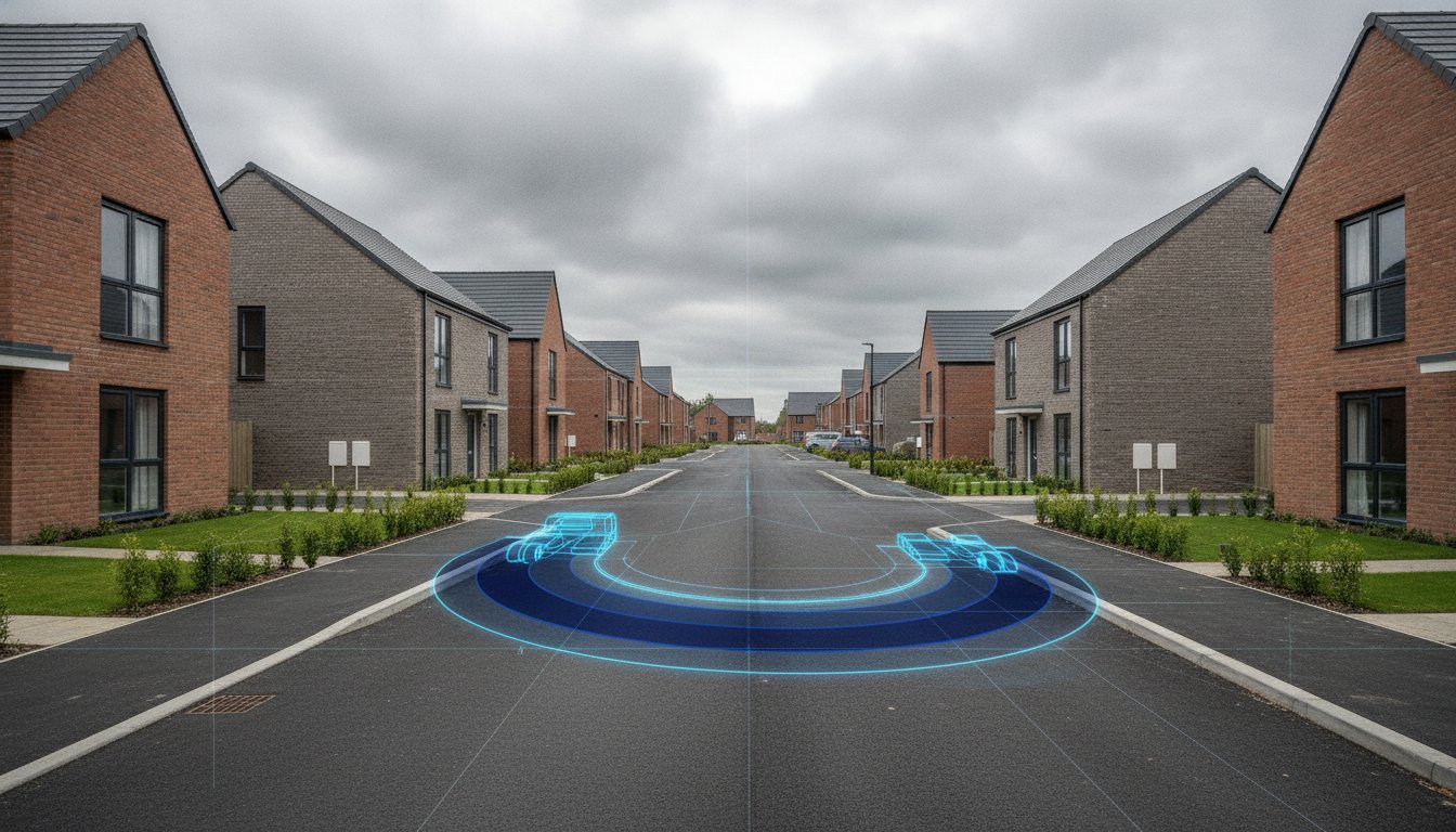
A single Highway Authority objection can stall a residential project for months, yet many developers still approach their transport assessment for residential development as a late-stage box-ticking exercise. You’re likely feeling the pressure of the August 2026 NPPF overhaul, where the new “default yes” for well-connected sites exists alongside stricter national decision-making policies. It’s frustrating to face unexpected costs from over-engineered road improvements when your goal is simply to maximize developable area and secure a first-time approval.
This technical guide provides the clarity you need to master these complex UK planning requirements, ensuring your site access is both compliant and cost-effective. We’ll break down the latest 2026 thresholds for Transport Statements and Assessments, explain how to leverage the new sustainable transport policies, and show you how precision engineering avoids the trap of unnecessary mitigation. From swept path analysis for refuse vehicles to TRICS land-use modeling, you’ll find the data-driven strategies required to move from submission to construction without delay. We focus on the technical precision that secures approvals on the first attempt.
Key Takeaways
- Understand the impact of the August 2026 NPPF updates and why sustainable travel mandates now dictate residential site feasibility.
- Identify whether your project requires a full transport assessment for residential development or a simplified statement based on current 50-80 dwelling thresholds.
- Learn how to utilize TRICS database modeling and multi-modal traffic surveys to provide the robust evidence required for first-time planning approval.
- Discover how Swept Path Analysis ensures your site layout safely accommodates 11.2m refuse vehicles without compromising developable land.
- Implement effective Travel Plans and negotiation strategies for Section 106 contributions to minimize unexpected off-site highway costs.
Navigating Transport Assessments for Residential Developments in 2026
A transport assessment is a systematic study that evaluates the accessibility and traffic impact of a proposed scheme. For any transport assessment for residential development, the core objective is to demonstrate that the site can be integrated into the local network without compromising safety or efficiency. In 2026, residential sites face unprecedented scrutiny. Sustainable travel mandates now require developers to prioritize walking, cycling, and public transport over private vehicle use. This assessment is a critical pillar of your planning application. It justifies your site density and access strategy to the Local Highway Authority (LHA). Early engagement with the LHA is essential. It identifies potential constraints before you finalize a layout, which prevents costly redesigns during the later stages of the planning cycle.
The Legal and Policy Basis: NPPF 2026
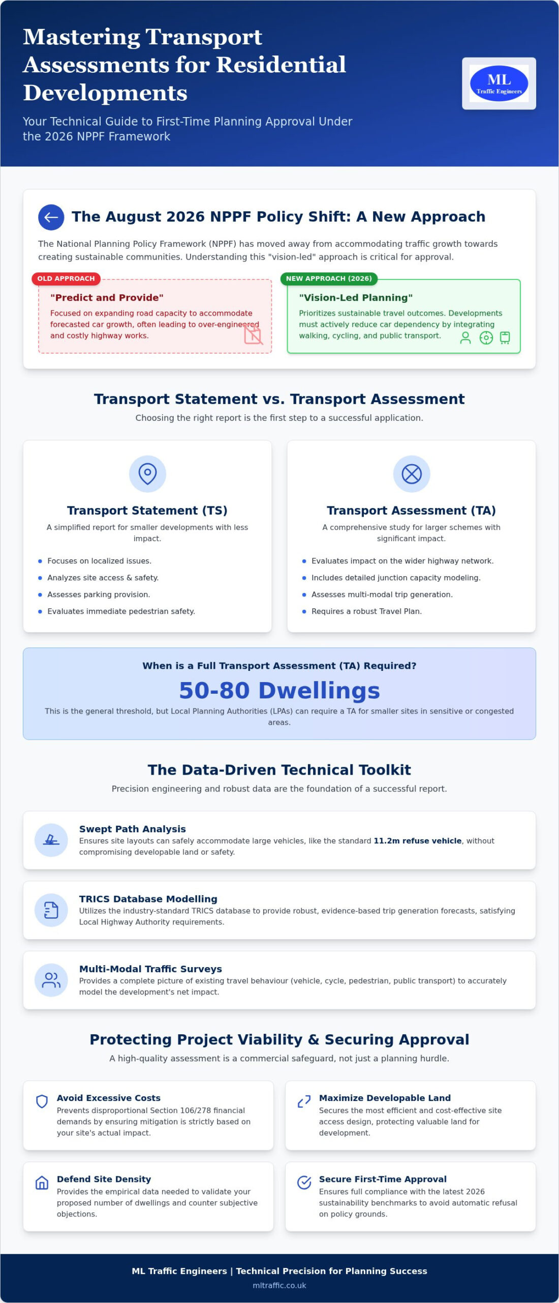
The National Planning Policy Framework (NPPF) update from August 2026 has redefined the criteria for planning success. Paragraphs 115 and 116 provide the primary tests for advising on planning refusal. Under these rules, development should only be prevented on highway grounds if there’s an unacceptable impact on highway safety or if the residual cumulative impacts on the road network are severe. The industry has moved away from the traditional “predict and provide” model that historically favored road expansion. We now employ a “vision-led” transportation planning process. This methodology focuses on achieving specific sustainable outcomes rather than simply reacting to forecasted car growth. Within this framework, councils typically define a severe residual impact as a condition where the development causes the local network to exceed its operational capacity to a degree that results in persistent, unmitigated congestion or fundamental safety failures.
Why a Robust Assessment is Essential for Site Viability
Technical precision in your report protects the commercial viability of your project. Without a robust data set, you’re vulnerable to excessive Section 106 and Section 278 mitigation demands. These financial contributions for off-site highway works can quickly diminish your margins if they aren’t based on accurate impact modeling. A professional assessment ensures that any required mitigation is strictly proportional to your site’s actual footprint. It also helps you defend your site density. If an LHA objects based on perceived traffic increases, you must use empirical data to challenge their position. A high-quality report supports your goals by:
- Validating that the proposed number of dwellings is sustainable for the local infrastructure.
- Securing the most efficient site access design to maximize developable land.
- Providing the technical evidence needed to push back against over-engineered highway requirements.
- Ensuring compliance with the latest 2026 sustainability benchmarks to avoid automatic refusals.
Reliable data collection and engineering analysis are the only ways to navigate these regulatory pressures. We ensure your submission meets every technical standard from the outset.
Transport Statement vs. Transport Assessment: Which Do You Need?
Determining the correct level of reporting is the first step in any transport assessment for residential development. A Transport Statement (TS) typically addresses localized issues, such as site access, parking provision, and nearby pedestrian safety. In contrast, a full Transport Assessment (TA) evaluates the impact on the wider highway network, often including detailed junction capacity modeling. The August 2026 planning updates have solidified the shift toward vision-led modeling. Unlike the traditional “predict and provide” method, which focused on accommodating car growth, a vision-led approach prioritizes sustainable travel outcomes from the outset. We use this framework to demonstrate how your development will actively reduce car dependency through design and policy.
Residential Thresholds and Triggers
General thresholds suggest that residential schemes of 50 to 80 dwellings trigger a full TA. However, these numbers aren’t absolute. Local Planning Authorities (LPAs) frequently lower these triggers based on the site’s specific context. A small scheme in a congested urban center or a 30-unit site in a rural area with restricted visibility may still require a comprehensive report. The UK government’s official guidance provides the national framework, but local highway policy often overrides unit counts. If your project falls below the 50-dwelling mark, you might qualify for a Transport Statement. This saves significant time and budget while still meeting the technical requirements for planning approval.
The Scoping Process with Highway Authorities
A Scoping Note is a technical memorandum submitted to the Local Highway Authority (LHA) before formal data collection begins. It defines the “Study Area” by identifying which junctions require modeling and which years should be tested. This proactive step prevents the council from rejecting your final report for being too narrow in scope. In 2026, scoping must align with vision-led principles by agreeing on modal split targets and sustainable infrastructure before running traffic simulations. A formal Scoping Response from the LHA provides a written agreement that locks in the assessment methodology, protecting you from shifting requirements during the planning determination period. Getting this stage right ensures your data collection is efficient and targeted. You can explore our technical services to see how we manage these early-stage negotiations to protect your project timelines.
- Localized Impact: Handled via a Transport Statement for smaller or less sensitive sites.
- Network-wide Impact: Requires a full Transport Assessment with junction modeling.
- Vision-Led Strategy: Focuses on sustainable travel targets rather than just road capacity.
- Scoping: Essential to avoid late-stage objections from the Highway Authority.
Technical Data: The Foundation of a Successful Residential Report
Data precision prevents planning delays. A transport assessment for residential development relies on empirical evidence to satisfy Highway Authority scrutiny. We use multi-modal traffic surveys to capture existing flows, including cyclists and pedestrians, as required by the latest 2026 standards. This baseline data informs junction capacity modelling via industry-standard software like Junctions 10. We use PICADY modules for priority junctions and ARCADY for roundabouts. Accurate modelling ensures your access design isn’t rejected for underestimating potential queues or delays. Our team manages the full data collection lifecycle to ensure technical integrity. We typically collect several types of data to build a robust case:
- Automatic Traffic Counts (ATC): For 24-hour volume and speed data.
- Manual Classified Counts (MCC): To identify vehicle types at specific junctions.
- Pedestrian and Cycle Surveys: To support sustainable travel claims.
- Queue Length Surveys: To calibrate junction models against real-world conditions.
Residential Trip Generation and TRICS
Predicting how many vehicles a new site will add requires the TRICS database. We select comparable sites based on region, dwelling type, and tenure to ensure model accuracy. For mixed-use schemes, we factor in “internalization” and “pass-by” trips to reflect real-world behavior. It’s vital to defend these trip rates during the council consultation period. We provide the technical justification needed to prove your site won’t overwhelm the local network. This aligns with the UK Government Guidance on Transport Assessments, which emphasizes the need for proportionate and robust evidence. We ensure every trip rate calculation is defensible under professional cross-examination and reflects the most current land-use categories for 2026 models.
Parking Provision and Standards
Balancing local parking standards with the push for car-free developments is a common challenge for 2026 developers. In London, the Public Transport Accessibility Level (PTAL) score dictates the maximum allowable parking ratios. Outside the capital, we utilize the Lambeth Methodology to justify lower parking provision when sustainable travel options are available. We conduct overnight parking surveys to perform stress tests on surrounding streets. These surveys prove that any potential overspill parking won’t impact highway safety or the amenity of existing residents. By providing clear data on parking demand, we help you maximize the developable area of your site while remaining compliant with local policy. This technical approach reduces the risk of objections based on parking concerns.
Designing for Safety: Swept Path Analysis and Access
Precision in your site layout directly impacts your project’s profitability. A Swept Path Analysis is no longer just a safety check. It’s a technical tool for maximizing the number of units a site can hold. If your internal roads are over-engineered to accommodate large vehicles, you lose valuable developable land. Conversely, if roads are too narrow, the Local Highway Authority will reject the transport assessment for residential development on safety grounds. We use high-precision digital tracking to find the ‘sweet spot’ where road widths are minimized to prioritize pedestrian safety while still permitting safe passage for essential heavy vehicles.
Vehicle Tracking for Refuse and Emergency Services
Councils require proof that an 11.2m refuse vehicle can navigate your site without mounting curbs or reversing long distances. They also demand 15m coach tracking for larger developments near schools or transit hubs. Fire Tender access is a non-negotiable statutory requirement. If a fire engine can’t reach within 45m of every dwelling’s furthest point, Building Control will block the scheme. Common errors in residential cul-de-sacs, such as insufficient turning heads or poorly placed visitor parking, often lead to late-stage redesigns that reduce unit counts. A thorough transport assessment for residential development must include these tracking details to avoid automatic refusal. Swept Path Analysis is the digital verification of vehicle manoeuvrability.
Visibility Splays and Junction Safety
Site access safety hinges on visibility splays. We calculate stopping sight distances based on recorded 85th percentile road speeds rather than just the posted limit. This data-driven approach ensures your access point is safe for all users, including pedestrians and cyclists. Under the August 2026 NPPF, “vision-led” design requires us to prioritize the safety of vulnerable road users at every junction. We ensure that visibility envelopes are clear of obstructions and legally protected through planning conditions. This prevents the Highway Authority from claiming your development compromises existing road safety. You can request a swept path assessment today to verify your site’s access viability and protect your project from building control rejections.
Securing Approval: Travel Plans and Mitigation Strategies
Mitigation is the final hurdle in the planning process. A Travel Plan acts as a “soft” mitigation measure by reducing the overall number of car trips generated by a site. This strategy is essential for any transport assessment for residential development, as it demonstrates a commitment to sustainable growth. By lowering the predicted traffic impact through behavioral change, we can often negotiate more favorable Section 106 contributions for off-site highway improvements. This saves you capital while still satisfying the Local Highway Authority’s requirements for network safety and capacity.
The project lifecycle moves from the initial assessment through to construction. For any works involving the public highway, such as new site accesses or junction upgrades, you’ll eventually require Section 278 Agreements. We manage this transition to ensure that the technical commitments made during the planning stage are realistically achievable during the engineering phase. Our team provides the technical data and design support needed to navigate these legal hurdles without stalling your build schedule. We prioritize precision to avoid the trap of over-engineered mitigation, which protects your project’s bottom line.
ML Traffic Engineers UK is the preferred partner for complex residential applications because we manage the full regulatory lifecycle. We combine technical authority with a client-focused approach to reduce the pressure on your internal teams. Our team remains ready to act, ensuring your transport assessment for residential development is robust enough to withstand any level of scrutiny from planning officers or the public.
The Residential Travel Plan
We set clear modal split targets that align with the council’s 2026 sustainability goals. These plans often include car club integration and cycle-to-work incentives to encourage residents to utilize sustainable transport modes. A Travel Plan Coordinator monitors the site post-occupation, providing the regular reports required by planning conditions. This ongoing management ensures the development remains compliant throughout its entire lifespan and helps avoid potential enforcement actions.
Navigating the Planning Committee
Securing approval often requires defending the report in front of a planning committee. We respond to technical queries from Highway Officers and local residents with professional integrity and data-backed evidence. Our experts provide the technical authority needed to address objections and reassure decision-makers during public meetings. You can contact us for a tailored Transport Statement or Assessment quote to ensure your project is ready for committee scrutiny.
Securing Your Residential Planning Approval in 2026
Precision in your transport assessment for residential development is the most effective way to avoid planning delays and unnecessary mitigation costs. By adopting a vision-led approach that aligns with the August 2026 NPPF updates, you position your project for immediate success. We’ve explored how robust TRICS data and detailed Swept Path Analysis protect your developable area while satisfying the strictest safety requirements for emergency and refuse vehicles.
Managing the full regulatory lifecycle requires an expert partner who understands the transition from initial feasibility to final Section 278 agreements. Our team provides the technical authority and professional integrity needed to overcome Highway Authority objections and secure committee approval. We deliver expert analysis of 2026 transport requirements and specialized vehicle tracking to ensure your site layout is both compliant and profitable. Our proven track record in navigating regional regulations reduces the logistical pressure on your internal teams.
Don’t let regulatory complexity stall your progress. You can Request a Residential Transport Assessment Quote today to ensure your submission is technically flawless. With the right data and a proactive strategy, your development will move smoothly from the drawing board to the construction phase.
Frequently Asked Questions
Is a Transport Assessment mandatory for all residential developments?
No, a full transport assessment for residential development is not mandatory for every project. Requirements are determined by the scale of the scheme and its potential impact on the local highway network. While smaller developments of fewer than 50 dwellings often only require a Transport Statement, larger sites typically trigger a full assessment. You should consult your Local Planning Authority early to confirm their specific thresholds and avoid unnecessary reporting costs.
How much does a Transport Assessment for a residential site cost?
The cost of a report varies significantly based on the project’s complexity and the required technical data. Factors such as the number of junctions requiring capacity modelling, the need for overnight parking surveys, and the extent of the study area all influence the final fee. Because each site presents unique challenges, we provide tailored quotes that reflect the specific engineering analysis and data collection required for your planning application.
What is the difference between a Transport Statement and a Transport Assessment?
The primary difference lies in the depth of the analysis and the geographical scope. A Transport Statement focuses on localized issues like site access, visibility splays, and internal parking arrangements. A full Transport Assessment evaluates the development’s impact on the wider highway network, often requiring complex junction modelling and multi-modal trip generation data. Assessments are necessary when a scheme is likely to have a significant cumulative impact on traffic flow.
How long is a Transport Assessment valid for a residential planning application?
Most Local Highway Authorities consider a report valid for two to three years, provided there haven’t been major changes to the local road network. However, the underlying traffic survey data often has a shorter shelf life. If new developments have been approved nearby or if road layouts have changed, you may need to refresh your data to ensure the transport assessment for residential development remains accurate and defensible during the planning committee stage.
Can I use old traffic data for a new residential assessment in 2026?
It’s unlikely that data older than three years will be accepted for a new 2026 application. Highway officers generally require recent, multi-modal counts to ensure the modelling reflects current travel patterns and the latest sustainable transport trends. Using outdated data increases the risk of a formal objection. We recommend commissioning fresh traffic surveys to provide a robust foundation for your submission and avoid costly delays during the consultation period.
What happens if the Highway Authority objects to my residential development?
An objection from the Highway Authority doesn’t automatically end your project. We typically review the technical basis of the objection and negotiate mitigation strategies, such as Section 106 contributions or physical junction improvements. If the objection is based on perceived rather than empirical impacts, we use precise modelling and Swept Path Analysis to challenge their findings. Professional integrity and technical evidence are your best tools for overcoming these regulatory hurdles.
What vehicle templates are used for residential Swept Path Analysis?
We utilize industry-standard vehicle templates to verify that your site layout is functional and safe. For residential sites, the most critical templates include the 11.2m refuse collection vehicle and the standard fire tender to meet statutory safety requirements. Larger developments may also require tracking for 15m coaches or heavy delivery vehicles. Accurate tracking ensures your road widths are optimized without compromising the ability of emergency services to navigate the site safely.
How does a Travel Plan help reduce the required number of parking spaces?
A Travel Plan reduces the need for on-site parking by proving that residents will have viable alternatives to private car use. By implementing measures like car clubs, improved cycle storage, and public transport incentives, you can demonstrate a lower predicted parking demand. This evidence allows us to justify parking ratios that fall below standard local requirements, which helps you maximize the developable area and improve the overall commercial viability of your site.

Disclaimer
The content on mltraffic.co.uk, including all technical articles, guides, and resources, is provided for general informational and educational purposes only. It is not intended to constitute professional advice in traffic engineering, transportation planning, development approvals, or any other technical or legal field.
While ML Traffic Engineers makes every reasonable effort to ensure the accuracy, completeness, and timeliness of the information published, we do not provide any warranties or representations (express or implied) regarding its reliability, suitability, or availability for any particular purpose. Any reliance you place on the content is strictly at your own risk.
In no event shall ML Traffic Engineers, its directors, employees, authors, or affiliates be liable for any direct, indirect, incidental, special, consequential, or punitive damages (including, without limitation, loss of profits, data, or business opportunities) arising out of or in connection with the use of, or inability to use, any information provided on this website.
The articles and guides on this site are not a substitute for engaging a qualified, professional traffic engineer to assess your specific project requirements. For tailored advice, compliance assessments, or traffic engineering services, please contact a competent professional.
This disclaimer may be updated from time to time without notice. By accessing or using this website, you agree to be bound by the most current version of this disclaimer.