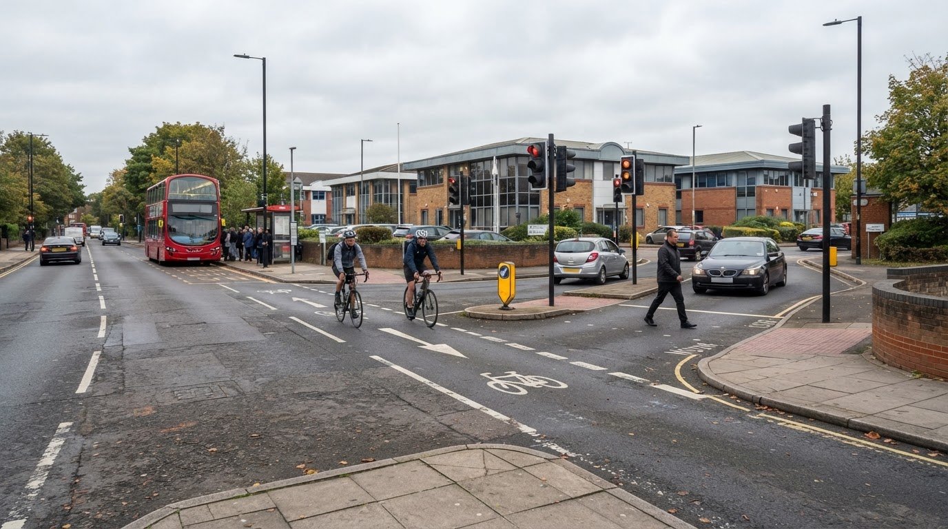
A business park proposal needs transport evidence showing how its trips could affect roads, junctions, parking and travel choices. A transport assessment for a business park in Hounslow sets out these effects, considers ways to support sustainable travel and identifies measures to manage impacts. The proposal’s scale and likely effects help determine whether it needs a full Transport Assessment or a shorter Transport Statement.
It is understandable to focus first on whether the site can accommodate expected traffic. The assessment must also explain how staff, visitors and delivery vehicles will reach and move around the site, and how it addresses walking, cycling, public transport, access and servicing.
This guide explains what a Transport Assessment covers, what evidence a business park application may need and how to choose between a Transport Assessment and a Transport Statement. It also shows how delivery and servicing arrangements fit into the transport picture, helping you understand the work involved and plan the evidence in sequence.
Key Takeaways
- Understand how a transport assessment examines development trips and their effects on roads, access, parking and sustainable travel.
- Build an evidence package around the proposal’s scale, intended use, site access and local planning context.
- Learn what influences the choice between a full Transport Assessment and a shorter Transport Statement.
- See how delivery movements and servicing arrangements can be considered as part of a business park’s transport strategy.
- Find out how Transport Assessments, Transport Statements, Swept Path Analysis and Parking Surveys can support planning evidence.
What is a transport assessment?
A Transport Assessment examines how a proposed development could affect movement, access and the surrounding highway network. For a business park, it considers staff, visitor and servicing trips alongside opportunities for sustainable travel.
Planning Application Requirements
A transport assessment for a business park in Hounslow explains the proposal’s transport effects and how they can be managed. In England, an application may require a Transport Assessment or a shorter Transport Statement, depending on the development’s scale, use and likely transport impacts. London applications must also address the London Plan’s transport policies. The National Planning Policy Framework identifies severe transport impacts as a possible reason for refusing permission.
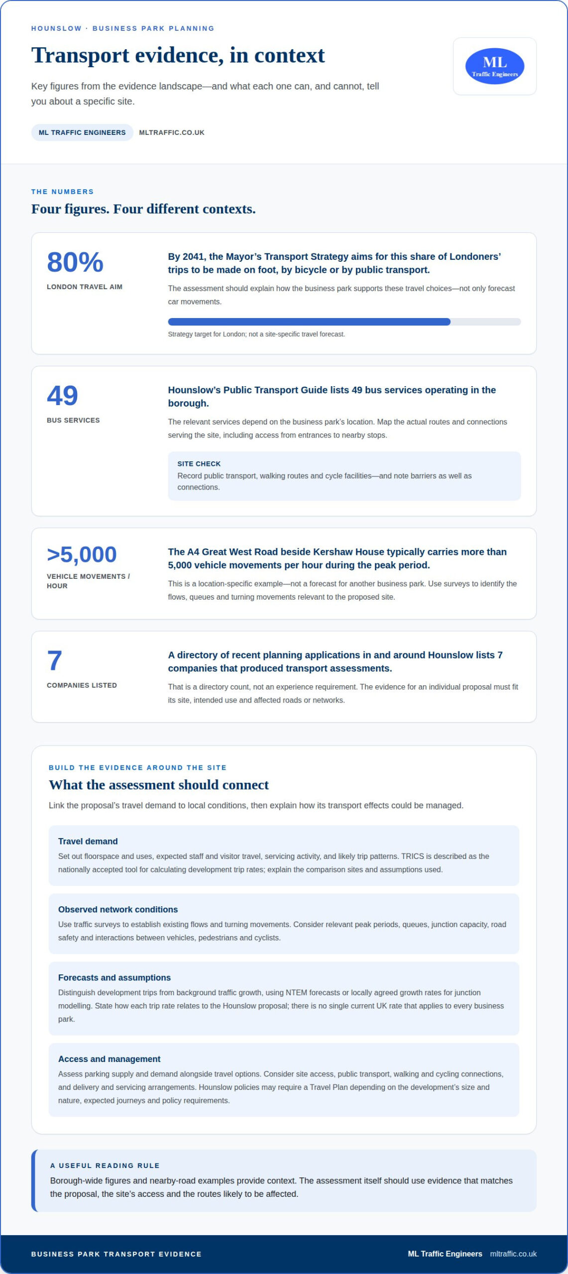
The Mayor’s Transport Strategy aims for 80% of Londoners’ trips to be made on foot, by bicycle or by public transport by 2041, according to the Greater London Authority. The assessment should therefore explain how the business park supports those travel choices, not only forecast car movements.
Parking standards and cycle parking requirements for commercial developments in Hounslow depend on the applicable borough and London planning policies, the proposal’s use and its location. The assessment sets out the proposed provision against those requirements and considers the site’s access to public transport, walking and cycling routes.
Junction Capacity and Road Safety
For a Hounslow proposal, junction analysis should relate expected development trips to observed network conditions. It examines turning movements, capacity, queues and potential traffic effects on nearby roads during relevant periods. The assessment should also consider road safety, site access and interactions between vehicles, pedestrians and cyclists. If modelling is needed, its assumptions and results should clearly relate to the proposal and affected junctions.
The planning authority and highway authority may be different bodies. The site boundary helps identify the planning authority, while responsibility for a road determines the relevant highway authority. Transport for London may be involved where its network or referral requirements apply. For London applications above the Mayor’s referable thresholds, TfL acts as a statutory consultee.
Planning permission, land rights and separate highway approvals require distinct consideration. A planning decision does not itself resolve every approval or right needed for highway works. The assessment should identify proposed access or network changes and explain their relationship to the development. The London transport assessment guide for developers provides related context for planning evidence, with insights supported by ML Traffic Engineers UK.
For context, a directory of recent planning applications in and around Hounslow lists 7 companies that produced transport assessments. That figure describes the directory, not the level of experience needed for a particular business park. The relevant evidence must match the site, its intended use and the roads or networks affected.
Transport evidence for development proposals
Evidence should link the proposed business park’s travel demand to its location, access and surrounding network. The assessment combines forecasts with local conditions, then explains how travel impacts could be managed.
Traffic and Trip-Generation Evidence
Set out the proposed floorspace and uses, expected staff and visitor travel, servicing activity and likely trip patterns. TRICS is described as the nationally accepted tool for calculating development trip rates. Explain the chosen comparison sites and assumptions, then apply the forecasts to relevant peak periods and affected junctions.
Traffic surveys can establish existing flows and turning movements. Forecasts should distinguish development trips from background traffic growth, using NTEM forecasts or locally agreed growth rates for junction modelling.
Business Park Trip Rates
There is no single current UK rate that applies to every business park. Car, van, HGV and public transport trips depend on the proposed uses, floorspace, transport access, operating patterns and evidence from comparable sites. The report should state its assumptions and explain how each rate relates to the Hounslow proposal.
Present parking evidence alongside trip forecasts: parking supply, demand and travel options all affect how employees and visitors arrive. Hounslow planning policies may require a Travel Plan depending on the development’s size and nature, expected journeys and policy requirements. Commercial proposals that generate significant journeys commonly require one.
Nearby Roads and Junctions
The roads to analyse depend on the site boundary, access points and the routes development traffic is likely to use. No borough-wide list of congested junctions applies to every proposal. Survey data helps identify relevant flows, queues and turning movements before the assessment tests the development’s effects.
For context, the A4 Great West Road beside Kershaw House typically carries more than 5,000 vehicle movements per hour during the peak period. That example is site-specific, not a forecast for another business park. Chapter 9 of the NPPF 2024 provides a basis for assessing and promoting sustainable travel.
Access by Public Transport, Walking and Cycling
Map the public transport services, walking routes and cycle facilities serving the actual site, including access between entrances and nearby connections. Hounslow’s Public Transport Guide shows 49 bus services operating in the borough, but the relevant services depend on the business park’s location.
Record barriers as well as connections, including indirect walking routes or gaps between the site and public transport. Assess cycle access and parking against the proposed layout, and explain how inclusive access works for people travelling to and through the development.
A mixed-use example illustrates why evidence must reflect the proposal: an application for 8 flats in a mixed-use development in Ealing included a Transport Assessment and was decided in February 2026. Its trip profile cannot simply stand in for a Hounslow business park; use and location shape the assessment.
For a London-focused overview of assessment evidence, see this guide to London Transport Assessments.
When to prepare a TA or Transport Statement
Choose the transport document early, while the proposal’s use, scale and access arrangements are taking shape. For a Hounslow site, this allows the scope to reflect the development and relevant borough planning policies before the application evidence is finalised.
London’s transport assessment guidance uses national guidance from 2007 to help determine when different development types and sizes need a Transport Assessment or Transport Statement. A Transport Statement is a shorter, simpler alternative for developments with limited transport impacts, subject to relevant borough guidance. A full assessment is appropriate where the proposal needs more detailed analysis of its transport effects.
The decision depends on more than floorspace. Consider the proposed use, likely trip generation, access arrangements, parking, servicing and connections to public transport, walking and cycling. The evidence should also reflect whether nearby roads or junctions need surveys or modelling. In Hounslow, read the borough’s development plan alongside the London Plan’s transport policies.
Define the development and its location first, then identify the likely transport questions. This helps establish whether a concise statement can explain the effects or whether a fuller assessment must test them. If traffic surveys and junction modelling are needed, allow time to collect and analyse the evidence before submitting the application.
A straightforward Transport Statement can typically be prepared within 2 to 3 weeks after the necessary information is received. A full Transport Assessment involving traffic surveys and junction modelling will usually take 6 to 10 weeks to prepare. Survey timing, modelling requirements and the completeness of project information affect the work programme.
Prepare a Travel Plan alongside the transport evidence when the development’s size, nature and expected journeys make one relevant under Hounslow planning policies. Link the proposed measures to the site’s actual access, public transport links, walking routes and cycle facilities. Developing the plan alongside the assessment helps ensure its measures respond to the same trip forecasts and site conditions.
Authorities may consider different aspects of a proposal, including planning effects and impacts on roads. The exact site boundary helps establish which planning authority and policy documents apply; highway responsibility may lie elsewhere. For strategically important developments legally referable to the Mayor, a Transport Assessment is expected unless TfL agrees another approach in writing before submission. Other London applications may also need one.
Set the scope before commissioning surveys or modelling. Define the site, intended use, approximate scale and access points, then identify the required drawings, evidence, officer discussions and revisions. This sequence aligns document preparation with the application programme and reduces the risk of transport evidence arriving after key design decisions.
Delivery and servicing management
Business park servicing affects site access, vehicle movements and the safe operation of loading areas. Explain how deliveries reach the site, where vehicles stop and how servicing relates to staff and visitor movements.
Start with the proposed business uses and the servicing they are likely to generate. Offices, warehouses and other commercial premises can have different delivery patterns, vehicle sizes and loading needs. Record the assumptions, then consider how vans and larger goods vehicles enter, manoeuvre, load and leave. Show how these activities fit the site layout and connect to the surrounding highway.
Routes matter as much as the loading area. Set out the expected approach to the site and consider whether vehicles can reach loading spaces without obstructing access or creating avoidable conflicts. Drawings can show the entrance, internal circulation, turning space and exit route. Where vehicle dimensions affect the layout, swept-path drawings can demonstrate manoeuvres.
Keep servicing movements distinct from general staff and visitor travel in the evidence. Explain likely delivery periods, vehicle types and how arrivals relate to the business park’s operating pattern. Consider whether deliveries could coincide with employee arrival or departure periods, and whether site access would remain clear. This links servicing assumptions to traffic forecasts and access design.
A Hounslow example shows how operating hours can form part of servicing management. The Kershaw House traffic management plan proposed limiting servicing hours to 9am-7pm. That is a proposal for that site, not a universal rule for business parks. For another development, the assessment should explain the proposed hours and how they relate to the site’s uses and neighbouring transport conditions.
- Access: show how delivery vehicles enter, circulate and leave.
- Loading: identify where vehicles stop and how loading relates to site activity.
- Timing: explain proposed servicing periods and their relationship to other movements.
- Routes: describe expected approaches and any relevant highway effects.
Coordinate transport documents with the development drawings. If the loading area, access or internal routes change, update the servicing assumptions and related plans together. This keeps the submitted evidence consistent and helps decision-makers understand the proposed operation.
Effective servicing evidence for a business park is specific to the site, not based on a generic delivery arrangement. Link vehicle movements, operating hours, loading space and access routes in a clear account. If the proposal includes several business uses, explain how each contributes to servicing demand and how those movements fit the proposed layout.
Transport assessment consultants near Hounslow
A Hounslow transport assessment should reflect the specific site, its access points and the network it affects. A useful consultant’s scope links planning policy, traffic evidence and development design rather than relying on a generic report.
Start by defining the site boundary, proposed use and approximate scale. These details help identify the relevant planning authority and policy documents. They also determine which roads, junctions and public transport connections belong in the assessment. In Hounslow, the authority responsible for a road may differ from the authority deciding the planning application.
Ask for a clear scope identifying the evidence and outputs needed for the proposal. Depending on its impacts, this may include traffic surveys, trip-generation analysis, junction modelling, parking evidence and a Transport Assessment or Transport Statement. The scope should explain how each item answers a planning question, rather than simply listing technical tasks.
For a site near Heathrow Airport or the A4, A30 or M4, consider access effects, route choice, junction capacity, queues, road safety and servicing movements. Mitigation can include measures supported by the assessment, such as managing access or servicing arrangements and improving walking, cycling or public transport connections. The right measures depend on the site’s location and the network impacts being tested.
For example, an A4-facing proposal may need evidence focused on its access and the affected junctions. A site near Heathrow may also need careful consideration of how staff, visitors and deliveries reach it. Do not assume that proximity to a major road means every route or junction needs equal analysis. Survey findings and the development’s travel patterns should guide the study area.
Establish at the outset how the consultant will coordinate evidence with the evolving layout. The assessment relies on consistent information about access, parking, cycle provision and servicing. If drawings change, related forecasts and analysis may also need revision. Agreeing how surveys, drawings, officer discussions and revisions fit into the commission helps keep the work aligned with the application programme.
Check that the final documents explain assumptions in plain English and present findings clearly. Maps, photographs, drawings and diagrams can make access arrangements and affected routes easier to understand. If modelling is needed, the report should explain its inputs and how the results relate to the proposal, rather than presenting unexplained outputs.
Consultant selection should therefore focus on a site-specific scope, transparent assumptions and evidence tied to Hounslow’s planning context. This approach helps identify the work needed before submission and keeps transport analysis relevant to the decision. Discuss the transport evidence for your Hounslow proposal.
ML Traffic Engineers UK: Transport Statements
ML Traffic Engineers UK prepares Transport Statements and Transport Assessments to support planning applications, with the scope shaped around the proposal’s transport impacts. For a business park, Parking Surveys can provide evidence about parking conditions, while Swept Path Analysis can show how vehicles manoeuvre through the proposed layout.
Use these services when you need transport evidence for an application or closer analysis of access, parking or vehicle movements. The right document depends on the development and the questions raised by its transport effects.
Contact ML Traffic Engineers UK to discuss the transport evidence for your Hounslow proposal.
Set the transport evidence in motion
The next step is to connect transport evidence with the business park’s evolving design. As access points, parking areas and operating arrangements develop, keep the transport assumptions aligned with the plans submitted for consideration. This gives the planning team a coherent basis for understanding how the proposal is expected to work.
A transport assessment for a business park in Hounslow should reflect the site’s intended use and the transport questions its application needs to address. ML Traffic Engineers UK can prepare Transport Statements, Parking Surveys and Swept Path Analysis to support the work. The appropriate scope depends on the evidence the proposal requires.
Bring the site location, intended use and current layout to the initial discussion. These details provide a practical starting point for defining the transport work and identifying how it can support the planning application.
Contact ML Traffic Engineers UK to discuss your Hounslow transport assessment and take the next step with a clear evidence plan.
Frequently Asked Questions
Why do a TA?
A Transport Assessment gives the planning authority evidence about a proposal’s transport effects before it decides the application. It can show how access, travel demand and network effects relate to the development’s design, helping identify issues that need attention or mitigation. For example, a business park with separate office and warehouse uses may need to distinguish staff journeys from goods vehicle movements in its travel assumptions.
What transport assessment requirements apply to planning applications in Hounslow?
Requirements depend on the proposal’s scale, use, likely transport effects and applicable planning policies. A Hounslow application should consider the borough’s development plan alongside London Plan transport policies. The planning authority may request transport evidence even if the application is not referable to the Mayor. Confirming the site boundary helps identify the relevant planning authority, while TfL involvement depends on its network or referral requirements.
What travel-plan measures and monitoring targets might Hounslow Council require for a business park?
Measures should respond to the site’s travel options and the journeys it is expected to generate. A plan might set out staff travel information, support for walking and cycling, public transport promotion or car-sharing arrangements. Monitoring can track how employees travel and whether agreed measures are being implemented. Any targets and reporting arrangements should be tailored to the development and Hounslow Council’s planning requirements.
How much does a transport assessment for a business park in Hounslow typically cost, and how long does it take?
The cost depends on the proposal’s scope and the evidence needed, such as traffic surveys or junction modelling; it is given after a quote request. A straightforward Transport Statement can typically take 2 to 3 weeks after the necessary information is received. A full Transport Assessment involving surveys and modelling will usually take 6 to 10 weeks. Design changes or evidence requirements affect the programme.
Which roads and junctions near the proposed Hounslow business park are most congested?
The relevant roads and junctions depend on the site boundary, access points and likely traffic routes; surveys help identify flows, queues and turning movements. The A4 Great West Road beside Kershaw House is a site-specific example, not a congestion guide for another business park.

Disclaimer
The content on mltraffic.co.uk, including all technical articles, guides, and resources, is provided for general informational and educational purposes only. It is not intended to constitute professional advice in traffic engineering, transportation planning, development approvals, or any other technical or legal field.
While ML Traffic Engineers makes every reasonable effort to ensure the accuracy, completeness, and timeliness of the information published, we do not provide any warranties or representations (express or implied) regarding its reliability, suitability, or availability for any particular purpose. Any reliance you place on the content is strictly at your own risk.
In no event shall ML Traffic Engineers, its directors, employees, authors, or affiliates be liable for any direct, indirect, incidental, special, consequential, or punitive damages (including, without limitation, loss of profits, data, or business opportunities) arising out of or in connection with the use of, or inability to use, any information provided on this website.
The articles and guides on this site are not a substitute for engaging a qualified, professional traffic engineer to assess your specific project requirements. For tailored advice, compliance assessments, or traffic engineering services, please contact a competent professional.
This disclaimer may be updated from time to time without notice. By accessing or using this website, you agree to be bound by the most current version of this disclaimer.