Author: adminmltuk

  • Property Development Transport Advice: What Developers Need To Get Planning Right In 2026

    Property Development Transport Advice: What Developers Need To Get Planning Right In 2026

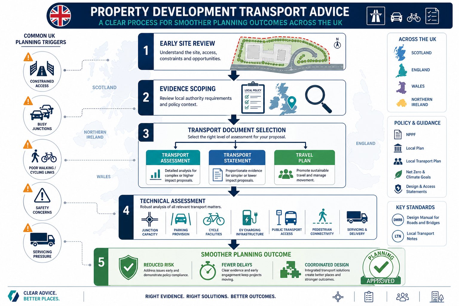
    Planning risk rarely starts at committee. More often, it starts much earlier, when a site layout is fixed before anyone has properly tested access, trip impact, parking pressure, or whether the local authority will expect a Transport Assessment at all. That’s why property development transport advice matters so much in 2026.

    Across the UK, planning officers and highway authorities are looking closely at how development affects not just road capacity, but sustainable travel, safety, servicing, EV provision, active travel links, and the wider place-making agenda. A scheme can look commercially strong on paper, yet still run into delay if transport evidence is weak, late, or out of step with local policy.

    For architects, planners, lawyers, surveyors, developers and councils, the practical question isn’t simply whether a transport report is needed. It’s what level of evidence will be proportionate, what the risks are, and how early transport input should shape the scheme.

    In this guide, we set out what developers need to know: when transport input is likely to be required, what consultants actually review, how assessments are prepared, and where applications often come unstuck. Drawing on the realities of UK planning practice, and the kind of concise, authority-aware reporting firms such as ML Traffic are known for, we’ll show how early, well-scoped transport advice can save time, redesign costs, and a lot of avoidable friction.

    Why Transport Advice Matters Early In The Development Process
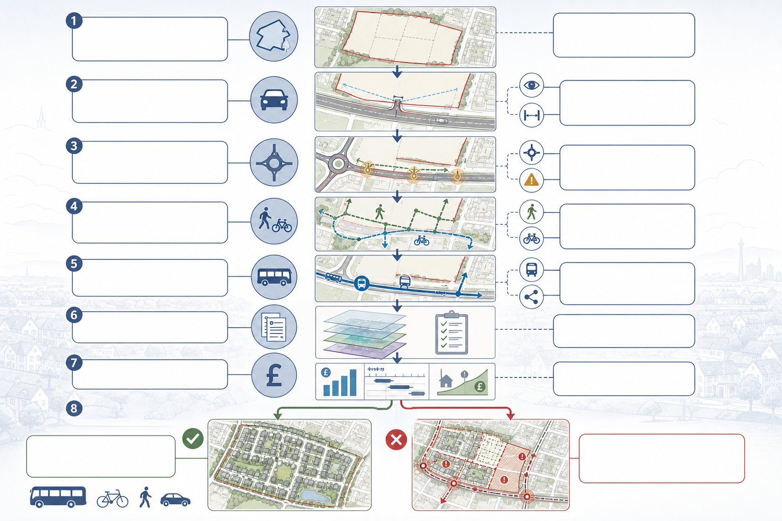
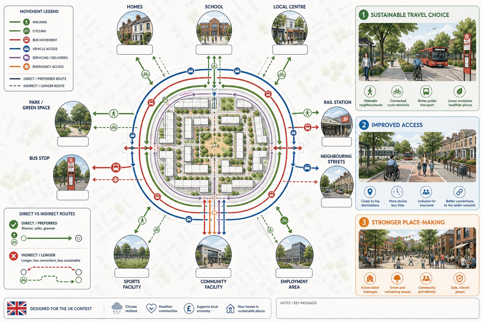
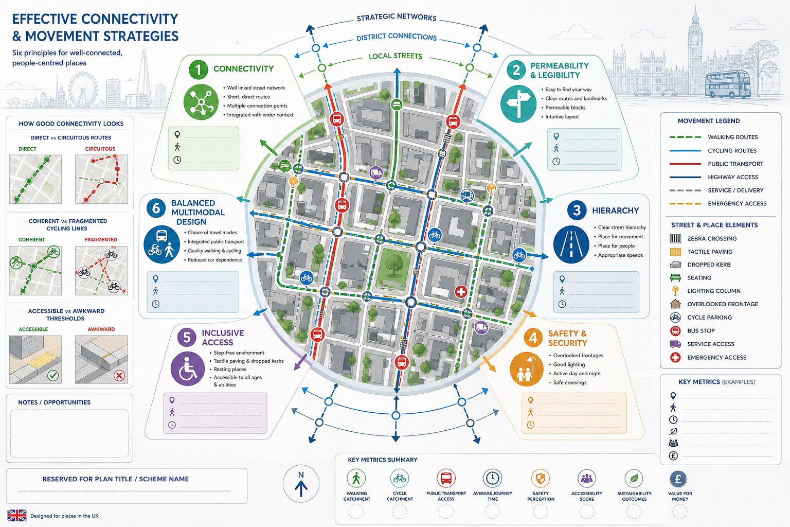
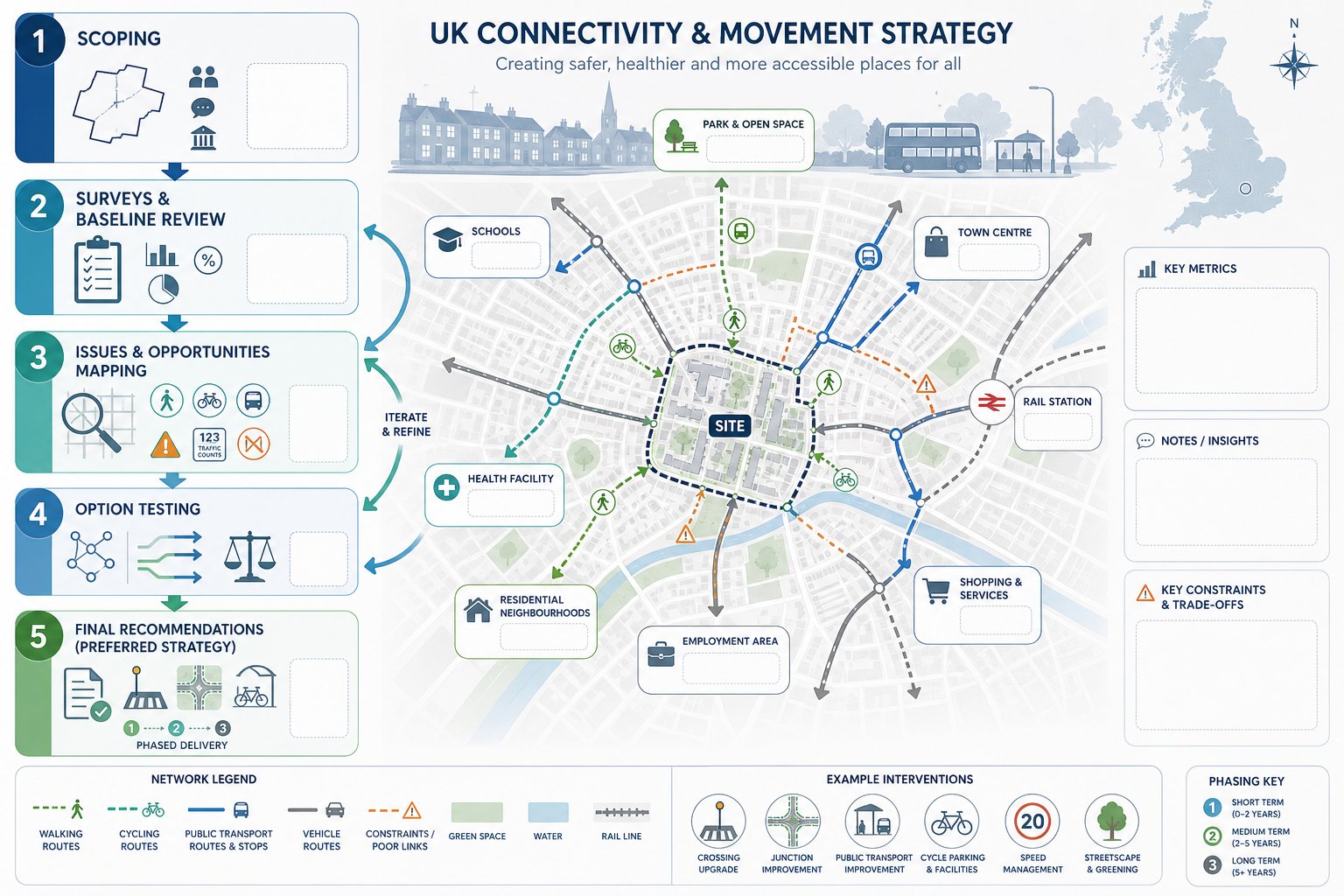
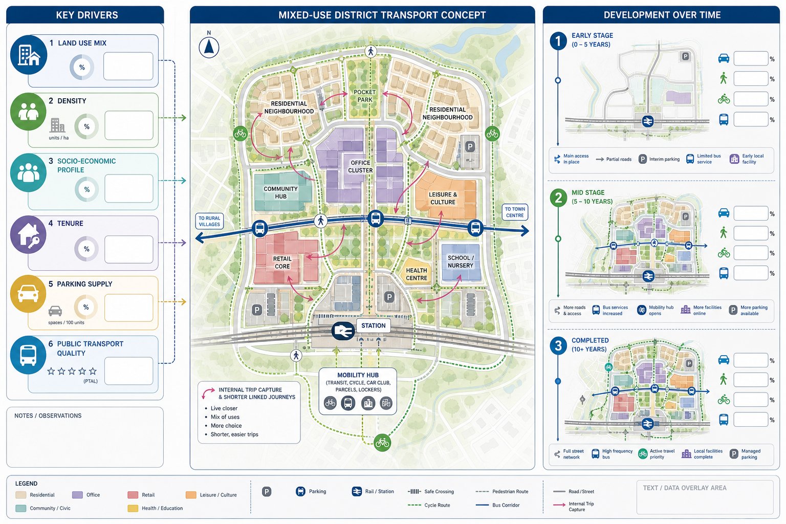
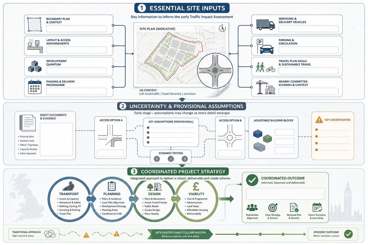
    infographic showing early transport advice guiding a UK property development site.

    The biggest value of early transport input is that it influences decisions while they are still cheap to change. Once a red-line boundary is fixed, a preferred access point chosen, and unit numbers baked into the appraisal, transport problems become expensive problems.

    In practice, early advice helps us test whether a site can realistically support the proposed scale and type of development. That includes obvious questions, can vehicles get in and out safely, is visibility acceptable, are nearby junctions already stressed, but also less obvious ones. Is the site genuinely accessible on foot? Are bus services frequent enough to support lower parking provision? Will the authority expect off-site improvements, a crossing upgrade, or cycle links? Those issues can affect viability just as much as build costs.

    This is also where planning policy comes into sharp focus. National policy continues to emphasise sustainable transport and safe, suitable access, while local plans and supplementary guidance often set specific thresholds or expectations. If we assess those requirements early, we can shape the masterplan around them rather than scrambling to justify a poor fit later.

    And there’s a commercial angle that experienced developers understand immediately: transport advice is a due diligence tool. Before land is acquired, it can reveal whether a site is likely to need junction mitigation, bus stop improvements, travel plan monitoring, parking restraint, or technical modelling. That knowledge feeds directly into land value, programme, and delivery strategy.

    Put simply, early transport advice doesn’t just support planning. It helps determine whether the scheme is workable in the first place.

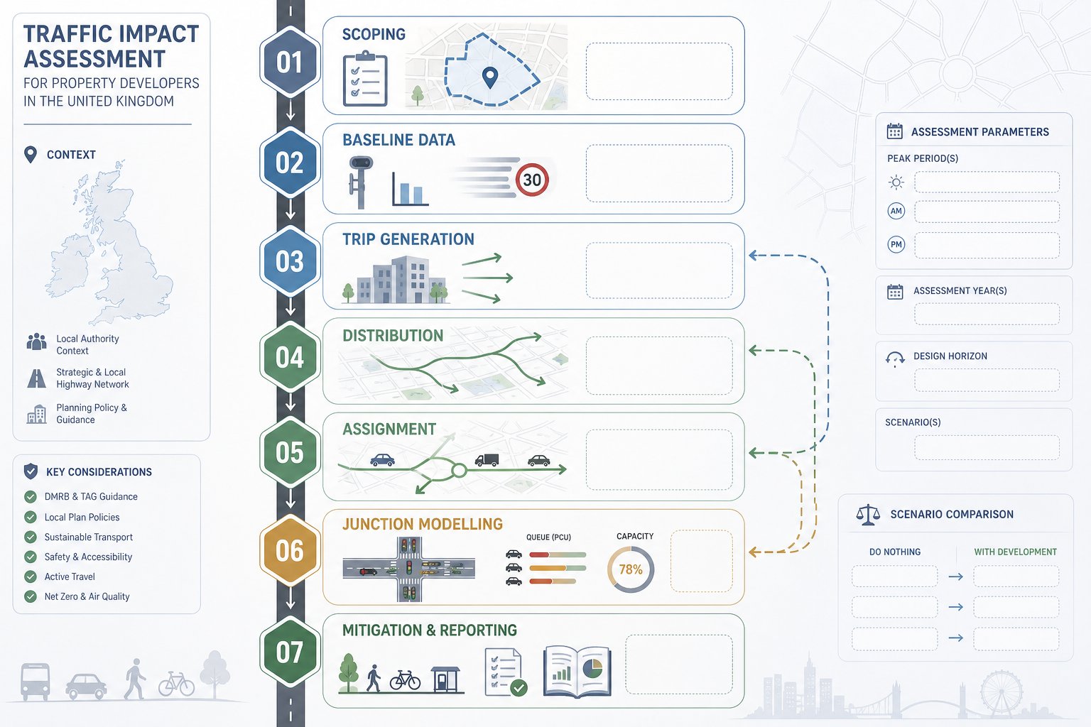
    How Transport Evidence Supports Planning Applications
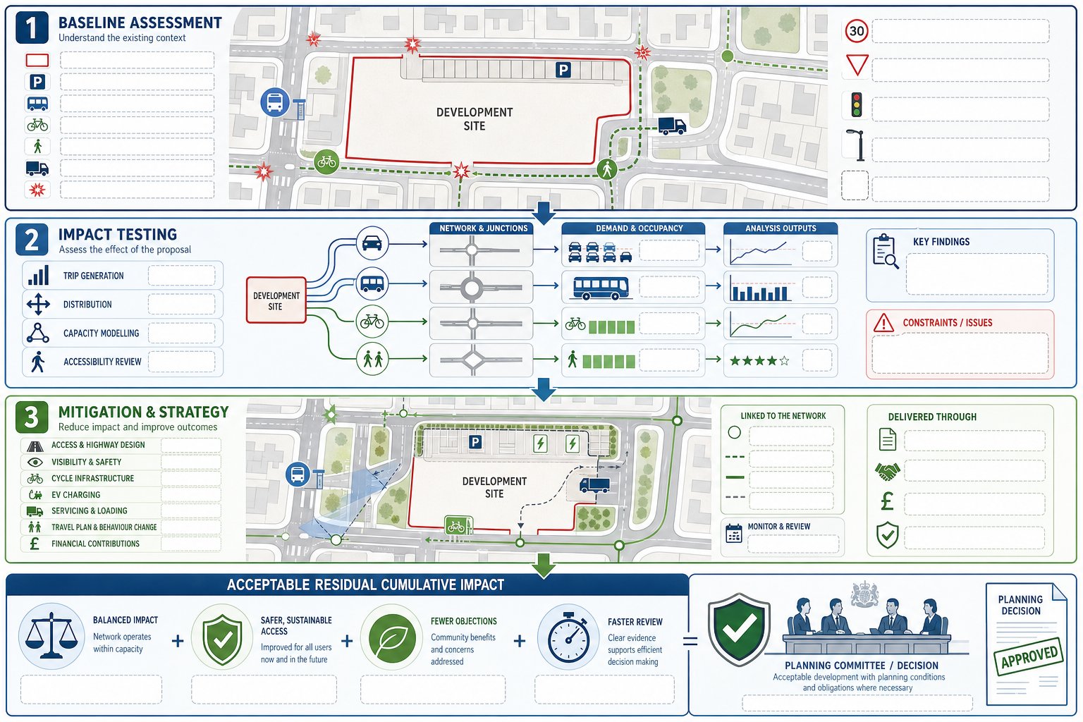
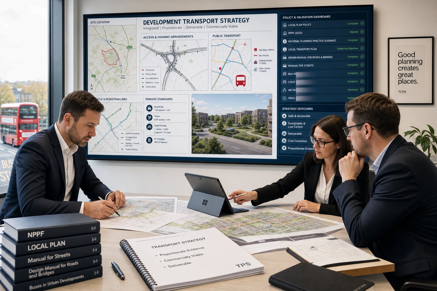
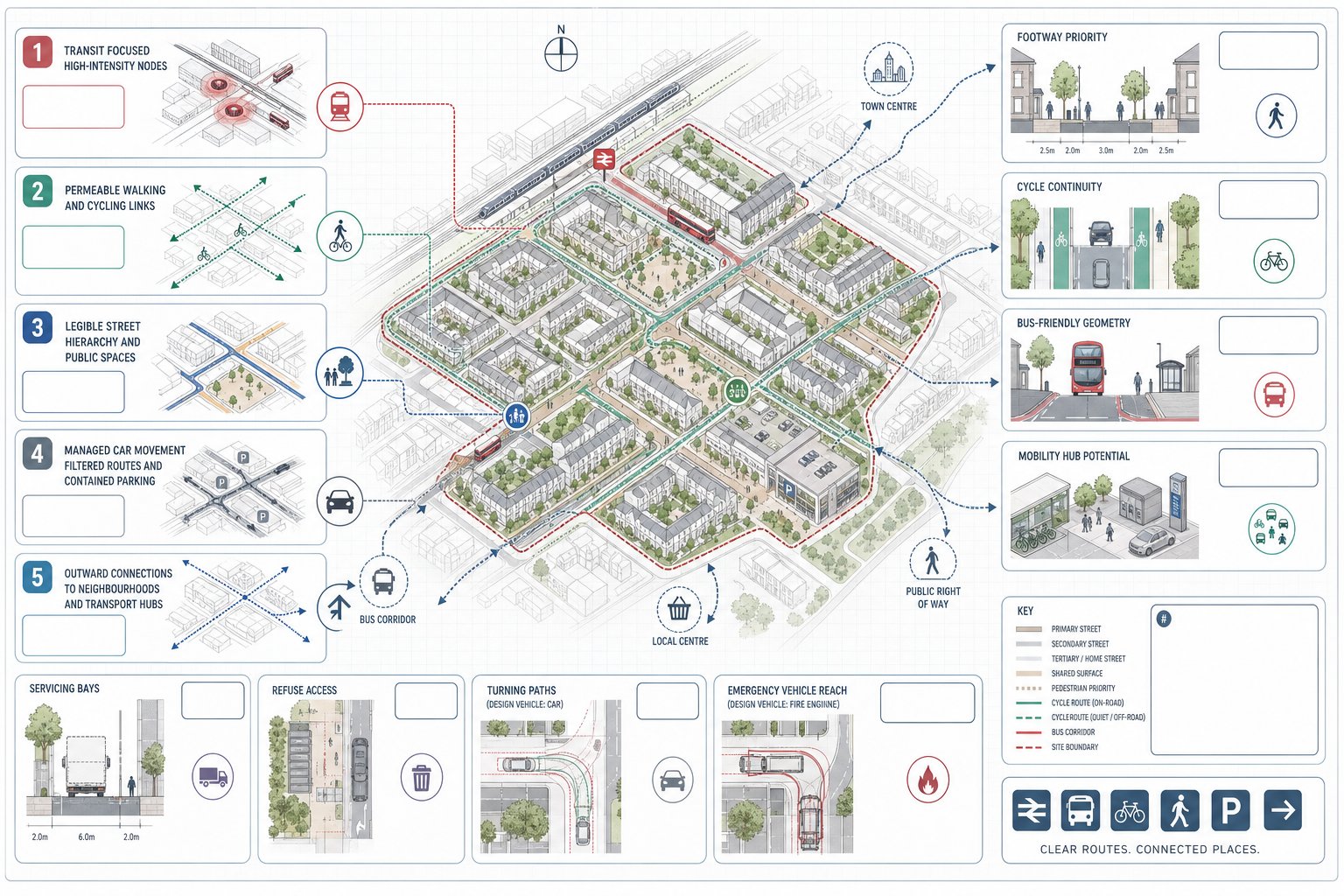
    UK planning infographic showing transport evidence, impact analysis, and mitigation steps.

    Good transport evidence gives decision-makers confidence. It shows that the likely effects of development have been assessed properly, that impacts can be managed, and that the scheme aligns with transport and land-use policy rather than cutting across it.

    At application stage, transport documents usually serve three related purposes.

    First, they explain existing conditions. That means the surrounding highway network, sustainable travel options, collision history, parking context, servicing environment, and any known constraints. Without that baseline, there is no credible way to judge impact.

    Second, they quantify the effect of the development. Depending on scheme scale, that may involve trip generation, distribution and assignment, junction modelling, parking demand analysis, and review of walking, cycling and public transport accessibility. For some sites, the issue is highway capacity. For others, it is whether the location can support policy-compliant mode share assumptions.

    Third, they set out mitigation and strategy. That could include access redesign, visibility improvements, local highway works, travel plan measures, cycle parking, EV charging, servicing controls, or contributions secured through planning obligations.

    This matters because planning officers, highway officers and committee members are not simply asking, “Will traffic increase?” Of course it will, to some degree. The real question is whether the residual cumulative impacts are acceptable and whether the scheme delivers safe and sustainable access in policy terms.

    Well-prepared evidence can also reduce ambiguity in consultation. Instead of prolonged back-and-forth over assumptions, the application presents a clear, proportionate, policy-led case from the outset. That tends to mean faster review, fewer technical objections, and a stronger platform for negotiation if mitigation is needed.

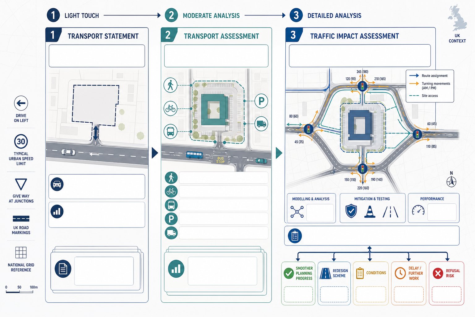
    Transport Assessment, Transport Statement, And Travel Plan: What Is The Difference?
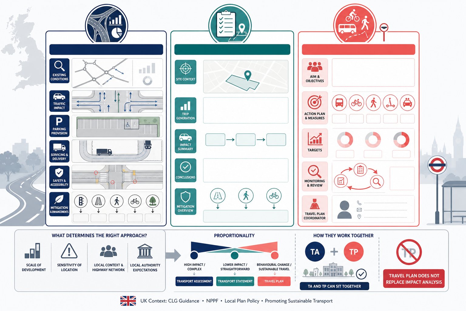
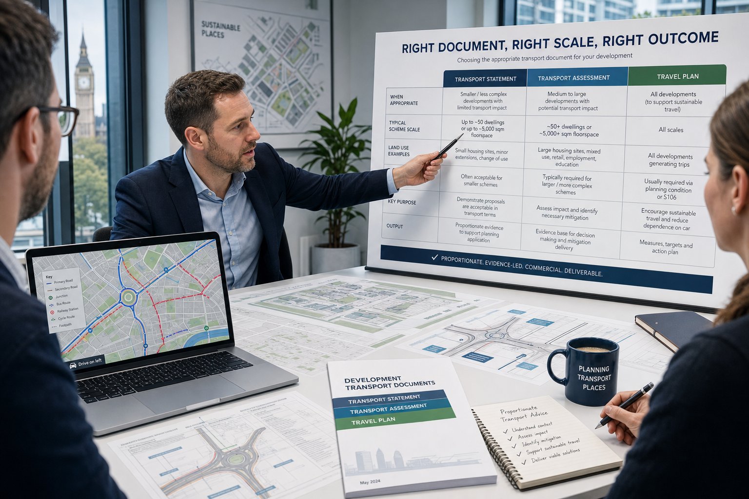
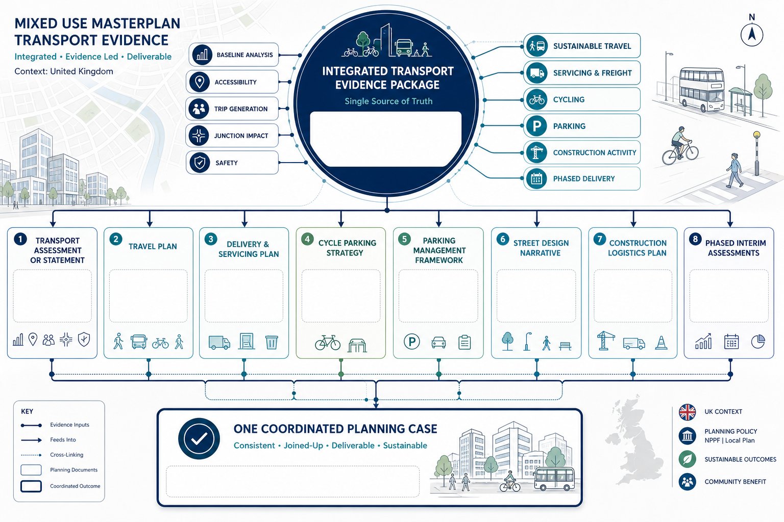
    comparison infographic of Transport Assessment, Transport Statement, and Travel Plan in the UK

    These documents are often mentioned together, but they do different jobs.

    A Transport Assessment (TA) is the fuller, more analytical document. It is usually prepared for larger schemes, developments in sensitive locations, or proposals where transport effects are likely to be material. A TA will typically cover site accessibility, baseline conditions, trip generation, trip distribution, junction impact, parking, servicing, road safety, and mitigation. It is evidence-heavy and often supported by modelling or technical appendices.

    A Transport Statement (TS) is a lighter-touch version for smaller or less impactful proposals. The principle is proportionality. A TS still needs to be robust, but it may not require the same level of survey data, modelling, or scenario testing as a full TA. For many modest residential or commercial schemes, a TS is the appropriate tool where impacts are limited and straightforward to explain.

    A Travel Plan (TP) is different again. It is not primarily an impact assessment. It is a strategy document aimed at influencing travel behaviour. A Travel Plan sets out measures to encourage sustainable travel, such as cycle facilities, public transport information, car club provision, welcome packs, monitoring arrangements, targets, and coordinator responsibilities. On larger schemes, authorities often expect a TP alongside a TA rather than instead of one.

    The mistake we sometimes see is assuming these documents are interchangeable. They aren’t. A Travel Plan cannot fill the gap where junction impact has not been assessed, and a Transport Statement is not enough if the local authority expects a full assessment because of scale, sensitivity, or policy thresholds.

    The right question is not “Which document is easiest?” It’s “What level of evidence is proportionate and likely to satisfy the authority?” That’s the decision that matters.

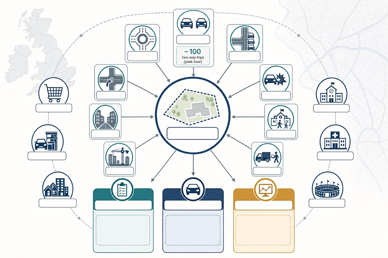
    When A Development Is Likely To Need A Transport Report
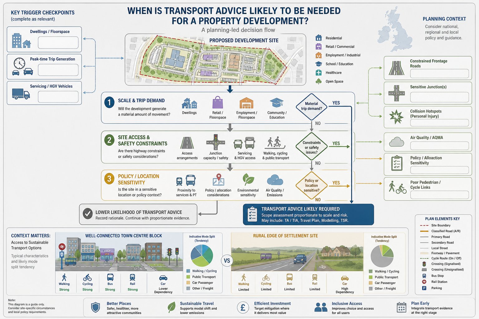
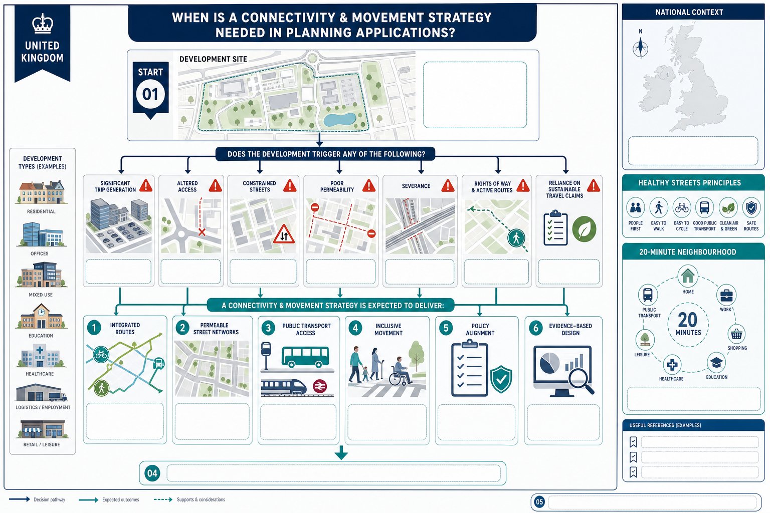
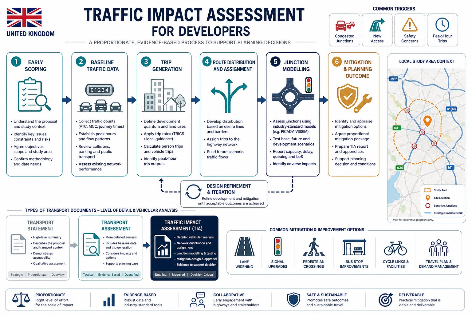
    UK infographic showing triggers for when developments need transport advice.

    There is no single national trigger that covers every site in every authority, which is why local context matters so much. But in broad terms, a transport report becomes likely where a development would create material travel demand, raise access concerns, or sit within a policy-sensitive location.

    Larger residential schemes are the obvious example, but they are far from the only one. Retail, logistics, education, healthcare, leisure, mixed-use and employment developments can all require formal transport evidence, especially where trip peaks coincide with existing congestion or where servicing demands are substantial.

    We also see transport reports requested for relatively modest schemes if the site is constrained. A small development on a narrow frontage road, near a busy junction, or with poor pedestrian links may attract more scrutiny than a larger scheme in a highly accessible urban area. That can surprise applicants who focus only on unit numbers or floorspace.

    Another trigger is strategic relevance. If access is proposed onto a classified road, near a junction of concern, or within an area where the highway authority has known capacity or safety issues, transport evidence is usually expected early and in some depth.

    And then there is policy. Many local planning authorities publish validation requirements, local plan policies, parking standards, and transport guidance that effectively determine whether a TA, TS or Travel Plan will be needed. Ignoring those documents is one of the quickest ways to lose time.

    Typical Triggers Considered By Local Planning Authorities

    Local planning authorities tend to look at a mix of scale, impact, and sensitivity rather than one blunt threshold alone.

    Common triggers include:

    • number of dwellings or gross floorspace
    • likely trip generation at peak times
    • access onto a busy, constrained, or strategic route
    • proximity to sensitive junctions, schools, town centres, or air quality issues
    • poor availability of walking, cycling, or public transport options
    • servicing intensity, especially for commercial uses
    • collision history or known highway safety concerns nearby

    Some authorities set indicative thresholds in local guidance, while others rely more heavily on professional judgement. Either way, the direction of travel is clear: if a proposal has a realistic prospect of affecting network performance, safety, or sustainable access, expect transport evidence to be required.

    How Site Location And Existing Network Conditions Affect Requirements

    Location can change everything. A town-centre infill site near rail, bus, shops and services may justify lower parking provision and a stronger emphasis on walking, cycling and mode shift. In those cases, the assessment may focus more on accessibility, parking management, and travel planning than on major junction capacity issues.

    By contrast, edge-of-settlement or rural sites often face tougher questions. If residents or staff are likely to rely heavily on the private car, the authority may want stronger evidence on trip rates, assignment, visibility, road geometry, bus service viability, or off-site mitigation. Even where highway capacity is acceptable, weak sustainable transport credentials can become a policy issue.

    Existing network conditions matter just as much. A site next to a junction already operating under pressure is more likely to trigger modelling. A site with a poor collision record nearby is more likely to require detailed safety review. And where footways are missing, crossing opportunities are weak, or cycling connections are severed by major roads, transport evidence has to grapple with those real-world constraints rather than gloss over them.

    That’s why site-specific advice beats assumptions every time.

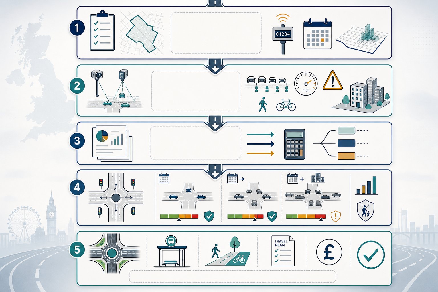
    What A Transport Consultant Will Review Before Recommending A Strategy
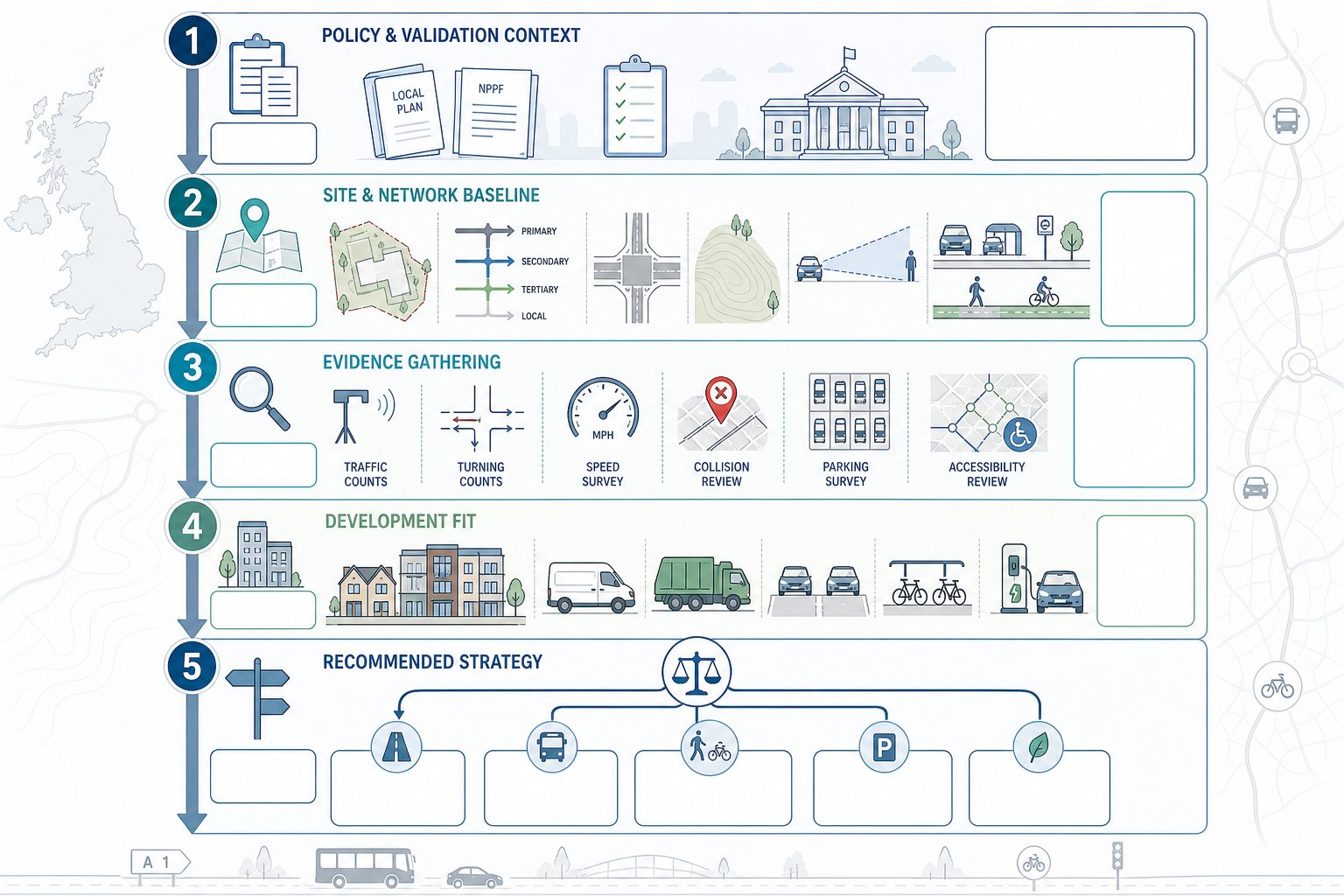
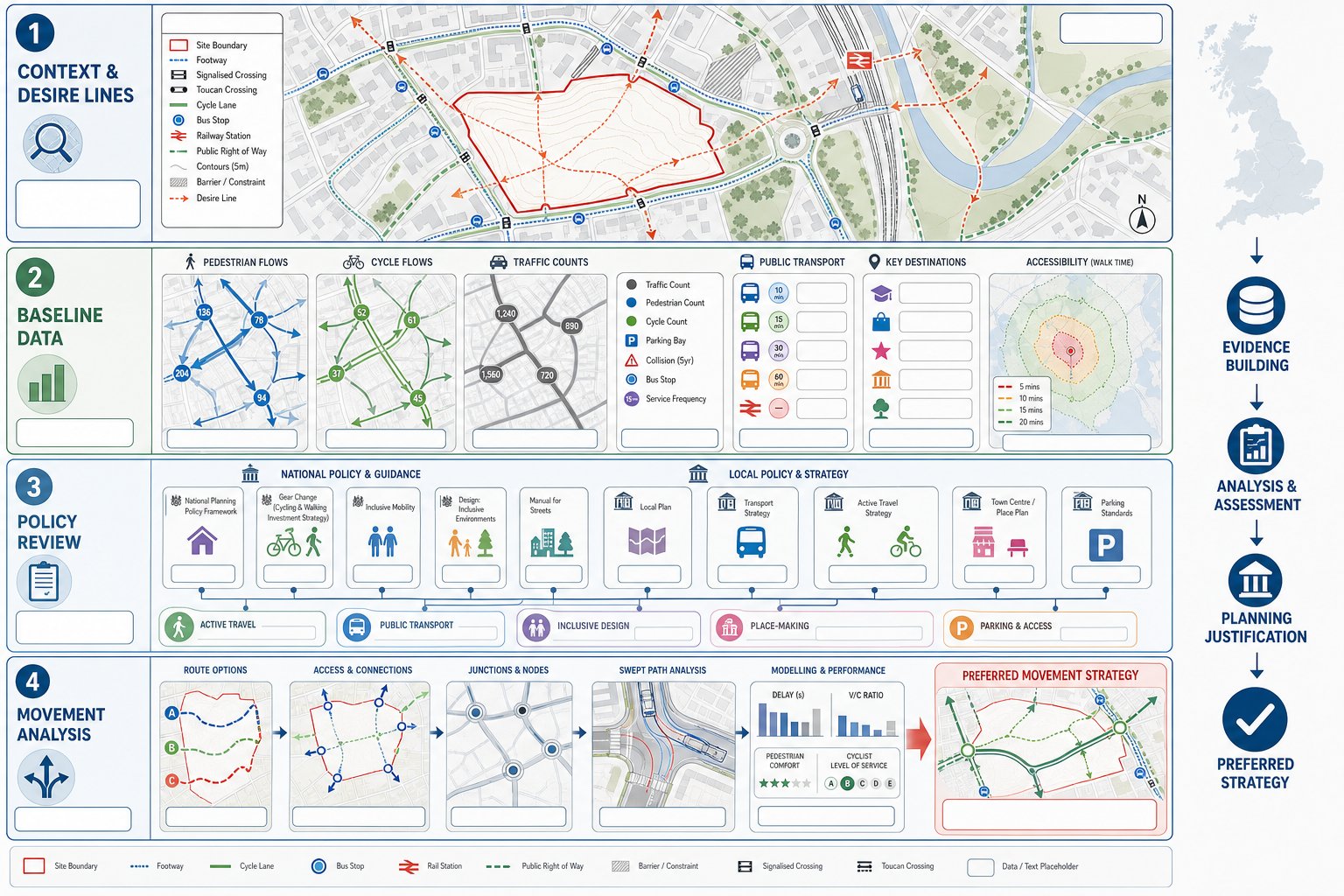
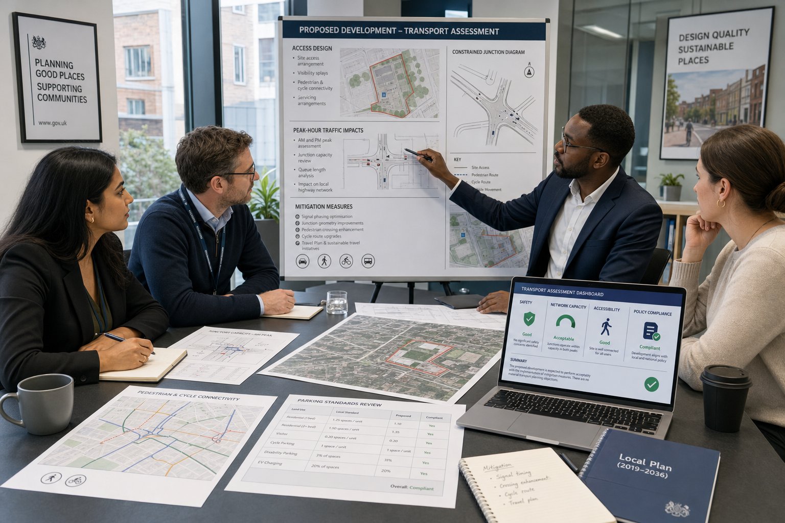
    Five-step transport planning review infographic for a UK development site.

    Before recommending whether a scheme needs a TA, TS, Travel Plan, technical note, or a package of supporting drawings, a transport consultant will usually work through several layers of review.

    The first is policy and validation context. We need to know what the local planning authority and highway authority typically expect, what the local plan says about sustainable transport, parking, and accessibility, and whether supplementary guidance sets thresholds or methodology preferences.

    The second is the site and network baseline. That means existing access arrangements, road hierarchy, speed environment, visibility, topography, nearby junctions, traffic conditions, parking stress, public transport services, walking and cycling routes, and local amenities. Desktop review is useful, but site visits are where awkward truths often show up, a steep route that looks walkable on plan but isn’t in practice, or a visibility issue hidden by street furniture and parked vehicles.

    The third is evidence gathering. Depending on the scheme, that may include traffic counts, junction turning counts, queue surveys, speed surveys, collision data, parking beat surveys, or accessibility mapping. The aim is to establish what is actually happening, not what we assume is happening.

    Then comes development fit. We review likely trip generation, servicing needs, refuse collection, parking demand, cycle parking, EV charging expectations, and whether the proposed layout can accommodate vehicles safely and efficiently.

    Only after those strands are understood can we recommend a sensible strategy. Sometimes that means a full assessment. Sometimes it means a proportionate statement with focused technical appendices. The best consultants do not start with a template. They start with the planning problem the site actually presents.

    Access, Parking, Servicing, And Highway Safety Considerations

    These are the issues that often decide whether a scheme feels credible to a highway officer.

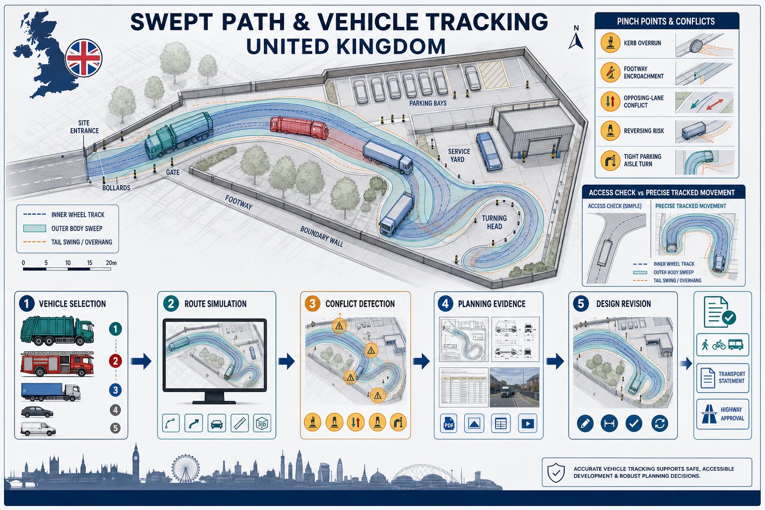
    Access comes first. The authority will want to know whether the proposed access point is suitable in principle, whether visibility splays meet the relevant standard, whether gradients are acceptable, and whether vehicles can enter and leave without conflict or overrun. On tighter sites, the exact geometry matters enormously. A seemingly minor change in kerb line, gate position, or internal tracking can make the difference between an acceptable and unacceptable arrangement.

    Parking is no longer just a matter of counting spaces. Authorities increasingly look at parking provision in the round: local standards, disabled bays, visitor provision, cycle parking quality, EV charging infrastructure, motorcycle spaces where relevant, and whether parking restraint is justified by accessibility. Over-provision can be as problematic as under-provision if it undermines sustainable transport policy or site quality.

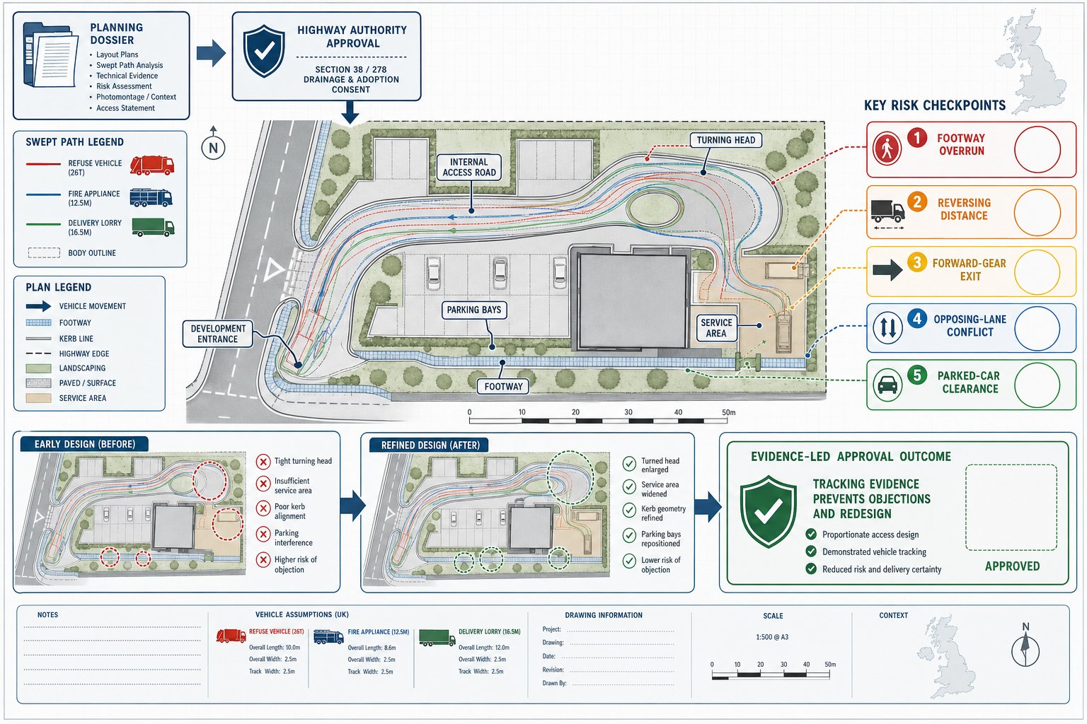
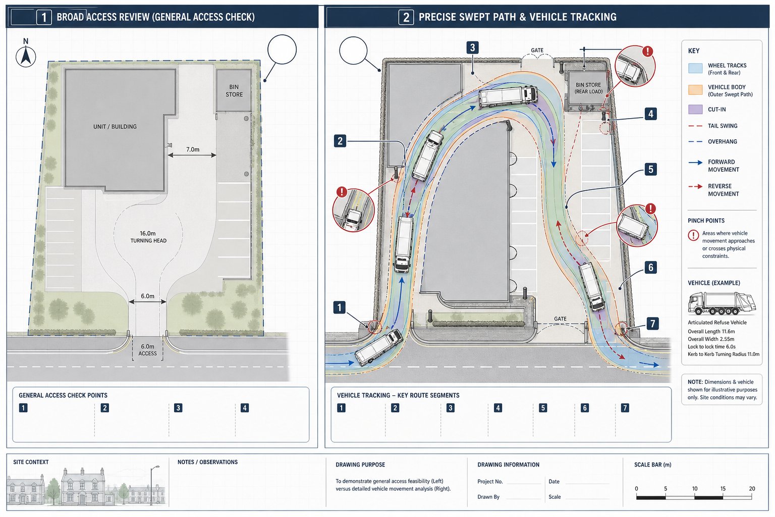
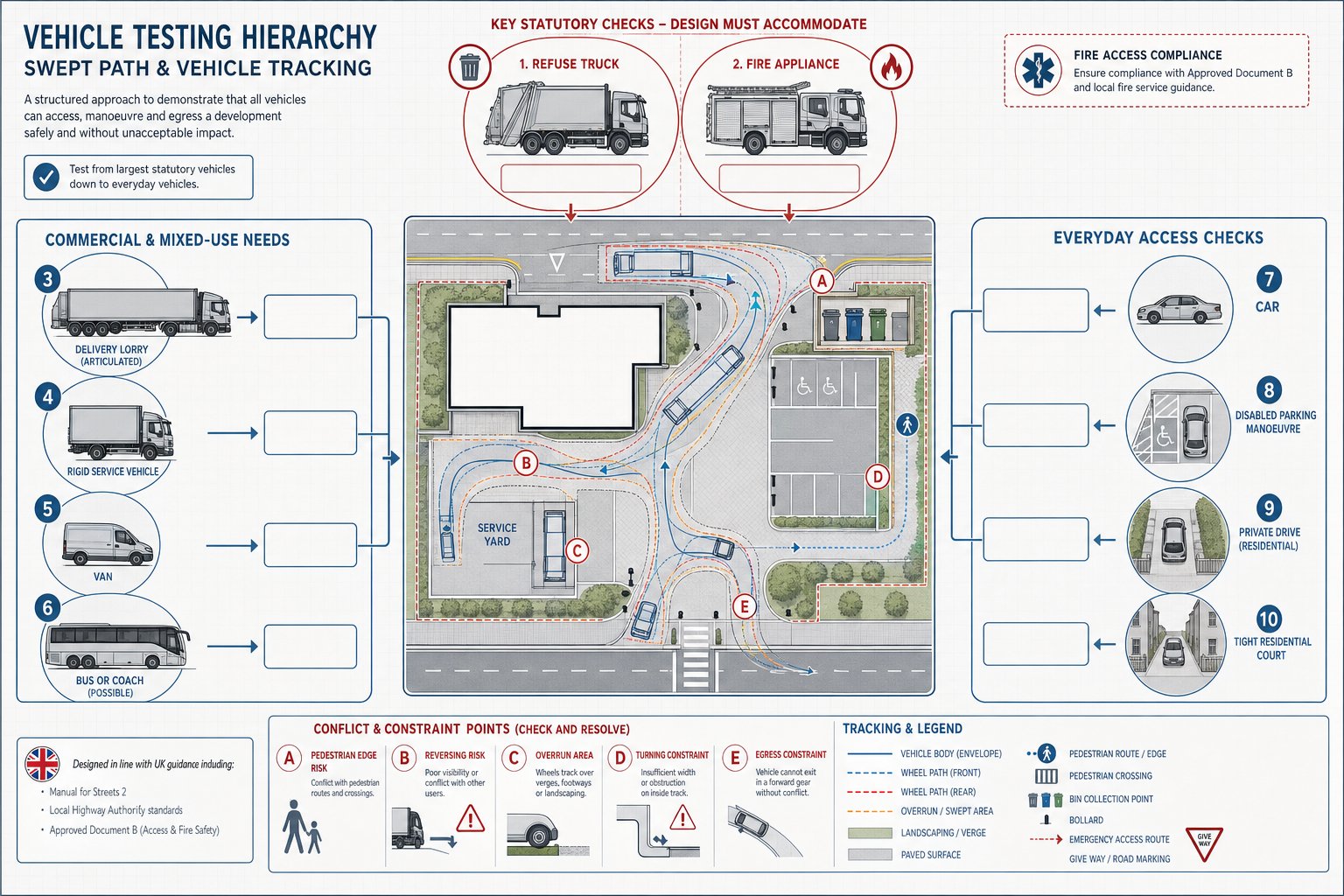
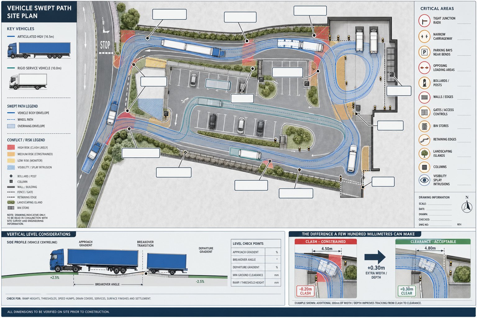
    Servicing and refuse are another frequent weak point. Delivery vehicles, refuse trucks, and emergency access all need to be considered early. Swept path analysis often reveals design conflicts that are not obvious on a general arrangement drawing. If a vehicle has to reverse excessively, mount footways, or block the carriageway, objections tend to follow.

    Then there is highway safety. That includes collision record review, conflict points, pedestrian desire lines, crossing opportunities, school routes, and the interaction between cars, cyclists and service vehicles. Some schemes may also require a Road Safety Audit or response process, particularly where highway works are proposed.

    These are technical matters, yes. But they are also practical ones. If the access looks awkward, the parking feels unrealistic, or servicing appears unresolved, confidence in the whole application drops very quickly.

    How Trip Generation And Junction Impact Are Assessed

    Trip generation is where transport evidence becomes quantifiable. The purpose is to estimate how many trips a development is likely to create, when those trips will occur, what modes people will use, and where vehicle trips will go on the surrounding network.

    In UK planning practice, this often starts with databases such as TRICS, supported by census data, local survey evidence, and professional judgement. The consultant selects comparable sites, considers location characteristics, and derives trip rates for the proposed land use. Good practice matters here: poor comparator choices can skew the whole assessment.

    Once trip rates are established, trips are assigned to the network based on existing travel patterns, local geography, committed development, and likely route choice. That produces forecast movements at key junctions and access points.

    The next step is junction impact assessment. Depending on junction type, this may involve priority junction modelling, roundabout assessment, signal junction modelling, or broader network review. The outputs usually include measures such as ratio of flow to capacity, queue lengths, delays, reserve capacity, and operational stress in future year scenarios.

    But numbers alone are not enough. We also look at whether peak times align with existing pressure points, whether development traffic materially worsens an already sensitive junction, and whether mitigation could resolve the issue. Sometimes a modest level of extra traffic is acceptable. Sometimes a small increment at the wrong location tips the balance.

    Multi-modal assessment matters too. For urban sites especially, person trips can be more informative than vehicle trips alone, because the strength of public transport, walking and cycling connections affects likely mode split.

    The core aim is straightforward: provide a transparent, evidence-based picture of transport effects so that the authority can judge acceptability, and, where needed, agree proportionate mitigation.

    Common Planning Risks That Delay Or Undermine Applications

    Most transport-related planning problems are not caused by one dramatic error. They build up through small omissions, late decisions, and optimistic assumptions that don’t survive scrutiny.

    One common risk is under-scoping the work. A developer assumes a short statement will be enough, only for the authority to request junction modelling, safety analysis, parking surveys, or a Travel Plan late in the process. That creates delay and can knock the wider team off programme.

    Another is underestimating trip impact. If trip rates, distribution assumptions, or committed development scenarios appear selective, consultees quickly lose confidence. It is much easier to defend a realistic case than a rosy one.

    We also see applications stumble because they ignore sensitive junctions or local concerns. A consultant may focus on the site access while a nearby roundabout, school crossing, or town-centre parking issue becomes the authority’s real concern. Local knowledge matters here more than people sometimes think.

    A further risk is weak sustainable transport evidence. In policy-sensitive areas, authorities expect credible walking, cycling and public transport analysis, not a token paragraph saying a bus stop exists nearby. If the route to that bus stop is unattractive or unsafe, that needs to be addressed honestly.

    Then there are the design-led issues: poor visibility, unresolved servicing, unrealistic parking layouts, lack of cycle provision, no swept paths, or insufficient safety evidence. These can make an otherwise promising scheme look undercooked.

    Finally, late engagement with highways officers remains a classic own goal. Early discussion does not guarantee agreement, but it often clarifies scope, flags concerns, and avoids producing the wrong report for the wrong audience.

    In short, most delays are preventable, but only if transport is treated as part of strategy, not paperwork.

    How To Prepare For A Smoother Planning Submission

    The smoothest applications usually have one thing in common: transport has been integrated into the project early enough to influence design, not merely justify it.

    The first step is to seek transport input at site acquisition or concept stage. That does not always mean commissioning a full assessment immediately. Often, an early feasibility review is enough to identify whether access is workable, what level of report is likely, and where the main planning risks sit.

    The second is to agree scope early, ideally through pre-application engagement where appropriate. If the local authority or highway authority can confirm whether a TA, TS or Travel Plan is expected, what survey work is needed, and which junctions should be tested, the eventual submission is far less likely to drift into technical dispute.

    Third, collect robust data. Traffic surveys, parking surveys, speed data, collision records, and accessibility evidence need to be recent, relevant, and clearly presented. Weak or stale baseline data has a habit of coming back to haunt applications.

    Fourth, align transport work with the masterplan. Access geometry, internal circulation, servicing, parking, cycle storage, refuse collection, and pedestrian links should all respond to transport findings. If the report says one thing and the drawings show another, everyone notices.

    Fifth, build policy compliance into the narrative. Authorities want to see that the scheme supports sustainable access, responds to local standards, and manages impacts proportionately. That policy thread should run through the submission rather than appearing as a late add-on.

    This is where experienced, locally aware consultants add real value. Firms such as ML Traffic focus on concise, accurate reporting tailored to authority expectations, which is often exactly what a project team needs: not a bloated document, but the right evidence, presented clearly, at the right moment.

    Get that right, and planning tends to move with fewer surprises.

    Conclusion

    In 2026, property development transport advice is not a box-ticking exercise. It is part of how good development gets shaped, tested, and delivered.

    When transport issues are addressed early, teams can make better decisions about site layout, density, access, parking, servicing, viability, and policy fit before those decisions harden into risk. When evidence is proportionate, credible and aligned with local authority expectations, planning applications are simply easier to progress.

    For developers, architects, planners, lawyers and councils alike, the lesson is the same: treat transport as an early strategic input, not a late technical appendage. A well-scoped Transport Assessment, Transport Statement or Travel Plan can de-risk applications, support sustainable access, and reduce the chance of costly redesign or avoidable objection.

    That doesn’t guarantee a frictionless route to consent, planning never works quite like that, but it does stack the odds in your favour. And in a tight planning environment, that advantage matters.

    Property Development Transport Advice FAQs

    Why is early transport advice crucial in property development?

    Early transport advice helps shape site layout, access, and viability before design decisions are fixed, reducing refusal risks and costly redesigns. It ensures developments comply with local and national policies promoting sustainable transport and identifies any off-site works or travel demand measures required.

    What is the difference between a Transport Assessment, Transport Statement, and Travel Plan?

    A Transport Assessment (TA) is a detailed, quantitative analysis for larger or sensitive developments. A Transport Statement (TS) is a lighter, proportionate version suitable for smaller schemes. A Travel Plan (TP) is a strategy to encourage sustainable travel through measures like cycle facilities and monitoring, rather than assessing transport impacts.

    When is a transport report typically required for a development?

    Transport reports are usually needed when a development generates significant trip demand, involves access from constrained or busy roads, or when local policies and planning authority thresholds demand it. Common triggers include large residential schemes, retail, employment developments, and sites near sensitive junctions or with poor sustainable transport options.

    How do site location and existing network conditions affect transport advice requirements?

    Urban sites with good public transport might focus transport advice on parking restraint and active travel, while peripheral or car-dependent locations require stronger evidence on highway capacity, bus viability, and mitigation. Existing network issues such as busy junctions or poor pedestrian infrastructure also increase the need for detailed transport assessment.

    What do transport consultants review to advise on transport evidence strategy?

    Consultants examine planning policies, local authority validation requirements, existing traffic and safety data, public transport accessibility, and site-specific factors like access geometry and topography. They gather robust survey data to assess trip generation and impact, aiming to recommend the appropriate level of transport evidence to support planning applications.

    How can developers prepare transport evidence to ensure smoother planning submissions?

    Engage transport consultants early, ideally at site acquisition or concept stage. Agree the scope of required reports with local authorities, collect robust survey data, and ensure transport findings are integrated into the masterplan. This alignment with policy and early engagement helps reduce delays, objections, and costly redesigns during the planning process.


  • Developer Transport Consultants: What They Do, When You Need One, And How They Support Planning Success In 2026

    Developer Transport Consultants: What They Do, When You Need One, And How They Support Planning Success In 2026

    Planning risk rarely announces itself with a big red warning sign. More often, it shows up later: a highway objection that could have been anticipated, an access arrangement that looked fine on a concept plan but fails visibility standards, or a parking strategy that doesn’t survive scrutiny from the local authority. By that point, redesigns are expensive, programmes slip, and everyone around the table is asking the same question, why wasn’t transport picked up sooner?

    That’s where developer transport consultants come in. In UK planning, they play a practical and often decisive role in turning an ambitious scheme into one that can actually be consented, delivered and operated safely. We use the term broadly here to include transport planning consultants advising on access, trip generation, junction impact, active travel, servicing, parking, and the evidence needed to support an application.

    For architects, planners, lawyers, surveyors, developers and councils, the value isn’t just in producing a report. It’s in shaping a proposal early enough that transport issues are designed out rather than argued over later. In 2026, with policy pressure around sustainable travel, tighter scrutiny on highway impacts, and local validation requirements varying from one authority to the next, that early advice matters more than ever.

    In this guide, we’ll explain what developer transport consultants actually do, when their input becomes essential, and how good transport advice helps keep planning applications moving.

    What Developer Transport Consultants Do On Planning And Development Projects

    Transport consultants reviewing a UK development site plan in a modern office.

    Developer transport consultants assess how a scheme will function in transport terms, and whether it can satisfy planning and highway authority requirements without creating unacceptable impacts. That sounds straightforward, but in practice it covers a wide technical brief.

    At the most basic level, we examine how people, goods and service vehicles will get to and from a site. That means reviewing site access, visibility, internal circulation, parking, drop-off arrangements, refuse collection, emergency access, pedestrian routes, cycle provision and connections to public transport. On larger schemes, it also means looking beyond the red line boundary to understand off-site effects on nearby junctions, streets and travel patterns.

    Just as importantly, we advise on what level of evidence a planning application needs. Some sites warrant a concise statement: others need a full Transport Assessment, Travel Plan, technical appendices and capacity modelling. The point is proportionality. Too little work creates objections. Too much can waste time and budget.

    On many projects, our role is part technical author, part risk manager. We identify likely concerns from the local highway authority, test options before layouts are fixed, and help the wider team present a robust, policy-aligned case. That’s why many developers now treat developer transport consultants as an early-stage planning input rather than a late reporting exercise.

    Why Transport Advice Matters Early In The Development Process

    Transport consultant advising a development team over early site access plans.

    Early transport advice saves schemes from preventable problems. Once an architect has locked in building footprints, parking courts, servicing yards and frontage treatment, even a small highways issue can trigger disproportionate redesign.

    We’ve seen this repeatedly: an access point positioned too close to a junction, a ramp gradient that works on paper but not for real vehicles, or a parking layout that technically fits spaces in but leaves no comfortable manoeuvring room. None of these are unusual mistakes. They happen when transport is treated as a validation item rather than part of the design process.

    Bringing a transport consultant in early helps shape the fundamentals, access strategy, likely vehicle movements, parking quantum, cycle provision, servicing, and how the site connects to its surroundings. It also allows us to flag whether a proposal may face highway safety or capacity concerns before a lot of design fee is spent.

    There’s a policy dimension too. The National Planning Policy Framework continues to push sustainable transport, safe access and proportionate evidence, while Local Plans and supplementary guidance often set specific expectations on mode share, parking restraint and active travel. Early advice lets the team respond coherently rather than bolt on a Travel Plan at the end.

    In practical terms, early input usually means quicker pre-app discussions, fewer surprises in validation, and stronger negotiation positions once comments come back.

    How Transport Consultants Support Different Types Of Development

    Transport consultant reviewing plans for residential, mixed-use and logistics developments.

    Transport advice isn’t one-size-fits-all. The issues, evidence and authority concerns vary significantly by land use, scale and context. A town-centre mixed-use site has very different transport risks from an edge-of-settlement logistics scheme, even if both technically need a planning transport submission.

    That’s why a good consultant tailors the work to the development type rather than recycling a generic methodology. The right scope depends on who will travel, when they’ll travel, how the site will be serviced, and what the surrounding network can realistically absorb.

    Residential, Mixed-Use, Commercial, And Public Sector Schemes

    For residential development, the focus is often on access safety, parking provision, cycle storage, pedestrian links, trip generation, and the effect of school-run and commuter peaks. On family housing sites, local authorities may also look closely at school access, healthcare catchments and whether the street design supports walkable movement rather than car dependence.

    Mixed-use development adds complexity. Uses can complement each other, with some trips internalised rather than loaded onto the surrounding highway network, but that argument has to be evidenced properly. Shared parking, servicing arrangements, delivery timing and peak-hour overlap all need careful treatment.

    Commercial, industrial and logistics schemes bring another set of questions: HGV routing, swept paths, yard depth, gatehouse arrangements, shift changes, staff travel and amenity impacts on nearby roads. Public sector schemes such as schools, hospitals, civic buildings and transport interchanges often attract intense scrutiny because of safeguarding, peak concentration and user vulnerability.

    The best transport advice responds to those specifics. It doesn’t force every project into the same template.

    Core Planning Reports Developers May Need

    Transport consultants reviewing planning reports for a UK development project.

    Most planning transport work ends up in a defined set of reports, but choosing the right document matters. A mismatch between the scale of development and the scale of evidence is one of the easiest ways to create friction with a local authority.

    In broad terms, the reporting suite should explain how the development will be accessed, what travel demand it will create, whether the surrounding network can accommodate that demand, and what mitigation or sustainable travel measures are proposed. Sometimes that can be done in a concise document: sometimes it needs a much more detailed package.

    Where developers are still weighing scope, timing or likely authority expectations, a short piece of property development transport advice can be useful before committing to surveys and modelling.

    Transport Assessments, Transport Statements, Travel Plans, And Technical Notes

    A Transport Assessment (TA) is the fuller option. It is typically required for larger or more sensitive schemes and covers trip generation, trip distribution, junction impact, accessibility, parking, servicing, road safety considerations and mitigation. If junctions are likely to be affected, a TA usually needs capacity modelling and tested future-year scenarios.

    A Transport Statement (TS) is a lighter-touch, proportionate document for smaller developments where the transport effects are more limited. It still needs to be credible and site-specific: “lighter-touch” should never mean vague.

    A Travel Plan sets out practical measures to encourage sustainable travel, walking, cycling, bus, rail, car sharing, and monitoring arrangements. Authorities increasingly expect these to contain real actions, responsibilities and targets.

    Technical Notes are narrower papers used to address specific matters, such as access geometry, parking justification, visibility splays or a response to consultee comments. They’re often the unsung heroes of a planning negotiation because they can resolve one issue without reopening the whole application.

    How Local Authority Requirements And Thresholds Affect Transport Work

    Transport consultants reviewing UK development plans and traffic analysis in a modern office.

    One of the biggest misconceptions in planning transport is that the rules are identical everywhere. They aren’t. Each local planning authority and highway authority may have its own validation list, threshold guidance, parking standards, design preferences and expectations on modelling.

    Some authorities trigger a TA or TS using floorspace or dwelling thresholds. Others take a more discretionary approach based on location, network sensitivity, collision history, school proximity or whether the development affects a constrained town-centre junction. A scheme below a headline threshold can still need substantial transport work if the site context is difficult.

    That local variation is why area-specific experience matters. We need to know not only the written policy but also how officers typically interpret it, what survey extents they expect, whether they prefer certain design standards, and how robust they are on Travel Plan commitments.

    There’s also a technical layer. Authorities may ask for modelling in PICADY, ARCADY, LINSIG or, on more complex networks, microsimulation such as VISSIM. They may require committed development assumptions, TEMPro growth, collision analysis, active travel audits or independent stage reviews depending on the proposal.

    In other words, transport work isn’t just about engineering competence. It’s about aligning evidence to local requirements from the outset, so an application lands in the right format and doesn’t lose momentum over avoidable validation or consultation queries.

    The Surveys, Data, And Modelling Behind A Robust Submission

    A persuasive transport submission is built on evidence, not optimism. If the surveys are weak, the assumptions are thin, or the modelling scenarios don’t reflect reality, even a well-written report will struggle under scrutiny.

    The starting point is usually data collection around the site and on the local network. That may involve classified turning counts at junctions, queue surveys, automatic traffic counts, speed surveys, parking beat surveys, pedestrian and cycle counts, or public transport accessibility review. Timing matters. Surveys need to reflect representative conditions and avoid obvious distortions unless those distortions can be explained and adjusted.

    Then comes interpretation. Data on its own doesn’t win arguments: it has to be translated into a clear picture of how the development will operate and what change it introduces. That’s where trip generation, distribution logic, design checks and capacity testing become crucial.

    Junction Counts, Trip Generation, Capacity Testing, And Site Access Review

    Junction counts establish existing network performance and reveal whether queues, delays or turning conflicts are already an issue. But the raw count isn’t enough. We need the right peak periods and the right geographic coverage, otherwise the analysis can understate impact.

    Trip generation is often derived from TRICS, sometimes supplemented by bespoke evidence where a scheme has unusual characteristics. The selection of comparator sites needs judgement. Choose poor comparators and the whole forecast starts to wobble.

    Capacity testing may then be undertaken in tools such as PICADY, ARCADY, LINSIG or VISSIM, depending on the junction form and complexity. Future-year scenarios, background growth, committed development and sensitivity testing all matter.

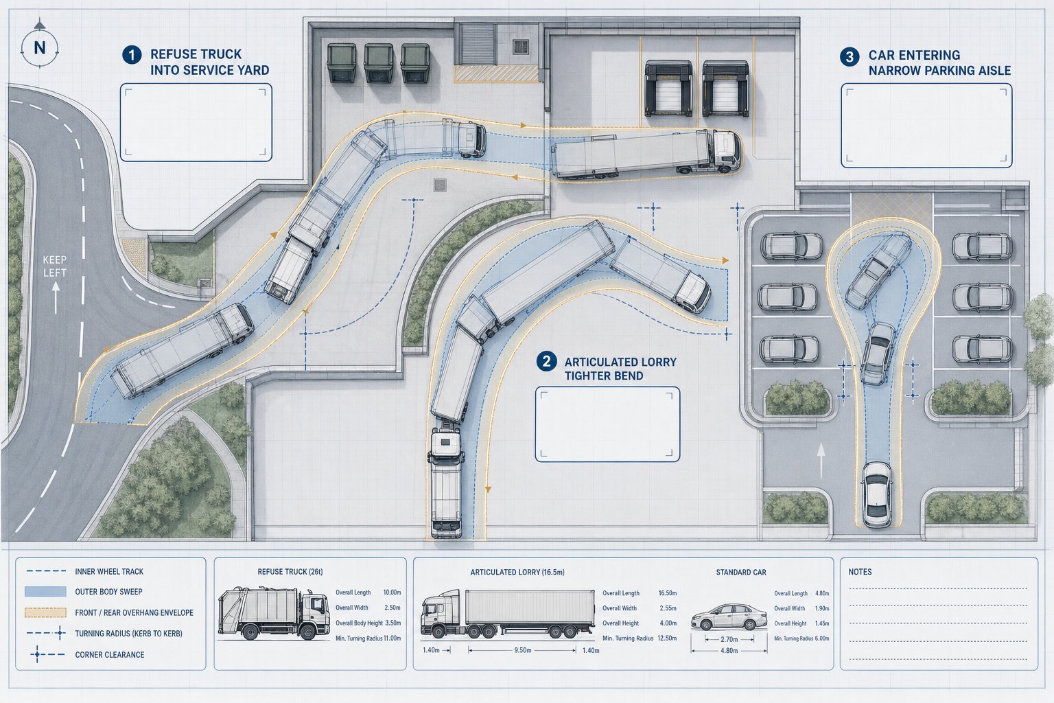
    Alongside this, site access review checks geometry, visibility splays, gradients, swept paths, pedestrian crossing points, cycle access and operational practicality for refuse and emergency vehicles. Often, that’s the difference between a neat concept and a deliverable scheme.

    Common Transport Issues That Delay Planning Applications

    Most planning delays don’t happen because transport is inherently controversial. They happen because a submission leaves obvious questions unanswered.

    One common issue is understated trip generation. If peak-hour forecasts look implausibly low, highway officers tend to dig deeper, and once confidence drops, every other part of the submission is tested harder. Missing survey periods, selective comparator choices or failure to reflect local travel behaviour can all trigger that problem.

    Another regular stumbling block is incomplete junction analysis. We often see assessments that test the wrong year, omit committed development, or model only one arm of a wider network issue. That may save time initially, but it rarely survives consultation.

    Access design is another frequent weakness. Substandard visibility, awkward radii, poor pedestrian priority, conflict between service vehicles and residents, or a lack of inclusive design can all generate legitimate objections. Parking can be just as problematic, especially where a scheme departs from local standards without a coherent justification.

    And then there’s the Travel Plan. Authorities are increasingly wary of generic documents full of nice intentions and very little accountability. A weak Travel Plan won’t usually kill a strong scheme on its own, but it can undermine the credibility of broader sustainable transport claims.

    Good transport work reduces delay by answering the next question before it’s asked.

    How Developer Transport Consultants Work With Architects, Planners, And Design Teams

    Transport consultants rarely work in isolation. On a well-run project, we are part of a wider design and planning conversation from the outset, feeding into layout decisions, policy strategy, viability discussions and technical coordination.

    With architects, the relationship is usually most intense at concept and developed design stage. Access points, parking courts, turning areas, cycle storage, refuse strategy and frontage treatment all have transport implications, but they also affect placemaking and building efficiency. The best outcomes come when those issues are resolved collaboratively rather than passed back and forth as constraints.

    With planners, we help align the transport case with local and national policy, pre-application feedback, consultee negotiation and planning condition wording. That can include targeted technical responses, mitigation wording, Travel Plan commitments and support during committee or appeal. Where a scheme needs concise reporting and authority-aware input, transport advice for planning is often most effective when integrated with the planning strategy, not separated from it.

    We also coordinate with civil engineers, landscape teams and urban designers to make sure streets, levels, drainage, servicing and active travel infrastructure actually work together. Lawyers and valuation teams may need our input on Section 106 or Section 278 obligations, mitigation scope and delivery triggers.

    That joined-up role is often underestimated. In reality, transport sits across design, policy and delivery.

    Choosing The Right Transport Consultant For Your Development

    Not every transport consultant is the right fit for every scheme. Technical competence is essential, but it’s only part of the picture. Developers, architects and planning teams usually need someone who can judge risk early, communicate clearly, and tailor the scope to the real planning challenge rather than defaulting to a generic package.

    Relevant experience matters first. A consultant who regularly supports residential schemes in outer suburban locations may not be the best choice for a constrained town-centre mixed-use site or a logistics-led employment proposal. Local authority familiarity matters too, especially where officers have clear preferences on thresholds, modelling, visibility standards or Travel Plan content.

    Then look at breadth of service. Can the consultant support pre-app input, surveys, modelling, technical reporting, design development, and post-permission highway work if the scheme progresses? A fragmented team can work, but it often creates gaps between planning advice and deliverable detail.

    Reporting style is more important than many clients expect. Highway officers and planning case officers are busy. Clear, concise, evidence-led writing tends to travel further than a bulky report full of copied guidance and very little judgement. That’s one reason experienced firms with a focused offer, such as those providing concise, authority-aware developer transport consultants support, are often valued on programme-critical projects.

    Finally, ask a simple question: will this consultant help us make better decisions early, or just document problems later?

    Conclusion

    The strongest planning applications rarely treat transport as an afterthought. They use it as a design and risk-management tool from the beginning. That’s the real value of developer transport consultants: not just producing a compliant report, but helping the team shape an access strategy, movement pattern and evidence base that can withstand scrutiny.

    In 2026, with local authority expectations tightening and sustainable travel policies carrying more weight, that role is only becoming more important. For developers, architects, planners, lawyers and councils alike, robust transport input helps separate manageable issues from scheme-threatening ones while there is still time to act.

    When transport advice is proportionate, locally informed and brought in early, applications tend to move with fewer surprises. And in planning, fewer surprises usually means faster decisions, lower redesign costs and a much better chance of consent on terms everyone can work with.

    Developer Transport Consultants FAQs

    What roles do developer transport consultants play in UK planning projects?

    Developer transport consultants assess site access, parking, circulation, and off-site impacts to ensure planning and highway authority requirements are met. They help design safe access strategies, manage trip generation, and prepare technical reports for planning applications and appeals.

    Why is early involvement of transport consultants important in property development?

    Early engagement helps shape site layout, access points, and parking before designs are fixed, reducing risks of highway safety or capacity objections. It also aligns the scheme with sustainable transport policies, speeding up pre-application discussions and minimizing redesign costs.

    How do transport consultants support different types of development projects?

    They tailor advice based on development type—residential projects focus on parking and trip generation; mixed-use developments require managing internal trips and shared parking; commercial schemes involve HGV routing and shift patterns; public sector projects assess safeguarding and peak demand impacts.

    What planning reports do developers typically need from transport consultants?

    Common reports include Transport Assessments (detailed trip and junction analysis for larger schemes), Transport Statements (lighter assessments for smaller projects), Travel Plans (plans to encourage sustainable travel), and Technical Notes addressing specific concerns like access geometry.

    How do local authority requirements affect transport consulting work?

    Local authorities set thresholds and validation lists determining when reports like TAs or TSs are needed. They specify design standards, survey requirements, and modelling tools, which vary by area. Consultants must align their evidence with these local rules to avoid application delays.

    What factors should be considered when choosing a developer transport consultant?

    Select consultants with relevant local experience, a proven track record of securing permissions, and capable of supporting projects end-to-end from pre-application through detailed design. Clear reporting and strong stakeholder engagement skills are also crucial for smooth planning processes.

  • Access Strategy Transport Planning: How To Design A Planning-Ready Approach In 2026

    Access Strategy Transport Planning: How To Design A Planning-Ready Approach In 2026

    A surprising number of planning delays come down to something that looks straightforward on the drawing but unravels under scrutiny: access. A site may have land, demand and a viable layout, yet if the route in and out is poorly justified, unsafe, or disconnected from the wider network, the whole proposal starts to wobble.

    That is why access strategy transport planning matters so much in 2026. It is not just about where the bellmouth sits or whether a refuse vehicle can turn. It is the disciplined case for how people, goods and services will reach a development safely, conveniently and sustainably, and how that access will work with the surrounding highway, walking, cycling and public transport networks.

    For architects, planners, lawyers, surveyors, developers and local authorities, the practical challenge is rarely the label. It is knowing what a robust access strategy actually needs to include, how much evidence is enough, and where schemes most often run into objections from highway officers.

    In our experience, strong access planning is usually clear rather than flashy. It joins policy, geometry, surveys and real-world movement patterns into one coherent story. Get that story right early, and a planning application stands on firmer ground. Get it wrong, and even a promising scheme can spend months in redesign, negotiation or appeal.

    This guide sets out what a planning-ready access strategy looks like, what evidence supports it, and how to prepare it for effective local authority review.

    What Access Strategy Means In Transport Planning

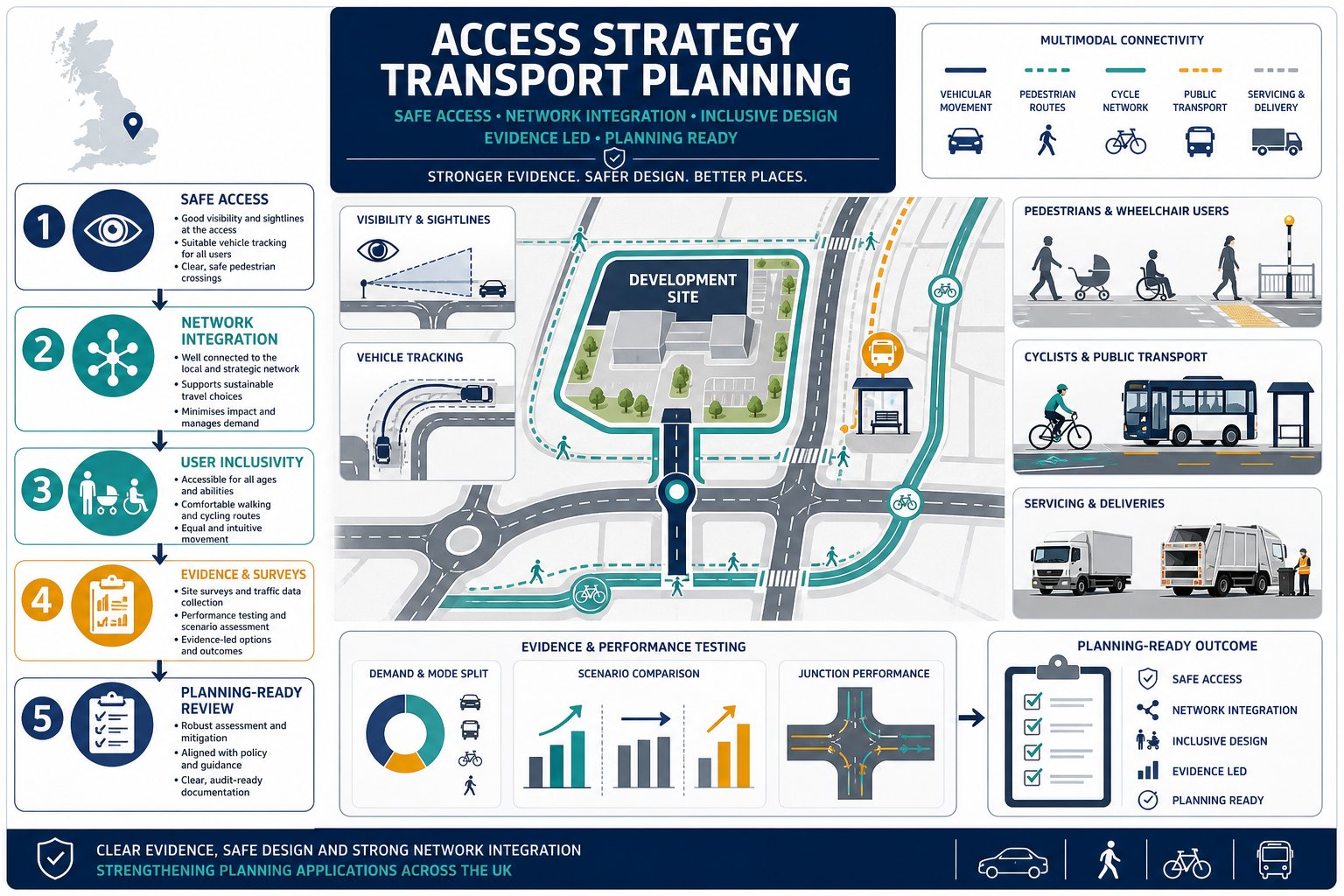
    Infographic of a UK development site showing safe access for all transport users.

    An access strategy in transport planning is the structured explanation of how a development connects to the transport network and how that connection will function for all users. In plain terms, it covers how vehicles, pedestrians, cyclists, buses, servicing vehicles and, where relevant, emergency access will enter, leave and move around a site without creating unacceptable safety or operational problems.

    That sounds simple. It rarely is.

    A proper access strategy is broader than a single access drawing. It combines design intent, technical evidence and policy alignment. It should show not only the physical arrangement of access points, but also why those arrangements are appropriate for the site context, local street hierarchy and expected travel patterns.

    In UK planning practice, the strategy often sits within a Transport Statement or Transport Assessment and helps address the familiar test of whether the development offers safe and suitable access for all users. That includes people arriving on foot, by cycle or public transport, not just by car.

    This is also where access management comes in. Too many access points, poor spacing from junctions, weak visibility or awkward servicing arrangements can all undermine a proposal. By contrast, a well-considered strategy reduces conflict, supports efficient movement and fits the surrounding network rather than fighting it.

    For applicants needing concise technical support, the thinking overlaps strongly with the kind of planning-led advice described in Property Development Transport: it starts early, responds to local authority expectations, and ties transport evidence back to the planning narrative.

    Why Access Strategy Matters For Planning Applications

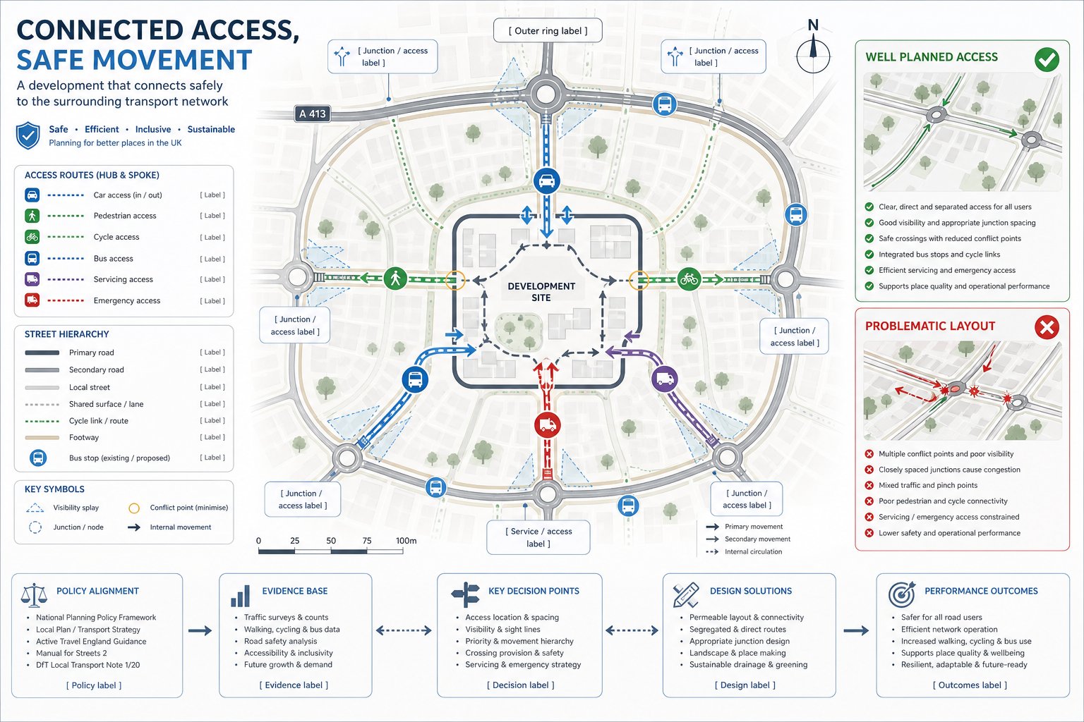
    Infographic showing key access strategy factors affecting UK planning application approval.

    Access can make or break an application because it sits right at the intersection of planning policy, highway safety and deliverability. Local planning authorities and highway officers are not only asking whether a development can be built. They are asking whether it can operate acceptably once occupied.

    A robust access strategy helps answer several critical questions at once:

    • Is the proposed access safe for all users?
    • Will it create unacceptable risk or conflict on the local highway network?
    • Does it support sustainable travel rather than forcing car dependency?
    • Can servicing, deliveries and emergency movements be accommodated?
    • Is the proposal genuinely workable, or just graphically convenient?

    If those questions are left vague, objections follow quickly. We often see concern focused on collision risk at new junctions, substandard pedestrian routes, visibility constraints, queueing impacts, or layouts that look acceptable for cars but ignore cycling and refuse collection.

    That is why access strategy transport planning is not a side note. It underpins decisions on suitability, residual cumulative impact and the practical use of the site. For larger or more sensitive schemes, it can also influence viability, reserved matters discussions, Section 278 works and the scope of planning conditions.

    In a busy planning programme, early technical input tends to save time later. That is one reason many applicants engage Developer Transport Consultants: What issues before a layout hardens into something difficult to defend. A modest design adjustment at concept stage is usually far cheaper than reworking access after a formal objection lands.

    The Core Principles Of A Strong Access Strategy

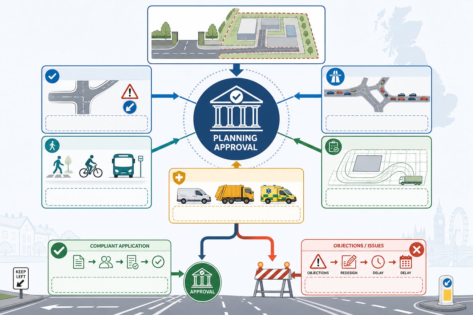
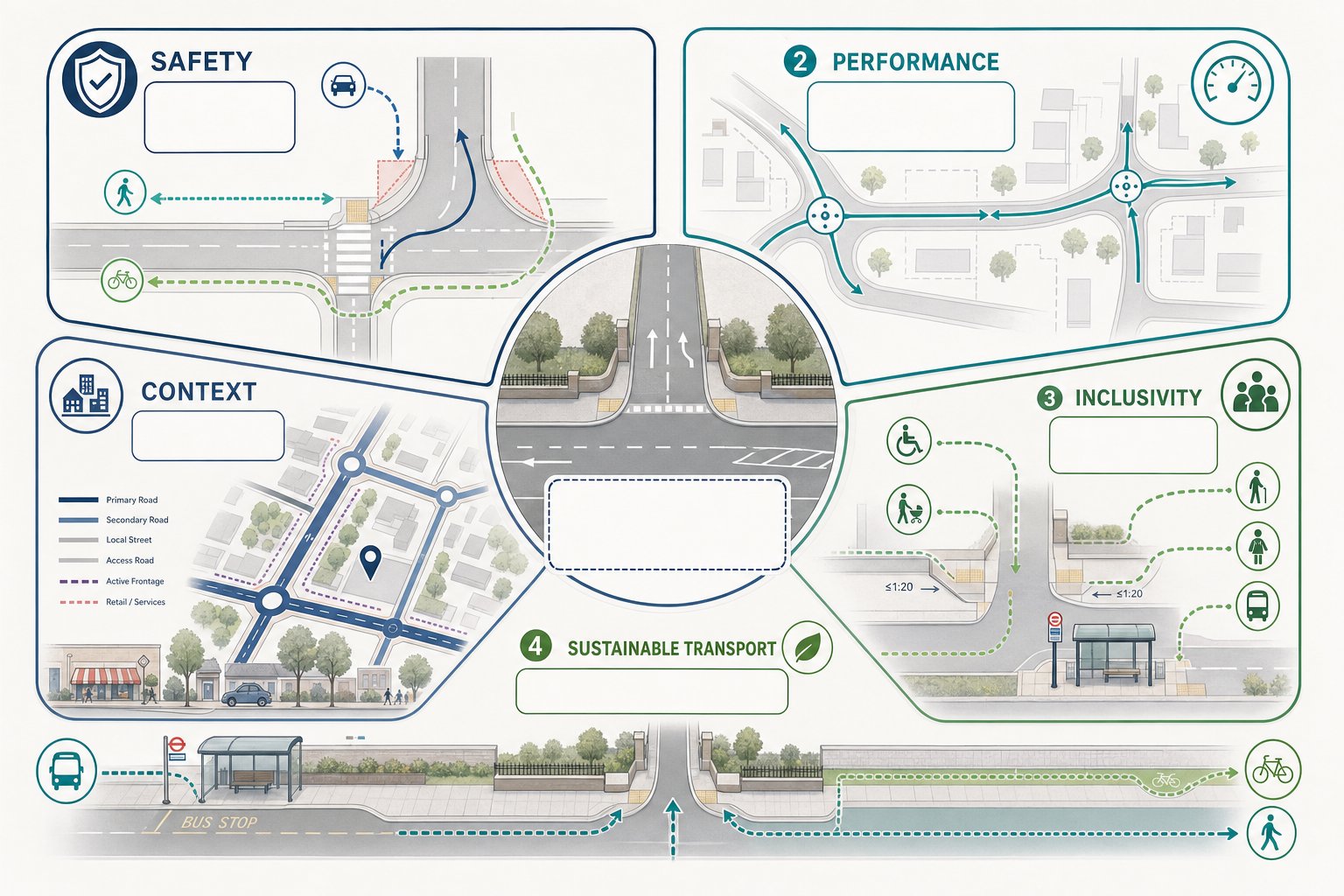
    Infographic showing five principles of site access strategy in UK transport planning.

    A strong access strategy is not built around a single metric. It balances safety, functionality, inclusivity and context. Good schemes do not simply push traffic through a gap in the boundary: they shape movement in a way that reflects how streets actually work and how people actually travel.

    At a minimum, we would expect the strategy to demonstrate five things: that the access arrangement is safe, that it performs acceptably, that it works for different user groups, that it supports sustainable transport, and that it responds to the character and hierarchy of the surrounding network.

    Safe And Suitable Access For All Users

    This is the baseline test, and rightly so. Access should minimise conflict between vehicles, pedestrians and cyclists, especially at points where crossing, turning and servicing movements overlap. That means looking carefully at geometry, visibility, vehicle speeds, crossing desire lines, gradients, waiting areas and whether vulnerable users are being squeezed into left-over space.

    A scheme may technically accommodate a car access while still failing the wider planning test if pedestrian routes are indirect, crossing points are weak, or cycle movements are forced into conflict with turning traffic. Inclusivity matters here as much as geometry. Parents with prams, older residents, wheelchair users, schoolchildren and bus passengers all experience the site differently.

    The best access strategies do not treat these needs as add-ons. They bake them into the front end of the design.

    Integration With The Surrounding Highway And Movement Network

    Even a neatly designed access can fail if it ignores its setting. Access points need to align with the road hierarchy, nearby junctions, crossing locations, bus stops and established walking and cycling routes. A development should feel connected to the wider movement network, not stranded on it.

    This is especially important where several constraints pull in different directions: a classified road frontage, adjacent driveways, existing trees, frontage activity, or public transport stops close to the site boundary. Integration means understanding how the proposed access affects operations beyond the red line.

    That broader network view often separates workable schemes from fragile ones. In urban areas, applicants commonly need to show how access interacts with signal junctions, kerbside activity, cycle corridors and loading pressure. In suburban or edge-of-settlement locations, the focus may shift to visibility, speed environment, bus stop accessibility and whether pedestrians can reach local facilities safely.

    And yes, local context matters a lot. The practical issues considered by a Traffic Engineer In Leeds: setting may differ from those in a town-centre authority, even when policy language looks familiar on paper.

    How Access Strategy Supports Different Types Of Development

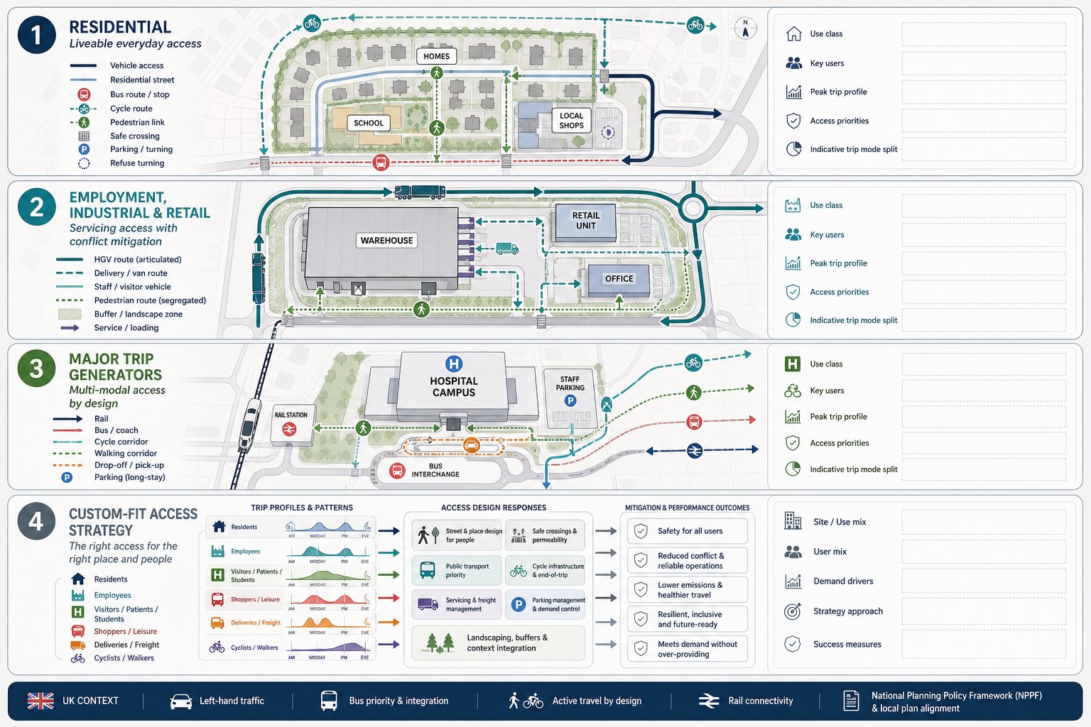
    Infographic comparing access planning needs for residential, industrial, and major UK developments.

    Not every development asks the same question of its access strategy. A small residential infill site, a logistics yard and a mixed-use town-centre scheme can all require very different responses, even where the planning principles are similar.

    For residential development, the emphasis usually falls on everyday convenience and liveability. Can residents walk to schools, shops and bus stops without negotiating hostile crossings or dead-end footways? Is cycle access direct enough to be realistic? Will domestic parking, refuse collection and visitor movements work without creating low-level but persistent conflict? On many schemes, the strongest access move is not a wider junction: it is a better pedestrian connection.

    Employment, industrial and retail sites bring another layer: servicing, shift patterns and freight. Here the access strategy has to address vehicle size, loading activity, routeing and the interface between staff, visitors and commercial traffic. If HGVs and pedestrians are expected to share constrained space, local authorities will want very clear justification and mitigation.

    Larger trip generators, including education, healthcare and transport hubs, often need a mode-share perspective as well. Surface access planning becomes central: how the proposal will reduce single-occupancy car trips, connect to public transport and support active travel at scale.

    This is why access strategy transport planning should always be development-specific. Templates rarely convince. A planning-ready strategy speaks directly to how the use class, trip profile and user mix shape access demand, design choices and mitigation requirements.

    Key Evidence And Surveys Needed To Inform Access Design

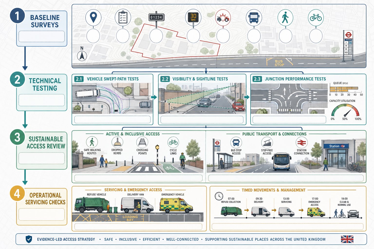
    Infographic of access strategy surveys, junction tests, and walking, cycling, transport checks.

    An access strategy is only as persuasive as the evidence behind it. Officers do not want assertion: they want a clear chain from baseline conditions to design response. That usually means combining site observation, measured data and technical testing.

    The exact evidence package depends on scale and context, but most robust submissions draw on traffic counts, turning counts, speed data, collision records, topographical information, site constraints, public transport provision, and walking and cycling audits. For larger schemes, parking accumulation, servicing demand and mode split analysis may also be needed.

    The trap, oddly enough, is not always too little data. Sometimes it is the wrong data, collected at the wrong time, then stretched to answer questions it cannot really answer. A school-adjacent site surveyed outside term time, for example, may produce a very tidy dataset and a very shaky planning case.

    Vehicle Tracking, Visibility, And Junction Performance

    These are often the first technical tests people think about, because they are easy to visualise and easy for consultees to challenge. Swept-path analysis demonstrates whether the design vehicle can enter, turn, service and exit without overrunning footways, clipping street furniture or relying on unrealistic manoeuvres. It should reflect actual vehicle needs, not just the most convenient drawing standard.

    Visibility is equally fundamental. Splays, stopping sight distance and forward visibility must respond to the speed environment and local conditions. If boundary walls, vegetation, parked vehicles or vertical alignment constrain visibility, the strategy needs to deal with that openly.

    Junction performance then tests whether the access arrangement operates acceptably in network terms. Depending on context, that may involve priority-junction modelling, signal modelling, queue assessment or practical reserve capacity review. The aim is not to pretend every junction is free-flowing. It is to show that delay, queueing and interaction with nearby junctions remain acceptable and defensible.

    Walking, Cycling, Public Transport, And Servicing Requirements

    This is where many access strategies improve markedly, or come unstuck. A proposal can pass a vehicle-tracking check and still fall short if active travel and public transport links are weak.

    Pedestrian routes should be direct, legible and safe. That means considering width, surfacing, gradient, lighting, crossing provision, dropped kerbs and how users move beyond the site boundary. Cycling provision needs similar honesty: painted intent is not the same as a connected route.

    Public transport assessment should cover proximity, frequency, route choice and the quality of access to stops or stations. If a bus stop is technically close but requires a difficult crossing of a busy arm, that matters. So does whether sheltered waiting, interchange and timetable coverage make the option genuinely usable.

    Servicing must be planned with equal care. Delivery bays, refuse collection, management vehicles and emergency access should work without blocking primary pedestrian routes or creating repeated conflict at peak times. On urban schemes, timed deliveries and operational controls can be just as important as geometry.

    In practice, this is often where local knowledge helps, particularly in places with tightly managed networks and sensitive frontage conditions, such as those handled by a Traffic Engineer In Manchester: project team.

    Common Planning Issues That Delay Or Weaken Access Proposals

    Most weak access proposals do not fail because of one dramatic flaw. They fail because a cluster of smaller issues leaves doubt hanging over the scheme.

    A common problem is over-reliance on a vehicle-led layout. The drawing may show cars getting in and out efficiently, but pedestrians are left with awkward routes, no clear priority, or poor crossing opportunities. Highway officers notice that immediately.

    Another regular issue is access proliferation: too many access points, poor spacing from adjacent junctions, or new openings onto roads where turning movements already create pressure. Every extra conflict point invites scrutiny. If the strategy cannot justify why access is arranged that way, objections become hard to rebut.

    Then there is evidence quality. Underestimated trip generation, unrepresentative surveys, weak speed data, unclear tracking diagrams and optimistic modelling assumptions all undermine confidence. Even when the physical design is broadly workable, poor technical presentation can make the proposal look less credible than it is.

    We also see schemes weakened by standards non-compliance without proper explanation. Departures are not always fatal, but unexplained departures usually are. If a visibility splay is constrained, if a footway width is below preference, or if servicing requires management controls, the strategy should address that directly and proportionately.

    The practical lesson is simple: local authorities are not just reviewing drawings. They are reviewing judgement. A convincing access strategy anticipates the obvious questions before they are raised.

    How Access Strategy Fits Within Transport Assessments And Planning Documents

    An access strategy is rarely a standalone planning document. More often, it forms a core part of the wider transport submission and helps tie together policy, evidence and design.

    Within a Transport Statement or Transport Assessment, the access strategy explains how baseline conditions, trip generation, servicing needs, sustainable travel opportunities and highway impacts have informed the proposed arrangement. It is the narrative that turns technical appendices into a coherent planning case.

    That role matters because transport documents can become fragmented if each part answers a different question in isolation. A junction model may demonstrate capacity, a tracking plan may prove manoeuvrability, and a site plan may show footways, but without a clear access strategy the authority is left to assemble the story itself. That is not ideal for anyone.

    A good strategy also links naturally with travel planning, delivery and servicing plans, construction logistics, design and access statements, and sometimes flood or public realm documents where access levels, gradients or frontage treatment overlap. On major schemes, it may support planning conditions, reserved matters parameters and off-site highway agreements.

    For applicants, the key is consistency. The access assumptions in the transport chapter should match the architectural layout, servicing approach and sustainability narrative. Where teams are working quickly, that sounds obvious, yet mismatches are surprisingly common.

    That joined-up approach sits at the heart of effective access strategy transport planning: one evidence-based story, told clearly across all planning documents.

    Preparing An Effective Access Strategy For Local Authority Review

    If we want an access strategy to stand up under review, we need to write and draw it for the officer reading it, not just for the project team that already knows the scheme. That means clarity, proportionality and evidence that can be followed without guesswork.

    Start with policy and context. Set out the relevant national and local standards, the site constraints, the surrounding movement network and the development’s expected access demands. Then show how those factors have shaped the proposed arrangement. Officers should be able to understand not only what is proposed, but why.

    Early engagement helps enormously. Pre-application discussions with highway and transport officers can identify whether the authority is most concerned about visibility, speed environment, sustainable access, servicing, nearby junction interaction or something more local and site-specific. It is much easier to refine scope early than to retrofit justification later.

    Presentation matters too. Plans should be legible. Tracking diagrams should be realistic. Modelling assumptions should be transparent. Supporting notes should explain departures, mitigation and operational controls without burying the reader in unnecessary jargon.

    We also find that concise reporting tends to carry more weight than bloated reporting. Authorities want sufficient detail, not theatre. That is very much the ethos behind Property Development Transport Advice: clear, locally tailored reporting: answer the real planning questions, and answer them well.

    Finally, sense-check the strategy against the objections most likely to arise. If someone asks whether the access is safe, suitable, inclusive, connected and evidence-led, the document should allow a confident yes.

    Conclusion

    A robust access strategy is not decorative paperwork. It is central to showing that a development can be reached, used and serviced safely and sensibly within its real transport context.

    When access strategy transport planning is done properly, it does three things at once: it demonstrates safe and suitable access for all users, it shows how the proposal integrates with the wider highway and movement network, and it gives planning and highway authorities the evidence they need to support a decision.

    For development teams, that means starting early, grounding the design in surveys and site reality, and treating walking, cycling, public transport and servicing as core parts of the access question rather than afterthoughts. The strongest submissions are usually the clearest ones.

    In 2026, with policy pressure still focused on safety, sustainability and defensible evidence, access strategy will remain one of the most practical levers for strengthening planning applications. Get it right, and the rest of the transport case becomes much easier to trust.

    Frequently Asked Questions about Access Strategy Transport Planning

    What is an access strategy in transport planning?

    An access strategy in transport planning details how a development connects safely and efficiently to transport networks for all users, including vehicles, pedestrians, cyclists, and public transport, ensuring safe, suitable, and sustainable access.

    Why is access strategy important for planning applications?

    Access strategy matters because it demonstrates that a development can provide safe and suitable access for all users, supports highway safety, sustainable travel, and operational viability, which are critical for securing planning approval.

    What core principles should a strong access strategy follow?

    A robust access strategy balances safety, functionality, inclusivity, sustainable transport support, and sensitivity to the local context, ensuring efficient movement and conflict reduction among all transport modes.

    How does an access strategy support different types of developments?

    Access strategies are tailored to development types: residential focuses on walkability and local services; employment and retail sites address servicing and freight; major trip generators prioritize sustainable transport and mode-share shifts.

    What key evidence is needed to support an access strategy?

    Effective access strategies rely on traffic and turning counts, speed and collision data, walking and cycling audits, public transport assessments, vehicle tracking, visibility analysis, and junction performance modelling to justify design choices.

    How can early engagement with local authorities improve access strategy outcomes?

    Engaging early with highway and transport officers clarifies local concerns, allowing tailored design and evidence collection that meet policy standards, reducing objections and strengthening the planning application.

  • Net Zero Transport Planning In 2026: How To Cut Emissions And Strengthen Planning Applications

    Net Zero Transport Planning In 2026: How To Cut Emissions And Strengthen Planning Applications

    Transport is now one of the clearest tests of whether a planning application looks like yesterday’s development logic or tomorrow’s. In the UK, that matters because transport emissions remain stubbornly high, while planning decisions made today will shape travel behaviour for decades. A scheme that locks in car dependency, long trip lengths and weak public transport access can quickly run into policy tension, local objection and awkward questions from highways officers, planning committees and consultees.

    That is why net zero transport planning has moved from a nice-to-have narrative to a practical development requirement. For architects, planners, lawyers, surveyors, developers and councils, the issue is no longer just whether a site can accommodate vehicle trips. It is whether the proposal reduces the need to travel, supports mode shift, enables low-emission movement and stands up to increasingly climate-aware scrutiny.

    In our experience, stronger planning outcomes tend to come from joining up land use, access, movement and carbon evidence early, not bolting it on at the Transport Assessment stage. The best schemes are not simply “less bad” for traffic. They are intentionally planned around sustainable travel first, with parking, servicing and electric vehicle provision handled as part of a wider decarbonisation strategy.

    This guide sets out what that means in practice in 2026, how policy is shaping decisions, and where planning applications most often succeed or stumble.

    What Net Zero Transport Planning Means In A UK Planning Context

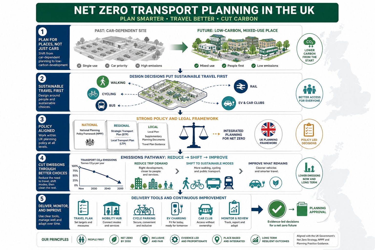
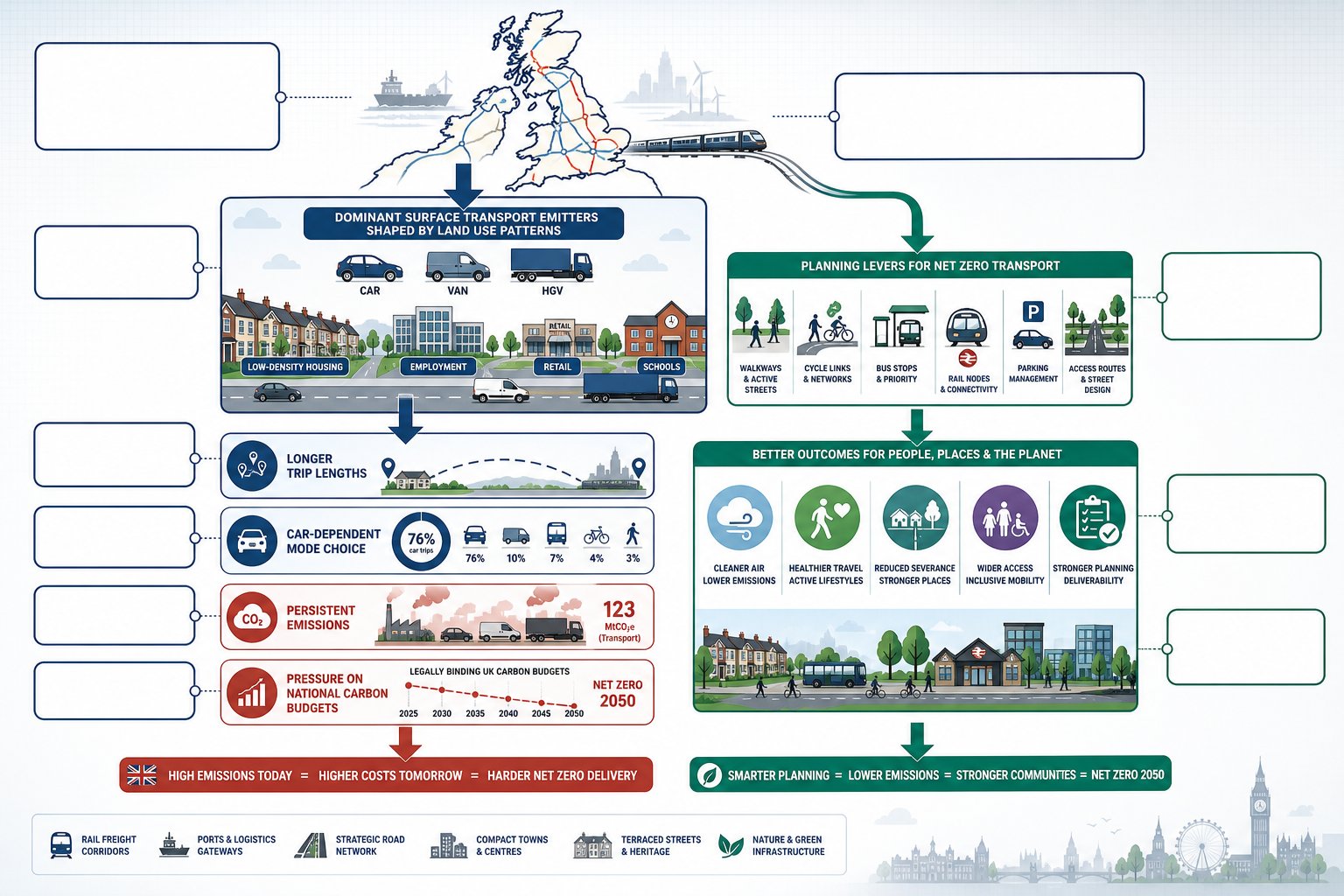
    UK infographic showing net zero transport planning from policy to site design.

    In UK terms, net zero transport planning means aligning transport-related planning decisions with the statutory target to reach net zero greenhouse gas emissions by 2050. In practice, that pushes us beyond the old question of whether residual traffic impacts are “severe”. We also need to ask whether a development pattern increases car dependence, whether trips can reasonably shift to walking, cycling and public transport, and whether remaining vehicle trips are being decarbonised.

    That changes the starting point. Instead of treating transport as a technical exercise in accommodating forecast demand, the planning process increasingly expects us to shape demand. The Transport Decarbonisation Plan, the Climate Change Act framework and local climate policies all point in the same direction: fewer unnecessary vehicle kilometres, more sustainable mode share, and support for zero-emission travel where trips still occur.

    Spatial planning is central to this. Site layout, land-use mix, density, frontage activity, permeability and proximity to services all influence carbon outcomes long before a junction model is built. A well-located scheme with direct pedestrian links and realistic bus access can materially reduce emissions. A remote, single-use, car-led layout usually does the opposite.

    For applicants, this means transport evidence should explain not only movement impacts, but the carbon logic of the proposal. That is often where early strategy work pays off, especially when access design, parking restraint and sustainable travel measures are coordinated from the start rather than revisited under pressure late in the application programme.

    Why Transport Planning Matters To Net Zero Targets

    UK transport planning infographic showing emissions sources, planning choices, and net zero outcomes.

    Transport planning matters because surface transport remains one of the UK’s biggest emitting sectors and, compared with electricity generation, progress has been frustratingly slow. Cars, vans, HGVs and the land-use patterns that generate their trips still dominate day-to-day emissions. If that trajectory does not change, other sectors have to decarbonise even faster to keep the country within its carbon budgets.

    This is why transport is no longer a side issue in planning policy. The way we locate housing, employment, logistics, education and retail directly affects trip lengths and mode choice. A development approved today may still be shaping commuting, servicing and school-run patterns in 2050. So a weak transport strategy is not just a highways problem: it is a carbon problem with a very long tail.

    There is also a practical development angle. Schemes that show a credible route to lower car use are often easier to defend in planning terms, especially in authorities with climate emergency declarations or strong local transport policies. That may involve active travel links, parking standards aligned with sustainable access, or a more coherent access strategy approach tied to the site’s context.

    And there is a broader public interest. Lower-carbon transport planning can improve air quality, support healthier travel, reduce severance and widen access for people who do not own a car. Net zero, in other words, is not a separate planning theme. It is tied to place quality, equity and deliverability.

    The Policy And Regulatory Framework Shaping Decisions

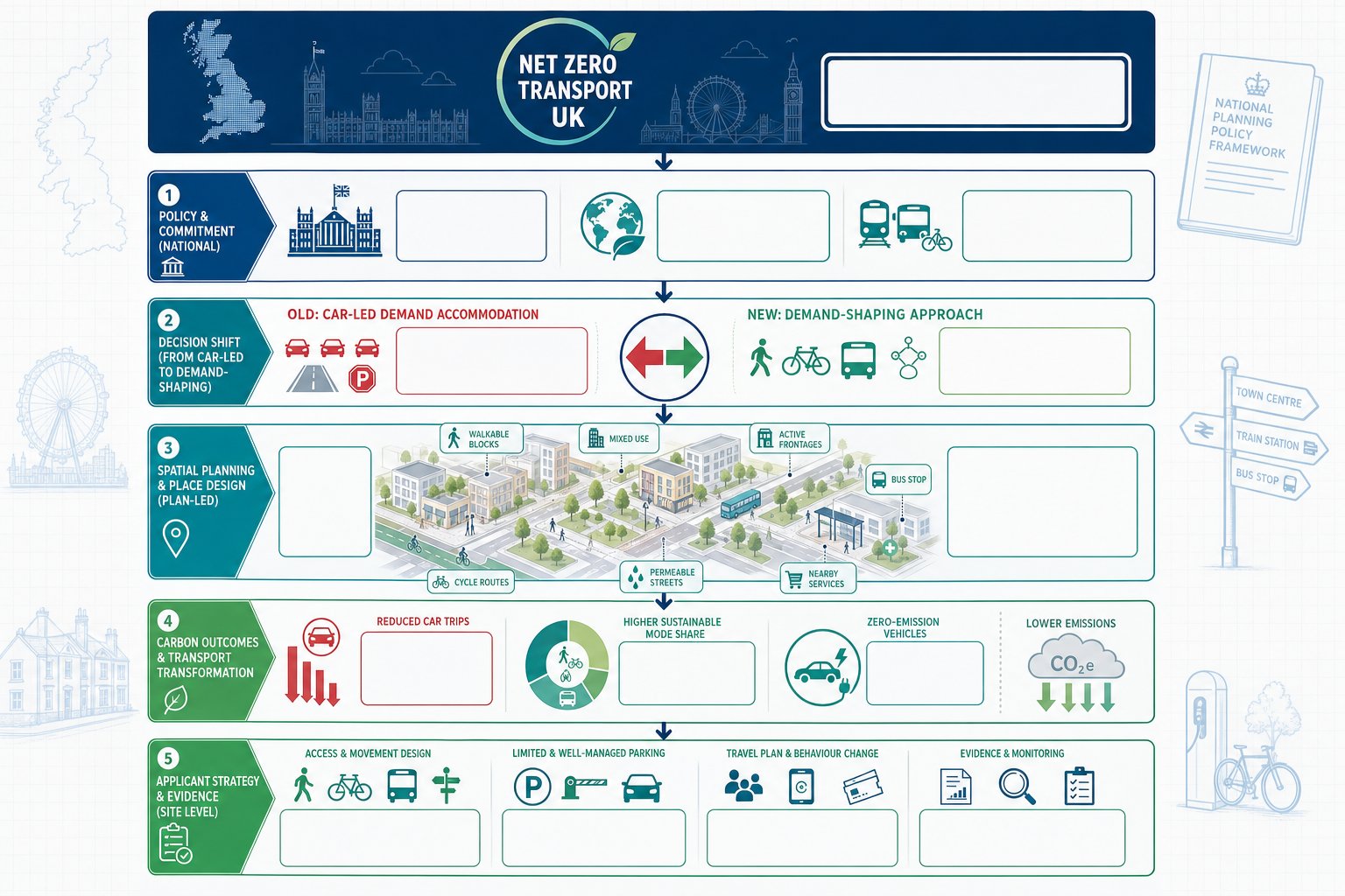
    UK net zero transport planning policy framework and decision-making flow infographic.

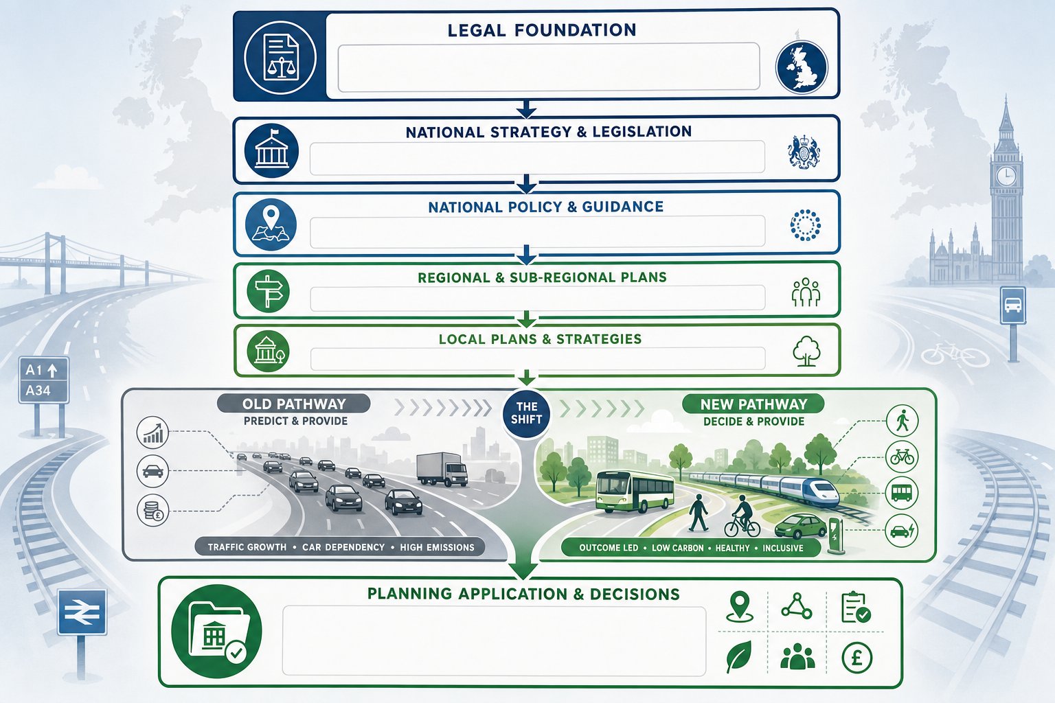
    The policy framework is now broad enough that net zero transport planning cannot be treated as optional gloss. At national level, the Climate Change Act 2008, as amended for the 2050 net zero target, sets the legal backdrop. The Transport Decarbonisation Plan then gives sector-specific direction, including the need to avoid unnecessary travel, shift more trips to public and active transport, and decarbonise the vehicles that remain.

    For planning decisions, this intersects with the National Planning Policy Framework in England and equivalent policy approaches across the UK nations. The common thread is familiar: developments should be focused on locations which can be made sustainable, opportunities to promote walking, cycling and public transport should be identified and pursued, and planning should support the transition to a low-carbon future.

    A more subtle but important shift sits underneath this. Transport planning is moving away from “predict and provide”, where growing traffic is accepted and accommodated, toward “decide and provide”, where networks and places are planned around desired outcomes. Those outcomes now include carbon reduction. So forecasting still matters, but it is no longer the whole story.

    For applicants, that means reports should read like planning documents, not just engineering appendices. Policy alignment needs to be explicit, especially where local authorities expect climate impacts to be addressed alongside traffic operation. This is often where experienced transport consultants add value: turning technical transport evidence into a planning-ready case.

    National, Regional And Local Planning Requirements

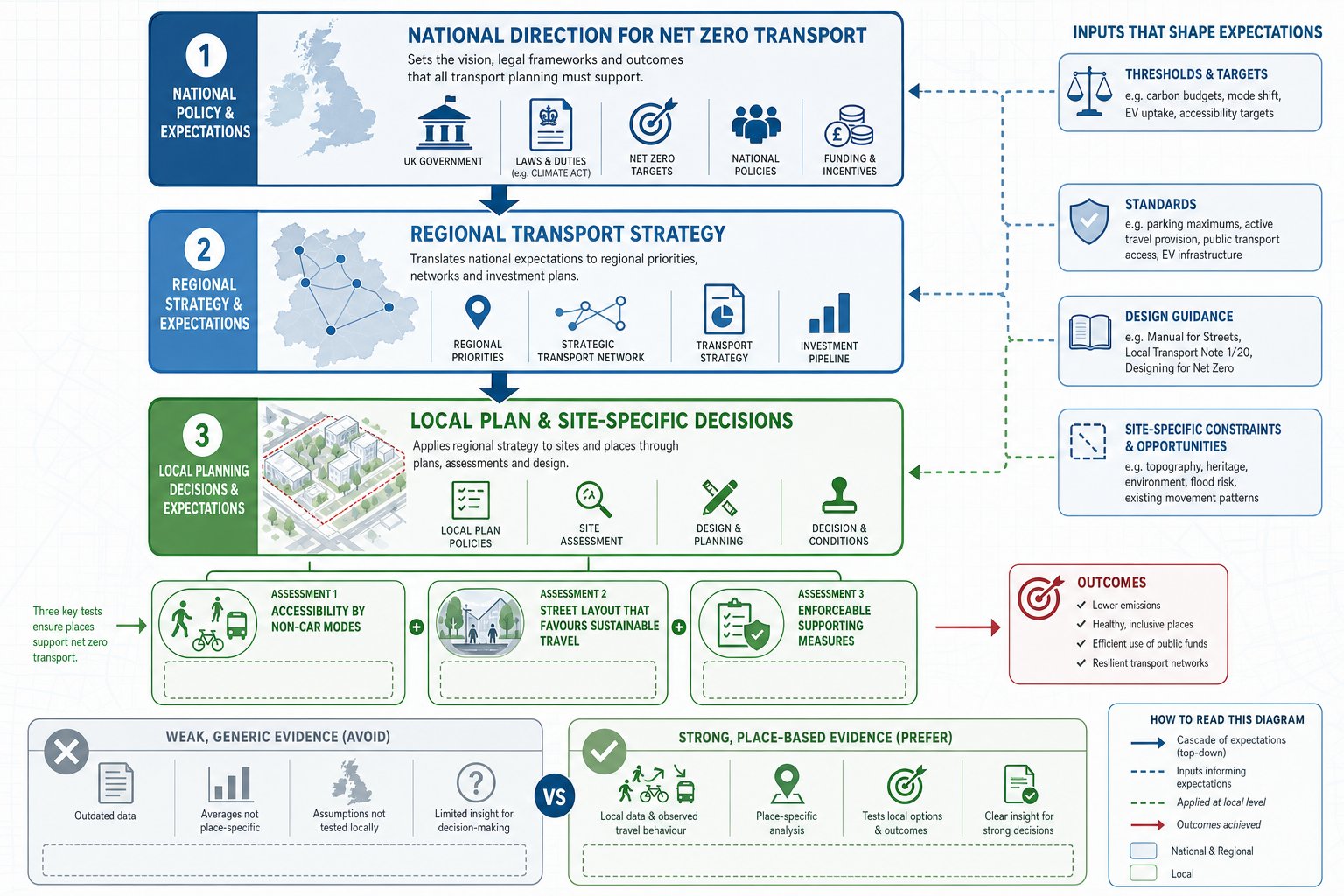
    UK planning hierarchy for net zero transport decisions and local site tests.

    National policy sets the direction, but most decisions are won or lost through regional and local interpretation. Combined authorities, county councils, unitary authorities and London boroughs increasingly embed decarbonisation in Local Transport Plans, movement strategies, parking standards, climate action plans and design guidance. Those documents may not all carry equal statutory weight, but together they shape what officers expect to see.

    At local level, we often find three practical tests. First, is the site genuinely accessible by non-car modes, not just theoretically served by them? Second, does the layout make sustainable travel the easiest option? Third, do the supporting documents commit the applicant to measures that can be monitored and enforced?

    This is where detail matters. A Local Plan allocation does not automatically mean the transport strategy is net zero aligned. Nor does proximity to a bus stop, if the walking route is indirect or the service infrequent. Councils are increasingly alive to those gaps.

    Good applications hence map national policy to regional strategy and then to local thresholds, standards and site-specific constraints. We have found that concise, authority-aware evidence often performs better than generic climate wording. It shows that the proposal has been designed for the place it sits in, which is exactly what decision-makers want to see.

    How Development Proposals Are Assessed For Transport Carbon Impacts

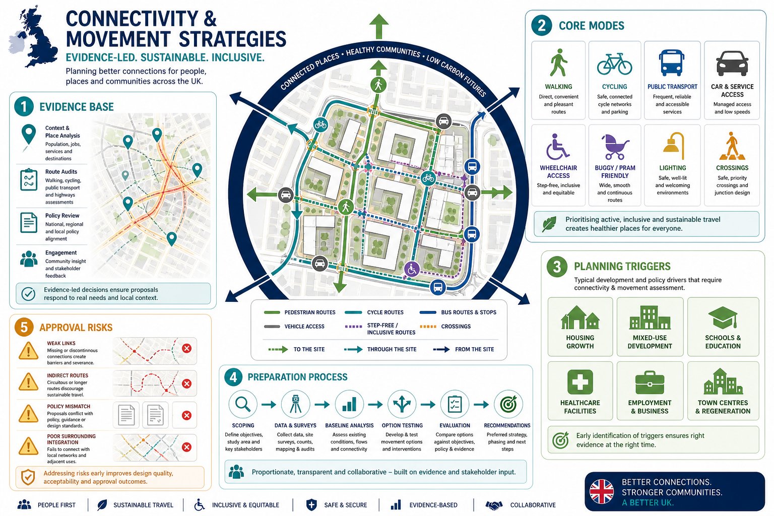
    UK transport carbon assessment process for development proposals and net zero planning.

    Transport carbon assessment is becoming more structured, even where formal methodologies still vary between authorities. In broad terms, decision-makers want to understand three things: how many trips a scheme will generate, how those trips are likely to be made, and what emissions follow from that travel profile.

    That sounds straightforward, but the quality of the answer depends heavily on assumptions. If trip rates are borrowed from highly car-dependent comparator sites, if mode share is left close to baseline even though strong intervention opportunities, or if the assessment ignores demand reduction measures, the carbon picture will skew badly.

    A robust approach usually starts with land-use context and accessibility. From there, we assess realistic trip generation, test mode share against local evidence, and explain how design and operational measures influence outcomes. For larger schemes, there may also be value in considering freight, servicing and construction movement strategies, because those can materially affect total transport emissions.

    Some authorities now expect carbon impacts to be addressed directly in the Transport Assessment, while others deal with them across planning, sustainability and energy statements. Either way, disconnects between the documents can cause trouble. If the sustainability narrative promises mode shift but the TA assumes car-dominant behaviour, objections become much more likely.

    And yes, embedded emissions from transport infrastructure are entering the conversation too, especially where highway works are extensive.

    Forecasting Trip Demand, Mode Share And Operational Emissions

    Traditional forecasting tools still have a role, but they need handling carefully in a net zero context. If we simply project historic traffic patterns forward, we risk baking past behaviour into future development. That is rarely enough in 2026, particularly on sites where policy clearly seeks lower car reliance.

    A better approach is scenario-led. We can test baseline demand, then examine how layout, mixed use, active travel links, bus improvements, parking levels, EV uptake and Travel Plan measures alter mode share over time. This does not mean inventing optimistic numbers. It means grounding forecasts in the interventions actually proposed and in decarbonisation trajectories already embedded in policy.

    Operational emissions can then be estimated from trip volumes, travel distances, likely vehicle mix and expected fleet transition. EV uptake matters, but so does total mileage. A scheme with slightly cleaner cars but substantially more car trips may still perform poorly from a net zero perspective.

    There is also a presentational point. Carbon forecasting should be intelligible to planners and committees, not just modellers. Clear assumptions, tested sensitivities and transparent caveats usually carry more weight than black-box outputs. We have seen applications improve considerably when the forecasting narrative is written to explain decision-relevant choices, not merely to document software runs.

    Designing Developments Around Sustainable Travel First

    If we are serious about net zero transport planning, design sequence matters. The most common mistake is to set the site up around vehicle circulation and parking, then try to insert walking, cycling and bus access afterwards. By that stage, the carbon outcome is largely locked in.

    A sustainable-travel-first approach begins with the shortest, most direct routes on foot and by cycle: to local centres, schools, employment, bus stops, stations and open space. It then looks at block structure, permeability, frontage quality, crossing points, gradients, overlooked paths and the simple question of whether people will actually want to use those routes in winter, with shopping, with children, at 7am.

    Mixed use and density also matter. Bringing homes, services and jobs closer together reduces trip lengths and supports viable public transport. Parking and vehicle access are still important, of course, but they should be resolved in ways that do not undermine those first principles.

    This is often where early coordination between architects, planners and transport specialists pays off. It is much easier to evidence low-carbon movement when the masterplan visibly supports it. In that sense, net zero transport planning is not just a reporting exercise. It is a site design discipline.

    Walking, Cycling, Public Transport And Mobility Hubs

    Walking and cycling provision carries an outsized share of the net zero burden because so many everyday trips are short enough to switch mode if the route feels safe, direct and obvious. That means continuous footways, low-stress crossings, secure cycle parking, coherent internal streets, reduced conflict with servicing, and links that connect to real destinations rather than ending neatly at the red line boundary.

    Public transport has to be treated with the same realism. A stop within nominal walking distance is not enough if service frequency is poor, journey times are uncompetitive or interchange feels awkward. Stronger schemes often show how the development supports public transport viability, whether through density, stop upgrades, routing changes, travel information or phased contributions.

    Mobility hubs are increasingly useful on larger or more urban sites. Done properly, they bring together bus or rail access, cycle hire, car-club spaces, lockers, parcel facilities, seating, wayfinding and EV charging in one recognisable place. The point is not trendiness. It is reducing friction in multimodal travel.

    These measures also support inclusion. Not everyone drives, can afford to drive, or wants to. A net zero transport strategy that improves independent mobility for more people is usually stronger planning, full stop.

    The Role Of Travel Plans In Delivering Long-Term Behaviour Change

    Travel Plans are sometimes treated as a postscript to the Transport Assessment. That is a mistake. In a net zero framework, they are one of the few mechanisms that can convert design intent into measurable long-term travel behaviour.

    A good Travel Plan does more than list aspirations. It identifies target groups, baseline conditions, specific interventions, monitoring periods, responsibilities, funding and triggers for action if outcomes slip. For residential schemes that may include welcome packs, public transport ticket offers, cycle vouchers, car-club membership, school travel support and parking management. For employment sites, it may extend to flexible working, season ticket loans, shower facilities, demand-responsive shuttle links or freight consolidation measures.

    The key word is credibility. If a planning application relies on mode shift to justify its transport and carbon case, the Travel Plan must show how that shift will actually be delivered and tracked. Without that, local authorities may reasonably conclude that the lower-car scenario is more hope than evidence.

    We often advise clients to develop the Travel Plan alongside the TA rather than after it. That way, assumptions on mode share, parking demand and mitigation line up properly, and the commitments can be framed in a way that supports both planning negotiation and long-term site management.

    Planning For Electric Vehicles Without Relying On Car-Led Schemes

    Electric vehicles are essential to decarbonisation, but they are not a licence to keep designing car-dominant places. That distinction matters. EVs reduce tailpipe emissions, yet they do not solve congestion, road danger, inactive travel patterns or the land-use inefficiency that comes with over-parking and vehicle-heavy layouts.

    So EV planning needs balance. We should provide charging infrastructure at homes, workplaces and shared locations where it is justified, but within a broader strategy that also reduces total car kilometres. On many schemes, that means pairing EV charging with parking restraint, car-club bays, robust active travel provision and realistic public transport access.

    There are technical questions too: grid capacity, passive versus active provision, management arrangements, accessibility of charge points, and how future demand will be phased. Poorly handled charging layouts can create operational headaches or consume valuable frontage and public realm.

    For planning purposes, the strongest position is usually to show that EVs are part of the answer, not the whole answer. A proposal that simply replaces petrol parking with electric parking may still struggle if the wider movement strategy remains fundamentally car-led. Authorities are increasingly alert to that nuance, and rightly so.

    Embedding Net Zero Principles In Transport Assessments And Statements

    A Transport Assessment or Statement written for 2026 should make net zero principles visible throughout, not confine them to a paragraph near the end. That starts with scoping: agreeing early what the authority expects on carbon, mode shift, EV provision, active travel, public transport and monitoring.

    From there, the document should explicitly align the proposal with national and local carbon objectives. It should explain how the site context, land use, layout and access strategy reduce the need to travel and support lower-emission modes. It should test parking and trip assumptions against those objectives. And it should show that mitigation is not limited to junction tweaks.

    In practical terms, that often means including a clear narrative on trip reduction, mode share targets, Travel Plan commitments, servicing strategy, EV infrastructure and any phased interventions. Where appropriate, it may also reference how developer transport advice can coordinate local thresholds, authority expectations and application timing.

    Most importantly, the TA should be internally consistent. If the drawings, sustainability statement and transport evidence all point in the same direction, the application feels deliberate. If they do not, officers notice. Usually quite quickly.

    Common Risks, Evidence Gaps And Reasons Schemes Face Objection

    Most objections in this area are not caused by the phrase “net zero” itself. They arise because the evidence does not support the claim. We regularly see the same pressure points.

    One is over-optimistic forecasting dressed up as sustainability. If the mode share assumptions are ambitious but the site has weak walking links, poor buses and generous parking, the authority may conclude the strategy is not deliverable. Another is the reverse problem: a highly car-based forecast on a site where policy clearly expects stronger mode shift. That can make the scheme appear out of step with both local policy and national decarbonisation direction.

    Evidence gaps around freight, servicing, construction traffic and infrastructure emissions also cause issues, especially on larger or more complex schemes. So does underplaying cumulative impact where several developments rely on the same constrained active travel or bus network.

    Travel Plans are another common weak spot. If monitoring is vague, funding unclear or remedial triggers absent, committees may see commitments as unenforceable. Parking can be similarly contentious: too much suggests car lock-in: too little without proper alternatives can look performative.

    In truth, most of these risks are manageable. But they need early, place-specific evidence and a willingness to test the uncomfortable question: does this scheme genuinely reduce transport carbon, or are we only describing it that way?

    Conclusion

    Net zero transport planning is now a core planning discipline, not a specialist add-on. In the UK context, it means bringing land use, movement and carbon strategy together from the earliest design stages, then evidencing that logic clearly through Transport Assessments, Statements and Travel Plans.

    For applicants and advisers, the direction of travel is clear. Stronger schemes reduce the need to travel, prioritise walking, cycling and public transport, support cleaner remaining vehicle trips, and avoid locking places into long-term car dependence. Just as importantly, they show how those outcomes will actually be delivered and monitored.

    That is what strengthens planning applications in 2026: not broad sustainability language, but a transport strategy that is policy-aligned, locally grounded and technically credible. When the movement strategy and the place strategy point the same way, objections become easier to answer and good development becomes easier to support.

    Net Zero Transport Planning FAQs

    What does net zero transport planning mean in the UK context?

    Net zero transport planning in the UK means making planning decisions that align with the statutory target of net zero greenhouse gas emissions by 2050, reducing trip lengths, car dependence, and vehicle emissions, while supporting zero-emission vehicles as outlined in the Transport Decarbonisation Plan.

    Why is transport planning crucial for achieving net zero targets?

    Transport is one of the UK’s largest emitting sectors with slow progress in decarbonisation. Effective transport planning reduces car dependency and travel demand, which is critical to meet carbon budgets and avoid increasing decarbonisation burdens on other sectors.

    How should developments be designed to support net zero transport goals?

    Developments should prioritise sustainable travel by placing homes, jobs, and services close together, creating permeable street networks, and providing high-quality walking, cycling, and public transport links before addressing car access and parking to avoid car-led patterns.

    What role do Travel Plans play in net zero transport planning?

    Travel Plans are essential for delivering long-term behaviour change by detailing specific interventions, monitoring, funding, and responsibilities, ensuring mode shift commitments are credible and enforceable throughout the development’s lifetime.

    Can electric vehicle provision alone achieve net zero transport planning objectives?

    No, while electric vehicles reduce tailpipe emissions, net zero transport planning requires combining EV infrastructure with strategies that reduce total car kilometres, such as parking restraint, car-club provision, and enhancing alternatives to car ownership.

    How are transport carbon impacts assessed in planning applications?

    Transport carbon assessment involves estimating trip generation, mode share, and emissions linked to travel profiles, referencing policy trajectories and local carbon plans, and ensuring consistent low-carbon design and operational measures are supported by credible evidence and monitoring.

  • Connectivity And Movement Strategies: A Practical Guide For Better Planning Outcomes In 2026

    Connectivity And Movement Strategies: A Practical Guide For Better Planning Outcomes In 2026

    Planning outcomes are rarely decided by traffic numbers alone. Increasingly, local authorities want to see how a scheme will actually work as a place: how people will arrive, move around, cross streets, reach bus stops, cycle safely, and navigate the site if they are pushing a buggy, using a wheelchair, or walking home after dark. That is where connectivity and movement strategies come in.

    For architects, planners, developers, surveyors and councils, a strong strategy does more than support an application. It helps shape the layout itself. Done well, it can reduce avoidable objections, improve design quality, and provide a clearer line of sight between policy, access, and deliverability. Done badly, it tends to expose weak links in a scheme very quickly.

    In our experience, the best connectivity and movement strategies are practical rather than abstract. They connect site constraints, local policy, transport evidence and place-making principles into one coherent framework. They also speak the language of decision-makers: clarity, proportionate evidence, and a visible commitment to sustainable and inclusive movement.

    In this guide, we set out what a connectivity and movement strategy is, when it is needed, what evidence underpins it, how it is prepared, and the issues that most often slow planning approval. The aim is simple: help project teams produce better planning submissions and better places, with less friction in the process.

    What A Connectivity And Movement Strategy Is And Why It Matters In Planning

    Infographic of integrated walking, cycling, transit and street connections in a development.

    A connectivity and movement strategy is a structured framework showing how people and vehicles will move to, from, and through a development, and how that movement ties into the wider network. In planning terms, it sits at the meeting point of transport, urban design and policy compliance. It is not just a drawing of access points or a broad statement that walking and cycling will be encouraged. It should explain the logic of movement across all modes.

    That means looking at walking routes, cycle links, bus access, vehicle access, servicing, emergency access and inclusive movement together rather than in isolation. For many schemes, especially residential, mixed-use, employment and town centre proposals, this joined-up view is central to planning acceptability.

    Why does it matter so much? Because movement influences almost everything else. It affects whether a place feels legible, safe and convenient. It affects whether people can realistically choose sustainable modes. It affects street design, parking pressure, junction performance, rights of way, frontage activity and environmental outcomes. And it often determines whether a local authority sees a proposal as policy-aligned or car-led.

    A robust strategy also helps avoid a common planning weakness: designing a site internally, then trying to justify its connections afterwards. We see the strongest outcomes when access and movement are considered early, with the layout responding to real desire lines and existing infrastructure rather than forcing awkward, indirect routes.

    How It Supports Sustainable Development, Access, And Place-Making

    At its best, a connectivity and movement strategy supports sustainable development in a very direct way. It prioritises short, direct and attractive routes for everyday trips, making it easier for residents, employees and visitors to walk, cycle or use public transport instead of defaulting to the car. That shift matters not only for carbon and air quality, but for the day-to-day usability of a scheme.

    It also improves access. A well-planned network gives people genuine choices, with routes that are easy to understand, well overlooked, and linked to the destinations that matter: schools, local centres, open space, bus stops, stations and neighbouring streets. The difference between a route that is technically available and one people will actually use is often huge.

    Place-making is the other big piece. Streets are not merely corridors for movement: they structure the development. A clear movement framework helps create legible street hierarchy, stronger frontages, better public spaces and more sociable environments. In other words, movement is not separate from design quality. It is one of the main ingredients of it.

    From a planning perspective, that alignment is powerful. Local authorities increasingly expect schemes to show that access, movement and place-making have been thought through as one integrated proposition, not as separate consultant workstreams stitched together at the end.

    When A Connectivity And Movement Strategy Is Needed For A Planning Application

    Infographic showing planning triggers and expectations for connectivity and movement strategies.

    Not every planning application requires a formal standalone connectivity and movement strategy, but many do in practice, either explicitly or because the issues are too important to leave underexplained. Major residential developments, mixed-use schemes, employment sites, education proposals, healthcare uses and town centre regeneration projects are the most common examples.

    The need usually becomes clearer where a development is expected to generate significant trips, alter existing access arrangements, interact with constrained streets, or rely on sustainable travel claims to support planning acceptability. In those cases, the strategy often works alongside a Transport Assessment, Design and Access Statement, Travel Plan or framework masterplan.

    We also see strategies requested where connectivity is itself a planning issue: perhaps a site sits near a rail station but lacks a direct pedestrian route, or it borders an existing neighbourhood with poor permeability, or there are concerns about severance, rights of way or school travel patterns. In those situations, decision-makers want more than capacity analysis. They want to understand how the development fits into the movement network around it.

    For applicants, there is a practical point here. Even where the local authority has not used the exact phrase “connectivity and movement strategy”, the expectation may still exist in local policy, design guidance, pre-application advice or officer feedback. Reading that early can save a lot of redesign later.

    Common Development Types, Triggers, And Local Authority Expectations

    Typical triggers include major residential applications, urban extensions, estate regeneration, larger commercial schemes, logistics or employment proposals, and mixed-use masterplans where the internal street network needs to be justified. Smaller sites can also trigger the need if they sit in sensitive or highly connected urban locations.

    Local authorities generally expect several things. First, clear integration with existing routes, including public rights of way, adopted highways, cycle corridors and nearby public transport. Second, a permeable street network rather than inward-looking cul-de-sacs or token links. Third, visible priority for sustainable and inclusive travel.

    They also expect consistency with adopted policy. In England, that often means alignment with the National Planning Policy Framework, local plan transport and design policies, parking standards, active travel guidance and any design code that addresses movement. Some councils are especially focused on healthy streets, 20-minute neighbourhood principles, school access, or reduced car dependence near public transport nodes.

    A recurring expectation, and one that is sometimes underestimated, is evidence. Officers and highway authorities want to see that proposed links, crossings, stop locations and access arrangements are grounded in actual site conditions and user needs. Assertions alone rarely carry much weight. The more a strategy can show its workings, the more persuasive it becomes.

    Core Principles That Shape An Effective Strategy

    Infographic of connected streets, travel modes, safety, and inclusive access in the UK.

    Effective connectivity and movement strategies tend to share a handful of core principles, regardless of site size. The first is connectivity itself: a fine-grain network with enough links and junctions to make movement direct rather than circuitous. If people must take a long detour to reach a bus stop or neighbouring street, many simply will not.

    The second is permeability and legibility. Routes should be easy to access and easy to understand. That sounds obvious, yet many plans still produce ambiguous paths, awkward thresholds or networks that only make sense on a consultant drawing. A good strategy should work in real life, for first-time visitors as well as regular users.

    The third principle is hierarchy. Not every street or route should do the same job. Primary streets, secondary streets, shared surfaces, cycle routes, pedestrian corridors and service areas each need a clear role. Without hierarchy, layouts become muddled and conflicts between modes tend to increase.

    Safety and security are equally important. That includes road safety, but also personal safety: lighting, natural surveillance, overlooked routes and avoiding spaces that feel isolated. Finally, inclusive access must be embedded from the start. It should not be treated as a compliance add-on.

    In our work, the most convincing strategies are the ones that balance these principles rather than over-optimising one at the expense of the others. A highly permeable layout that feels unsafe will struggle. So will a technically efficient vehicle layout that undermines walking and place quality.

    Walking, Cycling, Public Transport, Highway Access, And Inclusive Movement

    Walking should usually be the starting point. Short, direct, well-lit routes with safe crossings and minimal unnecessary level changes are often the clearest test of whether a site is genuinely connected. If the pedestrian route is awkward, the sustainable travel narrative quickly weakens.

    Cycling needs coherence, not just isolated bits of infrastructure. An effective strategy shows how cyclists enter the site, move through it, park securely, and connect to wider routes. That may involve segregated facilities, quieter low-speed streets, filtered permeability or improved crossings, depending on context.

    Public transport is about more than nearest-stop distance. We need to consider route quality to stops, service frequency, crossing opportunities, passive surveillance, waiting conditions and whether the stop locations align with real desire lines. A bus stop that is technically close but difficult to reach is not much of an asset.

    Highway access still matters, of course. Junctions must function safely and efficiently, and servicing, refuse and emergency access must be practical. But highway design should support the place rather than dominate it. Over-engineered geometries can weaken frontage quality, crossing comfort and speed control.

    Inclusive movement cuts across every mode. Step-free routes, manageable gradients, tactile paving, dropped kerbs, accessible parking, seating, rest points and clear wayfinding all matter. Good inclusive design is not niche: it makes places easier for everyone to use. And from a planning viewpoint, it is increasingly non-negotiable.

    The Evidence Base Behind A Robust Strategy

    Infographic showing evidence layers behind a UK connectivity and movement strategy.

    A strong connectivity and movement strategy is only as good as the evidence behind it. Planning officers and highway authorities are used to broad aspirations. What tends to influence them more is a strategy that is clearly rooted in baseline conditions, policy context and proportionate analysis.

    The evidence base usually starts with a site and context assessment. We need to understand the surrounding street network, crossing points, cycle provision, bus stops, rail access, rights of way, topography, frontage activity, safety constraints and any severance caused by major roads or barriers. Desire lines are particularly important. People do not move according to neat diagrammatic assumptions: they follow the routes that make sense to them.

    From there, baseline data helps test what is really happening. Depending on the scheme, that may include traffic counts, pedestrian and cycle flows, parking stress observations, accessibility mapping, collision data, service frequency data and school or town centre movement patterns. The amount of analysis should be proportionate, but it does need to be credible.

    Policy review is the other major pillar. The strategy should show how the scheme responds to national policy, local plan requirements, transport strategies and local design guidance. That policy thread matters because it turns technical analysis into planning justification.

    In practice, this is where experience helps. At ML Traffic, for example, our role is often to translate technical evidence into a concise planning narrative that aligns with local authority thresholds and expectations rather than producing data for data’s sake.

    Site Assessments, Baseline Data, Policy Review, And Movement Analysis

    Site assessments should look beyond the red line boundary. Some of the most important movement issues sit just outside it: missing footways, substandard crossings, barriers to nearby services, bus stop quality, informal desire lines across verges, or a right of way that has been forgotten in early layout work. These edge conditions often become key planning points.

    Baseline data should then quantify what the assessment suggests. We may need pedestrian, cycle and traffic surveys, queue observations, speed data, parking accumulation, public transport accessibility measures, or audits of walking and cycling routes. Collision records can reveal safety concerns that are not obvious from a single site visit. GIS and accessibility mapping can be especially useful for showing catchments and comparative route quality.

    Policy review should be explicit, not implied. The strategy should identify the transport and movement policies that matter, then show how the scheme responds to them. That may include sustainable transport, active travel, inclusive design, place-making, parking restraint or public realm objectives.

    Movement analysis brings those strands together. On some sites, that means straightforward route and access analysis. On others, it may extend to trip generation, junction capacity, swept path work, accessibility modelling or more advanced tools where the highway authority expects them. The point is not to overcomplicate things. It is to provide enough evidence to show that the preferred movement strategy is justified, workable and aligned with planning policy.

    How Connectivity And Movement Strategies Are Prepared

    Infographic showing stages of a connectivity and movement strategy process.

    Preparation usually begins long before the final report is written. The best strategies emerge through an iterative process that runs alongside site design, transport assessment and planning input. If movement is left until the layout is largely fixed, options narrow quickly and compromise becomes harder to avoid.

    The first step is scoping. We need to define the study area, relevant travel modes, key destinations, planning context and expected evidence requirements. On larger or more sensitive schemes, early discussion with the local planning authority and highway authority can be invaluable. It helps establish what level of detail is expected and where likely concerns sit.

    Next comes survey work and baseline review. That can include site visits, route audits, pedestrian and cycle surveys, traffic counts, accessibility mapping, public transport review and policy analysis. The purpose is not just to collect information, but to identify the site’s genuine movement problems and opportunities.

    Then we move into strategy development. Different access and network options are tested against practical criteria: safety, convenience, capacity, inclusivity, deliverability and policy fit. Sometimes the answer is obvious. Quite often, though, there is a real trade-off between layout efficiency, frontage quality, parking, servicing or off-site improvements.

    The final strategy should set out the preferred approach clearly, using plans and text that are detailed enough for planning but not so technical that the core story gets lost. A good document gives decision-makers confidence that the movement framework is coherent and implementable.

    From Scoping And Surveys To Option Testing And Recommendations

    Scoping is where we set the rules of the exercise. We identify what the authority is likely to want, what the site conditions suggest, and how the strategy will relate to the Transport Assessment, Travel Plan and design material. Getting this wrong can mean expensive rework later.

    Surveys and baseline studies provide the raw material. We typically review walking routes, cycle connectivity, public transport accessibility, highway conditions, collision history, parking, servicing constraints and inclusive access issues. Where needed, we also consider school travel patterns, peak-hour network stress or town centre footfall. Context matters.

    Once the baseline is clear, issues and opportunities can be mapped. Maybe there is a missing link to a bus stop, a poor crossing on a distributor road, an internal street that could become a key active travel corridor, or an opportunity to connect into an adjoining site. This is usually the most creative stage, because it is where problems become design options.

    Option testing then compares alternatives. We look at how each option performs in terms of route directness, safety, mode share potential, network operation, place quality and deliverability. Some options fail because they are weak technically. Others fail because they are unrealistic to deliver or out of step with policy.

    Recommendations should be practical and coordinated. That may include on-site links, crossing improvements, cycle parking, bus stop upgrades, junction changes, phased delivery, parking strategy and supporting Travel Plan measures. The strongest recommendations are specific enough to be useful, but flexible enough to sit comfortably within the planning stage of the project.

    Common Issues That Delay Approval And How To Avoid Them

    Most delays do not happen because authorities oppose connectivity and movement strategies in principle. They happen because the strategy is incomplete, inconsistent or unconvinving. One of the most common problems is weak baseline evidence. If important desire lines, local rights of way, nearby schools, bus links or safety issues are missing, consultees quickly lose confidence in the wider document.

    Another frequent issue is over-reliance on car access. We still see schemes where vehicle access is resolved in detail but walking and cycling links are vague, indirect or clearly secondary. That can be fatal to a planning case, especially where policy places strong emphasis on sustainable transport and healthy place-making.

    Poor integration with surrounding networks is another classic stumbling block. A site may function internally, yet fail to connect properly to neighbouring streets, greenways, bus stops or public rights of way. Authorities notice this straight away because it affects not just movement, but how well the development joins the existing place.

    Policy mismatch also causes delay. If a strategy does not clearly address adopted design guides, active travel policies, parking standards or accessibility requirements, officers may ask for revisions even where the technical work is otherwise sound. And inclusive access is too often underplayed, treated as a detail for later stages rather than a core design principle.

    The fix, in most cases, is straightforward: start earlier, gather better evidence, and make the sustainable and inclusive movement story visible throughout the scheme rather than confining it to a few paragraphs.

    In practical terms, we recommend five checks before submission:

    • confirm the study area captures all relevant external links and constraints:
    • test whether pedestrian and cycle routes are genuinely direct and attractive:
    • cross-check the strategy against local policy and design guidance:
    • ensure inclusive access is embedded in plans, not left to general statements:
    • align the strategy with the Transport Assessment, Travel Plan and site layout.

    Those checks sound basic, but they prevent a surprising amount of planning friction. And they help create reports that answer the authority’s likely questions before they are asked.

    Conclusion

    Connectivity and movement strategies have become a core part of better planning submissions because they deal with a core planning question: will this development function as a connected, accessible and sustainable place? For many schemes in 2026, that question carries as much weight as conventional traffic impact analysis.

    A persuasive strategy is grounded in evidence, aligned with policy, and clear about how walking, cycling, public transport, highway access and inclusive movement work together. It should explain not only how people can move, but how they are likely to move in reality.

    For architects, planners, developers and councils, the value is practical. Better strategies support better layouts, stronger planning narratives and fewer avoidable delays. And when prepared early enough, they often improve the design itself.

    That is really the point. Connectivity and movement are not just technical matters to be signed off near submission. They are fundamental to place-making, planning acceptability and long-term usability. Treat them that way, and the planning process usually goes far more smoothly.

    Connectivity and Movement Strategies – Frequently Asked Questions

    What is a connectivity and movement strategy in planning?

    It is a structured plan showing how people and vehicles move to, from, and within a development, integrating walking, cycling, public transport, vehicles and inclusive access, and connecting these to the wider transport network.

    Why are connectivity and movement strategies important for sustainable development?

    They prioritise short, direct routes that encourage walking, cycling and public transport use, reducing car dependency and carbon emissions while enhancing access, safety and the liveability of places.

    When is a connectivity and movement strategy typically required for a planning application?

    Such strategies are needed for major residential, mixed-use, employment and town centre schemes, especially where developments generate significant trips or affect existing transport networks and policy compliance is required.

    What are the core principles of an effective connectivity and movement strategy?

    Key principles include a connected fine-grain network, permeability and legibility of routes, clear street hierarchy, safety and security measures, and inclusive access for all users from the outset.

    How do connectivity and movement strategies support inclusive access?

    They ensure step-free routes, manageable gradients, tactile paving, accessible entrances and parking, making movement easier for people of all ages and abilities as a central design feature.

    What common issues cause delays in planning approval related to connectivity strategies, and how can they be avoided?

    Delays often result from weak baseline evidence, overemphasis on car access, poor network integration, policy misalignment, and insufficient inclusive access. Early, comprehensive evidence gathering and clear sustainable design help avoid these problems.

  • Commercially Viable Transport Advice: How To Balance Planning Success, Cost And Deliverability In 2026

    Commercially Viable Transport Advice: How To Balance Planning Success, Cost And Deliverability In 2026

    A transport report can be technically flawless and still be commercially wrong. We see that more often than many teams expect. A scheme may satisfy a checklist, model every movement to exhaustion and recommend a belt-and-braces mitigation package, yet still damage land value, stretch programme, complicate delivery or invite conditions that make the development harder to build and operate.

    That is why commercially viable transport advice matters. In planning and development, the goal is not simply to produce a compliant document. It is to give decision-useful advice that helps secure consent, protects the scheme’s economics and remains deliverable in the real world. For architects, planners, lawyers, surveyors, developers and local authorities, that means transport input has to do three jobs at once: stand up technically, satisfy policy and support the business case.

    In 2026, that balance is even more important. Authorities are under pressure on active travel, safety, climate and place-making, while applicants face tighter margins, programme risk and increasing scrutiny of evidence. So the right answer is rarely the biggest assessment or the cheapest one. It is the proportionate one.

    In this guide, we set out what commercially viable transport advice actually means, where schemes commonly go wrong, when a Transport Statement, Transport Assessment or Travel Plan is likely to be needed, and how to choose advice that is robust without becoming over-engineered. The aim is simple: help teams make better planning decisions earlier, with fewer surprises later.

    What Commercially Viable Transport Advice Means In Planning And Development

    Transport consultant reviewing site plans and viability strategy in a modern office.

    Commercially viable transport advice is transport planning input that secures permission and supports safe, policy-compliant operation without undermining project cost, programme, marketability or long-term income. That definition matters because transport is not an isolated planning workstream. It affects site capacity, frontage design, servicing, basement layouts, build cost, phasing, legal agreements and, sometimes, whether a scheme stacks up at all.

    In practical terms, we are looking for advice that aligns with the development’s business case rather than chasing technical perfection for its own sake. A viable approach asks a few grounded questions early. What level of assessment is genuinely needed? What are the real transport risks? Which mitigation items are essential for permission, and which are simply nice to have? Can the proposed access, parking and servicing strategy be delivered within the land available, the budget allowed and the programme envisaged?

    That often means proportionate scoping. A modest infill scheme does not always need a heavyweight modelling exercise. Equally, a strategic mixed-use site should not be supported by a thin report that avoids obvious issues. The commercially sensible route sits between those extremes.

    This is also where experienced judgement counts. At ML Traffic, and across good development-planning practice generally, the strongest advice is usually concise, accurate and tailored to local authority thresholds, local policy and the actual scale of the proposal. It is not about producing the longest report. It is about producing the right one.

    Why Viability Matters As Much As Technical Compliance

    Planning team reviewing transport strategy, costs, and development layout in office.

    Technical compliance is essential, but it is not the whole test. A planning application can still struggle if the transport strategy creates disproportionate cost, consumes developable land or triggers obligations that are out of step with the value of the scheme. We have all seen cases where a technically defensible recommendation ends up weakening the very development it is meant to help unlock.

    The classic example is gold-plating. A scheme with manageable impacts is assessed as though it were a major strategic allocation, leading to unnecessary junction upgrades, over-designed access works, excessive parking provision or modelling exercises that add time without changing the planning outcome. None of that is free. It can increase capex, extend design coordination, delay determination and complicate legal agreements.

    But the opposite mistake is just as damaging. If transport input is under-scoped, obvious concerns around traffic, visibility, safety, servicing or active travel can surface late, often through consultee responses. Then the team is forced into reactive redesign, fresh surveys, supplementary notes or committee deferral. That is rarely cheaper in the end.

    So viability matters because transport advice influences both consent and commercial performance. A sound strategy should meet policy tests and highway authority expectations while protecting density, layout efficiency and deliverability. In other words, the transport answer has to work on paper and on the appraisal. If it fails either test, it is not really fit for development planning.

    The Commercial Risks Of Over-Engineering Or Under-Scoping Transport Input

    UK transport planning team reviewing balanced development and road design options.

    Over-engineering and under-scoping are opposite errors, but they often come from the same place: poor calibration at the start.

    Over-engineering usually shows up as a transport response that is larger than the planning risk justifies. That might mean oversized junction layouts, road widening with significant land take, signalisation where simple priority control would likely suffice, or parking levels driven by caution rather than market reality and policy context. On constrained sites, that can be particularly harmful. Every extra metre given to highway works may be a metre taken from frontage quality, landscaping, active travel provision or even saleable floor area.

    There is also a quieter cost. Over-engineered advice can harden expectations. Once a mitigation package appears in a report, it becomes difficult to unwind, even if later discussions suggest a lighter-touch solution would have worked.

    Under-scoping carries different risks. A report may rely on limited data, avoid junction testing that the authority plainly expects, skim over school-run impacts, ignore collision patterns or treat servicing as an afterthought. Those gaps are exactly where objections tend to land. And when they do, the consequences are commercial as well as technical: determination delay, redesign fees, extended holding costs, more consultant time and, in some cases, reduced confidence from funders or buyers.

    The best commercially viable transport advice avoids both traps. It identifies what matters most, tests those issues properly and stops where additional complexity no longer improves decision-making. That sounds simple. In practice, it is one of the hardest judgement calls in the planning process.
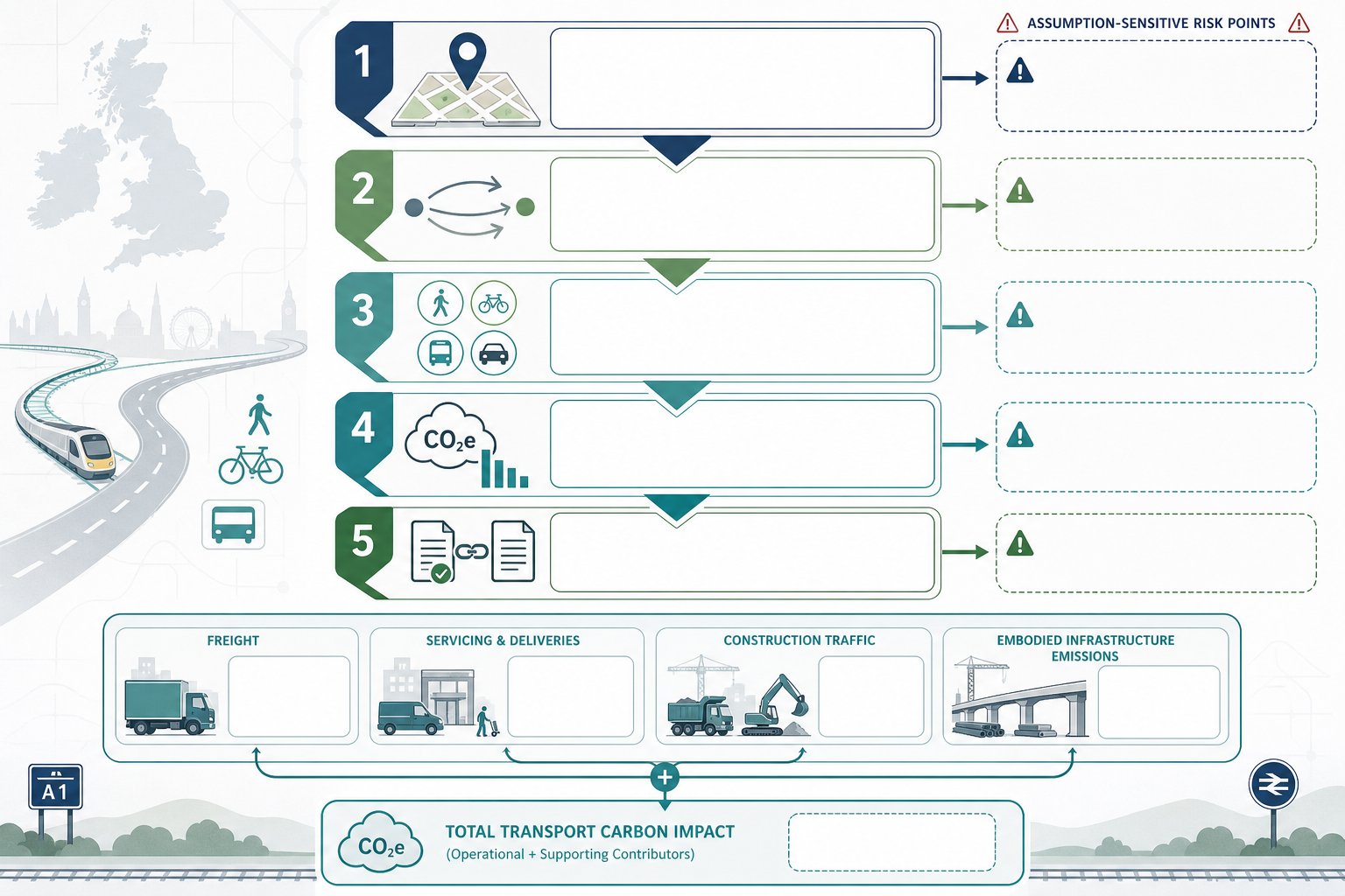
    Key Factors That Shape A Viable Transport Strategy

    Transport consultants reviewing a UK site strategy in a modern office.

    A viable transport strategy is shaped by context long before any report is drafted. The same development quantum can be entirely acceptable on one site and highly contentious on another because transport planning is local, policy-driven and deeply tied to physical constraints.

    At the outset, we need to understand not just likely traffic impact, but what type of evidence the site will demand, how the authority tends to respond, and which issues could affect layout, cost and planning timescales. That context determines whether the sensible answer is a straightforward statement, a fuller assessment, a phased mitigation package or, occasionally, a rethink of the scheme assumptions themselves.

    Two areas usually drive the biggest differences: the site’s transport characteristics and the authority’s policy and validation expectations. If either is misread, the strategy can quickly become either too light or too burdensome.

    Site Location, Access Constraints And Local Highway Sensitivities

    Site location is not just a map pin. It shapes trip patterns, mode choice, junction pressure and the realism of sustainability claims. A site near frequent public transport, walkable services and established cycle routes may support lower parking levels and stronger active travel measures. A car-dependent edge-of-settlement site may need a more cautious strategy on access, servicing and mode shift assumptions.

    Access constraints are equally important. Visibility, gradients, frontage width, third-party land, nearby junctions, existing TROs and the ability to accommodate refuse vehicles or emergency access can all alter viability. Sometimes the issue is not whether access can be designed, but whether it can be delivered without expensive off-site works or land assembly.

    Local highway sensitivities add another layer. Congestion hotspots, school frontages, collision clusters, AQMA locations, bus corridors and freight routes often attract attention from consultees. If a scheme sits near one of those pressure points, the commercially sensible response is to address it early and proportionately, not hope it passes unnoticed.

    Planning Policy, Validation Requirements And Authority Expectations

    Policy and local validation requirements can make or break transport strategy. National guidance sets broad principles, but local plans, parking standards, street design documents, active travel policies and area-based strategies often drive the detailed ask. Some authorities are pragmatic and proportionate. Others are highly process-led. Either way, we need to know the ground rules before scoping work.

    Validation checklists are especially important because they can turn a technically minor issue into a programme problem. If an authority expects a Travel Plan above certain thresholds, or junction analysis for specific uses and scales, omitting it can delay registration or trigger immediate requests for more information.

    Authority expectations also evolve. In 2026, many councils place greater weight on walking, cycling and public transport integration, even on sites that would historically have been considered mainly vehicular. That does not always mean expensive intervention. But it does mean the transport narrative must show how the development supports policy objectives in a credible, site-specific way.

    A commercially realistic strategy hence does two things at once: it meets what is likely to be asked for, and it resists unnecessary additions that do not materially affect the planning outcome.

    When A Transport Statement, Transport Assessment Or Travel Plan Is Needed

    Transport consultants reviewing planning documents and site maps in a modern UK office.

    This is one of the most common early questions on a project, and the honest answer is: it depends on scale, use, context and local authority practice. Still, there are reliable rules of thumb.

    A Transport Statement (TS) is typically suitable for smaller schemes with relatively modest trip generation and limited expected impact on the surrounding network. Its job is to explain existing conditions, likely demand, access arrangements, parking, servicing and any local transport considerations without the depth of a full strategic assessment. For many minor residential, commercial or change-of-use schemes, that is enough, provided the site is straightforward and there are no unusual sensitivities.

    A Transport Assessment (TA) is usually needed for larger or more complex proposals where traffic, capacity, safety or cumulative impacts may be material. Mixed-use sites, larger housing developments, schools, logistics uses, healthcare schemes and developments near constrained junctions often fall into this category. A TA should be evidence-led and proportionate, not automatically maximalist. The objective is to test the issues that matter, with the right level of analysis for decision-makers.

    A Travel Plan (TP) is commonly expected where authorities want a clear framework for encouraging sustainable travel and managing car use. Major employment, education and residential schemes are typical examples, as are sites in town centres, transit-oriented locations or areas with strong active travel policy. A Travel Plan can be standalone or embedded alongside a TS or TA.

    The key is early agreement on scope where possible. Thresholds vary, and local practice matters. We would rather confirm expectations upfront than produce the wrong level of document and lose weeks correcting course.

    How Early Transport Advice Can Reduce Delay, Redesign And Application Risk

    Early transport advice is rarely about producing a full report at day one. It is about identifying the issues that could affect land deals, concept design, application strategy and determination risk before the project hardens around the wrong assumptions.

    The biggest value is often in spotting fatal flaws, or near-fatal flaws, early enough to respond sensibly. Can the required visibility be achieved? Is a suitable access geometry realistic within the red line? Is there likely to be junction pressure that affects achievable unit numbers or use mix? Are there public transport or active travel gaps that need to be addressed in design rather than patched over later in narrative? These are not academic questions. They can change whether a scheme is buyable, plannable and fundable.

    Early advice also helps avoid repeated redesign. If transport input comes in after layout freeze, even a modest change to access, parking, servicing or swept paths can ripple through architecture, landscape, drainage and viability. That is when programmes slip and fees multiply.

    From a planning perspective, early work sharpens the application strategy. It helps determine whether pre-app engagement is worth pursuing, what evidence package is likely to be needed and which consultee concerns should be addressed proactively. It can also improve first-time approval prospects by reducing surprise objections and keeping conditions manageable.

    In short, commercially viable transport advice is not merely a submission-stage product. Its real value often appears much earlier, when the cost of changing direction is still relatively low.

    Core Elements Of Advice That Is Both Robust And Commercially Realistic

    Advice that is both robust and commercially realistic has a clear purpose: it should tell the team what the transport risks are, what evidence is needed, what mitigation is likely to satisfy decision-makers and what all of that means for layout, cost and programme.

    That starts with defining the problem properly. Is the real issue junction capacity, road safety, access geometry, parking pressure, servicing conflict, sustainability narrative or cumulative impact? Too many transport workstreams become bloated because they never isolate the actual planning questions. Once the issue is clear, the evidence can be scoped proportionately.

    Data collection and modelling should be aligned with authority standards and the complexity of the site, but not expanded automatically. There is no value in commissioning elaborate testing that does not alter the design response or decision risk. Equally, if sensitivity testing could materially affect mitigation, phasing or obligations, it should not be skipped.

    Commercial realism also means thinking beyond the report. Mitigation needs to be costed, phased and deliverable. If works depend on third-party land, off-site agreements or substantial Section 278 intervention, that needs to be understood early. If measures are likely to sit in Section 106 obligations or planning conditions, the strategy should reflect how that affects implementation risk.

    In good practice, robust advice does not create complexity to prove seriousness. It reduces uncertainty enough for confident planning and investment decisions.

    Trip Generation, Distribution And Junction Impact Without Unnecessary Complexity

    Trip generation, distribution and junction analysis often become the most contested parts of a transport submission, so this is where proportion really matters. The objective is not to run every conceivable scenario. It is to produce a transparent and defensible picture of likely impact.

    That usually means selecting appropriate land-use assumptions, using recognised industry databases and applying realistic local adjustments where justified. Distribution should reflect how people and vehicles are actually likely to travel, not simply a generic split carried over from another project. And if the authority has known preferences on study area or modelling approach, those should be considered early rather than argued over late.

    Junction testing should focus on locations where there is a plausible planning concern. Testing a string of peripheral junctions with no meaningful link to the proposal may look thorough, but often adds time and noise rather than insight. By contrast, failing to assess the one sensitive junction everyone knows is already under pressure is asking for trouble.

    Sensitivity testing has its place too, particularly where development phasing, background growth or committed schemes may alter the picture. But the litmus test is simple: will this additional analysis change the planning risk or mitigation decision? If not, it may be theatre rather than strategy.

    Access Design, Parking, Servicing And Active Travel Considerations

    These are the elements that most obviously bridge planning policy and commercial reality because they directly shape the physical scheme.

    Access design must work safely and credibly, with suitable geometry, visibility, pedestrian and cycle interaction, tie-in to the existing highway and emergency access where relevant. But it also has to fit the site. A theoretically elegant access arrangement that consumes frontage, interrupts active uses or requires disproportionate off-site reconstruction may be a poor commercial answer.

    Parking strategy needs similar balance. Under-provision can trigger market resistance, overspill concerns and political pressure. Over-provision can suppress density, increase build cost and undermine active travel arguments. The right approach sits between local policy standards, actual likely demand and the locational strengths of the site.

    Servicing is another area where schemes can come unstuck. Loading, refuse collection, delivery timing and turning requirements must be considered early, especially for mixed-use, urban and constrained sites. It is surprising how often a seemingly minor servicing oversight unravels an otherwise tidy layout.

    And active travel is no longer a token paragraph. Safe, direct walking and cycling links, secure cycle parking and sensible integration with public transport are now central to many authorities’ expectations. Done well, they strengthen the planning case without excessive cost. Done badly, they can weaken both policy compliance and scheme quality.

    How To Choose A Transport Consultant Who Understands Planning Commerciality

    Not every technically capable transport consultant is strong on planning commerciality. The difference matters.

    A consultant who understands development planning will not just ask what report is needed. They will ask what the scheme is trying to achieve, where the real planning risks sit, how the site may evolve, what the authority is likely to focus on and how transport advice affects value, density, phasing and deliverability. That broader view is often what prevents expensive missteps.

    We would look for a few specific qualities.

    First, relevant experience securing permission for similar schemes in comparable planning contexts. Development transport planning is not the same as pure highway design or network strategy. Track record matters.

    Second, an ability to scope work proportionately. Good advisers know when a concise, accurate Transport Statement is enough and when a fuller Transport Assessment is unavoidable. They do not default to unnecessary modelling just to appear comprehensive.

    Third, strong negotiation skills with highway and planning authorities. Many projects are won or lost in the quality of that dialogue. The best consultants can defend a proportionate position without becoming combative.

    Fourth, clarity. You need risk-based advice in plain English, not a report that hides commercial implications behind technical jargon.

    For teams seeking concise and locally tuned reporting, firms such as ML Traffic position themselves around exactly that blend of speed, accuracy and authority-aware scoping. Whatever consultant is appointed, the core question is the same: do they understand not only transport standards, but what makes a scheme viable in the first place?

    Conclusion

    Commercially viable transport advice is not the cheapest option, and it is not the most elaborate one either. It is the advice that helps a development secure permission, operate safely and meet policy expectations while still protecting cost, programme, layout efficiency and long-term value.

    For project teams in 2026, that means being deliberate from the start. Scope transport input around real planning risk. Test the issues that matter. Avoid gold-plated mitigation that erodes viability, but do not underplay concerns that will simply resurface later as objections, conditions or redesign.

    The strongest outcomes usually come from early, proportionate and commercially aware transport planning, the kind that links trip impact, access, parking, servicing and active travel back to the business case as well as the policy framework. Get that balance right, and transport becomes an enabler of planning success rather than a late-stage obstacle. Get it wrong, and even a technically competent submission can become far more expensive than it first looked.

    Commercially Viable Transport Advice – Frequently Asked Questions

    What is commercially viable transport advice in planning and development?

    It is transport planning input that secures permission, operates safely and in line with policy, while protecting project cost, programme, marketability and long-term revenue.

    Why is commercial viability as important as technical compliance in transport advice?

    Because over-engineering can inflate costs and harm development value, while under-scoping can cause delays, redesigns and possible refusals, both affecting the project’s success.

    When is a Transport Statement, Transport Assessment or Travel Plan required?

    A Transport Statement suits smaller schemes with low impact, a Transport Assessment is for larger or complex developments with material impacts, and a Travel Plan is needed where authorities expect sustainable travel measures.

    How can early transport advice reduce delays and risks in development projects?

    By identifying fatal flaws early on, informing site layout and planning strategy, and avoiding costly redesigns or planning objections, thus improving first-time approval chances.

    What factors shape a commercially viable transport strategy?

    Key factors include site location, access constraints, local highway sensitivities, and local planning policy and validation requirements that guide appropriate scope and solutions.

    How should I choose a transport consultant with strong planning commerciality?

    Look for experience securing permissions in similar schemes, understanding of developer economics, negotiation skills with authorities, ability to scope work proportionately, and clear, risk-based advice.

  • Private Sector Transport Planning In 2026: How Developers Can Strengthen Planning Applications And Reduce Risk

    Private Sector Transport Planning In 2026: How Developers Can Strengthen Planning Applications And Reduce Risk

    Planning risk rarely begins on committee day. More often, it starts months earlier, when a site is promoted without testing access properly, when parking is sketched before policy is reviewed, or when a development team assumes transport can be “sorted later”. In our experience, that’s where costs creep in and avoidable objections take shape.

    Private sector transport planning sits right in the middle of that risk picture. For developers, landowners and project teams, it is the practical process of proving that a scheme can work on the ground: safely, efficiently and in line with national and local policy. Done well, it can sharpen site layout, improve negotiations with councils and highways officers, and give planning applications a much stronger footing. Done badly, it can delay validation, trigger redesign, or undermine an otherwise good proposal.

    In 2026, the bar is not necessarily about producing more paperwork. It is about producing the right level of evidence, at the right time, in a form that local planning authorities can actually rely on. That means proportionate reporting, credible survey data, realistic modelling, and transport strategies tied closely to design, sustainability and deliverability.

    Below, we set out what private sector transport planning covers, how schemes are assessed, the reports and evidence that matter most, and how developers can scope a transport strategy that strengthens an application rather than simply reacting to problems late in the process.

    What Private Sector Transport Planning Covers

    Transport planning team reviewing a UK development site access plan.

    Private sector transport planning is broader than writing a Transport Assessment shortly before submission. At its best, it supports the full development lifecycle: early feasibility, planning strategy, negotiation, detailed design and, sometimes, appeal evidence.

    For developers and landowners, the core question is simple: can the proposed development be accessed safely and sustainably without creating unacceptable effects on the surrounding network? Answering that properly involves several technical strands.

    Typical work includes site access reviews, visibility assessments, trip generation, junction capacity testing, active travel audits, parking analysis, servicing strategy, refuse and emergency access checks, and construction traffic planning. On larger or more sensitive sites, we may also need network modelling, signal junction review or phased mitigation advice. This is why many teams bring in Developer Transport Consultants: What early, rather than treating transport as a late planning add-on.

    There is also a commercial layer. Good transport advice is not just about satisfying policy: it is about protecting site value and avoiding design choices that become expensive to reverse. In practice, private sector transport planning often sits between architecture, planning, civil engineering and viability, translating technical constraints into workable decisions.

    Why Transport Planning Matters Early In The Development Process

    Transport planning team reviewing a UK development layout in a modern office.

    Early transport input changes outcomes. That sounds obvious, but it is surprising how often transport is still commissioned after the layout is largely fixed. By then, options narrow quickly.

    At concept stage, transport planning helps test whether a site can support the proposed quantum and mix of development. A simple access constraint, substandard visibility, a nearby congested junction or a local parking restriction can alter what is realistically deliverable. If we identify those issues early, the team can adapt the layout, adjust unit numbers, rework servicing or phase mitigation before the application hardens.

    This is also where proportionate advice matters. Developers do not need every site to be burdened with elaborate modelling. They do need enough analysis to spot show-stoppers and shape a sensible submission route. That balance sits at the heart of Property Development Transport: enough evidence to de-risk the scheme, without wasting time or budget on unnecessary work.

    Early involvement also improves coordination. Architects can protect pedestrian routes and vehicle tracking space from the start. Planning consultants can align statements with transport policy. Lawyers can anticipate likely conditions or Section 106 and Section 278 obligations. Put bluntly, early transport planning is usually cheaper than late redesign.

    How Private Sector Schemes Are Assessed By Local Planning Authorities

    Transport planning professionals reviewing a UK development proposal in a modern office.

    Local planning authorities and highway authorities do not assess transport documents in a vacuum. They are looking at whether the proposal would have a severe residual cumulative impact, whether access is safe, whether the transport strategy aligns with policy, and whether any mitigation is realistic and enforceable.

    In practical terms, officers usually focus on four themes.

    First, highway safety. That includes access geometry, visibility splays, pedestrian crossings, cycle conflict points, servicing movements and collision history. Second, network operation. They will consider traffic generation, peak-hour effects, junction capacity and whether committed development has been taken into account. Third, accessibility. A scheme that relies entirely on private car use, even though being in a location with realistic walking, cycling or public transport opportunities, may struggle. Fourth, policy compliance: local parking standards, design guides, Local Plan policies, and national guidance all matter.

    The level of scrutiny varies by authority and site context. A modest infill residential scheme in a low-sensitivity location may only need a concise statement. A mixed-use or roadside commercial proposal near constrained junctions will face more detailed review. When local context matters, location-specific insight can make a difference, especially in places with distinct authority expectations such as Traffic Engineer In Leeds: or comparable metropolitan areas.

    The key point is that authorities expect transport evidence to be proportionate, but also credible. Thin analysis is rarely persuasive.

    Core Transport Reports Used In Planning Applications

    Transport planners reviewing assessment, statement, and travel plan documents in an office.

    Most private sector planning submissions rely on one or more core transport reports. The right choice depends on scheme scale, local thresholds, likely impact and policy context. Getting this wrong can create delay before the application is even fully considered.

    Transport Assessment

    A Transport Assessment, or TA, is the more detailed option. It is normally required for larger developments or sites likely to create material transport effects. A TA looks at existing conditions, forecast trips, trip distribution, junction performance, sustainable travel opportunities, access design and mitigation.

    A good TA does more than present numbers. It tells a coherent story about how people and vehicles will reach the site, what the likely impacts are, and why those impacts are acceptable or can be mitigated. That often includes sensitivity testing, committed development review and a clear explanation of assumptions.

    Transport Statement

    A Transport Statement, or TS, is a lighter-touch report for smaller or lower-impact proposals. But “lighter-touch” should not mean superficial. A TS still needs to explain the site context, access arrangements, likely trip effects and policy position clearly enough for officers to make a sound judgement.

    In many cases, the real skill lies in showing why a TS is proportionate and sufficient. Over-assessing can waste cost: under-assessing can invite requests for more work and slow determination.

    Travel Plan

    A Travel Plan sets out how a development will encourage more sustainable travel and manage reliance on the private car. Depending on the scheme, that can include cycle parking, public transport information, welcome packs, car club provision, EV charging, monitoring arrangements, targets and named responsibility for implementation.

    Authorities often scrutinise Travel Plans more closely than applicants expect. Vague promises are not enough. Measures need to be realistic, measurable and tied to the site’s actual location and occupier profile. On some schemes, stronger sustainable measures linked with Net Zero Transport Planning can materially improve the planning case.

    The Main Evidence Base Behind A Robust Submission

    Transport planners reviewing traffic data and site plans in a modern office.

    Robust transport planning stands on evidence, not assumption. If the evidence base is weak, even a well-written report can unravel under review.

    Observed traffic surveys are usually the starting point: junction turning counts, queue observations, pedestrian and cycle movements, parking beat surveys, and sometimes automatic traffic counts. Those surveys establish how the network actually operates, not how we think it operates. Timings matter too. Surveying during school holidays, abnormal roadworks or atypical weather can distort the picture.

    Trip generation often relies on TRICS or comparable databases, but selecting suitable sites is critical. A suburban warehouse is not a fair comparator for a town-centre mixed-use scheme. Distribution and assignment assumptions also need to be defensible, ideally drawing on local census patterns, existing network logic and observed movements.

    Then comes technical testing: junction modelling, safety review, swept path analysis, accessibility audit and policy review. National policy, Local Plans, parking standards, design guides and active travel guidance such as LTN 1/20 should all feed into the assessment. Where cost and deliverability are sensitive, a Commercially Viable Transport approach helps ensure mitigation is not only technically acceptable but realistic to carry out.

    In short, a robust submission combines data, engineering judgement and policy awareness. Remove any one of those, and objections become more likely.

    Key Development Types And Their Transport Planning Challenges

    Different development types create different transport risks, and authorities know it. A report that ignores those distinctions usually feels generic straight away.

    Residential schemes often turn on parking pressure, internal layout, refuse tracking, school-run effects and the quality of walking and cycling links. Even relatively small housing sites can draw local concern if on-street parking is already stressed or nearby junctions are sensitive at peak times.

    Retail and leisure development brings a different profile: sharper peaks, higher turnover of short-stay trips, parking accumulation, servicing activity and, in some cases, weekend pressure that standard weekday surveys can miss. For drive-throughs, roadside retail or food-led uses, queueing and internal circulation can become central issues.

    Employment, industrial and logistics schemes raise questions around HGV routing, delivery windows, staff shift patterns, amenity impact and suitability of the strategic road connection. Councils will often want reassurance that large vehicles can access the site without harming safety or neighbouring residential streets.

    Student, healthcare, education and mixed-use schemes each add their own complications, from term-time peaks to ambulance access or multi-peak trip patterns. That is why a one-size-fits-all report rarely works. The strategy must respond to how the site will actually operate, not just what land-use label appears on the application form.

    Common Risks That Delay Approval Or Trigger Objections

    Most transport objections are not surprises. They usually arise from a short list of recurring problems.

    One of the biggest is underestimating trips. If trip rates are obviously optimistic, or if committed development nearby has been ignored, officers and objectors will question the whole assessment. Another common issue is incomplete modelling: testing only one junction, using outdated baseline data, or omitting sensitivity scenarios where congestion is already a live concern.

    Access design is another flashpoint. Substandard visibility, awkward turning movements, poor pedestrian priority and unresolved servicing can all prompt highways objections. Parking is similar. Too little parking can trigger overspill concerns: too much can conflict with sustainability policy, especially in accessible urban areas.

    Travel Plans also fail more often than they should. If targets are generic, measures are weak, or monitoring responsibility is vague, authorities may treat the plan as window dressing rather than meaningful mitigation.

    And then there is timing. Late engagement with the highway authority can undo months of progress. We often find that an agreed Access Strategy Transport framework early on prevents exactly the kind of last-minute redesign that frustrates applicants, consultants and councils alike.

    In reality, delay risk comes less from complexity than from unresolved basics.

    Design, Access, Parking And Servicing Considerations

    Transport planning is not only about external traffic impact. A great deal of planning risk sits within the red line boundary.

    Access design needs to work for all users, not just the design vehicle. That means visibility, gradients, junction spacing, pedestrian crossing points, cycle continuity and clear hierarchy between public and private movement. A technically possible access is not always a planning-ready access.
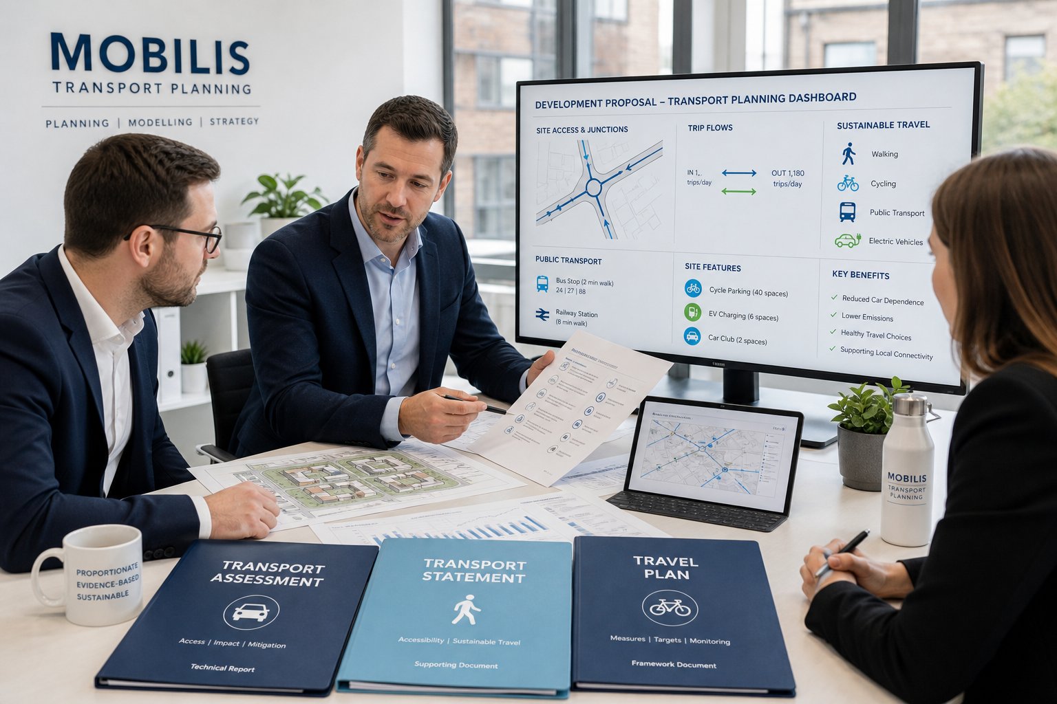
    Parking design goes beyond counting spaces. Authorities will look at layout efficiency, disabled provision, EV charging, cycle parking quality, visitor arrangements, turning space and whether parking is likely to function as intended. Poorly designed parking courts or awkward basement ramps can create operational issues long after consent is granted.

    Servicing is equally important. Delivery vans, refuse vehicles, fire appliances and, on some schemes, articulated HGVs all need to enter, manoeuvre and leave safely. Swept path analysis often becomes decisive here. A layout that looks tidy on plan can fail once real vehicle movements are tested.

    Construction access should not be overlooked either, especially on constrained urban sites. Temporary traffic management, routing, delivery timing and neighbour impact can influence both planning conditions and stakeholder confidence.

    This is where transport planning has to mesh closely with architecture and civil design. Small geometric changes early on can remove major objections later.

    Working With Highways Authorities, Councils And Project Teams

    Transport planning is partly technical and partly diplomatic. The strongest schemes usually have both.

    Highways officers want clear evidence, but they also want confidence that the applicant understands local issues and is responding constructively. Early pre-application discussions can help define scope, flag likely concerns and avoid producing a report package that misses the authority’s real priorities. In larger or more complex cases, those discussions may also shape the path towards planning conditions, Section 278 highway works or Section 106 obligations.

    Within the project team, coordination matters just as much. Transport advice needs to feed into architectural layouts, drainage constraints, level changes, landscape strategy, refuse arrangements and planning narrative. If those strands drift apart, contradictions appear fast. A Transport Statement that assumes one access point while the drawings show another is the sort of inconsistency that creates unnecessary scrutiny.

    For regionally sensitive schemes, teams often benefit from practitioners who understand local authority behaviour as well as technical standards, whether that means insight comparable to a Traffic Engineer In London: context or another authority with exacting review processes.

    Our experience is that steady, well-documented engagement tends to outperform last-minute argument. Councils rarely object because a report is concise: they object because it leaves too many unanswered questions.

    How To Scope A Proportionate Transport Planning Strategy

    A proportionate strategy is the sweet spot: enough technical work to satisfy the authority and de-risk the application, but not so much that the project becomes slow, bloated or commercially unbalanced.

    We normally start with five questions. What is the scale and land use of the proposal? How sensitive is the surrounding network? What do local policy and validation requirements say? Are there obvious access, parking or servicing constraints? And which transport issues are most likely to drive officer comments or third-party objection?

    From there, scope can be tailored. Some sites need only a concise Transport Statement and a focused Travel Plan. Others need multi-junction modelling, road safety review, parking stress surveys, construction management input and extensive design iteration. The point is not to produce the biggest package: it is to produce the right one.

    Pre-application engagement is often worth the effort because it helps agree assumptions on survey extent, assessment years, junctions to model and report type. That reduces the risk of abortive work. For many clients, this is where effective private sector transport planning delivers the biggest value: not merely writing reports, but setting a strategy that aligns planning success, cost control and deliverability.

    In 2026, proportionate does not mean minimal. It means targeted, evidence-led and genuinely useful.

    Frequently Asked Questions about Private Sector Transport Planning

    What is private sector transport planning and why is it important for developers?

    Private sector transport planning helps developers demonstrate that a development can be accessed safely, sustainably, and efficiently in line with policies. Early planning reduces risks, improves site layout, and strengthens planning applications, avoiding costly redesigns or objections later.

    How does early transport planning influence a development project?

    Early transport planning identifies access constraints, potential trip generation, and mitigation needs while designs are flexible. This proactive approach prevents costly late-stage changes, improves coordination with architects and planners, and aligns development with local policy, ultimately saving time and budget.

    What key reports are typically required in private sector transport planning?

    Developments often need a Transport Assessment for larger sites, a lighter Transport Statement for smaller schemes, and a Travel Plan to promote sustainable travel. These documents provide evidence on trip impacts, access arrangements, and strategies to manage car use consistent with planning authority requirements.

    What do local planning authorities assess in transport planning submissions?

    Authorities focus on highway safety, traffic impact including junction capacity, accessibility by walking and public transport, and compliance with parking and transport policies. They expect credible, proportionate evidence demonstrating that the development will not cause severe residual impacts.

    How can developers avoid common risks that delay transport-related planning approval?

    To avoid delays, developers should provide realistic trip estimates including committed developments, carry out thorough junction modelling, design safe access and parking, prepare enforceable Travel Plans, and engage early with highway authorities, preventing last-minute objections and redesigns.

    What role do Developer Transport Consultants play in private sector transport planning?

    Developer Transport Consultants provide specialist advice throughout development stages, managing transport assessments, negotiations with authorities, and aligning technical constraints with design and viability. Their involvement ensures transport strategies are robust, efficient, and supportive of planning success in 2026.

  • Mixed-Use Masterplan Transport: How To Plan Movement, Access And Parking For Successful Schemes In 2026

    Mixed-Use Masterplan Transport: How To Plan Movement, Access And Parking For Successful Schemes In 2026

    Getting transport wrong on a mixed-use scheme is expensive in all the predictable ways: delayed validation, awkward consultee comments, redesigns that ripple through the layout, and junction fixes that arrive far too late to be cheap. Getting it right does something more valuable. It gives the masterplan a logic people can actually move through.

    That is what mixed use masterplan transport is really about. Not just traffic counts, and not just parking ratios, but the joined-up planning of movement, access and servicing across homes, employment, retail, community uses and public realm. In practice, that means deciding early how walking, cycling, buses, cars, deliveries and emergency vehicles will work together, then proving the strategy is robust enough for planning.

    For architects, planners, developers, councils and legal teams, the transport piece often becomes the point where ambition meets delivery. A compact, policy-aligned scheme may look convincing on a drawing, but if access is weak, trip impacts are undercooked, or kerbside activity has been ignored, confidence drains quickly.

    In this guide, we set out how we approach mixed use masterplan transport in 2026: what it means in the planning process, why it must be embedded early, how travel demand is shaped, what supporting documents matter, and where approvals most often come unstuck. The aim is simple, help teams build schemes that are easier to justify, easier to phase, and far more likely to secure consent without avoidable transport objections.

    What Mixed-Use Masterplan Transport Means In The Planning Process

    Infographic of a mixed-use masterplan transport framework for a UK development.

    Mixed-use masterplan transport is the transport framework that sits underneath a large, often outline, planning proposal. It coordinates land use, access, street hierarchy, modal priorities, parking, servicing and network impact so the scheme can demonstrate a sustainable and policy-compliant pattern of movement.

    That sounds technical because it is, but it is also spatial. Transport is not a separate appendix that appears once the design is finished. It affects block structure, frontage conditions, crossing points, where active uses sit, where bus routes can operate, how parking is distributed and whether daily trips can be made internally rather than by car.

    For mixed-use schemes, this matters more than on single-use sites because the trip profile is more varied. Peak commuting flows, school-related trips, servicing windows, leisure activity, weekend footfall and resident parking demand all overlap. A credible transport strategy hence has to deal with person movement, not only vehicle movement.

    In planning terms, we are usually trying to show three things at once:

    • the site is accessible by sustainable modes
    • the internal layout supports safe and efficient movement
    • the residual impact on the wider network is acceptable, or can be mitigated

    That is why transport input often needs to align with design coding, parameter plans, viability discussions and delivery strategy. On larger projects, it becomes a core part of the evidence base rather than a bolt-on report.

    Why Transport Strategy Must Be Embedded At The Earliest Masterplanning Stage

    early transport strategy shaping a mixed-use masterplan in the UK

    The biggest transport mistake on mixed-use sites is leaving strategic movement questions until the layout already feels fixed. By that point, teams are often trying to retrofit bus penetration, cycle continuity, servicing yards or secondary access into a structure that was never designed for them.

    Early transport input changes the fundamentals. It helps place density where public transport access is strongest, shape desire lines before blocks harden, and reserve enough corridor width for footways, cycle tracks, trees, utilities and servicing to coexist. It also reduces the risk of costly late-stage redesign.

    We regularly find that early work on Access Strategy Transport clarifies whether a scheme should rely on one principal access, multiple points of entry, filtered routes, or phased connections tied to build-out. Those choices affect not only capacity and safety, but marketability, emergency resilience and planning confidence.

    There is also a policy reason to start early. Current UK planning and design guidance increasingly expects development to prioritise walking, cycling and public transport. If those modes are only considered after the road layout is drawn, they tend to be squeezed into leftover space. And everyone notices.

    A strong early strategy gives the whole consultant team something useful: a movement framework that informs design rather than chasing it.

    Core Travel Demand Drivers In Mixed-Use Development

    Infographic of mixed-use development travel drivers, internal trips, density, and phasing.

    Travel demand on mixed-use sites is driven by more than raw floorspace totals. Yes, the amount of housing, employment and commercial space matters. But so do the relationships between those uses, the surrounding network, likely car ownership, parking controls, public transport quality and the timing of delivery.

    Mixed-use schemes can reduce external vehicle demand because some trips are captured internally. Residents may walk to local retail, workers may use cafés on site, and community facilities can serve nearby neighbourhoods without generating long-distance movement. That internal capture is one of the major benefits of a well-composed masterplan, but it has to be evidenced carefully rather than assumed.

    Density is another strong driver. Compact forms near stations or high-frequency bus corridors tend to support higher walking, cycling and public transport mode share. Lower-density schemes, especially on edge locations, often generate more car trips and longer trip lengths unless the transport offer is unusually strong.

    Socio-economic profile and tenure also influence outcomes. Car ownership patterns are not the same across market housing, affordable housing, later living, student accommodation and urban build-to-rent. Nor are peak patterns identical across office, industrial, leisure and retail uses.

    Parking supply and pricing can quietly reshape all of this. The transport strategy is hence not only about forecasting demand, but about designing the conditions that influence it.

    How Land Use Mix, Density And Phasing Affect Movement Patterns

    A scheme’s land use mix determines when people travel, why they travel and whether those trips can be linked or shortened. Homes plus local services can create daily internal walking trips. Offices plus food and convenience retail can flatten some lunchtime travel. Leisure uses may shift demand into evenings and weekends, when highway conditions differ from weekday commuter peaks.

    Density changes the picture again. Higher density near good public transport usually supports frequent services, stronger footfall and more viable active travel investment. It can also justify lower car parking provision. But density without permeability, safe crossings and direct routes simply creates concentrated friction.

    Phasing is where many masterplans become less elegant. Early phases often arrive before the full network, final bus service pattern or all local facilities are in place. That can mean temporary reliance on cars, different access arrangements or interim parking demand. If phasing is not considered properly, the first years of occupation can produce movement patterns very different from the completed vision.

    So we need to test both the end state and the journey to it: what happens when only part of the site is built, when one access is operational, or when a mobility hub is delivered later than housing. Those details matter to planning officers and highway authorities because they affect real-world performance, not just the final illustration.

    The Main Transport Principles That Shape A Strong Masterplan

    Infographic of mixed-use masterplan transport principles, street networks, servicing and emergency access.

    Strong mixed-use masterplans usually share a few transport principles, even when the sites themselves are very different.

    First, they are transit-conscious. They place intensity near stations, key corridors or bus-ready streets and avoid dispersing trip generators into inaccessible corners. Second, they are permeable. People can move through them using more than one route, and active modes are typically given the shortest, simplest paths.

    Third, they are legible. Street hierarchy, frontages, crossing points and public spaces make intuitive sense. Fourth, they manage car movement rather than letting it dominate. That does not mean cars are banned: it means carriageway width, parking location and junction design are proportionate to context.

    Fifth, they connect outward as well as inward. A masterplan is not successful if it works only within the red line. It needs to stitch into surrounding neighbourhoods, transport hubs, rights of way and desire lines.

    On more complex projects, these principles often sit alongside broader Private Sector Transport Planning advice, because planning risk is rarely caused by one isolated drawing. It is usually caused by inconsistencies between layout, access, policy position and evidence.

    Designing Street Networks For Walking, Cycling, Public Transport And Vehicles

    Street design is where transport strategy becomes visible. We generally want a network that is connected enough to distribute movement, clear enough to navigate, and calm enough to support place as well as flow.

    For walking, that means wide footways where demand warrants them, frequent crossing opportunities, short waiting times, active frontages and routes that follow obvious desire lines. For cycling, continuity matters more than decorative fragments. If a route disappears at a key junction, people notice immediately.

    Public transport needs streets that can physically and operationally support it: sensible geometry, stopping locations that connect to active uses, and layouts that do not trap buses behind preventable delay. On larger schemes, that may include mobility hubs or safeguarded corridors for future service enhancement.

    Vehicle access still matters, of course. But right-sized carriageways, filtered permeability, low-speed environments and carefully chosen junction forms usually produce better outcomes than over-engineered roads that sever the place they are meant to serve.

    Access, Servicing And Emergency Movement Requirements

    Mixed-use sites do not function on resident and visitor trips alone. They need bins collected, shops stocked, plant maintained, parcels delivered and emergency services accommodated at all times.

    That means access strategy has to consider swept paths, loading arrangements, vehicle waiting, turning, refuse operations and conflict points with pedestrians and cyclists. Dedicated loading bays may be essential for some uses: in other cases, timed servicing or shared facilities can reduce kerbside pressure.

    Emergency movement requirements are equally important. Fire appliance access, hydrant reach, secondary routes where needed, and avoidance of dead-end vulnerabilities should all be tested early. A beautiful street hierarchy on paper can collapse quickly if the emergency geometry does not work.

    The best schemes treat servicing as part of placemaking rather than an embarrassing afterthought hidden in the final week before submission.

    Transport Assessments And Supporting Planning Documents For Mixed-Use Schemes

    infographic of transport planning documents for a mixed-use development scheme

    For most substantial mixed-use proposals, the transport evidence base extends well beyond a single Transport Assessment. The exact package depends on scale, use class mix, local authority thresholds and site sensitivity, but there is a fairly familiar toolkit.

    A Transport Assessment or Transport Statement normally explains baseline conditions, accessibility, trip generation, distribution, junction impact, road safety context and mitigation. A Travel Plan sets out how sustainable travel will be encouraged over time, often through targets, measures, monitoring and management arrangements.

    Mixed-use sites also commonly need a Delivery and Servicing Plan, cycle parking strategy, parking management framework, street design narrative and, where relevant, a Construction Logistics Plan. On phased schemes, we may also need interim assessments showing how each stage performs before the full network is complete.

    The key is consistency. If the TA assumes low car mode share but the parking strategy is generous, the documents undermine each other. If the Travel Plan promises strong bus use but there is no realistic service route, consultees will spot the gap.

    That is why Property Development Transport advice is often most valuable when it starts before drafting begins. The strongest submissions read as one joined-up argument, not five separate reports written in parallel.

    Modelling Trip Generation, Distribution And Junction Performance

    Trip modelling for mixed-use sites is part evidence, part judgement. We start with established trip-rate sources and local survey information where available, then adjust for land use context, multi-purpose trip linking, internal capture, sustainable accessibility and parking restraint.

    The important point is that mixed-use development should not be assessed as a simple pile-up of standalone peak trip rates. If we do that mechanically, we can overstate some effects and miss others. Person trips, mode split and timing all matter. A foodstore, office building, residential block and gym do not all load the network in the same way, or at the same hour.

    Distribution and assignment then need to reflect realistic routing choices based on network hierarchy, existing travel patterns and site access arrangements. For larger schemes, this can involve strategic models, junction modelling, queue analysis and scenario testing across different build-out stages.

    Junction performance remains a central planning issue because it turns strategic debate into visible numbers: capacity, delay, reserve, queue length, practical impact. But we should not let junction modelling dominate the whole conversation. A masterplan can technically squeeze through a set of junctions while still being weak on walkability, bus penetration or street safety.

    Good modelling hence supports design decisions: it should not substitute for them.

    Parking Strategy, Servicing Strategy And Kerbside Management

    Parking on mixed-use sites is rarely just a quantity question. It is a design, policy and operational question rolled into one. How much parking is provided, where it sits, who controls it, whether it is shared across uses, and how it interacts with active frontages all affect the success of the scheme.

    In 2026, the direction of travel is fairly clear. Sites with strong public transport accessibility are generally expected to constrain private car parking, especially where that helps support mode shift and better use of land. More peripheral sites may justify higher provision, but even there, councils usually expect a stronger rationale than “people will drive”.

    Cycle parking should be generous, secure, convenient and designed for actual use rather than compliance theatre. Micromobility storage, charging and visitor provision are becoming more relevant too, particularly on higher-density urban sites.

    Servicing strategy needs equal attention. Retail, food and beverage, residential parcels, refuse collection, taxis and ride-hail can all compete for the same kerb space. Without management, the result is obstruction, unsafe manoeuvring and frustrated occupiers.

    A good kerbside plan typically includes:

    • dedicated loading where demand is regular
    • timed windows for servicing activity
    • clear controls for pick-up and drop-off
    • short-stay visitor arrangements where appropriate
    • enforcement and management responsibility

    When parking and kerbside strategy are treated as one integrated system, mixed-use places work much better day to day.

    Managing Delivery Phasing, Construction Traffic And Future Growth

    Phasing is not just a programme issue: it is a transport risk issue. Early phases may depend on temporary accesses, reduced parking supply, interim pedestrian links or bus services that are not yet commercially viable. Unless that is planned carefully, the first phase can set poor travel habits that are hard to unwind later.

    We usually advise testing transport arrangements by phase rather than relying only on the completed masterplan. That means asking practical questions. When does each access open? At what point is a secondary route needed for resilience? When is the first mobility hub delivered? Which junction upgrades are trigger-based, and what happens if occupation outpaces forecast?

    Construction traffic needs its own strategy because build-out periods on mixed-use schemes can be long and disruptive. Routing agreements, compound locations, delivery timing, wheel washing, abnormal load procedures and worker parking controls all affect neighbouring streets and local acceptability.

    Future growth should also be safeguarded. If a corridor may need bus priority later, do not design it so tightly that improvement becomes impossible. If adjacent land could come forward, consider whether the network can connect onward without tearing up the first phase.

    The best phased transport strategies are realistic, not heroic. They acknowledge temporary compromises but make sure those compromises are controlled and reversible.

    Common Risks That Delay Approval For Mixed-Use Masterplan Transport

    The most common delays are surprisingly familiar.

    One is underestimating trip generation or relying on optimistic mode share assumptions without enough supporting evidence. Another is weak active travel provision: routes that look acceptable on a parameter plan but fail under scrutiny because crossings are indirect, cycle links are discontinuous or surrounding connections are poor.

    Over-reliance on car access is another frequent problem. That may show up as excessive parking, oversized internal roads, poor bus penetration or a layout that makes walking the slowest option. Highway authorities and planning officers increasingly recognise when a scheme says “sustainable” while drawing something else.

    Junction design and road safety can also delay progress, especially where access geometry is awkward, visibility is compromised, or servicing conflicts with vulnerable road users. On larger sites, vague phasing is a serious issue too. If mitigation is promised “later” without clear triggers, trust tends to evaporate.

    There is a softer risk as well: fragmented consultant coordination. When the architect, transport team, planning consultant and highways authority are effectively having different conversations, decisions drift and objections become harder to close. Many delayed applications are not undone by one fatal flaw but by a build-up of smaller inconsistencies that suggest the scheme is not yet ready.

    Conclusion

    A robust mixed use masterplan transport strategy is early, integrated and unapologetically practical. It should shape the masterplan from the start, not tidy it up at the end. And it has to do more than predict traffic. It needs to explain how people will move, how streets will function, how servicing will operate, how phases will be managed and why the overall pattern supports policy as well as delivery.

    For teams promoting mixed-use development, that usually means keeping three priorities in balance: strong sustainable access, realistic network evidence, and operational detail that stands up under scrutiny. When those pieces align, planning discussions become sharper, design decisions become easier to defend, and the scheme has a better chance of progressing without unnecessary transport friction.

    In our experience, the winning schemes are rarely the ones with the most paperwork. They are the ones where movement, access and parking were thought through early enough to become part of the place itself.

    Frequently Asked Questions about Mixed Use Masterplan Transport

    What does mixed use masterplan transport involve in the planning process?

    Mixed use masterplan transport coordinates land uses, access points, street hierarchy, modal priorities, and parking to create a sustainable and policy-compliant movement framework supporting homes, jobs, and services.

    Why is it important to embed transport strategy early in mixed use masterplanning?

    Embedding transport strategy early allows land use and block layout to align with transit stations and quality walking or cycling routes, reducing car dependence, infrastructure costs, and supporting viable public transport integration.

    How do land use mix, density, and phasing affect movement patterns in a mixed use development?

    Compact, mixed-use areas near transit encourage walking, cycling, and public transport trips while reducing car trips. Phasing must ensure network capacity and transit services develop alongside the scheme.

    What are the main transport principles shaping an effective mixed use masterplan?

    Key principles include transit-oriented design, street permeability and legibility, safe and direct active travel routes, managed car access and parking, and integration with wider transport networks and hubs.

    How should parking and servicing be managed in mixed use masterplan transport?

    Parking should be constrained near transit with generous, secure cycle parking. Servicing requires dedicated loading bays, timed windows, and managed kerbspace to prevent conflicts and support smooth deliveries and pickups.

    What common issues cause delays in approval of mixed use masterplan transport strategies?

    Delays often arise from underestimating trip generation, insufficient active travel provision, excessive reliance on car access, poor junction or safety design, and weak phasing or construction traffic management.

  • Traffic Impact Assessments For Developers: What You Need, When You Need It, And How To Keep Planning On Track In 2026

    Traffic Impact Assessments For Developers: What You Need, When You Need It, And How To Keep Planning On Track In 2026

    A planning application can look perfectly sound on paper and still run into trouble the moment highways comments come back. We’ve all seen it: a scheme with commercial promise, a sensible layout, even broad policy support, but then questions land about junction capacity, queueing, access safety, or whether the local network can actually absorb the extra traffic. That’s where a Traffic Impact Assessment, or TIA, stops being a technical afterthought and becomes a project-critical document.

    For developers, architects, planners, surveyors, and local authorities, a good TIA does more than count cars. It explains how a development will function in the real world. It shows whether traffic effects are acceptable, what mitigation is needed, and how transport evidence aligns with the design, phasing, and planning strategy. Done early, it can save redesign time, reduce objections, and prevent expensive late-stage surprises.

    In 2026, expectations are if anything tighter: local thresholds are more closely applied, modelling assumptions are scrutinised, and supporting transport evidence needs to be clear, defensible, and tailored to the site. In this guide, we set out what traffic impact assessment developers need to understand, when a TIA is typically required, what authorities usually expect, and how to keep the planning process moving rather than stalling over avoidable transport issues.

    What A Traffic Impact Assessment Means For Developers

    Comparison of UK transport statement, transport assessment, and traffic impact assessment.

    A Traffic Impact Assessment is a technical study that tests how a proposed development will affect the surrounding highway network and what should be done if those effects are material. For developers, that usually means answering a few practical questions early: will the roads and junctions still operate acceptably, will the access work safely, and will off-site improvements or contributions be needed?

    That matters because transport concerns can alter a scheme far beyond the highway boundary. A weak assessment can trigger redesign, added conditions, delayed determination, or refusal. A strong one gives the project team something much more useful: evidence. It helps us understand whether a site access is in the right place, whether phasing is realistic, whether a signal upgrade is likely to be requested, and whether the planning case is vulnerable at committee or appeal.

    For developers in particular, the value of a TIA is risk control. It turns transport from a vague planning concern into a defined workstream with a scope, programme, assumptions, and mitigation path. And when it’s aligned with wider Property Development Transport Advice:, it often saves far more time and cost than it adds.

    How A Traffic Impact Assessment Differs From A Transport Statement And Transport Assessment

    A Transport Statement, Transport Assessment, and Traffic Impact Assessment are related, but they are not interchangeable.

    A Transport Statement (TS) is usually the lightest-touch document. It suits smaller developments where transport impacts are expected to be limited. It may summarise site accessibility, existing conditions, and likely trip effects without detailed modelling.

    A Transport Assessment (TA) is broader. It covers multi-modal transport matters: walking, cycling, public transport, travel patterns, parking, servicing, and wider accessibility as well as traffic. For larger or more complex schemes, the TA often becomes the main transport evidence base.

    A Traffic Impact Assessment (TIA), sometimes called a Traffic Impact Study, is more specifically focused on vehicular effects. It tends to involve detailed capacity analysis, turning counts, trip distribution, route assignment, and junction modelling. In practice, a TIA may sit within a TA or be submitted alongside one.

    The distinction matters because authorities usually expect the level of evidence to match the scale and sensitivity of the scheme. Calling something a statement when it really needs network analysis rarely ends well.

    When A Traffic Impact Assessment Is Required For A Planning Application

    UK infographic showing planning triggers for when a traffic assessment is needed.

    There isn’t a single national trigger that applies to every site in exactly the same way, which is why developers sometimes get caught out. In general, a TIA is required where a proposal is likely to create significant traffic effects, put pressure on sensitive junctions, alter access arrangements, or raise local highway safety concerns. A commonly used rule of thumb is around 100 two-way peak-hour vehicle trips, but that is only a guide, not a universal pass-fail test.

    In reality, local planning authorities and highway authorities rely on their own validation requirements, transport guidance, and network knowledge. A scheme below 100 peak-hour trips may still need a TIA if it sits on a constrained urban corridor, beside a school, near a poor accident record, or on an already stressed roundabout. Equally, some lower-impact proposals may justify a more proportionate submission.

    That’s why we usually advise scoping the requirement before the application strategy hardens. Early transport input helps determine whether a concise statement is enough, whether a full TA is needed, or whether traffic modelling will be central to the planning case. On more complex sites, specialist support from a Traffic Engineer In Manchester: or an equivalent local consultant can be the difference between a clean submission and a prolonged highways debate.

    Typical Development Types And Triggers That Lead To A TIA

    Some development types repeatedly lead to TIAs because their trip generation profile is high, peaky, or operationally complex.

    Typical examples include:

    • supermarkets and retail parks
    • drive-thrus and roadside food uses
    • larger residential schemes
    • employment and industrial parks
    • schools, colleges, and hospitals
    • stadiums, event venues, and major leisure schemes

    But land use alone doesn’t decide it. Authorities usually look at a cluster of triggers, including:

    • high forecast vehicle trip generation
    • a congested or capacity-sensitive local network
    • new or materially altered access points
    • collision history or visibility constraints
    • interaction with nearby consented developments
    • unusual servicing, coach, or pick-up/drop-off demand

    A 60-unit housing site in a lightly trafficked location may be straightforward. A smaller drive-thru near an over-capacity junction may not be. The planning issue is never just “how big is the scheme?” but “what happens on this network, at these times, under this form of access?”

    What Local Planning Authorities And Highway Authorities Usually Expect

    Infographic of five key traffic assessment expectations for UK planning authorities.

    Most authorities are not looking for a glossy report full of traffic jargon. They want a clear, proportionate, technically sound assessment that answers the right questions.

    Usually, that means five things.

    First, an agreed scope. If the study area, survey periods, growth assumptions, and modelling tools have not been discussed early, the authority may challenge the whole foundation of the work.

    Second, robust and current data. Turning counts, queue observations, speed data, collision records, active travel context, and committed development information all need to be relevant and recent enough to support the analysis.

    Third, transparent methodology. Authorities want to see where trip rates came from, how reductions were applied, how trips were distributed, and why certain scenarios were modelled. Hidden assumptions are one of the fastest ways to invite objections.

    Fourth, credible impact testing. That includes assessing the base year, future year without development, and future year with development, then explaining whether the differences are material. Sensitive junctions usually need detailed capacity testing, and safety concerns need more than a passing mention.

    Finally, deliverable mitigation. If a report suggests off-site works, travel planning, or access changes, authorities will expect those measures to be proportionate, fundable, and tied directly to the development’s impacts.

    In short, local planning and highway teams usually expect a TIA to behave like evidence, not advocacy. It can support a proposal strongly, but only if the technical case is honest, traceable, and site-specific.

    The Core Stages Of A Traffic Impact Assessment

    Traffic impact assessment stages for UK developers shown as a step-by-step flowchart.

    A well-prepared TIA follows a fairly consistent sequence, even though the detail varies by site and authority. Understanding that sequence helps developers programme surveys, design work, and planning submissions more sensibly.

    The process usually begins with scope, then moves through baseline evidence, trip forecasting, routeing, network testing, and mitigation. If any of those stages are rushed, problems tend to appear later, often when revisions are more expensive.

    We also find that the best assessments are iterative rather than linear. The modelling might reveal that an access arrangement needs refinement. A revised layout may alter internal circulation or servicing. A mitigation option may improve a junction enough to support a later phase. So while the stages are technical, they’re also design tools.

    For teams handling multiple planning inputs at once, this is where experienced transport consultants earn their fee: not by producing a long report, but by making each stage answer a development question before it becomes a planning objection.

    Scoping, Baseline Data, Trip Generation, Distribution, Assignment, And Junction Modelling

    Scoping comes first. We agree the study area, peak periods, future assessment years, development scenarios, committed developments to include, and the software or calculation methods likely to be accepted by the authority.

    Baseline data comes next. That may include classified turning counts, queue lengths, journey times, speed surveys, collision analysis, parking stress, and observations of pedestrian and cycle movement. Existing conditions matter, but so do committed schemes that will change the network before the development opens.

    Trip generation estimates how many journeys the proposal is likely to create, often using accepted databases, survey comparators, and professional judgement. For mixed-use schemes, this can get nuanced quite quickly.

    Distribution and assignment then tests where those trips come from and where they go. A poor assignment pattern can undermine an otherwise competent report.

    Finally, junction modelling assesses how the network performs in different scenarios: base year, future year without the scheme, and future year with it. This is where capacity issues, queueing effects, and mitigation needs usually become most visible. The output is then pulled into a report that explains impacts in plain planning terms, not just technical tables.

    What Developers Need To Provide At The Start Of The Process

    Infographic of early traffic assessment inputs for UK property developers.

    The quality of a TIA is heavily influenced by what the developer team provides in the first week or two. If key information arrives late, transport work becomes reactive, and that often means duplicated modelling, revised figures, or avoidable delays.

    At the outset, we generally need:

    • the red-line boundary and any wider land control plan
    • a draft site layout and access strategy
    • the development quantum by land use, such as dwellings, gross floor area, pupils, beds, or seats
    • proposed phasing and likely opening years
    • expected servicing arrangements and vehicle types
    • parking provision and internal circulation assumptions
    • any travel plan ambitions or mode-share targets
    • details of nearby committed or related schemes

    Even rough information is better than silence, provided everyone understands what is provisional. The key is to flag uncertainty early. If the residential mix may change, if the commercial floorspace is only indicative, or if a signalised access is being considered alongside a priority option, that should be stated upfront.

    This early briefing stage is also where broader traffic impact assessment developers strategy pays off. When transport assumptions align with planning, design, and viability from the beginning, the TIA becomes part of project coordination rather than a late technical hurdle.

    Common Issues That Delay Approval Or Trigger Objections

    Highways objections are often presented as if they arise from deep technical disputes. Sometimes they do. But more often, the root cause is procedural: the wrong scope, the wrong data, or the wrong assumptions.

    One common issue is no early scoping with the authority. If the applicant team proceeds on its own view of the study area or survey hours and gets that wrong, the authority may ask for fresh analysis after submission. That can add weeks.

    Another is out-of-date or thin baseline data. Traffic conditions change. Nearby schemes get built. Signal timings are revised. What looked acceptable six months ago can become questionable if the evidence is stale.

    A third problem is underestimating trip rates or smoothing awkward peaks. Authorities are quick to challenge selective comparisons, optimistic reductions, or weak assumptions around linked trips and pass-by traffic, especially for retail and roadside uses.

    Then there’s ignoring committed development. A junction may appear to cope until approved housing, employment, or education growth is added to the model.

    And finally, we regularly see mitigation that isn’t deliverable. If proposed works sit outside highway control, lack land, rely on uncertain third-party consent, or are not proportionate to the impact, they can weaken rather than strengthen an application.

    In practice, the fastest route to approval is not trying to make impacts disappear. It’s identifying them honestly, testing them properly, and resolving them before submission where possible.

    Mitigation Measures That Can Strengthen A Development Proposal

    Mitigation should do one thing above all: address the actual transport effect of the development in a way that is proportionate, deliverable, and understandable to decision-makers. Not every scheme needs major highway works. Some need none. But where impacts are identified, vague promises rarely satisfy anyone.

    Common mitigation measures include:

    • junction geometry changes, such as flare extensions or lane widening
    • signal optimisation or signal-controlled junction upgrades
    • revised site access arrangements and visibility improvements
    • right-turn lanes, ghost islands, or splitter islands
    • speed management, crossing facilities, and local safety measures
    • improved footways, cycle links, and bus stop infrastructure
    • travel plans and demand management measures to reduce single-occupancy car trips
    • delivery and servicing controls
    • construction traffic management plans

    The strongest mitigation packages are usually layered. A residential scheme might pair a junction improvement with pedestrian crossing upgrades and a travel plan. A school may need pick-up/drop-off management, walking routes, and timed operational controls. A logistics or industrial site could depend heavily on swept-path design, routing arrangements, and peak management.

    Authorities also tend to respond better when mitigation is tied to evidence rather than offered as a generic wish list. If the TIA shows a specific arm of a roundabout deteriorating beyond acceptable operation, the solution should address that precise issue. Good mitigation feels engineered, not improvised.

    How A Strong TIA Supports Planning, Design, And Delivery Decisions

    A strong TIA doesn’t just help us get through validation or answer a consultee response. It improves the scheme itself.

    At planning stage, it gives the applicant team a credible evidence base. That can support statements of case, committee reports, negotiations over conditions, and, where needed, appeal submissions. It also helps explain why certain design choices were made, which is valuable when objections focus on traffic, safety, or local congestion fears.

    At design stage, a TIA often influences access location, internal road hierarchy, parking layout, servicing space, and phasing. Sometimes a modest layout tweak avoids an expensive off-site junction upgrade. Sometimes the analysis confirms that a proposed access is too close to a constrained node and should move before drawings are fixed.

    At delivery stage, transport evidence can shape section 106 and section 278 discussions, trigger points for works, and the timing of occupation relative to mitigation delivery. It also gives project managers something solid to work from when contractors, legal teams, and highways officers need the same answer to the same question.

    That’s especially true on sensitive or urban sites, where concise local knowledge matters as much as modelling. We often see better outcomes when transport input is treated as part of place-making and delivery planning, not a separate technical appendix.

    Choosing The Right Time To Commission A TIA

    The best time to commission a TIA is almost always earlier than the team first thinks.

    In most cases, that means the concept or early planning design stage, before the layout is fixed and well before submission. At that point, transport evidence can still influence access design, land take, parking strategy, servicing, and phasing. Leave it too late and the TIA becomes a test of a nearly finished scheme rather than a tool for shaping one.

    Early instruction also matters because transport work has lead-in time. Surveys must be commissioned, school holidays and abnormal periods avoided, baseline data reviewed, committed development tracked, and authority scope discussions allowed to happen. Then comes modelling, internal review, design coordination, and reporting. None of that is impossible under pressure, but compressed programmes tend to generate avoidable risk.

    For complex sites, we usually suggest commissioning once there is a workable site plan, a broad development quantum, and a realistic planning route. That is enough to scope properly without waiting for every design detail. In some cases, especially where local junction sensitivity is obvious, an initial feasibility review can start even earlier. That kind of front-loaded thinking is often what keeps planning on track rather than trying to rescue it later.

    Conclusion

    For developers, a Traffic Impact Assessment is rarely just a planning document. It is a decision-making tool that tests whether a scheme can work on the network around it, what needs to change if it can’t, and how transport evidence should support the wider application.

    The practical takeaway is simple enough: scope early, use current data, be realistic about trip generation, and make sure mitigation is directly tied to the impacts identified. When a TIA is commissioned at the right stage, it can guide layout, strengthen negotiations with authorities, and reduce the risk of avoidable delay.

    In 2026, that matters more than ever. Authorities expect transport submissions to be proportionate, transparent, and technically robust. Developers who treat the TIA as an early project input rather than a late compliance exercise usually put themselves in a much stronger planning position.

    Frequently Asked Questions About Traffic Impact Assessment for Developers

    What is a Traffic Impact Assessment and why is it important for developers?

    A Traffic Impact Assessment (TIA) is a detailed study evaluating how a proposed development will affect nearby roads and junctions. It helps developers understand if the local network can handle additional traffic safely, informs access design, identifies required mitigation, and reduces risks of refusal or costly redesign.

    How does a Traffic Impact Assessment differ from a Transport Statement or Transport Assessment?

    A Transport Statement is a brief overview suitable for small developments with limited impact. A Transport Assessment covers wider transport modes like walking and public transit. A Traffic Impact Assessment specifically focuses on vehicular traffic effects, involving detailed capacity and junction modelling usually for larger or complex projects.

    When is a Traffic Impact Assessment typically required for a planning application?

    A TIA is usually required when development is expected to generate around 100 or more two-way peak-hour vehicle trips, or when there are sensitive network conditions, altered access points, or local highway safety concerns. Local authorities provide specific guidance, so early scoping is recommended.

    What information should developers provide when commissioning a Traffic Impact Assessment?

    Developers should provide the red-line boundary, draft site layout, access strategy, quantum of development by land use, proposed phasing and opening years, servicing plans, parking layout, any travel plan targets, and details of nearby committed developments to ensure accurate and timely assessment.

    What common issues cause delays or objections in Traffic Impact Assessment approvals?

    Delays often stem from lack of early scoping with authorities, outdated or insufficient traffic data, underestimated trip rates, ignoring committed developments, inadequate junction modelling, and mitigation proposals that are undeliverable or unrelated to actual impacts.

    How can mitigation measures improve the chances of development approval in a Traffic Impact Assessment?

    Effective mitigation addresses identified impacts directly with deliverable solutions such as junction improvements, access changes, safety enhancements, and travel demand management. Clear, evidence-based mitigation tied to specific issues strengthens planning applications and helps meet local authority expectations.

  • Swept Path And Vehicle Tracking: A Practical Guide For Planning Applications In 2026

    Swept Path And Vehicle Tracking: A Practical Guide For Planning Applications In 2026

    If a layout looks fine on paper but a refuse lorry can’t turn, the planning risk shows up fast. That’s why swept path and vehicle tracking sit at the centre of so many UK planning applications, transport statements and highway negotiations. They answer a very practical question: can the vehicles that need to use a site actually get in, manoeuvre safely, and leave without conflict?

    For architects, planners, developers and local authorities, this isn’t a box-ticking exercise. A junction may appear generous, a service yard may seem workable, and a turning head may satisfy a rough rule of thumb. But until we test the movement of real vehicles against the proposed geometry, there’s no reliable evidence that the design works in day-to-day operation.

    In practice, swept path analysis uses specialist software such as Autodesk Vehicle Tracking or AutoTURN on CAD-based site layouts to simulate wheel paths, body overhang, tail swing and overall clearance. The result is a set of drawings that can support planning submissions, respond to highway comments, and often prevent expensive redesign later.

    In this guide, we’ll explain what swept path and vehicle tracking mean in practice, which vehicles usually need testing, the site design issues that most often affect the results, and what UK local authorities typically expect to see in 2026. We’ll keep it practical, planning-focused, and aligned with how these assessments are actually used on live development projects.

    What Swept Path And Vehicle Tracking Mean In Practice

    vehicle tracking infographic showing swept paths of truck, lorry, and car.

    Swept path analysis and vehicle tracking are methods used to predict the physical space a vehicle occupies while turning or manoeuvring. That includes not only the line of the wheels, but also the wider area taken up by the body of the vehicle as it swings through a movement. In other words, we’re checking the true envelope of motion, not just whether a route looks wide enough by eye.

    On live projects, this is usually carried out using specialist software linked to a CAD site layout. We input the relevant vehicle type, define the route or manoeuvre, and simulate how it moves through the proposed access, internal road, turning head, car park or service yard. The software then plots the inner wheel track, outer body sweep and key overhang points, which can be overlaid directly on the drawing.

    That matters because different vehicles behave very differently. A large rigid refuse vehicle cuts in sharply on turns. An articulated lorry creates a different tracking pattern again. Even a standard car entering a tight parking aisle can need more clearance than a simple dimension check suggests.

    In practice, good swept path work is part engineering, part judgment. We need the right design vehicle, realistic assumptions, and a layout that is developed enough to test properly. Done well, it gives everyone involved a clearer answer to a deceptively simple question: will the site work once it’s built?

    Why They Matter For Planning Applications And Highway Approval

    UK site plan infographic showing vehicle tracking for planning and highway approval.

    Planning officers and highway authorities want evidence, not optimism. That’s the core reason swept path and vehicle tracking matter. Where a development depends on refuse collection, emergency access, deliveries, parking circulation or turning space, drawings need to show that those movements can happen safely and without unacceptable conflict.

    For many UK schemes, that evidence is expected as part of a transport statement, transport assessment, servicing note or general planning pack. Residential developments often need to demonstrate that refuse vehicles can approach and turn. Commercial and mixed-use sites may need delivery and service vehicle tracking. And almost every scheme with internal access roads or constrained geometry raises the question of emergency vehicle access.
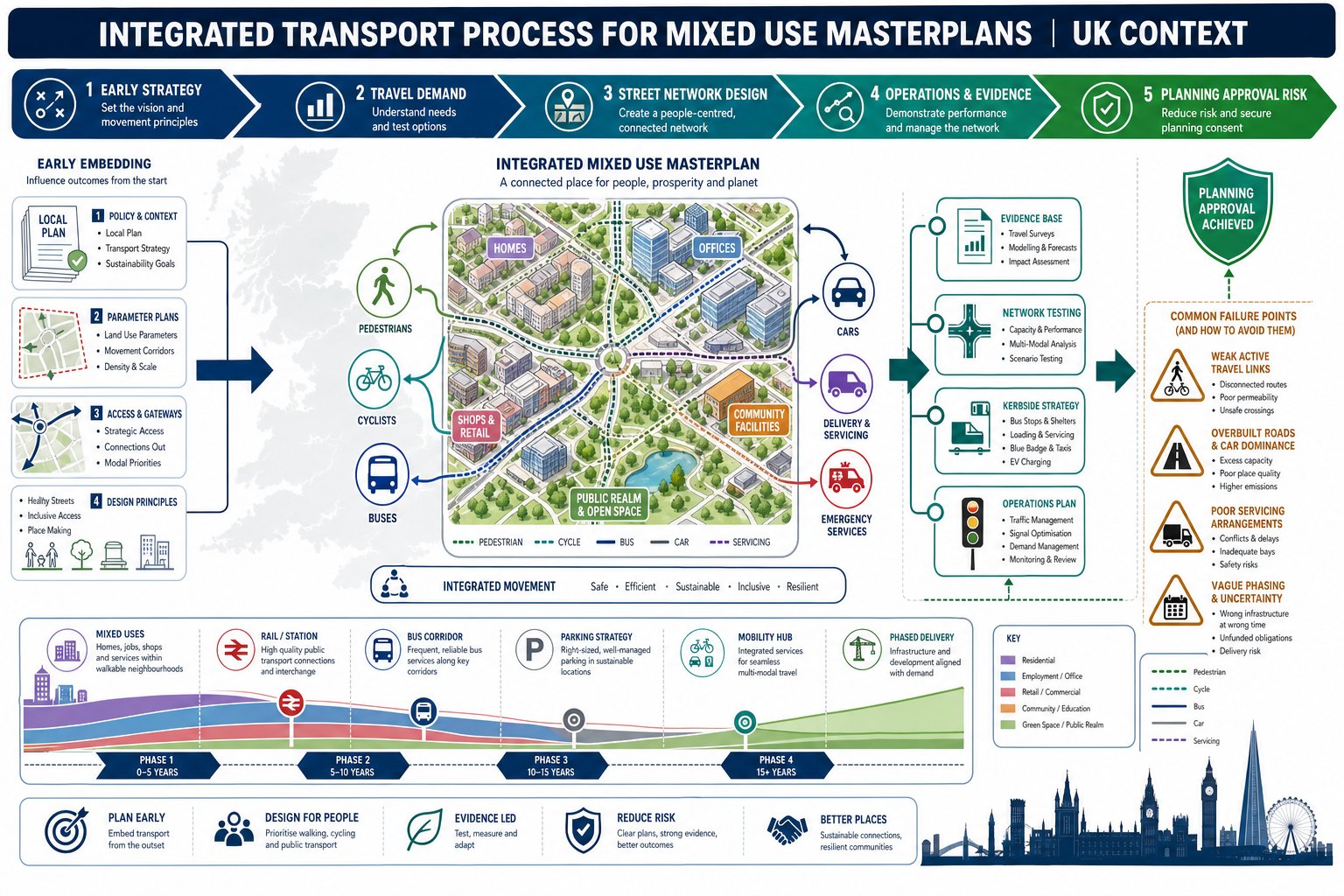
    These drawings also help resolve the most common planning concerns. Will a lorry overrun the footway at the site entrance? Does a fire appliance need to reverse too far? Can a vehicle exit in forward gear? Will turning movements depend on using the opposing lane or clipping parked cars? Those are exactly the issues that can generate objections, conditions, or redesign requests.
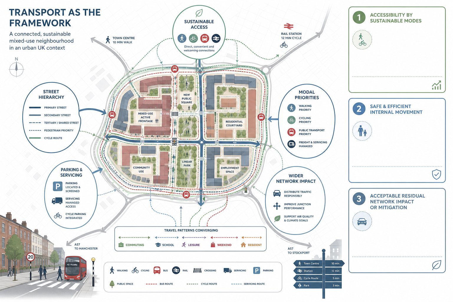
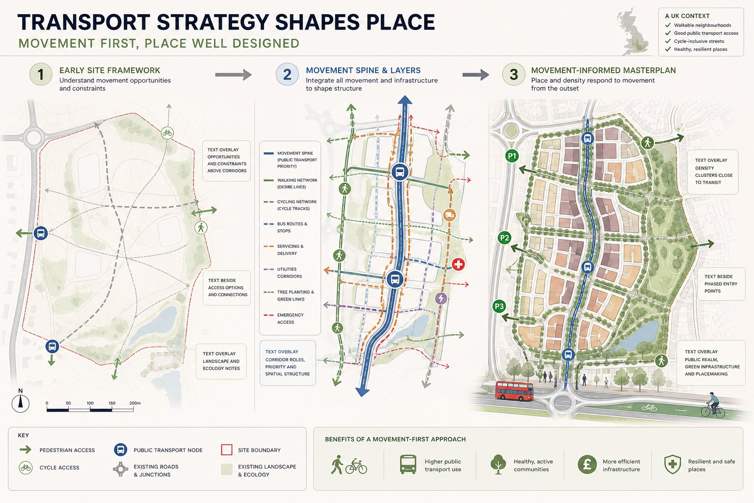
    From our perspective, early tracking work almost always saves time. It is far easier to adjust a kerb line, move a bay, or widen a service area before a submission goes in than after comments come back from the local highway authority. And when the layout is unusual or constrained, properly prepared tracking can justify a design decision that might otherwise be challenged.

    How Vehicle Tracking Shows Real Vehicle Movement On A Site

    site plan infographic showing vehicle tracking and swept path movement.

    Vehicle tracking turns a static site plan into something closer to real operation. Instead of looking at a junction, aisle or service yard as a set of dimensions, we test how a specific vehicle actually moves through it. The software models the geometry of the chosen vehicle and calculates the paths of the wheels, the outer swept envelope of the body, and the areas affected by overhang or tail swing.

    That output is then placed over the proposed layout. We can see where a front corner swings towards a wall, where rear wheels cut across a kerb radius, or whether a long vehicle needs to take too much of the carriageway to complete the manoeuvre. Clearances to bollards, parking bays, gates, bin stores, boundary walls and other fixed features become visible very quickly.

    It’s especially useful because site design rarely fails in one obvious place. A route may be acceptable at the entrance but break down at an internal bend. A delivery vehicle may be able to enter a yard but not leave it neatly. A refuse lorry may technically reach the collection point, yet only by sweeping across bays that are meant to remain parked. Tracking helps us see these pinch points before they become planning issues or operational problems.

    The result is a drawing set that is visual, measurable and difficult to argue with when prepared properly.

    The Difference Between Swept Path Analysis And General Access Checks

    A general access check asks broad questions: is there an access point, is the turning head present, does the road look wide enough? That level of review has its place early on, especially in concept design. But it is not evidence that a particular vehicle can complete a movement safely.

    Swept path analysis is more precise. It tests a defined vehicle on a defined route and measures what happens as it turns, reverses, swings out and cuts in. It captures wheel tracking, body overhang, articulation where relevant, and the clearances left to surrounding features.

    That distinction matters in planning. A scheme can pass a casual sense-check and still fail once a realistic refuse vehicle or fire appliance is tracked. We’ve seen layouts where the access looked generous until the tail swing clipped a boundary wall, and others where a turning area seemed adequate until the rear axle path showed repeated overrun of a footway.

    So while general access checks are useful at feasibility stage, they should not be confused with swept path analysis. If the planning outcome depends on proving that vehicles can use the site, the quantitative test is the one that carries weight.

    Which Vehicles Should Be Tested For A Development

    UK site access infographic showing vehicle tracking for cars, lorries, refuse and fire vehicles.

    The right vehicle list depends on the use, scale and operational pattern of the development. But in UK planning practice, there are some recurring expectations. We need to test the vehicles that will realistically and routinely use the site, plus any emergency or statutory access vehicles that local guidance requires.

    For residential schemes, that usually means at least a refuse vehicle and a fire appliance, alongside cars using access roads, parking courts and turning areas. For employment, retail, logistics or mixed-use projects, the list often expands to include delivery lorries, service vehicles, maintenance vans and sometimes articulated HGVs. Where public transport infrastructure is involved, buses or coaches may also need to be checked.

    A common mistake is choosing a vehicle that is convenient rather than realistic. If the local authority or waste contractor uses a particular refuse vehicle type, that should usually be the starting point. Likewise, where servicing is central to the use of the site, a generic van model may not tell us much if the occupier will in reality rely on larger rigid lorries.

    The aim is not to create the longest possible test list. It is to create the right one. Over-testing can muddy the picture, but under-testing creates planning risk and often leads to requests for further work.

    Refuse Vehicles, Fire Appliances, Delivery Lorries, And Service Vehicles

    These are the vehicles most likely to drive technical comments from highway officers. Refuse vehicles are critical on residential developments because collection arrangements need to be practical, not theoretical. Many authorities expect a standard vehicle around the 11.2 m class, though local fleet details can vary and should always be checked.

    Fire appliance tracking is also commonly expected. Even where the highways role overlaps with building regulations or fire access considerations, planning teams often want confidence that emergency vehicles can approach appropriately and, where relevant, turn or leave without unsafe manoeuvres.

    Delivery and service vehicles become especially important on commercial sites, care facilities, schools, retail units and mixed-use schemes. Here the question is not just whether a lorry can enter, but whether it can load, turn, and exit without blocking circulation or overrunning pedestrian areas. If servicing strategy depends on a specific vehicle type, the drawings should reflect that.

    And this is where realistic operational assumptions matter. A service yard that only works if every driver steers perfectly at a crawl and no other vehicle is present may not satisfy an authority reviewing the scheme in practical terms.

    Cars, Vans, Disabled Bays, And Residential Access Requirements

    Smaller vehicles matter too, particularly where the design includes tight parking layouts, private drives, basement ramps, mews courts or constrained residential access roads. A site can accommodate a refuse vehicle at the entrance and still fail on ordinary day-to-day usability for residents.

    Car tracking is often needed to show that vehicles can enter and leave spaces cleanly, manoeuvre within aisles, and exit in forward gear where required. Vans may also be relevant where trades, maintenance or light commercial activity form part of normal site use. This is particularly common on mixed-use and urban infill sites where circulation space is limited.

    Disabled parking needs careful review. It’s not just a question of fitting a bay dimension onto the plan. We should consider approach angles, door opening space, nearby obstructions, and whether a vehicle can actually align and park without awkward multi-point movements.

    For residential access, local authorities frequently focus on whether cars can turn within the site rather than reverse out onto the public highway. That issue comes up repeatedly on small developments. A simple turning diagram can be the difference between a smooth planning decision and a prolonged request for revisions.

    Key Site Design Issues That Affect Tracking Results

    Infographic of vehicle swept paths and site layout conflicts in the UK.

    A vehicle tracking exercise is only as good as the layout it tests. Small geometric choices can produce major differences in the result, especially on constrained sites. The obvious factors are junction radii and carriageway width, but they’re only part of the picture.

    Parking and loading layouts regularly influence tracking more than teams expect. A bay positioned close to a bend, a loading area placed opposite a turning movement, or an aisle narrowed by columns or landscaping can turn a workable route into a conflict point. The same goes for walls, gates, bollards, retaining structures, bin stores and visibility splays that reduce usable width even where the drawing seems generous overall.

    Turning heads and service yards deserve particular care. Some look compliant in shape yet fail because a long vehicle needs more depth to straighten, or because the assumed route relies on sweeping across areas that will be occupied in normal use. Internal junction spacing is another common issue: when bends or access points are too close together, one manoeuvre can compromise the next.

    Levels matter as well. Long wheelbase vehicles on steep gradients or at sharp vertical transitions can experience practical problems beyond a simple horizontal tracking diagram. That’s why near-final CAD information, including levels where relevant, gives much more reliable output than an early sketch.

    In short, tracking results are shaped by details. A few hundred millimetres in the right place can resolve a planning comment: in the wrong place, it can create one.

    Common Problems Found In Vehicle Tracking Assessments

    The same issues appear again and again in swept path reviews. One of the most common is a manoeuvre that only works by taking the full width of the carriageway, including the opposing lane. In a quiet private yard that may be manageable. At a site access or shared internal road, it can create obvious conflict and attract highway concern.

    Another regular problem is overrun. We see vehicles clipping kerbs, mounting footways, encroaching into verges, crossing into parking bays, or sweeping through pedestrian space that was never intended to be shared with large vehicles. Sometimes the conflict is small on paper but significant in practice, especially where formal footways or boundary features are involved.

    Reversing is a further trigger point. Long reverse distances within a site are often discouraged, and reversing onto or from the public highway is rarely acceptable for larger vehicles. A layout that depends on extensive reversing by refuse or service vehicles usually needs redesign unless there is a very clear operational justification.

    Then there’s the issue of realism. Some layouts can be made to work in software only by using idealised steering inputs, low-speed assumptions, or a route that ignores likely parked vehicles. Authorities are increasingly alert to that. A credible assessment should reflect how the site will actually operate, not just how it behaves in a best-case simulation.

    The value of the assessment lies in exposing these weak points early enough to fix them.

    How Swept Path Drawings Support Transport Statements And Planning Packs

    Swept path drawings are often one of the most useful pieces of technical evidence in a planning pack because they convert a design claim into something visible. Rather than stating that vehicles can access, turn and leave safely, we can show it. That has real value in transport statements, transport assessments, delivery and servicing notes, and planning responses.

    For straightforward schemes, the drawings may simply confirm that standard vehicles can use the access and internal layout as proposed. For more constrained developments, they help explain why a design still functions even though tight geometry, unusual boundaries or departures from standard dimensions. In both cases, they support the narrative of the wider report.

    They’re also practical when comments come back from the local authority. If an officer queries refuse access, emergency vehicle turning or servicing arrangements, a well-prepared tracking drawing lets us answer precisely rather than generically. It can show the tested route, the design vehicle used, and whether any accommodation measures are built into the proposal.

    From our side at ML Traffic, this is where concise, authority-aware reporting matters. The best planning material doesn’t overwhelm readers with unnecessary graphics: it gives them the evidence they need to make a decision. Clear tracking plans, tied to the written assessment, often do that better than pages of loose commentary.

    What Local Authorities Typically Expect To See

    Although requirements vary between councils, the broad UK expectation is fairly consistent. Authorities want to see the right vehicle types, realistic manoeuvres, and clear drawings that identify whether conflicts occur at the key points of access and circulation.

    That usually means plans covering the site entrance, internal junctions, turning heads, service yards, loading areas, emergency routes and any constrained parking movements. The drawings should show tracked wheel paths and the wider swept envelope of the vehicle body. If there are overruns or dependencies on non-standard operation, those should be obvious and explained rather than hidden.

    Vehicle choice matters. Many councils expect the analysis to reflect local vehicle types, particularly refuse fleets. If a specific authority standard or vehicle library applies, we should use it. Speeds and assumptions should also be credible. Some authorities publish modelling parameters, such as low forward manoeuvring speeds and very low reverse speeds, and it makes sense to align with those where relevant.

    Increasingly, reviewers also look beyond an empty-site scenario. If on-street parking, loading activity or likely parking behaviour will affect the manoeuvre, they may expect that to be acknowledged. A drawing that works only when every bay is empty can be less persuasive than one that reflects normal occupation.

    Good submissions make the authority’s review easier. That usually improves the outcome.

    How To Prepare Good Information Before Commissioning An Assessment

    The quality of a tracking assessment depends heavily on the information provided at the outset. If the layout is too early, the levels are missing, or the vehicle assumptions are unclear, the output may be provisional at best. That can still be useful at feasibility stage, but it won’t always stand up well in a planning submission.

    The ideal starting point is a final or near-final CAD layout showing kerbs, carriageways, parking, boundaries, buildings, gates, walls, landscaping features and any fixed obstructions. If gradients or vertical geometry may affect larger vehicles, levels should be included as well. Without that, horizontal tracking can give a false sense of confidence.

    We also need an agreed vehicle list. That should cover refuse, fire, delivery, service, bus or car movements as relevant to the scheme. Where local highway authority standards or known refuse fleet details exist, those should be passed through before modelling begins. It saves revisions later.

    Operational assumptions are just as important. Will servicing occur from a bay or on-street? Are parking spaces assumed occupied during the manoeuvre? Must vehicles exit in forward gear? Where are refuse collection points located? Those practical details shape the test.

    In our experience, the fastest and cleanest assessments happen when the project team provides coordinated drawings, realistic vehicle requirements and any authority-specific guidance from day one. It sounds basic, but it makes an enormous difference.

    Conclusion

    For UK development projects, swept path and vehicle tracking are not decorative add-ons. They are one of the clearest ways to prove that a site will function safely and practically once built. When prepared properly, they show whether refuse vehicles, fire appliances, delivery lorries, cars and service vehicles can move through a layout without avoidable conflict.

    That matters to architects, planners, developers, legal teams and councils alike because access problems have a habit of surfacing late and costing more than expected. Early, realistic analysis helps us catch design issues while they are still easy to solve, supports transport statements with hard evidence, and gives highway officers what they typically need to assess a proposal.

    In 2026, the standard is simple: use the right vehicles, test the real movements, and present the results clearly. If we do that, planning applications are stronger, reviews are smoother, and the finished development is much more likely to work as intended in everyday use.

    Frequently Asked Questions about Swept Path and Vehicle Tracking

    What is swept path analysis and why is it important in UK planning applications?

    Swept path analysis uses specialist software to simulate a vehicle’s wheel paths and body movement on a site layout. It provides evidence that vehicles like refuse lorries and fire appliances can manoeuvre safely, helping secure planning and highway approvals by showing practical, not just theoretical, access.

    Which types of vehicles typically need to be tested in vehicle tracking assessments for developments?

    Common vehicles include refuse vehicles (around 11.2 m), fire appliances, delivery lorries, service vehicles, buses or coaches where applicable, cars and vans, and disabled parking vehicles. Testing assures realistic, routine access for all relevant users as expected by UK local authorities.

    How does vehicle tracking differ from general access checks in site design?

    General access checks are broad reviews asking if access points or turning heads exist. Swept path analysis quantitatively simulates a specific vehicle’s movement, including wheel tracks and body overhang, providing precise proof that the vehicle can safely complete manoeuvres on the site.

    What common site design issues can affect the results of swept path and vehicle tracking?

    Key factors include junction radii, carriageway widths, positioning of parking and loading bays, geometry of turning heads, obstacles like walls or bollards, and gradients. Even small geometric details can cause conflicts or prevent safe manoeuvres if not carefully considered.

    Can swept path drawings help address highway authority concerns during planning reviews?

    Yes, swept path drawings visually and measurably demonstrate vehicle movements, highlight conflicts, and justify design decisions. They support transport assessments and servicing plans by providing clear evidence that vehicles can access, turn, and exit safely, helping resolve objections or redesign requests.

    How should developers prepare before commissioning a swept path or vehicle tracking assessment?

    Developers should provide a near-final CAD layout with all relevant features and levels, an agreed list of vehicles to be tested based on local requirements, relevant highway authority standards or vehicle libraries, and operational assumptions like parking occupation and servicing strategies to ensure accurate, credible analysis.