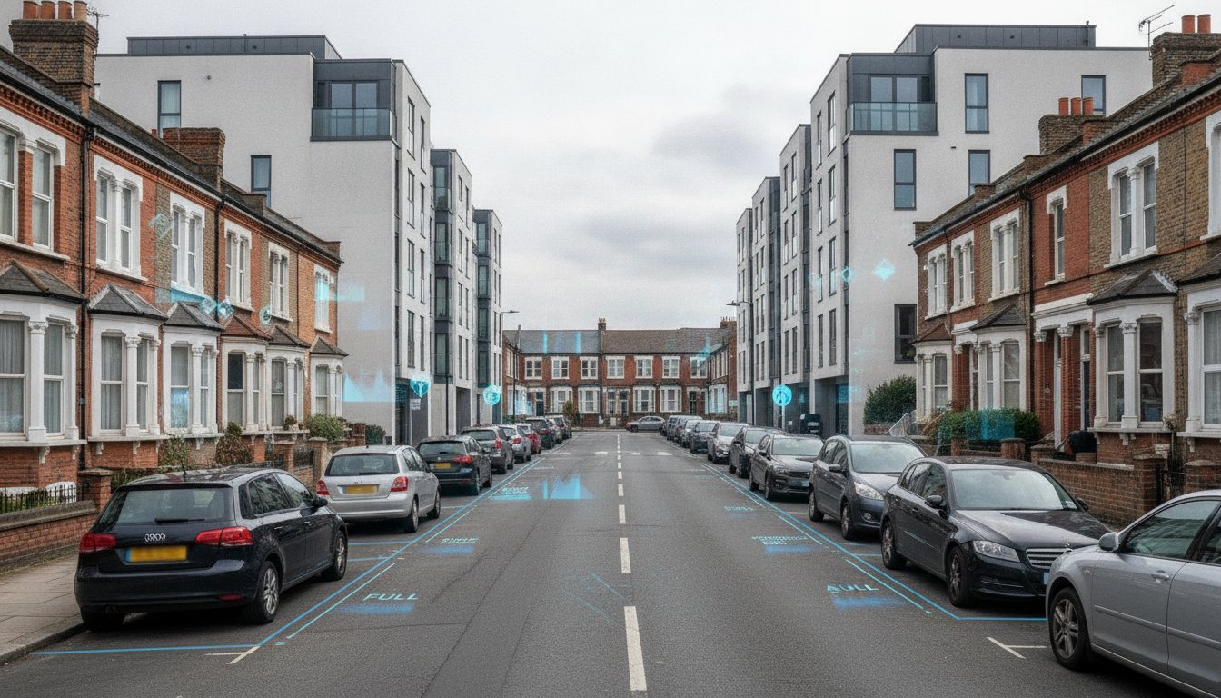
What if the difference between a project approval and a costly refusal isn’t the design of your building, but the data on the street at 3:00 AM? You likely understand the frustration of a high-density scheme being blocked because of concerns over resident overspill. A professional parking survey for planning application is now the critical tool for developers to prove their project’s viability. With the 2026 National Planning Policy Framework reforms placing even greater emphasis on sustainable transport and data-driven evidence, your submission must be technically flawless to withstand council scrutiny.
This guide provides the technical clarity you need to master parking survey requirements and overcome local authority objections. You’ll learn how to navigate the specific differences between Lambeth and Merton methodologies and how to interpret parking stress levels before they become a barrier to approval. We’ll show you how to use precise data to justify minimized parking requirements and secure your planning permission. This ensures your project moves from the drawing board to the construction phase without the regulatory delays that often derail ambitious developments.
Key Takeaways
- Quantify existing parking demand and capacity to meet Local Planning Authority requirements and prevent unnecessary objections.
- Navigate the industry-standard Lambeth Methodology and the 200-metre survey rule to ensure your data collection area is legally compliant.
- Identify the critical 85% parking stress threshold and learn how these ratios directly influence the success of high-density planning submissions.
- Secure accurate results by scheduling your parking survey for planning application during neutral months while avoiding holidays or events that distort figures.
- Leverage professional technical reports that are designed to withstand council scrutiny and public inquiries through precise, expert-led data collection.
Why Planning Applications Require a Professional Parking Survey
A parking survey for planning application is a rigorous technical assessment. It quantifies the existing parking demand and available legal capacity within a defined radius, usually 200 metres, of a proposed development. Local Planning Authorities (LPAs) require this data to evaluate how a new project will affect the local highway network. Without this data, councils often default to a position of refusal. They fear that new residents or visitors will saturate local streets and compromise highway safety. This survey provides the objective evidence needed to move past subjective objections.
To better understand how parking layouts and data influence site design, watch this helpful video:
The Link Between Parking and Planning Permission
Councils prioritize protecting existing residential amenity. If a developer proposes a high-density scheme, the primary concern is “parking overspill.” This occurs when the development provides fewer spaces than the anticipated demand, forcing vehicles onto surrounding streets. Historically, Parking mandates forced developers to provide high volumes of off-street parking. In 2026, urban planning focuses more on PTAL (Public Transport Accessibility Level). High PTAL scores allow for “car-free” or “car-lite” developments, but only if a parking survey for planning application proves the local infrastructure can absorb any residual pressure. Accurate data allows you to justify higher density by showing that local streets aren’t actually at breaking point.
When Is a Survey Mandatory?
Several trigger points make a professional survey mandatory for your submission. These usually include a change of use, an increase in residential units, or the loss of existing off-street parking spaces. In London boroughs, requirements are strictly governed by the London Plan, whereas regional English councils may have more varied local standards. Identifying these needs during the pre-application phase is vital. It prevents last-minute delays and allows data to be integrated into a broader Transport Statement if the scale of the project requires it. Precision here is non-negotiable; flawed data is the fastest route to a planning objection. We ensure your data is collected during the correct windows to meet these strict regulatory benchmarks.
Understanding the Lambeth Methodology and On-Street Surveys
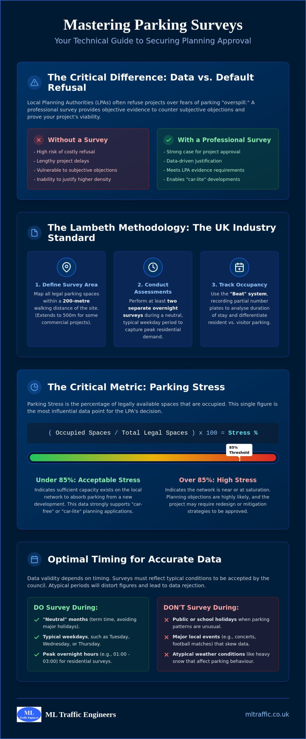
The Lambeth Methodology remains the definitive framework for assessing on-street parking capacity in 2026. While originally developed for a specific London borough, its technical rigour has led to its adoption by planning authorities across the UK. It provides a standardised way to measure “parking stress,” which is the percentage of available legal spaces occupied at peak times. For developers, following this protocol isn’t optional. It’s a functional necessity to ensure the data in your parking survey for planning application is accepted by the council without challenge.
Precision starts with defining the survey area. The industry standard is the 200-metre rule, which requires surveyors to map every legal parking space within a 200-metre walking distance of the site entrance. For commercial projects, this radius often extends to 500 metres. We use a “Beat” system during data collection. This involves recording partial number plates of parked vehicles at specific intervals. It’s a reliable method to track duration of stay and distinguish between long-term residential parking and short-term visitor turnover. While Lambeth is the most common, some boroughs require variations. Merton, Southwark, and Richmond have their own specific tweaks to the timing or radius that you must account for to avoid data rejection.
The Lambeth Methodology Explained
A compliant survey requires two separate overnight assessments, typically conducted on a Tuesday and Wednesday. These are “neutral” nights that represent peak residential demand when most residents are at home. The critical window for data collection is between 12:30 AM and 5:30 AM. During these hours, we calculate parking stress by dividing the number of parked vehicles by the total number of legal spaces. If the resulting figure is too high, it signals to the council that the local area cannot support additional parking demand. Integrating this technical data into a comprehensive Transport Statement helps contextualise these figures for the planning officer.
On-Street vs. Off-Street Data Collection
Mapping the kerbside requires more than just counting cars. We must identify all legal parking areas, including permit holder bays, pay-and-display zones, and unrestricted stretches of road. Crucially, we must subtract “dead” space where parking is prohibited or unsafe. This includes areas in front of driveways, fire hydrants, and dropped kerbs. In residential zones, we focus on overnight occupancy, while commercial zones might require daytime surveys to capture employee and customer demand. Accuracy in these measurements prevents the council from claiming your survey inflated the available capacity. If you’re unsure which methodology your local authority prefers, our team can help you identify the correct scope for your parking survey for planning application to ensure full compliance from day one.
Calculating Parking Stress: How Data Influences Decisions
Data interpretation is where a standard report transforms into a strategic asset. Parking stress is the primary metric councils use to evaluate your proposal. It’s calculated using a simple but critical formula: (Number of Parked Vehicles / Total Legal Capacity) x 100. The resulting percentage tells the planning officer exactly how much “room” is left on the street. While a low percentage suggests easy approval, high-density urban projects often face tighter margins. We don’t just count cars; we provide the technical narrative that proves your development’s viability even in crowded environments.
The 85% threshold is the industry-standard benchmark for saturation. When parking stress exceeds 85%, planning authorities consider the area “at capacity.” At this level, drivers begin circulating for spaces, which increases local congestion and compromises highway safety. If your parking survey for planning application shows figures above this limit, the council will likely object. ML Traffic Engineers specializes in identifying residual capacity that others might overlook, ensuring that your data reflects the true availability of the local infrastructure.
Interpreting the Results
High stress levels, such as 95% or above, don’t necessarily lead to an automatic refusal if you have a robust mitigation strategy. We help you present the data within a professional Transport Assessment to contextualize the findings. Mitigation options often include implementing car club memberships for residents, providing detailed travel plans, or accepting permit restrictions. These tools allow you to argue that while the street is busy, your specific project won’t contribute to the problem. We provide the technical evidence to support these claims, turning potential deal-breakers into manageable planning conditions.
The Impact of “Car-Free” Designations
In 2026, many urban developments are designed as “car-free” to meet sustainability targets. A parking survey for planning application is still mandatory for these projects. You must prove that residents won’t simply park their cars on nearby streets regardless of the designation. The survey data supports S106 agreements, which legally prevent new residents from applying for local parking permits. This is particularly effective in high PTAL areas where public transport is a viable alternative. By showing that “overspill” won’t occur, you justify higher density and lower construction costs associated with underground or on-site parking facilities.
Beyond the logistics of parking, these new residential communities are increasingly defined by residents who value digital efficiency in all areas of life. For couples planning their future together in such a modern development, you can visit MyNikahNow to learn how their digital platform simplifies Islamic marriage ceremonies.
Preparing for Your Parking Survey: Timing and Compliance
Success in a parking survey for planning application depends heavily on the calendar. A perfectly executed count is worthless if the data is collected during an atypical period. Highway authorities require data that reflects “neutral” conditions to ensure the results are representative of everyday parking stress. If your survey is conducted during a period of abnormally low or high demand, it won’t withstand technical scrutiny. This leads to unnecessary delays and potential planning refusal.
The “Tuesday/Wednesday” rule is a non-negotiable standard for residential parking beats. These nights represent the highest levels of residential occupancy. We also monitor local conditions before deployment. Local football matches, festivals, or major roadworks can skew the data by artificially inflating or deflating the number of available spaces. Weather is another technical constraint. Heavy snow, ice, or local flooding can invalidate results because they change how and where residents park. Our team manages these logistical variables to ensure your data is robust and compliant.
The 2026 Survey Calendar
For 2026, the best months for surveying remain March, April, May, June, September, October, and November. These windows avoid the significant seasonal variations caused by summer and winter holidays. Highway Authorities generally reject data from August and December because these months don’t reflect typical commuter or residential patterns. We also account for bank holidays and half-term breaks when planning your project timeline. To secure your planning approval, book our expert parking survey services to ensure your data collection falls within these critical windows.
Avoiding Common Survey Mistakes
Incomplete reporting is a frequent cause of planning objections. One major error is the inaccurate mapping of “legal” vs. “illegal” parking spaces. Surveyors must correctly identify restricted zones, dropped kerbs, and driveways to calculate the true capacity. Failing to account for temporary obstructions like skips or roadworks also leads to skewed stress percentages. We provide comprehensive reports that detail these variables, ensuring your submission meets the LPA’s specific methodology without gaps. Precision in a parking survey for planning application prevents the council from challenging the validity of your data.
How ML Traffic Engineers Secure Your Planning Approval
Precision is the foundation of a successful planning submission. ML Traffic Engineers provides expert data collection to ensure your parking survey for planning application withstands the most rigorous council scrutiny. Since our founding in 2014, we’ve specialized in delivering technical reports that satisfy Local Planning Authority requirements across the UK. We understand that a single data error can lead to a costly refusal. Our team treats every survey as a critical component of your project’s safety and regulatory compliance.
We provide a holistic approach to transport planning. We don’t just count vehicles; we analyze how parking patterns interact with your site’s physical constraints. We frequently integrate parking data with Swept Path Analysis to verify that site access remains functional even when local streets are at peak capacity. This ensures that emergency services and delivery vehicles can navigate the area safely. Our commitment to technical excellence means your report is ready for public inquiries and highway authority reviews from the moment of submission.
A Fully Managed Technical Service
Our experts manage the entire lifecycle of your survey requirements. We handle everything from the initial site assessment to the final technical report submission. We act as your technical representative, liaising directly with Local Highway Authorities to resolve potential objections before they escalate. It’s vital that your Travel Plan aligns perfectly with your survey findings. We coordinate these documents to create a consistent, evidence-based argument for your development. This comprehensive support reduces the logistical pressure on your team and keeps your project on schedule.
Request a Bespoke Parking Survey Quote
Every development presents unique challenges. We offer tailored solutions for residential, commercial, and mixed-use projects of all scales. Our team prioritizes rapid response times and efficient data processing to help you meet tight planning deadlines without sacrificing accuracy. We take pride in our role as a dependable partner for developers navigating complex regional regulations. You can rely on our precision and adherence to industry benchmarks to protect your investment. Contact ML Traffic Engineers today for an expert parking survey for planning application that secures your project’s future in 2026.
Secure Your Planning Success with Precision Data
Precision is a functional necessity in modern planning. Mastering the technical nuances of a parking survey for planning application is the most effective way to eliminate regulatory roadblocks. By adhering to the Lambeth Methodology and scheduling your assessment during neutral windows, you provide the Local Planning Authority with the objective evidence required for approval. This data justifies your project’s density and proves that local infrastructure remains safe and functional.
ML Traffic Engineers provides over 10 years of transport planning excellence. We deliver technical reports that are fully compliant with all UK Local Highway Authorities. Our team possesses deep expertise in the specific planning regulations governing London and the South East. We manage the entire survey lifecycle so you don’t have to navigate complex logistical pressures alone. Your project deserves a foundation of reliable, expert-led data to ensure a smooth path through the planning process.
Get a Professional Parking Survey Quote from ML Traffic Engineers and move your development forward with confidence.
Frequently Asked Questions
How long does a parking survey take to complete?
A professional parking survey for planning application usually takes between 10 and 15 working days from the point of commission to the delivery of the final report. This period includes two nights of on-site data collection, technical analysis, and report drafting. We ensure all surveys are scheduled during neutral periods to avoid data rejection. If your local authority requires specific variations or additional nights of data, the timeline might extend slightly to accommodate these technical requirements.
What is the “Lambeth Methodology” for parking surveys?
The Lambeth Methodology is the industry-standard framework used to assess on-street parking capacity across the UK. It requires surveyors to record parking occupancy on two separate weekday nights, typically Tuesday and Wednesday, between 00:30 and 05:30. This specific window captures peak residential demand when most residents are at home. The methodology provides a consistent way to calculate parking stress, ensuring the data is robust enough to withstand council scrutiny during the planning process.
Can I conduct my own parking survey for a planning application?
While you can technically collect your own data, Local Planning Authorities rarely accept non-professional surveys for planning submissions. Councils require impartial, expert evidence to ensure the data is accurate and compliant with regional regulations. Self-conducted surveys often lack the technical rigour needed and are frequently rejected due to biased methodology or incomplete mapping of legal spaces. Professional consultants provide the technical authority required to satisfy highway officers and address potential public objections.
Why did the council reject my parking survey data?
Councils typically reject survey data if it was collected during non-neutral periods, such as school holidays, bank holidays, or during local events. Rejection also occurs if the surveyor fails to follow the borough’s specific methodology or inaccurately maps legal parking spaces by including driveways or dropped kerbs. If your report doesn’t account for temporary obstructions like skips or roadworks, the data is considered flawed. Ensuring your parking survey for planning application aligns with 2026 highway standards is vital for approval.
How much does a professional parking survey cost in 2026?
The cost of a professional survey depends on the size of the survey area and the complexity of the local authority’s requirements. Factors such as the number of required “beats” and the specific walking distance radius will influence the final quote. We provide bespoke pricing tailored to your project’s unique scale rather than using a one-size-fits-all approach. This ensures you receive a technical service that is perfectly aligned with your development’s specific planning needs and budget constraints.
What is “parking stress” and why does it matter for my development?
Parking stress is the percentage of available legal parking spaces that are occupied at a given time. It’s a critical metric because it tells the planning officer whether the local street network can absorb the additional demand generated by your development. If stress levels exceed the 85% threshold, the council considers the area saturated. High stress levels suggest that any new vehicles will compromise highway safety and resident amenity, which often leads to a recommendation for refusal.
Do I need a parking survey if my development is “car-free”?
Yes, car-free developments still require a parking survey to prove that the project won’t cause unacceptable overspill. You must demonstrate that visitors, service vehicles, and residents with blue badges can be accommodated within the existing street capacity. The survey data also supports the implementation of S106 agreements, which legally prevent new residents from obtaining local parking permits. This evidence is essential for justifying high-density schemes in areas with high public transport accessibility levels.
What radius should a parking survey cover?
For most residential projects, the survey must cover a 200-metre walking distance from the site entrance. This radius represents the typical distance a resident is willing to walk between their vehicle and their home. For commercial or large-scale mixed-use developments, the required radius often extends to 500 metres. It’s important to verify these requirements with the local highway authority during the pre-application stage, as some boroughs may mandate specific extensions based on local parking zones or infrastructure constraints.

Disclaimer
The content on mltraffic.co.uk, including all technical articles, guides, and resources, is provided for general informational and educational purposes only. It is not intended to constitute professional advice in traffic engineering, transportation planning, development approvals, or any other technical or legal field.
While ML Traffic Engineers makes every reasonable effort to ensure the accuracy, completeness, and timeliness of the information published, we do not provide any warranties or representations (express or implied) regarding its reliability, suitability, or availability for any particular purpose. Any reliance you place on the content is strictly at your own risk.
In no event shall ML Traffic Engineers, its directors, employees, authors, or affiliates be liable for any direct, indirect, incidental, special, consequential, or punitive damages (including, without limitation, loss of profits, data, or business opportunities) arising out of or in connection with the use of, or inability to use, any information provided on this website.
The articles and guides on this site are not a substitute for engaging a qualified, professional traffic engineer to assess your specific project requirements. For tailored advice, compliance assessments, or traffic engineering services, please contact a competent professional.
This disclaimer may be updated from time to time without notice. By accessing or using this website, you agree to be bound by the most current version of this disclaimer.