Author: adminmltuk

  • Church Transport Assessments In 2026: What Planners, Parishes, And Consultants Need To Get Right

    Church Transport Assessments In 2026: What Planners, Parishes, And Consultants Need To Get Right

    A church transport assessment can look straightforward on paper: count some trips, review access, check parking, submit the report. In practice, church schemes rarely behave like standard commercial or residential development. Their traffic patterns are more peaky, their busiest periods often fall outside typical commuter models, and a single site may need to accommodate worshippers, school-age children, elderly attendees, taxis, minibuses, delivery vehicles, funeral corteges and the occasional coach, all without creating safety or amenity problems on nearby streets.

    That is exactly why church proposals can attract closer scrutiny from local planning authorities and highway officers than applicants first expect. Whether we are dealing with a new worship building, an extension to an established parish, or a change-of-use scheme, the transport evidence has to reflect how the site will actually operate in real life, not how a generic land-use spreadsheet says it might.

    In this guide, we set out what planners, parishes, architects and consultants need to get right in 2026. We cover when a church transport assessment is likely to be required, what makes church travel demand distinctive, the core components of a robust report, and how to present evidence that stands up in planning. Drawing on the practical approach we use at ML Traffic, the focus here is simple: clear analysis, locally relevant evidence, and fewer avoidable planning delays.

    What A Church Transport Assessment Is And When It Is Required

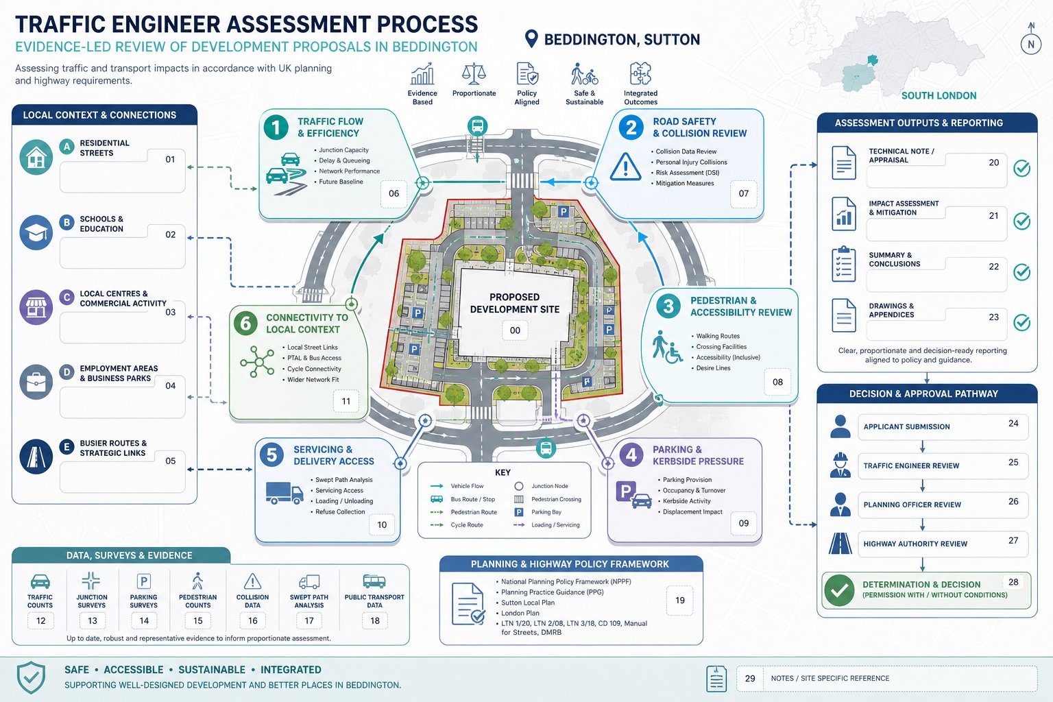
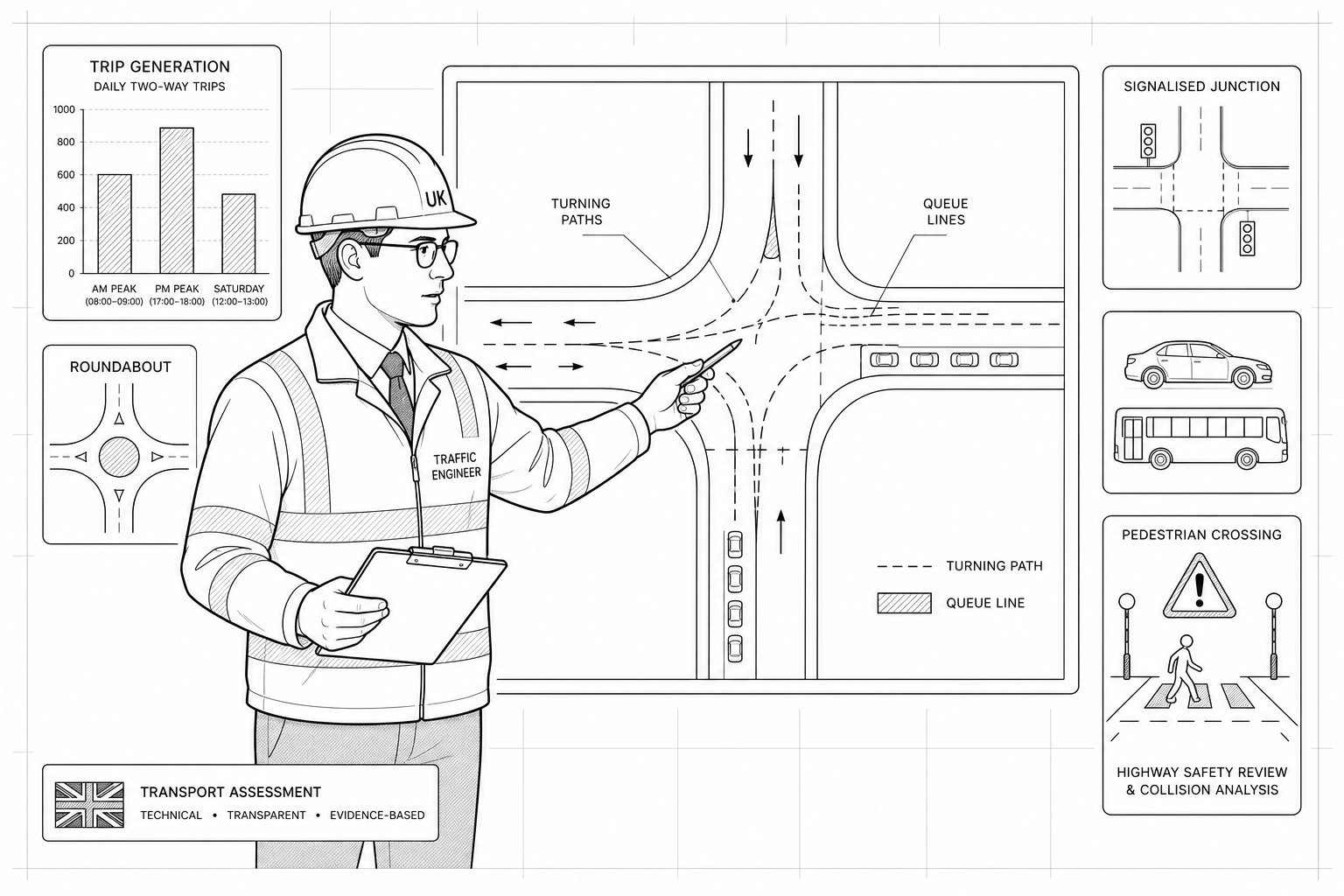
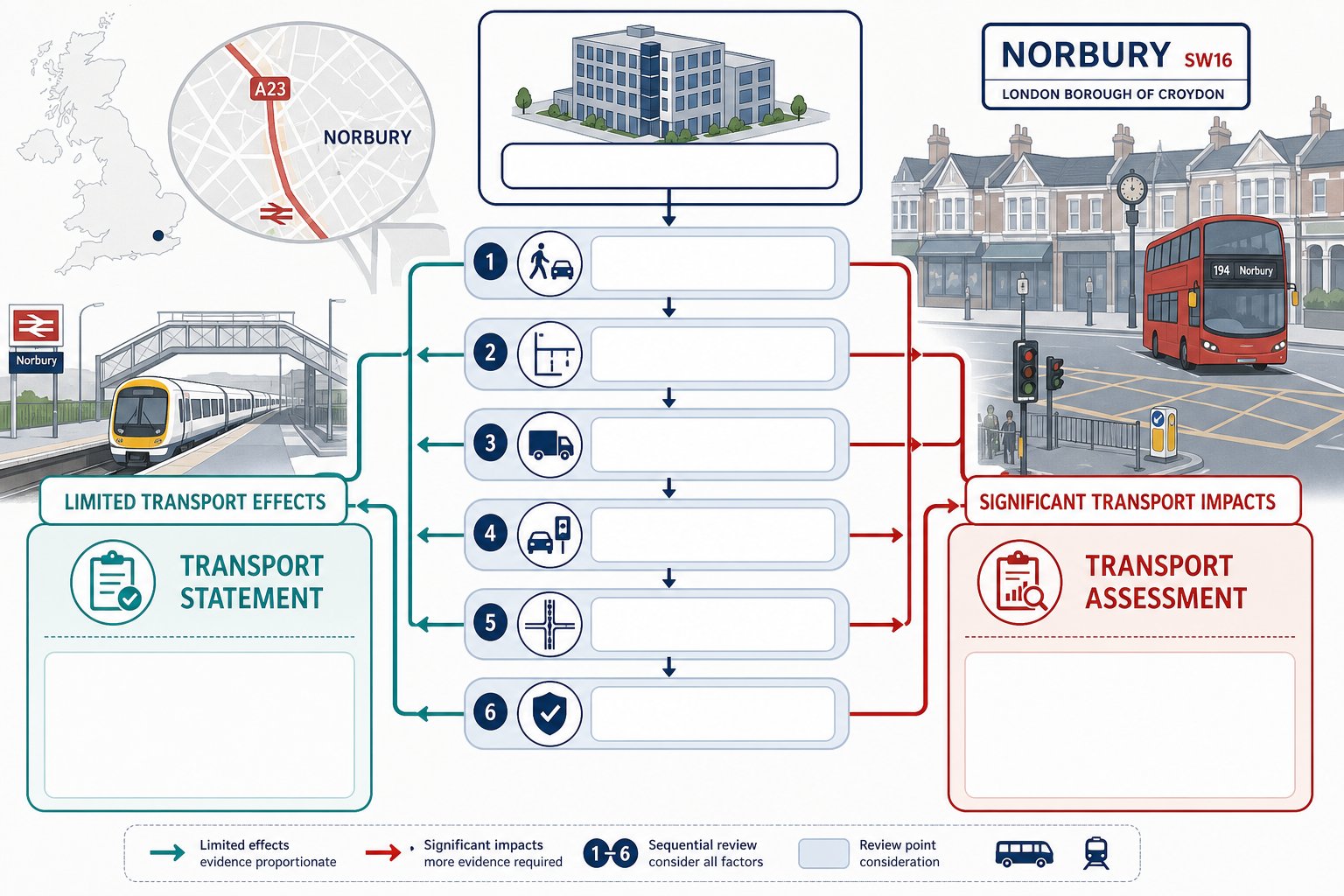
    Church transport assessment flow showing when transport evidence is needed.
    Infographic showing when a church transport assessment may be required.

    A church transport assessment is a planning document that examines how a proposed church development will affect movement to and from a site. In plain terms, it asks whether the surrounding highway network, access points, footways, crossings, parking areas and servicing arrangements can cope safely and efficiently with the development being proposed.

    For church schemes, that usually means assessing existing conditions first, then forecasting likely changes in vehicle trips, pedestrian activity, cycle movements and parking demand. The report may range from a concise transport statement for a modest proposal through to a fuller assessment for larger or more sensitive schemes.

    When is it required? There is no single national threshold that applies to every church project. Local planning authorities typically decide the level of transport evidence based on scale, location and likely impact. A small internal alteration with no material change in attendance may need very little transport input. A new-build church, a substantial extension, or a proposal that intensifies use can be very different.

    In our experience, transport appraisal is most often triggered where a scheme is likely to generate noticeable traffic, worsen parking stress, alter access arrangements, or raise road safety concerns. Sites on constrained rural roads, in residential streets with existing parking pressure, or near busy junctions often receive closer attention. Councils also tend to look carefully at proposals where there are regular children’s activities, community uses, or larger event days.

    The key point is this: if the church proposal changes how many people travel to the site, when they travel, or how they arrive, transport evidence is usually needed in some form.

    How Church Use Creates Unique Transport Planning Issues

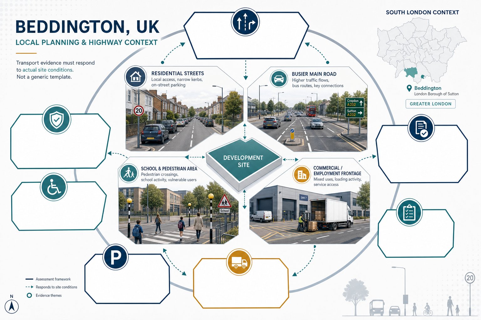
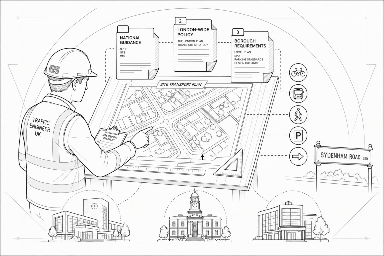
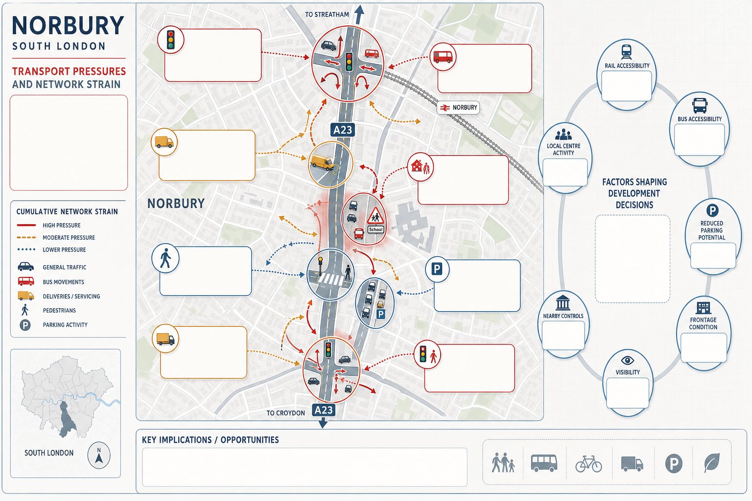
    Infographic showing church transport peaks, planning triggers, and scheme comparison in the UK.
    Infographic of church transport planning issues, peak arrivals, triggers, and scheme types.

    Church development does not fit neatly into the standard transport-planning mould. Unlike offices, schools or supermarkets, churches often produce highly concentrated arrivals and departures over relatively short periods. A Sunday morning service may lead to a pronounced spike in vehicle movements, then the site can be comparatively quiet for hours. Midweek prayer meetings, youth groups, foodbank operations or counselling sessions may create a very different profile again.

    That variability matters. If we rely only on average daily traffic assumptions, we can miss the real operational issue, the 20 to 40 minutes before and after a main service, wedding or funeral, when access and parking are under the greatest strain. Church sites also tend to attract a broad demographic. Some attendees walk from nearby homes, some share lifts, some need blue-badge parking close to the entrance, and some arrive by minibus or coach.

    There is also a behavioural element that planning reports sometimes underplay. Congregations are often loyal to a venue rather than choosing the nearest one. So catchments can be wider than expected, especially for larger evangelical, Pentecostal, Catholic or multi-service churches serving a regional community. That can increase car dependency even in urban areas with decent public transport.

    And then there are occasional peaks. Christmas services, Easter events, weddings, funerals, conferences and charity drives can all create transport conditions far removed from an ordinary weekday. A credible church transport assessment needs to acknowledge that lived reality and build the analysis around it.

    Typical Triggers For A Church Transport Assessment In Planning Applications

    Certain planning scenarios nearly always justify transport input. A new church building is the clearest example, especially where it introduces a substantial congregation to a site that has not previously operated as a place of worship. The same applies where a proposal includes a large hall, classrooms, café space, community rooms or multiple auditoriums that widen the scale and frequency of use.

    Extensions can also trigger assessment, even where the worship use is already established. If new floorspace is intended to increase attendance, host parallel activities or formalise previously informal gatherings, councils will usually want evidence on traffic and parking implications. We often see this where applicants describe a scheme as “ancillary” but the practical effect is to intensify use materially.

    Change-of-use applications are another common trigger. Converting a warehouse, office, light industrial unit or former retail premises into a church can alter trip patterns sharply, particularly on Sundays and evenings. Authorities may ask whether the previous lawful use would really have generated more traffic than the proposed church use, and if so, at what times.

    Other triggers include new or amended access arrangements, proposals near schools or congested junctions, known neighbour objections about overspill parking, and sites with a poor road safety record. Even where a full assessment is not required, a transport statement or technical note may still be essential.

    Key Differences Between New Churches, Extensions, And Change-Of-Use Schemes

    The transport strategy should reflect the type of church proposal rather than treating all schemes the same.

    For new churches, we usually need the broadest evidence base. There may be no established attendance pattern at the site, no proven parking arrangement and no accepted baseline traffic profile linked to worship use. That means the assessment often has to rely on observed data from comparable sites, congregation surveys, agreed assumptions about likely attendance, and careful testing of access and parking operation.

    For extensions, the central issue is uplift. How many extra attendees will the enlarged building accommodate? Will service times change? Will the extension support children’s ministry, events or weekday programmes that increase trip generation beyond the current pattern? Here, comparing existing observed use against forecast future use is often more persuasive than abstract trip-rate modelling alone.

    For change-of-use schemes, the key planning question is comparative impact. The previous lawful use may have generated weekday traffic but little Sunday demand: the church use may reverse that pattern. Councils and neighbours often focus on parking shortfall, evening activity and compatibility with local streets. A robust comparison must hence consider not just gross trip totals but timing, mode split, turnover and operational management.

    In short, each scheme type needs a tailored line of evidence. One-size-fits-all reporting is where planning trouble usually starts.

    Core Elements Of A Church Transport Assessment

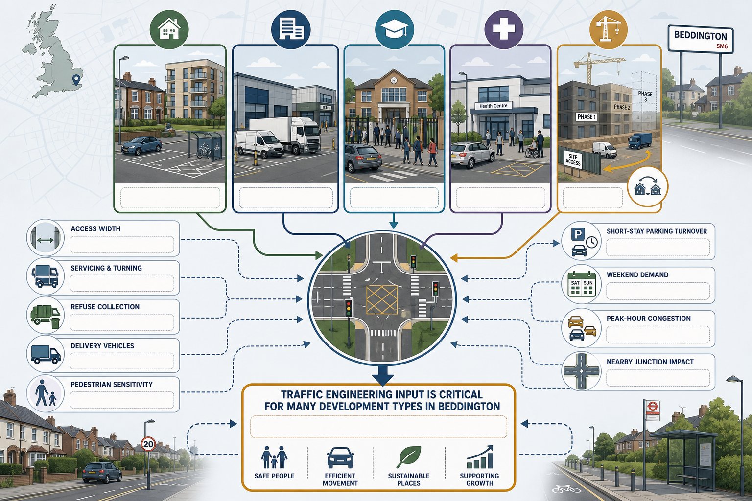
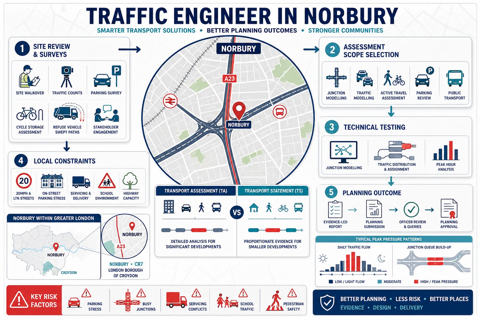
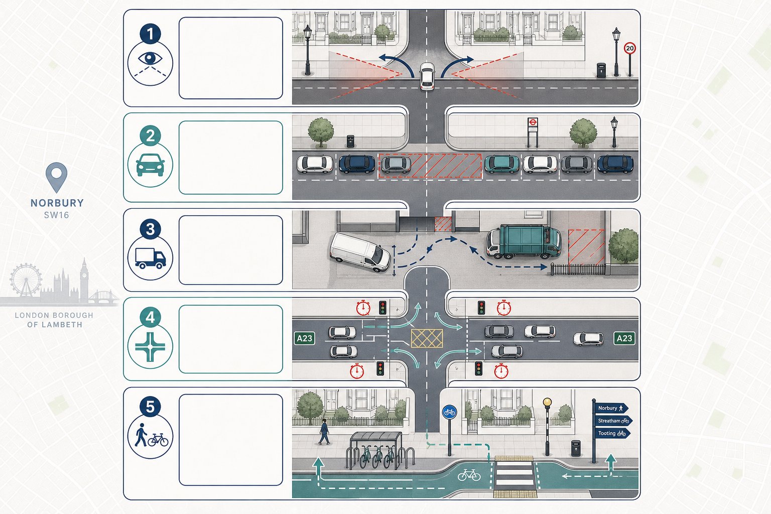
    infographic of church transport assessment with access, parking, and walking routes.
    infographic of church site access, parking, safety, and travel assessment.

    A robust church transport assessment is not just a traffic count with a few plans attached. It should explain how the site works now, how the proposed development will work in practice, and whether any mitigation is needed to make that operation safe and acceptable.

    Most reports begin with the site context: surrounding roads, speed environment, nearby junctions, footways, crossings, bus stops, cycle routes and local parking controls. From there, the assessment typically moves into existing traffic and parking surveys, an overview of current church activity if relevant, and a forecast of future trip demand.

    The core technical themes are usually consistent. We need to understand whether vehicles can enter and leave safely, whether visibility splays meet the appropriate standard, whether on-site layout allows convenient turning and drop-off, and whether parking supply is realistic for both ordinary worship and more intensive events. Pedestrian accessibility is equally important. A church site serving families, older worshippers and disabled users cannot be assessed credibly without looking closely at footway quality, crossing opportunities, gradients and public transport availability.

    Good reports also deal with operation, not just infrastructure. If the site occasionally hosts large events, how will stewards manage arrivals? If minibuses are used, where do they load and wait? If parking demand exceeds on-site capacity during peak events, what is the actual strategy, not the hopeful one, for avoiding overspill impact?

    That practical level of detail is often what turns a transport document from merely adequate into genuinely persuasive.

    Site Access, Visibility, And Highway Safety Considerations

    Access design is usually one of the first issues a highway officer will test. For church schemes, that scrutiny can be sharper because arrivals are often concentrated into short windows, increasing the chance of conflict at the site entrance. If vehicles are turning across traffic, reversing into the highway, or queuing back from a substandard access, even a modest congregation can create planning concern.

    We hence assess the geometry of the access in detail: width, radii, gradients, gate set-back, intervisibility and the ability for cars, minibuses or service vehicles to manoeuvre within the site. Visibility splays need to match the local speed environment and actual on-street conditions. Parked cars, boundary walls, vegetation and street furniture regularly compromise visibility in ways that old site plans never quite capture.

    Highway safety review should also cover pedestrian movement at the frontage. Can people step out of cars or minibuses without entering the carriageway? Are there safe walking routes from the entrance to the building? If children attend classes or Sunday school, are the crossing conditions acceptable at busy times?

    Where there is an existing accident pattern nearby, that should be examined properly rather than brushed aside. Not every recorded collision is relevant, but a cluster of turning or pedestrian incidents can shape the authority’s view quickly. Sometimes modest mitigation, revised access alignment, localised widening, mirror-free visibility improvements, stewarding arrangements, can make the difference between a difficult recommendation and a workable one.

    Parking, Drop-Off, And Coach Management

    Parking is where many church applications become contentious. Local residents worry about overspill. Councils worry about obstruction, unsafe manoeuvring and pressure on controlled streets. Applicants, understandably, sometimes point to staggered services or shared travel. All can be relevant, but none replaces evidence.

    A sound assessment should quantify on-site parking capacity, describe how spaces are laid out, and test whether the supply is suitable for the actual user profile. Churches often need more than standard parking calculations suggest because demand may peak sharply and include older worshippers, families with children and mobility-impaired users who need convenient access.

    Drop-off is another recurring issue. Taxis, community transport, informal lift-sharing and school-age passenger drop-off can create a surprising amount of short-stay activity. If there is no dedicated area, vehicles may stop on the highway, block visibility or interfere with through traffic right when arrivals are busiest.

    Coach and minibus management matters too, particularly for larger congregations or occasional conferences. Can larger vehicles enter, turn and exit in forward gear? Is there somewhere to wait without obstructing the car park? If not, where exactly will they go? “Managed off-site” is not enough unless the arrangement is specific and credible.

    For some sites, a parking management plan is as important as the parking layout itself. Stewarding, overflow protocols, marked blue-badge bays and event-specific controls can significantly reduce planning risk when backed by a realistic operating strategy.

    Walking, Cycling, Public Transport, And Accessibility

    A church transport assessment should never assume everyone drives. Equally, it should not exaggerate sustainable travel prospects where the site context does not support them. The right approach is evidence-led and honest.

    Walking catchments need to reflect the actual quality of local routes, not just distance circles on a plan. Are the footways continuous? Are there dropped kerbs? Is the route lit? Would an older worshipper or parent with a buggy genuinely find the route practical in winter? These details matter, particularly where a proposal is presented as sustainably located.

    Cycling should be reviewed in the same practical way. If a church expects some cycle arrivals, secure and convenient cycle parking should be shown, not treated as an afterthought near the bins. Public transport access also needs careful treatment. A site may be close to a bus stop on paper, but if Sunday frequencies are sparse or evening services finish after buses have thinned out, the effect on mode choice may be limited.

    Accessibility for disabled users deserves particular emphasis. Places of worship often serve people with reduced mobility who attend regularly and need predictable, dignified access. That includes blue-badge parking close to entrances, step-free routes, manageable gradients, suitable crossing points and enough space for assisted drop-off.

    When these factors are assessed properly, they strengthen the whole planning case. They show the authority that the proposal has been designed around real users rather than generic transport-policy language.

    How Trip Generation Is Assessed For Church Developments

    Trip generation is often the technical heart of a church transport assessment. It is also where generic methodology can let schemes down.

    For many land uses, standard database trip rates give a reasonable starting point. Church developments are trickier. Attendance can vary by denomination, service format, catchment, parking availability, and whether the building doubles as a broader community hub. One congregation might have a single main Sunday service: another may run multiple services, youth activities, food distribution, rehearsals and counselling sessions across the week.

    That is why we usually combine several strands of evidence. Existing traffic counts at the site, where a church use is already operating, are often the most persuasive starting point. For new churches, surveys from comparable worship sites can help, but they must be chosen carefully. A suburban parish church with mainly local walk-in attendance is not an obvious proxy for a regional destination church drawing families from several boroughs.

    Congregation data can also be valuable if treated critically. Expected attendance, number of staff or volunteers, car-sharing patterns and service schedules all inform the forecast. Parking beat surveys and on-street observations help test whether claimed travel patterns align with actual demand.

    The assessment should then identify the relevant peak periods and quantify arrivals and departures by mode. That may include ordinary worship periods, weekday activity and occasional higher-intensity events if they are part of the proposal. The aim is not to produce a false sense of precision: it is to provide a reasonable, transparent and defensible forecast that the local authority can follow.

    Peak Worship, Weekday, And Special Event Traffic Patterns

    The biggest mistake in church trip generation is averaging away the problem. A site may have modest daily traffic overall but still create a sharp and locally significant peak before and after services. That is the pattern that usually matters most to neighbours and highway officers.

    Sunday worship is the obvious focus. We need to understand not just total attendance, but service times, overlap between congregations, volunteer arrival patterns, and whether departures from one gathering coincide with arrivals for the next. A church running back-to-back services can create two compressed peaks rather than one.

    Weekday use can be equally relevant, especially where the proposal includes nursery activity, community outreach, counselling, classes, rehearsals or evening meetings. These uses may spread demand more evenly, but they can also overlap with school-run traffic or commuter parking pressure, which changes the planning picture.

    Special events deserve explicit treatment. Weddings and funerals are not everyday occurrences, but they are foreseeable and can produce concentrated arrivals, unusual parking behaviour and sensitivity around kerbside stopping. Seasonal events such as Christmas services, conferences or festivals can be larger still. Authorities do not always expect every occasional peak to be modelled in full, but they usually do expect an operational strategy showing how those events will be managed.

    A realistic assessment hence distinguishes between regular peak worship periods, recurring weekday activity and occasional high-demand events. That layered approach is far more credible than relying on one blended average trip figure.

    Common Planning Risks And How To Address Them Early

    Most church transport objections are predictable. That is good news, because predictable issues can usually be addressed before they harden into refusal reasons.

    The first recurring risk is parking shortfall. If likely peak demand materially exceeds on-site supply, local residents will assume overspill onto surrounding streets. Sometimes they are right. Early surveys should test both normal and busier operating periods, with honest allowance for disabled spaces, staff parking and drop-off activity. If there is a shortfall, the answer may involve revised layout, shared parking agreements, staggered service times or a formal management plan, but it needs substance.

    The second is unsafe or constrained access. Narrow entrances, weak visibility, awkward turning and vehicles waiting on the highway can all trigger concern. These issues are best reviewed before an application is fixed architecturally, because small layout changes early on are much cheaper than redesign after objections arrive.

    Third, there is overspill and event management. Even where ordinary worship is manageable, unplanned peaks for funerals, weddings or conferences can undermine confidence. A simple operational note on stewarding, booking controls, overflow arrangements and minibus handling can go a long way.

    Fourth is mismatch between planning description and real use. If a proposal is presented as modest worship accommodation but plans show extensive halls, classrooms or café space, authorities may assume the impacts are being understated. We always advise aligning the transport case with the actual intended operation.

    And finally, there is late evidence. Once neighbour concern and officer doubt have set in, even good technical work can feel reactive. Front-loading surveys and strategy usually produces a smoother planning path.

    Preparing Evidence That Supports A Stronger Planning Submission

    The strongest church planning submissions do not just say the impacts are acceptable: they show why, with evidence that is proportionate, transparent and local.

    First, we need reliable baseline data. That often includes traffic counts, parking accumulation surveys, access observations, swept-path review where larger vehicles are relevant, and a clear audit of walking, cycling and public transport conditions. Timing matters. Surveying only a quiet weekday and ignoring Sunday worship patterns is an easy way to weaken the file from the outset.

    Second, assumptions must be visible. If trip forecasts are based on expected congregation size, service schedules, car occupancy or modal split, those assumptions should be stated plainly and, where possible, supported by comparable evidence. Hidden assumptions are where objections usually land.

    Third, the report should explain operations in human terms. How will arrivals be managed? Where will blue-badge users park? What happens when a funeral coincides with another activity? Can a minibus turn on site? This kind of operational clarity often reassures authorities more than pages of abstract policy citation.

    Fourth, mitigation should be practical and deliverable. That may mean access improvements, revised internal layout, marked drop-off areas, cycle parking, a travel plan, stewarding protocols or an event management note. The best mitigation is usually simple, specific and easy to secure by condition if needed.

    Finally, the transport evidence should align with the wider planning package. Plans, design statement, planning statement and transport report all need to describe the same development in the same way. When they do, the submission feels competent and credible. When they do not, even a technically sound church transport assessment can be dragged into avoidable doubt.

    For applicants working to tight planning programmes, that is often where experienced transport input adds the most value: not by producing a longer report, but by producing the right report, at the right level, early enough to influence the design.

    Conclusion

    A well-prepared church transport assessment is really about fit between a proposal and the way a site will function in everyday life. In 2026, local authorities are not just looking for standard trip-rate tables or generic policy wording. They want evidence that reflects the distinctive rhythm of church use: concentrated worship peaks, varied weekday activity, occasional high-demand events, and the practical needs of families, older worshippers and disabled users.

    For planners, parishes and consultants, the lesson is straightforward. Start early, survey the right periods, test the real operational risks, and make sure the transport story matches the development being applied for. That usually means focusing on access, parking, drop-off, walkability, public transport realism and event management in one coherent narrative.

    When that is done properly, transport need not be the part of the application that causes delay. It can become one of the clearest parts of the planning case, concise, defensible and tailored to local authority expectations.

    Church Transport Assessment FAQs

    What is a church transport assessment and when is it required?

    A church transport assessment evaluates how a proposed church development affects local traffic, parking, access, and safety. It’s typically needed for new churches, significant extensions, or changes in use that increase vehicle trips or parking demand, especially on constrained or residential streets.

    Why do church transport assessments differ from those for other developments?

    Churches create highly peaked traffic patterns during services and special events, unlike standard daily flows. They also serve diverse users including elderly or disabled attendees, minibuses, and coaches, requiring assessments to reflect real operational scenarios rather than generic land-use data.

    What are the key components of a robust church transport assessment?

    It should include analysis of site access and visibility, parking capacity and management, drop-off arrangements, pedestrian routes, cycle and public transport links, and accessibility for disabled users, plus operational strategies for peak worship times and special events.

    How is trip generation assessed for church developments?

    Trip generation uses observed traffic counts, congregation attendance data, and surveys from comparable churches to forecast vehicle arrivals by mode and time. It distinguishes between Sunday peaks, weekday activities, and occasional events for a realistic travel demand profile.

    What common planning risks should be addressed early in a church transport assessment?

    Key risks include insufficient parking causing overspill, unsafe or narrow site access, limited visibility, unmanaged event peaks, and discrepancies between planning descriptions and actual use. Early surveys and clear strategies help mitigate these issues.

    How can a church ensure its transport assessment supports a smoother planning process?

    By providing transparent baseline data, clear travel assumptions, detailed access and parking strategies, event management plans, and aligning transport reports with other planning documents, churches can create credible, tailored cases that local authorities accept more readily.

  • Synagogue Transport Assessment: What Planning Authorities Expect In 2026

    Synagogue Transport Assessment: What Planning Authorities Expect In 2026

    Planning officers rarely worry about a transport report in the abstract. What they worry about is what actually happens on the street outside a site: queues at the junction, cars circling for spaces, pedestrians stepping into the carriageway, neighbours complaining that the busiest period was never properly assessed. That is exactly why a synagogue transport assessment needs to be more tailored than a standard place-of-worship report.

    In practice, synagogue proposals often produce travel patterns that don’t fit neatly into ordinary weekday assumptions. Friday evening arrivals can be sharp and compressed. Shabbat can mean a high walking mode share in some communities, while still creating kerbside set-down demand before and after services. Add education uses, community functions, weddings, funerals, and High Holy Day peaks, and the planning picture becomes far more nuanced than a simple floorspace calculation.

    For architects, planners, solicitors, developers, surveyors, and councils, the key issue in 2026 is not whether a report exists, but whether it reflects real use. We’ve seen that local authorities respond best when the evidence is site-specific, honest about peak conditions, and tied to practical mitigation. At ML Traffic, that has long been the focus: concise, accurate transport reporting shaped around local thresholds and real planning risks rather than boilerplate.

    This guide sets out what planning authorities typically expect, when a synagogue transport assessment is needed, what evidence usually matters most, and how to deal with common concerns before they become objections.

    When A Synagogue Transport Assessment Is Needed

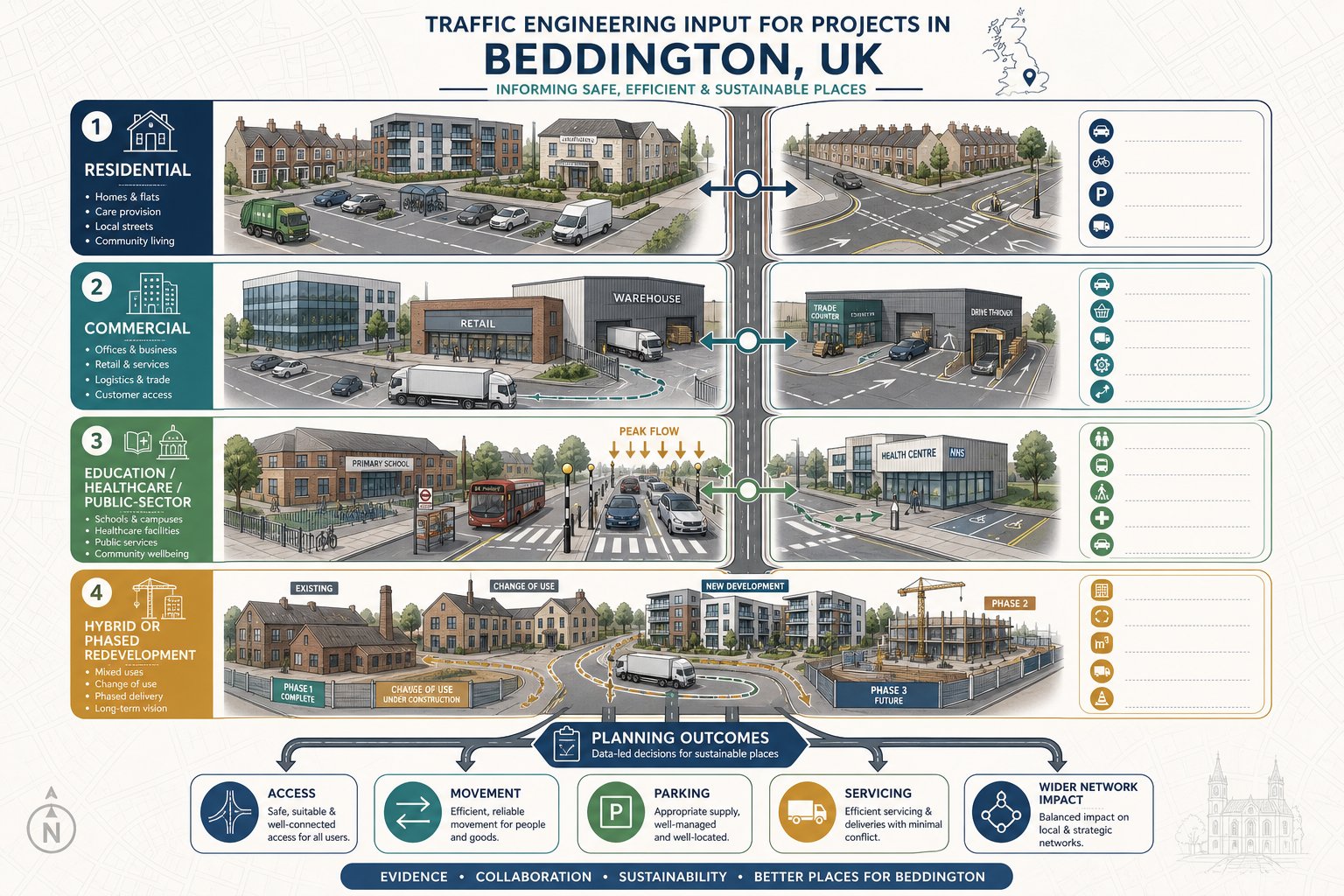
    UK synagogue transport assessment triggers for new build, extension, and change of use.

    A synagogue transport assessment is usually required where a proposal could materially affect travel demand, access arrangements, or parking conditions. In some cases the local authority will ask for a full Transport Assessment: in others, a shorter Transport Statement will do. The difference tends to come down to scale, local sensitivity, and whether the likely effects can be dealt with through proportionate evidence.

    For synagogue schemes, the most common triggers are straightforward: a new-build development, an extension that increases capacity, or a change of use that intensifies attendance patterns. But the planning judgement is rarely based on one number alone. Authorities are increasingly interested in whether the proposal changes how the site functions over the week, especially around worship periods, education sessions, and community events.

    A modest extension on a wide road with plentiful off-street parking may need relatively light evidence. A similar extension on a narrow residential street near a school, a controlled parking zone, or a sensitive junction may need much more robust analysis. That is why we usually advise looking beyond floorspace thresholds at the start.

    Local plans, parking standards, and transport supplementary planning documents often provide the formal trigger points. Even so, officers can request a synagogue transport assessment below those thresholds if they consider the local context constrained or the use pattern atypical.

    Typical Planning Triggers For New Build, Extension, And Change-Of-Use Schemes

    The clearest trigger is a new-build synagogue, particularly where regular worship, classrooms, function space, offices, or ancillary community uses are proposed together. New sites create a fresh trip pattern, and planning authorities will want to know how people arrive, where they park, how drop-off activity works, and whether nearby junctions can absorb the demand.

    Extensions are another common trigger. An increase in prayer hall space, extra seating, enlarged halls, or more educational accommodation can all intensify use. Sometimes the issue is not average daily activity but a sharper peak after expansion, especially if the larger building enables more simultaneous functions.

    Change of use can be even more sensitive. Converting a shop, office, warehouse, or former community building into a synagogue may be acceptable in principle, but transport effects often differ materially from the lawful use. A site that previously generated spread-out weekday trips may instead produce concentrated arrivals around services or event times.

    Authorities also look closely at proposals that worsen access, intensify parking demand, or introduce larger gatherings than an existing consent envisaged. If nearby streets already experience parking stress, or if the proposal sits close to schools, busy crossings, or substandard junctions, expect the need for stronger evidence.

    How Synagogue Travel Patterns Differ From Other Community Uses

    Infographic showing synagogue travel peaks, walking routes, and event-related transport impacts.

    One reason a synagogue transport assessment needs care is that synagogue travel patterns often don’t resemble those of a generic hall, church, or community centre. The use may look similar in land-use terms, but the transport reality can be quite different.

    The first difference is the strength of fixed-time demand. Services begin at defined times, so arrivals are often concentrated into short windows rather than dispersed across an hour or two. That can create intense but brief pressure on crossings, footways, side roads, and kerb space.

    The second difference is mode choice. In observant communities, Shabbat restrictions can produce a very high walking mode share, which may reduce parking demand during certain periods but increase the need for safe, direct pedestrian routes. At the same time, some worshippers, visitors, elderly attendees, or those travelling from farther away may still arrive by car before or after key periods, so it would be a mistake to assume zero vehicular impact.

    Then there are ancillary uses. Many synagogues are not just places of worship: they may include education, youth activity, social events, charitable functions, and lifecycle ceremonies. Those uses can alter demand profiles substantially and may be the part of the proposal that generates the greatest planning concern.

    Peak Arrival And Departure Periods Around Services, Festivals, And Events

    Peak periods matter because they often drive the planning outcome. A local authority is less interested in whether a street is quiet at 2pm on a Tuesday than in whether it operates safely and acceptably during the busiest realistic conditions.

    For many synagogues, Friday evening is one of the most important peaks. Arrivals can cluster close to sunset, producing a compressed demand profile. Some attendees walk, others are dropped off, and those who drive may seek spaces quickly in nearby streets. The result can be a short burst of activity that standard weekday surveys simply miss.

    Shabbat morning is another key period. Depending on congregation size and observance patterns, arrival peaks may be more gradual than Friday evening, but departures can bunch after the service and any associated gathering such as kiddush. That creates a different transport effect: more crossing movements, more doorstep activity, and potential conflicts at site access points.

    Festival periods and major events complicate things further. High Holy Days can generate attendance levels materially above a normal week. Weddings, bar and bat mitzvahs, funerals, and large community programmes can also produce one-off or recurring peaks with higher car use than routine worship. A robust synagogue transport assessment needs to distinguish between regular conditions, predictable seasonal peaks, and event-led demand rather than blending them into one average.

    Key Issues Assessed In A Synagogue Transport Assessment

    Infographic of synagogue transport assessment issues including access, parking, drop-off, and walking safety.

    A sound synagogue transport assessment should explain not just how many trips are expected, but how those trips interact with the site, the street, and the surrounding area. In 2026, planning authorities generally expect a more rounded appraisal than a simple traffic count and parking estimate.

    The starting point is usually trip generation and mode split: how many people attend, when they arrive and leave, and whether they walk, drive, share lifts, use public transport, cycle, or rely on taxis and community transport. From there, the assessment should examine whether the site layout and local network can accommodate those movements safely.

    Access design is central. Officers will want confidence that vehicles can enter and leave without awkward manoeuvres, reversing conflicts, or visibility problems. Where servicing, refuse collection, or security arrangements affect circulation, those issues need to be explained clearly.

    Parking is almost always scrutinised, but it should be considered honestly. Under-provision can create overspill and resident objection: over-provision may conflict with policy aims if the site is in an accessible location. The right answer is usually evidence-led rather than formulaic.

    Pedestrian movement is equally important. A scheme with a high walking share still needs enough footway capacity, safe crossing opportunities, and sensible interaction between people and vehicles at the frontage.

    Vehicle Access, Parking Demand, Drop-Off Activity, And Pedestrian Safety

    Vehicle access is more than a geometry exercise. Yes, the assessment should cover visibility splays, gate positions, swept paths, and whether two-way movement is workable. But authorities also look at how the access operates at the moments that matter most. If several cars try to turn in during a compressed pre-service window, does queuing spill back onto the carriageway? If a refuse vehicle arrives at the same time as worshippers are departing, is there a conflict?

    Parking demand needs a similarly practical approach. On-site spaces should be reviewed against local standards, but that is only part of the picture. The real planning question is whether likely demand can be absorbed without harmful overspill into surrounding streets, especially where residents already experience stress. Parking beat surveys, accumulation profiles, and observations of turnover all help here.

    Drop-off and pick-up activity can be the hidden issue on synagogue schemes. Even where many attendees walk, there may still be short-stay set-down demand for older people, children, disabled users, and visitors. Without designated or managed kerbside space, vehicles may stop informally, obstruct driveways, or narrow the running lane.

    On pedestrian safety, officers usually expect more than a passing note. Footway widths, crossing desire lines, lighting, passive surveillance, and the interface with security measures all matter. If children walk from nearby homes or schools, or if older worshippers use mobility aids, the assessment should say so plainly and show how the design responds.

    Survey Data And Evidence Usually Required

    Evidence quality often determines whether a synagogue transport assessment feels credible. A technically neat report can still fall apart if the survey base ignores the actual busiest periods. Planning authorities know this, and objectors certainly do.

    Most applications need multi-day traffic and parking surveys covering the streets most likely to be affected, not just the road directly outside the site. Depending on local conditions, that may include beat surveys of on-street parking, automatic traffic counts, turning counts at nearby junctions, and site observations of arrival and departure patterns.

    Attendance evidence is usually just as important as highway data. Occupancy counts for services, classes, and events help establish realistic trip generation. Where an existing synagogue is being extended, observed attendance by time of day and day of week is often the strongest evidence available. For proposed relocations or new communities, comparable site data and transparent assumptions become more important.

    Public transport and active travel evidence should also be included. Distance to bus stops and rail stations, service frequency, walking routes, step-free access, and cycle parking provision all influence the mode split case.

    Where local concern is high, we often find that clearly presented evidence matters as much as the surveys themselves. If residents and officers can follow the methodology, the discussion becomes far more constructive.

    How Friday Evenings, Weekends, And Seasonal Religious Events Affect Data Collection

    This is where many weaker reports miss the mark. If surveys only cover standard weekday AM and PM peaks, they can materially understate synagogue demand. A proper synagogue transport assessment should normally include Friday PM, weekend/Shabbat periods, and, where practicable, at least one relevant festival or event condition.

    Friday evening is especially important because arrivals may be brief, intense, and tied to sunset rather than a fixed civil time throughout the year. Survey timing should reflect that seasonal reality. A count from 5pm to 6pm may be useful in one month and much less so in another.

    Weekend data matters too. Shabbat morning conditions often differ from weekday operations in parking availability, pedestrian volume, and background traffic. A street that seems manageable on a Tuesday may operate very differently on a Saturday when residents are home and kerbside occupancy is already high.

    Seasonal events require judgement. High Holy Day counts are not always practical, but authorities still expect them to be addressed. In those cases, robust forecasting based on synagogue attendance records, ticketing or registration data, and comparable sites can be acceptable, provided the assumptions are transparent and sensitivity-tested.

    In short, the evidence base should reflect how the building is truly used, not merely when it is easiest to survey.

    Assessing Impact On The Local Highway Network

    Once the survey base is established, the next step is to assess whether the proposal creates a material effect on the surrounding network. That means looking beyond gross attendance numbers and focusing on the difference between the proposed use and the site’s existing lawful or consented baseline.

    That baseline comparison is critical. A change-of-use from office to synagogue, for example, may reduce daily vehicle trips overall while still increasing short-duration parking pressure at particular times. Planning authorities generally want both points acknowledged: the scheme may be beneficial in one respect and more sensitive in another.

    Trip assignment should then show where vehicle movements are likely to come from and which routes they will use. If there is concern about a nearby junction, mini-roundabout, school frontage, or narrow residential road, capacity and operational effects should be tested at the relevant periods. Depending on complexity, that may involve junction modelling, queue analysis, or a more qualitative operational review.

    Parking effects also sit within network impact. If on-site parking is limited, the assessment should quantify likely accumulation on surrounding streets and explain whether overspill can be absorbed without causing severe inconvenience or safety issues.

    Mitigation should be practical, not decorative. Authorities respond better to specific measures such as revised access geometry, waiting restrictions, marked drop-off space, event management procedures, volunteer stewarding, travel planning, or timed servicing restrictions than to vague promises of “monitoring”.

    And importantly, network assessment should reflect synagogue-specific peaks. If the busiest realistic condition is Friday evening rather than the weekday PM peak, that is the scenario that needs testing. Otherwise the report may be technically complete but planning-wise unconvincing.

    Sustainable Travel, Accessibility, And Inclusive Access Considerations

    Transport planning for synagogues is not just about avoiding traffic problems. It is also about showing that people can reach the site safely, conveniently, and inclusively. In 2026, planning authorities increasingly expect this part of the report to be substantive rather than a standard policy paragraph.

    For many synagogue proposals, walking is fundamental. If a significant share of worshippers live locally, the quality of footways, crossing points, lighting, gradients, and wayfinding becomes central to the planning case. A high walk mode share is a strength, but only if the local environment supports it safely.

    Public transport accessibility should also be assessed properly. Bus stop locations, rail access, service frequency, hours of operation, and step-free availability all matter, especially for weekday services, staff, visitors, and event attendees travelling from further afield.

    Inclusive access deserves particular care. A synagogue may serve older worshippers, children, disabled users, and people with temporary mobility limitations. That means step-free routes from parking and set-down points, suitable gradients, disabled bays near the entrance, enough space for mobility aid users, and clear pedestrian priority where vehicles and people mix.

    Cycle access can be relevant too, especially in urban areas, but provision should be realistic: secure, convenient, and overlooked rather than tokenistic.

    Where we prepare these reports, we find that this section often helps bridge planning and community objectives. It shows not only how impacts are controlled, but how the scheme supports dignified access for the people who actually use it.

    Common Planning Concerns And How To Address Them Early

    Most objections to synagogue proposals are predictable. That is actually good news, because predictable concerns can be addressed early if the transport work is honest and site-specific.

    The most common issue is parking stress. Neighbours often fear that worshippers or event guests will occupy already limited kerbside space. The best response is rarely argument: it is evidence. Transparent parking beat surveys, clear accumulation charts, and a frank explanation of regular versus exceptional demand can defuse a lot of tension. If pressure remains, a parking management plan, controlled event procedures, or discussion with the highway authority about local controls may be needed.

    Congestion and drop-off activity are also frequent concerns, particularly on narrow roads. Here, layout design, swept path review, set-down strategy, and stewarding arrangements can make the difference. Sometimes a small design amendment, such as relocating gates or formalising a drop-off point, resolves an issue that would otherwise dominate the application.

    Noise and disturbance may arise where evening events or departures affect nearby homes. End-time management, marshalling, communication with attendees, and sensible dispersal arrangements should be built into the operational plan rather than added as an afterthought.

    Another recurring issue is the interaction with school traffic or sensitive pedestrian environments. If the site is close to a school gate, narrow footways, or a difficult crossing, the assessment should directly address timing overlap, child safety, and whether staggered activity or access changes are needed.

    In our experience, the strongest planning submissions do not pretend there is no impact. They identify the likely pressure points early, quantify them properly, and set out mitigation that officers can condition and communities can understand.

    Conclusion

    A robust synagogue transport assessment is not a generic planning attachment. It is a focused piece of evidence that reflects real worship patterns, real peak conditions, and the real character of the surrounding streets.

    In 2026, planning authorities typically expect three things: accurate baseline evidence, analysis tied to synagogue-specific peaks such as Friday evenings and Shabbat, and mitigation that is practical enough to work on the ground. Where those elements are missing, even a modest scheme can face delay. Where they are handled well, the transport case becomes clearer, more defensible, and far easier for officers and local residents to engage with.

    For architects, planners, developers, councils, and legal teams, the message is simple: start early, scope the surveys around actual religious use, and don’t rely on standard weekday assumptions. A well-prepared report can do more than satisfy validation requirements: it can remove uncertainty from the planning process and help a proposal move forward with confidence.

    Synagogue Transport Assessment FAQs

    What is a synagogue transport assessment and why is it important?

    A synagogue transport assessment is a specialised report evaluating how a synagogue proposal affects local travel, parking, and road safety. It is important because synagogue use patterns often differ from typical community buildings, with peak times and unique travel modes requiring tailored analysis.

    When is a synagogue transport assessment typically required by planning authorities?

    It is generally required for new-build synagogues, extensions increasing capacity or community uses, change of use to synagogue, or when proposals may intensify parking or access pressures, especially on constrained streets or near sensitive sites like schools.

    How do synagogue travel patterns differ from other places of worship or community centres?

    Synagogue travel patterns have sharply defined peak arrival times, like Friday evening near sunset and Shabbat mornings. Many attendees walk due to Shabbat restrictions, but kerbside drop-off demand remains. Ancillary uses like education and lifecycle events add varied trip profiles not typical of generic halls.

    Why must survey data for a synagogue transport assessment include Fridays, weekends, and festival periods?

    Because religious attendance peaks often occur on Friday evenings close to sunset, Shabbat mornings, and on festival days. Surveys limited to weekday peaks underestimate true demand and miss critical times when transport and parking impacts are greatest.

    What key issues are assessed in a synagogue transport assessment?

    Assessments review trip generation and mode share, vehicle access and layout, parking demand including overspill, drop-off activity, pedestrian safety, and inclusive access considerations. They also evaluate impact on the local highway network and propose practical mitigation measures.

    How can planners address common local concerns like parking stress and congestion around synagogues?

    By providing transparent, site-specific evidence such as parking beat surveys and accumulation charts, and offering practical solutions like parking management plans, designated drop-off zones, stewarding for events, and traffic calming measures tailored to observed peak conditions.

  • Hindu Temple Transport Assessment: A Practical Planning Guide For 2026 Applications

    Hindu Temple Transport Assessment: A Practical Planning Guide For 2026 Applications

    Planning applications for places of worship rarely succeed on good intentions alone. When a proposed mandir is likely to attract regular congregations, festival peaks, community classes, weddings, volunteer activity, and visitors from a wide catchment, transport becomes one of the first issues that planning officers, highway authorities, and neighbours examine. That is exactly where a well-prepared hindu temple transport assessment earns its place.

    In practice, this document does much more than count cars. It explains how people will arrive, when demand will peak, where vehicles will park, whether local junctions can cope, and what management measures are needed to keep the site operating safely. For Hindu temple developments, those questions are rarely straightforward. Travel demand can be highly peaky, family-based, event-led, and very different from a typical community hall or assembly use.

    In this guide, we set out how we approach a temple transport assessment in the UK planning system for 2026 applications. We focus on the evidence local authorities usually expect, the transport characteristics that make temple schemes distinctive, and the practical steps that help strengthen a planning submission. Drawing on the sort of concise, authority-aware reporting used across transport engineering practice, including our work at ML Traffic, we aim to give architects, planners, lawyers, surveyors, developers, and councils a clear framework they can actually use.

    Why A Hindu Temple Transport Assessment Matters In The Planning Process

    Infographic of temple transport assessment factors affecting planning approval in the UK.

    A Hindu temple transport assessment matters because it translates a sensitive planning issue into evidence. Without it, concerns about traffic, overspill parking, drop-off activity, coach movements, and highway safety tend to remain speculative. With it, those same issues can be tested, quantified, and managed.

    For planning officers, the assessment helps answer a basic question: can the development operate safely and acceptably on the surrounding transport network? That means understanding not just daily worship activity, but also major festivals, overlapping community uses, volunteer arrivals, and family-based travel patterns. A standard assumption borrowed from another land use often misses the real picture.

    For applicants, the document is equally valuable. It supports site layout decisions, informs access design, shapes parking provision, and often identifies mitigation early enough to avoid expensive redesign later. We’ve seen many schemes improve materially once transport evidence is brought into the design process rather than left until the end.

    It also helps with objections. Residents commonly worry about congestion, noise from late departures, indiscriminate parking, and conflict with children or elderly visitors crossing the road. A robust submission does not dismiss those concerns: it responds to them with survey data, realistic event assumptions, and workable management commitments.

    In short, the assessment is not a formality. It is often one of the central documents that determines whether permission can be granted, and on what conditions.

    When A Temple Development Is Likely To Need A Transport Assessment Or Transport Statement

    Temple transport assessment decision chart with event peaks, roads, parking, and UK context.

    Not every temple proposal needs a full Transport Assessment, but many will need at least a Transport Statement. The dividing line is usually whether the development is likely to create significant transport implications in its local context.

    A smaller change of use, modest prayer hall, or low-intensity extension may be capable of being assessed proportionately through a Transport Statement. In those cases, the focus is often on access, parking, local road conditions, and a reasoned review of likely trip levels. But once a scheme involves larger congregations, frequent events, material intensification of an existing site, or a location with constrained highways, a fuller assessment is often justified.

    Temple developments deserve particular care because average daily activity can understate the real transport effect. A site that appears manageable on a typical weekday may still generate sharp pressure during Friday evenings, weekends, Navratri, Diwali, Janmashtami, weddings, funerals, or large cultural gatherings. Local authorities know this. So do local residents.

    Thresholds vary. Some councils set local plan triggers based on floorspace, parking demand, or expected trip generation, while highway authorities may ask for additional evidence where the road network is already sensitive. That is why early scoping matters. We generally recommend confirming expectations with the planning and highway authority at pre-application stage, especially where peak events are central to the proposal.

    A proportionate approach is fine. An under-scoped one usually isn’t.

    Key Factors That Make Hindu Temple Travel Demand Different From Standard Community Uses

    Infographic of Hindu temple travel patterns, peak events, families, and transport impacts.

    Treating a mandir like a generic community hall is one of the quickest ways to weaken a planning case. Hindu temple travel demand has distinctive characteristics, and a credible assessment needs to recognise them clearly from the outset.

    First, demand is often event- and peak-led rather than evenly spread. Second, activities are usually multi-layered: worship may sit alongside classes, charitable work, celebrations, food preparation, and cultural programmes. Third, catchments can be wider than those associated with neighbourhood community uses, which changes both mode choice and arrival patterns.

    There is also a strong family dimension. Higher car occupancies, elderly passengers, children, and shared rides are common. Volunteers may arrive early for set-up and stay late for cleaning or lock-up. On major festival days, some visitors may come by coach or organised group transport from outside the immediate area.

    Those differences are not just interesting background. They affect trip generation, parking stress, drop-off design, accessible provision, event management, and the credibility of mitigation. If the assessment does not capture them, the authority may reasonably conclude that the impacts have been understated.

    Regular Worship, Festival Peaks, And Multi-Use Activities

    A sound assessment distinguishes between normal operation and exceptional peaks. That usually means separating typical weekday worship, weekend worship, educational or community sessions, and major annual festivals or life events such as weddings.

    Why does this matter? Because the transport profile can change dramatically. A regular prayer session may create moderate arrivals over a contained period. A festival can produce a compressed surge of arrivals, heavier parking demand, more walking from remote parking locations, and greater reliance on stewards or temporary controls.

    Multi-use activity adds another layer. If worship overlaps with language classes, music tuition, community meetings, or catering activity, the combined demand may be more material than any one element in isolation. We hence prefer to identify the worst realistic combinations, rather than simply describing each use separately.

    For larger schemes, surveys of comparable temples or existing on-site counts are often the strongest evidence. They give decision-makers something far more reliable than generic trip rates.

    Volunteer, Visitor, And Family Travel Patterns

    A temple is not used by one homogenous group. Devotees, volunteers, visitors, celebrants, caterers, and occasional service providers can all have different travel behaviours.

    Volunteers often arrive before the main congregation and may leave after it, which affects parking duration and internal circulation. Families may travel together, increasing car occupancy but also creating short dwell drop-off movements, buggy access needs, and demands for safer crossing points. Elderly worshippers may depend on being dropped close to the entrance, with step-free routes and accessible bays genuinely essential rather than merely desirable.

    Then there is the wider catchment issue. For major events, attendees may come from neighbouring towns with limited direct public transport links. That can increase shared car trips, taxis, minibuses, and coaches. If we ignore those patterns, we risk underestimating kerbside activity or overestimating how much standard parking alone can solve.

    A stronger assessment maps these user groups explicitly and shows how each has been considered in the transport strategy.

    Core Transport Data Needed To Assess A Hindu Temple Proposal

    A persuasive transport submission is built on the right data, not just a neat narrative. For a Hindu temple proposal, the core dataset usually needs to cover the highway network, parking conditions, travel choices, and safety context around the site.

    At minimum, we would expect to review existing traffic flows on surrounding roads, turning movements at key junctions, observed queueing, and local speeds where they affect access safety. If the proposal could materially influence nearby junctions, the baseline has to be robust enough to support later capacity testing.

    Parking evidence is just as important. On-street parking stress surveys within a sensible walking catchment can show whether surrounding roads have genuine spare capacity or are already under pressure. This is often one of the most contested parts of a temple application, so timing surveys carefully around likely stress periods matters.

    Collision data should also be examined, typically using recorded personal injury collision history over the relevant study period. If there is an existing pattern involving turning conflicts, pedestrian vulnerability, or visibility issues, the design response needs to show that the proposal will not worsen it.

    We also need a clear picture of public transport accessibility, footway continuity, crossing opportunities, lighting, cycle routes, and access constraints such as narrow frontages or difficult visibility splays. In many cases, the quality of this baseline determines whether mitigation appears proportionate and credible later in the planning process.

    How Trip Generation Is Estimated For Daily Use And Major Religious Events

    Trip generation for a temple cannot be lifted blindly from a generic database. The better approach is usually to combine several evidence sources and show the logic transparently.

    Comparable survey data is often the starting point. If there are similar Hindu temples with known attendance patterns, parking behaviour, and event profiles, those observations can provide a grounded basis for estimating arrivals and departures. Where an existing temple is being extended, relocated, or intensified, on-site counts and attendance records become even more valuable.

    The key is to separate people from vehicles. Attendance should first be estimated by activity type: regular worship, community use, classes, weddings, and major festivals. Those attendance figures can then be converted into vehicle trips using realistic car occupancy assumptions, with separate allowance for taxis, minibuses, and coaches where relevant.

    Time profiling is crucial. A daily total tells us very little about operational impact if arrivals are concentrated within a 15- or 30-minute window. For that reason, we normally build arrival and departure profiles across the peak periods for both normal days and festival scenarios.

    Sensitivity testing is often where weak submissions get exposed. Authorities will want to know not only the expected case, but also what happens if attendance is higher than forecast, if overlapping activities occur, or if weather reduces walking and public transport mode share. Honest, well-reasoned sensitivity cases usually strengthen credibility rather than weaken it.

    Assessing Parking Demand, Drop-Off Activity, And Coach Provision

    Parking for a temple scheme is rarely just a question of counting bays against floorspace. What matters is whether the site can accommodate the pattern of demand generated by regular worship, overlapping activities, and major events without causing harmful overspill on nearby streets.

    We usually assess parking demand across more than one scenario: a typical regular session, a weekend peak, a combined use scenario, and the highest-demand festival or ceremonial event that could reasonably occur. This avoids the common mistake of designing only for an average day and then relying on hope for everything else.

    Drop-off is often underestimated. Elderly worshippers, children attending classes, and families arriving together can create intense but short-duration kerbside activity near the entrance. A properly designed drop-off loop or lay-by arrangement can reduce conflict, but only if it is sized, signed, and managed realistically.

    Coach provision is another issue that can make or break a submission. If major festivals are likely to attract organised group travel, the assessment should identify whether coaches will park on site, lay over elsewhere, or operate on a managed pick-up and set-down basis. Vague wording here tends to invite planning conditions at best and objections at worst.

    And if overspill risk remains, it should be faced directly. Resident parking controls, overflow agreements, stewarding, and attendance management may all have a role. The strongest reports acknowledge operational reality and plan for it.

    Highway Safety, Access Design, And Local Junction Impacts

    Even where trip numbers are acceptable, a temple proposal can still fail on safety or access design. That is why this part of the assessment needs to be precise.

    The first test is whether the site can be entered and exited safely by the vehicles likely to use it. That includes private cars, taxis, minibuses, service vehicles, refuse collection, and emergency access. Visibility splays, gate set-backs, turning space, width constraints, and pedestrian interaction all need to be checked against the character of the road and the level of activity.

    Internal circulation matters more than applicants sometimes expect. If vehicles have to reverse awkwardly, if drop-off activity blocks access, or if pedestrians are funnelled across manoeuvring areas, the design will attract legitimate concern. We prefer to show clearly how circulation works at the moments of greatest pressure, not just in a quiet midday snapshot.

    Where temple traffic would materially affect nearby junctions, capacity assessment may be required. That could involve priority junction analysis, signal modelling, or practical review of right-turning effects, queue interaction, and blocking back. In some cases, mitigation such as a ghost island right-turn lane, altered access arrangement, or local signal changes may be justified.

    Collision history should also be reviewed carefully. If there is an existing record of turning shunts, pedestrian incidents, or speed-related problems nearby, the design response must show why the proposal will not intensify that pattern.

    Walking, Cycling, Public Transport, And Inclusive Access Considerations

    A temple transport assessment should never read as though everyone will arrive by car, even where car use is expected to dominate. Planning policy generally requires us to consider sustainable travel and inclusive access in a serious, site-specific way.

    That starts with walking routes. Are footways continuous? Are crossings available where people actually want to cross? Is lighting adequate for evening worship? Can families, elderly people, and children move safely between the site and nearby parking or bus stops? Small missing links can matter a lot when arrivals occur after dark or in poor weather.

    Cycling can also be part of the picture, especially for volunteers, staff, and local worshippers. Secure, convenient cycle parking should be proportionate but properly located, not hidden in a corner that nobody will use.

    Public transport analysis needs more than a list of bus stops. We should understand service frequency, evening and weekend availability, rail connections where relevant, and whether major event timing aligns with the network. For larger festivals, shuttle buses or coordinated off-site parking may be more realistic than expecting scheduled services to absorb demand.

    Inclusive access is fundamental. Step-free routes, Blue Badge bays, dropped kerbs, manageable walking distances, and safe internal pedestrian paths all need to be integrated into the layout. For temple uses, where elderly worshippers often form a significant part of the user profile, this is not a compliance footnote. It is central to whether the site works in practice.

    Travel Plans, Event Management, And Mitigation Measures For Planning Approval

    Where impacts cannot be designed out entirely, they often need to be managed. That is where Travel Plans, Event Management Plans, and targeted mitigation become essential parts of a temple planning package.

    A Travel Plan should set out practical measures to reduce single-occupancy car trips and encourage more sustainable choices. Depending on the site, that may include car-sharing promotion, volunteer ride coordination, clear public transport information, cycle provision, and communication with worshippers about preferred arrival routes and parking behaviour. To carry weight, the plan should include monitoring and realistic targets rather than vague aspirations.

    For many temple schemes, an Event Management Plan is just as important. Major festivals and weddings can create transport conditions very different from normal operation, so the authority will want confidence that these peaks can be handled. Measures may include timed admissions, advance booking, overflow parking arrangements, stewarding, shuttle buses, temporary signage, police liaison where necessary, and staggered start or finish times.

    Physical mitigation may also be required. That could mean footway widening, new crossing points, revised access geometry, parking controls, or minor junction works. The key is proportionality: mitigation should respond to identified impacts, not be added as decorative padding.

    In our experience, planning submissions are strongest when the operational measures are specific, enforceable, and aligned with how the temple will genuinely function on busy days.

    Common Planning Concerns And How To Strengthen A Temple Transport Submission

    Most objections to temple schemes are predictable. That is not necessarily a problem. Predictable concerns can be addressed if the submission is honest, detailed, and technically sound.

    Traffic congestion is usually first. Authorities and residents will ask whether arrival peaks will overload local junctions or create queues at the site entrance. The answer needs to come from observed data, defensible trip generation, and, where necessary, capacity testing. Hand-waving about staggered arrivals is rarely enough on its own.

    Parking overspill is often the most emotive issue. If neighbours believe worshippers will occupy residential streets, the assessment must show existing parking stress, realistic event demand, and the management measures proposed to prevent unacceptable displacement. Drawings, survey plans, and operational commitments matter here.

    Highway safety is another recurring concern, especially where children and elderly visitors are expected. Access geometry, pedestrian routes, crossing points, visibility, and internal circulation all need to be shown clearly and in a standards-aware way.

    So how do we strengthen a submission? By being transparent. Use robust survey evidence. Test realistic festival scenarios, not just average days. Show standards-compliant layouts. Commit to a meaningful Travel Plan and Event Management Plan. And where appropriate, engage early with neighbours, emergency services, and the highway authority.

    A submission becomes far more persuasive when it demonstrates not only that impacts have been assessed, but that they can be managed in the real world, on the busiest day of the year as well as the quietest.

    Conclusion

    A hindu temple transport assessment is not a generic planning appendix. It is a tailored evidence base for a land use whose impacts are often shaped by festivals, family travel, volunteer activity, and sharp peak periods rather than flat daily averages.

    That is why the strongest submissions distinguish regular worship from exceptional events, ground trip generation in real evidence, test parking and junction effects honestly, and deal properly with walking, public transport, accessibility, and event management. When those elements come together, planning discussions become clearer and more constructive.

    For architects, planners, lawyers, developers, and councils, the takeaway is simple: treat temple transport as a specialist exercise, not a templated one. A proportionate but rigorous assessment can reduce objections, inform better design, and improve the prospects of planning permission.

    And for projects needing concise, locally aware transport input, that practical mindset matters. Good transport reporting does not just defend a proposal on paper: it helps make the finished development safer, more workable, and easier for authorities to support.

    Hindu Temple Transport Assessment FAQs

    What is a Hindu temple transport assessment and why is it important?

    A Hindu temple transport assessment predicts and manages travel, parking, and highway impacts of a proposed temple, ensuring it operates safely without adverse effects on the local transport network. It provides evidence for planning decisions, addresses community concerns, and supports safer site design and management.

    When is a transport assessment required for a Hindu temple development?

    A transport assessment or statement is needed when a temple development is likely to create significant transport implications, such as large congregations, frequent events, or site intensification. Smaller prayer halls or modest changes may only require a simpler transport statement, subject to local authority thresholds.

    How does travel demand for a Hindu temple differ from typical community uses?

    Hindu temple travel demand is peak- and event-led, with multi-use activities like worship, classes, festivals, and weddings. Visitors often come from wide areas via cars, shared rides, and coaches, with higher family car occupancy and volunteer movements, differing markedly from standard community centres.

    What core data is needed to accurately assess transport impacts for a Hindu temple?

    Assessment requires data on local traffic flows, junction turning movements, parking occupancy and stress, collision history, public transport accessibility, and site access features. This evidence ensures credible trip generation estimates and demonstrates safe access and management measures.

    How are parking and drop-off needs evaluated in a Hindu temple transport assessment?

    Parking demand is assessed for regular worship, overlapping activities, and peak festivals or life events. Drop-off zones are designed for families and elderly visitors, and coach parking or managed lay-over plans are considered. Overspill risks are evaluated with mitigation such as parking controls or stewarding.

    What mitigation and management measures support planning approval for Hindu temples?

    Measures include Travel Plans promoting sustainable travel, Event Management Plans for peak festivals detailing stewarding, timed admissions, shuttle buses, and parking arrangements. Physical mitigation like pedestrian crossings, footway widening, and junction improvements may also be implemented to reduce impacts.

  • Function Centre Transport Assessment: What Planning Authorities Expect In 2026

    Function Centre Transport Assessment: What Planning Authorities Expect In 2026

    Planning authorities rarely object to a well-run function centre in principle. What tends to cause delay is uncertainty: how guests will arrive, whether parking will overflow onto nearby streets, whether a rural access is safe after dark, and whether coaches, taxis, staff and suppliers can all use the site without conflict. That’s where a function centre transport assessment becomes critical.

    In 2026, expectations are a little sharper than they were a few years ago. Highway officers want evidence, not broad assumptions. They expect clear trip generation logic, realistic peak event testing, proper parking accumulation, and a genuine look at walking, cycling and public transport rather than a token paragraph. For architects, planners, lawyers, developers and local authorities, the transport piece often becomes one of the decisive parts of a planning submission.

    We see this regularly in practice at ML Traffic, where concise, authority-focused reporting matters just as much as technical accuracy. A strong assessment does two jobs at once: it identifies whether there is a transport problem, and it shows how that problem can be resolved before the application stalls.

    This guide explains what a function centre transport assessment usually covers, when a Transport Assessment or Transport Statement is likely to be needed, and the specific issues planning authorities are now looking for when reviewing proposals for new or expanded function centres.

    What A Function Centre Transport Assessment Covers

    Infographic showing stages of a function centre transport assessment in the UK.
    Infographic of function centre transport assessment stages and transport impacts in the UK.

    A function centre transport assessment is a formal study prepared to quantify and test the transport effects of a proposed venue, whether that is a new build, a change of use, or an expansion of an existing operation. In simple terms, it tells the planning authority how the site will work in the real world.

    A robust assessment normally starts with existing conditions. That includes the surrounding highway network, current traffic flows, access arrangements, nearby junction performance, speed environment, collision history, parking controls, and the availability of sustainable transport. Without that baseline, later conclusions are weak.

    It then moves to forecast impacts. We would typically assess trip generation, modal split, traffic distribution, junction capacity, parking demand, drop-off activity, servicing, and internal circulation. For a function centre, this has to reflect the way events actually operate rather than relying on generic daytime assumptions.

    The scope usually extends beyond cars. Planning authorities increasingly expect comment on buses, rail access where relevant, pedestrian routes, cycling links, taxi activity, coach movements and accessibility for disabled users. If the venue hosts weddings, conferences, private parties or seasonal events, those operational differences should be reflected too.

    Finally, the assessment should set out any mitigation measures needed to make the development acceptable. That might include access improvements, signage, travel planning, parking management, or servicing controls. The point is not just to describe impacts, but to demonstrate that they are understood and manageable.

    When A Transport Assessment Or Transport Statement Is Needed

    Decision tree showing when a function centre needs a transport assessment.
    Decision infographic showing when a function venue needs a transport statement or assessment.

    Not every proposal needs a full Transport Assessment. In many cases, a smaller scheme with limited impact can be supported by a Transport Statement, which is shorter and more proportionate. The distinction usually turns on whether the development is expected to create significant traffic and transport effects.

    A full TA is more likely where a function centre has substantial guest capacity, sits on a constrained road network, relies heavily on private car travel, or may affect a sensitive junction, village centre, or residential street pattern. Extensions to existing venues can also trigger the need for a TA if intensification materially changes how the site operates.

    A TS may be enough where the proposal is modest, parking and access are already established, and the local highway authority is unlikely to need detailed modelling. But there is no universal threshold that applies everywhere in exactly the same way. Local planning and highway authorities set expectations case by case, often informed by the scale of the venue, local policy, and network sensitivity.

    That is why early scoping matters. We generally recommend agreeing the extent of the work with the authority before surveys begin, especially for event venues. A short pre-application discussion can avoid the classic problem: an applicant submits a light-touch statement, the authority asks for a full TA, and weeks are lost while new surveys and modelling are commissioned.

    In practice, proportionate evidence wins. The right question is not “how little can we submit?” but “what level of transport evidence will satisfy the authority first time?”

    How Function Centres Generate Travel Demand

    Infographic of guest, staff and supplier travel peaks at a UK function venue.
    Infographic showing guest, staff, and supplier travel patterns at a UK function centre.

    Function centres do not behave like standard offices, retail units or industrial sites. Their travel demand is shaped by event schedules, booking patterns, seasonality and operational logistics. That makes them a slightly awkward land use from a transport planning perspective, but not an impossible one.

    The primary demand driver is obvious: guests. A wedding venue may be quiet for most of the day and then receive a surge of arrivals over a 60 to 90 minute period. A conference facility may see stronger morning arrivals and late afternoon departures. A multi-room venue may host overlapping events, which is where parking and circulation issues can become more pronounced.

    The second demand stream is staff. Front-of-house teams, catering staff, management, cleaners and security often work shifts that start before guests arrive and finish after the venue closes. Those trips can either smooth demand across the day or, if poorly managed, add to peak site activity.

    Then there are suppliers and servicing movements: food deliveries, florists, entertainment equipment, waste collection, laundry, maintenance contractors and occasional larger vehicles. Individually these may not dominate the traffic picture, but they can create manoeuvring, access and conflict issues on constrained sites.

    A credible function centre transport assessment needs to separate these trip types and test how they interact. If all users are simply lumped together into one headline number, the assessment usually misses the operational reality that planning authorities care about most.

    Peak Event Timing And Seasonal Variations

    For function centres, timing is everything. Planning authorities will usually want to understand not only the classic weekday AM and PM highway peaks, but also the event peaks that the venue itself creates.

    That matters because a site can appear harmless in standard commuter periods yet still generate local stress when 150 guests arrive within an hour on a Saturday afternoon or when multiple evening events finish at roughly the same time. In rural or edge-of-settlement locations, darkness, narrow lanes and limited passing opportunities can make those peaks more sensitive.

    Seasonality matters too. Wedding season, Christmas parties, summer corporate events and school-leaver functions can all alter demand. If a venue’s busiest months are materially different from its annual average, a planning authority may expect those conditions to be tested. The same applies where a proposed extension is specifically intended to capture more peak-season trade.

    We generally advise taking a realistic view rather than relying on annualised averages that dilute the worst case. Authorities tend to respond better when the assessment openly identifies the busiest likely operating scenarios and explains why they remain acceptable.

    Guest Arrival Patterns, Staff Movements, And Supplier Trips

    Guest arrivals are often highly concentrated. People don’t drift into a wedding venue evenly across four hours: they typically arrive in a fairly compressed window before the ceremony or reception starts. Departures can be even more peaked, particularly where taxis are booked for similar times or where an event has a defined finish.

    Staff patterns are different. Setup crews, caterers and management may arrive well in advance, while bar staff, cleaners or security may leave later than guests. That can be useful operationally, because it reduces direct overlap, but only if the site has enough space for staggered parking and circulation.

    Supplier trips usually occur earlier in the day and can often be scheduled away from guest peaks. Planning authorities like to see that thought through. A simple operational commitment, such as avoiding routine deliveries during arrival and dispersal periods, can make a noticeable difference to perceived impact.

    The key point is this: transport effects are not driven only by how many trips are made, but by when, how, and in what combination those trips occur. Good assessments reflect that nuance.

    Trip Generation, Modal Split, And Traffic Distribution

    Trip generation is where many assessments either gain credibility or lose it. Planning authorities expect the trip rate assumptions for a function centre to be grounded in evidence, usually through TRICS comparisons, local survey data, observed operation at similar venues, or a reasoned combination of those sources.

    For event venues, selecting comparable sites is especially important. Capacity, location, parking supply, rural or urban context, and event type all influence travel behaviour. A town-centre banqueting venue near a rail station is rarely a good comparator for a countryside function barn accessed from minor roads. If the comparator set is poor, every number that follows becomes vulnerable.

    Modal split should also be site-specific. In many locations, private car travel will dominate, and pretending otherwise tends to weaken the report. But authorities still want an honest assessment of bus use, rail access, walking, cycling, shared travel, taxi use and coach potential where relevant. Census journey-to-work data, local accessibility mapping and site surveys can all help build a realistic mode share picture.

    Traffic distribution then assigns those trips onto the surrounding road network. That is usually informed by local journey patterns, census origins, route logic, and existing turning movements. Once assigned, the forecast flows can be tested through junction modelling where needed.

    Done properly, this section answers a practical planning question: where will the vehicles come from, where will they go, and can the surrounding network cope? That is the heart of transport acceptability.

    Car Parking, Drop-Off Areas, And On-Site Circulation

    Parking is often the make-or-break issue for function centre proposals. Even where the strategic highway impact is modest, local concern tends to focus on overspill parking, awkward reversing, blocked accesses and late-night disturbance on surrounding roads.

    A good assessment should test parking demand against supply using realistic accumulation analysis. That means considering event overlap, staff parking, disabled bays, VIP or wedding party demand, and whether taxis or private hire vehicles reduce or increase space pressure at key times. It should not rely on a simple ratio and stop there.

    Drop-off and pick-up areas deserve specific attention. If guests are expected to arrive dressed for a formal event, often in poor weather, a usable drop-off space near the entrance becomes more than a nice extra. Without it, vehicles may stop on the access road or highway verge, creating conflict and delay.

    Internal circulation matters just as much. Can cars pass each other? Is there room to turn without long reversing movements? Do pedestrian routes cross manoeuvring areas safely? Can a full car park still function late in the evening when visibility is lower and driver behaviour is less orderly than on a plan drawing?

    Planning authorities usually respond well to clear diagrams and parking accumulation tables. They want confidence that the site can operate on its own land, without exporting operational problems to neighbours or the public highway.

    Access Design, Visibility, And Highway Safety Considerations

    No matter how attractive the venue, planning consent becomes difficult if the access is unsafe. For function centres, this is especially important because arrivals often include unfamiliar drivers, evening travel, occasional alcohol-related taxi activity, and in some cases rural roads with limited lighting.

    Access assessment usually covers junction geometry, entry width, radii, gradient, gate setback, and the ability of vehicles to enter and leave without conflict. Visibility splays are a core consideration. They need to reflect measured vehicle speeds, not optimistic assumptions, and they must be achievable within land under the applicant’s control or via deliverable highway works.

    Highway safety is broader than visibility alone. We would normally review personal injury collision data for the surrounding network, consider whether there are existing patterns of turning conflict or shunt risk, and assess interaction with walking and cycling routes. If the access crosses a footway or shared route, that interface matters.

    Swept path analysis can also be crucial, particularly where coaches, refuse vehicles or delivery vehicles need to use the access. Authorities will want reassurance that larger vehicles can manoeuvre without overrunning verges, blocking opposing traffic, or creating unsafe reversing movements.

    Where shortcomings exist, the assessment should confront them directly and propose mitigation. That may include widening, localised carriageway works, improved signing, speed management, passing provision, or operational controls. A candid, solution-led approach is usually more persuasive than trying to downplay an obvious constraint.

    Public Transport, Walking, And Cycling Accessibility

    Even when a function centre is expected to be car-led, planning authorities still want to see a proper assessment of sustainable travel options. In 2026, a token sentence saying “the site is accessible by non-car modes” will not do much heavy lifting.

    The assessment should map nearby bus stops, rail stations where relevant, service frequencies, operating hours, walking routes, crossing points, gradients, lighting and footway quality. For cycling, the local network, route directness, traffic conditions, and on-site cycle parking all matter. If staff are likely to travel differently from guests, that distinction should be made.

    The point is not to force unrealistic mode share claims. A rural wedding venue with infrequent evening buses is unlikely to achieve a high public transport share, and authorities know that. But they still expect the report to identify opportunities to reduce car dependence at the margin. Sometimes that means staff travel planning, better cycle storage, links to local taxi operators, shuttle arrangements from rail stations, or wayfinding information in booking materials.

    For urban venues, the bar is higher. Authorities may expect stronger sustainable travel measures, especially where local policy prioritises mode shift. A framework travel plan can help, setting out actions, monitoring and management responsibilities.

    In short, this section should show that sustainable access has been genuinely examined, not treated as an afterthought because the car park looked easier.

    Servicing, Coaches, Taxis, And Large Vehicle Management

    Function centres often operate with a wider mix of vehicles than applicants first assume. It is not just cars. There may be minibuses, coaches, rigid delivery vehicles, refuse lorries, wedding transport, private hire vehicles, and the occasional rather ambitious florist van trying to arrive at the same time as everyone else.

    That is why servicing and large vehicle management should be addressed explicitly in the assessment. A planning authority will usually want to know where deliveries occur, whether vehicles can enter and leave in forward gear, how loading activity is separated from guests, and whether there is enough turning space on site.

    Coaches can be particularly sensitive. They may be occasional, but when they do attend, their space requirements are substantial. If a venue markets itself for larger parties or corporate functions, coach management should not be brushed aside as hypothetical. Swept path drawings, waiting arrangements and set-down locations are often needed.

    Taxis and private hire activity also deserve more attention than they sometimes get. Evening peaks can create clusters of pick-ups, with vehicles arriving early and waiting informally. If there is no designated area, the consequence is usually congestion at the entrance or on the public highway.

    Simple management measures can solve a lot: timed deliveries, marked loading space, coach booking protocols, designated taxi bays, and stewarding during major events. Planning officers like to see that the site can be run actively, not merely hoped into compliance.

    How Transport Assessments Support Planning Applications For Function Centres

    A transport assessment is not just a technical appendix. Done properly, it becomes one of the most useful pieces of evidence in the planning application, because it addresses a question that sits near the centre of decision-making: can the development operate safely and acceptably in transport terms?

    For function centres, that evidence can be decisive. Local planning authorities and highway officers want confidence that the proposal will not create severe traffic impact, dangerous access conditions, unacceptable parking stress, or unresolved servicing problems. A clear assessment gives them a structured basis for saying yes.

    It also helps the wider consultant team. Architects can use it to refine layout, entrance positioning and parking design. Planning consultants can align it with policy arguments. Lawyers can rely on it when conditions or obligations are being drafted. Developers gain a clearer picture of likely mitigation cost early enough to make informed decisions.

    Just as importantly, a good TA can narrow disagreement. If impacts are identified honestly and mitigation is credible, discussions with the authority become more focused. Instead of arguing about whether a problem exists, the conversation shifts to what solution is proportionate.

    That is often the difference between a smooth determination and a prolonged cycle of objections, revisions and deferred committee dates. In planning, certainty has real value. A well-prepared function centre transport assessment provides some of that certainty.

    Common Planning Issues And How To Address Them Early

    Most transport objections to function centres are not especially surprising. They tend to revolve around a familiar set of issues: inadequate parking, poor access visibility, pressure on nearby junctions, overspill parking on residential streets, weak sustainable travel credentials, and servicing arrangements that do not work once the venue is busy.

    What does cause trouble is when those issues are discovered too late. A layout is fixed, the planning statement is drafted, public consultation has started, and only then does the transport evidence reveal that the access is substandard or the car park cannot cope with overlapping events. At that point, options narrow quickly.

    Early review is the best defence. Pre-application engagement with the local highway authority can clarify whether a TA or TS is needed, what survey periods should be used, whether junction modelling is likely, and which local sensitivities need particular attention. That early steer can save a surprising amount of time.

    It also helps to be realistic about assumptions. Understated trip rates and heroic modal split claims may look attractive on paper, but they are exactly the kind of thing an experienced case officer will challenge. A robust assessment usually performs better than an optimistic one, because it is easier to trust.

    Where concerns are foreseeable, address them before submission: refine the site layout, improve access geometry, increase parking provision, formalise drop-off areas, schedule servicing off-peak, and include a practical travel plan. Prevention is cheaper than redesign under pressure.

    The Evidence Typically Included In A Robust Assessment

    Planning authorities generally expect a function centre transport assessment to be evidence-led from start to finish. The exact scope varies by site, but a robust submission will usually include a core set of technical materials.

    First, there is the baseline survey package: traffic counts, turning counts at key junctions, queue observations where relevant, parking beat surveys, speed surveys if visibility is an issue, and site observations of pedestrian, cycle and servicing activity. For an existing venue, operational surveys during representative events can be very persuasive.

    Second comes the analytical evidence: trip generation using TRICS or equivalent comparative data, modal split assessment, traffic distribution, and junction capacity modelling where impact may be material. Parking accumulation analysis is often essential for function centres because event overlap and departure peaks can be more revealing than average demand.

    Third is the safety and accessibility evidence. That typically includes collision records, access review drawings, visibility assessment, swept path analysis, and mapping of public transport, walking and cycling opportunities.

    Finally, the assessment should set out mitigation and management measures clearly. These may include highway works, revised layouts, signage, parking controls, servicing protocols, and often a Framework Travel Plan with monitoring commitments.

    The strongest reports do not just contain data. They explain why the data matters, how the conclusions have been reached, and why the authority can rely on them.

    A robust function centre transport assessment should leave very few loose ends. If the evidence is proportionate, transparent and tied closely to how the venue will actually operate, the planning process is usually much smoother. And that, frankly, is what most project teams want: fewer surprises, clearer technical answers, and a planning submission that stands up to scrutiny in 2026.

    Function Centre Transport Assessment FAQs

    What is a function centre transport assessment and why is it important?

    A function centre transport assessment is a formal study that evaluates the traffic and transport impacts of a proposed or expanded function centre. It helps planning authorities ensure the venue operates safely and manages traffic, parking, and access without negative effects on the local area.

    When is a full Transport Assessment required instead of a Transport Statement for a function centre?

    A full Transport Assessment is needed when the function centre is expected to generate significant traffic, has a large guest capacity, sits on a constrained network, or may impact sensitive junctions or local streets. Smaller schemes with limited impact may only require a shorter Transport Statement.

    How does a function centre generate travel demand throughout an event day?

    Travel demand comes from guests who often arrive and depart in concentrated peaks around event start and finish times, staff working shifts that may smooth demand, and suppliers or service vehicles that typically schedule trips outside peak guest times.

    What transport factors are typically covered in a function centre transport assessment?

    Assessments cover existing road conditions, trip generation and distribution, parking and internal circulation, access design and safety, public transport and sustainable travel options, and servicing and large vehicle management, along with any mitigation measures needed.

    How can transport assessments help improve planning applications for function centres?

    They provide clear, evidence-based analysis showing the venue can operate safely with manageable traffic impacts. This supports planning authorities’ decisions, helps align design and policy, and promotes early resolution of issues to avoid delays in approval.

    What measures can be proposed to manage parking and vehicle circulation at function centres?

    Mitigation may include realistic parking demand analysis, designated drop-off and taxi areas, improved signage, internal circulation layouts allowing vehicles to pass safely, and managing event timing or servicing schedules to reduce congestion and overspill parking.

  • Tourist Hotel Transport Assessments In 2026: What Planners, Developers, And Councils Need To Get Right

    Tourist Hotel Transport Assessments In 2026: What Planners, Developers, And Councils Need To Get Right

    A hotel planning application can look straightforward on paper: a site, a bedroom number, a parking layout, a new access. But anyone who has worked on tourist-led development knows the transport picture is rarely simple. Hotels do not behave like standard housing, offices or even many other commercial uses. They operate all day and all night. Demand shifts by season. Arrival patterns can bunch around check-in, breakfast, events and weekend turnover. And in the wrong location, even a moderate scheme can create awkward pressure on nearby junctions, kerbside activity and pedestrian routes.

    That is exactly why a tourist hotel transport assessment matters. In UK planning terms, it is the document that shows whether the transport effects of a hotel development have been properly understood, tested and, where necessary, mitigated. For architects, planners, developers, solicitors, surveyors and local authorities, the quality of that assessment often shapes whether an application moves smoothly or stalls in validation, consultation or determination.

    In 2026, expectations are sharper than they were a few years ago. Local validation lists are more specific. Highway authorities are looking harder at sustainable travel, servicing, pick-up activity, EV provision and realistic seasonal demand. In this guide, we set out what a hotel transport assessment needs to cover, where schemes commonly run into trouble, and what we need to get right if we want a planning submission to stand up to scrutiny.

    What A Tourist Hotel Transport Assessment Is And When It Is Required

    Decision flow showing when a hotel transport assessment is needed in the UK.

    A tourist hotel transport assessment is a formal transport study submitted with a planning application to identify, quantify and manage the likely travel and traffic effects of a proposed hotel. In practice, it sits between policy, design and evidence. We use it to explain how people and vehicles will reach the site, what demand the hotel will generate, how the surrounding network will perform, and whether mitigation is needed.

    Under UK planning guidance, a transport assessment is generally required where development is likely to create significant transport implications. That principle sounds simple, but the real trigger usually comes from local validation requirements and site-specific judgement. Some councils set indicative thresholds based on bedroom numbers, gross floor area, parking spaces or proximity to constrained roads. Others focus more on context: town-centre sensitivity, tourism pressure, highway safety history, or whether the site sits close to a strategic route or fragile local junction.

    For hotel schemes, requirement is often driven by more than scale alone. A 60-bedroom hotel in a tightly constrained coastal town may need a fuller assessment than a larger scheme in a highly accessible city-centre location. Add a restaurant, spa, function suite or conference space, and the transport case becomes broader again.

    So the key point is this: we should not treat requirement as a box-ticking exercise. Early review of the local authority checklist, local plan policies and likely highway authority concerns usually tells us whether a full assessment, a lighter transport statement, or supporting technical notes will be expected.

    How Hotel Developments Create Distinct Transport And Traffic Impacts

    Infographic showing hotel traffic patterns, transport types, and seasonal variation in the UK.

    Hotels produce a transport profile that is different from most mainstream land uses, and that difference matters when we forecast impact. Unlike offices, hotels are not driven by a single AM and PM commuter rhythm. Unlike residential, they do not simply generate home-based trips spread through the day. They are operational businesses with guest turnover, staffing patterns, deliveries and visitor movement layered on top of one another.

    The first distinctive feature is timing. Check-in and check-out periods can create short bursts of activity, particularly on Fridays, Sundays and holiday changeover days. Breakfast periods generate internal and external movement. Evening arrivals often overlap with restaurant demand, taxis and app-based pick-ups. If the hotel includes events or conferencing, those patterns can become more pronounced and more irregular.

    The second is user mix. A hotel does not only generate guest cars. It may attract rail arrivals transferring by taxi, airport-linked coach activity, tourists unfamiliar with the network, shift staff arriving outside normal peak periods, and servicing vehicles for food, linen, waste and maintenance. That means kerbside behaviour, loading demand and turning movements can be just as important as total trip numbers.

    The third is seasonality. Tourist accommodation in seaside towns, heritage centres, resort locations and event-led destinations can vary sharply through the year. Summer weekends may bear little resemblance to a wet Tuesday in November. A robust assessment recognises those swings rather than relying on generic average-day assumptions.

    Key Planning Triggers, Local Policy Thresholds, And Validation Expectations

    UK hotel transport planning triggers, validation checks, and early scoping flow.

    In hotel planning work, transport requirements are often determined by a combination of national guidance, development plan policy and local validation practice. We need all three in view. National policy provides the broad test around whether a development creates significant transport impacts. Local plans and supplementary guidance then shape what “significant” means in that authority area.

    Common triggers include the scale of the proposed hotel, the inclusion of ancillary uses, and the sensitivity of the surrounding network. Bedroom numbers are an obvious indicator, but they are not the only one. A 100-bedroom budget hotel next to a rail station may raise fewer transport concerns than a 40-bedroom rural hotel with a wedding venue accessed from a substandard junction.

    Parking can also trigger scrutiny. Where proposed provision materially departs from local standards, or where low parking levels rely on strong sustainable transport credentials, councils will expect clear evidence. Equally, oversized parking can conflict with town-centre first principles, mode shift policy and placemaking objectives.

    Validation expectations have become more exact in recent years. Many local authorities now want a transport note even before they ask for a full assessment. They may expect traffic surveys, accessibility audits, collision analysis, swept paths, refuse tracking, cycle parking details and a framework travel plan at submission stage.

    This is where early scoping is invaluable. On projects we prepare for planning, aligning scope with the authority before submission usually saves time, reduces rework and avoids the familiar frustration of a validation query landing when the design team thought transport was already settled.

    Core Scope Of A Hotel Transport Assessment

    A hotel transport assessment should explain the transport case from first principles through to mitigation. That normally includes the site context, baseline conditions, committed development, trip generation, distribution and assignment, capacity testing, access arrangements, parking, servicing, sustainable travel opportunities and any mitigation package. The exact depth depends on the site and the authority, but the structure needs to be coherent and transparent.

    At minimum, we should be able to answer a few practical questions. How accessible is the hotel by foot, cycle and public transport? How many person trips and vehicle trips will it generate in realistic peak periods? Where will those trips come from and go to? Will nearby junctions still operate acceptably? Is the access safe? Can deliveries, taxis and coaches operate without conflict? And does the parking strategy support both policy and real-world demand?

    A good assessment also distinguishes between total movement and critical movement. A scheme may not add large traffic volumes overall, yet still cause a local problem through poor pick-up arrangements, reversing delivery vehicles or pedestrian conflict at the entrance.

    Below are three of the most important technical components for tourist accommodation in particular.

    Trip Generation And Seasonal Demand Forecasting For Tourist Accommodation

    Trip generation for hotels needs more care than many applicants assume. Standard database references can help, but they rarely tell the full story on their own. We typically start with recognised survey sources and then sense-check them against comparable hotel types, room occupancy assumptions, day-of-week effects and local tourism patterns.

    Seasonality is where assessments often become thin. A tourist hotel in Cornwall, the Lake District or a major festival city can perform very differently in August than it does in February. If we only assess an average neutral month, we may miss the period that actually worries the highway authority. That is why scenario testing matters. Peak tourist season, major events, school holidays and changeover weekends can all justify sensitivity testing.

    Occupancy assumptions also need to be explicit. A report that quietly assumes moderate occupancy when the operator’s business case depends on stronger year-round trade will not inspire confidence. Better to set out a central case and a robust sensitivity case, then explain the basis clearly.

    Another useful distinction is between person trips and vehicle trips. Hotels may generate healthy visitor numbers without equivalent car growth if they sit near rail, coach, park-and-ride or strong walking routes. But we should prove that through evidence, not optimism.

    Modal Split, Accessibility, And Sustainable Travel Considerations

    Accessibility is not a decorative chapter in a hotel transport assessment: it is often central to the planning balance. If a development proposes restrained parking, relies on town-centre policy support, or claims limited highway impact, we need a credible explanation of how guests and staff can travel without depending entirely on the private car.

    That starts with an accessibility audit. We should review footway continuity, crossing opportunities, gradients, lighting, wayfinding, bus stop quality, rail links, cycle routes and realistic walking distances to local attractions and services. Staff access is especially important. A hotel may be attractive for car-free visitors while still being awkward for early-morning or late-night employees.

    Modal split assumptions should follow from that evidence. If the site sits a short walk from a railway station and frequent bus services, lower car driver mode share may be justified. If it is remote, hilly and poorly served, sustainable mode claims must be more modest.

    Travel plans remain useful here, but only when they are practical. Discounted bus information, staff cycle facilities, secure cycle parking, EV charging, taxi booking protocols and clear guest arrival information can all help. What authorities increasingly resist is the vague promise of “encouraging sustainable travel” without defined measures, management responsibility or monitoring.

    Servicing, Coach Activity, And Hotel Operational Movements

    Operational movement is one of the most underestimated parts of hotel assessment work. Guests are visible, so they get attention. Linen vans, refuse vehicles, catering deliveries, maintenance contractors, taxis and occasional coaches are less glamorous, but they often drive the hardest design and management questions.

    We need to understand the hotel’s operating model early. Will refuse be stored internally and collected kerbside? Are deliveries booked or ad hoc? Is there a dedicated loading bay? Are coaches expected for group tourism or events? Can a large vehicle enter, turn and leave in forward gear? If not, what management controls are proposed?

    Coach activity deserves special mention near tourist destinations. Even a small number of arrivals can create disproportionate effects where streets are narrow or heavily trafficked by pedestrians. Swept-path analysis, dwell time assumptions and boarding location management are essential.

    Taxi and private hire activity also needs realistic treatment. Many urban hotels rely heavily on them, particularly in the evening and for station transfers. If there is no formal pick-up area, kerbside stopping can quickly become a safety and amenity issue.

    The strongest reports do not treat operations as an afterthought. They show how the building, the forecourt and day-to-day management will actually function together.

    Site Access, Internal Layout, And Highway Safety Appraisal

    A sound access strategy is about more than checking visibility splays and moving on. For hotels, the access point often has to accommodate a wider range of manoeuvres and behaviours than a conventional development. Guests may arrive unfamiliar with the area, stop suddenly, hesitate at the entrance or rely on sat-nav instructions that are technically correct but operationally clumsy.

    We hence need to assess the access in context: road hierarchy, speed environment, nearby junction spacing, crossing desire lines, frontage activity and existing collision history. Where the surrounding network already shows a pattern of turning, shunt or pedestrian incidents, a safety appraisal becomes more than a routine annex.

    Internal layout matters just as much. Can vehicles circulate without conflict between drop-off activity, parking searches and servicing? Are pedestrian routes legible from the car park to reception? Is there enough space for Blue Badge users and step-free access? Can emergency and refuse vehicles operate safely?

    Design should be checked against current standards, but standards alone are not the whole story. A technically compliant layout can still work badly if it creates awkward reversing, hidden pedestrian pinch points or overspill waiting on the public highway.

    In practical terms, this section should combine geometry, tracking, safety evidence and operational realism. When those pieces align, objections tend to reduce. When they do not, access becomes the issue everyone remembers from the consultation responses.

    Parking Strategy For Guests, Staff, Blue Badge Users, And Pick-Up Activity

    Parking is where planning policy, commercial expectations and day-to-day hotel operations often collide. There is rarely a one-size-fits-all answer. Some authorities support restrained provision in centres with strong public transport. Others expect a higher level of on-site parking where overspill would affect nearby residents or tourism streets.

    A robust strategy begins by separating user groups. Guest parking, staff parking, Blue Badge spaces, EV charging, cycle parking, taxi waiting and short-stay pick-up/drop-off do not perform the same role, so they should not be lumped together in a single total. Blue Badge provision and accessible routes need particular care, especially where level changes or remote parking are involved.

    Pick-up activity has become more important with the growth of ride-hailing and app-based travel. Hotels that provide no obvious space for stopping often push activity onto the carriageway, nearby bays or private land not designed for frequent turnover. That can create exactly the sort of localised friction highway officers pick up on during a site visit.

    Demand management may be part of the solution: pre-booked parking, staff permit controls, valet arrangements, EV charging strategy, coach booking windows or guest information that directs arrivals clearly. But management proposals need teeth. If a parking strategy only works when everyone behaves perfectly, it probably does not work.

    The aim is balance: enough provision and control to avoid harm, without undermining sustainable transport policy or overdeveloping the site around cars.

    Assessing Junction Capacity And Network Effects Near Tourist Destinations

    Junction assessment remains a core part of many hotel transport submissions, particularly where the site sits near a constrained priority junction, signalised node, roundabout or town-centre corridor already affected by visitor demand. The key is to test what matters, not simply to run a model because one is expected.

    We usually begin with observed traffic conditions: turning counts, queue surveys where needed, journey patterns, committed development and existing stress points. From there, future-year scenarios can be developed using agreed growth factors and development traffic assumptions. The assessment year, design year and sensitivity scenarios should all be clear.

    Tourist locations add nuance. Peak impacts may occur during holiday periods, weekends or event days rather than standard commuter peaks. If the surrounding area is known to experience sharp seasonal pressure, we should discuss with the local highway authority whether neutral weekday counts alone are sufficient. Often they are not.

    Model choice matters too. Simple priority modelling may be enough for some sites. Elsewhere, linked junctions, signal operation or heavy pedestrian demand may require broader analysis. But models are only as good as the assumptions inside them.

    Where impacts are identified, mitigation should be proportionate and deliverable: revised access geometry, signal tweaks, kerbside controls, crossing upgrades, travel plan measures or operational management. The best assessments are honest about residual impacts and clear about how they can be managed.

    Common Issues Raised By Local Highway Authorities And How To Address Them

    Local highway authorities tend to raise similar concerns on hotel schemes, and most of them are avoidable with better preparation. One common issue is underplayed trip generation. Reports sometimes rely on generic rates without explaining why they suit the specific hotel type, location or seasonal pattern. The remedy is straightforward: use defensible comparators, show assumptions openly and test sensitivity cases.

    Another recurring issue is weak sustainable transport evidence. Applicants may claim low car dependency while providing little detail on walking routes, staff access or public transport quality. A proper accessibility review, linked to realistic mode share assumptions and practical travel plan measures, usually strengthens the case considerably.

    Access and layout problems are also common. Highway officers will quickly focus on pinch points, poor visibility, inadequate turning, conflict between taxis and service vehicles, or parking layouts that appear unmanageable. Revised tracking, amended geometry and clearer operational plans often resolve these points better than lengthy narrative.

    Authorities also challenge missing safety evidence. If there is a collision pattern nearby, we should analyse it. If coaches are expected, we should track them. If kerbside pick-up is likely, we should show how it will work.

    And then there is presentation. A technically sound report can still attract queries if the logic is buried. Clear figures, readable plans, transparent assumptions and a simple explanation of mitigation go a long way. Sometimes the problem is not the conclusion: it is that no one can see how we got there.

    Preparing A Robust Hotel Transport Assessment For A Planning Application

    The strongest hotel transport assessments are usually shaped before drafting begins. Early scoping with the design team and local highway authority helps us agree what needs to be assessed, what survey work is required, which peak periods matter and what level of modelling is proportionate. That early alignment can save weeks later on.

    A robust submission should be methodical. We need a clear description of the proposal, including ancillary uses and operational assumptions. Baseline conditions should be current and relevant. Survey dates should be explained, especially if they sit outside the obvious tourist peak. Forecasting assumptions should be transparent. And every conclusion should trace back to evidence rather than aspiration.

    It also helps to think like a case officer reading under time pressure. Can they see, quickly, what the site does well and where mitigation is proposed? Are the drawings consistent with the text? Does the parking strategy line up with the travel plan and access layout? Do the swept paths reflect actual vehicle types?

    For applicants, speed matters too. That is one reason specialist support can make a difference. Teams such as ML Traffic focus on concise, planning-ready transport reports aligned to local authority thresholds and the realities of the development programme. In our experience, concise is not the opposite of robust: done properly, it is what robust looks like.

    Eventually, a planning-ready assessment is one that answers likely objections before they are formally raised.

    Conclusion

    A well-prepared tourist hotel transport assessment does more than satisfy a validation checklist. It gives planners, developers and councils a credible basis for deciding whether a hotel can operate safely, sustainably and without unacceptable pressure on the surrounding network.

    In 2026, the difference between a weak report and a strong one usually comes down to realism. Realistic trip rates. Realistic seasonal testing. Realistic servicing assumptions. Realistic parking and pick-up management. Hotels are operationally complex, and the assessment has to reflect that.

    If we scope the work early, align it with local policy, and test the issues that genuinely matter to the site, the transport case becomes much easier to defend. And if we ignore those details, even a good development can lose time in avoidable objections.

    For teams preparing a planning application, that is the real goal: not a longer report, but a sharper one that helps the right decision get made.

    Tourist Hotel Transport Assessment FAQs

    What is a tourist hotel transport assessment and when is it required?

    A tourist hotel transport assessment is a formal study submitted with planning applications to evaluate the transport and traffic impacts of a hotel. It is generally required under UK planning guidance when developments generate significant travel demand, often based on local thresholds like bedroom numbers or site sensitivity.

    How do tourist hotel transport impacts differ from other developments?

    Hotels have unique transport patterns including 24-hour operation with peaks at check-in/check-out times, mixed user types such as guests, staff, taxis, and coaches, plus strong seasonal demand variations, which differ from typical residential or office traffic profiles.

    What key elements should a hotel transport assessment cover?

    It should include baseline transport conditions, trip generation with seasonal forecasts, junction capacity tests, access and parking design, servicing and operational movements, sustainable travel opportunities, and mitigation proposals tailored to local policy and site specifics.

    Why is seasonal demand forecasting important in hotel transport assessments?

    Seasonality affects tourist hotel traffic significantly. Peak tourist seasons, events, and holiday changeovers create fluctuations in demand that must be scenario-tested to ensure the assessment reflects realistic trip generation and local highway pressures.

    How are sustainable travel and accessibility addressed in these assessments?

    Assessments audit walking, cycling, and public transport access, evaluate modal splits, and propose practical travel plans. This supports reduced car dependency aligned with local sustainable transport policies and helps justify restrained parking strategies.

    What common issues do local highway authorities raise regarding hotel transport assessments?

    Frequent concerns include underestimating trip rates, insufficient seasonal or sustainable transport analysis, constrained access or parking designs, and lack of safety evidence. These are addressed through additional surveys, clear assumptions, improved modelling, and operational management plans.

  • Residential Transport Assessment In 2026: What Planners, Developers, And Councils Need To Get Right

    Residential Transport Assessment In 2026: What Planners, Developers, And Councils Need To Get Right

    Planning risk rarely arrives with much warning. A housing scheme can look well judged on design, density and policy fit, then stall because the transport evidence is thin, outdated or poorly scoped. In our experience, that is exactly why a strong residential transport assessment matters: it turns transport from a late-stage objection into a structured, evidence-led part of the planning case.

    For architects, planners, developers, surveyors, lawyers and local authorities, the issue in 2026 is not simply whether traffic increases. It is whether a proposal can demonstrate safe and suitable access, acceptable network performance, realistic parking, and credible opportunities for walking, cycling and public transport. Those are planning questions, not just engineering ones.

    A well-prepared assessment does more than satisfy a checklist. It shows the local highway authority that the development has been tested properly, that assumptions are transparent, and that mitigation is proportionate. Done badly, it invites requests for further information, delays to determination, and sometimes refusal. Done well, it helps everyone move faster.

    In this guide, we set out what a residential transport assessment is, when it is usually required, what authorities expect to see, and how to prepare one efficiently. We write from the practical side of transport planning: the aim is to help teams submit reports that are concise, robust and aligned with how decisions are really made.

    What A Residential Transport Assessment Is And When It Is Required

    Infographic showing when a residential transport assessment is needed in the UK.

    A residential Transport Assessment, usually shortened to TA, is a detailed report examining the transport effects of a proposed housing development and identifying any measures needed to make the scheme acceptable in planning terms. National guidance treats it as a comprehensive and systematic process rather than a single calculation. In plain English, it is the document that explains how people will reach the site, what movements the development will generate, where those trips will go, whether the surrounding network can cope, and what should be changed if it cannot.

    The key trigger is whether the scheme is expected to generate significant amounts of movement. That phrase appears often because there is no universal national dwelling threshold that fits every site. A 40-home scheme on a constrained rural road near a difficult junction may justify more analysis than a larger site in a highly accessible urban location. Context matters.

    In practice, a full TA is usually required for larger residential schemes, urban extensions, or sites where existing capacity and safety issues are already sensitive. Local plan policy, county guidance, parking standards and discussions with the local highway authority normally decide the exact level of evidence needed. That is why pre-application scoping is so valuable: it confirms whether the authority expects a full TA, a lighter document, or no formal transport report at all.

    How It Differs From A Transport Statement And Travel Plan

    These three documents are related, but they are not interchangeable.

    A Transport Assessment is the fullest form of transport evidence. It reviews baseline conditions across all modes, estimates development trips, tests junctions and links, assesses safety, considers parking and servicing, and sets out mitigation where required. For residential planning applications with material highway implications, this is the main technical report.

    A Transport Statement is lighter touch. It is used where impacts are more limited and a full modelling exercise would be disproportionate. A statement may still assess access, local conditions, trip generation and policy compliance, but usually with less technical depth and fewer modelled scenarios.

    A Travel Plan is different again. It is not primarily about proving impact: it is about shaping travel behaviour after the development is occupied. It may include targets, welcome packs, cycle measures, public transport information, monitoring and management arrangements. On larger schemes, the TA often provides the evidence base, while the Travel Plan becomes the delivery tool for sustainable travel measures.

    Which Residential Developments Usually Trigger An Assessment

    The schemes most likely to trigger a residential transport assessment are straightforward enough to spot.

    First, there are large housing developments: major residential sites, strategic allocations, estate extensions and multi-phase schemes. These are expected to generate substantial two-way traffic, often across several peak periods, and their effects may extend well beyond the site access.

    Second, medium-sized schemes can also require a TA where the location is sensitive. Typical examples include development near constrained priority junctions, busy signalised nodes, schools, level crossings, narrow rural roads, Air Quality Management Areas, or places with a known collision history. In these situations, even a moderate increase in trips can become a planning concern.

    Third, mixed or specialist residential forms may need fuller assessment than dwelling numbers alone suggest. Extra care housing, student accommodation and high-density flatted development can have distinctive travel patterns, parking demands and servicing needs.

    What matters most is not simply scale, but likely transport effect. We generally advise clients to confirm thresholds and methodology with the local highway authority early, because local expectations vary more than many applicants expect.

    Why Residential Transport Assessments Matter In The Planning Process

    Infographic showing how transport assessments support safe and compliant UK housing planning.

    Transport remains one of the most common pressure points in residential planning. It sits at the intersection of design, policy, viability and local politics. Residents worry about rat-running and parking overspill. Planning officers look for policy compliance. Highway authorities focus on safety, capacity and deliverability. A residential transport assessment is the document that brings those concerns into one evidence base.

    It matters because planning decisions are not made on instinct alone. Under the National Planning Policy Framework, decision-makers must consider whether there would be an unacceptable impact on highway safety or whether the residual cumulative impacts on the road network would be severe. A TA provides the structured evidence needed to answer those tests.

    It also matters because residential transport issues are rarely isolated. Access geometry affects layout. Parking strategy influences street design. Walking and cycling links affect sustainability credentials. Bus accessibility can shape both policy compliance and trip assumptions. If transport is considered too late, development teams often discover that the problem is no longer a report problem: it is a design problem.

    A robust TA helps align these moving parts before positions harden. That can save a surprising amount of time.

    Demonstrating Safe Access, Capacity, And Policy Compliance

    At its strongest, a residential TA demonstrates three things clearly.

    First, that the site can be accessed safely and suitably by all users. That includes vehicle access geometry, visibility splays, pedestrian crossing opportunities, cycle connections, internal turning, refuse access and, where relevant, emergency access. Authorities will want confidence that the scheme does not create avoidable conflict or unsafe manoeuvres.

    Second, it shows whether the surrounding network can operate acceptably with the development in place. That means understanding existing traffic flows, future baseline growth, committed development, and the additional demand from the proposed homes. Junction modelling then tests performance under agreed scenarios. The point is not to promise zero impact: few developments can do that honestly. The point is to show impacts are understood, proportionate and, where needed, mitigated.

    Third, the TA demonstrates policy compliance. In 2026 that usually means alignment with the NPPF, local plan transport policies, highway design guides and parking standards. If the scheme departs from any of these, the assessment should explain why and show that the outcome remains acceptable. Authorities respond better to a reasoned justification than to silence.

    Reducing Objections, Delays, And Requests For Further Information

    A good TA is often measured by what it prevents.

    When transport evidence is vague, several things tend to happen. The local highway authority asks for more surveys or revised modelling. Planning officers delay determination while technical points are resolved. Objectors focus on congestion, parking stress or school-run safety because the application has not dealt with those issues convincingly. And the design team ends up redrawing access arrangements after submission, which is never the efficient route.

    A well-scoped residential transport assessment reduces that risk. It anticipates likely concerns, uses survey data that the authority accepts, tests the right peak periods, and presents assumptions transparently. That makes it easier for consultees to agree with the findings, even where mitigation is needed.

    There is also a practical negotiation benefit. If impacts are identified early, the conversation can move towards proportionate mitigation, planning conditions or Section 106 obligations rather than entrenched disagreement. We often find that highway officers are more receptive when they can see the work has been done properly from the start. No one enjoys a speculative transport chapter that leaves the hard questions for later.

    The Core Components Of A Residential Transport Assessment

    infographic showing stages of a residential transport assessment for a housing scheme.

    Most local authorities expect a residential TA to follow a recognisable structure. The exact format varies, but the core content is consistent because the same planning questions keep coming up: what is proposed, what conditions exist now, what extra movement will occur, where will it go, what effect will that have, and what mitigation is necessary?

    A clear report usually begins with the development description, planning context and agreed scope. It then moves through baseline site and network conditions, sustainable transport opportunities, safety evidence, trip generation, trip distribution and assignment, future year scenarios, junction capacity testing, parking and servicing, and finally mitigation and conclusions.

    That may sound formulaic, but clarity helps. Highway officers do not want to hunt through a narrative to find the PIC analysis or the committed development assumptions. And planning teams benefit when each conclusion can be traced back to a defined dataset or model output.

    There is another point worth stressing. A TA should be proportionate, but proportionate does not mean thin. If a site raises obvious issues around access, school-run congestion, or parking displacement, a short report that simply says impacts are limited will not reassure anyone. It needs evidence, explanation and, where necessary, drawings to support the case.

    Site Access, Highway Conditions, And Baseline Transport Data

    This part of the assessment establishes the starting position. If the baseline is weak, everything built on top of it becomes vulnerable.

    We would normally expect to see a description of the development quantum, dwelling mix if relevant, access proposals, phasing, and any linked infrastructure works. The report should then explain the site context: surrounding road hierarchy, speed environment, footways, crossing points, cycle routes, bus services, rail access where relevant, local facilities and key destinations.

    Baseline highway conditions usually include traffic surveys undertaken at agreed locations and during agreed periods, often weekday peaks and sometimes Saturday where retail or leisure interactions matter. Personal Injury Collision data, commonly over a five-year period, should be reviewed to identify any pattern that might affect access or mitigation design. Authorities often look closely at this section because it goes directly to safety.

    For sustainable modes, walk and cycle audits and public transport accessibility reviews are increasingly important. A residential scheme is stronger when the TA shows not only vehicular effects, but also genuine opportunities for non-car travel. Even on rural sites, that analysis matters. It frames what mitigation is realistic and what limitations need to be acknowledged.

    Trip Generation, Distribution, Junction Modelling, And Parking Review

    This is where the assessment shifts from description to testing.

    Trip generation estimates how many movements the development is likely to create, by mode and by time period. For residential schemes, vehicle trips are often derived from TRICS, supported by professional judgement and local comparators where necessary. The assumptions need to be transparent. Underplaying trip rates may save a page today, but it rarely survives scrutiny.

    Trip distribution and assignment then determine where those movements will travel on the surrounding network. This may draw on census data, local journey patterns, observed turning counts, gravity modelling or agreed distribution assumptions. The result feeds future year traffic scenarios: baseline, baseline plus committed development, and baseline plus committed development plus the proposed scheme.

    Junction modelling tests whether key access points and nearby nodes can accommodate those flows. Depending on the network, that might involve priority junction software, roundabout modelling, signal models or microsimulation for more complex layouts. The purpose is to understand delay, queueing and reserve capacity, then identify whether mitigation is needed.

    Alongside that, parking review is essential. The TA should compare proposed parking against local standards, explain visitor provision, cycle parking, EV considerations where relevant, and any reasons for deviation. Servicing, refuse collection and swept path analysis also belong here. A scheme can satisfy junction capacity yet still fail on basic operational practicality if parking and manoeuvring are not resolved.

    Key Guidance, Local Policy, And Authority Expectations To Consider

    A residential transport assessment does not sit in a policy vacuum. The technical work only becomes useful in planning terms when it is tied back to the right guidance and the expectations of the decision-makers reviewing it.

    At national level, the starting point is the National Planning Policy Framework. The transport sections set the broad tests around sustainable transport, safe and suitable access, and the threshold for refusal where residual cumulative impacts on the road network would be severe or where there would be an unacceptable impact on highway safety. The wording matters. TAs should be drafted with those tests in mind, because that is how planning decisions are defended.

    Then come local policies and standards. County councils and unitary authorities often publish highway design guides, parking standards, visibility requirements, adoptable road criteria and transport assessment guidance notes. Some authorities are very specific about survey age, study areas, committed development assumptions, or preferred modelling software. Others are less prescriptive but still have clear unwritten expectations, which usually emerge through pre-application discussion.

    Local plan policy is equally important. A site may be acceptable in pure capacity terms but still face challenge if it does not provide adequate active travel connections, bus accessibility or parking compliance under local policy. In some authorities, the sustainable travel narrative carries significant weight: in others, junction operation and highway geometry dominate the review. Either way, the TA needs to speak the authority’s language.

    This is one reason local knowledge matters so much. At ML Traffic, for example, the value is not just technical reporting speed: it is understanding how different authorities apply thresholds and what level of evidence they are likely to expect. That can make the difference between a concise, targeted submission and a report that is technically busy but strategically off-point.

    As a rule, we recommend agreeing methodology early: scope, survey locations, peak periods, future years, committed developments, accident study area, trip rates and modelling approach. That small upfront discipline saves a lot of avoidable friction later.

    Common Issues That Strengthen Or Weaken A Planning Submission

    Two residential TAs can cover the same site and arrive at very different planning outcomes, often because of quality rather than complexity. Authorities tend to respond well when the assessment is candid, proportionate and clearly evidenced. They become sceptical when the report feels selective.

    What strengthens a submission? An agreed scope is near the top of the list. If the authority has already accepted the survey strategy, study area and modelling approach, the review becomes much smoother. Robust baseline data also helps enormously. Recent traffic counts, a sensible collision review, realistic walk and cycle auditing, and clear public transport information give the whole report credibility.

    Trip generation and modelling assumptions are another dividing line. Good assessments explain why the chosen TRICS sites are comparable, how reductions have been applied, how committed development is treated, and why the tested scenarios are appropriate. They do not hide sensitivity testing. In fact, modest sensitivity testing can strengthen the case by showing the conclusions are resilient.

    Design quality matters too. Safe access geometry, adequate visibility, coherent pedestrian routes, logical internal layout and practical servicing all signal that transport has been integrated with the scheme rather than bolted on. Realistic mitigation, whether off-site works, crossing upgrades, travel planning measures or contributions, also improves confidence.

    What weakens a submission is just as predictable. Underestimated trip rates. Missing peak periods. Ignoring a known pressure point outside the immediate site frontage. Failing to include committed development. Treating parking as an afterthought. Or overlooking a collision pattern that local residents know all too well. Those omissions do not simply create technical disagreement: they undermine trust in the wider planning case.

    One slightly awkward truth: overclaiming can be as damaging as under-analysing. If a TA insists impacts are negligible where everyone can see a mitigation package is needed, reviewers may question the rest of the evidence as well. Honest, proportionate assessment usually travels further.

    How To Prepare A Residential Transport Assessment Efficiently

    Efficiency is not about producing the shortest report. It is about getting to a defensible, submission-ready document without repeated redesign, duplicated surveys or avoidable rounds of comments.

    The first step is early engagement. Before survey work starts, we should confirm whether the authority wants a full TA, a Transport Statement, a Travel Plan, or some combination of the three. That discussion should also settle the study area, survey scope, assessment years, committed development list, collision data extent, and likely modelling requirements. Ten minutes of clarity here can save weeks later.

    Next comes coordination with the design team. Access positions, internal layout, refuse tracking, parking strategy and walking connections should evolve alongside the transport work, not after it. It is much cheaper to move a priority junction on a layout drawing in week three than after comments land on a live planning application.

    For technical inputs, use recognised tools and keep assumptions transparent. TRICS remains the usual starting point for trip generation, but it should be applied thoughtfully, with sensible filtering and local judgement. Junction models should be those accepted by the authority and calibrated to agreed datasets. If sensitivity tests are needed, say so early.

    Report structure matters more than people think. Authorities appreciate a TA that mirrors standard expectations and uses familiar planning language. A concise report with clear appendices, readable figures and a direct mitigation summary often performs better than a longer report that buries conclusions.

    Finally, build in review time. Many weak submissions are not wrong in principle: they are simply rushed. Internal checking of figures, consistency between drawings and text, and alignment with the Design and Access Statement or Planning Statement are basic, but they prevent surprisingly common problems. Efficient delivery comes from sequencing the work properly, not from skipping steps.

    Conclusion

    A residential transport assessment is not just a planning attachment. For larger or more sensitive housing schemes, it is one of the documents that tells the authority whether the proposal is genuinely workable.

    When prepared properly, it demonstrates safe access, tests network effects, addresses parking and servicing, and shows how the development aligns with national and local transport policy. Just as importantly, it gives planning officers and highway authorities confidence that the scheme has been examined honestly and that mitigation is deliverable.

    The practical lesson is simple: scope early, use robust data, align the transport work with the evolving design, and write the report around the authority’s actual concerns. That approach reduces objections, cuts down requests for further information and supports faster, better-informed decisions.

    In 2026, the schemes that move most smoothly through planning are rarely the ones with no transport impacts at all. They are the ones where those impacts are understood, evidenced and dealt with proportionately from the outset.

    Residential Transport Assessment FAQs

    What is a residential transport assessment, and when is it required?

    A residential transport assessment (TA) is a comprehensive report evaluating transport impacts of a proposed housing development. It is usually required for larger schemes or developments in sensitive locations expected to generate significant traffic movements, as agreed with the local highway authority.

    How does a residential transport assessment differ from a transport statement or a travel plan?

    A TA is a detailed, multi-modal evaluation including capacity tests and mitigation. A transport statement is a lighter report for smaller, lower-impact schemes. A travel plan focuses on influencing future travel behaviour and promoting sustainable transport once the development is occupied.

    Why are residential transport assessments important in the planning process?

    They provide structured evidence to demonstrate safe access, acceptable network impacts, and compliance with national and local transport policies. This helps avoid severe residual effects on highways, reduces objections and delays, and supports proportionate mitigation measures.
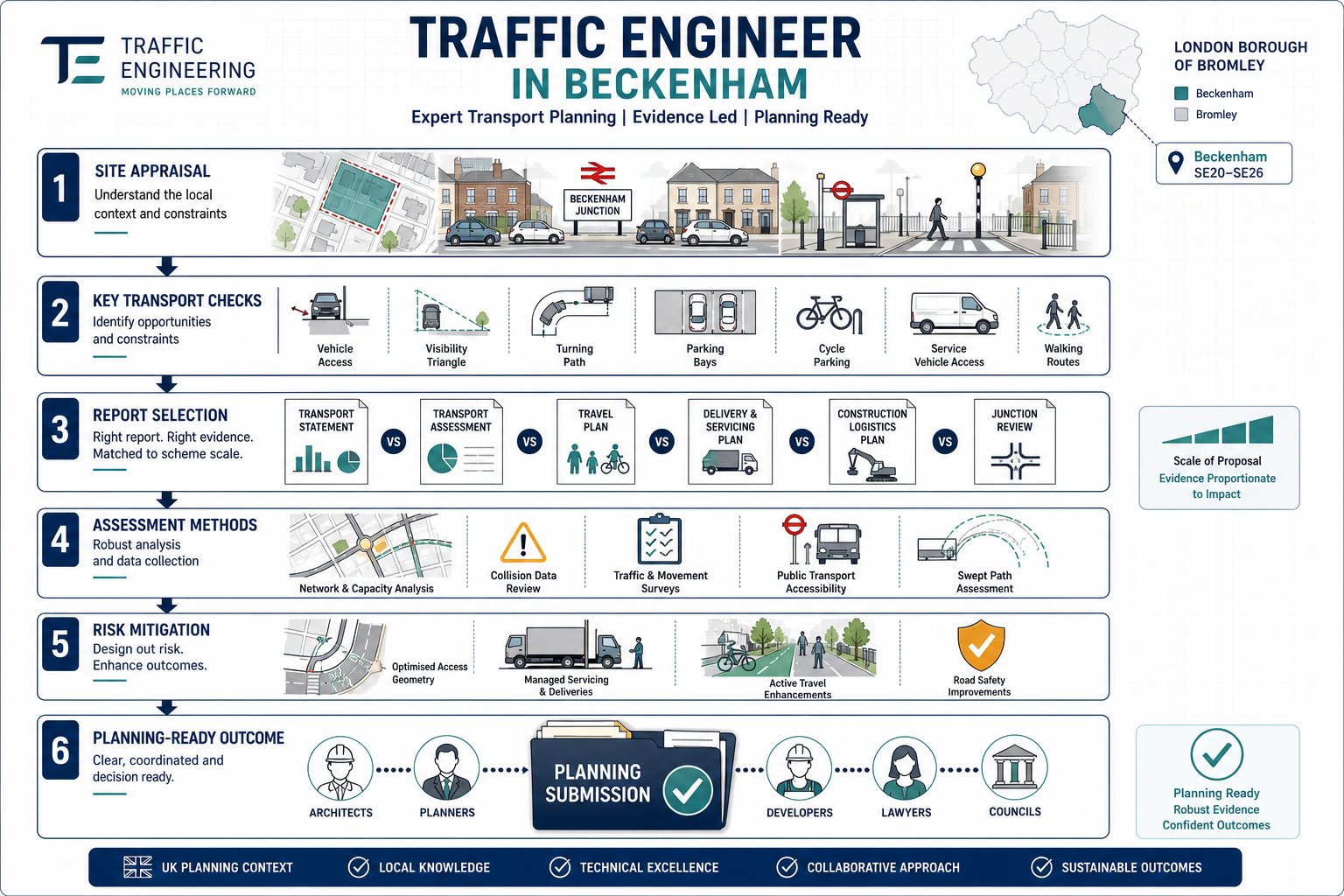
    What key elements are typically included in a residential transport assessment?

    Core components include site access and baseline highway conditions, personal injury collision data, multi-modal trip generation and distribution, junction capacity modelling, parking and servicing reviews, and recommendations for mitigation aligned with planning policy.

    How can developers ensure their residential transport assessment is efficient and effective?

    Early engagement with the local highway authority to agree scope, using recognised tools like TRICS and accepted modelling software, aligning the TA with evolving design, and producing a clear, well-structured report reduces delays and objections.

    What common pitfalls should be avoided when preparing a residential transport assessment?

    Avoid underestimating trip generation, missing peak period analyses, ignoring committed developments or known safety issues, and failing to comply with parking standards. Overclaiming minimal impacts can also undermine credibility with authorities.

  • Office Transport Assessment In 2026: What Developers And Planning Teams Need To Get Right

    Office Transport Assessment In 2026: What Developers And Planning Teams Need To Get Right

    Planning officers rarely object to an office scheme because of one dramatic traffic flaw. More often, an application starts to wobble because the transport evidence feels thin, generic or out of step with the site’s actual context. A junction has been modelled, but the wrong peak hour was used. Parking has been justified, but not against local restraint policies. Hybrid working has been mentioned, yet not evidenced. And suddenly a perfectly viable proposal is stuck in rounds of transport queries.
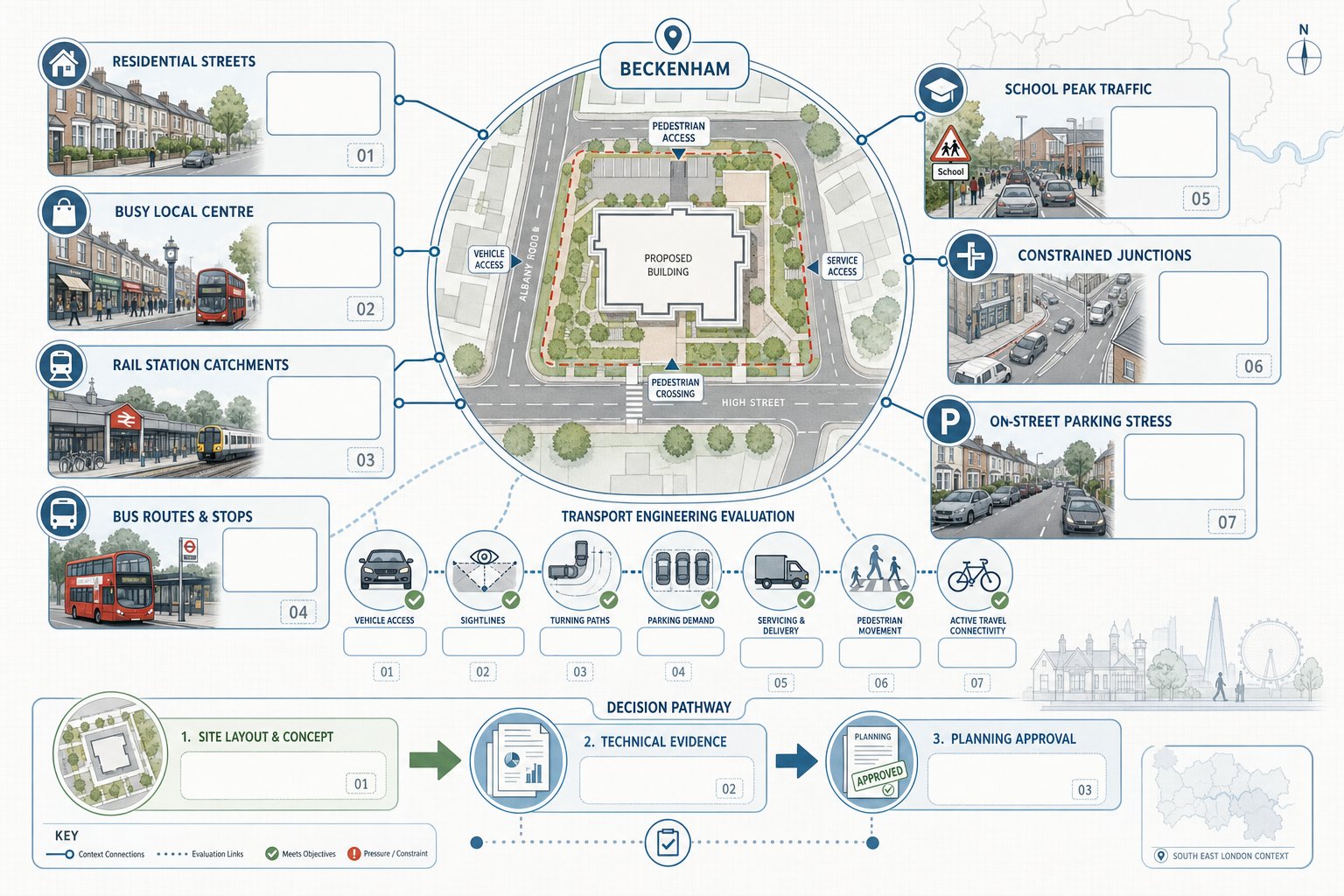
    That is why an office transport assessment still matters so much in 2026. For architects, planners, lawyers, surveyors, developers and local councils, it is the document that ties the transport case together: existing conditions, trip generation, access design, sustainable travel, parking, servicing, mitigation and policy compliance. When it is done properly, it does more than satisfy validation requirements. It helps show that an office development can be accommodated safely, efficiently and in a way that supports wider planning goals.

    In our experience, the strongest assessments are proportionate, evidence-led and shaped early with the local highway authority. They are also grounded in local realities rather than boilerplate assumptions. Below, we set out what an office transport assessment needs to cover, where office schemes most often come unstuck, and how teams can prepare a report that stands up well at planning stage.

    What An Office Transport Assessment Is And When It Is Required

    Office transport assessment infographic showing impacts, transport modes, and early planning steps.

    An office transport assessment is a structured appraisal of how a proposed office development will affect travel demand, the local highway network, access arrangements and sustainable transport choices. In simple terms, it asks: how many people and vehicles will the scheme generate, where will they go, can the network cope, and what needs to be done to make the development acceptable in transport terms?

    In England, the starting point is usually the Department for Transport’s guidance on Transport Assessments and Travel Plans, read alongside the National Planning Policy Framework and local plan policy. There is no single national threshold that applies to every site in every authority. Some councils publish floorspace triggers: others rely more on likely trip impact, site sensitivity or location. That means a modest office building in a constrained town centre could require more detailed analysis than a larger scheme in a highly accessible commercial area.

    Typically, an assessment is required where material traffic, access or road safety effects may arise, or where the authority needs evidence on parking, servicing, public transport accessibility or active travel provision. For smaller, lower-impact schemes, a Transport Statement may be enough.

    The sensible move is to scope the work early. We usually recommend agreeing the study area, assessment years, peak periods, junctions, committed developments and modelling assumptions with the local highway authority before analysis begins. That early agreement can save weeks later on.

    How Office Development Type, Scale And Location Affect Assessment Scope

    Infographic showing how office type, scale, and location affect transport assessment scope.

    Not all office schemes behave the same way. A headquarters building, a public sector office, a flexible co-working hub and a call-centre style operation can produce very different travel patterns even if the gross floorspace looks similar on paper.

    Type matters because occupancy density, working hours, visitor activity and operational needs vary. A traditional multi-let office may have relatively predictable commuter peaks. A serviced office with short-term occupiers may show more dispersed arrivals through the day. A customer-facing office use can also create higher visitor and taxi activity than a back-office function.

    Scale matters because larger schemes tend to trigger more extensive analysis. Authorities may expect broader study areas, more junction testing, stronger evidence on mode split, and greater detail on parking and servicing as floorspace and employment numbers rise. Sometimes the issue is not just size, but concentration: a compact office campus can load a small number of access points very heavily.

    Location often has the biggest effect on scope. A city-centre office next to a rail station may justify low parking and a strong public transport mode share, but it still needs to show how pedestrian flows, servicing and drop-off activity will work. Edge-of-town schemes near strategic roads often require more detailed junction and access analysis. Rural offices may face tougher questions on car dependence and sustainable accessibility.

    So the right scope is always site-specific. Good assessments reflect the actual place, not a template.

    Planning Policy And Local Authority Expectations

    UK planning policy infographic for an office transport assessment framework.

    Transport evidence for office development sits within a planning policy framework, not a technical vacuum. In practice, local authorities want to see that an office scheme aligns with national policy objectives on safe and suitable access, sustainable travel and avoiding severe residual cumulative impacts on the road network.

    The NPPF remains central, particularly where it deals with promoting sustainable transport, managing impacts of development and ensuring safe access for all users. But local plan policy is where much of the real detail sits. Parking restraint standards, cycle parking requirements, servicing expectations, accessibility thresholds, public realm priorities and junction-specific concerns often come directly from local policy, supplementary planning documents or authority guidance notes.

    By 2026, many councils also expect transport documents to engage properly with decarbonisation, healthy streets and active travel objectives, not simply vehicle capacity. That means an office transport assessment should not read like a highway-only submission. It should explain how the scheme supports walking, cycling and public transport, and how design choices reinforce those outcomes.

    Authorities also expect proportionality. They do not always want a mountain of modelling: they want the right evidence, clearly presented, based on transparent assumptions. If there are constraints, they want to see mitigation. If there are uncertainties, they want those acknowledged and tested.

    In short, the best reports speak both languages: technical transport analysis and policy-led planning judgment.

    Key Trip Generation Principles For Office Schemes

    Trip generation is often the most scrutinised part of an office transport assessment because it drives almost everything else: distribution, junction modelling, parking demand, Travel Plan targets and the case for mitigation.

    For office schemes, we need to assess not only vehicle trips but person trips by mode. That distinction matters. A development in a highly accessible urban location may generate substantial footfall and public transport demand with relatively modest additional car traffic. If the assessment focuses only on vehicle movements, it can miss important design and operational issues.

    Weekday AM and PM peak periods usually remain the key assessment windows, but they should reflect local network conditions rather than assumption alone. In some centres, rail station activity, school traffic or adjacent uses can shift the critical period. Office uses can also interact differently with network peaks than retail or education uses nearby.

    Trip rates should be proportionate to the proposed office type, occupancy assumptions and parking provision. Authorities often challenge generic rates where there is no attempt to reflect site-specific context. Likewise, ambitious low-car assumptions need a proper basis in accessibility, comparable evidence and proposed mitigation.

    A sound approach combines recognised data sources with local observation and professional judgment. It should also explain what has been excluded, adjusted or sensitivity-tested. The clearer the chain from data to conclusion, the stronger the assessment.

    Using Robust Data Sources And Comparable Sites

    Recognised databases such as TRICS are commonly used to derive trip rates for office development, but raw outputs are not enough on their own. The quality of the analysis depends on selecting genuinely comparable sites and explaining why they are relevant.

    We would usually look at office type, urban context, public transport accessibility, parking provision, scale, local catchment and whether the benchmark sites are owner-occupied, multi-let or flexible workspace. A suburban office with generous parking is rarely a sensible comparator for a station-adjacent city-centre scheme.

    Robust evidence also draws on more than one source. Classified traffic counts, turning counts, census journey-to-work data, local public transport information, observed active travel conditions and committed development flows all help build a more credible picture. Where available, local survey data from existing offices can be especially useful.

    And transparency matters. If a site has been removed from a comparison set, we should say why. If an average has been moderated by local evidence, we should show the steps. Decision-makers are far more comfortable with a clear, auditable methodology than a black-box number.

    Accounting For Hybrid Working, Peak Spreading And Multi-Modal Travel

    Hybrid working changed the office market, but it did not remove the need for careful transport analysis. In fact, it made assumptions more delicate. Many offices now have variable attendance by day, staggered start times and more fluid use of space. That can reduce traditional commuter peaks, yet some schemes still experience pronounced midweek surges.

    So if we adjust trip rates for home working or peak spreading, we need evidence. That might include occupier data, sector-specific attendance patterns, tenancy strategy, flexible working policies or surveys from comparable developments. Unsupported claims that “people work from home now” will not carry much weight with a highway authority.

    Multi-modal travel is equally important. A robust office transport assessment should present person trips by car driver, car passenger, rail, bus, walk and cycle where relevant. In mixed-use or campus-style developments, there may also be internal capture between uses, but again it needs to be justified rather than simply assumed.

    The goal is realism. Neither overstate traffic to the point of distorting design decisions nor understate it to make a scheme look easy. Authorities tend to respond best when the analysis recognises uncertainty and includes sensitivity tests where appropriate.

    Junction Capacity, Access Design And Highway Impact

    Once trip generation and distribution are understood, the next question is whether the surrounding network and site access can safely and efficiently accommodate the development.

    For office schemes, that usually means testing key junctions and access points in the base year, future baseline year and future year with development. Depending on the network and authority preference, that may involve priority junction assessments, signal modelling, roundabout analysis or wider network tools. The exact software matters less than whether the approach is suitable, agreed where possible, and interpreted properly.

    Capacity is only part of the story. A technically acceptable ratio of flow to capacity does not automatically mean an access arrangement works well on the ground. Authorities will look closely at visibility, lane geometry, pedestrian crossing desire lines, cycle movements, refuse vehicle tracking, entry barriers, taxi activity and the potential for queues to block internal circulation.

    Office developments can create awkward frontage conditions, especially where there is pressure for drop-off, blue badge parking, servicing and cycle access in a constrained urban edge. These details often make the difference between a clean review and a long list of comments.

    We also need to frame impact in planning terms. The issue is not whether there is any additional traffic, there usually is, but whether the residual cumulative impact is acceptable, whether access is safe, and whether mitigation can resolve identified pressure points.

    Sustainable Transport, Accessibility And Active Travel Considerations

    An office transport assessment that treats sustainable transport as an afterthought tends to look dated very quickly. Local authorities increasingly expect a genuine accessibility-led narrative: can people reach the site conveniently without relying on a private car, and what improvements are proposed where current conditions are weak?

    That starts with a clear audit of walking routes, cycle connections and public transport options. We would normally examine footway continuity, crossing points, gradients, lighting, personal security, cycle route quality, bus stop proximity, service frequency, rail access and interchange conditions. For many office occupiers, the quality of the last 400 to 800 metres matters as much as the headline distance to a station.

    Good analysis then links accessibility to the proposed design. Secure cycle parking, showers, lockers, wayfinding, pedestrian-priority access, safe crossing provision and well-designed entrances are not decorative extras. They support the modal assumptions used elsewhere in the assessment.

    Where gaps exist, the report should identify realistic opportunities for improvement. That might include upgraded crossings, footway widening, dropped kerbs, cycle parking enhancements, bus stop works or contributions toward wider local measures.

    This is one area where early coordination with architects and planners pays off. If sustainable travel measures are embedded in the site layout from the outset, the transport case becomes much more persuasive.

    Parking Strategy, Servicing And Operational Movement

    Parking is rarely just a numbers exercise. For office schemes, it sits at the intersection of local standards, accessibility, occupier expectations, viability and transport policy.

    A defensible parking strategy should explain the proposed level of car parking in relation to local maximum or restraint standards, public transport accessibility, likely workforce profile, disabled parking requirements, electric vehicle charging and demand management measures. In accessible town-centre locations, lower parking provision may be entirely appropriate, but the rationale needs to be explicit. In less accessible areas, an authority may accept a higher level if sustainable measures are still credible and the layout works safely.

    Cycle parking deserves equal attention. Quantity, security, convenience and weather protection all matter, as do supporting facilities such as showers and lockers. Weak cycle provision can undermine wider mode share assumptions surprisingly quickly.

    Servicing and operational movement are another common pressure point. Even relatively straightforward office schemes need safe arrangements for deliveries, refuse collection, maintenance access and occasional larger vehicles. Swept path analysis, routing strategy and loading bay design should demonstrate that vehicles can enter, manoeuvre and leave without hazardous reversing onto the highway or obstructing pedestrians.

    If the site relies on timed restrictions, shared yards or tightly managed loading periods, the assessment should say so clearly. Operational realism beats optimistic diagrams every time.

    Travel Plans, Mitigation Measures And Planning Obligations

    A well-prepared Travel Plan is not a bolt-on appendix: it is the behavioural counterpart to the technical assessment. For office development, it should show how the occupier or estate management will actively encourage sustainable travel once the building is occupied.

    Typical measures include public transport information, season-ticket loans, cycle parking and repair stands, showers, lockers, car-share promotion, parking management, EV charging, flexible working support and induction material for new staff. But the strongest Travel Plans go beyond listing measures. They identify a coordinator, set mode share targets, define monitoring arrangements and explain what happens if targets are missed.

    Mitigation measures identified through the assessment may be on-site or off-site. They can include junction improvements, crossing upgrades, footway links, cycle infrastructure, signing, access amendments or operational controls. The key is proportionality: mitigation should directly address identified impacts and be deliverable within the planning and implementation framework.

    Where off-site works or financial contributions are needed, these may be secured through planning obligations or conditions, depending on the authority’s approach and the nature of the measure. By this stage, transport analysis, design and legal drafting need to line up. There is little value in a technically elegant mitigation package that cannot realistically be secured.

    This is also where an experienced consultant helps. On projects such as those we support at ML Traffic, speed matters, but so does getting the strategy right for the authority reviewing the application.

    Common Reasons Office Transport Assessments Are Challenged

    Most challenged assessments are not rejected because of one fatal flaw. They are challenged because several small weaknesses create doubt about the overall reliability of the case.

    A common issue is unrealistic trip generation. Sometimes rates are imported from poorly matched comparator sites. Sometimes mode share assumptions are too optimistic for the location, especially where parking is generous or public transport quality is patchy. Hybrid working can also be misused as a blanket justification for reduced impacts without supporting evidence.

    Another recurring problem is incomplete baseline analysis. Authorities will quickly spot when committed developments, local traffic growth, nearby consented schemes or known junction issues have not been factored in. Likewise, if the assessment tests only the applicant’s preferred peak hour and ignores a locally sensitive period, expect questions.

    Sustainable transport analysis is often weaker than it needs to be. A map of nearby bus stops is not the same as an accessibility assessment. Nor is a line in the report about encouraging cycling enough if the route quality is poor and cycle parking is minimal.

    Then there are presentation issues: missing appendices, unexplained assumptions, inconsistent figures across documents, outdated counts, vague mitigation and little connection to site design. Those are avoidable problems. They may seem minor, but together they can erode confidence fast.

    How To Prepare A Strong Assessment For A Planning Application

    The strongest office transport assessments usually have one thing in common: they start early enough to influence the scheme, not merely describe it after decisions have already been made.

    First, agree scope as soon as the development parameters are stable enough. A concise scoping note to the local authority can flush out likely concerns on study area, junctions, peak periods, parking standards, accessibility issues and Travel Plan expectations. That early dialogue is often worth more than pages of later explanation.

    Second, build the assessment on reliable and current evidence. Use robust traffic counts, sensible comparators, clear distribution assumptions and policy references that are actually up to date. If there is uncertainty, and there usually is, test it. Sensitivity scenarios on trip generation, occupancy or network performance can make the final report feel more credible, not less.

    Third, integrate disciplines. Access design, highways, active travel, parking, servicing and Travel Plan measures should tell one coherent story. If the architect proposes excellent cycle facilities but the transport report assumes negligible cycling, something has gone wrong.

    Finally, write for the decision-maker. Technical depth matters, but clarity matters too. The report should explain why the office scheme can be accommodated safely and efficiently, what mitigation is proposed, and how the development supports sustainable travel objectives. If that message gets lost in jargon, the assessment is doing less work than it should.

    Conclusion

    A credible office transport assessment is not just a planning formality. It is often the document that shows whether an office scheme truly fits its transport context, on the network, at the access point, and in day-to-day operation.

    In 2026, that means taking a broader view than traffic alone. Trip generation still matters, of course, but so do active travel links, public transport accessibility, parking restraint, servicing practicality, hybrid working patterns and policy alignment. The most successful submissions are the ones that join those strands up early and present them clearly.

    For developers, design teams and public sector applicants alike, the message is fairly simple: scope early, use sound evidence, test assumptions honestly and make sure the transport story matches the place. Do that, and the assessment becomes more than a report. It becomes a practical tool for getting better schemes through planning with fewer surprises.

    Office Transport Assessment FAQs

    What is an office transport assessment and when is it required?

    An office transport assessment is a detailed report evaluating how a proposed office development affects travel demand, access, and the local highway network. It is required when developments have potential traffic or access impacts, as triggered by local policy or floorspace thresholds, and is scoped early with the highway authority.

    How do office type, scale, and location influence the scope of a transport assessment?

    The type of office (e.g., HQ, co-working), its size, and location (city centre, edge-of-town, rural) affect trip generation, mode share, and network impact. These factors determine study area extent, junctions assessed, and modal travel considerations to ensure the assessment is site-specific and proportionate.

    Why must office transport assessments consider sustainable transport and active travel?

    Sustainable transport and active travel elements ensure access without reliance on private cars. Assessments audit pedestrian and cycle routes, public transport quality, and propose improvements like secure cycle parking and better crossings to support walking, cycling, and public transport use consistent with planning policies.
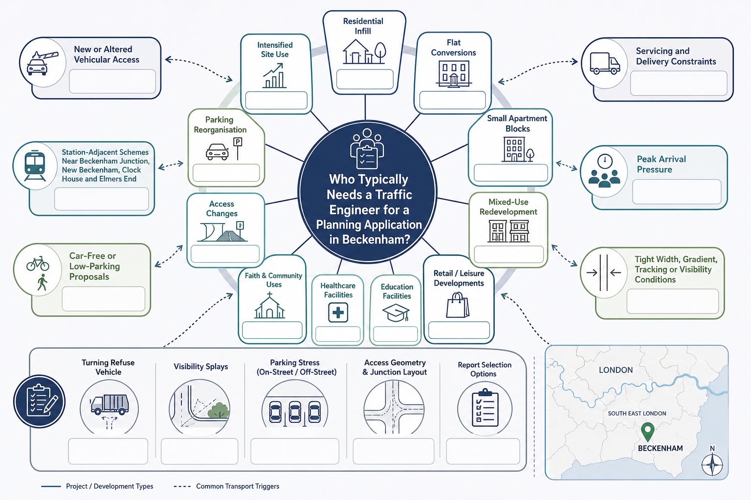
    How does hybrid working impact trip generation in office transport assessments?

    Hybrid working affects attendance patterns, reducing traditional peak trips and spreading travel across the day. Assessments must provide robust evidence on working patterns and adjust trip rates accordingly rather than assuming blanket reductions, ensuring realistic modelling of travel demand by all modes.

    What are common reasons for an office transport assessment being challenged by local authorities?

    Assessments are often challenged for unrealistic trip generation or mode split assumptions, ignoring committed developments, inadequate or narrow junction modelling, weak sustainable transport analysis, poor data transparency, or failure to align with planning policies and guidance.

    What key elements should a strong office transport assessment include to support planning applications?

    A strong assessment agrees scope early with authorities, uses robust, transparent data and comparable sites, models junction capacity realistically, integrates sustainable travel and parking analysis, and includes a well-prepared Travel Plan. Clear presentation of mitigation and alignment with local policies is essential.

  • Supermarket Transport Assessment In 2026: What Planning Teams Need To Get Approved Faster

    Supermarket Transport Assessment In 2026: What Planning Teams Need To Get Approved Faster

    A supermarket scheme can look straightforward on a layout plan and still become surprisingly awkward once transport is tested properly. One access point in the wrong place, one set of optimistic trip assumptions, or one missing delivery swept path can be enough to slow an application down for weeks. Sometimes months.

    That’s why a supermarket transport assessment matters so much in 2026. For planning teams, it isn’t just a compliance document. It’s the piece of evidence that shows a proposed foodstore, extension or retail-led redevelopment can function safely, efficiently and acceptably within the local network. Done well, it gives planners, highway officers and consultees confidence early. Done badly, it invites questions, rework and avoidable objections.

    We see this regularly across supermarket and wider retail submissions: the schemes that move faster are usually the ones where the transport scope is proportionate, the survey data is current, and the conclusions line up with local policy and real site conditions. That sounds obvious, but it’s where many applications still wobble.

    In this guide, we break down what a supermarket transport assessment should cover, when it is likely to be needed, how local authority expectations shape the scope, and what typically causes challenges. The aim is simple: help architects, planners, developers, legal teams and councils prepare planning-ready submissions that are technically robust and easier to approve.

    What A Supermarket Transport Assessment Covers

    Infographic of supermarket transport assessment steps, access, traffic, parking, and mitigation.

    A supermarket transport assessment examines how a proposed foodstore will affect movement to, from and within the site. In practice, that means much more than forecasting extra cars on the road. A robust assessment draws together the full transport picture: accessibility, traffic impact, servicing, parking, walking and cycling conditions, public transport access, and any mitigation needed to make the scheme acceptable.

    For most supermarket proposals, we would expect the report to describe the development clearly first. Gross floor area, net sales area, trading format, opening hours, servicing arrangements and access strategy all matter because they shape travel demand. Discount stores, town-centre convenience formats and edge-of-centre superstores do not behave in quite the same way.

    From there, the assessment usually covers:

    • the site location and surrounding highway context
    • local walking, cycling and bus accessibility
    • existing traffic conditions and baseline surveys
    • trip generation and distribution
    • linked trips and pass-by trips
    • junction capacity and access performance
    • internal circulation and servicing movements
    • car and cycle parking demand
    • road safety and collision history
    • sustainable travel measures and mitigation

    The key point is proportionality. A modest extension may not need the same level of modelling as a new standalone supermarket with a petrol filling station and altered junction arrangements. But the document still needs to tell a coherent story: what the development is, how people will reach it, what the likely impacts are, and why those impacts are acceptable in planning terms.

    When A Transport Assessment Is Needed For A Supermarket Scheme

    Decision-tree infographic showing when a supermarket transport assessment is needed in the UK.

    A transport assessment is usually needed where a supermarket proposal is likely to create significant transport effects. That can apply to new-build stores, major extensions, subdivision of retail floorspace, changes of use into food retail, or redevelopment schemes that materially alter traffic generation, servicing activity or parking demand.

    The decision is rarely based on floor area alone, although thresholds are often part of the conversation. In England, national guidance supports a proportionate approach: a full transport assessment where impacts are likely to be significant, and a shorter transport statement where they are not. Local planning authorities and highway authorities then refine that through their own validation requirements and standing advice.

    For supermarkets, the trigger tends to come from the nature of the use as much as the size. Food retail often generates concentrated arrivals, regular servicing, weekend peaks and short-stay vehicle turnover. Even a relatively moderate store can create planning concern if access is constrained, the local network is already stressed, or nearby walking routes are poor.

    We’d normally expect a full assessment where a proposal:

    • introduces a new foodstore use
    • increases trading floorspace materially
    • changes an access arrangement or junction form
    • intensifies delivery activity
    • relies on parking reconfiguration
    • sits on a sensitive or congested network

    Early pre-application discussion helps. It’s far easier to agree whether a supermarket transport assessment or transport statement is needed at the start than to discover halfway through design development that the authority expected a wider study area and more evidence.

    How Local Planning Policy And Highway Authority Requirements Shape The Scope

    Infographic showing factors shaping supermarket transport assessment scope in the UK.

    No two supermarket assessments are scoped in exactly the same way, because local policy and highway authority requirements shape the brief from day one. National policy provides the broad framework, but the detail that decides whether a submission lands smoothly usually sits at local level.

    Authorities often define, explicitly or implicitly, the study area, peak periods, survey expectations, modelling tools, parking standards, accessibility benchmarks and mitigation thresholds. Some are comfortable with straightforward junction modelling for smaller schemes: others expect a broader network review, particularly where the site sits near committed development, schools, signalised corridors or town-centre constraints.

    That has a practical effect on programme and cost. If the authority wants queue length validation, weekend counts, swept-path tracking, delivery management detail and a travel plan, the assessment must be set up to provide it rather than bolt it on later.

    For planning teams, the safest approach is to scope around three things:

    1. Development characteristics, format, floorspace, access, servicing, parking and opening hours.
    2. Local sensitivities, congestion, safety record, residential frontage, sustainable travel gaps and cumulative growth.
    3. Authority expectations, validation checklists, local plan policies, design guides and any pre-app feedback.

    This is also where experience helps. At ML Traffic, the value is often in matching the report to the relevant authority’s normal threshold, language and concerns, so the submission feels familiar and usable rather than generic.

    Key Development Types That Commonly Require Assessment

    The schemes most commonly requiring transport assessment are new supermarkets, discount foodstores, mixed-use retail schemes with a supermarket anchor, large extensions to existing stores, and redevelopment proposals that change access or substantially intensify trading activity.

    Town-centre refurbishments can also trigger assessment where servicing is tight or public realm changes affect vehicle movement. Likewise, edge-of-settlement stores often attract scrutiny because of car dependence and the need to demonstrate safe pedestrian and cycle access. In other words, the question is not simply “Is it retail?” but “Will this proposal change how the network works?”

    Traffic Surveys And Baseline Data Needed For A Robust Submission

    Good analysis starts with good evidence. If the survey base is weak, the rest of the supermarket transport assessment becomes vulnerable very quickly. Highway officers usually spot thin data straight away, and once confidence drops, every assumption gets tested harder.

    A robust baseline normally includes traffic counts at the key junctions and access points affected by the scheme. Depending on the site, that may mean weekday AM and PM peaks, Saturday peak trading periods, or sometimes all three. For supermarkets, Saturday survey coverage is often essential because that is when shopping-related demand is most visible.

    Typical baseline information includes:

    • classified turning counts at nearby junctions
    • queue length observations and congestion notes
    • automatic traffic counts and speed data
    • pedestrian and cycle counts
    • parking beat surveys or occupancy checks
    • bus stop locations, frequencies and journey opportunities
    • Personal Injury Collision data, usually over five years
    • site photographs and observed driver behaviour

    What matters isn’t just collecting data, but making sure the data reflects reality. School holidays, roadworks, temporary traffic management, abnormal weather and seasonal distortion can all undermine confidence if not explained properly.

    We also recommend connecting survey findings back to the supermarket format. A discount foodstore with fast turnover and a compact catchment will behave differently from a larger store with complementary concessions and longer dwell times. Baseline analysis should hence do more than present numbers. It should explain how the local network currently functions, where pressure points already exist, and what conditions are likely to influence development impact.

    Trip Generation, Linked Trips, Pass-By Trips, And Modal Split

    Trip generation is where many supermarket applications are won or lost. Not because the maths is inherently complicated, but because assumptions have to be credible, transparent and rooted in the actual trading format of the proposal.

    Most assessments estimate vehicle person trips using a combination of survey databases, comparable sites, local census context, accessibility characteristics and professional judgment. For supermarkets, simply lifting a standard trip rate and applying it rigidly can produce a distorted picture. Foodstores generate a high proportion of trips that are not entirely new to the network.

    That is where linked trips and pass-by trips matter. A linked trip is part of a wider journey chain, such as stopping at a supermarket on the way home from work. A pass-by trip is made by traffic already travelling past the site and diverting in briefly. If these effects are ignored, impact can be overstated. If they are pushed too hard, authorities may feel the assessment is trying to make traffic disappear on paper.

    The balance has to be defensible. We normally explain:

    • the source of base trip rates
    • why selected comparators are relevant
    • the proportion of linked and pass-by trips assumed
    • whether internalisation applies within a wider retail park or mixed-use site
    • how modal split reflects local walking, cycling and public transport conditions

    Modal split is increasingly important in 2026 because many authorities expect realistic support for non-car access, especially in urban areas. But realism is the word. If the site sits off a fast distributor road with poor crossings and infrequent buses, a very ambitious non-car mode share will not survive scrutiny. Honest assumptions usually travel further than optimistic ones.

    Junction Capacity, Access Design, And Internal Layout Appraisal

    Once trips are established, the assessment needs to show that the surrounding network and the site itself can operate safely and efficiently. That typically involves junction capacity modelling, access design review and an appraisal of internal circulation.

    The scope depends on the proposal. A small extension may only need updated access and parking analysis. A new supermarket with a priority junction, signal changes or a roundabout upgrade will usually require more detailed modelling and geometric review. The key is to test the points where impact could genuinely occur, not to swamp the report with unnecessary modelling that adds little value.

    For external junctions, the assessment usually considers:

    • existing and forecast traffic flows
    • committed development traffic where relevant
    • queueing and delay in design years
    • sensitivity testing if background growth or trip assumptions are uncertain
    • whether mitigation is required to keep operation within acceptable limits

    Inside the site, layout matters just as much. Supermarkets fail transport review surprisingly often because the external junction works but the car park doesn’t. Tight aisles, awkward trolley crossing points, poorly separated servicing routes and unclear pedestrian desire lines can all create conflict.

    A proper internal appraisal should check entry and exit logic, aisle widths, turning space, visibility, pedestrian routes, disabled access, taxi and pick-up activity if relevant, and whether vehicles can circulate without awkward reversing or queue spillback to the public highway.

    Servicing, Delivery Vehicles, And Refuse Collection Considerations

    Servicing is one of the most supermarket-specific parts of transport assessment. Food retail relies on regular deliveries, often by large articulated or rigid vehicles, and those movements can drive both amenity and highway concerns.

    Planning officers and highway authorities typically want to see that delivery vehicles can enter, manoeuvre, unload and leave in forward gear where possible, without blocking customer circulation or causing queuing on the highway. Swept-path analysis is usually essential, and so is a clear explanation of delivery frequency, timing, loading bay management and refuse collection arrangements.

    Where a site sits close to housing, schools or narrow frontages, servicing hours and routing strategy may become as important as geometry. In those cases, the best assessments do not treat servicing as an appendix afterthought: they address it as a core operational issue.

    Parking, Cycle Provision, And Pedestrian Accessibility

    Parking is rarely just a numbers exercise for supermarket developments. Yes, planners and highway officers will want to know whether the quantity of parking is suitable. But they also want to understand turnover, user mix, layout quality and whether the site works for people arriving by means other than the private car.

    A strong submission normally reviews car parking demand against local standards and observed comparator performance. For foodstores, short-stay turnover can be high, and that changes how occupancy should be interpreted. The assessment should consider staff parking, parent-and-child bays, disabled provision, EV charging expectations and whether pick-up or home-delivery activity needs dedicated space.

    Cycle parking is another area where detail matters. Token provision tucked behind a substation won’t convince anyone. Good cycle parking should be convenient, secure, visible and matched to likely users. If local policy pushes active travel strongly, poor cycle design can become a disproportionate issue.

    Pedestrian accessibility deserves equal weight. We’d usually review:

    • footway continuity to nearby residential areas
    • crossing opportunities on desire lines
    • step-free access and inclusive design
    • walking distances to bus stops and local facilities
    • wayfinding and public realm quality

    This is where many supermarket transport assessments improve markedly when the transport consultant works closely with the architect and civil engineer. Often, small layout tweaks, a better crossing point, a more direct footpath, a clearer cycle route, can remove objections that no amount of narrative would solve.

    Road Safety, Walking Routes, And Sustainable Travel Measures

    Safety has to run through the whole assessment, not sit in a short section near the end. For supermarket schemes, that means considering existing road safety conditions, likely conflict points created by the development, and how the proposal supports safer walking, cycling and access by public transport.

    A standard review will usually include recent collision data on the surrounding network, with attention paid to patterns rather than isolated raw totals. A junction with several shunt-type incidents may tell a different story from one with vulnerable road user collisions near a crossing point. Context matters.

    Walking routes are especially important because supermarkets attract a wide mix of users: parents with children, older shoppers, people carrying bags, mobility-impaired users and short local trips on foot. A route may be technically available but still unattractive or unsafe in practical terms if crossings are indirect, lighting is poor or footways narrow beside fast traffic.

    Typical sustainable travel measures include:

    • improved pedestrian crossings
    • widened or resurfaced footways
    • better cycle parking and links
    • bus stop upgrades or stop clearways
    • travel plan measures for staff
    • signage and wayfinding improvements

    The trick is not to over-promise. Sustainable travel measures should be relevant to the site and proportionate to the impact. A concise, well-targeted package usually carries more weight than a long wish list with no clear delivery route. Authorities want to see that the measures are practical, funded where necessary, and genuinely connected to how the supermarket will operate.

    How Supermarket Assessments Differ From Other Retail Transport Studies

    Supermarket transport work shares a foundation with wider retail assessment, but supermarkets have distinct characteristics that change the analysis. If those differences are missed, the report can feel generic very quickly.

    First, trading patterns are different. Supermarkets often generate stronger Saturday peaks, sharper short-stay turnover, and regular repeat visits from a local catchment. The traffic profile may not align neatly with standard weekday retail assumptions.

    Second, linked and pass-by trip behaviour is usually more significant. Many supermarket visits are folded into existing journeys, especially commuter and school-run patterns. That needs careful handling because it can materially affect net impact at nearby junctions.

    Third, servicing is heavier and more operationally sensitive. Deliveries, cage handling, loading bay design, refuse collection and sometimes home-delivery vans all create transport issues that many non-food retail units simply do not generate to the same degree.

    Fourth, internal layout tends to matter more. A foodstore car park often has high turnover, trolley movement, family parking demand and frequent interaction between pedestrians and vehicles. What looks acceptable for a bulky goods unit might perform poorly for a supermarket.

    And finally, supermarkets can attract stronger scrutiny around accessibility and local centre impact, especially if they sit in edge-of-centre locations. So while the methodology may sound familiar, a supermarket transport assessment normally needs a more operational, site-specific lens than a generic retail study.

    Common Reasons Supermarket Transport Assessments Are Challenged

    Most challenges come down to one issue: lack of confidence. If the authority feels the assessment is selective, too generic or unsupported by evidence, questions follow fast.

    The most common weak spots are poor or outdated survey data, unclear scoping, and trip assumptions that feel too convenient. A supermarket proposal might present low net traffic growth, for example, but if the linked-trip reduction is not backed by suitable evidence, officers are unlikely to accept it. The same applies to comparator site selection. If the chosen stores do not resemble the proposed format, the trip rates will be questioned.

    Other frequent challenge points include:

    • modelling only one junction when the impact is clearly wider
    • ignoring Saturday peak conditions
    • weak servicing evidence or no swept-path analysis
    • parking assessments that rely on standard ratios without occupancy review
    • limited pedestrian accessibility analysis
    • mitigation that is vague, undeliverable or detached from the identified issue

    There is also a softer problem: inconsistency between reports. If the transport assessment says one thing, the planning statement implies another, and the drawings show a third version of the access arrangement, confidence disappears. We’ve seen otherwise decent applications slowed simply because the documentation was not aligned.

    The fix is rarely flashy. Early agreement on scope, robust surveys, transparent assumptions and coordination across the consultant team usually prevent most objections before they start.

    What To Include In A Planning-Ready Supermarket Transport Assessment

    A planning-ready submission should be clear enough for a case officer to follow, technical enough for a highway engineer to trust, and focused enough that the main points do not get buried. That sounds simple, but it takes discipline.

    At a minimum, a supermarket transport assessment should include a concise description of the proposal, the policy and scoping context, and an explanation of why the level of assessment is proportionate. From there, it should set out the baseline transport conditions using current survey evidence, then move logically into trip generation, trip distribution, assignment and impact testing.

    A strong report will normally include:

    • development description and site context
    • relevant national and local policy framework
    • agreed scoping assumptions where available
    • baseline traffic, parking, safety and accessibility data
    • trip generation with linked/pass-by treatment explained
    • junction capacity and access appraisal
    • internal layout and servicing review
    • parking, cycle and pedestrian assessment
    • sustainable travel measures and mitigation
    • a clear conclusion on transport acceptability

    The conclusion should not be woolly. It should state, in plain terms, whether the development is acceptable in transport terms, what mitigation is proposed, and whether any residual impacts would be severe. That planning language matters.

    If the report can answer the obvious authority questions before they are asked, it is doing its job. And in our experience, that is what gets approvals moving faster: not a longer document, but a sharper one.

    For teams preparing a new store, extension or retail redevelopment, the goal isn’t merely to submit a supermarket transport assessment. It’s to submit one that feels complete, locally tuned and decision-ready from the first read.

    Supermarket Transport Assessment FAQs

    What is a supermarket transport assessment and why is it important?

    A supermarket transport assessment evaluates the impact of a proposed supermarket on local transport, including traffic, access, servicing, parking, safety, and sustainable travel. It ensures the development operates safely and efficiently within the local highway network, facilitating smoother planning approvals.

    When is a supermarket transport assessment typically required?

    It is usually required for new supermarkets, major extensions, changes of use increasing traffic or servicing, or redevelopment schemes that alter access or parking demand, particularly when significant transport effects on the local network are expected.

    What key elements are covered in a supermarket transport assessment?

    The assessment covers site accessibility, trip generation including linked and pass-by trips, traffic impact, junction and access performance, internal circulation, parking demand, pedestrian and cycle access, servicing and delivery arrangements, road safety, and sustainable travel measures.

    How do local planning policies influence the scope of a supermarket transport assessment?

    Local planning authorities and highway agencies define study areas, peak survey periods, modelling tools, parking standards, and mitigation requirements. These local policies tailor the assessment scope and ensure it meets specific regional expectations and transportation challenges.

    How does a supermarket transport assessment differ from other retail transport studies?

    Supermarket assessments focus more on sharper peak-hour shopping traffic, high delivery servicing demands, linked and pass-by trips, and internal layout considerations like trolley routes and pedestrian interaction, reflecting the unique operational patterns of foodstores compared to other retail types.

    What common issues can cause supermarket transport assessments to be challenged or delayed?

    Common challenges include outdated or insufficient survey data, unrealistic trip generation assumptions, inadequate junction modelling, weak servicing evidence, poor parking and pedestrian accessibility analysis, and vague or undeliverable mitigation proposals, impacting the confidence of planning authorities.

  • Massage Parlour Transport Assessment: What Planning Authorities Expect In 2026

    Massage Parlour Transport Assessment: What Planning Authorities Expect In 2026

    A massage parlour transport assessment is rarely the first issue applicants think about. Usually, attention goes to the use class, licensing, neighbour representations, opening hours, and whether the site will attract policy scrutiny for town centre, amenity, or character reasons. But in practice, transport can become one of the points that determines whether an application moves smoothly or stalls.

    That is because planning authorities do not look at this type of proposal in the abstract. They look at how people will actually arrive, where they will park, whether taxis and private hire vehicles will stop on the frontage, and what happens at 8pm, 10pm, or later when background traffic conditions and local sensitivities are different from the daytime pattern. A small premises on a highly accessible high street may need only proportionate transport evidence. A larger or late-opening scheme in a constrained street can trigger far more detailed scrutiny.

    In 2026, that scrutiny is increasingly evidence-led. Local planning authorities want a clear, policy-based explanation of trip generation, parking demand, access safety, servicing, and sustainable travel options, all presented in a way that matches the scale of the proposal. In this guide, we set out what a robust massage parlour transport assessment should cover, the objections it needs to anticipate, and how it supports a stronger planning case overall.

    What A Massage Parlour Transport Assessment Is And When It Is Needed

    Infographic showing when a massage parlour transport assessment is needed in the UK.

    A massage parlour transport assessment is a planning report that examines how a proposed new venue, change of use, intensification, or extension could affect the surrounding transport network. In simple terms, it tests whether the local highway, kerbside, parking stock, and access arrangements can accommodate the use safely and acceptably, and whether any mitigation is needed.

    The report may be prepared as a concise Transport Statement or as a fuller Transport Assessment, depending on scale and likely impact. That distinction matters. Authorities generally expect a proportionate response, but “proportionate” does not mean superficial. If a proposal has evening activity, constrained frontage conditions, or a realistic prospect of attracting taxis and car-based visitors, a thin report often invites objections rather than resolves them.

    In most cases, the need for transport evidence arises where one or more of the following apply:

    • the premises is relatively large or has multiple treatment rooms:
    • opening hours extend into the evening or late night:
    • the site sits on a busy high street, near a junction, or on a road with waiting restrictions:
    • there is limited on-site parking and a risk of overspill:
    • the location is close to residential properties, schools, or other sensitive receptors:
    • the council’s local validation requirements or transport thresholds call for supporting analysis.

    National policy still turns on whether residual cumulative transport impacts would be severe, but local authorities typically assess this through very practical questions: will people park legally, will drop-offs interfere with traffic, and is the access arrangement genuinely safe?

    How Use Class, Location, And Scale Affect Transport Requirements

    Use class, location, and operational scale shape the whole assessment. If the proposal falls within a use the authority treats as sui generis or otherwise operationally distinct, transport expectations often become more tailored because standard daytime assumptions do not fit neatly. A town centre location with strong public transport links may support lower parking demand assumptions. A suburban or edge-of-centre unit usually will not.

    Scale is equally important. A premises with a small number of rooms and tightly managed appointments may generate modest movements. Increase the number of rooms, overlap appointment slots, add longer opening hours, and the parking accumulation picture changes quickly. Staff shifts can overlap too, which is often where underestimation creeps in.

    Location then determines policy emphasis. On a central high street, we would normally expect stronger analysis of walking routes, bus accessibility, cycle provision, and kerbside controls. In residential streets, the focus usually shifts towards neighbour impact, overspill parking, manoeuvring, and late-evening vehicle activity. That is why a credible assessment is never generic: it has to be written around the actual site and the way the use will operate.

    Why Massage Parlours Raise Distinct Transport Planning Considerations

    Infographic of massage parlour trips, parking pressure, and drop-off management.

    This use raises transport issues that differ from many standard retail or office assumptions. The key reason is timing. Visitor arrivals are often appointment-led and concentrated outside normal business hours, when neighbouring uses may be closed, public transport may be less frequent, and residents are more sensitive to noise and kerbside activity.

    There is also a behavioural element. Many customers prefer direct, discreet arrival by car, taxi, or PHV rather than a longer walk from remote parking. That can increase pressure at the frontage even where total trip numbers are not especially high. So the transport issue is not always network capacity in the traditional sense: often it is the localised effect of a small number of poorly managed stopping and parking movements.

    Planning authorities also know that objections are rarely framed only in technical transport language. Residents may talk about disturbance, car doors slamming, engines idling, vehicles waiting, awkward turning, or people being dropped close to the entrance. Those are amenity concerns, but they are transport-related amenity concerns. A strong report recognises that reality and addresses it directly.

    Typical Trip Generation, Staff Travel, And Visitor Arrival Patterns

    Trip generation for this type of use should be based on how the business will actually function, not on borrowed assumptions from a generic town centre unit. Appointment-based operations usually mean arrivals are relatively predictable. That can help. If bookings are staggered, arrivals and departures can be smoothed rather than peaking sharply.

    But the detail matters. We need to test:

    • number of treatment rooms in use at one time:
    • average appointment duration:
    • overlap between bookings:
    • staff shift start and finish times:
    • busiest trading periods, including evenings and weekends:
    • likely mode split by location.

    In accessible centres, some visitors will come on foot or by public transport. Elsewhere, car and taxi mode share may dominate. Staff patterns can be a hidden issue because employees often stay for longer periods, consuming spaces for hours rather than minutes. If there are shift overlaps, parking accumulation can rise even if customer turnover is controlled.

    A robust assessment hence combines operational assumptions with local accessibility evidence. It should show not only how many trips are expected, but when they occur and how they distribute by mode.

    Parking Demand, Drop-Off Activity, And Kerbside Pressure

    Parking demand for massage parlours is rarely just a simple “spaces per square metre” exercise. Demand is driven more by operational intensity: treatment rooms, overlapping appointments, average dwell time, staffing, and whether visitors are likely to be dropped off.

    Kerbside pressure is often the sharp end of the planning debate. Taxi and PHV activity can result in short-stay stopping on double yellows, in bus lanes, across accesses, or close to junctions. Even when the stop lasts only a minute or two, repeated events can create friction with through traffic and fuel local objections.

    That is why we usually assess:

    • on-site parking supply and turnover:
    • nearby public parking and its restrictions:
    • resident permit controls and waiting restrictions:
    • likely drop-off and pick-up frequency:
    • whether any frontage can safely accommodate set-down activity.

    Sometimes the solution is not more parking, but better management: staggered appointments, staff travel measures, signed drop-off arrangements, and clear instructions discouraging waiting on the highway. In constrained locations, those operational commitments can be just as important as the physical layout.

    How Local Planning Authorities Assess Highway And Access Impacts

    Infographic of UK highway and access checks for a planning transport assessment.

    Local planning authorities usually start with one broad question: would the proposal create an unacceptable impact on highway safety or a severe residual cumulative impact on the road network? But that broad policy test breaks down into a series of smaller practical checks.

    First, the authority will look at the surrounding network. Is the site on a classified road, near a signalised junction, on a bus corridor, or in a street already under parking stress? Second, it will look at operation. What are the busiest hours, and do those align with commuter peaks, school activity, evening leisure traffic, or quieter periods? Third, it will consider whether the applicant has provided evidence rather than assertion.

    For many schemes, the key issue is not that the proposal generates huge traffic volumes. It is whether the additional movements, but modest, compound an already awkward local situation. A handful of extra cars in the wrong place can attract more concern than a larger number in a well-designed town centre setting.

    Authorities hence expect the assessment to address highway impact in proportionate but specific terms, often including:

    • local traffic conditions and network constraints:
    • trip generation and assignment:
    • parking and drop-off demand:
    • access geometry and visibility:
    • servicing and refuse arrangements:
    • collision history and safety context:
    • pedestrian quality, especially after dark.

    The quality threshold in 2026 is pretty clear: applicants need a site-specific explanation tied to local policy and measurable evidence, not a recycled report with the use name changed.

    Safe Access, Visibility, Servicing, And Highway Safety Issues

    Access design can make or break the acceptability of a proposal. If vehicles must reverse into the highway, wait in the carriageway, or turn in a way that conflicts with pedestrians, the authority is likely to probe hard. The same applies where visibility is constrained by parked cars, street furniture, bins, or frontage activity.

    A sound assessment should consider access width, gradient, visibility splays where relevant, pedestrian routes across the frontage, and whether inclusive access has been properly thought through. Step-free entry matters not only from an accessibility perspective but from an operational one too, because awkward entrances can slow movement and cause bunching at the frontage.

    Servicing is often underestimated. Even a relatively small premises may need refuse collection, laundry deliveries, consumables, maintenance visits, and occasional larger deliveries. If those vehicles cannot enter, turn, and leave safely, they may stop on-street and create avoidable conflict.

    Highway safety review should also include recent collision data, commonly covering the previous three to five years. That does not mean every recorded collision is attributable to the development, of course. But patterns matter. If there is a history of shunt-type collisions, pedestrian incidents, or turning conflicts near the site, the assessment should explain why the proposal would not worsen that risk, and what mitigation is offered if necessary.

    Public Transport, Walking, And Accessibility Expectations

    Authorities now expect sustainable access analysis even where a use has a clear car-based element. For a massage parlour, that means the report should not simply state that bus stops exist nearby. It should examine whether those alternatives are genuinely usable at the times the business operates.

    That usually includes walking distances to bus stops and rail stations, service frequency, evening operating hours, route coverage, interchange convenience, and the quality of onward walking routes. Lighting, natural surveillance, crossing points, footway width, and perceived personal safety all matter more when customers and staff may be travelling after dark.

    In practice, we would normally assess accessibility under four headings:

    1. Walking: directness of routes, pavement quality, crossing facilities, gradients, and lighting.
    2. Public transport: timetable frequency, span of service, evening reliability, and proximity to the site.
    3. Cycling: nearby cycle routes, secure parking provision, and whether cycling is realistic for staff.
    4. Inclusive access: ease of access for users with reduced mobility, including step-free arrival.

    For central locations, stronger sustainable mode share assumptions may be justified, but they still need evidence. For suburban sites, authorities may accept a higher car mode share, yet expect realistic mitigation to reduce unnecessary vehicle trips. That can include staff travel planning, cycle parking, customer booking messages encouraging non-car travel where practical, and management of appointment timings to avoid bunching.

    And there is a subtle point here. Good accessibility analysis does not only support policy compliance: it can also defend the parking case. If we can show that genuine non-car options exist for a meaningful proportion of users, parking accumulation assumptions become more credible and often more robust under scrutiny.

    What Data And Surveys Are Usually Required For A Robust Assessment

    The best transport reports are built on evidence that matches the proposal. For a massage parlour transport assessment, that usually means a combination of baseline site review, operational data, local parking analysis, and highway safety evidence.

    At minimum, we would expect a robust submission to cover:

    • a description of the site, surrounding road network, and relevant constraints:
    • local parking controls, permit zones, waiting restrictions, and public car parks:
    • existing access arrangements for vehicles, pedestrians, and servicing:
    • traffic conditions at relevant times, including evening periods if applicable:
    • trip generation estimates based on comparable sites or reasoned occupancy assumptions:
    • parking accumulation for staff and visitors on typical and busiest days:
    • collision data review for the surrounding network:
    • service and refuse vehicle tracking or swept-path analysis where needed:
    • public transport, walking, and cycling accessibility:
    • mitigation and, where appropriate, a Travel Plan framework.

    Survey requirements vary by site. Some smaller schemes can be supported by desk-based analysis and carefully reasoned assumptions. Others need parking beat surveys, junction counts, frontage observations, or on-street occupancy surveys, especially where local objection risk is high.

    Comparable survey evidence can be particularly useful, but only if the comparator is genuinely comparable in size, location, operating hours, and business model. Using poor comparators is one of the quickest ways to weaken credibility.

    What authorities generally want is not the most data possible, but the right data, collected at the right times, interpreted honestly.

    Common Planning Risks, Objections, And How To Address Them Early

    The predictable objections are usually the ones worth addressing upfront. For massage parlour proposals, those objections commonly centre on late-night traffic, neighbour disturbance, overspill parking, taxi stopping, and conflict with sustainable transport policy.

    We can often reduce those risks well before submission by testing the scheme as an operator would actually run it. That means asking awkward but necessary questions. How many people may arrive within a fifteen-minute window? What happens if two appointments overrun? Where does a PHV wait if the customer is delayed? Where do staff park on the busiest evening?

    Early mitigation may include:

    • limiting concurrent appointments:
    • staggering booking slots and shift changes:
    • providing managed off-street parking where feasible:
    • formalising refuse and delivery timings:
    • designing a set-back drop-off space, if the site can accommodate one:
    • adding signage and customer booking instructions to discourage unsafe stopping:
    • committing to a Travel Plan or parking management plan.

    Just as important is framing the impact properly. Some authorities and neighbours assume this use will generate intensive traffic by default. If the actual trip levels are modest relative to existing background flows, the report should demonstrate that clearly with numbers, not reassurance alone.

    Where the site is in a sensitive residential street, honesty matters. If there is a kerbside issue, we should identify it and explain how it will be managed. Trying to glide over it usually backfires.

    Common Planning Risks, Objections, And How To Address Them Early

    Planning risk on these applications is often cumulative. A single concern about parking might be manageable. But combine parking pressure with late opening, neighbour sensitivity, weak public transport, and a narrow frontage, and the proposal can quickly look harder to defend than it really is.

    The most common risk areas tend to be:

    • overspill parking into nearby residential streets:
    • obstruction of private driveways or informal frontage parking:
    • frequent taxi and PHV stopping close to junctions or on restrictions:
    • additional evening noise from arrivals and departures:
    • policy concerns that the use is overly car-dependent in a sustainable location:
    • concerns over personal safety and pedestrian conditions after dark.

    Addressing them early means integrating transport thinking into the design and planning strategy from the start. We should not wait until the planning statement is drafted to ask where deliveries happen or whether a customer can be dropped off without blocking the carriageway.

    In practical terms, early action often includes a site visit in the evening, review of local parking beat patterns, dialogue with the design team, and a realistic operational schedule. If the authority is known to be sensitive to kerbside issues, a targeted parking survey or frontage observation can save weeks later.

    The strongest responses are specific. If neighbours are likely to fear overspill, show parking accumulation and local capacity. If the issue is drop-off activity, demonstrate how the frontage operates and what management measures apply. If the concern is sustainable transport policy, evidence the actual accessibility profile and commit to proportionate travel measures.

    Done well, this does more than answer objections. It changes the tone of the application from defensive to credible.

    How A Transport Assessment Supports Planning Statements And Related Reports

    A transport assessment does not sit in isolation. It is one of the reports that helps the wider planning narrative hold together. For this type of proposal, that role is especially important because transport issues often overlap with amenity, design, town centre policy, accessibility, and operational management.

    A strong assessment gives the planning statement quantified evidence on:

    • expected trip generation and how it compares with background traffic:
    • parking demand and whether on-site or nearby supply is adequate:
    • whether highway safety risks have been identified and mitigated:
    • how the proposal aligns with local parking standards and transport policy:
    • what conditions or obligations, if any, are reasonable and necessary.

    It can also support related reports. For example, an amenity report may rely on the transport evidence to explain likely evening arrival patterns and associated disturbance. A design and access statement may draw on the assessment’s inclusive access analysis. A planning statement may use the findings to justify proposed opening hours, servicing arrangements, or Travel Plan commitments.

    This is where coordination matters. If the transport report assumes staggered appointments but the planning statement describes unrestricted operation, decision-makers will notice. Likewise, if the access drawing shows one arrangement and the swept-path assessment assumes another, credibility drops.

    At ML Traffic, this is exactly why concise reporting still needs to be carefully joined up. Fast turnaround is useful, but only if the final package speaks with one voice. When the transport evidence, plans, and planning case align, authorities have a much clearer basis to conclude that impacts are understood, proportionate, and manageable.

    Conclusion

    A well-prepared massage parlour transport assessment is not just a technical appendix. It is often the document that translates a potentially contentious proposal into something measurable, policy-compliant, and manageable.

    In 2026, planning authorities expect more than generic statements about modest traffic generation. They want evidence on how the premises will operate, when people will arrive, where they will park, how taxis and servicing will be handled, and whether the site remains safe and accessible after dark. The closer the site is to residential streets, constrained kerbsides, or sensitive frontages, the more important that detail becomes.

    Our advice is simple: treat transport early, and treat it realistically. If the report reflects the actual business model, local highway conditions, and likely objections, it becomes far easier to support the planning statement, answer consultee concerns, and keep the application on track. That is usually the difference between a report that merely accompanies an application and one that actively helps secure permission.

    Frequently Asked Questions about Massage Parlour Transport Assessment

    What is a massage parlour transport assessment and why is it important?

    A massage parlour transport assessment evaluates how a proposed or expanded venue affects local transport, parking, and highway safety. It is important because it ensures that impacts like trip generation, parking demand, and access safety are manageable and meet planning policy requirements.

    When is a full Transport Assessment required for a massage parlour?

    A full Transport Assessment is needed when the massage parlour is large, has multiple treatment rooms, operates late into the evening, or is located in a sensitive or constrained area with likely significant transport impacts, exceeding thresholds that require detailed analysis beyond a simple Transport Statement.

    How do use class, location, and scale affect transport assessment requirements for massage parlours?

    Use class defines parking and access standards; town centre or high street locations demand more emphasis on sustainable travel. Larger premises and extended hours increase trip generation, often requiring comprehensive transport evidence tailored to the site’s accessibility and operational scale.

    What are the common transport concerns related to massage parlours?

    Common concerns include late-night vehicle arrivals, overspill parking onto residential streets, taxi and private hire vehicle stopping near entrances, kerbside obstruction, and potential noise or disturbance to neighbours, all of which can impact local amenity and highway safety.

    How do planning authorities assess highway and access impacts for massage parlour proposals?

    Authorities examine local traffic conditions, network constraints, parking demand, access safety, pedestrian quality, and collision history. They assess whether additional trips cause severe residual impacts and expect evidence-based, site-specific assessments aligned with local policy.

    What data and surveys are typically required for a robust massage parlour transport assessment?

    A thorough assessment usually includes site and network descriptions, local parking restrictions, trip generation estimates based on appointment schedules, parking accumulation studies, collision data review, swept-path analysis for servicing vehicles, and accessibility analysis for all transport modes.

  • Shop Transport Assessment: What Planning Authorities Expect In 2026

    Shop Transport Assessment: What Planning Authorities Expect In 2026

    A shop transport assessment can look deceptively straightforward on paper: count some trips, check the junctions, add a few parking tables, and move on. In practice, planning authorities in 2026 expect something sharper. They want evidence that reflects the actual retail format, the local street network, servicing realities, accessibility by non-car modes, and whether the proposal can operate safely without creating avoidable pressure on surrounding roads.

    That matters because retail schemes are rarely judged on floorspace alone. A modest convenience store can create more intense short-stay traffic than a larger comparison goods unit. A town-centre shop with strong bus links may need a very different assessment from an out-of-centre retail unit with heavy car dependence. And when a site sits near a constrained junction, school route, Air Quality Management Area, or already stressed high street, transport evidence quickly becomes central to the planning decision.

    In our experience, the strongest submissions are proportionate but not superficial. They respond to local thresholds, explain assumptions clearly, and deal with the issues officers and highway authorities are already worrying about. That is exactly where a well-prepared shop transport assessment helps.

    Below, we set out what a shop transport assessment is, when it is usually needed, what planning authorities tend to examine, and how to improve the chances of a smoother planning process in 2026.

    What A Shop Transport Assessment Is And When It Is Needed

    Flowchart showing when a shop transport assessment is needed in the UK.

    A shop transport assessment is a formal transport study submitted alongside a planning application to identify, quantify, and evaluate the transport effects of a proposed retail development. Its purpose is not simply to predict traffic. It also considers accessibility, road safety, servicing, parking demand, and whether mitigation is needed to make the scheme acceptable in planning terms.

    In the UK planning system, a full Transport Assessment is generally required where a proposal is likely to create significant movement. Where impacts are expected to be more limited, a Transport Statement may be sufficient. The dividing line is not fixed nationally for every retail scheme. Instead, local validation requirements, local plan policies, and highway authority guidance often determine what level of evidence is expected.

    For shop developments, that judgment usually turns on three things: the nature of the retail use, the scale of the proposal, and the sensitivity of the location. A relatively small unit can still trigger transport work if it sits on a constrained frontage road, relies on awkward servicing, or is expected to attract frequent short-stay turnover. Equally, some larger schemes in highly accessible centres may still be capable of being assessed proportionately if their impacts are modest and well understood.

    In other words, the right question is rarely, “Do we need a report at all?” It is usually, “What level of transport evidence will the authority reasonably expect for this specific shop proposal?”

    How Retail Use Class, Store Size, And Local Context Affect Requirements

    Retail is not one homogenous land use, and planning authorities know it. A convenience store, discount foodstore, boutique high-street unit, bulky goods warehouse, and mixed-use ground-floor retail parade can produce very different trip patterns. That is why a shop transport assessment must reflect the actual trading format rather than rely on generic assumptions.

    Store size still matters. Gross floor area is usually the starting point for estimating trip generation, often using TRICS data and local evidence where available. But floorspace alone never tells the whole story. A smaller food-led unit may generate higher peak turnover, more delivery activity, and stronger parking demand than a larger comparison retail shop.

    Local context is equally important. Town-centre and edge-of-centre sites may benefit from stronger walking, cycling, and public transport mode share. Out-of-centre retail can be much more car-dependent and may place greater pressure on key junctions. Rural locations often raise accessibility concerns even where traffic volumes appear manageable.

    Use class, size, and context together shape whether an authority asks for a full TA, a lighter Transport Statement, supplementary parking evidence, or detailed servicing analysis. We usually find that early review of local thresholds avoids the most common mistake: under-scoping the work and then having to retrofit evidence later.

    Why Transport Evidence Matters For Shop Planning Applications

    Infographic showing key transport evidence areas for a UK shop planning application.

    Transport evidence matters because it sits at the point where planning policy, highway operation, and day-to-day retail function meet. A shop can be acceptable in design, principle, and commercial terms, yet still run into difficulty if the application does not show how customers, staff, deliveries, and servicing vehicles will use the site safely and efficiently.

    Planning authorities and local highway authorities typically want to see clear evidence on four broad issues: capacity, safety, accessibility, and parking/servicing management. Can the surrounding network absorb the extra trips? Will pedestrians and cyclists be exposed to greater conflict? Is the site reasonably accessible by sustainable modes? And are parking and loading arrangements realistic for the proposed operator and format?

    These points link directly to the National Planning Policy Framework and local transport policies. In 2026, there is continued emphasis on proportionate evidence, sustainable travel, and avoiding severe residual cumulative impacts on the road network. Retail proposals that ignore those themes tend to attract delay, requests for further information, or outright objection.
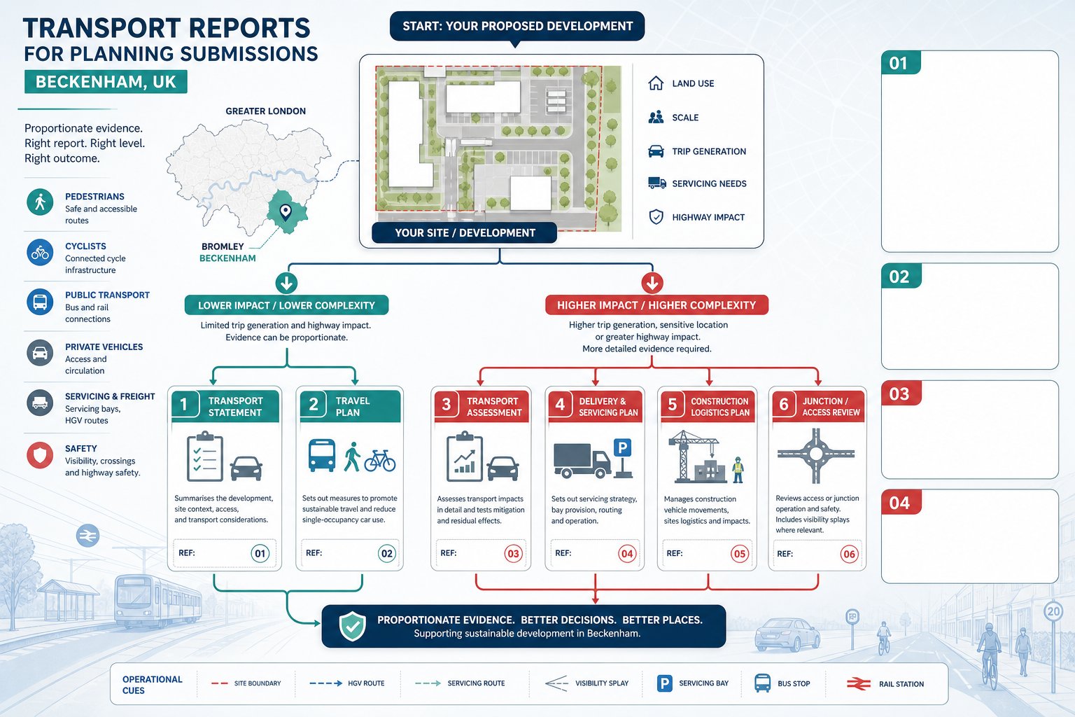
    A good transport assessment also helps define mitigation early. That may include junction improvements, revised access geometry, crossing upgrades, delivery management, cycle parking, or a travel plan. In many cases, it shapes conditions and legal agreements under section 106 or section 278.

    Just as importantly, transport evidence gives decision-makers confidence. If assumptions are transparent, surveys are sound, and mitigation is practical, the planning conversation becomes much easier. Instead of debating whether impacts have been understood at all, everyone can focus on whether the proposed response is proportionate and effective.

    Key Triggers That Can Lead To A Transport Assessment Or Transport Statement

    Infographic of key triggers for a shop transport assessment in the UK.

    The most obvious trigger is scale. If a proposed shop exceeds local gross floor area thresholds, or if forecast trips move beyond the authority’s normal screening levels, a Transport Assessment or Transport Statement is likely to be required. But in practice, retail schemes are often triggered by a wider set of circumstances than applicants first expect.

    A change of use can do it. So can an intensification of an existing shop where opening hours extend, delivery patterns become heavier, or customer turnover increases sharply. Authorities will also look closely at schemes in sensitive locations: near congested junctions, schools, hospitals, controlled parking zones, Air Quality Management Areas, or narrow streets where loading already causes friction.

    For retail, the type of operation matters a lot. Food retail, drive-thru-related formats, discount operators, and roadside convenience sites commonly produce strong short-stay demand and higher vehicular activity than a simple floorspace comparison suggests. A modest proposal can hence trigger meaningful transport analysis if the use profile is intense.

    Another trigger is site complexity. Shared access with neighbouring uses, poor visibility, reliance on reversing service vehicles, or interaction with heavy pedestrian flows can all justify a fuller assessment, even where total trip numbers are not especially large.

    The practical lesson is simple: never screen a retail application on floorspace alone. Planning authorities rarely do.

    Gross Floor Area, Trip Generation, And Local Authority Thresholds

    Gross floor area remains the usual starting point because it gives a measurable basis for estimating trip generation. Using TRICS or comparable evidence, we can derive likely arrival and departure rates, then test how those trips affect the local network. But local authority thresholds vary, sometimes significantly, and retail categories are not always treated equally.

    Many authorities set lower thresholds for convenience retail than for comparison goods because food shopping tends to produce more frequent car-based trips, stronger peak spreads, and more intensive parking turnover. Retail parks, roadside schemes, and locations with weak sustainable access may also attract stricter scrutiny. Some councils publish clear validation checklists: others rely more heavily on pre-application advice and case-by-case judgment.

    Trip generation itself should never be a mechanical exercise. We need to consider pass-by and linked trips, existing lawful use, local competition, catchment characteristics, and whether the proposed operator is likely to draw from nearby residential areas or a wider drive-time market. Get that wrong and the rest of the assessment starts to wobble.

    This is one area where local knowledge really pays off. At ML Traffic, for example, the value is often in matching national database evidence to local thresholds and planning context rather than just producing a generic trip-rate spreadsheet. Authorities can spot the difference quickly.

    Primary Factors Assessed For A Retail Development

    A retail-focused transport assessment is usually built around a fairly consistent set of questions, though the emphasis changes by site. Authorities want to understand not just how many trips a shop will create, but also how those trips behave across the day, where they enter and leave the network, whether the access works safely, and how sustainable modes are accommodated.

    For most shop schemes, the assessment covers:

    • forecast vehicle trips by time period
    • trip distribution and assignment on the local network
    • junction capacity and queueing effects
    • access design and visibility
    • delivery and servicing arrangements
    • car and cycle parking demand
    • pedestrian, cycle, and public transport accessibility
    • road safety and conflict with vulnerable users

    Retail brings particular quirks. The busiest period on the road network may not match the busiest period in-store. Some schemes generate high levels of pass-by traffic: others rely on deliberate destination trips. Staff parking can be modest in one format and material in another. Deliveries might be small and frequent, or less frequent but HGV-based and operationally awkward.

    A robust assessment hence needs to move beyond generic checklists. It should reflect how the proposed shop is likely to trade in real conditions, on that specific site, within that local network.

    Vehicle Trips, Delivery Activity, Parking Demand, And Servicing

    This is usually the technical core of the report. We assess how many vehicle trips the shop is likely to generate during daily and peak periods, then test what those movements mean for nearby junctions and access points. For retail, it is often important to distinguish between total trips and new trips, especially where pass-by or linked shopping trips reduce the net effect on the wider network.

    Delivery activity matters just as much. A compact urban shop can function poorly if servicing is not resolved, even where customer traffic impacts are modest. Authorities often focus on HGV routing, delivery frequency, loading bay dimensions, swept path analysis, and whether vehicles can enter and leave in a forward gear. If loading is proposed from the highway, the justification needs to be very strong.

    Parking assessment also needs realism. We typically review likely demand by customer and staff category, duration of stay, turnover, local parking controls, and nearby competing demand. For convenience stores, short-stay pressure can be intense. For high-street units, the question may be whether existing public parking and sustainable access reduce the need for dedicated on-site provision.

    Servicing plans, delivery time controls, and management measures are often what unlock a difficult retail application. Not glamorous, admittedly, but planners and highway officers care because these are the arrangements that determine whether a scheme works at 8.15 on a wet Tuesday, not just on a layout drawing.

    Walking, Cycling, Public Transport, And Accessibility

    In 2026, no credible shop transport assessment can focus only on cars. Planning authorities expect us to show how the proposal performs for people arriving on foot, by cycle, or by public transport, and whether the location aligns with broader policy support for sustainable travel.

    That means reviewing pedestrian catchments, footway width, crossing opportunities, dropped kerbs, lighting, gradient, personal security, and connections to surrounding streets. For cyclists, we look at route quality, traffic stress, cycle parking quantity and design, and how riders move through the site. Public transport assessment usually covers bus stops, rail access where relevant, service frequencies, walking routes to stops, and the practical attractiveness of those options.

    For town-centre shops, this can be a major strength. Good accessibility by non-car modes may help support lower parking provision and a more policy-compliant case. For out-of-centre schemes, the sustainable access story often needs more work: better crossings, upgraded footways, bus stop improvements, cycle links, or a credible travel plan.

    Accessibility is not just a policy box-tick. It often changes the traffic outcome. If a site is genuinely well connected, mode share assumptions can be more robust and car dependence lower. But authorities will expect evidence, not aspiration. A dashed line on a plan is not the same thing as a safe, convenient, and legible route that people will actually use.

    How A Shop Transport Assessment Is Prepared

    A sound assessment starts with scope. Before modelling anything, we need to understand what the authority is likely to care about: the local thresholds, the key junctions, the survey requirements, the peak periods, and whether the proposal should be assessed as a full TA or a lighter statement. Early engagement with the local highway authority can save weeks of avoidable rework.

    From there, the process usually moves through baseline data collection, trip generation, distribution and assignment, capacity testing, accessibility review, and mitigation design. Existing use is important too. Where a lawful retail or commercial use already operates on the site, the assessment should identify the realistic fallback position rather than treating everything as net new impact.

    The best reports are proportionate. They do not drown a small shop application in unnecessary modelling, but they also do not skip over obvious risks such as delivery conflicts, constrained accesses, or nearby junction stress. A clear narrative matters. Decision-makers should be able to follow the logic from survey data to forecasts to conclusions without feeling they have to decode an engineering puzzle.

    For planning teams, timing is often the hidden issue. Transport work affects layout, servicing, parking, swept paths, and mitigation costs. Leave it too late and the assessment becomes reactive. Bring it in early and it can shape a scheme that is easier to consent.

    Surveys, Traffic Data, Junction Capacity, And Site Access Review

    The technical backbone of a shop transport assessment is good baseline evidence. Depending on the proposal, that may include automatic traffic counts, turning counts at nearby junctions, queue length observations, parking beat surveys, pedestrian and cycle counts, and public transport audits. Retail sites often need survey periods that capture genuine shopping conditions rather than unusually quiet or distorted trading days.

    We then establish traffic forecasts. That usually means building base scenarios, applying background growth, accounting for committed developments, and adding development traffic based on appropriately selected trip rates. Junction modelling may involve priority, signalised, roundabout, or network software depending on the local highway layout. The aim is not to produce numbers for their own sake: it is to identify whether residual impacts are acceptable and, if not, what mitigation would solve the problem.
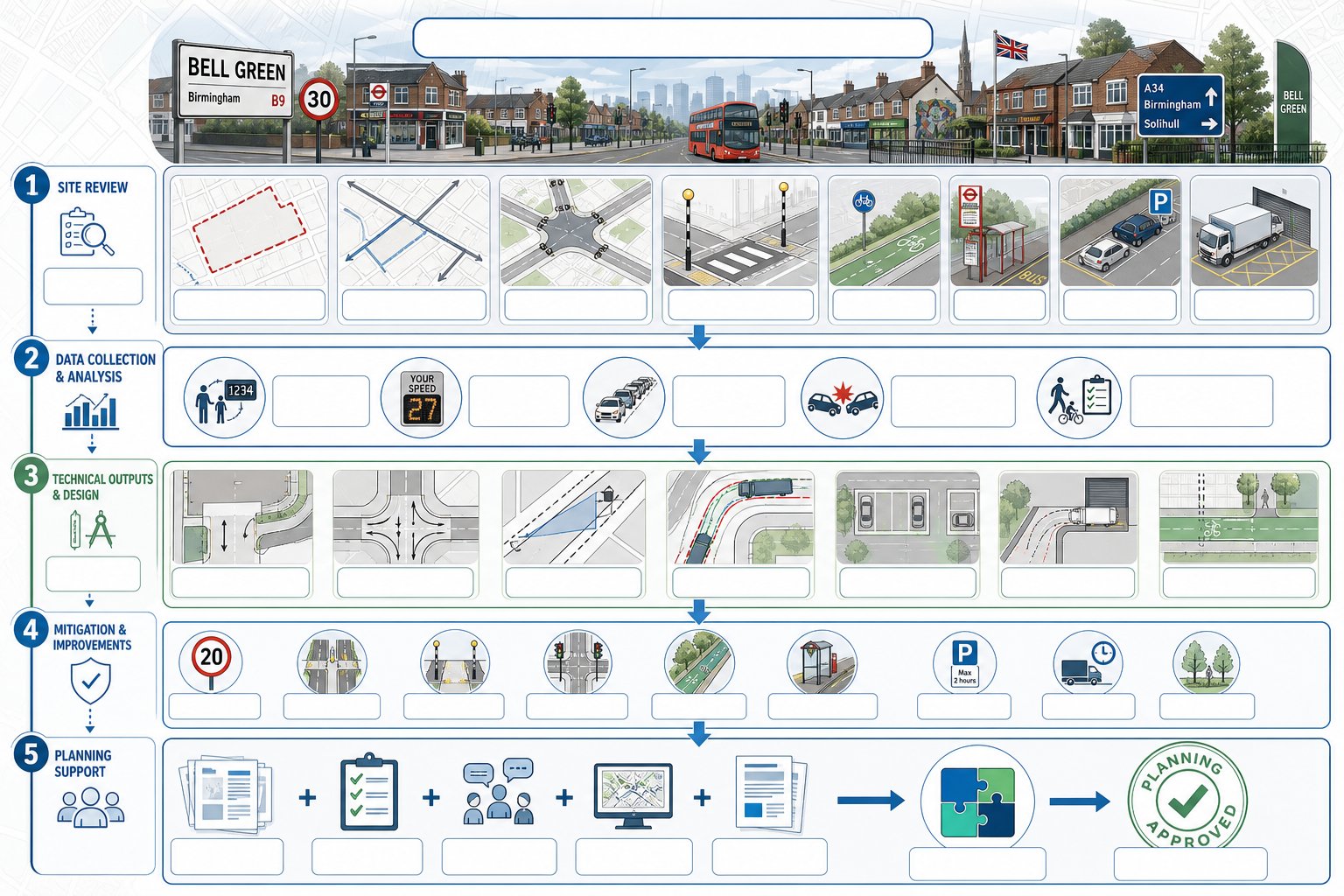
    Site access review is another critical step. We assess visibility splays, geometry, entry radii, pedestrian crossing desire lines, internal circulation, and whether service vehicles can manoeuvre safely. On many retail applications, access and servicing are the deciding issues.
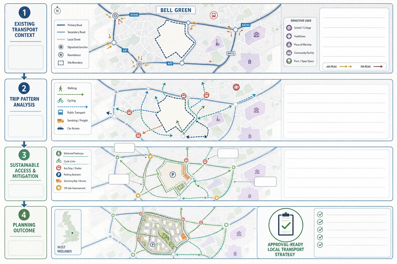
    The final report should draw those strands together clearly: what the site conditions are, what the development adds, what the network can absorb, and what measures are proposed to keep operation safe and efficient.
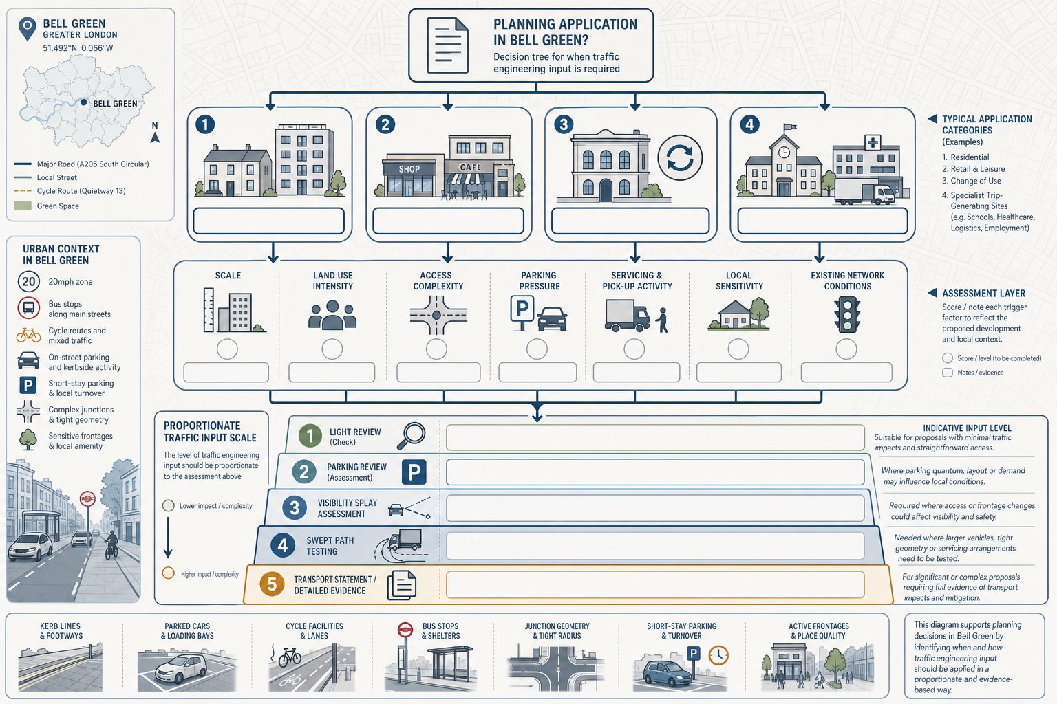
    Common Planning Issues For Shops And How They Are Addressed

    Retail schemes tend to attract a recognisable set of transport concerns. Some are strategic, like pressure on a roundabout or signal junction. Others are very local and operational: vans blocking the carriageway, customers queuing into a tight access, or pedestrians crossing where the layout never quite anticipated them. The challenge is that small frictions can become planning objections if they are not dealt with properly.

    One common issue is underestimating operational intensity. Applicants sometimes assume a modest floorspace means modest impact, but convenience-led retail can generate rapid turnover, short dwell times, and recurring delivery activity. Another is treating parking as a simple standards exercise when actual demand depends on local controls, nearby land uses, mode choice, and store format.

    There is also the policy dimension. Authorities increasingly expect shop proposals to support walking, cycling, and public transport, especially in centres and edge-of-centre locations. So even when highway capacity is acceptable, poor sustainable access can still weaken the overall planning case.

    The good news is that most recurring transport issues are manageable if identified early. Clear servicing strategies, access refinements, parking management, crossing improvements, and proportionate mitigation often make the difference between an objection and a workable recommendation.

    High Street, Out-Of-Centre, Convenience, And Mixed-Use Retail Considerations

    High-street shop proposals often face constrained streets, limited on-site parking, strong pedestrian activity, and awkward servicing windows. Here, the transport solution is usually about management as much as infrastructure: timed deliveries, loading controls, strengthened crossing points, footway protection, and realistic assumptions about customer travel behaviour.

    Out-of-centre and retail park schemes raise a different set of issues. Car mode share is often higher, junction impacts can extend further into the strategic network, and walking routes may be indirect or unattractive. In those cases, authorities commonly expect more detailed junction analysis plus tangible sustainable access improvements rather than a generic promise to encourage non-car travel.

    Convenience retail has its own profile again. These stores can attract significant pass-by trade, fast turnover, and pressure for very short-stay parking. If the access arrangement is unclear or the bays are poorly designed, operational problems show up quickly. Delivery timing controls, clear circulation, and carefully designed short-stay provision can help a lot.

    Mixed-use retail schemes add another layer because parking, servicing, and trip patterns interact across uses. Shared parking may be efficient, but only if accumulation analysis demonstrates it. Residential or commercial neighbours can also create sensitivity around servicing hours and access design. A joined-up, multi-modal assessment is usually essential.

    How To Improve The Chances Of A Smooth Planning Decision

    If we want a smoother planning decision, the best move is nearly always to engage early and scope properly. That means speaking with the local highway authority before the application is fixed, agreeing survey extents where possible, checking local thresholds, and identifying whether the authority expects a full TA, a Transport Statement, a travel plan, or targeted supporting notes on parking and servicing.

    The next step is proportionality with substance. Thin evidence invites challenge: bloated evidence can obscure the real issues. The aim is a report that is concise but robust, clearly tied to local and national policy, and honest about where mitigation is needed. Highway officers are far more receptive when assumptions are transparent and difficult points are addressed directly rather than buried.

    Design integration matters too. Transport should not be left to justify a layout that is already fixed and flawed. If access geometry, delivery space, pedestrian routes, cycle parking, or internal circulation are weak, it is better to amend the scheme early than defend the indefensible later.

    And finally, treat mitigation as part of the proposal, not an afterthought. Junction works, crossing upgrades, delivery management plans, and a realistic Retail Travel Plan often give authorities the confidence that impacts can be controlled in practice.

    In our experience, shop applications move more smoothly when the transport evidence feels locally tuned, commercially realistic, and planning-aware. That combination is what turns a report from a validation document into a useful decision-making tool.

    Shop Transport Assessment FAQs

    What is a shop transport assessment and when is it required?

    A shop transport assessment is a formal study submitted with a planning application to evaluate transport impacts of retail developments. It is required when proposals are expected to generate significant movements, based on use class, gross floor area, and local authority thresholds.

    How do retail use class, store size, and location affect transport assessment requirements?

    Use class and format influence trip rates and mode share; store size (gross floor area) guides trip generation estimates, while local context like town centre or out-of-centre affects car dependence and accessibility. These factors determine the level of transport evidence needed.

    Why is transport evidence important for planning retail shops?

    Transport evidence demonstrates that a retail scheme can operate safely and efficiently without undue pressure on roads. It covers network capacity, safety, accessibility, and parking and supports planning policies ensuring sustainable travel and mitigating impacts.

    What transport aspects are assessed in a shop transport assessment?

    Assessments cover vehicle trip generation and distribution, junction capacity, site access safety, servicing and delivery logistics, parking demand, and accessibility by walking, cycling, and public transport to provide a comprehensive evaluation.

    How can early engagement with local highway authorities improve shop transport assessments?

    Early consultation helps define appropriate scope, local thresholds, and survey needs. It ensures proportionate evidence, aligns with local policies, and reduces rework, increasing the likelihood of a smooth and timely planning decision.

    What are common transport challenges for different retail locations like high-street and out-of-centre shops?

    High-street shops face constrained streets, limited parking, and pedestrian conflicts managed by servicing plans and crossing improvements. Out-of-centre shops often have high car trip levels needing junction upgrades and strong sustainable access measures to reduce impact.