Author: adminmltuk

  • Traffic Engineer In Edgware: Expert Support For Planning Applications And Transport Assessments In 2026

    Traffic Engineer In Edgware: Expert Support For Planning Applications And Transport Assessments In 2026

    A planning application can look straightforward on paper and still run into trouble the moment transport issues are examined properly. In Edgware, that happens more often than many teams expect. A scheme may fit the site boundary neatly, tick off floor area targets, and even satisfy design objectives, yet still raise concerns about access, servicing, parking stress, road safety or junction impact.

    That is where a Traffic Engineer in Edgware becomes essential. We help architects, planners, surveyors, developers and legal teams understand how a proposal interacts with the surrounding highway network before objections harden into delays. In practice, that means translating technical transport risks into clear evidence that supports planning decisions.

    Edgware is not a blank canvas. It sits within a busy North London context shaped by strategic roads, local residential streets, bus corridors, pedestrian movement, school traffic, on-street parking pressure and policy expectations around sustainable travel. Even relatively modest developments can trigger questions from planning and highway officers if the transport case is weak.

    Our role is to make that case robust, proportionate and locally aware. With more than 30 years of experience across planning-led transport work, we know that speed matters, but accuracy matters more. A concise report that addresses the right issues usually does far more for an application than a bulky document that misses the authority’s real concerns.

    Key Takeaways

    • A Traffic Engineer in Edgware is essential to assess and mitigate transport impacts on local highway networks for planning applications.
    • Early involvement of a Traffic Engineer helps shape designs that comply with Edgware’s local and London-wide transport policies, reducing delays.
    • Common schemes needing transport input include residential intensifications, mixed-use developments, change-of-use projects, and sites near busy roads or junctions.
    • Transport assessments range from concise Transport Statements to detailed Transport Assessments and Travel Plans, chosen based on development scale and impact.
    • Key assessment areas include access, servicing, parking management, highway safety, trip generation, junction impact, and sustainable travel measures.
    • A robust, proportionate transport strategy aligned with local conditions and policy expectations significantly improves planning application success in Edgware.

    What A Traffic Engineer In Edgware Does And When You Need One
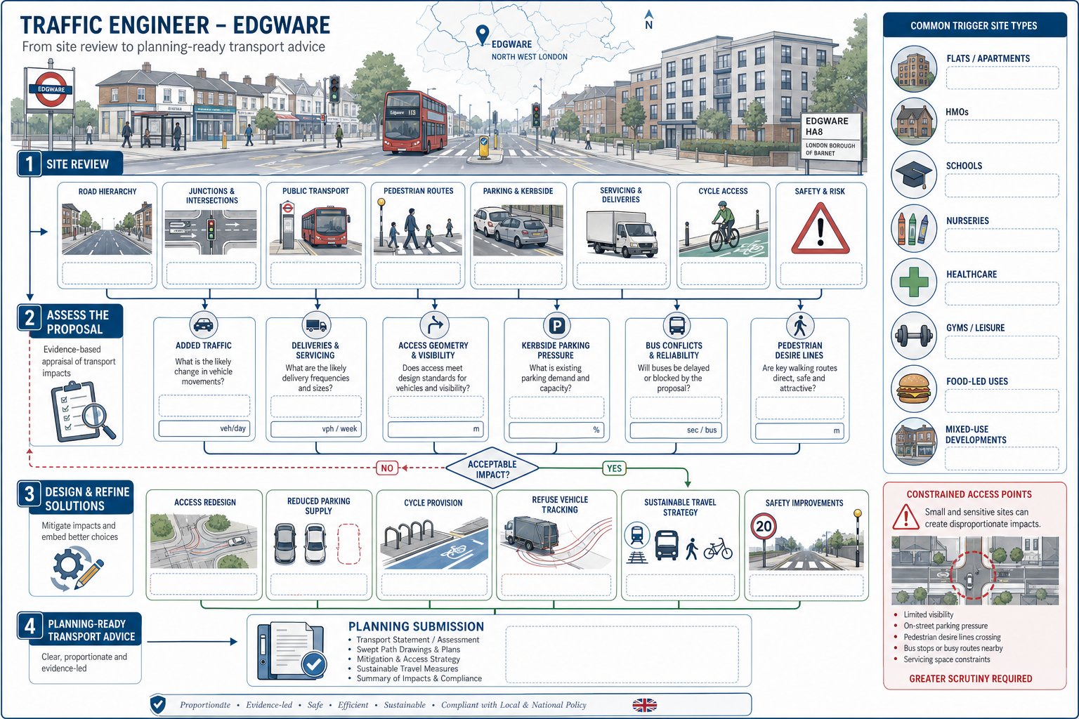
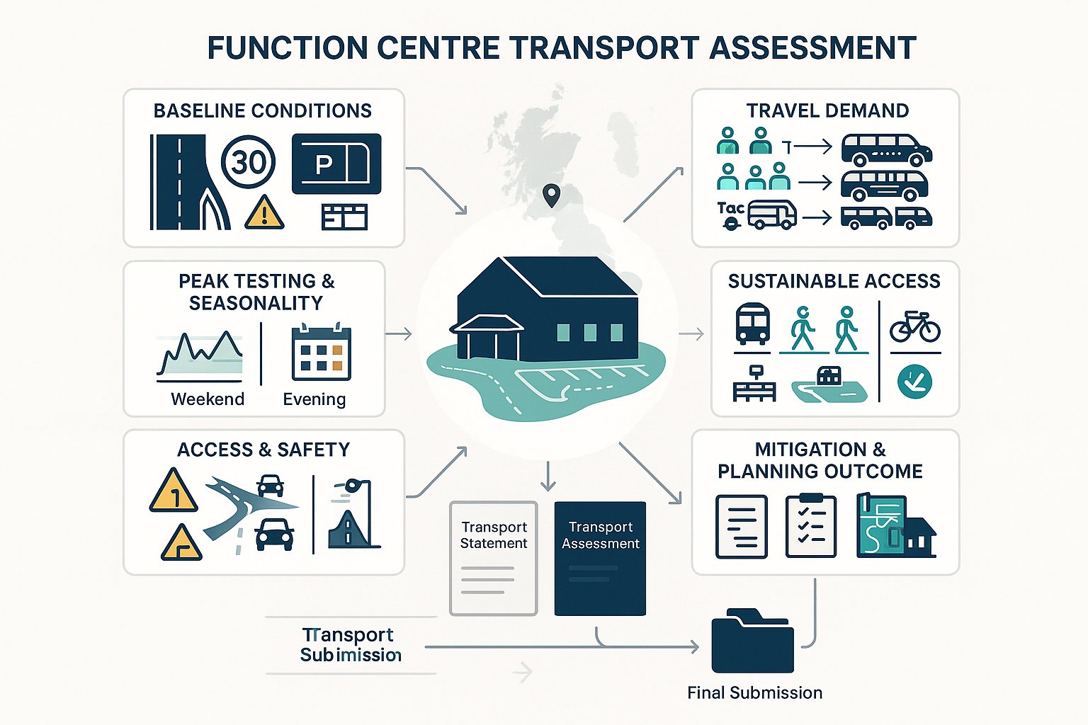
    Traffic engineer workflow showing site review, impact checks, and planning solutions in Edgware.

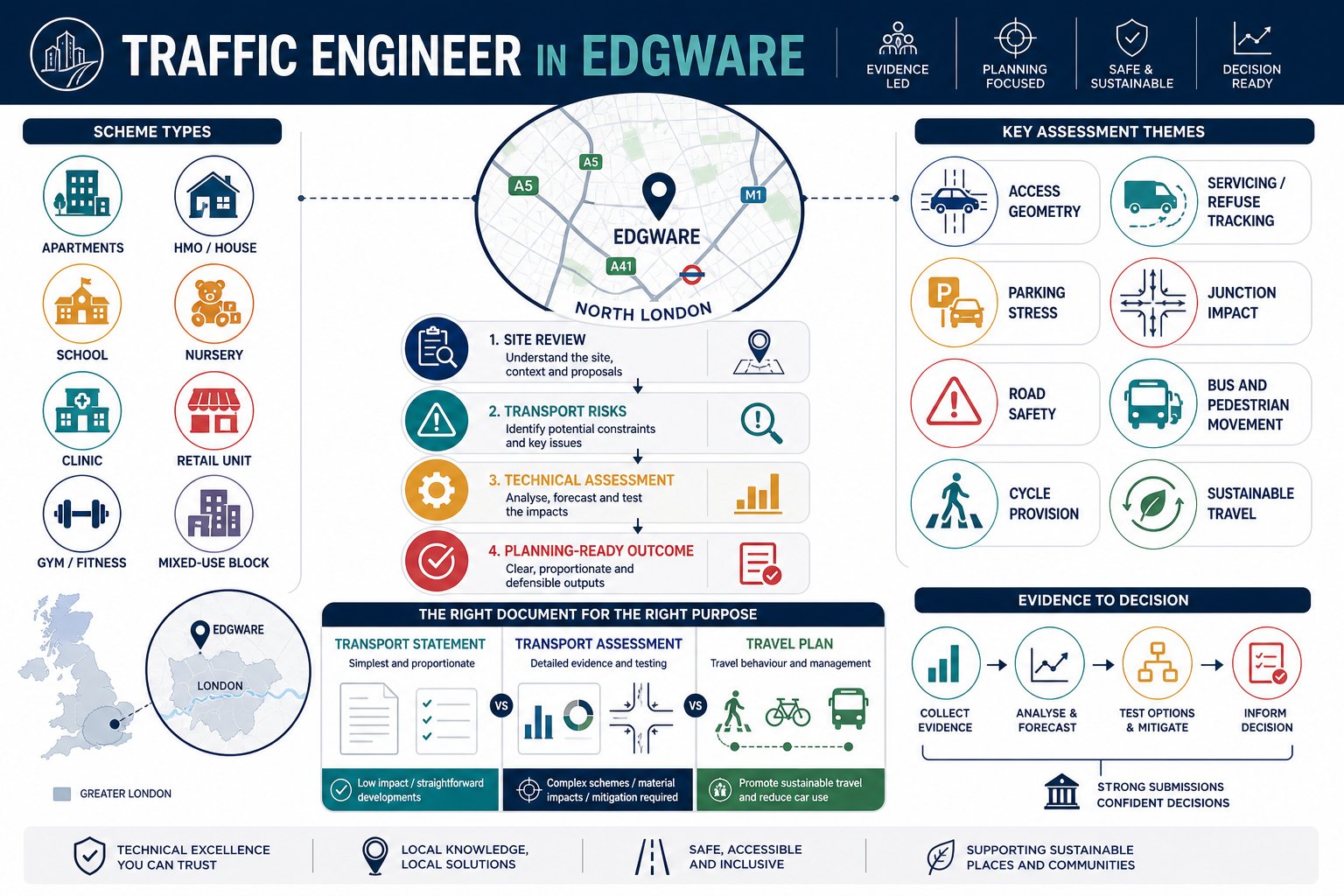
    A Traffic Engineer in Edgware assesses how development proposals affect movement, safety and highway operation, then turns that analysis into planning-ready evidence. That sounds simple. It rarely is.

    At the earliest stage, we review the site in context: road classification, nearby junctions, public transport links, pedestrian routes, parking conditions, servicing constraints and any obvious safety sensitivities. We then consider the development itself. Will it add vehicle trips? Intensify deliveries? Create awkward access geometry? Put pressure on kerbside parking? Conflict with bus movements or pedestrian desire lines? Those are the questions that shape the level of transport work required.

    In many cases, our job is not just to write a report but to help the wider design team avoid foreseeable objections. That may involve refining an access arrangement, reducing parking, improving cycle provision, checking refuse tracking, or setting out a sustainable travel strategy that aligns with policy. Broader Traffic Engineering and Transportation advice is often most valuable before drawings are fixed.

    You usually need transport input where a proposal could materially affect traffic, parking demand or highway safety. Common triggers include flatted residential schemes, larger HMOs, schools, nurseries, healthcare uses, gyms, food-led uses, mixed-use redevelopment and sites on or near busy roads. A constrained access point can be enough on its own.

    And size is only part of the story. A small scheme in a sensitive location may need more transport scrutiny than a larger one on a forgiving site. That is why experienced Traffic Engineering Consultants: tend to start with local context, not generic thresholds.

    Planning Applications That Commonly Require Transport Input In Edgware
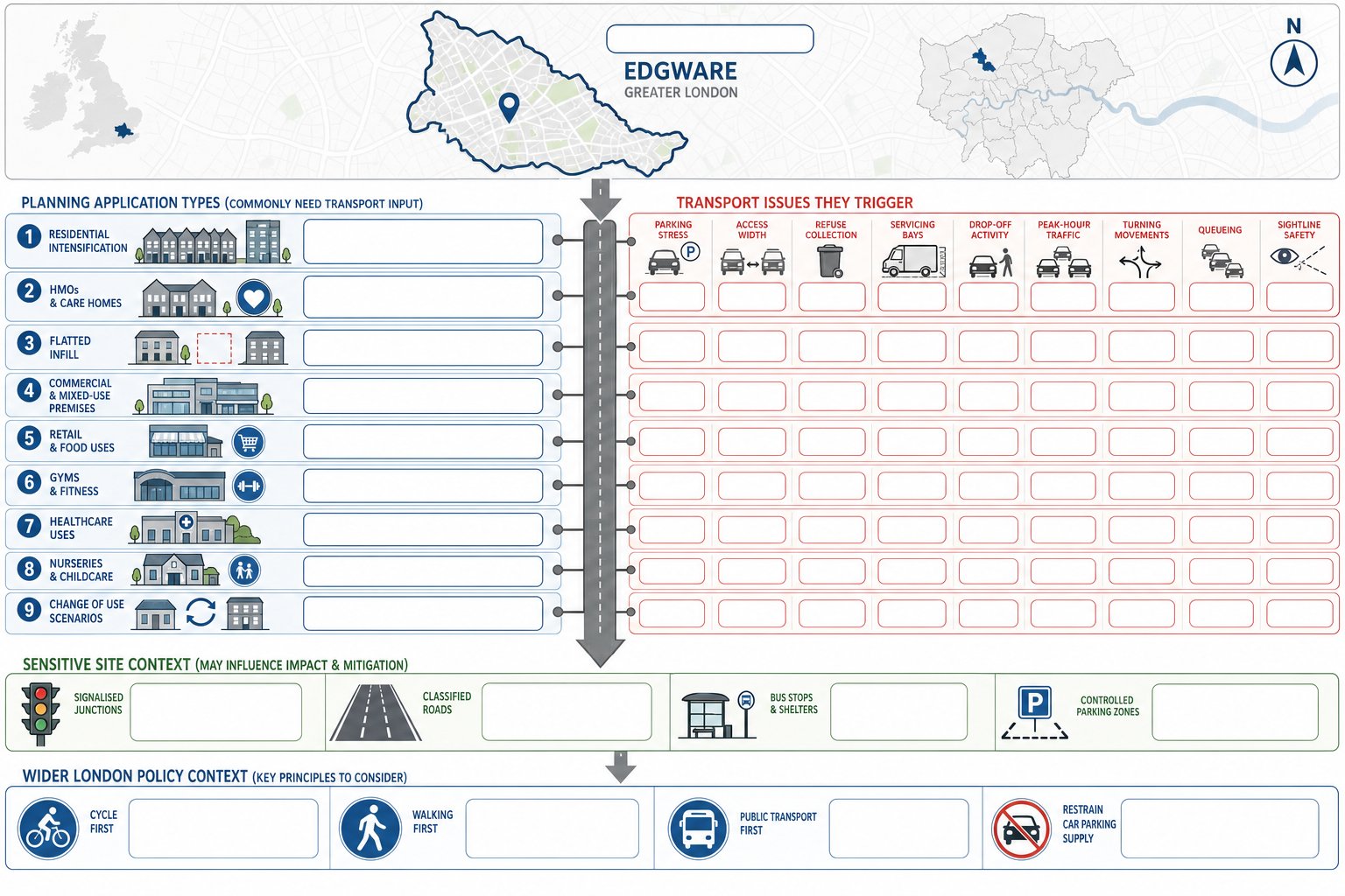
    Infographic of Edgware planning applications that often need transport assessment.

    In Edgware, transport input is commonly needed for planning applications where the use, scale or site arrangement could alter how people and vehicles move to and from the development. The most obvious examples are new-build residential schemes, but the list is much wider.

    Residential intensification often requires careful assessment, especially where family units, car ownership patterns or servicing needs may increase pressure on already constrained streets. HMOs, care homes and flatted infill developments can all attract scrutiny if parking provision, access width or refuse collection arrangements are unclear.

    Commercial and mixed-use schemes are another regular trigger. Retail units, cafés, restaurants, gyms, healthcare premises and nurseries can all generate short-stay traffic, drop-off activity or peak-time demand that sits awkwardly with local road conditions. Change-of-use proposals are particularly important because a seemingly modest shift in planning use can produce a very different transport profile. A former office becoming residential, or a retail unit becoming a takeaway, can raise entirely different servicing and parking questions.

    Sites close to signalised junctions, classified roads, bus stops or controlled parking zones also tend to require stronger evidence. On those sites, highway officers usually want confidence that access can operate safely and that queues, turning movements or visibility problems will not worsen.

    For developers working across several boroughs, it helps to remember that Edgware schemes sit within a wider London policy environment. The practical overlap with a Traffic Engineer In London: approach is obvious: local detail matters, but so do London-wide expectations on mode share, parking restraint and active travel.

    Transport Statement Vs Transport Assessment Vs Travel Plan
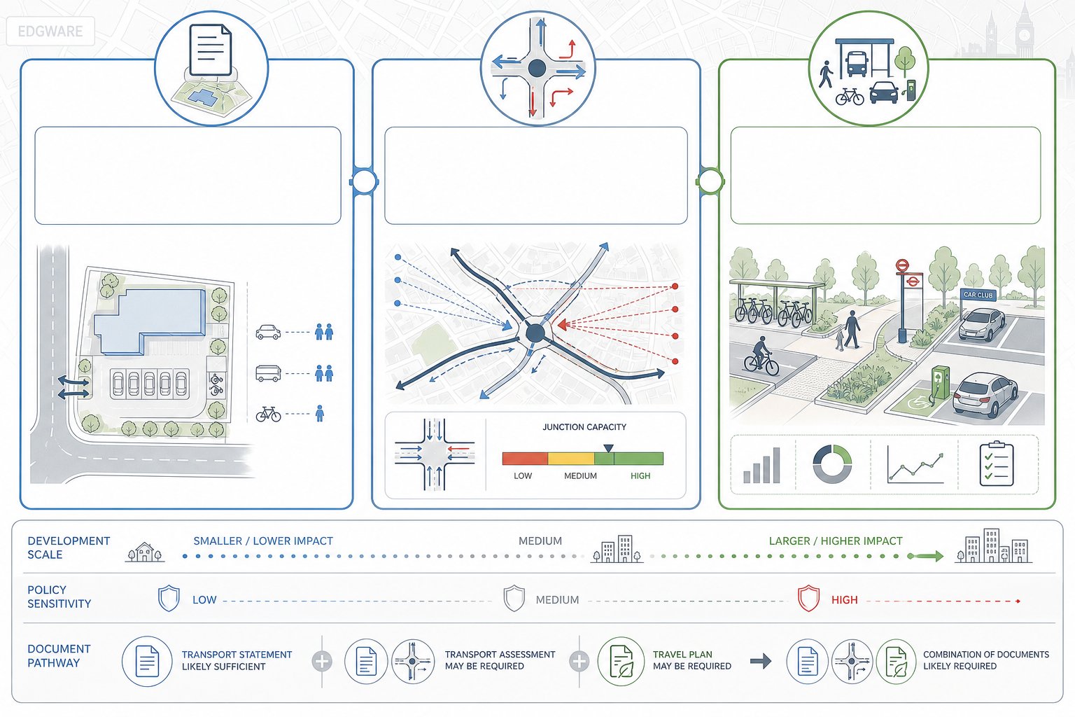
    Comparison infographic of Transport Statement, Transport Assessment, and Travel Plan.

    One of the most common points of confusion in planning is the difference between a Transport Statement, a Transport Assessment and a Travel Plan. They are related, but they are not interchangeable.

    A Transport Statement is usually the proportionate option for smaller or less impactful schemes. It sets out the site context, existing access conditions, parking provision, likely trip levels and whether the proposal would create any material highway or transport concerns. The emphasis is on concise evidence rather than extensive modelling.

    A Transport Assessment goes further. It is used for larger, more sensitive or potentially more impactful developments and typically includes detailed trip generation analysis, trip distribution, network assignment and junction capacity testing where needed. If there is a realistic prospect that the scheme could affect queueing, delay or operation on the surrounding network, a TA is often the appropriate route. This is where Highway And Traffic analysis becomes central to the planning case.

    A Travel Plan is different again. It is a strategy document aimed at influencing travel behaviour. Rather than focusing only on predicted traffic effects, it sets out measures to encourage walking, cycling, public transport use, car-sharing and lower-car travel patterns. It may include targets, monitoring arrangements, welcome packs, cycle facilities, EV provision and site management measures.

    In practice, schemes may require one of these documents, or a combination. A smaller residential scheme might only need a Transport Statement. A larger mixed-use proposal may need a Transport Assessment and a Travel Plan. The right choice depends on scale, sensitivity, local policy and what the highway authority is likely to ask for.

    How Local Highway And Planning Requirements Shape Development In Edgware
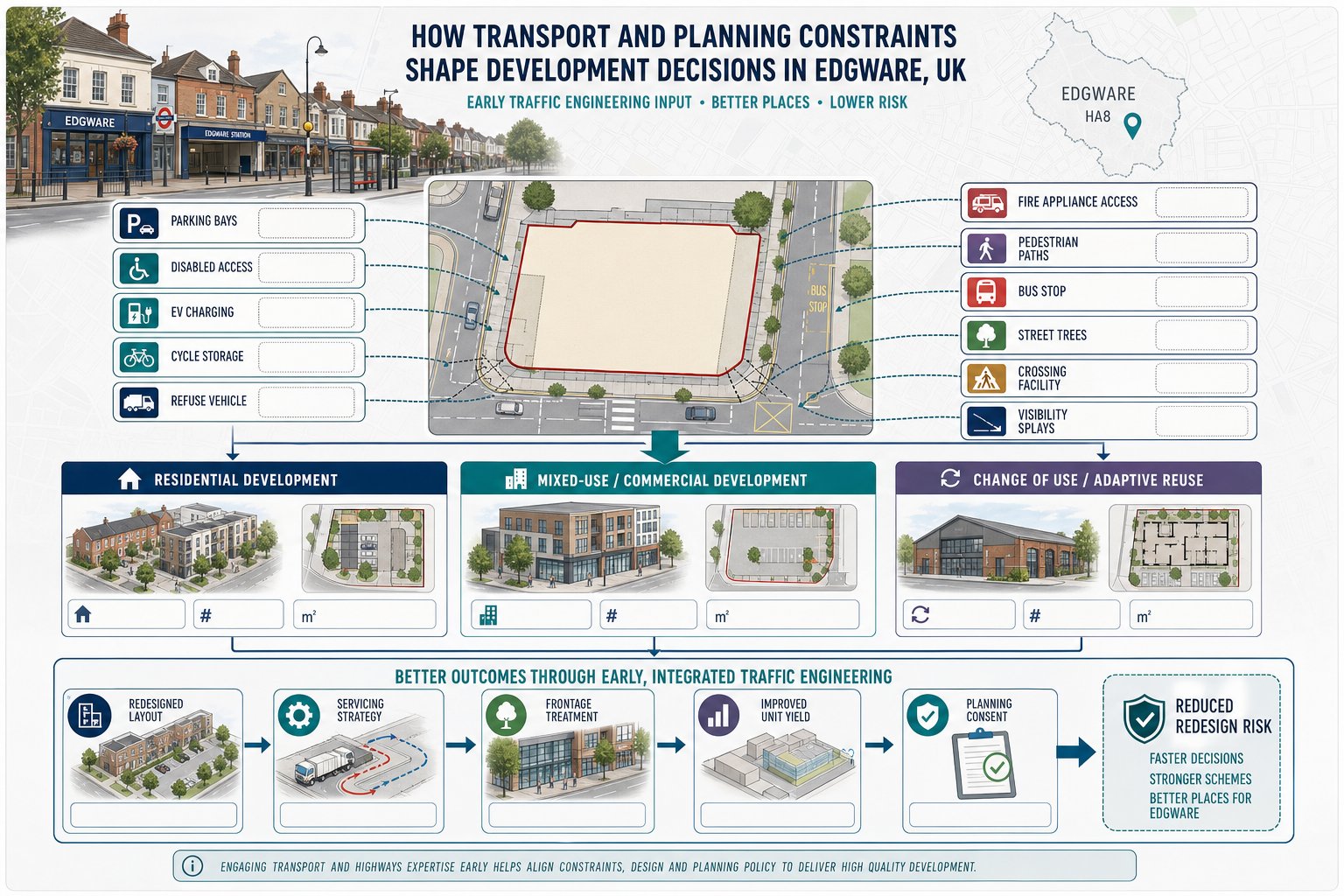
    Infographic of Edgware development shaped by parking, access, servicing and planning constraints.

    Edgware development is shaped not only by what physically fits on site, but by what local and London-wide transport policy will accept. That distinction matters. A layout may appear efficient from an architectural perspective and still need redesign once highway, parking and sustainable travel requirements are tested.

    Parking standards are a good example. In much of London, the direction of travel is clear: developments should not over-rely on private car use, especially where public transport accessibility is reasonable. But low parking is not a free pass either. Authorities still expect robust justification, disabled provision where required, workable servicing and secure cycle parking. Add EV charging expectations, refuse access, fire access and pedestrian movement, and the transport side can quickly reshape a scheme.

    Access design is often where policy meets geometry. Tight frontage conditions, existing street trees, nearby crossings, bus stops or visibility constraints can limit what is acceptable. In those situations, early access design highway input can prevent a great deal of redesign later.

    The practical point is this: planning and highway requirements are not an afterthought. They influence unit numbers, servicing strategy, basement layouts, frontage treatment and even the viability conversation. A good transport strategy does not simply defend a finished design: it helps shape one that stands a better chance of consent.

    Typical Schemes That Need A Traffic Engineer

    Some schemes almost announce the need for transport input the moment the red line is drawn. Others look uncomplicated until one local issue changes the picture.

    Typical projects include infill residential plots, estate intensification, apartment blocks over ground-floor commercial space, care facilities, schools and nurseries, roadside retail, gym conversions, medical uses and redevelopment of constrained brownfield sites. Change-of-use projects are especially common candidates because transport effects can shift sharply even when the building envelope stays much the same.

    Schemes near heavily trafficked routes, signalised junctions or streets with existing parking stress often benefit from an early review. The same is true where servicing is awkward, where refuse collection depends on precise manoeuvring, or where there is a tension between maximising floor area and maintaining safe access.

    For planning teams, the value of a traffic engineer is often not the report alone. It is the ability to identify the transport issue that is most likely to delay the application, then deal with it before submission.

    Residential Developments

    Residential schemes in Edgware vary hugely, but a few recurring themes come up again and again: parking demand, refuse access, emergency vehicle access, cycle storage, pedestrian quality and the relationship between frontage design and highway safety.

    A small flatted development on a suburban street may need a concise statement showing that the access works safely, that parking demand is manageable and that local walking and public transport options justify the proposed level of car parking. A larger or denser scheme may require a more detailed assessment of trip generation and wider network effects.

    HMOs and care-related uses can be particularly sensitive because occupancy patterns, staff movements, visitor activity and servicing may differ substantially from conventional housing. Even where net trips appear modest, highway officers often want comfort that pick-up, drop-off or informal parking will not create friction on the public highway.

    Residential work also increasingly requires attention to car-lite or low-car principles, cycle parking quality and inclusive access. A thoughtful parking strategy traffic approach can be as important as traffic forecasting itself.

    Commercial, Mixed-Use, And Change-Of-Use Projects

    Commercial and mixed-use projects often generate more varied transport effects than residential schemes because activity patterns are less uniform. Staff arrival peaks, customer turnover, servicing windows and delivery intensity can all matter.

    A nursery may create concentrated morning and afternoon drop-off pressure. A restaurant or takeaway may increase short-stay kerbside activity into the evening. A medical use may alter both trip profile and accessibility requirements. Mixed-use schemes add another layer because residential and commercial demand can overlap or compete for the same space.

    Change-of-use applications are frequently underestimated. The floorspace may remain identical, yet trip patterns can change completely. That is why comparative appraisal between existing lawful use and proposed use is often central to the planning argument.

    In these cases, we usually focus on practical operation as much as headline trip totals: where vehicles stop, how deliveries are managed, whether shared surfaces remain safe, and whether sustainable travel measures are credible. For developer teams, this is where Commercial Traffic Engineering input tends to pay for itself.

    What A Traffic Engineer Will Assess For An Edgware Site
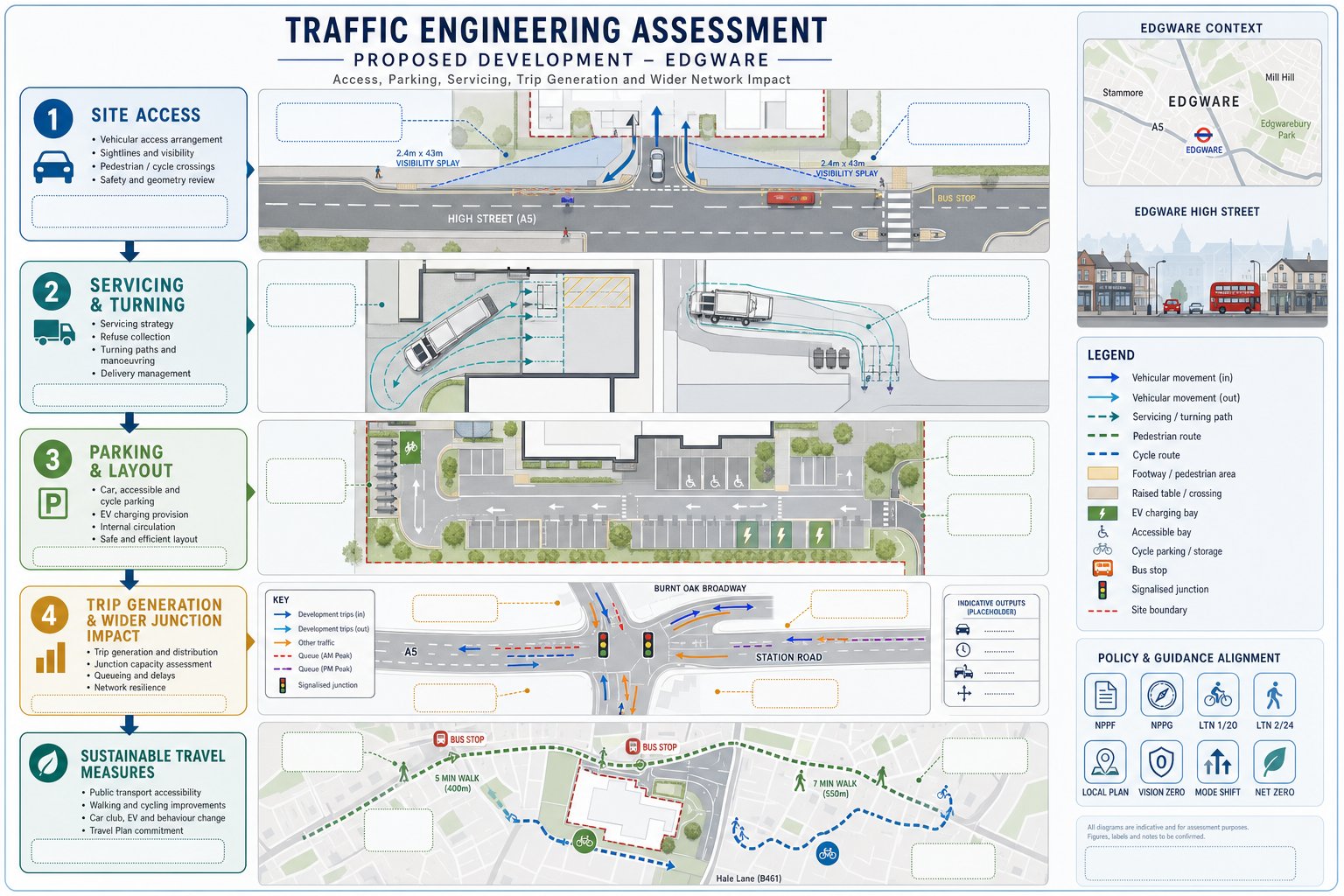
    Traffic engineering site assessment infographic for access, parking, safety and travel impact.

    The scope of assessment depends on the proposal, but most Edgware sites call for a structured review of how the development will function in transport terms, both on site and on the surrounding network. We are usually testing two things at once: can the scheme operate safely and efficiently, and can it be justified convincingly within planning policy?

    That means looking at physical design, forecast demand and how people are likely to travel in real life rather than in a vacuum. A technically neat drawing is not enough if refuse vehicles cannot turn, if visibility is compromised, or if parking assumptions are clearly detached from local conditions. Equally, a site with some constraints may still be entirely supportable if the evidence is proportionate, transparent and well argued.

    Access, Servicing, Parking, And Highway Safety

    Access is usually the first issue under the microscope. We assess where vehicles and pedestrians enter and leave the site, whether the geometry is workable, whether visibility is adequate, and whether the location of the access creates avoidable conflict with junctions, crossings, bus stops or existing kerbside activity.

    Servicing is equally important. Delivery vans, refuse vehicles and emergency vehicles all have different operational needs. If the scheme relies on large vehicles entering, turning or reversing, swept-path analysis may be needed to demonstrate that manoeuvres can be completed safely. If servicing must occur from the street, we consider whether that arrangement is realistic and acceptable.

    Parking is not just about bay numbers. We examine layout efficiency, disabled provision, cycle storage, EV charging expectations and whether the parking strategy aligns with policy and likely demand. For many schemes, the parking case is as sensitive as the traffic case.

    Highway safety then pulls these strands together. We review road layout, local movement patterns and any available collision record to understand whether the development could worsen an existing problem or introduce a new one. Sometimes the answer is a design amendment. Sometimes it is a clearer technical justification.

    Trip Generation, Junction Impact, And Sustainable Travel

    Once site operation is understood, we move to transport demand. Trip generation estimates help us forecast how many person trips and vehicle trips a proposal is likely to create, often using recognised databases such as TRICS and informed professional judgement. Existing lawful use matters here, because net impact is often more relevant than gross numbers.

    We then consider where those trips are likely to go and which parts of the local highway network may be affected. For more substantial schemes, that may lead to junction modelling to test capacity, queueing and delay in forecast scenarios. Not every development requires modelling, but where there is a realistic concern about network effect, a robust evidence base is hard to avoid.

    Sustainable travel sits alongside this analysis, not after it. We review walking links, bus accessibility, cycling opportunities, local amenities and any measures the scheme can introduce to reduce car dependence. That may include cycle parking improvements, travel information, management plans or targeted Travel Plan measures.

    Done properly, this stage is not just a numbers exercise. It is about showing that the development can function within its setting and that the transport strategy supports wider planning objectives. Solid Traffic Engineering: Your judgement is what connects those threads.

    How The Transport Assessment Process Works From Start To Submission

    A good transport submission is usually the product of an orderly process rather than a last-minute report. In Edgware, that process typically starts with scoping: deciding what level of transport work is proportionate and what issues the local planning and highway authority are most likely to focus on.

    First, we review the proposal, the site context and any known policy or highway sensitivities. That allows us to advise whether a Transport Statement, Transport Assessment, Travel Plan or supporting technical note is likely to be needed. On more complex schemes, we may engage early with the authority to agree study junctions, survey requirements or the overall methodology.

    Next comes baseline data. Depending on the site, this may include traffic counts, speed surveys, parking beat surveys, collision review, site observations and an audit of walking, cycling and public transport conditions. Good baseline work matters because weak inputs produce weak conclusions.

    We then assess trip generation and trip distribution, identify the likely effect on surrounding roads and, where necessary, undertake junction modelling. At the same time, the design often evolves. Access arrangements may be adjusted, servicing may be rationalised, cycle storage refined or parking rebalanced. Transport work is rarely isolated from the design process: it feeds directly into it.

    Once the evidence is assembled, we prepare the report and supporting plans in a form that is concise, accurate and aligned with the planning application. The final stage is often overlooked: responding to officer queries. Many applications are won or lost there. A clear, prompt response to transport comments can keep a scheme moving, while a vague or defensive one can cause avoidable delay.

    That is why we place so much emphasis on being practical as well as technical. For planning teams, the best outcome is not just a compliant report, but a submission that anticipates questions before they land.

    Conclusion

    A Traffic Engineer in Edgware adds value long before a planning officer reads the transport report. The real benefit is in spotting pressure points early, shaping a workable design and presenting transport evidence in a way that is proportionate, credible and locally grounded.

    For architects, planners, lawyers, surveyors, developers and councils, that can mean fewer revisions, clearer negotiations and a stronger route through the planning process. Edgware schemes are rarely judged on land use alone: they are judged on how safely and sensibly they fit into the surrounding network.

    Whether the project involves residential intensification, a mixed-use redevelopment or a sensitive change of use, the transport strategy needs to reflect real conditions on the ground. When it does, planning risk becomes easier to manage. And in 2026, that is often what separates a delayed application from a defensible one.

    Frequently Asked Questions about Traffic Engineering in Edgware

    What does a Traffic Engineer in Edgware do for planning applications?

    A Traffic Engineer in Edgware assesses how developments affect local roads, parking, and safety, preparing Transport Statements, Assessments, and Travel Plans to support planning applications and help avoid delays due to transport objections.

    When is a Traffic Engineer required for a development in Edgware?

    You usually need a Traffic Engineer when a proposal could noticeably change traffic flow, parking demand, or highway safety, such as with new flats, schools, nurseries, commercial or mixed-use schemes, and sites near busy roads or constrained access points.

    What is the difference between a Transport Statement, Transport Assessment, and Travel Plan?

    A Transport Statement is a concise review for smaller schemes, a Transport Assessment provides detailed impact analysis including junction modelling for larger developments, and a Travel Plan outlines strategies to promote sustainable travel like walking, cycling, and public transport use.

    How do local and London-wide policies affect development transport requirements in Edgware?

    Local and London policies prioritise walking, cycling, and public transport over cars, enforcing parking and cycle storage standards, EV charging provision, and safe access design, often leading to scheme redesigns to meet these requirements.

    What transport issues are commonly assessed by Traffic Engineers in residential schemes in Edgware?

    Key assessments include parking demand, refuse and emergency vehicle access, cycle storage quality, pedestrian safety, and compliance with low-car and inclusive access principles to ensure the development fits safely within the local highway network.

    How does a Traffic Engineer in Edgware assess trip generation and junction impact?

    They estimate vehicle and person trips using recognised data sources like TRICS, analyse trip distribution on the local network, and perform junction capacity modelling where needed to forecast effects on queues and delays, ensuring developments operate safely and efficiently.
  • Traffic Engineer In Stanmore: Planning-Focused Transport Advice For Smoother Development Outcomes In 2026

    Traffic Engineer In Stanmore: Planning-Focused Transport Advice For Smoother Development Outcomes In 2026

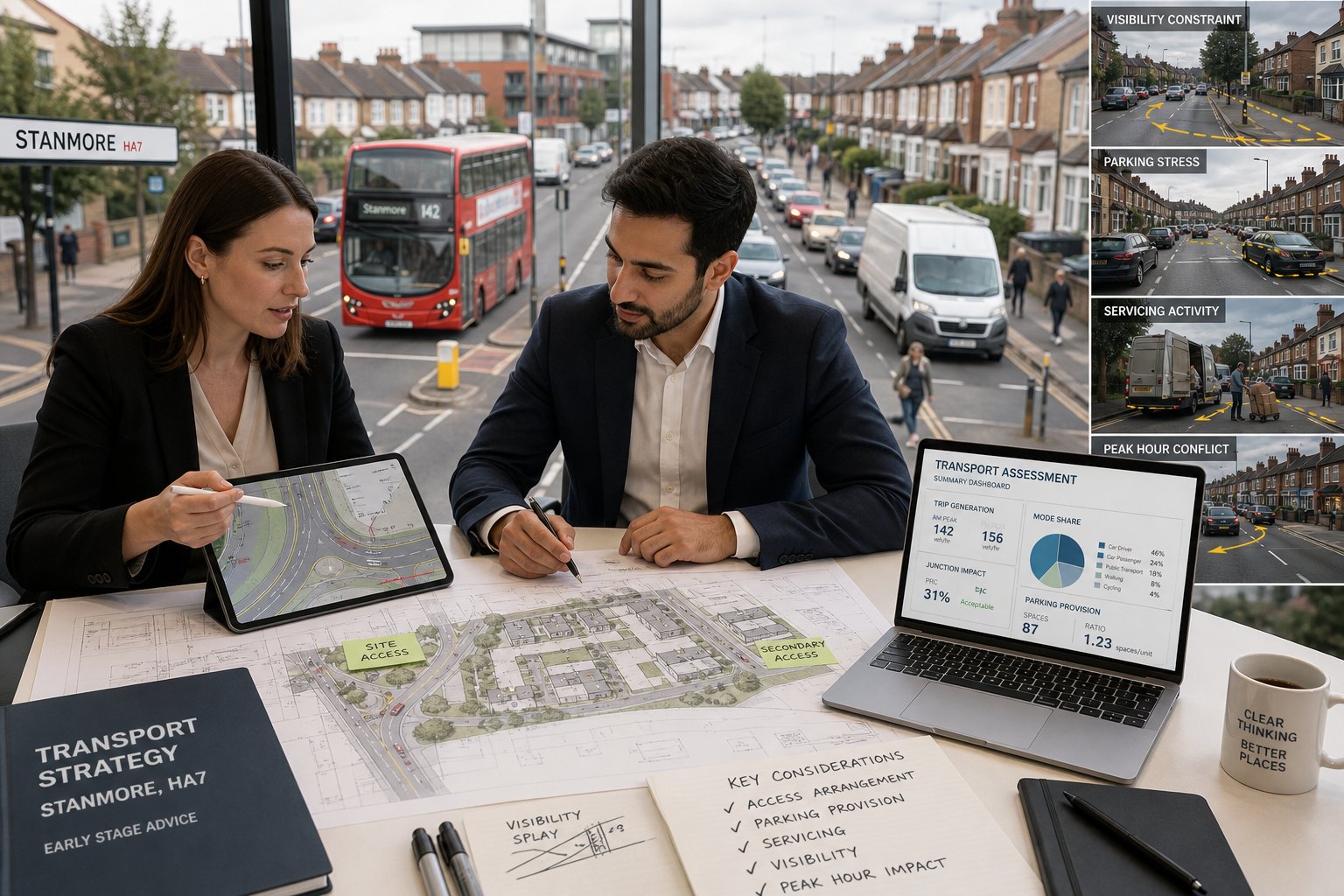
    Planning in Stanmore rarely fails on design alone. More often, schemes slow down because access is awkward, parking is contested, servicing looks unresolved, or the likely transport impact has not been explained in a way the local authority can rely on. That is where a traffic engineer in Stanmore becomes central to the planning process rather than a late-stage add-on.

    We work with architects, planners, developers, lawyers and project teams who need transport advice that is proportionate, technically sound and genuinely useful in moving an application forward. In practical terms, that means reviewing how a site is reached, how many trips a proposal is likely to generate, whether the local network can absorb those movements, and what mitigation or supporting evidence may be needed to satisfy highways concerns.

    Stanmore brings a very particular set of issues. Residential streets can be sensitive to even modest changes in traffic. Parking pressure is often a live local issue. Bus routes, station proximity, visibility constraints and servicing practicality all shape what is realistic. A well-prepared transport strategy needs to respond to those local conditions from the outset.

    In this guide, we set out what a traffic engineer in Stanmore actually does for planning applications, when transport input is usually required, what reports may be needed, and how to avoid the common mistakes that lead to objections, requests for further information, or frustrating delay.

    Key Takeaways

    • A traffic engineer in Stanmore plays a crucial role in planning applications by providing clear, evidence-based transport advice tailored to local conditions and planning policies.
    • Early involvement of a traffic engineer helps identify and mitigate key transport risks such as access issues, parking pressures, servicing constraints, and traffic impacts before submission.
    • Transport reports for Stanmore developments must use current, robust data and be concise, focused on relevant local and London policies to avoid delays and objections.
    • Common triggers for professional transport input include new or intensified access, increased traffic generation, complex land uses, parking variations, and servicing challenges.
    • Effective transport strategies in Stanmore respond to specific site constraints like road hierarchy, public transport accessibility, and existing parking demand to ensure realistic and operational layouts.
    • Choosing the right traffic engineer means selecting one with local authority knowledge, technical expertise, and the ability to provide candid, timely, and proportionate reporting to support smoother planning outcomes.

    What A Traffic Engineer In Stanmore Does For Planning Applications

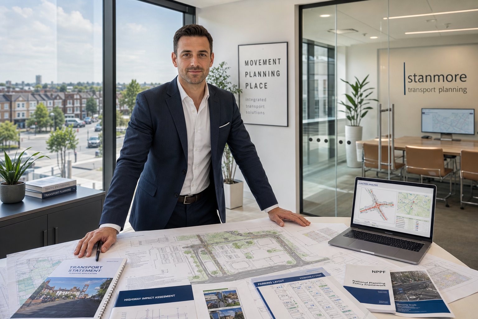
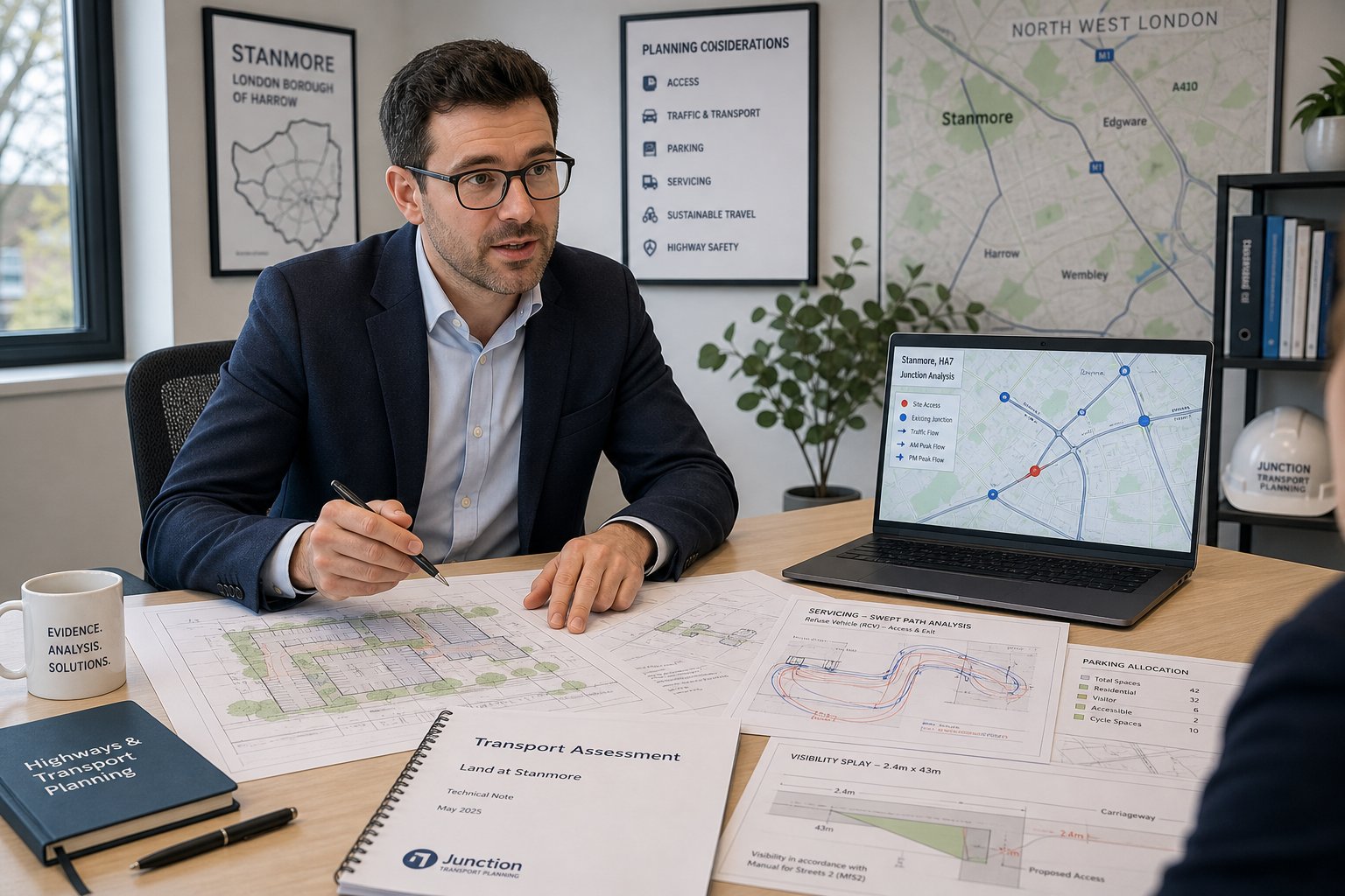
    Traffic engineer reviewing planning and transport documents in a modern office.

    A traffic engineer in Stanmore supports planning applications by turning transport risk into clear, evidence-based advice. That starts with understanding the development proposal in detail: the land use, scale, likely occupiers or users, parking offer, servicing needs, access arrangements and relationship with the surrounding highway network.

    We typically review four core issues first: access, trip generation, parking and servicing. If a new or altered access is proposed, we assess whether it can operate safely, whether visibility is acceptable, and whether the road hierarchy makes that arrangement suitable. If the proposal will intensify use of an existing site, we consider whether the increase in movement is material enough to need a Transport Statement or full Transport Assessment.

    For many schemes, our role also includes preparing technical planning documents. These may include a Transport Assessment, Transport Statement, access note, travel plan, delivery and servicing strategy, or a response to highways consultation comments. On more constrained or contentious sites, we may undertake junction capacity analysis, swept-path testing, parking accumulation review, or support design changes that improve the prospects of approval.

    The key point is this: highways officers do not simply want assurances. They want robust justification. That is why concise reporting matters. Good transport advice explains impacts proportionately, references local and London policy correctly, and gives decision-makers confidence that the proposal has been properly thought through. In broader terms, the role sits within the kind of planning support outlined by Traffic Engineering Consultants: experienced in translating technical transport matters into planning-ready evidence.

    When A Development In Stanmore Needs Transport Input

    Traffic engineer reviewing Stanmore development access and parking plans.

    Not every planning application in Stanmore needs a lengthy transport report. But many do need some level of professional transport input much earlier than applicants expect. The usual trigger is not simply size: it is whether the proposal creates transport effects that the planning authority will reasonably want tested or explained.

    A small residential scheme can require detailed highways input if the access is poor, the road is heavily parked, or the site sits on a sensitive corner. Equally, a commercial scheme with modest floor area may still need servicing analysis if vans or larger vehicles will arrive regularly. In London borough contexts, transport concerns often arise from site circumstances as much as headline development quantum.

    We hence advise project teams to ask an early question: what is most likely to worry highways officers or neighbours? If the answer is vehicle conflict, parking overspill, peak-hour traffic, delivery activity, or pressure on local junctions, transport input is rarely optional.

    This is also why early-stage strategy matters. Across urban applications, the same principle appears in Highway And Traffic work more generally: identify the transport risk first, then tailor the reporting level to that risk rather than defaulting to a generic template.

    Common Triggers For Professional Transport Advice

    Common triggers include:

    • New or intensified access onto busy roads, bus routes, or streets with constrained visibility
    • Material increases in traffic generation, especially during AM and PM peaks
    • Flatted schemes, HMOs, mixed-use, education, healthcare, leisure or commercial uses where activity patterns are more complex
    • Car-free or car-lite proposals, or developments with reduced parking compared with typical expectations
    • Servicing, refuse or emergency access constraints that need tested vehicle tracking
    • Larger applications likely to require a full TA, Framework Travel Plan, or supporting operational plans

    There is also the planning politics of transport. Parking stress and road safety can become focal objections even where technical impact is manageable. A proportionate transport note prepared at the right moment can often head off avoidable dispute. And, frankly, it is usually cheaper to redesign access or servicing before submission than to defend a weak layout once objections land.

    How Stanmore Site Constraints Shape Traffic And Access Strategy

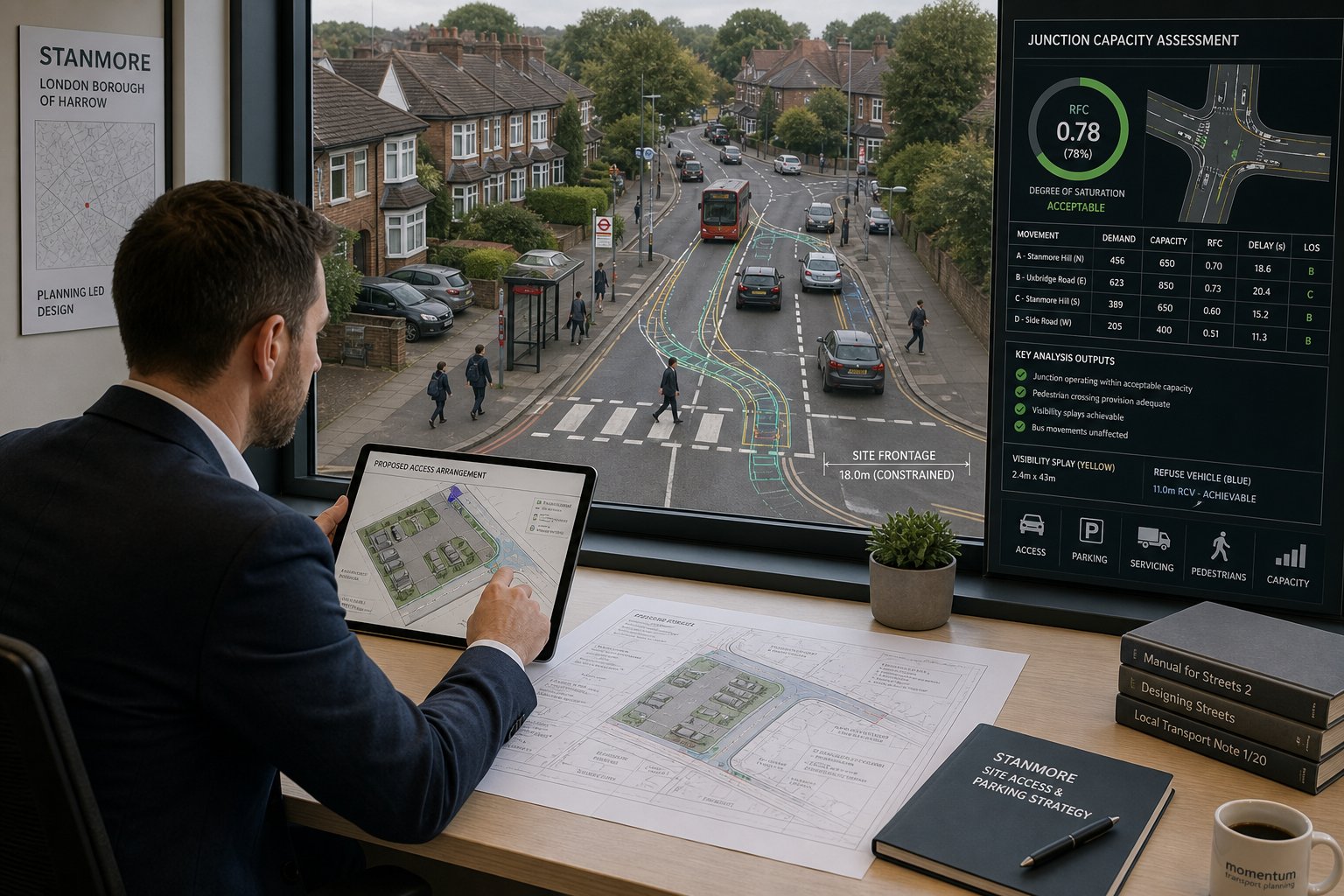
    Traffic engineer reviewing Stanmore site access and parking layout.

    Stanmore is not a blank sheet. Each site sits within a specific pattern of road hierarchy, residential sensitivity, public transport accessibility, topography, frontage conditions and existing parking demand. Those constraints shape transport strategy from the first sketch layout.

    In practice, we often find that the most successful planning-led transport solutions are not the ones with the most technical analysis, but the ones that respond honestly to what the site can and cannot do. If a frontage is tight, that affects access width, pedestrian visibility and vehicle waiting space. If neighbouring driveways are close, turning movements and inter-visibility become more important. If the surrounding streets are already heavily parked, the margin for operational friction is much smaller.

    For sites near public transport, there may be stronger support for reduced car parking and a more sustainable travel-led narrative. But that does not remove the need to prove servicing practicality, refuse collection arrangements, and safe day-to-day operation. Where layouts are especially constrained, transport advice can influence one-way circulation, internal geometry, service timing restrictions, or whether a proposal needs to be redesigned altogether.

    This planning-first approach aligns with wider Traffic Engineering: Your Complete practice: use evidence not just to defend a scheme, but to improve it before it reaches determination.

    Local Road Network, Junction Capacity, And Access Considerations

    Stanmore schemes often turn on local network performance as much as site access itself. We review the nearby road function, existing turning patterns, bus activity, pedestrian flows and any known pressure points at adjoining junctions. For straightforward schemes, a qualitative assessment may be enough. For others, more formal analysis may be needed using tools such as PICADY, ARCADY or LINSIG where a junction’s operation is genuinely material.

    Access design then has to work within that context. Questions usually include:

    • Is visibility acceptable for the speed environment?
    • Can vehicles enter and leave in forward gear where necessary?
    • Will right-turning movements create undue delay or conflict?
    • Is the spacing from nearby junctions or crossings acceptable?
    • Could the access interrupt bus movement, parking bays or pedestrian desire lines?

    Sometimes the answer is not a bigger report but a better layout. Shifting a bellmouth, narrowing a crossover, formalising entry and exit operation, or changing vehicle type assumptions can make a significant difference.

    Parking, Servicing, And On-Site Vehicle Movement

    Parking arguments in Stanmore are rarely abstract. Residents know local pressure intimately, and planning officers know when a parking shortfall is likely to become a political issue. We hence assess parking provision against policy, local context and realistic demand rather than relying on broad assumptions alone.

    That usually means reviewing car parking numbers, disabled bays, EV charging, cycle parking, and how the parking arrangement functions operationally. Can vehicles manoeuvre practically? Is there stacking space? Does a resident or service vehicle need multiple shunts? Those details matter because a compliant drawing can still fail in real use.

    Servicing is equally important. Refuse vehicles, delivery vans and emergency access often define whether a layout is acceptable. Swept-path analysis is commonly needed to show that the design works, particularly on tight sites. Where turning space is limited, timed deliveries or smaller vehicle assumptions may help, but they need to be credible and clearly secured if relied upon.

    For employment-led or mixed-use proposals, the same issues appear at greater scale, which is why Commercial Traffic Engineering principles are often relevant even on relatively modest urban sites.

    Transport Assessments And Statements For Stanmore Projects

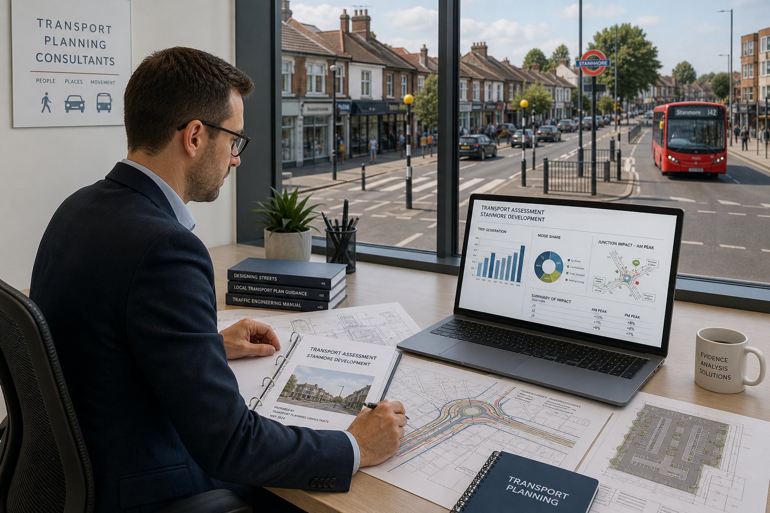
    Traffic engineer reviewing a transport assessment for a Stanmore development.

    A Transport Assessment (TA) or Transport Statement (TS) is not just a planning formality. It is the main technical narrative explaining how a proposal interacts with the transport network and why that impact is acceptable, manageable, or mitigated.

    The choice between a TA and TS depends on scale, complexity and likely impact. A Transport Statement is usually appropriate where impacts are limited but still need structured explanation. A Transport Assessment is more detailed and is typically required for larger or more sensitive developments where trip generation, junction capacity, mode share, parking strategy and mitigation need fuller testing.

    For Stanmore projects, a good TA or TS usually covers:

    • site location and accessibility
    • existing highway and transport conditions
    • development proposals
    • trip generation and distribution
    • traffic impact and, where relevant, capacity analysis
    • parking and servicing strategy
    • sustainable travel opportunities
    • mitigation, if needed

    The standard of evidence matters as much as the document title. Survey data should be current and relevant. Assumptions should be transparent. Comparisons with existing lawful use need to be properly handled. And the conclusions should be proportionate rather than over-claimed.

    Too many transport reports fall into one of two traps: either they are so thin that they invite challenge, or so inflated that the real planning points get buried. We aim for the middle ground, concise, technically solid, and tailored to local authority expectations. That same approach underpins work delivered across Traffic Engineer In London: planning contexts, where report quality is judged not by length but by clarity, evidence and relevance.

    Travel Plans, Delivery Management, And Wider Supporting Reports

    Traffic engineer reviewing transport and delivery planning documents in a modern office.

    Many Stanmore applications need more than a TA or TS. Supporting transport documents can be essential where the planning authority wants confidence that day-to-day operation, construction activity or sustainable travel outcomes will be actively managed.

    A Travel Plan sets out how a development will encourage sustainable travel and reduce reliance on private car use. Depending on the scheme, this may be residential, workplace or school-focused. The strongest travel plans are realistic. They reflect actual public transport accessibility, identify practical measures such as cycle facilities, welcome packs, monitoring, car club information or site-specific incentives, and avoid vague promises that nobody can carry out.

    A Delivery and Servicing Management Plan becomes important where deliveries, collections or operational servicing could affect neighbours or local roads. This is common for mixed-use, commercial, education and healthcare schemes. It can define delivery hours, vehicle size assumptions, routing expectations and on-site management procedures.

    On some projects, a Construction Logistics Plan is also needed, especially where demolition or build activity may affect narrow roads, schools, buses or parking-sensitive streets. And where access design is finely balanced, road safety audit input or additional technical notes may support the package.

    These supporting reports often look secondary on a document list, but they can be the difference between a proposal that feels operationally credible and one that appears undercooked. That is particularly true when officers are deciding whether concerns can be managed through condition or need redesign before consent.

    Working With Harrow Planning Requirements And Local Policy Context

    Transport planning in Stanmore sits within a layered policy framework. Harrow’s local planning requirements matter, but so do the London Plan, relevant TfL guidance, parking standards, cycle standards, and national planning and transport policy. A report that ignores that hierarchy can be technically competent yet still unpersuasive.

    We hence frame transport advice around the actual policy tests a scheme is likely to meet: highway safety, residual cumulative impact, sustainable transport, parking justification, servicing practicality and design quality. In London boroughs, the policy direction usually supports sustainable modes strongly, but local decision-making remains highly sensitive to street-level operational realities. That tension needs handling properly.

    Early scoping is often valuable. Where a scheme is likely to be borderline in transport terms, discussing methodology, survey scope or report expectations early can reduce later disagreement. It will not eliminate challenge, nothing does, but it often narrows the debate to the points that genuinely matter.

    Experience also helps with proportionality. Not every scheme needs every available technical appendix. Harrow officers, like most planning authorities, generally respond better to direct answers than to padded submissions. The objective is to provide enough robust evidence to support determination, not to impress with volume.

    And because many projects in Stanmore sit within wider London development dynamics, lessons from other urban authorities can be useful too. We often see similar reporting expectations across city contexts, including those discussed in Traffic Engineer In Leeds: planning-led transport work.

    How A Traffic Engineer Supports Architects, Planners, And Developers

    Transport input works best when it is integrated early with design and planning strategy rather than commissioned after the layout is fixed. For architects, that means we can test whether access geometry, parking courts, cycle stores, refuse tracking and pedestrian routes are viable before the design hardens. For planners, we help shape a planning narrative that is realistic about transport effects and aligned with policy. For developers, we reduce the risk of costly redesign late in the programme.

    The collaboration is usually iterative. An architect issues a concept. We flag access or servicing conflicts. The layout shifts. Parking is reviewed again. A planner refines the planning balance. Then the supporting transport evidence is drafted around a scheme that is already more robust. That process is faster, and usually far cheaper, than trying to rescue a weak proposal after submission.

    Lawyers and planning consultants also rely on transport input where appeal risk, committee sensitivity or objection management is in play. A concise technical note can help clarify whether a concern is genuinely substantive or simply asserted.

    Our role is not to inflate transport issues, but to resolve them. Sometimes that means confirming a proposal is low impact. Sometimes it means saying a scheme needs a redesign before it is planning-ready. Honest advice tends to save everyone time.

    The Typical Process From Initial Review To Planning Submission

    Most transport instructions for Stanmore planning applications follow a fairly consistent sequence, even though the level of analysis varies by project.

    First, we carry out an initial review. That usually involves examining the site location, proposed land use, access drawings, parking layout, local road context and likely planning triggers. At this point, we identify the probable transport risks and advise what level of reporting may be needed.

    Second comes scoping. For straightforward schemes this may be internal. For more sensitive applications, it can involve discussions with the project team and sometimes early engagement on methodology. The aim is to avoid unnecessary work while making sure the final submission answers the right questions.

    Third, we arrange the evidence base. That may include traffic counts, parking surveys, pedestrian observations, accessibility review, servicing assumptions or junction modelling inputs. If the site is tight, vehicle tracking can start surprisingly early because layout feasibility may depend on it.

    Fourth, we prepare the draft transport package, often a TS or TA, sometimes with a travel plan, servicing plan or technical note. This is then coordinated with the architect, planner and wider application documents so that the story is consistent.

    Finally, after submission, there may be highways queries or requests for clarification. Prompt, technically precise responses are often what keep determination moving. Speed matters here. A delayed answer to a simple highways point can hold up an otherwise ready application.

    Common Reasons Transport Reports Are Challenged And How To Avoid Delays

    Transport reports are usually challenged for predictable reasons. The frustrating part is that most of them are avoidable.

    One common issue is poor scoping. A report answers the wrong transport question because nobody identified the real point of concern at the outset. For example, a scheme may focus heavily on trip rates when the authority is actually most concerned about servicing conflict or parking overspill.

    Another frequent problem is weak or outdated evidence. Survey data that is too old, unrepresentative, or disconnected from local conditions can quickly undermine confidence. The same applies to generic trip-rate selection without proper justification, or capacity modelling built on assumptions that are not explained clearly.

    We also see challenges arise from layout optimism, drawings that technically fit on paper but do not work in practice. If a refuse vehicle can turn only with repeated overruns, or visibility relies on unrealistic conditions, highways officers will spot it.

    Parking is another classic pressure point. If proposed provision diverges from expectation, the justification must be careful, location-specific and policy-led. Simply stating that residents will own fewer cars rarely carries much weight on its own.

    To avoid delay, we recommend four things:

    1. Scope early around the actual planning risks.
    2. Use current, robust data and explain assumptions plainly.
    3. Test the layout operationally, not just dimensionally.
    4. Respond quickly and directly to consultation comments.

    That practical emphasis is one reason concise planning support tends to outperform bloated reporting. Similar lessons appear in Traffic Engineer In Bristol: work, where local thresholds differ but the causes of delay look very familiar.

    Choosing The Right Traffic Engineer In Stanmore For Reliable, Timely Reporting

    Choosing the right traffic engineer in Stanmore is partly about technical competence and partly about planning judgement. You need both.

    At a minimum, the consultant should understand transport assessment methodology, access design principles, parking standards, servicing review and, where relevant, junction modelling tools. They should also know how London and borough-level planning policy affects transport submissions. But credentials alone are not enough. The real test is whether they can identify what matters on your site, produce evidence proportionate to the risk, and do it within the programme your application actually has.

    For project teams, a few questions are worth asking early:

    • Have they worked on Harrow or similar London borough applications?
    • Can they advise at concept stage, not just write reports later?
    • Do they produce concise, planning-focused documents rather than generic templates?
    • Can they handle supporting work such as swept-path analysis, travel plans or technical responses to objections?
    • Are they realistic about deadlines and information needed from the design team?

    We would add one more point: choose someone willing to be candid. If the access is poor, if parking justification is weak, or if servicing is not believable, you want to know before submission. Fast reporting is valuable only when it is also accurate.

    For many clients, that combination of local authority awareness, technical clarity and speed is the deciding factor. With more than 30 years of experience behind our work, we focus on exactly that, clear transport advice, tailored to planning thresholds, delivered in time to support smoother development outcomes.

    A capable traffic engineer in Stanmore should leave the team with fewer unknowns, not more. When the transport strategy is right, the rest of the planning package tends to stand up much better under scrutiny.

    Frequently Asked Questions About Traffic Engineering in Stanmore

    What does a traffic engineer in Stanmore do for planning applications?

    A traffic engineer in Stanmore reviews access, parking, servicing, and trip generation to provide evidence-based transport advice. They produce Transport Assessments, Statements, and technical notes to support planning applications in line with Harrow Council’s requirements.

    When is transport input required for a development in Stanmore?

    Transport input is needed when developments propose new or intensified access, generate significant vehicle trips during peak hours, include flats or commercial uses, or have car-free schemes. Early transport advice helps address local concerns and avoid delays in approvals.

    How do local site constraints in Stanmore affect traffic and access strategies?

    Stanmore’s narrow residential streets, on-street parking, proximity to the station, and road hierarchy impact access design. Traffic engineers consider visibility, parking pressure, and local bus routes to develop practical, safe layouts that align with local transport policies.

    What types of reports does a traffic engineer prepare for Stanmore projects?

    Depending on scale and impact, reports can include Transport Assessments or Statements, Travel Plans, Delivery and Servicing Management Plans, and Construction Logistics Plans. These documents provide detailed analysis and mitigation strategies tailored to local planning requirements.

    How can developers avoid delays related to transport reports in Stanmore?

    Delays can be avoided by early scoping with highways officers, using robust and current data, ensuring layouts work operationally not just dimensionally, and responding promptly to consultation comments. Clear, proportionate reporting reduces objections and speeds up approvals.

    What should be considered when choosing a traffic engineer in Stanmore?

    Choose a traffic engineer with experience in Harrow and TfL policies, ability to produce clear, concise reports on time, competence in modelling tools, and readiness to advise from the design concept stage. Candid advice on access and parking issues is critical to success.

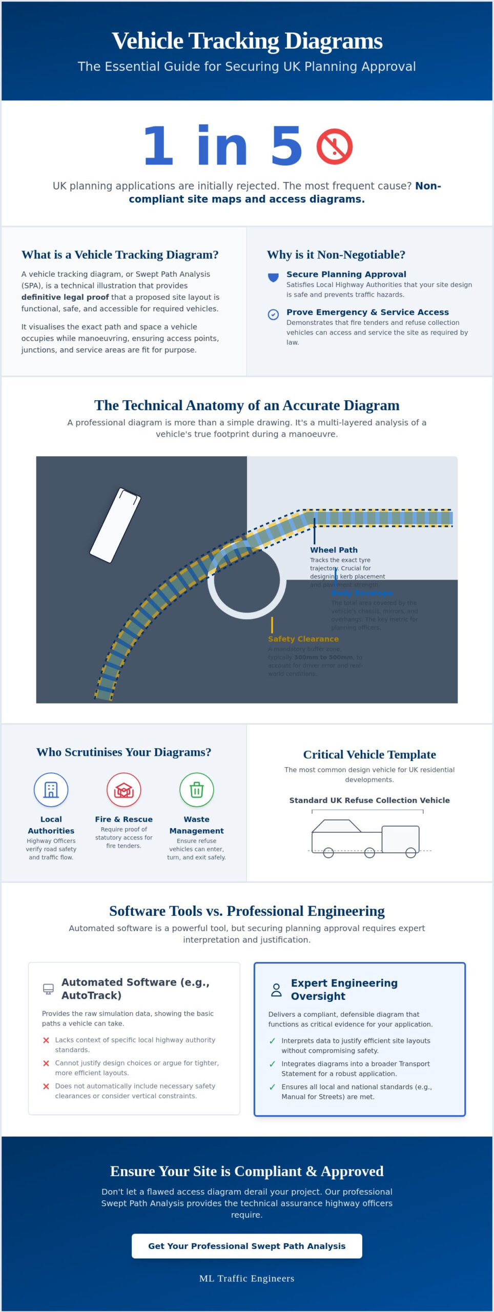
  • What is a Vehicle Tracking Diagram?  A Guide for Developers

    What is a Vehicle Tracking Diagram? A Guide for Developers

    Approximately one in five planning applications in the UK are initially rejected as invalid, with non-compliant site maps cited as the most frequent cause for failure. For any developer, a vehicle tracking diagram is far more than a simple technical drawing; it serves as the definitive legal proof that your proposed site layout is functional and safe. You likely recognize the stress of selecting the correct vehicle templates, such as fire tenders or refuse trucks, knowing that a single unworkable access point can lead to a costly planning refusal from the Local Highway Authority.

    We understand the pressure of meeting stringent highway standards while trying to maximize every square meter of your site. This guide provides a clear understanding of Swept Path Analysis (SPA) and explains how a professional vehicle tracking diagram functions as critical evidence for your application. You’ll learn how to ensure your layout meets the latest 2026 regulatory benchmarks, including updates to the Manual for Streets. We will preview how to bridge the gap between software features and engineering requirements to deliver a site that is both compliant and highly efficient.

    Key Takeaways

    • Understand why a vehicle tracking diagram is a mandatory requirement for proving site accessibility to Local Highway Authorities and emergency services.
    • Distinguish between wheel paths and body envelopes to ensure your layout accommodates the full physical footprint of a manoeuvring vehicle.
    • Identify the specific design templates required for your project, including the standard 11.4m refuse collection vehicle used by most UK councils.
    • Learn how professional interpretation of swept path data can justify tighter site layouts without compromising on safety or regulatory compliance.
    • Recognise the limitations of automated software and why expert engineering oversight is essential for securing planning approval.

    What is a Vehicle Tracking Diagram in UK Planning?

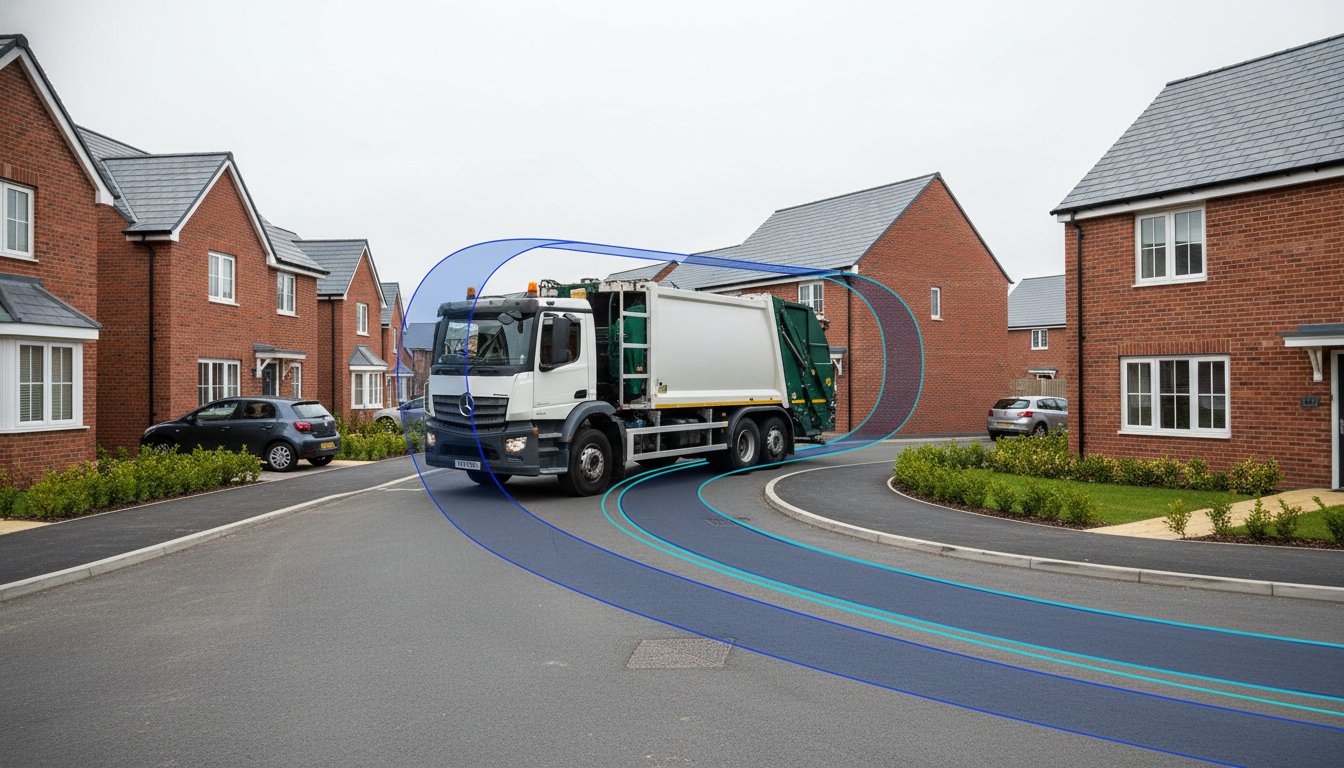
    A vehicle tracking diagram is a technical illustration that visualises the physical space required for a vehicle to manoeuvre through a site layout. It serves as a vital piece of evidence in the UK planning system, proving that a proposed design can safely accommodate the vehicles expected to use it. These diagrams aren’t just for show; they’re essential for securing approval from Local Highway Authorities who must ensure that emergency and service vehicles don’t get stuck or cause hazards on the public highway. By mapping the ‘swept path’ of a vehicle, developers can demonstrate that their site is functional before a single brick is laid.

    The role of these diagrams extends throughout the entire planning lifecycle. During the pre-application stage, they help identify potential access issues before they become expensive design flaws. Later, they’re frequently submitted as part of a formal application or used to discharge planning conditions once permission is granted. By integrating professional Swept Path Analysis services, developers provide the technical assurance that highway officers require to recommend an application for approval.

    A common oversight in many planning submissions is failing to integrate these diagrams into the broader Transport Statement. A vehicle tracking diagram shouldn’t stand alone. It provides the empirical data that supports the access and safety arguments within your Transport Statement. Without this visual proof, claims about site accessibility are merely anecdotal and often face immediate rejection from the council. Precision here is a functional necessity, not an optional extra.

    Terminology: Vehicle Tracking vs. Swept Path Analysis

    While often used interchangeably, ‘vehicle tracking’ refers to the simulation process itself, whereas the ‘diagram’ is the physical or digital output. This technical field has evolved significantly since the development of AutoTrack, the world’s first swept path analysis software. In professional engineering reports, ‘swept path’ specifically describes the area covered by the vehicle’s body plus a necessary safety margin. This margin is critical because it accounts for driver error and minor variations in vehicle dimensions, ensuring the layout works in the real world.

    Who Requires These Diagrams?

    Several statutory consultees will scrutinise your site’s accessibility. Local Planning Authorities (LPAs) and Highway Officers are the primary gatekeepers. They use these diagrams to verify road safety and traffic flow. Additionally, Fire and Rescue services require proof of statutory access for fire tenders to meet building regulations. Finally, waste management departments won’t approve a development unless a vehicle tracking diagram proves that a standard refuse collection vehicle can enter, turn, and exit the site safely in forward gear.

    The Technical Anatomy of an Accurate Tracking Diagram

    A professional vehicle tracking diagram is a composite of several critical data layers. It isn’t merely a drawing of a vehicle moving through a space; it’s a calculated projection of physical limits. The most fundamental layer is the ‘Wheel Path’, which tracks the exact trajectory of the tyres. This data is vital for engineers to determine curb heights and pavement structural requirements. However, the ‘Body Envelope’ is often the primary focus for planning officers. This represents the outer limits of the vehicle’s chassis, including mirrors and overhangs. In a tight turn, the body of a refuse truck or fire tender will often swing wider than the wheels. Ignoring this distinction is a common reason for planning failure.

    Precision is mandatory. Real-world driving isn’t perfect, so a safety clearance is essential. Most UK authorities expect a buffer of 300mm to 500mm between the vehicle’s body envelope and any physical obstruction like a wall or a parked car. For developments involving underground car parks or low bridges, vertical clearance must also be factored into the vehicle tracking diagram. A layout that works on a 2D plane might still fail if it doesn’t account for the height of a standard delivery van or emergency vehicle. If you’re concerned about these technical margins, our experts can provide a detailed Swept Path Analysis to ensure your site remains functional and compliant.

    Visual Standards for Planning Submission

    Clarity is just as important as accuracy. Planning officers often review dozens of applications a week, so your diagram must be legible and professional. High-resolution PDF outputs are the industry standard; raw CAD files are rarely accepted because they require specialised software to view. We recommend colour-coding different vehicle types to make the diagram intuitive. For example, using red for fire tenders and blue for passenger cars allows a reviewer to quickly verify access for different services. Adhering to these UK government requirements for vehicle tracking plans ensures your base map, typically an OS MasterMap, is up-to-date and provides an accurate context for the manoeuvres.

    Interpreting ‘Lock-to-Lock’ Time

    One technical detail that frequently trips up developers is ‘lock-to-lock’ time. This is the time it takes a driver to turn the steering wheel from one extreme to the other. If a diagram assumes a steering speed that’s too fast for a heavy refuse vehicle, the resulting arc will be unrealistically tight. Most residential manoeuvres occur at slow speeds, often under 5mph. Your vehicle tracking diagram must reflect these slow-speed realities. Applications are often rejected when highway officers spot steering assumptions that don’t align with the physical capabilities of the chosen design vehicle.

    Software Tools vs. Professional Engineering Services

    Autodesk Vehicle Tracking has become the dominant force in digital site modeling, providing developers with powerful tools to simulate vehicle movement. While this software is the industry standard for precision, it’s vital to remember that it is a tool, not a solution. A vehicle tracking diagram generated by a computer is only as reliable as the parameters defined by the operator. Simply owning the software doesn’t mean a developer can produce a document that will withstand the scrutiny of a Local Highway Authority. Expert interpretation remains the bridge between a technical drawing and a successful planning approval.

    One of the most significant risks in using automated software is the reliance on ‘default settings’. Standard vehicle libraries often include templates that don’t align with specific UK council requirements. For instance, using a generic ‘Garbage Truck’ template might result in a manoeuvre that is either too optimistic or unnecessarily restrictive. Most English councils require a specific 11.4m Refuse Collection Vehicle (RCV) template. If your diagram uses a 10.5m default model, your application will likely be rejected for being ‘unworkable’. Hiring a transport consultant ensures that the correct, council-specific design vehicles are used from the start, avoiding costly redesigns.

    The Limitations of Automated Software

    Software lacks the ability to understand local policy or the nuances of the ‘human element’ in driving. While a computer might flag a turn as ‘failing’ because of a 50mm overlap, an experienced engineer can often optimise the layout or provide a technical justification for the manoeuvre. We focus on finding functional solutions that maximise your site’s developable area. A professional report includes the commentary necessary to explain why a specific path is safe, even in ‘tight’ site layouts that automated software might struggle to validate.

    Why Professional Certification Matters

    Highway Officers give significantly more weight to a vehicle tracking diagram submitted by a recognised traffic engineering firm. This isn’t just about the drawing; it’s about the accountability that comes with it. Professional firms carry Professional Indemnity (PI) insurance, which protects the developer against design errors that could lead to structural or operational failures. Furthermore, we ensure these diagrams are seamlessly integrated into a comprehensive Transport Statement London. This holistic approach provides the statutory consultees with all the evidence they need in a single, authoritative package, significantly reducing the likelihood of a planning refusal.

    What is a Vehicle Tracking Diagram? A Guide for Developers

    Critical Vehicle Templates for UK Planning Approval

    Selecting the correct ‘Design Vehicle’ is the most consequential decision in the creation of a vehicle tracking diagram. A design vehicle is the largest or most frequent vehicle expected to use the site, and its dimensions dictate the layout’s feasibility. Using a generic or undersized template is a common error that leads to immediate planning rejection. For most residential developments in England, the 11.4m Refuse Collection Vehicle (RCV) is the non-negotiable standard. Highway officers require proof that this specific vehicle can navigate the site without mounting kerbs or endangering pedestrians.

    Statutory access for emergency services is equally critical. Fire tenders must meet the 12.5m outer turning circle rule, as specified in Building Regulations. If your site layout cannot accommodate this manoeuvre, it won’t pass safety inspections regardless of how well the rest of the design performs. For commercial and retail schemes, the focus shifts to delivery logistics. This often requires tracking for 16.5m Articulated HGVs or smaller Rigid HGVs for urban environments. If you are unsure which templates your local council requires, our team can provide expert Swept Path Analysis to ensure your submission is accurate from the start.

    Residential Development Requirements

    In residential schemes, the vehicle tracking diagram must demonstrate that refuse trucks can enter and exit in forward gear. This often involves designing ‘turning heads’ at the end of cul-de-sacs. If a dead-end road is longer than 20 metres, a turning facility is a mandatory requirement for fire access. Larger residential developments may also need to show tracking for a Pantechnicon, or standard removal van, to ensure residents can move in and out without blocking the entire street. For premium developments, ensuring that high-end private hire services like Hyper Executive Travel can easily access drop-off points is equally important for the end-user experience. Precision here prevents the ‘unworkable’ label that highway officers often apply to poorly planned access points.

    Commercial and Industrial Standards

    Industrial developments face different challenges, particularly regarding warehouse loading bays. These sites require tracking for 16.5m Articulated HGVs to prove that vehicles can reverse into bays without multiple shunts that disrupt traffic flow. Urban retail units often rely on Rigid HGV templates, which are more manoeuvrable but still require significant clearance. Some specialist developments, such as petrol stations or industrial plants, may even require tracking for fuel tankers or abnormal loads. For developers managing the logistics of industrial site setup, silver-knight.co.uk offers a detailed guide on heavy equipment transport costs. We ensure every vehicle tracking diagram uses the specific manufacturer data required for these high-stakes manoeuvres, maintaining the safety-conscious standards your project demands.

    Securing Planning Approval with Accurate Vehicle Tracking

    A professional vehicle tracking diagram serves as a persuasive tool during negotiations with the Local Highway Authority. It transforms subjective concerns about site access into objective, data-driven discussions. When a highway officer or a local resident raises an objection based on perceived congestion or “unworkable” turns, your diagram provides the empirical proof needed to mitigate those concerns. By demonstrating that every manoeuvre is within safe physical limits, you can often justify “tight” site layouts that maximise your developable land without compromising on safety standards.

    Engaging in pre-application tracking is one of the most effective ways to avoid expensive redesigns. Identifying a conflict between a refuse truck’s body envelope and a proposed building corner is far easier to fix during the initial design phase than after a formal submission. At ML Traffic Engineers UK, we provide compliant, planning-ready documentation that integrates seamlessly into your wider application. We ensure that every vehicle tracking diagram we produce adheres to the latest 2026 standards, providing the technical authority required to satisfy statutory consultees and streamline the approval process.

    Integrating Tracking into Your Design Process

    Tracking should never be an afterthought. We recommend conducting a Swept Path Analysis before your final site plan is frozen. This proactive approach allows you to determine the absolute minimum road widths required for safe passage. It also helps you find the critical balance between maximizing parking provision and ensuring necessary vehicle manoeuvrability. When you design with tracking data from the start, you create a layout that is both functional for users and acceptable to highway officers.

    Next Steps for Your Planning Application

    Securing a professional assessment is a straightforward process that provides immediate clarity for your project. You can request a quote for a professional Swept Path Analysis by contacting our team with your current site plans. We understand the urgency of planning deadlines; we prioritise efficient turnaround times to keep your application moving forward. For more developer guides and technical insights, visit our resources page. Our goal is to act as your dependable partner, managing the intricate regional regulations so you can focus on the broader vision of your development.

    Advancing Your Development with Technical Certainty

    A compliant site layout depends on more than just a drawing; it requires the precise application of highway standards and physical limits. You’ve seen how the body envelope and safety clearances dictate the success of your application. Choosing the correct design vehicles, from refuse trucks to fire tenders, ensures your layout remains functional under real-world conditions. A professional vehicle tracking diagram acts as your definitive evidence against planning objections and helps you avoid the high costs of post-submission redesigns.

    Expertise matters when navigating the specific requirements of London and England planning authorities. We provide technical analysis that is accepted by all UK Highway Authorities, ensuring your project meets every regulatory benchmark. We understand that planning deadlines move quickly, so we offer a rapid turnaround to keep your development on track. Request a Professional Swept Path Analysis for Your Project today to secure your site access. Our team is ready to provide the precision your application needs for a smooth path to approval.

    Frequently Asked Questions

    Is a vehicle tracking diagram required for every planning application?

    Not all applications require a vehicle tracking diagram, but they’re mandatory for any development creating new access points or involving significant changes to vehicle movement. Local Highway Authorities typically demand them for residential schemes of three or more dwellings and all commercial developments. If your project requires service or emergency vehicle access, you’ll need to provide this technical proof to avoid an invalid application status.

    What is the standard size of a fire tender for UK swept path analysis?

    The standard fire tender used for UK swept path analysis typically measures 8 metres in length and 2.55 metres in width. However, the most critical metric is the 12.5 metre outer turning circle requirement specified in Building Regulations. We ensure your diagram accounts for these dimensions plus the necessary safety buffers to ensure statutory access is guaranteed for emergency services without any risk of collision.

    Can I use a standard car for my tracking diagram?

    You can use a standard car template for tracking individual parking spaces, but it won’t satisfy access requirements for a planning application. Highway officers focus on the largest vehicles expected on site, such as refuse trucks or fire tenders. A vehicle tracking diagram that only shows a passenger car doesn’t prove that the site is functional for essential services or emergency responders.

    What happens if my site layout fails the vehicle tracking test?

    If your site layout fails the test, you’ll need to redesign the access or turning areas before submitting your application. This often involves widening internal junctions, increasing the radius of a turning head, or slightly relocating buildings to provide the necessary clearance. Identifying these failures during the pre-application stage prevents a formal refusal and the associated costs of starting the process over again.

    Do I need a separate diagram for every entrance and exit?

    You must provide tracking for every entrance and exit that serves different vehicle types or has unique geometric constraints. While you don’t necessarily need separate drawings, the diagrams must clearly show that all access points are functional for their intended use. This includes demonstrating that a refuse truck can safely enter and exit the site in forward gear at every designated point.

    How much does a professional swept path analysis cost in 2026?

    The cost of a professional swept path analysis varies depending on the complexity of the site and the number of vehicle manoeuvres required. While industry rates in London for standard CAD assessments can range significantly, every project has unique requirements. We recommend requesting a tailored quote to ensure you receive a comprehensive report that meets your specific local authority’s stringent standards.

    What software do transport engineers use for vehicle tracking?

    Transport engineers primarily use specialised software such as Autodesk Vehicle Tracking, AutoTURN 2026, and RapidPath. These tools allow us to simulate precise manoeuvres using up-to-date libraries of UK-specific vehicle templates. By using industry-standard software, we produce a verifiable vehicle tracking diagram that highway officers can trust, ensuring your technical evidence aligns with the digital systems used by local planning departments.

    Does the diagram need to show the vehicle reversing?

    Your diagram must show reversing manoeuvres if they’re a necessary part of the site’s operation, such as in turning heads or loading bays. However, councils generally prefer designs that allow refuse and emergency vehicles to enter and exit in forward gear. If reversing is required, the diagram must prove the manoeuvre is safe and doesn’t conflict with pedestrian paths or structural boundaries.

    Michael Lee

    Article by

    Michael Lee

    Transport planner with over 35 years' experience.

    Disclaimer

    The content on mltraffic.co.uk, including all technical articles, guides, and resources, is provided for general informational and educational purposes only. It is not intended to constitute professional advice in traffic engineering, transportation planning, development approvals, or any other technical or legal field.
    While ML Traffic Engineers makes every reasonable effort to ensure the accuracy, completeness, and timeliness of the information published, we do not provide any warranties or representations (express or implied) regarding its reliability, suitability, or availability for any particular purpose. Any reliance you place on the content is strictly at your own risk.
    In no event shall ML Traffic Engineers, its directors, employees, authors, or affiliates be liable for any direct, indirect, incidental, special, consequential, or punitive damages (including, without limitation, loss of profits, data, or business opportunities) arising out of or in connection with the use of, or inability to use, any information provided on this website.
    The articles and guides on this site are not a substitute for engaging a qualified, professional traffic engineer to assess your specific project requirements. For tailored advice, compliance assessments, or traffic engineering services, please contact a competent professional.
    This disclaimer may be updated from time to time without notice. By accessing or using this website, you agree to be bound by the most current version of this disclaimer.

  • What is a Transport Consultant? A Guide for Developers

    What is a Transport Consultant? A Guide for Developers

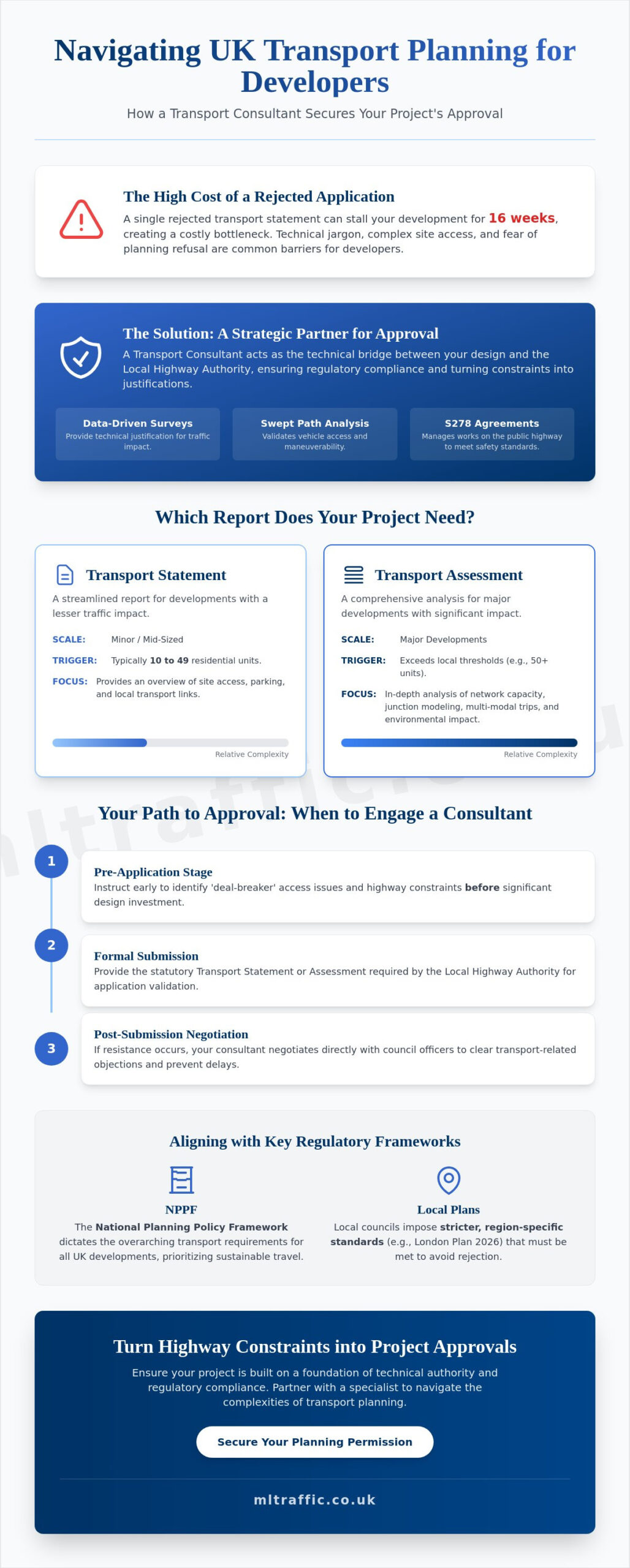
    A single rejected transport statement can stall your development for 16 weeks, creating a costly bottleneck in your project timeline. For many developers, the Highway Authority’s requirements for Section 278 agreements or complex site access layouts feel like a high-stakes barrier to progress. It’s common to feel frustrated by technical jargon and the fear that a minor design error in your car park could trigger a full planning refusal. You need a partner who understands that precision is a functional necessity when dealing with modern infrastructure. Engaging a transport consultant ensures your application is built on a foundation of technical authority and regulatory compliance.

    This guide explains how a transport consultant acts as your strategic architect of approval. You’ll learn how they secure your planning permission through data-driven traffic surveys, swept path analysis, and expert negotiation with local authorities. We will outline the process of validating site access and optimizing layouts to ensure your project meets the latest 2026 regulatory standards without unnecessary delays. From Transport Assessments to detailed Travel Plans, we cover everything required to move your project from inception to completion with confidence. By the end of this article, you will understand how to turn highway constraints into technical justifications for your development.

    Key Takeaways

    • Understand the critical role of a transport consultant as the technical bridge between your development design and the Local Highway Authority.
    • Identify the specific reporting requirements for your site, including the differences between Transport Statements for minor works and comprehensive Transport Assessments for major developments.
    • Learn how to streamline the instruction process by defining project scope and requesting detailed fee proposals aligned with planning demands.
    • Gain insights into managing Section 278 agreements to ensure all works on the public highway comply with current safety benchmarks.
    • Discover how data-driven tools like Swept Path Analysis and professional Parking Surveys provide the technical justification needed to secure planning approval.

    What is a Transport Consultant in the Context of UK Planning?

    A transport consultant is a specialized technical expert who evaluates the impact of new developments on the existing transport network. They don’t just provide data; they act as the vital bridge between your architectural site design and the Local Highway Authority (LHA). Their primary role involves translating complex development goals into technical justifications that satisfy regulatory requirements. By integrating transportation planning principles with site-specific engineering, they ensure your project is both accessible and safe for the public. They manage the full lifecycle of transport requirements, from initial feasibility studies to final highway adoptions.

    To better understand this concept, watch this helpful video:

    The 2026 planning standards demand more robust data than ever before. With planning fees in England having increased by 3.8% as of April 1, 2026, the cost of a rejected application is higher than ever. Authorities now require granular evidence regarding vehicle movements and environmental impact. Within a consultancy, you’ll encounter two distinct roles. Transport planners focus on policy, sustainable travel strategies, and long-term network impact. Traffic engineers handle the technical design aspects, such as junction capacity and physical site access. Both roles are essential for a successful Transport Statement or Assessment.

    When Does a Developer Need to Instruct a Consultant?

    Precision starts at the pre-application stage. Instructing a consultant early allows you to identify ‘deal-breaker’ access issues before you’ve invested heavily in design. During formal submission, they provide the statutory Transport Statement or Assessment required by law. For residential developments of 10 to 49 units, a Statement is typically the baseline. If your project faces resistance, the consultant works post-submission to negotiate directly with council officers. This targeted advocacy helps clear transport objections that might otherwise stall your progress for 16 weeks or more.

    Key Regulatory Frameworks: NPPF and Local Plans

    The National Planning Policy Framework (NPPF) dictates the overarching transport requirements for all UK developments. However, local councils often impose stricter regional standards, such as the London Plan 2026 mandates for car-free developments in high PTAL areas. Your reports must align perfectly with these specific borough expectations to avoid immediate rejection. Under the 2026 NPPF update, sustainable transport is defined as an integrated network that prioritizes low-carbon mobility, active travel, and public transport accessibility to reduce reliance on private vehicles. Adhering to these benchmarks is a non-negotiable foundation for modern planning success.

    Technical Reports: Transport Statements, Assessments, and Travel Plans

    Technical reports serve as the objective evidence required to move a project through the planning system. A transport consultant uses these documents to demonstrate that a proposed development will not negatively impact highway safety or network capacity. Following official UK government guidance, these reports must be proportional to the scale of the development. They provide the technical justification that planning officers need to recommend an application for approval.

    Transport Statements are the baseline requirement for mid-sized schemes. In 2026, national guidelines indicate that residential projects between 10 and 49 units typically require a Statement. This report provides a streamlined overview of site access and local transport links. For larger developments, a full Transport Assessment is necessary. In London, the 2026 threshold for an Assessment is usually 80 residential units or commercial space exceeding 2,500 square meters. These assessments involve rigorous data modeling to predict how your site will interact with the wider road network over time.

    Travel Plans are strategic documents designed to encourage sustainable travel patterns. They are critical for meeting the 2026 National Planning Policy Framework (NPPF) requirements regarding decarbonisation. By promoting walking, cycling, and public transport use, these plans help developers meet TfL’s ambitious target of 80% sustainable trips by 2041. Without a robust Travel Plan, larger applications often face immediate objections from the Local Highway Authority. You can review our full range of technical reporting services to see how we support UK developers.

    Swept Path Analysis: Visualising Vehicle Maneuverability

    Designing a site layout without verifying vehicle movements is a high-risk strategy that often leads to planning refusal. We use CAD software to perform Swept Path Analysis Services in London, simulating the exact turning circles of refuse trucks, fire tenders, and delivery vans. This technical verification prevents costly site redesigns by proving access feasibility before a single brick is laid. If a fire engine cannot safely navigate your proposed access road, the Highway Authority will reject the layout. It’s a functional necessity that ensures your site is safe and operational from day one.

    Data Collection: Traffic and Parking Surveys

    Planning committees require objective data, not anecdotal evidence about parking availability. We utilize the Lambeth Methodology for parking surveys to establish precise demand and capacity in high-density areas. This data is essential for justifying parking provision in 2026, especially under the London Plan’s car-free mandates for areas with high PTAL scores. We also deploy Automatic Traffic Counters (ATC) to establish baseline traffic flows. This data-driven approach ensures your transport consultant can build a case grounded in reality, making your application ready for the highest levels of technical scrutiny.

    How to Instruct a Transport Consultant: A Step-by-Step Guide

    Instructing a transport consultant is a logical process that begins with project definition. To avoid technical delays, you must provide a clear brief that allows your partner to align their work with Local Highway Authority (LHA) expectations. Following a structured approach ensures that the resulting reports are robust enough to withstand the scrutiny of planning committees and statutory consultees.

    • Step 1: Define project scope. Identify which LHA oversees your site. Requirements in Worcestershire differ from those in West Sussex or London, so local context is vital.
    • Step 2: Request a fee proposal. Base this on specific planning needs. Ensure the proposal covers all necessary deliverables, such as Parking Surveys or Swept Path Analysis.
    • Step 3: Provide site plans. Submit accurate layouts and confirmed use classes. This data allows for precise trip generation analysis, which is the cornerstone of any Transport Assessment.
    • Step 4: Review the draft. Check the report for alignment with your commercial goals. Ensure the technical justifications maintain safety standards while supporting your site access strategy.
    • Step 5: Finalise for submission. Once approved, the consultant finalises the document for the planning portal, ready for formal consultation.

    Avoiding Common ‘Poor Service’ Pitfalls

    Technical accuracy depends on the quality of the tools used. Council officers will flag outdated data immediately, which leads to costly revisions. Ensure your consultant uses the latest TRICS database versions for trip rate analysis to maintain credibility. It’s also vital to verify that your partner holds adequate professional indemnity insurance and maintains membership with the Chartered Institution of Highways & Transportation. Selecting a low-cost report often creates a false economy. Low-quality submissions frequently trigger 16-week delays during the consultation period as authorities demand more detailed evidence.

    The Importance of Pre-Application Advice

    Early engagement with the LHA is a strategic necessity. By involving your transport consultant during the pre-application stage, you can secure early buy-in for your access strategy. This proactive approach identifies potential ‘deal-breakers’ before you commit to final designs. A well-negotiated pre-application response can significantly reduce the number of restrictive planning conditions attached to your final approval. You can learn more about how we manage these early-stage negotiations by reviewing what we do at ML Traffic. Reducing regulatory pressure through expert advocacy is the most efficient way to maintain your project timeline.

    What is a Transport Consultant? A Guide for Developers

    A Section 278 (S278) agreement is a legal requirement for any developer needing to carry out permanent alterations or improvements to the public highway. Whether you’re creating a new site access or improving a junction, the transport consultant acts as the technical lead during these negotiations. They ensure that your proposed highway works meet the exacting safety standards of the Local Highway Authority (LHA). Without a precise design, you risk facing the ‘Highway Objection’, which is the most common reason for planning delays in the UK. This objection can stall a project for months, directly impacting the commercial viability of your development.

    The financial stakes for these agreements are high. Medium-scale S278 schemes typically cost between £50,000 and £500,000, with utility diversions often accounting for 30% to 50% of the total budget. Regional fee structures also add to the complexity. For example, as of June 1, 2026, Worcestershire County Council requires an initial technical submission fee of £2,000. In West Sussex, the fee is 10% for schemes up to £1 million as of April 1, 2026. A skilled transport consultant manages these regulatory pressures, ensuring your design is approved without triggering excessive inspection fees or repeated submission costs.

    Car Park Layout and Access Review

    Precision in car park design is a functional necessity to avoid costly site redesigns after construction has begun. We focus on optimising parking spaces while maintaining safe visibility splays for both vehicles and pedestrians. Modern design also requires strict adherence to environmental mandates. The London Plan 2026 now mandates that 100% of all permitted parking spaces in new developments must have active electric vehicle charging points. Integrating these requirements early prevents logistical bottlenecks during the planning phase. For a deeper look at these requirements, read our Highway Design S278 & S38 Guide.

    Mitigating Traffic Impact Through Design

    Your transport consultant can often reduce the need for expensive ‘hard’ infrastructure changes by implementing ‘soft’ mitigation measures. These strategies are essential for negotiating Section 106 contributions and ensuring that pedestrian safety remains at the heart of your technical submission. By demonstrating a clear commitment to active travel and public transport accessibility, you can often secure approval for higher density sites even in constrained areas. If you need expert support with your highway design, contact ML Traffic Engineers UK to ensure your submission meets all current benchmarks.

    Why Partner with ML Traffic Engineers UK for Your Next Project?

    Choosing the right transport consultant is a strategic decision that directly impacts your project’s risk profile and delivery timeline. ML Traffic Engineers UK provides the technical authority required to manage the logistical and regulatory pressures of the UK planning system. We specialize in delivering high-precision Transport Statements and Assessments that meet the rigorous standards of 2026 legislation. Our team balances technical expertise with a client-focused approach, ensuring that your site design is both safe and commercially viable. By providing an all-encompassing, fully-managed service, we act as a vital guardian of your project’s progress from inception to final approval.

    Precision is a functional necessity in modern development. We utilize a data-driven approach to eliminate guesswork and prevent costly design errors. Our team performs detailed Swept Path Analysis to verify vehicle maneuverability and conducts professional Parking Surveys to establish robust baseline data. These technical deliverables are essential for overcoming the ‘Highway Objection’ and securing approval from the Local Highway Authority. We take immense pride in our adherence to industry benchmarks, ensuring every report we produce is ready for the highest levels of technical scrutiny.

    Our track record includes navigating complex planning applications across London and the wider English regions. We understand the specific nuances of the London Plan 2026, including car-free mandates and 100% EV charging requirements. We also manage the financial and technical complexities of Section 278 agreements, helping you avoid the pitfalls of repeated submissions and excessive inspection fees. Our readiness and urgency stem from a deep understanding of the fast-moving nature of the infrastructure sector. We ensure your application is built on a foundation of professional integrity and regulatory compliance.

    Our Comprehensive Approach to Transport Planning

    We manage the full project lifecycle, reducing the burden on your internal teams. Our consultants possess direct experience working with local highway authorities across the country, allowing us to anticipate potential obstacles before they cause delays. From initial feasibility assessments to final planning negotiations, we provide the unwavering reliability your development requires. You can explore our project types to see how we have successfully supported developers in residential, commercial, and mixed-use sectors.

    Get Started with Your Transport Planning Strategy

    Don’t let transport constraints stall your development progress. Our team is available to provide expert guidance tailored to the specific requirements of your site and the relevant local authority. We deliver the technical justifications needed to turn highway challenges into approved access solutions. Contact us today to ensure your planning application is supported by expert technical reporting and data-driven insights. You can request a transport planning quote from ML Traffic Engineers UK to begin your journey toward a successful planning outcome.

    Secure Your Planning Approval with Technical Precision

    Securing planning permission in the current regulatory environment requires more than just a basic site plan. It demands a rigorous technical foundation that addresses the specific concerns of Local Highway Authorities. By engaging an expert transport consultant, you ensure that every aspect of your site’s traffic impact is documented and justified. This process includes the production of data-led reports that align with the latest 2026 planning standards and the 2024 NPPF framework. Expert advocacy at the pre-application stage can prevent the 16-week delays that frequently stall projects during the consultation period.

    ML Traffic Engineers UK, founded in 2014, brings over a decade of technical expertise to your project. We specialize in precision tools like Swept Path Analysis and Lambeth Parking Surveys to validate your site’s functionality. Our team delivers comprehensive technical reports tailored to strict English planning standards, helping you navigate Section 278 agreements without unnecessary delays. Secure your planning approval with a professional Transport Statement from ML Traffic Engineers UK. Your project’s success depends on the technical authority we provide. We’re ready to help you move forward with confidence.

    Frequently Asked Questions

    What is the difference between a transport consultant and a traffic surveyor?

    A traffic surveyor focuses on the physical collection of raw data, such as manual vehicle counts or installing Automatic Traffic Counters (ATC). In contrast, a transport consultant takes this raw data and applies it to planning policy and engineering design. The consultant produces the technical reports and planning justifications required to secure approval from the Local Highway Authority. They act as the strategic lead for your application’s transport strategy.

    Do I need a transport consultant for a small residential development?

    Most developments with 10 or more units require professional technical input. National guidelines in 2026 state that residential projects between 10 and 49 units typically need a Transport Statement. Even for smaller sites, a consultant is often necessary to resolve complex visibility splays or site access issues. Engaging a professional early prevents design errors that could lead to a full planning refusal based on highway safety concerns.

    How much does it cost to hire a transport consultant for a planning application?

    Fees for consultancy services are determined by the specific technical requirements of your planning application. Factors that influence the final quote include the need for specialized Parking Surveys, junction modeling, or complex Swept Path Analysis. Developers should provide clear site plans and use classes to receive an accurate fee proposal. This ensures the technical support is proportional to the scale and potential traffic impact of the development.

    What is a Swept Path Analysis and why is it required by the council?

    Swept Path Analysis is a computer-aided simulation that tracks the physical path of a vehicle’s body and wheels during a maneuver. Councils require this to verify that large vehicles, such as refuse collectors or emergency fire tenders, can navigate the site safely. Proving that these vehicles won’t overrun footways or collide with structures is a functional necessity for securing approval of your proposed site layout.

    Can a transport consultant help if the council has already objected to my site access?

    A consultant is often the most effective partner for resolving existing highway objections. They review the council’s feedback and use data-driven evidence to challenge or mitigate the concerns raised. This might involve redesigning site access, providing more detailed traffic surveys, or negotiating soft mitigation measures through a Travel Plan. Their role is to find a technical solution that satisfies the authority while protecting your project’s viability.

    How long does it take to produce a Transport Statement for a planning submission?

    Producing a robust Transport Statement typically takes between two and four weeks. This timeline depends on whether baseline data is already available or if new Traffic Surveys are required. If field data collection is necessary, the process includes the time needed to deploy equipment and analyze the results. We prioritize efficiency to ensure your technical submission is ready for the planning portal without unnecessary delays.

    What data is required to start a Transport Assessment?

    You need to provide accurate site layouts, confirmed use classes, and total floor areas to begin the process. The consultant uses this information to calculate trip generation using the TRICS database. Additional requirements include details on existing parking provision and any proposed changes to the highway. This data allows for a comprehensive analysis of how the development will interact with the local transport network and public transport links.

    Do transport consultants handle Section 278 negotiations with the highway authority?

    Transport consultants manage the full technical negotiation of Section 278 agreements. They design the physical changes to the public highway and ensure these plans meet the strict safety benchmarks of the local authority. By managing the technical submission and liaison with highway officers, they help developers avoid the high costs associated with repeated design revisions or excessive inspection fees for defective works.

    Michael Lee

    Article by

    Michael Lee

    Transport planner with over 35 years' experience.

    Disclaimer

    The content on mltraffic.co.uk, including all technical articles, guides, and resources, is provided for general informational and educational purposes only. It is not intended to constitute professional advice in traffic engineering, transportation planning, development approvals, or any other technical or legal field.
    While ML Traffic Engineers makes every reasonable effort to ensure the accuracy, completeness, and timeliness of the information published, we do not provide any warranties or representations (express or implied) regarding its reliability, suitability, or availability for any particular purpose. Any reliance you place on the content is strictly at your own risk.
    In no event shall ML Traffic Engineers, its directors, employees, authors, or affiliates be liable for any direct, indirect, incidental, special, consequential, or punitive damages (including, without limitation, loss of profits, data, or business opportunities) arising out of or in connection with the use of, or inability to use, any information provided on this website.
    The articles and guides on this site are not a substitute for engaging a qualified, professional traffic engineer to assess your specific project requirements. For tailored advice, compliance assessments, or traffic engineering services, please contact a competent professional.
    This disclaimer may be updated from time to time without notice. By accessing or using this website, you agree to be bound by the most current version of this disclaimer.

  • Mosque Transport Assessment In 2026: What Planning Teams Need To Get Right

    Mosque Transport Assessment In 2026: What Planning Teams Need To Get Right

    A mosque transport assessment is rarely a routine box-ticking exercise. In practice, it sits at the point where planning policy, local community sensitivity, highway impact, and real worship patterns all meet. And that matters, because mosque proposals often generate a transport profile that looks very different from a standard D1/F1 community use, particularly around Friday prayers, Ramadan activity, and Eid events.

    For architects, planning consultants, developers, local authorities, and legal teams, the challenge is usually not whether transport can be addressed at all. It is whether the evidence is specific enough, realistic enough, and well-presented enough to stand up during validation, consultation, and determination. Generic assumptions tend to get exposed quickly, especially where surrounding streets already experience parking pressure or where neighbours are likely to raise concerns about congestion and highway safety.

    We see this regularly in planning work. The strongest assessments are the ones that start early, use mosque-specific data where possible, reflect local authority thresholds and policy wording, and deal honestly with worst-case demand rather than smoothing it out. That is exactly what planning teams need to get right in 2026.

    In this guide, we set out what a robust mosque transport assessment should cover, when a full Transport Assessment or lighter Transport Statement is likely to be needed, the evidence base that makes it credible, and the practical steps that make an application more defensible.

    What A Mosque Transport Assessment Covers

    Infographic showing key parts of a mosque transport assessment process.

    A mosque transport assessment should explain, in a structured and evidence-led way, how a proposal will affect travel demand, parking demand, highway operation, and safe access. That starts with a clear description of the development itself: prayer hall capacity, number of worshippers likely to attend key sessions, opening hours, ancillary functions such as madrasa classes, community rooms, funeral use, or event space, and whether the scheme is a new-build, expansion, or change of use.

    From there, the assessment normally sets out existing transport conditions around the site. We would expect this to include the local highway network, access arrangements, nearby junctions, public transport availability, walking and cycling catchments, parking restrictions, and the current level of on-street parking stress. If the site sits in a dense residential area, that context needs to be documented properly rather than described in broad terms.

    The core analytical chapters then look at trip generation, modal split, and peak accumulation, with particular attention to Jumu’ah and Eid. A sound report also tests whether local junctions can accommodate additional traffic, whether pedestrians can arrive and leave safely, and whether any overspill parking effects are likely.

    Finally, it should identify mitigation: Travel Plan measures, stewarding, managed drop-off arrangements, formal overflow parking where appropriate, and any highway works needed to make the development acceptable in planning terms.

    When A Transport Assessment Or Transport Statement Is Likely To Be Required

    Flowchart showing when a mosque transport statement or assessment may be needed.

    The starting point is national policy. Under the National Planning Policy Framework, developments that generate significant amounts of movement should be supported by a Transport Statement or Transport Assessment. In reality, the question is not just floor area. It is the scale, concentration, timing, and sensitivity of movement.

    That distinction is important for mosques. A relatively modest scheme can still trigger concern if arrivals are heavily compressed into a short pre-prayer window, if the surrounding roads are narrow, or if the site sits in a controlled parking zone with known stress at weekends or lunchtime. Conversely, a larger proposal in a highly accessible town-centre location with strong non-car mode share may be capable of being addressed proportionately.

    Local planning authorities usually publish validation guidance or transport thresholds, and these vary. Some councils will expect a full TA for larger places of worship or where there is likely to be material parking impact. Others may accept a Transport Statement for smaller changes of use, provided the evidence is still site-specific and robust.

    Our advice is simple: do not assume that a lighter report will be enough just because the gross internal area appears modest. If the proposal could attract objections on parking, congestion, or road safety grounds, it is often better to scope the work early with the council and prepare evidence at a level that can survive scrutiny.

    Why Mosques Create Distinct Transport Planning Challenges

    Infographic of mosque travel peaks, drop-offs, and nearby parking pressure in UK streets.

    Mosques often produce a transport pattern that differs from many other community, education, or assembly uses. The issue is not simply trip volume: it is the concentration of demand at specific times, the interaction between person trips and vehicle trips, and the strong local sensitivity to parking and kerbside activity.

    Many mosque sites are in established urban neighbourhoods where land is tight, streets are already parked up, and off-street provision is limited. Worshippers may live locally and a substantial proportion may walk, which is positive. But a relatively short peak period can still create sharp pressure from car arrivals, drop-offs, informal stopping, and short-stay parking on nearby residential roads. That pattern can feel more intense than the total daily trip numbers might suggest.

    Planning teams also need to recognise that attendance is not always evenly spread across the week. Friday prayers matter most from an assessment perspective, and Eid can generate a very different demand profile again. Add in madrasa sessions, evening activity during Ramadan, or occasional larger community events, and the transport picture quickly becomes more complex than a generic land-use category implies.

    That is why a defensible mosque transport assessment needs to be tailored. Standard assumptions may help as a starting point, but they are rarely enough on their own.

    Friday Prayers, Eid, And Peak-Demand Patterns

    Friday Jumu’ah is usually the defining test. Arrivals often cluster within 30 to 45 minutes before prayers, and departures can also be sharply concentrated, especially where there is a single main session. Some mosques manage demand through multiple prayer sittings, which can reduce peak accumulation at any one moment, but only if the timing, management, and expected distribution are evidenced properly.

    Eid is different again. Attendance can exceed normal Friday levels, trips may start much earlier in the morning, family travel is more common, and car mode share may be higher than on a routine weekday. If the proposal is likely to rely on temporary arrangements for Eid, the assessment should say so clearly and explain how those arrangements will be managed.

    A common mistake is to assess only weekday network peaks and overlook the actual worship peak. Councils and objectors tend to notice that straight away. We need to test the development at the times that genuinely matter, not only at the times that are easiest to model.

    Travel Modes, Drop-Off Activity, And Short-Stay Parking Pressure

    Travel mode can be mixed and highly local. Many worshippers may walk from surrounding neighbourhoods: others arrive by car as drivers or passengers: some use buses: cycling is usually modest but can still form part of the Travel Plan case. The detail matters because person attendance does not translate neatly into vehicle demand.

    Drop-off and pick-up activity is especially important. A site may technically have a manageable number of parked vehicles, yet still create operational issues because cars stop briefly near the entrance, double-park, wait on corners, or turn in awkward locations. Those movements can affect visibility, bus operation, pedestrian comfort, and general traffic flow.

    Short-stay parking pressure also tends to be spatially concentrated. Drivers often seek the nearest available spaces, which can lead to overspill on a small cluster of streets rather than a broad, dispersed pattern. That is why parking beat surveys and street-by-street occupancy data are so valuable. Without them, it is difficult to show whether spare capacity genuinely exists or whether a proposal would simply shift stress onto neighbouring roads.

    Key Planning Policy And Local Authority Considerations

    Policy compliance is one of the foundations of a successful mosque transport assessment. At national level, the NPPF remains central: developments should provide safe and suitable access for all users, help address the impacts of transport, and support sustainable modes where practical. Parking policy also matters, particularly where local plans balance accessibility with constraints on excessive car provision.

    At local level, councils will usually have more specific expectations. These can include transport thresholds, parking standards or maximums, cycle parking requirements, road safety criteria, Travel Plan triggers, and guidance on when junction modelling or parking surveys are required. In London and other dense urban authorities, accessibility and restraint-based parking policy can carry particular weight. In suburban and edge-of-centre areas, the emphasis may fall more heavily on parking stress and residential amenity.

    For mosques, planning officers often focus on a few recurring points: whether peak attendance has been assessed realistically: whether local parking conditions have been measured, not guessed: whether the site is genuinely accessible by non-car modes: and whether operational mitigation can be secured by condition or obligation.

    We find that the strongest reports do not just cite policy in a standard appendix-style way. They show how the evidence answers the actual policy tests. In other words: safe access, acceptable highway impact, appropriate parking management, and credible support for walking, cycling, public transport, and shared travel.

    Core Evidence Needed To Prepare A Robust Assessment

    A robust assessment stands or falls on evidence quality. For mosque proposals, that evidence usually needs to go beyond a standard desktop review because worship patterns, modal split, and parking behaviour can vary markedly by location, denomination, local catchment, and management approach.

    At minimum, we would normally expect a clear development schedule, plans showing access and parking layout, local highway context, baseline traffic data, parking controls, public transport information, and an explanation of likely attendance profiles. But the more sensitive the scheme, the more valuable site-specific and mosque-specific survey evidence becomes.

    Comparable-site surveys can be particularly useful where a new mosque has no operating history yet. They can help anchor assumptions about arrivals by mode, vehicle occupancy, dwell time, and the effect of multiple prayer sessions. TRICS can still play a role, but for many mosque schemes it should be treated carefully and supplemented with bespoke evidence rather than used as a blunt shortcut.

    The report should also bring together safety inputs, accessibility analysis, Travel Plan measures, and, where relevant, operational management arrangements for Friday and Eid. A planning team that assembles this evidence early is in a much better position to respond to highways comments before they become reasons for refusal.

    Site Surveys, Junction Capacity, And Parking Stress Data

    Survey design matters. If counts are taken only on a standard weekday peak and not around Jumu’ah, the resulting evidence may miss the very impact that the application needs to address. For many mosque proposals, we need classified turning counts at nearby junctions, observed traffic conditions on key streets, and parking beat surveys covering the right days and times.

    Parking stress data is particularly persuasive when done properly. That means recording occupancy by street, by hour or half-hour, identifying permit controls or limited waiting restrictions, and distinguishing between legal capacity and practical capacity. Streets that are technically unrestricted can still operate as effectively full when gaps are too small or access is obstructed.

    Junction capacity analysis should then focus on the locations that actually matter to the proposal. Depending on context, that may involve priority junction modelling, signalised junction assessment, or a more observational operational review where formal modelling would add little. What councils want to see is a transparent explanation of existing conditions and whether forecast demand would cause material queues, delay, or safety concerns.

    Travel Plan Information, Accessibility, And Highway Safety Inputs

    A Travel Plan should not sit in the report as a generic afterthought. For a mosque, it needs to respond to real worship patterns and include practical measures: promoting walking catchments, secure cycle parking, better public transport information, lift-sharing, staggered sessions where appropriate, volunteer stewarding, and communication with worshippers about considerate parking.

    Accessibility analysis helps demonstrate whether these measures are realistic. We usually look at walking isochrones, cycle routes, bus stops, rail access if relevant, pedestrian crossings, gradients, lighting, and route quality. If the site is well connected, that should be evidenced clearly. If it is not, the report needs to be honest about that and show how vehicle impacts will still be managed.

    Highway safety is another essential input. Collision data, visibility splays, crossing points, footway widths, vehicle manoeuvring, servicing arrangements, and school-run interactions can all become material. In some cases, the issue is not traffic volume at all, but conflict at the kerb edge just before and after prayer times. A good assessment recognises that early and addresses it directly.

    How Trip Generation And Peak Impacts Are Assessed For Mosques

    Trip generation for a mosque should be assessed in people first, then converted into modes and vehicle movements. That sounds obvious, but it is where many weak reports go wrong. They jump too quickly to car trip rates without first establishing likely attendance, session timing, and catchment behaviour.

    A sound approach usually combines several strands: capacity-based estimates, observed survey data from the site or comparable mosques, local demographic and accessibility context, and any relevant TRICS evidence used with caution. We then derive person trips by time period, split them by mode, and apply realistic vehicle occupancy assumptions to estimate driver and passenger trips.

    The peak period needs just as much care as the trip rate. For a mosque, the critical assessment window may be a Friday lunchtime period, an evening prayer period during Ramadan, or an Eid scenario rather than the standard AM peak. Scenario testing is often essential: routine weekday use, worst-case Friday attendance, multiple-session operation, and exceptional event management where relevant.

    Once vehicle trips are derived, we assess impact on the surrounding network and kerbside conditions. That may include junction modelling, qualitative operational review, parking accumulation analysis, and sensitivity testing. The most defensible reports show assumptions openly and test reasonable worst cases rather than presenting a single neat figure as if travel behaviour were fixed.

    Common Planning Risks And How To Address Them Early

    The most common planning risk is underestimating car-related impact. That can happen because attendance is overstated as walk-in and local, because drop-off activity is ignored, or because parking surveys are carried out at the wrong times. Once neighbours submit photos of overspill parking and blocked driveways, the application can become much harder to recover.

    Another recurring risk is relying on management measures that are vague or unsecured. Statements such as “worshippers will be encouraged not to park nearby” rarely carry much weight. Councils want specifics: who manages arrivals, how stewards operate, whether formal overflow parking exists, whether multiple sessions are committed to, and how these measures will be monitored.

    A third issue is mismatch between the planning description and actual use. If the building also accommodates teaching, community events, or evening programmes, the transport evidence needs to reflect that. Trying to assess only the core prayer use may create credibility problems later.

    The best way to address these risks is early scoping, realistic assumptions, and a willingness to test uncomfortable scenarios. That includes Friday and Eid, not just average days: local parking stress, not just on-site provision: and operational detail, not just broad intent. In our experience, concise, accurate evidence prepared early is far cheaper than trying to retrofit justification once objections arrive.

    What Makes A Mosque Transport Assessment More Defensible

    A defensible report is one that a planning officer, highway officer, committee member, or inspector can follow without having to fill in the gaps themselves. That usually comes down to four things: mosque-specific evidence, transparent assumptions, proportionate technical analysis, and clear mitigation linked to policy.

    First, the evidence should reflect actual worship patterns. If survey data comes from the application site, excellent. If not, comparable mosque surveys with a clear rationale are often far stronger than generic class averages. Second, every important assumption should be stated plainly: attendance, mode share, vehicle occupancy, session timings, parking accumulation, and sensitivity scenarios.

    Third, the analysis needs to be proportionate but not thin. A small scheme does not always need complex modelling, but it does need enough technical depth to address the likely concerns. And fourth, mitigation has to be concrete. Travel Plan measures, stewarding, signage, controlled access, cycle parking, formalised overflow arrangements, and any highway works should connect directly back to the impacts identified.

    This is also where experience helps. At ML Traffic, we know that local authority expectations can differ sharply from one borough or district to another. Reports that are concise but tailored to those expectations tend to perform far better than generic templates. In 2026, that local calibration is not a nice extra: it is part of what makes a mosque transport assessment credible.

    Conclusion

    A strong mosque transport assessment does not try to dilute the difficult bits. It deals with them directly: Friday peaks, Eid demand, parking stress, drop-off behaviour, and the realities of urban site constraints. That is what makes the difference between a report that merely accompanies an application and one that actively helps secure permission.

    For planning teams, the practical takeaway is straightforward. Start early. Scope with the local authority. Use mosque-specific evidence wherever possible. Test the real peak conditions, not just conventional traffic periods. And make sure mitigation is detailed enough to be secured and implemented.

    When those pieces come together, the assessment becomes far more defensible. It shows that the proposal can operate safely, manage local impact responsibly, and align with national and local transport policy. In a sensitive planning context, that level of rigour is often exactly what gets a scheme over the line.

    Frequently Asked Questions about Mosque Transport Assessment

    What is a mosque transport assessment and why is it important?

    A mosque transport assessment evaluates how a mosque proposal affects travel demand, parking, highway safety, and access, focusing on peak periods like Friday prayers and Eid. It helps ensure the development complies with planning policies and manages local transport impacts responsibly.

    When is a full Transport Assessment or Transport Statement required for a mosque project?

    Under the National Planning Policy Framework, any development generating significant movement needs a Transport Assessment or Statement. For mosques, this depends on factors like size, peak traffic concentration, local parking stress, and council thresholds, so early scoping with local authorities is advised.

    Why do mosques create distinct transport planning challenges compared to other community uses?

    Mosques generate highly concentrated arrivals in short time windows, especially for Friday prayers and Eid, often in dense residential areas with limited off-street parking. This leads to intense short-stay parking, drop-offs, and kerbside activity, requiring tailored transport assessments to address these specific issues.

    How are trip generation and peak demand assessed for mosques?

    Trip generation is first estimated by person attendance, then converted into vehicle trips using mode share and occupancy data. Peak demand is carefully assessed for key times like Friday Jumu’ah and Eid, including scenario testing with mosque-specific survey data, rather than relying solely on generic traffic periods.

    What key evidence supports a robust mosque transport assessment?

    Essential evidence includes mosque-specific attendance and travel surveys, detailed parking beat data, classified turning counts at local junctions during peak worship times, accessibility analysis, highway safety data, and a Travel Plan with practical measures tailored to mosque activities and local transport policy.

    How can transport impacts from mosques be mitigated effectively?

    Mitigation can include managed drop-off and pick-up arrangements, stewarding at peak times, formal overflow parking, Travel Plan initiatives promoting walking and public transport, traffic management measures, and secured obligations or conditions aligning with identified transport risks and local policies.

  • Friday Prayer Mosque Parking Impact Mitigation: Practical Planning Strategies For 2026 Applications

    Friday Prayer Mosque Parking Impact Mitigation: Practical Planning Strategies For 2026 Applications

    A mosque scheme can look perfectly manageable on paper and still run into planning resistance if the Friday picture hasn’t been properly tested. That’s because Friday prayer mosque parking impact mitigation is rarely about average daily demand. It’s about one compressed period, usually around midday, when arrivals and departures bunch tightly, kerbside pressure rises fast, and local concerns become very visible.

    For architects, planners, developers and local authorities, that distinction matters. A generic parking standard or broad-brush transport note often won’t be enough where Jumu’ah demand is a material issue. Planning officers and highways authorities usually want a focused, evidence-led explanation of what happens on a typical Friday, what risks arise on surrounding streets, and how those risks will be controlled in practice.

    In our work at ML Traffic, we see the same pattern repeatedly: proposals become easier to defend when Friday conditions are assessed as their own operational scenario rather than folded into a standard place-of-worship narrative. The strongest applications don’t deny peak impacts. They quantify them, compare them properly with local parking supply and network conditions, and then set out a mitigation package that is realistic, proportionate and monitorable.

    This article looks at how to approach that process in 2026 applications, from evidence gathering and survey design through to transport statements, layout decisions and practical management measures that can make a real difference on the ground.

    Why Friday Prayer Parking Impacts Require A Distinct Assessment Approach

    Infographic of Friday mosque parking peak impacts on nearby UK streets.

    Friday midday demand should not be treated as a simple extension of normal daily mosque activity. In planning terms, it behaves more like a short-duration peak event layered onto an otherwise modest background use pattern. That is exactly why a tailored assessment is usually needed.

    For many worshippers, Jumu’ah is the key weekly attendance period. The result is a concentrated arrival wave before the sermon and a similarly concentrated departure wave afterwards, often within 30 to 60 minutes. If we rely only on generic class-based assumptions, we risk missing the issue that actually drives objections: temporary but intense parking and traffic pressure on streets around the site.

    A distinct assessment also helps keep the process fair and proportionate. Local authorities are entitled to test impacts rigorously, but parking expectations should be applied consistently with how comparable places of worship and other peak-time community uses are considered. The aim is not to single out mosques. It is to understand the real transport effects of the proposed use and respond with evidence-based mitigation.

    In practice, that means focusing on Friday peak trip generation, modal split, catchment patterns, parking accumulation, overspill risk, pedestrian movement and local junction performance, rather than leaning too heavily on average weekday activity.

    The Main Parking And Traffic Risks Around Friday Prayers

    Infographic of Friday mosque parking risks, peak traffic, and mitigation steps.

    The principal transport challenge around Friday prayers is not usually all-day traffic growth. It is a short, intense pulse of vehicle activity that can overwhelm nearby kerbside space if unmanaged. That pulse creates a cluster of familiar planning concerns.

    First, there is overspill parking. Even where on-site provision exists, demand may temporarily exceed capacity, pushing vehicles onto surrounding residential or mixed-use streets. Second, there is localised congestion. Vehicles slowing to search for spaces, stopping informally, turning around, or waiting for passengers can affect side roads, priority junctions and crossing points.

    Third, there are safety issues. Compressed arrivals and departures increase vehicle manoeuvring at exactly the moment pedestrian activity is highest. If the route between informal parking locations and the mosque entrance crosses side roads, private accesses or busier distributor roads, conflict risk can rise quickly.

    And finally, there is perception. Even where the measurable highway effect is modest, repeated weekly episodes of poor parking behaviour can generate strong neighbour concern and planning resistance. So our job in a transport assessment is not only to demonstrate technical adequacy. It is also to show that the operation will be orderly, enforceable and considerate of the surrounding area.

    How Friday Midday Demand Differs From Daily Mosque Activity

    Typical daily mosque activity is dispersed. Attendance levels vary by prayer time, many journeys are made on foot from the immediate neighbourhood, and family or household-linked trips are more common. Friday midday is different.

    The catchment often broadens because people travel from workplaces, colleges, shops and other daytime locations rather than from home alone. That tends to increase the proportion of car-borne trips from a wider area. At the same time, family travel is often less dominant, with more solo drivers or very small groups arriving under time pressure. Those two factors can push parking demand up faster than headline attendance numbers might suggest.

    Then there is timing. Daily activity usually ebbs and flows. Jumu’ah compresses movement into a narrow operational window tied to sermon and prayer start times. That compression affects not just parking occupancy but kerb turnover, access junction performance, pedestrian crossing demand and the practical usefulness of on-site spaces. A car park that functions acceptably over an hour and a half may feel overloaded if most vehicles try to enter within 15 to 20 minutes.

    For that reason, Friday prayer mosque parking impact mitigation has to be grounded in the actual peak profile, not diluted by averages that smooth away the operational problem.

    What Planning Officers And Highways Authorities Usually Expect

    Most planning officers and highway authorities expect a focused Transport Statement or Transport Assessment that deals specifically with the Friday peak. In straightforward cases, a concise but well-evidenced statement can be enough. In more constrained urban locations, or where demand is expected to be substantial, a fuller assessment is usually safer.

    What do they normally look for? First, credible local evidence: parking beat surveys, traffic counts, site observations, on-site occupancy data and a reasoned estimate of trip generation and modal split. Second, context: existing parking stress, road hierarchy, collision history, nearby schools or other attractors, and any residents’ parking controls. Third, mitigation: not a vague promise to “manage parking”, but a defined package with responsibilities and implementation triggers.

    Authorities also tend to expect proportionality. Requirements should be reasonable, site-specific and applied consistently with comparable uses. A mosque cannot be assessed on a lower evidential standard just because the use is familiar: equally, it should not be subjected to arbitrary parking demands that are not applied elsewhere. The strongest reports recognise that balance and make it easy for decision-makers to follow the chain from evidence, to impact, to mitigation, to residual effect.

    Building A Robust Evidence Base For A Planning Application

    Infographic of Friday mosque parking surveys, traffic counts, and planning evidence steps.

    A defensible planning application starts with evidence that reflects how the site and surrounding streets actually function. If Friday effects are likely to be the main concern, the baseline must be built around that reality from day one.

    We usually begin with four strands. The first is the local parking context: existing on-street demand, parking restrictions, private accesses, public car parks, school keep-clear markings, loading activity and any obvious pressure points. The second is traffic and highway context: access geometry, junction operation, pedestrian crossing desire lines, bus routes, cycle facilities and collision records. The third is use-based evidence: likely attendance profile, role of the mosque within its catchment, and whether the proposal replaces, expands or regularises an existing pattern. The fourth is comparative and qualitative material, including observations from similar mosques where that comparison is genuinely relevant.

    Early engagement matters too. A brief pre-application discussion with the highway authority can save a lot of wasted effort by clarifying survey extents, expected peak periods and the level of reporting needed. Community engagement can also be useful, not as a substitute for technical work, but as a way of identifying blocked-drive concerns, school-time interactions or informal parking hotspots that surveys should test.

    A strong evidence base does two things at once: it shows we understand the local problem, and it gives the authority confidence that the proposed mitigation is rooted in real operating conditions rather than generic assumptions.

    Survey Methods, Peak Period Counts, And Seasonal Considerations

    Survey design is where many applications either gain credibility or lose it. For Friday prayer issues, one isolated count is rarely enough. We need a method that captures accumulation, turnover and network effects before, during and after the key period.

    Area-wide parking beat surveys are often the backbone of the work. These involve repeated sweeps of surrounding streets on typical Fridays, recording occupancy levels, parking stress, and where relevant, inappropriate parking behaviour. The survey area has to be wide enough to capture realistic overspill rather than just the streets immediately outside the site. We normally pair this with on-site parking occupancy counts, entry and exit surveys, and observation of nearby public car parks that may be part of the demand picture.

    Classified traffic counts or turning counts can also help where the access is sensitive or where local concern focuses on a particular junction. Pedestrian counts may be appropriate near crossing points, bus stops or schools. And timing matters: surveys should capture pre-prayer build-up and post-prayer dispersal, not just a single snapshot at the nominal start time.

    Seasonality needs judgment. Ramadan, school holidays, bank holidays, abnormal weather and special religious dates can all distort the picture. The goal is a representative typical Friday unless the application specifically relates to an exceptional scenario. If a survey date is not ideal, the report should say so plainly and explain why the data remains robust or how it has been supplemented.

    Effective Mitigation Measures For Friday Prayer Parking Demand

    Mitigation works best as a package. There is rarely a single measure that resolves every Friday issue on its own. What authorities want to see is a joined-up strategy that tackles demand, distributes arrivals more safely, protects neighbours, and gives the operator practical tools to manage the peak every week.

    The right package depends on context. In a dense urban area with limited kerbside capacity, travel planning, remote parking agreements and active stewarding may carry most of the weight. On a larger suburban site, internal circulation, queue storage and pedestrian segregation may be more important. Some locations need both.

    A good mitigation package is also operational, not just physical. It should explain who does what on a Friday, how worshippers are informed, what happens if the on-site car park fills, how drop-offs are controlled, and when any monitoring review will be triggered. If the package depends on shared parking, stewards or timed controls, those elements should be secured and deliverable rather than aspirational.

    Importantly, mitigation should be proportionate. Over-design can be as unhelpful as under-design if it creates unnecessary cost or awkward site constraints without addressing the actual transport problem. The aim is to reduce overspill, conflict and neighbour impact to an acceptable level, using measures that reflect the scale of the proposal and the characteristics of the surrounding network.

    Travel Planning, Stewarding, Remote Parking, And Managed Drop-Offs

    Travel planning is often underestimated in these cases. Yet a focused mosque Travel Plan can make a real difference when it is practical, specific and actively managed. We usually recommend identifying a Travel Plan Coordinator and, where appropriate, volunteer travel champions who can communicate expectations to regular attendees. Clear messaging about walking routes, bus services, cycle parking, car-sharing and where not to park matters more than many applicants assume.

    Stewarding is frequently one of the most effective Friday peak measures because it addresses behaviour in real time. Trained stewards can direct vehicles into available on-site spaces, prevent stopping across dropped kerbs, keep informal queues off the highway, guide pedestrians at conflict points and redirect late arrivals to agreed remote parking. But the key word is trained. A planning authority will have more confidence if the report explains numbers, positions, timings and responsibilities.

    Remote parking can be highly effective where there is a willing partner and a realistic walking route. Shared use of public, office or church car parks by agreement often works well, especially if spaces are close, signed and publicised in advance. If managed drop-offs are needed, they should be formalised with a defined location, short dwell times, supervision and no-waiting discipline. Otherwise, a “drop-off zone” can quickly turn into ad hoc kerbside obstruction.

    Designing Site Access, Internal Layout, And Kerbside Controls

    Physical design still matters, even where much of the management response is operational. Poor access geometry or a muddled internal layout can create avoidable conflict during the short Friday peak.

    Where space allows, a simple one-way circulation system can improve turnover and reduce reversing conflict. Sufficient internal queue space is critical so that arriving vehicles do not stack back onto the highway. Pedestrian routes from parking spaces to the entrance should be direct, legible and separated from manoeuvring areas where possible. Good lighting, surface treatment and signs are basic, but they often determine whether a layout works smoothly under pressure.

    Access design should also account for the real user pattern. If many attendees arrive shortly before the start time, gate widths, barrier arrangements and visibility splays need to support quick and safe entry. If post-prayer departures are more concentrated, exit operation may be the limiting factor. Sometimes small design changes, such as repositioning a pedestrian gate, widening an aisle or removing a conflict point near the frontage, have outsized benefits.

    Kerbside controls may be needed beyond the site boundary. In some cases, waiting restrictions, protected dropped kerbs, loading controls or residents’ parking arrangements can support the mitigation strategy. Those measures require careful discussion with the authority because they involve separate powers and processes, but acknowledging that relationship in the application can strengthen the overall case.

    Presenting Mitigation Clearly In Transport Statements And Assessments

    Even strong mitigation can fall flat if it is poorly presented. Planning officers, committee members and local residents need to understand not just what is proposed, but how it changes the transport picture on a typical Friday.

    The clearest reports usually start with a short explanation of the Friday operational scenario, then present baseline evidence in a disciplined way: survey dates, area coverage, parking occupancy, traffic conditions, local constraints and any known complaint themes. After that, the report should quantify demand and supply as directly as possible. How many attendees are expected at the Friday peak? What modal split has been assumed, and why? How many vehicles are likely to arrive? What on-site and off-site managed spaces are available? What is the likely residual overspill, if any?

    Plans and diagrams help enormously. A simple parking stress plan, stewarding plan, remote parking plan and access layout can do more than pages of prose. Peak hour tables should show before-and-after conditions where mitigation changes capacity or distribution. If a package relies on travel planning or remote parking, the mechanism should be explicit: agreements, management arrangements, communication channels and implementation timing.

    Monitoring is the part many reports rush, but authorities notice when it is done properly. We recommend setting out who will monitor Friday operations, what metrics will be checked, how often reviews will take place, and what triggers would lead to changes in stewarding, communications or parking management. That level of transparency makes a proposal feel governable, which is often half the battle in planning.

    Conclusion

    Friday prayer parking issues are rarely solved by generic standards or broad statements of intent. They are solved when we treat Jumu’ah as the distinct operational peak it is, measure conditions honestly, and put forward a mitigation package that reflects the actual site and street context.

    For 2026 applications, the most persuasive approach is straightforward: quantify Friday demand clearly, test it against local parking and highway conditions, and explain exactly how travel planning, stewarding, layout design, remote parking and kerbside management will work together. Just as importantly, present that package in a transparent Transport Statement or Transport Assessment with plans, tables and monitoring commitments that decision-makers can rely on.

    When that is done well, mosque proposals can be shown to be acceptable in transport terms without imposing arbitrary or inconsistent standards. In our experience, that combination of robust evidence, proportionate mitigation and clear reporting gives applicants the best chance of moving discussions away from assumption and towards practical, defensible planning outcomes.

    Friday Prayer Mosque Parking Impact FAQs

    Why does Friday prayer parking require a distinct assessment from regular mosque activities?

    Friday midday Jumu’ah prayers generate a sharp 30–60 minute peak in arrivals and departures, creating intense parking and traffic pressure unlike typical daily mosque use, necessitating a focused, evidence-based assessment to capture this unique demand accurately.

    How is parking demand during Friday midday prayers different from daily mosque activity?

    During Friday midday prayers, a larger proportion of worshippers arrive by car from wider catchment areas due to work or study locations, with fewer family groups and more solo drivers, concentrating arrivals and departures in a short time window around the sermon.

    What do planning and highways authorities expect in assessments for mosque Friday prayer parking impact?

    Authorities typically require a robust Transport Statement or Assessment focused on the Friday peak, including local survey data on trip generation, parking demand, modal split, plus a clear, proportionate mitigation and monitoring plan consistent with standards applied to similar places of worship.

    What are common parking and traffic risks associated with Friday prayers at mosques?

    Risks include short-term overspill parking onto surrounding streets, localised congestion at junctions, informal double-parking, driveway blocking, and heightened vehicle-pedestrian conflict due to compressed arrival and departure times around the mosque entrance.

    How can effective mitigation reduce Friday prayer mosque parking impacts?

    A coordinated mitigation package using travel planning, stewarding, remote parking agreements, managed drop-off zones, optimised site layout, and kerbside controls tailored to local context helps disperse demand, improve safety, and minimise neighbour disturbance during peak periods.

    What role does stewarding play in managing Friday prayer parking demand?

    Trained stewards direct vehicles to available on-site or remote spaces, prevent obstructive parking, manage queues off the highway, guide pedestrians safely, and redirect late arrivals, significantly reducing congestion and neighbour impact during the intense Friday midday peak.

  • Church Transport Assessments In 2026: What Planners, Parishes, And Consultants Need To Get Right

    Church Transport Assessments In 2026: What Planners, Parishes, And Consultants Need To Get Right

    A church transport assessment can look straightforward on paper: count some trips, review access, check parking, submit the report. In practice, church schemes rarely behave like standard commercial or residential development. Their traffic patterns are more peaky, their busiest periods often fall outside typical commuter models, and a single site may need to accommodate worshippers, school-age children, elderly attendees, taxis, minibuses, delivery vehicles, funeral corteges and the occasional coach, all without creating safety or amenity problems on nearby streets.

    That is exactly why church proposals can attract closer scrutiny from local planning authorities and highway officers than applicants first expect. Whether we are dealing with a new worship building, an extension to an established parish, or a change-of-use scheme, the transport evidence has to reflect how the site will actually operate in real life, not how a generic land-use spreadsheet says it might.

    In this guide, we set out what planners, parishes, architects and consultants need to get right in 2026. We cover when a church transport assessment is likely to be required, what makes church travel demand distinctive, the core components of a robust report, and how to present evidence that stands up in planning. Drawing on the practical approach we use at ML Traffic, the focus here is simple: clear analysis, locally relevant evidence, and fewer avoidable planning delays.

    What A Church Transport Assessment Is And When It Is Required

    Church transport assessment flow showing when transport evidence is needed.
    Infographic showing when a church transport assessment may be required.

    A church transport assessment is a planning document that examines how a proposed church development will affect movement to and from a site. In plain terms, it asks whether the surrounding highway network, access points, footways, crossings, parking areas and servicing arrangements can cope safely and efficiently with the development being proposed.

    For church schemes, that usually means assessing existing conditions first, then forecasting likely changes in vehicle trips, pedestrian activity, cycle movements and parking demand. The report may range from a concise transport statement for a modest proposal through to a fuller assessment for larger or more sensitive schemes.

    When is it required? There is no single national threshold that applies to every church project. Local planning authorities typically decide the level of transport evidence based on scale, location and likely impact. A small internal alteration with no material change in attendance may need very little transport input. A new-build church, a substantial extension, or a proposal that intensifies use can be very different.

    In our experience, transport appraisal is most often triggered where a scheme is likely to generate noticeable traffic, worsen parking stress, alter access arrangements, or raise road safety concerns. Sites on constrained rural roads, in residential streets with existing parking pressure, or near busy junctions often receive closer attention. Councils also tend to look carefully at proposals where there are regular children’s activities, community uses, or larger event days.

    The key point is this: if the church proposal changes how many people travel to the site, when they travel, or how they arrive, transport evidence is usually needed in some form.

    How Church Use Creates Unique Transport Planning Issues

    Infographic showing church transport peaks, planning triggers, and scheme comparison in the UK.
    Infographic of church transport planning issues, peak arrivals, triggers, and scheme types.

    Church development does not fit neatly into the standard transport-planning mould. Unlike offices, schools or supermarkets, churches often produce highly concentrated arrivals and departures over relatively short periods. A Sunday morning service may lead to a pronounced spike in vehicle movements, then the site can be comparatively quiet for hours. Midweek prayer meetings, youth groups, foodbank operations or counselling sessions may create a very different profile again.

    That variability matters. If we rely only on average daily traffic assumptions, we can miss the real operational issue, the 20 to 40 minutes before and after a main service, wedding or funeral, when access and parking are under the greatest strain. Church sites also tend to attract a broad demographic. Some attendees walk from nearby homes, some share lifts, some need blue-badge parking close to the entrance, and some arrive by minibus or coach.

    There is also a behavioural element that planning reports sometimes underplay. Congregations are often loyal to a venue rather than choosing the nearest one. So catchments can be wider than expected, especially for larger evangelical, Pentecostal, Catholic or multi-service churches serving a regional community. That can increase car dependency even in urban areas with decent public transport.

    And then there are occasional peaks. Christmas services, Easter events, weddings, funerals, conferences and charity drives can all create transport conditions far removed from an ordinary weekday. A credible church transport assessment needs to acknowledge that lived reality and build the analysis around it.

    Typical Triggers For A Church Transport Assessment In Planning Applications

    Certain planning scenarios nearly always justify transport input. A new church building is the clearest example, especially where it introduces a substantial congregation to a site that has not previously operated as a place of worship. The same applies where a proposal includes a large hall, classrooms, café space, community rooms or multiple auditoriums that widen the scale and frequency of use.

    Extensions can also trigger assessment, even where the worship use is already established. If new floorspace is intended to increase attendance, host parallel activities or formalise previously informal gatherings, councils will usually want evidence on traffic and parking implications. We often see this where applicants describe a scheme as “ancillary” but the practical effect is to intensify use materially.

    Change-of-use applications are another common trigger. Converting a warehouse, office, light industrial unit or former retail premises into a church can alter trip patterns sharply, particularly on Sundays and evenings. Authorities may ask whether the previous lawful use would really have generated more traffic than the proposed church use, and if so, at what times.

    Other triggers include new or amended access arrangements, proposals near schools or congested junctions, known neighbour objections about overspill parking, and sites with a poor road safety record. Even where a full assessment is not required, a transport statement or technical note may still be essential.

    Key Differences Between New Churches, Extensions, And Change-Of-Use Schemes

    The transport strategy should reflect the type of church proposal rather than treating all schemes the same.

    For new churches, we usually need the broadest evidence base. There may be no established attendance pattern at the site, no proven parking arrangement and no accepted baseline traffic profile linked to worship use. That means the assessment often has to rely on observed data from comparable sites, congregation surveys, agreed assumptions about likely attendance, and careful testing of access and parking operation.

    For extensions, the central issue is uplift. How many extra attendees will the enlarged building accommodate? Will service times change? Will the extension support children’s ministry, events or weekday programmes that increase trip generation beyond the current pattern? Here, comparing existing observed use against forecast future use is often more persuasive than abstract trip-rate modelling alone.

    For change-of-use schemes, the key planning question is comparative impact. The previous lawful use may have generated weekday traffic but little Sunday demand: the church use may reverse that pattern. Councils and neighbours often focus on parking shortfall, evening activity and compatibility with local streets. A robust comparison must hence consider not just gross trip totals but timing, mode split, turnover and operational management.

    In short, each scheme type needs a tailored line of evidence. One-size-fits-all reporting is where planning trouble usually starts.

    Core Elements Of A Church Transport Assessment

    infographic of church transport assessment with access, parking, and walking routes.
    infographic of church site access, parking, safety, and travel assessment.

    A robust church transport assessment is not just a traffic count with a few plans attached. It should explain how the site works now, how the proposed development will work in practice, and whether any mitigation is needed to make that operation safe and acceptable.

    Most reports begin with the site context: surrounding roads, speed environment, nearby junctions, footways, crossings, bus stops, cycle routes and local parking controls. From there, the assessment typically moves into existing traffic and parking surveys, an overview of current church activity if relevant, and a forecast of future trip demand.

    The core technical themes are usually consistent. We need to understand whether vehicles can enter and leave safely, whether visibility splays meet the appropriate standard, whether on-site layout allows convenient turning and drop-off, and whether parking supply is realistic for both ordinary worship and more intensive events. Pedestrian accessibility is equally important. A church site serving families, older worshippers and disabled users cannot be assessed credibly without looking closely at footway quality, crossing opportunities, gradients and public transport availability.

    Good reports also deal with operation, not just infrastructure. If the site occasionally hosts large events, how will stewards manage arrivals? If minibuses are used, where do they load and wait? If parking demand exceeds on-site capacity during peak events, what is the actual strategy, not the hopeful one, for avoiding overspill impact?

    That practical level of detail is often what turns a transport document from merely adequate into genuinely persuasive.

    Site Access, Visibility, And Highway Safety Considerations

    Access design is usually one of the first issues a highway officer will test. For church schemes, that scrutiny can be sharper because arrivals are often concentrated into short windows, increasing the chance of conflict at the site entrance. If vehicles are turning across traffic, reversing into the highway, or queuing back from a substandard access, even a modest congregation can create planning concern.

    We hence assess the geometry of the access in detail: width, radii, gradients, gate set-back, intervisibility and the ability for cars, minibuses or service vehicles to manoeuvre within the site. Visibility splays need to match the local speed environment and actual on-street conditions. Parked cars, boundary walls, vegetation and street furniture regularly compromise visibility in ways that old site plans never quite capture.

    Highway safety review should also cover pedestrian movement at the frontage. Can people step out of cars or minibuses without entering the carriageway? Are there safe walking routes from the entrance to the building? If children attend classes or Sunday school, are the crossing conditions acceptable at busy times?

    Where there is an existing accident pattern nearby, that should be examined properly rather than brushed aside. Not every recorded collision is relevant, but a cluster of turning or pedestrian incidents can shape the authority’s view quickly. Sometimes modest mitigation, revised access alignment, localised widening, mirror-free visibility improvements, stewarding arrangements, can make the difference between a difficult recommendation and a workable one.

    Parking, Drop-Off, And Coach Management

    Parking is where many church applications become contentious. Local residents worry about overspill. Councils worry about obstruction, unsafe manoeuvring and pressure on controlled streets. Applicants, understandably, sometimes point to staggered services or shared travel. All can be relevant, but none replaces evidence.

    A sound assessment should quantify on-site parking capacity, describe how spaces are laid out, and test whether the supply is suitable for the actual user profile. Churches often need more than standard parking calculations suggest because demand may peak sharply and include older worshippers, families with children and mobility-impaired users who need convenient access.

    Drop-off is another recurring issue. Taxis, community transport, informal lift-sharing and school-age passenger drop-off can create a surprising amount of short-stay activity. If there is no dedicated area, vehicles may stop on the highway, block visibility or interfere with through traffic right when arrivals are busiest.

    Coach and minibus management matters too, particularly for larger congregations or occasional conferences. Can larger vehicles enter, turn and exit in forward gear? Is there somewhere to wait without obstructing the car park? If not, where exactly will they go? “Managed off-site” is not enough unless the arrangement is specific and credible.

    For some sites, a parking management plan is as important as the parking layout itself. Stewarding, overflow protocols, marked blue-badge bays and event-specific controls can significantly reduce planning risk when backed by a realistic operating strategy.

    Walking, Cycling, Public Transport, And Accessibility

    A church transport assessment should never assume everyone drives. Equally, it should not exaggerate sustainable travel prospects where the site context does not support them. The right approach is evidence-led and honest.

    Walking catchments need to reflect the actual quality of local routes, not just distance circles on a plan. Are the footways continuous? Are there dropped kerbs? Is the route lit? Would an older worshipper or parent with a buggy genuinely find the route practical in winter? These details matter, particularly where a proposal is presented as sustainably located.

    Cycling should be reviewed in the same practical way. If a church expects some cycle arrivals, secure and convenient cycle parking should be shown, not treated as an afterthought near the bins. Public transport access also needs careful treatment. A site may be close to a bus stop on paper, but if Sunday frequencies are sparse or evening services finish after buses have thinned out, the effect on mode choice may be limited.

    Accessibility for disabled users deserves particular emphasis. Places of worship often serve people with reduced mobility who attend regularly and need predictable, dignified access. That includes blue-badge parking close to entrances, step-free routes, manageable gradients, suitable crossing points and enough space for assisted drop-off.

    When these factors are assessed properly, they strengthen the whole planning case. They show the authority that the proposal has been designed around real users rather than generic transport-policy language.

    How Trip Generation Is Assessed For Church Developments

    Trip generation is often the technical heart of a church transport assessment. It is also where generic methodology can let schemes down.

    For many land uses, standard database trip rates give a reasonable starting point. Church developments are trickier. Attendance can vary by denomination, service format, catchment, parking availability, and whether the building doubles as a broader community hub. One congregation might have a single main Sunday service: another may run multiple services, youth activities, food distribution, rehearsals and counselling sessions across the week.

    That is why we usually combine several strands of evidence. Existing traffic counts at the site, where a church use is already operating, are often the most persuasive starting point. For new churches, surveys from comparable worship sites can help, but they must be chosen carefully. A suburban parish church with mainly local walk-in attendance is not an obvious proxy for a regional destination church drawing families from several boroughs.

    Congregation data can also be valuable if treated critically. Expected attendance, number of staff or volunteers, car-sharing patterns and service schedules all inform the forecast. Parking beat surveys and on-street observations help test whether claimed travel patterns align with actual demand.

    The assessment should then identify the relevant peak periods and quantify arrivals and departures by mode. That may include ordinary worship periods, weekday activity and occasional higher-intensity events if they are part of the proposal. The aim is not to produce a false sense of precision: it is to provide a reasonable, transparent and defensible forecast that the local authority can follow.

    Peak Worship, Weekday, And Special Event Traffic Patterns

    The biggest mistake in church trip generation is averaging away the problem. A site may have modest daily traffic overall but still create a sharp and locally significant peak before and after services. That is the pattern that usually matters most to neighbours and highway officers.

    Sunday worship is the obvious focus. We need to understand not just total attendance, but service times, overlap between congregations, volunteer arrival patterns, and whether departures from one gathering coincide with arrivals for the next. A church running back-to-back services can create two compressed peaks rather than one.

    Weekday use can be equally relevant, especially where the proposal includes nursery activity, community outreach, counselling, classes, rehearsals or evening meetings. These uses may spread demand more evenly, but they can also overlap with school-run traffic or commuter parking pressure, which changes the planning picture.

    Special events deserve explicit treatment. Weddings and funerals are not everyday occurrences, but they are foreseeable and can produce concentrated arrivals, unusual parking behaviour and sensitivity around kerbside stopping. Seasonal events such as Christmas services, conferences or festivals can be larger still. Authorities do not always expect every occasional peak to be modelled in full, but they usually do expect an operational strategy showing how those events will be managed.

    A realistic assessment hence distinguishes between regular peak worship periods, recurring weekday activity and occasional high-demand events. That layered approach is far more credible than relying on one blended average trip figure.

    Common Planning Risks And How To Address Them Early

    Most church transport objections are predictable. That is good news, because predictable issues can usually be addressed before they harden into refusal reasons.

    The first recurring risk is parking shortfall. If likely peak demand materially exceeds on-site supply, local residents will assume overspill onto surrounding streets. Sometimes they are right. Early surveys should test both normal and busier operating periods, with honest allowance for disabled spaces, staff parking and drop-off activity. If there is a shortfall, the answer may involve revised layout, shared parking agreements, staggered service times or a formal management plan, but it needs substance.

    The second is unsafe or constrained access. Narrow entrances, weak visibility, awkward turning and vehicles waiting on the highway can all trigger concern. These issues are best reviewed before an application is fixed architecturally, because small layout changes early on are much cheaper than redesign after objections arrive.

    Third, there is overspill and event management. Even where ordinary worship is manageable, unplanned peaks for funerals, weddings or conferences can undermine confidence. A simple operational note on stewarding, booking controls, overflow arrangements and minibus handling can go a long way.

    Fourth is mismatch between planning description and real use. If a proposal is presented as modest worship accommodation but plans show extensive halls, classrooms or café space, authorities may assume the impacts are being understated. We always advise aligning the transport case with the actual intended operation.

    And finally, there is late evidence. Once neighbour concern and officer doubt have set in, even good technical work can feel reactive. Front-loading surveys and strategy usually produces a smoother planning path.

    Preparing Evidence That Supports A Stronger Planning Submission

    The strongest church planning submissions do not just say the impacts are acceptable: they show why, with evidence that is proportionate, transparent and local.

    First, we need reliable baseline data. That often includes traffic counts, parking accumulation surveys, access observations, swept-path review where larger vehicles are relevant, and a clear audit of walking, cycling and public transport conditions. Timing matters. Surveying only a quiet weekday and ignoring Sunday worship patterns is an easy way to weaken the file from the outset.

    Second, assumptions must be visible. If trip forecasts are based on expected congregation size, service schedules, car occupancy or modal split, those assumptions should be stated plainly and, where possible, supported by comparable evidence. Hidden assumptions are where objections usually land.

    Third, the report should explain operations in human terms. How will arrivals be managed? Where will blue-badge users park? What happens when a funeral coincides with another activity? Can a minibus turn on site? This kind of operational clarity often reassures authorities more than pages of abstract policy citation.

    Fourth, mitigation should be practical and deliverable. That may mean access improvements, revised internal layout, marked drop-off areas, cycle parking, a travel plan, stewarding protocols or an event management note. The best mitigation is usually simple, specific and easy to secure by condition if needed.

    Finally, the transport evidence should align with the wider planning package. Plans, design statement, planning statement and transport report all need to describe the same development in the same way. When they do, the submission feels competent and credible. When they do not, even a technically sound church transport assessment can be dragged into avoidable doubt.

    For applicants working to tight planning programmes, that is often where experienced transport input adds the most value: not by producing a longer report, but by producing the right report, at the right level, early enough to influence the design.

    Conclusion

    A well-prepared church transport assessment is really about fit between a proposal and the way a site will function in everyday life. In 2026, local authorities are not just looking for standard trip-rate tables or generic policy wording. They want evidence that reflects the distinctive rhythm of church use: concentrated worship peaks, varied weekday activity, occasional high-demand events, and the practical needs of families, older worshippers and disabled users.

    For planners, parishes and consultants, the lesson is straightforward. Start early, survey the right periods, test the real operational risks, and make sure the transport story matches the development being applied for. That usually means focusing on access, parking, drop-off, walkability, public transport realism and event management in one coherent narrative.

    When that is done properly, transport need not be the part of the application that causes delay. It can become one of the clearest parts of the planning case, concise, defensible and tailored to local authority expectations.

    Church Transport Assessment FAQs

    What is a church transport assessment and when is it required?

    A church transport assessment evaluates how a proposed church development affects local traffic, parking, access, and safety. It’s typically needed for new churches, significant extensions, or changes in use that increase vehicle trips or parking demand, especially on constrained or residential streets.

    Why do church transport assessments differ from those for other developments?

    Churches create highly peaked traffic patterns during services and special events, unlike standard daily flows. They also serve diverse users including elderly or disabled attendees, minibuses, and coaches, requiring assessments to reflect real operational scenarios rather than generic land-use data.

    What are the key components of a robust church transport assessment?

    It should include analysis of site access and visibility, parking capacity and management, drop-off arrangements, pedestrian routes, cycle and public transport links, and accessibility for disabled users, plus operational strategies for peak worship times and special events.

    How is trip generation assessed for church developments?

    Trip generation uses observed traffic counts, congregation attendance data, and surveys from comparable churches to forecast vehicle arrivals by mode and time. It distinguishes between Sunday peaks, weekday activities, and occasional events for a realistic travel demand profile.

    What common planning risks should be addressed early in a church transport assessment?

    Key risks include insufficient parking causing overspill, unsafe or narrow site access, limited visibility, unmanaged event peaks, and discrepancies between planning descriptions and actual use. Early surveys and clear strategies help mitigate these issues.

    How can a church ensure its transport assessment supports a smoother planning process?

    By providing transparent baseline data, clear travel assumptions, detailed access and parking strategies, event management plans, and aligning transport reports with other planning documents, churches can create credible, tailored cases that local authorities accept more readily.

  • Synagogue Transport Assessment: What Planning Authorities Expect In 2026

    Synagogue Transport Assessment: What Planning Authorities Expect In 2026

    Planning officers rarely worry about a transport report in the abstract. What they worry about is what actually happens on the street outside a site: queues at the junction, cars circling for spaces, pedestrians stepping into the carriageway, neighbours complaining that the busiest period was never properly assessed. That is exactly why a synagogue transport assessment needs to be more tailored than a standard place-of-worship report.

    In practice, synagogue proposals often produce travel patterns that don’t fit neatly into ordinary weekday assumptions. Friday evening arrivals can be sharp and compressed. Shabbat can mean a high walking mode share in some communities, while still creating kerbside set-down demand before and after services. Add education uses, community functions, weddings, funerals, and High Holy Day peaks, and the planning picture becomes far more nuanced than a simple floorspace calculation.

    For architects, planners, solicitors, developers, surveyors, and councils, the key issue in 2026 is not whether a report exists, but whether it reflects real use. We’ve seen that local authorities respond best when the evidence is site-specific, honest about peak conditions, and tied to practical mitigation. At ML Traffic, that has long been the focus: concise, accurate transport reporting shaped around local thresholds and real planning risks rather than boilerplate.

    This guide sets out what planning authorities typically expect, when a synagogue transport assessment is needed, what evidence usually matters most, and how to deal with common concerns before they become objections.

    When A Synagogue Transport Assessment Is Needed

    UK synagogue transport assessment triggers for new build, extension, and change of use.

    A synagogue transport assessment is usually required where a proposal could materially affect travel demand, access arrangements, or parking conditions. In some cases the local authority will ask for a full Transport Assessment: in others, a shorter Transport Statement will do. The difference tends to come down to scale, local sensitivity, and whether the likely effects can be dealt with through proportionate evidence.

    For synagogue schemes, the most common triggers are straightforward: a new-build development, an extension that increases capacity, or a change of use that intensifies attendance patterns. But the planning judgement is rarely based on one number alone. Authorities are increasingly interested in whether the proposal changes how the site functions over the week, especially around worship periods, education sessions, and community events.

    A modest extension on a wide road with plentiful off-street parking may need relatively light evidence. A similar extension on a narrow residential street near a school, a controlled parking zone, or a sensitive junction may need much more robust analysis. That is why we usually advise looking beyond floorspace thresholds at the start.

    Local plans, parking standards, and transport supplementary planning documents often provide the formal trigger points. Even so, officers can request a synagogue transport assessment below those thresholds if they consider the local context constrained or the use pattern atypical.

    Typical Planning Triggers For New Build, Extension, And Change-Of-Use Schemes

    The clearest trigger is a new-build synagogue, particularly where regular worship, classrooms, function space, offices, or ancillary community uses are proposed together. New sites create a fresh trip pattern, and planning authorities will want to know how people arrive, where they park, how drop-off activity works, and whether nearby junctions can absorb the demand.

    Extensions are another common trigger. An increase in prayer hall space, extra seating, enlarged halls, or more educational accommodation can all intensify use. Sometimes the issue is not average daily activity but a sharper peak after expansion, especially if the larger building enables more simultaneous functions.

    Change of use can be even more sensitive. Converting a shop, office, warehouse, or former community building into a synagogue may be acceptable in principle, but transport effects often differ materially from the lawful use. A site that previously generated spread-out weekday trips may instead produce concentrated arrivals around services or event times.

    Authorities also look closely at proposals that worsen access, intensify parking demand, or introduce larger gatherings than an existing consent envisaged. If nearby streets already experience parking stress, or if the proposal sits close to schools, busy crossings, or substandard junctions, expect the need for stronger evidence.

    How Synagogue Travel Patterns Differ From Other Community Uses

    Infographic showing synagogue travel peaks, walking routes, and event-related transport impacts.

    One reason a synagogue transport assessment needs care is that synagogue travel patterns often don’t resemble those of a generic hall, church, or community centre. The use may look similar in land-use terms, but the transport reality can be quite different.

    The first difference is the strength of fixed-time demand. Services begin at defined times, so arrivals are often concentrated into short windows rather than dispersed across an hour or two. That can create intense but brief pressure on crossings, footways, side roads, and kerb space.

    The second difference is mode choice. In observant communities, Shabbat restrictions can produce a very high walking mode share, which may reduce parking demand during certain periods but increase the need for safe, direct pedestrian routes. At the same time, some worshippers, visitors, elderly attendees, or those travelling from farther away may still arrive by car before or after key periods, so it would be a mistake to assume zero vehicular impact.

    Then there are ancillary uses. Many synagogues are not just places of worship: they may include education, youth activity, social events, charitable functions, and lifecycle ceremonies. Those uses can alter demand profiles substantially and may be the part of the proposal that generates the greatest planning concern.

    Peak Arrival And Departure Periods Around Services, Festivals, And Events

    Peak periods matter because they often drive the planning outcome. A local authority is less interested in whether a street is quiet at 2pm on a Tuesday than in whether it operates safely and acceptably during the busiest realistic conditions.

    For many synagogues, Friday evening is one of the most important peaks. Arrivals can cluster close to sunset, producing a compressed demand profile. Some attendees walk, others are dropped off, and those who drive may seek spaces quickly in nearby streets. The result can be a short burst of activity that standard weekday surveys simply miss.

    Shabbat morning is another key period. Depending on congregation size and observance patterns, arrival peaks may be more gradual than Friday evening, but departures can bunch after the service and any associated gathering such as kiddush. That creates a different transport effect: more crossing movements, more doorstep activity, and potential conflicts at site access points.

    Festival periods and major events complicate things further. High Holy Days can generate attendance levels materially above a normal week. Weddings, bar and bat mitzvahs, funerals, and large community programmes can also produce one-off or recurring peaks with higher car use than routine worship. A robust synagogue transport assessment needs to distinguish between regular conditions, predictable seasonal peaks, and event-led demand rather than blending them into one average.

    Key Issues Assessed In A Synagogue Transport Assessment

    Infographic of synagogue transport assessment issues including access, parking, drop-off, and walking safety.

    A sound synagogue transport assessment should explain not just how many trips are expected, but how those trips interact with the site, the street, and the surrounding area. In 2026, planning authorities generally expect a more rounded appraisal than a simple traffic count and parking estimate.

    The starting point is usually trip generation and mode split: how many people attend, when they arrive and leave, and whether they walk, drive, share lifts, use public transport, cycle, or rely on taxis and community transport. From there, the assessment should examine whether the site layout and local network can accommodate those movements safely.

    Access design is central. Officers will want confidence that vehicles can enter and leave without awkward manoeuvres, reversing conflicts, or visibility problems. Where servicing, refuse collection, or security arrangements affect circulation, those issues need to be explained clearly.

    Parking is almost always scrutinised, but it should be considered honestly. Under-provision can create overspill and resident objection: over-provision may conflict with policy aims if the site is in an accessible location. The right answer is usually evidence-led rather than formulaic.

    Pedestrian movement is equally important. A scheme with a high walking share still needs enough footway capacity, safe crossing opportunities, and sensible interaction between people and vehicles at the frontage.

    Vehicle Access, Parking Demand, Drop-Off Activity, And Pedestrian Safety

    Vehicle access is more than a geometry exercise. Yes, the assessment should cover visibility splays, gate positions, swept paths, and whether two-way movement is workable. But authorities also look at how the access operates at the moments that matter most. If several cars try to turn in during a compressed pre-service window, does queuing spill back onto the carriageway? If a refuse vehicle arrives at the same time as worshippers are departing, is there a conflict?

    Parking demand needs a similarly practical approach. On-site spaces should be reviewed against local standards, but that is only part of the picture. The real planning question is whether likely demand can be absorbed without harmful overspill into surrounding streets, especially where residents already experience stress. Parking beat surveys, accumulation profiles, and observations of turnover all help here.

    Drop-off and pick-up activity can be the hidden issue on synagogue schemes. Even where many attendees walk, there may still be short-stay set-down demand for older people, children, disabled users, and visitors. Without designated or managed kerbside space, vehicles may stop informally, obstruct driveways, or narrow the running lane.

    On pedestrian safety, officers usually expect more than a passing note. Footway widths, crossing desire lines, lighting, passive surveillance, and the interface with security measures all matter. If children walk from nearby homes or schools, or if older worshippers use mobility aids, the assessment should say so plainly and show how the design responds.

    Survey Data And Evidence Usually Required

    Evidence quality often determines whether a synagogue transport assessment feels credible. A technically neat report can still fall apart if the survey base ignores the actual busiest periods. Planning authorities know this, and objectors certainly do.

    Most applications need multi-day traffic and parking surveys covering the streets most likely to be affected, not just the road directly outside the site. Depending on local conditions, that may include beat surveys of on-street parking, automatic traffic counts, turning counts at nearby junctions, and site observations of arrival and departure patterns.

    Attendance evidence is usually just as important as highway data. Occupancy counts for services, classes, and events help establish realistic trip generation. Where an existing synagogue is being extended, observed attendance by time of day and day of week is often the strongest evidence available. For proposed relocations or new communities, comparable site data and transparent assumptions become more important.

    Public transport and active travel evidence should also be included. Distance to bus stops and rail stations, service frequency, walking routes, step-free access, and cycle parking provision all influence the mode split case.

    Where local concern is high, we often find that clearly presented evidence matters as much as the surveys themselves. If residents and officers can follow the methodology, the discussion becomes far more constructive.

    How Friday Evenings, Weekends, And Seasonal Religious Events Affect Data Collection

    This is where many weaker reports miss the mark. If surveys only cover standard weekday AM and PM peaks, they can materially understate synagogue demand. A proper synagogue transport assessment should normally include Friday PM, weekend/Shabbat periods, and, where practicable, at least one relevant festival or event condition.

    Friday evening is especially important because arrivals may be brief, intense, and tied to sunset rather than a fixed civil time throughout the year. Survey timing should reflect that seasonal reality. A count from 5pm to 6pm may be useful in one month and much less so in another.

    Weekend data matters too. Shabbat morning conditions often differ from weekday operations in parking availability, pedestrian volume, and background traffic. A street that seems manageable on a Tuesday may operate very differently on a Saturday when residents are home and kerbside occupancy is already high.

    Seasonal events require judgement. High Holy Day counts are not always practical, but authorities still expect them to be addressed. In those cases, robust forecasting based on synagogue attendance records, ticketing or registration data, and comparable sites can be acceptable, provided the assumptions are transparent and sensitivity-tested.

    In short, the evidence base should reflect how the building is truly used, not merely when it is easiest to survey.

    Assessing Impact On The Local Highway Network

    Once the survey base is established, the next step is to assess whether the proposal creates a material effect on the surrounding network. That means looking beyond gross attendance numbers and focusing on the difference between the proposed use and the site’s existing lawful or consented baseline.

    That baseline comparison is critical. A change-of-use from office to synagogue, for example, may reduce daily vehicle trips overall while still increasing short-duration parking pressure at particular times. Planning authorities generally want both points acknowledged: the scheme may be beneficial in one respect and more sensitive in another.

    Trip assignment should then show where vehicle movements are likely to come from and which routes they will use. If there is concern about a nearby junction, mini-roundabout, school frontage, or narrow residential road, capacity and operational effects should be tested at the relevant periods. Depending on complexity, that may involve junction modelling, queue analysis, or a more qualitative operational review.

    Parking effects also sit within network impact. If on-site parking is limited, the assessment should quantify likely accumulation on surrounding streets and explain whether overspill can be absorbed without causing severe inconvenience or safety issues.

    Mitigation should be practical, not decorative. Authorities respond better to specific measures such as revised access geometry, waiting restrictions, marked drop-off space, event management procedures, volunteer stewarding, travel planning, or timed servicing restrictions than to vague promises of “monitoring”.

    And importantly, network assessment should reflect synagogue-specific peaks. If the busiest realistic condition is Friday evening rather than the weekday PM peak, that is the scenario that needs testing. Otherwise the report may be technically complete but planning-wise unconvincing.

    Sustainable Travel, Accessibility, And Inclusive Access Considerations

    Transport planning for synagogues is not just about avoiding traffic problems. It is also about showing that people can reach the site safely, conveniently, and inclusively. In 2026, planning authorities increasingly expect this part of the report to be substantive rather than a standard policy paragraph.

    For many synagogue proposals, walking is fundamental. If a significant share of worshippers live locally, the quality of footways, crossing points, lighting, gradients, and wayfinding becomes central to the planning case. A high walk mode share is a strength, but only if the local environment supports it safely.

    Public transport accessibility should also be assessed properly. Bus stop locations, rail access, service frequency, hours of operation, and step-free availability all matter, especially for weekday services, staff, visitors, and event attendees travelling from further afield.

    Inclusive access deserves particular care. A synagogue may serve older worshippers, children, disabled users, and people with temporary mobility limitations. That means step-free routes from parking and set-down points, suitable gradients, disabled bays near the entrance, enough space for mobility aid users, and clear pedestrian priority where vehicles and people mix.

    Cycle access can be relevant too, especially in urban areas, but provision should be realistic: secure, convenient, and overlooked rather than tokenistic.

    Where we prepare these reports, we find that this section often helps bridge planning and community objectives. It shows not only how impacts are controlled, but how the scheme supports dignified access for the people who actually use it.

    Common Planning Concerns And How To Address Them Early

    Most objections to synagogue proposals are predictable. That is actually good news, because predictable concerns can be addressed early if the transport work is honest and site-specific.

    The most common issue is parking stress. Neighbours often fear that worshippers or event guests will occupy already limited kerbside space. The best response is rarely argument: it is evidence. Transparent parking beat surveys, clear accumulation charts, and a frank explanation of regular versus exceptional demand can defuse a lot of tension. If pressure remains, a parking management plan, controlled event procedures, or discussion with the highway authority about local controls may be needed.

    Congestion and drop-off activity are also frequent concerns, particularly on narrow roads. Here, layout design, swept path review, set-down strategy, and stewarding arrangements can make the difference. Sometimes a small design amendment, such as relocating gates or formalising a drop-off point, resolves an issue that would otherwise dominate the application.

    Noise and disturbance may arise where evening events or departures affect nearby homes. End-time management, marshalling, communication with attendees, and sensible dispersal arrangements should be built into the operational plan rather than added as an afterthought.

    Another recurring issue is the interaction with school traffic or sensitive pedestrian environments. If the site is close to a school gate, narrow footways, or a difficult crossing, the assessment should directly address timing overlap, child safety, and whether staggered activity or access changes are needed.

    In our experience, the strongest planning submissions do not pretend there is no impact. They identify the likely pressure points early, quantify them properly, and set out mitigation that officers can condition and communities can understand.

    Conclusion

    A robust synagogue transport assessment is not a generic planning attachment. It is a focused piece of evidence that reflects real worship patterns, real peak conditions, and the real character of the surrounding streets.

    In 2026, planning authorities typically expect three things: accurate baseline evidence, analysis tied to synagogue-specific peaks such as Friday evenings and Shabbat, and mitigation that is practical enough to work on the ground. Where those elements are missing, even a modest scheme can face delay. Where they are handled well, the transport case becomes clearer, more defensible, and far easier for officers and local residents to engage with.

    For architects, planners, developers, councils, and legal teams, the message is simple: start early, scope the surveys around actual religious use, and don’t rely on standard weekday assumptions. A well-prepared report can do more than satisfy validation requirements: it can remove uncertainty from the planning process and help a proposal move forward with confidence.

    Synagogue Transport Assessment FAQs

    What is a synagogue transport assessment and why is it important?

    A synagogue transport assessment is a specialised report evaluating how a synagogue proposal affects local travel, parking, and road safety. It is important because synagogue use patterns often differ from typical community buildings, with peak times and unique travel modes requiring tailored analysis.

    When is a synagogue transport assessment typically required by planning authorities?

    It is generally required for new-build synagogues, extensions increasing capacity or community uses, change of use to synagogue, or when proposals may intensify parking or access pressures, especially on constrained streets or near sensitive sites like schools.

    How do synagogue travel patterns differ from other places of worship or community centres?

    Synagogue travel patterns have sharply defined peak arrival times, like Friday evening near sunset and Shabbat mornings. Many attendees walk due to Shabbat restrictions, but kerbside drop-off demand remains. Ancillary uses like education and lifecycle events add varied trip profiles not typical of generic halls.

    Why must survey data for a synagogue transport assessment include Fridays, weekends, and festival periods?

    Because religious attendance peaks often occur on Friday evenings close to sunset, Shabbat mornings, and on festival days. Surveys limited to weekday peaks underestimate true demand and miss critical times when transport and parking impacts are greatest.

    What key issues are assessed in a synagogue transport assessment?

    Assessments review trip generation and mode share, vehicle access and layout, parking demand including overspill, drop-off activity, pedestrian safety, and inclusive access considerations. They also evaluate impact on the local highway network and propose practical mitigation measures.

    How can planners address common local concerns like parking stress and congestion around synagogues?

    By providing transparent, site-specific evidence such as parking beat surveys and accumulation charts, and offering practical solutions like parking management plans, designated drop-off zones, stewarding for events, and traffic calming measures tailored to observed peak conditions.

  • Hindu Temple Transport Assessment: A Practical Planning Guide For 2026 Applications

    Hindu Temple Transport Assessment: A Practical Planning Guide For 2026 Applications

    Planning applications for places of worship rarely succeed on good intentions alone. When a proposed mandir is likely to attract regular congregations, festival peaks, community classes, weddings, volunteer activity, and visitors from a wide catchment, transport becomes one of the first issues that planning officers, highway authorities, and neighbours examine. That is exactly where a well-prepared hindu temple transport assessment earns its place.

    In practice, this document does much more than count cars. It explains how people will arrive, when demand will peak, where vehicles will park, whether local junctions can cope, and what management measures are needed to keep the site operating safely. For Hindu temple developments, those questions are rarely straightforward. Travel demand can be highly peaky, family-based, event-led, and very different from a typical community hall or assembly use.

    In this guide, we set out how we approach a temple transport assessment in the UK planning system for 2026 applications. We focus on the evidence local authorities usually expect, the transport characteristics that make temple schemes distinctive, and the practical steps that help strengthen a planning submission. Drawing on the sort of concise, authority-aware reporting used across transport engineering practice, including our work at ML Traffic, we aim to give architects, planners, lawyers, surveyors, developers, and councils a clear framework they can actually use.

    Why A Hindu Temple Transport Assessment Matters In The Planning Process

    Infographic of temple transport assessment factors affecting planning approval in the UK.

    A Hindu temple transport assessment matters because it translates a sensitive planning issue into evidence. Without it, concerns about traffic, overspill parking, drop-off activity, coach movements, and highway safety tend to remain speculative. With it, those same issues can be tested, quantified, and managed.

    For planning officers, the assessment helps answer a basic question: can the development operate safely and acceptably on the surrounding transport network? That means understanding not just daily worship activity, but also major festivals, overlapping community uses, volunteer arrivals, and family-based travel patterns. A standard assumption borrowed from another land use often misses the real picture.

    For applicants, the document is equally valuable. It supports site layout decisions, informs access design, shapes parking provision, and often identifies mitigation early enough to avoid expensive redesign later. We’ve seen many schemes improve materially once transport evidence is brought into the design process rather than left until the end.

    It also helps with objections. Residents commonly worry about congestion, noise from late departures, indiscriminate parking, and conflict with children or elderly visitors crossing the road. A robust submission does not dismiss those concerns: it responds to them with survey data, realistic event assumptions, and workable management commitments.

    In short, the assessment is not a formality. It is often one of the central documents that determines whether permission can be granted, and on what conditions.

    When A Temple Development Is Likely To Need A Transport Assessment Or Transport Statement

    Temple transport assessment decision chart with event peaks, roads, parking, and UK context.

    Not every temple proposal needs a full Transport Assessment, but many will need at least a Transport Statement. The dividing line is usually whether the development is likely to create significant transport implications in its local context.

    A smaller change of use, modest prayer hall, or low-intensity extension may be capable of being assessed proportionately through a Transport Statement. In those cases, the focus is often on access, parking, local road conditions, and a reasoned review of likely trip levels. But once a scheme involves larger congregations, frequent events, material intensification of an existing site, or a location with constrained highways, a fuller assessment is often justified.

    Temple developments deserve particular care because average daily activity can understate the real transport effect. A site that appears manageable on a typical weekday may still generate sharp pressure during Friday evenings, weekends, Navratri, Diwali, Janmashtami, weddings, funerals, or large cultural gatherings. Local authorities know this. So do local residents.

    Thresholds vary. Some councils set local plan triggers based on floorspace, parking demand, or expected trip generation, while highway authorities may ask for additional evidence where the road network is already sensitive. That is why early scoping matters. We generally recommend confirming expectations with the planning and highway authority at pre-application stage, especially where peak events are central to the proposal.

    A proportionate approach is fine. An under-scoped one usually isn’t.

    Key Factors That Make Hindu Temple Travel Demand Different From Standard Community Uses

    Infographic of Hindu temple travel patterns, peak events, families, and transport impacts.

    Treating a mandir like a generic community hall is one of the quickest ways to weaken a planning case. Hindu temple travel demand has distinctive characteristics, and a credible assessment needs to recognise them clearly from the outset.

    First, demand is often event- and peak-led rather than evenly spread. Second, activities are usually multi-layered: worship may sit alongside classes, charitable work, celebrations, food preparation, and cultural programmes. Third, catchments can be wider than those associated with neighbourhood community uses, which changes both mode choice and arrival patterns.

    There is also a strong family dimension. Higher car occupancies, elderly passengers, children, and shared rides are common. Volunteers may arrive early for set-up and stay late for cleaning or lock-up. On major festival days, some visitors may come by coach or organised group transport from outside the immediate area.

    Those differences are not just interesting background. They affect trip generation, parking stress, drop-off design, accessible provision, event management, and the credibility of mitigation. If the assessment does not capture them, the authority may reasonably conclude that the impacts have been understated.

    Regular Worship, Festival Peaks, And Multi-Use Activities

    A sound assessment distinguishes between normal operation and exceptional peaks. That usually means separating typical weekday worship, weekend worship, educational or community sessions, and major annual festivals or life events such as weddings.

    Why does this matter? Because the transport profile can change dramatically. A regular prayer session may create moderate arrivals over a contained period. A festival can produce a compressed surge of arrivals, heavier parking demand, more walking from remote parking locations, and greater reliance on stewards or temporary controls.

    Multi-use activity adds another layer. If worship overlaps with language classes, music tuition, community meetings, or catering activity, the combined demand may be more material than any one element in isolation. We hence prefer to identify the worst realistic combinations, rather than simply describing each use separately.

    For larger schemes, surveys of comparable temples or existing on-site counts are often the strongest evidence. They give decision-makers something far more reliable than generic trip rates.

    Volunteer, Visitor, And Family Travel Patterns

    A temple is not used by one homogenous group. Devotees, volunteers, visitors, celebrants, caterers, and occasional service providers can all have different travel behaviours.

    Volunteers often arrive before the main congregation and may leave after it, which affects parking duration and internal circulation. Families may travel together, increasing car occupancy but also creating short dwell drop-off movements, buggy access needs, and demands for safer crossing points. Elderly worshippers may depend on being dropped close to the entrance, with step-free routes and accessible bays genuinely essential rather than merely desirable.

    Then there is the wider catchment issue. For major events, attendees may come from neighbouring towns with limited direct public transport links. That can increase shared car trips, taxis, minibuses, and coaches. If we ignore those patterns, we risk underestimating kerbside activity or overestimating how much standard parking alone can solve.

    A stronger assessment maps these user groups explicitly and shows how each has been considered in the transport strategy.

    Core Transport Data Needed To Assess A Hindu Temple Proposal

    A persuasive transport submission is built on the right data, not just a neat narrative. For a Hindu temple proposal, the core dataset usually needs to cover the highway network, parking conditions, travel choices, and safety context around the site.

    At minimum, we would expect to review existing traffic flows on surrounding roads, turning movements at key junctions, observed queueing, and local speeds where they affect access safety. If the proposal could materially influence nearby junctions, the baseline has to be robust enough to support later capacity testing.

    Parking evidence is just as important. On-street parking stress surveys within a sensible walking catchment can show whether surrounding roads have genuine spare capacity or are already under pressure. This is often one of the most contested parts of a temple application, so timing surveys carefully around likely stress periods matters.

    Collision data should also be examined, typically using recorded personal injury collision history over the relevant study period. If there is an existing pattern involving turning conflicts, pedestrian vulnerability, or visibility issues, the design response needs to show that the proposal will not worsen it.

    We also need a clear picture of public transport accessibility, footway continuity, crossing opportunities, lighting, cycle routes, and access constraints such as narrow frontages or difficult visibility splays. In many cases, the quality of this baseline determines whether mitigation appears proportionate and credible later in the planning process.

    How Trip Generation Is Estimated For Daily Use And Major Religious Events

    Trip generation for a temple cannot be lifted blindly from a generic database. The better approach is usually to combine several evidence sources and show the logic transparently.
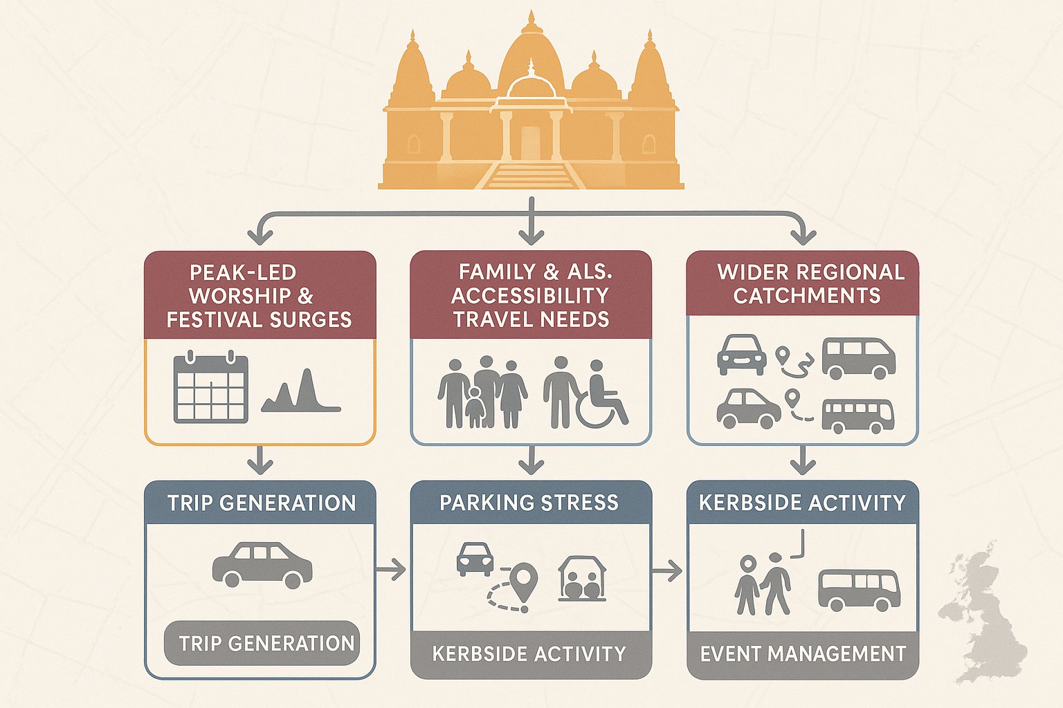
    Comparable survey data is often the starting point. If there are similar Hindu temples with known attendance patterns, parking behaviour, and event profiles, those observations can provide a grounded basis for estimating arrivals and departures. Where an existing temple is being extended, relocated, or intensified, on-site counts and attendance records become even more valuable.

    The key is to separate people from vehicles. Attendance should first be estimated by activity type: regular worship, community use, classes, weddings, and major festivals. Those attendance figures can then be converted into vehicle trips using realistic car occupancy assumptions, with separate allowance for taxis, minibuses, and coaches where relevant.

    Time profiling is crucial. A daily total tells us very little about operational impact if arrivals are concentrated within a 15- or 30-minute window. For that reason, we normally build arrival and departure profiles across the peak periods for both normal days and festival scenarios.

    Sensitivity testing is often where weak submissions get exposed. Authorities will want to know not only the expected case, but also what happens if attendance is higher than forecast, if overlapping activities occur, or if weather reduces walking and public transport mode share. Honest, well-reasoned sensitivity cases usually strengthen credibility rather than weaken it.

    Assessing Parking Demand, Drop-Off Activity, And Coach Provision

    Parking for a temple scheme is rarely just a question of counting bays against floorspace. What matters is whether the site can accommodate the pattern of demand generated by regular worship, overlapping activities, and major events without causing harmful overspill on nearby streets.

    We usually assess parking demand across more than one scenario: a typical regular session, a weekend peak, a combined use scenario, and the highest-demand festival or ceremonial event that could reasonably occur. This avoids the common mistake of designing only for an average day and then relying on hope for everything else.

    Drop-off is often underestimated. Elderly worshippers, children attending classes, and families arriving together can create intense but short-duration kerbside activity near the entrance. A properly designed drop-off loop or lay-by arrangement can reduce conflict, but only if it is sized, signed, and managed realistically.

    Coach provision is another issue that can make or break a submission. If major festivals are likely to attract organised group travel, the assessment should identify whether coaches will park on site, lay over elsewhere, or operate on a managed pick-up and set-down basis. Vague wording here tends to invite planning conditions at best and objections at worst.

    And if overspill risk remains, it should be faced directly. Resident parking controls, overflow agreements, stewarding, and attendance management may all have a role. The strongest reports acknowledge operational reality and plan for it.
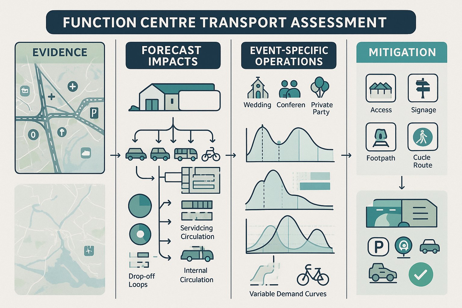
    Highway Safety, Access Design, And Local Junction Impacts

    Even where trip numbers are acceptable, a temple proposal can still fail on safety or access design. That is why this part of the assessment needs to be precise.

    The first test is whether the site can be entered and exited safely by the vehicles likely to use it. That includes private cars, taxis, minibuses, service vehicles, refuse collection, and emergency access. Visibility splays, gate set-backs, turning space, width constraints, and pedestrian interaction all need to be checked against the character of the road and the level of activity.

    Internal circulation matters more than applicants sometimes expect. If vehicles have to reverse awkwardly, if drop-off activity blocks access, or if pedestrians are funnelled across manoeuvring areas, the design will attract legitimate concern. We prefer to show clearly how circulation works at the moments of greatest pressure, not just in a quiet midday snapshot.

    Where temple traffic would materially affect nearby junctions, capacity assessment may be required. That could involve priority junction analysis, signal modelling, or practical review of right-turning effects, queue interaction, and blocking back. In some cases, mitigation such as a ghost island right-turn lane, altered access arrangement, or local signal changes may be justified.

    Collision history should also be reviewed carefully. If there is an existing record of turning shunts, pedestrian incidents, or speed-related problems nearby, the design response must show why the proposal will not intensify that pattern.
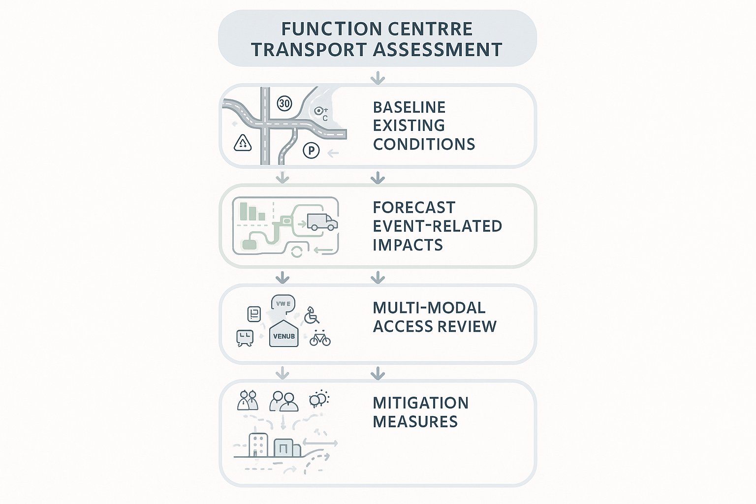
    Walking, Cycling, Public Transport, And Inclusive Access Considerations

    A temple transport assessment should never read as though everyone will arrive by car, even where car use is expected to dominate. Planning policy generally requires us to consider sustainable travel and inclusive access in a serious, site-specific way.
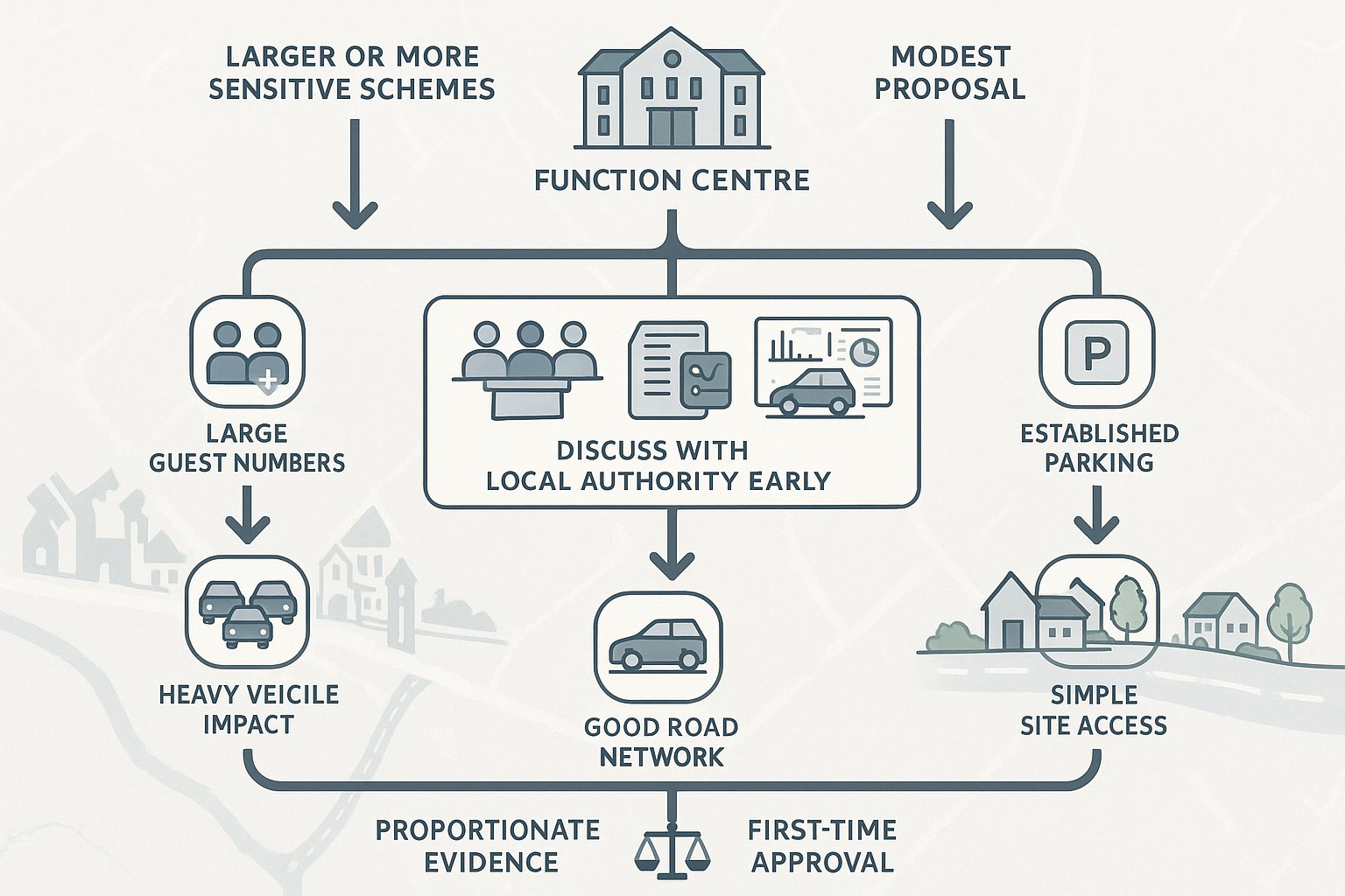
    That starts with walking routes. Are footways continuous? Are crossings available where people actually want to cross? Is lighting adequate for evening worship? Can families, elderly people, and children move safely between the site and nearby parking or bus stops? Small missing links can matter a lot when arrivals occur after dark or in poor weather.
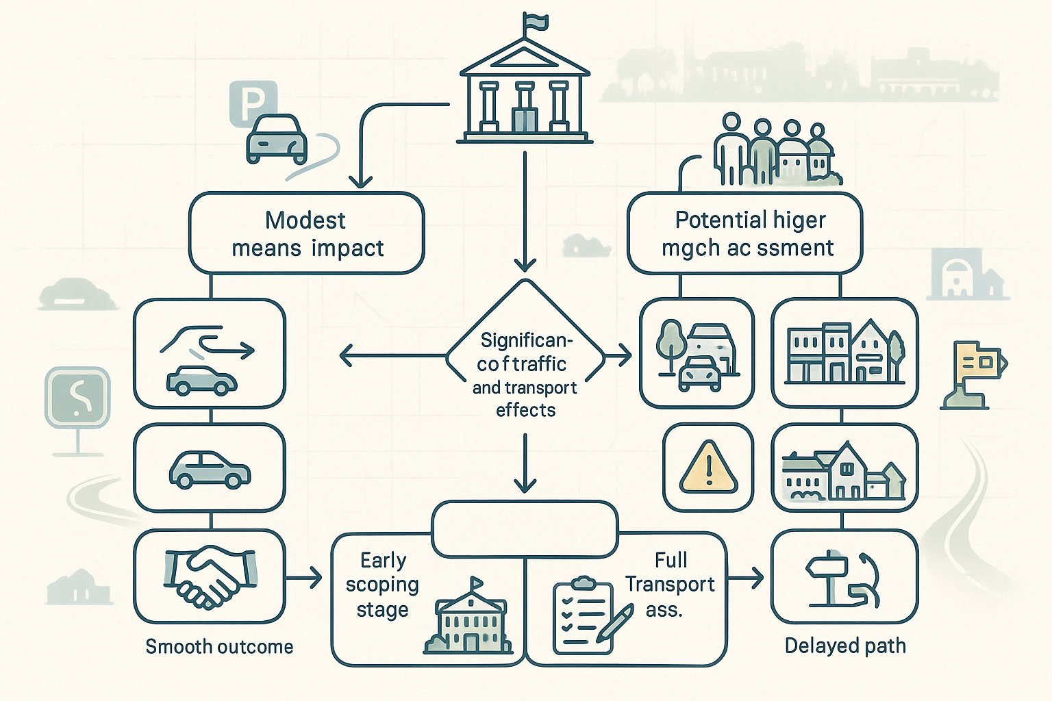
    Cycling can also be part of the picture, especially for volunteers, staff, and local worshippers. Secure, convenient cycle parking should be proportionate but properly located, not hidden in a corner that nobody will use.

    Public transport analysis needs more than a list of bus stops. We should understand service frequency, evening and weekend availability, rail connections where relevant, and whether major event timing aligns with the network. For larger festivals, shuttle buses or coordinated off-site parking may be more realistic than expecting scheduled services to absorb demand.

    Inclusive access is fundamental. Step-free routes, Blue Badge bays, dropped kerbs, manageable walking distances, and safe internal pedestrian paths all need to be integrated into the layout. For temple uses, where elderly worshippers often form a significant part of the user profile, this is not a compliance footnote. It is central to whether the site works in practice.

    Travel Plans, Event Management, And Mitigation Measures For Planning Approval

    Where impacts cannot be designed out entirely, they often need to be managed. That is where Travel Plans, Event Management Plans, and targeted mitigation become essential parts of a temple planning package.

    A Travel Plan should set out practical measures to reduce single-occupancy car trips and encourage more sustainable choices. Depending on the site, that may include car-sharing promotion, volunteer ride coordination, clear public transport information, cycle provision, and communication with worshippers about preferred arrival routes and parking behaviour. To carry weight, the plan should include monitoring and realistic targets rather than vague aspirations.

    For many temple schemes, an Event Management Plan is just as important. Major festivals and weddings can create transport conditions very different from normal operation, so the authority will want confidence that these peaks can be handled. Measures may include timed admissions, advance booking, overflow parking arrangements, stewarding, shuttle buses, temporary signage, police liaison where necessary, and staggered start or finish times.

    Physical mitigation may also be required. That could mean footway widening, new crossing points, revised access geometry, parking controls, or minor junction works. The key is proportionality: mitigation should respond to identified impacts, not be added as decorative padding.

    In our experience, planning submissions are strongest when the operational measures are specific, enforceable, and aligned with how the temple will genuinely function on busy days.

    Common Planning Concerns And How To Strengthen A Temple Transport Submission

    Most objections to temple schemes are predictable. That is not necessarily a problem. Predictable concerns can be addressed if the submission is honest, detailed, and technically sound.

    Traffic congestion is usually first. Authorities and residents will ask whether arrival peaks will overload local junctions or create queues at the site entrance. The answer needs to come from observed data, defensible trip generation, and, where necessary, capacity testing. Hand-waving about staggered arrivals is rarely enough on its own.

    Parking overspill is often the most emotive issue. If neighbours believe worshippers will occupy residential streets, the assessment must show existing parking stress, realistic event demand, and the management measures proposed to prevent unacceptable displacement. Drawings, survey plans, and operational commitments matter here.

    Highway safety is another recurring concern, especially where children and elderly visitors are expected. Access geometry, pedestrian routes, crossing points, visibility, and internal circulation all need to be shown clearly and in a standards-aware way.

    So how do we strengthen a submission? By being transparent. Use robust survey evidence. Test realistic festival scenarios, not just average days. Show standards-compliant layouts. Commit to a meaningful Travel Plan and Event Management Plan. And where appropriate, engage early with neighbours, emergency services, and the highway authority.

    A submission becomes far more persuasive when it demonstrates not only that impacts have been assessed, but that they can be managed in the real world, on the busiest day of the year as well as the quietest.

    Conclusion

    A hindu temple transport assessment is not a generic planning appendix. It is a tailored evidence base for a land use whose impacts are often shaped by festivals, family travel, volunteer activity, and sharp peak periods rather than flat daily averages.

    That is why the strongest submissions distinguish regular worship from exceptional events, ground trip generation in real evidence, test parking and junction effects honestly, and deal properly with walking, public transport, accessibility, and event management. When those elements come together, planning discussions become clearer and more constructive.

    For architects, planners, lawyers, developers, and councils, the takeaway is simple: treat temple transport as a specialist exercise, not a templated one. A proportionate but rigorous assessment can reduce objections, inform better design, and improve the prospects of planning permission.

    And for projects needing concise, locally aware transport input, that practical mindset matters. Good transport reporting does not just defend a proposal on paper: it helps make the finished development safer, more workable, and easier for authorities to support.

    Hindu Temple Transport Assessment FAQs

    What is a Hindu temple transport assessment and why is it important?

    A Hindu temple transport assessment predicts and manages travel, parking, and highway impacts of a proposed temple, ensuring it operates safely without adverse effects on the local transport network. It provides evidence for planning decisions, addresses community concerns, and supports safer site design and management.

    When is a transport assessment required for a Hindu temple development?

    A transport assessment or statement is needed when a temple development is likely to create significant transport implications, such as large congregations, frequent events, or site intensification. Smaller prayer halls or modest changes may only require a simpler transport statement, subject to local authority thresholds.

    How does travel demand for a Hindu temple differ from typical community uses?

    Hindu temple travel demand is peak- and event-led, with multi-use activities like worship, classes, festivals, and weddings. Visitors often come from wide areas via cars, shared rides, and coaches, with higher family car occupancy and volunteer movements, differing markedly from standard community centres.

    What core data is needed to accurately assess transport impacts for a Hindu temple?

    Assessment requires data on local traffic flows, junction turning movements, parking occupancy and stress, collision history, public transport accessibility, and site access features. This evidence ensures credible trip generation estimates and demonstrates safe access and management measures.

    How are parking and drop-off needs evaluated in a Hindu temple transport assessment?

    Parking demand is assessed for regular worship, overlapping activities, and peak festivals or life events. Drop-off zones are designed for families and elderly visitors, and coach parking or managed lay-over plans are considered. Overspill risks are evaluated with mitigation such as parking controls or stewarding.

    What mitigation and management measures support planning approval for Hindu temples?

    Measures include Travel Plans promoting sustainable travel, Event Management Plans for peak festivals detailing stewarding, timed admissions, shuttle buses, and parking arrangements. Physical mitigation like pedestrian crossings, footway widening, and junction improvements may also be implemented to reduce impacts.

  • Function Centre Transport Assessment: What Planning Authorities Expect In 2026

    Function Centre Transport Assessment: What Planning Authorities Expect In 2026

    Planning authorities rarely object to a well-run function centre in principle. What tends to cause delay is uncertainty: how guests will arrive, whether parking will overflow onto nearby streets, whether a rural access is safe after dark, and whether coaches, taxis, staff and suppliers can all use the site without conflict. That’s where a function centre transport assessment becomes critical.

    In 2026, expectations are a little sharper than they were a few years ago. Highway officers want evidence, not broad assumptions. They expect clear trip generation logic, realistic peak event testing, proper parking accumulation, and a genuine look at walking, cycling and public transport rather than a token paragraph. For architects, planners, lawyers, developers and local authorities, the transport piece often becomes one of the decisive parts of a planning submission.

    We see this regularly in practice at ML Traffic, where concise, authority-focused reporting matters just as much as technical accuracy. A strong assessment does two jobs at once: it identifies whether there is a transport problem, and it shows how that problem can be resolved before the application stalls.

    This guide explains what a function centre transport assessment usually covers, when a Transport Assessment or Transport Statement is likely to be needed, and the specific issues planning authorities are now looking for when reviewing proposals for new or expanded function centres.

    What A Function Centre Transport Assessment Covers

    Infographic showing stages of a function centre transport assessment in the UK.
    Infographic of function centre transport assessment stages and transport impacts in the UK.

    A function centre transport assessment is a formal study prepared to quantify and test the transport effects of a proposed venue, whether that is a new build, a change of use, or an expansion of an existing operation. In simple terms, it tells the planning authority how the site will work in the real world.

    A robust assessment normally starts with existing conditions. That includes the surrounding highway network, current traffic flows, access arrangements, nearby junction performance, speed environment, collision history, parking controls, and the availability of sustainable transport. Without that baseline, later conclusions are weak.

    It then moves to forecast impacts. We would typically assess trip generation, modal split, traffic distribution, junction capacity, parking demand, drop-off activity, servicing, and internal circulation. For a function centre, this has to reflect the way events actually operate rather than relying on generic daytime assumptions.

    The scope usually extends beyond cars. Planning authorities increasingly expect comment on buses, rail access where relevant, pedestrian routes, cycling links, taxi activity, coach movements and accessibility for disabled users. If the venue hosts weddings, conferences, private parties or seasonal events, those operational differences should be reflected too.

    Finally, the assessment should set out any mitigation measures needed to make the development acceptable. That might include access improvements, signage, travel planning, parking management, or servicing controls. The point is not just to describe impacts, but to demonstrate that they are understood and manageable.

    When A Transport Assessment Or Transport Statement Is Needed

    Decision tree showing when a function centre needs a transport assessment.
    Decision infographic showing when a function venue needs a transport statement or assessment.

    Not every proposal needs a full Transport Assessment. In many cases, a smaller scheme with limited impact can be supported by a Transport Statement, which is shorter and more proportionate. The distinction usually turns on whether the development is expected to create significant traffic and transport effects.

    A full TA is more likely where a function centre has substantial guest capacity, sits on a constrained road network, relies heavily on private car travel, or may affect a sensitive junction, village centre, or residential street pattern. Extensions to existing venues can also trigger the need for a TA if intensification materially changes how the site operates.

    A TS may be enough where the proposal is modest, parking and access are already established, and the local highway authority is unlikely to need detailed modelling. But there is no universal threshold that applies everywhere in exactly the same way. Local planning and highway authorities set expectations case by case, often informed by the scale of the venue, local policy, and network sensitivity.

    That is why early scoping matters. We generally recommend agreeing the extent of the work with the authority before surveys begin, especially for event venues. A short pre-application discussion can avoid the classic problem: an applicant submits a light-touch statement, the authority asks for a full TA, and weeks are lost while new surveys and modelling are commissioned.

    In practice, proportionate evidence wins. The right question is not “how little can we submit?” but “what level of transport evidence will satisfy the authority first time?”

    How Function Centres Generate Travel Demand

    Infographic of guest, staff and supplier travel peaks at a UK function venue.
    Infographic showing guest, staff, and supplier travel patterns at a UK function centre.

    Function centres do not behave like standard offices, retail units or industrial sites. Their travel demand is shaped by event schedules, booking patterns, seasonality and operational logistics. That makes them a slightly awkward land use from a transport planning perspective, but not an impossible one.

    The primary demand driver is obvious: guests. A wedding venue may be quiet for most of the day and then receive a surge of arrivals over a 60 to 90 minute period. A conference facility may see stronger morning arrivals and late afternoon departures. A multi-room venue may host overlapping events, which is where parking and circulation issues can become more pronounced.

    The second demand stream is staff. Front-of-house teams, catering staff, management, cleaners and security often work shifts that start before guests arrive and finish after the venue closes. Those trips can either smooth demand across the day or, if poorly managed, add to peak site activity.

    Then there are suppliers and servicing movements: food deliveries, florists, entertainment equipment, waste collection, laundry, maintenance contractors and occasional larger vehicles. Individually these may not dominate the traffic picture, but they can create manoeuvring, access and conflict issues on constrained sites.

    A credible function centre transport assessment needs to separate these trip types and test how they interact. If all users are simply lumped together into one headline number, the assessment usually misses the operational reality that planning authorities care about most.

    Peak Event Timing And Seasonal Variations

    For function centres, timing is everything. Planning authorities will usually want to understand not only the classic weekday AM and PM highway peaks, but also the event peaks that the venue itself creates.

    That matters because a site can appear harmless in standard commuter periods yet still generate local stress when 150 guests arrive within an hour on a Saturday afternoon or when multiple evening events finish at roughly the same time. In rural or edge-of-settlement locations, darkness, narrow lanes and limited passing opportunities can make those peaks more sensitive.

    Seasonality matters too. Wedding season, Christmas parties, summer corporate events and school-leaver functions can all alter demand. If a venue’s busiest months are materially different from its annual average, a planning authority may expect those conditions to be tested. The same applies where a proposed extension is specifically intended to capture more peak-season trade.

    We generally advise taking a realistic view rather than relying on annualised averages that dilute the worst case. Authorities tend to respond better when the assessment openly identifies the busiest likely operating scenarios and explains why they remain acceptable.

    Guest Arrival Patterns, Staff Movements, And Supplier Trips

    Guest arrivals are often highly concentrated. People don’t drift into a wedding venue evenly across four hours: they typically arrive in a fairly compressed window before the ceremony or reception starts. Departures can be even more peaked, particularly where taxis are booked for similar times or where an event has a defined finish.

    Staff patterns are different. Setup crews, caterers and management may arrive well in advance, while bar staff, cleaners or security may leave later than guests. That can be useful operationally, because it reduces direct overlap, but only if the site has enough space for staggered parking and circulation.

    Supplier trips usually occur earlier in the day and can often be scheduled away from guest peaks. Planning authorities like to see that thought through. A simple operational commitment, such as avoiding routine deliveries during arrival and dispersal periods, can make a noticeable difference to perceived impact.

    The key point is this: transport effects are not driven only by how many trips are made, but by when, how, and in what combination those trips occur. Good assessments reflect that nuance.

    Trip Generation, Modal Split, And Traffic Distribution

    Trip generation is where many assessments either gain credibility or lose it. Planning authorities expect the trip rate assumptions for a function centre to be grounded in evidence, usually through TRICS comparisons, local survey data, observed operation at similar venues, or a reasoned combination of those sources.

    For event venues, selecting comparable sites is especially important. Capacity, location, parking supply, rural or urban context, and event type all influence travel behaviour. A town-centre banqueting venue near a rail station is rarely a good comparator for a countryside function barn accessed from minor roads. If the comparator set is poor, every number that follows becomes vulnerable.

    Modal split should also be site-specific. In many locations, private car travel will dominate, and pretending otherwise tends to weaken the report. But authorities still want an honest assessment of bus use, rail access, walking, cycling, shared travel, taxi use and coach potential where relevant. Census journey-to-work data, local accessibility mapping and site surveys can all help build a realistic mode share picture.

    Traffic distribution then assigns those trips onto the surrounding road network. That is usually informed by local journey patterns, census origins, route logic, and existing turning movements. Once assigned, the forecast flows can be tested through junction modelling where needed.

    Done properly, this section answers a practical planning question: where will the vehicles come from, where will they go, and can the surrounding network cope? That is the heart of transport acceptability.

    Car Parking, Drop-Off Areas, And On-Site Circulation

    Parking is often the make-or-break issue for function centre proposals. Even where the strategic highway impact is modest, local concern tends to focus on overspill parking, awkward reversing, blocked accesses and late-night disturbance on surrounding roads.

    A good assessment should test parking demand against supply using realistic accumulation analysis. That means considering event overlap, staff parking, disabled bays, VIP or wedding party demand, and whether taxis or private hire vehicles reduce or increase space pressure at key times. It should not rely on a simple ratio and stop there.

    Drop-off and pick-up areas deserve specific attention. If guests are expected to arrive dressed for a formal event, often in poor weather, a usable drop-off space near the entrance becomes more than a nice extra. Without it, vehicles may stop on the access road or highway verge, creating conflict and delay.

    Internal circulation matters just as much. Can cars pass each other? Is there room to turn without long reversing movements? Do pedestrian routes cross manoeuvring areas safely? Can a full car park still function late in the evening when visibility is lower and driver behaviour is less orderly than on a plan drawing?

    Planning authorities usually respond well to clear diagrams and parking accumulation tables. They want confidence that the site can operate on its own land, without exporting operational problems to neighbours or the public highway.

    Access Design, Visibility, And Highway Safety Considerations

    No matter how attractive the venue, planning consent becomes difficult if the access is unsafe. For function centres, this is especially important because arrivals often include unfamiliar drivers, evening travel, occasional alcohol-related taxi activity, and in some cases rural roads with limited lighting.

    Access assessment usually covers junction geometry, entry width, radii, gradient, gate setback, and the ability of vehicles to enter and leave without conflict. Visibility splays are a core consideration. They need to reflect measured vehicle speeds, not optimistic assumptions, and they must be achievable within land under the applicant’s control or via deliverable highway works.

    Highway safety is broader than visibility alone. We would normally review personal injury collision data for the surrounding network, consider whether there are existing patterns of turning conflict or shunt risk, and assess interaction with walking and cycling routes. If the access crosses a footway or shared route, that interface matters.

    Swept path analysis can also be crucial, particularly where coaches, refuse vehicles or delivery vehicles need to use the access. Authorities will want reassurance that larger vehicles can manoeuvre without overrunning verges, blocking opposing traffic, or creating unsafe reversing movements.

    Where shortcomings exist, the assessment should confront them directly and propose mitigation. That may include widening, localised carriageway works, improved signing, speed management, passing provision, or operational controls. A candid, solution-led approach is usually more persuasive than trying to downplay an obvious constraint.

    Public Transport, Walking, And Cycling Accessibility

    Even when a function centre is expected to be car-led, planning authorities still want to see a proper assessment of sustainable travel options. In 2026, a token sentence saying “the site is accessible by non-car modes” will not do much heavy lifting.

    The assessment should map nearby bus stops, rail stations where relevant, service frequencies, operating hours, walking routes, crossing points, gradients, lighting and footway quality. For cycling, the local network, route directness, traffic conditions, and on-site cycle parking all matter. If staff are likely to travel differently from guests, that distinction should be made.

    The point is not to force unrealistic mode share claims. A rural wedding venue with infrequent evening buses is unlikely to achieve a high public transport share, and authorities know that. But they still expect the report to identify opportunities to reduce car dependence at the margin. Sometimes that means staff travel planning, better cycle storage, links to local taxi operators, shuttle arrangements from rail stations, or wayfinding information in booking materials.

    For urban venues, the bar is higher. Authorities may expect stronger sustainable travel measures, especially where local policy prioritises mode shift. A framework travel plan can help, setting out actions, monitoring and management responsibilities.

    In short, this section should show that sustainable access has been genuinely examined, not treated as an afterthought because the car park looked easier.

    Servicing, Coaches, Taxis, And Large Vehicle Management

    Function centres often operate with a wider mix of vehicles than applicants first assume. It is not just cars. There may be minibuses, coaches, rigid delivery vehicles, refuse lorries, wedding transport, private hire vehicles, and the occasional rather ambitious florist van trying to arrive at the same time as everyone else.

    That is why servicing and large vehicle management should be addressed explicitly in the assessment. A planning authority will usually want to know where deliveries occur, whether vehicles can enter and leave in forward gear, how loading activity is separated from guests, and whether there is enough turning space on site.

    Coaches can be particularly sensitive. They may be occasional, but when they do attend, their space requirements are substantial. If a venue markets itself for larger parties or corporate functions, coach management should not be brushed aside as hypothetical. Swept path drawings, waiting arrangements and set-down locations are often needed.

    Taxis and private hire activity also deserve more attention than they sometimes get. Evening peaks can create clusters of pick-ups, with vehicles arriving early and waiting informally. If there is no designated area, the consequence is usually congestion at the entrance or on the public highway.

    Simple management measures can solve a lot: timed deliveries, marked loading space, coach booking protocols, designated taxi bays, and stewarding during major events. Planning officers like to see that the site can be run actively, not merely hoped into compliance.

    How Transport Assessments Support Planning Applications For Function Centres

    A transport assessment is not just a technical appendix. Done properly, it becomes one of the most useful pieces of evidence in the planning application, because it addresses a question that sits near the centre of decision-making: can the development operate safely and acceptably in transport terms?

    For function centres, that evidence can be decisive. Local planning authorities and highway officers want confidence that the proposal will not create severe traffic impact, dangerous access conditions, unacceptable parking stress, or unresolved servicing problems. A clear assessment gives them a structured basis for saying yes.

    It also helps the wider consultant team. Architects can use it to refine layout, entrance positioning and parking design. Planning consultants can align it with policy arguments. Lawyers can rely on it when conditions or obligations are being drafted. Developers gain a clearer picture of likely mitigation cost early enough to make informed decisions.

    Just as importantly, a good TA can narrow disagreement. If impacts are identified honestly and mitigation is credible, discussions with the authority become more focused. Instead of arguing about whether a problem exists, the conversation shifts to what solution is proportionate.

    That is often the difference between a smooth determination and a prolonged cycle of objections, revisions and deferred committee dates. In planning, certainty has real value. A well-prepared function centre transport assessment provides some of that certainty.

    Common Planning Issues And How To Address Them Early

    Most transport objections to function centres are not especially surprising. They tend to revolve around a familiar set of issues: inadequate parking, poor access visibility, pressure on nearby junctions, overspill parking on residential streets, weak sustainable travel credentials, and servicing arrangements that do not work once the venue is busy.

    What does cause trouble is when those issues are discovered too late. A layout is fixed, the planning statement is drafted, public consultation has started, and only then does the transport evidence reveal that the access is substandard or the car park cannot cope with overlapping events. At that point, options narrow quickly.

    Early review is the best defence. Pre-application engagement with the local highway authority can clarify whether a TA or TS is needed, what survey periods should be used, whether junction modelling is likely, and which local sensitivities need particular attention. That early steer can save a surprising amount of time.

    It also helps to be realistic about assumptions. Understated trip rates and heroic modal split claims may look attractive on paper, but they are exactly the kind of thing an experienced case officer will challenge. A robust assessment usually performs better than an optimistic one, because it is easier to trust.

    Where concerns are foreseeable, address them before submission: refine the site layout, improve access geometry, increase parking provision, formalise drop-off areas, schedule servicing off-peak, and include a practical travel plan. Prevention is cheaper than redesign under pressure.

    The Evidence Typically Included In A Robust Assessment

    Planning authorities generally expect a function centre transport assessment to be evidence-led from start to finish. The exact scope varies by site, but a robust submission will usually include a core set of technical materials.

    First, there is the baseline survey package: traffic counts, turning counts at key junctions, queue observations where relevant, parking beat surveys, speed surveys if visibility is an issue, and site observations of pedestrian, cycle and servicing activity. For an existing venue, operational surveys during representative events can be very persuasive.

    Second comes the analytical evidence: trip generation using TRICS or equivalent comparative data, modal split assessment, traffic distribution, and junction capacity modelling where impact may be material. Parking accumulation analysis is often essential for function centres because event overlap and departure peaks can be more revealing than average demand.

    Third is the safety and accessibility evidence. That typically includes collision records, access review drawings, visibility assessment, swept path analysis, and mapping of public transport, walking and cycling opportunities.

    Finally, the assessment should set out mitigation and management measures clearly. These may include highway works, revised layouts, signage, parking controls, servicing protocols, and often a Framework Travel Plan with monitoring commitments.

    The strongest reports do not just contain data. They explain why the data matters, how the conclusions have been reached, and why the authority can rely on them.

    A robust function centre transport assessment should leave very few loose ends. If the evidence is proportionate, transparent and tied closely to how the venue will actually operate, the planning process is usually much smoother. And that, frankly, is what most project teams want: fewer surprises, clearer technical answers, and a planning submission that stands up to scrutiny in 2026.

    Function Centre Transport Assessment FAQs

    What is a function centre transport assessment and why is it important?

    A function centre transport assessment is a formal study that evaluates the traffic and transport impacts of a proposed or expanded function centre. It helps planning authorities ensure the venue operates safely and manages traffic, parking, and access without negative effects on the local area.

    When is a full Transport Assessment required instead of a Transport Statement for a function centre?

    A full Transport Assessment is needed when the function centre is expected to generate significant traffic, has a large guest capacity, sits on a constrained network, or may impact sensitive junctions or local streets. Smaller schemes with limited impact may only require a shorter Transport Statement.

    How does a function centre generate travel demand throughout an event day?

    Travel demand comes from guests who often arrive and depart in concentrated peaks around event start and finish times, staff working shifts that may smooth demand, and suppliers or service vehicles that typically schedule trips outside peak guest times.

    What transport factors are typically covered in a function centre transport assessment?

    Assessments cover existing road conditions, trip generation and distribution, parking and internal circulation, access design and safety, public transport and sustainable travel options, and servicing and large vehicle management, along with any mitigation measures needed.

    How can transport assessments help improve planning applications for function centres?

    They provide clear, evidence-based analysis showing the venue can operate safely with manageable traffic impacts. This supports planning authorities’ decisions, helps align design and policy, and promotes early resolution of issues to avoid delays in approval.

    What measures can be proposed to manage parking and vehicle circulation at function centres?

    Mitigation may include realistic parking demand analysis, designated drop-off and taxi areas, improved signage, internal circulation layouts allowing vehicles to pass safely, and managing event timing or servicing schedules to reduce congestion and overspill parking.